Geophysical surveys Anomaly maps 2D modeling Discussion Conclusion
|
|
|
- Vanessa Cross
- 5 years ago
- Views:
Transcription


1


2 Introduction Geophysical surveys Anomaly maps 2D modeling Discussion Conclusion General context Growth of volcanic domes is a multiphase process: extrusion phases 2005 lava dome growth inside the Mount St. Helens crater (modified from Major and al., 2005) volcanic explosions and dome collapses 2009 Soufrière Hills eruption Photo J. Stone Photo Photovolcanica 2014 Sinabung dome collapse 16/04/2015 Angélie Portal EGU General Assembly

 Photo CVGHM/ULB A.")
 Resulting")

")
3 General context intense hydrothermal and fumarolic activity F. BEAUDUCEL/IPGP 2010 Soufrière de Guadeloupe (2010) Photo CVGHM/ULB A. Bernard Kelud lava dome (2008) Photo CSVO Fuego de Colima (2001) Resulting inner structure is complex: massive lava parts, pyroclastic deposits and breccia, talus. Modified after Wohletz (1992) 16/04/2015 Angélie Portal EGU General Assembly
.")

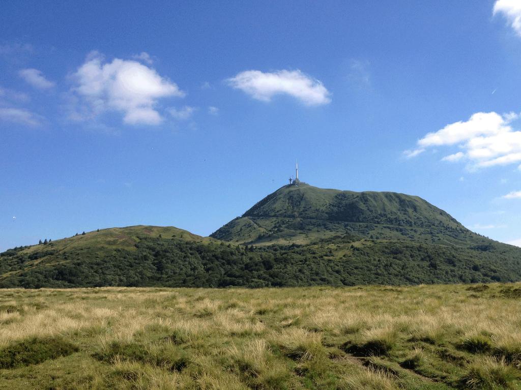
4 The Chaîne des Puys volcanic field Volcanic ~N-S alignment West of the Limagne graben More than 100 volcanic edifices (lava domes, strombolian cones, maars). The Puy de Dôme volcano 11,000 yrs old trachytic lava dome huge edifice as compared to other volcanic edifices The Puy de Dôme View from the North Photo P. SOISSON Puy de Dôme western flank Photo P. SOISSON 16/04/2015 Angélie Portal EGU General Assembly
 underlying intrusion? (van Wyk de Vries and al.")
5 The Puy de Dôme volcano Structural analysis Flat summit area Block and ash avalanche deposits fans toward West and East 2 zones showing deformation structures (N and S of the dome) underlying intrusion? (van Wyk de Vries and al., 2014) 16/04/2015 Angélie Portal EGU General Assembly
6 The Puy de Dôme volcano Slope analysis Flat summit area Block and ash avalanche deposits fans toward West and East 2 zones showing deformation structures (N and S of the dome) underlying intrusion? (van Wyk de Vries and al., 2014) High slopes (>40 ): limited to the summit part solid carapace Intermediate slopes (35-40 ) solid carapace covered by Puy de Dôme deposits Low slopes (30-35 ) unconsolidate materials 16/04/2015 Angélie Portal EGU General Assembly
7 The Puy de Dôme volcano Slope analysis Flat summit area Block and ash avalanche deposits fans toward West and East 2 zones showing deformation structures (N and S of the dome) underlying intrusion? (van Wyk de Vries and al., 2014) High slopes (>40 ): limited to the summit part solid carapace Intermediate slopes (35-40 ) solid carapace Objectives covered by Puy de Dôme deposits Low slopes (30-35 ) Provide geological model of the Puy de Dôme inner structure unconsolidate Constrain materials the relation between the dome and its surroundings 16/04/2015 Angélie Portal EGU General Assembly

 1350 gravity")

8 Gravity measurements Gravity measurements location map Relative measurements (Scintrex Autograv CG-5) 1350 gravity stations Precise DGPS positioning 16/04/2015 Angélie Portal EGU General Assembly
9 Magnetic measurements Magnetic surveys location map Proton-precession magnetometer (Overhauser) 0.5s sampling interval Simultaneous GPS positionning 16/04/2015 Angélie Portal EGU General Assembly

10 Bouguer anomaly map Density correction ρ corr = 1.8 * 10 3 kg.m -3 Regional trend = 2 nd degree polynomial surface 16/04/2015 Angélie Portal EGU General Assembly
11 Bouguer anomaly map Density correction ρ corr = 1.8 * 10 3 kg.m -3 Regional trend = 2 nd degree polynomial surface Qualitative interpretation Negative Bouguer anomaly values Scoria cones/maar (low density structures) 16/04/2015 Angélie Portal EGU General Assembly
12 Bouguer anomaly map Density correction ρ corr = 1.8 * 10 3 kg.m -3 Regional trend = 2 nd degree polynomial surface Qualitative interpretation Negative Bouguer anomaly values Scoria cones/maar (low density structures) Positive anomalies Lava flows? 16/04/2015 Angélie Portal EGU General Assembly
 Positive anomalies Lava flows?")
13 Bouguer anomaly map Density correction ρ corr = 1.8 * 10 3 kg.m -3 Regional trend = 2 nd degree polynomial surface Qualitative interpretation Negative Bouguer anomaly values Scoria cones/maar (low density structures) Positive anomalies Lava flows? Puy de Dôme: complex anomaly Central positive anomaly dense rock core Negative anomaly toward S underlying Puy Lacroix scoria cone Positive anomaly on the northern flank 16/04/2015 Angélie Portal EGU General Assembly
14 Magnetic anomaly map Reduction to the magnetic pole (I=60, D=0) 16/04/2015 Angélie Portal EGU General Assembly
15 Magnetic anomaly map Reduction to the magnetic pole (I=60, D=0) Qualitative interpretation Negative anomaly on both sides of the PdD 16/04/2015 Angélie Portal EGU General Assembly

 northward to the PdD 3D representation of the magnetic")
16 Magnetic anomaly map Reduction to the magnetic pole (I=60, D=0) Qualitative interpretation Negative anomaly on both sides of the PdD Positive anomaly of the dome itself Lava dome massive core? 2 high anomalies (>3000 nt) northward to the PdD 3D representation of the magnetic anomaly 16/04/2015 Angélie Portal EGU General Assembly
17 Magnetic anomaly map Reduction to the magnetic pole (I=60, D=0) Qualitative interpretation Negative anomaly on both sides of the PdD Positive anomaly of the dome itself Lava dome massive core? 2 high anomalies (>3000 nt) northward to the PdD Massive volcanic rocks (intrusion, filled crater?) 16/04/2015 Angélie Portal EGU General Assembly
 High density structures at depth (ρ 2.")
18 2D 1/2 model Slice WE Slice SN Direct model of the Bouguer anomaly based on inferred geological structure Low density basement (ρ<1.6) High density structures at depth (ρ 2.6) Wide density range for the Puy de Dôme 16/04/2015 Angélie Portal EGU General Assembly

19 Geological interpretation Slice WE Slice SN 16/04/2015 Angélie Portal EGU General Assembly

20 Geological interpretation Slice WE Slice SN Basement older scoria cones partially (e.g. Petit Puy de Dôme) or totaly covered (Puy Lacroix) associated lava flows oriented toward East and West Puy de Dôme central massive intrusion (dyke) with W-E extension breccia ring around the intrusion, probably highly altered by hydrothermal fluids edifice mainly composed of unconsolidated material (blocks, pyroclastites and breccias) Geological interpretation of the northern part of the volcanic system stays difficult 16/04/2015 Angélie Portal EGU General Assembly

21 Conclusion Morpho-structural analysis shows that the Puy de Dôme is a composite edifice New gravity and magnetic anomalies maps highlight the well identified geological features provide new information about the dome complexity 2D direct modeling of the Bouguer anomaly better simulates complex geological structures whereas 3D approach provides more global information Comparison with complementary geophysical models (ERT, muography) give constraints about the geological structure of the dome (see Portal et al., 2015, GMPV6.5 poster session) Observations of recent domes growth suggest composite structure of dome after the end of the eruption Confirmed by our study of the Puy de Dôme volcano! 16/04/2015 Angélie Portal EGU General Assembly
, Inner structure of the Puy de Dôme volcano: cross-comparison of geophysical models (ERT, gravimetry, muon imaging), Geosci. Instrumentation, Methods Data Syst., 2(1), 47 54. Wohletz, K.")
22 Thank you for your attention! References Major, J. J., W. E. Scott, C. Driegger, and D. D. Dzurisin (2005), Mount St. Helens Erupts Again - Activity from September trough March. Portal, A. et al. (2013), Inner structure of the Puy de Dôme volcano: cross-comparison of geophysical models (ERT, gravimetry, muon imaging), Geosci. Instrumentation, Methods Data Syst., 2(1), Wohletz, K. (1992), Volcanology and geothermal energy / Kenneth Wohletz, Grant Heiken, Los Alamos series in basic and applied sciences 12, edited by G. Heiken, University of California Press, Berkeley. Van Wyk de Vries, B., A. Márquez, R. Herrera, J. L. G. Bruña, P. Llanes, and A. Delcamp (2014), Craters of elevation revisited: forcedfolds, bulging and uplift of volcanoes, Bull. Volcanol., 76(11), /04/2015 Angélie Portal EGU General Assembly 2015 Photo P. Soisson 22
EAS 116 Earthquakes and Volcanoes
 EAS 116 Earthquakes and Volcanoes J. Haase Forecasting Volcanic Eruptions Assessment of Volcanic Hazard Is that volcano active? Mount Lassen: 12000 BP and 1915 Santorini, IT: 180,000 BP, 70,000 BP, 21000
GEOTHERMAL ENERGY POTENTIAL FOR LONGONOT PROSPECT, KENYA. By Mariita N. O. Kenya Electricity Generating Company
 GEOTHERMAL ENERGY POTENTIAL FOR LONGONOT PROSPECT, KENYA By Mariita N. O. Kenya Electricity Generating Company PRESENTATION OUTLINE INTRODUCTION REGIONAL SETTING GEOLOGY GEOTHERMAL MANIFESTATIONS HYDROGEOLOGY
Why was this eruption important?
 Mount St. Helens Mount St. Helens has a long geological history (>3,000 yrs) of explosive eruptions. The 1980 Events: Initial relatively mild steam and ash (Vulcanian) eruptions. Sustained plinian eruption
Volcanism (Chapter 5)
") GEOLOGY 306 Laboratory Instructor: TERRY J. BOROUGHS NAME: Volcanism (Chapter 5) For this assignment, you will require: a calculator, colored pencils, string, protractor, stereoscopes (provided). Objectives
GEOLOGY 306 Laboratory Instructor: TERRY J. BOROUGHS NAME: Volcanism (Chapter 5) For this assignment, you will require: a calculator, colored pencils, string, protractor, stereoscopes (provided). Objectives
Examining the Terrestrial Planets (Chapter 20)
") GEOLOGY 306 Laboratory Instructor: TERRY J. BOROUGHS NAME: Examining the Terrestrial Planets (Chapter 20) For this assignment you will require: a calculator, colored pencils, a metric ruler, and your geology
GEOLOGY 306 Laboratory Instructor: TERRY J. BOROUGHS NAME: Examining the Terrestrial Planets (Chapter 20) For this assignment you will require: a calculator, colored pencils, a metric ruler, and your geology
Subaerial Felsic Lava Flows and Domes
 Subaerial Felsic Lava Flows and Domes Occurrence Alone or in linear and arcuate chains up to 20 km long Margins of calderas or volcanic depressions. Feeder occupies synvolcanic fault (ring fracture). Extrusion
Degassing processes and recent activity at Volcán de Colima. Universidad de Colima, Mexico Corresponding author
 Degassing processes and recent activity at Volcán de Colima Nick Varley * & Gabriel Reyes Dávila Universidad de Colima, Mexico Corresponding author email: nick@ucol.mx Volcán de Colima is currently in
Dynamic Planet PUT ALL YOUR ANSWERS ON THE ANSWER SHEET. c) low temperature d) high volatile content
 low temperature d) high volatile content") School Name: Team #: Students Names: Dynamic Planet 2016 Science Olympiad Invitational University of Texas at Austin PUT ALL YOUR ANSWERS ON THE ANSWER SHEET 1) Low viscosity magmas have: a) high silica
School Name: Team #: Students Names: Dynamic Planet 2016 Science Olympiad Invitational University of Texas at Austin PUT ALL YOUR ANSWERS ON THE ANSWER SHEET 1) Low viscosity magmas have: a) high silica
Visualizing Earth Science. Chapter Overview. Volcanoes and Eruption Types. By Z. Merali and B. F. Skinner. Chapter 9 Volcanism and Other
 Visualizing Earth Science By Z. Merali and B. F. Skinner Chapter 9 Volcanism and Other Igneous Processes Volcanoes types and effects of eruption Chapter Overview Melting and cooling of rocks Geological
GEOLOGY MEDIA SUITE Chapter 12
 UNDERSTANDING EARTH, SIXTH EDITION GROTZINGER JORDAN GEOLOGY MEDIA SUITE Chapter 12 Volcanoes 2010 W.H. Freeman and Company Plate tectonics explains the global pattern of volcanism. Key Figure 12.20 (page
FOUNDATIONS OF GEOLOGY CHAPTER 2
 FOUNDATIONS OF GEOLOGY CHAPTER 2 2.3A- VOLCANOES Volcanoes all share common characteristics. Vent- a central channel through which gases, ash and rock are ejected. Magma- molten rock which lies several
Vulcanicity. Objectives to identify the basic structure of volcanoes and understand how they form.
 Vulcanicity Objectives to identify the basic structure of volcanoes and understand how they form. Some key terms to start.. Viscosity how well a substance (lava) flows. Acid lavas have a high viscosity,
What is the Relationship between Pressure & Volume Change in a Magma Chamber and Surface Deformation at Active Volcanoes?
 SSAC-pv2007.QE522.PL1.1 What is the Relationship between Pressure & Volume Change in a Magma Chamber and Surface Deformation at Active Volcanoes? What factors control the magnitude of surface deformation?
FLANK COLLAPSE AND NEW RELATIVE INSTABILITY ANALYSIS TECHNIQUES APPLIED TO VOLCAN DE COLIMA AND MT ST. HELENS Lorenzo Borselli*, Damiano Sarocchi *
 FLANK COLLAPSE AND NEW RELATIVE INSTABILITY ANALYSIS TECHNIQUES APPLIED TO VOLCAN DE COLIMA AND MT ST. HELENS Lorenzo Borselli*, Damiano Sarocchi * *Instituto de Geología Universidad Autónoma de San Luis
GEOTHERMAL POTENTIAL OF ST. KITTS AND NEVIS ISLANDS
 GEOTHERMAL POTENTIAL OF ST. KITTS AND NEVIS ISLANDS By Gerald W. Huttrer Geothermal Management Company, Inc. For the Eastern Caribbean Geothermal Energy Project ( Geo- Caraibes ; G-C ) Presented Using
Sylvain Charbonnier. PASI Workshop About 60% of Indonesians live around 16 active volcanoes on the island of Java
 Numerical modelling of pyroclastic flows: a case study from the recent activity of Merapi Volcano, Central Java, Indonesia Sylvain Charbonnier PASI Workshop 2011 Case study: Merapi Volcano! About 60% of
Large Volcanic Debris Avalanches; Characteristics, Distribution, and Hazards
 Lee Siebert discussion: 25 Jan 2007 Large Volcanic Debris Avalanches; Characteristics, Distribution, and Hazards UBC: 1. What are the differences between cohesive and non cohesive debris flows? (Is it
C5 Magnetic exploration methods data analysis techniques
 C5 Magnetic exploration methods data analysis techniques C5.1 Data processing and corrections After magnetic field data have been collected a number of corrections are applied to simplify the interpretation.
Multiple Choice Identify the letter of the choice that best completes the statement or answers the question.
 volcano sample test Multiple Choice Identify the letter of the choice that best completes the statement or answers the question. 1. Volcanic belts form along a. islands in the Pacific Ocean. b. North American
HEAT AND MASS TRANSFER PROCESSES AFTER 1995 PHREATIC ERUPTION OF KUJU VOLCANO, CENTRAL KYUSHU, JAPAN
 HEAT AND MASS TRANSFER PROCESSES AFTER 1995 PHREATIC ERUPTION OF KUJU VOLCANO, CENTRAL KYUSHU, JAPAN Sachio Ehara 1,Yasuhiro Fujimitsu 1, Jun Nishijima 1,Akira Ono 1 and Yuichi Nakano 1 1 Laboratory of
From Punchbowl to Panum: Long Valley Volcanism and the Mono-Inyo Crater Chain
 From Punchbowl to Panum: Leslie Schaffer E105 2002 Final Paper Long Valley Volcanism and the Mono-Inyo Crater Chain Figure 1. After a sequence of earthquakes during the late 1970 s to the early 1980 s
Hawaiian Submarine Volcanism. Stages of Hawaiian Volcanoes:
 Hawaiian Submarine Volcanism November 1, 2011 Mary Tardona GG 711 Stages of Hawaiian Volcanoes: Typically, three main stages: Pre shield Shield Post shield Sometimes followed by: Rejuvenation Stage GG
Latitude: 42 49'36" N, Longitude: '41" E, Elevation: 1,898 m (Ezo-Fuji) (Elevation Point)
 (Elevation Point)") 16.Yoteizan Latitude: 42 49'36" N, Longitude: 140 48'41" E, Elevation: 1,898 m (Ezo-Fuji) (Elevation Point) Overview of Yoteizan taken from northwest side on May 18, 2003 by the Japan Meteorological Agency
16.Yoteizan Latitude: 42 49'36" N, Longitude: 140 48'41" E, Elevation: 1,898 m (Ezo-Fuji) (Elevation Point) Overview of Yoteizan taken from northwest side on May 18, 2003 by the Japan Meteorological Agency
Volcanic Strata-Hosted Gold Deposits in Quaternary Volcanoes: The Sandwich-Style Model
 Volcanic Strata-Hosted Gold Deposits in Quaternary Volcanoes: The Sandwich-Style Model Alberto Lobo-Guerrero S. Geologist, M.Sc. MinEx Economic Geology Research Institute University of the Witwatersrand
Calc-alkaline Volcanic Rocks. Calc-alkali Volcanics. Fabric. Petrography. Compositional Classification. Petrography. Processes.
 Calc-alkaline Volcanic Rocks Calc-alkali Volcanics Winter Chapters 16 & 17 Petrography Processes Field relations Volcanic arcs Petrogenesis Petrography Fabric Classification Alteration Fabric Aphanitic
NOTICE CONCERNING COPYRIGHT RESTRICTIONS
 NOTICE CONCERNING COPYRIGHT RESTRICTIONS This document may contain copyrighted materials. These materials have been made available for use in research, teaching, and private study, but may not be used
Daniel Frost & Stefan Lachowycz
 Daniel Frost & Stefan Lachowycz Studying the Colima active volcano, Mexico 2009 Daniel and Stefan studied Earth Science at Oxford University. For their project they went to Mexico to work as field assistants
INVERSE MODELING IN GEOPHYSICAL APPLICATIONS
 1 INVERSE MODELING IN GEOPHYSICAL APPLICATIONS G. CURRENTI,R. NAPOLI, D. CARBONE, C. DEL NEGRO, G. GANCI Istituto Nazionale di Geofisica e Vulcanologia, Sezione di Catania, Catania, Italy E-mail: currenti@ct.ingv.it
Debris Avalanches. Debris avalanche deposits on a volcano in Chile. All of the area in the foreground is buried by a thick debris avalanche.
 Debris Avalanches Volcanoes are not very stable structures. From time to time, they collapse producing large rock and ash avalanches that travel at high speeds down valleys. Collapse maybe caused by an
Magma. Objectives. Describe factors that affect the formation of magma. Compare and contrast the different types of magma. Vocabulary.
 Magma Objectives Describe factors that affect the formation of magma. Compare and contrast the different types of magma. Vocabulary viscosity Magma Magma The ash that spews from some volcanoes can form
Geophysical Surveys of The Geothermal System of The Lakes District Rift, Ethiopia
 Geophysical Surveys of The Geothermal System of The Lakes District Rift, Ethiopia By: Befekadu Oluma By: Geophysics Department Geological Survey of Ethiopia The formation of the rift was preceded by a
Volcanic Deformation and Evolution.
 Volcanic Deformation and Evolution of Mt. Saint SitHelens http://pubs.usgs.gov/sim/3008/ B. A. Digital perspective view derived from USGS Digital Elevation Model (DEM) of Mount St. Helens as seen from
Geomagnetic Dip Changes in the 1950 Eruption of Izu-Oshima Volcano, Central Japan: Magnetic Source Inversion Using Genetic Algorithm (GA)
") Geomagnetic Dip Changes in the 1950 Eruption of Izu-Oshima Volcano, Central Japan: Magnetic Source Inversion Using Genetic Algorithm (GA) Yoichi Sasai Disaster Prevention Division, Tokyo Metropolitan Government
Geomagnetic Dip Changes in the 1950 Eruption of Izu-Oshima Volcano, Central Japan: Magnetic Source Inversion Using Genetic Algorithm (GA) Yoichi Sasai Disaster Prevention Division, Tokyo Metropolitan Government
Recent activity. Current episode 12 years Transition between styles 4 periods of dome growth Since 2003, Vulcanian explosions (4 25 per day)
") Recent activity Current episode 12 years Transition between styles 4 periods of dome growth Since 2003, Vulcanian explosions (4 25 per day) 02 December 09 Explosions originating from dome e.g. 10 Jan 2010
Recent activity Current episode 12 years Transition between styles 4 periods of dome growth Since 2003, Vulcanian explosions (4 25 per day) 02 December 09 Explosions originating from dome e.g. 10 Jan 2010
Pyroclastic Flows. Lesson 6
 Pyroclastic Flows Lesson 6 P yroclastic flows are one of the most dangerous natural events that occur on our planet. They can at hurricane speeds down the slopes of a mountain, destroying everything in
A New College in Orting?
 A New College in Orting? Risk Report and Recommendation by: Safe Schools Kause Everyone Deserves (SSKED) 2017 Geographic location and physical site of Orting The city of Orting is located in Pierce county,
Introduction to Volcanic Seismology
 Introduction to Volcanic Seismology Second edition Vyacheslav M. Zobin Observatorio Vulcanolo'gico, Universidad de Colima, Colima, Col., Mexico ELSEVIER AMSTERDAM BOSTON HEIDELBERG LONDON * NEW YORK OXFORD
GEOL1 Physical Geology Laboratory Manual College of the Redwoods Lesson Five: Volcanoes Background Reading: Volcanoes Volcanic Terms: Silca:
 Name: Date: GEOL1 Physical Geology Laboratory Manual College of the Redwoods Lesson Five: Volcanoes Background Reading: Volcanoes Volcanic Terms: Silca: SiO 2 silicon dioxide. This is quartz when it crystallizes.
Mt St Helens was know to have entered into active periods that lasted from years once every years over the last 500 years, (Figure 5).
.") Lecture #8 notes; Geology 3950, Spring 2006; CR Stern May 1980 eruption of Mt St Helens volcano (text pages 183-192 in the 4 th edition and 206-222 in the 5 th edition) Mt St Helens in southwest Washington
Lecture #8 notes; Geology 3950, Spring 2006; CR Stern May 1980 eruption of Mt St Helens volcano (text pages 183-192 in the 4 th edition and 206-222 in the 5 th edition) Mt St Helens in southwest Washington
When Mount St. Helens erupted, trapped gases caused the north side of the mountain to explode. Volcanic ash was ejected high into the atmosphere.
 When Mount St. Helens erupted, trapped gases caused the north side of the mountain to explode. Volcanic ash was ejected high into the atmosphere. A volcano is a mountain that forms when magma reaches the
Continuous Caldera Changes in Miyakejima Volcano after Hiroyuki HASEGAWA, Hiroshi P. SATO and Junko IWAHASHI
 Continuous Caldera Changes in Miyakejima Volcano after 2001 60 Hiroyuki HASEGAWA, Hiroshi P. SATO and Junko IWAHASHI Abstract This study investigated the evolvement of the caldera at Miyakejima volcano
Volcanostratigraphic Approach for Evaluation of Geothermal Potential in Galunggung Volcano
 IOP Conference Series: Earth and Environmental Science PAPER OPEN ACCESS Volcanostratigraphic Approach for Evaluation of Geothermal Potential in Galunggung Volcano To cite this article: Q S Ramadhan et
MIRAVALLES CALDERA AND SHALLOW STRUCTURES INFERRED FROM GRAVITY
 Presented at Short Course on Surface Exploration for Geothermal Resources, organized by UNU-GTP and LaGeo, in Ahuachapan and Santa Tecla, El Salvador, 17-30 October, 2009. GEOTHERMAL TRAINING PROGRAMME
Magnetic and Gravity Methods for Geothermal Exploration
 Magnetic and Gravity Methods for Geothermal Exploration Dr. Hendra Grandis Geophysics - ITB method and survey procedure Aero- or ground magnetic (covers a large area) Schlumberger resistivity mapping and
Late Tertiary Volcanism. North Washington. Other Andesite Volcanoes. Southern Washington. High Cascades. High Cascades. Mid-Miocene Miocene to present
 Miocene to Present Late Tertiary Volcanism Mid-Miocene Miocene to present Reading: DNAG volume G3, Ch. 7 High Cascade Range Columbia River Snake River Plain Basin and Range Southwestern California Sierra
CHAPTER 2 NOTES -FOUNDATIONS OF GEOLOGY-
 CHAPTER 2 NOTES -FOUNDATIONS OF GEOLOGY- LESSON 2.1A: LAYERS OF THE EARTH GEOLOGY Geology- LAYERS OF THE EARTH Earth has 3 major layers based on their composition: o - the outer layer, made of solid rock.
Spreading and potential instability of Teide volcano, Tenerife, Canary Islands
 GEOPHYSICAL RESEARCH LETTERS, VOL. 35, L05305, doi:10.1029/2007gl032625, 2008 Spreading and potential instability of Teide volcano, Tenerife, Canary Islands Alvaro Márquez, 1 Iván López, 1 Raquel Herrera,
Summary of geothermal setting in Geo-Caraïbes target islands
 Summary of geothermal setting in Geo-Caraïbes target islands Dr Simon R Young Consultant to OAS Presentation made at the Guadeloupe workshop, 27 April 2004 St Lucia - overview Only one broad target area
Introduction. The output temperature of Fumarole fluids is strongly related to the upward
 Heat flux monitoring of steam heated grounds on two active volcanoes I.S. Diliberto, E. Gagliano Candela, M. Longo Istituto Nazionale di Geofisica e Vulcanologia, Sezione di Palermo, Italy Introduction.
Structural Geology tectonics, volcanology and geothermal activity. Kristján Saemundsson ÍSOR Iceland GeoSurvey
 Structural Geology tectonics, volcanology and geothermal activity Kristján Saemundsson ÍSOR Iceland GeoSurvey Discussion will be limited to rift zone geothermal systems with sidelook on hot spot environment.
3/24/2016. Geology 12 Mr. M. Gauthier 24 March 2016
 Geology 12 Mr. M. Gauthier 24 March 2016 Introduction: Mt. St. Helens Before 1980 Mt. St Helens, in Southern Washington State, had not erupted since 1857 On March 27,1980 minor ashand eruptions were due
Magma. Objectives. Describe factors that affect the formation of magma. Compare and contrast the different types of magma. Vocabulary.
 Magma Objectives Describe factors that affect the formation of magma. Compare and contrast the different types of magma. Vocabulary viscosity Magma Magma The ash that spews from some volcanoes can form
Contextualizing the View Hill Scoria Cone, Akaroa Volcanic Complex
 1 2 3 4 5 6 7 8 9 10 11 12 13 14 15 16 17 18 19 20 21 22 23 24 25 26 27 28 29 30 31 32 33 34 35 36 37 Contextualizing the View Hill Scoria Cone, Akaroa Volcanic Complex Spencer Irvine 1, 2, Darren Gravely
GE 2400 Test #2 3/26/03. Name
 GE 2400 Test #2 3/26/03 Name 9. Fill in the blank. a. minerals have a negative magnetic susceptibility. b. Ground surveys that use gradiometer magnetometers generally measure the. c. Horizontal derivatives
453/01 GEOLOGY - GL3 GEOLOGY AND THE HUMAN ENVIRONMENT. P.M. TUESDAY, 11 January (1 hour 15 minutes)
") Candidate Name Centre Number Candidate Number WELSH JOINT EDUCATION COMMITTEE General Certificate of Education Advanced Subsidiary/Advanced CYD-BWYLLGOR ADDYSG CYMRU Tystysgrif Addysg Gyffredinol Uwch
Candidate Name Centre Number Candidate Number WELSH JOINT EDUCATION COMMITTEE General Certificate of Education Advanced Subsidiary/Advanced CYD-BWYLLGOR ADDYSG CYMRU Tystysgrif Addysg Gyffredinol Uwch
V. Pinel, A. Hooper, S. de la Cruz-Reyna, G. Reyes-Davila, M.P. Doin
 !"#$%&'(&")*&$*('+,-".'/&(.*0$&'(&"1'&-2".3*&4*5.2-/& 6"+-"'3'02-/'*6 78'9'2-"*9*"0 -/$&&:'0.,- ;'02-/'
GEOLOGY 285: INTRO. PETROLOGY
 Dr. Helen Lang Dept. of Geology & Geography West Virginia University SPRING 2015 GEOLOGY 285: INTRO. PETROLOGY The Cascade Volcanoes are a good example of the Circum- Pacific ring of fire of subductionrelated
Directed Reading. Section: How Mountains Form MOUNTAIN RANGES AND SYSTEMS. Skills Worksheet
 Skills Worksheet Directed Reading Section: How Mountains Form 1. How high is Mount Everest? a. about 1980 km above sea level b. more than 8 km below sea level c. more than 8 km above sea level d. more
VOLCANO MONITORING PRACTICAL. Hazard alert levels established for communication at Mt. Pinatubo
 VOLCANO MONITORING PRACTICAL Predicting volcanic eruptions is a hazardous and stressful business. If an eruption has occurred and was not predicted then the volcanologists get the blame for not giving
Fig. 1. Joint volcanological experiment on volcanic structure and magma supply system in Japan.
 2. Joint Volcanological Experiment on Volcanic Structure and Magma Supply System Since 1994, joint experiments have been conducted in several volcanoes in Japan to reveal the structure and the magma supply
Continuously Monitored by JMA. Overview of Kuchinoerabujima taken from the East on July 23, 1996 by the Japan Meteorological Agency
 94. Kuchinoerabujima Continuously Monitored by JMA Latitude: 30 26'36" N, Longitude: 130 13'02" E, Elevation: 657 m (Furudake) (Elevation Point) Overview of Kuchinoerabujima taken from the East on July
GRAVITY AND MAGNETIC METHODS
 Presented at Short Course IX on Exploration for Geothermal Resources, organized by UNU-GTP, GDC and KenGen, at Lake Bogoria and Lake Naivasha, Kenya, Nov. 2-24, 2014. Kenya Electricity Generating Co.,
Volcanic Plumes. JOHN WILEY & SONS Chichester New York Weinheim Brisbane Singapore Toronto
 Volcanic Plumes R. S. J. SPARKS University of Bristol, UK M. I. BURSIK State University of New York, USA S. N. CAREY University of Rhode Island, USA J. S. GILBERT Lancaster University, UK L. S. GLAZE NASA/Goddard
Volcanic eruption prediction: Magma chamber physics from gravity and deformation measurements
 1 Volcanic eruption prediction: Magma chamber physics from gravity and deformation measurements Hazel Rymer and Glyn Williams-Jones Volcano Dynamics Group, Department of Earth Sciences, The Open University,
1 Types of Volcanoes CHAPTER. Chapter 1. Types of Volcanoes
 CHAPTER 1 Types of Volcanoes Describe the magma compositions and characteristics of different types of volcanoes. What does an active volcano look like? Climbing up Mount St. Helens and looking into the
Integrated Geophysical Model for Suswa Geothermal Prospect using Resistivity, Seismics and Gravity Survey Data in Kenya
 Proceedings World Geothermal Congress 2015 Melbourne, Australia, 19-25 April 2015 Integrated Geophysical Model for Suswa Geothermal Prospect using Resistivity, Seismics and Gravity Survey Data in Kenya
Volcanic Landforms, Volcanoes and Plate Tectonics
 Page 1 of 12 EENS 3050 Tulane University Natural Disasters Prof. Stephen A. Nelson Volcanic Landforms, Volcanoes and Plate Tectonics This page last updated on 26-Aug-2017 Volcanic Landforms Volcanic landforms
Inverse Modeling in Geophysical Applications
 Communications to SIMAI Congress, ISSN 1827-9015, Vol. 1 (2006) DOI: 10.1685/CSC06036 Inverse Modeling in Geophysical Applications Daniele Carbone, Gilda Currenti, Ciro Del Negro, Gaetana Ganci, Rosalba
GEOPHYSICAL CONCEPTUAL MODEL OF THE SAN VICENTE GEOTHERMAL AREA, EL SALVADOR
 Presented at Short Course on Surface Exploration for Geothermal Resources, organized by UNU-GTP and LaGeo, in Ahuachapan and Santa Tecla, El Salvador, 17-30 October, 2009. GEOTHERMAL TRAINING PROGRAMME
Geothermal Energy Resources Exploration using Gravity and magnetics. By Mariita, N.O. KenGen
 Geothermal Energy Resources Exploration using Gravity and magnetics By Mariita, N.O. KenGen What is Geothermal Energy? Geothermal Energy = heat from the Earth Transmitted by fluids via fractures and pores
Foundations of Earth Science, 6e Lutgens, Tarbuck, & Tasa
 Foundations of Earth Science, 6e Lutgens, Tarbuck, & Tasa Fires Within: Igneous Activity Foundations, 6e - Chapter 7 Stan Hatfield Southwestern Illinois College The nature of volcanic eruptions Characteristics
NSF-MARGINS Expedition to Anatahan Volcano March 2005
 1 NSF-MARGINS Expedition to Anatahan Volcano March 2005 According to the Emergency Management Office (EMO) report distributed in February 2005, the third historical eruption of Anatahan began on January
Overview of Ch. 4. I. The nature of volcanic eruptions 9/19/2011. Volcanoes and Other Igneous Activity Chapter 4 or 5
 Overview of Ch. 4 Volcanoes and Other Igneous Activity Chapter 4 or 5 I. Nature of Volcanic Eruptions II. Materials Extruded from a Volcano III.Types of Volcanoes IV.Volcanic Landforms V. Plutonic (intrusive)
Mount Spurr geothermal workshop August 27 28, 2007
 Mount Spurr geothermal workshop August 27 28, 2007 Geologic Overview & Review of Geothermal Exploration Christopher Nye geologist / volcanologist DNR/GGS & AVO Alaska Division of Geological and Geophysical
Chapter 18. Volcanism
 Chapter 18 Volcanism Ring of fire contains 66% of world s active volcanoes Convergent : Divergent: Icelandic Eruption Mount Etna Different Kinds of eruptions: Volcanic activity is controlled by plate tectonics,
Engineering Geology ECIV 2204
 Engineering Geology ECIV 2204 2017-2016 Chapter (4) Volcanoes Chapter 4: Volcanoes and Other Igneous Activity cataclysmic relating to or denoting a violent natural even Eventually the entire
EHaz 26 April 2007 Questions. The following questions are arranged by topic. Risk assessment & management MTU
 EHaz 26 April 2007 Questions The following questions are arranged by topic. Risk assessment & management Slide 17 (very good slide, by the way!): In the case of the Merapi and Mt. St. Helens crises, how
VLF -MT Survey around Nakadake crater at Aso Volcano
 IOP Conference Series: Earth and Environmental Science OPEN ACCESS VLF -MT Survey around Nakadake crater at Aso Volcano To cite this article: A Harja et al 2016 IOP Conf. Ser.: Earth Environ. Sci. 29 012016
Unit 4 Lesson 4 Volcanoes. Copyright Houghton Mifflin Harcourt Publishing Company
 Magma Magic What is a volcano? A volcano is any place where gas, ash, or melted rock come out of the ground. Many volcanoes are dormant, meaning an eruption has not occurred in a long period of time. What
Mount St. Helens. Copyright 2010 LessonSnips
 Mount St. Helens Washington State is home to the Cascade Mountains, a range of mountains that extends from the Canadian province of British Columbia to northern California. Many of these mountains are
Piles of Fire Individual and Team Project Modified from
 Piles of Fire Individual and Team Project Modified from http://www.spacegrant.hawaii.edu/class_acts/pilesfirete.html The purpose of this activity is to investigate how particle size affects the angle of
Interactive comment on Dome instability at Merapi volcano identified by drone photogrammetry and numerical modeling by Herlan Darmawan et al.
 Nat. Hazards Earth Syst. Sci. Discuss., https://doi.org/10.5194/nhess-2018-120-ac3, 2018 Author(s) 2018. This work is distributed under the Creative Commons Attribution 4.0 License. Interactive comment
Posteruption glacier development within the crater of Mount St. Helens, Washington, USA
 Quaternary Research 61 (2004) 325 329 Short Paper Posteruption glacier development within the crater of Mount St. Helens, Washington, USA Steve P. Schilling, a, * Paul E. Carrara, b Ren A. Thompson, b
RELATIONSHIP BETWEEN GEOTHERMAL ACTIVITY AND GRAVITY ANOMALIES ON VULCANO ISLAND, ITALY
 Proceedings NZ Geothermal Workshop 2002 RLATIONSHIP BTWN GOTHRMAL ACTIVITY AND GRAVITY ANOMALIS ON VULCANO ISLAND, ITALY M. S.OKUMA', S.NAKANO', R. FURUKAWA', M. KOMAZAWA' & R. SUPPR 2 'Geological Survey
Latitude: 43 25'03" N, Longitude: '52" E, Elevation: 1,692 m (Maruyama) (Triangulation Point)
 (Triangulation Point)") 8.Maruyama Latitude: 43 25'03" N, Longitude: 143 01'52" E, Elevation: 1,692 m (Maruyama) (Triangulation Point) Overview of Maruyama taken from northwest side on July 2, 2007 by the Japan Meteorological
8.Maruyama Latitude: 43 25'03" N, Longitude: 143 01'52" E, Elevation: 1,692 m (Maruyama) (Triangulation Point) Overview of Maruyama taken from northwest side on July 2, 2007 by the Japan Meteorological
19. Esan Continuously Monitored by JMA
 19. Esan Continuously Monitored by JMA Latitude: 41 48'17" N, Longitude: 141 09'58" E, Elevation: 618 m (Esan) (Triangulation Point) Overview of Esan, taken from east side on March 13, 2009 by the Japan
Requirements for a survey system of active volcanoes based on muon radiography
 Requirements for a survey system of active volcanoes based on muon radiography Philippe LABAZUY on behalf of the TOMUVOL Collaboration http://www.tomuvol.fr/ Laboratoire Magmas et Volcans, Laboratoire
Directed Reading. Section: Volcanic Eruptions. light in color is called a. felsic. b. oceanic. c. mantle. d. mafic. dark in color is called
 Skills Worksheet Directed Reading Section: Volcanic Eruptions 1. Lava provides an opportunity for scientists to study a. the nature of Earth s inner core. b. the nature of Earth s tectonic plates. c. temperatures
OIKOS > volcano > mechanism >types of volcanoes
 Main Types of Volcanoes Volcanologists have classified volcanoes into groups based on the shape of the volcano, the materials they are built of, and the way the volcano erupts. The main one can be described
Keywords: geophysics field camp, low to moderate, temperature, geothermal system, Mt Pancar, Indonesia
 Proceedings World Geothermal Congress 2015 Melbourne, Australia, 19-25 April 2015 Geophysics Field Camp (GFC): A Student Project Aimed to Investigate the Low to Moderate Temperature Geothermal System in
What mainly controls eruptive style?
 Introduction to volcanoes, volcanic eruptions, and volcanic landforms Previous: Magmatic differentiation, Bowens Reaction series (mineral melting points), mafic vs. felsic (fluid vs. sticky) Video: Lava
Geology 1 st Semester Exam YSBAT
 1. What is the role of a geologist? Geology 1 st Semester Exam YSBAT 2016-2017 2. Earth is subdivided into three main layers based on what? 3. What features do you find at divergent boundaries? 4. Rock
SPECTRAL ANALYSIS OF GROUND MAGNETIC DATA IN MAGADI AREA, SOUTHERN KENYA RIFT
 SPECTRAL ANALYSIS OF GROUND MAGNETIC DATA IN MAGADI AREA, SOUTHERN KENYA RIFT 1 JG Githiri, 2 JP Patel, 3 JO Barongo and 4 PK Karanja 1 Jomo-Kenyatta University of Agriculture, Science and Technology,
Volcanology. The study of volcanoes
 Volcanology The study of volcanoes Magma forms wherever temperature and pressure are high enough to melt rock. Some magma forms at the aesthenosphere Magma also forms at plate boundaries, where intense
Volcano. Magma. Lava. weak spot in crust where magma and gases come up. molten mixture of rockforming
 Volcanoes Volcano weak spot in crust where magma and gases come up Magma Lava molten mixture of rockforming substance, gases, water from the mantle Magma that flows onto earth surface forms solid rock
Geography. Key facts. Volcanoes and volcanic eruptions
 Geography Volcanoes and volcanic eruptions Volcanoes form when magma reaches the Earth's surface, causing eruptions of lava and ash. They occur at destructive (compressional) and constructive (tensional)
Folding. Faulting. Volcanoes
 Folding Faulting Volcanoes Most major global mountain ranges were formed by the collision of continental (tectonic) plates Fold mountains are actually formed by crust which have been uplifted and folded
Euler Deconvolution JAGST Vol. 15(1) 2013
 2013") Euler Deconvolution JAGST Vol. 15(1) 2013 2D-EULER DECONVOLUTION AND FORWARD MODELING OF GRAVITY DATA OF HOMA-HILLS GEOTHERMAL PROSPECT, KENYA A. Odek 1, A. B. Otieno 1, W. J. Ambusso 1 and J. G. Githiri
Euler Deconvolution JAGST Vol. 15(1) 2013 2D-EULER DECONVOLUTION AND FORWARD MODELING OF GRAVITY DATA OF HOMA-HILLS GEOTHERMAL PROSPECT, KENYA A. Odek 1, A. B. Otieno 1, W. J. Ambusso 1 and J. G. Githiri
Section 10.1 The Nature of Volcanic Eruptions This section discusses volcanic eruptions, types of volcanoes, and other volcanic landforms.
 Chapter 10 Section 10.1 The Nature of Volcanic Eruptions This section discusses volcanic eruptions, types of volcanoes, and other volcanic landforms. Reading Strategy Previewing Before you read the section,
A bowl shaped depression formed by the collapse of a volcano is called a. Magma that has left the vent of a volcano is known as. Lava.
 Magma that has left the vent of a volcano is known as Lava A bowl shaped depression formed by the collapse of a volcano is called a Caldera This can form in a caldera when magma starts to come back up