Update on the Berea Sandstone Oil Play in Kentucky
|
|
|
- Hope Phoebe McCoy
- 6 years ago
- Views:
Transcription
1 Update on the Berea Sandstone Oil Play in Kentucky Stephen F. Greb, David C. Harris, Thomas M. (Marty) Parris, Cortland F. Eble, and Brandon C. Nuttall Kentucky Geological Survey, University of Kentucky


2 Update on the Berea Ss Berea Ss background Recent KY oil production trends Greenup and Lawrence County update Research questions raised by recent activity Berea Sandstone Consortium

3 Background The Berea Ss is an upper Devonian tight sand (siltstone across much of KY) Interfingers with the Bedford Sh Overlain by the Sunbury Sh and underlain by the Ohio Sh (potential source rocks)
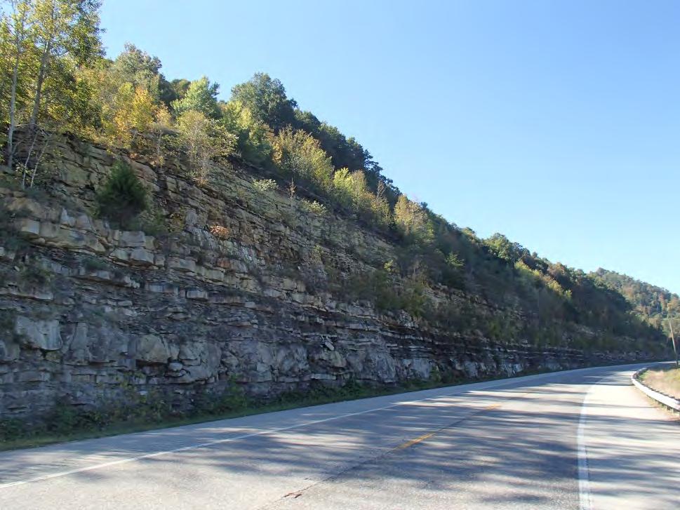
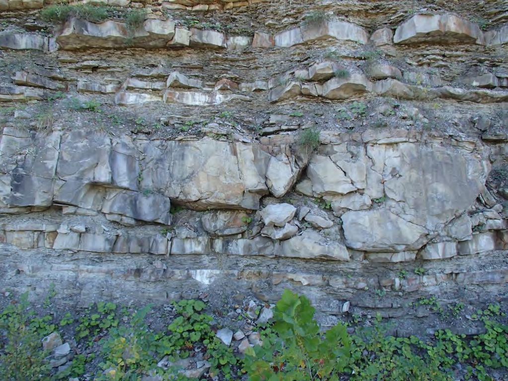
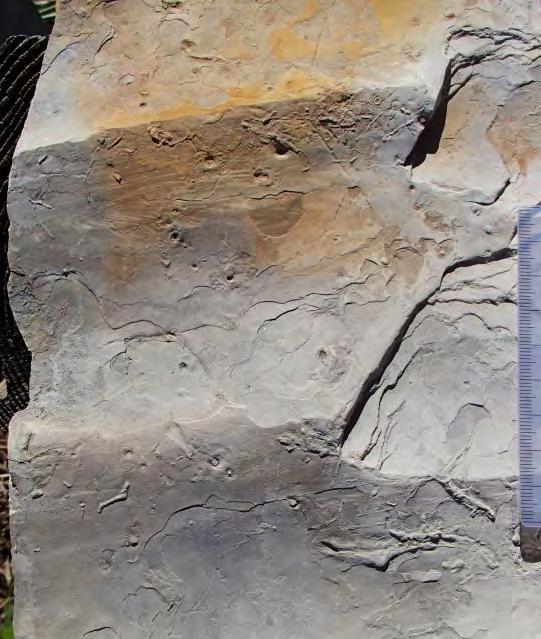
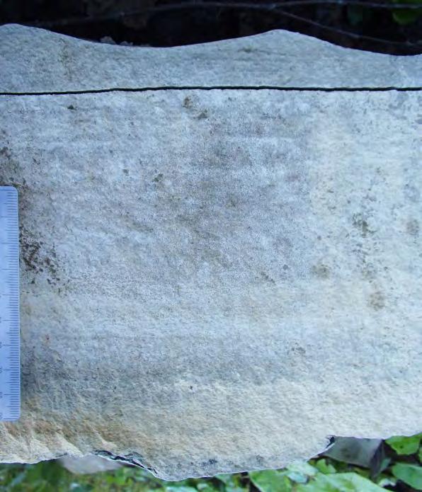
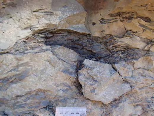
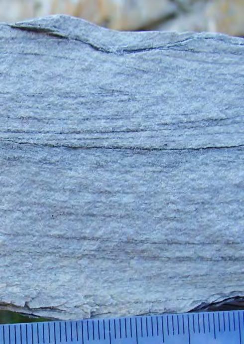
4 Background Berea outcrops in NE KY 1 cm 1 cm 1 cm
, Ky reservoirs could be developed in storm shelf and slope facies including turbidite fans and channels.")
5 Background Storm-dominated shelf Berea Basin floor Turbidite fans/ aprons Feeder channel THREE LICK BED CLEVELAND SHALE HURON SHALE Basement-related growth fault HURON SHALE Based on existing models (e.g., Pashin and Ettensohn, 1995), Ky reservoirs could be developed in storm shelf and slope facies including turbidite fans and channels. (from Pashin and Ettensohn, 1995)

6 APP ENERG Y 1 M O O RE, C Background Eastern KY type Log, Lawrence County Caliper 7 17 Gamma Ray NPHI% TEMP Density Por (ss) PEF RILM Bulk Density RILD tt Lawrence 0 66,611 FEET Sunbury Sh Berea Ss/Bedford Sh Ohio Sh PETRA 4/22/2013 1:42:32 PM Berea is a classic lowpermeability reservoir (perms are generally less than 2 md based on available core) APP ENERGY 1 MOORE, C Lawrence KY
7 LEWIS GREENUP CARTER BOYD ROWAN ELLIOTT LAWRENCE MORGAN JOHNSON MARTIN WOLFE MAGOFFIN BREATHITT FLOYD PIKE KNOTT PERRY LETCHER LESLIE HARLAN KEN MASON RTSON FLEMING ICHOLAS MONTGOMERY BATH POWELL MENIFEE ESTILL LEE JACKSON OWSLEY CLAY REL KNOX LEY BELL Background Berea Hydrocarbon Distribution Oil production limited to NE KY Shallower part of basin (north of Rome Trough) 1,898 Berea completions (mostly verticals) in KGS database 58 horizontal oil completions since 2011 KRFS IPCFS PETRA 4/22/2013 5:02:40 PM Berea Production BEREA PRODUCTION - BEREA PRODUCTION Greenup Boyd Lawrence Johnson Oil, Oil & Gas Gas 0 112,382 FEET
8 Recent Production Trends Greenup County Operator: Nytis Exploration First completion in March, horizontal wells permitted Completion data submitted for 28 wells True vertical depths: ft (avg = 1132 ft) Stratigraphic traps Average lateral is 2,500 ft, oriented SE-NW (downdip) Multistage hydraulic fracture stimulation
: 1.3-6.")
9 Recent Production Trends Greenup County 17 wells with IP s as of March, 2014 Reported oil IP s: BOPD 7-37 MCFGD Water IP: bbl/day WOR (water/oil): (avg = 3)

10 Recent Oil Production Trends Greenup County Horizontal Well Locations 2014 Greenup Greenup Carter Boyd Boyd

11 Recent Production Trends Greenup County Oil (bbls/month) Production data for four wells max:1649 Oil production data for four wells: Avg bbls/month First 6 months bbls/month Months Since bbls/month Brice Sheperd 1 Emory Patton Heirs 2 Emory Patton Heirs 3 Brice Sheperd Heirs Avg = 583 bbls/month
12 Recent Production Trends Lawrence County Operators: Eagle and others, Nytis Exploration, Hay Exploration, App Energy First completion in October, horizontal wells permitted Completion data submitted for 30 wells True vertical depths: ft (avg = 1517 ft) Stratigraphic traps Average lateral is 2,600 ft., variable orientations Multistage hydraulic fracture stimulation
: 10 bbl/day WOR (for 1 well)): 0.")
13 Recent Production Trends Lawrence County 25 wells with IP s as of 3/2014 Reported oil IP s: 8-44 BOPD, avg. = 25 BOPD 12 MCFGD Water IP (for 1 well): 10 bbl/day WOR (for 1 well)): 0.33 No public production data available yet

14 Recent Production Trends Lawrence County Horizontal Well Locations 2014 Lawrence
15 Recent Production Trends Recent Berea Oil Production, East Kentucky Oil production (barrels) Thousands Greenup Lawrence >10% of statewide production production volume for Greenup County is confidential (3 or fewer respondents)
16 Recent Production Trends Summary Initial data shows horizontal drilling has been a technical success in shallow tight Berea reservoirs Horizontal drilling has dramatically increased Berea oil production in KY Dramatic increases in Greenup and Lawrence County oil production (and for EKY as a whole) Berea horizontal play spreading into neighboring Boyd and Johnson Counties Shallow depths (lower costs) part of the interest Determining economic success will require longer term production data
17 Research Questions KY Berea oil play 1) Why does the Berea produce oil and gas in areas where the surrounding source rocks are interpreted as thermally immature? Thermally immature (<0.6 % Ro) USGS Thermal Maturity Map (East and others, SIM 3214, 2012) Prolific oil generation (0.6 to 1.1 % Ro) Thermal gas generation (>1.1 % Ro)
 USGS Thermal Maturity Map (East and others, SIM 3214, 2012) Prolific oil generation (0.6 to 1.1 % Ro) Thermal gas generation (>1.")
18 Research Questions KY Berea oil play 1) Why does the Berea produce oil and gas in areas where the surrounding source rocks are interpreted as thermally immature? Thermally immature (<0.6 % Ro) USGS Thermal Maturity Map (East and others, SIM 3214, 2012) Prolific oil generation (0.6 to 1.1 % Ro) Thermal gas generation (>1.1 % Ro)

19 Research Questions 1a) Is vitrinite suppression responsible for the apparent source rock immaturity? Or is some of the vitrinite from Devonian shales actually bitumen with a different R o and different relationship to maturity? Dispersed vitrinite Petrographic slide of dispersed vitrinite from the Ohio Shale under white light Can we use other geochemistry measurements (e.g. isotopes, biomarkers) in gas, oil, and extract samples to better understand thermal maturity in conjunction with vitrinite reflectance measurements.

20 Research Questions 2) Are Berea hydrocarbons derived from the Sunbury or Ohio Shales and are the hydrocarbons generated locally or migrated from deeper (more mature) parts of the basin? NW Shallower Deeper SE Sunbury Shale Berea Ss Berea oil fields Ohio Shale What does the Berea petroleum system look like? Faults Faults Immature Oil-prone Gas-prone

? Any structural influences on facies?")
21 Research Questions 3) What are some of the controls on pay zones, porosity, and permeability in the Berea in Kentucky? Regional trends in thickness? Sandstone architecture and facies in producing fields (lateral and vertical variability)? Any structural influences on facies? Any structural influences on oil/gas/water saturations? Berea
22 Berea Sandstone Consortium Project KGS, USGS, OGS, R.J. Lee Group, and 7 industry partners 18-month study (07/ /2015) of the Berea petroleum system Analysis will be conducted along a NW-SE transect representing thermal maturity range in Ky Generate regional cross sections, and updated isopach and structure maps of the Berea in KY Compare geophysical logs, cores, and outcrops to better characterize the Berea petroleum system
23 Berea Consortium Project Collect and analyze samples of source rocks for TOC, Rock-Eval pyrolysis, vitrinite reflectance, and spectral fluorescence to evaluate thermal maturity Collect and analyze (LC, GC, GCMS) samples of Berea oil and gas to geochemically understand provenance and distribution Use GCMS and IRMS measurements of extracts and oils to analyze biomarker profiles and carbon isotope composition to interpret hydrocarbon source Results will be confidential for one year and then a public report will be published (~Dec. 2016)

24 Thank you KGS Berea Play Web Page: Upper_Devonian_Berea_SS.htm
DISTRIBUTION OF FERTILIZER SALES
 DISTRIBUTION OF FERTILIZER SALES IN KENTUCKY Annual Report Fertilizer Year 2012 July 2011 June 2012 An Equal Opportunity University Agricultural Experimental Station Division of Regulatory Services Lexington,
Distribution of Fertilizer Sales In Kentucky Fertilizer Year: 2004 July June Revised September 26, Bagged 12% Bulk 65% Liquid 23%
 Distribution of Fertilizer Sales In Kentucky Fertilizer Year: 2004 July 2003 - June 2004 Revised September 26, 2006 Bagged 12% Bulk 65% Liquid 23% Table of Contents INTRODUCTION...3 TOTAL FERTILIZER SUMMARY...4
The Giant Continuous Oil Accumulation in the Bakken Petroleum System, Williston Basin
 The Giant Continuous Oil Accumulation in the Bakken Petroleum System, Williston Basin Stephen A. Sonnenberg Department of Geology and Geological Engineering Colorado School of Mines Williston Basin Conference
OVERVIEW OF THE ROGERSVILLE SHALE IN WEST VIRGINIA. Philip Dinterman West Virginia Geological & Economic Survey May 11, 2017
 OVERVIEW OF THE ROGERSVILLE SHALE IN WEST VIRGINIA Philip Dinterman West Virginia Geological & Economic Survey May 11, 2017 ACKNOWLEDGEMENT Dave Harris, John Hickman, Kentucky Geological Survey DATA NOTE
Evaluation of geological characteristics of the New Albany Shale as a potential liquids-from- shale play in the Illinois Basin
 2014 Eastern Unconventional Oil and Gas Symposium - November 5-7, 2014 in Lexington, Kentucky, USA http://www.euogs.org Evaluation of geological characteristics of the New Albany Shale as a potential liquids-fromshale
New Albany Shale? Brandon C. Nuttall, Speaker Kentucky Geological Survey KOGA, Louisville, Ky 16 Jul 2014
 Oil and NGLs in the Devonian New Albany Shale? Brandon C. Nuttall, Speaker Kentucky Geological Survey KOGA, Louisville, Ky 16 Jul 2014 Natural Gas Phases at 1 Atm Benzene (C6) Hexane (C6) Pentane (C5)
Recap and Integrated Rock Mechanics and Natural Fracture Study in the Bakken Formation, Williston Basin
 Recap and Integrated Rock Mechanics and Natural Fracture Study in the Bakken Formation, Williston Basin EERC, 2011 Cosima Theloy PhD Candidate Department of Geology and Geological Engineering Colorado
Exploration / Appraisal of Shales. Petrophysics Technical Manager Unconventional Resources
 Exploration / Appraisal of Shales Rick Lewis Petrophysics Technical Manager Unconventional Resources Organic Shale Factors Controlling Gas Reservoir Quality Conventional sandstone Mineral framework Gas
Geologic Structure and Seismic Analysis
 Geologic Structure and Seismic Analysis Kentucky Geological Survey James A. Drahovzal, John B. Hickman and Paul D. Lake Trenton Black-River Research Consortium September 9, 2004 Pittsburgh, PA Structure
Using Thermal Maturity to Identify the Most Productive Part of the Oil Window to Target in the Woodford Shale
 2 nd Annual Woodford Liquids-Rich January 28, 2015 Horizontal Targets Congress 2015 Using Thermal Maturity to Identify the Most Productive Part of the Oil Window to Target in the Woodford Shale Brian J.
Kentucky HFA Performance Data Reporting- Borrower Characteristics
 Borrower Income ($) Above $90,000 0% 0% $70,000- $89,000 0% 0% $50,000- $69,000 0% 0% Below $50,000 0% 0% Borrower Income as Percent of Area Median Income (AMI) Above 120 110%-119 100%- 109 90%- 99 80%-
MIDDLE DEVONIAN PLAY MICHIGAN BASIN OF ONTARIO. Duncan Hamilton
 MIDDLE DEVONIAN PLAY MICHIGAN BASIN OF ONTARIO Duncan Hamilton 1 Middle Devonian Pools of the Michigan Basin 375+ Million Barrels Michigan 45+ million Barrels Ontario 2 Outline of Presentation History
2003 GCSSEPM Foundation Ed Picou Fellowship Grant for Graduate Studies in the Earth Sciences Recipient
 2003 GCSSEPM Foundation Ed Picou Fellowship Grant for Graduate Studies in the Earth Sciences Recipient Tarek A. El Shayeb University of Texas at Austin Integrated reservoir characterization and 3-D diagenetic
Recap and Integrated Rock Mechanics and Natural Fracture Study on the Bakken Formation, Williston Basin Abstract Figure 1:
 Recap and Integrated Rock Mechanics and Natural Fracture Study on the Bakken Formation, Williston Basin Cosima Theloy, Department of Geology & Geological Engineering Abstract The late Devonian to early
Dr. Kenneth B. Taylor, P.G.
 North Carolina Forestry Association 2013 Annual Meeting October 3, 2013 Shale Gas 101: Natural Gas Exploration / Development: A North Carolina Perspective presented by Dr. Kenneth B. Taylor, P.G. State
Overview of Woodford Gas-Shale Play in Oklahoma, 2008 Update
 Oklahoma Gas Shales Conference October 22, 2008 Overview of Woodford Gas-Shale Play in Oklahoma, 2008 Update Brian J. Cardott Oklahoma Geological Survey Number of Wells 300 250 200 Oklahoma Shale-Gas Well
A Review of Three North American Shale Plays: Learnings from Shale Gas Exploration in the Americas*
 A Review of Three North American Shale Plays: Learnings from Shale Gas Exploration in the Americas* David Waldo 1 Search and Discovery Article #80214 (2012)** Posted May 28, 2012 *Adapted from oral presentation
GEOLOGY, RESOURCES, AND POTENTIAL ACTIVITY LEVELS
 GEOLOGY, RESOURCES, AND POTENTIAL ACTIVITY LEVELS NAS Workshop on the Development of Unconventional Hydrocarbon Resources in the Appalachian Basin Ray Boswell, US DOE/NETL Morgantown, West Virginia September
Sequence Stratigraphy of the Upper Cretaceous Niobrara Formation, A Bench, Wattenberg Field, Denver Julesburg Basin, Colorado*
 Sequence Stratigraphy of the Upper Cretaceous Niobrara Formation, A Bench, Wattenberg Field, Denver Julesburg Basin, Colorado* Lisa E. Remington LaChance 1 and Mark C. Robinson 1 Search and Discovery Article
BACKGROUND GEOLOGY. Hoaglund 1. Wichita Orogeny to the south (10k 15k uplift) Rapid erosion and deposition of uplifted granitic basement rock ~18,000
 Rapid erosion and deposition of uplifted granitic basement rock ~18,000") POST APPRAISAL OF THE MISSOURIAN HOGSHOOTER HYDROCARBON SYSTEM: IMPLICATIONS FOR FUTURE EXPLOITATION IN THE ANADARKO BASIN STEVE HOAGLUND (GEOLOGIST CHESAPEAKE ENERGY) BACKGROUND GEOLOGY Wichita Orogeny
POST APPRAISAL OF THE MISSOURIAN HOGSHOOTER HYDROCARBON SYSTEM: IMPLICATIONS FOR FUTURE EXPLOITATION IN THE ANADARKO BASIN STEVE HOAGLUND (GEOLOGIST CHESAPEAKE ENERGY) BACKGROUND GEOLOGY Wichita Orogeny
Devonian Petroleum Systems and Exploration Potential, Southern Alberta, Part 3 Core Conference
 Devonian Petroleum Systems and Exploration Potential, Southern Alberta, Part 3 Core Conference Andy Mort (1), Leonard Stevens (2), Richard Wierzbicki (2) Abstract Part 1: Devonian Petroleum Systems Dr.
Petroleum Potential of the Application Area L12-4
 Petroleum Potential of the Application Area L12-4 The Application Area (L12-4) is underlain by the western Officer Basin, beneath the Gunbarrel Basin. The general basin architecture is outlined in Figure
Alaska Oil Discoveries
 Identifying new prospects in Alaska's North Slope trends. Chris Williams, MS., PG. Geoscience Advisor Stratigraphic Column Era M.Y.A. Albian ~113 Formation Oil and Gas Producing Areas Kuvlum, Hammerhead.
Technology of Production from Shale
 Technology of Production from Shale Doug Bentley, European Unconventional, Schlumberger May 29 th, 2012 Johannesburg, South Africa What are Unconventional Reservoirs Shale both Gas & Oil Coal Bed Methane
Geologic influence on variations in oil and gas production from the Cardium Formation, Ferrier Oilfield, west-central Alberta, Canada
 Geologic influence on variations in oil and gas production from the Cardium Formation, Ferrier Oilfield, west-central Alberta, Canada Marco Venieri and Per Kent Pedersen Department of Geoscience, University
Integrated Analytical Approach Identifies Wolfcamp Targets Outside Defined Play Area
 SEPTEMBER 2017 The Better Business Publication Serving the Exploration / Drilling / Production Industry Integrated Analytical Approach Identifies Wolfcamp Targets Outside Defined Play Area By Austin S.
Harlan County Landslide Risk Analysis A Geoprocessing Task Using ArcGIS Model Builder
 Harlan County Landslide Risk Analysis A Geoprocessing Task Using ArcGIS Model Builder Ryan Kelly Associate Professor of Geography & Geospatial Technologies, GISP Bluegrass Community & Technical College
Depositional Model and Distribution of Marginal Marine Sands in the Chase Group, Hugoton Gas Field, Southwest Kansas and Oklahoma Panhandle
 Depositional Model and Distribution of Marginal Marine Sands in the Chase Group, Hugoton Gas Field, Southwest Kansas and Oklahoma Panhandle Nathan D. Winters, Martin K. Dubois, and Timothy R. Carr Kansas
of Pennsylvanian Marine Shale Beds from the Central Appalachian and Eastern Interior Basins
 Comparative 2014 Eastern Unconventional Oil and Organic Gas Symposium - November 5-7, 2014 in Petrography Lexington, Kentucky, USA http://www.euogs.org of Pennsylvanian Marine Shale Beds from the Central
Abstract. 1. Introduction. Dan Kohlruss 1 and Kosta Stamatinos 2
 Preliminary Bulk Density Mapping of the Upper and Lower Bakken Member Shales of Southeastern Saskatchewan: A Potential Indicator for Oil Generation and Expulsion Dan Kohlruss 1 and Kosta Stamatinos 2 Kohlruss,
FY 2013 Annual Technical Report for NCRDS State Cooperative Program
 FY 2013 Annual Technical Report for NCRDS State Cooperative Program SUBSURFACE GAS-SHALE SAMPLES OF THE UPPER DEVONIAN AND LOWER MISSISSIPPIAN WOODFORD SHALE, PERMIAN BASIN, WEST TEXAS AND SOUTHEASTERN
Relinquishment Report
 Relinquishment Report Licence P1403 Block 13/22d Chevron North Sea Limited Korean National Oil Company Chevron North Sea Limited December 2009 1 SYNOPSIS... 3 2 INTRODUCTION. 3 2.1 Licence Terms.. 3 2.2
Brine Disposal Reservoirs in the Appalachian Basin: Injection Performance and Geological Properties
 Brine Disposal Reservoirs in the Appalachian Basin: Injection Performance and Geological Properties Joel Sminchak, John Miller, and Neeraj Gupta Battelle, Columbus, Ohio Ground Water Protection Council
Steve Cumella 1. Search and Discovery Article # (2009) Posted July 30, Abstract
 Posted July 30, Abstract") AV Geology of the Piceance Basin Mesaverde Gas Accumulation* Steve Cumella 1 Search and Discovery Article #110106 (2009) Posted July 30, 2009 *Adapted from oral presentation at AAPG Annual Convention,
AV Geology of the Piceance Basin Mesaverde Gas Accumulation* Steve Cumella 1 Search and Discovery Article #110106 (2009) Posted July 30, 2009 *Adapted from oral presentation at AAPG Annual Convention,
Licence P1368: Relinquishment Report (end of 2 nd term) Hurricane Exploration PLC
 Hurricane Exploration PLC") Licence P1368: Relinquishment Report (end of 2 nd term) Hurricane Exploration PLC March 2012 1. Header Licence Number: P1368 Licence Round: 23 rd Licence Type: Frontier Block Numbers: 202/4, 202/5, 204/30,
Licence P1368: Relinquishment Report (end of 2 nd term) Hurricane Exploration PLC March 2012 1. Header Licence Number: P1368 Licence Round: 23 rd Licence Type: Frontier Block Numbers: 202/4, 202/5, 204/30,
Update - Testing of the Strawn Sand, White Hat 20#3, Mustang Prospect, Permian Basin, Texas
 Date: 15 April 2019 ASX Code: WEL Directors John Kopcheff Non-Executive Chairman Neville Henry Managing Director Peter Allchurch Non-Executive Director Larry Liu Non-Executive Director Lloyd Flint Company
Overview of Selected Shale Plays in New Mexico*
 Overview of Selected Shale Plays in New Mexico* Ron Broadhead 1 Search and Discovery Article #10627 (2014)** Posted August 18, 2014 *Adapted from presentation at RMAG luncheon meeting, Denver, Colorado,
Bulletin of Earth Sciences of Thailand. Evaluation of the Petroleum Systems in the Lanta-Similan Area, Northern Pattani Basin, Gulf of Thailand
 Evaluation of the Petroleum Systems in the Lanta-Similan Area, Northern Pattani Basin, Gulf of Thailand Sirajum Munira Petroleum Geoscience Program, Department of Geology, Faculty of Science, Chulalongkorn
Horizontal San Andres Play
 Horizontal San Andres Play Russell K. Hall Presented at the CO 2 & ROZ Conference Dec 5, 2018 Midland, Texas CO 2 Recovery Conference Permian Basin Trends Horizontal San Andres Play PERMIAN BASIN TRENDS
Testing of the Strawn Sand, White Hat 20#3, Mustang Prospect, Permian Basin, Texas
 Date: 11 April 2019 ASX Code: WEL Directors John Kopcheff Non-Executive Chairman Neville Henry Managing Director Peter Allchurch Non-Executive Director Larry Liu Non-Executive Director Lloyd Flint Company
Optimizing Completions within the Montney Resource Play Mike Seifert, Mark Lenko, Joshua Lee Canadian Discovery Ltd.
 URTeC: 2139640 Optimizing Completions within the Montney Resource Play Mike Seifert, Mark Lenko, Joshua Lee Canadian Discovery Ltd. Introduction The Montney resource play covers 57,000 square miles from
Considerations for Infill Well Development in Low Permeability Reservoirs
 Considerations for Infill Well Development in Low Permeability Reservoirs George Waters Technical Manager Unconventional Completions September 9, 2014 Topics Continuous Improvement in Field Development
Relationships of the Ordovician. Appalachian Basin. June 21, 2011
 Regional Stratigraphic and Facies Relationships of the Ordovician Utica/Point i t Pleasant Interval in the Appalachian Basin June 21, 2011 Ron Riley and Mark Baranoski Stratigraphic Correlation Chart Modified
Predicting Initial Production of Granite Wash Horizontal Wells Using Old Well Logs and Cores. Strong correlation, eh?
 Oil Initial Production, STB/D Predicting Initial Production of Granite Wash Horizontal Wells Using Old Well Logs and Cores 13 November 2014 Granite Wash Workshop Strong correlation, eh? 4000 3000 2000
Assessment of CO 2 Enhanced Gas Recovery in Shale Gas Reservoirs (Preliminary)*
*") Assessment of CO 2 Enhanced Gas Recovery in Shale Gas Reservoirs (Preliminary)* Brandon C. Nuttall 1, Michael L. Godec 2, Robert J. Butsch 3, and David E. Riestenberg 4 Search and Discovery Article #80296
Assessment of CO 2 Enhanced Gas Recovery in Shale Gas Reservoirs (Preliminary)* Brandon C. Nuttall 1, Michael L. Godec 2, Robert J. Butsch 3, and David E. Riestenberg 4 Search and Discovery Article #80296
North GOM Petroleum Systems: Modeling the Burial and Thermal History, Organic Maturation, and Hydrocarbon Generation and Expulsion
 North GOM Petroleum Systems: Modeling the Burial and Thermal History, Organic Maturation, and Hydrocarbon Generation and Expulsion Roger J. Barnaby 2006 GCAGS MEETING Previous studies of northern GOM crude
Halliburton Engineering for Success in Developing Shale Assets
 Halliburton Engineering for Success in Developing Shale Assets Nov 30, 2010 Shale is a Very Broad Name Used to Describe a Large Category of Rock In conventional petroleum geology shale is thought of as
Ministry of Oil and Minerals Petroleum Exploration & Production Authority BLOCK 85 (Al Uqlah North)
") Ministry of Oil and Minerals Petroleum Exploration & Production Authority BLOCK 85 (Al Uqlah North) The Al Uqlah North Block (85) occupies an area of 597 km 2 in the Sabatayn Basin in the province of Shabwah
Ministry of Oil and Minerals Petroleum Exploration & Production Authority BLOCK 85 (Al Uqlah North) The Al Uqlah North Block (85) occupies an area of 597 km 2 in the Sabatayn Basin in the province of Shabwah
The Niobrara Petroleum System, Rocky Mountain Region. Steve Sonnenberg & James Taylor Colorado School of Mines
 The Niobrara Petroleum System, Rocky Mountain Region Steve Sonnenberg & James Taylor Colorado School of Mines The Niobrara-Mancos Oil & Gas Play, Rocky Mountain Region Niobrara and Mancos Production, Rocky
MUHAMMAD S TAMANNAI, DOUGLAS WINSTONE, IAN DEIGHTON & PETER CONN, TGS Nopec Geological Products and Services, London, United Kingdom
 Geological and Geophysical Evaluation of Offshore Morondava Frontier Basin based on Satellite Gravity, Well and regional 2D Seismic Data Interpretation MUHAMMAD S TAMANNAI, DOUGLAS WINSTONE, IAN DEIGHTON
Core Technology for Evaluating the Bakken
 Core Technology for Evaluating the Bakken Fundamentals for Reservoir Quality Assessment and Completion Analysis John Kieschnick and Roberto Suarez-Rivera TerraTek 1 Topics Covered Core Technology Changes
Ministry of Oil and Minerals Petroleum Exploration & Production Authority BLOCK 80 (WADI SARR)
") Ministry of Oil and Minerals Petroleum Exploration & Production Authority BLOCK 80 (WADI SARR) The Wadi Sarr Block (80) occupies an area of 1961 km 2 on the Sayun- Masilah Basin in the central Yemen. Block
Ministry of Oil and Minerals Petroleum Exploration & Production Authority BLOCK 80 (WADI SARR) The Wadi Sarr Block (80) occupies an area of 1961 km 2 on the Sayun- Masilah Basin in the central Yemen. Block
Process, Zeit Bay Fields - Gulf of Suez, Egypt*
 PS Pressure Regime Evaluation, Role, and Contribution in Well Planning and Formation Evaluation Process, Zeit Bay Fields - Gulf of Suez, Egypt* Saber Moustafa Selim 1, Khaled Mohamed Abdallah 1, and Khalaf
Debra K. Gomez 1 and David Brewster 2. Search and Discovery Article #10843 (2016)** Posted March 21, Abstract
** Posted March 21, Abstract") PS Petroleum Potential Onshore Southern Madagascar, Morandava Basin, Block 3114* Debra K. Gomez 1 and David Brewster 2 Search and Discovery Article #10843 (2016)** Posted March 21, 2016 *Adapted from poster
PS Petroleum Potential Onshore Southern Madagascar, Morandava Basin, Block 3114* Debra K. Gomez 1 and David Brewster 2 Search and Discovery Article #10843 (2016)** Posted March 21, 2016 *Adapted from poster
EVALUATION OF KEY FACTORS AFFECTING SUCCESSFUL OIL PRODUCTION IN THE BAKKEN FORMATION, NORTH DAKOTA. Technology Status Assessment.
 EVALUATION OF KEY FACTORS AFFECTING SUCCESSFUL OIL PRODUCTION IN THE BAKKEN FORMATION, NORTH DAKOTA Technology Status Assessment Prepared by: James A. Sorensen Senior Research Manager Energy & Environmental
Fracking for Tight Oil and Shale Gas in the U.S.
 Fracking for Tight Oil and Shale Gas in the U.S. Terminology 1. Crude Oil: Liquid petroleum extracted from the Earth (barrels, bbl) 2. Natural Gas: Mixture of hydrocarbon and non-hydrocarbon gases extracted
Farms With Sales of $2,500 and Over. Table 1. Livestock: 1969 HARDIN HARRISON,,,,,,,,,,,,,,,,, HART WEBSTER..,,,,,,,,,,, WOODFORD,,,,,,,,,,,,,,,,,
 With of $2,00 and Over Kentucky 2 Class 1 LAMBS UNDI;:R 1 YR OLD AOArR-,,,,,,,,,,,,,,,,,,,, BOYLE,,,,, BRECKINRIOGEe CA.RLISLE,, FLEMING,, FRANKLIN,,,,,,,,,,,,,,,,, GARRARD, HOPKINS KENTON. LIVINGSTON,,,,,,,,,,,,,,,
Canol Formation Oil Shale, Exhumation Charge, and Regional Geology of the Central Mackenzie, NWT
 Photo: Canol Fm near Arctic Red River Canol Formation Oil Shale, Exhumation Charge, and Regional Geology of the Central Mackenzie, NWT Hadlari T. Geological Survey of GSC 2018 Introduction Research made
Barnett Shale-Woodford Shale play of the Delaware basin is it another giant shale gas field in Texas?
 Barnett Shale-Woodford Shale play of the Delaware basin is it another giant shale gas field in Texas? Bob Cluff The Discovery Group, Inc Denver, Colorado, USA bobcluff@discovery-group.com Delaware basin
Flow Units in Conventional and Unconventional Petroleum Reservoirs
 Flow Units in Conventional and Unconventional Petroleum Reservoirs Roberto Aguilera, Schulich School of Engineering, University of Calgary (Based mostly on SPE 165360-PA and SPE 178619-PA) Presented at
Is It Likely That Fracking the Organic-Rich Utica Shale Beneath Bowling Green, OH Would Be Environmentally Safe?
 Is It Likely That Fracking the Organic-Rich Utica Shale Beneath Bowling Green, OH Would Be Environmentally Safe? Dr. Robert K. Vincent Prof. Emeritus, Dept. of Geology Bowling Green State University How
Relinquishment Report for Licence P.1265, Block 12/28
 Relinquishment Report for Licence P.1265, Block 12/28 1. Licence Information Licence Number: P.1265 Licence Round: 23 rd Round Awarded 22 December 2005 Licence Type: Traditional Block Number(s): 12/28
Geological Overview of the Niobrara Chalk Natural Gas Play
 Geological Overview of the Niobrara Chalk Natural Gas Play W. Lynn Watney Kansas Geological Survey KU Energy Research Center The University of Kansas Lawrence, KS Outline Geologic Setting Paleogeography
Overview of Unconventional Energy Resources of Oklahoma
 Overview of Unconventional Energy Resources of Oklahoma By Brian J. Cardott (Oklahoma Geological Survey) Presented at OGS Conference on Unconventional Energy Resources in the Southern Midcontinent in Oklahoma
Wattenberg Field Area, A Near Miss & Lessons Learned After 35 Years of Development History. Stephen A. Sonnenberg Robert J. Weimer
 Wattenberg Field Area, A Near Miss & Lessons Learned After 35 Years of Development History Stephen A. Sonnenberg Robert J. Weimer Front Wattenberg Field DJ Basin WYOMING Pay PIERRE SHALE Typical Depth
Play fairway mapping in the Northeast Atlantic Margin Comparison between mature and immature basins. David Mudge, Joanne Cranswick
 Play fairway mapping in the Northeast Atlantic Margin Comparison between mature and immature basins David Mudge, Joanne Cranswick Contents Ternan North Sea Play fairway mapping Tertiary case study Northeast
SCOOP Woodford. Regional Field Study
 SCOOP Woodford Regional Field Study OVERVIEW The Woodford shale is an organic rich siliceous shale formation of late Devonian and early Mississippian age deposited throughout most of the Anadarko basin
For personal use only
 Date: 18 February 2019 ASX Code: WEL Directors John Kopcheff Non-Executive Chairman Neville Henry Managing Director Peter Allchurch Non-Executive Director James Hodges Non-Executive Director Larry Liu
Ministry of Oil and Minerals Petroleum Exploration & Production Authority BLOCK 6 (Iryam)
") Ministry of Oil and Minerals Petroleum Exploration & Production Authority BLOCK 6 (Iryam) The Iryam Block (6) occupies an area of 3,911 km 2 in the Sabatayn Basin in the province of Shabwah in central
Ministry of Oil and Minerals Petroleum Exploration & Production Authority BLOCK 6 (Iryam) The Iryam Block (6) occupies an area of 3,911 km 2 in the Sabatayn Basin in the province of Shabwah in central
A Case Study into the Successful Evaluation and Completion Nonconventional. Jorge Viamontes, PhD VP Reservoir Intelligence, NUTECH
 A Case Study into the Successful Evaluation and Completion Nonconventional Wells in Mexico Jorge Viamontes, PhD VP Reservoir Intelligence, Presentation Outline - experience in the Eagle Ford and Burgos
Mesaverde Tight Gas Sandstone Sourcing from Underlying Mancos-Niobrara Shales*
 Mesaverde Tight Gas Sandstone Sourcing from Underlying Mancos-Niobrara Shales* Steve Cumella 1 and Jay Scheevel 2 Search and Discovery Article #10450 (2012)** Posted October 22, 2012 *Adapted from oral
APPENDIX C GEOLOGICAL CHANCE OF SUCCESS RYDER SCOTT COMPANY PETROLEUM CONSULTANTS
 APPENDIX C GEOLOGICAL CHANCE OF SUCCESS Page 2 The Geological Chance of Success is intended to evaluate the probability that a functioning petroleum system is in place for each prospective reservoir. The
Unconventional Shale Plays in MT
 Unconventional Shale Plays in MT A Look at the Geology & Development of the Bakken and Heath Formations Jay Gunderson Montana Bureau of Mines and Geology Why Shales? Traditional Source Rocks Mostly clays
MAPPING AND RESERVOIR CHARACTERIZATION OF GEOLOGIC INTERVALS FOR NGL STORAGE APPLICATIONS
 MAPPING AND RESERVOIR CHARACTERIZATION OF GEOLOGIC INTERVALS FOR NGL STORAGE APPLICATIONS Robin V. Anthony 1, Doug Patchen 2, Jessica Moore 3, Michael Solis 4 1 PA DCNR, Bureau of Topographic & Geologic
Relinquishment Report for Licence Number P1435, Block 30/25a March 2009
 Relinquishment Report for Licence Number P1435, Block 30/25a March 2009 Endeavour Energy UK Ltd Relinquishment Report for Licence Number P1435 Block 30/25a 1 Table of Contents 1.0 Header...3 2.0 Synopsis...3
Petroleum geology framework, West Coast offshore region
 Petroleum geology framework, West Coast offshore region James W. Haggart* Geological Survey of Canada, Vancouver, BC jhaggart@nrcan.gc.ca James R. Dietrich Geological Survey of Canada, Calgary, AB and
Kilometre-Scale Uplift of the Early Cretaceous Rift Section, Camamu Basin, Offshore North-East Brazil*
 Kilometre-Scale Uplift of the Early Cretaceous Rift Section, Camamu Basin, Offshore North-East Brazil* Iain Scotchman 1 and Dario Chiossi 2 Search and Discovery Article #50183 (2009) Posted May 20, 2009
Relinquishment Report. for. Licences: P.1596 (Blocks 205/3, 205/4a) P.1836 (Block 205/2b) P.1837 (Block 205/5b)
 P.1836 (Block 205/2b) P.1837 (Block 205/5b)") Relinquishment Report for Licences: P.1596 (Blocks 205/3, 205/4a) P.1836 (Block 205/2b) P.1837 (Block 205/5b) November 2013 1 of 9 CONTENT 1. Header 2. Synopsis 3. Exploration Activities 4. Prospectivity
Relinquishment Report for Licences: P.1596 (Blocks 205/3, 205/4a) P.1836 (Block 205/2b) P.1837 (Block 205/5b) November 2013 1 of 9 CONTENT 1. Header 2. Synopsis 3. Exploration Activities 4. Prospectivity
Short Course. Petroleum Geochemistry & Basin Evaluation. Available to EGI Corporate Associate Members. Overview. Objectives.
 Short Course Instructor: David Thul, M.Sc. Manager of Petroleum Geochemistry Petroleum Geochemistry & Basin Evaluation Available to EGI Corporate Associate Members Course Structure Lectures, presentation
Licence P Relinquishment Report
 Licence P.1762 Relinquishment Report February 2014 Relinquishment Report P.1762 1 Licence Information 1 2 Licence Synopsis 2 3 Work Programme Summary 3 4 Database 4 5 Prospectivity Update 5 6 Additional
FORMATION EVALUATION PETE 321
 FORMATION EVALUATION PETE 321 DENSITY AND NEUTRON LOGS Summer 2010 David Schechter Fluorescent Intervals in 1U Sand Sharp transition between oil saturated pay and non-pay observed by fluorescence in core
Burket/Geneseo Shale Appalachia s little brother to the Marcellus & Utica
 Burket/Geneseo Shale Appalachia s little brother to the Marcellus & Utica Gregory Wrightstone Presented at: WrightstoneEnergy.com October 8, 2015 Pittsburgh Association of Petroleum Geologists Pittsburgh,
North Dakota Geological Survey
 Review of Hydrocarbon Production from the Stonewall and lower Interlake Formations: western North Dakota Williston Basin Timothy O. Nesheim North Dakota Geological Survey North Dakota Geological Survey
Tim Carr - West Virginia University
 GEOGRAPHIC EXTENT OF PETROLEUM SYSTEM A Trap Trap Trap A STRATIGRAPHIC EXTENT OF PETROLEUM SYSTEM Petroleum accumulation Top of oil window Bottom of oil window Overburden Seal Reservoir Source Underburden
Geology & Geophysics Applied in Industry. EXERCISE 2: A Quick-Look Evaluation
 EXERCISE 2: A Quick-Look Evaluation You have been asked to perform a quick back-of-the-envelope evaluation of the blocks being offered off of Somewhereia. Is there enough potential that our company should
South Texas* Paul C. Hackley 1, Kristin Dennen 1, Rachel Gesserman 1, and Jennie L. Ridgley 2
 AV Preliminary Investigation of the Thermal Maturity of Pearsall Formation Shales in the Maverick Basin, South Texas* Paul C. Hackley 1, Kristin Dennen 1, Rachel Gesserman 1, and Jennie L. Ridgley 2 Search
Update on Trenton Black River Playbook Study-New York State Museum
 Update on Trenton Black River Playbook Study-New York State Museum Taury Smith, Rich Nyahay, Rick Bray, Courtney Lugert, Rose Schulze and Brian Slater New York State Museum Task 4: Geochemistry Task 1
StackFRAC HD system outperforms cased hole in vertical wells
 Case Study StackFRAC HD system outperforms cased hole in vertical wells UNITED STATES, PERMIAN BASIN STACKFRAC HD SYSTEM Background The Permian Basin consists of several stacked pay zones and is one of
Key Elements of the Petroleum Systems of the Rockall and Slyne-Erris Basins
 Key Elements of the Petroleum Systems of the Rockall and Slyne-Erris Basins Bandon Corrib Dooish Atlantic Ireland Conference, Dublin, 1 st - 2 nd November 2016 Rockall and Slyne-Erris Basins Only 11 exploration
Subsurface Mapping 1 TYPES OF SUBSURFACE MAPS:- 1.1 Structural Maps and Sections: -
 Subsurface Mapping The purpose of subsurface mapping in the geology of petroleum Is to find traps that contain oil and gas pools and the information obtained from wells forms the heart of the data upon
An Analytic Approach to Sweetspot Mapping in the Eagle Ford Unconventional Play
 An Analytic Approach to Sweetspot Mapping in the Eagle Ford Unconventional Play Murray Roth*, Transform Software and Services, Denver, Colorado, Murray@transformsw.com Michael Roth, Transform Software
Unconventional reservoir characterization using conventional tools
 Ritesh K. Sharma* and Satinder Chopra Arcis Seismic Solutions, TGS, Calgary, Canada Summary Shale resources characterization has gained attention in the last decade or so, after the Mississippian Barnett
3-4 year research program funded by GeoScience BC, Industry Collaborators NSERC Collaborative Research Development. E. Munson - R.
 Petrophysics and hydrocarbon generation, retention and production from ultra-low permeability rocks: HC liquid potential from Western Canadian Shales- a study in progress 3-4 year research program funded
Fluid contacts and net-pay identification in three phase reservoirs using seismic data
 Fluid contacts and net-pay identification in three phase reservoirs using seismic data José Gil*; Fusion Petroleum Technologies, Richard Pérez; Julian Cuesta; Rosa Altamar, María Sanabria; Petrodelta.
Ingrain Laboratories INTEGRATED ROCK ANALYSIS FOR THE OIL AND GAS INDUSTRY
 Ingrain Laboratories INTEGRATED ROCK ANALYSIS FOR THE OIL AND GAS INDUSTRY 3 INGRAIN We Help Identify and Develop the Most Productive Reservoir by Characterizing Rocks at Pore Level and Upscaling to the
Atlantic Rim Coalbed Methane Play: The Newest SuccessfulCBM Play in the Rockies
 Atlantic Rim Coalbed Methane Play: The Newest SuccessfulCBM Play in the Rockies Robert A. Lamarre Lamarre Geological, Denver, Colorado Stephen K. Ruhl Anadarko Petroleum Corporation, The Woodlands, Texas
OIL AND GAS PLAYS OF THE MICHIGAN BASIN, SOUTHERN ONTARIO. Terry Carter, Consulting Geologist London, Ontario
 OIL AND GAS PLAYS OF THE MICHIGAN BASIN, SOUTHERN ONTARIO Terry Carter, Consulting Geologist London, Ontario 1 Ontario Petroleum Industries Oil and Natural Gas 1250 oil wells, 1200 gas wells, annual production
MESOZOIC BASINS. North Carolina Geological Survey
 MESOZOIC BASINS North Carolina Geological Survey The 1823 organic act which created the North Carolina Geological Survey (NCGS) tasked us to examine, describe and map the geology, geologic hazards, and
Integrated 3D Geological Model of the Mississippian Devonian Bakken Formation, Elm Coulee, Williston Basin: Richland County, Montana
 Integrated 3D Geological Model of the Mississippian Devonian Bakken Formation, Elm Coulee, Williston Basin: Richland County, Montana Adrian Almanza Colorado School of Mines Outline Location Stratigraphy
Exploration, Drilling & Production
 Nontechnical Guide to PETMOLEUM Geology, Exploration, Drilling & Production Third Edition Norman J. Hyne, Ph.D. Contents Preface *i Introduction 1 The Nature of Gas and Oil 1 Petroleum 1 The Chemistry