Technical Report and Resource Estimate for the Sierra Mojada Project, Mexico. Prepared for. Metalline Mining Company
|
|
|
- Erick Stephens
- 6 years ago
- Views:
Transcription
1 Technical Report and Resource Estimate for the Sierra Mojada Project, Mexico Prepared for Metalline Mining Company January 29,
2 Technical Report and Resource Estimate for the Sierra Mojada Project, Mexico Prepared for Metalline Mining Company January 29, Prepared by Pincock, Allen & Holt Jeremy L. Clark J. Ross Conner, P.Geo. Aaron M. McMahon, P.G.
3 CONTENTS Page 1.0 EXECUTIVE SUMMARY History Geology Mineralization South Side Mineralization North Side Mineralization Mixed Zone Exploration QA/QC Data Verification Resource Statement Conclusions Recommendations Re-sampling Program Exploration Drill Program Surface and Underground Mapping / Surveying INTRODUCTION AND TERMS OF REFERENCE Background and Purpose of Report Terms of Reference Source of Information Participants Units and Abbreviations RELIANCE ON OTHER EXPERTS PROPERTY DESCRIPTION AND LOCATION Project Location Property Ownership Royalties and Agreements Environmental Permits and Liabilities ACCESSIBILITY, CLIMATE, LOCAL RESOURCES, INFRASTRUCTURE AND PHYSIOGRAPHY Project Access Climate and Physiography 5.1 Pincock, Allen & Holt i
4 CONTENTS (Continued) Page 5.3 Local Infrastructure and Services HISTORY Past Production Historical Resource Estimates GEOLOGICAL SETTING Regional Setting District/Local Geology DEPOSIT TYPES MINERALIZATION South Side Zinc Rich Zone Red Zinc White Zinc North Silver Zone Mixed Zone EXPLORATION DRILLING Methods Surface Diamond Core Underground Diamond Core Surface Reverse Circulation Underground Long Hole Historic Drilling Pre Long Hole MMC Drilling Campaign of MMC and North Limited Campaign of MMC Drilling Campaign of MMC and Peñoles Campaign of 2002 to Surface Diamond Core 11.3 Pincock, Allen & Holt ii
5 CONTENTS (Continued) Page Underground Diamond Core Underground Long Hole MMC Campaign of 2004 to Present Surface Diamond Core Underground Diamond Core Surface Reverse Circulation Underground Long Hole Drilling Summary SAMPLING METHOD AND APPROACH Diamond Core Channel Samples Surface Reverse Circulation Underground Long Hole Muck Samples Unidentified Samples Sample Summary SAMPLE PREPARATION, ANALYSES, AND SECURITY Sample Preparation ALS Chemex Sample Preparation Procedures MMC Sample Preparation Procedures Analyses Quality Assurance / Quality Control (QA/QC) Introduction Sierra Mojada QA/QC Procedures Sample Error Rate Conclusions Laboratory Accreditation DATA VERIFICATION Verification Methods Collar Coordinates Assay Data Channel Samples, Collars, and Underground Workings 14.2 Pincock, Allen & Holt iii
6 CONTENTS (Continued) Page Missing and Inconsistent Holes Downhole Surveys Bulk Density ADJACENT PROPERTIES METALLURGY AND MINERAL PROCESSING Metallurgical Testwork Comminution Testing Gravity Separation Tests Flotation Development Testing Process Testing and Evaluation of Sample Variability DMS Tests on Composite Variability Samples Flotation Tests on Composite Variability Samples MINERAL RESOURCE AND MINERAL RESERVE ESTIMATE Geological Interpretation and Modeling Statistical Analysis Sample Type Comparison Data Utilized Compositing Histograms and Primary Statistics Element Correlation High Grade Cut Analysis Variography North South Red Zinc High Grade Zone South Red Zinc Low Grade Zone Density Data Red Zinc Density Variography Block Modeling Grade Estimation Block Model Validation Resource Reporting Underground Workings and Exclusion Zones Mineral Resource Classification Criteria Pincock, Allen & Holt iv
7 CONTENTS (Continued) Page Mineral Resource Statement OTHER RELEVANT DATA AND INFORMATION ADDITIONAL REQUIREMENTS FOR TECHNICAL REPORT DEVELOPMENT PROPERTIES AND PRODUCTION PROPERTIES INTERPRETATION AND CONCLUSIONS RECOMMENDATIONS Re-sampling Program Exploration Drill Program Surface and Underground Mapping / Surveying ILLUSTRATIONS REFERENCES CERTIFICATE OF QUALIFIED PERSONS 24.1 TABLES 1-2 Inferred Resource Estimate for the Sierra Mojada Deposit Mining Concessions Royalty Agreements Drilling Campaign Summary Summary of Samples Bulk Density Determinations (gm/cc) Summary of Communition Tests Composition of Composite Samples HMS Results Summary on Composite Samples Summary of Flotation Results on Composite Samples Descriptive Statistics for Composites by Domain 17.5 Pincock, Allen & Holt v
8 CONTENTS (Continued) Page 17-2 High Grade Cuts Variography Parameters Bulk Density Determinations (gm/cc) Block Model Parameters Estimation Parameters Search Ellipse Parameters Grade Comparison Inferred Mineral Resource by Domain and Various Grade Cutoff FIGURES 4-1 Sierra Mojada Project General Location Map Sierra Mojada Project Satellite Image Looking South Ownership Map Regional Detailed Land Position in Resource Area Exclusion Zones and Underground Survey Generalized Stratigraphic Sequence for Late Mesozic Sequence Interpreted Stratigraphic Sequence in the Sierra Mojada District Geological Plan View Drill Hole Map Proposed Process Flowsheet Exclusion Zones and Underground Survey Oblique Cross Section Looking Northwest (approx. 632,800 E) Diamond vs Long Hole Ag Grades Histograms, North and Red Zinc North Domain, Variography for Ag North Domain, Variography for Zn South High Grade, Variography for Ag South High Grade, Variography for Zn South Low Grade, Variography for Ag South Low Grade, Variography for Zn Density, Red Zinc High Grade and Low Grade with North South Red Zone Variography Resource Validation Plots, Ag Resource Validation Plots, Zn Pincock, Allen & Holt vi
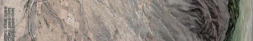
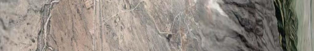
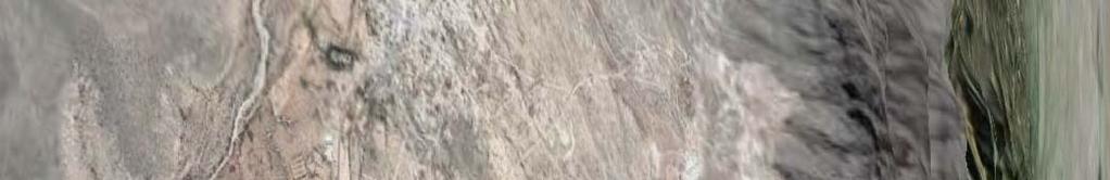
9 1.0 EXECUTIVE SUMMARY This technical report on the Sierra Mojada Project was prepared by Pincock Allen & Holt (PAH) for Metalline Mining Company (MMC). It discloses an inferred resource estimate for the Sierra Mojada project in Coahuila State, Mexico. MMC is not currently a publicly listed company in Canada. On December 4, 2009 MMC executed an Agreement and Plan of Merger and Reorganization with Dome Ventures Corporation (Dome), which is listed on the TSX Venture Exchange (TSX-V). Upon the closing of the transaction, Dome will become a wholly owned subsidiary of MMC. After the completion of the transaction, the parties intend for MMC to be a reporting company under the laws of certain provinces in Canada, thereby subjecting MMC s disclosure of scientific or technical information to Canadian National Instrument (NI ) standards. This technical report was prepared to meet NI standards in anticipation of the MMC/Dome merger. The Sierra Mojada project site was visited between the dates of July 28 to August 2, 2009 by PAH personnel including J. Ross Conner, P. Geo., Principal Environmental Geologist; Aaron McMahon, P.G., Senior Geologist; and Jeremy Clark (AIG), Senior Geologist. Jeremy Clark also visited the Sierra Mojada site between August 17 and 25, During the initial site visits, inspections were made of the property, electronic data stored on site, the core collection, handling and processing facilities as well as a tour of underground workings. An additional PAH visit was made by Mr. Conner between the dates of January 18 and 20, MMC has purchased 15 mining concessions, located at Sierra Mojada, Coahuila, Mexico. It operates in Mexico through a wholly owned Mexican subsidiary; Minera Metalin S.A. de C.V. (MMC 2007). All minerals in Mexico are owned by the federal government and mineral rights are granted by soliciting mining concessions which by law have priority over surface land use. It is PAH s understanding that all necessary agreements are in place and that the mining and surface rights are in good standing for the resource estimates presented in this report. The Sierra Mojada project is located in west central Coahuila State in central northern Mexico at North Latitude, West Longitude. The project is located approximately 250 kilometers by road, north of the major city of Torreón. Access is primarily by good paved road to the town of La Esmeralda and then a gravel road for 1 kilometer to the site. The nearby townships of La Esmeralda and Sierra Mojada have approximately 500 to 1,000 residents combined, and have basic amenities including water and electricity. Although power levels are sufficient for current operations and exploration, any development of the project would potentially require additional power sources. The Comisión Federal de Electricidad (English: Federal Electricity Commission) is the Mexican state-owned electricity monopoly, widely known as CFE, which provides service to the area. High voltage (13,400 v) power is available in the vicinity of the head frame for the San Salvador shaft (500 KVA), the Encantada shaft (300 KVA), and the Metalline shop area (112.5 KVA). Pincock, Allen & Holt 1.1
10 1.1 History Silver and lead were first discovered by a foraging party in 1879, and mining to 1886 consisted of native silver, silver chloride, and lead carbonate. After 1886 silver-lead-zinc-copper sulfate ores within limestone and sandstone units were produced. Approximately 90 years ago zinc silicate and zinc carbonate minerals were discovered underlying the silver-lead mineralized horizon. Since discovery and up to 1990 zinc, silver and lead ores were mined from various mines along the strike of the deposit including from the Sierra Mojada property. Ores mined from within these areas were hand sorted and the concentrate shipped mostly to smelters in the United States. Estimates from 1931, by Hayward and Dickenson, puts production, along the mineralized trend of which the Sierra Mojada property is a subset, at approximately 5 million short tons (all of the following will be short tons). That compares with Shaw who in his 1922 AIME paper estimated that production to 1920 was 3 to 3.5 million tons of lead-silver ores; and 1.5 to 2 million tons of Ag and Cu-Ag ores. Based on fragmented records, anecdotal evidence, and stope volumes perhaps 900,000 tons of additional oxide zinc may have been mined from red zinc and white zinc areas on the Sierra Mojada property. It is assumed that there was significant production between 1920 and 1950 from the district with the involvement of major international mining companies operating small daily tonnage mines during that period. Between 1996 and 2003 Metalline has been involved in several joint ventures to explore the property the most recent of which, with Peñoles, terminated in Metalline subsequently acquired 100 percent of the project and since 2003 Metalline has continued sampling numerous underground workings through channel and grab samples. Surface and underground diamond drilling has been completed and is still ongoing at the project site. 1.2 Geology The Sierra Mojada district is located within the Eastern Zone of Mexico s three geologic zones, defined by age and rocks types that are basements orogens (Campa and Coney, 1983). Basement of the Eastern Zone is mostly heterogeneous rocks of late Paleozoic age accreted to the Precambrian craton of North America during the Appalachian-Ouchits-Marathon orogeny. Basement is unconformably overlain by Middle Jurassic continental red beds and Cretaceous marine carbonate rocks. The latter carbonate rocks host the mineral deposits within the Sierra Mojada district. The Sierra Mojada district lies on the northeast leading edge of the Laramide thrust belt and as a result has upright kink folds, broad domes and some low-angle faults related to this compression. However steep normal and reverse faults dominate the district and are related to the history of the Sabinas basin, rather than the Laramide orogeny. The resulting geomorphology has a distinct basin and range geometry and structure aligned northwest. Pincock, Allen & Holt 1.2
11 Several authors have attempted to map the stratigraphic sequence of the district both at surface and sub-surface; however, due to the structural complexities a detailed understanding of the district statigraphy has yet to be completed. Structural complexities appear to disrupt the continuity and stratigraphy both along strike and vertically giving rise to the difficulties in establishing the stratigraphic sequence in the district. Within the property limits the difficulties are further enhanced by potential hydrothermal overprinting and remobilization of minerals. Mineral dating has led to the interpretation of the lithologies on the northern side of the Sierra Mojada Fault as older, having given dates from Kimmeridigan through to the Hauterivian/Barremian whereas the lithologies on the south side of the fault are younger. These dates result in the interpretation that the lithologies found on either side of the Sierra Mojada Fault form different parts of the carbonate cycle. Of particular note is that the evaporites formed in the middle Cretaceous are missing in the sequence in the district. The lack of these rocks indicates they are probably dissolved or sheared out along a major decollment, during Larmide thrusting. The thrusting, along with basin-bounding faults, now brings Menchaca formation in contact (north side) with Aurora (south side) formation. This effectively removes 200m and 25 million years from the sequence. The San Marcos formation, which is clastic in origin, usually forms part of this sequence, and has been noted in the field within the district by several authors. Discussions with site personnel and field observations lead to the interpretation that the red beds overlying the north side mineralization are the San Marcos formation, however PAH believes further investigation is warranted. Observations by PAH in the field indicate that at least some of these red beds could be the product of hydrothermal alteration and replacement of the limestone formations and as a result do not form part of the stratigraphic sequence. The stratigraphic sequence remains a point of conjecture with both the district and more specifically within the deposit. A detailed understanding of the stratigraphy will enhance the structural reconstruction of the deposit as well as enabling a genetic exploration model to be established. The Sierra Mojada deposit is very unique and does not easily lend itself to common deposit type definitions. Both the zinc and silver mineralization bodies are hosted in limestone/dolomite. Morphologically, these bodies are mantos indicating broad stratal controls on mineralization. There also appears to be some structural control on mineralization proximal to the Sierra Mojada Fault. The Sierra Mojada deposit has a total absence of high temperature mineral phases either in the deposit or as spatially and temporally related peripheral alterations (Hodder, 2001). No evidence of replacement of sulfide minerals by oxide minerals is found. The deposits are probably low temperature carbonate hosted deposits formed from basinal brines. This interpretation differs from the high temperature carbonate hosted deposits commonly found in Mexico, and in Arizona and New Mexico in the United States. Pincock, Allen & Holt 1.3
12 1.2.1 Mineralization The Sierra Mojada deposit can be separated into three main mineralized zones: the south side zinc zone, the north side silver zone, and the mixed zone between these south and north zones. Generally, the south and north zones are separated by the Sierra Mojada Fault, which strikes east-west and dips to the north between 60 to 80 o. Each of the zones within the deposit is outlined below South Side Mineralization Mineralization within the south side zinc zone commonly occurs in two forms, Iron Oxide Manto (Red Zinc) and Smithsonite Manto (White Zinc). Both the Red Zinc and White Zinc are zinc-rich, with lower concentrations of silver and lead mineralization. Both the Red and White Zinc zones have similar orientation which plunge towards 110 o at -30 o. The Red Zinc zone has a known strike length of 2,400m and a thickness up to 100m. This zone appears to be parallel or semi-parallel to the primary dolomitic host bedding, which dips to the south at approximately 15 o. PAH has interpreted a higher grade zone of semi-massive to massive hemimorphite (minor smithsonite), within a halo of fracture fill and replacement lower grade mineralization. The White Zinc zone commonly underlies the Red Zinc zone but on several occurrences lies adjacent, possibly due to structural displacement. The White Zinc zone is slightly higher in zinc grade than the Red Zinc zone, lower in lead and higher in aluminum. Mineralogically the White Zinc zone differs from the Red Zinc zone with much higher concentration of smithsonite and a lower amount of hemimorphite. For the purpose of this resource estimate only the Red Zinc zone has been included North Side Mineralization Mineralization within the North Silver zone commonly occurs directly below and is conformable with the contact of the red clay-rich rock, commonly referred to as the San Marcos formation, and the underlying Limestone (Manchaca formation). The origin of this contact is debatable, with one school of thought believing this contact is an unconformity, while another believes this contact is a low angle thrust fault. Mineralization ranges from a few meters thick up to 50 meters and appears to cross cut bedding, or at least has a markedly different orientation. The parallel orientation of mineralization suggests the overlying clay-rich layer potentially acts a confining layer for fluid movement. Mineralogy of the north side differs from the south side with very little hemimorphite or smithsonite present, and the common occurence of sulfides. Mineral studies by Hodder, 2001 suggests sulfides, sulfosalts and sulfarsenide minerals rich in copper and silver and poor in sulfur are present locally. Sphalerite and galena occur but rarely and mostly as secondary formations along fractures. Pincock, Allen & Holt 1.4
13 1.2.4 Mixed Zone Between the North Silver zone and the Red Zinc zone on the north and south side of the Sierra Mojada fault a mixed mineralized zone occurs, which contains relatively high levels of silver and zinc. Commonly associated with this zone of mineralization is copper occurring as mostly malachite and azurite Exploration Exploration has focused on the definition of the remaining zinc and silver mineralization-bearing structures which have similar strike but differing dips. Generally, the zinc and silver zones are separated by the steeply dipping Sierra Mojada Fault, which strike east west has a variable dip of 60 to 80 o. The Red Zinc zone lies on the southern side of the fault, dips to the south at approximately 15 o, and plunges to the east at 30 o. The silver mineralization commonly lies on the northern side of fault, dips to the north at approximately 30 o and plunges to the east at 30 o. PAH believes a mixed zone of zinc and silver can be found between the north side and south zones, which commonly has copper associated. The Sierra Mojada project has accumulated an extensive amount of data through past years of exploration which provide the background for the resource estimates and analysis that underpin this Technical Report. The recommendations for further development of the project are primarily concerned with confirming the existing data and the acquisition of additional information to confirm the geological interpretation and increase the level of confidence in the resource estimate. Current exploration efforts consist of both surface and underground diamond drilling as well as the continuation of mineralogical and structural investigations QA/QC Currently, all resources for the Sierra Mojada deposit are classified as inferred despite very high sampling density in many parts of the deposit. This is in large part due to insufficient QA/QC procedures used in the past during sample preparation and analysis. A robust QA/QC program provides a measure of confidence in the analytical results returned from the lab. This measure of confidence is currently lacking. Specific deficiencies identified are as follows: No Twin Samples, Coarse Duplicates, Coarse Blanks, Pulp Duplicates, and Pulp Blanks inserted into the sample stream. Infrequent submission of Check Samples to a secondary lab. The average grades and standard deviations of Standards submitted to the primary lab are neither known nor certified. MMC and PAH are in the process of executing a re-sampling program. The aim of this program is to provide the measure of confidence in the analytical results that is currently lacking. Pincock, Allen & Holt 1.5
14 1.2.7 Data Verification Data validation completed by PAH included a review of all available information. This review included: All available driller s reports, which typically recorded the hole ID, design azimuth and dip, and any reflex down-hole surveys. Reconciliation of assay data between the digital drill hole database and assay certificates. Reconciliation of channel sample locations and underground workings. Comparison of the driller s reports to holes currently in the database. This was completed to validate all holes in the database and find missing and inconsistent holes. All survey information including compilation of all collar coordinates, dip and azimuth readings using the collar DH survey method, and all data previously compiled by survey and engineer personnel. After compilation of the data, comparisons to the current database were conducted to determine potential errors in the database. Bulk density data were reviewed by comparing hard copy sheets to the spread sheet provided to PAH by site personnel. QA/QC procedures were reviewed and all available data were verified in hardcopy. During this review, several errors were noted by PAH. PAH was then involved in investigating the source and mitigation of these errors. Following the corrective actions taken by PAH and MMC, the integrity of the digital data appears to be sound. PAH believes that the analytical data have sufficient accuracy to allow the calculation of resource estimates for the Sierra Mojada deposit Resource Statement The geologic three dimensional resource model was constructed by PAH at its offices in Denver, in September All resources stated in this report are classified as inferred and are represented in Table 1-1, Inferred Resource Estimate for the Sierra Mojada Deposit. The resources are reported at a variety of cut off grades; however, PAH currently recommends 60 g/t silver as the cut off for the North Side mineralization, while 6 percent zinc is recommended as the cutoff for the South Side mineralization. Pincock, Allen & Holt 1.6
15 TABLE 1-1 Metalline Mining Company Technical Report, Sierra Mojada Project Inferred Resource Estimate for the Sierra Mojada Deposit Cut Off Cut Off Tonnes Domain Silver g/t Element Grade (,000's) Silver Ounces (,000's) Zinc % Zinc Tonnes (,000's) North Ag 60g/t 28, , Red Zinc Zn 6% 20, , , Conclusions The Sierra Mojada project is an advanced project with 553 drill holes totaling 78,081 meters of sampling drilled into two different mineralized areas. Historical production has occurred within project limits, with total production estimated to be approximately 10 million short tons over the past 100 years. The available geological data (drilling, surveys, assays, density, lithology, etc.) for the Sierra Mojada deposit are of sufficient quality and quantity to estimate mineral resources for the property. PAH has generated a resource estimate for the North Side and Red Zinc zones of the Sierra Mojada Deposit. Currently, all resources for the Sierra Mojada deposit are classified as inferred despite very high sampling density in many parts of the deposit. This is in large part due to insufficient QA/QC procedures used in the past during sample preparation and analysis. A robust QA/QC program provides a measure of confidence in the analytical results returned from the lab. This measure of confidence is currently lacking, but is in the process of being improved. The resource estimate is limited by concession boundaries particularly on the Western side of the property. The current estimate excludes any material that does not fall inside MMC s concession boundaries. The resource estimate is limited by unknown underground workings. There are large areas at Sierra Mojada where MMC believes underground workings exist, but have not been surveyed. The current estimate excludes any material from these areas. 1.4 Recommendations Re-sampling Program Currently, all resources for the Sierra Mojada deposit are classified as inferred despite very high sampling density in many parts of the deposit. Pincock, Allen & Holt 1.7
16 Core halves, coarse rejects and pulps covering the core drilling and channel sampling campaigns dating back to 1998 are stored at the site. The author recommended re-sampling, preparing and analyzing a significant percentage of this material under a robust QA/QC program. Analysis of the QA/QC data and a comparison of the old and new assay results will then provide a measure of confidence for the sample data used to estimate resources at Sierra Mojada. This exercise will provide an opportunity to re-assess the current resource classification scheme and potentially upgrade a portion of the inferred resources to a higher level of confidence. MMC and the author are in the process of executing this re-sampling program. The estimated costs for this program are US$76, Exploration Drill Program With regard to the North Side Silver resource, further surface exploration appears warranted. A surface drill program designed to better delineate the mineralization as well as provide better geological information into the continued development of the resource model is recommended. The current resource model has significant zones, particularly in the western area of the North Side silver resource, with only sparse sampling supporting the projection of the geological model. A program of surface drilling should be undertaken to delineate the resource boundaries in this area. Delineation of the resource boundaries in the western end of the deposit should then be followed up with infill drilling directed toward increasing the confidence level in the current resource estimate. PAH recommends an initial Phase 1 drilling program of 32 holes comprising 4,200 meters of drilling at an estimated cost of $150/meter all inclusive, for a total initial drilling cost of $630, Surface and Underground Mapping / Surveying There is considerable debate over the genesis of the Sierra Mojada deposits and further mapping of both underground and surface features is recommended. This work will assist in the understanding of the deposit and aid in the use of the geological model for resource estimation. PAH anticipates that an initial mapping program will take approximately 5 months to complete at a cost of $50,000. Pincock, Allen & Holt 1.8
17 2.0 INTRODUCTION 2.1 Background and Purpose of Report This technical report was prepared for Metalline Mining Company (MMC). It discloses an inferred resource estimate for the Sierra Mojada project in Coahuila State, Mexico. MMC is not currently a publicly listed company in Canada. On December 4, 2009 MMC executed an Agreement and Plan of Merger and Reorganization with Dome Ventures Corporation (Dome). Upon the closing of the transaction Dome will become a wholly owned subsidiary of MMC. After the completion of the transaction the parties intend for MMC s common stock issued in the transaction to be listed on both the NYSE Amex and the TSX Venture Exchange, thereby subjecting MMC s disclosure of scientific or technical information to Canadian National Instrument (NI ) standards. This technical report was prepared to meet NI standards in anticipation of the MMC/Dome merger. 2.2 Terms of Reference Metalline or MMC refers to Metalline Mining Company, PAH refers to Pincock, Allen and Holt and its representatives. The Sierra Mojada project refers to the Sierra Mojada project located in Coahuila State in central northern Mexico. Silver grades are described in terms of grams per dry metric tonne (g/t) with tonnage stated in dry metric tonnes, zinc grades are described in terms of percentage. Resource and Reserve definitions are as set forth in Canadian Institute of Mining, Metallurgy and Petroleum, CIM Standards on Mineral Resource and Mineral Reserves Definitions and Guidelines adopted by CIM Counsel on December 11, Source of Information PAH has relied upon information provided by MMC as well as published reports on the geology and mining history of the Sierra Mojada region of Mexico. R.W. Hodder completed a review of the deposit in 2001 titled: Carbonate-Hosted Zinc Deposits, Sierra Mojada Province of Coahuila, Mexico, August 2001 and this report has provided much of the background information. Section 23 contains a list of references used in the report. 2.4 Participants The Sierra Mojada project site was visited between the dates of July 28 to August 2, 2009 by PAH personnel including J. Ross Conner, P. Geo., Principal Environmental Geologist; Aaron McMahon, P.G., Senior Geologist; and Jeremy Clark (AIG), Senior Geologist. Jeremy Clark also visited the Sierra Mojada site between August 17 and 25, During the initial site visits site inspections were made of the property, electronic data stored on site, core collection and of the handling and processing facilities as well as a tour of underground workings. Underground areas of the North Silver Zone were also inspected by J. Ross Conner, P. Geo. during a site visit between January 18 and 20, Pincock, Allen & Holt 2.1
18 2.5 Units and Abbreviations All units are carried in metric units, unless otherwise noted. Grades are described in terms of percent (%) or grams per metric tonne (gpt, g/t), with tonnages stated in metric tonnes. Salable metals are described in terms of tonnes, or troy ounces (precious metals) and percent weight. Unless otherwise stated, dollars are U.S. dollars. The following abbreviations are used in this report: Abbreviation ASTM Ag Au Cu g/t kg km k LOM m masl mm Mt mtpd Mtpy NPV Ni Unit or Term American Society for Testing and Materials Silver Gold Copper Grams Per Tonne Kilograms Kilometer Thousands Life of Mine Meters Meters Above Sea Level Millimeters Million tonnes Metric tonnes per day Million tonnes per year Net Present Value Nickel % Percent by weight Pb Lead T or t tpy tpd Metric Tonne (2,204 lbs), tonne Tonnes per year Tonnes per day Zn Zinc $ United States Dollars Pincock, Allen & Holt 2.2
19 3.0 RELIANCE ON OTHER EXPERTS This report was prepared for Metalline Mining Company (MMC) by Pincock, Allen and Holt (PAH) and PAH has relied upon certain legal opinions regarding mining concessions and MMC s ownership of these concessions. This information is provided in Section 4 of this report and has been based on the following opinion provided by Manuel E. Tabuenca, a person qualified to practice law in Mexico. Report on Minera Metalin, S.A. de C.V. and Contratistas de Sierra Mojada, S.A. de C.V. (collectively referred to as the Companies ), subsidiaries of Metalline Mining dated January 7, PAH has not conducted independent land status evaluations, and has relied upon these statements regarding property status, legal title, and environmental compliance for the project, which PAH believes to be accurate. Pincock, Allen & Holt 3.1
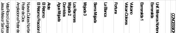
20 4.0 PROPERTY DESCRIPTION AND LOCATION 4.1 Project Location The Sierra Mojada project is located in west central Coahuila State in central northern México at Latitude North, Longitude West ( Figure 4-1). This location is approximately 250 kilometers by road north of the major city of Torreón. Access is primarily by good paved road to the town of La Esmeralda and then a gravel road for 1 kilometer to the site (Figure 4-2). The nearby townships of La Esmeralda and Sierra Mojada have approximately 500 to 1,000 residents combined, and have basic amenities including water and electricity. 4.2 Property Ownership PAH has not reviewed any claims record or any agreement regarding mineral titles of the Sierra Mojada property, and the information here presented is based solely on report provided by Metalline Mining Company (MMC). In addition, PAH reviewed legal opinions provided by MMC legal counsel regarding the disposition of the mining concessions. This has been referred to in Section 3.0 of this report. PAH also locates certain survey markers in the field associated with the legal concession boundaries. MMC has purchased mining concessions located at Sierra Mojada, Coahuila, México. It operates in México through a wholly owned Méxican subsidiary; Minera Metalin S.A. de C.V. (MMC 2007). All minerals in Mexico are owned by the federal government and mineral rights are granted by soliciting mining concessions which by law have priority over surface land use, but in practice the concessions owner must have an agreement with the surface owner. Figures 4-3 and 4-4 illustrate the property position held by MMC. It is PAH s understanding that all necessary agreements are in place and that the mining concessions are in good standing for the resource estimates presented in this report. Table 4-1 shows the mining concessions currently controlled by MMC. It is PAH s understanding as per the legal opinion provided by MMC that the current mining law in Mexico allows for the concession to be issued for 50 years. This law was made effective April 29, 2005 and concessions issued prior to this change in mining law will have the expiration date of the concession amended to reflect the 50-year period. Concessions in Table 4-1 which are shown as expired will have new certificates issued respecting the 50-year concession period. This is considered an administrative function and expired concessions can, therefore, be represented as in good standing by MMC. As stated elsewhere in this report, PAH has relied on representations and legal opinions provided by Metalline regarding the legal disposition of mining concessions. MMC holdings cover all the mineralized zones. No mining operations are currently active within the area, except for a dolomite quarry by Peñoles near Esmeralda. Pincock, Allen & Holt 4.1


21


22
23
24
25 TABLE 4-1 Metalline Mining Company Technical Report, Sierra Mojada Project Mining Concessions Concession No. Expiration Date Surface (ha) Agua Mojada /1/2058 2, Mojada /17/2056 3, Mojada /27/ Dormidos /9/2057 2, La Blanca /27/ Esmeralda /21/ Esmeralda /30/ Sierra Mojada /29/2043 4, Fortuna /20/ Unificacion Mineros Nortenos /10/ Vulcano /29/ Los Ramones /14/ El Retorno Fracc /25/ El Retorno /00/ Volcan Dolores /16/ Total hectares 15, Royalties and Agreements Table 4-2 outlines the royalty agreements applicable to MMC Land holdings affecting the resource calculation. 4.4 Environmental Permits and Liabilities PAH understands that all the necessary environmental permits are currently in place to support the proposed exploration activities associated with the project. Should the project move beyond the exploration phase it is most likely that a complete socio-economic and environmental assessment will be required. MMC has been progressing in this direction with the collection of baseline environmental data. Additional permitting will only be required if surface disturbance exceeds 25 percent of any 100 meter by 100 meter square. Future surface drill programs are not expected to exceed this threshold. TABLE 4-2 Metalline Mining Company Technical Report, Sierra Mojada Project Royalty Agreements Espinosa Espinosa Underlying Dakota (USMX) Dakota (USMX) Concession Title Royalty (%) Capped at Royalty (%) Capped at Precious Metals (%) Base Metals (%) Sierra Mojada $500K Mojada Unificaion Mineros Nortenos $6.875M Fortuna $100k Esmeralda $100k Esmeralda I $100k La Blanca Ex Royalties are production royalties. Dakota acquired USMX royalty rights; Dakota w as liquidated from bankruptcy. Continued existence/ow nership of the royalty interest is unknow n. Sierra Mojada Espinosa royalty is capped at $500,000 US, thereafter Dakota incrreases to 2.5% precious, 1.5% base. Mineros Nortenos capped at $6,875,000 US thereafter Dakota incrreases to 2.5% precious, 1.5% base. Fortuna, Esmeralda, Esmeralda I Espinosa Royalty capped at $100,000 US thereafter Dakota incrreases to 2.5% for precious metals and 1.5% for base metals. Pincock, Allen & Holt 4.6
26 5.0 ACCESSIBILITY, CLIMATE, LOCAL RESOURCES, INFRASTRUCTURE, AND PHYSIOGRAPHY 5.1 Project Access Access to the project is via 250 km of paved road from Torreón, México north to the town of La Esmeralda and then approximately 1 kilometer south on a gravel road. A 1,200 meter-long gravel airstrip for light aircraft is located between the two towns of Sierra Mojada and La Esmeralda; however, usage is restricted and permission is required from the Mexican government. The project area is crossed by numerous gravel roads and trails and most areas are readily accessible. An exploration camp, with all facilities including core logging, processing, analysis, and core storage, is located on the site. 5.2 Climate and Physiography The climate is arid and warm. The average annual temperature is 14 to 16 o C, with a rainfall of 400 to 500 mm/year. The highest daily temperatures typically are experienced in May, and the maximum temperature is moderated by rainfall in the months of June through October. Freezing occurs from time to time during the winter, and there is snow in some years. Temperatures below freezing occur less than 20 days in most years. Winds are highly variable, but strong southerly winds coming down from the mountains are common. Streams are ephemeral and wells with acceptable water quality are tens to hundreds of meters deep. The physical relief in the project area varies from virtually flat to near vertical cliff faces on the southern boundary of the project site. The majority of the mineral concessions are located in areas at the base of the cliffs which has moderate relief with numerous stream forming gullies which erode the surface alluvium. The area is high desert covered by scrub vegetation, comparable to the Basin and Range in Nevada. Mining operations are viable throughout the year. 5.3 Local Infrastructure and Services The Sierra Mojada Project located within the State of Coahuila, lies to the south of the paved state highway and the small town of La Esmeralda, which serves as a center for the local workforce and minor resupply for the project. Most of the area adjacent to the project site is used for cattle ranching; however, the southeastern boundary of the project abuts the Peñoles magnesite production facilities. These facilities consist of a small open pit operation and associated waste piles. A rail line is located adjacent to the property holdings and is currently utilized by Peñoles to transport material to its chemical plant in Laguna del Rey. The spur line connects the main national line which connects Escalon and Monclova. Rail traffic to the east is through Frontera to the United States via Eagle Pass, Texas, or southward to Monterrey or the seaport at Altamira. Service to the west is available as well as to the western USA via El Paso, or to points south connected through Torreón. Although power levels are sufficient for current operations and exploration, any development of the project would potentially Pincock, Allen & Holt 5.1
27 require additional power supplies to be sourced. The Comisión Federal de Electricidad (English: Federal Electricity Commission) is the Mexican state-owned electricity monopoly, widely known as CFE, which provides service to the area. High voltage (13,400 v) power is available to the vicinity of the head frames the San Salvador shaft (500 KVA), the Encantada shaft (300 KVA), and the Metalline shop area (112.5 KVA). Pincock, Allen & Holt 5.2
28 6.0 HISTORY The following historical summary has been compiled from previous reports written by R.W. Hodder and MMC. Silver and lead were first discovered by a foraging party in 1879, and mining to 1886 consisted of native silver, silver chloride, and lead carbonate ores. After 1886 silver-lead-zinc-copper sulfate ores within limestone and sandstone units were produced. No accurate production history has been found for historical mining during this period. Approximately 90 years ago zinc silicate and zinc carbonate minerals were discovered underlying the silver-lead mineralized horizon. Since discovery and up to 1990 zinc, silver, and lead ores were mined from various mines along the strike of the deposit including from the Sierra Mojada property. Ores mined from within these areas were hand sorted and the concentrate shipped mostly to smelters in the United States. Activity during the period from 1956 to 1990 consisted of operations by the Mineros Norteños Cooperativa and operations by individual owners and lessors of preexisting mines. The Mineros Norteños operated the San Salvador, Encantada, Fronteriza, Esmeralda, and Parrena mines, shipping oxide zinc ore to Zinc National s smelter in Monterrey, with copper and silver ore shipped to smelters in Mexico and the United States. The principal mines operated by individuals and lessors were the Veta Rica, Deonea, Juárez, Volcán I and II, Once, San Antonio, San José, San Buena, Monterrey, Vasquez III, Tiro K, El Indio and Poder de Dios. The individual operators were mainly local residents, such as the Farias, Espinoza, and Valdez families. In the early 1990s Kennecott Copper Corporation had a joint venture agreement involving USMX s Sierra Mojada concessions. Kennecott terminated the joint venture in approximately Metalline entered a Joint Exploration and Development Agreement with USMX in July 1996 involving USMX s Sierra Mojada concessions. In 1998, Metalline purchased the Sierra Mojada and the Mojada 3 concessions from USMX, and the Joint Exploration and Development Agreement was terminated. Metalline also purchased the Esmeralda, Esmeralda I, Unificación Mineros Norteños, Volcán, La Blanca and Fortuna concessions, and conducted exploration on the copper-silver mineralization from 1997 through During this period, exploration consisted of reverse circulation drilling which intersected significant zinc mineralization. In October 1999, Metalline entered into joint venture with North Limited of Melbourne, Australia (now Rio Tinto). Exploration by North Limited consisted of underground channel samples in addition to surface RC and diamond drilling. North Limited withdrew from the joint venture in October Pincock, Allen & Holt 6.1
29 A joint venture agreement was made with Peñoles in November The agreement allowed Peñoles to acquire 60 percent of the project by completing a bankable Feasibility Study and making annual payments to Metalline. During 2002, Peñoles conducted an underground exploration program consisting of driving raises through the oxide zinc manto, diamond drilling, and a continuation of the percussion drilling and channel sampling of the oxide zinc workings (stopes and drifts) previously started by Metalline in 1999, and continued by North in 2000, and Metalline during The workings mined by the Norteños Cooperativa in the oxide zinc manto provide access to the entire oxide zinc manto in the San Salvador, Encantada, and Fronteriza mines. The objective of the Peñoles 2002 program, in addition to evaluating the oxide zinc manto mineralization, was to compare the quality and consistency of sampling methods. Peñoles excavated diamond drill sites in the San Salvador and Encantada mines. It also excavated raises through the vertical extent of the manto. Bulk samples of the raise muck and channel samples of the raise walls were collected at 1 meter intervals. Percussion and diamond drill holes were drilled parallel to the raises and also sampled at 1 meter intervals. Peñoles concern, and the reason for this comparison, was to determine if the diamond drill, percussion drill channel, and bulk samples had an acceptable analytical correlation. The Peñoles 2003 program continued the underground channel sampling and percussion drilling, and diamond drilling was conducted from the surface. In addition to drilling the manto along its extent in the three mines, Peñoles conducted step out drilling to the east and west. Peñoles drilled holes on fences spaced 200 m apart east of the Fronteriza mine toward the Oriental mine, a distance of nearly 2 km. The holes were spaced 50 to 100m in a north-south direction along the fences. To the west Peñoles followed up the North Limited drilling in the vicinity of the San Antonio mine, 2 km west, which confirmed and extended the mineralization. In December 2003, the joint venture was terminated by mutual consent between Peñoles and Metalline. Peñoles had other projects it preferred to fund and Metalline was interested in re-acquiring a 100 percent interest in the project. Since 2003, Metalline has continued sampling numerous underground workings through channel and grab samples. Surface and underground diamond drilling has been completed and is still ongoing at the project site. 6.1 Past Production Total production from the Sierra Mojada district is estimated at approximately 10 million short tons of silver, zinc, lead, and copper ore. Numerous shaft and smaller underground workings are located within the district and the current tenement holdings of Metalline. Estimates from 1931 put production along the mineralized trend, of which the Sierra Mojada property is a subset, at approximately 5 million short tons (all of the following will be short tons). That compares with Shaw who in his 1922 AIME paper estimated that production to 1920 was 3 to 3.5 million tons of leadsilver ores; and 1.5 to 2 million tons of Ag and Cu-Ag ores. Based on fragmented records, anecdotal Pincock, Allen & Holt 6.2
30 evidence and stope volumes perhaps 900,000 tons of additional oxide zinc may have been mined from red zinc and white zinc areas on the Sierra Mojada property. It is assumed that there was significant production between 1920 and 1950 from the district with the involvement of major international mining companies operating small daily tonnage mines during that period. To date approximately 150 km of underground workings have been surveyed on the property. This represents approximately 4 million tons of development attributable to the Sierra Mojada property. These workings are mostly accessed through vertical shafts. To the extent possible, these workings have been surveyed and accounted for as shown in Figure Historical Resource Estimates While the area has hosted mining activity for over 100 years and there has been some 10 million tons produced form the Sierra Mojada trend, PAH is not aware of any historical resource estimates for the properties held as part of the Sierra Mojada project. Pincock, Allen & Holt 6.3
31
32 7.0 GEOLOGICAL SETTING 7.1 Regional Setting The Sierra Mojada district is located within the Eastern Zone of México s three geologic zones, defined by age and rocks types that are basements orogens (Campa and Coney, 1983). Basement of the Eastern Zone is mostly heterogeneous rocks of late Paleozoic age accreted to the Precambrian craton of North America during the Appalachian-Ouchits-Marathon orogeny. Basement is unconformably overlain by Middle Jurassic continental beds and Cretaceous marine carbonate rocks. The latter carbonate rocks host the mineral deposits within the Sierra Mojada district (Hodder, 2001). The Eastern Zone has three terrains: the Coahuila, Maya, and Sierra Madre. These are areas of homogenous stratigraphy and structure bounded by major faults, unconformities and discontinuities that cannot be explained by facies changes. The Sierra Mojada district is located within the Coahuila terrain and has had the basement deformed and metamorphosed subsequent to sedimentary deposition during the Cambrian to Permian periods. The basement was later intruded by granodiorite plutons during the Cretaceous. Cambrian though Permian sedimentary rocks were intruded by granodiorite plutons of Cretaceous period. The Coahuila terrain is bound to the south by the Maya terrain and the west by the Sierra Madre terrain and the Torreón-Monterrey discontinuity. This is the frontal area of the late Cretaceous-early Tertiary Laramide thrust zone. The boundary between the Coahuila terrain and Chihuahua terrain of the northwestern zone is a strike slip fault related to the opening of the Gulf of México (Hodder, 2001). As a result the tetono-stratigraphic setting of the Coahuila terrain has a distinctly different geological setting to other areas in México. Carbonate rocks were deposited during the Cretaceous and Jurassic periods and formed the Mesozioc sequence which hosts the majority of metaliferous deposits in México and southern Arizona. The Mesozoic sequence has been the subject of numerous studies both from industry and academia. The majority of these studies have focused on the sequence in areas distal from the Sierra Mojada deposit, as previous work was focused on the petroleum potential. Given the wide ranging extent of this sequence of rocks, the general sequence is well documented and is shown in Figure District/Local Geology The Sierra Mojada district lies on the northeast leading edge of the Laramide thrust belt and as a result has upright kink folds, broad domes and some low angle faults related to this compression. However steep normal and reverse fault dominate the district and are related to the history of the Sabinas basin, rather than the Laramide orogeny. The resulting geomorphology has a distinct basin and range structure aligned northwest (Hodder, 2001). Pincock, Allen & Holt 7.1
33
34 The Sierra Mojada District is on the northwestern edge of the Sabinas basin, an extensional basin in a broad platform of clastic and carbonate sedimentary rocks, accumulated in rifts during the Lower Jurassic and Cretaceous. The Cretaceous sequence, which hosts known deposits in the district begins from oldest to youngest with mixed carbonates and clastic rocks of the Menchaca formation, followed by evaporates and ultimately massive carbonate rocks of Cupido, La Peña and reefal rudistid Aurora and Georgetown formations, as described in the stratigraphic map shown in Figure 7-2. The Aurora and Georgetown carbonate formations are very prominent in the north facing cliffs above the mine. Several authors have attempted to map the stratigraphic sequence of the district both at surface and sub-surface, however due to the structural complexities a detailed understanding of the district statigraphy has yet to be completed. Structural complexities appear to disrupt the continuity and stratigraphy both along strike and vertically giving rise to the difficulties in establishing the stratigraphic sequence in the district. Within the property limits the difficulties are further enhanced by potential hydrothermal overprinting and remobilization of minerals. Mineral dating has led to the interpretation of the lithologies on the northern side of the Sierra Mojada Fault as older, having yielded dates from Kimmeridigan through to the Hauterivian/Barremian whereas the lithologies on the Southside are younger. These dates result in the interpretation that the lithologies found on either side of the Siera Mojada fault form part of different parts of the carbonate cycle. Of particular note is that evaporates formed in the middle Cretaceous are missing in the stratigraphic sequence of the district. The lack of these rocks indicates they are probably sheared out along a major decollment, during Larmide thrusting. The thrusting, along with basin-bounding faults, now brings Menchaca formation in contact (north side) with Aurora (South side) formation. This effectively removes 200m and 25 million years from the sequence. The San Marcos formation, which is clastic in origin, usually forms part of this sequence, and has been noted in the field within the district by several authors. Discussions with site personnel and field observations lead to the interpretation that the red beds overlying the north side mineralization are the San Marcos formation; however, PAH believes further investigation is warranted. Observations by PAH in the field indicate that at least some of these red beds could be the product of hydrothermal replacement of the limestone formations and as a result do not form part of the stratigraphic sequence. The stratigraphic sequence remains a point of conjecture with both the district and more specifically within the deposit area. A detailed understanding of the stratigraphy will enhance the structural reconstruction of the deposit as well as enabling a genetic exploration model to be established. A general geological map of the deposit area, modified after Hodder 2001, is shown as Figure 7-3. No igneous rocks are found within the district but felsic to intermediate volcanic clasts are found within clastic rocks in the district. Pincock, Allen & Holt 7.3

35


36 Stratigraphy Quaternary Tertiary Upper Lower Upper Jurassic Cretaceous Cretaceous Alluvium Conglomerate Buda Del Rio Georgetown Aurora Aurora Rud zone La Pena Cupido San Marcos Taraises La Casita Sierra Mojada Town Site La Esmeralda Town Site Approximate Sierra Mojada Project Boundary Scale 1:5000 Project No Drawing Provided by/ Prepared for Metalline Mining Company Project Name Sierra Mojada Technical Report FIGURE 7-3 Geological Plan View Sierra Mojada Modified from Hodder, 2001 Date of Issue Jan 2010 Drawing Name GeoPln.pdf
37 8.0 DEPOSIT TYPES The Sierra Mojada Deposit is very unique and does not easily lend itself to common deposit type definitions. Both the zinc and silver mineralization bodies are hosted in limestone/dolomite. Morphologically, these bodies are mantos indicating broad stratigraphic controls on mineralization. There also appears to be some structural control on mineralization proximal to the Sierra Mojada Fault. The Sierra Mojada deposit has a total absence of high temperature mineral phases either in the deposit or as spatially and temporally related peripheral alterations (Hodder, 2001). No evidence of replacement of sulfide minerals by oxide minerals is found. The deposits are probably low temperature carbonate hosted deposits formed from basinal brines. This interpretation differs from the high temperature carbonate hosted deposits commonly found in México, and in the United States in Arizona and New Mexico. Pincock, Allen & Holt 8.1
38 9.0 MINERALIZATION The Sierra Mojada deposit can be separated into three main mineralized zones: the south side zinc zone, the north side silver zone, and the mixed zone between these south and north zones. Generally, the south and north zones are separated by the Sierra Mojada fault, which strikes east west and dips to the north between 60 to 80 o. Each of the zones within the deposit are outlined below. 9.1 South Side Zinc Rich Zone Mineralization within the south side zinc-rich zone commonly occurs in two forms: Red Zinc zone and White Zinc zone. Both the Red zone and White zone are zinc rich, with lower concentrations of silver and lead mineralization. Both the Red and White zones have similar orientation which plunge towards an azimuth of 110 o at 30 o dip Red Zinc The Red zone has a known strike length of 2,400m and a thickness up to 100m. The Red zinc zone appears to be parallel or semi-parallel to the primary dolomitic host bedding, which dips to the south at approximately 15 o. PAH has interpreted a higher grade zone semi-massive to massive hemimorphite (minor smithsonite), within a halo of fracture fill and replacement mineralization. The high grade zone has a high percentage of vugs and has a rarity of sulphide minerals. Hemimorphite is by far the major mineral in this zone; however, smithsonite is commonly associated, giving rise to the white streaks commonly found within the zone. High grade core samples commonly have iron oxide veins associated which appear to cross cut bedding (when available). The halo surrounding the high grade zone has fewer vugs than the high grade zone and a lower concentration of iron oxide minerals which occur either as fracture fill veinlets or diffuse replacement along the fractures of the host limestone/dolomite. Hodder summarizes the red zinc zone as follows: Such zonations support an interpretation that fluids have penetrated limestone, affected dolomitization along grain boundaries, and in some instances completely replaced primary calcite. Dolomitization caused a volume reduction that made open spaces in which iron oxides, zinc silicates and zinc carbonate minerals precipitated. Sulphide minerals are sparse, on fractures, and at local sites of reduction. In this interpretation, the Red Zinc is epigenetic and superimposed on a selectively dolomitized horizon in the Aurora formation. There is no mineralogical or textural evidence that the manto is supergene-the product of weathering of previously existing sulphide mineral species. Core inspection by PAH indicates that a general increase in iron content (hematite) is usually found with a general increase in grade, whether it is be a fracture fill in the peripheries or massive hemimorphite with iron oxide (hematite) veins in the central high grade zone. This general increase in iron content is Pincock, Allen & Holt 9.1
39 consistent with fluid penetration of the limestone as described by Hodder. PAH noticed replacement textures in the core which further supports Hodder s epigenetic model for the formation White Zinc The white zinc commonly underlies the red zinc but in several occurrences lies adjacent, possibly due to structural displacement. The White zone is slightly higher in zinc grade than the Red zone, with lower lead and more aluminum. Mineralogically the White zone differs from the Red zone with a significantly lower content of iron oxide and a much higher concentration of smithsonite and a lower amount of hemimorphite. Vugs are extremely common with open spaces up to 1m being reported. The geometry of the body is poorly understood due to the limited drilling in the vicinity of the deposit; however, interpretations suggest a chimney-like shape. The body is hosted by a thinly bedded limestone with the majority of the deposit constituting smithsonite interbedded with calcite. It is unclear if the red zinc and white zinc are replacement or fracture/cavern fill deposits and further investigation is warranted to better understand the genetic model of the deposit. With the available data PAH believes that mineralization is most probably related to fluid penetration through fractures in the limestones. Precipitation most probably occurs in open spaces in the limestones, such as factures, vugs and caverns; however, replacement has almost certainly occurred either on fracture planes or complete dissolution of the limestone by the penetrating fluids along bedding planes. For the purpose of this resource estimate the White Zinc has not been included. 9.2 North Silver Zone Mineralization within the North Silver zone commonly occurs directly below and is conformable with the contact of the red clay-rich rock, commonly referred to as the San Marcos, and the underlying Limestone (Menchaca). The origin of this contact is debatable, with one school of thought believing this contact is an unconformity, while another believes this contact is a low angle thrust fault. During the site visit PAH did note that slickeneslide were on this contact; however, these could be localized movement and structural displacements of the lithologies. Whatever the complexities of the origin, it is clear that silver mineralization parallels this contact. Mineralization ranges from a few meters thick up to 50 meters and appears to cross cut bedding, or at least has a markedly different orientation. The parallel orientation of mineralization suggests the overlying clay rich layer potentially acts a confining layer for fluids movement. Pincock, Allen & Holt 9.2
40 Mineralogically, the north side mineralization differs from the south side mineralization. Very little hemimorphite or smithsonite is present, and sulfides do occur. Mineral studies by Hodder, 2001 suggest sulfides, sulfosalts and sulfarsenide minerals rich in copper and silver and poor in sulfur are present. Sphalerite and galena occurs but rarely and mostly as secondary formations along fractures. 9.3 Mixed Zone Between the two zones on the north and south side of the Sierra Mojada fault a mixed mineralized zone occurs, which contained relatively high levels of silver and zinc. Commonly associated with this zone of mineralization is copper occurring as mostly malachite and azurite. Very little is known about this zone and PAH would recommend further investigation in the mineralogical characteristics as well as the extent of mineralization. Pincock, Allen & Holt 9.3
41 10.0 EXPLORATION The mineralization in the Sierra Mojada area was discovered in the late nineteenth century, and early exploration was by mining outcropping ore. By 1920, diamond drilling was widely used in the district and the subsurface exploration and development included workings and stopes. Underground diamond core drilling using relatively short holes and very small diameter cores, was widely used in the 1930s and later. The modern exploration began with the Kennecott efforts in the 1990s which included surface diamond drilling and some experimentation with geophysical techniques. Bedrock exposures in the area are generally extremely poor except in areas that have been previously mined. As a result, geochemical methods have not been a primary exploration tool. Extremely high (percent range) background numbers for zinc are common close to zinc deposits, but gradients that lead to ore have not been recognized. Sampling is the most important exploration and evaluation tool, but conventional low-level trace element geochemical surveys are rarely used in the area. Kennecott did extensive regional Controlled Source Audio Frequency Magneto Telluric (CSAMT) and Resistivity-Induced Polarization (IP) surveys to the north of the Sierra Mojada Mountains from Palomas Negras to around El Oro. These surveys were performed by the Tucson, Arizona office of Zonge Engineering and Research Organization (ZERO). The Mexican government has flown aeromagnetic and radiometric surveys for the area, but the data seem to yield only regional structure information. There are no igneous rocks, other than deep crystalline basement, known in the area and no other rocks, including the various mineralized types, that are expected to have high magnetic susceptibility. When Metalline entered the district, the prospecting tools used were collection and compilation of older mine maps and drill core assays, surface and underground mine mapping, and sampling. A methodology evolved that uses geology and channel sampling to identify areas of interest, followed by long hole percussion drilling to extend samples away from old workings, and finally, underground and surface core drilling to further extend sampling. Pincock, Allen & Holt 10.1
42 11.0 DRILLING 11.1 Methods Throughout its history, the Sierra Mojada deposit has been drilled extensively by mainly four methods. These methods are surface diamond core, underground diamond core, surface reverse circulation and underground long hole Surface Diamond Core An extensive program of surface core drilling was performed by Peñoles. Most of the holes in this phase were drilled from the surface to a predetermined depth using RC drilling, then cased through the gravel, and completed as a core hole. In many instances, the RC portion of the hole was drilled into mineralized rocks before the hole was converted to core. The core drilling was extremely difficult, expensive, slow, and mineralized zones had extremely poor core recovery. The drill helpers were observed to wash the red, muddy material from Iron Oxide Manto off of the core before boxing it. Typically, short intervals of white limestone were all that reached the core boxes. None of the Peñoles surface drilling results were used in the resource calculations. During 2006, some surface core holes were drilled for Metalline by World Wide Exploration, a start-up drilling contractor based in Torreón, México. This drilling was done using a drill with a casing advancement system that was recommended because of its presumed ability to rapidly set surface casing. This system never worked reliably during the time that the drill was at Sierra Mojada, and eventually an older Longyear drill was brought to the project. Other holes were drilled to the west, and two shallow holes were drilled to the east. Sophisticated mud and bit selection programs were run and a few of the drillers had previous experience drilling underground at the project. With these changes, adequate sample quality was obtained Underground Diamond Core Underground diamond core drilling was conducted by Peñoles, by Metalline s contractors in 2004 and subsequently by Metalline with its own drills. For Peñoles drilling, the drillers laid the core out in core boxes carried to the surface daily. The Peñoles core is NQ2 size (50.6 mm core diameter) wireline core. The cores were taken to the core shack where Peñoles technicians measured the length of the cores to determine core recovery. Peñoles contract drillers were on a typical footage contract with bonus for good core recovery. Most of Metalline s underground drilling used NQ2 wireline core. Some HQ (63.5 mm core diameter) drilling was done early in 2004 but the drilling was much slower and core recovery was no better than for NQ2 so NQ2 soon became the standard. Some holes were drilled using LTK48 (35.6 mm core diameter) conventional core. Sludge samples were not collected in any of this drilling. It had been observed that in Pincock, Allen & Holt 11.1
43 highly fractured zones the core was often intact in the core barrel but fell apart into angular fragments of gravel sized material when the core was transferred to the core box. As a result, for Metalline s work recovery was determined by measuring the length of recovered core in the barrel Surface Reverse Circulation Reverse circulation (RC) drilling using a down-the-hole-hammer was used to obtain samples during the Metalline 1999 campaign and the North campaign. In the Peñoles campaign, many of the surface drill holes were begun as RC holes and were completed as core holes after holes were well into carbonate rocks below the surface alluvium. Standard RC drilling equipment was used by all RC drilling contractors. None of the RC samples are believed to be of adequate quality to use in calculating a mineral resource, and none of the RC assays are used in the resource model Underground Long Hole Percussion drill holes are laid out by the geologist and surveyor in locations selected to obtain reasonable coverage in an area and where the back of the workings is high enough that the drilling crew can work. A pneumatic hammer with a jackleg is used with one inch (2.54 cm) diameter drill steel and a 1.75 inch (4.45 cm) diameter bit. A hole is drilled below the location of the desired test hole, and a bucket to catch the return is suspended there Historic Drilling Pre Long Hole MMC purchased all of the available historic data from Peñoles. This included early 1900s underground maps, a drill hole folio dating from 1930 to 1950 and a few late 1980s reports. The drill hole folio includes nearly 900 long holes for 22,400 meters. These holes were drilled from several underground stations in radiating fan patterns. This drilling appears to have been concentrated on four separate areas along the trend of Silver Mineralization. Within these four areas, underground stations are typically spaced 20 meters apart with average hole depths 25 meters resulting in very dense drilling. Areal coverage of these long holes is approximately 9 hectares. Due to a lack of information concerning sample quality, these holes are not used for grade interpolation MMC Drilling Campaign of 1999 Twenty-four holes were drilled from surface using reverse circulation for a total of 6,600 meters. This drilling covers 28 hectares and intercepts the Iron Oxide Manto and Silver Mineralization. Approximately half of the holes were drilled vertically and the remaining holes were angled with dips ranging from near vertical to 54 degrees. Pincock, Allen & Holt 11.2
44 11.4 MMC and North Limited Campaign of 2000 MMC entered a joint venture with North Limited of Australia in North drilled a string of 26 reverse circulation holes over a linear distance of approximately 3.5 km down the long axis of the known Iron Oxide Manto. All holes were drilled vertically. For reasons related to sample quality, these holes are not used for grade interpolation MMC Drilling Campaign of 2001 MMC drilled 73 underground long holes for 1,100 meters. These holes were drilled from several underground stations in radiating fan patterns. This drilling is located at the western extent of the Iron Oxide Manto. For reasons related to sample quality, these holes are not used for grade interpolation MMC and Peñoles Campaign of 2002 to 2003 A joint venture agreement was made with Peñoles in November of Two different teams from Peñoles spearheaded drilling activities. One team focused on the eastern end of the deposit targeting the Iron Oxide Manto in 2002 and This consisted of both diamond core and long hole drilling from underground and diamond core drilling from surface. The second team drilled core holes from surface targeting shallow Silver Mineralization at the western end of the property Surface Diamond Core In the eastern end of the property thirty-four diamond core holes were drilled from surface for 11,000 meters. The surface diamond core holes were drilled on fences spaced 200 m apart east of the Fronteriza mine toward the Oriental mine, a distance of nearly 2 km. The holes were spaced 50 to 100 m in a north-south direction along the fences. The Peñoles program at the western end of the property followed up the North Limited drilling in the vicinity of the San Antonio mine, 2 km west, which confirmed and extended the silver mineralization. Five core holes were drilled from surface for 1,300 meters. The holes are irregularly spaced and cover an area of approximately 7 hectares Underground Diamond Core Thirty-sixty diamond core holes were drilled from underground for 2,400 meters. These holes were drilled from several underground drilling stations in radiating fan patterns. Drilling stations are typically spaced 50 to 100 meters apart in an irregular pattern. In Plan view, this drilling covers approximately 7 hectares, mostly in the Iron Oxide Manto Underground Long Hole Six-hundred eighty-five underground long holes were drilled for 11,000 meters. Typically, these holes are drilled from several underground stations in radiating fan patterns. Spacing of the underground Pincock, Allen & Holt 11.3
45 stations is typically less than 20 meters and hole lengths average 13 meters resulting in very dense drilling. These holes intercept much of the Iron Oxide Manto and Silver Mineralization east of Easting 630,700. For reasons related to sample quality, these holes are not used for grade interpolation MMC Campaign of 2004 to Present Surface Diamond Core MMC drilled 101 diamond drill holes from surface for 15,400 meters. The surface drilling has been completed along fences oriented north-south with hole spacing varying from 50m to 200m. The majority of drilling has been completed using 100 meter fences with 50m hole spacing. The main concentration of drilling covers approximately 20 hectares intercepting the Silver Mineralization just west of the Iron Oxide Manto. Vertical dip is commonly used, however, and due to location restrictions, some holes are angle drilled with dips up to 60 degrees. MMC updated the surface drilling practices employed during the MMC and Peñoles drilling campaign of 2002 to These updates have largely mitigated the recovery issues experienced then Underground Diamond Core MMC drilled 650 underground diamond drill holes for 60,000 meters. These holes were drilled from several underground drilling stations in radiating fan patterns. Drilling stations are typically spaced 50 to 100 meters apart in an irregular pattern. In plan view, this drilling covers approximately 52 hectares intercepting most of the known Iron Oxide Manto and Silver Mineralization east of Easting 631, Surface Reverse Circulation MMC drilled eight reverse circulation holes from surface for 2,900 meters. These were water well and condemnation holes drilled in an irregular and widely spaced pattern testing areas east and north of the underground workings. Of these eight holes, only R intercepts the known mineralization (silver). For reasons related to sample quality, these holes are not used for grade interpolation Underground Long Hole Approximately 2,300 underground long holes were drilled for 31,300 meters. Typically, these holes are drilled from several underground stations in radiating fan patterns. Spacing of the underground stations is typically less than 50 meters and hole lengths average 17 meters, resulting in very dense drilling. These holes intercept much of the Iron Oxide Manto and Silver Mineralization east of Easting 630,700. For reasons related to sample quality, these holes are not used for grade interpolation. Pincock, Allen & Holt 11.4
46 11.8 Drilling Summary Table 11-1 and Figure 11-1 attempt to summarize the extent of the various drilling campaigns throughout the history of the Sierra Mojada deposit. TABLE 11-1 Metalline Mining Company Technical Report, Sierra Mojada Project Drilling Campaign Summary Number of Holes Total Meters Drilled Type Historic Long Hole ,435 MMC 1999 Surface RC 24 6,628 MMC & North 2000 Surface RC 26 6,783 MMC 2001 Long Hole 73 1,068 MMC & Peñoles Surface Core 39 11,830 Underground Core 36 2,449 Long Hole ,729 MMC 2004-Present Surface Core ,387 Underground Core ,893 Surface RC 8 2,938 Long Hole ,272 Pincock, Allen & Holt 11.5
47
48 12.0 SAMPLING METHOD AND APPROACH There have been a relatively large number of approaches to sampling the Sierra Mojada deposit. Each employs different sampling methods and yields samples of variable quality. The following is a summary of these sampling approaches, their respective methods and a discussion of the sample quality Diamond Core The project geologist responsible for logging the core also picks the sampling breaks. Wooden blocks are placed at each sample break. The hole number and depth of the sample breaks are written on the wooden blocks. Normally these breaks are set one meter apart irrespective of lithological or mineralogical boundaries. If core recovery for a given 1 meter interval is less than 50 percent, the section is combined with either the previous or subsequent core sample. The core boxes are sent to the diamond saw cutter where the core is cut down the long axis in even halves with one half being used for the assay samples and the other half is kept in the core box to be stored in the core houses. The halves of the core selected for sample preparation are transferred to labeled aluminum trays for subsequent drying. The reference core is returned to the core box in the order that it was received. When core sampling is completed, samples are taken to the sample preparation laboratory and core boxes are stored on special shelves in the core houses. Diamond core sample coverage and density are variable depending on drilling pattern. The majority of surface drilling has been completed using vertical holes along 100m fences with 50m spacing covering an area of 84 hectares. Underground core drilling was conducted in fan patterns from drilling stations. As a result, sample density is highly variable, decreasing with distance from a drilling station. In Plan view, the underground core drilling covers an area of 65 hectares. Surface diamond core drilled in the Iron Oxide Manto by Peñoles from 2002 to 2003 suffered from poor recovery. The Iron Oxide Manto, which is very friable, was being washed away with water prior to sampling. As a result, these holes play a very limited, qualitative role in defining the resource. Samples from these holes were not used to calculate grade in the resource model. Surface core drilled by MMC targeting Silver Mineralization in 2003, later surface diamond core holes drilled by MMC and all underground diamond core holes, exhibited satisfactory recovery and were fully incorporated into the resource model Channel Samples Channel samples are collected from the walls of underground workings. A geologist or surveyor selects the channel sample location, paints the position of the sample on the mine wall, and writes the sample number on a sample sack which is suspended from a nail at the sample point. He marks the approximate sample location on a mine map and reports the sample number of each sample on a daily sampling report. At the sample point, sampling crews spread a drop cloth, clean the face, and cut a sample about 2 cm deep and 10 to 12 cm wide. The sample is transferred to a large plastic sample sack and about 5 Pincock, Allen & Holt 12.1
49 to 6 kilograms of sample are transported from the mine to the sample preparation area. Sample location, length and orientation are subsequently determined by the surveyor using tape and compass surveying tied to nearby spads located by first order surveying. Sample density for channels is considerably greater than for diamond core (1.5 to 10 meter spacing). There are approximately 11,000 channel samples in the sample database covering an area of 180 hectares. Approximately one percent of all channel samples were collected prior to MMC s involvement in the project. MMC has little information on the quality of these samples. As such, these pre-mmc channel samples have not been considered during resource estimation Surface Reverse Circulation Cuttings brought to the surface by reverse circulation drilling (air) are sampled. These samples are collected by passing the exhaust air through a cyclone type sample splitter and catching the cuttings in a large, porous sample bag. The samples were subsequently split through a Jones splitter to appropriate size to send to the sample preparation lab. The sample was weighed as a measure of recovery, but there is typically no sample return and no air return in bad recovery zones. A split of the rejects was collected for geologic logging. This sample was sieved and washed to collect a size fraction suitable for visual examination. Reverse circulation sample coverage and density are variable depending on drilling pattern. The majority of reverse circulation drilling covers an area of 40 hectares with an average hole spacing of 100 meters. None of the RC samples are believed to be of adequate quality. As a result, these holes play a very limited, qualitative role in defining the resource. Samples from these holes were not used to calculate grade in the resource model Underground Long Hole Underground long holes are drilled wet and the returns from each one meter interval are collected in a bucket suspended below the hole collar. The sample is then transferred to a porous cloth bag labeled with the hole number and interval. The samples are then set aside in a dry place to drain while drilling continues. Water is allowed to flush the hole after each interval to minimize sample-to-sample contamination. Under the best conditions, holes can be drilled to depths of 30m, but this is very demanding on the drillers, and normally a drill crew only has about 20m of drill steel. The hole cannot be continued after circulation is lost, either in a fracture system or by penetrating mine workings. As a result some holes are very much shorter than the maximum. Sample density for underground long holes is variable yet very high. There are approximately 60,000 long hole samples covering an area of 64 hectares. Pincock, Allen & Holt 12.2
50 None of the long hole samples are believed to be of adequate quality. As a result, these holes play a very limited, solely qualitative role in defining the resource. Samples from these holes were not used to calculate grade in the resource model Muck Samples These samples are collected by a geologist or at a geologist s direction. Muck samples are muck from blasting in the mine. The larger pieces of the material are broken with a hammer. The sample size is then reduced by coning and quartering. Final sample size is as directed by the geologist, but generally not less than 10 kg. Grab samples include character samples and samples collected from the mine or from drill core for special purposes; e.g., for paleontological age dating. Where appropriate, sample locations and orientations are determined by the surveyor using tape and compass surveying tied to nearby spads located by first order surveying. Samples are collected in labeled bags and transported to the sample processing area. If the sample is for chemical analysis, it is dried, weighed and given bar code labels. Sample density is high, typically with less than 10 meters separating samplings. There are approximately 1,200 muck samples covering an area of 64 hectares largely within the Iron Oxide Manto east of Easting 631,300. None of the muck samples are believed to be of adequate quality. As a result, these samples play a very limited, solely qualitative role in defining the resource. Muck and grab samples were not used to calculate grade in the resource model Unidentified Samples Of the over 100,000 samples found in the Sierra Mojada database, about 750 were of a type and/or origin that could not be discerned by PAH. Currently, the sampling approach and method of these samples is unknown as well. As a result, these samples play a very limited, solely qualitative role in defining the resource Sample Summary The sampling at Sierra Mojada throughout its history is complex. As a result, PAH and MMC have deemed it necessary to treat the sample types differently when generating a resource estimate. Table 12-1 is a summary of the type, amount and average grades of these samples including a breakdown of those samples used for grade interpolation and those that have not. Pincock, Allen & Holt 12.3
51 TABLE 12-1 Metalline Mining Company Technical Report, Sierra Mojada Project Summary of Samples Silver Zinc Sample Type # w/ assay avg. grade avg. length # w/ assay avg. grade avg. length Underground Core 45, gpt 1.02 m 45, % 1.02 m Current Channels 10, gpt 1.00 m 10, % 1.00 m MMC Surface Core 5,463 8 gpt 0.99 m 5, % 0.99 m Long Holes 34, gpt 1.21 m 34, % 1.21 m Reverse Circulation 8,352 9 gpt 1.22 m 8, % 1.22 m Penoles Surface Core 3,385 4 gpt 1.38 m 3, % 1.38 m Muck 1, gpt 2.14 m 1, % 2.13 m Historic Channels gpt 0.97 m % 0.97 m Unknown Origin gpt 1.33 m % 1.21 m * These samples played a qualitative role in defining the limits of mineralization, but were not used to calculate block grades Not Used* Used Pincock, Allen & Holt 12.4
52 13.0 SAMPLE PREPARATION, ANALYSES, AND SECURITY 13.1 Sample Preparation Prior to November 2003, all samples were shipped directly to ALS Chemex for sample preparation and assay. After November 2003, samples were prepared to the pulp stage on site by MMC personnel. In 2007, MMC updated its laboratory equipment and sample preparation procedures following recommendations made by ALS Chemex MMC Sample Preparation Procedures (2007-present) Samples are transferred to a clean drying pan. The pan is transferred to the drying area, which is a block building with two propane space heaters. After the sample is thoroughly dried, the pan and sample are transferred to the on-site preparation facility. The sample is passed through a Rhino crusher and then a secondary crusher resulting in material that has been crushed to greater than 70 percent passing -10 mesh (-2 mm). The crushed sample is passed through a Jones splitter multiple times to generate a gram crushed sub-sample. The crushed sub-sample is transferred to a puck mill and milled for three minutes to attain a size specification of greater than 95 percent passing a -150 mesh screen. The pulverized material is passed through a riffle splitter to generate two pulp sub-samples (one for analysis and one for reference). The pulp sub-samples are transferred to individual sample bags. It is PAH s opinion that these sample preparation procedures are adequate for generating assay data for use in resource estimation MMC Sample Preparation Procedures ( ) All samples are weighed and the weight is recorded, before processing begins. The entire sample is then crushed to nominal ¾-inch, using a Fraser & Chalmers jaw crusher. The crusher is cleaned after each sample, using compressed air. Once first stage crushing is complete, the samples are then crushed to nominal ¼-inch using a Roskamp rolls crusher. The rolls crusher is also cleaned with compressed air, after each sample. All quality control is visual at both crushing stages and no testing for screen sizing is done at either stage. After the second crushing stage, the nominal ¼-inch sample is split through a Jones type splitter, to approximately 500 grams, and placed in an aluminum pan, to be taken to the drying oven. Each pan is well labeled, with the contained sample number recorded on masking tape, attached to the pan. Drying is conducted in a block building, which has two propane space heaters, manufactured by Desa, Inc. At the time of the PAH visit, only one of the heaters was in use, due to the second heater being out of service. The samples are placed upon drying racks, still in the aluminum pans, and the heater is activated. Once dry, the pans and contained samples are returned to the sample preparation area, for pulverizing. Pincock, Allen & Holt 13.1
53 Pulverizing is conducted upon the ¼-inch sample, using one of four Bico disc pulverizors. The 500-gram sample is pulverized to nominal 80 mesh, with visual and tactile inspection performed upon each sample after pulverizing, to ensure that the nominal 80 mesh size has been achieved. No screen size testing is done upon the pulverized samples, on a regular basis. The pulverizors are cleaned with compressed air, after each sample has been processed. Once pulverizing is complete, each 500-gram sample is split into two sub-samples, with a maximum of 200 grams kept for each subsample. These two sub-samples are packaged in Kraft type envelopes, with one 200-gram sample being sent to the shipping area to be boxed and prepared for shipping to the ALS Chemex laboratory, in Vancouver, Canada. The remaining 200 gram sample is stored in archive storage, as a reserve sample, should more analysis be required. All pulps are labeled with the sample number, which has all drill hole and interval data included, as well as date drilled. It is PAH s opinion that these sample preparation procedures are adequate for generating assay data for use in resource estimation ALS Chemex Sample Preparation Procedures (pre-2003) Below is a description of the standard sample preparation procedures used by ALS Chemex. 1. Coarse crushing of rock chip and drill samples to 70 percent nominal -6mm. Used if the material is too coarse for introduction into the pulverizing mill, and as a preliminary step before fine crushing of larger samples. 2. Fine crushing of rock chip and drill samples to 70 percent -2mm or better. Standard preparation procedure for samples where a representative split will be pulverized. 3. Split sample using a riffle splitter. 4. All pulverizing procedures make use of flying disk or ring and puck style grinding mills. Unless otherwise indicated, all pulverizing procedures guarantee that for most sample types at least 85 percent of the material will be pulverized to 75 micron (200 mesh) or better. It is PAH s opinion that these sample preparation procedures are adequate for generating assay data to be used in resource estimation Analyses All analytical work used in the project has been performed in the ALS Chemex (Chemex) laboratory in Vancouver, BC, Canada. A prepared sample (0.4) g is digested with nitric, perchloric, and hydrofluoric acids, and then evaporated to dryness. Hydrochloric acid is added for further digestion, and the sample is again taken to dryness. The residue is dissolved in nitric and hydrochloric acids and transferred to a volumetric flask. The resulting solution is diluted to volume with de-mineralized water, mixed and then analyzed by atomic absorption spectrometry against matrix-matched standards. Pincock, Allen & Holt 13.2
54 Occasionally, high grade zinc and silver samples exceed their respective analytical ranges for Atomic Absorption and are re-analyzed using alternated methods. Samples with greater than 30 percent zinc are re-analyzed for zinc using a classical titration method. Samples with greater than 1,000 grams silver per tonne are re-analyzed for silver by fire assay. It is PAH s opinion that these analytical procedures are adequate for generating assay data to be used in resource estimation Quality Assurance/Quality Control (QA/QC) Introduction PAH reviewed the QA/QC procedures implemented throughout the life of the project and concludes that they are insufficient relative to current industry standards of practice or CIM s Exploration Best Practices Guidelines Sierra Mojada QA/QC Procedures The current QA/QC procedures for Sierra Mojada are limited. Standards are sent to the primary laboratory on a regular basis. However, this material was not prepared and certified by an outside laboratory. As a result, there is no known value to compare the primary lab results against. Twenty-one check samples were sent to two secondary laboratories for zinc assay. Silver data are only available for one lab making an inter-lab comparison impossible for this element. This exercise was carried out only once rather than intermittently throughout the campaign. Submission of twin samples, coarse duplicates, coarse blanks, pulp duplicates and pulp blanks are not currently part of the program. As a result, PAH concludes that the current QA/QC procedures for Sierra Mojada are not adequate to support a resource estimate with confidence higher than inferred Sample Error Rate While the current QA/QC procedures are limited, they do provide data to be analyzed. Metalline provided PAH with the assay results of the standards submitted since 2004 as well as 21 check samples sent to both the primary lab and two secondary labs. PAH reviewed these data in an attempt to assess the frequency of significant errors. Approximately 4 percent of the standard samples submitted to the primary lab are significant outliers. In some cases, the error is clearly due to a mix-up where a standard is misidentified. For others, the cause is unclear. A 4 percent rate of significant errors is much higher than PAH deems tolerable. Analysis of the check samples indicates that the primary lab and both secondary labs are yielding similar values for zinc. Of the 21 check samples, none of the primary lab zinc assays appear anomalous relative to the secondary lab results. Pincock, Allen & Holt 13.3
55 QA/QC Conclusions It is PAH s opinion that the current QA/QC procedures for the Sierra Mojada assay results are not adequate to support a resource estimate with a confidence higher than inferred. Specific deficiencies are as follows: No Twin Samples, Coarse Duplicates, Coarse Blanks, Pulp Duplicates, and Pulp Blanks inserted into the sample stream. Infrequent submission of Check Samples to a secondary lab. The average grades and standard deviations of Standards submitted to the primary lab are neither known nor certified. PAH and MMC are currently working together on a re-sampling/re-assaying program. The aim of this program is to mitigate the above deficiencies. Upon completion of this program, PAH will re-evaluate the adequacy of the existing assay results to support a resource estimate with a confidence higher than inferred Laboratory Accreditation ALS Chemex s Vancouver facility operates under ALS Laboratory Group's global Quality Management System and is in compliance with ISO 9001:2000 for the provision of assay and geochemical services according to QMI-SAI Global Management Systems Registration. The laboratory has also been accredited to ISO standards for specific laboratory procedures by the Standards Council of Canada (SCC). MMC s internal lab, which has handled sample preparation since November 2003, is not an accredited laboratory. Furthermore, it is fully operated by MMC staff. Pincock, Allen & Holt 13.4
56 14.0 DATA VERIFICATION Data validation completed by PAH included a review of all available information. This review included: All available driller s reports, which typically recorded the hole ID, design azimuth and dip, and any reflex downhole surveys. Reconciliation of assay data between the digital drill hole database and assay certificates. Reconciliation of channel sample locations and underground workings. Comparison of the driller s reports to holes currently in the database. This was completed to validate all holes in the database and find missing and inconsistent holes. All survey information including compilation of all collar coordinates, dip and azimuth readings using the collar DH survey method and all data previously compiled by survey and engineer personnel. After compilation of the data, comparisons to the current database were conducted to determine potential errors in the database. Bulk density data was reviewed by comparing hard copy sheets to the spread sheet provided to PAH by site personnel. QA/QC procedures were reviewed and all available data was verified in hardcopy. During this review, several errors were noted by PAH. PAH was then involved in investigating the source and mitigation of these errors. Following the corrective actions taken by PAH and MMC, the integrity of the digital data appears to be sound. PAH believes that the analytical data have sufficient accuracy to allow the calculation of resource estimates for the Sierra Mojada deposit. Jeremy Clark conducted the data verifications listed in Sections , , , and Aaron McMahon conducted the data verifications listed in Sections and Verification Methods Below is a more detailed discussion of PAH s methods of data verification, errors observed, corrective actions taken, and currently outstanding issues Collar Coordinates Selected holes were checked against hardcopy notes, spread sheet information and the database. No issues were found and all holes validated correctly. GPS measurements by PAH confirm the approximate locations of selected drill hole collars. Pincock, Allen & Holt 14.1
57 Assay Data Assay data were provided by MMC in the digital drill hole database as well as scanned images of assay certificates from ALS Chemex. PAH compared the digital database to the certificates for approximately 5 percent of the samples used to estimate resources at Sierra Mojada. No material discrepancies were noted Channel Samples, Collars, and Underground Workings The three dimensional locations of channel samples, underground drill holes and surveyed underground workings were supplied by MMC to PAH. PAH imported these data into Gems mine planning software, which has the capability of displaying such data in three dimensions. The channel samples and underground drill hole collars were visually compared against the underground workings. A number of inconsistencies were noted from this comparison. Namely, some channel samples and collars were located several meters away from the surveyed underground workings. This implies erroneous survey data for either the channel sample/collar location or the underground workings. MMC was informed of these discrepancies and conducted a resurveying program to mitigate these issues. MMC provided PAH with corrected survey data resulting from this program. Due to safety and accessibility issues, not all survey discrepancies were resurveyed. Consequently, PAH has excluded these areas from the resource estimate (see Section 17) Missing and Inconsistent Holes All driller s records were reviewed and compiled into a list of all known holes. This list, when compared with the database indicated 82 holes were not in the database. To mitigate these issues, PAH and MMC compiled all known hard copies of drill hole data. These data were reconciled against the digital drill hole database provided by MMC. Holes whose identifications were inconsistent with those recorded on the hardcopies were corrected. There still remain 11 holes with missing collar coordinates, two holes that are inaccessible and two holes with unreadable names Downhole Surveys PAH s initial review of downhole survey information indicated several issues relating to improper interpretation and processing of the survey data. To mitigate these issues PAH and MMC compiled all available survey data. Occasionally, downhole survey data were not available for some holes (32 holes in all). In these cases, the database was reconciled against the initial drill hole design and corrected, when applicable. Pincock, Allen & Holt 14.2
58 Bulk Density Bulk density data were provided to PAH in a compiled master spreadsheet of all density data. This spreadsheet was a combination of all individual hole spreadsheets. The individual spreadsheets are entered by site personnel and copied to the master spreadsheet. Comparison of the hardcopy sheets to the master spreadsheet provided to PAH has indicated several issues in data entry and calculation. PAH corrected these issues with the data prior to interpolating density in the block model used for resource estimation. The following table is a summary of the bulk density analysis results (Table 14-1). Further detail on bulk density is discussed in Section 17.4 of this report. TABLE 14-1 Metalline Mining Company Technical Report, Sierra Mojada Project Bulk Density Determinations (gm/cc) Domain Number Mean North Red Low Grade Red High Grade Unmineralized 1, Pincock, Allen & Holt 14.3
59 15.0 ADJACENT PROPERTIES While the Sierra Mojada District and the Sierra Mojada property have been the subject of past production, there are currently no adjacent properties or operators publicly reporting resources or reserves. MMC holdings cover all the mineralized zones. No mining operations are currently active within the area, except for a dolomite quarry by Peñoles near Esmeralda. Pincock, Allen & Holt 15.1
60 16.0 METALLURGY AND MINERAL PROCESSING The Sierra Mojada (SM) project has identified two resource areas of differing composition referred to as South Side Zinc Manto and the North Side Silver deposit. The South Side Zinc Manto consists of two distinct mineralized zones one referred to as the Red Zinc and the other the White Zinc zones. The following metallurgical summary refers only to the South Side Zinc Manto. To date, no significant metallurgical work has been performed on the North Side Silver Deposit. The South Side Zinc Manto is comprised of the Red Zinc Manto and the White Zinc Manto. The Red Zinc Manto is composed primarily of goethite, hematite, hemimorphite, dolomite and calcite and constitutes the main target of economic importance for zinc. The predominant minerals in the White Zinc Manto are calcite, dolomite and smithsonite. Metalline commissioned a metallurgical test program for the Sierra Mojada project focusing primarily on processing the Red Zinc Manto samples. The program was conducted at Mintek of Randburg, South Africa in seven phases. PAH has reviewed a summary of this test effort prepared by Green Team International (GTI) in its report titled Sierra Mojada Feasibility Study: Bench Scale Testwork Report dated July 10, Mintek s reports for this test program were not available for review by PAH. The test program, as reported by GTI, culminated in the development of a potential processing scheme for the SM resource. The scheme involves crushing, screening, dense media separation, grinding, flotation, and leaching of the resource material in route to the production of zinc either as a zinc oxide material or refined metal product. Although much of the testwork reported is preliminary in nature, it is PAH s opinion that this testwork demonstrates that the envisioned process scheme is plausible. Considerable metallurgical testwork, however, remains to be completed to demonstrate economic viability of the SM resource. Since no North Side silver mineralization has been included in the metallurgical test program PAH cannot represent the samples as being representative of the resources stated in this report Metallurgical Testwork The metallurgical test program initially envisioned processing the run of mine SM material by sulfuric acid leaching, solvent extraction and electrowinning as is practiced by Skorpion Zinc in Namibia. However, it was soon realized that the acid consuming minerals, mainly calcite and dolomite, were present throughout the deposit and that it would be impossible to selectively mine the zinc mineralization. As a result, the focus of the testing was shifted to rejecting the acid consuming minerals by mineral processing techniques. The test program reported by GTI included a broad spectrum of physical separation tests, detailed process optimization tests and testwork to evaluate basic plant design parameters. The test program included: Comminution testing Gravity separation tests Heavy media separation Pincock, Allen & Holt 16.1
61 Spirals Shaking tables Knelson centrifugal concentrators Froth flotation Thickening and filtration Leaching and neutralization The most relevant and key process test results are summarized in the following sections Comminution Testing A variety of crushing and grinding tests along with grind simulation studies were performed on the Sierra Mojada samples, primarily from the Red Zinc Manto. The results of the standard Bond Work Index tests are presented in Table TABLE 16-1 Metalline Mining Company Technical Report, Sierra Mojada Project Summary of Comminution Tests Sample Crushability Work Index Rod Mill Work Index Ball Mill Work Index Name kwh/tonne kwh/tonne kwh/tonne Red Zinc Manto White Zinc Manto As demonstrated in Table 16-1 the hardness of the samples can be described as medium to soft. No problems would be anticipated in designing a comminution circuit to prepare the Sierra Mojada material Gravity Separation Tests Due to the difference in specific gravity of the zinc minerals (hemimorphite 3.45 and smithsonite 4.4), and the gangue calcium minerals (calcite 2.8 and dolomite 2.9), gravity separation was the first route pursued to separate the acid consuming calcium minerals from the zinc minerals. Dense media separation (DMS) evaluated by heavy liquid separation (HLS) testing was successful treating a coarse size fraction (- 6mm, +1mm) of the SM samples at a density cut point of 3.0 tonne/m 3. Since the efficiency of DMS decreases dramatically at finer particle sizes, material finer than 1 mm generally cannot be effectively treated in DMS plants. Due to the friable nature of the SM material, approximately 30 percent of the material will be finer than 1 mm when the material is crushed to 100 percent minus 6 mm. Since a 30 percent loss of material to the fines would be economically significant, options to recover the Zn lost to the -1mm fraction were pursued. Spirals, shaking tables and the Knelson concentrator were tested for Zn recovery from the fines and none were successful. Consequently froth flotation was pursued as an alternative. Pincock, Allen & Holt 16.2
62 16.4 Flotation Development Testing An initial flotation procedure and a reagent suite were developed based on a literature survey. Scoping flotation tests were conducted on Red Zinc Manto samples and it was determined that flotation feed needed to be ground to 100 percent passing 212 microns (65 mesh) to be effectively floated. Again, the friability of the SM material proved to be detrimental with approximately 50 percent of the flotation feed reporting to the minus 38 micron (400 mesh) fraction when the milling the sample to 100 percent minus 212 microns. Further it was determined that the slimes or minus 38 micron fraction was detrimental to Zn recovery in flotation. Consequently, a procedure was developed where the flotation feed was separated into a -212, +38 micron fraction and a -38 micron fraction and the two were floated separately. This procedure conducted on a number of Red Zinc Manto samples resulted in zinc recoveries in the range of 61 percent with a 4 percent Zn feed and 87.7 percent with a 26 percent Zn feed. A test campaign conducted on the slimes fraction resulted in an overall Zn recovery of 71 percent from a flotation feed of 11.4 percent Zn utilizing rougher, scavenger 1, scavenger 2, cleaner and recleaner flotation stages Process Testing and Evaluation of Sample Variability The developmental process testing for the SM project resulted in the establishment of the processing flowsheet presented in Figure DMS Tests on Composite Variability Samples The validity of this process flowsheet was evaluated by testing this process scheme on a number of SM diamond drill core composite samples. Fourteen drill core composite samples of variable head grade were assembled from the mineralized segments of several drill cores. The composition of the composite samples is presented in Table 16-2, which identifies the drill hole and interval depth, in meters, comprising each composite sample. Each composite sample was prepared for testing by stage crushing to minus 6 mm. The -6 mm material was then screened at 1.18 mm. The mm material was then processed by DMS in a bucket. The results of the DMS separation tests are presented in Table In general, Zn recoveries greater than 60 percent were obtained with more than 70 percent of the calcium minerals rejected to the DMS tails. The results were used to compile a grade-recovery curve for the Red Zinc Manto and the White Zinc Manto and were found to conform well to the following formula: Zn recovery (%) = ((Zn feed grade C) / (Zn feed grade)) * 100 Where C is the fixed loss percentage. The average fixed Zn loss percentage for the Red Zinc Manto DMS tests was 2.08, and 3.78 percent for the White Zinc Manto. Pincock, Allen & Holt 16.3
63
64 TABLE 16-2 Metalline Mining Company Technical Report, Sierra Mojada Project Composition of Composite Samples Sample Borehole Core Sections Composite 1 D , 51-52, 54-55, Composite 2 D , 52-53, Composite 3 D , 50-51, 47-48, 48-49, Composite 4 D , 79-80, 76-77, 74-75, 75-76, Composite 5 D , , D Composite 6 D D , 36-37, 35-36, 32-33, Composite 7 D , 31-32, 30-31, Composite 8 D , 24-25, 22-23, 20-21, Composite 9 D , 53-54, Composite 10 D , 72-73, Composite 11 D , Composite 12 D , 69-70, Composite 13 D , 66-67, Composite 14 D , TABLE 16-3 Metalline Mining Company Technical Report, Sierra Mojada Project HMS Results Summary on Composite Samples HLS/DMS Zn Concentrate Grade (%) Ca Concentrate Grade (%) Test Zn Head Grade (%) Cum Zn Recovery (%) Fixed Loss Zn (%) Composite Composite Composite Composite Composite Composite Composite Composite Composite Composite Composite Composite Composite Composite Pincock, Allen & Holt 16.5
65 Flotation Tests on Composite Variability Samples The DMS tailings of the composite samples were combined with the corresponding mm material from the sample and prepared for flotation testing by grinding to 100 percent passing 212 microns and desliming by sieving on a 400 mesh screen. The flotation test results for the coarse material are presented in Table The flotation Zn recovery, in general, ranges from 71 to 95 percent. The average fixed Zn loss was found to be 1.5 percent for both the Red Zinc Manto and White Zinc Manto materials. TABLE 16-4 Metalline Mining Company Technical Report, Sierra Mojada Project Summary of Flotation Results on Composite Samples Flotation Zn Zn Head Cum Zn Concentrate Test Grade (%) Recovery (%) Grade (%) Ca Concentrate Grade (%) Fixed Loss Zn (%) Composite Composite Composite Composite Composite Composite Composite Composite Composite Composite Composite 11 & Composite 13 & Pincock, Allen & Holt 16.6
66 17.0 MINERAL RESOURCE AND MINERAL RESERVE ESTIMATES The mineral resource for the Sierra Mojada project is reported for two areas. These are known as the Red Zinc and the North Silver Mantos. All statistical analysis and mineral resource estimations were carried out by PAH. PAH developed three dimensional digital resources for the concentration of the zinc and silver metals and developed the resource estimates based on statistical analysis of information provided by MMC, the current project owners. Figure 17-1 illustrates the current block model limits, underground survey, and exclusion zones Geological Interpretation and Modeling Geological interpretations were generated to fit the mineralized model of the Red Zinc Manto and the North Silver Manto (see Figure 17-2). PAH constructed 3D geological models for the Northern and Red zone domains based on geological information and sample grades. A lower threshold of 10g/t silver was used for the North Silver Manto domains. The Red Zinc Manto domains were partitioned into high grade and low grade domains using lower thresholds of 4 percent and 0.1 percent zinc, respectively. Mineralization was interpreted to be structurally controlled rather than lithologically controlled. Sectional interpretations were used to define a total of six domains within both areas. Sectional interpretations were wireframed to produce mineralized envelopes, in which grades distributions were analyzed and interpolated. The domain interpretations were based on all drill hole data, underground mapping and surface outcrops. Not all data were used to interpolate grade, however (see Section 12 for a detailed discussion). As a result, large areas of interpreted mineralization were interpolated with limited composite data. Of particular note is the western extent of the Northern domain. This area has very limited drilling and sampling but displays similar tenor of mineralization interpreted further east. High levels of grade continuity are shown in areas in the eastern portion of the deposit which have high data density. Interpretation of the similar geology and mineralization between the eastern and western portion of the north domain indicate grade continuity is highly probable in this area, and as a result was incorporated in the geological model Statistical Analysis Sample Type Comparison Analysis of the different drill types within the Sierra Mojada deposit suggests a very poor correlation between the diamond core and long hole samples. Figure 17-3 shows a scatter plot of long holes and DD samples spatially related. As can be seen very poor correlation is found, the long holes appear to be biased high, and as a result PAH decided to exclude the long holes from the grade interpolation. Pincock, Allen & Holt 17.1


67
68
69
70 Data Utilized The drill holes utilized for grade interpolation were restricted to holes whose hole ID, collar coordinates and sample information could be confirmed in hardcopy. This was limited to all the MMC drilling and most of the underground Peñoles drilling. All of the surface RC and DD holes completed pre-mmc were excluded either due to poor recovery or unconfirmed data. Only channel samples whose location could be confirmed were utilized for the grade interpolation, while none of the long hole data was used. As noted above, sample bias is evident in the long holes and as a result, these were not utilized for the estimate. All of the muck and stockpile grab samples were not utilized due to the poor quality of the sample and the questionable sample location Compositing Drill hole sample values were composited to normalize the variation of the sample lengths. The assay sample lengths vary from less than 0.5 meters up to 2 meters. Over 90 percent of the samples have sample lengths at 1 meter or below; therefore, it was decided to use 1 meter composite lengths for the interpolation Histograms and Primary Statistics PAH completed descriptive statistics of the composited silver and zinc values within each domain, as shown in Table Histograms (shown in Figure 17-4) of the composites for each domain indicate a relatively log normal distribution, with the presence of some outliers within the distribution. This is consistent with the style of mineralization found at the Sierra Mojada deposit. TABLE 17-1 Metalline Mining Company Technical Report, Sierra Mojada Project Descriptive Statistics for Composites by Domain Domain Red Low Grade Red High Grade North Domain1 North Domain 2 North Domain 3 Statistic Zn % Ag g/t Zn % Ag g/t Zn % Ag g/t Zn % Ag g/t Zn % Ag g/t Number 24, , , , , , , , Min Max , , , , , Mean Median SD CV Skewness Kurtosis , Pincock, Allen & Holt 17.5
71 Analysis of the distribution of silver and zinc grades in each individual domain within the North and South areas shows that similar distributions are found. As a result, individual domains within the Red zone high grade were combined and all North zone mineralization was combined for further statistical analysis Element Correlation Analysis of the silver and zinc elements indicates that no statistical correlation can be found between the two. This is supported by the distinct domaining of the elements within the deposit High Grade Cut Analysis As noted previously, analysis of the grade distribution for silver and zinc indicates outliers are present within several of the populations; therefore, the potential application of a high grade cut needs to be considered prior to any linear grade interpolation. Analysis of the histogram for each area, shown in Figure 17-4, indicate that high grades cuts to all but the high grade zinc domain need to be applied. The high grade cuts applied are shown in Table TABLE 17-2 Metalline Mining Company Technical Report, Sierra Mojada Project High Grade Cuts Domain Ag g/t Zn % North 1, Red Zinc High Grade 300 none Red Zinc Low Grade Variography PAH completed variography on the separate North and South zone composites. Uncut composite data were used for the variography analysis North Spatial analysis of the Northern area was completed for both silver and zinc. As noted previously, it is PAH s opinion that no correlation exists between the silver and zinc elements within this area; as a result no co-regionalization variography was attempted. Due to the geometry and spatial locations of the data, only composites with an easting greater than 630,972 were utilized for the analysis. Pincock, Allen & Holt 17.6
72
73 Silver Analysis Interpretation of the spatial analysis for the silver element determined that the major direction of continuity had a slight plunge of -9.3 towards 84, as shown in Figure Using a lag of 17 meters, a range of 95 meters was interpreted for the major direction. While using the same lag, a range of 30 meters was interpreted for the semi major direction. The semi major direction had a dip to the north at -11 o, while the minor direction had a range of 5 meters using a lag of 5 meters. Zinc Analysis Interpretation of the spatial analysis within the zinc element determined that the major direction of continuity was the same as silver, with a plunge of 9.3 o towards 84 o. Using a lag of 27 meters an interpreted range of 100 meters was determined, as shown in Figure The semi major direction was interpreted to be perpendicular to this direction with a dip to the north at -11 o ; using a lag of 16 meters the range was interpreted to be 50 meters. The minor direction had range of 5 meters using a lag of 2 meters South Red Zinc High Grade Zone Spatial analysis of the South Red Zinc High Grade zone was completed for both silver and zinc. As noted previously, it is PAH s opinion that no correlation exists between the silver and zinc elements. As a result no co-regionalization variography was attempted. Silver Analysis Interpretation of the spatial analysis of the silver element determined the major direction of continuity to have a strike of 72.7 o and plunge of -8.6 o. Using a lag of 17 meters an interpreted range of 54 meters was determined, as shown in Figure Analysis of the plane of mineralization indicated that similar structures could be seen in the variograms; as a result an isotropic search in the mineralized was used. The minor direction had a range of 10 meters using a lag of 7 meters. Zinc Analysis Interpretation of the spatial analysis within the zinc element determined that the major direction of continuity was the same as silver, with a plunge of 8.6 o towards 72.7 o. Using a lag of 24 meters an interpreted range of 65.5 meters was determined, as shown in Figure The semi major direction was interpreted to be perpendicular to this direction with a dip to the south at -11 o ; using a lag of 16 meters the range was interpreted to be 50 meters. The minor direction had range of 25 meters using a lag of 7 meters. Pincock, Allen & Holt 17.8
74
75
76
77
78 South Red Zinc Low Grade Zone Spatial analysis of the South Red Zinc Low Grade zone was completed for both silver and zinc. As noted previously, it is PAH s opinion that no correlation exists between the silver and zinc elements. As a result no co-regionalization variography was attempted. Silver Analysis Interpretation of the spatial analysis of the silver element determined the major direction of continuity to have a strike of 95.1 o and plunge of -8.3 o. Using a lag of 25 meters an interpreted range of 53 meters was determined, as shown in Figure The semi major direction was interpreted to be perpendicular to this direction with a dip to the south at -11 o ; using a lag of 12 meters the range was interpreted to be 30 meters. The minor direction had a range of 10 meters using a lag of 7 meters. Zinc Analysis Interpretation of the spatial analysis within the zinc element determined that the major direction of continuity was the same as silver, with a plunge of 8.6 o towards 72.7 o. Using a lag of 24 meters an interpreted range of 113 meters was determined, as shown in Figure Analysis of the plane of mineralization indicated that similar structures could be seen in the variograms; as a result, an isotropic search in the mineralized zone was used. The minor direction had a range of 50 meters using a lag of 12 meters. Table 17-3 is a summary of the variography parameters Density Data The bulk density data used in the estimates was supplied by MMC. Due to the unknown method used prior to MMC, only MMC data were utilized. Determinations were made approximately every 15 meters down hole and constituted a 10 cm sample. Analysis of the data by PAH indicated some major variations between sample locations and domains. The number of determinations and mean values by domain are shown in Table The means of the domains are similar; however, analysis of the histograms in Figure indicates that some variation occurs in the red zinc domain. The north domain has a quite small spread with a low standard deviation. This would indicate that using the mean value would be appropriate; however, analysis of both the low grade and high grade red zinc domains indicates that both datasets have a large spread. This distribution is expected given the porous rock in the red zinc domain. As a result, PAH utilized the ordinary kriging method to estimate the bulk density grade within this domain. Given the small number of determinations in the high grade zone, it was decided to combine the high and low grade for the estimation. Pincock, Allen & Holt 17.13
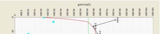

79

80

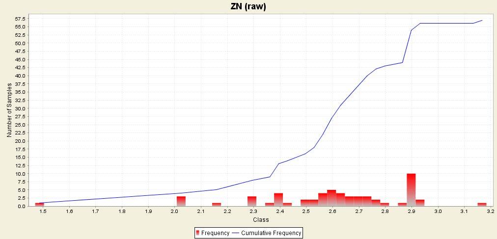

81
Sierra Mojada District
 Metalline Mining Company Sierra Mojada District Coahuila, Mexico Location Map COAHUILA.EPS Sierra Mojada Concessions District Concessions Sierra Mojada Range Dolomite Quarry Sierra Mojada La Esmeralda
Highlights from the four holes announced in this news release include:
 November 20, 2017 OTCQB: SVBL, TSX: SVB SILVER BULL INTERSECTS 9 METERS OF SULPHIDE MINERALIZATION GRADING 20.7% ZINC, 1% LEAD AND 98G/T SILVER, INCLUDING 3.65 METERS OF MASSIVE SULPHIDE MINERALIZATION
CERRO PRIETO PROJECT MINERAL CONCESSIONS LOCATION AND ACCESS
 Cerro Prieto CERRO PRIETO PROJECT MINERAL CONCESSIONS The Cerro Prieto Project is comprised of three mining exploitation concessions encompassing 2,723 hectares in northern Sonora, Mexico. Oroco holds
Technical Report on the Sierra Mojada Silver Project, Coahuila State, Mexico
 Technical Report on the Sierra Mojada Silver Project, Coahuila State, Mexico Report Prepared for Silver Bull Resources Inc. Report Prepared by SRK Consulting (Canada) Inc. 2CS030.000 November 25, 2011
Pahtavaara Drill Program Intersects 32.8 G/T Gold Over 2.0M And 2.1 G/T Gold Over 18.0M In The Karoliina Zone
 Page 1 of 6 a Pahtavaara Drill Program Intersects 32.8 G/T Gold Over 2.0M And 2.1 G/T Gold Over 18.0M In The Karoliina Zone Jan 11, 2017 Toronto, Ontario, Canada Listed: RUP-TSX-V January 10, 2017 Rupert
May 17, Two holes explored the extension at depth of the historic Sta Rosa vein
 May 17, 2011 PROSPERO INTERSECTS 781 g/t Ag, 1.2% Cu, 4.1% Zn OVER 2.62 METERS; DISCOVERS NEW ZINC RICH CANAL ZONE AT SAN LUIS DEL CORDERO PROJECT, MEXICO Vancouver, B.C. - Prospero Silver Corp. (TSX VENTURE:
MARKET UPDATE ON URANIUM AND GOLD PROJECTS
 ASX Announcement 1 March 2011 MARKET UPDATE ON URANIUM AND GOLD PROJECTS HIGHLIGHTS 5,000 metre drilling programme to commence at Rio Puerco uranium project within the next two weeks. Drilling to commence
GOLDEN MINERALS DISCOVERS ADDITIONAL HIGH GRADE VEINS AT SANTA MARIA RESULTS UP TO 1.88 g/t Au and 648 g/t Ag
 GOLDEN MINERALS DISCOVERS ADDITIONAL HIGH GRADE VEINS AT SANTA MARIA RESULTS UP TO 1.88 g/t Au and 648 g/t Ag Golden, Colorado /Globe Newswire/ July 12, 2018 Golden Minerals Company (NYSE American and
ET and and and
 NEWS RELEASE Oceanus Intersects 110 Meters of 0.79 g/t Gold Equivalent Consisting of 0.6 g/t Gold and 14.5 g/t Silver at its El Tigre Property in Sonora, Mexico HALIFAX, NOVA SCOTIA December 14, 2016 Oceanus
GOLDEN MINERALS IDENTIFIES HIGH GRADE GOLD AND SILVER VEINS AT YOQUIVO
 GOLDEN MINERALS IDENTIFIES HIGH GRADE GOLD AND SILVER VEINS AT YOQUIVO GOLDEN, CO /GLOBE NEWSWIRE/ October 31, 2018 Golden Minerals Company ( Golden Minerals, Golden or the Company ) (NYSE American and
The new sulphide mineralization lies within a 1.4 kilometer long east-west trending
 June 17, 2015 NYSE-MKT: SVBL, TSX: SVB SILVER BULL IDENTIFIES NEW MASSIVE SULPHIDE MINERALIZATION GRADING 690G/T SILVER, 1% COPPER, 4.8% LEAD AND 15.25% ZINC AT THE SIERRA MOJADA PROJECT, COAHUILA, MEXICO.
60% upgrade of Flying Doctor Resource to 104,600 tonnes of contained zinc and lead.
 30 April 2008 60% upgrade of Flying Doctor Resource to 104,600 tonnes of contained zinc and lead. Perilya Limited (ASX: PEM) is pleased to announce a 60% increase in the mineral resource estimate for the
Goldplay President and CEO Marcio Fonseca commented
 February 7, 2019 GOLDPLAY ANNOUNCES ITS MAIDEN MINERAL RESOURCE, CONTAINING 36 MILLION Oz AgEq (INDICATED) AND 11 MILLION Oz AgEq (INFERRED), AT THE SAN MARCIAL PROJECT Vancouver, BC - Goldplay Exploration
A B C PAD A HIGHLIGHTS
 Murchison Minerals Intercepts 12.30% Zinc, 0.70% Copper, 0.18% Lead and 42.03 g/t Silver 14.97% ZnEq over 6.37 Metres and Extends Known Limits of Brabant McKenzie VMS Deposit June 25, 2018 (Toronto, Ontario):
Mineral Resource Estimate Comparison at 3 g/t Au cut-off
 HARTE GOLD CORP. 8 King Street East, Suite 1700 Toronto, Ontario, M5C 1B5 Tel: 416-368-0999 Fax: 416-368-5146 Harte Gold Announces 2018 Drilling Increases Indicated Mineral Resources by 55% Overall Resource
Drilling Extending Mineralization in La Mina North Zone
 Toachi Mining Inc. Intersects 5.42 m grading 4.35 g/t Au, 77.34 g/t Ag, 7.48% Cu, 4.24% Zn and 0.22% Pb at the Gold-Rich La Plata VMS Project in Ecuador Drilling Extending Mineralization in La Mina North
OSISKO METALS INTERSECTS 10.49% ZINC+LEAD OVER METRES AND 12.15% ZINC+LEAD OVER METRES AT PINE POINT
 OSISKO METALS INTERSECTS 10.49% ZINC+LEAD OVER 22.84 METRES AND 12.15% ZINC+LEAD OVER 17.00 METRES AT PINE POINT (Montreal November 19, 2018) Osisko Metals Incorporated (the Company or Osisko Metals )
New Drilling Program Commences at Mutiny s Deflector Deposit
 New Drilling Program Commences at Mutiny s Deflector Deposit Drilling Program Highlights 12,000 metre RC and diamond drilling program underway New drilling program targets strike extensions in the Northern
IDM Mining s Underground Drilling Intersects g/t Au and g/t Ag over 6.80 Meters True Width at the Red Mountain Gold Project
 IDM Mining s Underground Drilling Intersects 18.70 g/t Au and 66.85 g/t Ag over 6.80 Meters True Width at the Red Mountain Gold Project November 22 nd, 2016, Vancouver, BC IDM Mining Ltd. (TSX.V:IDM) (
SALAZAR ANNOUNCES AN UPDATED RESOURCE REPORT OF 5.53 MT INDICATED AND 1.46 MT INFERRED AT ITS HIGH GRADE VMS EL DOMO DEPOSIT
 SALAZAR ANNOUNCES AN UPDATED 43-101 RESOURCE REPORT OF 5.53 MT INDICATED AND 1.46 MT INFERRED AT ITS HIGH GRADE VMS EL DOMO DEPOSIT VANCOUVER, BRITISH COLUMBIA, January 12, 2012 - Salazar Resources Ltd.
Carrapateena Mineral Resources Explanatory Notes April OZ Minerals Limited. Carrapateena Mineral Resources Statement April
 OZ Minerals Limited Carrapateena Mineral Resources Statement April 14 2011 CARRAPATEENA MINERAL RESOURCE STATEMENT April 14, 2011 The Carrapateena Resource Statement relates to an upgrading to an Inferred
Vendetta Reports Initial Results from 2017 Pegmont Program with High Grade Zone 3 Step Out Drilling
 FOR IMMEDIATE RELEASE July 25 th, 2017 (VTT2017 NR # 7) Vendetta Reports Initial Results from 2017 Pegmont Program with High Grade Zone 3 Step Out Drilling Vancouver, BC July 25 th, 2017 - Vendetta Mining
Bass Metals records further positive drill results & progress at 3 prospects.
 16 March 2011 Bass Metals records further positive drill results & progress at 3 prospects. HIGHLIGHTS: New high-grade drilling intercept confirms Switchback potential; Drilling commences at Lake Margaret
True Width (m) Carneritos to
 Carneritos to") Exchange Tower 410-150 York Street Toronto, Ontario M5H 3S5 Canada www.mammothresources.ca FOR IMMEDIATE RELEASE: July 13, 2017 No. 08/17 Mammoth Resources Intersects 36.5 Grams per Tonne Gold in Channel
Exchange Tower 410-150 York Street Toronto, Ontario M5H 3S5 Canada www.mammothresources.ca FOR IMMEDIATE RELEASE: July 13, 2017 No. 08/17 Mammoth Resources Intersects 36.5 Grams per Tonne Gold in Channel
EXPLORATION NEWS RELEASE EL GALLO EXPANDED AT DEPTH & TO THE WEST SEVERAL ZONES MERGING TOGETHER RESOURCE ESTIMATE 2 WEEKS
 June 23, 2010 EXPLORATION NEWS RELEASE EL GALLO EXPANDED AT DEPTH & TO THE WEST SEVERAL ZONES MERGING TOGETHER RESOURCE ESTIMATE 2 WEEKS TORONTO, ONTARIO (JUNE 23, 2010) US GOLD CORPORATION (NYSE Amex:
VETA GRANDE PROJECT, TETIPAC, GRO.
 VETA GRANDE PROJECT, TETIPAC, GRO. 1 INTRODUCTION Itislocatedinthenorthern portion of the state of Guerrero, in the municipality of Tetipac, in the vicinity of the village of Noxtepec, 25 km in straight
Drilling Extending Mineralization in La Mina North Zone
 Toachi Mining Inc. Intersects 10.78 m grading 6.35 g/t Au, 54.32 g/t Ag, 9.64% Cu, 8.70% Zn and 0.43% Pb at the Gold-Rich La Plata VMS Project in Ecuador Drilling Extending Mineralization in La Mina North
ATON RETURNS 22.2 METRES OF 2.77 GRAMS PER TONNE GOLD EQUIVALENT FROM HAMAMA WEST; VISIBLE GOLD DISCOVERED AT BOHLOG
 FOR IMMEDIATE RELEASE: ATON RETURNS 22.2 METRES OF 2.77 GRAMS PER TONNE GOLD EQUIVALENT FROM HAMAMA WEST; VISIBLE GOLD DISCOVERED AT BOHLOG Vancouver, April XX, 2017: Aton Resources Inc. (AAN: TSX-V) (
BOREAL EXPANDS DISCOVERY ZONE OF HIGH-GRADE ZINC, SILVER AND LEAD MINERALIZATION AT GUMSBERG PROJECT IN SWEDEN
 BOREAL EXPANDS DISCOVERY ZONE OF HIGH-GRADE ZINC, SILVER AND LEAD MINERALIZATION AT GUMSBERG PROJECT IN SWEDEN Vancouver, B.C., March 4, 2019. Boreal Metals Corp. ( Boreal or the Company ) (TSXV:BMX) is
STEP-OUT DRILLING EXTENDS HIGH GRADE COPPER ZONE AT SYNDICATED S 100% BARBARA SOUTH LODE
 November 5th 2009 Manager Announcements Companies Announcements Office Australian Securities Exchange Limited Level 4, 20 Bridge Street Sydney NSW 2000 STEP-OUT DRILLING EXTENDS HIGH GRADE COPPER ZONE
GOLDPLAY OUTLINES FIVE NEW EXPLORATION TARGETS AT THE SAN MARCIAL PROJECT IN MEXICO
 January 18, 2019 GOLDPLAY OUTLINES FIVE NEW EXPLORATION TARGETS AT THE SAN MARCIAL PROJECT IN MEXICO Vancouver, BC - Goldplay Exploration Ltd. (TSXV: GPLY, FRANKFURT: GPE, OTCQB: GLYXF) ( Goldplay or the
Vendetta Reports Additional High Grade Drilling Results from Zones 2 and 3 at Pegmont Lead-Zinc Project
 FOR IMMEDIATE RELEASE August 24 th, 2017 (VTT2017 NR # 9) Vendetta Reports Additional High Grade Drilling Results from Zones 2 and 3 at Pegmont Lead-Zinc Project Vancouver, BC August 24 th, 2017 Vendetta
CHAMPION IRON REPORTS EXPLORATION RESULTS AT POWDERHORN PROJECT, NEWFOUNDLAND
 PRESS RELEASE CHAMPION IRON REPORTS EXPLORATION RESULTS AT POWDERHORN PROJECT, NEWFOUNDLAND Confirmed Continuity of High-Grade Zinc Zone and Addition of Gold to the Expanded Copper Zone Montreal, March
PEAK GOLD JOINT VENTURE PROJECT TOK MINING DISTRICT, ALASKA
 PEAK GOLD JOINT VENTURE PROJECT TOK MINING DISTRICT, ALASKA Contango ORE, Inc. September 20, 2017 1 CONTANGO ORE, INC. DISCLAIMER This presentation may contain forward-looking statements including, but
Hole (93) From (m) To (m) m Au (g/t) Ag (g/t) Cu (%) Pb (%) Zn (%) CMLP
 From (m) To (m) m Au (g/t) Ag (g/t) Cu (%) Pb (%) Zn (%) CMLP") Toachi Mining Inc. Intersects 13.91 m grading 3.51 g/t Au, 64.24 g/t Ag, 0.59% Cu, 4.11% Zn and 0.85% Pb at the Gold-Rich La Plata VMS Project in Ecuador Toronto, Ontario October 11, 2017 Toachi Mining
Toachi Mining Inc. Intersects 13.91 m grading 3.51 g/t Au, 64.24 g/t Ag, 0.59% Cu, 4.11% Zn and 0.85% Pb at the Gold-Rich La Plata VMS Project in Ecuador Toronto, Ontario October 11, 2017 Toachi Mining
NEWS RELEASE. September 30 th, Trading Symbols: GTP (TSX-V) P01 (FRANKFURT) COLTF (OTC Pink)
 P01 (FRANKFURT) COLTF (OTC Pink)") NEWS RELEASE September 30 th, 2015 Trading Symbols: GTP (TSX-V) P01 (FRANKFURT) COLTF (OTC Pink) Colt Resources intersects 2.29% Cu over a 7.30 metres true width at its Miguel Vacas copper project in its
NEWS RELEASE September 30 th, 2015 Trading Symbols: GTP (TSX-V) P01 (FRANKFURT) COLTF (OTC Pink) Colt Resources intersects 2.29% Cu over a 7.30 metres true width at its Miguel Vacas copper project in its
Sherlock drilling returns best intercept to date of 0.63% Cu and 7.45 g/t Ag over m
 NEWS RELEASE For immediate distribution Sherlock drilling returns best intercept to date of 0.63% Cu and 7.45 g/t Ag over 34.25 m All the five drill holes successfully intersected the mineralized stratigraphy
(TSXV: GPLY, OTCQB: GLYXF
 GOLDPLAY ANNOUNCES POSITIVE RESULTS FROM SAMPLING OF HISTORICAL CORE AT SAN MARCIAL - ATTRACTIVE SILVER-LEAD-ZINC MINERALIZATION SUPPORTS OPEN PIT POTENTIAL October 09, 2018, Vancouver, BC - Goldplay Exploration
Quarterly Activities Report For the Period Ended March HIGHLIGHTS
 Quarterly Activities Report For the Period Ended March 31 2008 HIGHLIGHTS Merceditas Project, Chile Genesis Minerals Limited secured an Option to acquire a 100% interest in the significant Merceditas copper
Green Springs Project
 Green Springs Project AUGUST 2016 Ely Gold & Minerals Inc. elygoldandminerals.com @ElyGoldNevada TSX.V:ELY FORWARD LOOKING STATEMENTS Certain statements herein may contain forward looking information within
EXCELLON ANNOUNCES LA PLATOSA EXPLORATION RESULTS: HIGH GRADES CONTINUE TO EXTEND MANTO SULPHIDES DRILL HOLE ENCOUNTERS SOURCE ENVIRONMENT INDICATORS
 FOR IMMEDIATE RELEASE: APRIL 13, 2012 Exchange EXN Toronto Stock No. 06 2012 EXCELLON ANNOUNCES LA PLATOSA EXPLORATION RESULTS: HIGH GRADES CONTINUE TO EXTEND MANTO SULPHIDES DRILL HOLE ENCOUNTERS SOURCE
San Gold Drills New Mine Horizon Adjacent to Rice Lake Mine, Returns 10.4 Metres Grading 25.7 g/t Au
 SAN GOLD CORPORATION TSX: SGR OTCQX: SGRCF FOR IMMEDIATE RELEASE October 15, 2014 San Gold Drills New Mine Horizon Adjacent to Rice Lake Mine, Returns 10.4 Metres Grading 25.7 g/t Au WINNIPEG, MANITOBA
AUGUSTINE VENTURES ANNOUNCES HIGH GRADE GOLD BEARING TENSION VEINS IN THE HANGING WALL OF THE SURLUGA DEPOSIT
 NEWS RELEASE November 29, 2016 AUGUSTINE VENTURES ANNOUNCES HIGH GRADE GOLD BEARING TENSION VEINS IN THE HANGING WALL OF THE SURLUGA DEPOSIT Toronto, Ontario November 29, 2016 - The Manager, Red Pine Exploration
Canada Zinc Metals Announces Expanded Mineral Resource Estimate for the Cardiac Creek Deposit
 FOR IMMEDIATE RELEASE Contact: Investor Relations Monday, January 29, 2018 Phone (604) 684-2181 (No.2018-01-02) info@canadazincmetals.com Canada Zinc Metals Announces Expanded Mineral Resource Estimate
FALCO ANNOUNCES INITIAL HORNE 5 DRILLING RESULTS. Confirmation Holes in Line with Historical Data
 For Immediate Release TSX.V - FPC FALCO ANNOUNCES INITIAL HORNE 5 DRILLING RESULTS Confirmation Holes in Line with Historical Data (July 6, 2015) Montreal, Québec Falco Resources (FPC: TSX-V) ( Falco )
Highlights. 9 November 2018 DRILLING UPDATE - SORBY HILLS Pb-Ag-Zn PROJECT CORPORATE DIRECTORY
 9 November 2018 DRILLING UPDATE - SORBY HILLS Pb-Ag-Zn PROJECT CORPORATE DIRECTORY Managing Director Simon Noon Directors Richard Monti (Chairman) Peter Harold (Non-exec.) Andrew Parker (Non-exec.) Company
FALCO PACIFIC COMPLETES INITIAL MODEL FOR THE HORNE 5 GOLD/SILVER/ZINC/COPPER DEPOSIT
 For Immediate Release NR 13-10 FALCO PACIFIC COMPLETES INITIAL MODEL FOR THE HORNE 5 GOLD/SILVER/ZINC/COPPER DEPOSIT (Vancouver, BC, September 16, 2013) Falco Pacific Resource Group Inc. ( Falco Pacific
Mountain Maid Gold System Displays Major Size Potential
 29 July 2008 The Manager, Companies Australian Securities Exchange Ltd Electronic Announcement System Dear Sir, AXIOM MINING LIMITED (ASX CODE: AVQ) ASX Announcement Mountain Maid Gold System Displays
EXPLORATION LICENCE SURROUNDING THE HISTORIC FALUN COPPER MINE GRANTED
 ASX ANNOUNCEMENT 30 August 2007 EXPLORATION LICENCE SURROUNDING THE HISTORIC FALUN COPPER MINE GRANTED The Drake-Zinifex Alliance application for an exploration licence that covers the historic Falun copper
SAN LUCAS PROJECT Technical Data
 SAN LUCAS PROJECT Technical Data 1 San Lucas Overview 3km long mineralized Main Shear zone with 2 parallel vein structures identified 79 historical RC holes, ranging from about 32m-259m and averaging 158m
NEWS RELEASE For immediate distribution
 NEWS RELEASE For immediate distribution Mitchi Project: up to 9.12% Cu, 100 g/t Ag and 0.88 g/t Au in Grab Samples at the New Nasigon Sud Trench; Repurchase of Royalty Making Entire Sedimentary Basin Royalty
ASX RELEASE. Punt Hill Project Update
 Exploration Office Unit 2, 81 Harrison Road Dudley Park SA 5008 ABN: 96 110 336 733 Tel: +61 8 8245 4900 Fax: +61 8 8245 4999 www.monaxmining.com.au For Immediate Release Monday 15 June, 2015 ASX RELEASE
MONETA INTERCEPTS g/t GOLD INCLUDING g/t GOLD AND g/t GOLD INCLUDING g/t GOLD AT SOUTH WEST
 NEWS RELEASE 15/2018 Symbol: TSX: ME FOR IMMEDIATE RELEASE MONETA INTERCEPTS 5.30 m @ 7.63 g/t GOLD INCLUDING 0.80 m @ 22.40 g/t GOLD AND 7.13 m @ 5.06 g/t GOLD INCLUDING 1.98 m @ 12.47 g/t GOLD AT SOUTH
MONETA INTERCEPTS g/t GOLD INCLUDING g/t GOLD AT SOUTH WEST
 NEWS RELEASE 13/2018 Symbol: TSX: ME FOR IMMEDIATE RELEASE MONETA INTERCEPTS 25.00 m @ 2.48 g/t GOLD INCLUDING 4.50 m @ 5.00 g/t GOLD AT SOUTH WEST Toronto, Ontario September 13, 2018 - Moneta Porcupine
EXPLORATION NEWS RELEASE MAGISTRAL DISTRICT: MORE GROWTH, MORE GOLD, MORE SILVER
 EXPLORATION NEWS RELEASE MAGISTRAL DISTRICT: MORE GROWTH, MORE GOLD, MORE SILVER.1 OPT GOLD OVER 6 FT. 5.6 OPT SILVER EQUIVALENT OVER 65 FT. INCLUDING 13.6 OPT SILVER EQUILALENT OVER 15 FT. Denver, Colorado
Bellhaven Expands the Middle Zone Prospect with New Drilling: Advances toward New Resource in First Half of 2012
 Bellhaven Expands the Middle Zone Prospect with New Drilling: Advances toward New Resource in First Half of 2012 Vancouver, British Columbia January 19, 2012. Bellhaven Copper & Gold Inc. (TSX- Venture:
STRONG GOLD IN SOIL ANOMALY OUTLINED AT MARY HARRISON PROJECT HIGHLIGHTS
 National Stock Exchange of Australia Company Announcements Level 2, 117 Scott Street Newcastle NSW 2300 25 th January 2013 STRONG GOLD IN SOIL ANOMALY OUTLINED AT MARY HARRISON PROJECT HIGHLIGHTS 100m
DRILLING NEWS. NYSE Amex: GORO 22, February. Tuesday DENVER. Company. 50 meters ahead of. La Arista. 11 meters of within, La Arista
 FOR IMMEDIATE RELEASE February 22, 2011 NEWS NYSE Amex: GORO GOLD RESOURCE CORPORATION DRILLING RETURNS HIGHEST GRADE INTERCEPTS TO DATE DENVER Tuesday February 22, 2011 Gold Resource Corporation s (GORO)
Probe Metals Intersects 3.2 g/t Gold Over 45.5 Metres At Val-d Or East
 NEWS RELEASE 11/2018 Symbol: TSX-V: PRB Shares Issued: 110,584,945 Highlights: Probe Metals Intersects 3.2 g/t Gold Over 45.5 Metres At Val-d Or East Near-surface intercept grading 3.2 g/t Au over 45.5
Figure 1. Location of Boreal s Key Projects
 Boreal Completes Surface IP Geophysics At Burfjord, Norway Vancouver, B.C., January 4, 2018. Boreal Metals Corp. ( Boreal or the Company ) (TSXV:BMX) is pleased to announce the results of an Induced Polarization
NEWS RELEASE. Evrim and Harvest Gold Complete Drilling at Cerro Cascaron
 910-850 WEST HASTINGS ST. VANCOUVER, BC, CANADA V6C 1E1 TEL: 604.248.8648 FAX: 604.248.8663 WWW.EVRIMRESOURCES.COM TSX-V: EVM CONTACT: PADDY NICOL OR CHARLES FUNK NEWS RELEASE Evrim and Harvest Gold Complete
GOLDPLAY ANNOUNCES FURTHER SAMPLING RESULTS FROM SAN MARCIAL HISTORICAL CORE; CONFIRMS OPEN PIT TARGET NEAR SURFACE WITH gpt AgEq.
 GOLDPLAY ANNOUNCES FURTHER SAMPLING RESULTS FROM SAN MARCIAL HISTORICAL CORE; CONFIRMS OPEN PIT TARGET NEAR SURFACE WITH 46.0 METERS @ 129 gpt AgEq. August 28, 2018, Vancouver, BC - Goldplay Exploration
OPOSURA PROJECT, MOCTEZUMA, SONORA, MÉXICO, A HIGH GRADE ZN-PB, AG (CU, MO), ADVANCED STAGE, SKARN DEPOSIT (34) Expositor Día Hora Sala
, ADVANCED STAGE, SKARN DEPOSIT (34) Expositor Día Hora Sala") OPOSURA PROJECT, MOCTEZUMA, SONORA, MÉXICO, A HIGH GRADE ZN-PB, AG (CU, MO), ADVANCED STAGE, SKARN DEPOSIT (34) Expositor Día Hora Sala Cruz Paez Viernes 26 12:30 13:00 Sala A Cruz Enrique Paez Minera
OPOSURA PROJECT, MOCTEZUMA, SONORA, MÉXICO, A HIGH GRADE ZN-PB, AG (CU, MO), ADVANCED STAGE, SKARN DEPOSIT (34) Expositor Día Hora Sala Cruz Paez Viernes 26 12:30 13:00 Sala A Cruz Enrique Paez Minera
Novo Resources Corp. Suite West Georgia Street Vancouver, BC V6E 3C9
 Novo Resources Corp. Suite 1980 1075 West Georgia Street Vancouver, BC V6E 3C9 SAMPLING RETURNS HIGH GRADES AT NOVO RESOURCES BLUE SPEC GOLD-ANTIMONY PROJECT VANCOUVER, BC, January 21, 2016 - Novo Resources
Table 1: Mineral Resources at Costerfield, Inclusive of Mineral Reserves as of December 1, 2018 and December 31, 2017.
 MANDALAY RESOURCES CORPORATION ANNOUNCES 2018 MINERAL RESOURCES AND RESERVES UPDATE FOR ITS COSTERFIELD OPERATION, INCLUDING MAIDEN RESOURCES AND RESERVES ESTIMATE FOR THE YOULE LODE TORONTO, ON, January
April Exploring for Canadian Gold in the Rainy River District of Ontario
 April 2013 Exploring for Canadian Gold in the Rainy River District of Ontario 1 Forward Looking Statements This presentation may contain forward-looking statements including but not limited to comments
Strategic Phase 2 Exploration Program Launched at Island Gold High-Grade Resource Potential Identified Laterally and at Depth
 PRESS RELEASE TSX NYSE MKT: RIC Strategic Phase 2 Exploration Program Launched at Island Gold High-Grade Resource Potential Identified Laterally and at Depth Deep Drilling Intersects 18.63 g/t over 6.60
PUMA EXPLORATION AND TREVALI MINING CORPORATION DRILLED 13.1% Zn, 4.8% Pb OVER 27.0 METERS AT MURRAY BROOK DEPOSIT
 PRESS RELEASE For immediate dissemination PUMA EXPLORATION AND TREVALI MINING CORPORATION DRILLED 13.1% Zn, 4.8% Pb OVER 27.0 METERS AT MURRAY BROOK DEPOSIT Rimouski, August 29 th, 2018 Puma Exploration
EXCELLON DRILLS BROAD MINERALIZED ZONES AND EXPANDS DRILL PROGRAM ON NORTHERN FRESNILLO SILVER TREND
 www.excellonresources.com EXCELLON DRILLS BROAD MINERALIZED ZONES AND EXPANDS DRILL PROGRAM ON NORTHERN FRESNILLO SILVER TREND Toronto, Ontario October 2, 2018 Excellon Resources Inc. (TSX:EXN and EXN.WT.A;
KIRKLAND LAKE GOLD ANNOUNCES 120 METRE DOWN-PLUNGE EXTENSION OF SWAN ZONE
 KIRKLAND LAKE GOLD ANNOUNCES 120 METRE DOWN-PLUNGE EXTENSION OF SWAN ZONE High-grade, visible-gold mineralization intersected 120 metres ( m ) down-plunge of Swan Zone Inferred Mineral Resource and 210
ASX/Media Announcement
 ASX/Media Announcement 25 March 2013 MAIDEN HIGH-GRADE JUDY LODE RESOURCE INDICATES POTENTIAL TO INCREASE ANDY WELL MINE LIFE 106,000 ounce high-grade resource (Indicated & Inferred) Judy South (137,000t
Acquisition agreement to move to 100% ownership of the Ashford Coking Coal Project
 Level 9, Waterfront Place, 1 Eagle St, Brisbane QLD 4000 GPO Box 1164, Brisbane QLD 4001 Telephone: 07 3108 3500 Fax: 07 3108 3501 Email: admin@lanewayresources.com.au www.lanewayresources.com.au ASX ANNOUNCEMENT
July Exploring for Canadian Gold in the Rainy River District of Ontario
 July 2013 Exploring for Canadian Gold in the Rainy River District of Ontario 1 Forward Looking Statements Some of the statements in this document may be deemed to be "forward-looking statements". All statements
TRENCHING AT LAS DOLORES EXTENDS STRIKE LENGTH TO OVER 1,000 METRES, INTERSECTING
 January 31, 2018 NEWS RELEASE - #18-03 TSX- V: GRR Suite 501-595 Howe Street Vancouver, BC V6C 2T5 Tel: (604) 685-4655 Fax: (604) 685-4675 Toll Free: 1-888-685-4655 TRENCHING AT LAS DOLORES EXTENDS STRIKE
TROILUS GOLD CORP. INITIATES 30,000 METRE DRILL PROGRAM ON TROILUS PROPERTY
 TROILUS GOLD CORP. INITIATES 30,000 METRE DRILL PROGRAM ON TROILUS PROPERTY February 5, 2018, Toronto, Ontario Troilus Gold Corp. (TSX- V: TLG) ( Troilus or the Company ) is pleased to announce the commencement
NEWS RELEASE ORCA GOLD REPORTS CONTINUED SUCCESS AT GSS
 NEWS RELEASE OA GOLD REPORTS CONTINUED SUCCESS AT GSS May 26, 2014 Orca Gold Inc. (TSX.V:ORG) ( Orca or the Company ) is pleased to provide an update on exploration at its Galat Sufar South ( GSS ) prospect
Pershing Gold Hits Highest Grade Gold to Date in Relief Canyon with Grams per Tonne (3.618 Ounces per Ton) Intercept
 Intercept") March 3, 2015 Pershing Gold Hits Highest Grade Gold to Date in Relief Canyon with 123.90 Grams per Tonne (3.618 Ounces per Ton) Intercept LAKEWOOD, Colo., March 3, 2015 (PR NEWSWIRE) Pershing Gold Corporation
March 3, 2015 Pershing Gold Hits Highest Grade Gold to Date in Relief Canyon with 123.90 Grams per Tonne (3.618 Ounces per Ton) Intercept LAKEWOOD, Colo., March 3, 2015 (PR NEWSWIRE) Pershing Gold Corporation
T Boli Gold Mine Exploration Update
 NEWS RELEASE Symbol: RZL-TSX.V T Boli Gold Mine Exploration Update March 28 2018 - Vancouver, British Columbia: Rizal Resources Corporation (TSXV: RZL) ( Rizal or the Company ) announces that it has filed
Exploration targets identified to increase Browns Range Project s mine life
 Exploration targets identified to increase Browns Range Project s mine life Highlights Exploration Target estimate demonstrates the potential for very significant increases in Total Mineral Resource at
For personal use only
 ACN 097 088 689 ASX Announcement 1 EXPLORATION SUCCESS CONTINUES AT RAVENSWOOD RC drilling targeting shallow portions of Welcome breccia returns a number of significant new results including: 7m @ 7.84g/t
LME m averaging 0.65 g/t Au and 0.32% Cu, or 1.19 g/t Au Equiv LME m averaging 0.64 g/t Au and 0.11% Cu, or 0.
 Bellhaven Tops Previous Best Hole at the Middle Zone Deposit, La Mina Project, Colombia: LME-1072 134.39m at 0.65 g/t Au and 0.32%Cu, or 1.19 g/t Au Equivalent Medellin, Colombia May 14, 2012. Bellhaven
Probe Metals Confirms Continuity of Gold Mineralization on its Val-d Or East Project And Increases 2017 Drill Program to 75,000 metres
 NEWS RELEASE 07/2017 Symbol: TSX-V: PRB Shares Issued: 93,328,938 Probe Metals Confirms Continuity of Gold Mineralization on its Val-d Or East Project And Increases 2017 Drill Program to 75,000 metres
ASX ANNOUNCEMENT Date: 03 October 2018 Number: 604/031018
 ASX ANNOUNCEMENT Date: 03 October 2018 Number: 604/031018 TRIAL BULK SAMPLING PROGRAMME COMPLETED AT BLACKRIDGE CONGLOMERATE-HOSTED GOLD PROJECT QUEENSLAND Approx 8.5 tonnes of samples collected covering
News Release. Trilogy Metals Reports Additional Drilling Results from the Bornite Project
 TSX, NYSE American Symbol: TMQ News Release Trilogy Metals Reports Additional Drilling Results from the Bornite Project November 19, 2018 - Vancouver, British Columbia Trilogy Metals Inc. (TSX/NYSE American:
Surface Trenching Highlights. Santos Target. To (m) Width (m) Au (g/t) Comment. (m) Santos (1)-includes internal dilution
 Width (m) Au (g/t) Comment. (m) Santos (1)-includes internal dilution") Goldplay Exploration announces surface trenching program results to date at the 100% owned El Habal Property: including 130 meters grading 1.86 g/t Au, 100 meters grading 1.20 g/t Au, 90 meters grading
Goldplay Exploration announces surface trenching program results to date at the 100% owned El Habal Property: including 130 meters grading 1.86 g/t Au, 100 meters grading 1.20 g/t Au, 90 meters grading
NEWS RELEASE ORCA GOLD INDICATED AND INFERRED RESOURCES AT BLOCK 14 INCREASE BY 24% AND 48% RESPECTIVELY
 Orca Gold Inc., 2000-885 West Georgia St., Vancouver, B.C., V6C 3E8, Canada Tel: +1 604 689 7842 Fax: +1 604 689 4250 NEWS RELEASE ORCA GOLD INDICATED AND INFERRED RESOURCES AT BLOCK 14 INCREASE BY 24%
Trouser Legs Mine Strong Drilling Results - including g/t Au Potential for Further Mine Development
 ABN 44 009 157 439 Company Announcement 22 November 2018 Level 2, 90 William St Melbourne Victoria 3000 Australia Telephone: +61 3 9605 5950 Facsimile: +61 3 9605 5999 Email: info@hawthornresources.com
MCEWEN MINING ANNOUNCES EXPLORATION UPDATE FOR EL GALLO 1, MEXICO
 MCEWEN MINING ANNOUNCES EXPLORATION UPDATE FOR EL GALLO 1, MEXICO TORONTO, ONTARIO - (April 21, 2015) - McEwen Mining Inc. (NYSE: MUX) (TSX: MUX) is pleased to announce drill results that we expect will
Coeur Mining Provides Silvertip Exploration Update
 Coeur Mining Provides Silvertip Exploration Update Positive results include 6.0 meters (19.7 feet) at 925.7 g/t (27.0 oz/t) silver, 16.0% zinc and 15.2% lead, or (2,076.9 g/t (60.6 oz/t) AgEq 1 ) in Discovery
Namibia Critical Metals Drilling Confirms Cobalt and Copper Mineralization in First Two Targets at Kunene
 Press Release Namibia Critical Metals Drilling Confirms Cobalt and Copper Mineralization in First Two Targets at Kunene First results received from drilling on DOF Extension and Okanihova Lineament DOF
EXPLOR INTERSECTS MULTIPLE COPPER ZONES GRADES UP TO 3.65% CU OVER 5.35 METERS ON THE CHESTER COPPER PROPERTY
 15 Gamble East Street - Suite 204 - Rouyn-Noranda (Canada) J9X 3B6 Listing (TSX-V = EXS) (OTCQB = EXSFF) (FSE & BE = E1H1) EXPLOR INTERSECTS MULTIPLE COPPER ZONES GRADES UP TO 3.65% CU OVER 5.35 METERS
Tahoe Resources Mineral Reserves as of January 1, 2018
 Tahoe Resources Mineral Reserves as of January 1, 2018 Gold Location Ownership Bell Creek Canada 100% 0.5 3.90 68 1.9 4.12 246 2.4 4.07 315 Escobal Guatemala 100% 2.5 0.42 34 22.1 0.34 244 24.7 0.35 278
12 tons of high-grade ore was mined from the No. 1 vein with an average grade of 13 g/t gold, 3,250 g/t silver and 23.3% lead.
 DUNWELL MINE GROUP The Dunwell Mine Group (Dunwell, Dunwell East, Bear River/MM and Silvershot properties), which includes the historic, past-producing Dunwell mine, is located 8 km northeast of Stewart
Probe Metals Continues to Expand Gold Zones At Val-d Or East
 NEWS RELEASE 02/2018 Symbol: TSX-V: PRB Shares Issued: 93,914,742 Highlights: Probe Metals Continues to Expand Gold Zones At Val-d Or East New Beliveau Deposit resource expansion drilling to the West returned
InZinc Intersects 6.8m of 16.5% Zinc Focuses on Western Expansion of High Grades at West Desert Project
 InZinc Mining Ltd. 912 1112 West Pender Street P.O. Box 48268, Station Bentall Centre Vancouver, BC Canada V7X 1A2 1.604.687.7211 info@inzincmining.com inzincmining.com TSX-V: IZN August 27, 2018 News
COAU PROPERTY LEMHI COUNTY, IDAHO
 COAU PROPERTY LEMHI COUNTY, IDAHO Utah Mineral Resources 447 N 300 W, Suite 3 Kaysville, UT 84037 (801) 544-3421 ojgatten@nae-xploration.com Prepared by: North American Mine Services, LLC. March 21, 2017
Corvus Gold Drills g/t Gold, Extends Mother Lode Sediment Hosted Gold System to at Least 450 Metres Along Strike
 Suite 1750, 700 West Pender St. Vancouver, British Columbia CANADA V6C 1G8 TSX: KOR OTCQX: CORVF Tel: (604) 638-3246 Toll Free: 1-844-638-3246 info@corvusgold.com www.corvusgold.com NR17-19 December 12,
NEWS RELEASE LATEST EXPLORATION PROGRAM CONTINUES TO DEMONSTRATE NARANJILLO AS A HIGH GRADE SILVER HOST
 555-999 Canada Place Vancouver, BC V6C 3E1 Tel: (604) 687-1717 Fax: (604) 687-1715 www.plminerals.com NEWS RELEASE NOT FOR DISTRIBUTION TO U.S. NEWSWIRE SERVICES OR FOR DISSEMINATION IN THE UNITED STATES
Amador Canyon Silver Mining Property Lander County, NV
 Amador Canyon Silver Mining Property Lander County, NV Over $1 million worth of exploration and evaluation work performed Favorable drill results including a return of 286 g/ton silver over 12.2 meters
Widest Intercepts to Date Extend High-Grade Valdecañas Vein to Depth
 #770 800 West Pender Street Vancouver, BC V6C 2V6 P: 604-630-1399 F: 604-681-0894 MAG Corp. April 23, 2015 For Immediate Release NR#15-02 Widest Intercepts to Date Extend High-Grade Valdecañas Vein to