3D and 4D Seismic Data Integration for Geomodel Infilling: A Deep Offshore Turbiditic Field Case Study.
|
|
|
- Quentin Short
- 6 years ago
- Views:
Transcription

1 IPTC MS 3D and 4D Seismic Data Integration for Geomodel Infilling: A Deep Offshore Turbiditic Field Case Study. V. Silva, T. Cadoret, L.Bergamo, and R.Brahmantio, TOTAL E&P France Copyright 2015, International Petroleum Technology Conference This paper was prepared for presentation at the International Petroleum Technology Conference held in Doha, Qatar, 7-9 December This paper was selected for presentation by an IPTC Programme Committee following review of information contained in an abstract submitted by the author(s). Contents of the paper, as presented, have not been reviewed by the International Petroleum Technology Conference and are subject to correction by the author(s). The material, as presented, does not necessarily reflect any position of the International Petroleum Technology Conference, its officers, or members. Papers presented at IPTC are subject to publication review by Sponsor Society Committees of IPTC. Electronic reproduction, distribution, or storage of any part of this paper for commercial purposes without the written consent of the International Petroleum Technology Conference is prohibited. Permission to reproduce in print is restricted to an abstract of not more than 300 words; illustrations may not be copied. The abstract must contain conspicuous acknowledgment of where and by whom the paper was presented. Write Librarian, IPTC, P.O. Box , Richardson, TX , U.S.A., fax Abstract When seismic data is of good quality and that it can be related to useful geological properties it can become a useful driver to distribute spatial heterogeneity within the geomodel. This paper describes a workflow to incorporate efficiently seismic data during the geomodel infilling process. We propose to combine the seismic facies probability attribute (obtained after 3D pre-stack inversion) with 4D attributes. This is done by increasing the seismic facies probability where 4D information highlights the presence of permeable reservoir facies. Afterward the obtained attribute is combined with well information using Total in-house workflow to generate the final facies proportion cubes. Finally, Associated Facies (AF) simulation is performed using SIS (Sequence Indicator Simulation) algorithms. Comparison is performed between the AF obtained using 3D seismic data only and AF obtained using combined 3D and 4D seismic data. The integration of 4D information early in the geomodeling workflow (i.e. in facies modelling stage) improves the efficiency of the dynamic back-loop by allowing an early combination of Static and dynamic information. Thanks to this, history matching of dynamic reservoir simulation is facilitated. Introduction While defining a geological model, different pieces of information must be integrated to obtain a reliable spatial organization of geological facies and petrophysical properties. In the field case presented below, a new reservoir model is designed to improve the representation of geological facies heterogeneities for a turbiditic deep offshore field. Total in-house Seismic Reservoir Characterization tool (CARESS) enables conversion of inverted seismic attributes (such as acoustic impedance and poisson s ratio) into attributes describing the probability of occurrence of selected geological facies. It must be pointed out that these attributes have the same resolution as seismic and can possibly be influenced by pore fluid content. In the field considered for this study 4D seismic data has proven to be a key piece of information to understand the dynamic behaviour of the reservoirs. The main 4D attribute used in this study is the fractional P-wave velocity changes between two different seismic monitors (DV/V). If no subsidence effect occurs in the reservoir interval, it is assumed that strong DV/V response corresponds to some production or injection related effect which can only occur in the presence of permeable sand.
2 IPTC MS 2 Until now, 4D seismic data was integrated in geomodel workflow following facies simulation to assign deterministically reservoir facies in zones where strong 4D response is visible. In this work we propose to combine the seismic facies probability attributes and 4D attribute (DV/V) earlier on in the infilling process to better constrain the facies property infilling in the model. Seismic data QC and seismic quality map definition Before the use of the seismic data to constraint the geomodel infilling, the quality of the different seismic data were assessed to estimate the relative confidence we can have on it. The computations are performed at reservoir interval and the final product of this analysis is the seismic quality map. The seismic stacks used for seismic inversion derives from the Broadband survey. Computation of several attributes was performed for these stacks as RMS amplitudes, signal to noise analysis, standard AVO QC maps between near and far stacks after common bandwidth filtering. The stretch between near and far stacks was performed on raw data, without common bandwidth filtering. Seismic inversion products are the input for the Caress study, so its qualities have a direct impact on the potential seismic constraint. Over the reservoir interval the residuals amplitude are as expected weak and without lateral or vertical organization. In order to analyze in more detail its distribution the residuals are normalized with respect to the amplitude of the input sub-stacks. This is performed by dividing the RMS of the residuals calculated in the interval of interest by the RMS amplitudes of the reference seismic. The Caress quality assessment is performed at well scale by comparing the facies found at well with the caress prediction, section view by analyzing the continuity of the events and at base map view by analysing the Geological coherence. Jointly with the Caress cubes, DV/V is another source of seismic constraint for model infilling. The assessment of its quality is performed by analyzing the residual time shift between base and monitor survey below reservoir after warping operation using such attribute. We then look for zones showing higher time shift which would be an indication of less reliable DV/V. 4 different attributes have been selected to analyze the seismic quality. Figure 1 presents their spatial variation within a layer defined around the reservoir interval. To highlight zones of relatively poorer AVO behaviour the correlation and stretch of the seismic signal between Near and Far traces have been measured. Such attributes allows getting some hint about lateral variation in the quality of NMO correction. The correlation map exhibits higher correlation values between sub-stacks within the channels. The stretch attribute shows globally reasonable values except in some small localized zones. Signal to Noise ratio is another obvious criteria to understand the seismic quality. It has been computed using the near stack. It indicates that the seismic is noisier in the central panel area because of a highly faulted zone. It highlights also areas of poor seismic signal in the west flank of the survey where a salt diaper induces very steep seismic reflectors. A last seismic QC taken into account to define a quality indicator is a normalized RMS inversion residual map computed for the near substack. It allows to assess, at least partially, if the pre-stack inversion process has been successful to find an impedance solution explaining the seismic response. This map shows higher residuals, and therefore lower impedance reliability, in the faulted zone within the sand channels. We interpret these areas as being less reliable in term of inversion products and therefore less able to have an important weight in the reservoir model infilling. In order to define a qualitative indicator reflecting the seismic quality over our interval of interest a map is defined using some of attributes described in the previous paragraph. For each single attribute, a quality map was defined, as can be seen in Figure 1. To obtain a single attributes quality map a superposition of each maps is achieved to delineate zones where low reliability seismic can be defined. Figure 2 displays the final seismic quality map. In overall the seismic quality is high to medium, except in the salt zone and in a small zone to the west, possibly affected by shallower faulted zone. This quality map is afterward integrated to weight the seismic information put in the Geomodel.
3 IPTC MS 3 3D and 4D Seismic attributes time alignment Prior to the combination of 3D and 4D seismic attributes, a time alignment had to be performed between dataset to compensate for time shifts introduced by 4D effects and different seismic acquisitions and processing. While the Caress has been computed using a broadband seismic survey acquired while the field was in production, the 4D attribute DV/V is obtained from 3D high resolution survey referenced to the baseline time. In order to be used together the Caress and 4D DV/V attributes have therefore to be put in the same time and geographical referential as they have been acquired and migrated differently. In order to do so the time shift has been computed by measuring the amount of shift necessary to maximize the correlation between the Full stack volume coming from both dataset. 3D and 4D attributes combination and geomodel infilling The dataset for seismic constraint definition is composed of four CARESS lithoseismic probability cubes (non reservoir, laminated sand, massive soft sand and massive hard sand) related to each lithology occurrence. Three 4D seismic monitors (M1, M2 and M3) are also available derived from different vintages of high resolution seismic surveys. Figure 3 illustrates a schematic workflow for 3D and 4D seismic data combination. Most probable facies cube was computed using as input the facies probability cubes by assigning in the output cube the facies with highest probability value. Moreover, cumulative 4D attribute is calculated by adding to M3 the response of M1 and M2 above one percent cut-off of DV/V in zones where M3 does not presents a response above the cut-off. This step was performed to account for possible attenuation/compensation in 4D response in M3 monitor. Afterward, a cross validation of the most probable facies and cumulative DV/V is performed by analyzing the zones where the 4D signal presents a clear response (DV/V above 1%) and the CARESS facies probabilities does not correspond to a reservoir facies. This allows the definition of a Facies Analysis Cross-Validation attribute (FAC) highlighting the incoherent zones which require some modification of the facies probabilities. Such update is performed by increasing the initial reservoir facies probability as shown in Figure 4. This step was performed at seismic scale and afterword upscalled into the grid to be used during the model infilling workflow. Final facies proportion cubes for the model were then built using an in-house workflow (Figure 5) allowing to combine two proportion cubes per facies: a quantitative cube (or reference cube) providing the target facies proportions (mainly guided by facies proportions at wells), and a qualitative cube guiding spatial distribution of the facies (derived from lithoseismic probability cubes providing 3D trends per facies). A seismic quality map derived from 3D seismic attributes QC has also been used to vary spatially the weight given to the seismic constraint introduced as qualitative cube. One final proportion cube is defined for each facies (5 cubes, one per AF). These cubes were then used to distribute the facies in the model using Sequence Indicator Simulation (SIS). AF facies were modelled stochastically (Figure 5) in the reservoir grid using the following inputs: Well AF upscaled (1D) at wells Facies proportion cubes Local Varying Azimuth (LVA) property computed in channelized Architectural Elements (AE4, AE5 & AE6) Vertical and Horizontal Variography The result of facies modelling was used as basis for Petrophysical modelling in the reservoir grid. The petrophysical simulations were performed using the Sequential Gaussian Simulation (SGS) algorithm. First of all, the Effective Porosity ( e) was simulated. Given the good relationship of e with Net Effective Porosity net, Net To Gross (NTG) and Permeability (K), these parameters were co-simulated with e.
4 IPTC MS 4 Two model infilling using seismic constraint were performed : one using only Caress lithoseismic probability cubes and a second one using combined Caress lithoseismic probability cubes and 4D DV/V attribute. Results Discussion and Conclusions Assessment of the quality of the input seismic data is a key step for an optimum integration of the seismic data in the geomodel infilling workflow. Even though the analysis based on various seismic attributes remains qualitative, this assessment has allowed defining a 2D seismic confidence map which was later integrated in the compromise workflow to balance the seismic weight in the output facies proportion cubes. The spatial distribution of the geological facies within the reservoir grid obtained with both 3D only or integrated 3D and 4D attributes exhibits a good coherency with the geologic context. Nonetheless, the combination of 3D attributes (CARESS) and 4D attributes (DV/V) has increased the sand content of the geomodel in comparison to the model infilling using the CARESS attribute alone. Statistics in AF for both models show that reservoir facies proportion within the main channel area is higher when 4D seismic data is integrated in the infilling workflow. More importantly, this integration is improving the reservoir facies continuity as illustrated in Figure 6. QC was also performed on the NTG per AE. It was observed a maximum NTG error (in comparison to well input) of 3%,. This difference was considered as acceptable having to take into account the multiple constraints used by the simulation (e.g. Seismic, Variograms with local variation, well constraint). 3D petrophysical properties coherence were also validated by a seismic back-loop study aiming to check the compatibility between actual inverted seismic and synthetic elastic properties (IP, PR). These synthetic attributes are obtained thanks to a petroelastic model using as input the geological model petrophysical properties. This exercise has allowed demonstrating that modelled P-impedance and Poisson s Ratio are globally less than 6% different from the inverted values. This has been considered has a sufficient level of coherency to validate the model infilling from this point of view. To conclude it is important to stress the benefit of this integration of 4D information early on in the geomodel infilling workflow. Indeed, it makes the dynamic modelling more reliable by allowing an early combination of static and dynamic information. This has improved the dynamic loop by reducing the time needed to history match the reservoir model with production data. Acknowledgments The authors would like to thank TOTAL for permission to publish this paper. The authors would like also to thank Hildebrando Vicente-Pedro for assistance in the Facies modelling workflow. References Sengupta S., Cadoret T., Pivot F., (2014). Semi-Automatic Facies Up-scaling Techinique for Litho-Seismic Classification Application to a field located in Western Offshore Africa. IPTC Paper presented at International Petroleum Technology Conference in Doha Hubans C., Cauquil E.C., Brechet E. (2014). 4D (time lapse) seismic: an emerging tool for underwater monitoring. OTC paper presented at Offshore Technology Conference held in Houston 2014.


5 IPTC MS 5 Correlation Near/Far Near/Far Stretch Seismic Confidence Low Medium High Mean Relative Inversion Residual Near Substack MeanSignal/Noise Near Substack Fig. 1: Seismic QC attributes and confidence contours. Top left - correlation between near and far sub-stack, top right - stretch between near and far sub-stack. Bottom left mean relative inversion residual for near sub-stack, bottom right mean signal to noise ratio for near sub-stack.

 Seismic Quality Map UPDATED CARESS Compromise workflow Fig.")
6 IPTC MS 6 Confidence Low Medium High Fig. 2: Seismic Quality Map highlighting zones with low, medium and high seismic confidence. CARESS (Facies Probabilities) 3D + 4D seismic data Combination Time Alignment to Baseline reference 4D DV/V (M1, M2, M3) Seismic Quality Map UPDATED CARESS Compromise workflow Fig. 3: Schematic workflow for 3D and 4D seismic data combination.
 Aux.")
7 Confidence Low Medium High IPTC MS 7 Fig. 4: Caress lithoseismic probability update using 4D data. Red ellipse highlights a zone where 4D anomaly is visible but no reservoir facies exists. Ref. cube Context / applicability of unchanged the method (2) Aux. Cube modified Step 1: proportions of the auxiliary cube are modified to honor the proportions of the reference cube Objective of the proposed method: given proportion targets (the reference cube), add to it the shapes, the spatial organization contained Ref. cube Aux. Cube in the auxiliary cube or, ain x other unchanged words, modify+b the global x modified proportions of the auxiliary cube in order to honorthose of the reference cube The workflow uses the second option: With a + b =1 To keep the proportions of the reference cube 10 - Références, date, lieu Step 2: Combination. In Case of VPC or global proportions, only the auxiliary cube is used (a=0, b=1) Ref. cube Aux. cube Ref. cube unchanged Aux. Cube modified Step 1: proportions of the auxiliary cube are modified to honor the proportions of the reference cube a x 10 - Références, date, lieu Ref. cube unchanged +b x x Aux. Cube modified With a + b =1 To keep the proportions of the reference cube Step 2: Combination. In Case of VPC or global proportions, only the auxiliary cube is used (a=0, b=1) Fig. 5: Compromise and Facies modeling workflow. Reference proportions from well data and auxiliary proportions from seismic data. Seismic quality map used to weight the seismic information (alpha parameter).

8 IPTC MS 8 AF CARESS No 4D 27.1% Statistics AF without 4D AE6 AF No 4D 23.2% 15.8% 17.7% 16.2% AF CARESS + 4D Statistics AF with 4D AE6 AF_4D 30.3% 22.2% 12.9% 17.6% 17% Fig. 6: Comparison between AF property generated using only 3D as seismic constraint and AF generated using combined 3D and 4D seismic.
9 Paper No D and 4D Seismic Data Integration for Geomodel Infilling: A Deep Offshore Turbiditic Field Case Study V.A. DA SILVA*, T. CADORET, L. BERGAMO, R. BRAHMANTIO
10 CONTEXT Motivations to perform the study OUTLINE Slide 2 1 SEISMIC DATA QC AND CONFIDENCE MAP DEFINITION Assessing the spatial variability of the seismic quality 3D AND 4D SEISMIC DATA COMBINATION How to integrate 3D and 4D attributes in the geomodel infilling workflow? GEOMODEL INFILLING Impact of the 4D integration in the outcome? SEISMIC BACKLOOP Validating the petrophysical infilling CONCLUSIONS Key messages
11 CONTEXT Slide 3 This study was performed in a deep offshore turbiditic field Study motivated by the need of an updated model integrating new data 4D attribute (dvp/vp) has proven to be useful as an additional lithological indicator This presentation will show a workflow to integrate efficiently the seismic information in the geomodel infilling workflow Seismic has also been used to quality control the geomodel infilling
12 CONTEXT Motivations to perform the study OUTLINE Slide 4 1 SEISMIC DATA QC AND CONFIDENCE MAP DEFINITION Assessing the spatial variability of the seismic quality 3D AND 4D SEISMIC DATA COMBINATION How to integrate 3D and 4D attributes in the geomodel infilling workflow? GEOMODEL INFILLING Impact of the 4D integration in the outcome? SEISMIC BACKLOOP Validating the petrophysical infilling CONCLUSIONS Key messages


13 SEISMIC DATA QC AND CONFIDENCE MAP DEFINITION Slide 5 Seismic Attributes QC Bad Bad Seismic Quality Map Good Bad Good Bad Boundary compilation Good Good
14 CONTEXT Motivations to perform the study OUTLINE Slide 6 1 SEISMIC DATA QC AND CONFIDENCE MAP DEFINITION Assessing the spatial variability of the seismic quality 3D AND 4D SEISMIC DATA COMBINATION How to integrate 3D and 4D attributes in the geomodel infilling workflow? GEOMODEL INFILLING Impact of the 4D integration in the outcome? SEISMIC BACKLOOP Validating the petrophysical infilling CONCLUSIONS Key messages


>1% & MPF=0 Update the")
15 Initial Most Probable Facies 3D AND 4D SEISMIC DATA COMBINATION 4D attribute Cumulative DV/V Slide 7-3% -1% LithoSeismic Facies Check the Consistency +1% +3% Most Probable Facies Post Update Zones to be updated Abs(DV/V)>1% & MPF=0 Update the inconsistent zones

16 3D AND 4D SEISMIC DATA COMBINATION: Spatial Continuity QC Slide 8 Most Probable Facies before 4D Update: Most Representative in Layer 4D Signed Absolute Maximum in Layer Most Probable Facies after 4D Update: Most Representative in Layer Attributes Combination LithoSeismic Facies
 LithoSeismic Facies WOC Cut off used for facies update Increased Water Sand")
17 3D AND 4D SEISMIC DATA COMBINATION: QC at well Slide 9 GR AF Sand Probability before update 4D DV/V B00M2 Sand Probability After update Associated Facies (AF) LithoSeismic Facies WOC Cut off used for facies update Increased Water Sand probability
18 CONTEXT Motivations to perform the study OUTLINE Slide 10 1 SEISMIC DATA QC AND CONFIDENCE MAP DEFINITION Assessing the spatial variability of the seismic quality 3D AND 4D SEISMIC DATA COMBINATION How to integrate 3D and 4D attributes in the geomodel infilling workflow? GEOMODEL INFILLING Impact of the 4D integration in the outcome? SEISMIC BACKLOOP Validating the petrophysical infilling CONCLUSIONS Key messages
 Ref.")


19 Confidence Low Medium High From seismic Litho-Cubes + 4D The workflow uses the second option: a x Architectural Elements AF/AE on wells 10 - Références, date, lieu Ref. cube Ref. cube unchanged FACIES MODELLING WORKFLOW Proportion of AF per AE (CARESS) Ref. cube unchanged AF Target Proportions a x 10 - Références, date, lieu +bx With a + b =1 Ref. cube unchanged Aux. cube Proportion cube from CARESS, Ref. cube one cube per AF unchanged «spatial Aux. organisation Cube» Constant per AE, one cube per GAF «target proportion» To keep the proportions of the reference cube Aux. Cube modified Slide 11 Step 1: proportions Ref. cube of cube are modified to proportions of the ref Ref. cube unchanged Cubes Aux Step SIS2: Combination. Ref. cube In C Aux. Cube or global a x unchanged proportion + MODELLING +b O Step x 1: modified proportions of the auxiliary Wit Cubes PC auxiliary cube is use To keep the propor M cube are modified to honor the 10 - Références, date, lieu Final modified With Proportion cube P a + proportions b =1 Facies of the reference cube with spatial To keep the proportions of the reference organisation cube R Proportion respecting the target proportion, + O one Cubes cube per AF M Step 2: Combination. In Case of VPC Cubes Aux. Cube Ref I or global proportions, only the modified S auxiliary cube is used (a=0, b=1) E


20 AF Lithocubes No 4D Geomodelling Results Statistics AF without 4D In AE6 27.1% 23.2% Slide % 17.7% 16.2% AF2 AF3 AF4 AF5 AF6 AF Lithocubes + 4D Statistics AF with 4D In AE6 Observation: 30.3% Sand proportion more in line with wells results 22.2% 12.9% 17.6% 17% AF2 AF3 AF4 AF5 AF6
21 CONTEXT Motivations to perform the study OUTLINE Slide 13 1 SEISMIC DATA QC AND CONFIDENCE MAP DEFINITION Assessing the spatial variability of the seismic quality 3D AND 4D SEISMIC DATA COMBINATION How to integrate 3D and 4D attributes in the geomodel infilling workflow? GEOMODEL INFILLING Impact of the 4D integration in the outcome? SEISMIC BACKLOOP Validating the petrophysical infilling CONCLUSIONS Key messages


22 3D Geomodel SEISMIC BACKLOOP (SBL) WORKFLOW 3D Inverted cubes Slide 14 Update Petrophysics Comparison is done in the Geomodel space


 attributes by color code to")
23 Reservoirs Non-Reservoirs SEISMIC BACKLOOP AT WHOLE GRID Slide 15 Initial mismatch analysis on the whole 3D grid DIP = RPM - INVERSION DPR= RPM - INVERSION Non-Reservoirs +DPR 0 -DIP Vcl +DIP PR IP 0.6 Rock Physics Model Display Strong Mismatch Moderate Mismatch Small Mismatch Evaluate the impact -DPR of petrophysical properties (VCL, PHI, SW) on the Elastic IP-PR) attributes by color code to obtain the Summary X-plot

 2.")
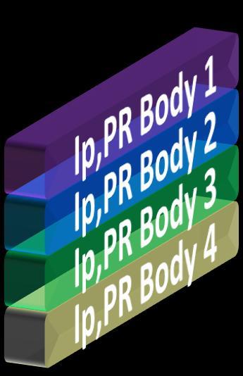
24 Slide 16 SUMMARY X-PLOT AND STATISTICAL ANALYSIS OF ANOMALY BODY DIP = RPM - INVERSION DPR= RPM - INVERSION IV +DPR I IP Overestimation Possible interpretations: IP Percentage Difference 1. Overestimation of SW 2. Underestimation of PHI 12,0% 10,0% 8,0% 6,0% 4,0% 2,0% 0,0% SLAP_Initial SLAP_Final Anomaly Threshold -DIP +DIP 3. Combination of options 1 and 2 But High Stakes FACIES III -DPR II 1. Bodies located below WOC (options 1 and 3 are unlikely to happen ) 2. Most likely a porosity effect Properties Update SLAP_Inial: Initial infilling SLAP_Final: porosity increased by 3pu 0 PHIE 0.5
25 CONTEXT Motivations to perform the study OUTLINE Slide 17 1 SEISMIC DATA QC AND CONFIDENCE MAP DEFINITION Assessing the spatial variability of the seismic quality 3D AND 4D SEISMIC DATA COMBINATION How to integrate 3D and 4D attributes in the geomodel infilling workflow? GEOMODEL INFILLING Impact of the 4D integration in the outcome? SEISMIC BACKLOOP Validating the petrophysical infilling CONCLUSIONS Key messages


26 CONCLUSIONS Slide 18 Seismic constraint allows to distribute realistic lateral heterogeneities and increases the reservoir facies continuity Seismic quality map permit weighting spatially the seismic constraint during model infilling The integration of 4D information has reduced the time needed to history match the reservoir model with production data Seismic Backloop shows that model in-filling allow to globally honor the inverted 3D seismic

27 Slide 19 We thanks Total and its partners for the authorization to present this work Thank You / Questions
QUANTITATIVE INTERPRETATION
 QUANTITATIVE INTERPRETATION THE AIM OF QUANTITATIVE INTERPRETATION (QI) IS, THROUGH THE USE OF AMPLITUDE ANALYSIS, TO PREDICT LITHOLOGY AND FLUID CONTENT AWAY FROM THE WELL BORE This process should make
OTC OTC PP. Abstract
 OTC OTC-19977-PP Using Modern Geophysical Technology to Explore for Bypassed Opportunities in the Gulf of Mexico R.A. Young/eSeis; W.G. Holt, G. Klefstad/ Fairways Offshore Exploration Copyright 2009,
Bertrand Six, Olivier Colnard, Jean-Philippe Coulon and Yasmine Aziez CGGVeritas Frédéric Cailly, Total
 4-D Seismic Inversion: A Case Study Offshore Congo Bertrand Six, Olivier Colnard, Jean-Philippe Coulon and Yasmine Aziez CGGVeritas Frédéric Cailly, Total Summary The first 4D seismic survey in Congo was
Seismic Guided Drilling: Near Real Time 3D Updating of Subsurface Images and Pore Pressure Model
 IPTC 16575 Seismic Guided Drilling: Near Real Time 3D Updating of Subsurface Images and Pore Pressure Model Chuck Peng, John Dai and Sherman Yang, Schlumberger WesternGeco Copyright 2013, International
A021 Petrophysical Seismic Inversion for Porosity and 4D Calibration on the Troll Field
 A021 Petrophysical Seismic Inversion for Porosity and 4D Calibration on the Troll Field T. Coleou* (CGG), A.J. van Wijngaarden (Hydro), A. Norenes Haaland (Hydro), P. Moliere (Hydro), R. Ona (Hydro) &
Training Venue and Dates Ref # Reservoir Geophysics October, 2019 $ 6,500 London
 Training Title RESERVOIR GEOPHYSICS Training Duration 5 days Training Venue and Dates Ref # Reservoir Geophysics DE035 5 07 11 October, 2019 $ 6,500 London In any of the 5 star hotels. The exact venue
Quantitative Interpretation
 Quantitative Interpretation The aim of quantitative interpretation (QI) is, through the use of amplitude analysis, to predict lithology and fluid content away from the well bore. This process should make
Constraining Uncertainty in Static Reservoir Modeling: A Case Study from Namorado Field, Brazil*
 Constraining Uncertainty in Static Reservoir Modeling: A Case Study from Namorado Field, Brazil* Juliana F. Bueno 1, Rodrigo D. Drummond 1, Alexandre C. Vidal 1, Emilson P. Leite 1, and Sérgio S. Sancevero
URTeC: Abstract
 URTeC: 2902950 Can Seismic Inversion Be Used for Geomechanics? A Casing Deformation Example Jeremy J. Meyer 1*, Jeremy Gallop 1, Alvin Chen 1, Scott Reynolds 1, Scott Mildren 1 ; 1. Ikon Science Copyright
23855 Rock Physics Constraints on Seismic Inversion
 23855 Rock Physics Constraints on Seismic Inversion M. Sams* (Ikon Science Ltd) & D. Saussus (Ikon Science) SUMMARY Seismic data are bandlimited, offset limited and noisy. Consequently interpretation of
URTeC: Summary
 URTeC: 2665754 Using Seismic Inversion to Predict Geomechanical Well Behavior: a Case Study From the Permian Basin Simon S. Payne*, Ikon Science; Jeremy Meyer*, Ikon Science Copyright 2017, Unconventional
RC 2.7. Main Menu. SEG/Houston 2005 Annual Meeting 1355
 Thierry Coléou, Fabien Allo and Raphaël Bornard, CGG; Jeff Hamman and Don Caldwell, Marathon Oil Summary We present a seismic inversion method driven by a petroelastic model, providing fine-scale geological
The SPE Foundation through member donations and a contribution from Offshore Europe
 Primary funding is provided by The SPE Foundation through member donations and a contribution from Offshore Europe The Society is grateful to those companies that allow their professionals to serve as
SPE These in turn can be used to estimate mechanical properties.
 SPE 96112 Pressure Effects on Porosity-Log Responses Using Rock Physics Modeling: Implications on Geophysical and Engineering Models as Reservoir Pressure Decreases Michael Holmes, SPE, Digital Formation,
Integrating rock physics and full elastic modeling for reservoir characterization Mosab Nasser and John B. Sinton*, Maersk Oil Houston Inc.
 Integrating rock physics and full elastic modeling for reservoir characterization Mosab Nasser and John B. Sinton*, Maersk Oil Houston Inc. Summary Rock physics establishes the link between reservoir properties,
F003 Geomodel Update Using 4-D Petrophysical Seismic Inversion on the Troll West Field
 F003 Geomodel Update Using 4-D Petrophysical Seismic Inversion on the Troll West Field K. Gjerding* (Statoil), N. Skjei (Statoil), A. Norenes Haaland (Statoil), I. Machecler (CGGVeritas Services) & T.
Quantitative Seismic Interpretation An Earth Modeling Perspective
 Quantitative Seismic Interpretation An Earth Modeling Perspective Damien Thenin*, RPS, Calgary, AB, Canada TheninD@rpsgroup.com Ron Larson, RPS, Calgary, AB, Canada LarsonR@rpsgroup.com Summary Earth models
Reservoir connectivity uncertainty from stochastic seismic inversion Rémi Moyen* and Philippe M. Doyen (CGGVeritas)
") Rémi Moyen* and Philippe M. Doyen (CGGVeritas) Summary Static reservoir connectivity analysis is sometimes based on 3D facies or geobody models defined by combining well data and inverted seismic impedances.
Rémi Moyen* and Philippe M. Doyen (CGGVeritas) Summary Static reservoir connectivity analysis is sometimes based on 3D facies or geobody models defined by combining well data and inverted seismic impedances.
3D geologic modelling of channellized reservoirs: applications in seismic attribute facies classification
 first break volume 23, December 2005 technology feature 3D geologic modelling of channellized reservoirs: applications in seismic attribute facies classification Renjun Wen, * president and CEO, Geomodeling
Downloaded 10/02/18 to Redistribution subject to SEG license or copyright; see Terms of Use at
 Multi-scenario, multi-realization seismic inversion for probabilistic seismic reservoir characterization Kester Waters* and Michael Kemper, Ikon Science Ltd. Summary We propose a two tiered inversion strategy
Reservoir characterization
 1/15 Reservoir characterization This paper gives an overview of the activities in geostatistics for the Petroleum industry in the domain of reservoir characterization. This description has been simplified
Multiple horizons mapping: A better approach for maximizing the value of seismic data
 Multiple horizons mapping: A better approach for maximizing the value of seismic data Das Ujjal Kumar *, SG(S) ONGC Ltd., New Delhi, Deputed in Ministry of Petroleum and Natural Gas, Govt. of India Email:
Stochastic vs Deterministic Pre-stack Inversion Methods. Brian Russell
 Stochastic vs Deterministic Pre-stack Inversion Methods Brian Russell Introduction Seismic reservoir analysis techniques utilize the fact that seismic amplitudes contain information about the geological
Dynamic GeoScience Martyn Millwood Hargrave Chief Executive OPTIMISE SUCCESS THROUGH SCIENCE
 Dynamic GeoScience Martyn Millwood Hargrave Chief Executive OPTIMISE SUCCESS THROUGH SCIENCE Agenda 1. Ikon Science Where we are now 2. Geoscience 2012 A motion picture 3. Rock physics, AVO and Inversion
Keywords. PMR, Reservoir Characterization, EEI, LR
 Enhancing the Reservoir Characterization Experience through Post Migration Reprocessed (PMR) Data A case study Indrajit Das*, Ashish Kumar Singh, Shakuntala Mangal, Reliance Industries Limited, Mumbai
Building an Integrated Static Reservoir Model 5-day Course
 Building an Integrated Static Reservoir Model 5-day Course Prepared by International Reservoir Technologies Lakewood, Colorado http://www.irt-inc.com/ 1 Agenda Day 1 Day 2 Day 3 Day 4 Day 5 Morning Introduction
Toward an Integrated and Realistic Interpretation of Continuous 4D Seismic Data for a CO 2 EOR and Sequestration Project
 SPE-183789-MS Toward an Integrated and Realistic Interpretation of Continuous 4D Seismic Data for a CO 2 EOR and Sequestration Project Philippe Nivlet, Robert Smith, Michael A. Jervis, and Andrey Bakulin,
Net-to-gross from Seismic P and S Impedances: Estimation and Uncertainty Analysis using Bayesian Statistics
 Net-to-gross from Seismic P and S Impedances: Estimation and Uncertainty Analysis using Bayesian Statistics Summary Madhumita Sengupta*, Ran Bachrach, Niranjan Banik, esterngeco. Net-to-gross (N/G ) is
Best Practice Reservoir Characterization for the Alberta Oil Sands
 Best Practice Reservoir Characterization for the Alberta Oil Sands Jason A. McLennan and Clayton V. Deutsch Centre for Computational Geostatistics (CCG) Department of Civil and Environmental Engineering
Simultaneous Inversion of Clastic Zubair Reservoir: Case Study from Sabiriyah Field, North Kuwait
 Simultaneous Inversion of Clastic Zubair Reservoir: Case Study from Sabiriyah Field, North Kuwait Osman Khaled, Yousef Al-Zuabi, Hameed Shereef Summary The zone under study is Zubair formation of Cretaceous
Downloaded 10/25/16 to Redistribution subject to SEG license or copyright; see Terms of Use at
 Facies modeling in unconventional reservoirs using seismic derived facies probabilities Reinaldo J. Michelena*, Omar G. Angola, and Kevin S. Godbey, ireservoir.com, Inc. Summary We present in this paper
IPTC PP Challenges in Shallow Water CSEM Surveying: A Case History from Southeast Asia
 IPTC-11511-PP Challenges in Shallow Water CSEM Surveying: A Case History from Southeast Asia Sandeep K. Chandola*, Rashidah Karim, Amy Mawarni, Russikin Ismail, Noreehan Shahud, Ramlee Rahman, Paul Bernabe
3D Converted Wave Data Processing A case history
 P-290 3D Converted Wave Data Processing A case history N. B. R. Prasad, ONGC Summary In recent years, there has been a growing interest in shear- wave exploration for hydrocarbons as it facilitates to
SEISMIC INVERSION OVERVIEW
 DHI CONSORTIUM SEISMIC INVERSION OVERVIEW Rocky Roden September 2011 NOTE: Terminology for inversion varies, depending on the different contractors and service providers, emphasis on certain approaches,
SPE MS. Abstract
 Seismically Derived Porosity Prediction for Field Development- An Onshore Abu Dhabi Jurassic Carbonate Reservoir Case Study Shraddha Chatterjee, CGG; Matthew Burreson, Al Hosn Gas; Bertrand Six, CGG; Jean-Marc
A010 MULTISCALE RESERVOIR CHARACTERIZATION USING
 1 A010 MULTISCALE RESERVOIR CHARACTERIZATION USING RODUCTION AND TIME LASE SEISMIC DATA Mokhles MEZGHANI, Alexandre FORNEL, Valérie LANGLAIS, Nathalie LUCET IF, 1 & 4 av de Bois réau, 92852 RUEIL-MALMAISON
IPTC Abstract. Introduction
 IPTC 17035 AKPO Condensate Field Case Study, Nigeria: 4D Seismic Monitoring of a Complex Deepwater Turbidite Reservoir E. PIOVESANEL, G.CLAUDEL, A. ATEWOLOGUN, A. ADEYEMI and S. YUH, TOTAL Copyright 2013,
The Marrying of Petrophysics with Geophysics Results in a Powerful Tool for Independents Roger A. Young, eseis, Inc.
 The Marrying of Petrophysics with Geophysics Results in a Powerful Tool for Independents Roger A. Young, eseis, Inc. While the application of new geophysical and petrophysical technology separately can
Porosity. Downloaded 09/22/16 to Redistribution subject to SEG license or copyright; see Terms of Use at
 Geostatistical Reservoir Characterization of Deepwater Channel, Offshore Malaysia Trisakti Kurniawan* and Jahan Zeb, Petronas Carigali Sdn Bhd, Jimmy Ting and Lee Chung Shen, CGG Summary A quantitative
A Petroleum Geologist's Guide to Seismic Reflection
 A Petroleum Geologist's Guide to Seismic Reflection William Ashcroft WILEY-BLACKWELL A John Wiley & Sons, Ltd., Publication Contents Preface Acknowledgements xi xiii Part I Basic topics and 2D interpretation
Subsurface Consultancy Services
 Subsurface Consultancy Services Porosity from Reservoir Modeling Perspective Arnout Everts with contributions by Peter Friedinger and Laurent Alessio FESM June 2011 LEAP Energy Main Office: G-Tower, level
A E. SEG/San Antonio 2007 Annual Meeting. exp. a V. a V. Summary
 Time-lapse simulator-to-seismic study - Forties field, North Sea. Christophe Ribeiro *, Cyrille Reiser, Philippe Doyen, CGGeritas, London, UK August Lau, Apache Corp., Houston, US, Steve Adiletta, Apache
Updating the low-frequency model in time-lapse seismic inversion: A case study from a heavy-oil steam-injection project
 Updating the low-frequency model in time-lapse seismic inversion: A case study from a heavy-oil steam-injection project Peter R. Mesdag 1, M. Reza Saberi 1, and Cheran Mangat 2 Abstract A workflow to update
HampsonRussell. A comprehensive suite of reservoir characterization tools. cgg.com/geosoftware
 HampsonRussell A comprehensive suite of reservoir characterization tools cgg.com/geosoftware HampsonRussell Software World-class geophysical interpretation HampsonRussell Software is a comprehensive suite
Downloaded 01/06/15 to Redistribution subject to SEG license or copyright; see Terms of Use at
 Application of wide-azimuth 3D seismic attributes to predict the microfractures in Block MA area for shale gas exploration in South China Yusheng Zhang* 1, Gang Yu 1, Ximing Wang 1, Xing Liang 2, and Li
Statistical Rock Physics
 Statistical - Introduction Book review 3.1-3.3 Min Sun March. 13, 2009 Outline. What is Statistical. Why we need Statistical. How Statistical works Statistical Rock physics Information theory Statistics
RESERVOIR SEISMIC CHARACTERISATION OF THIN SANDS IN WEST SYBERIA
 www.senergyltd.com RESERVOIR SEISMIC CHARACTERISATION OF THIN SANDS IN WEST SYBERIA Erick Alvarez, Jaume Hernandez, Bolkhotivin E.A., Belov A.V., Hakima Ben Meradi,Jonathan Hall, Olivier Siccardi, Phil
3D geostatistical porosity modelling: A case study at the Saint-Flavien CO 2 storage project
 3D geostatistical porosity modelling: A case study at the Saint-Flavien CO 2 storage project Maxime Claprood Institut national de la recherche scientifique, Québec, Canada Earth Modelling 2013 October
Seismic reservoir characterization in offshore Nile Delta.
 Seismic reservoir characterization in offshore Nile Delta. Part II: Probabilistic petrophysical-seismic inversion M. Aleardi 1, F. Ciabarri 2, B. Garcea 2, A. Mazzotti 1 1 Earth Sciences Department, University
Use of Seismic Inversion Attributes In Field Development Planning
 IOSR Journal of Applied Geology and Geophysics (IOSR-JAGG) e-issn: 2321 0990, p-issn: 2321 0982.Volume 6, Issue 2 Ver. II (Mar. Apr. 2018), PP 86-92 www.iosrjournals.org Use of Seismic Inversion Attributes
RC 1.3. SEG/Houston 2005 Annual Meeting 1307
 from seismic AVO Xin-Gong Li,University of Houston and IntSeis Inc, De-Hua Han, and Jiajin Liu, University of Houston Donn McGuire, Anadarko Petroleum Corp Summary A new inversion method is tested to directly
Integrating reservoir flow simulation with time-lapse seismic inversion in a heavy oil case study
 Integrating reservoir flow simulation with time-lapse seismic inversion in a heavy oil case study Naimeh Riazi*, Larry Lines*, and Brian Russell** Department of Geoscience, University of Calgary **Hampson-Russell
We apply a rock physics analysis to well log data from the North-East Gulf of Mexico
 Rock Physics for Fluid and Porosity Mapping in NE GoM JACK DVORKIN, Stanford University and Rock Solid Images TIM FASNACHT, Anadarko Petroleum Corporation RICHARD UDEN, MAGGIE SMITH, NAUM DERZHI, AND JOEL
PETROLEUM GEOSCIENCES GEOLOGY OR GEOPHYSICS MAJOR
 PETROLEUM GEOSCIENCES GEOLOGY OR GEOPHYSICS MAJOR APPLIED GRADUATE STUDIES Geology Geophysics GEO1 Introduction to the petroleum geosciences GEO2 Seismic methods GEO3 Multi-scale geological analysis GEO4
Lithology prediction and fluid discrimination in Block A6 offshore Myanmar
 10 th Biennial International Conference & Exposition P 141 Lithology prediction and fluid discrimination in Block A6 offshore Myanmar Hanumantha Rao. Y *, Loic Michel, Hampson-Russell, Kyaw Myint, Ko Ko,
Vertical and horizontal resolution considerations for a joint 3D CSEM and MT inversion
 Antony PRICE*, Total E&P and Don WATTS, WesternGeco Electromagnetics Summary To further explore the potential data content and inherent limitations of a detailed 3D Controlled Source ElectroMagnetic and
A seismic reservoir characterization and porosity estimation workflow to support geological model update: pre-salt reservoir case study, Brazil
 A seismic reservoir characterization and porosity estimation workflow to support geological model update: pre-salt reservoir case study, Brazil Laryssa Oliveira 1*, Francis Pimentel 2, Manuel Peiro 1,
Downloaded 09/16/16 to Redistribution subject to SEG license or copyright; see Terms of Use at
 Data Using a Facies Based Bayesian Seismic Inversion, Forties Field, UKCS Kester Waters* (Ikon Science Ltd), Ana Somoza (Ikon Science Ltd), Grant Byerley (Apache Corp), Phil Rose (Apache UK) Summary The
Neural Inversion Technology for reservoir property prediction from seismic data
 Original article published in Russian in Nefteservice, March 2009 Neural Inversion Technology for reservoir property prediction from seismic data Malyarova Tatyana, Kopenkin Roman, Paradigm At the software
Reservoir properties inversion from AVO attributes
 Reservoir properties inversion from AVO attributes Xin-gang Chi* and De-hua Han, University of Houston Summary A new rock physics model based inversion method is put forward where the shaly-sand mixture
The Alba Field: Improved Reservoir Characterisation using 4D Seismic Data. Elaine Campbell Oliver Hermann Steve Dobbs Andrew Warnock John Hampson
 The Alba Field: Improved Reservoir Characterisation using 4D Seismic Data Elaine Campbell Oliver Hermann Steve Dobbs Andrew Warnock John Hampson Chevron 2005 Alba Field Location Equity: Chevron 23% (operator)
Integration of seismic and fluid-flow data: a two-way road linked by rock physics
 Integration of seismic and fluid-flow data: a two-way road linked by rock physics Abstract Yunyue (Elita) Li, Yi Shen, and Peter K. Kang Geologic model building of the subsurface is a complicated and lengthy
Interpretation and Reservoir Properties Estimation Using Dual-Sensor Streamer Seismic Without the Use of Well
 Interpretation and Reservoir Properties Estimation Using Dual-Sensor Streamer Seismic Without the Use of Well C. Reiser (Petroleum Geo-Services), T. Bird* (Petroleum Geo-Services) & M. Whaley (Petroleum
Downloaded 09/15/16 to Redistribution subject to SEG license or copyright; see Terms of Use at
 A Full Field Static Model of the RG-oil Field, Central Sirte Basin, Libya Abdalla Abdelnabi*, Kelly H. Liu, and Stephen Gao Missouri University of Science and Technology Summary Cambrian-Ordovician and
Downloaded 09/16/16 to Redistribution subject to SEG license or copyright; see Terms of Use at
 Ehsan Zabihi Naeini*, Ikon Science & Russell Exley, Summit Exploration & Production Ltd Summary Quantitative interpretation (QI) is an important part of successful Central North Sea exploration, appraisal
Rock Physics and Quantitative Wavelet Estimation. for Seismic Interpretation: Tertiary North Sea. R.W.Simm 1, S.Xu 2 and R.E.
 Rock Physics and Quantitative Wavelet Estimation for Seismic Interpretation: Tertiary North Sea R.W.Simm 1, S.Xu 2 and R.E.White 2 1. Enterprise Oil plc, Grand Buildings, Trafalgar Square, London WC2N
Oil and Natural Gas Corporation Ltd., VRC(Panvel), WOB, ONGC, Mumbai. 1
, WOB, ONGC, Mumbai. 1") P-259 Summary Data for identification of Porosity Behaviour in Oligocene Lime Stone of D18 Area Of Western Offshore, India V.K. Baid*, P.H. Rao, P.S. Basak, Ravi Kant, V. Vairavan 1, K.M. Sundaram 1, ONGC
P-259 Summary Data for identification of Porosity Behaviour in Oligocene Lime Stone of D18 Area Of Western Offshore, India V.K. Baid*, P.H. Rao, P.S. Basak, Ravi Kant, V. Vairavan 1, K.M. Sundaram 1, ONGC
Imaging complex structure with crosswell seismic in Jianghan oil field
 INTERPRETER S CORNER Coordinated by Rebecca B. Latimer Imaging complex structure with crosswell seismic in Jianghan oil field QICHENG DONG and BRUCE MARION, Z-Seis, Houston, Texas, U.S. JEFF MEYER, Fusion
SPE Uncertainty in rock and fluid properties.
 SPE 77533 Effects on Well Test Analysis of Pressure and Flowrate Noise R.A. Archer, University of Auckland, M.B. Merad, Schlumberger, T.A. Blasingame, Texas A&M University Copyright 2002, Society of Petroleum
Pre-stack (AVO) and post-stack inversion of the Hussar low frequency seismic data
 and post-stack inversion of the Hussar low frequency seismic data") Pre-stack (AVO) and post-stack inversion of the Hussar low frequency seismic data A.Nassir Saeed, Gary F. Margrave and Laurence R. Lines ABSTRACT Post-stack and pre-stack (AVO) inversion were performed
Pre-stack (AVO) and post-stack inversion of the Hussar low frequency seismic data A.Nassir Saeed, Gary F. Margrave and Laurence R. Lines ABSTRACT Post-stack and pre-stack (AVO) inversion were performed
J.V. Herwanger* (Ikon Science), A. Bottrill (Ikon Science) & P. Popov (Ikon Science)
, A. Bottrill (Ikon Science) & P. Popov (Ikon Science)") 29829. One 4D geomechanical model and its many applications J.V. Herwanger* (Ikon Science), A. Bottrill (Ikon Science) & P. Popov (Ikon Science) Main objectives (i) Field case study demonstrating application
29829. One 4D geomechanical model and its many applications J.V. Herwanger* (Ikon Science), A. Bottrill (Ikon Science) & P. Popov (Ikon Science) Main objectives (i) Field case study demonstrating application
New Frontier Advanced Multiclient Data Offshore Uruguay. Advanced data interpretation to empower your decision making in the upcoming bid round
 New Frontier Advanced Multiclient Data Offshore Uruguay Advanced data interpretation to empower your decision making in the upcoming bid round Multiclient data interpretation provides key deliverables
Downloaded 09/09/15 to Redistribution subject to SEG license or copyright; see Terms of Use at
 Reservoir properties estimation from marine broadband seismic without a-priori well information: A powerful de-risking workflow Cyrille Reiser*, Matt Whaley and Tim Bird, PGS Reservoir Limited Summary
SEISMIC PROFILE CGG SEISMIC INVERSIONS. by Lucia Levato, CGG. three offshore case studies show how one size does not fi t all. 18 seismic profile
 4D SEISMIC INVERSIONS by Lucia Levato, CGG three offshore case studies show how one size does not fi t all 18 seismic profile The following three cases of offshore 4D seismic inversions illustrate how
We P2 04 Rock Property Volume Estimation Using the Multiattribute Rotation Scheme (MARS) - Case Study in the South Falkland Basin
 - Case Study in the South Falkland Basin") We P2 04 Rock Property Volume Estimation Using the Multiattribute Rotation Scheme (MARS) - Case Study in the South Falkland Basin P.K. Alvarez* (Rock Solid Images), B. Farrer (Borders & Southern Petroleum),
We P2 04 Rock Property Volume Estimation Using the Multiattribute Rotation Scheme (MARS) - Case Study in the South Falkland Basin P.K. Alvarez* (Rock Solid Images), B. Farrer (Borders & Southern Petroleum),
Chapter 1. Introduction EARTH MODEL BUILDING
 Chapter 1 Introduction Seismic anisotropy in complex earth subsurface has become increasingly important in seismic imaging due to the increasing offset and azimuth in modern seismic data. To account for
Multiattributes and Seismic Interpretation of Offshore Exploratory Block in Bahrain A Case Study
 Multiattributes and Seismic Interpretation of Offshore Exploratory Block in Bahrain A Case Study Suresh Thampi, Aqeel Ahmed, Yahya Al-Ansari, Ali Shehab, Ahmed Fateh, Anindya Ghosh, Ghada Almoulani. The
An Integrated Workflow for Seismic Data Conditioning and Modern Prestack Inversion Applied to the Odin Field. P.E.Harris, O.I.Frette, W.T.
 An Integrated Workflow for Seismic Data Conditioning and Modern Prestack Inversion Applied to the Odin Field P.E.Harris, O.I.Frette, W.T.Shea Talk Outline Introduction Motivation Introducing Pcube+ Gather
Pluto 1.5 2D ELASTIC MODEL FOR WAVEFIELD INVESTIGATIONS OF SUBSALT OBJECTIVES, DEEP WATER GULF OF MEXICO*
 Pluto 1.5 2D ELASTIC MODEL FOR WAVEFIELD INVESTIGATIONS OF SUBSALT OBJECTIVES, DEEP WATER GULF OF MEXICO* *This paper has been submitted to the EAGE for presentation at the June 2001 EAGE meeting. SUMMARY
A031 Porosity and Shale Volume Estimation for the Ardmore Field Using Extended Elastic Impedance
 A31 Porosity and Shale Volume Estimation for the Ardmore Field Using Extended Elastic Impedance A.M. Francis* (Earthworks Environment & Resources Ltd) & G.J. Hicks (Earthworks Environment & Resources Ltd)
THE USE OF SEISMIC ATTRIBUTES AND SPECTRAL DECOMPOSITION TO SUPPORT THE DRILLING PLAN OF THE URACOA-BOMBAL FIELDS
 THE USE OF SEISMIC ATTRIBUTES AND SPECTRAL DECOMPOSITION TO SUPPORT THE DRILLING PLAN OF THE URACOA-BOMBAL FIELDS Cuesta, Julián* 1, Pérez, Richard 1 ; Hernández, Freddy 1 ; Carrasquel, Williams 1 ; Cabrera,
Modeling Optimizes Asset Performance By Chad Baillie
 MARCH 2016 The Better Business Publication Serving the Exploration / Drilling / Production Industry Modeling Optimizes Asset Performance By Chad Baillie MISSOURI CITY, TX. As more well and completion data
An Overview of the Tapia Canyon Field Static Geocellular Model and Simulation Study
 An Overview of the Tapia Canyon Field Static Geocellular Model and Simulation Study Prepared for Sefton Resources Inc. Jennifer Dunn, Chief Geologist Petrel Robertson Consulting Ltd. Outline Background
Reliability of Seismic Data for Hydrocarbon Reservoir Characterization
 Reliability of Seismic Data for Hydrocarbon Reservoir Characterization Geetartha Dutta (gdutta@stanford.edu) December 10, 2015 Abstract Seismic data helps in better characterization of hydrocarbon reservoirs.
MITIGATE RISK, ENHANCE RECOVERY Seismically-Constrained Multivariate Analysis Optimizes Development, Increases EUR in Unconventional Plays
 White Paper MITIGATE RISK, ENHANCE RECOVERY Seismically-Constrained Multivariate Analysis Optimizes Development, Increases EUR in Unconventional Plays SM Seismically-Constrained Multivariate Analysis Optimizes
AFI (AVO Fluid Inversion)
") AFI (AVO Fluid Inversion) Uncertainty in AVO: How can we measure it? Dan Hampson, Brian Russell Hampson-Russell Software, Calgary Last Updated: April 2005 Authors: Dan Hampson, Brian Russell 1 Overview
AFI (AVO Fluid Inversion) Uncertainty in AVO: How can we measure it? Dan Hampson, Brian Russell Hampson-Russell Software, Calgary Last Updated: April 2005 Authors: Dan Hampson, Brian Russell 1 Overview
Uncertainties in rock pore compressibility and effects on time lapse seismic modeling An application to Norne field
 Uncertainties in rock pore compressibility and effects on time lapse seismic modeling An application to Norne field Amit Suman and Tapan Mukerji Department of Energy Resources Engineering Stanford University
Tu N Fault Shadow Removal over Timor Trough Using Broadband Seismic, FWI and Fault Constrained Tomography
 Tu N118 05 Fault Shadow Removal over Timor Trough Using Broadband Seismic, FWI and Fault Constrained Tomography Y. Guo* (CGG), M. Fujimoto (INPEX), S. Wu (CGG) & Y. Sasaki (INPEX) SUMMARY Thrust-complex
Shaly Sand Rock Physics Analysis and Seismic Inversion Implication
 Shaly Sand Rock Physics Analysis and Seismic Inversion Implication Adi Widyantoro (IkonScience), Matthew Saul (IkonScience/UWA) Rock physics analysis of reservoir elastic properties often assumes homogeneity
Introduction AGR AVO Figure 1 (a) (b)
 (b)") Introduction In order to ensure the safety of its drilling operations while developing an important gas field in South East Asia, Total performed a large project of Shallow Gas Hazard identification with
Introduction In order to ensure the safety of its drilling operations while developing an important gas field in South East Asia, Total performed a large project of Shallow Gas Hazard identification with
Downloaded 11/02/16 to Redistribution subject to SEG license or copyright; see Terms of Use at Summary.
 in thin sand reservoirs William Marin* and Paola Vera de Newton, Rock Solid Images, and Mario Di Luca, Pacific Exploración y Producción. Summary Rock Physics Templates (RPTs) are useful tools for well
Improved Exploration, Appraisal and Production Monitoring with Multi-Transient EM Solutions
 Improved Exploration, Appraisal and Production Monitoring with Multi-Transient EM Solutions Folke Engelmark* PGS Multi-Transient EM, Asia-Pacific, Singapore folke.engelmark@pgs.com Summary Successful as
Evaluation of Rock Properties from Logs Affected by Deep Invasion A Case Study
 Evaluation of Rock Properties from Logs Affected by Deep Invasion A Case Study Jahan Zeb a, Reece Murrell b a CGG Australia, 1 Ord Street, West Perth, WA 6005 Contact email: Jahan.Zeb@cgg.com b Esso Australia,
Heriot-Watt University
 Heriot-Watt University Heriot-Watt University Research Gateway 4D seismic feasibility study for enhanced oil recovery (EOR) with CO2 injection in a mature North Sea field Amini, Hamed; Alvarez, Erick Raciel;
P026 Outcrop-based reservoir modeling of a naturally fractured siliciclastic CO 2 sequestration site, Svalbard, Arctic Norway
 P026 Outcrop-based reservoir modeling of a naturally fractured siliciclastic CO 2 sequestration site, Svalbard, Arctic Norway K. Senger (University of Bergen / CIPR), K. Ogata* (University Centre in Svalbard),
SEG Houston 2009 International Exposition and Annual Meeting. that the project results can correctly interpreted.
 Calibration of Pre-Stack Simultaneous Impedance Inversion using Rock Physics Scott Singleton and Rob Keirstead, Rock Solid Images Log Conditioning and Rock Physics Modeling Summary Geophysical Well Log
Time-lapse filtering and improved repeatability with automatic factorial co-kriging. Thierry Coléou CGG Reservoir Services Massy
 Time-lapse filtering and improved repeatability with automatic factorial co-kriging. Thierry Coléou CGG Reservoir Services Massy 1 Outline Introduction Variogram and Autocorrelation Factorial Kriging Factorial
Seismic Attributes and Their Applications in Seismic Geomorphology
 Academic article Seismic Attributes and Their Applications in Seismic Geomorphology Sanhasuk Koson, Piyaphong Chenrai* and Montri Choowong Department of Geology, Faculty of Science, Chulalongkorn University,
Tu B3 15 Multi-physics Characterisation of Reservoir Prospects in the Hoop Area of the Barents Sea
 Tu B3 15 Multi-physics Characterisation of Reservoir Prospects in the Hoop Area of the Barents Sea P. Alvarez (RSI), F. Marcy (ENGIE E&P), M. Vrijlandt (ENGIE E&P), K. Nichols (RSI), F. Bolivar (RSI),
Seismic Velocities for Pore-Pressure Prediction. Some Case Histories.
 P - 87 Seismic Velocities for Pore-Pressure Prediction. Some Case Histories. Patrizia Cibin*, Luigi Pizzaferri, Mauro Della Martera Eni E&P Division (Milano, Italy) Summary Seismic velocities have long