Restoring river-floodplain interconnection and riparian habitats along the embanked Danube between Neuburg and Ingolstadt (Germany)
|
|
|
- Ambrose Craig
- 6 years ago
- Views:
Transcription

1 Restoring river-floodplain interconnection and riparian habitats along the embanked Danube between Neuburg and Ingolstadt (Germany) Dipl.-Geogr. Gerald Blasch Department of Physical Geography, Cath. University Eichstätt / Floodplain Institute Neuburg/Danube Gerald Blasch Danube Parks - Task Force Meeting Bratislava, 27th 28th January

2 Project area Gerald Blasch Danube Parks - Task Force Meeting Bratislava, 27th 28th January


3 Historical background Since 1970 barrages of Bergheim and Ingolstadt Since 1830 embankment and straightening measurements Gerald Blasch Danube Parks - Task Force Meeting Bratislava, 27th 28th January
 FFH-/SPA-area Gerald Blasch")
4 Status quo ha high biodiversity (habitats and species) FFH-/SPA-area Gerald Blasch Danube Parks - Task Force Meeting Bratislava, 27th 28th January


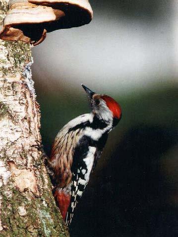
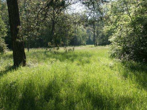
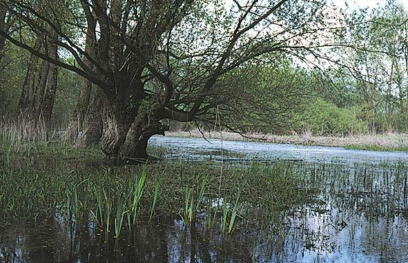
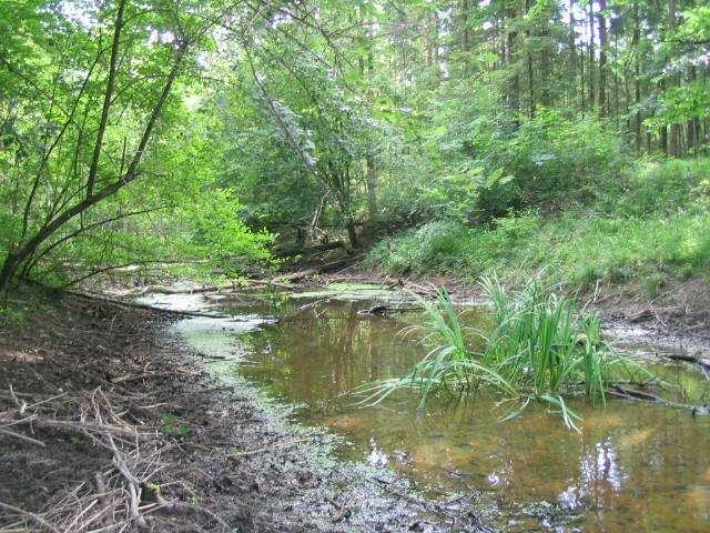
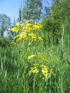
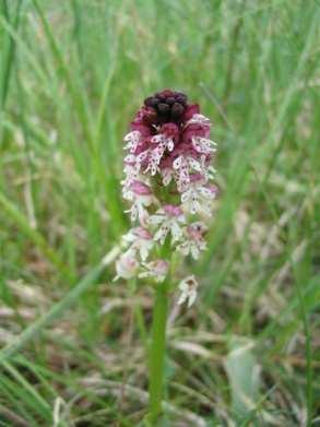
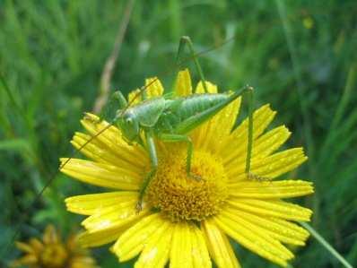
5 softwood riparian forest calcareous grasslands ruderal habitats hardwood riparian forest Gerald Blasch Danube Parks - Task Force Meeting Bratislava, 27th 28th January
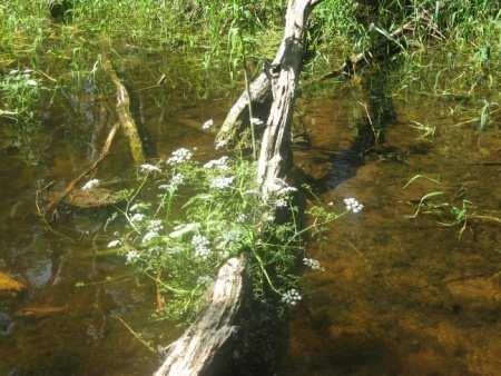
6 Status quo No river continuity No water and soil dynamics in the floodplain, no connection between river and floodplain (except from flooding > m 3 /s) Partly high groundwater level Change of vegetation from typical riparian and floodplain species to terrestrial or wetland species Lost of dynamic ruderal habitats (ox-bows, gravel banks, undercut slopes ) Gerald Blasch Danube Parks - Task Force Meeting Bratislava, 27th 28th January


7 Former dynamics still readable Laser DTM, resolution 2 m Gerald Blasch Danube Parks - Task Force Meeting Bratislava, 27th 28th January
8 The project Idea Hydrological process is key process for: morphological dynamics and water dynamics therefore it is a precondition for vegetation and fauna Aim Bring back dynamics to the floodplain and Reconnect floodplain and river In charge Water-Management Authority Ingolstadt Gerald Blasch Danube Parks - Task Force Meeting Bratislava, 27th 28th January

9 The project: Bypass Bergheim barrage Bergheim barrage Effects river continuity hydromorphological dynamics new riparian and aquatic habitats improved groundwater dynamics Return flow weir Return flow weir Technical data permanent flow of m 3 /s total length 9 km new water course or temporary water bodies Gerald Blasch Danube Parks - Task Force Meeting Bratislava, 27th 28th January


10 The project: Bypass Bergheim barrage Gerald Blasch Danube Parks - Task Force Meeting Bratislava, 27th 28th January
 2 or 3 times a year, duration 5-10 days main flowing of water is along the bypass,")
11 The project: ecological flooding Bergheim barrage Effects more frequent floods adjusted to the Danube improved groundwater dynamics restoration of floodplain habitat relicts development of new floodplain habitats Weir Technical data runoff up to 30 m 3 /s during peak discharge of the Danube ( m 3 /s) 2 or 3 times a year, duration 5-10 days main flowing of water is along the bypass, return at different sites man-controlled Gerald Blasch Danube Parks - Task Force Meeting Bratislava, 27th 28th January
12 Natural floods: Danube more than m 3 /s Weir man-controlled flooding Bypass weir Gerald Blasch Danube Parks - Task Force Meeting Bratislava, 27th 28th January
13 New dynamics Natural flood Man-controlled flooding (up to 30 m 3 /s) Bypass permant water course (ca. 2-5 m 3 /s) Danube Dam Ox-bow Ox-bow Gerald Blasch Danube Parks - Task Force Meeting Bratislava, 27th 28th January
14 The project: temporary drainage Bergheim barrage Effects temporary drawdown of permanent high groundwater level the adequate water level is part of the research program restoration of floodplain habitats instead of wetland habitats Technical data new drainage channel in the water storage area of Ingolstadt two locks of the return courses of the new river, sluice in the dike man-controlled, during low water level of the Danube Gerald Blasch Danube Parks - Task Force Meeting Bratislava, 27th 28th January

15 Floodplain Institute Neuburg/Danube Gerald Blasch Danube Parks - Task Force Meeting Bratislava, 27th 28th January
16 Task Force Monitoring of floodplain-ecological processes Cath. University Eichstätt-Ingolstadt Component II: Fluvial morphodynamic, Soil moisture and Groundwater Technical University München / Bavarian Academy of Forestry Component V: Tree species development and Vitality University Weihenstephan-Triesdorf Component III: Monitoring of Vegetation University Osnabrück Component IV: Transformation of water and riparian vegetation Cath. University Eichstätt-Ingolstadt / Floodplain Institut Neuburg Component I: Projetc management Technical University München Comonent VI: Survey and Monitoring of floodplain fauna University Weihenstephan-Triesdorf / Cath. University Eichstätt-Ingolstadt Component VII: Biodiversity and environmental education Gerald Blasch Danube Parks - Task Force Meeting Bratislava, 27th 28th January

17 Thank you for your attention! Gerald Blasch Danube Parks - Task Force Meeting Bratislava, 27th 28th January
The Danube River. Hydrological Connectivity and Human Influence. By: Pat O Connell, Pat Wilkins, Tiana Royer, and Kevin Gaitsch
 The Danube River Hydrological Connectivity and Human Influence By: Pat O Connell, Pat Wilkins, Tiana Royer, and Kevin Gaitsch Danube River Characteristics Length: 2860 km Drainage Area: 816,000 km 2 Peak
Fact sheet: Glacial rivers (all Europe)
") Fact sheet: Glacial rivers (all Europe) General description Valleyplanform Hydrology and The valley form varies from a gorge to a V-shaped valley and the single-thread channel is mainly characterized by
Fact sheet: Glacial rivers (all Europe) General description Valleyplanform Hydrology and The valley form varies from a gorge to a V-shaped valley and the single-thread channel is mainly characterized by
Wetland & Floodplain Functional Assessments and Mapping To Protect and Restore Riverine Systems in Vermont. Mike Kline and Laura Lapierre Vermont DEC
 Wetland & Floodplain Functional Assessments and Mapping To Protect and Restore Riverine Systems in Vermont Mike Kline and Laura Lapierre Vermont DEC NWI+ Hydro-Geomorphic Characterization of Wetlands and
Pilot-Project Project Bad Deutsch Altenburg:
 Pilot-Project Project Bad Deutsch Altenburg: River Restoration and Prevention of Riverbed-Erosion in the Danube Floodplain National Park (Austria) Stefan Schneeweihs Mohács, 2013 11 18 Pictures: F. Kovacs,
Lower South Fork McKenzie River Floodplain Enhancement Project
 Lower South Fork McKenzie River Floodplain Enhancement Project McKenzie River Ranger District Willamette National Forest Project Location The project is located in the South Fork McKenzie River Watershed,
Why Geomorphology for Fish Passage
 Channel Morphology - Stream Crossing Interactions An Overview Michael Love Michael Love & Associates mlove@h2odesigns.com (707) 476-8938 Why Geomorphology for Fish Passage 1. Understand the Scale of the
The River Restoration Centre therrc.co.uk. Understanding Fluvial Processes: supporting River Restoration. Dr Jenny Mant
 The River Restoration Centre therrc.co.uk Understanding Fluvial Processes: supporting River Restoration Dr Jenny Mant Jenny@therrc.co.uk Understanding your catchment Hydrology Energy associated with the
Licca Liber - the free Lech
 Licca Liber - the free Lech Source: W. Schilling WWA Donauwörth The river Lech an overview Hydrography / Hydrology catchment area 4000 km² Length 256 km Delta H 1100 m Slope Ø 0,4 % discharge in Augsburg
Sediment management plans in French mountainous catchments with illustrations from emblematic projects Dr. Benoit Terrier
 Sediment management plans in French mountainous catchments with illustrations from emblematic projects Dr. Benoit Terrier Agence de l Eau Rhône Méditerranée et Corse, FRANCE Presentation layout 1. The
Assessment. Assessment
 2001 SPRINGBROOK CREEK RESTORATION - THREE YEAR POST-CONSTRUCTION REVIEW - Presented by Bruce Henderson and Andy Harris 2005 River Restoration Northwest Symposium Skamania Lodge, Washington www.hendersonlandservices.com
Restoring Meanders to Straightened Rivers 1.7 Reconnecting remnant meanders
 .7 Reconnecting remnant meanders River Little Ouse Location - Thetford, Norfolk TL87082 Date of construction - 994 Length 900m Cost 5,000 Maximum extent of flooding during winter floods BTO boundary Small
!"#$%&&'()*+#$%(,-./0*)%(!
*+#$%(,-./0*)%(!") 8:30 Sign in Hoosic River Revival Coalition!"#$%&&'()*+#$%(,-./0*)%(! 12-#30+4/#"5-(60 9:00 Welcome and Introductions 9:15 Goals for Today s Program: A Description of the Planning Process 9:30 First Session:
8:30 Sign in Hoosic River Revival Coalition!"#$%&&'()*+#$%(,-./0*)%(! 12-#30+4/#"5-(60 9:00 Welcome and Introductions 9:15 Goals for Today s Program: A Description of the Planning Process 9:30 First Session:
Gully Erosion Part 1 GULLY EROSION AND ITS CAUSES. Introduction. The mechanics of gully erosion
 Gully Erosion Part 1 GULLY EROSION AND ITS CAUSES Gully erosion A complex of processes whereby the removal of soil is characterised by incised channels in the landscape. NSW Soil Conservation Service,
Biodiversity Blueprint Overview
 Biodiversity Blueprint Overview Climate Variability Climate projections for the Glenelg Hopkins Regions suggest that the weather will be hotter and drier in the coming years which will impact on land use,
Ground Water Control of Tree Island Origin, Genesis and Destruction. By John F. Meeder and Peter W. Harlem SERC,FIU
 Ground Water Control of Tree Island Origin, Genesis and Destruction By John F. Meeder and Peter W. Harlem SERC,FIU Functional Definition Our functional definition of a Tree Island is; an isolated scrub
How Do Human Impacts and Geomorphological Responses Vary with Spatial Scale in the Streams and Rivers of the Illinois Basin?
 How Do Human Impacts and Geomorphological Responses Vary with Spatial Scale in the Streams and Rivers of the Illinois Basin? Bruce Rhoads Department of Geography University of Illinois at Urbana-Champaign
SCOPE OF PRESENTATION STREAM DYNAMICS, CHANNEL RESTORATION PLANS, & SEDIMENT TRANSPORT ANALYSES IN RELATION TO RESTORATION PLANS
 DESIGN METHODS B: SEDIMENT TRANSPORT PROCESSES FOR STREAM RESTORATION DESIGN PETER KLINGEMAN OREGON STATE UNIVERSITY CIVIL ENGINEERING DEPT., CORVALLIS 2 ND ANNUAL NORTHWEST STREAM RESTORATION DESIGN SYMPOSIUM
Upper Drac River restoration project
 Upper Drac River restoration project Restoration of a braided river bed incised in clay substratum through sediment reloading and bed widening SHF Conference, Nantes, 6 & 7 october 2014 Small scale morphological
New Forest SSSI Geomorphological Survey Overview
 Natural England Commissioned Report NECR140 New Forest SSSI Geomorphological Survey Overview Annex C: Amberwood / Alderhill Restoration Plan - SSSI Unit 66 First published 06 March 2014 www.naturalengland.org.uk
Implementing a Project with 319 Funds: The Spring Brook Meander Project. Leslie A. Berns
 Implementing a Project with 319 Funds: The Spring Brook Meander Project Leslie A. Berns "...to acquire... and hold lands... for the purpose of protecting and preserving the flora, fauna and scenic beauties...
Birch Creek Geomorphic Assessment and Action Plan
 Birch Creek Geomorphic Assessment and Action Plan Jim Webster Tim Hanrahan, PhD, CFM Jesse Schwartz, PhD Zach Hill January 22, 2015 White Eagle Grange This Project is a First Step in Strategy Planning
Influence of the Major Drainages to the Mississippi River and Implications for System Level Management
 Influence of the Major Drainages to the Mississippi River and Implications for System Level Management Brian M. Vosburg Geologist Louisiana Coastal Protection and Restoration Authority brian.vosburg@la.gov
Technical note about the monitoring of hydromorphological restoration/management of the Drava River in Slovenia
 Technical note about the monitoring of hydromorphological restoration/management of the Drava River in Slovenia 1 Project: HyMoCARES Work package: WPC. Communication Activity: Web Site Deliverable: Case
Removal of riverbank protection along the River Rhine (the Netherlands)
") RR 2004 3rd European Conference on River Restoration RIVER RESTORATION 2004 Zagreb, Croatia, 17-21 May 2004 Removal of riverbank protection along the River Rhine (the Netherlands) L.J. Bolwidt, H.E.J.
RR 2004 3rd European Conference on River Restoration RIVER RESTORATION 2004 Zagreb, Croatia, 17-21 May 2004 Removal of riverbank protection along the River Rhine (the Netherlands) L.J. Bolwidt, H.E.J.
RESTORATION DESIGN FOR REROUTED WATERCOURSES
 With thanks to: Thames Water Utilities Limited RESTORATION DESIGN FOR REROUTED WATERCOURSES Project Design Team Colin Thorne, Nick Clifford Gary Priestnall Philip Soar Kieran Conlan, Steve Dangerfield
Stream Geomorphology. Leslie A. Morrissey UVM July 25, 2012
 Stream Geomorphology Leslie A. Morrissey UVM July 25, 2012 What Functions do Healthy Streams Provide? Flood mitigation Water supply Water quality Sediment storage and transport Habitat Recreation Transportation
Flow regime, floodplain inundation and floodplain waterbody connectivity at Congaree National Park
 Flow regime, floodplain inundation and floodplain waterbody connectivity at Congaree National Park John Kupfer Dept. of Geography Univ. of South Carolina Kimberly Meitzen Duke University Nature Conservancy
Katarina Holubova & Franz Steiner. Joint efforts for cross-border restoration of the Morava river
 Katarina Holubova & Franz Steiner Joint efforts for cross-border restoration BACKGROUND INFORMATION AUSTRIA LOCALITY THE MORAVA RIVER IS THE DANUBE LEFT SIDE TRIBUTARY IN THE LENGTH OF 70 KM FORMS INTERNATIONALLY
Stream Restoration and Environmental River Mechanics. Objectives. Pierre Y. Julien. 1. Peligre Dam in Haiti (deforestation)
") Stream Restoration and Environmental River Mechanics Pierre Y. Julien Malaysia 2004 Objectives Brief overview of environmental river mechanics and stream restoration: 1. Typical problems in environmental
Stream Restoration and Environmental River Mechanics Pierre Y. Julien Malaysia 2004 Objectives Brief overview of environmental river mechanics and stream restoration: 1. Typical problems in environmental
Upper Truckee River Restoration Lake Tahoe, California Presented by Brendan Belby Sacramento, California
 Upper Truckee River Restoration Lake Tahoe, California Presented by Brendan Belby Sacramento, California Mike Rudd (Project Manager), Charley Miller & Chad Krofta Declines in Tahoe s Water Clarity The
Consequences of river regulation works: altered fluvial processes + increasing flood hazard
 Consequences of river regulation works: altered fluvial processes + increasing flood hazard Dr. Tímea Kiss assistant professor Department of Physical Geography and Geoinformatics, University of Szeged,
EAGLES NEST AND PIASA ISLANDS
 EAGLES NEST AND PIASA ISLANDS HABITAT REHABILITATION AND ENHANCEMENT PROJECT MADISON AND JERSEY COUNTIES, ILLINOIS ENVIRONMENTAL MANAGEMENT PROGRAM ST. LOUIS DISTRICT FACT SHEET I. LOCATION The proposed
HAW CREEK, PIKE COUNTY, MISSOURI-TRIB TO SALT RIVER ERODING STREAM THREATHENING COUNTY ROAD #107, FOURTEEN FT TALL ERODING BANK WITHIN 4 FT OF THE
 HAW CREEK, PIKE COUNTY, MISSOURI-TRIB TO SALT RIVER ERODING STREAM THREATHENING COUNTY ROAD #107, FOURTEEN FT TALL ERODING BANK WITHIN 4 FT OF THE ROAD, PROJECT CONSTRUCTED IN 1 DAY, MARCH 10, 2009 BY
Tom Ballestero University of New Hampshire. 1 May 2013
 Tom Ballestero University of New Hampshire 1 May 2013 1 Hydrology 2 Basic Hydrology Low flows most common Flows that fill the stream to the banks and higher are much less common Filling the stream to the
Dr.ing.Iulian Nichersu, Dr. Ing. Iuliana Nichersu 1
 Dr.ing.Iulian Nichersu, Dr. Ing. Iuliana Nichersu 1 Biodiversity Research Maliuc 1. Environmental Impact Assessment 2. Inventory & monitoring of biodiversity (habitats, plants, invertebrates, vertebrates)
River Restoration and Rehabilitation. Pierre Y. Julien
 River Restoration and Rehabilitation Pierre Y. Julien Department of Civil and Environmental Engineering Colorado State University Fort Collins, Colorado River Mechanics and Sediment Transport Lima Peru
River Response. Sediment Water Wood. Confinement. Bank material. Channel morphology. Valley slope. Riparian vegetation.
 River Response River Response Sediment Water Wood Confinement Valley slope Channel morphology Bank material Flow obstructions Riparian vegetation climate catchment vegetation hydrological regime channel
CR AAO Bridge. Dead River Flood & Natural Channel Design. Mitch Koetje Water Resources Division UP District
 CR AAO Bridge Dead River Flood & Natural Channel Design Mitch Koetje Water Resources Division UP District Old County Road AAO Bridge Map courtesy of Marquette County Silver Lake Basin McClure Basin
Solutions to Flooding on Pescadero Creek Road
 Hydrology Hydraulics Geomorphology Design Field Services Photo courtesy Half Moon Bay Review Solutions to Flooding on Pescadero Creek Road Prepared for: San Mateo County Resource Conservation District
Watershed concepts for community environmental planning
 Purpose and Objectives Watershed concepts for community environmental planning Dale Bruns, Wilkes University USDA Rural GIS Consortium May 2007 Provide background on basic concepts in watershed, stream,
Managing sediment continuity at hydropower dams : conceptual and operational approach
 Workshop 2 : Planning, managing and restoring hydromorphology at river basin scale, within an ecosystem services framework Managing sediment continuity at hydropower dams : conceptual and operational approach
Geomorphology Of The Chilliwack River Watershed Landform Mapping At North Cascades National Park Service Complex, Washington By National Park Service
 Geomorphology Of The Chilliwack River Watershed Landform Mapping At North Cascades National Park Service Complex, Washington By National Park Service READ ONLINE Snowshed contributions to the Nooksack
UGRC 144 Science and Technology in Our Lives/Geohazards
 UGRC 144 Science and Technology in Our Lives/Geohazards Flood and Flood Hazards Dr. Patrick Asamoah Sakyi Department of Earth Science, UG, Legon College of Education School of Continuing and Distance Education
SusWater WP6 Status desember 2017
 SusWater WP6 Status desember 2017 Mesohabitater / strømningstyper Elvetyper Workshops Leveranser WP6 Forsker-workshops Nordisk vannforvaltning EU WFD Ad-hoc task force HyMo Notater og rapporter Test av
SESSION 6: FLUVIAL LANDFORMS
 SESSION 6: FLUVIAL LANDFORMS KEY CONCEPTS: Fluvial Landforms Management of River Catchment Areas Slope Elements X-PLANATION: FLUVIAL LANDFORMS Rivers form landforms as they erode the landscape. These landforms
Best Management Practices for Coldwater Fisheries Enhancement and Restoration
 Best Management Practices for Coldwater Fisheries Enhancement and Restoration MACC Annual Environmental Conference 2017 March 3, 2017 Tim Dexter, MassDOT Highway Division 1 Leading the Nation in Transportation
Conceptual Model of Stream Flow Processes for the Russian River Watershed. Chris Farrar
 Conceptual Model of Stream Flow Processes for the Russian River Watershed Chris Farrar Several features of creeks affect the interactions between surface and groundwater. This conceptual model uses the
Running Water Earth - Chapter 16 Stan Hatfield Southwestern Illinois College
 Running Water Earth - Chapter 16 Stan Hatfield Southwestern Illinois College Hydrologic Cycle The hydrologic cycle is a summary of the circulation of Earth s water supply. Processes involved in the hydrologic
APPENDIX E. GEOMORPHOLOGICAL MONTORING REPORT Prepared by Steve Vrooman, Keystone Restoration Ecology September 2013
 APPENDIX E GEOMORPHOLOGICAL MONTORING REPORT Prepared by Steve Vrooman, Keystone Restoration Ecology September 2 Introduction Keystone Restoration Ecology (KRE) conducted geomorphological monitoring in
Identifying, Understanding and Addressing Flood-Related Hazards
 Identifying, Understanding and Addressing Flood-Related Hazards Julie Moore, P.E. July 9, 2012 Agenda Traditional approach to river management Understanding flood-related hazards Common flood and flood
Perspectives on river restoration science, geomorphic processes, and channel stability
 Perspectives on river restoration science, geomorphic processes, and channel stability Stream Restoration Forum: Science and Regulatory Connections Andrew C. Wilcox Department of Geosciences University
Sediment management: a european perspective. Piet den Besten Centre for Water Management Rijkswaterstaat, Netherlands
 Sediment management: a european perspective Piet den Besten Centre for Water Management Rijkswaterstaat, Netherlands Content Background of Dutch-German exchange (DGE plus) What is needed for adequate sediment
Kootenai River Habitat Restoration Program Update
 Kootenai River Habitat Restoration Program Update Kootenai Tribe of Idaho Kootenai Valley Resource Initiative November 19, 2012 Bonners Ferry, Idaho Changes to Kootenai Basin Beaver trapping Floodplain
When Creek Meets Valley Wall: Prioritizing Erosion Mitigation alongside the Oshawa Landfill
 1 When Creek Meets Valley Wall: Prioritizing Erosion Mitigation alongside the Oshawa Landfill Robin McKillop 1, Dan McParland 1 & Cassie Scobie 2 TRIECA conference March 22-23, 2017 1 Palmer Environmental
The Imperative of Sediment Management Concepts in River Basin Management Plans
 The Imperative of Sediment Management Concepts in River Basin Management Plans Stefan Vollmer, Thomas Hoffmann, Gudrun Hillebrand, Ina Quick, Axel Winterscheid Department M3 Groundwater, Geology, River
Instream Sediment Control Systems
 Instream Sediment Control Systems INSTREAM PRACTICES Photo 1 Photo 2 Modular sediment The information contained within this series of fact sheets deals only with the design of temporary instream sediment
Consulting Services (Pty.) Ltd.
 Ltd.") Wetland Consulting Services (Pty.) Ltd. 98/726/07 P.O. Box 72295 Lynnwood Ridge Pretoria 0040 Consulting Services (Pty.) Ltd. Specialist wetland and riparian consultants Room S 57 Building 33 CSIR Meiring
Wetland Consulting Services (Pty.) Ltd. 98/726/07 P.O. Box 72295 Lynnwood Ridge Pretoria 0040 Consulting Services (Pty.) Ltd. Specialist wetland and riparian consultants Room S 57 Building 33 CSIR Meiring
FOREST RESEARCH INSTITUTE, DEHRADUN
 PROJECT REPORT DRAINAGE AND REPLENISHMENT STUDY OF MINED AREA OF GANGA SHYAMPUR RIVER HARIDWAR Submitted to UTTARAKHAND FOREST DEVELOPMENT CORPORATION (UFDC) 73, Nehru Road, Deharadun Prepared&Submitted
Influence of Morphological Changes on Ecology: A Cascade of Scales
 Influence of Morphological Changes on Ecology: A Cascade of Scales Prof. Dr.-Ing. Silke Wieprecht University Stuttgart Institute of Hydraulic Engineering Department of Hydraulic Engineering and Water Resources
Introduction Fluvial Processes in Small Southeastern Watersheds
 Introduction Fluvial Processes in Small Southeastern Watersheds L. Allan James Scott A. Lecce Lisa Davis Southeastern Geographer, Volume 50, Number 4, Winter 2010, pp. 393-396 (Article) Published by The
Fresh Water: Streams, Lakes Groundwater & Wetlands
 Fresh Water:, Lakes Groundwater & Wetlands Oct 27 Glaciers and Ice Ages Chp 13 Nov 3 Deserts and Wind and EXAM #3 Slope hydrologic cycle P = precip I = precip intercepted by veg ET = evapotranspiration
Introduction to the Hydrogeomorphic (HGM) Classification System
 Classification System") Introduction to the Hydrogeomorphic (HGM) Classification System Objectives The Student Will be Able to: Define the 7 HGM Classes List the 3 Parameters That Define HGM Classes List the Major Water Budget
Introduction to the Hydrogeomorphic (HGM) Classification System Objectives The Student Will be Able to: Define the 7 HGM Classes List the 3 Parameters That Define HGM Classes List the Major Water Budget
DAM REMOVAL ENGINEERING ISSUES & OPTIONS
 DAM REMOVAL ENGINEERING ISSUES & OPTIONS Presented by: James G. Mac Broom, P.E. Milone & Mac Broom, Inc. October 2011 CLEAR GOALS and OBJECTIVES Fish Passage Habitat Defragmentation Water Quality Dam Failure
Hydrologic Analysis for Ecosystem Restoration
 Hydrologic Analysis for Ecosystem Restoration Davis, California Objectives: To provide participants with: 1) an understanding of the issues in restoration studies; 2) an overview of Corps policies and
Limitation to qualitative stability indicators. the real world is a continuum, not a dichotomy ~ 100 % 30 % ~ 100 % ~ 40 %
 Stream Stability Assessment & BEHI Surveys Joe Rathbun MDEQ Water Resources Division rathbunj@michigan.gov 517--373 517 373--8868 Stability Stream can transport its water and sediment inputs without changing
BASIS FOR RIVER RESTORATION PROJECT
 The FLUVIO FCT-Doctoral Program Hydromorphological and Habitat Restoration Course Diego García de Jalón and Marta González del Tánago, UPM Madrid BASIS FOR RIVER RESTORATION PROJECT Throughout the course,
Continuing Education Associated with Maintaining CPESC and CESSWI Certification
 Continuing Education Associated with Maintaining CPESC and CESSWI Certification Module 2: Stormwater Management Principles for Earth Disturbing Activities Sponsors: ODOTs Local Technical Assistance Program
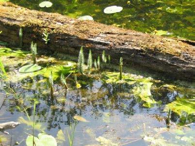
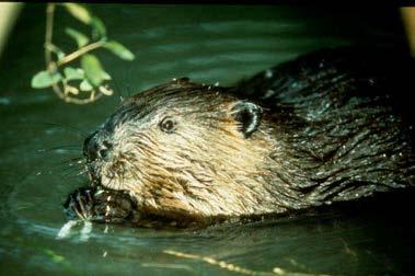
Beaver Dam Influence on Wet Meadow Habitat
 Beaver Dam Influence on Wet Meadow Habitat HOPE FISHER WRITER S COMMENT: I ve always been fascinated by the natural world. This deep appreciation for nature and passion for conservation inspired me to
DANUBEparksCONNECTED WP 3 WILDisland
 DANUBEparksCONNECTED WP 3 WILDisland Towards a Danube Wild Island Habitat Corridor WP responsible partner: Duna Ipoly National Park Total Budget: 680.959,20 Act. 3.1: Danube WILDisland learning process
Geomorphology Studies
 Geomorphology Studies Technical Workgroup Meeting February 14, 2012 Prepared by: Tetra Tech Prepared for: Alaska Energy Authority Overall Goal Geomorphology Studies Two studies Geomorphology Study (RSP
Strategies for managing sediment in dams. Iwona Conlan Consultant to IKMP, MRCS
 Strategies for managing sediment in dams Iwona Conlan Consultant to IKMP, MRCS 1 Sediment trapping by dams Active storage capacity Dead storage coarse material (bed load) Fine materials (suspension) Francis
Streams. Stream Water Flow
 CHAPTER 14 OUTLINE Streams: Transport to the Oceans Does not contain complete lecture notes. To be used to help organize lecture notes and home/test studies. Streams Streams are the major geological agents
Fish Passage at Road Crossings
 Fish Passage at Road Crossings 1 Crossing Design Workshop Outline 1:00 to 2:00 Intro, Design Overview, Channel Width 2:00 to 2:15 Break 2:15 to 3:15 No-Slope, Stream Simulation Design 3:15 to 3:30 Break
Four Mile Run Levee Corridor Stream Restoration
 Four Mile Run Levee Corridor Stream Restoration 30% Design Summary U.S. Army Corps of Engineers, Baltimore District Presentation Outline Four Mile Run 1.) Historic Perspective 2.) Existing Conditions 3.)
Danube Sediment Management Restoration of Sediment Balance in the Danube A still ongoing project preparation
 Annual Steakholder Seminar Protecting the Environment EU SDR Budapest, 6 November, 2012 Danube Sediment Management Restoration of Sediment Balance in the Danube A still ongoing project preparation Values
Savannah District s Revised SOP: Moving Towards A Functional Approach. US Army Corps of Engineers BUILDING STRONG
 Savannah District s Revised SOP: Moving Towards A Functional Approach US Army Corps of Engineers Agenda SOP Revision Concept New Aquatic Resource Credit Types New Urban Mitigation Service Area Filter Background
Sediment Weirs (Instream)
") Sediment Weirs (Instream) INSTREAM PRACTICES Flow Control No Channel Flow Dry Channels Erosion Control Low Channel Flows Shallow Water Sediment Control High Channel Flows [1] Deep Water [1] Sediment weirs
Sediment Weirs (Instream) INSTREAM PRACTICES Flow Control No Channel Flow Dry Channels Erosion Control Low Channel Flows Shallow Water Sediment Control High Channel Flows [1] Deep Water [1] Sediment weirs
Overview of fluvial and geotechnical processes for TMDL assessment
 Overview of fluvial and geotechnical processes for TMDL assessment Christian F Lenhart, Assistant Prof, MSU Research Assoc., U of M Biosystems Engineering Fluvial processes in a glaciated landscape Martin
Ecosystems Chapter 4. What is an Ecosystem? Section 4-1
 Ecosystems Chapter 4 What is an Ecosystem? Section 4-1 Ecosystems Key Idea: An ecosystem includes a community of organisms and their physical environment. A community is a group of various species that
[1] Performance of the sediment trap depends on the type of outlet structure and the settling pond surface area.
![[1] Performance of the sediment trap depends on the type of outlet structure and the settling pond surface area.](/thumbs/76/74245181.jpg "[1] Performance of the sediment trap depends on the type of outlet structure and the settling pond surface area.") Sediment Trench SEDIMENT CONTROL TECHNIQUE Type 1 System Sheet Flow Sandy Soils Type 2 System [1] Concentrated Flow Clayey Soils Type 3 System [1] Supplementary Trap Dispersive Soils [1] Performance of
Sediment Trench SEDIMENT CONTROL TECHNIQUE Type 1 System Sheet Flow Sandy Soils Type 2 System [1] Concentrated Flow Clayey Soils Type 3 System [1] Supplementary Trap Dispersive Soils [1] Performance of
Numerical modelling of morphological stability of proposed restoration measures along the Havel River
 Numerical modelling of morphological stability of proposed restoration measures along the Havel River Small scale morphological evolution of coastal, estuarine and rivers systems 6 7 October 2014, Nantes,
APPROACH TO THE SPANISH WATER ORGANISATION IMPROVING FLOOD HAZARD MAPPING, LAWS AND AUTHORITIES COORDINATION
 "Workshop On Land Use Planning And Water Management, With Focus On Flood Risk Management Oslo, Norway. Wednesday 31 January and Thursday 1 February 2007 APPROACH TO THE SPANISH WATER ORGANISATION IMPROVING
Bank Erosion and Morphology of the Kaskaskia River
 Bank Erosion and Morphology of the Kaskaskia River US Army Corps Of Engineers St. Louis District Fayette County Soil and Water Conservation District Team Partners : Carlyle Lake Ecosystem Partnership Vicinity
ADDRESSING GEOMORPHIC AND HYDRAULIC CONTROLS IN OFF-CHANNEL HABITAT DESIGN
 ADDRESSING GEOMORPHIC AND HYDRAULIC CONTROLS IN OFF-CHANNEL HABITAT DESIGN Conor Shea - Hydrologist U.S. Fish and Wildlife Service Conservation Partnerships Program Arcata, CA Learning Objectives Examine
Griswold Creek August 22, 2013
 Creek August 22, 2013 1 Lake Erie Protection Fund Creek Study ver Evaluate the overall condition of Creek Determine stable channel dimensions & appropriate restoration techniques Starting Stat gpoint for
Figure 1. Which part of the river is labelled in Figure 1? a) Mouth b) Source c) Lower course d) channel
 Mouth b) Source c) Lower course d) channel") Rivers 1. Study Figure 1 showing the long profile of a river Figure 1 A Which part of the river is labelled in Figure 1? a) Mouth b) Source c) Lower course d) channel (1 mark) 2. Complete the sentences
Rivers 1. Study Figure 1 showing the long profile of a river Figure 1 A Which part of the river is labelled in Figure 1? a) Mouth b) Source c) Lower course d) channel (1 mark) 2. Complete the sentences
APPENDIX B WORKSHEETS & EXHIBITS
 APPENDIX B WORKSHEETS & EXHIBITS A worksheet provides the designer a representation of a measure that allows for input of specific design criteria. The plan designer will be required to assess field conditions
Rock Sizing for Waterway & Gully Chutes
 Rock Sizing for Waterway & Gully Chutes WATERWAY MANAGEMENT PRACTICES Photo 1 Rock-lined waterway chute Photo 2 Rock-lined gully chute 1. Introduction A waterway chute is a stabilised section of channel
Where
 Where What Past Updated Construction Parameters Assumed start date 2030 6 year bulk EW duration plus approx. 1 year enabling works and early construction activities Enabling and early activities includes
Sediment and nutrient transport and storage along the urban stream corridor
 Sediment and nutrient transport and storage along the urban stream corridor Greg Noe, Cliff Hupp, Ed Schenk, Jackie Batson, Nancy Rybicki, Allen Gellis What is the role of floodplains everywhere? Noe 2013,
Discharge. Discharge (Streamflow) is: Q = Velocity (L T -1 ) x Area (L 2 ) Units: L 3 T -1 e.g., m 3 s -1. Velocity. Area
 is: Q = Velocity (L T -1 ) x Area (L 2 ) Units: L 3 T -1 e.g., m 3 s -1. Velocity. Area") Discharge Discharge (Streamflow) is: Q = Velocity (L T -1 ) x Area (L 2 ) Units: L 3 T -1 e.g., m 3 s -1 Velocity Area Where is the average velocity?? 3 Source: Brooks et al., Hydrology and the Management
Discharge Discharge (Streamflow) is: Q = Velocity (L T -1 ) x Area (L 2 ) Units: L 3 T -1 e.g., m 3 s -1 Velocity Area Where is the average velocity?? 3 Source: Brooks et al., Hydrology and the Management
What discharge (cfs) is required to entrain the D 84 (84 th percentile of sediment size distribution) in Red Canyon Wash?
 is required to entrain the D 84 (84 th percentile of sediment size distribution) in Red Canyon Wash?") Gregory Indivero 31 October 2011 What discharge (cfs) is required to entrain the D 84 (84 th percentile of sediment size distribution) in Red Canyon Wash? What discharge was required to deposit observed
Gregory Indivero 31 October 2011 What discharge (cfs) is required to entrain the D 84 (84 th percentile of sediment size distribution) in Red Canyon Wash? What discharge was required to deposit observed
Ways To Identify Background Verses Accelerated Erosion
 Ways To Identify Background Verses Accelerated Erosion Establish Background Condition From Old Ground Photos, Aerial Photos, and Maps Compare Rate Over Time At the Same Location, or for Reaches Channel
WQ Outlet Design Single Orifice Orifice diameter = 24. Perforated riser/orifice Plate Outlet area per perforation row = 4
 These calculations should be used when designing the outlet structures for extended wet and dry detention basins (Sections 4. 7 and 4.8). The water quality outlet size and the trash rack design will vary
Diagnostic Geomorphic Methods for Understanding Future Behavior of Lake Superior Streams What Have We Learned in Two Decades?
 Diagnostic Geomorphic Methods for Understanding Future Behavior of Lake Superior Streams What Have We Learned in Two Decades? Faith Fitzpatrick USGS WI Water Science Center, Middleton, WI fafitzpa@usgs.gov
Lecture 10: River Channels
 GEOG415 Lecture 10: River Channels 10-1 Importance of channel characteristics Prediction of flow was the sole purpose of hydrology, and still is a very important aspect of hydrology. - Water balance gives
Defining Hydromorphological Conditions and Links to Ecology. The changing role of Geomorphology in River Management and Restoration
 Defining Hydromorphological Conditions and Links to Ecology The changing role of Geomorphology in River Management and Restoration Colin Thorne University of Nottingham Topic 1 1. How has the role of fluvial
2018 Geography Mock Examination
 2018 Geography Mock Examination Your Geography mock examination will test your understanding of Paper 1 (Living with the physical environment) and Section B (Fieldwork) from Paper 2. Attached are the necessary
WORKSHOP #2 [Modeling and Sediment Transfers Review of alternative solutions] Bucharest 07 October 2015
![WORKSHOP #2 [Modeling and Sediment Transfers Review of alternative solutions] Bucharest 07 October 2015](/thumbs/82/85703998.jpg "WORKSHOP #2 [Modeling and Sediment Transfers Review of alternative solutions] Bucharest 07 October 2015") STUDIU DE FEZABILITATE PENTRU SOLUŢII TEHNICE ALTERNATIVE/COMPLEMENTARE PRIVIND LUCRĂRILE CE SE VOR EXECUTA ÎN PUNCTUL CRITIC 01 BALA DIN CADRUL PROIECTULUI ÎMBUNĂTĂŢIREA CONDIŢIILOR DE NAVIGAŢIE PE DUNĂRE
STUDIU DE FEZABILITATE PENTRU SOLUŢII TEHNICE ALTERNATIVE/COMPLEMENTARE PRIVIND LUCRĂRILE CE SE VOR EXECUTA ÎN PUNCTUL CRITIC 01 BALA DIN CADRUL PROIECTULUI ÎMBUNĂTĂŢIREA CONDIŢIILOR DE NAVIGAŢIE PE DUNĂRE
RAILWAYS AND FISH: HOW TO PROTECT AND ENHANCE FISH HABITAT VALUES AT STREAM CROSSINGS THROUGH PROJECT DESIGN AND CONSTRUCTION
 RAILWAYS AND FISH: HOW TO PROTECT AND ENHANCE FISH HABITAT VALUES AT STREAM CROSSINGS THROUGH PROJECT DESIGN AND CONSTRUCTION Rail Environment Conference November 2016 AGENDA Objective Background Benefits