A geoscience solution that empowers exploration teams to work smarter, quicker and make more informed decisions.
|
|
|
- Melanie Smith
- 6 years ago
- Views:
Transcription

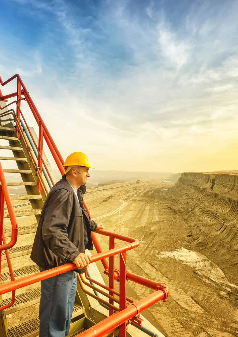
1 FOR METALS & MINING A geoscience solution that empowers exploration teams to work smarter, quicker and make more informed decisions. ESSENTIAL KNOWLEDGE FOR EXPLORATION Hundreds of thousands of scientific maps extracted from geologic publications EASY DISCOVERY OF MAPS AND OTHER SPATIAL DATA Intuitive search and discovery features help geoscientists find critical information quickly SEAMLESS WORKFLOW INTEGRATIONS Maps are actionable and can be integrated into essential geoscience workflow tools 1
2 Help your exploration teams manage through risk and uncertainty. WHY GEOFACETS Support exploration decisions with trusted geologic data: From general geology to specialized subject areas, Geofacets contains a diversified set of downloadable geologic maps that can help geoscientists characterize a region or basin, provide scientific backup for prioritizing exploration prospects and keep internal knowledge about a strategic area of interest up-to-date. Save time and increase team productivity: Geofacets offers hundreds of thousands of easily discoverable and georeferenced scientific maps aggregated from across trusted geologic publications so that geoscientists avoid manual searches and georeferencing work. THE CHALLENGE OF THE UNKNOWN For geoscientists and team leaders working in the metals and mining industry, the concepts of risk and uncertainty are everyday occurrences. Determining whether an economically viable mineral deposit exists beneath the subsurface is not an exact science and requires answers to challenging research questions. Whether exploring greenfields or brownfields, companies face huge economic risks when a project is not fully researched and vetted during the prospecting process. The biggest risk of all, however, is not having the right information at all or easily accessible and that is more often the case than not. Even when valuable information, such as scientific literature, maps and seismic data, is available, it s often buried in the literature, rendering it too time-consuming to draw conclusions from. The exploration geoscientist s work is integral to the bottom line, yet their time and research is often hampered by the lack of easily accessible, relevant information. When geoscientists spend too much time searching for information rather than analyzing it, projects delay and fail. In a tough economic environment, in a volatile industry, it s even more critical that exploration plays and assets are optimized. A SOLUTION THAT MAKES EXPLORATION MORE SEAMLESS Geofacets empowers geoscientists with an innovative, spatially-designed platform combined with hundreds of thousands of geologic maps and integration capabilities. With Geofacets, users quickly discover downloadable, georeferenced maps curated from trusted publications helping exploration teams make more informed decisions, mitigate risk and increase productivity. Geofacets offers: Essential geologic knowledge Hundreds of thousands of scientific maps extracted from geologic publications Easy discovery of maps and other spatial data Intuitive search and discovery features help geoscientists find critical information quickly Seamless workflow integrations Maps are actionable and can be integrated into essential geoscience workflow tools such as ArcGIS, Google Earth and more 2

3 ESSENTIAL GEOLOGIC KNOWLEDGE FOR NATURAL RESOURCE EXPLORATION Geofacets extracts scientific maps from vital geologic publications, like Ore Geology Reviews and Economic Geology, and aggregates them into our vast database. Geoscientists use Geofacets content to understand the geologic characteristics of an area, enhance analyses and interpretations, and integrate proprietary data with published information. Over 600,000 scientific maps sourced from esteemed geologic publications Carefully curated for relevance to exploration geoscientists Multi-disciplinary from foundational geologic maps to specialized subject area-based maps Read-only PDF of entire source article included with each map for added context Link to original source also included for full-rights access to source article Geofacets adds maps every month 3


4 EASY DISCOVERY OF MAPS AND OTHER SPATIAL DATA With Geofacets, geoscientists search for maps in the way they think spatially. Discover worldwide and regional content on an interactive map-based interface that makes searching seamless. - OR - Conduct a search by location Conduct a text-based search, including geographic metadata Results are displayed via clusters, as defined by map centerpoints Refine results using geologic facets, including map subject, map type and basin 4


5 Geofacets provides the ability to quickly access geoscience data for active and potential exploration areas. Information Specialist, Metals and Mining Company SEAMLESS WORKFLOW INTEGRATIONS Maps are downloadable into multiple file formats and can be seamlessly integrated into essential exploration workflow tools: ArcGIS TM Download a map in Geofacets as a GeoTIFF or shapefile and upload into ArcGIS TM Web Map Service/ Web Feature Service Display and discover Geofacets content index in any WMS-enabled platform Google Earth Download a map as a KMZ and upload into Google Earth Powerpoint Download a map as a JPEG and upload into PowerPoint 5
6 6
7 Geofacets accelerates exploration, reduces risk and helps validate decisions HOW GEOSCIENTISTS USE GEOFACETS Characterizing a mineral deposit or geographic area s geology Formulating specific questions, and points for use in asset acquisition or joint ventures Providing scientific backup for prioritizing exploration prospects Keeping internal knowledge for a region of strategic importance up-to-date Integrating proprietary maps and data with published information WHY COMPANIES/ORGANIZATIONS USE GEOFACETS Making more informed exploration decisions Better assessing risks Doing more with less resources and time 7
8 GEOFACETS EXTRACTS MAPS FROM ESSENTIAL GEOLOGIC PUBLICATIONS AND WORKS WITH SEVERAL ESTEEMED PUBLISHERS Elsevier is the world s leading provider of academic information, serving more than 30 million professionals worldwide. For over 40 years, Elsevier has provided the upstream oil & gas industry with trusted content from our books and journals, and innovative research tools like Geofacets. Applied Geochemistry Chemical Geology Chemie der Erde Geochemistry Cretaceous Research Earth and Planetary Science Letters Earth Science Frontiers Earth Science Reviews Geochimica et Cosmochimica Acta Geodinamica Acta Global and Planetary Change Gondwana Research International Journal of Coal Geology Journal of African Earth Sciences Journal of Asian Earth Sciences Journal of South East Asian Earth Sciences Journal of Geochemical Exploration Journal of Geodynamics Journal of Petroleum Science and Engineering Journal of South American Earth Sciences Journal of Structural Geology Journal of Unconventional Oil and Gas Resources Journal of Volcanology and Geothermal Research Lithos Marine and Petroleum Geology Marine Geology Marine Micropaleontology Ore Geology Reviews Organic Geochemistry Palaeogeography, Palaeoclimatology, Palaeoecology Palaeoworld Petroleum Exploration and Development Precambrian Research Russian Geology and Geophysics Sedimentary Geology Tectonophysics 1986 present 1988 present 2002 present 1980 present 1990 present present 1990 present present 1997 present 1980 present 1983 present 1997 present present 1984 present 1987 present 1988 present 1979 present 2013 present 2000 present 1997 present 1984 present 1964 present 1976 present 1986 present 1977 present 1993 present 2006 present 2008 present 1974 present 2007 present 1967 present 1964 present 8
9 SEG is an international organization committed to advancing the science and the discovery of mineral resources. The Society s market-leading journal Economic Geology is widely recognized as the authoritative reference on ore deposit geology. Its content is particularly useful to researchers attempting to better understand geological processes, decision-makers attempting to assess mineral resource potential of areas and explorationists attempting to discover new ore bodies. Economic Geology 1905 present Economic Geology contains the results of basic and applied research focused on the geology and genesis of ore deposits from throughout the world. Papers specifically include the most up-to-date geological maps of world-class ore deposits, and information regarding their tectonic setting, geological history, age of ore formation, mineralogy, hydrothermal alteration, geochemistry, structural geology, exploration guidelines and processes of formation. GSL s Lyell Collection, one of the largest integrated collections of earth science literature, delivers a wealth of knowledge from the complete collection of GSL s journals, special publications and book series, and covers subject areas such as exploration geology, geophysics, geochemistry and petrophysics. Scientific insights derived from this research can be applied to the exploration of conventional and unconventional oil and gas resources. Engineering Geology Special Publications 1985 present Geochemistry: Exploration, Environment, Analysis 2001 present Journal of Micropaleontology 1982 present Journal of the Geological Society 1845 present Memoirs* 1958 present Petroleum Geology Conference Series* 1993 present Petroleum Geoscience 1995 present Proceedings of the Yorkshire Geological Society 1839 present Quarterly Journal of Engineering Geology and Hydrogeology 1967 present Scottish Journal of Geology 1965 present Special Publications 1964 present Transactions of the Geological Society of London* SEPM is an international not-for-profit society dedicated to the dissemination of scientific information on sedimentology, stratigraphy, paleontology and many related specialties. The society has a long tradition of publishing papers that become benchmark contributions to sedimentary geology. With top technical journals and book series, including the Journal of Sedimentary Research and PALAIOS, SEPM is a definitive source of essential scientific insights for the exploration of conventional and unconventional oil and gas resources. Core Workshop Notes 1980 present Journal of Sedimentary Research 1931 present PALAIOS 1986 present Special Publications 1929 present Founded in 1930, the Society of Exploration Geophysicists is a not-for-profit organization committed to connecting and inspiring the people and science of geophysics. With 30,000+ members in 138 countries, SEG provides educational resources to the geosciences community through publications, books, events, forums, professional development courses, and more. Visit Geophysics 1936 present Interpretation 2013 present The Leading Edge 1982 present 9
10 AGU is an international scientific society of nearly 60,000 members representing 139 countries. AGU provides a collaborative and engaging forum for the Earth and space science community online and through scholarly journals, books, meetings, career services, education and student programs, and science policy resources. Learn more at Journal of Advances in Modeling Earth Systems 2009 present Geochemistry, Geophysics, Geosystems 2000 present Geophysical Research Letters 1974 present Journal of Geophysical Research Journal of Geophysical Research: Biogeosciences 2005 present Journal of Geophysical Research: Earth Surface 2003 present Paleoceanography 1996 present Reviews of Geophysics 1963 present Tectonics 1982 present For 125 years, the Geological Society of America has delivered trusted scientific findings through its journals and publications, including market-leading Geology and the acclaimed Decade of North American Geology book series. Its authoritative collection of geoscience research provides valuable insights that can be directly applied to the exploration of conventional and unconventional oil and gas resources. Decade of North American Geology Book Series* Geology 1973 present Geosphere 2005 present GSA Bulletin 1890 present GSA Field Guides 1999 present GSA Memoirs 1934 present GSA Reviews in Engineering Geology* 1962 present GSA Special Papers 1934 present Lithosphere 2009 present Wiley publishes on behalf of more societies and professional associations than any other publisher and is committed to supporting the geoscience community. With an extensive portfolio in Earth and environmental sciences, Wiley s content contains a wealth of important maps and data for natural resource exploration geoscientists. Acta Geological Sinica English Edition 1986 present Basin Research 1988 present Boreas 1972 present Earth Surface Processes and Landforms 1976 present Geobiology 2003 present Geofluids 2001 present Geological Journal 1951 present Geophysical Prospecting 1953 present Island Arc 1992 present Journal of Metamorphic Geology 1983 present Journal of Petroleum Geology 1978 present Lethaia 1968 present Palaeontology 1999 present Resource Geology 1998 present Sedimentology 1962 present Terra Nova 1989 present *This is an intermittent publication series. Not every year has a published volume. 10
11 GET STARTED To learn more about how Geofacets can help position your company for success in Natural Resource Exploration, contact your Elsevier sales representative or request for more information or a product demonstration by visiting elsevier.com/geofacets 11
12 LEARN MORE To request information or a product demonstration, please visit elsevier.com/geofacets or us at geofacets@elsevier.com. Visit or contact your nearest Elsevier office. ASIA AND AUSTRALIA Tel: sginfo@elsevier.com JAPAN Tel: jpinfo@elsevier.com KOREA AND TAIWAN Tel: krinfo.corp@elsevier.com EUROPE, MIDDLE EAST AND AFRICA Tel: nlinfo@elsevier.com NORTH AMERICA, CENTRAL AMERICA AND CANADA Tel: usinfo@elsevier.com SOUTH AMERICA Tel: brinfo@elsevier.com GEOFACETS is a trademark of Elsevier Ltd. Copyright 2015 Elsevier B.V. All rights reserved. March
A geoscience solution that empowers exploration teams to work smarter, quicker and make more informed decisions.
 FOR OIL & GAS A geoscience solution that empowers exploration teams to work smarter, quicker and make more informed decisions. ESSENTIAL KNOWLEDGE FOR EXPLORATION Hundreds of thousands of scientific maps
Geofacets. Do more with less OIL & GAS
 OIL & GAS Geofacets Do more with less Oil and gas companies face major challenges from the dramatic decline in oil prices to the need to drastically cut costs and mitigate risk. They must find ways to
Geofacets EDUCATION & RESEARCH
 EDUCATION & RESEARCH Geofacets In academic institutions, geoscience departments are tasked with producing high-quality research, instilling best practice research principles in students, and preparing
Geofacets Seminar & Interactive Workshop
 Geofacets Seminar & Workshop University of Bergen Geofacets Seminar & Interactive Workshop UNIVERSITY OF BERGEN Sandra Merten Geofacets Product Manager University of Bergen, 22 March 2017 Geofacets Seminar
2017 Scientific Ocean Drilling Bibliographic Database Report
 2017 Scientific Ocean Drilling Bibliographic Database Report Covering records related to the Deep Sea Drilling Project, Ocean Drilling Program, Integrated Ocean Drilling Program, and International Ocean
The shortest path to chemistry data and literature
 R&D SOLUTIONS Reaxys Fact Sheet The shortest path to chemistry data and literature Designed to support the full range of chemistry research, including pharmaceutical development, environmental health &
Elsevier R&D Solutions. Tool Sheet. Exploring a chemical reaction
 Elsevier R&D Solutions Exploring a chemical reaction Exploring a chemical reaction Use Ask Reaxys to explore reactions, substances and concepts Learning objectives Use Ask Reaxys as an entry point to browse
Reaxys Medicinal Chemistry Fact Sheet
 R&D SOLUTIONS FOR PHARMA & LIFE SCIENCES Reaxys Medicinal Chemistry Fact Sheet Essential data for lead identification and optimization Reaxys Medicinal Chemistry empowers early discovery in drug development
Reaxys Improved synthetic planning with Reaxys
 R&D SOLUTIONS Reaxys Improved synthetic planning with Reaxys Integration of custom inventory and supplier catalogs in Reaxys helps chemists overcome challenges in planning chemical synthesis due to the
In Silico Investigation of Off-Target Effects
 PHARMA & LIFE SCIENCES WHITEPAPER In Silico Investigation of Off-Target Effects STREAMLINING IN SILICO PROFILING In silico techniques require exhaustive data and sophisticated, well-structured informatics
* * * trademarks of Schlumberger USER GUIDE
 * * * trademarks of Schlumberger USER GUIDE Copyright 204 Elsevier, Ltd. All rights reserved. Geofacets Connector for Petrel and Studio is an Ocean plug-in for Petrel 203 and is Copyright of Elsevier Inc.
When Map Quality Matters
 When Map Quality Matters 50% 25% Powerful geospatial mapping tools for Adobe Creative Cloud and offline map solutions for mobile devices 20% When Map Quality Matters 10% We re focused on creating powerful
Petroleum Exploration
 Petroleum Exploration Upstream Petroleum Exploration The role of exploration is to provide the information required to exploit the best opportunities presented in the choice of areas, and to manage research
TECHNICAL STUDIES. rpsgroup.com/energy
 TECHNICAL STUDIES RPS Energy - a global energy consultancy RPS Energy is part of the RPS Group plc, a FTSE 250 company with an annual turnover of $700m and over 4700 employees. As one of the world s leading
Professional Socie.es and You. Geosciences Department Mentoring Program Presenta2on 12/10/15 Rick Aster
 Professional Socie.es and You Geosciences Department Mentoring Program Presenta2on 12/10/15 Rick Aster Why join professional socie.es? Keep abreast of and contribute to your field Professional mee2ngs
Teaching Field: Geology Date: 10/16/2015 Higher Learning Commission (HLC) Faculty Qualifications for Hiring
 Faculty Qualifications for Hiring") Teaching Field: Geology Date: 10/16/2015 Higher Learning Commission (HLC) Faculty Qualifications for Hiring The Geology Instructional Council of the Maricopa County Community College District is firmly
Teaching Field: Geology Date: 10/16/2015 Higher Learning Commission (HLC) Faculty Qualifications for Hiring The Geology Instructional Council of the Maricopa County Community College District is firmly
Solution Story: Dr. Carsten Schauerte, Managing Director of solid-chem GmbH
 Reaxys CHEMICAL R&D Solution Story: Dr. Carsten Schauerte, Managing Director of solid-chem GmbH Reaxys meets the property data needs for effective analytics, saving time and advancing scientific work Summary
Our Services. What We Do. How We Can Help. Contact us today: January (0)
") Listening and Understanding to Optimize our Efficiency Our Experience and Knowledge to Work for You Tailor-made Solutions to Meet your Needs Our Challenge is You Success What We Do Our Services GeoViz
Listening and Understanding to Optimize our Efficiency Our Experience and Knowledge to Work for You Tailor-made Solutions to Meet your Needs Our Challenge is You Success What We Do Our Services GeoViz
Map your way to deeper insights
 Map your way to deeper insights Target, forecast and plan by geographic region Highlights Apply your data to pre-installed map templates and customize to meet your needs. Select from included map files
Vancouver Island University
 Vancouver Island University Geology Course Equivalent Listing (Updated May 2017) NOTE: This course listing is a reflection of APEGBC s adoption of the Geoscientists Canada Geoscience Knowledge Requirements.
EDUCATION DAYS RIO DE JANEIRO AUGUST 2018 I RIO DE JANEIRO, BRAZIL.
 EDUCATION DAYS RIO DE JANEIRO 2018 27 31 AUGUST 2018 I RIO DE JANEIRO, BRAZIL www.learninggeoscience.org Welcome to Rio! EAGE is pleased to invite you to visit Rio de Janeiro for our Education Days Rio
Seismic Prospecting For Oil By C. Hewitt Dix READ ONLINE
 Seismic Prospecting For Oil By C. Hewitt Dix READ ONLINE If you are searched for the ebook by C. Hewitt Dix Seismic Prospecting for Oil in pdf form, in that case you come on to the right site. We presented
Experienced specialists providing consulting services worldwide. Coalbed Methane Consulting Services
 Experienced specialists providing consulting services worldwide Coalbed Methane Consulting Services Proven technical leadership Schlumberger is a world leader in coalbed methane (CBM) engineering and geosciences.
Gulf Coast Association of Geological Societies and the Gulf Coast Section of SEPM. Hosted by the South Texas Geological Society
 Gulf Coast Association of Geological Societies and the Gulf Coast Section of SEPM 10 Short Courses 60 th Annual Convention October 10-12, 2010 San Antonio, Texas Hosted by the South Texas Geological Society
Geology Checklist for Self-Evaluation
 Geology Checklist for Self-Evaluation NOTE: This checklist is a reflection of APEGBC s adoption of the Geoscientists Canada Geoscience Knowledge Requirements. Effective January 2011, geoscience applicants
What can I do with a major in Earth Information Science?
 Lewis-Clark State College offers a Bachelor of Arts or Science Degree in Earth Information Science through the Natural Sciences and Mathematics Division. You can learn more about the Natural Sciences and
Strategic Resources Exploration Program. Queensland Exploration Council Technical Forum 28 Feb 2018 Tony Knight - Chief Government Geologist
 Strategic Resources Exploration Program Queensland Exploration Council Technical Forum 28 Feb 2018 Tony Knight - Chief Government Geologist Strategic resources exploration program What is it? Application
For personal use only
 19 October 2011 AOM to expand into Shale Gas Exploration The Directors of (ASX:AOM) are pleased to announce the Company has entered into an agreement with Dr David Falvey to establish a subsidiary company,
1 of , 8:04 PM
 APGO Knowledge Requirements Note: The APGO Registration Committee has final discretion regarding acceptance of educational units (courses). For inquiries regarding the acceptance of a particular course,
University of Victoria
 University of Victoria Geology Course Equivalent Listing (Updated May 2012) NOTE: This course listing is a reflection of APEGBC s adoption of the Geoscientists Canada Geoscience Knowledge Requirements.
University of British Columbia (Okanagan)
") University of British Columbia (Okanagan) Geology Course Equivalent Listing (Updated ) This course listing is a reflection of Engineers & Geoscientists BC s adoption of the Geoscientists Canada Geoscience
University of British Columbia (Okanagan) Geology Course Equivalent Listing (Updated ) This course listing is a reflection of Engineers & Geoscientists BC s adoption of the Geoscientists Canada Geoscience
BHP Billiton Mineral Exploration Perspective Mineral Exploration Imperatives [Key Business Drivers]
![BHP Billiton Mineral Exploration Perspective Mineral Exploration Imperatives [Key Business Drivers]](/thumbs/74/70001151.jpg "BHP Billiton Mineral Exploration Perspective Mineral Exploration Imperatives [Key Business Drivers]") BHP Billiton Mineral Exploration Perspective Mineral Exploration Imperatives [Key Business Drivers] Solid Earth and Environment Grid CANBERRA, July 2003 Liedeke Bosma Chief Geologist Knowledge Management
BHP Billiton Mineral Exploration Perspective Mineral Exploration Imperatives [Key Business Drivers] Solid Earth and Environment Grid CANBERRA, July 2003 Liedeke Bosma Chief Geologist Knowledge Management
Exploring Eastern Africa. East Africa Oil and Gas Summit, 2014 March 2014
 Exploring Eastern Africa East Africa Oil and Gas Summit, 2014 March 2014 1 Exploring Eastern Africa Who is Rift Energy? Why East Africa? History of an exploration asset: Block L19 Kenya Growing the portfolio
Advancing Geoscientific Capability. Geological Survey of Finland
 Advancing Geoscientific Capability Geological Survey of Finland GTK in brief The Geological Survey of Finland (GTK) is one of the largest European centres of excellence in assessment, research and the
Outline Brief Overview MapPlace Website Data Delivery & Map Themes Digital Geology
 BRITISH COLUMBIA GEOLOGICAL SURVEY Kirk Hancock Pat Desjardins Nick Massey BRITISH COLUMBIA Ministry of Energy and Mines Ward Kilby acknowledged developer of MapPlace Outline Brief Overview MapPlace Website
Modifying natural products: a fresh look at traditional medicine
 R&D Solutions for Pharma & Life Sciences INTERVIEW Modifying natural products: a fresh look at traditional medicine In 2014, Professor Dawen Niu was one of three young chemists to win the prestigious Reaxys
Simon Fraser University
 Simon Fraser University Geology Course Equivalent Listing (Updated June 2013) NOTE: This course listing is a reflection of APEGBC s adoption of the Geoscientists Canada Geoscience Knowledge Requirements.
Licensed Science Officer Benchmark
 POSITION EVALUATION RATIONALE POSITION TITLE Senior Project Geologist MINISTRY AND DIVISION Energy, Mines and Petroleum Resources: Geological Division BRANCH AND SECTION Mineral Resources UNIT OR PROGRAM
Spatially Enabled Society
 International Seminar on Land Administration Trends and Issues in Asia and the Pacific Region Spatially Enabled Society Abbas Rajabifard Vice Chair PCGIAP-WG3 Vice-President (President Elect), GSDI Association
Geology Geologists and Prospectors
 Geology Geologists and Prospectors David Lefebure and JoAnne Nelson BC Geological Survey April 17, 2008 Ministry of Energy and Mines Geology - A type of Geoscience is the study of the Earth, the materials
TEAM MAK EAGE SC. Project Description: Research in Albertine Graben an important location for oil and gas in Uganda.
 TEAM MAK EAGE SC Project Title: Technical Paper Presentation at the 79 th EAGE CONFERENCE AND EXHIBITION and Society Of Petroleum Engineers Europec in Paris, France (11-16 June 2017). Project Description:
Petroleum Geology for Non-Geologists
 An Intensive 5 Day Training Course Petroleum Geology for Non-Geologists 16-OCT-17 12-16 Aug 2018, Dubai www.petroknowledge.com Petroleum Geology for Non-Geologists Why Choose this Training Course? The
Valuation Early Stage Exploration Projects
 Valuation Early Stage Exploration Projects Presented By: Tracey Laight Date: 20 January 2016 Location: AMA London SRK Exploration Services Ltd 2016. All rights reserved. Everything has a value Every project
UiT The Arctic University of Norway/Faculty of Science and Technology/Department of Geosciences
 Geology - Master Name: Norwegian (Bokmål): Geologi - Master Norwegian (Nynorsk): Geologi - Master English: Geology - Master Qualification awarded: Master of Science in Geology. Workload: 120 ECTS credits,
Geophysical, Geological and Environmental Services
 Geophysical, Geological and Environmental Services Experience KAZAKHSTAN MOLDOVA CROATIA SERBIA ROMANIA MONTENEGRO BULGARIA F.Y.R.O.M. ALBANIA ARMENIA PORTUGAL GREECE TURKEY SYRIA IRAN AFGHANISTAN MOROCCO
Subject map. Custodians Geological Curators Group Geoscience Information Group Higher Education Network History of Geology Group
 Subject map In preparing the science strategy during 2013, Science and External Relations Committee (SERC) thought about how best to map the structure of geoscience, identifying its main disciplines, sub-disciplines
Introduction to ArcGIS Maps for Office. Greg Ponto Scott Ball
 Introduction to ArcGIS Maps for Office Greg Ponto Scott Ball Agenda What is Maps for Office? Platform overview What are Apps for the Office? ArcGIS Maps for Office features - Visualization - Geoenrichment
BERG-HUGHES CENTER FOR PETROLEUM AND SEDIMENTARY SYSTEMS. Department of Geology and Geophysics College of Geosciences
 BERG-HUGHES CENTER FOR PETROLEUM AND SEDIMENTARY SYSTEMS Department of Geology and Geophysics College of Geosciences MISSION Integrate geoscience, engineering and other disciplines to collaborate with
Mineral Supply and Consumption Searching for a Twenty-First Century Balance
 Mineral Supply and Consumption Searching for a Twenty-First Century Balance presentation for the Government-University-Industry Research Roundtable The National Academies W. David Menzie U.S. Geological
Geological information for Europe : Towards a pan-european Geological Data Infrastructure
 Geological information for Europe : Towards a pan-european Geological Data Infrastructure Integrating geoscientific information for EU competitiveness Co-funded by the European Union European societal
SPECIALIST GEOLOGY SERVICES
 SPECIALIST GEOLOGY SERVICES rpsgroup.com/energy RPS ENERGY an independent global energy consultancy RPS Energy is part of RPS Group which has been listed on the main London Stock Exchange since 1995. It
Discovering the Earth s Resources. Geophysical, Geological and Environmental Services
 Geophysical, Geological and Environmental Services Services Overview Prospectiuni SA is the leading geophysical and geological service company in South Eastern Europe with 60 years of experience of international
DEPARTMENT OF GEOSCIENCES
 DEPARTMENT OF GEOSCIENCES Office in Natural Resources Building, Room 322 (970) 491-7826 warnercnr.colostate.edu/geosciences-home (http:// warnercnr.colostate.edu/geosciences-home) Richard Aster, Department
Geosciences Career Pathways (Including Alternative Energy)
") Geosciences Career Pathways (Including Alternative Energy) Shale Carbonates Clastics Unconventionals Geology Characterization and Production Properties of Gas Shales Geomechanics in International Shale
Geosciences Career Pathways (Including Alternative Energy) Shale Carbonates Clastics Unconventionals Geology Characterization and Production Properties of Gas Shales Geomechanics in International Shale
Australian Earth Science Research Spatial Information Infrastructure
 AN ORGANISATION FOR A NATIONAL EARTH SCIENCE INFRASTRUCTURE PROGRAM Australian Earth Science Research Spatial Information Infrastructure Dr Robert Woodcock AuScope Grid - Director Outline Why build an
ArcGIS for Desktop. ArcGIS for Desktop is the primary authoring tool for the ArcGIS platform.
 ArcGIS for Desktop ArcGIS for Desktop ArcGIS for Desktop is the primary authoring tool for the ArcGIS platform. Beyond showing your data as points on a map, ArcGIS for Desktop gives you the power to manage
Course Project Elective Elective (6 ec) Exams Holidays. Climate Modelling (1, 2) (6 ec) AM_ Orogenesis (5) (6 ec) AM_450190
 Exams Holidays. Climate Modelling (1, 2) (6 ec) AM_ Orogenesis (5) (6 ec) AM_450190") Course Project Elective Elective (6 ec) Exams Holidays Year Schedule Master Earth Sciences 2018-2019 Earth and Climate period 1 period 2 period 3 period 4 period 5 Climate Systems (1-4) (6 ec) AM_1124
Course Project Elective Elective (6 ec) Exams Holidays Year Schedule Master Earth Sciences 2018-2019 Earth and Climate period 1 period 2 period 3 period 4 period 5 Climate Systems (1-4) (6 ec) AM_1124
esri.com/apps Copyright 2017 Esri. All rights reserved.
 ArcGIS Apps esri.com/apps Copyright 2017 Esri. All rights reserved. 159913 G79379 ArcGIS Apps Survey123 for ArcGIS Included with ArcGIS Survey123 for ArcGIS Create survey style forms to capture accurate
GIS for Crime Analysis. Building Better Analysis Capabilities with the ArcGIS Platform
 GIS for Crime Analysis Building Better Analysis Capabilities with the ArcGIS Platform Crime Analysis The Current State One of the foundations of criminological theory is that three things are needed for
PETROLEUM GEOSCIENCES GEOLOGY OR GEOPHYSICS MAJOR
 PETROLEUM GEOSCIENCES GEOLOGY OR GEOPHYSICS MAJOR APPLIED GRADUATE STUDIES Geology Geophysics GEO1 Introduction to the petroleum geosciences GEO2 Seismic methods GEO3 Multi-scale geological analysis GEO4
Spatial Data Availability Energizes Florida s Citizens
 NASCIO 2016 Recognition Awards Nomination Spatial Data Availability Energizes Florida s Citizens State of Florida Agency for State Technology & Department of Environmental Protection Category: ICT Innovations
NAME OF THE PROGRAMME : M.Sc. GEOLOGY PROGRAMME OUTCOME
 NAME OF THE PROGRAMME : M.Sc. GEOLOGY PROGRAMME OUTCOME 1. Understanding development of landforms through Earth's external processes by various geological agents; marine processes and formation of marine
TRAITS to put you on the map
 TRAITS to put you on the map Know what s where See the big picture Connect the dots Get it right Use where to say WOW Look around Spread the word Make it yours Finding your way Location is associated with
GY 111: Physical Geology
 UNIVERSITY OF SOUTH ALABAMA GY 111: Physical Geology Lecture 1: Introduction to Physical Geology Instructor: Dr. Douglas W. Haywick Today s Agenda 1. Introductions and class policy 2. What do geologists
Namibia Rare Earths Inc. Mobilizes for Airborne Survey Over Kunene Cobalt-Copper Project as Exploration Ramps Up
 Press Release Namibia Rare Earths Inc. Mobilizes for Airborne Survey Over Kunene Cobalt-Copper Project as Exploration Ramps Up Detailed airborne electromagnetic and magnetic survey comprising 3,700 line
eeducation ssolution
 10.811 5 E EVALUATION 50.942 23 X X-RADIATION 16 32.065 pposition 5 10.811 eeducation 39.948 18 r realisation 40.078 20 t TRANSFORMATION 18.998 9 I INNOVATION 19 39.098 ssolution 10.811 5 e EXPLORATION
An introduction to ArcGIS Maps for Office. Scott Ball & Mike Flanagan
 An introduction to ArcGIS Maps for Office Scott Ball & Mike Flanagan Main takeaways for today Adding the where to your analysis You can learn a lot when you unlock the power of geography in your analytics
CHAPTER 22 GEOGRAPHIC INFORMATION SYSTEMS
 CHAPTER 22 GEOGRAPHIC INFORMATION SYSTEMS PURPOSE: This chapter establishes the administration and use of to improve the quality and accessibility of Department s spatial information and support graphical
Drillworks. DecisionSpace Geomechanics DATA SHEET
 DATA SHEET Drillworks overview DecisionSpace Geomechanics Key features Pre-drill, real-time, and post-drill analyses are all easily performed in one application using the latest data from across the field
QSAR Modeling of ErbB1 Inhibitors Using Genetic Algorithm-Based Regression
 APPLICATION NOTE QSAR Modeling of ErbB1 Inhibitors Using Genetic Algorithm-Based Regression GAINING EFFICIENCY IN QUANTITATIVE STRUCTURE ACTIVITY RELATIONSHIPS ErbB1 kinase is the cell-surface receptor
For personal use only
 ASX Announcement 11 March 2014 Sunbird Receives Independent Certification of 7.8 Tcf (SNY 76%: 5.9 Tcf) of Best Estimate Prospective Resources for Block 2A in South Africa Independent certification of
Vancouver Island University
 Vancouver Island University Geoscience Course Equivalent Listing (Updated May 2017) NOTE: This course listing is a reflection of APEGBC s adoption of the Geoscientists Canada Geoscience Knowledge Requirements.
Applied Geoscience and Technology Division SOPAC. Joy Papao, Risk Information Systems Officer
 Joy Papao, Risk Information Systems Officer Secretariat of the Pacific Community SPC 22 Pacific Island States Head office in Noumea, New Caledonia 2 Regional offices (Pohnpei and Honiara) 600 staff 9 Technical
Bachelor of Science in Geology
 Bachelor of Science in Geology 1 Bachelor of Science in Geology Why study geology? In Geology you get to apply techniques and knowledge from chemistry, physics, biology and math to answer important questions
G EOSPAT I A L ERDAS IMAGINE. The world s most widely-used software package for creating information from geospatial data
 G EOSPAT I A L ERDAS IMAGINE The world s most widely-used software package for creating information from geospatial data ERDAS IMAGINE Geographic imaging professionals need to process vast amounts of
Jan 06, 2014 understanding of the physical SEDIMENTOLOGY AND THE isotope geochemistry and of their physical properties
 Sedimentology, Physical Properties, And Geochemistry In The Initial Reports Of The Deep Sea Drilling Project Volumes 1-44: An Overview [World Data Center A For Marine Geology And Geophysics Report MGG
For personal use only
 ASX Announcement ASX: ERM ABN: 53 117 086 745 June 18, 2015 Seismic Survey to underpin future gold discoveries at Tennant Creek First application of seismic geophysics to the Tennant Creek Mineral Field
The Canadian Ceoscience Knowledge Network. - A Collaborative Effort for Unified Access to Ceoscience Data
 The Canadian Ceoscience Knowledge Network - A Collaborative Effort for Unified Access to Ceoscience Data The Canadian Geoscience Knowledge Network A Collaborative Effort for Unified Access to Geoscience
Thompson Rivers University
 Thompson Rivers University Geoscience Course Equivalent Listing (Updated March 2013) NOTE: This course listing is a reflection of APEGBC s adoption of the Geoscientists Canada Geoscience Knowledge Requirements.
Quarterly Report Quarter ended 30 June 2010
 28 July 2010 The Company Announcement Officer Australian Securities Exchange Ltd via electronic lodgement Quarterly Report Quarter ended 30 June 2010 Highlights PhosEnergy - Uranium Extraction Technology
Geophysics Checklist for Self-Evaluation
 Geophysics Checklist for Self-Evaluation NOTE: This checklist is a reflection of APEGBC s adoption of the Geoscientists Canada Geoscience Knowledge Requirements. Effective January 2011, geoscience applicants
Intensive Field Based Exploration Program Commences at Dobsina Cobalt-Nickel-Copper Sulphide Project
 5 th July 2017 Intensive Field Based Exploration Program Commences at Dobsina Cobalt-Nickel-Copper Sulphide Project Intensive site based exploration has commenced at Dobsina Co-Ni Project. Activities include:
about GCC
 about GCC Bldg 234, Flat 11, Al Barakat Street, Hail Al Janaubiyah P.O Box: 94, Postal Code: 123, Al Khaudh, Sultante of Oman Fax : +968 24543188 Mobile :+968 96666445 info@gcc-oman.com www.gcc-oman.com
Changing the World of Geosciences
 Changing the World of Geosciences This is a great time to pursue graduate studies at the Jackson School of Geosciences. Since receiving one of the largest bequests in the history of higher education, we
For personal use only
 ASX Announcement 15 March 2017 HIGHLIGHTS Drill contractors have been engaged with drilling to commence April 2017 pending access approvals Two mineralised lodes within the oxide volcanogenic massive sulphide
Better Topographic Map Production Using ArcGIS. A Comprehensive Solution for Mapping Organizations
 Better Topographic Map Production Using ArcGIS A Comprehensive Solution for Mapping Organizations The World Is Always Changing As a member of a national mapping organization, you know this is true. You
Study program: Geology. Semester I Required subject Code Subject ECTS. Hours per week
 Study program: Geology Semester I 2FI100112 Math 1 8 3+2+2 216 2FP100212 Physics 1 8 3+2+2 216 UGD101312 Computer Science 6 2+2+1 156 1 4 2+1+1 120 2 4 2+1+1 120 : 2FP110112 Basics geology 2FP101212 Fundamentals
Dennis L Buchanan Imperial College London, UK
 METALS AND ENERGY FINANCE Advanced Textbook on the Evaluation of Mineral and Energy Projects Dennis L Buchanan Imperial College London, UK Contents Acknowledgements List of Abbreviations xi xv Chapter
Environmental Geoscience Checklist for Self-Evaluation
 Geoscience Checklist for Self-Evaluation NOTE: This checklist is a reflection of APEGBC s adoption of the Geoscientists Canada Geoscience Knowledge Requirements. Effective January 2011, geoscience applicants
DENR s Oil and Gas Initiative. Legislative briefing March 7, 2011 by DENR s Geological Survey Program
 DENR s Oil and Gas Initiative Legislative briefing March 7, 2011 by DENR s Geological Survey Program South Dakota DOES have exploration for and production of oil and gas Taken from http://denr.sd.gov/des/og/producti.aspx
GSDI: Towards a Spatially Enabled Society
 GSDI: Towards a Spatially Enabled Society Dr. David J. Coleman, President Global Spatial Data Infrastructure Association UN Regional Cartographic Conference for the Americas, United Nations, New York,
Exploring Eastern Africa. Africa Oil and Gas Conference October 2014
 Exploring Eastern Africa Africa Oil and Gas Conference October 2014 1 Exploring Eastern Africa Who is Rift Energy? Why East Africa? History of an exploration asset: Block L19 Kenya Growing the portfolio
Digital Datasets Available from the Exploration & Mining Division. Dr. Wayne R. Cox, Senior Geologist, Exploration & Mining Division, DCENR.
 Digital Datasets Available from the Exploration & Mining Division Dr. Wayne R. Cox, Senior Geologist, Exploration & Mining Division, DCENR. Who Are EMD? Line Division of DCENR Small Unit (4 Geological
University of the Fraser Valley
 University of the Fraser Valley Geoscience Course Equivalent Listing (Updated May 2013) NOTE: This course listing is a reflection of APEGBC s adoption of the Geoscientists Canada Geoscience Knowledge Requirements.
The Global Shift to Undercover Exploration - How fast? How effective?
 The Global Shift to Undercover Exploration - How fast? How effective? Richard Schodde Managing Director, Adjunct Professor, University of Western Australia Society of Economic Geologists 214 Conference
Challenges and opportunities for under-cover exploration in Australia
 Challenges and opportunities for under-cover exploration in Australia Richard Schodde Managing Director, Adjunct Professor, Centre for Exploration Targeting, UWA UNCOVER Summit 2014 31st March 2014 Adelaide
Geo Business Gis In The Digital Organization
 We have made it easy for you to find a PDF Ebooks without any digging. And by having access to our ebooks online or by storing it on your computer, you have convenient answers with geo business gis in
Bass Metals records further positive drill results & progress at 3 prospects.
 16 March 2011 Bass Metals records further positive drill results & progress at 3 prospects. HIGHLIGHTS: New high-grade drilling intercept confirms Switchback potential; Drilling commences at Lake Margaret
Geological Survey of Canada Lands and Minerals Sector Natural Resources Canada OneGeology, June 2018
 Geological Survey of Canada Lands and Minerals Sector Natural Resources Canada OneGeology, June 2018 Geological Survey of Canada Mission The Geological Survey of Canada provides public geoscience knowledge
Geochemistry By William M. White
 Geochemistry By William M. White "Geochemistry is the science that uses the tools and principles of chemistry to explain the mechanisms behind major geological systems such as the Earth's crust and The