Subsurface Erosion in Response to Land Management Changes and Soil Hydropedology. G.V. Wilson, J. R. Rigby, S.M. Dabney
|
|
|
- Milton Shepherd
- 6 years ago
- Views:
Transcription


1 Subsurface Erosion in Response to Land Management Changes and Soil Hydropedology G.V. Wilson, J. R. Rigby, S.M. Dabney USDA-ARS National Sedimentation Laboratory


 concluded that internal erosion of soil pipes by")

2 Soil Pipeflow & Internal Erosion Impacts Rapid flow through soil pipes causes landslides and mud/debris flow (Uchida et al., 2001) when blockage of the soil pipe by eroded material causes internal water pressures to jump. Photo by Joe Gartner, USGS Foster et al., (2000, 2002) concluded that internal erosion of soil pipes by pipe flow was the leading cause of embankment failures. Internal erosion of soil pipes occurs undetected until a mature gully is suddenly formed by tunnel collapse (Swanson et al., 1989)
3 Pipes Form Over Restrictive Layers A common feature for pipe-erosion is the existence of water-restrictive layers, which Faulkner (2006) termed duplex soils, that focus flow through soil-pipes. Lateral Flow Lateral Flow Perched water Perched water Water-Restricting Horizon Water-Restricting Horizon Preferential flow can be so rapid that the shear forces exceed the soil strength binding particles and the pore erodes internally to form a soil-pipe. Pipeflow can be occurring even when no surface runoff. Internal erosion of soil pipes can be occurring undetected on the surface. If IE continues, the shear strength of the soil can be exceeded by the overburden forces and the pipe collapses producing an ephemeral gully at an advanced stage of development or sink holes/pipe openings.

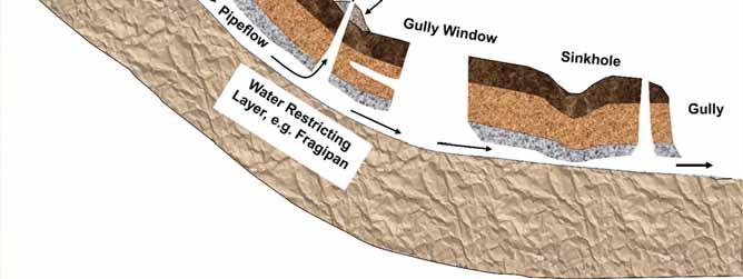
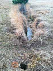
4 Pipe Collapse Features

 alluvial plains occupying only 6% of the area whereas")
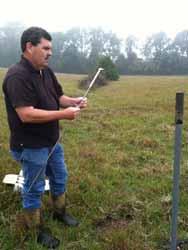
5 Field Site Description C1 C2 C3 GCEW The 2,132 ha Goodwin Creek Experimental Watershed is located in Panola County, MS. Agriculture (cotton) was historically practiced over the majority of the watershed, but is currently only in flat (slope < 2%) alluvial plains occupying only 6% of the area whereas the hilly forest and pasture lands occupy 39 and 55 %, respectively. MS
 A p 0 to 18 cm, SiL, 10YR 4/3, moderate fine granular B t1 18 to 36 cm, SiL, 7.")
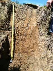
6 Soils of GCW Pasture Site Loring silt loam C1 C2 C3 Catchment 1 = 5.0 ha, 72% Loring, 28 % gullied Catchment 2 = 6.5 ha, 98% Loring, 2% gullied Catchment 3 = 1.4 ha, 55% Loring, 45% gullied (fine-silty, mixed, active thermic Oxyaquic Fragiudalf) A p 0 to 18 cm, SiL, 10YR 4/3, moderate fine granular B t1 18 to 36 cm, SiL, 7.5YR 4/4, medium subangular blocky B t2 36 cm to 71 cm, SiL, 7.5YR 4/4, medium subangular blocky B tx1 71 cm to 81 cm, SiL, 7.5 YR 4/4, prisms to medium subangular blocky, iron accumulations (10YR 5/6) and depletions (10YR 6/2) B tx2 81 to 102 cm, SiL, 7.5 YR 4/4, prisms to medium subangular blocky, iron depletions (10YR 5/1) and accumulations (10YR 5/4) B tx3 102 to 127 cm, SiL, coarse prisms, iron depletions (10YR 5/1) and accumulations (10YR 5/4)
 has 40 pipe collapse features, density=29.4 ha -1 WHY?")
7 Pipe Collapses in GCW Pasture Site C1 C2 C3 Catchment 1 (purple) has no pipe collapse features, density=0 Catchment 2 (green) has 100 pipe collapse features, density=15.4 ha -1 Catchment 3 (orange) has 40 pipe collapse features, density=29.4 ha -1 WHY?


8 Pipe Collapses in GCW Pasture Site C2 Total Depth Length Width Volume Feature number cm cm cm m 3 Flute hole Sink Hole Small GW Large GW


9 Pipe Collapses in GCW Pasture Site C3 Total Depth Length Width Volume Feature number cm cm cm m 3 Flute hole Sink Hole Small GW Large GW

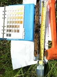
10 Soil Characterization of GCW Pasture Site

 Measure flow Slightly rate, sed.")
11 Soil Characterization of GCW Pasture Site Soil cores have water retention determined using Tempe Cell apparatus, and K sat by constant head method. Then Pinhole test. Classify Soil according Pinhole to test: flow rate, effluent Pinhole color, (2mm and final diam) hole through size as: center Dispersive Constant Moderately heads (50, Dispersive 180, 380, 1020 mm) Measure flow Slightly rate, sed. Dispersive conc, effluent color Nondispersive (Non Erodible) 1 min intervals for 5 minutes at each head
12 Soil Characterization of GCW Pasture Site C1 Swale/thalweg positions Anthropic soil A p 0 to 5 cm, SiL, 10YR 3/4, granular, 5YR 5/6 flakes L1 5 to 19 cm, SiL, 10YR 6/6, weak subangular blocky, 10YR4/4 fragic pieces, L2 19 to 40 cm, SiL, 10YR 5/6, weak subangular blocky, occasional fragic pieces and gravel L3 40- cm, SiL, 10YR 4/3, weak subangular blocky, mottles, concretions, occasional gravel C1 Catchment Severely Eroded Hillslopes positions Natural Loring silt loam A p 0 to 4 cm, SiL, 10YR4/4, granular B t1 3 to 18 cm, SiL, 10YR4/6, weak subangular blocky B t2 24 to 32 cm, SiL, 10YR5/6, subangular blocky, mottles B tx1 25 to 38 cm, SiL, 7.5 YR 5/6, subangular blocky, weak iron depletions (10YR 6/2) B tx2 28 to 41 cm, SiL, 10YR 4/4, prismatic, iron depletions (10YR6/2) B tx3 41 to 48, SiL, 10YR4/4, prismatic, strong iron depletions (10YR7/1) Hillslopes have severely eroded Loring soil with upper layers missing Swale positions have Anthropic soil: sediment deposition
13 Soil Characterization of GCW Pasture Site C2 Swale/thalweg positions Anthropic soil A p 0 to 14 cm, SiL, 10YR 5/2, granular L1 14 to 33 cm, Si, 10YR 6/2, blocky, charcoal L2 33 to 46 cm, SiL, 10YR 5/4, 5YR5/6 flakes, subangular blocky, charcoal L3 46 to 65 cm, SiL, 10YR 5/6, 5YR5/6 flakes, subangular blocky, charcoal, concretions L4 65 to 88 cm, SiL, 10YR 5/6, 10YR4/4 fragic pieces, massive, charcoal, concretions C2 Catchment Hillslopes positions Natural Loring silt loam A p 0 to 11 cm, Si, 10YR 4/4, granular B t1 11 to 30 cm, Si, 7.5YR 4/6, subangular blocky B t2 30 to 48 cm, SiL, 7.5YR 5/8, subangular blocky B tx1 48 to 62 cm, SiL, 7.5 YR 4/6, subangular blocky, iron depletions (10YR 6/2) B tx2 62 to 74 cm, SiL, 7.5 YR 4/6, prismatic, iron depletions (10YR 7/1) B tx3 74 -, SiL, prismatic, iron depletions (10YR 7/2) Hillslopes have eroded Loring soil Swale positions have Anthropic soil: charcoal, artifiacts,
14 Soil Characterization of GCW Pasture Site All layers present, A p severely eroded C3 C3 Catchment All positions Natural Loring silt loam A p 0 to 5 cm, Si, 10YR4/4, granular B t1 5 to 27 cm, SiL, 10YR5/6, subangular blocky B t2 27 to 45 cm, SiL, 10YR5/4, weak subangular blocky, concretions, mottles B tx1 45 to 61 cm, SiL, 10YR4/4, subangular blocky, weak iron depletions (10YR 5/2), concretions B tx2 61 to 81 cm, Si, 10YR4/4, prismatic, iron depletions (10YR 5/2) B tx3 81-, Si, 10YR4/4, prismatic, strong iron depletions (10YR 7/1)
15 Soil Characterization of GCW Pasture Site Horizon Bulk Density mg m -3 SV kpa SPR kpa Pinhole Erodibility Natural Soil A p Non Erodible B t Non/Slightly Dispersive B t Slightly Dispersive B tx Slight/Mod. Dispersive B tx Slight/Mod. Dispersive B tx Slightly Dispersive Anthropic Soil A p Non Erodible Slightly Dispersive Moderately Dispersive Moderately Dispersive Moderately Dispersive Surface layer is non erodible due to high OM and root density Subsurface layers more erosive, especially the Anthropic soils Surface layer forms a bridge over soil pipes formed below Lower fragipan layer is erosion resistant and forms lower boundary
 Elevation (m) 102 100 98 96 94 92-25 -20-15 -10-5 0 5 10 15 20 25 Distance (m) Anthropic material")
16 Soil Characterization of GCW Pasture Site Elevation (m) Distance (m) 104 Elevation (m) Distance (m) Elevation (m) Distance (m) Anthropic material


17 Past Land Use of GCW Pasture Site C1 in pasture, C2 in forest, C3 still in cotton with terraces C1 was pure gullies and raw banks late 1950s trees removed from C2, piled up and burnt C1 was smoothed and in C2 the burnt trees pushed into gullies and the gullies were filled in Trees removed from C3 swale All three catchments converted to pasture


18 Past Land Use of GCW Pasture Site 1977 no pipe collapse features 1978 Pipe collapse features first appear in C Pipe collapse features first appear in C over 100 pipe collapse features

 Mostly between 55-65 depth Pinhole goes from 2 mm")
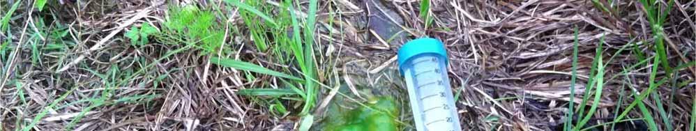
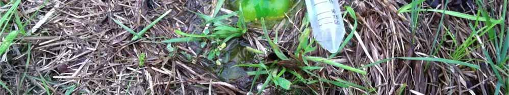
19 Soil Pipe Erosion Processes Vertical Macropores: Increased from 12 to 40 ha -1 with depth Lateral Macropores on gully sidewalls: 30 ha -1 (0.1 to 0.5 cm diameter) Mostly between depth Pinhole goes from 2 mm to >10 mm in 20 minutes with 5 to 100 cm heads
 20.0 15.0 10.0 5.0 10.0 0.0 4/18 4/19 4/20 4/21 80.0 P2 time 70.0 0.0 4/18 4/19 4/20 4/21 time Pressure (cm) 60.0 50.0 40.0 30.0 Heads of 5-100 cm that last for hours to days 20.")
20 Soil Pipe Erosion Processes P P23 Pressure (cm) /18 4/19 4/20 4/21 time 35.0 P Pressure (cm) Pressure (cm) P13 4/18 4/19 4/20 4/21 time Pressure (cm) /18 4/19 4/20 4/ P2 time /18 4/19 4/20 4/21 time Pressure (cm) Heads of cm that last for hours to days /18 4/19 4/20 4/21 Time


21 Soil Pipe Erosion Processes Pinhole goes from 2 mm to >10 mm in 20 minutes of 5 to 100 cm heads Comparable heads and flow rates that last for hours during numerous storm events annually.
22 Summary Erosion can take place in subsurface without evidence of erosion on surface Fragipan layers can restrict vertical water movement and foster lateral flow The surface layer is non-erodible and forms a bridge over more erosive subsurface layers Lower fragipan layer is erosion resistant and forms bottom of gullies Sediment deposited in old filled-in gullies are highly susceptible to piping Susceptibility to piping is dependent upon land use history as well as soil properties 20 to 40 year transition period following conversion of forest/cropland to pasture, combined with filling-in gullies, for pipe erosion to be evident on surface
23
Updating Slope Topography During Erosion Simulations with the Water Erosion Prediction Project
 This paper was peer-reviewed for scientific content. Pages 882-887. In: D.E. Stott, R.H. Mohtar and G.C. Steinhardt (eds). 2001. Sustaining the Global Farm. Selected papers from the 10th International
Monitoring and modelling hydrological fluxes in support of nutrient cycling studies in Amazonian rain forest ecosystems Tobon-Marin, C.
 UvA-DARE (Digital Academic Repository) Monitoring and modelling hydrological fluxes in support of nutrient cycling studies in Amazonian rain forest ecosystems Tobon-Marin, C. Link to publication Citation
Monitoring Headwater Streams for Landscape Response to
 Monitoring Headwater Streams for Landscape Response to Climate Change Matthew Connor, PhD Connor nvironmental, nc. www.oe-i.com icom Healdsburg, California verview Headwater stream geomorphology Response
Watershed Conservation Management Planning Using the Integrated Field & Channel Technology of AnnAGNPS & CONCEPTS
 Watershed Conservation Management Planning Using the Integrated Field & Channel Technology of AnnAGNPS & CONCEPTS Eddy Langendoen Ron Bingner USDA-ARS National Sedimentation Laboratory, Oxford, Mississippi
Landscape Function Analysis
 Landscape Function Analysis Ephemeral Drainage-line Assessments (EDA): Indicators of Stability Ephemeral drainage-lines are present in almost all landscapes such as those observed on a hillslope in a watershed
Maggie Payne Jim Turenne
 Maggie Payne Jim Turenne USDA-NRCS 60 Quaker Lane, Suite 46 Warwick, RI. 02886 401-822-8832 maggie.payne@ri.usda.gov U.S. Department of Agriculture 1935: Soil Conservation Service (SCS) Natural Resources
Lowest and Youngest Terrace : Soil Pit #4
 Lowest and Youngest Terrace : Soil Pit #4 Observations : Where : Huntington Terraces Climate : Cloudy, mid 60 s Our soil pit was the lowest of the 4 sites The pit site was located on the right side of
On-Site Soils Investigation. Buttermilk Way Storm water Treatment Project Buzzards Bay. MA. February 28 th, 2012
 1 On-Site Soils Investigation Buttermilk Way Storm water Treatment Project Buzzards Bay. MA February 28 th, 2012 Glenn Stanisewski, Resource Soil Scientist, USDA-NRCS, West Wareham, MA Introduction: The
CONCEPTS Conservational Channel Evolution and Pollutant Transport System
 CONCEPTS Conservational Channel Evolution and Pollutant Transport System Eddy J. Langendoen Watershed Physical Processes Research Unit National Sedimentation Laboratory USDA Agricultural Research Service
Parent Materials. & some of Seattle s soils
 Parent Material & some of Seattle s soils ESRM 311/SEFS 507 Week 3 SOILS = f(cl, r, o, p, t) Parent Materials 1) Sedentary a) residual (bedrock weathered in place) b) organic 2) Transported by a) gravity
Why Geomorphology for Fish Passage
 Channel Morphology - Stream Crossing Interactions An Overview Michael Love Michael Love & Associates mlove@h2odesigns.com (707) 476-8938 Why Geomorphology for Fish Passage 1. Understand the Scale of the
Overview of fluvial and geotechnical processes for TMDL assessment
 Overview of fluvial and geotechnical processes for TMDL assessment Christian F Lenhart, Assistant Prof, MSU Research Assoc., U of M Biosystems Engineering Fluvial processes in a glaciated landscape Martin
Erosion and Sedimentation Basics
 Erosion and Sedimentation Basics Coastal San Luis Resource Conservation District G.W. Bates, PE, CPESC Outline: 1. Terms & Concepts 2. Causes of Erosion 3. The Erosion/Sedimentation Process 4. Erosion
GEOLOGICAL PROCESSES AND MATERIALS SGM210
 University of Pretoria GEOLOGICAL PROCESSES AND MATERIALS SGM210 2 May 2014 1 DISPERSIVE SOILS Thanks to Dr Phil Paige Green 1 Dispersive (and Erodible) Soils Phil Paige Green (H.F.W.K Elges) CSIR Built
What Is Water Erosion? Aren t they the same thing? What Is Sediment? What Is Sedimentation? How can Sediment Yields be Minimized?
 Jerald S. Fifield, Ph.D. CISEC HydroDynamics Incorporated Parker, CO 303-841-0377 Aren t they the same thing? What Is Sediment? Soil particles deposited or suspended in water or air The process of depositing
Coarse Sediment Traps
 Coarse Sediment Traps SEDIMENT CONTROL TECHNIQUE Type 1 System Sheet Flow Sandy Soils Type 2 System [1] Concentrated Flow Clayey Soils [2] Type 3 System Supplementary Trap Dispersive Soils [1] Though primarily
Surface Water and Stream Development
 Surface Water and Stream Development Surface Water The moment a raindrop falls to earth it begins its return to the sea. Once water reaches Earth s surface it may evaporate back into the atmosphere, soak
Soil Surveys. What are the most important properties to consider in a taxonomic system used for making a soil survey?
 Soil Surveys What are the most important properties to consider in a taxonomic system used for making a soil survey? What is a Soil Survey? Inventory of soil resources Delineation of spatial distribution
Circle the correct (best) terms inside the brackets:
 terms inside the brackets:") 1 Circle the correct (best) terms inside the brackets: 1) Soils are [consolidated / unconsolidated] [natural / artificial] bodies at the earth s surface. Soils contain mineral and organic material, which
1 Circle the correct (best) terms inside the brackets: 1) Soils are [consolidated / unconsolidated] [natural / artificial] bodies at the earth s surface. Soils contain mineral and organic material, which
APPENDIX E. GEOMORPHOLOGICAL MONTORING REPORT Prepared by Steve Vrooman, Keystone Restoration Ecology September 2013
 APPENDIX E GEOMORPHOLOGICAL MONTORING REPORT Prepared by Steve Vrooman, Keystone Restoration Ecology September 2 Introduction Keystone Restoration Ecology (KRE) conducted geomorphological monitoring in
Geomorphic Importance of Winter Peak Flows and Annual Snowmelt Hydrographs in a Sierra Nevada Boulder-Bedrock River
 Geomorphic Importance of Winter Peak Flows and Annual Snowmelt Hydrographs in a Sierra Nevada Boulder-Bedrock River Scott McBain and Bill Trush McBain & Trush, Inc. Clavey River and Cherry Creek vicinity
Jim Turenne. Soils on Social Media
 Jim Turenne USDA-NRCS 60 Quaker Lane, Suite 46 Warwick, RI. 02886 401-822-8832 Jim.turenne@ri.usda.gov Soils on Social Media www.twitter.com/soilsne www.fb.com/soilsne www.nesoil.com U.S. Department of
4. Soils and soil conditions
 4. Soils and soil conditions 4.1 General characteristics 4.1.1 Soil-forming processes Most soils of the Bardenas area show no distinct characteristics of soil development. Except in the ancient alluvium
Erosion Surface Water. moving, transporting, and depositing sediment.
 + Erosion Surface Water moving, transporting, and depositing sediment. + Surface Water 2 Water from rainfall can hit Earth s surface and do a number of things: Slowly soak into the ground: Infiltration
Track design and management
 1 Track design and management Peter Fogarty, Certified Professional Soil Scientist NSW Soil Knowledge Network Cooma, June 18, 2018 Acknowledgements Antia Brademann, Cooma Waterwatch, Organiser Jo Powells,
 UNIT DESCRIPTIONS: Artificial Fill, Undocumented (Afu): Locally derived sandy silt and silty sand, locally with clay and varying amounts of gravel and man-made debris. Abundant concrete rubble, in places
Rock Sizing for Waterway & Gully Chutes
 Rock Sizing for Waterway & Gully Chutes WATERWAY MANAGEMENT PRACTICES Photo 1 Rock-lined waterway chute Photo 2 Rock-lined gully chute 1. Introduction A waterway chute is a stabilised section of channel
Gully Erosion Part 1 GULLY EROSION AND ITS CAUSES. Introduction. The mechanics of gully erosion
 Gully Erosion Part 1 GULLY EROSION AND ITS CAUSES Gully erosion A complex of processes whereby the removal of soil is characterised by incised channels in the landscape. NSW Soil Conservation Service,
Landslides & Debris Flows
 T.#Perron# #12.001# #Landslides#&#Debris#Flows# 1# Landslides & Debris Flows Many geologic processes, including those shaping the land surface, are slowacting, involving feedbacks that operate over many
In Situ Soil Pipeflow Experiments on Contrasting Streambank Soils
 University of Nebraska - Lincoln DigitalCommons@University of Nebraska - Lincoln Biological Systems Engineering: Papers and Publications Biological Systems Engineering 213 In Situ Soil Pipeflow Experiments
SOIL PROFILE STUDY GUIDE
 2017 USDA, Natural Resources Conservation Service Yuri Plowden Ecological Site Specialist SOIL PROFILE STUDY GUIDE The purpose of this study guide is to help familiarize you with different characteristics
Statement of Impact and Objectives. Watershed Impacts. Watershed. Floodplain. Tumblin Creek Floodplain:
 Tumblin Creek Floodplain: Impacts Assessment and Conceptual Restoration Plan Casey A. Schmidt Statement of Impact and Objectives Urbanization has increased stormflow rate and volume and increased sediment,
SUPPLEMENTAL MATERIAL
 SUPPLEMENTAL MATERIAL DESCRIPTIONS OF OTHER STRATIGRAPHIC SECTIONS Cherry Creek In its middle reaches, Cherry Creek meanders between three paired terraces within a narrow bedrock valley. The highest is
IMAGING A SOIL FRAGIPAN USING A HIGH-FREQUENCY MASW METHOD. Abstract
 SAGEEP 2014 Boston, MA USA http://www.eegs.org IMAGING A SOIL FRAGIPAN USING A HIGH-FREQUENCY MASW METHOD Zhiqu Lu, National Center for Physical Acoustics, The University of Mississippi, University, MS
Weathering, Soil, and Mass Movements
 Tarbuck Lutgens Weathering, Soil, and Mass Movements 5.1 Weathering Mechanical Weathering Mechanical weathering occurs when physical forces break rock into smaller and smaller pieces without changing the
Watershed concepts for community environmental planning
 Purpose and Objectives Watershed concepts for community environmental planning Dale Bruns, Wilkes University USDA Rural GIS Consortium May 2007 Provide background on basic concepts in watershed, stream,
Chapter 6 Geoarchaeological Investigation of New Philadelphia: Soil Core Testing of Thermal Infrared Anomalies 1
 Chapter 6 Geoarchaeological Investigation of New Philadelphia: Soil Core Testing of Thermal Infrared Anomalies 1 M. Kathryn Rocheford 2 Background The New Philadelphia town site was designated as a National
Flood and Stream Restoration
 2 3 4 Pedestrian bridge under construction 3 CSPs perched on DS side Large area of sand deposition Bottom layer of gabions has been scoured out large bar of gabion stone Gabions slumping bank slope failure
What is weathering and how does it change Earth s surface? Answer the question using
 7 th Grade Lesson What is weathering and how does it change Earth s surface? Answer the question using the sentence frame. You have 4 minutes. Weathering is. This changes the Earth s surface because. 1
Development and testing of improved physically based streambank erosion and sediment routing routines in SWAT
 Development and testing of improved physically based streambank erosion and sediment routing routines in SWAT Balaji Narasimhan, P. M. Allen, Stephanie Capello, and Dave Coffman, J.G. Arnold, and R. Srinivasan
Topic 6: Weathering, Erosion and Erosional-Deposition Systems (workbook p ) Workbook Chapter 4, 5 WEATHERING
 Workbook Chapter 4, 5 WEATHERING") Topic 6: Weathering, Erosion and Erosional-Deposition Systems (workbook p. 95-125) Workbook Chapter 4, 5 THE BIG PICTURE: Weathering, erosion and deposition are processes that cause changes to rock material
Topic 6: Weathering, Erosion and Erosional-Deposition Systems (workbook p. 95-125) Workbook Chapter 4, 5 THE BIG PICTURE: Weathering, erosion and deposition are processes that cause changes to rock material
Appendix I SOIL RATING CHART. (Storie soil Index Rating = factor A* factor B* factor C* factor X) FACTOR A- Rating on character of Physical Profile
 FACTOR A- Rating on character of Physical Profile") Appendix I SOIL RATING CHART (Storie soil Index Rating = factor A* factor B* factor C* factor X) FACTOR A- Rating on character of Physical Profile Sr. No Particulars Percentage I Soil on recent alluvial
Appendix I SOIL RATING CHART (Storie soil Index Rating = factor A* factor B* factor C* factor X) FACTOR A- Rating on character of Physical Profile Sr. No Particulars Percentage I Soil on recent alluvial
Rock & Aggregate Drop Inlet Protection
 Rock & Aggregate Drop Inlet Protection SEDIMENT CONTROL TECHNIQUE Type 1 System Sheet Flow Sandy Soils Type 2 System [1] Concentrated Flow Clayey Soils Type 3 System Supplementary Trap Dispersive Soils
Storm Sewer Design [2]
![Storm Sewer Design [2]](/thumbs/82/86956590.jpg "Storm Sewer Design [2]") Class 5 [1] Storm Sewer Design 9. Check Q < Qf and Vmax > vf > Vmin. Vmin is normally specified to avoid sedimentation. This will normally be 1.0 m/s at pipe full condition. (BS EN 752 suggests that for
Class 5 [1] Storm Sewer Design 9. Check Q < Qf and Vmax > vf > Vmin. Vmin is normally specified to avoid sedimentation. This will normally be 1.0 m/s at pipe full condition. (BS EN 752 suggests that for
TEXTURE ANALYSIS. Unknown 1 Unknown 2. Unknown 3 6O 6O O Z 14X 10Z X X 8Z
 Unknown 1 Unknown 2 TEXTURE ANALYSIS Unknown 3 O 2O 10Z X X 8Z O 2X O Z 14X X 2O 6O 6O Parent Material & some of Seattle s soils ESRM 311/SEFS 507 Week 3 SOILS = f(cl, r, o, p, t) Parent Materials 1) Sedentary
Conservation Planning evaluate land management alternatives to reduce soil erosion to acceptable levels. Resource Inventories estimate current and
 Conservation Planning evaluate land management alternatives to reduce soil erosion to acceptable levels. Resource Inventories estimate current and projected erosion levels and their impact on natural resource
Black Gore Creek 2013 Sediment Source Monitoring and TMDL Sediment Budget
 Black Gore Creek 2013 Sediment Source Monitoring and TMDL Sediment Budget Prepared for: Prepared By: - I. Introduction The Black Gore Creek Total Maximum Daily Load (TMDL) was developed in collaboration
Measurement of effective stress shear strength of rock
 Measurement of effective stress shear strength of rock R. A. Failmezger, P.E., F. ASCE In-Situ Soil Testing, L.C., Lancaster, Virginia USA D. J. White, Ph. D., P.E. Iowa State University, Ames, Iowa USA
PREDICTING BACKGROUND AND RISK-BASED SEDIMENTATION FOR FOREST WATERSHED TMDLS
 This is not a peer-reviewed article. Watershed Management to Meet Water Quality Standards and TMDLS (Total Maximum Daily Load) Proceedings of the Fourth Conference 10-14 March 2007 (San Antonio, Texas
1/6/ th Grade Earth s Surface. Chapter 3: Erosion and Deposition. Lesson 1 (Mass Movement)
") Lesson 1 (Mass Movement) 7 th Grade Earth s Surface Chapter 3: Erosion and Deposition Weathering the chemical and physical processes that break down rock at Earth s surface Mechanical weathering when rock
Lesson 1 (Mass Movement) 7 th Grade Earth s Surface Chapter 3: Erosion and Deposition Weathering the chemical and physical processes that break down rock at Earth s surface Mechanical weathering when rock
Climate effects on landslides
 GEORAMP ONE DAY SYMPOSIUM Climate effects on landslides E. E. Alonso, M. Sondón, N. M. Pinyol Universitat Politècnica de Catalunya October 14th, 2016. UPC, Barcelona Infiltration (evaporation) and slope
Sediment Distribution and Characteristics
 Sediment Distribution and Characteristics Sediments at the bottom of ponds are a source or sink for nutrients in relation to the water column, contribute to turbidity during storm events, serve as the
Do you think sediment transport is a concern?
 STREAM RESTORATION FRAMEWORK AND SEDIMENT TRANSPORT BASICS Pete Klingeman 1 What is Your Restoration Project Like? k? Do you think sediment transport is a concern? East Fork Lewis River, WA Tidal creek,
Science EOG Review: Landforms
 Mathematician Science EOG Review: Landforms Vocabulary Definition Term canyon deep, large, V- shaped valley formed by a river over millions of years of erosion; sometimes called gorges (example: Linville
PR206 NARRATIVE Updated 16 June 2015
 PR206 NARRATIVE Updated 16 June 2015 Cross section PR206 was established in 1977 in a fairly straight reach of Powder River about a kilometer downriver of the Highway 212 bridge at Broadus. The section
Each basin is surrounded & defined by a drainage divide (high point from which water flows away) Channel initiation
 Channel initiation") DRAINAGE BASINS A drainage basin or watershed is defined from a downstream point, working upstream, to include all of the hillslope & channel areas which drain to that point Each basin is surrounded &
DRAINAGE BASINS A drainage basin or watershed is defined from a downstream point, working upstream, to include all of the hillslope & channel areas which drain to that point Each basin is surrounded &
Diagnostic Geomorphic Methods for Understanding Future Behavior of Lake Superior Streams What Have We Learned in Two Decades?
 Diagnostic Geomorphic Methods for Understanding Future Behavior of Lake Superior Streams What Have We Learned in Two Decades? Faith Fitzpatrick USGS WI Water Science Center, Middleton, WI fafitzpa@usgs.gov
Application of SWAT Model to Estimate the Runoff and Sediment Load from the Right Bank Valleys of Mosul Dam Reservoir
 Application of SWAT Model to Estimate the Runoff and Sediment Load from the Right Bank Valleys of Mosul Dam Reservoir Dr Mohammad Ezeel Deen Prof. Nadhir Al-Ansari Prof Sven Knutsson Figure 1.Map of Iraq
MAFF Ministry of IfiriLE Agriculture Fisheries and Food
 MAFF Ministry of IfiriLE Agriculture Fisheries and Food STATEMENT OF PHYSICAL CHARACTERISTICS AND AGRICULTURAL LAND CLASSIFICATION UPSLAND, KIRKLINGTON NORTH YORKSHIRE EXTRACTION OF SAND AND GRAVEL MARCH
Remote Sensing and GIS Applications for Hilly Watersheds SUBASHISA DUTTA DEPARTMENT OF CIVIL ENGINEERING IIT GUWAHATI
 Remote Sensing and GIS Applications for Hilly Watersheds SUBASHISA DUTTA DEPARTMENT OF CIVIL ENGINEERING IIT GUWAHATI Deciding Alternative Land Use Options in a Watershed Using GIS Source: Anita Prakash
RIVERS, GROUNDWATER, AND GLACIERS
 RIVERS, GROUNDWATER, AND GLACIERS Delta A fan-shaped deposit that forms when a river flows into a quiet or large body of water, such as a lake, an ocean, or an inland sea. Alluvial Fan A sloping triangle
Prof. B V S Viswanadham, Department of Civil Engineering, IIT Bombay
 13 Permeability and Seepage -2 Conditions favourable for the formation quick sand Quick sand is not a type of sand but a flow condition occurring within a cohesion-less soil when its effective stress is
Weathering, Erosion and Deposition
 Weathering, Erosion and Deposition Shaping the Earth s Surface Weathering the process of breaking down rocks into smaller fragments Erosion the transport of rock fragments from one location to another
mountain rivers fixed channel boundaries (bedrock banks and bed) high transport capacity low storage input output
 high transport capacity low storage input output") mountain rivers fixed channel boundaries (bedrock banks and bed) high transport capacity low storage input output strong interaction between streams & hillslopes Sediment Budgets for Mountain Rivers Little
mountain rivers fixed channel boundaries (bedrock banks and bed) high transport capacity low storage input output strong interaction between streams & hillslopes Sediment Budgets for Mountain Rivers Little
Starting at Rock Bottom
 Starting at Rock Bottom At rock bottom of the Brushy Creek site s geological column lies the first clue to human habitation: A smelting and heattreating furnace, and mold, carved into Bed Ked: Figure 15
10YR 3/1 Weakly developed fine to coarse angular blocky peds
 Data Repository item 2003030 Table DR1A: UNIT DESCRIPTIONS FOR ALLUVIAL FAN TRENCHES, EDEN MILLS, VERMONT Unit Identifier Grain size Soil color Soil structure Soil consistence Soil texture Other notes
Roger Andy Gaines, Research Civil Engineer, PhD, P.E.
 Roger Andy Gaines, Research Civil Engineer, PhD, P.E. Research Civil Engineer/Regional Technical Specialist Memphis District August 24, 2010 Objectives Where we have been (recap of situation and what s
Chapter 10. Running Water aka Rivers. BFRB Pages
 Chapter 10 Running Water aka Rivers BFRB Pages 101-116 Stream Erosion and Transportation Running water is all precipitation (rain, snow, etc) that falls on Earth and is pulled downhill by gravity. Running
Sedimentation Rate Change in the Winooski River Delta
 Sedimentation Rate Change in the Winooski River Delta Chris Ricker and Brian Connelly Abstract Historical air photographs, from 1937 show the Winooski River Delta extended much farther into Lake Champlain
NATURE OF RIVERS B-1. Channel Function... ALLUVIAL FEATURES. ... to successfully carry sediment and water from the watershed. ...dissipate energy.
 1 2 Function... Sevier River... to successfully carry sediment and water from the watershed....dissipate energy. 3 ALLUVIAL FEATURES 4 CHANNEL DIMENSION The purpose of a stream is to carry water and sediment
TPDES: Soil, Erosion and Sedimentation Methods
 SAWS TPDES: Soil, Erosion and Sedimentation Methods Philip Handley Supervisor-Resource Protection & Compliance August 25, 2014 TPDES: Soil, Erosion and Sedimentation Methods Soil Common term: Dirt Common
2017 NACTA Contest FAQs for 2-Year and 4-Year Universities
 2017 NACTA Contest FAQs for 2-Year and 4-Year Universities 1. Have you determined how many practice days there will be? a. We plan on having 10 practice sites. They will be open on Tuesday, Wednesday,
Exploring the role of channel processes and legacy sediment in nutrient and sediment delivery, Upper Pecatonica River, Wisconsin
 Exploring the role of channel processes and legacy sediment in nutrient and sediment delivery, Upper Pecatonica River, Wisconsin Faith Fitzpatrick and Rebecca Carvin (USGS WI Water Science Center), Robert
SECTION G SEDIMENT BUDGET
 SECTION G SEDIMENT BUDGET INTRODUCTION A sediment budget has been constructed for the for the time period 1952-2000. The purpose of the sediment budget is to determine the relative importance of different
Classify Rock (rock1)
") Name: Date: 1. Cleavage of a mineral is related to a mineral's A. chemical composition. B. streak color. C. luster. D. crystalline structure. 2. Which is not part of the definition of a mineral? A. naturally
Name: Date: 1. Cleavage of a mineral is related to a mineral's A. chemical composition. B. streak color. C. luster. D. crystalline structure. 2. Which is not part of the definition of a mineral? A. naturally
Low Gradient Velocity Control Short Term Steep Gradient Channel Lining Medium-Long Term Outlet Control Soil Treatment Permanent [1]
![Low Gradient Velocity Control Short Term Steep Gradient Channel Lining Medium-Long Term Outlet Control Soil Treatment Permanent [1]](/thumbs/87/96478185.jpg "Low Gradient Velocity Control Short Term Steep Gradient Channel Lining Medium-Long Term Outlet Control Soil Treatment Permanent [1]") Rock Linings DRAINAGE CONTROL TECHNIQUE Low Gradient Velocity Control Short Term Steep Gradient Channel Lining Medium-Long Term Outlet Control Soil Treatment Permanent [1] [1] The design of permanent installations
Rock Linings DRAINAGE CONTROL TECHNIQUE Low Gradient Velocity Control Short Term Steep Gradient Channel Lining Medium-Long Term Outlet Control Soil Treatment Permanent [1] [1] The design of permanent installations
Open Channel Flow Part 2. Ch 10 Young, notes, handouts
 Open Channel Flow Part 2 Ch 10 Young, notes, handouts Uniform Channel Flow Many situations have a good approximation d(v,y,q)/dx=0 Uniform flow Look at extended Bernoulli equation Friction slope exactly
Waterbury Dam Disturbance Mike Fitzgerald Devin Rowland
 Waterbury Dam Disturbance Mike Fitzgerald Devin Rowland Abstract The Waterbury Dam was completed in October 1938 as a method of flood control in the Winooski Valley. The construction began in April1935
Technical Memorandum No Sediment Model
 Pajaro River Watershed Study in association with Technical Memorandum No. 1.2.9 Sediment Model Task: Development of Sediment Model To: PRWFPA Staff Working Group Prepared by: Gregory Morris and Elsie Parrilla
Effect of Runoff and Sediment from Hillslope on Gully Slope In the Hilly Loess Region, North China**
 This paper was peer-reviewed for scientific content. Pages 732-736. In: D.E. Stott, R.H. Mohtar and G.C. Steinhardt (eds). 2001. Sustaining the Global Farm. Selected papers from the 10th International
ENGINEERING HYDROLOGY
 ENGINEERING HYDROLOGY Prof. Rajesh Bhagat Asst. Professor Civil Engineering Department Yeshwantrao Chavan College Of Engineering Nagpur B. E. (Civil Engg.) M. Tech. (Enviro. Engg.) GCOE, Amravati VNIT,
STUDY GUIDE FOR CONTENT MASTERY. Surface Water Movement
 Surface Water SECTION 9.1 Surface Water Movement In your textbook, read about surface water and the way in which it moves sediment. Complete each statement. 1. An excessive amount of water flowing downslope
Chapter 2. Wearing Down Landforms: Rivers and Ice. Physical Weathering
 Chapter 2 Wearing Down Landforms: Rivers and Ice Physical Weathering Weathering vs. Erosion Weathering is the breakdown of rock and minerals. Erosion is a two fold process that starts with 1) breakdown
Improved physically based approaches for Channel Erosion Modeling in SWAT. Balaji Narasimhan, P. M. Allen, J. G. Arnold, and R.
 Improved physically based approaches for Channel Erosion Modeling in SWAT Balaji Narasimhan, P. M. Allen, J. G. Arnold, and R. Srinivasan Outline Channel Erosion Sediment Routing In SWAT2000 and SWAT2005
Clyde River Landslide
 Clyde River Landslide Department of Geology, Perkins Hall, University of Vermont, Burlington, VT 05405 Abstract: This paper investigates a landslide on the Clyde River in Newport, Vermont. The landslide
Effect of GIS data quality on small watershed stream flow and sediment simulations
 HYDROLOGICAL PROCESSES Hydrol. Process. 19, 629 650 (2005) Published online in Wiley InterScience (www.interscience.wiley.com). DOI: 10.1002/hyp.5612 Effect of GIS data quality on small watershed stream
DATA REPOSITORY FIGURES AND TABLES
 GSA Data Repository Item 2016322 Sweeney, K.E., and Roering, J.J., 2016, Rapid fluvial incision of a late Holocene lava flow: Insights from lidar, alluvial stratigraphy, and numerical modeling: GSA Bulletin,
Instream Sediment Control Systems
 Instream Sediment Control Systems INSTREAM PRACTICES Photo 1 Photo 2 Modular sediment The information contained within this series of fact sheets deals only with the design of temporary instream sediment
Using Weather and Climate Information for Landslide Prevention and Mitigation
 Using Weather and Climate Information for Landslide Prevention and Mitigation Professor Roy C. Sidle Disaster Prevention Research Institute Kyoto University, Japan International Workshop on Climate and
EFFECTS OF RIPARIAN RETENTION (IN WATERSHEDS) ON ALLUVIAL FANS
 ON ALLUVIAL FANS") EFFECTS OF RIPARIAN RETENTION (IN WATERSHEDS) ON ALLUVIAL FANS TIM GILES GEOMORPHOLOGIST FLNRO EFFECTS OF RIPARIAN RETENTION (IN WATERSHEDS) ON ALLUVIAL FANS Description of alluvial fans Three case studies
EFFECTS OF RIPARIAN RETENTION (IN WATERSHEDS) ON ALLUVIAL FANS TIM GILES GEOMORPHOLOGIST FLNRO EFFECTS OF RIPARIAN RETENTION (IN WATERSHEDS) ON ALLUVIAL FANS Description of alluvial fans Three case studies
INTRODUCTION TO STATIC ANALYSIS PDPI 2013
 INTRODUCTION TO STATIC ANALYSIS PDPI 2013 What is Pile Capacity? When we load a pile until IT Fails what is IT Strength Considerations Two Failure Modes 1. Pile structural failure controlled by allowable
The Interaction Between Trees and the Landscape Through Debris Flows
 The Interaction Between Trees and the Landscape Through Debris Flows Stephen T. Lancaster 1, Shannon K. Hayes 1, and Gordon E. Grant 2 1. Dept. of Geosciences, Oregon State University (slancast@fsl.orst.edu)
Floodplain modeling. Ovidius University of Constanta (P4) Romania & Technological Educational Institute of Serres, Greece
 Romania & Technological Educational Institute of Serres, Greece") Floodplain modeling Ovidius University of Constanta (P4) Romania & Technological Educational Institute of Serres, Greece Scientific Staff: Dr Carmen Maftei, Professor, Civil Engineering Dept. Dr Konstantinos
Floodplain modeling Ovidius University of Constanta (P4) Romania & Technological Educational Institute of Serres, Greece Scientific Staff: Dr Carmen Maftei, Professor, Civil Engineering Dept. Dr Konstantinos
Landslide FE Stability Analysis
 Landslide FE Stability Analysis L. Kellezi Dept. of Geotechnical Engineering, GEO-Danish Geotechnical Institute, Denmark S. Allkja Altea & Geostudio 2000, Albania P. B. Hansen Dept. of Geotechnical Engineering,
STATEMENT OF PHYSICAL CHARACTERISTICS REPORT FOR WELLINGTON, HEREFORD AND WORCESTER MINERALS LOCAL PLAN
 STATEMENT OF PHYSICAL CHARACTERISTICS REPORT FOR WELLINGTON, HEREFORD AND WORCESTER MINERALS LOCAL PLAN M J Wood ADAS Ref: 25/RPT/0039 Resource Planning Team Job No: 164/94 ADAS Statutory Group MAFF Ref:
SLOPE FAILURE SLOPES. Landslides, Mudflows, Earthflows, and other Mass Wasting Processes
 GEOL g406 Environmental Geology SLOPE FAILURE Landslides, Mudflows, Earthflows, and other Mass Wasting Processes Read Chapter 5 in your textbook (Keller, 2000) Gros Ventre landslide, Wyoming S. Hughes,
Changes to Land 5.7B. landforms: features on the surface of Earth such as mountains, hills, dunes, oceans and rivers
 All the landforms on Earth have changed over time and continue to change. Many of the changes were caused by wind, moving water, and moving ice. Mountains have grown and shrunk. Rivers have cut away land
Which map shows the stream drainage pattern that most likely formed on the surface of this volcano? A) B)
 B)") 1. When snow cover on the land melts, the water will most likely become surface runoff if the land surface is A) frozen B) porous C) grass covered D) unconsolidated gravel Base your answers to questions
1. When snow cover on the land melts, the water will most likely become surface runoff if the land surface is A) frozen B) porous C) grass covered D) unconsolidated gravel Base your answers to questions
Think about the landforms where you live. How do you think they have changed over time? How do you think they will change in the future?
 reflect All the landforms on Earth have changed over time and continue to change. Many of the changes were caused by wind, moving water, and moving ice. Mountains have grown and shrunk. Rivers have cut
[1] Performance of the sediment trap depends on the type of outlet structure and the settling pond surface area.
![[1] Performance of the sediment trap depends on the type of outlet structure and the settling pond surface area.](/thumbs/76/74245181.jpg "[1] Performance of the sediment trap depends on the type of outlet structure and the settling pond surface area.") Sediment Trench SEDIMENT CONTROL TECHNIQUE Type 1 System Sheet Flow Sandy Soils Type 2 System [1] Concentrated Flow Clayey Soils Type 3 System [1] Supplementary Trap Dispersive Soils [1] Performance of
Sediment Trench SEDIMENT CONTROL TECHNIQUE Type 1 System Sheet Flow Sandy Soils Type 2 System [1] Concentrated Flow Clayey Soils Type 3 System [1] Supplementary Trap Dispersive Soils [1] Performance of