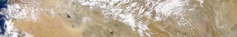
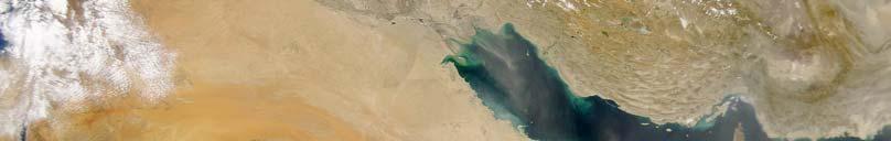
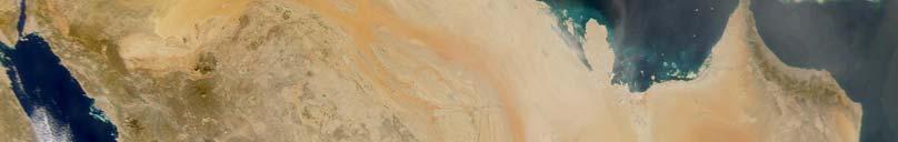
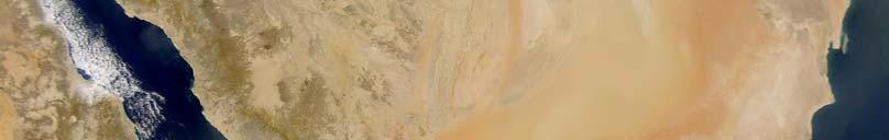
Water Resources of Saudi Arabia
|
|
|
- Meghan Baker
- 6 years ago
- Views:
Transcription
1 Water Resources of Saudi Arabia Resources of Saudi Arabia 1
2 Water Resources of Saudi Arabia Water Supply in KSA Surface water (48-10%) Groundwater 70m- 1000m depth) Desalinated water (3-6%) Reclaimed water (0-5%) MCM Surface water Groundwater Desalinated water Reclaimed water Total Year Resources of Saudi Arabia 2
3 Water Demands in Saudi Arabia Water demand in KSA Domestic and industrial uses (15-21%) Agricultural uses (79-85%) MCM Domestic & Industrial Agricultural Total Year Resources of Saudi Arabia 3
4 Problems Associated with Water Demands Increasing number of private & farming wells (26,000 in ,000 in 1997???) Uncontrolled pumping (sharp drop in water levels) (Sea water intrusion in eastern province and dryness of natural springs in the eastern, central and western provinces) Water quality deterioration (high TDS levels) Uncontrolled agricultural practices (Around 88% of water resources are used by agriculture out of which only 30% is really needed!! This means that about 62% of the total water resources are lost!!!) Over-irrigation increases soil salinity (sabkhanization) Leakage from water supply systems (About 20% of water leaks from domestic water supply systems) Resources of Saudi Arabia 4
5 Surface Water Average annual precipitation (SW)mm 20-80% of precipitated water evaporates to the atmosphere 200 dams were constructed allover KSA Largest dams in KSA Jezan dam sores 51 mcm of water Najran dam stores 86 mcm of water Dams: Prevent flush floods Recharge alluvial (unconfined) aquifers Agricultural uses Resources of Saudi Arabia 5
6 Desalinated Water Started in 1970 Average desalination cost is SR 4.00 per cubic meter 21 plants in the western province 6 plants in the eastern province Operation modes 76% of plants are operated by multistage flash systems 24% of plants are operated by reverse osmosis technology Resources of Saudi Arabia 6
7 Groundwater &Regional Geology of KSA Resources of Saudi Arabia 7
8 Regional Geology of KSA 36 o 40 o 44 o 48 o 52 o 56 o 60 o 30 o 26 o 22 o 18 o 14 o J o r d a n Turaif A Tabuk R E D S E A Wadi as Sarhan Al Jauf A B D Hail A SAUDI ARABIA Y E M E N B C RIYADH E F B C C A Arabian Gulf H Qatar G D I R A N A GULF OF OMAN OMAN A R A B I A N S E A Km Miles. B B EXPLANATION STABLE REGION ARABIAN SHIELD A. Western Arabian shield B. Yemen-Adan Plateau C. Southern Arabian Shield ARABIAN SHELF A. Tabuk Segment B. Ha il Arch C. Northern Tuwayq Segment D. Widyan Basin Margin E. Central Arabian Arch F. Southern Tuwayq Segment G. Hadramawt Segment H. Hadarmawt Plateau Interior Platform Basins A. Sirhan-Turayf Basin B. Dibdibba Basin C. Northern Persian Gulf Basin D. Rub al Khali Basin MOBILE BELT Mountains A. Zagros Mountains B. Oman Mountains Forelands A. Zagros Mountains Foreland B. Oman Mountains Foreland Haqf-Haushi Swell Resources of Saudi Arabia 8
9 SW-NE Cross-section of KSA E W TIHAMA Red Sea ASIR Lava flows AD DAHNA W E BASEMENT COMPLEX IGNEOUS and METAMORPHIC SAQ TABUK JAWF MINJUR, JILH ARUMA DAMMAM WASIA BIYADH NEOGENE UMM ER RADHUMA GHAWAR anticline?? AL HUFUF AL QATIF BAHRAIN A. GULF Probable fault Groundwater discharge to surface Sabkha (groundwater evaporation) Infiltration / Recharge Flow lines Depleted aquifers Fresh groundwater Saline groundwater Resources of Saudi Arabia 9
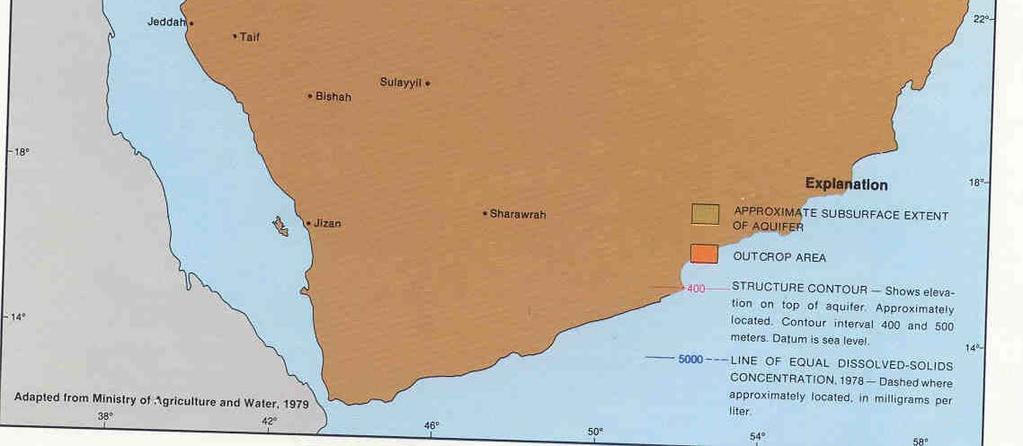
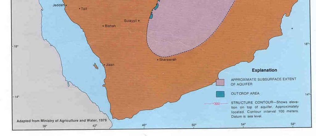
10 PRINCIPAL AQUIFERS in KSA Resources of Saudi Arabia 10

11 Resources of Saudi Arabia 11


12 Proven reserves= 30,000 mcm Resources of Saudi Arabia 12


13 Proven reserves= 65,000 mcm Resources of Saudi Arabia 13

14 Resources of Saudi Arabia 14


15 Proven reserves= 17,500 mcm Resources of Saudi Arabia 15

16 Resources of Saudi Arabia 16


17 Proven reserves= 120,000 mcm Resources of Saudi Arabia 17

18 Resources of Saudi Arabia 18

19 Proven reserves= 16,000 mcm Resources of Saudi Arabia 19

20 Resources of Saudi Arabia 20

21 Proven reserves= 5,000 mcm Resources of Saudi Arabia 21

22 Resources of Saudi Arabia 22

23 Resources of Saudi Arabia 23
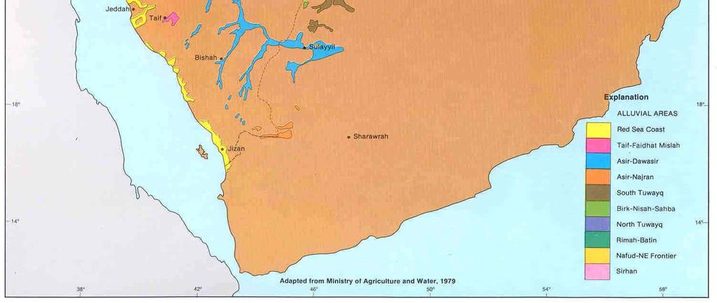
24 SECONDARY AQUIFERS in KSA Resources of Saudi Arabia 24

25 Resources of Saudi Arabia 25

26 Resources of Saudi Arabia 26

27 Resources of Saudi Arabia 27

28 Resources of Saudi Arabia 28

29 Resources of Saudi Arabia 29
30 Resources of Saudi Arabia 30

31 Resources of Saudi Arabia 31
32 Age Formation Member Lithology Hydrogeologic Unit Quaternary and Recent MIOCENE and PLIOCENE EOCENE Surficial Deposits Gravel, Sand and Silt Aquifer with variable productivity Kharj Limestone, gypsum and granels Aquifer Hofuf Sandy marl and Sandy limestone Aquifer Dam Marl and Shale Aquitard Hadhrukh Silty Sandstone Aquifer Limestone Aquifer Alat Marl Aquitard Khobar Limestone Aquifer Dammam Alveolina Limestone Limestone Saila Shale Shale Aquitard Midra Shale Shale RUS Marl, chalky limestone, gypsum PALEOCENE Umm Er Radhuma Limestone, Dolomitic limestone Aquifer Aruma Shales, Limestone Aquifer (poor) Wasia Sakaka (in North - Sansdstone Aquifer CRETACEOUS Western region Biyadh Sandstone Aquifer Buwaib Biogenic calcarenite, limestone Yamam Biogenic-pellet calcarenite Aquitard Sulay Chalky aphanitic limestone Aquifer (Local) Hith Anhydrite Aquitard Arab Calcarenite, Aphanitic limestone to poor Aquifer Jubaila Aphanitic Limestone, calcarenite (locally) Hanifa Aphanitic Limestone, calcarenite Aquifer (locally) JURASSIC Tuwaiq Mountain Aphanitic Limestone Aquitard Dhruma Aphanitic limestone and sandstone Aquifer Marrat Shales and aphanitic limestone Aquitard Minjur Sandstone Aquifer TRIASSIC Jilh Sandstone, aphanitic limestone Poor Aquifer Sudair Shales (red and green) Aquitard PERMIAN Khuf Limestone, dolomites Aquifer CARBONIFEROUS Unyzah (FAW) Sandstone Poor Aquifer Berwath Argillaceous Sandstone Aquifer DEVONIAN Jauf Upper Limestone Aquifer Shaibah Shale and sandstone Aquitard Tawil Sandstone Aquifer SILURIAN Qusaibah Shale Aquitard Middle Tabuk Sandstone Aquifer Tabuk Ra an Shale Aquitard ORDOVICIAN Lower Tabuk Sandstone Aquifer Hanadir Shale Aquitard Saq - Wajid Sandstone Aquifer CAMBRIAN PRE-CAMBRIAN Basement Complex Figure 1 Lithostratigraphic Succession and Hydrogeologic Units in Saudi Arabia (Modified after Powers et. al 1966; MAW, 1984; and Edgell, 1997) Resources of Saudi Arabia 32
33 Age Formation Member Lithology Hydrogeologic Unit Surficial Deposits Gravel, Sand and Silt Aquifer with variable productivity Kharj Limestone, gypsum and granels Aquifer Hofuf Sandy marl and Sandy limestone Aquifer Quaternary and Recent MIOCENE and PLIOCENE EOCENE Dam Marl and Shale Aquitard Hadhrukh Silty Sandstone Aquifer Alat Limestone Aquifer Marl Aquitard Dammam Khobar Limestone Aquifer Alveolina Limestone Limestone Saila Shale Shale Aquitard Midra Shale Shale RUS Marl, chalky limestone, gypsum PALEOCENE Umm Er Radhuma Limestone, Dolomitic limestone Aquifer Lithostratigraphic succession and hydrogeologic units in Saudi Arabia (modified after Powers et al. 1966, MAW 1984, Edgell 1997), Contd. Resources of Saudi Arabia 33
34 CRETACEOUS JURASSIC Aruma Shales, Limestone Aquifer (poor) Wasia Sakaka (in North - Sansdstone Western region Aquifer Biyadh Sandstone Aquifer Buwaib Biogenic calcarenite, limestone Yamama Biogenic-pellet calcarenite Aquitard Sulay Chalky aphanitic limestone Aquifer (Local) Hith Anhydrite Aquitard Arab Calcarenite, Aphanitic limestone to poor Aquifer Jubaila Aphanitic Limestone, calcarenite (locally) Hanifa Aphanitic Limestone, calcarenite Aquifer (locally) Tuwaiq Mountain Aphanitic Limestone Aquitard Dhruma Aphanitic limestone and sandstone Aquifer Marrat Shales and aphanitic limestone Aquitard Lithostratigraphic succession and hydrogeologic units in Saudi Arabia (modified after Powers et. al 1966, MAW 1984, Edgell 1997) Contd. Resources of Saudi Arabia 34
35 TRIASSIC Minjur Sandstone Aquifer Jilh Sandstone, aphanitic limestone Poor Aquifer Sudair Shales (red and green) Aquitard PERMIAN Khuf Limestone, dolomites Aquifer CARBONIFEROUS DEVONIAN SILURIAN ORDOVICIAN CAMBRIAN Unyzah (FAW) Sandstone Poor Aquifer Berwath Argillaceous Sandstone Aquifer Jauf Upper Limestone Aquifer Shaibah Shale and sandstone Aquitard Tawil Sandstone Aquifer Qusaibah Shale Aquitard Tabuk Middle Tabuk Sandstone Aquifer Ra an Shale Aquitard Lower Tabuk Sandstone Aquifer Hanadir Shale Aquitard Saq - Wajid Sandstone Aquifer PRE-CAMBRIAN Basement Complex Lithostratigraphic succession and hydrogeologic units in Saudi Arabia (modified after Powers et. al 1966, MAW 1984, Edgell 1997) Resources of Saudi Arabia 35
Assessment of Artificial Groundwater Recharge in Some Wadies in UAE by using Isotope Hydrology Techniques
 Assessment of Artificial Groundwater Recharge in Some Wadies in UAE by using Isotope Hydrology Techniques Presented by : Ahmed Saif Al Matri Head, Water Resources Section Ministry of Environment & Water
Hydrochemical evaluation of the Umm-er-Radhuma aquifer system, Saudi Arabia
 Hydrochemistry (Proceedings of the Rabat Symposium, April 1997) IAHSPubl.no. 244,1997. 13 Hydrochemical evaluation of the Umm-er-Radhuma aquifer system, Saudi Arabia A.M. AL BASSAM KingSaoud University,
GROUNDWATER PART II INVENTORY OF SHARED WATER RESOURCES IN WESTERN ASIA (ONLINE VERSION)
") PART II GROUNDWATER 10. 11. 12. 13. 14. 15. 16. 17. 18. 19. 20. 21. 22. 23. 24. 25. 26. INVENTORY OF SHARED WATER RESOURCES IN WESTERN ASIA ONLINE VERSION) How to cite UN-ESCWA and BGR United Nations Economic
PART II GROUNDWATER 10. 11. 12. 13. 14. 15. 16. 17. 18. 19. 20. 21. 22. 23. 24. 25. 26. INVENTORY OF SHARED WATER RESOURCES IN WESTERN ASIA ONLINE VERSION) How to cite UN-ESCWA and BGR United Nations Economic
Potentiality of Secondary Aquifers in Saudi Arabia: Evaluation of Groundwater Quality in Jubaila Limestone
 International Journal of Geosciences, 2012, 3, 71-80 http://dx.doi.org/10.236/ijg.2012.31009 Published Online February 2012 (http://www.scirp.org/journal/ijg) Potentiality of Secondary Aquifers in Saudi
Tawil-Quaternary Aquifer System
 Chapter 17 Wadi Sirhan Basin Tawil-Quaternary Aquifer System INVENTORY OF SHARED WATER RESOURCES IN WESTERN ASIA (ONLINE VERSION) How to cite UN-ESCWA and BGR (United Nations Economic and Social Commission
POTENTIAL SAUDI STANDARD SANDSTONE FOR APPLIED STUDIES OF PETROLEUM AND NATURAL GAS ENGINEERING
 [SPE KSA 848] 1 SPE-KSA (848) POTENTIAL SAUDI STANDARD SANDSTONE FOR APPLIED STUDIES OF PETROLEUM AND NATURAL GAS ENGINEERING Musaed N. J. Al-Awad 1, Abdulrahman A. AlQuraishi 2, Omar A. Almisned 3, and
The Hydrogeology of Al Hassa Springs
 The 3 rd International Conference on Water Resources and Arid Environments (2008) and the 1 st Arab Water Forum The Hydrogeology of Al Hassa Springs Ali Saad Al Tokhais 1 and Randolf Rausch 2 1. Ministry
ELECTRICAL RESISTIVITY IMAGING FOR QUATERNARY AQUIFER IN WADI MURAYKHAT AND WADI SA A, AL AIN AREA, UAE.
 ELECTRICAL RESISTIVITY IMAGING FOR QUATERNARY AQUIFER IN WADI MURAYKHAT AND WADI SA A, AL AIN AREA, UAE. By: Ahmed. El-Mahmoudi KFU University, Water Studies Centre, KSA Figure (#) Map of Al Jaww Plain
Variations in the Rus Formation
 Variations in the Rus Formation The Need for Consistent Core Logging Sallie Vest Halcrow / CH2M Hill 7 Nov 2012- TIME Not exposed at ground surface Umm Er- Raduh ma Paleogen e Eocene Damma m Cenozoic Oligoce
Wasia-Biyadh- Aruma Aquifer System (South)
") Chapter 12 Tawila-Mahra/Cretaceous Sands Wasia-Biyadh- Aruma Aquifer System (South) INVENTORY OF SHARED WATER RESOURCES IN WESTERN ASIA (ONLINE VERSION) How to cite UN-ESCWA and BGR (United Nations Economic
Chapter 12 Tawila-Mahra/Cretaceous Sands Wasia-Biyadh- Aruma Aquifer System (South) INVENTORY OF SHARED WATER RESOURCES IN WESTERN ASIA (ONLINE VERSION) How to cite UN-ESCWA and BGR (United Nations Economic
Soils, Hydrogeology, and Aquifer Properties. Philip B. Bedient 2006 Rice University
 Soils, Hydrogeology, and Aquifer Properties Philip B. Bedient 2006 Rice University Charbeneau, 2000. Basin Hydrologic Cycle Global Water Supply Distribution 3% of earth s water is fresh - 97% oceans 1%
Development and Application of Groundwater Flow and Solute Transport Models. Randolf Rausch
 Development and Application of Groundwater Flow and Solute Transport Models Randolf Rausch Overview Groundwater Flow Modeling Solute Transport Modeling Inverse Problem in Groundwater Modeling Groundwater
IRAQ. Target Exploration. Geodynamic Evolutions of The Sedimentary Basins of. This study is a major reference for Petroleum
 barr Target Exploration Target Exploration Geodynamic Evolutions of The Sedimentary Basins of IRAQ This study is a major reference for Petroleum Explorationists on the tectonics, stratigraphy, sedimentary
Hydrogeology of the Saq Aquifer Northwest of Tabuk, Northern Saudi Arabia
 JKAU: Earth Sci., Vol. 20 No. 1, pp: 51-66 (2009 A.D./ 1430 A.H.) Hydrogeology of the Saq Aquifer Northwest of Tabuk, Northern Saudi Arabia Masoud Eid Al-Ahmadi Faculty of Earth Sciences, King Abdulaziz
Ministry of Oil and Minerals Petroleum Exploration & Production Authority BLOCK 80 (WADI SARR)
") Ministry of Oil and Minerals Petroleum Exploration & Production Authority BLOCK 80 (WADI SARR) The Wadi Sarr Block (80) occupies an area of 1961 km 2 on the Sayun- Masilah Basin in the central Yemen. Block
Ministry of Oil and Minerals Petroleum Exploration & Production Authority BLOCK 80 (WADI SARR) The Wadi Sarr Block (80) occupies an area of 1961 km 2 on the Sayun- Masilah Basin in the central Yemen. Block
The Nubian Sandstone Aquifer System. Martina Müller Claudia Dengler Felix Leicht
 The Nubian Sandstone Aquifer System Martina Müller Claudia Dengler Felix Leicht Geography Transboundary groundwater system beneath the north-eastern Sahara total extension of over 2.2 Mio km² Shared between
Multiattributes and Seismic Interpretation of Offshore Exploratory Block in Bahrain A Case Study
 Multiattributes and Seismic Interpretation of Offshore Exploratory Block in Bahrain A Case Study Suresh Thampi, Aqeel Ahmed, Yahya Al-Ansari, Ali Shehab, Ahmed Fateh, Anindya Ghosh, Ghada Almoulani. The
Groundwater Level Monitoring of the Quaternary Aquifer at Al Ain City, United Arab Emirates (UAE) using Geophysical Methods
 using Geophysical Methods") Groundwater Level Monitoring of the Quaternary Aquifer at Al Ain City, United Arab Emirates (UAE) using Geophysical Methods Ahmed Murad & Amir Gabr Geology Department UAE University Outlines Introduction
Groundwater Level Monitoring of the Quaternary Aquifer at Al Ain City, United Arab Emirates (UAE) using Geophysical Methods Ahmed Murad & Amir Gabr Geology Department UAE University Outlines Introduction
EVALUATION OF GROUNDWATER QUALITY IN THE EASTERN DISTRICT OF ABU DHABI EMIRATE, UAE
 Proceedings of the 4 th International Conference on Environmental Science and Technology Rhodes, Greece, 3-5 September 05 EVALUATION OF GROUNDWATER QUALITY IN THE EASTERN DISTRICT OF ABU DHABI EMIRATE,
Groundwater Sustainability at Wadi Al Bih Dam, Ras El Khaimah, United Arab Emirates (UAE) using Geophysical methods
 using Geophysical methods") Groundwater Sustainability at Wadi Al Bih Dam, Ras El Khaimah, United Arab Emirates (UAE) using Geophysical methods Ahmed Murad, Amir Gabr, Saber Mahmoud, Hasan Arman & Abdulla Al Dhuhoori Geology Department
Groundwater Sustainability at Wadi Al Bih Dam, Ras El Khaimah, United Arab Emirates (UAE) using Geophysical methods Ahmed Murad, Amir Gabr, Saber Mahmoud, Hasan Arman & Abdulla Al Dhuhoori Geology Department
Neogene Aquifer System (South-East): Dibdibba-Kuwait Group
: Dibdibba-Kuwait Group") Chapter 26 Dibdibba Delta Basin Neogene Aquifer System (South-East): Dibdibba-Kuwait Group INVENTORY OF SHARED WATER RESOURCES IN WESTERN ASIA (ONLINE VERSION) How to cite UN-ESCWA and BGR (United Nations
Chapter 26 Dibdibba Delta Basin Neogene Aquifer System (South-East): Dibdibba-Kuwait Group INVENTORY OF SHARED WATER RESOURCES IN WESTERN ASIA (ONLINE VERSION) How to cite UN-ESCWA and BGR (United Nations
Geology and Soils. Technical Memorandum
 Geology and Soils Technical Memorandum TO: FDOT FROM: HDR, Inc. DATE: February 2013 PROJECT: St Johns River Crossing FPID No: 208225-3-21-01 Clay, Duval, and St. Johns Counties; Florida Geology and soils
Origin and Evolution of Formation Waters in the West-Central Part of the Alberta Basin
 Page No. 004-1 Origin and Evolution of Formation Waters in the West-Central Part of the Alberta Basin Karsten Michael* University of Alberta, 1-26 ESB, Edmonton, AB T6G 2E3 karsten@ualberta.ca and Stefan
FORMATION OF GROUNDWATER IN SEDIMENTARY BASINS: TRADITIONAL AND ALTERNATIVE MODELS
 FORMATION OF GROUNDWATER IN SEDIMENTARY BASINS: TRADITIONAL AND ALTERNATIVE MODELS Albertas Bitinas Klaipėda University, Coastal Research and Planning Institute, H. Manto St. 84, Klaipėda, Lithuania, albertas.bitinas@corpi.ku.lt
Five buried crater structures imaged on reflection seismic data in Saudi Arabia
 GeoArabia, 24, v. 9, no., p. 7-44 Gulf PetroLink, Bahrain Five buried crater structures imaged on reflection seismic data in Saudi Arabia Allen S. eville, Douglas J. Cook, Abdulkader M. Afifi and Simon
SEASONAL WATER STORAGE AND REPLENISHMENT OF A FRACTURED GRANITE AQUIFER USING ASR WELLS
 SEASONAL WATER STORAGE AND REPLENISHMENT OF A FRACTURED GRANITE AQUIFER USING ASR WELLS Mario R. Lluria; Phillip M. Paski; Gary G. Small HydroSystems, Incorporated Phoenix, Arizona USA Presentation Contents
MECHANISMS OF GROUNDWATER RECHARGE IN THE BALTIC ARTESIAN BASIN
 and modelling system for groundwater research MECHANISMS OF GROUNDWATER RECHARGE IN THE BALTIC ARTESIAN BASIN Alise BABRE 1, Rein VAIKMÄE 2, Tõnu MARTMA 2, Konrāds POPOVS 1, Aija DĒLIŅA 1 1 University
Exploration Opportunities in the Middle East
 Exploration Opportunities in the Middle East Richard Herbert R Herbert Associates Ltd Finding Petroleum Middle East Forum Tuesday 16 th May 2017 The Geological Society, London Agenda What defines the Middle
11/22/2010. Groundwater in Unconsolidated Deposits. Alluvial (fluvial) deposits. - consist of gravel, sand, silt and clay
 deposits. - consist of gravel, sand, silt and clay") Groundwater in Unconsolidated Deposits Alluvial (fluvial) deposits - consist of gravel, sand, silt and clay - laid down by physical processes in rivers and flood plains - major sources for water supplies
Groundwater in Unconsolidated Deposits Alluvial (fluvial) deposits - consist of gravel, sand, silt and clay - laid down by physical processes in rivers and flood plains - major sources for water supplies
TAMPA BAY TRIBUTARIES BASIN. Hydrogeological Setting
 TAMPA BAY TRIBUTARIES BASIN Hydrogeological Setting Aquifers within the Tampa Bay Tributaries Basins ground water flow system include the Floridan aquifer system, the intermediate aquifer system, and the
Evolution of the conceptual hydrogeologic and ground-water flow model for Las Vegas Valley, Clark County, Nevada
 Evolution of the conceptual hydrogeologic and ground-water flow model for Las Vegas Valley, Clark County, Nevada Geological Society of America Annual Meeting November 14, 2 David J. Donovan Southern Nevada
PALYGORSKITE FROM TERTIARY FORMATIONS OF EASTERN SAUDI ARABIA
 Clays and Clay Minerals, Vol. 33, No. 5, 451-457, 1985. PALYGORSKITE FROM TERTIARY FORMATIONS OF EASTERN SAUDI ARABIA H. SHADFAN, A. S. MASHHADY, J. B. DIXON, 1 AND A. A. HOSSEN Soil Science Department,
THEMATIC MAPPING FOR DEVELOPMENT AND MANAGEMENT OF
 Distr.: LIMITED ECA/NRD/CART.9/0RG. 1 October 1996 Original: ENGLISH Ninth United Nations Regional Cartographic Conference for Africa Addis Ababa, Ethiopia 11-15 November 1996 THEMATIC MAPPING FOR DEVELOPMENT
Land subsidence due to groundwater withdrawal in Hanoi, Vietnam
 Land Subsidence (Proceedings of the Fifth International Symposium on Land Subsidence, The Hague, October 1995). 1AHS Publ. no. 234, 1995. 55 Land subsidence due to groundwater withdrawal in Hanoi, Vietnam
Ground-motion simulation for the eastern province of Saudi Arabia using a stochastic model
 Earthquake Ground Motion: Input Definition for Aseismic Design 91 Ground-motion simulation for the eastern province of Saudi Arabia using a stochastic model M. S. Fnais Geology & Geophysics Department,
HYDROGYEOLOGICAL CONDITIONS IN EGYPT REGWA
 HYDROGYEOLOGICAL CONDITIONS IN EGYPT REGWA Introduction The purpose of this report is to present a summary of hydrogeological condition in Egypt. The main water-bearing formation in Egypt are the extensive
Groundwater Resources of Missouri. Cynthia Brookshire, R. G.
 Groundwater Resources of Missouri Cynthia Brookshire, R. G. GROUNDWATER... Water beneath the Earth s surface within a zone of saturation AQUIFER... A geologic formation or group of formations that are
Geological Setting. Chapter 3 Geological Setting 15
 Chapter 3 Geological Setting 15 3 Geological Setting The region of the Nubian Sandstone Aquifer System as a major constituent of the Eastern Sahara was subjected to intensive geological studies on all
JOURNAL OF ENVIRONMENTAL HYDROLOGY
 JOURNAL OF ENVIRONMENTAL HYDROLOGY The Electronic Journal of the International Association for Environmental Hydrology On the World Wide Web at http://www.hydroweb.com VOLUME 13 2005 THE EFFECT OF SINKHOLES
GEOLOGICAL CO 2 STORAGE POTENTIAL IN THE ARAB REGION.
 ESCWA Earth and Environmental Sciences GEOLOGICAL CO 2 STORAGE POTENTIAL IN THE ARAB REGION. Andrea Moscariello University of Geneva Expert Group Meeting on Carbon Capture, Utilization and Storage in ESCWA
Blocks 31, 32, 33, 34, 35 & 36/03 Southeast Offshore Vietnam
 Blocks 31, 32, 33, 34, 35 & 36/03 Southeast Offshore Vietnam Block 31 32 33 34 35 36/03 Area (km 2) 5,036 4,440 4,630 4,700 4,630 2,950 Sea level (m) 20 20-30 30-40 50 50 50 Seismic 2D (km) 1,294 685 431
High-purity limestone assessment : from mine to market
 High-purity limestone assessment : from mine to market Clive Mitchell Industrial Minerals Specialist, British Geological Survey Email: cjmi@bgs.ac.uk Website: www.mineralsuk.com Outline Introduction Limestone
Shuttle Imaging Radar Views of Some Geological Features in the Arabian Peninsula
 GeoArabia, Vol. 2, o. 2, 1997 Gulf PetroLink, Bahrain Shuttle Imaging Radar Views of the Arabian Peninsula Shuttle Imaging Radar Views of Some Geological Features in the Arabian Peninsula Khattab G. Al-Hinai,
Status of Quaternary aquifer sustainability at Umm Ghafa area, eastern part of Al-Ain area, UAE
 184 Trends and Sustainability of Groundwater in Highly Stressed Aquifers (Proc. of Symposium JS.2 at the Joint IAHS & IAH Convention, Hyderabad, India, September 2009). IAHS Publ. 329, 2009. Status of
the Quarrying Industry Dewatering and the Quarrying Industry the Quarrying Industry
 Dewatering and the Quarrying Industry Dewatering and Dewatering and the Quarrying Industry the Quarrying Industry Les Brown Eugene P. Daly John Kelly Objectives 1) To present a summary of water management
L.O: HOW GEOLOGISTS SEQUENCE EVENTS IN EARTH'S GEOLOGIC HISTORY IF NOT OVERTURNED, OLDEST ON BOTTOM, YOUNGEST ON TOP
 L.O: HOW GEOLOGISTS SEQUENCE EVENTS IN EARTH'S GEOLOGIC HISTORY IF NOT OVERTURNED, OLDEST ON BOTTOM, YOUNGEST ON TOP 1. Unless a series of sedimentary rock layers has been overturned, the bottom rock layer
Copyright Gulf PetroLink All Rights Reserved. Downloaded by IP:
 JILH TO SHU'AIBA 35 48o 5o 28o 3 25 2 15 26o 1 Distance (Km) 5 (feet) -5 2, 3, -1 4, 24o 5, -15 6, 7, -2 8, 9, -25 1, 11, -3 12, 13, 22o -35-15 -1-5 5 1 15 2 25 3 13,5 Distance (Km) Figure 5: Triassic-Early
Phanerozoic cycles of sea-level change on the Arabian Platform
 GeoArabia, Vol. 10, No. 2, 2005 Gulf PetroLink, Bahrain Phanerozoic cycles of sea-level change on the Arabian Platform Bilal U. Haq and Abdul Motaleb Al-Qahtani ABSTRACT The Arabian Plate has experienced
Palaeohydrogeology and Water Quality Control of the Tertiary Aquifer, Kuwait
 International Water Resources Association Water International, Volume 32, Number 2, Pg. 325-338, June 2007 2007 International Water Resources Association Palaeohydrogeology and Water Quality Control of
Ministry of Oil and Minerals Petroleum Exploration & Production Authority BLOCK 85 (Al Uqlah North)
") Ministry of Oil and Minerals Petroleum Exploration & Production Authority BLOCK 85 (Al Uqlah North) The Al Uqlah North Block (85) occupies an area of 597 km 2 in the Sabatayn Basin in the province of Shabwah
Ministry of Oil and Minerals Petroleum Exploration & Production Authority BLOCK 85 (Al Uqlah North) The Al Uqlah North Block (85) occupies an area of 597 km 2 in the Sabatayn Basin in the province of Shabwah
IPMO2-1. Groundwater Modelling of Chiang Rai Basin, Northern Thailand. Sattaya Intanum* Dr.Schradh Saenton**
 IPMO2-1 Groundwater Modelling of Chiang Rai Basin, Northern Thailand Sattaya Intanum* Dr.Schradh Saenton** ABSTRACT Chiang Rai basin, situated in Chiang Rai and Phayao provinces covering an area of 11,000
SAMPLE QUESTIONS FOR GEOLOGY 103, TEST 1
 SAMPLE QUESTIONS FOR GEOLOGY 103, TEST 1 The correct answers are listed at the bottom (no peeking!). These questions are to give you an idea of the type of questions that will be asked. They are not a
Arabian Journal of Earth Sciences (AJES)
") Arabian Journal of Earth Sciences Vol. 2 (2015) - Issue 1: 1-21 www.asrongo.org/doi:2.2015.2.1.1 الدورية العربية لعلوم األرض Arabian Journal of Earth Sciences (AJES) www.arabianjournalofscience.com/index.php/ajes
Arabian Journal of Earth Sciences Vol. 2 (2015) - Issue 1: 1-21 www.asrongo.org/doi:2.2015.2.1.1 الدورية العربية لعلوم األرض Arabian Journal of Earth Sciences (AJES) www.arabianjournalofscience.com/index.php/ajes
EGAS. Ministry of Petroleum
 EGAS Ministry of Petroleum EGAS Ministry of Petroleum About The Block Location: N. El Arish offshore block is located in the extreme eastern part of the Egypt s economic water border and bounded from the
Ministry of Oil and Minerals Petroleum Exploration & Production Authority BLOCK 6 (Iryam)
") Ministry of Oil and Minerals Petroleum Exploration & Production Authority BLOCK 6 (Iryam) The Iryam Block (6) occupies an area of 3,911 km 2 in the Sabatayn Basin in the province of Shabwah in central
Ministry of Oil and Minerals Petroleum Exploration & Production Authority BLOCK 6 (Iryam) The Iryam Block (6) occupies an area of 3,911 km 2 in the Sabatayn Basin in the province of Shabwah in central
Biology. Slide 1 of 40. End Show. Copyright Pearson Prentice Hall
 Biology 1 of 40 2 of 40 Fossils and Ancient Life What is the fossil record? 3 of 40 Fossils and Ancient Life The fossil record provides evidence about the history of life on Earth. It also shows how different
Groundwater Hydrology
 EXERCISE 12 Groundwater Hydrology INTRODUCTION Groundwater is an important component of the hydrologic cycle. It feeds lakes, rivers, wetlands, and reservoirs; it supplies water for domestic, municipal,
3/5/05 Dr. Stewart 1
 I. Physiography of Appalachian Mountains A. Introduction 1. These mountains extend from NE Canada to Georgia 2. They are the remains of a deeply eroded, ancient mountain chain once larger than the Himalayans
The Lithosphere and the Tectonic System. The Structure of the Earth. Temperature 3000º ºC. Mantle
 The Lithosphere and the Tectonic System Objectives: Understand the structure of the planet Earth Review the geologic timescale as a point of reference for the history of the Earth Examine the major relief
EGAS. Ministry of Petroleum
 EGAS Ministry of Petroleum EGAS Ministry of Petroleum About The Block Location: N. Thekah offshore block is located at about 56 km to the north of the Mediterranean shore line, 85 km to the north west
Chapter 3. Geology & Tectonics
 Chapter 3 Geology & Tectonics 3.1 Geology The general geological features of Indonesia are shown in Figure 3.1. The basement formation is metamorphic and it is intruded with plutonic formations. They are
The elevations on the interior plateau generally vary between 300 and 650 meters with
 11 2. HYDROLOGICAL SETTING 2.1 Physical Features and Relief Labrador is bounded in the east by the Labrador Sea (Atlantic Ocean), in the west by the watershed divide, and in the south, for the most part,
FLOOD PLAIN MITIGATION IN ARID REGIONS CASE STUDY: SOUTH OF AL-KHARJ CITY, SAUDI ARABIA
 www.arpapress.com/volumes/vol16issue1/ijrras_16_1_16.pdf FLOOD PLAIN MITIGATION IN ARID REGIONS CASE STUDY: SOUTH OF AL-KHARJ CITY, SAUDI ARABIA Mona A. Hagras 1, Ashraf M. Elmoustafa 2 & Ahmed Kotb 3
WP2 country review Lithuania
 Saulius Sliaupa Rasa Sliaupiene institute of Geology and Geography WP2 country review Lithuania CO 2 emission in Lithuania (2005) 94 sources listed in the CO2 trading system of Lithuania in 2005 CO 2 emissions
Wisconsin s Hydrogeology: an overview
 2012 Soil and Water Conservation Society Conference Stevens Point, WI Feb 9, 2012 Wisconsin s Hydrogeology: an overview Ken Bradbury Wisconsin Geological and Natural History Survey University of Wisconsin-Extension
Continental Landscapes
 Continental Landscapes Landscape influenced by tectonics, climate & differential weathering Most landforms developed within the last 2 million years System moves toward an equilibrium Continental Landscapes
REGION 2 ASSESSMENT SUMMARY MIDDLE EAST. in U.S. Geological Survey Digital Data Series 60
 Chapter R2 REGION 2 ASSESSMENT SUMMARY MIDDLE EAST AND NORTH AFRICA by Thomas S. Ahlbrandt 1, Richard M. Pollastro 1, Timothy R. Klett 1, Christopher J. Schenk 1, Sandra J. Lindquist 2, and James E. Fox
Constraining the thermal history of carbonate reservoirs
 Constraining the thermal history of carbonate reservoirs Kristin Bergmann Victor P. Starr Assistant Professor Department of Earth, Atmospheric and Planetary Sciences MIT Earth Resources Laboratory 217
The Capitan Aquifer - Ellenburger Production Wells Geothermal Engine Source?
 GEOTHERMAL ENERGY UTILIZATION ASSOCIATED WITH OIL & GAS DEVELOPMENT June 17-18, 2008 Southern Methodist University Dallas, Texas The Capitan Aquifer - Ellenburger Production Wells Geothermal Engine Source?
Deep Time and the Geologic Time Scale
 Deep Time and the Geologic Time Scale Prior to the 1700 s deep time did not exist... According to Genesis the Earth was created in 6 days about 6000 years ago. Earth history = Biblical history Dinosaurs
KHASHM FORMATION, A NEW LITHOSTRATIGRAPHIC UNIT WITHIN THE CRETACEOUS WASIA GROUP OF ARABIA
 Qatar Univ. Sci. Bull. (1988), 8: 287-295 KHASHM FORMATION, A NEW LITHOSTRATIGRAPHIC UNIT WITHIN THE CRETACEOUS WASIA GROUP OF ARABIA By HAMED A. EL-NAKHAL Dept. of Geology, Faculty of Science, University
The Building of the NYC Region
 The Building of the NYC Region Definitions Fall Line marks the area where an upland region (continental bedrock) and a coastal plain meet Piedmont the plateau region of the eastern United States which
Red Sea Basins. by Prof. Dr. Abbas Mansour
 Red Sea Basins TECTONO-SEDIMENTARY EVOLUTION OF THE NW PARTS OF THE RED SEA The pre-rift rift by Prof. Dr. Abbas Mansour 1.a. The Precambrian basement and the inherited structural pattern of the rift
GEO 303. Introduction to Geology LAB FINAL EXAM
 Name Lab section: Day Hour TA GEO 303 Introduction to Geology LAB FINAL EXAM Spring, 1999 100 points 2 INSTRUCTION: This multiple-choice, machine-graded exam consists of 100 questions, each worth 1 point.
Groundwater. (x 1000 km 3 /y) Reservoirs. Oceans Cover >70% of Surface. Groundwater and the. Hydrologic Cycle
 Reservoirs. Oceans Cover >70% of Surface. Groundwater and the. Hydrologic Cycle") Chapter 13 Oceans Cover >70% of Surface Groundwater and the Hydrologic Cycle Oceans are only 0.025% of Mass Groundwater Groundwater is liquid water that lies in the subsurface in fractures in rocks and
Chapter 13 Oceans Cover >70% of Surface Groundwater and the Hydrologic Cycle Oceans are only 0.025% of Mass Groundwater Groundwater is liquid water that lies in the subsurface in fractures in rocks and
GEOLOGY GL1 Foundation Unit
 Candidate Name Centre Number Candidate Number 2 General Certificate of Education Advanced Subsidiary/Advanced 451/01 GEOLOGY GL1 Foundation Unit P.M. THURSDAY, 10 January 2008 (1 hour) Examiner Question
40 th Anniversary Chemical Characteristics of Geothermal Fluids in Jiaodong Peninsula, Shandong, China. Tingting Zheng Student UNU GTP
 40 th Anniversary Chemical Characteristics of Geothermal Fluids in Jiaodong Peninsula, Shandong, China Tingting Zheng Student UNU GTP Contents Geothermal developments in Shandong, China The Shandong area
IMPACT OF CLIMATE CHANGE OVER THE ARABIAN PENINSULA
 IMPACT OF CLIMATE CHANGE OVER THE ARABIAN PENINSULA By: Talal Alharbi June, 29 2017 1 Motivation: In arid and semi-arid regions of the world the demand for fresh water resources is increasing due to: increasing
iii CONTENTS vii ACKNOWLEDGMENTS EXECUTIVE SUMMARY INTRODUCTION Study Area Data Sources Preparation of Geologic Maps
 CONTENTS ACKNOWLEDGMENTS EXECUTIVE SUMMARY INTRODUCTION Study Area Data Sources Preparation of Geologic Maps GEOLOGY Bedrock Geology Succession and Distribution Structural Features Description of Bedrock
Block 43B - Onshore Oman
 Block 43B - Onshore Oman SUMMARY Block 43B is an 11,967 km 2 area located along the coastal area of Oman north of the Hajar Mountains. This is an unexplored region, both geographically and stratigraphically.
entered a rapid development phase. Annual increased proven reserves are above 500 billion cubic meters (bcm) from 2003, and annual natural gas product
 from 2003, and annual natural gas product") (), entered a rapid development phase. Annual increased proven reserves are above 500 billion cubic meters (bcm) from 2003, and annual natural gas production has increased from 50bcm in 2000 to nearly
(), entered a rapid development phase. Annual increased proven reserves are above 500 billion cubic meters (bcm) from 2003, and annual natural gas production has increased from 50bcm in 2000 to nearly
Hydrologic factors controlling groundwater salinity in northwestern coastal zone, Egypt
 Hydrologic factors controlling groundwater salinity in northwestern coastal zone, Egypt Nahla A Morad 1, M H Masoud 1,2, and S M Abdel Moghith 1 1 Hydrology Department, Desert Research Centre, Cairo, Egypt.
Unconformities are depositional contacts that overlie rocks distinctly older than they are. They are often called gaps in the sedimentary record.
 UNCONFORMITIES Unconformities are depositional contacts that overlie rocks distinctly older than they are. They are often called gaps in the sedimentary record. The contact represents time when no sediment
SCHOOL OF ENVIRONMENTAL SCIENCES JAWAHARLAL NEHRU UNIVERSITY NEWDELHI INDIA
 PRELIMENARY RESULT FROM SURFACE AND SUBSURAFCE HYDROLOGICAL INVESTIGATION OF DEHGOLAN-PLAIN, KURDISTAN, IRAN USING GEOPHYSICAL REMOTE SENSING AND GIS TECHNIQUES Payam Sajadi SCHOOL OF ENVIRONMENTAL SCIENCES
Exploration Of The Geothermal Energy
 Exploration Of The Geothermal Energy Resources In The Republic Of Yemen Ameen sharian Mazen ALmakatari November 2008 The geographical location of Yemen The Republic of Yemen is located in the southern
Chapter 3 Time and Geology
 Chapter 3 Time and Geology Methods of Dating Rocks 1. Relative dating - Using fundamental principles of geology (Steno's Laws, Fossil Succession, etc.) to determine the relative ages of rocks (which rocks
Structural Geology of the Mountains
 Structural Geology of the Mountains Clinton R. Tippett Shell Canada Limited, Calgary, Alberta clinton.tippett@shell.ca INTRODUCTION The Southern Rocky Mountains of Canada (Figure 1) are made up of several
Florida s Karst Geology
 Florida s Karst Geology Orange Creek Basin Interagency Working Group Public Workshop, November 5 th, 2015 Harley Means, P.G. Assistant State Geologist Florida Geological Survey Karst Karst a type of topography
GEOLOGY - GL4 INTERPRETING THE GEOLOGICAL RECORD
 Candidate Name Centre Number 2 Candidate Number GCE A level 1214/01 GEOLOGY - GL4 INTERPRETING THE GEOLOGICAL RECORD A.M. MONDAY, 21 June 2010 2 hours Section A 1. 2. 3. 15 15 15 1214 01 01 4. 15 Section
Structural Styles and Geotectonic Elements in Northwestern Mississippi: Interpreted from Gravity, Magnetic, and Proprietary 2D Seismic Data
 Structural Styles and Geotectonic Elements in Northwestern Mississippi: Interpreted from Gravity, Magnetic, and Proprietary 2D Seismic Data Nick Loundagin 1 and Gary L. Kinsland 2 1 6573 W. Euclid Pl.,
GEOLOGICAL AND HYDROGEOLOGICAL CONSIDERATIONS ON THE PHREATIC AQUIFER OF THE TARNAVA MICA RIVER FLOOD PLAIN AND TERRACES
 GEOLOGICAL AND HYDROGEOLOGICAL CONSIDERATIONS ON THE PHREATIC AQUIFER OF THE TARNAVA MICA RIVER FLOOD PLAIN AND TERRACES E. RADU 1, M. RADESCU, C. RADU, A. PANDELE, M. MINCIUNA ABSTRACT. Geological and
EVALUATION OF SOIL AND WATER RESOURCES IN WADI WARDAN, SINAI, EGYPT, USING ELECTRICAL RESISTIVITY METHOD
 Qatar Univ. Sci. Bull. (1985), 5: 321-333 EVALUATION OF SOIL AND WATER RESOURCES IN WADI WARDAN, SINAI, EGYPT, USING ELECTRICAL RESISTIVITY METHOD By MOKHTAR ABDULAZIZ SAYED* Desert Institute, Al-Matariya
Petroleum Systems (Part One) Source, Generation, and Migration
 Source, Generation, and Migration") Petroleum Systems (Part One) Source, Generation, and Migration GEOL 4233 Class January 2008 Petroleum Systems Elements Source Rock Migration Route Reservoir Rock Seal Rock Trap Processes Generation Migration
Petroleum Systems (Part One) Source, Generation, and Migration GEOL 4233 Class January 2008 Petroleum Systems Elements Source Rock Migration Route Reservoir Rock Seal Rock Trap Processes Generation Migration
Using transmissivity, specific capacity and borehole yielddata to assess the productivity of Scottish aquifers
 Using transmissivity, specific capacity and borehole yielddata to assess the productivity of Scottish aquifers M.T. Graham, D.F. Ball, B.É. Ó Dochartaigh* & A.M. MacDonald British Geological Survey, Murchison
Chapter 8 Fetter, Applied Hydrology 4 th Edition, Geology of Groundwater Occurrence
 Chapter 8 Fetter, Applied Hydrology 4 th Edition, 2001 Geology of Groundwater Occurrence Figure 8.42. Alluvial Valleys ground-water region. Fetter, Applied Hydrology 4 th Edition, 2001 Fetter, Applied
Stratigraphic Trap in the Permian Unayzah Formation, Central Saudi Arabia
 GeoArabia, Vol. 2, No. 3, 1997 Gulf PetroLink, Bahrain Unayzah Stratigraphic Trap, Saudi Arabia Stratigraphic Trap in the Permian Unayzah Formation, Central Saudi Arabia Daniel S. Evans, Bassam H. Bahabri
THE EXPLORATION AND EVALUATION OF WATER RESOURCES IN HARRAT KHYBAR SAUDI GEOLOGICAL SURVEY DEPARTMENT OF APPLIED GEOLOGY HYDROGEOLOGY SECTION JEDDAH
 THE EXPLORATION AND EVALUATION OF WATER RESOURCES IN HARRAT KHYBAR SAUDI GEOLOGICAL SURVEY DEPARTMENT OF APPLIED GEOLOGY HYDROGEOLOGY SECTION JEDDAH Water Resources under stress Kingdom of Saudi Arabia
A Preliminary Geophysical Reconnaissance Mapping of Emirau Ground Water Resource, Emirau Island, New Ireland Province, PNG
 A Preliminary Geophysical Reconnaissance Mapping of Emirau Ground Water Resource, Emirau Island, New Ireland Province, PNG Geological Survey Division of Mineral Resources Authority (MRA) Papua New Guinea
RESISTIVITY IMAGING AND BOREHOLE INVESTIGATION OF THE BANTING AREA AQUIFER, SELANGOR, MALAYSIA. A.N. Ibrahim Z.Z.T. Harith M.N.M.
 JOURNAL OF ENVIRONMENTAL HYDROLOGY The Electronic Journal of the International Association for Environmental Hydrology On the World Wide Web at http://www.hydroweb.com VOLUME 11 2003 RESISTIVITY IMAGING
Mesozoic rock formations in the NY region. The Geologic History of New York State. The Mesozoic. Mesozoic Rock Formations in the NY Region
 The eologic History of New York State The Mesozoic eologic Provinces NY Region Timescale and geologic provinces of NY-NJ Mesozoic Rock Formations in the NY Region Mesozoic rock formations in the NY region