TIME DOMAIN ELECTROMAGNETICS IN MARS ANALOG ENVIRONMENTS: COMPARING TWO FIELD STUDIES. Joern A. Jernsletten 1
|
|
|
- Rosa Alexander
- 6 years ago
- Views:
Transcription
1 AAS TIME DOMAIN ELECTROMAGNETICS IN MARS ANALOG ENVIRONMENTS: COMPARING TWO FIELD STUDIES Joern A. Jernsletten 1 The purpose of this study is to evaluate the use of (diffusive) Time Domain Electromagnetics (TEM) for sounding of subsurface water in conductive Mars analog environments. To provide a baseline for such studies, I show data from two field studies: 1) Diffusive sounding data (TEM) from Pima County, Arizona; and 2) Shallower sounding data using the Fast-Turnoff TEM method from Peña de Hierro in the Rio Tinto region of Spain. The latter is data from work conducted under the auspices of the Mars Analog Research and Technology Experiment (MARTE). A TEM survey was carried out in Pima County, Arizona, in January Data was collected using 100 m Tx loops and a ferrite-cored magnetic coil Rx antenna, and processed using commercial software. The survey used a 16 Hz sounding frequency, which is sensitive to slightly salty groundwater. Prominent features in the data from Arizona are the ~500 m depth of investigation and the ~120 m depth to the water table, confirmed by data from four USGS test wells surrounding the field area. During May and June of 2003, a Fast-Turnoff (early time) TEM survey was carried out at the Peña de Hierro field area of the MARTE project, near the town of Nerva, Spain. Data was collected using 20 m and 40 m Tx loop antennae and 10 m loop Rx antennae, with a 32 Hz sounding frequency. Data from Line 4 of this survey show ~200 m depth of investigation and a conductive high at ~90 m depth. This is interpreted as the water table, matching the 431 m MSL elevation of the nearby pit lake. Data from Line 15 and Line 14 of investigation and show conductive highs at ~15 m depth, interpreted as subsurface water flow under mine tailings matching surface flows seen coming out from under the tailings, and shown on maps. Both of the interpretations from Rio Tinto data were confirmed by preliminary results from the MARTE ground truth drilling campaign carried out in September and October Global Geophysical Services, Inc., 3535 Briarpark Drive, Ste. 200, Houston, Texas joern@jernsletten.name 93

2 INTRODUCTION Surface geophysical methods to look for deep groundwater on Mars is a technology being considered for future missions to Mars. Electromagnetic geophysical methods are attractive in this context for two primary reasons: Their relative light footprints and logistical simplicity compared to some other geophysical methods (seismics, etc.), and a history of use in groundwater mapping, making them a mature technique I a wide range of terrestrial contexts. The purpose of this study was to evaluate the use of two variant techniques of Time Domain Electromagnetics (TEM) for sounding of subsurface water in different conductive Mars analog environments. The two studies were: 1) Diffusive sounding data (TEM) from Pima County, Arizona Figure 1; and 2) Shallower sounding data using the Fast-Turnoff TEM method [1] from Peña de Hierro in the Rio Tinto region of Spain Figure 2. The latter is data from work conducted under the auspices of the Mars Analog Research and Technology Experiment (MARTE) [2-7]. Figure 1. Tucson field area location map. The goal of this work is to begin defining basic parameters (frequencies, antennae sizes, etc.) appropriate for sounding conductive (saline, mineralized) groundwater to great depths (100 s of meters to kilometers). Such depths are almost certainly required for groundwater to exist in a liquid phase on Mars, even if such water is assumed to be saline to the point of nearly being eutectic brines [8]. 94
3 Figure 2. Peña de Hierro and Rio Tinto location map. Adapted from [3]. 95


4 Figure 3. Pima County, Arizona Field Area. 96

5 Figure 4. Typical TEM Setup in the Field SURVEY RESULTS AND METHODOLOGY TEM Survey, Pima County, Arizona A TEM survey intended to be the first step on a long road to the goal of geophysically searching for water on Mars was carried out in Pima County, Arizona, in January Figure 3 shows a map of the field area of this study, located about 35 miles southwest of the city of Tucson. The TEM method has been widely used for mapping of groundwater [9-10], and of metalbearing acid solutions in leaching operations. Figure 4 shows a typical TEM setup in the field, and Figure 5 shows model data from this survey. Data was collected using 100 m Tx loops and a ferrite-cored magnetic coil Rx antenna, and processed using commercial software [10-11]. The survey used a 16 Hz sounding frequency, which is sensitive to slightly salty groundwater [10, 12]. Prominent features in Figure 5 are the ~500 m depth of investigation and the ~120 m depth to the water table (horizontal lines). Note also the conductive (~20-40 Ωm) clay-rich soil above the water table. The horizontal line marks the ~120 m depth to the water table found in several USGS test wells in the area (Table 1). 97
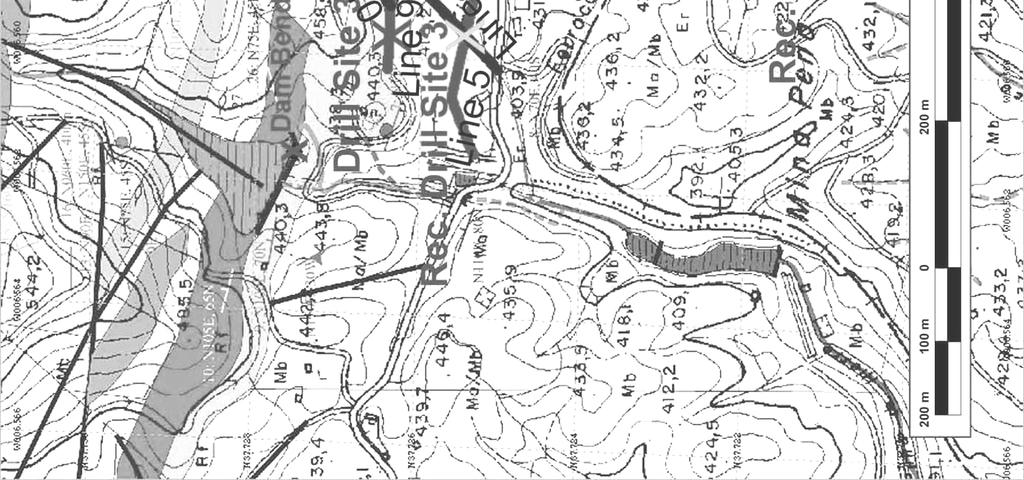
6 Well Site Label Water Depth (m) Water Depth (ft) Date of Latest Reading USGS Well # m ft 12/10/1991 USGS Well # m ft 12/17/1986 USGS Well # m ft 12/07/1991 USGS Well # m ft 12/27/1990 Table 1. USGS Well Data. Fast-Turnoff TEM Survey, Rio Tinto, Spain During May and June of 2003, a Fast-Turnoff (early time) TEM survey was carried out at the Peña de Hierro field area of the MARTE project, near the town of Nerva, Spain. Data was collected using 20 m and 40 m Tx loop antennae and 10 m loop Rx antennae, with a 32 Hz sounding frequency. Data from Line 4 (of 16) from this survey, collected using 40 m Tx loops, show ~200 m depth of investigation and a conductive high at ~90 m depth below Station 20 (second station of 10 along this line). This is the water table, matching the 431 m MSL elevation of the nearby pit lake. Data from Line 15 and Line 14 of the Rio Tinto survey, collected using 20 m Tx loops, achieve ~50 m depth of investigation and show conductive highs at ~15 m depth below Station 50 (Line 15) and Station 30 (Line 14), interpreted as subsurface water flow under mine tailings matching surface flows seen coming out from under the tailings, and shown on maps. Figure 6 shows a map of the Peña de Hierro field area, near the town of Nerva, while Figure 7 shows photographs of Peña de Hierro and the working conditions in the field area. Figure 8 shows data from the MARTE Drill Site 4 area (Lines 4 and 7 of 16 total) from this survey, collected using 40 m Tx loops, 10 m Rx loops, and a 32 Hz sounding frequency [1, 2]. Note the ~200 m depth of investigation and the conductive high at ~80 m depth below Station 20 of Line 4 (Figure 8b). This is the water table, matching the 431 m elevation of the nearby pit lake. The center of the pileup below Station 60 of Line 4 (Figure 8b) is spatially coincident with the vertical fault plane located here. Line 7 data corroborates the ~80 m depth to the water table (Figure 8a). Figure 9 shows Fast-Turnoff TEM data from the MARTE Drill Site 1 area (Lines 14 and 15) of the Rio Tinto survey, collected using 20 m Tx loops and 10 m Rx loops, again with a 32 Hz sounding frequency [1, 2]. Note the ~50 m depth of investigation and the conductive high at ~15 m depth below Station 50 of Line 15 (Figure 9b) and Station 30 of Line 14 (Figure 9a), interpreted as subsurface water flow under mine tailings matching surface flows seen coming out from under the tailings, and shown on the map. (Figure 6). Both of the interpretations from Rio Tinto data (Line 4, Figure 8; and Line 15 (Figure 9) were confirmed by preliminary results from the MARTE ground truth drilling campaign carried out in September and October 2003 [2, 7]. Drill Site 1 was moved ~50 m based on recommendations built on data from Line 15 and Line 14 of the Fast-Turnoff TEM survey (Table 2). 98


7 Legend a. Line 1 b. Line 2 c. Line 3 Figure 5. TEM Model Data from Arizona. 99


8 Figure 6. Peña de Hierro Field Map. 100


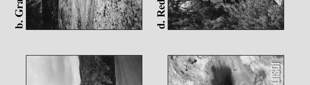
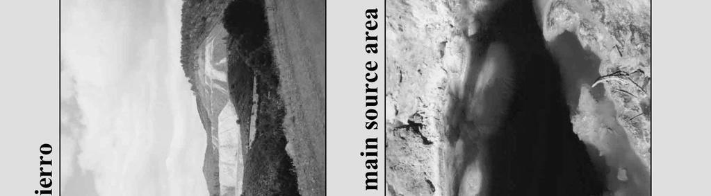
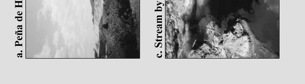
9 Figure 7. Peña de Hierro Working Conditions. 101


10 a. Line 7 b. Line 4 Figure 8. Site 4 Fast-Turnoff Data, Rio Tinto. 102
11 Description Rec. reloc. of Drill Site 1 Rec. reloc. of Drill Site 4 Rec. reloc. of Drill Site 3 Rec. reloc. of Drill site 2 Latitude Longitude N º W º N º W º N º W º N º W º Bearing from Plan Distance from Plan 335.5º m 70.1º m 180.9º m 254.5º (2a) 214.9º (2b) m (2a) m (2b) Elevation Unknown (L15S02: 431 m) Unknown (L04S02: 518 m) Unknown (L05S05: 421 m) Unknown (L02S06: 443 m) Table 2. Recommended Drill Site Relocations. CONCLUSIONS Results from the Pima County TEM survey were in good agreement with control data from four USGS test wells located around the field area (Figure 5, Table 1; for locations see Figure 3). This survey also achieved a very acceptable 500+ m depth of investigation. Both of the interpretations from Rio Tinto data (Line 4, and Lines 15 & 14) were confirmed by preliminary results from the MARTE ground truth drilling campaign carried out in September and October Drill Site 1 was moved ~50 m based on recommendations built on data from Line 15 and Line 14 of the Fast-Turnoff TEM survey. This work demonstrates that time domain electromagnetics is appropriate for sounding of deep groundwater (Arizona study) and of very conductive groundwater (Spain study), and as such hold promise for studies of deep groundwater in a Mars analog context. The next logical steps would be to study groundwater at greater depths (kilometers), and in hyperarid environments (ex. North Africa / Egyptian Sahara, Australia). With that perspective, it is important to point out that the deeper study presented herein (the conventional TEM survey in the Arizona desert) in itself by no means represent the top end of the scale of what is possible with TEM in terms of depths of investigation. It has indeed been demonstrated possible to use this method [10], or other EM geophysical methods that measure resistivity/conductivity (such as natural or active source magnetotellurics), to sound conductive features to depths of kilometers. This has been demonstrated extensively in mining exploration and in monitoring of copper leaching operations, for example [13, 14]. Electromagnetic geophysical methods, such as those discussed herein, hold the best promise for sounding groundwater to the depths required of true Mars analogs, that is, several kilometers. On earth, such environments are exceedingly rare - one example would be the Nubian aquifer in the Baharïya region in the Egyptian part of the Sahara desert, where depths to the groundwater table in some areas reach depths approaching 3 kilometers [15, 16, 17]. It is the intent and hope of at least this author that such work continue, and that the Mars scientific community will hold the geophysical search for deep groundwater on Mars (eventually) and in Mars analog environments on Earth up as a worthy scientific and exploration goal to pursue. 103


12 a. Line 14 b. Line 15 Figure 9. Site 1 Fast-Turnoff Data, Rio Tinto. 104
13 ACKNOWLEDGEMENTS The author would like to acknowledge the following two individuals who lent support to these studies: Kenneth L. Zonge, Owner and President, Zonge Engineering and Research Organization, Inc., Tucson, Arizona, and Carol R. Stoker, NASA Ames, Principal Investigator, Mars Analog Research and Technology Experiment (MARTE). Furthermore, this article would not have been possible without the helpful reviews by several reviewers, who all deserve acknowledgment here. Thank you to all of you. REFERENCES [1] Zonge K. L. (2001), NanoTEM A Very Fast-Turnoff TEM System. Zonge Engineering case study. [2] Jernsletten J. A. (2003), Fast-Turnoff Transient Electro-Magnetic (TEM) Geophysical Survey. MARTE field report. [3] Fernández-Remolar et al. (2003), JGR, 108/E7, [4] Stoker C. R. et al. (2003), Drilling Campaign Plan V0.1. MARTE working document. [5] Stoker C. R. et al. (2003), Drilling Plan CRS MARTE working document. [6] Stoker C. R. et al. (2003), LPSC 34, abstract no [7] Stoker C. R. et al. (2003), Initial Results From the 2003 Ground Truth Drilling Campaign. MARTE working document. [8] Clifford, S. M. (1993), A model for the hydrologic and climatic behavior of water on Mars, J. Geophys. Res., 98(E6), [9] Reynolds J. M. (1997), An Introduction to Applied and Environmental Geophysics. [10] Zonge K. L. (1992), Introduction to TEM. In: Practical Geophysics II, for the Exploration Geologist. Van Blaricom, R., editor. Northwest Mining Assoc., Spokane, Washington. [11] MacInnes S. and Raymond M. (1996) Zonge STEMINV manual. [12] Palacky G. J. (1987), Resistivity Characteristics of Geologic Targets. In: Electromagnetic Methods in Applied Geophysics, Volume 1, Theory. Nabighian M. N., editor. Society of Exploration Geophysicists, Series: Investigations in Geophysics, Volume 3. Tulsa, Oklahoma. [13] Zonge, K. L. (1992), Introduction to CSAMT. In: Practical Geophysics II, for the Exploration Geologist. Van Blaricom, R., editor. Northwest Mining Assoc., Spokane, Washington. [14] Zonge, K. L. (2000), NSAMT Natural Source Audio-frequency Magnetotelluric Imaging. Zonge Engineering and Research Organization, Inc., Tucson, Arizona. [15] Jernsletten, J. A., and E. Heggy (2005), Comparing transient electromagnetics and low frequency ground penetrating radar for sounding of subsurface water in Mars analog environments, Abstract no. 6040, Workshop on Radar Investigations of Planetary and Terrestrial Environments, Houston, Texas, February [16] Jernsletten, J. A., and E. Heggy (2004), Sounding of groundwater through conductive media in Mars analog environments using transient electromagnetics and low frequency GPR, Eos Trans. AGU, 85(17), Jt. Assem. Suppl., Abstract no. P53A-01, AGU 2004 Joint Assembly, Montreal, Canada, May [17] Jernsletten, J. A., and E. Heggy (2004), Sounding of subsurface water through conductive media in Mars analog environments using transient electromagnetics and low frequency ground penetrating radar, Abstract no. 2089, 35th Lunar and Planetary Science Conference, Houston, Texas, March
POTASH DRAGON CHILE GEOPHYSICAL SURVEY TRANSIENT ELECTROMAGNETIC (TEM) METHOD. LLAMARA and SOLIDA PROJECTS SALAR DE LLAMARA, IQUIQUE, REGION I, CHILE
 METHOD. LLAMARA and SOLIDA PROJECTS SALAR DE LLAMARA, IQUIQUE, REGION I, CHILE") POTASH DRAGON CHILE GEOPHYSICAL SURVEY TRANSIENT ELECTROMAGNETIC (TEM) METHOD LLAMARA and SOLIDA PROJECTS SALAR DE LLAMARA, IQUIQUE, REGION I, CHILE OCTOBER 2012 CONTENT Page I INTRODUCTION 1 II FIELD
POTASH DRAGON CHILE GEOPHYSICAL SURVEY TRANSIENT ELECTROMAGNETIC (TEM) METHOD LLAMARA and SOLIDA PROJECTS SALAR DE LLAMARA, IQUIQUE, REGION I, CHILE OCTOBER 2012 CONTENT Page I INTRODUCTION 1 II FIELD
EXTREMELY FAST IP USED TO DELINEATE BURIED LANDFILLS. Norman R. Carlson, Cris Mauldin Mayerle, and Kenneth L. Zonge
 EXTREMELY FAST IP USED TO DELINEATE BURIED LANDFILLS Norman R. Carlson, Cris Mauldin Mayerle, and Kenneth L. Zonge Zonge Engineering and Research Organization, Inc. 3322 East Fort Lowell Road Tucson, Arizona,
DEEP GROUND-WATER EXPLORATION IN THE FLAGSTAFF, ARIZONA AREA USING CSAMT
 DEEP GROUND-WATER EXPLORATION IN THE FLAGSTAFF, ARIZONA AREA USING CSAMT Norman R. Carlson Zonge Engineering & Research Organization, Inc. 3322 E Fort Lowell Rd Tucson, Arizona 85716 Tel: (520)327-5501
ASSESSMENT REPORT N 0. REPORT ON HORIZONTAL COPLANAR LOOP ELECTROMAGNETIC SURVEY HOUSTON AREA OF BRITISH COLUMBIA AQUITAINE COMPANY OF CANADA DURING
 tf 62 33 REPORT ON HORIZONTAL COPLANAR LOOP ELECTROMAGNETIC SURVEY IN THE HOUSTON AREA OF BRITISH COLUMBIA BY AQUITAINE COMPANY OF CANADA c DURING MARCH 21 - MARCH 25, 1977 MINERAL RESOURCES BRANCH ASSESSMENT
RESISTIVITY IMAGING IN EASTERN NEVADA USING THE AUDIOMAGNETOTELLURIC METHOD FOR HYDROGEOLOGIC FRAMEWORK STUDIES. Abstract.
 RESISTIVITY IMAGING IN EASTERN NEVADA USING THE AUDIOMAGNETOTELLURIC METHOD FOR HYDROGEOLOGIC FRAMEWORK STUDIES Darcy K. McPhee, U.S. Geological Survey, Menlo Park, CA Louise Pellerin, Green Engineering,
Use of Non-Invasive Near-Surface Geophysics for Managing Brine Releases
 Use of Non-Invasive Near-Surface Geophysics for Managing Brine Releases Presented by: Brent W. Barker, Staff Geophysicist Remediation Technologies Symposium 2012 Imagine the result Co-Authors Boyce L.
Magnetotelluric (MT) Method
 Method") Magnetotelluric (MT) Method Dr. Hendra Grandis Graduate Program in Applied Geophysics Faculty of Mining and Petroleum Engineering ITB Geophysical Methods Techniques applying physical laws (or theory) to
Magnetotelluric (MT) Method Dr. Hendra Grandis Graduate Program in Applied Geophysics Faculty of Mining and Petroleum Engineering ITB Geophysical Methods Techniques applying physical laws (or theory) to
Applied Geophysics for Environmental Site Characterization and Remediation
 Applied Geophysics for Environmental Site Characterization and Remediation MSECA Webinar September 24, 2015 John Mundell, P.E., L.P.G. Ryan Brumbaugh, L.P.G. MUNDELL & ASSOCIATES, INC. Webinar Objective
THE UTILITY OF HORIZONTAL COMPONENT MEASUREMENTS IN RANDOM-WALK TEM SURVEYS. Abstract
 THE UTILITY OF HORIZONTAL COMPONENT MEASUREMENTS IN RANDOM-WALK TEM SURVEYS Norman R. Carlson, Zonge Engineering & Research Organization, Inc., Tucson, AZ Kenneth L. Zonge, Zonge Engineering & Research
MT Prospecting. Map Resistivity. Determine Formations. Determine Structure. Targeted Drilling
 MT Prospecting Map Resistivity Determine Formations Determine Structure Targeted Drilling Cross-sectional interpretation before and after an MT survey of a mineral exploration prospect containing volcanic
High Resolution Geophysics: A Better View of the Subsurface. By John Jansen, P.G., Ph.D., Aquifer Science and Technology
 High Resolution Geophysics: A Better View of the Subsurface By John Jansen, P.G., Ph.D., Aquifer Science and Technology Geologist Use Only Part of the Information Available To Them Most Geologist rely
ambiguity in earth sciences IESO Geophysics Section Eddy hartantyo, Lab Geofisika FMIPA UGM
 ambiguity in earth sciences IESO Geophysics Section Eddy hartantyo, Lab Geofisika FMIPA UGM Pelatihan Tahap II IESO Teknik Geologi UGM Februari 2009 1 Introduction Photos from http://www.eegs.org/whatis/
Introducing the Stratagem EH4. Electrical Conductivity Imaging System Hybrid-Source Magnetotellurics
 Introducing the Stratagem EH4 Electrical Conductivity Imaging System Hybrid-Source Magnetotellurics Stratagem EH4 Hybrid-Source Magnetotellurics Frequency range of 10 Hz to 90k Hz Approx. depth of investigation
Geophysical Surveys for Groundwater Modelling of Coastal Golf Courses
 1 Geophysical Surveys for Groundwater Modelling of Coastal Golf Courses C. RICHARD BATES and RUTH ROBINSON Sedimentary Systems Research Group, University of St. Andrews, St. Andrews, Scotland Abstract
Comparison of geophysical. techniques to determine depth to. bedrock in complex weathered. environments of the Mount Crawford. region, South Australia
 Comparison of geophysical techniques to determine depth to bedrock in complex weathered environments of the Mount Crawford region, South Australia Thesis submitted in accordance with the requirements of
indigeo Consultants Pvt Ltd Geophysical Surveys Geological Surveys GIS & Data Solutions Image Processing indigeo Company Profile, Page 1
 indigeo Consultants Pvt Ltd Geophysical Surveys Geological Surveys GIS & Data Solutions Image Processing MM Corner, 3 rd Floor #58, Banaswadi Main Road Bangalore 560033 INDIA Ph: +91 80 41638310 Mob: +91
Robotic Site Survey for ISRU
 NASA Ames Research Center Maria Bualat Intelligent Robotics Group Maria.Bualat@nasa.gov Outline Site Survey Overview GPR Survey Hydrogen Prospecting 2 Human-Robot Site Survey Project Systematic survey
Consider a Geonics EM31 with the TX and RX dipoles a distance s = 3 m apart.
 E Near field, frequency domain EM systems E.1 EM responses of 1-D resistivity models E.1.1 Response of a halfspace Consider a Geonics EM31 with the TX and RX dipoles a distance s = 3 m apart. The TX and
Geophysics for Environmental and Geotechnical Applications
 Geophysics for Environmental and Geotechnical Applications Dr. Katherine Grote University of Wisconsin Eau Claire Why Use Geophysics? Improve the quality of site characterization (higher resolution and
Geophysics and Geothermal Energy. Joseph Capriotti Meghan Helper Kendra Johnson Patricia Littman Gordon Osterman
 Geophysics and Geothermal Energy Joseph Capriotti Meghan Helper Kendra Johnson Patricia Littman Gordon Osterman Colorado School of Mines End of students junior year 4 week field camp Learning experience
Although most karstic regions
 Urban Geophysics: Geophysical Signature of Mount Bonnell Fault and Its Karstic Features in Austin, TX by Mustafa Saribudak, Environmental Geophysics Associates, Austin, TX Although most karstic regions
APPENDIX A: Magnetotelluric Data in Relation to San Pedro Mesa Structural. The San Pedro Mesa structural high (discussed in main text of paper) was
 was") Page of DR for GSA Special Paper 9, Chapter, Geophysical constraints APPENDIX A: Magnetotelluric Data in Relation to San Pedro Mesa Structural High The San Pedro Mesa structural high (discussed in main
Page of DR for GSA Special Paper 9, Chapter, Geophysical constraints APPENDIX A: Magnetotelluric Data in Relation to San Pedro Mesa Structural High The San Pedro Mesa structural high (discussed in main
SAGEEP. DoWN IN THE DUMPS. Workshop Notes
 Workshop Notes SAGEEP DoWN IN THE DUMPS Landfill characterization with an Extremely Fast IP Method March 15,1999 zonge engineering AND research organization 3322 e. fort lowell road. Tucson, AZ 85716 1-800-523-9913
Airborne Geophysics to Map Groundwater. Bill Brown
 Airborne Geophysics to Map Groundwater Bill Brown bb@skytem.com A 6 borehole represents 1 millionth of an acre Aquifer Materials An aquifer is an underground layer of water bearing permeable rock, rock
Location Restrictions Certification Report NIPSCO Michigan City Generating Station Boiler Slag Pond
 Location Restrictions Certification Report NIPSCO Michigan City Generating Station Boiler Slag Pond Pursuant to: 40 CFR 257.60 40 CFR 257.61 40 CFR 257.62 40 CFR 257.63 40 CFR 257.64 Submitted to: Northern
Geophysical Investigation of a 19th Century Archeological Site, Boston College K. Corcoran, J. Hager, M. Carnevale
 Geophysical Investigation of a 19th Century Archeological Site, Boston College K. Corcoran, J. Hager, M. Carnevale Hager GeoScience, Inc., Waltham, MA ------------------------------------------------------------------------
Integrated Geophysical Model for Suswa Geothermal Prospect using Resistivity, Seismics and Gravity Survey Data in Kenya
 Proceedings World Geothermal Congress 2015 Melbourne, Australia, 19-25 April 2015 Integrated Geophysical Model for Suswa Geothermal Prospect using Resistivity, Seismics and Gravity Survey Data in Kenya
SOUTHWEST & NORTHWEST EXPLORATION PROJECTS BINGHAM CANYON MINING DISTRICT
 SOUTHWEST & NORTHWEST EXPLORATION PROJECTS BINGHAM CANYON MINING DISTRICT SALT LAKE AND TOOELE COUNTIES, UTAH SUMMARY FRIDAY, MARCH 20, 2009 1 Tooele County Salt Lake County GOOGLE EARTH September, 2006
Seismoelectric Ground-flow DC-4500 Locator
 Seismoelectric Ground-flow DC-4500 Locator Introduction The seismoelectric survey is a new technology combined the electro kinetic potential method and geophysical technology. It is applied directly to
Geophysics Course Introduction to DC Resistivity
 NORAD supported project in MRRD covering Capacity Building and Institutional Cooperation in the field of Hydrogeology for Faryab Province Afghanistan Geophysics Course Introduction to DC Resistivity By
Geophysical Exploration in Water Resources Assessment. John Mundell, P.E., L.P.G., P.G. Ryan Brumbaugh, L.P.G. Mundell & Associates, Inc.
 Geophysical Exploration in Water Resources Assessment John Mundell, P.E., L.P.G., P.G. Ryan Brumbaugh, L.P.G. Mundell & Associates, Inc. Presentation Objective Introduce the use of geophysical survey methods
TRANSIENT ELECTROMAGNETIC (TEM) INVESTIGATION OF MICROBASIN MORPHOLOGY ALONG THE SANTA CRUZ RIVER, NOGALES, ARIZONA
 INVESTIGATION OF MICROBASIN MORPHOLOGY ALONG THE SANTA CRUZ RIVER, NOGALES, ARIZONA") TRANSIENT ELECTROMAGNETIC (TEM) INVESTIGATION OF MICROBASIN MORPHOLOGY ALONG THE SANTA CRUZ RIVER, NOGALES, ARIZONA GEOPHYSICS FIELD CAMP 2010 May 11, 2010 Chris Culbertson William E. Lytle Melissa M.
TRANSIENT ELECTROMAGNETIC (TEM) INVESTIGATION OF MICROBASIN MORPHOLOGY ALONG THE SANTA CRUZ RIVER, NOGALES, ARIZONA GEOPHYSICS FIELD CAMP 2010 May 11, 2010 Chris Culbertson William E. Lytle Melissa M.
First Technical Report Geophysical experiments near Kajiado town
 First Technical Report Geophysical experiments near Kajiado town Synthesis Report of First case study within the ISGEAG VIA Water project By: Michel Groen *), Harry Rolf **), and Ammon Muiti ***) *) Acacia
FINAL REPORT GEOPHYSICAL INVESTIGATION WATER TOWER NO. 6 SITE PLANT CITY, FL
 APPENDIX B FINAL REPORT GEOPHYSICAL INVESTIGATION WATER TOWER NO. 6 SITE PLANT CITY, FL Prepared for Madrid Engineering Group, Inc. Bartow, FL Prepared by GeoView, Inc. St. Petersburg, FL February 28,
We are committed to providing accessible customer service. If you need accessible formats or communications supports, please contact us.
 We are committed to providing accessible customer service. If you need accessible formats or communications supports, please contact us. Nous tenons à améliorer l accessibilité des services à la clientèle.
GPR AS A COST EFFECTIVE BEDROCK MAPPING TOOL FOR LARGE AREAS. Abstract
 GPR AS A COST EFFECTIVE BEDROCK MAPPING TOOL FOR LARGE AREAS Dr. Jutta L. Hager, Hager GeoScience, Inc., Waltham, MA Mario Carnevale, Hager GeoScience, Inc., Waltham, MA Abstract Hager GeoScience, Inc.
IDAWRA: Groundwater-flow model for the Wood River Valley aquifer system, south-central Idaho February 1, 2017, 11:30-1:00
 Idaho Section of the American Water Resources Association IDAWRA: Groundwater-flow model for the Wood River Valley aquifer system, south-central Idaho A three-dimensional numerical model of groundwater
Fox 2-Record No. 2524
 F HELICOPTER E.M. AND MAGNETOMETER SURVEY OVER THE FOX CLAIMS, OMINECA MINING DISTRICT BRITISH COLUMBIA ON BEHALF OF OWNER MR. MIKE BOYLE Claims: Fox l-record No. 2523 Fox 2-Record No. 2524 Location 126'
GEOLOGICAL FRACTURE MAPPING USING ELECTROMAGNETIC GEOTOMOGRAPHY. A.L. Ramirez, F.J. Deadrick and R.J. Lytle
 GEOLOGICAL FRACTURE MAPPING USING ELECTROMAGNETIC GEOTOMOGRAPHY A.L. Ramirez, F.J. Deadrick and R.J. Lytle Lawrence Livermore National Laboratory Livermore, California 94550 ABSTRACT This article describes
Ground-Water Exploration in the Worthington Area of Nobles County: Summary of Seismic Data and Recent Test Drilling Results
 Ground-Water Exploration in the Worthington Area of Nobles County: Summary of Seismic Data and Recent Test Drilling Results Jim Berg and Todd Petersen Geophysicists, DNR Waters January 2000 Table of Contents
CHAPTER 5 GEOPHYSICAL SURVEY. 5.1 Purpose of Survey
 CHAPTE 5 GEOPHYSICAL SUVEY 5.1 Purpose of Survey The objective of the Time Domain Electro- Magnetic (TDEM) survey was to define the electrical structure of the Stampriet Artesian Basin and relate this
CONTENTS 1. INTRODUCTION. 2. THE D.C. RESISTIVITY METHOD 2.1 Equipment 2.2 Survey Procedure 2.3 Data Reduction
 (i) CONTENTS 1. INTRODUCTION page 1 2. THE D.C. RESISTIVITY METHOD 2.1 Equipment 2.2 Survey Procedure 2.3 Data Reduction 3 3 3 3 3. GEOPHYSICAL RESULTS 3.1 General 3.2 Discussion 4 4 4 4. LIMITATIONS 5
Map Skills Test. 1. What do we call a person who makes maps? a. mapographer b. cartographer c. geologist d. archaeologist
 Map Skills Test 1. What do we call a person who makes maps? a. mapographer b. cartographer c. geologist d. archaeologist 2. What is the name of the 0 latitude line? a. Equator b. Arctic Circle c. First
KANSAS GEOLOGICAL SURVEY Open File Report LAND SUBSIDENCE KIOWA COUNTY, KANSAS. May 2, 2007
 KANSAS GEOLOGICAL SURVEY Open File Report 2007-22 LAND SUBSIDENCE KIOWA COUNTY, KANSAS Prepared by Michael T. Dealy L.G., Manager, Wichita Operations SITE LOCATION The site was approximately four miles
Titiribi Gold: Sleeping Giant in the Colombian Cordilleras (a Geophysical Study)
") Titiribi Gold: Sleeping Giant in the Colombian Cordilleras (a Geophysical Study) Emmett Van Reed, P.Gp. Zonge Engineering & Research Amit Tripathi, Ph.D. Terra Resources Development Technologies Jennifer
Titiribi Gold: Sleeping Giant in the Colombian Cordilleras (a Geophysical Study) Emmett Van Reed, P.Gp. Zonge Engineering & Research Amit Tripathi, Ph.D. Terra Resources Development Technologies Jennifer
GEOPHYSICAL SITE CHARACTERIZATION IN SUPPORT OF HIGHWAY EXPANSION PROJECT
 GEOPHYSICAL SITE CHARACTERIZATION IN SUPPORT OF HIGHWAY EXPANSION PROJECT * Shane Hickman, * Todd Lippincott, * Steve Cardimona, * Neil Anderson, and + Tim Newton * The University of Missouri-Rolla Department
Aquitard Characterization The Legend of Indiana s Magic Clay Layer. Juliet Port, LPG #2214 July 2014
 Aquitard Characterization The Legend of Indiana s Magic Clay Layer Juliet Port, LPG #2214 July 2014 Topics What is an Aquitard? Why do we care? Review of Indiana glacial geology Conceptual Framework Investigation
Application of Ground Penetrating Radar for hydro-geological study
 Journal of Scientific & Industrial Research Vol. 65, February 2006, pp. 160-164 Application of Ground Penetrating Radar for hydro-geological study K K K Singh* Central Mining Research Institute, Dhanbad
Morenikeji P. Anjorin, B.Tech. 1 and Martins O. Olorunfemi, Ph.D. 2*
 A Short Note on Comparative Study of Schlumberger and Half Schlumberger Arrays in Vertical Electrical Sounding in a Basement Complex Terrain of Southwest Nigeria. Morenikeji P. Anjorin, B.Tech. 1 and Martins
CCR Rule Compliance: Innovative Use of Geophysics to Certify Landfill Stability and Site Groundwater Monitoring Wells
 CCR Rule Compliance: Innovative Use of Geophysics to Certify Landfill Stability and Site Groundwater Monitoring Wells Gary Pendergrass, PE, RG Principal Geological Engineer Missouri Waste Control Coalition
MARKET UPDATE ON URANIUM AND GOLD PROJECTS
 ASX Announcement 1 March 2011 MARKET UPDATE ON URANIUM AND GOLD PROJECTS HIGHLIGHTS 5,000 metre drilling programme to commence at Rio Puerco uranium project within the next two weeks. Drilling to commence
Georadar Application for Dam Safety Study (Case Study of Selorejo Dam)
") The 2 nd International Seminar on Science and Technology 155 Georadar Application for Dam Safety Study (Case Study of Selorejo Dam) Teguh Winari 1, Kamsiyah Windianita 1, and Fahmi Hidayat 1 Abstract Selorejo
The 2 nd International Seminar on Science and Technology 155 Georadar Application for Dam Safety Study (Case Study of Selorejo Dam) Teguh Winari 1, Kamsiyah Windianita 1, and Fahmi Hidayat 1 Abstract Selorejo
Case Study: University of Connecticut (UConn) Landfill
 Landfill") Case Study: University of Connecticut (UConn) Landfill Problem Statement:» Locate disposal trenches» Identify geologic features and distinguish them from leachate and locate preferential pathways in fractured
Case Study: University of Connecticut (UConn) Landfill Problem Statement:» Locate disposal trenches» Identify geologic features and distinguish them from leachate and locate preferential pathways in fractured
Magnetotelluric and Controlled-Source Electromagnetic Study of Aquistore CO 2 Sequestration Site, near Estevan, Saskatchewan
 Magnetotelluric and Controlled-Source Electromagnetic Study of Aquistore CO 2 Sequestration Site, near Estevan, Saskatchewan Joe, B, McLeod 1, Ian, J, Ferguson 1, Jim Craven 2, Brian Roberts 2, Eric Roots
3D MAGNETOTELLURIC CHARACTERIZATION OF THE COSO GEOTHERMAL FIELD
 PROCEEDINGS, Thirtieth Workshop on Geothermal Reservoir Engineering Stanford University, Stanford, California, January 31-February 2, 2005 SGP-TR-176 3D MAGNETOTELLURIC CHARACTERIZATION OF THE COSO GEOTHERMAL
GM 1.4. SEG/Houston 2005 Annual Meeting 639
 storage recovery project in Leyden, Colorado Kristofer Davis *, Yaoguo Li, Michael Batzle, and Bob Raynolds** Center for Gravity, Electrical, and Magnetic Studies, Department of Geophysics, Colorado School
Jesse Crews, P.G. 1 Ahmad A. Behroozmand 2 Rosemary Knight 3. Senior Geophysicist, GEM Center*, Stanford University
 Jesse Crews, P.G. 1 Ahmad A. Behroozmand 2 Rosemary Knight 3 1 Senior Geophysicist, GEM Center*, Stanford University 2 Posdoctoral Researcher, Stanford University 3 Professor of Geophysics & Director of
Influence of Paleochannels on Seepage
 Study 4 Influence of Paleochannels on Seepage Public Draft 2014 Monitoring and Analysis Plan September 2013 August 2012 Influence of Paleochannels on Seepage 1. Statement of Need Historical maps, aerial
Remote sensing and Reflectance spectroscopy as useful tools for Uranium exploration
 Remote sensing and Reflectance spectroscopy as useful tools for Uranium exploration Fares Howari, PhD University of Texas at Austin Bureau of Economic Geology (BEG) and Center for International Energy
10. GEOTECHNICAL EXPLORATION PROGRAM
 Geotechnical site investigations should be conducted in multiple phases to obtain data for use during the planning and design of the tunnel system. Geotechnical investigations typically are performed in
Conducting Subsurface Surveys for Water Ice using Ground Penetrating Radar and a Neutron Spectrometer on the Lunar Electric Rover Never Stop
 Conducting Subsurface Surveys for Water Ice using Ground Penetrating Radar and a Neutron Spectrometer on the Lunar Electric Rover LPI/Kring Never Stop Exploring David A. Kring Lunar and Planetary Institute
PRELIMINARY. Select Geophysical Methods and Groundwater Modeling: Examples from USGS studies. Claudia Faunt and a cast of others
 Select Geophysical Methods and Groundwater Modeling: Examples from USGS studies Claudia Faunt and a cast of others Current Preliminary Studies Stanford Water in the West Groundwater Data Workshop Series:
Ground Penetrating Radar (GPR)
") Ground Penetrating Radar (GPR) In the search for uraniferous paleo-channels Klaus P. Knupp kknupp@mweb.com.na Uranium Conference 23-24 October 2009, Swakopmund, Namibia Some GPR Principles Source: Sensors
Ground Penetrating Radar (GPR) In the search for uraniferous paleo-channels Klaus P. Knupp kknupp@mweb.com.na Uranium Conference 23-24 October 2009, Swakopmund, Namibia Some GPR Principles Source: Sensors
PHOENIX GEOPHYSICS LIMITED REPORT ON THE VLF-EM AND TOTAL FIELD MAGNETOMETER SURVEYS ON THE
 PHOENIX GEOPHYSICS LIMITED REPORT ON THE VLF-EM AND TOTAL FIELD MAGNETOMETER SURVEYS ON THE TAN CLAIMS, CHILLIWACK AREA NEW WESTMINSTER MINING DIVISION, BRITISH COLUMBIA FOR LORNEX MINING CORPORATION LIMITED
CHAMPION IRON REPORTS EXPLORATION RESULTS AT POWDERHORN PROJECT, NEWFOUNDLAND
 PRESS RELEASE CHAMPION IRON REPORTS EXPLORATION RESULTS AT POWDERHORN PROJECT, NEWFOUNDLAND Confirmed Continuity of High-Grade Zinc Zone and Addition of Gold to the Expanded Copper Zone Montreal, March
SEISMIC REFRACTION SURVEY RIPPABILITY STUDY
 SEISMIC REFRACTION SURVEY RIPPABILITY STUDY US 95A SILVER SPRINGS to FERNLEY LYON COUNTY August 2008 E.A. 73455 MATERIALS DIVISION SEISMIC REFRACTION SURVEY RIPPABILITY STUDY LYON COUNTY US 95A SILVER
We 21 C15 Geophysical Investigation for an Assessment of Sinkhole Risk in Schleswig-Holstein/Northern Germany
 We 21 C15 Geophysical Investigation for an Assessment of Sinkhole Risk in Schleswig-Holstein/Northern Germany R. Kirsch* (LLUR-SH), H. Wiederhold (LIAG), W. Rabbel (CAU), E. Erkul (CAU), C. Thomsen (LLUR-SH),
ERDC/GSL TN-14-1 August 2014 Electromagnetic Induction Survey of the Mississippi River in Cleveland, Mississippi
 Electromagnetic Induction Survey of the Mississippi River in Cleveland, Mississippi By Joseph B. Dunbar and Maureen K. Corcoran PURPOSE: This study was conducted in support of Mississippi State University
EARLY-TIME, MULTI-COMPONENT MOBILE TEM FOR DEEP METAL DETECTION. Abstract
 EARLY-TIME, MULTI-COMPONENT MOBILE TEM FOR DEEP METAL DETECTION Norman R. Carlson and Kenneth L. Zonge Zonge Engineering & Research Organization, Inc., Tucson, AZ. Abstract Data examples from a recent
IMAGING OF DEEP SINKHOLES USING THE MULTI-ELECTRODE RESISTIVITY IMPLANT TECHNIQUE (MERIT) CASE STUDIES IN FLORIDA
 CASE STUDIES IN FLORIDA") IMAGING OF DEEP SINKHOLES USING THE MULTI-ELECTRODE RESISTIVITY IMPLANT TECHNIQUE (MERIT) CASE STUDIES IN FLORIDA David Harro The G3 Group, 2509 Success Drive, Suite 1, Odessa, FL 33556, david.harro@geo3group.com
IMAGING OF DEEP SINKHOLES USING THE MULTI-ELECTRODE RESISTIVITY IMPLANT TECHNIQUE (MERIT) CASE STUDIES IN FLORIDA David Harro The G3 Group, 2509 Success Drive, Suite 1, Odessa, FL 33556, david.harro@geo3group.com
Identified a possible new offset location where the customer is currently exploring drill options.
 GroundMetrics was hired to conduct a Full-Field Resistivity Survey for an oil and gas producer that needed to make crucial decisions to drive profitability at the location. The results saved them hundreds
Understanding Water Level Transducers. Texas Groundwater Summit San Antonio, TX 2018
 Understanding Water Level Transducers Texas Groundwater Summit San Antonio, TX 2018 Presented by Raymond L Straub Jr., P.G. Raymond L Straub Jr., P.G. Licensed Professional Geoscientist President of Straub
BUFFALO RIVER COALITION PO Box 101, Jasper, AR (870)
") BUFFALO RIVER COALITION PO Box 101, Jasper, AR 72641 (870) 446-5783 buffalowatershed@gmail.com Presentation before Arkansas Pollution Control and Ecology Commission, April 29, 2016 by Richard Mays on behalf
BUFFALO RIVER COALITION PO Box 101, Jasper, AR 72641 (870) 446-5783 buffalowatershed@gmail.com Presentation before Arkansas Pollution Control and Ecology Commission, April 29, 2016 by Richard Mays on behalf
Index Terms- Apparent Resistivity, Aquifer, Geoelectric Section, Piezometric Surface.
 Investigation of Groundwater Resources of Rafin Guza Area of Kaduna, Nigeria using Resistivity Method Olaniyan, Isaac O, Olorunnaiye, Emmanuel S. Abstract - The groundwater resources of Rafin Guza village
GEOELECTRICAL INVESTIGATIONS OF MARINE INTRUSIONS ON THE ROMANIAN BLACK SEA SHORE
 GEOELECTRICAL INVESTIGATIONS OF MARINE INTRUSIONS ON THE ROMANIAN BLACK SEA SHORE P. GEORGESCU, D. IOANE, B.M. NICULESCU, F. CHITEA University of Bucharest, Department of Geophysics, 6 Traian Vuia Street,
Two-dimensional Inversion of Resistivity and IP Data with Topography
 Two-dimensional Inversion of Resistivity and IP Data with Topography a) Smooth-Model Resistivity (ohm-m) Elevation (m) b) Calculated Apparent Resistivity (ohm-m) 9 9 9 9 9 9 9 9 9 9 9 9 9 9 9 9 9 9 9 9
Sabal Trail Pipeline Project Evaluation of Karst Topography and Sinkhole Potential for Pipeline and Facilities
 November 11, 2014 Sabal Trail Pipeline Project Evaluation of Karst Topography and Sinkhole Potential for Pipeline and Facilities Gulf Interstate Engineering Attention: Mr. Denys Stavnychyi - Project Engineer
ENVIRONMENTAL AND ENGINEERING GEOPHYSICS
 ENVIRONMENTAL AND ENGINEERING GEOPHYSICS Environmental Engineering MSc 08/09 nd semester COURSE COMMUNICATION DOCUMENT University of Miskolc Faculty of Earth Science and Engineering Institute of Geophysics
Geological Survey of Alabama Groundwater Assessment Program
 Geological Survey of Alabama Groundwater Assessment Program Hydrogeologic Characterization and Groundwater Source Development Assessment for Area 2, Southwestern Alabama Gheorghe M. Ponta, Marlon R. Cook,
Geophysical Investigation of the Old Gaborone Dumpsite, Botswana SHEMANG, E M; MOLWALEFHE, L; CHAOKA, TR; MOSWEU E; NONDO, M
 JASEM ISSN 1119-8362 All rights reserved Full-text Available Online at www.bioline.org.br/ja J. Appl. Sci. Environ. Mgt. September, 2006 Vol. 10 (3) 87-92 Geophysical Investigation of the Old Gaborone
Geophysical Surveys Near Tucson Electric Power Sundt Generating Station
 Geophysical Surveys Near Tucson Electric Power Sundt Generating Station Geophysics Field Camp 2014 LASI-14-1 May 10, 2014 Lujain Ali Alghannam Wadyan Osama Ayyad Carla Gabriela Do Lago Montenegro Wanjie
Determination of EM Coupling Effect in Dipole-Dipole Method : Complex Image Approach
 6 IJCSNS International Journal of Computer Science and Network Security, VOL. No.3, March Determination of EM Coupling Effect in Dipole-Dipole Method : Complex Image Approach Mester Sitepu Universitas
Today s Class. Results for Exam #2 11/7/2017. Today s Class: Robotic & Human Exploration of Mars
 11/7/2017 Today s Class: Robotic & Human Exploration of Mars Results for Exam #2 Homework: 1. Reading for Earth as a Planet: Section 9.4 of Cosmic Perspective. 2. Meet at Fiske on Thursday! Average Median
Town of Chino Valley. Survey Control Network Report. mgfneerhg mc N. Willow Creek Road Prescott AZ
 Town of Chino Valley Survey Control Network Report mgfneerhg mc. 2050 N. Willow Creek Road Prescott AZ 86301 928-771-2376 Page 1 of 70 Table of Contents Town of Chino Valley Survey Datum Outline A short
Site characterization at the Groundwater Remediation Field Laboratory
 Site characterization at the Groundwater Remediation Field Laboratory WILLIAM P. C LEMENT, STEVE CARDIMONA, ANTHONY L. ENDRES, Boston College, Boston, Massachusetts KATHARINE KADINSKY-CADE, Phillips Laboratory,
MESOZOIC BASINS. North Carolina Geological Survey
 MESOZOIC BASINS North Carolina Geological Survey The 1823 organic act which created the North Carolina Geological Survey (NCGS) tasked us to examine, describe and map the geology, geologic hazards, and
1. Resistivity of rocks
 RESISTIVITY 1) Resistivity of rocks 2) General principles of resistivity surveying 3) Field procedures, interpretation and examples 4) Summary and conclusions INDUCED POLARIZATION 1) General principles
In-seam GPR and 2-C seismic investigations at the Goderich, Ontario salt mine
 In-seam GPR and 2-C seismic investigations at the Goderich, Ontario salt mine Jill Belisle and Robert R. Stewart In-seam techniques ABSTRACT In-seam GPR and 2-C seismic techniques used in conjunction with
APPLICATION OF PASSIVE SEISMIC IN DETERMINING OVERBURDEN THICKNESS: NORTH WEST ZAMBIA
 APPLICATION OF PASSIVE SEISMIC IN DETERMINING OVERBURDEN THICKNESS: NORTH WEST ZAMBIA Manish Kumar John Hart Nikhil Prakash* Rio Tinto Exploration Rio Tinto Exploration Rio Tinto Exploration South Africa
15. MATHEMATICAL ALGORITHMS
 15. MATHEMATICAL ALGORITHMS 15.1 STANDARD ERROR OF THE MEAN (SEM)... 2 15.2 3-POINT DECOUPLING... 3 15.3 A NOTE ON RESISTIVITY CALCULATIONS... 4 15.4 RESISTIVITY CALCULATIONS... 4 DIPOLE - DIPOLE...4 POLE
Contractor Name and Address: Oxy USA, Inc. (Oxy), Midland, Texas OBJECTIVES
, Midland, Texas OBJECTIVES") 1 F TITLE: APPLICATION OF RESERVOIR CHARACTERIZATION AND ADVANCED TECHNOLOGY TO IMPROVE RECOVERY AND ECONOMICS IN A LOWER QUALITY SHALLOW SHELF CARBONATE RESERVOIR Cooperative Agreement No.: DE - FC22-948C14990
1 F TITLE: APPLICATION OF RESERVOIR CHARACTERIZATION AND ADVANCED TECHNOLOGY TO IMPROVE RECOVERY AND ECONOMICS IN A LOWER QUALITY SHALLOW SHELF CARBONATE RESERVOIR Cooperative Agreement No.: DE - FC22-948C14990
1D and 2D Inversion of the Magnetotelluric Data for Brine Bearing Structures Investigation
 1D and 2D Inversion of the Magnetotelluric Data for Brine Bearing Structures Investigation Behrooz Oskooi *, Isa Mansoori Kermanshahi * * Institute of Geophysics, University of Tehran, Tehran, Iran. boskooi@ut.ac.ir,
Preliminary results for a near surface 3D seismic survey of a geothermal system in Colorado
 Preliminary results for a near surface 3D seismic survey of a geothermal system in Colorado Andrew Lamb 1, Kasper van Wijk 1, Lee Liberty 1, Mike Batzle 2, André Revil 2, Kyle Richards 2 and Chuck Diggins
Geophysical Case studies From Texas
 Geophysical Case studies From Texas 1 PRESENTATION OUTLINE Active Growth Faults in Metropolitan Houston 1. Hockley 2. Tomball 3. Long Point 4. Pearland Foundation Case Studies Karst Geophysics in Austin:
Geophysical Investigation of Ground Water Using Vertical Electrical Sounding and Seismic Refraction Methods
 International Journal of Petroleum and Petrochemical Engineering (IJPPE) Volume 2, Issue 1, 2016, PP 6-11 ISSN 2454-7980 (Online) www.arcjournals.org Geophysical Investigation of Ground Water Using Vertical
Geophysical Study of Limestone Attributes At Abudu Area of Edo State, Nigeria
 Journal of Emerging Trends in Engineering and Applied Sciences (JETEAS) 2 (5): 795-800 Scholarlink Research Institute Journals, 2011 (ISSN: 2141-7016) jeteas.scholarlinkresearch.org Journal of Emerging
Aquifers, Faults, Subsidence, and Lightning Databases
 Aquifers, Faults, Subsidence, and Lightning Databases K. S. Haggar, L. Denham, H.R. Nelson, Jr. Dynamic Measurement, LLC NOGS 1 OUTLINE 1. Introduction and Theory 2. Geologic Setting in Texas Study Area
Measuring integral soil moisture variations using a geoelectrical resistivity meter
 Measuring integral soil moisture variations using a geoelectrical resistivity meter Thomas Klügel 1, Günter Harnisch 2 & Martina Harnisch 2 1 Bundesamt für Kartographie und Geodäsie, Fundamentalstation
POTENTIAL USE OF GROUND PENETRATING RADAR IN HIGHWAY ROCK CUT STABILITY Norbert H. Maerz* and Wooyoung Kim^ ABSTRACT INTRODUCTION
 Geophysics 2000, Dec. 11-15, 2000, St. Louis, MO, 9 pp. POTENTIAL USE OF GROUND PENETRATING RADAR IN HIGHWAY ROCK CUT STABILITY Norbert H. Maerz* and Wooyoung Kim^ *Rock Mechanics and Explosives Research
GPR SURVEYS AT SOME 700 YEARS-OLD STRUCTURES IN THE OLD CITY OF CAIRO, EGYPT.
 GPR SURVEYS AT SOME 700 YEARS-OLD STRUCTURES IN THE OLD CITY OF CAIRO, EGYPT. Mohamed G. El-Behiry Geophysics Department, Faculty of Science, Cairo University, Giza, Egypt. Abstract Remediation and restoration