GEO4270 EXERCISE 2 PROSPECT EVALUATION
|
|
|
- Benedict Miles Stanley
- 6 years ago
- Views:
Transcription


1 GEO4270 EXERCISE 2 PROSPECT EVALUATION
2 GEO4270 Integrated Basin Analysis and Prospect Evaluation 1. Integrated Seismic (reflection/refraction), Gravity and Magnetics and Basin Modelling Large Scale Structures of the Basin Deeper Parts of the Basin Tectonic Development of the Basin Maturation of Hydrocarbons 2. Prospect Evaluation 2
3 GEO4270 Prospect Evaluation Tampen Spur: Gullfaks; Snorre; Statfjord, Visund, Tordis Horda Platform: Troll, Oseberg Migration Mature HC 3
4 GEO4270 Prospect Evaluation Prospect, n. An examination or test of the mineral richness of a locality or of the material from which the ore, etc. is extracted OED, IV. 10. Mining b. Evaluation, The action of evaluating or determining the value of (a mathematical expression, a physical quantity, etc.), or of estimating the force of (e.g. probabilities, evidence) OED, 2. 4
5 GEO4270 Course Contents Introduction PETREL Introduction Course Exercise: Statfjord Field Data loading Interpretation Reservoir Modelling and Prospect Evaluation Report Follow up meetings Lecture on Geostatistical Reservoir Modeling 5


6 GEO4270 Prospect Evaluation Exercise Data Offshore Norway Northern North Sea What will we be using during the project: Seismic data 2D 3D Well data Formation Tops Geophysical well logs 6
7 WELL LOGGING / CORRELATION Resistivity Porosity SP GEO4250 Short summary
8 GEO4270 Well Logging / Correlation Formation Evaluation Formation evaluation, the process of using borehole measurements to evaluate the characteristics of subsurface formations. Helander, D.P., Fundamentals of Formation Evaluation 8
9 GEO4270 Well Logging / Correlation Formation Evaluation Objectives Identification of the reservoir (primary) Estimating hydrocarbons in place (primary) Reservoir properties Shape Thickness Porosity and permeability Lithology Well-to-well correlation Formation dip Surface seismic well tie A few more additional related to HC production 9
10 GEO4270 Well Logging /Correlation Hydrocarbons in Place N = initial oil in place (stb) 7758AhφS A = drainage area (acres) N = oi h = productive interval thickness (ft) B φ = effective porosity (fraction) G = oi 43,560Ah gi φ S oi S oi = initial oil saturation (fraction) B oi = initial oil formation volume factor (reservoir bbl/stb) G = initial gas in place (scf) B S gi = initial gas saturation (fraction) B gi = initial gas formation volume factor (ft 3 /scf) Oil formation volume factor: Oil and dissolved gas volume at reservoir conditions divided by oil volume at standard conditions. Gas formation volume factor: Gas volume at reservoir conditions divided by gas volume at standard conditions. 10
11 GEO4270 Well Logging / Correlation Hydrocarbon Reserves N N p = Oil Reserves (stb) φ φ e = effective porosity (fraction) = S har S o = Oil saturation (fraction) o h = productive interval thickness (ft) A = drainage area (acres) r = Recovery Factor p φ e 11
12 GEO4270 Well Logging / Correlation Important Parameters Saturation (S), n. [Formation Evaluation] The relative amount of water, oil and gas in the pores of a rock, usually as a percentage of volume. The pore space that does not contain formation water is assumed to contain hydrocarbons. Mathematically this can be expressed as: S hc = 1 S w Where S hc = hydrocarbon saturation S w = water saturation If S w is low, the formation is potentially productive 12
13 GEO4270 Well Logging / Correlation Important Parameters Porosity (φ), n. [Geology] The percentage of pore volume or void space, or that volume within rock that can contain fluids. Total Porosity (φ t ): The total pore volume per unit volume of rock Effective Porosity (φ e ): The interconnected pore volume or void space in a rock that contributes to fluid flow or permeability in a reservoir 13
14 GEO4270 Well Logging / Correlation Important Parameters Permeability (k), n. [Geology] The ability, or measurement of a rock's ability, to transmit fluids. Permeability is required to calculate the flow rate at which hydrocarbons can be produced, following Darcy law: u = k dp μ dx Permeability will not be addressed in the course 14
15 How can we measure these parameters?
16 GEO4270 Well Logging / Correlation Water Saturation Water saturation can be measured with the help of: Resistivity (R), n. [Formation Evaluation] The ability of a material to resist electrical conduction. It is the inverse of conductivity and is measured in ohmm. The resistivity is a property of the material, whereas the resistance also depends on the volume measured.!! Hydrocarbons are resistive while formation water is conductive!! 16
17 GEO4270 Well Logging / Correlation Water Saturation The Resistivity of a formation is dependent on: Presence of Formation water / Hydrocarbons Salinity of Formation water Temperature of Formation water Volume of water-saturated pore space Geometry of the pore space Morphology and species of clay minerals 17
18 GEO4270 Well Logging / Correlation Water Saturation Relation between Water Saturation and Resistivity Archie s equation (Archie, G.E., 1942) FR w R S o w = = R R t t S w = Water saturation F = Formation Resistivity Factor (a/φ φ m ): Porosity (φ) Tortuosity factor (a) Cementation factor (m) R w = Resistivity of the formation water R t = Resistivity of a rock with HC, i.e. true resistivity R o = Resistivity of the 100% water- saturated rock 18
19 GEO4270 Well Logging / Correlation Porosity Direct measurements Conventional coring Sidewall coring Indirect Measurements Sonic Log Density Log Neutron Log 19
20 GEO4270 Well Logging / Correlation Porosity Sonic Log, n. [Geophysics] A type of acoustic log that displays traveltime of P-waves versus depth (recorded in interval transit time (Δt), μs/ft, which is the reciprocal of velocity). Sonic logs are typically recorded by pulling a tool on a wireline up the wellbore. The tool emits a sound wave that travels from the source to the formation and back to a receiver. Log symbol: DT 20
21 GEO4270 Well Logging / Correlation Porosity T Dependent on lithology and porosity Sonic porosity derived by: φ R 1 p p sonic Δ tl = Δt log f Δ t Δt matrix matrix 1 Cp φ sonic = sonic derived porosity Δt matrix = interval transit time of the matrix (table) Δt log = interval transit time of the formation Δt f = interval transit time of the fluid in the wellbore (fresh mud = 189; salt mud = 185) Cp = compaction factor = Δt R sh C with: Δt sh = interval transit time for adjacent shale C = a constant, normally
22 GEO4270 Well Logging / Correlation Porosity Density Log, n. [Formation Evaluation] A well log that records formation density. The logging tool consists of a gamma-ray source (e.g., Cs 137 ) and a detector shielded from the source so that it records backscattered gamma rays from the formation (Compton scattering). The backscattering depends on the electron density of the formation, which is roughly proportional to the bulk density. Log symbol: RHOB, DEN 22
23 GEO4270 Well Logging / Correlation Porosity Density Log 1. Identify evaporite minerals 2. Detect gas-bearing zones 3. Determine hydrocarbon density 4. Evaluate shaly sand reservoirs and complex lithologies 23


 ρ b = formation bulk")
24 GEO4270 Well Logging / Correlation Porosity DRHO is a correction curve, if DRHO > 0.20 gm/cc the RHOB curve is invalid RHOB (formation bulk density) is a function of matrix density, porosity and density of the fluids in the pores, therefore: φ den = ρ matrix ρ b ρ ρ matrix f with: φ den = density derived porosity ρ matrix = matrix density (table) ρ b = formation bulk density ρ f = fluid density DRHO = 0.20 Log symbol: DPHI 24
25 GEO4270 Well Logging / Correlation Porosity Neutron Porosity, adj. [Formation Evaluation] Referring to a log of porosity based on the effect of the formation on fast neutrons emitted by a source. Hydrogen has by far the biggest effect in slowing down and capturing neutrons. Since hydrogen is found mainly in the pore fluids, the neutron porosity log responds principally to porosity. However, the matrix and the type of fluid also have an effect. Scaled in equivalent limestone porosity units, i.e. low NPHI values represent limestone Log symbol: NPHI, CN Hydrogen in pore water, hydrocarbons and shales NOT in quartz, feldspars and carbonates 25


26 GEO4270 Well Logging / Correlation Correlation Logs Gamma Ray Log A well log of the natural formation radioactivity level The log mainly reflects clay content because clay contains the radioactive isotopes of K, U and Th Often used in association with the SP-log 26
 voltage (or")


27 GEO4270 Well Logging / Correlation Correlation Logs Spontaneous Potential Log A record of Direct Current (DC) voltage (or Potential) that develops naturally (spontaneous) between a moveable electrode in the well and a fixed electrode located at the surface Used to Correlation Detect permeable beds Detect boundaries of permeable beds Determine formation-water resistivity (R w ) Determine the volume of shale in permeable beds Detection of hydrocarbons by the suppression of the SP curve Often used in association with the GR-log 27
28 SEISMIC INTERPRETATION Reservoir Identification Seismic Attributes GEO4240 Short summary
29 GEO4270 Seismic Interpretation Reservoir Identification Phase Polarity Amplitude Spatial Extent Frequency Velocity AVO Shear wave Seismic characteristics helping to identify HC 29
30 GEO4270 Seismic Interpretation Reservoir Identification Identify Phase and Polarity Minimum Phase RC+ Normal Polarity Zero Phase Reverse Polarity RC+ RC- RC- 30


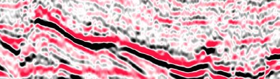

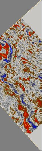
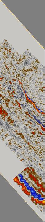
31 GEO4270 Seismic Interpretation Reservoir Identification 31
32 GEO4270 Seismic Interpretation Seismic Attributes An attribute is a derivative of a basic seismic measurement All the horizon and formation attributes t available (see Fig. 8-1) are not independent of each other but simply different ways of presenting and studying a limited amount of basic information That basic information is time, amplitude, frequency and attenuation and these form the basis of our attribute classification Seismic attributes may be defined as all the information obtained from seismic data, either by direct measurements or by logical or experience based reasoning. (Taner, 1998) 32
33 GEO4270 Seismic Interpretation Seismic Attributes Time-derived attributes provide structural information Amplitude-derived derived attributes provide stratigraphic and reservoir information Frequency-derived attributes are not yet well understood but there is wide-spread optimism that they will provide additional useful stratigraphic and reservoir information Attenuation is not used today, but there is a possibility that in the future it will yield information on permeability Most attributes are derived from the normal stacked and migrated data volume but variations of basic measurements as a function of angle of incidence (and hence source to receiver offset) provides a further source of information. The principal examples of these pre-stack attributes is AVO 33


34 GEO4270 Seismic Interpretation Seismic Attributes 34


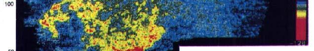
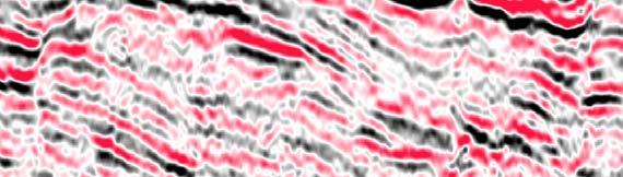
35 GEO4270 Seismic Interpretation Seismic Attributes 35


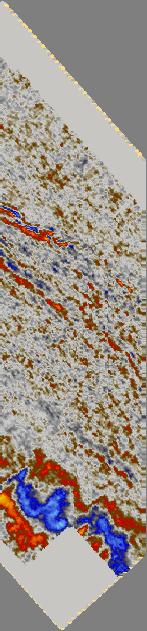
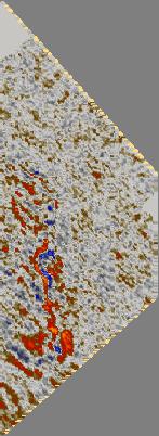

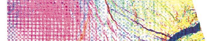
36 GEO4270 Seismic Interpretation Seismic Attributes Time Slice! 36
37 Property Modeling (or Reservoir Modeling) It is better to have a model of uncertainty than an illusion i of reality Andre Journel
38 GEO4270 Property Modeling Introduction Goal of Property modeling: Capture geology and build realistic property models Goal of Reservoir modeling: Predicting rock properties at unsampled locations and forecasting the future flow behaviour of complex geological and engineering systems (Deutsch, 12002) by use of Geostatistics ti ti 38
39 GEO4270 Property Modeling Why create a realistic reservoir property model? We are making big decisions based on limited data Maximize the usage of all information optimise production Correct upscaling of logs and a proper facies interpretation is important Reservoir properties are critical factors affecting production 39
40 GEO4270 Property Modeling Geostatistics Geostatistics is a branch of applied statistics that places emphasis on: The geological context of the data The spatial relationship between the data Data measured with different volumetric support and precision Business Need: make the best possible decision i in the face of uncertainty. Uncertainty exists because of our incomplete knowledge of a dataset (always incomplete data). One of the biggest uncertainties is the numerical description of the subsurface 40
41 GEO4270 Property Modeling Examples of Geostatistics Analysis of variables in space Samples located close to each other are probably more similar than samples located far from each other The spatial coordinates of the observed samples are built into the statistic formulas Examples: Gold content in ore (ppm) Reservoir sandstone porosity (%) Reservoir sandstone bed thickness (meter/feet) 41
42 GEO4270 Property Modeling Incorporate the Maximum Amount of Data Well data Seismic data Production Outcrops Other geological studies Integrated study Deterministic information Structure (horizon, fault) Stratigraphic correlation Facies images Framework Sedimentological model Facies description Connectivity Conceptual information Statistical information Histogram Variogram Correlation Trend Variation 42
43 GEO4270 Property Modeling Sequential Approach to Property Modeling 1. Defining the geometry and stratigraphic layering of the reservoir interval to be modeled Involves the development of a conceptual model for the major architecture and continuity of facies, porosity and permeability witihin each layer 2. The facies rock types are modeled by either (1) cell-based or (2) object-based techniques within each stratigraphic layer 3. The porosity is modeled on a by-facies basis before permeability because there are more reliable porosity data available 4. The 3-D models of permeability are constrained to the porosity, facies and layering previously established 5. Multiple equally likely realizations are created by repeating the entire process Each realization is equally likely to be drawn ; however, some realizations are more similar to others, hence their class has higher probability 6. These models are input to a simulator or visualized and used to aid in decision making 43
44 Tampen Spur Introduction


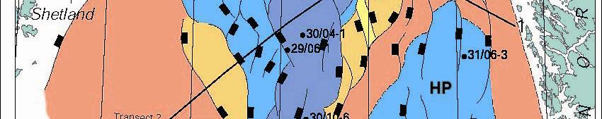
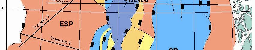
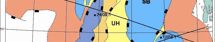
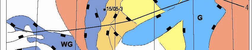
45 Tampen Spur Location F B H 45 10/14/2008 GEO Michel Heeremans
46 Statfjord Field Facts Discovery well: 33/12-1 Discovery Year: 1974 Gullfaks producing since Total production of saleable products : mill. Sm 3 o.e. Recoverable reserves: Oil: mill Sm 3 Statfjord Production Gas: bill Sm 3 NGL: mill tonne Total number of wells: Sm3 NGL: Natural Gas Liquids, incl. propane, butane, pentane, hexane and heptane, but not methane and ethane 1 tonne NGL: 1.9 Sm 3 o.e Year 1994 Oil [mill Sm3] Gas [bill Sm3] Sm3o.e. [mill] Water [mill Sm3]

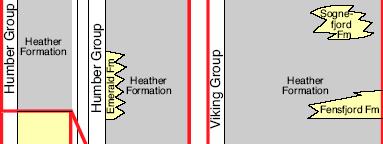
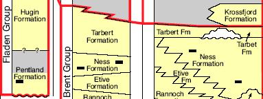
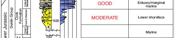
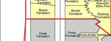
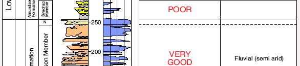
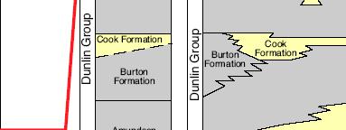
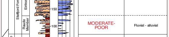
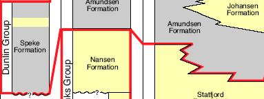
47 Tampen Spur Stratigraphy 47 From: Evans et al, 2003, Millenium Atlas
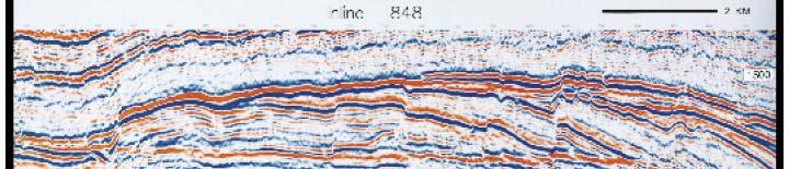
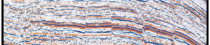
48 Tampen Spur Cross Section 48
49 GEO4270 Prospect Evaluation IMPORTANT! PETREL is just a tool which helps you with your interpretation and modeling This exercise e is meant for leaning reservoir identification, reservoir evaluation and reservoir modeling The results depend completely on your own interpretation and the accuracy of the available data 49
50 Important links +statistikk/fakta-start.htm (Norway Wells) (UK Wells) 50
51 Rf References Asquith, G. and Krygowski, D. (2004). Basic Well Log Analysis Brown, A. (2004). Interpretation of Three-Dimensional Seismic Data Deutsch, C. (2002). Geostatistical Reservoir Modeling Evans, D. et al. (2003). Millenium Atlas Schlumberger (2006). Petrel Seismic to Simulation Software Property Modeling Course, v
FORMATION EVALUATION PETE 321
 FORMATION EVALUATION PETE 321 DENSITY AND NEUTRON LOGS Summer 2010 David Schechter Fluorescent Intervals in 1U Sand Sharp transition between oil saturated pay and non-pay observed by fluorescence in core
Basics of Geophysical Well Logs_Porosity
 1 Porosity Logs Porosity (F), can be defined as the ratio between the volume of the pores and the total rock volume. Porosity defines the formation fluid storage capabilities of the reservoir. Well logs
Formation Evaluation: Logs and cores
 These powerpoint files were produced for the Earth History class at the Free University Berlin, Department of Geological Sciences The copyright for texts, graphical elements, and images lies with C. Heubeck,
Well Logging. Salam Al Rbeawi 2011
 Well Logging Salam Al Rbeawi 2011 Well Logging: Is a technique used for formation evaluation to determine the size of the reservoir and the amount of oil and gas in place. The following parameters can
PETROLEUM GEOSCIENCES GEOLOGY OR GEOPHYSICS MAJOR
 PETROLEUM GEOSCIENCES GEOLOGY OR GEOPHYSICS MAJOR APPLIED GRADUATE STUDIES Geology Geophysics GEO1 Introduction to the petroleum geosciences GEO2 Seismic methods GEO3 Multi-scale geological analysis GEO4
PETROPHYSICAL EVALUATION CORE COPYRIGHT. Petrophysical Evaluation Approach and Shaly Sands Evaluation. By the end of this lesson, you will be able to:
 PETROPHYSICAL EVALUATION CORE Petrophysical Evaluation Approach and Shaly Sands Evaluation LEARNING OBJECTIVES By the end of this lesson, you will be able to: Discuss how to approach a petrophysical evaluation
INTRODUCTION TO LOGGING TOOLS
 BY: MUHAMMAD ZAHID INTRODUCTION TO LOGGING TOOLS 1- SPONTANEOUS POTENTIAL (SP) The Spontaneous potential survey, (sp) was one of the first measurements, which was carried out, in a well bore. The SP log
Neutron Log. Introduction
 Neutron Log Introduction This summary focuses on the basic interactions between the tool s signal and measured information, that help characterize the formation. It is not intended to be a comprehensive
LITTLE ABOUT BASIC PETROPHYSICS
 LITTLE ABOUT BASIC PETROPHYSICS Author: MUHAMMAD ZAHID M.Sc (Applied Geology) Specialization in Petrophysics University of Azad Jammu & Kashmir, Muzaffarabad. ENTER Introduction - Determination of Physical
Petrophysical Charaterization of the Kwale Field Reservoir Sands (OML 60) from Wire-line Logs, Niger Delta, Nigeria. EKINE, A. S.
 from Wire-line Logs, Niger Delta, Nigeria. EKINE, A. S.") JASEM ISSN 1119-8362 All rights reserved Full-text Available Online at wwwbiolineorgbr/ja J Appl Sci Environ Manage December, 2009 Vol 13(4) 81-85 Petrophysical Charaterization of the Kwale Field Reservoir
JASEM ISSN 1119-8362 All rights reserved Full-text Available Online at wwwbiolineorgbr/ja J Appl Sci Environ Manage December, 2009 Vol 13(4) 81-85 Petrophysical Charaterization of the Kwale Field Reservoir
GY 402: Sedimentary Petrology
 UNIVERSITY OF SOUTH ALABAMA GY 402: Sedimentary Petrology Lecture 27: Introduction to Wireline Log Interpretations Instructor: Dr. Douglas W. Haywick Last Time Carbonate Diagenesis Diagenesis 0.5 mm PPL
Reservoir Rock Properties COPYRIGHT. Sources and Seals Porosity and Permeability. This section will cover the following learning objectives:
 Learning Objectives Reservoir Rock Properties Core Sources and Seals Porosity and Permeability This section will cover the following learning objectives: Explain why petroleum fluids are found in underground
Constraining Uncertainty in Static Reservoir Modeling: A Case Study from Namorado Field, Brazil*
 Constraining Uncertainty in Static Reservoir Modeling: A Case Study from Namorado Field, Brazil* Juliana F. Bueno 1, Rodrigo D. Drummond 1, Alexandre C. Vidal 1, Emilson P. Leite 1, and Sérgio S. Sancevero
Fundamentals Of Petroleum Engineering FORMATION EVALUATION
 Fundamentals Of Petroleum Engineering FORMATION EVALUATION Mohd Fauzi Hamid Wan Rosli Wan Sulaiman Department of Petroleum Engineering Faculty of Petroleum & Renewable Engineering Universiti Technologi
Module for: Resistivity Theory (adapted/modified from lectures in PETE 321 (Jensen/Ayers))
)") (PETE 663 Formation Evaluation and the Analysis of Reservoir Performance (Fall 2003)) Module for: Resistivity Theory (adapted/modified from lectures in PETE 321 (Jensen/Ayers)) J. L. Jensen W.B. Ayers
(PETE 663 Formation Evaluation and the Analysis of Reservoir Performance (Fall 2003)) Module for: Resistivity Theory (adapted/modified from lectures in PETE 321 (Jensen/Ayers)) J. L. Jensen W.B. Ayers
But these are what we really measure with logs..
 The role of the petrophysicist in reservoir characterization and the analysis of reservoir performance. What do we bring to the table? What do we want to take home? Bob Cluff The Discovery Group Inc. consulting
Simultaneous Inversion of Clastic Zubair Reservoir: Case Study from Sabiriyah Field, North Kuwait
 Simultaneous Inversion of Clastic Zubair Reservoir: Case Study from Sabiriyah Field, North Kuwait Osman Khaled, Yousef Al-Zuabi, Hameed Shereef Summary The zone under study is Zubair formation of Cretaceous
Tim Carr - West Virginia University
 Tim Carr - West Virginia University Understanding Seismic Data Resolution (Vertical and Horizontal) Common Depth Points (CDPs) Two way time (TWT) Time versus depth Interpretation of Reflectors 2 Able to
FORMATION EVALUATION OF SIRP FIELD USING WIRELINE LOGS IN WESTERN DEPOBELT OF NIGER DELTA
 FORMATION EVALUATION OF SIRP FIELD USING WIRELINE LOGS IN WESTERN DEPOBELT OF NIGER DELTA 1 Obioha C, ²Adiela U. P and ³*Egesi N 1,3 Department of Geology, Faculty of Science, University of Port Harcourt,
Generation of Pseudo-Log Volumes from 3D Seismic Multi-attributes using Neural Networks: A case Study
 5th Conference & Exposition on Petroleum Geophysics, Hyderabad-2004, India PP 541-549 Multi-attributes using Neural Networks: A case Study V.B.Singh, S.P.S.Negi, D.Subrahmanyam, S.Biswal & V.K.Baid G&G
Statistical Rock Physics
 Statistical - Introduction Book review 3.1-3.3 Min Sun March. 13, 2009 Outline. What is Statistical. Why we need Statistical. How Statistical works Statistical Rock physics Information theory Statistics
Well Logging Importance in Oil and Gas Exploration and Production
 Well Logging Importance in Oil and Gas Exploration and Production Dr. R. Giri Prasad 1 1 Associate Professor, Dept. of Petroleum Engineering, Aditya Engineering College, hod_pt@aec.edu.in I. INTRODUCTION
GEO4250 Reservoir Geology
 GEO4250 eservoir Geology Basic Well Log Analysis Determination of Saturation eminder N φ p e S hc har S S n 1 F S t hc n o t φ φ φ φ s den n e Δt Δt ρ ρ φ Δt Δt from log t log f matrix matrix ρ ρ matrix
The SPE Foundation through member donations and a contribution from Offshore Europe
 Primary funding is provided by The SPE Foundation through member donations and a contribution from Offshore Europe The Society is grateful to those companies that allow their professionals to serve as
Maximising the use of publicly available data: porosity and permeability mapping of the Rotliegend Leman Sandstone, Southern North Sea
 Maximising the use of publicly available data: porosity and permeability mapping of the Rotliegend Leman Sandstone, Southern North Sea Claire Imrie & Henk Kombrink 09 May 2018 Overview The Oil and Gas
FORMATION EVALUATION PETE 321
 FORMATION EVALUATION PETE 321 CROSSPLOTS (Porosity and Lithology) Summer 2010 TWO-MEASUREMENT POROSITY CROSSPLOTS Two measurements determine two unknowns Formations with one lithology Lithology Porosity
Mechanical Properties Log Processing and Calibration. R.D. Barree
 Mechanical Properties Log Processing and Calibration R.D. Barree Logging for Mechanical Properties Acoustic logs Measure compressional and shear velocity or slowness (1/v) Can be affected by fractures,
Hydrocarbon Volumetric Analysis Using Seismic and Borehole Data over Umoru Field, Niger Delta-Nigeria
 International Journal of Geosciences, 2011, 2, 179-183 doi:10.4236/ijg.2011.22019 Published Online May 2011 (http://www.scirp.org/journal/ijg) Hydrocarbon Volumetric Analysis Using Seismic and Borehole
Comparison of Classical Archie s Equation with Indonesian Equation and Use of Crossplots in Formation Evaluation: - A case study
 P-310 Summary Comparison of Classical Archie s Equation and Use of Crossplots in Formation Evaluation: - A case study Nitin Sharma In petroleum Exploration and Development Formation Evaluation is done
Oil and Natural Gas Corporation Limited, 4th Floor GEOPIC, Dehradun , Uttarakhand
 Sedimentoical Core Samples A Case Study of Western Offshore Basin, India Ashok Soni*, Pradeep Kumar and B.S. Bisht Oil and Natural Gas Corporation Limited, 4th Floor GEOPIC, Dehradun-248195, Uttarakhand
SPE DISTINGUISHED LECTURER SERIES is funded principally through a grant of the SPE FOUNDATION
 SPE DISTINGUISHED LECTURER SERIES is funded principally through a grant of the SPE FOUNDATION The Society gratefully acknowledges those companies that support the program by allowing their professionals
CHAPTER III. METHODOLOGY
 CHAPTER III. METHODOLOGY III.1. REASONING METHODOLOGY Analytical reasoning method which used in this study are: Deductive accumulative method: Reservoir connectivity can be evaluated from geological, geophysical
RESERVOIR CHARACTERIZATION USING SEISMIC AND WELL LOGS DATA (A CASE STUDY OF NIGER DELTA)
") RESERVOIR CHARACTERIZATION USING SEISMIC AND WELL LOGS DATA (A CASE STUDY OF NIGER DELTA) * ESHIMOKHAI, S. and AKHIREVBULU, O.E. http://dx.doi.org/10.4314/ejesm.v5i4.s20 Received 19th June 2012; accepted
RESERVOIR CHARACTERIZATION USING SEISMIC AND WELL LOGS DATA (A CASE STUDY OF NIGER DELTA) * ESHIMOKHAI, S. and AKHIREVBULU, O.E. http://dx.doi.org/10.4314/ejesm.v5i4.s20 Received 19th June 2012; accepted
New Frontier Advanced Multiclient Data Offshore Uruguay. Advanced data interpretation to empower your decision making in the upcoming bid round
 New Frontier Advanced Multiclient Data Offshore Uruguay Advanced data interpretation to empower your decision making in the upcoming bid round Multiclient data interpretation provides key deliverables
Well log interpretation and 3D reservoir property modeling of Maui-B field, Taranaki Basin, New Zealand
 Scholars' Mine Masters Theses Student Theses and Dissertations Fall 2017 Well log interpretation and 3D reservoir property modeling of Maui-B field, Taranaki Basin, New Zealand Aziz Mennan Follow this
Petrophysical Data and Open Hole Logging Operations Basics COPYRIGHT. Introduction to Petrophysical Data and Open Hole Logging Operations Basics
 Learning Objectives Petrophysical Data and Open Hole Logging Operations Basics Introduction to Petrophysical Data and Open Hole Logging Operations Basics By the end of this lesson, you will be able to:
BPM37 Linking Basin Modeling with Seismic Attributes through Rock Physics
 BPM37 Linking Basin Modeling with Seismic Attributes through Rock Physics W. AlKawai* (Stanford University), T. Mukerji (Stanford University) & S. Graham (Stanford University) SUMMARY In this study, we
Training Venue and Dates Ref # Reservoir Geophysics October, 2019 $ 6,500 London
 Training Title RESERVOIR GEOPHYSICS Training Duration 5 days Training Venue and Dates Ref # Reservoir Geophysics DE035 5 07 11 October, 2019 $ 6,500 London In any of the 5 star hotels. The exact venue
Electrical Surveying (part A)
") Electrical Surveying (part A) Dr. Laurent Marescot Course given at the University of Fribourg (2009) Contact: laurent@tomoquest.com www.tomoquest.com 1 Introduction Electrical surveying Resistivity method
Electrical Surveying (part A) Dr. Laurent Marescot Course given at the University of Fribourg (2009) Contact: laurent@tomoquest.com www.tomoquest.com 1 Introduction Electrical surveying Resistivity method
ECS Elemental Capture Spectroscopy Sonde. Fast, accurate lithology evaluation
 ECS Elemental Capture Spectroscopy Sonde Fast, accurate lithology evaluation Applications n Identify carbonate, gypsum, and anhydrite; quartz, feldspar, and mica; pyrite, siderite, coal, and salt fractions
Reservoir Characterization using AVO and Seismic Inversion Techniques
 P-205 Reservoir Characterization using AVO and Summary *Abhinav Kumar Dubey, IIT Kharagpur Reservoir characterization is one of the most important components of seismic data interpretation. Conventional
THE UNIVERSITY OF TRINIDAD & TOBAGO
 THE UNIVERSITY OF TRINIDAD & TOBAGO B. A. SC. PETROLEUM ENGINEERING ALTERNATE 2012 FINAL EXAMINATIONS Course Code and Title: Programme: DATE: DURATION: FMEV 2002 - BASIC WELL LOGGING BASc B.A.SC. Petroleum
Dynamic GeoScience Martyn Millwood Hargrave Chief Executive OPTIMISE SUCCESS THROUGH SCIENCE
 Dynamic GeoScience Martyn Millwood Hargrave Chief Executive OPTIMISE SUCCESS THROUGH SCIENCE Agenda 1. Ikon Science Where we are now 2. Geoscience 2012 A motion picture 3. Rock physics, AVO and Inversion
OTC OTC PP. Abstract
 OTC OTC-19977-PP Using Modern Geophysical Technology to Explore for Bypassed Opportunities in the Gulf of Mexico R.A. Young/eSeis; W.G. Holt, G. Klefstad/ Fairways Offshore Exploration Copyright 2009,
Reservoir Petrophysical Modeling from Seismic Impedance Volumes
 Reservoir Petrophysical Modeling from Seismic Impedance Volumes Wesley Emery, Director of Innovative Reservoir Petrophysical Modeling and Resource Technology Network Table of Contents 1. Background 2.
15. THE NEUTRON LOG 15.1 Introduction
 15. THE NEUTRON LOG 15.1 Introduction The neutron log is sensitive mainly to the amount of hydrogen atoms in a formation. Its main use is in the determination of the porosity of a formation. The tool operates
Verification of Archie Constants Using Special Core Analysis and Resistivity Porosity Cross Plot Using Picket Plot Method
 Int'l Journal of Computing, Communications & Instrumentation Engg. (IJCCIE) Vol. 4, Issue (207) ISSN 2349-469 EISSN 2349-477 Verification of Archie Constants Using Special Core Analysis and Resistivity
Opportunities in Oil and Gas Fields Questions TABLE OF CONTENTS
 TABLE OF CONTENTS A. Asset... 3 1. What is the size of the opportunity (size the prize)?... 3 2. Volumetric Evaluation... 3 3. Probabilistic Volume Estimates... 3 4. Material Balance Application... 3 5.
Rock Physics and Quantitative Wavelet Estimation. for Seismic Interpretation: Tertiary North Sea. R.W.Simm 1, S.Xu 2 and R.E.
 Rock Physics and Quantitative Wavelet Estimation for Seismic Interpretation: Tertiary North Sea R.W.Simm 1, S.Xu 2 and R.E.White 2 1. Enterprise Oil plc, Grand Buildings, Trafalgar Square, London WC2N
N121: Modern Petrophysical Well Log Interpretation
 Summary This course presents the principles and methods associated with the petrophysical interpretation of openand cased-hole wireline and LWD well logs. Open-hole topics covered include the use of log
INTRODUCTION TO APPLIED GEOPHYSICS
 INTRODUCTION TO APPLIED GEOPHYSICS Petroleum Geoengineering MSc 2018/19 Semester 1 COURSE COMMUNICATION FOLDER University of Miskolc Faculty of Earth Science and Engineering Institute of Geophysics and
Estimating the hydrocarbon volume from elastic and resistivity data: A concept
 INTERPRETER S CORNER Coordinated by Rebecca B. Latimer Estimating the hydrocarbon volume from elastic and resistivity data: A concept CARMEN T. GOMEZ, JACK DVORKIN, and GARY MAVKO, Stanford University,
INTRODUCTION TO WELL LOGS And BAYES THEOREM
 INTRODUCTION TO WELL LOGS And BAYES THEOREM EECS 833, 7 February 006 Geoff Bohling Assistant Scientist Kansas Geological Survey geoff@kgs.ku.edu 864-093 Overheads and resources available at http://people.ku.edu/~gbohling/eecs833
So I have a Seismic Image, But what is in that Image?
 P-513 So I have a Seismic Image, But what is in that Image? Dr. Nader C. Dutta, Schlumberger Introduction and background Migration involves repositioning of returned signals in a seismic experiment to
Shear Wave Velocity Estimation Utilizing Wireline Logs for a Carbonate Reservoir, South-West Iran
 Iranian Int. J. Sci. 4(2), 2003, p. 209-221 Shear Wave Velocity Estimation Utilizing Wireline Logs for a Carbonate Reservoir, South-West Iran Eskandari, H. 1, Rezaee, M.R., 2 Javaherian, A., 3 and Mohammadnia,
Subsurface Maps. K. W. Weissenburger. Isopach. Isochore. Conoco, Inc. Ponca City, Oklahoma, U.S.A.
 Subsurface Maps K. W. Weissenburger Conoco, Inc. Ponca City, Oklahoma, U.S.A. INTRODUCTION Reservoir properties are mapped to promote optimal field development. Subsurface maps dictate well placement and
Geological Classification of Seismic-Inversion Data in the Doba Basin of Chad*
 Geological Classification of Seismic-Inversion Data in the Doba Basin of Chad* Carl Reine 1, Chris Szelewski 2, and Chaminda Sandanayake 3 Search and Discovery Article #41899 (2016)** Posted September
INTEGRATED GEOPHYSICAL INTERPRETATION METHODS FOR HYDROCARBON EXPLORATION
 INTEGRATED GEOPHYSICAL INTERPRETATION METHODS FOR HYDROCARBON EXPLORATION Instructor : Kumar Ramachandran 31 July 4 August 2017 Jakarta COURSE OUTLINE The course is aimed at imparting working knowledge
Porosity. Downloaded 09/22/16 to Redistribution subject to SEG license or copyright; see Terms of Use at
 Geostatistical Reservoir Characterization of Deepwater Channel, Offshore Malaysia Trisakti Kurniawan* and Jahan Zeb, Petronas Carigali Sdn Bhd, Jimmy Ting and Lee Chung Shen, CGG Summary A quantitative
Earth models for early exploration stages
 ANNUAL MEETING MASTER OF PETROLEUM ENGINEERING Earth models for early exploration stages Ângela Pereira PhD student angela.pereira@tecnico.ulisboa.pt 3/May/2016 Instituto Superior Técnico 1 Outline Motivation
Basics of Geophysical Well Logs_Lithology&Resis7vity
 1 Spontaneous Poten7al When the well bore is filled by a water based mud and in presence of an alterna7on of permeable and impermeable layers, due to electrochemical phenomena, electrical currents are
Abstract. Introduction to Area
 Petro physical analysis of Habib Rahi Limestone of Mari Gas Field using open hole wire line logs of well Mari Deep -06 Central Indus Basin Pakistan (A Case Study) 1a Quaid Khan Jadoon, 1a Muhammad Zahid
Serica Energy (UK) Limited. P.1840 Relinquishment Report. Blocks 210/19a & 210/20a. UK Northern North Sea
 Limited. P.1840 Relinquishment Report. Blocks 210/19a & 210/20a. UK Northern North Sea") Serica Energy (UK) Limited P.1840 Relinquishment Report Blocks 210/19a & 210/20a UK Northern North Sea January 2013 1 Header Licence: P.1840 Round: Licence Type: 26th Round Traditional "Drill-or-Drop"
Serica Energy (UK) Limited P.1840 Relinquishment Report Blocks 210/19a & 210/20a UK Northern North Sea January 2013 1 Header Licence: P.1840 Round: Licence Type: 26th Round Traditional "Drill-or-Drop"
Evaluation of Rock Properties from Logs Affected by Deep Invasion A Case Study
 Evaluation of Rock Properties from Logs Affected by Deep Invasion A Case Study Jahan Zeb a, Reece Murrell b a CGG Australia, 1 Ord Street, West Perth, WA 6005 Contact email: Jahan.Zeb@cgg.com b Esso Australia,
We apply a rock physics analysis to well log data from the North-East Gulf of Mexico
 Rock Physics for Fluid and Porosity Mapping in NE GoM JACK DVORKIN, Stanford University and Rock Solid Images TIM FASNACHT, Anadarko Petroleum Corporation RICHARD UDEN, MAGGIE SMITH, NAUM DERZHI, AND JOEL
Contents. Introduction. Introduction. Modern Environments. Tools for Stratigraphic Analysis
 Contents Tools for Stratigraphic Analysis Introduction of Study: Modern Environments of Study: Ancient Deposits Summary Introduction Basin analysts use a variety of methods to study modern and ancient
23855 Rock Physics Constraints on Seismic Inversion
 23855 Rock Physics Constraints on Seismic Inversion M. Sams* (Ikon Science Ltd) & D. Saussus (Ikon Science) SUMMARY Seismic data are bandlimited, offset limited and noisy. Consequently interpretation of
Available online at ScienceDirect. Energy Procedia 114 (2017 )
") Available online at www.sciencedirect.com ScienceDirect Energy Procedia 114 (2017 ) 2772 2780 13th International Conference on Greenhouse Gas Control Technologies, GHGT-13, 14-18 November 2016, Lausanne,
Available online at www.sciencedirect.com ScienceDirect Energy Procedia 114 (2017 ) 2772 2780 13th International Conference on Greenhouse Gas Control Technologies, GHGT-13, 14-18 November 2016, Lausanne,
Principles of 3-D Seismic Interpretation and Applications
 Principles of 3-D Seismic Interpretation and Applications Instructor: Dominique AMILHON Duration: 5 days Level: Intermediate-Advanced Course Description This course delivers techniques related to practical
Integrating reservoir flow simulation with time-lapse seismic inversion in a heavy oil case study
 Integrating reservoir flow simulation with time-lapse seismic inversion in a heavy oil case study Naimeh Riazi*, Larry Lines*, and Brian Russell** Department of Geoscience, University of Calgary **Hampson-Russell
Integrating rock physics and full elastic modeling for reservoir characterization Mosab Nasser and John B. Sinton*, Maersk Oil Houston Inc.
 Integrating rock physics and full elastic modeling for reservoir characterization Mosab Nasser and John B. Sinton*, Maersk Oil Houston Inc. Summary Rock physics establishes the link between reservoir properties,
Available online Journal of Scientific and Engineering Research, 2018, 5(1):1-10. Research Article
:1-10. Research Article") Available online www.jsaer.com, 2018, 5(1):1-10 Research Article ISSN: 2394-2630 CODEN(USA): JSERBR Evaluation of Reservoir Production Performance Using 3-D Seismic Mapping and Well Logs Analysis (A Case
Available online www.jsaer.com, 2018, 5(1):1-10 Research Article ISSN: 2394-2630 CODEN(USA): JSERBR Evaluation of Reservoir Production Performance Using 3-D Seismic Mapping and Well Logs Analysis (A Case
Th SBT1 14 Seismic Characters of Pore Pressure Due to Smectite-to-illite Transition
 Th SBT1 14 Seismic Characters of Pore Pressure Due to Smectite-to-illite Transition X. Qin* (University of Houston) & D. Han (University of Houston) SUMMARY In this study, we strive to understand unloading
Seismic reservoir and source-rock analysis using inverse rock-physics modeling: A Norwegian Sea demonstration
 66 Seismic reservoir and source-rock analysis using inverse rock-physics modeling: A Norwegian Sea demonstration Kenneth Bredesen 1, Erling Hugo Jensen 1, 2, Tor Arne Johansen 1, 2, and Per Avseth 3, 4
Sensitivity Analysis of Pre stack Seismic Inversion on Facies Classification using Statistical Rock Physics
 Sensitivity Analysis of Pre stack Seismic Inversion on Facies Classification using Statistical Rock Physics Peipei Li 1 and Tapan Mukerji 1,2 1 Department of Energy Resources Engineering 2 Department of
FIELD DEVELOPMENT PLANS USING SEISMIC RESERVOIR CHARACTERIZATION AND MODELING; A NIGER DELTA 3D CASE STUDY
 FIELD DEVELOPMENT PLANS USING SEISMIC RESERVOIR CHARACTERIZATION AND MODELING; A NIGER DELTA 3D CASE STUDY Toluwalpe A.O 1, Beka Francis T 2 and Akagbosu Pius 3 1,2,3 Centre of Petroleum Geosciences, Institute
Site Characterization & Hydrogeophysics
 Site Characterization & Hydrogeophysics (Source: Matthew Becker, California State University) Site Characterization Definition: quantitative description of the hydraulic, geologic, and chemical properties
Combining geological surface data and geostatistical model for Enhanced Subsurface geological model
 Combining geological surface data and geostatistical model for Enhanced Subsurface geological model M. Kurniawan Alfadli, Nanda Natasia, Iyan Haryanto Faculty of Geological Engineering Jalan Raya Bandung
QUANTITATIVE ANALYSIS OF SEISMIC RESPONSE TO TOTAL-ORGANIC-CONTENT AND THERMAL MATURITY IN SHALE GAS PLAYS
 E: infoikonscience.com W: www.ikonscience.com QUANTITATIVE ANALYSIS OF SEISMIC RESPONSE TO TOTAL-ORGANIC-CONTENT AND THERMAL MATURITY IN SHALE GAS PLAYS Ebrahim Zadeh 12, Reza Rezaee 1, Michel Kemper 2
GEOLOGICAL LOG INTERPRETATION TUTORIAL
 GEOLOGICAL LOG INTERPRETATION TUTORIAL Text and Figures by Geoff Bohling and John Doveton The following pages will familiarize you with the basics of the geological interpretation of common logs as they
Downloaded 09/15/16 to Redistribution subject to SEG license or copyright; see Terms of Use at
 A Full Field Static Model of the RG-oil Field, Central Sirte Basin, Libya Abdalla Abdelnabi*, Kelly H. Liu, and Stephen Gao Missouri University of Science and Technology Summary Cambrian-Ordovician and
Reservoir connectivity uncertainty from stochastic seismic inversion Rémi Moyen* and Philippe M. Doyen (CGGVeritas)
") Rémi Moyen* and Philippe M. Doyen (CGGVeritas) Summary Static reservoir connectivity analysis is sometimes based on 3D facies or geobody models defined by combining well data and inverted seismic impedances.
Rémi Moyen* and Philippe M. Doyen (CGGVeritas) Summary Static reservoir connectivity analysis is sometimes based on 3D facies or geobody models defined by combining well data and inverted seismic impedances.
An Integrated Approach to Volume of Shale Analysis: Niger Delta Example, Orire Field
 World Applied Sciences Journal 7 (4): 448-452, 2009 ISSN 1818-4952 IDOSI Publications, 2009 An Integrated Approach to Volume of Shale Analysis: Niger Delta Example, Orire Field 1 1 2 L. Adeoti, E.A. Ayolabi
We LHR1 01 The Influence of Pore Pressure in Assessing Hydrocarbon Prospectivity - A Review
 We LHR1 01 The Influence of Pore Pressure in Assessing Hydrocarbon Prospectivity - A Review S. Green (Ikon Science), S.A. O'Connor (Ikon Science) & A.P. Edwards* (Ikon Science) SUMMARY Assessing the prospectivity
RESEARCH PROPOSAL. Effects of scales and extracting methods on quantifying quality factor Q. Yi Shen
 RESEARCH PROPOSAL Effects of scales and extracting methods on quantifying quality factor Q Yi Shen 2:30 P.M., Wednesday, November 28th, 2012 Shen 2 Ph.D. Proposal ABSTRACT The attenuation values obtained
PART A: Short-answer questions (50%; each worth 2%)
") PART A: Short-answer questions (50%; each worth 2%) Your answers should be brief (just a few words) and may be written on these pages if you wish. Remember to hand these pages in with your other exam pages!
PART A: Short-answer questions (50%; each worth 2%) Your answers should be brief (just a few words) and may be written on these pages if you wish. Remember to hand these pages in with your other exam pages!
IDENTIFYING PATCHY SATURATION FROM WELL LOGS Short Note. / K s. + K f., G Dry. = G / ρ, (2)
") IDENTIFYING PATCHY SATURATION FROM WELL LOGS Short Note JACK DVORKIN, DAN MOOS, JAMES PACKWOOD, AND AMOS NUR DEPARTMENT OF GEOPHYSICS, STANFORD UNIVERSITY January 5, 2001 INTRODUCTION Gassmann's (1951)
IDENTIFYING PATCHY SATURATION FROM WELL LOGS Short Note JACK DVORKIN, DAN MOOS, JAMES PACKWOOD, AND AMOS NUR DEPARTMENT OF GEOPHYSICS, STANFORD UNIVERSITY January 5, 2001 INTRODUCTION Gassmann's (1951)
Introduction to Formation Evaluation Abiodun Matthew Amao
 Introduction to Formation Evaluation By Abiodun Matthew Amao Monday, September 09, 2013 Well Logging PGE 492 1 Lecture Outline What is formation evaluation? Why do we evaluate formation? What do we evaluate?
Determining the Relationship between Resistivity, Water and Hydrocarbon Saturation of Rock Formation Using Composite Well Logs
 Determining the Relationship between Resistivity, Water and Hydrocarbon Saturation of Rock Formation Using Composite Well Logs Doi:10.5901/ajis.2013.v2n13p119 Absract Mamudu Afizu Department of Physics,
Integration of Rock Physics Models in a Geostatistical Seismic Inversion for Reservoir Rock Properties
 Integration of Rock Physics Models in a Geostatistical Seismic Inversion for Reservoir Rock Properties Amaro C. 1 Abstract: The main goal of reservoir modeling and characterization is the inference of
Competing Effect of Pore Fluid and Texture -- Case Study
 Competing Effect of Pore Fluid and Texture -- Case Study Depth (m) Sw Sxo. m Poisson's Ratio.. GOC.1 5 7 8 9 P-Impedance OWC 15 GR.. RHOB.5 1 Saturation...5. 1. 1.5 Vs (km/s).. Poisson's Ratio 5 7 P-Impedance
Quantitative Interpretation
 Quantitative Interpretation The aim of quantitative interpretation (QI) is, through the use of amplitude analysis, to predict lithology and fluid content away from the well bore. This process should make
An Overview of the Tapia Canyon Field Static Geocellular Model and Simulation Study
 An Overview of the Tapia Canyon Field Static Geocellular Model and Simulation Study Prepared for Sefton Resources Inc. Jennifer Dunn, Chief Geologist Petrel Robertson Consulting Ltd. Outline Background
Sequence Stratigraphy of the Upper Cretaceous Niobrara Formation, A Bench, Wattenberg Field, Denver Julesburg Basin, Colorado*
 Sequence Stratigraphy of the Upper Cretaceous Niobrara Formation, A Bench, Wattenberg Field, Denver Julesburg Basin, Colorado* Lisa E. Remington LaChance 1 and Mark C. Robinson 1 Search and Discovery Article
An Integrated Petrophysical Approach for Shale Gas Reservoirs
 An Integrated Petrophysical Approach for Shale Gas Reservoirs Richard Arnold & Matt Bratovich Baker Hughes Reservoir Development Services 1 2014 B A K E R H U G H E S I N C O R P O R A TED. A LL R I G
Quantitative Seismic Interpretation An Earth Modeling Perspective
 Quantitative Seismic Interpretation An Earth Modeling Perspective Damien Thenin*, RPS, Calgary, AB, Canada TheninD@rpsgroup.com Ron Larson, RPS, Calgary, AB, Canada LarsonR@rpsgroup.com Summary Earth models
GENERAL WORKFLOW AND DATA REQUIREMENTS FOR RESERVOIR CHARACTERIZATION AND SIMULATION WORKFLOW TABLE OF CONTENTS
 WORKFLOW TABLE OF CONTENTS A. Basic Support Tasks...4 1. Construction of base maps... 4 2. Digitize well logs where not available in digital format... 4 3. Organize and QC fundamental database... 4 B.
Interpretation and Reservoir Properties Estimation Using Dual-Sensor Streamer Seismic Without the Use of Well
 Interpretation and Reservoir Properties Estimation Using Dual-Sensor Streamer Seismic Without the Use of Well C. Reiser (Petroleum Geo-Services), T. Bird* (Petroleum Geo-Services) & M. Whaley (Petroleum
Role of Data Analysis in fixing parameters for petrophysics & rockphysics modeling for effective seismic reservoir characterization A case study
 10 th Biennial International Conference & Exposition P 145 Role of Data Analysis in fixing parameters for petrophysics & rockphysics modeling for effective seismic reservoir characterization A case study
Advances in Elemental Spectroscopy Logging: A Cased Hole Application Offshore West Africa
 Journal of Geography and Geology; Vol. 9, No. 4; 2017 ISSN 1916-9779 E-ISSN 1916-9787 Published by Canadian Center of Science and Education Advances in Elemental Spectroscopy Logging: A Cased Hole Application