Geology of the Black River and Paw Paw River Watersheds. Dr. Tara Kneeshaw Grand Valley State University Department of Geology
|
|
|
- Avis Cameron
- 6 years ago
- Views:
Transcription

1 Geology of the Black River and Paw Paw River Watersheds Dr. Tara Kneeshaw Grand Valley State University Department of Geology Two Rivers Coalition September 11, 2013

 Black River entering Lake Michigan in")

2 There s nothing boring about Michigan s Geology! We drive around on a glacial landscape consisting of soils that formed after the last Ice Age (~20,000 years ago) Black River entering Lake Michigan in South Haven Beach and Bluffs in St. Joseph But there s an exciting record hidden beneath those glacial sediments

3 Limestones, sandstones and shales, which dominate the Michigan Basin of the lower peninsula, are approximately 500 million years old


 Gypsum Mine,")
4 What s beneath those glacial sediments? Tropical seas and coral reefs from a time when Michigan was literally in the tropics! World's Largest Limestone Quarry- Rogers City, MI Petoskey Stone = colonial coral (350 MYA ) Gypsum Mine, Wyoming, MI Crinoids


5 What s beneath those glacial sediments? The geology of the U.P. is a completely different story In the Keweenaw Peninsula the most extensive crustal rift on Earth is exposed at the surface Ancient lava flows!! Basalt with copperfilled vesicles Similar to the current East African rift ~1 BYA parts of the continent tried to separate, but were ultimately unsuccessful

6 Geology of Michigan Thanks to the glaciers, we probably have the most diverse assemblage of surface rocks on Earth! Glaciers originated in Canada and bulldozed over some of the most ancient rocks on earth. They brought along rocks and boulders containing info on interesting firsts in earth s history and left them behind.


7 This has happened other places, so why is Michigan so unique? It s the range of geologic history that s recorded here In the Western U.P. there are rocks that are billion years old! Himalayan-sized Mountains Continental Rifts Tropical Seas Ice Ages

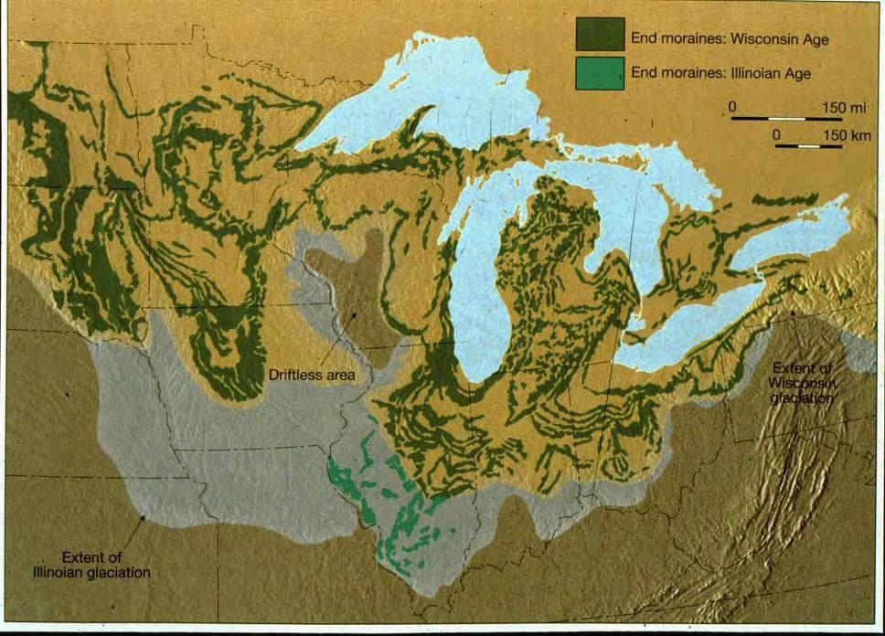
8 Glacial History of the Great Lakes(Quaternary Geology) The Laurentide Ice Sheet covered massive areas, multiple times during Quaternary glacial epochs. Glacial activity began nearly two million years ago Most of our land formations formed during the Wisconsin Glacial Age between 9,500 and 15,000 years ago. Kehew and Kozlowski Lobes of the Laurentide Ice Sheet in Michigan.

 and are capable of deforming and")

9 Glacial Ice Glacial ice forms when thick accumulations of snow are compacted under great pressure Glaciers flow plastically (like warm asphalt) and are capable of deforming and "flowing" under gravity An ice sheet flows outward from its thickest point Flows is slow ~a few 10s of m/yr

 causes apparent retreat of the")

10 Glacial Ice Although ice is soft, it is capable of eroding soil and hard rock Advance of the glacier moves both ice and sediment downslope. Ablation (melting) causes apparent retreat of the glacier and deposition of sediment (till). When the glacier melted from North America it left a mass of glacial drift over the area it had covered
11 The Great Lakes may have originated as drainages (rivers).

12 The glaciers advanced into the Great Lakes region as a series of ice lobes, each lobe seeking out the lowest preexisting spots on the landscape. The lobes moved slowly southward out of the old widened river valleys The ice front didn t separate into distinct lobes until the ice melted back into southern Michigan The lobes were welded together south of the Great Lakes region

13 Most of our land formations formed during the last retreat when the lobes were really apparent. The lobes of the Laurentide Ice Sheet in southern Michigan. Kehew and Kozlowski
14 Till Plains (ground moraines) Ice retreat left behind glacial moraine systems. Retreating glacier in Denali National Park, Alaska. Moraines Outwash Plains


15 Till is characteristically angular and poorly sorted material Poorly-sorted till, deposited at the base of a retreating glacier. Glacier Bay National Park, Alaska. Coarse glacial till in the Chugach Mountains, Chugach National Forest, Alaska. Boulders are a lag deposit resulting from the removal of the finer grain-sizes in the till by the ice-marginal stream.

16 Till Plains Till Plain (ground moraine) Extensive flat plains of glacial till that forms as ice melts in place depositing the sediments it carried. Sometimes called ground moraine if topography is irregular with gently undulating lands Generally fertile, with soils that are predominately clay loams and sandy loams, capable of supporting diversified agriculture


17 Glacial Landforms- Moraines Moraine is a landform made of till.there are many types End moraines Created by repeated annual advances and retreats when the extent of the glacier is constant for many years Glacier acts like a conveyor belt delivering sediment to the end of the glacier. Morainic soils consist of materials ranging from boulders to fine clay and silts Can have all possible gradations from coarse gravel to fine sand!

18 Moraines after a recent glacial retreat
19

20 Lake Border Moraine System Port Huron Moraine System
21
22
23

24 Outwash Plains Ice-marginal lakes (or proglacial lakes) form when the land in front of the ice margin slopes toward the ice, allowing meltwater to pond directly in contact with the ice When land slopes away from the ice broad sheets of water flow rapidly along or away from the ice front Water sorts and carries sediment out away from the moraine creating stratified gravelly, gently undulating to flat plains = the flatlands of southwest Michigan!

25 Kettles Broken blocks of ice from the ice front were frequently buried by glacial debris and did not melt until long after the ice had passed. When they did melt they left deep, steep-sided depressions, some of which filled with water. Such depressions are named "kettles" Near Argentine, Michigan. Kettles, as well as the depressions caused by unequal bulk of deposited morainic material, account for the hundreds of lake basins we now find

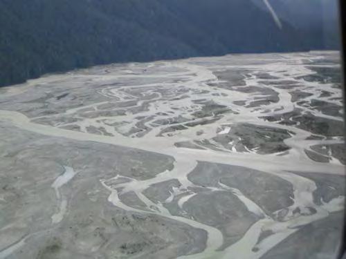
26 Glacial Outwash Plains


27 Glacial Outwash Plain In Michigan the old outwash plains and channels are often seen today as wet prairies They are typically near coarse-textured moraines within stream or river floodplains, lake margins, and isolated depressions Coarse-textured moraine Outwash Plain


 gravel and sand Flat")

28 Till Plain vs. Outwash Plain Till Plain Behind (towards the direction of retreat) of a moraine unsorted material (till) of all sizes with much clay Gently undulating to hilly surface Abandoned farms; hardwood forests Outwash Plain In front of the moraine Mainly stratified (layered and sorted) gravel and sand Flat or very gently undulating (where it is a thin veneer on the underlying till) flourishing farms; conifers
29 Lake Border Moraine System Port Huron Moraine System
30 Lake Border Moraine System Port Huron Moraine System

31 The way the Great Lakes looked 10,500 years ago


32 The way the Great Lakes looked 9,500 years ago The lowest lake levels occurred as the ice retreated and removed the barrier to the Gulf of St. Lawrence Detailed map of the Chippewa low lake stand

33 Lake Chippewa stage Lowest lake stage in Great Lakes basin This low level had profound effects on the rivers flowing directly into the basin!

 caused lake level")
34 6,000 and 4,000 years before present As land was relieved of the huge weight of the ice sheets "isostatic rebound" of the earth's crust from its "depressed" state began to accelerate. The rise of the outlet of ancestral Lake Superior (at North Bay, Ontario) caused lake level to rise relatively quickly to a level roughly 13 m (40 feet) higher than present Lake Superior.

35 Lake Nippissing late high level of Great Lakes produces many coastal features

36 Lacustrine Deposits where lake sediments cover an area, topography tends to be level and sediments well-sorted

37 Lake Nippissing Coastal lakes & dune systems
38 Sooo..it was these events during the Holocene Epoch (last 10,000 years) that ultimately resulted in the lakes and landforms as we know them today. Due to: period of crustal adjustment (isostatic rebound) climate changes

39 Quaternary Geology of Southern Michigan Black River and Paw Paw River watersheds

40 Kettles Characterized in the headwaters by glacial end moraine and ice-contact ridges with associated kettle depressions
41 General Sediment Descriptions South Haven Fennville Paw Paw Blue = lacustrine sand Yellow = dune sand Greens = moraines Pink and Purple = outwash Benton Harbor
42 General Sediment Descriptions Blue = lacustrine sand South Haven Benton Harbor Fennville Paw Paw pale brown, to pale-reddish brown, fine to medium sand Commonly includes beds of lenses of gravel Occurs chiefly as former beach and near-offshore littoral deposits of glacial Great Lakes May include lacustrine clay Locally veneered by discontinuous sheets or small dunes of eolian sand May include considerable areas of organic soil 1-30 m thick or more
43 General Sediment Descriptions Yellow = dune sand South Haven Benton Harbor Fennville Paw Paw pale brown, well-sorted, fine to medium sand Chiefly quartz with some heavy minerals Occurs chiefly in massive dune ridges, parallel to present leward shore lines Also occur as parbolic dunes on former lake and outwash plains Subject to continued movement where vegetation cover is disturbed
44 General Sediment Descriptions Purple = ice-contact outwash sand and gravel South Haven Fennville pale brown, fine to coarse sand with abundant gravel, cobbles and occasional boulders Paw Paw poorly sorted, poorly stratified Benton Harbor Commonly marked by kettle holes 1-30 m thick or more
45 General Sediment Descriptions Pink = glacial outwash sand and gravel and post-glacial alluvium Pale brown to pale South Haven Fennville reddish-brown, fine to coarse sand alternating with layers of small gravel to heavy cobbles Benton Harbor Paw Paw Well to poorly sorted, well stratified m thick

46 Dark Green =end moraines of coarse textured till South Haven Benton Harbor Fennville Paw Paw Gray, grayish brown or reddish brown, non-sorted glacial debris Dominately sandy clay loam, sandy loam, or loamy sand texture The coarse textured deposits result in groundwater contributions in the headwaters and along certain portions of the mainstem of the rivers as well as depressional storage in the form of wetlands, ponds and small lakes Mark former still-stands of ice sheet margin
47 Yellow-Green= coarse textured glacial till South Haven Fennville Gray, grayish brown or reddish brown, non-sorted glacial debris Benton Harbor Paw Paw Dominately sandy clay loam, sandy loam, or loamy sand texture Same as dark green but occurs as ground moraine or ground moraine-end moraine complexes
48 Bright Green= end moraine of fine-textured till South Haven Benton Harbor Fennville Paw Paw Same as other green deposits but occurs in narrow belts Marks former stillstands of ice sheet margin
49 Mint Green= fine-textured glacial till South Haven Fennville Paw Paw Same as others but occurs as ground moraine (or till plains) Benton Harbor What do these glacial sediments have to do with our soil properties and what we can do with the land?

 Entisols- unconsolidated")
50 Michigan Glaciation and Soils Mollisols- Grassland (base-rich and calcareous and include limestone, loess, or wind-blown sand Alfisols- Hardwood (Al, Fe rich) Entisols- unconsolidated sediment

51 Soil and Agriculture Much of the swamp land of Michigan was drained for agriculture. This accounted for the loss of 50% of Michigan s wetlands.

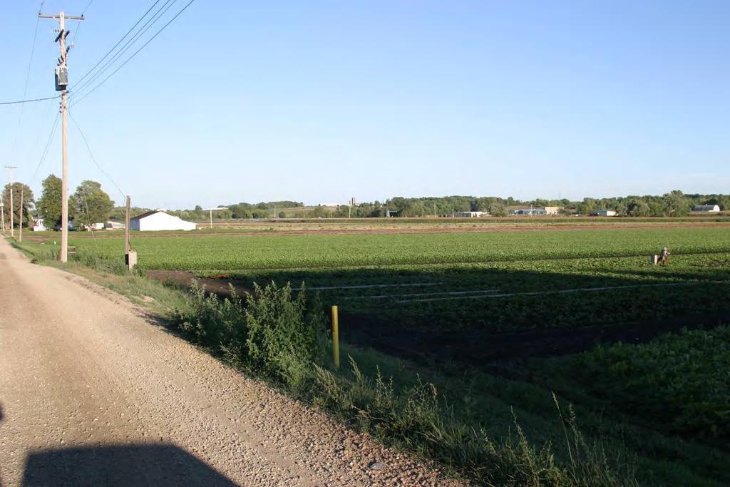
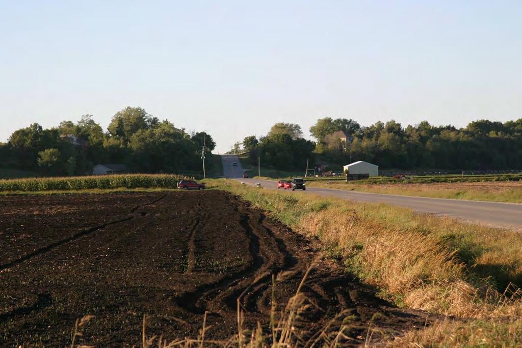
52 Paw Paw River Watershed Landcover

53 Questions? Thank You!
54 References GLACIAL LANDFORMS IN MICHIGAN (AN OVERVIEW) ms.html A.L. Kozlowski et al. / Quaternary Science Reviews 24 (2005) GGGR_302336_7.pdf
Prentice Hall EARTH SCIENCE
 Prentice Hall EARTH SCIENCE Tarbuck Lutgens Chapter 7 Glaciers, Desert, and Wind 7.1 Glaciers Types of Glaciers A glacier is a thick ice mass that forms above the snowline over hundreds or thousands of
CARD #1 The Shape of the Land: Effects of Crustal Tilting
 CARD #1 The Shape of the Land: Effects of Crustal Tilting When we look at a birds-eye view of the Great Lakes, it is easy to assume the lakes are all at a similar elevation, but viewed in this way, we
Geology and New England Landscapes
 Geology and New England Landscapes Jim Turenne, CPSS USDA-NRCS Warwick, RI. http://nesoil.com Why Geology? Provides the big picture of site conditions. Major part of soil formation (parent material and
Glacial Modification of Terrain
 Glacial Modification Part I Stupendous glaciers and crystal snowflakes -- every form of animate or inanimate existence leaves its impress upon the soul of man. 1 -Orison Swett Marden Glacial Modification
Landscape. Review Note Cards
 Landscape Review Note Cards Last Ice Age Pleistocene Epoch that occurred about 22,000 Years ago Glacier A large, long lasting mass of ice which forms on land and moves downhill because of gravity. Continental
1. Any process that causes rock to crack or break into pieces is called physical weathering. Initial product = final product
 Weathering 1. Any process that causes rock to crack or break into pieces is called physical weathering. Initial product = final product End Result of physical weathering is increased surface area. 2. Physical
Topic 6: Weathering, Erosion and Erosional-Deposition Systems (workbook p ) Workbook Chapter 4, 5 WEATHERING
 Workbook Chapter 4, 5 WEATHERING") Topic 6: Weathering, Erosion and Erosional-Deposition Systems (workbook p. 95-125) Workbook Chapter 4, 5 THE BIG PICTURE: Weathering, erosion and deposition are processes that cause changes to rock material
Topic 6: Weathering, Erosion and Erosional-Deposition Systems (workbook p. 95-125) Workbook Chapter 4, 5 THE BIG PICTURE: Weathering, erosion and deposition are processes that cause changes to rock material
Page 1. Name:
 Name: 1) Which property would best distinguish sediment deposited by a river from sediment deposited by a glacier? thickness of sediment layers age of fossils found in the sediment mineral composition
Name: Which rock layers appear to be most resistant to weathering? A) A, C, and E B) B and D
 A, C, and E B) B and D") Name: 1) The formation of soil is primarily the result of A) stream deposition and runoff B) precipitation and wind erosion C) stream erosion and mass movement D) weathering and biological activity 2)
Name: 1) The formation of soil is primarily the result of A) stream deposition and runoff B) precipitation and wind erosion C) stream erosion and mass movement D) weathering and biological activity 2)
How do glaciers form?
 Glaciers What is a Glacier? A large mass of moving ice that exists year round is called a glacier. Glaciers are formed when snowfall exceeds snow melt year after year Snow and ice remain on the ground
Bell Ringer. Are soil and dirt the same material? In your explanation be sure to talk about plants.
 Bell Ringer Are soil and dirt the same material? In your explanation be sure to talk about plants. 5.3 Mass Movements Triggers of Mass Movements The transfer of rock and soil downslope due to gravity is
Mass Movements, Wind, and Glaciers
 Mass Movements,, and Glaciers SECTION 8.1 Mass Movement at Earth s Surface In your textbook, read about mass movement. Use each of the terms below just once to complete the passage. avalanche creep landslide
Lab 7: Sedimentary Structures
 Name: Lab 7: Sedimentary Structures Sedimentary rocks account for a negligibly small fraction of Earth s mass, yet they are commonly encountered because the processes that form them are ubiquitous in the
The Geology of Sebago Lake State Park
 Maine Geologic Facts and Localities September, 2002 43 55 17.46 N, 70 34 13.07 W Text by Robert Johnston, Department of Agriculture, Conservation & Forestry 1 Map by Robert Johnston Introduction Sebago
4. The map below shows a meandering stream. Points A, B, C, and D represent locations along the stream bottom.
 1. Sediment is deposited as a river enters a lake because the A) velocity of the river decreases B) force of gravity decreases C) volume of water increases D) slope of the river increases 2. Which diagram
W he natural resources of Adams
 Above: Houghton Rock, Town of Adams. Following Page: "The Hole in the Rock" on Rattlesnake Mound--both remnants of rock formed by ancient seas hundreds of millions of year5 ago. (Courtesy, H.H. Bennett
Chapter 5: Glaciers and Deserts
 I. Glaciers and Glaciation Chapter 5: Glaciers and Deserts A. A thick mass of ice that forms over land from the compaction and recrystallization of snow and shows evidence of past or present flow B. Types
MASS MOVEMENTS, WIND, AND GLACIERS
 Date Period Name MASS MOVEMENTS, WIND, AND GLACIERS SECTION.1 Mass Movements In your textbook, read about mass movements. Use each of the terms below just once to complete the passage. avalanche creep
EARTH S CHANGING SURFACE
 EARTH S CHANGING SURFACE Weathering Together, weathering and erosion work continuously to wear down the material on Earth s surface. weathering process that breaks down rock and other substances of Earth
Which landscape best represents the shape of the valleys occupied by glaciers? A) B) C) D)
 B) C) D)") 1. Glaciers often form parallel scratches and grooves in bedrock because glaciers A) deposit sediment in unsorted piles B) deposit rounded sand in V-shaped valleys C) continually melt and refreeze D) drag
1. Glaciers often form parallel scratches and grooves in bedrock because glaciers A) deposit sediment in unsorted piles B) deposit rounded sand in V-shaped valleys C) continually melt and refreeze D) drag
Michigan s Geology and Groundwater
 Michigan s Geology and Groundwater Ralph J. Haefner Deputy Director U.S. Geological Survey Michigan-Ohio Water Science Center Lansing, Michigan Outline About the USGS Geology 101 Michigan s geology Bedrock
Unit 3 Review - Surface Processes
 Unit 3 Review - Surface Processes 1. Why is the surface of Mercury covered with meteor impact craters, while Earth s surface has relatively few craters? A) Mercury is larger than Earth, so it gets hit
4. What type of glacier forms in a sloping valley between rock walls? a. firn glacier b. ice sheet c. cirque d. alpine glacier
 Multiple Choice Questions 1. The term means the loss of snow and ice by evaporation and melting. a. sublimation b. ablation c. erosion d. abrasion 2. What condition must be met for a glacier to begin flowing
Weathering, Erosion and Deposition
 Weathering, Erosion and Deposition Shaping the Earth s Surface Weathering the process of breaking down rocks into smaller fragments Erosion the transport of rock fragments from one location to another
The boulder was most likely moved to this location by A) glacial ice B) prevailing wind C) streamfiow D) volcanic action
 glacial ice B) prevailing wind C) streamfiow D) volcanic action") 1. Which rock material was most likely transported to its present location by a glacier? A) rounded sand grains found in a river delta B) rounded grains found in a sand dune C) residual soil found on a
1. Which rock material was most likely transported to its present location by a glacier? A) rounded sand grains found in a river delta B) rounded grains found in a sand dune C) residual soil found on a
What are the different ways rocks can be weathered?
 Romano - 223 What are the different ways rocks can be weathered? Weathering - the breakdown of rocks and minerals at the Earth s surface 1. 2. PHYSICAL WEATHERING Rock is broken into smaller pieces with
Name. 4. The diagram below shows a soil profile formed in an area of granite bedrock. Four different soil horizons, A, B, C, and D, are shown.
 Name 1. In the cross section of the hill shown below, which rock units are probably most resistant to weathering? 4. The diagram below shows a soil profile formed in an area of granite bedrock. Four different
Lecture Outlines PowerPoint. Chapter 6 Earth Science 11e Tarbuck/Lutgens
 Lecture Outlines PowerPoint Chapter 6 Earth Science 11e Tarbuck/Lutgens 2006 Pearson Prentice Hall This work is protected by United States copyright laws and is provided solely for the use of instructors
Guided Notes Surface Processes. Erosion & Deposition By: Glaciers
 Guided Notes Surface Processes Erosion & Deposition By: Glaciers K. Coder 2015 26) How does moving ice erode and deposit sediments? Glaciers (Movement of Ice): a naturally formed mass of ice and snow that
Lecture Outline Lecture Outline Monday April 9-16, 2018 Questions? Announcements:
 Lecture Outline Lecture Outline Monday April 9-16, 2018 Questions? Announcements: Geology 101 Night Video: The Day After Tomorrow Hollywood disaster movie about the onset of a glacial period When: Monday
Cattaraugus Creek: A Story of Flowing Water and the Geology of the Channel It Flows Through Presentation to West Valley Citizen Task Force 4/27/16
 Cattaraugus Creek: A Story of Flowing Water and the Geology of the Channel It Flows Through Presentation to West Valley Citizen Task Force 4/27/16 Raymond C. Vaughan, Ph.D. What happens if you drop a
3 Erosion and Deposition by Ice
 CHAPTER 12 3 Erosion and Deposition by Ice SECTION Agents of Erosion and Deposition BEFORE YOU READ After you read this section, you should be able to answer these questions: What are glaciers? How do
Pratice Surface Processes Test
 1. The cross section below shows the movement of wind-driven sand particles that strike a partly exposed basalt cobble located at the surface of a windy desert. Which cross section best represents the
EROSION AND DEPOSITION
 CHAPTER 8 EROSION AND DEPOSITION SECTION 8 1 Changing Earth s Surface (pages 252-255) This section explains how sediment is carried away and deposited elsewhere to wear down and build up Earth s surface.
1. The map below shows a meandering river. A A' is the location of a cross section. The arrows show the direction of the river flow.
 1. The map below shows a meandering river. A A' is the location of a cross section. The arrows show the direction of the river flow. Which cross section best represents the shape of the river bottom at
The Niagara Escarpment extends from western New York, through the GTA all the way up to Manitoulin Island and into Michigan and Wisconsin.
 is southern Ontario s most prominent topographic feature, extending more than 500 kilometres from western New York, through Niagara Falls and the western part of the Greater Toronto Area (GTA), and north
Figure 1 The map shows the top view of a meandering stream as it enters a lake. At which points along the stream are erosion and deposition dominant?
 1. In which type of climate does chemical weathering usually occur most rapidly? 1. hot and dry 3. cold and dry 2. hot and wet 4. cold and wet 2. Figure 1 The map shows the top view of a meandering stream
PHYSICAL GEOGRAPHY. By Brett Lucas
 PHYSICAL GEOGRAPHY By Brett Lucas GLACIAL PROCESSES Glacial Processes The Impact of Glaciers on the Landscape Glaciations Past and Present Types of Glaciers Glacier Formation and Movement The Effects of
Erosion and Deposition
 Erosion and Deposition Erosion Sediment natural forces move rock/soil from one place to another. gravity, water, wind, glaciers, waves are causes material moved by erosion Deposition when erosion lays
Chapter 3 Erosion and Deposition. The Big Question:
 Chapter 3 Erosion and Deposition The Big Question: 1 Design a way to represent and describe the 4 types of mass movement. You may use pictures, diagrams, list, web, chart, etc 2 Chapter 3: Erosion and
Unit E: Basic Principles of Soil Science. Lesson 2: Understanding Soil Formation
 Unit E: Basic Principles of Soil Science Lesson 2: Understanding Soil Formation Important Terms Alluvium Bedrock Chemical weathering Climate Glacial till Loess Native vegetation Organic matter Outwash
Soil Formation. Lesson Plan: NRES B2-4
 Soil Formation Lesson Plan: NRES B2-4 1 Anticipated Problems 1. What are five different factors that affect soil formation? 2. What are some different types of parent material that affect soils? 3. What
STUDY GUIDE FOR CONTENT MASTERY. Surface Water Movement
 Surface Water SECTION 9.1 Surface Water Movement In your textbook, read about surface water and the way in which it moves sediment. Complete each statement. 1. An excessive amount of water flowing downslope
Soil Formation. Parent Material. Time. Climate
 Soil Formation Parent Material Time Climate Topography Biota Main Objectives 1. Gain a general understanding of soil formation processes 2. Understand the importance of mineral weathering in soil formation
Objectives. Introduction to Soils. Terms to know: What is soil? Study of Soils. The Soil Body 11/9/2012
 Objectives Explain what soil is and where it comes from Define a soil body List examples of the five soil-forming factors Explain how soils develop Introduction to Soils Terms to know: What is soil? Alluvial
Foundations of Earth Science, 6e Lutgens, Tarbuck, & Tasa
 Foundations of Earth Science, 6e Lutgens, Tarbuck, & Tasa Glacial and Arid Landscapes Foundations, 6e - Chapter 4 Stan Hatfield Southwestern Illinois College Glaciers Glaciers are parts of two basic cycles
Glaciers form wherever snow and ice can accumulate High latitudes High mountains at low latitudes Ice temperatures vary among glaciers Warm
 The Cryosphere Glaciers form wherever snow and ice can accumulate High latitudes High mountains at low latitudes Ice temperatures vary among glaciers Warm (temperate) glaciers: at pressure melting point,
Weathering, Erosion, Deposition
 Weathering, Erosion, Deposition The breakdown of rocks at or near the Earth s Surface. Physical Chemical - The breakdown of rock into smaller pieces without chemical change. - Dominant in moist /cold conditions
Erosion and Deposition
 Erosion and Deposition The Erosion-Deposition Process What do you think? Read the two statements below and decide whether you agree or disagree with them. Place an A in the Before column if you agree with
Ch 10 Deposition Practice Questions
 1. Base your answer to the following question on the data table below. Six identical cylinders, A through F, were filled with equal volumes of sorted spherical particles. The data table shows the particle
2/23/2009. Visualizing Earth Science. Chapter Overview. Deserts and Drylands. Glaciers and Ice Sheets
 Visualizing Earth Science By Z. Merali and B. F. Skinner Chapter 6 Deserts, Glaciers and Ice Sheets Chapter Overview Deserts and Drylands Glaciers and Ice Sheets Deserts Geography Categorization of deserts
Glaciers. (Shaping Earth s Surface, Part 6) Science 330 Summer 2005
 Science 330 Summer 2005") Glaciers (Shaping Earth s Surface, Part 6) Science 330 Summer 2005 1 Glaciers Glaciers are parts of two basic cycles Hydrologic cycle Rock cycle Glacier a thick mass of ice that originates on land from
Glaciers (Shaping Earth s Surface, Part 6) Science 330 Summer 2005 1 Glaciers Glaciers are parts of two basic cycles Hydrologic cycle Rock cycle Glacier a thick mass of ice that originates on land from
,Baynes Lake. TO...?&.?...A 2...KO.?'!!&... Sr. *logical Engineer
 > i evernment OF BRITISH COLUMBIA a TO...?&.?...A 2....KO.?'!!&... Sr. *logical Engineer... Grou,,water. Section Hydrology Division Wat.er... In~.~s.tiga.ti.On.s..Branck.... 5 u BJECT...C;.roun.dw.ater...Snve
Name: Class: Date: Multiple Choice Identify the letter of the choice that best completes the statement or answers the question.
 Name: Class: Date: geology ch 7 test 2008 Multiple Choice Identify the letter of the choice that best completes the statement or answers the question. 1. Which of the following is true about ice sheets?
Depositional Environment
 Depositional Environment Sedimentary depositional environment describes the combination of physical, chemical and biological processes associated with the deposition of a particular type of sediment. Types
 Page 1 of 9 Name: Base your answer to the question on the diagram below. The arrows show the direction in which sediment is being transported along the shoreline. A barrier beach has formed, creating a
Glaciers Earth 9th Edition Chapter 18 Glaciers: summary in haiku form Key Concepts Glaciers Glaciers Glaciers Glaciers
 1 2 3 4 5 6 7 8 9 10 11 12 13 14 Earth 9 th Edition Chapter 18 : summary in haiku form Ten thousand years thence big glaciers began to melt - called "global warming." Key Concepts and types of glaciers.
NC Earth Science Essential Standards
 NC Earth Science Essential Standards EEn. 2.1 Explain how processes and forces affect the Lithosphere. EEn. 2.1.1 Explain how the rock cycle, plate tectonics, volcanoes, and earthquakes impact the Lithosphere.
Chapter 2. Denudation: Rivers and Ice
 Chapter 2. Denudation: Rivers and Ice DENUDATION: process that lowers level of land - caused by rivers, glaciers, waves & wind - involves processes of WEATHERING & EROSION Weathering Def: breakdown of
Lecture 10 Glaciers and glaciation
 Lecture 10 Glaciers and glaciation Outline Importance of ice to people! Basics of glaciers formation, classification, mechanisms of movement Glacial landscapes erosion and deposition by glaciers and the
Lowland Glaciation North Wales
 Lowland Glaciation North Wales Background Although there have been many glaciations and advances in ice, the most significant for this are was the Dimlington Stadial which was a period of glacial advance
Chapter 2. Wearing Down Landforms: Rivers and Ice. Physical Weathering
 Chapter 2 Wearing Down Landforms: Rivers and Ice Physical Weathering Weathering vs. Erosion Weathering is the breakdown of rock and minerals. Erosion is a two fold process that starts with 1) breakdown
Name Roy G Biv Page 1
 Name Roy G Biv Base your answers to questions 1 through 3 on the diagram below. The arrows show the direction in which sediment is being transported along the shoreline. A barrier beach has formed, creating
Sediment and sedimentary rocks Sediment
 Sediment and sedimentary rocks Sediment From sediments to sedimentary rocks (transportation, deposition, preservation and lithification) Types of sedimentary rocks (clastic, chemical and organic) Sedimentary
Lecture Outline Wednesday - Friday February 14-16, 2018
 Lecture Outline Wednesday - Friday February 14-16, 2018 Quiz 2 scheduled for Friday Feb 23 (Interlude B, Chapters 6,7) Questions? Chapter 6 Pages of the Past: Sedimentary Rocks Key Points for today Be
Module 10: Resources and Virginia Geology Topic 4 Content: Virginia Geology Notes
 Virginia is composed of a very diverse landscape that extends from the beaches and barrier islands all of the way to the highly elevated Appalachian Plateau. Geologists have discovered ancient shallow
Changing Earth s Surface
 Name Date Class Changing Earth s Surface What processes wear down and build up Earth s surface? What causes the different types of mass movement? Erosion is the process by which natural forces move weathered
The Building of the NYC Region
 The Building of the NYC Region Definitions Fall Line marks the area where an upland region (continental bedrock) and a coastal plain meet Piedmont the plateau region of the eastern United States which
CHAPTER 4 NOTES -WEATHERING AND EROSION- LESSON 4.1: TYPES OF WEATHERING
 CHAPTER 4 NOTES -WEATHERING AND EROSION- LESSON 4.1: TYPES OF WEATHERING WEATHERING Weathering- the process by which rocks are broken down by the forces of nature. - the breakdown of large rocks into fragments
core mantle crust the center of the Earth the middle layer of the Earth made up of molten (melted) rock
 rock") core the center of the Earth mantle the middle layer of the Earth made up of molten (melted) rock crust the surface layer of the Earth that includes the continents and oceans 1 continental drift the theory
core the center of the Earth mantle the middle layer of the Earth made up of molten (melted) rock crust the surface layer of the Earth that includes the continents and oceans 1 continental drift the theory
Summary. Streams and Drainage Systems
 Streams and Drainage Systems Summary Streams are part of the hydrologic cycle and the chief means by which water returns from the land to the sea. They help shape the Earth s surface and transport sediment
What is weathering and how does it change Earth s surface? Answer the question using
 7 th Grade Lesson What is weathering and how does it change Earth s surface? Answer the question using the sentence frame. You have 4 minutes. Weathering is. This changes the Earth s surface because. 1
Glacial processes and landforms NGEA01, 2014
 Glacial processes and landforms NGEA01, 2014 Cecilia Akselsson Department of Physical Geography and Ecosystem Science Lund University Geomorphological processes and landforms all over the world Periglacial
mountain rivers fixed channel boundaries (bedrock banks and bed) high transport capacity low storage input output
 high transport capacity low storage input output") mountain rivers fixed channel boundaries (bedrock banks and bed) high transport capacity low storage input output strong interaction between streams & hillslopes Sediment Budgets for Mountain Rivers Little
mountain rivers fixed channel boundaries (bedrock banks and bed) high transport capacity low storage input output strong interaction between streams & hillslopes Sediment Budgets for Mountain Rivers Little
THE OHIO JOURNAL OF SCIENCE
 THE OHIO JOURNAL OF SCIENCE VOL. LIII MARCH, 1953 No. 2 SUBSURFACE STUDY OF GLACIAL DEPOSITS AT CLEVELAND, OHIO C. T. BAGLEY Sverdrup & Parcel, Inc., Consulting Engineers, St. Lotus, Mo. The soil 1 strata
Mammoth Cave National Park, Kentucky
 Mammoth Cave National Park, Kentucky Objectives of Today s Lecture Refresher on Sedimentary Depositional Systems and Rock Classifications Transgressive and Regressive Marine Environments Carbonate Depositional
Erosion and Deposition
 CHAPTER 3 LESSON 2 Erosion and Deposition Landforms Shaped by Water and Wind Key Concepts What are the stages of stream development? How do water erosion and deposition change Earth s surface? How do wind
CURRICULUM TR AILING ICE AGE M YST ERI E S
 MIDDLE SCHOOL CURRICULUM TR AILING ICE AGE M YST ERI E S THE Driftless Area CONTENTS I. Enduring Knowledge... 3 II. Teacher Background... 3 III. Before Viewing the Video... 5 IV. Viewing Guide... 5 V.
Maggie Payne Jim Turenne
 Maggie Payne Jim Turenne USDA-NRCS 60 Quaker Lane, Suite 46 Warwick, RI. 02886 401-822-8832 maggie.payne@ri.usda.gov U.S. Department of Agriculture 1935: Soil Conservation Service (SCS) Natural Resources
Jim Turenne. Soils on Social Media
 Jim Turenne USDA-NRCS 60 Quaker Lane, Suite 46 Warwick, RI. 02886 401-822-8832 Jim.turenne@ri.usda.gov Soils on Social Media www.twitter.com/soilsne www.fb.com/soilsne www.nesoil.com U.S. Department of
Maximum Extent of Pleistocene Glaciation - 1/3 of land surface Most recent glacial maximum peaked 18,000 years ago and is considered to have ended
 Glaciers Maximum Extent of Pleistocene Glaciation - 1/3 of land surface Most recent glacial maximum peaked 18,000 years ago and is considered to have ended 10,000 B.P. Current Extent of Glaciation - about
Chapter 9 Notes: Ice and Glaciers, Wind and Deserts
 Chapter 9 Notes: Ice and Glaciers, Wind and Deserts *Glaciers and Glacial Features glacier is a mass of ice that moves over land under its own weight through the action of gravity Glacier Formation must
Class Notes: Surface Processes
 Name: Date: Period: Surface Processes The Physical Setting: Earth Science Class Notes: Surface Processes I. Weathering and Soils Weathering -! Sediments -! Weathering occurs when rocks are exposed to:
The Agents of Erosion
 The Agents of Erosion 1. Erosion & Deposition 2. Water 3. Wind 4. Ice California Science Project 1 1. Erosion and Deposition Erosion is the physical removal and transport of material by mobile agents such
Weathering and Soil Formation. Chapter 10
 Weathering and Soil Formation Chapter 10 Old and New Mountains The Appalachian Mountains appear very different from the Sierra Mountains. The Appalachians are smaller, rounded, gently sloping, and covered
1. Erosion by Running Water Most powerful cause of erosion
 I. Destructive Forces Notes: Destructive force: a process in which land is destroyed or changed such as weathering and erosion. All landforms are a result of a combination of constructive and destructive
Chapter 5. The Sedimentary Archives
 Chapter 5 The Sedimentary Archives Factors affecting Sedimentary Characteristics 1. Tectonic setting 2. Physical, chemical, and biological processes in the depositional environment 3. Method of sediment
L.O: SLOWING STREAMS DEPOSIT (SORT) SEDIMENT HORIZONTALLY BY SIZE.
 SEDIMENT HORIZONTALLY BY SIZE.") L.O: SLOWING STREAMS DEPOSIT (SORT) SEDIMENT HORIZONTALLY BY SIZE. 1. Base your answer to the following question on the profile shown below, which shows the pattern of horizontal sorting produced at a
L.O: SLOWING STREAMS DEPOSIT (SORT) SEDIMENT HORIZONTALLY BY SIZE. 1. Base your answer to the following question on the profile shown below, which shows the pattern of horizontal sorting produced at a
UNIT 4: Earth Science Chapter 21: Earth s Changing Surface (pages )
") CORNELL NOTES Directions: You must create a minimum of 5 questions in this column per page (average). Use these to study your notes and prepare for tests and quizzes. Notes will be turned in to your teacher
CORNELL NOTES Directions: You must create a minimum of 5 questions in this column per page (average). Use these to study your notes and prepare for tests and quizzes. Notes will be turned in to your teacher
Name: Mid-Year Review #2 SAR
 Name: Mid-Year Review #2 SAR Base your answers to questions 1 through 3 on on the diagram below, which shows laboratory materials used for an investigation of the effects of sediment size on permeability,
On-Site Soils Investigation. Buttermilk Way Storm water Treatment Project Buzzards Bay. MA. February 28 th, 2012
 1 On-Site Soils Investigation Buttermilk Way Storm water Treatment Project Buzzards Bay. MA February 28 th, 2012 Glenn Stanisewski, Resource Soil Scientist, USDA-NRCS, West Wareham, MA Introduction: The
The boundary between two formations (or any distinct layers) is called a contact. Sedimentary rocks cover 75% of continents.
 is called a contact. Sedimentary rocks cover 75% of continents.") Sedimentary Rocks Sedimentary rocks form at the Earth s surface through interactions of the hydrologic system and the crust. Fortunately, many of these processes are in operation today, and geologists
Sedimentary Rocks Sedimentary rocks form at the Earth s surface through interactions of the hydrologic system and the crust. Fortunately, many of these processes are in operation today, and geologists
Weathering of Rocks. Weathering - Breakdown of rocks into pieces (sediment) 2 main types of weathering to rocks
 2 main types of weathering to rocks") Weathering of Rocks Weathering - Breakdown of rocks into pieces (sediment) 2 main types of weathering to rocks Mechanical weathering requires physical forces to break rocks into smaller pieces. Chemical
Weathering of Rocks Weathering - Breakdown of rocks into pieces (sediment) 2 main types of weathering to rocks Mechanical weathering requires physical forces to break rocks into smaller pieces. Chemical
EQ: Discuss main geographic landforms of the U.S. & Canada and examine varied landforms in relation to their lifestyles.
 EQ: Discuss main geographic landforms of the U.S. & Canada and examine varied landforms in relation to their lifestyles. Places & Terms for Discussion Appalachian Mountains Great Plains Canadian Shield
1/6/ th Grade Earth s Surface. Chapter 3: Erosion and Deposition. Lesson 1 (Mass Movement)
") Lesson 1 (Mass Movement) 7 th Grade Earth s Surface Chapter 3: Erosion and Deposition Weathering the chemical and physical processes that break down rock at Earth s surface Mechanical weathering when rock
Lesson 1 (Mass Movement) 7 th Grade Earth s Surface Chapter 3: Erosion and Deposition Weathering the chemical and physical processes that break down rock at Earth s surface Mechanical weathering when rock
Sediment. Weathering: mechanical and chemical decomposition and disintegration of rock and minerals at the surface
 Sediment Some basic terminology Weathering: mechanical and chemical decomposition and disintegration of rock and minerals at the surface Erosion: removal of weathered rock and minerals from one place to
GEOLOGY OF TODMORDEN MOOR 2 BACKGROUND
 GEOLOGY OF TODMORDEN MOOR 2 BACKGROUND 1) THE CARBONIFEROUS SERIES OF ROCKS The rocks of the Todmorden district are of the Carboniferous Series and were first laid down in an ancient sea, which covered
Science EOG Review: Landforms
 Mathematician Science EOG Review: Landforms Vocabulary Definition Term canyon deep, large, V- shaped valley formed by a river over millions of years of erosion; sometimes called gorges (example: Linville
Amazing Ice: Glaciers and Ice Ages
 Amazing Ice: Glaciers and Ice Ages Updated by: Rick Oches, Professor of Geology & Environmental Sciences Bentley University Waltham, Massachusetts Based on slides prepared by: Ronald L. Parker, Senior
UNIT 4 SEDIMENTARY ROCKS
 UNIT 4 SEDIMENTARY ROCKS WHAT ARE SEDIMENTS Sediments are loose Earth materials (unconsolidated materials) such as sand which are transported by the action of water, wind, glacial ice and gravity. These