Report of Designing and Producing the Pilot Learning Environments in Norway
|
|
|
- Sheryl Dennis
- 6 years ago
- Views:
Transcription


1 NEED Project WP4 Inspiring Environments for Education Action 19 Report of Designing and Producing the Pilot Learning Environments in Norway Learning environment 1 Learning environment 3 Learning environment 2 1
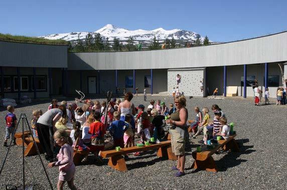
2 a) Summary of pilot learning environments in Norway 1.1 Short description of NEED target area The work of the NEED project in Norway are placed to the protected areas of Junkerdal and Saltfjellet-Svartisen national parks, mostly located on Storjord. These areas are located in northern Norway on the polar circle. The parks are known among other things for its limestone, and the high density of limestone caves. Between these two national parks lies Nordland National Park Center, which is a visitor centre that offers both nature knowledge and thrills. It provides information about all the national parks in Nordland County and the surrounding areas. The centre has a lot of geological information about the area, and offers among other things a free walking map with highlighted geological events in close surroundings. Findings from the Stone Age indicate that there were permanent settlements on Storjord in Saltdal municipality already during late Stone Age (from 3000 BC to 200 AD). Ancient charred remains and stone objects have been found here, together with animal traps. Later Storjord became the centre of activities of the forest commission in Saltdal and the river Saltdalselva was used for log rafting. Waterfalls, majestic mountains and a rich fauna and flora: Storjord has a varied nature with many exiting biological and geological features and places to visit for tourists and locals. The area also offers exiting learning environments for schools. 1.2 Short introduction to Norwegian pilot learning environments The piloted learning environments in Norway are: A. Nordland National Park Centre The centre itself holds both inside and outside several geological exhibitions and activities. The study module Good and Bad Geology takes place within the centre. B. Learning environments in the local area There are many good learning environments in the area as described below. The 2
3 learning environments that are connected to study modules are described in separate sections. Junkerdal Canyon and Nature reserve The gorge Junderdalsura offers rich vegetation, that one could not expect this far north. This is due to its wind-protected location, the abundance of water and the lime-rich soil. Along the path you can find numerous orchids, among them lady s slipper and dark-red helleborine. The botanical value of the area was already discovered in the 1820 s. The path starts at the national Park Centre and leads you into the gorge. On one side of the river valley you have deciduous forest and on the other side, the river Junkerdalselva. Large parts of the gorge are filled up with rocks and gravel coming down from the very steep mountain sides. The mountains contain layers of marble and mica-shale that is easily weathered into nutritious soil. The river also erodes sideways, leaving parts of the riverbanks unstable. After periods with rain, during winter and in spring time, there is a high risk for rock-fall, slides and avalanches, and people are not advised to go into the gorge. Futhellern ( The Tax Collector s Boulders ) The place called Futhellarn consists of several boulders that have been transported there by the glacier during the last ice-age. They fell straight down when the ice melted and landed on top of each other to form a large roofed space. It is said that in old times the tax collector spent his nights here when he was in the area and was not welcome at the villagers. Pot Hole In Norway many pot holes were formed at the end of the last ice age, when they were eroded into bedrock along the coast where the water level was much higher than today. They were also often carved out by high energy glacial rivers below or in front of the ice-age glaciers, which are long gone today. Many pot holes are therefore found above sea level and often far from today s rivers and coastline. Smaller pot holes are still continuously forming at the present coastline and in some rivers. The cause of pot hole formation is mechanical erosion by whirling water that may carry sand, gravel or boulders. Loose stones whirling in strong rapids or waterfalls create a deep round hole. Hardness of pebbles must be the same or higher than the bottom of the stream where the hole is eroding. 3
4 Dead Ice Hollow Along one of the trails is a 10 meter deep dead ice hollow which is 75 x 100 meter in space. As the glaciers melted and withdrew from the landscape after the last ice age, blocks of ice sometimes broke off from the main ice body and were over time covered with glacio-fluvial sand and gravel from the glaciers further up the valley. When the buried ice-block (or in this case; almost an ice-berg) finally melted, the sand and gravel on top of it subsided, forming a dead ice hollow. These may up to 30m deep and more than 1.6 km in diameter. Some of the hollows are completely dry, but it is most common to find water or peat in the bottom of the depression. The name, dead ice hollow, originates from that the buried ice block was a piece of dead glacial ice without movement in any direction. Plateau Hestbrinken (gravel pit) The plateau is a flat stretch of land of about 1 km 2 west of the National Park Centre. The plateau is sharply delimited by 20 meter high erosion banks where the rivers have eroded into the masses. In the southern part of the plateau there is a gravel pit in commercial use. The walls of the gravel pit displays deposits with 2-3 thick layers of unsorted sand, rock and boulders, and one thin layer of sorted sand. Most of the unsorted masses are rounded and consist of different rock types. Over 1000 large sharpe-edged boulder are found scattered in a fan-like shape on top of the deposit. The pattern of deposition of the masses, and the boulders on top of the plateau, indicate that the plateau is formed by masses that came out of the mouth of the Junkerdal Canyon in the last part of the last Ice Age. The masses probably came in episodic large events of debris-flow type, released by some form of dam-breaks triggered by the deglaciation of the Junkerdalen valley. Small Glacial Striations and Large Glacial Grooves/Plastic Shapes On polished rounded bedrock-hills you can sometimes find straight striations of different depth carved into the rock. These are called glacial striations and were formed by pieces of rocks that were frozen into glaciers during the ice-age and dragged under hard pressure over the bedrock surface. On the western side of the highest bedrock knoll on Kvanneshaugen, plastic shapes are carved into the bedrock. They consist of large rounded and streamlined hollows etched into the side 4
5 of the hill. This was due to the, also lateral, pressure under the glacier during the last ice-age that made the glacial erosion act also sideways in a direction normal to the main movement of the ice. Avalanche in 2002 In 2002 a period of snow melting and rain caused a large landslide, 112 meters wide and 100 meters long. The avalanche deposits now form a ridge at the base of the hillside. Limestone Precipitation (stalactites) under Boulders Under at least three large boulders along the path there are irregular grey-white stalactites that hang 1-2 cm down from the rocks. These are formed when rain water with dissolved lime from marble in the canyon drips along the boulders and precipitates when the water vaporizes or drips from the surface of the boulder. Doline (imploded cave) This doline was formed when a small cave collapsed and created a pit 10x15 meters wide. A small river still runs into the pit and disappears in the ground. The cave was made slowly by water that dissolved the lime in the marble. It is not known how large hollows there might exist in the mountain on the north side of the canyon. Round Boulder A round boulder of a granite bedrock lies just on the edge of the canyon. Because the mountain itself consists of marble and mica schist, we know that the boulder must come elsewhere from. The only way it can have been transported here is by a glacier that lifted it and deposited it here when the ice melted. The shape of the boulder tells us that it, at one time, must have rolled down a very large glacial river, polishing off the sharp edges. This must have happened long before the glacier lifted it to its present position, where it lies in wait, perhaps, before the next ice-age to carry it onwards. 5
6 Additional value achieved by NEED in the Norwegian target area Services: 1. Models for organizing business oriented education services 2. Marketing website 3. Project website (for disseminating NEED products) 4. Publishing a new website for Nordland National Park Centre, highlighting NEED. 5. Developing three study modules for schools 6. Brochure (z-card) to market Nordland National Park Centre (for study modules, learning environments and tourists) 7. Geo-scientific course for several of the SMEs, State Rangers and local people 8. Geo-scientific course for several of the local teachers 9. Participating in The National Day of Geology (promoting the geology surrounding Nordland national park Centre) Products: 1. Study modules aimed at schools visiting Nordland National Park Centre: a. Good and Bad Geology hver sin b. River Processes c. Hollows in the Ground 2. A new trail map for Storjord area (z-card) 3. A geo-lab (physical installation illustrating how river beds are made in the landscape) 4. An animation about the making of Storjord (for educational use) 5. A 2 meter high roll up for educational use (showing the ground under the gravel pit which is too dangerous to visit) 6. Bedrock map of Storjord, made by Norwegian Geological Survey (Google earth and paper based) 7. Developing learning environments Reports, reviews and case studies: 1. Curriculum analysis 2. Geological review of target area 3. Case study about learning results from one of the study module 6
7 4. Conference proceedings from WP4 conference in Norway 5. Survey report (customer demand and satisfaction Summer 2010 Nordland National Park Centre) 6. Case study about the social capital in educational tourism (implementation of geology Storjord Hotel, one of the SMEs) b) Designing and producing the learning environments a) LE1 The National Park Centre General information about the learning environment Nordland National Park Centre is located in Storjord, Saltdal municipality, Nordland County. It was founded in Its mandate is to be an information and visitor centre which shall document and impart knowledge about national parks, other protected areas, nature, and Norwegian and Sami culture in Nordland. The activities in total shall be a window for Nordlands natural values and stimulate to active outdoor life. The visitor center has traditional exhibitions and some activity based learning sites. Before the NEED project the centre miss the systematical connections to the nearby surroundings and more hand on activities explaining geological processes. Target groups are both schools and visitors (tourists). The centre also houses different cultural events for the local community during the year. Development work done in NEED Geo laboratory: Better knowledge about the surrounding geology. Better connections to examples of geological processes close to the center and the national parks. Photos 7
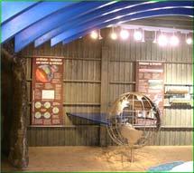
8 From the exhibitions inside From the yard (1) From the yard (2) 8

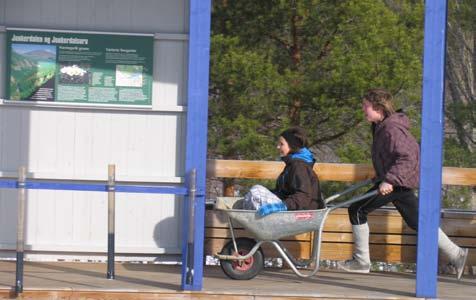
9 From the yard (3) b) LE 2 The geological landscape surrounding Nordland National Park Centre (Study module: Hollows in the Ground, trail) General information about the learning environment The geological landscape at Storjord consists of many interesting features. The study module makes use of these by pointing out strange hollows in the ground. When pupils have finished the trail, they will have a better understanding of the landscape and how to interpret geological features. Before NEED there existed a map showing the different features and physical signs at the locations. The study module pieces together the information and gives a better overview over Storjord. The main target group is pupils from schools. The study module contains several theoretical and practical tasks to be executed in the field. Visitors at the National Park Centre can use the z-card (map) to find and visit the same locations. Development work done in NEED The geological features have been there to visit if people used the map or went just by themselves. The new z-card (map) gives more information about the different locations. Photo 9

10 One of the trapping pits b) LE3 The river, Junkerdalselva (Study module: River Processes, trail) General information about the learning environment Junkerdalselva comes down through the Junkerdal gorge and passes right by the National Park Centre. A bit further down it merges with the river Saltdalselva. The river is exposed to flooding due to snow melting and heavy rains every year. Active processes can be observed and measured. The module is aimed at understanding a geological phenomenon in nature, river terraces, and their formation based upon using a Geo Lab installation. The valley, Saltdalen, has very many river terraces which is easy to see and access. Before NEED there existed no educational study module connected to the river as a modifier of the landscape. The main target group is pupils from schools. The study module contains several theoretical and practical tasks to be executed in the field. Photos 10


11 River terrace at Roparneset The river Junkerdalselva The river Junkerdalselva. Photo: Marianne Karbøl Hanssen 11
What is weathering and how does it change Earth s surface? Answer the question using
 7 th Grade Lesson What is weathering and how does it change Earth s surface? Answer the question using the sentence frame. You have 4 minutes. Weathering is. This changes the Earth s surface because. 1
Weathering and Erosion
 Have you ever looked at the land around you and wondered how it was shaped? The geologic features that help define the world are still being shaped by the natural processes of weathering, erosion, and
Chapter 3 Erosion and Deposition. The Big Question:
 Chapter 3 Erosion and Deposition The Big Question: 1 Design a way to represent and describe the 4 types of mass movement. You may use pictures, diagrams, list, web, chart, etc 2 Chapter 3: Erosion and
Glacial Erosion Polished on front side Glacial striations (scratches) on top
 on top") St Mary s Cemetery Glacial Erosion Polished on front side Glacial striations (scratches) on top Weathering Water channel in the rock mechanical weathering Some rocks eroding faster than others mechanical
St Mary s Cemetery Glacial Erosion Polished on front side Glacial striations (scratches) on top Weathering Water channel in the rock mechanical weathering Some rocks eroding faster than others mechanical
Erosion and Deposition
 CHAPTER 3 LESSON 2 Erosion and Deposition Landforms Shaped by Water and Wind Key Concepts What are the stages of stream development? How do water erosion and deposition change Earth s surface? How do wind
Science and Health EFFECT OF EROSION ON THE CONDITION OF SOIL AND LAND SHAPE
 4 Module 51 Science and Health EFFECT OF EROSION ON THE CONDITION OF SOIL AND LAND SHAPE A DepEd-BEAM Distance Learning Program supported by the Australian Agency for International Development To the Learner
Science EOG Review: Landforms
 Mathematician Science EOG Review: Landforms Vocabulary Definition Term canyon deep, large, V- shaped valley formed by a river over millions of years of erosion; sometimes called gorges (example: Linville
3 Erosion and Deposition by Ice
 CHAPTER 12 3 Erosion and Deposition by Ice SECTION Agents of Erosion and Deposition BEFORE YOU READ After you read this section, you should be able to answer these questions: What are glaciers? How do
Weathering, Erosion and Deposition
 Weathering, Erosion and Deposition Shaping the Earth s Surface Weathering the process of breaking down rocks into smaller fragments Erosion the transport of rock fragments from one location to another
Changes to Land 5.7B. landforms: features on the surface of Earth such as mountains, hills, dunes, oceans and rivers
 All the landforms on Earth have changed over time and continue to change. Many of the changes were caused by wind, moving water, and moving ice. Mountains have grown and shrunk. Rivers have cut away land
Think about the landforms where you live. How do you think they have changed over time? How do you think they will change in the future?
 reflect All the landforms on Earth have changed over time and continue to change. Many of the changes were caused by wind, moving water, and moving ice. Mountains have grown and shrunk. Rivers have cut
Study Module for RIVER PROCESSES. Geo Lab at Nordland National Park Centre. HANDBOOK for TEACHERS
 Study Module for RIVER PROCESSES Geo Lab at Nordland National Park Centre HANDBOOK for TEACHERS Table of contents 1 Summary of module... 3 1.1 Level... 5 1.2 Objectives... 5 1.3 Curriculum links... 5 1.3.1
EARTH S CHANGING SURFACE
 EARTH S CHANGING SURFACE Weathering Together, weathering and erosion work continuously to wear down the material on Earth s surface. weathering process that breaks down rock and other substances of Earth
Tips for Success on a Test
 Number of Incorrect: Final Grade: Parent Signature: Top Tips for Success on a Test 1. Read the following statements at least two times. 2. Circle the key words in each question/ or statement. (*Remember
What are the different ways rocks can be weathered?
 Romano - 223 What are the different ways rocks can be weathered? Weathering - the breakdown of rocks and minerals at the Earth s surface 1. 2. PHYSICAL WEATHERING Rock is broken into smaller pieces with
Surface Events & Landforms. Mrs. Green
 Surface Events & Landforms Mrs. Green Bell Work 1) Which event MOST likely causes the slowest change to the surface of Earth? a) Earthquake b) Landslide c) Volcano d) Wind 2) When cold weather freezes
TEACHER BACKGROUND KNOWLEDGE. Surface Processes: Weathering and Erosion
 TEACHER BACKGROUND KNOWLEDGE Surface Processes: Weathering and Erosion Core Concepts Precipitation (caused by the water cycle) and wind cause rocks to be broken into smaller pieces in the process called
Beyond the Book. FOCUS Book
 FOCUS Book Suppose your city wants to build a new housing development on a steep slope outside town. Design a model to test whether the land is safe from the types of landslides you read about in this
Name. 4. The diagram below shows a soil profile formed in an area of granite bedrock. Four different soil horizons, A, B, C, and D, are shown.
 Name 1. In the cross section of the hill shown below, which rock units are probably most resistant to weathering? 4. The diagram below shows a soil profile formed in an area of granite bedrock. Four different
1/6/ th Grade Earth s Surface. Chapter 3: Erosion and Deposition. Lesson 1 (Mass Movement)
") Lesson 1 (Mass Movement) 7 th Grade Earth s Surface Chapter 3: Erosion and Deposition Weathering the chemical and physical processes that break down rock at Earth s surface Mechanical weathering when rock
Lesson 1 (Mass Movement) 7 th Grade Earth s Surface Chapter 3: Erosion and Deposition Weathering the chemical and physical processes that break down rock at Earth s surface Mechanical weathering when rock
Topic 6: Weathering, Erosion and Erosional-Deposition Systems (workbook p ) Workbook Chapter 4, 5 WEATHERING
 Workbook Chapter 4, 5 WEATHERING") Topic 6: Weathering, Erosion and Erosional-Deposition Systems (workbook p. 95-125) Workbook Chapter 4, 5 THE BIG PICTURE: Weathering, erosion and deposition are processes that cause changes to rock material
Topic 6: Weathering, Erosion and Erosional-Deposition Systems (workbook p. 95-125) Workbook Chapter 4, 5 THE BIG PICTURE: Weathering, erosion and deposition are processes that cause changes to rock material
Page 1. Name:
 Name: 1) Which property would best distinguish sediment deposited by a river from sediment deposited by a glacier? thickness of sediment layers age of fossils found in the sediment mineral composition
Weathering, Erosion, Deposition
 Weathering, Erosion, Deposition The breakdown of rocks at or near the Earth s Surface. Physical Chemical - The breakdown of rock into smaller pieces without chemical change. - Dominant in moist /cold conditions
Prentice Hall EARTH SCIENCE
 Prentice Hall EARTH SCIENCE Tarbuck Lutgens Chapter 7 Glaciers, Desert, and Wind 7.1 Glaciers Types of Glaciers A glacier is a thick ice mass that forms above the snowline over hundreds or thousands of
Mass Movements, Wind, and Glaciers
 Mass Movements,, and Glaciers SECTION 8.1 Mass Movement at Earth s Surface In your textbook, read about mass movement. Use each of the terms below just once to complete the passage. avalanche creep landslide
Erosion and Deposition
 Erosion and Deposition Erosion Sediment natural forces move rock/soil from one place to another. gravity, water, wind, glaciers, waves are causes material moved by erosion Deposition when erosion lays
Lecture 10 Glaciers and glaciation
 Lecture 10 Glaciers and glaciation Outline Importance of ice to people! Basics of glaciers formation, classification, mechanisms of movement Glacial landscapes erosion and deposition by glaciers and the
1. Any process that causes rock to crack or break into pieces is called physical weathering. Initial product = final product
 Weathering 1. Any process that causes rock to crack or break into pieces is called physical weathering. Initial product = final product End Result of physical weathering is increased surface area. 2. Physical
Name: Period: Date: ID: A. Circle the choice that best completes the statement or answers the question and write the letter on the blank.
 Name: Period: _ Date: _ ID: A Unit 7 Practice Circle the choice that best completes the statement or answers the question and write the letter on the blank. 1. What term describes the movement of rock
STAAR 2013 #20; RC3; Readiness 1. Glaciers are masses of ice that move slowly on land. Which of these features was most likely formed by a glacier?
 Earth oot amp #1 5.7 Recognize how landforms such as deltas, canyons, and sand dunes are the result of changes to Earth s surface by wind, water, and ice. STR 2013 #20; R3; Readiness 1. Glaciers are masses
2nd Grade Changing of Earth
 Slide 1 / 133 Slide 2 / 133 2nd Grade Changing of Earth 2015-11-23 www.njctl.org Slide 3 / 133 Table of Contents: Changing of Earth Earth and Moon Cycles Weather Cycles The Rock Cycle Defined Events Gradual
1. Erosion by Running Water Most powerful cause of erosion
 I. Destructive Forces Notes: Destructive force: a process in which land is destroyed or changed such as weathering and erosion. All landforms are a result of a combination of constructive and destructive
2nd Grade. Earth and Moon Cycles. Slide 1 / 133 Slide 2 / 133. Slide 3 / 133. Slide 4 / 133. Slide 5 / 133. Slide 6 / 133.
 Slide 1 / 133 Slide 2 / 133 2nd Grade Changing of Earth 2015-11-23 www.njctl.org Slide 3 / 133 Slide 4 / 133 Table of Contents: Changing of Earth Earth and Moon Cycles Click on the topic to go to that
Practice 3rd Quarter Exam Page 1
 Name 1. Which characteristic would most likely remain constant when a limestone cobble is subjected to extensive abrasion? A) shape B) mass C) volume D) composition 2. Which activity demonstrates chemical
EROSION AND DEPOSITION
 CHAPTER 8 EROSION AND DEPOSITION SECTION 8 1 Changing Earth s Surface (pages 252-255) This section explains how sediment is carried away and deposited elsewhere to wear down and build up Earth s surface.
PROMISED LAND STATE PARK PIKE COUNTY ANCIENT RIVERS AND AGES OF ICE
 PENNSYLVANIA TRAIL OF GEOLOGY PARK GUIDE 18 PROMISED LAND STATE PARK PIKE COUNTY ANCIENT RIVERS AND AGES OF ICE Promised Land State Park is located on a broad upland surface known as the Pocono Plateau.
Landscape evolution. An Anthropic landscape is the landscape modified by humans for their activities and life
 Landforms Landscape evolution A Natural landscape is the original landscape that exists before it is acted upon by human culture. An Anthropic landscape is the landscape modified by humans for their activities
1. Which type of climate has the greatest amount of rock weathering caused by frost action? A) a wet climate in which temperatures remain below
 a wet climate in which temperatures remain below") 1. Which type of climate has the greatest amount of rock weathering caused by frost action? A) a wet climate in which temperatures remain below freezing B) a wet climate in which temperatures alternate
1. Which type of climate has the greatest amount of rock weathering caused by frost action? A) a wet climate in which temperatures remain below freezing B) a wet climate in which temperatures alternate
Weathering, Erosion, and Deposition
 Weathering, Erosion, and Deposition E Q : H O W I S T H E E A R T H A F F E C T E D B Y C O N S T R U C T I V E A N D D E S T R U C T I V E F O R C E S? http://player.discoveryeducation.com/index.cfm?guidassetid=6b1e329e-5a77-4b36-bfa9-1d307f75441c&blnfromsearch=1&productcode=us
core mantle crust the center of the Earth the middle layer of the Earth made up of molten (melted) rock
 rock") core the center of the Earth mantle the middle layer of the Earth made up of molten (melted) rock crust the surface layer of the Earth that includes the continents and oceans 1 continental drift the theory
core the center of the Earth mantle the middle layer of the Earth made up of molten (melted) rock crust the surface layer of the Earth that includes the continents and oceans 1 continental drift the theory
Essential Questions. What is erosion? What is mass wasting?
 Erosion Essential Questions What is erosion? What is mass wasting? What is Erosion? Erosion The transportation of sediment from one area to another Caused mainly by running water but also caused by glaciers,
How does erosion happen?
 How does erosion happen? By National Geographic, adapted by Newsela staff on 10.03.17 Word Count 682 Level 830L These rock formations, in Bryce Canyon National Park, Utah, are called hoodoos. Although
Cattaraugus Creek: A Story of Flowing Water and the Geology of the Channel It Flows Through Presentation to West Valley Citizen Task Force 4/27/16
 Cattaraugus Creek: A Story of Flowing Water and the Geology of the Channel It Flows Through Presentation to West Valley Citizen Task Force 4/27/16 Raymond C. Vaughan, Ph.D. What happens if you drop a
Mass Wasting. Revisit: Erosion, Transportation, and Deposition
 Mass Wasting Revisit: Erosion, Transportation, and Deposition While landslides are a normal part of erosion and surface processes, they can be very destructive to life and property! - Mass wasting: downslope
Glacial Geology of Moose Point State Park, ME
 Geologic Site of the Month May, 2013 Glacial Geology of Moose Point State Park, Maine 44 o 25 59.18"N, 68 o 56 37.11"W Text and photos by Woodrow B. Thompson, Department of Agriculture, Conservation &
Mass Wasting: The Work of Gravity
 Chapter 15 Lecture Earth: An Introduction to Physical Geology Twelfth Edition Mass Wasting: The Work of Gravity Tarbuck and Lutgens Chapter 15 Mass Wasting The Importance of Mass Wasting Slopes are the
Changing Earth s Surface
 Name Date Class Changing Earth s Surface What processes wear down and build up Earth s surface? What causes the different types of mass movement? Erosion is the process by which natural forces move weathered
Bell Ringer. Are soil and dirt the same material? In your explanation be sure to talk about plants.
 Bell Ringer Are soil and dirt the same material? In your explanation be sure to talk about plants. 5.3 Mass Movements Triggers of Mass Movements The transfer of rock and soil downslope due to gravity is
MASS MOVEMENTS, WIND, AND GLACIERS
 Date Period Name MASS MOVEMENTS, WIND, AND GLACIERS SECTION.1 Mass Movements In your textbook, read about mass movements. Use each of the terms below just once to complete the passage. avalanche creep
Earth s Dynamic Surface
 Earth s Dynamic Surface Key Concepts What is the difference between physical and chemical weathering? How do water, ice, and wind change Earth s surface? Changing Earth s Surface What do you think? Read
Read Across America. Listen as I read for facts about Volcanoes. In the Shadow of the Volcano
 Read Across America Listen as I read for facts about Volcanoes. In the Shadow of the Volcano Constructive & Destructive Processes Earth s surface is always changing. Blowing wind and flowing water causes
Grade 5 Hands on Science Weathering, Erosion and Deposition
 Grade 5 Hands on Science Weathering, Erosion and Deposition Objective: To demonstrate and investigate the effect of weathering, water and wind erosion and the subsequent deposition into landforms. Background:
mountain rivers fixed channel boundaries (bedrock banks and bed) high transport capacity low storage input output
 high transport capacity low storage input output") mountain rivers fixed channel boundaries (bedrock banks and bed) high transport capacity low storage input output strong interaction between streams & hillslopes Sediment Budgets for Mountain Rivers Little
mountain rivers fixed channel boundaries (bedrock banks and bed) high transport capacity low storage input output strong interaction between streams & hillslopes Sediment Budgets for Mountain Rivers Little
Your web browser (Safari 7) is out of date. For more security, comfort and the best experience on this site: Update your browser Ignore
 is out of date. For more security, comfort and the best experience on this site: Update your browser Ignore") Your web browser (Safari 7) is out of date. For more security, comfort and the best experience on this site: Update your browser Ignore BEDRO CK For the complete encyclopedic entry with media resources,
Your web browser (Safari 7) is out of date. For more security, comfort and the best experience on this site: Update your browser Ignore BEDRO CK For the complete encyclopedic entry with media resources,
Amazing Ice: Glaciers and Ice Ages
 Amazing Ice: Glaciers and Ice Ages Updated by: Rick Oches, Professor of Geology & Environmental Sciences Bentley University Waltham, Massachusetts Based on slides prepared by: Ronald L. Parker, Senior
Core Curriculum/Oklahoma AIMS Education Foundation
 Topic Erosion Key Question How do wind, water, and ice change Earth s surface? Learning Goal Students will look for evidence of erosion and determine its cause. Guiding Document Project 2061 Benchmarks
Mountain Rivers. Gutta cavat lapidem. (Dripping water hollows out a stone) -Ovid, Epistulae Ex Ponto, Book 3, no. 10, 1. 5
 -Ovid, Epistulae Ex Ponto, Book 3, no. 10, 1. 5") Mountain Rivers Gutta cavat lapidem (Dripping water hollows out a stone) -Ovid, Epistulae Ex Ponto, Book 3, no. 10, 1. 5 Mountain Rivers Fixed channel boundaries (bedrock banks and bed) High transport
Mountain Rivers Gutta cavat lapidem (Dripping water hollows out a stone) -Ovid, Epistulae Ex Ponto, Book 3, no. 10, 1. 5 Mountain Rivers Fixed channel boundaries (bedrock banks and bed) High transport
Module 10: Resources and Virginia Geology Topic 4 Content: Virginia Geology Notes
 Virginia is composed of a very diverse landscape that extends from the beaches and barrier islands all of the way to the highly elevated Appalachian Plateau. Geologists have discovered ancient shallow
Which landscape best represents the shape of the valleys occupied by glaciers? A) B) C) D)
 B) C) D)") 1. Glaciers often form parallel scratches and grooves in bedrock because glaciers A) deposit sediment in unsorted piles B) deposit rounded sand in V-shaped valleys C) continually melt and refreeze D) drag
1. Glaciers often form parallel scratches and grooves in bedrock because glaciers A) deposit sediment in unsorted piles B) deposit rounded sand in V-shaped valleys C) continually melt and refreeze D) drag
abrasion the rubbing, grinding, and bumping of rocks that cause physical weathering (SRB, IG)
") FOSS Soils, Rocks, and Landforms Module Glossary NGSS Edition 2019 abrasion the rubbing, grinding, and bumping of rocks that cause physical weathering (SRB, IG) acid a substance that geologists use to
FOSS Soils, Rocks, and Landforms Module Glossary NGSS Edition 2019 abrasion the rubbing, grinding, and bumping of rocks that cause physical weathering (SRB, IG) acid a substance that geologists use to
Weathering/ Erosion/ Deposition in the Texas Ecoregions
 Practice Test Study these answers Weathering/ Erosion/ Deposition in the Texas Ecoregions 1. In the Texas Panhandle, physical weathering by abrasion is usually caused by wind, water and gravity 2. Two
RIVERS, GROUNDWATER, AND GLACIERS
 RIVERS, GROUNDWATER, AND GLACIERS Delta A fan-shaped deposit that forms when a river flows into a quiet or large body of water, such as a lake, an ocean, or an inland sea. Alluvial Fan A sloping triangle
The Effect of Weather, Erosion, and Deposition in Texas Ecoregions
 The Effect of Weather, Erosion, and Deposition in Texas Ecoregions 7.8B: I can analyze the effects of weathering, erosion, and deposition on the environment in ecoregions of Texas Weathering The breakdown
Changes over Time: Destructive Processes
 1 Name Date Changes over Time: Destructive Processes Earth s surface is always changing. Blowing wind and flowing water causes some changes. Moving rock deep inside Earth causes other changes. These processes
Match up the pictures and key terms
 Match up the pictures and key terms 1 Plucking Striations 3 Roche Mountonnees 2 Chatter Marks 4 What is the difference between plucking and abrasion? Glacial Processes Erosion, Weathering and Deposition
1. The diagram below shows the stump of a tree whose root grew into a small crack in bedrock and split the rock apart.
 1. The diagram below shows the stump of a tree whose root grew into a small crack in bedrock and split the rock apart. 4. Which process involves either a physical or chemical breakdown of earth materials?
Pratice Surface Processes Test
 1. The cross section below shows the movement of wind-driven sand particles that strike a partly exposed basalt cobble located at the surface of a windy desert. Which cross section best represents the
10/27/2014. Surface Processes. Surface Processes. Surface Processes. Surface Processes. Surface Processes
 Hewitt/Lyons/Suchocki/Yeh Conceptual Integrated Science Chapter 25 Surface or surficial processes originate at Earth's surface and reshape its contours. Surface processes include: Weathering Erosion Deposition
4. The map below shows a meandering stream. Points A, B, C, and D represent locations along the stream bottom.
 1. Sediment is deposited as a river enters a lake because the A) velocity of the river decreases B) force of gravity decreases C) volume of water increases D) slope of the river increases 2. Which diagram
CHAPTER 4 NOTES -WEATHERING AND EROSION- LESSON 4.1: TYPES OF WEATHERING
 CHAPTER 4 NOTES -WEATHERING AND EROSION- LESSON 4.1: TYPES OF WEATHERING WEATHERING Weathering- the process by which rocks are broken down by the forces of nature. - the breakdown of large rocks into fragments
Weathering, Erosion, Deposition, and Landscape Development
 Weathering, Erosion, Deposition, and Landscape Development I. Weathering - the breakdown of rocks into smaller particles, also called sediments, by natural processes. Weathering is further divided into
The Niagara Escarpment extends from western New York, through the GTA all the way up to Manitoulin Island and into Michigan and Wisconsin.
 is southern Ontario s most prominent topographic feature, extending more than 500 kilometres from western New York, through Niagara Falls and the western part of the Greater Toronto Area (GTA), and north
THE ACTION OF GLACIERS
 Surface processes THE ACTION OF GLACIERS Glaciers are enormous masses of ice which are formed due to accumulation, compaction and re-crystallisation of the snow deposited in very cold regions (the majority
Unit 7.2 W.E.D. & Topography Test
 Name: Score: Unit 7.2 W.E.D. & Topography Test 1. 2. 3. 4. 5. 6. 7. 8. 9. 10. 11. 12. 13. 14. 15. 16. 17. 18. 19. 20. 21. 22. 23. 24. 25. 1. The formation of mountains is due mainly to while the destruction
Surface Processes on the Earth. Rocks, Weathering, Erosion and Soil
 Surface Processes on the Earth Rocks, Weathering, Erosion and Soil ROCKS AND ROCK CYCLE Rock types Three main types of rock Igneous Metamorphic Sedimentary Igneous Form when magma or lava cools and hardens
Objectives: Define Relative Age, Absolute Age
 S6E5. Students will investigate the scientific view of how the earth s surface is formed. c. Classify rocks by their process of formation. g. Describe how fossils show evidence of the changing surface
The boulder was most likely moved to this location by A) glacial ice B) prevailing wind C) streamfiow D) volcanic action
 glacial ice B) prevailing wind C) streamfiow D) volcanic action") 1. Which rock material was most likely transported to its present location by a glacier? A) rounded sand grains found in a river delta B) rounded grains found in a sand dune C) residual soil found on a
1. Which rock material was most likely transported to its present location by a glacier? A) rounded sand grains found in a river delta B) rounded grains found in a sand dune C) residual soil found on a
Objectives. Introduction to Soils. Terms to know: What is soil? Study of Soils. The Soil Body 11/9/2012
 Objectives Explain what soil is and where it comes from Define a soil body List examples of the five soil-forming factors Explain how soils develop Introduction to Soils Terms to know: What is soil? Alluvial
8UNIT. External dynamics of the Earth. What do you remember? Key language. Content objectives
 8UNIT External dynamics of the Earth What do you remember? Can you name the solids in the photograph? nd the liquid? Is the liquid moving? How does it move? What is the name of this formation of water?
Question #1: What are some ways that you think the climate may have changed in the area where you live over the past million years?
 Reading 5.2 Environmental Change Think about the area where you live. You may see changes in the landscape in that area over a year. Some of those changes are weather related. Others are due to how the
Ch 10 Deposition Practice Questions
 1. Base your answer to the following question on the data table below. Six identical cylinders, A through F, were filled with equal volumes of sorted spherical particles. The data table shows the particle
Rocks don't form into the three types of rocks and stay there. The Earth is constantly changing and in motion. The rock cycle demonstrates how a rock
 Rocks don't form into the three types of rocks and stay there. The Earth is constantly changing and in motion. The rock cycle demonstrates how a rock can start out as one type and change into another.
Chapter 2. Wearing Down Landforms: Rivers and Ice. Physical Weathering
 Chapter 2 Wearing Down Landforms: Rivers and Ice Physical Weathering Weathering vs. Erosion Weathering is the breakdown of rock and minerals. Erosion is a two fold process that starts with 1) breakdown
STUDY GUIDE FOR CONTENT MASTERY. Surface Water Movement
 Surface Water SECTION 9.1 Surface Water Movement In your textbook, read about surface water and the way in which it moves sediment. Complete each statement. 1. An excessive amount of water flowing downslope
Chapter 16 Weathering, Erosion, Mass Wasting. Chapter 16 Weathering, Erosion, Mass Wasting. Mechanical Weathering
 Weathering, Erosion and Mass Wasting Weathering is the the breakdown of solid rock at or near the Earth's surface. Chapter 16 Weathering, Erosion, Mass Wasting Does weathering of rock remove or add CO
1. The map below shows a meandering river. A A' is the location of a cross section. The arrows show the direction of the river flow.
 1. The map below shows a meandering river. A A' is the location of a cross section. The arrows show the direction of the river flow. Which cross section best represents the shape of the river bottom at
Chapter 2 Planet Earth
 Chapter 2 Planet Earth Section Notes Earth and the Sun s Energy Water on Earth The Land Close-up The Water Cycle World Almanac Major Eruptions in the Ring of Fire Quick Facts Chapter 2 Visual Summary Video
Name: Class: Date: Multiple Choice Identify the letter of the choice that best completes the statement or answers the question.
 Name: Class: Date: geology ch 7 test 2008 Multiple Choice Identify the letter of the choice that best completes the statement or answers the question. 1. Which of the following is true about ice sheets?
SCI-5 KES 5.7 Geology Post-test Exam not valid for Paper Pencil Test Sessions
 SCI-5 KES 5.7 Geology Post-test Exam not valid for Paper Pencil Test Sessions [Exam ID:1D5NLH 1 Earth's crust is made of plates that move slowly. This movement changes the appearance of the Earth's crust
CURRICULUM TR AILING ICE AGE M YST ERI E S
 MIDDLE SCHOOL CURRICULUM TR AILING ICE AGE M YST ERI E S THE Driftless Area CONTENTS I. Enduring Knowledge... 3 II. Teacher Background... 3 III. Before Viewing the Video... 5 IV. Viewing Guide... 5 V.
Weathering and Soil Formation. Chapter 10
 Weathering and Soil Formation Chapter 10 Old and New Mountains The Appalachian Mountains appear very different from the Sierra Mountains. The Appalachians are smaller, rounded, gently sloping, and covered
Ecoregions Glossary. 7.8B: Changes To Texas Land Earth and Space
 Ecoregions Glossary Ecoregions The term ecoregions was developed by combining the terms ecology and region. Ecology is the study of the interrelationship of organisms and their environments. The term,
Page 1. Name:
 Name: 1) Which event is the best example of erosion? dissolving of rock particles on a limestone gravestone by acid rain breaking apart of shale as a result of water freezing in a crack rolling of a pebble
Which map shows the stream drainage pattern that most likely formed on the surface of this volcano? A) B)
 B)") 1. When snow cover on the land melts, the water will most likely become surface runoff if the land surface is A) frozen B) porous C) grass covered D) unconsolidated gravel Base your answers to questions
1. When snow cover on the land melts, the water will most likely become surface runoff if the land surface is A) frozen B) porous C) grass covered D) unconsolidated gravel Base your answers to questions
Your web browser (Safari 7) is out of date. For more security, comfort and the best experience on this site: Update your browser Ignore
 is out of date. For more security, comfort and the best experience on this site: Update your browser Ignore") Your web browser (Safari 7) is out of date. For more security, comfort and the best experience on this site: Update your browser Ignore ALLU VIAL FAN colluvial fan, debris cone For the complete encyclopedic
Your web browser (Safari 7) is out of date. For more security, comfort and the best experience on this site: Update your browser Ignore ALLU VIAL FAN colluvial fan, debris cone For the complete encyclopedic
Analyzing our Topic IF SO, MAKE THE CHANGES AND BE READY TO REPORT OUT!
 Analyzing our Topic Look at the opening slide. Does anything there (words, pictures) make you want to change your thoughts from the smarties and chalk activities? IF SO, MAKE THE CHANGES AND BE READY TO
Unit 3 Review - Surface Processes
 Unit 3 Review - Surface Processes 1. Why is the surface of Mercury covered with meteor impact craters, while Earth s surface has relatively few craters? A) Mercury is larger than Earth, so it gets hit
 Page 1 of 9 Name: Base your answer to the question on the diagram below. The arrows show the direction in which sediment is being transported along the shoreline. A barrier beach has formed, creating a
Erosion and Deposition
 Erosion and Deposition The Erosion-Deposition Process What do you think? Read the two statements below and decide whether you agree or disagree with them. Place an A in the Before column if you agree with
UNIT SEVEN: Earth s Water. Chapter 21 Water and Solutions. Chapter 22 Water Systems. Chapter 23 How Water Shapes the Land
 UNIT SEVEN: Earth s Water Chapter 21 Water and Solutions Chapter 22 Water Systems Chapter 23 How Water Shapes the Land Chapter Twenty-Three: How Water Shapes the Land 23.1 Weathering and Erosion 23.2