Geology 101 Lab Worksheet: Geologic Structures
|
|
|
- Geoffrey Holmes
- 6 years ago
- Views:
Transcription
1 Name: Geology 101 Lab Worksheet: Geologic Structures Refer to the Geologic Structures Lab for the information you need to complete this worksheet ( To learn about geologic structures, you will work block diagrams, cross-sections, and geologic maps. Developing your understanding of geologic structures will require you to apply what you have learned previously, including the principles of relative geologic age and the rock cycle. Materials Needed This worksheet A computer with access to the Internet Colored pencils and a ruler There are three parts to this lab: Part 1: Work with a simplified geologic map to better understand how rock and sediment units and geologic structures are portrayed on a geologic map. Part 2: Interpret geologic structures on block diagrams with simplified cross-sections and geologic maps. Part 3: Work with simplified cross-sections that correspond to a real geologic map. Due by the time the next lab begins next week: 1. This work sheet, completed. PART 1: A MAP EXERCISE WITH A GEOLOGIC MAP OF THE WENATCHEE AREA In this exercise your task is to complete a simplified geologic map of the Wenatchee area, using the information I provide you. The goal is for you to become familiar with the essential parts of a geologic map, and how they relate to each other. Page 3 contains an uncolored, simplified geologic map of the Wenatchee area. The map shows four geologic formations. Three of the geologic formations of the Wenatchee area are bedrock (solid rock in the local crust), and the other formation is unconsolidated deposits of stream sediments and landslides. I will give you rock samples from the three bedrock formations. You name the rock types. Rock Number Rock Type Lab Worksheet Geologic Structures page 1
2 Based on your identification of the rocks, fill in the blanks to complete the names of the three rock formations. (The names are those recognized by the US Geological Survey.) Rock 1 is from the Columbia River Group. (Fill in the blank with the rock type you identified.) Rock 2 is from the Chumstick Formation commonly referred to as the Chumstick. (Fill in the blank with the rock type you identified, using the general name for rocks of that grain size.) Rock 3 is from the Swakane Biotite. (Fill in the blank with the rock type you identified. Hint: Depending on your specific rock sample, there are two possible names for this type of rock. The official name of this rock is based on its dark and light layers and high metamorphic grade, rather than its micaceous nature.) The map has a north arrow and a scale, but it is missing an essential component of any geologic map a map legend. Geologic Units Map Legend Geologic Structures Complete the map legend above. The four geologic units must be in age sequence, oldest at the bottom, youngest at the top. The alluvium and landslides unit is Quaternary in age; it must be colored yellow in accord with geologic map custom. Assign a color of your choice to each of the other three units. Color in each of the boxes and write the age, name, and rock type of the geologic unit to the right of each box. The Entiat fault is the only geologic structure shown on the map. It is an oblique-slip fault that combines right-lateral strike-slip offset with northeast side up offset. Draw the appropriate fault symbol in the geologic structures part of the map legend and write the explanation of what it stands for to the right of the symbol. Lab Worksheet Geologic Structures page 2
3 Color the geologic map according to the geologic map legend. Add the appropriate fault symbol to the Entiat fault on the map. You now have a complete geologic map of the Wenatchee area. The geologic map of the area published by the US Geologic Survey contains several more geologic units and shows numerous strikes and dips, folds, and faults not shown on this simplified version. Nonetheless, the geologic map you have completed is useful guide to the rock formations that dominate the land around Wenatchee and the location of a major fault in the area. Lab Worksheet Geologic Structures page 3
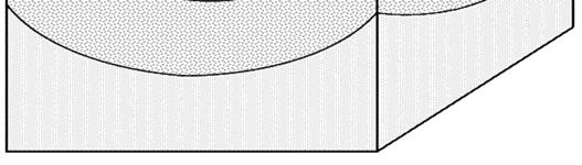
4 PART 2: IDENTIFYING GEOLOGIC STRUCTURES To understand geologic structures and how they relate to formations of rock and the geologic history of an area, we can measure the horizontal run and tilt (strike and dip) of sedimentary strata, record that information on a map, and draw the contacts (lines) between the mappable units. The data we record on the map allow us to recognize geologic structures and enables us to project what the structures look like beneath Earth's surface. That projection is what we depict on the cross-section diagrams based on the map. The diagrams in Part 2 are block diagrams. The top of a block diagram is an oblique view of the Earth's surface, a geologic map that you are viewing at an angle from above. The vertical sides of a block diagram are cross-sections, cut-away views that show how the rocks and structures extend into the Earth. Cross-sections typically don't contain geologic map symbols. However, to demonstrate that you understand relative motion on faults, you will put half-arrows on each side of any fault in the crosssections. All other geologic structure symbols appear only on the map (top) of the block diagrams. Refer to the Basics Table of geologic map symbols for more information on strike and dip ( The dip angle is written next to the strike and dip symbol on a real geologic map. However, for this exercise, you will be asked measure the dip angle and write it down next to the strike and dip symbol on only a few of the block diagrams. Horizontal and tilted strata (block diagrams 1 3) Block diagram 1 1. Label the strata in age sequence, starting with 1 for the oldest stratum. Label the strata on all faces of the block diagram both of the cross-sections (sides) and the map (top). 2. Draw the correct strike and dip symbol on the map of block diagram Have the strata been deformed in any noticeable way (folded, faulted, tilted) since they originated? Lab Worksheet Geologic Structures page 4
.")
5 Block diagram 2 1. Draw a third strike and dip symbol on the map in the stratum without one. 2. The strata are all tilted to the same angle, at a dip between 0 and 90. What is the dip angle? Once you have determined the dip, write the number next to each of the dip symbols on the map. All dips are known to be in degrees, so following custom, do not include the degree symbol ( ). I have a protractor you can borrow to measure the dip. Block diagram 3 1. Are the strata in block diagram 3 tilted, folded, or faulted? 2. Are the strata oriented horizontally, vertically or in-between? 3. Draw a third strike and dip symbol on the map in the blank formation. 4. Can you apply the principle of superposition to determine the age sequence of the strata in the diagram? Explain. 5. What could you look for in sedimentary beds to determine which way was originally up? Lab Worksheet Geologic Structures page 5
6 Folds (block diagrams 4 9) Block diagram 4 with 1 for the oldest stratum. Label the strata on all faces of the block diagram both of the crosssections (sides) and the map (top). 2. At least one more strike and dip symbol is needed for a complete map. Draw a correctly oriented strike and dip symbol in one of the strata in the eastern (right) limb of the fold. Estimate or measure dips to within 5 and write them next to all the dip symbols. 3. What is the name of this type of geologic structure? 4. Complete the appropriate fold symbol on the axis line of the fold. 5. Color at least every other stratum so the structure is clearly defined. Block diagram 5 with 1 for the oldest stratum. Label the strata on all faces of the block diagram. 2. Add one more strike and dip symbol to the map, correctly oriented, in a blank stratum. In this case, do not write in the dip angles. 3. What is the name of this type of geologic structure? 4. Complete the appropriate fold symbol on the axis line of the fold. 5. Color at least every other stratum so the structure is clearly defined. Lab Worksheet Geologic Structures page 6

7 Block diagram 6 with 1 for the oldest stratum. Label the strata on all faces of the block diagram. 2. Draw one strike and dip symbol in one of the strata in the eastern (right) limb of the fold. Estimate or measure the dips to within 5 and write them next to all the dip symbols. 3. What is the name of this type of geologic structure? 4. Complete the appropriate fold symbol on the axis line of the fold. 5. Color at least every other stratum so the structure is clearly defined. Block diagram 7 with 1 for the oldest stratum. Label the strata on all faces of the block diagram. 2. Add one more strike and dip symbol to the map, correctly oriented, in a blank stratum. In this case, do not write in the dip angles. 3. What is the name of this type of geologic structure? 4. Complete the appropriate fold symbol on the axis line of the fold. 5. Color at least every other stratum so the structure is clearly defined. Lab Worksheet Geologic Structures page 7


8 Block diagram 8 with 1 for the oldest stratum. Label the strata on all faces of the block diagram. 2. Add one more strike and dip symbol to the map, correctly oriented, in a blank stratum. In this case, do not write in the dip angles. 3. What is the name of this type of geologic structure? Block diagram 9 with 1 for the oldest stratum 2. Add one more strike and dip symbol to the map, correctly oriented, in a blank stratum. In this case, do not write in the dip angles. 3. What is the name of this type of geologic structure? Lab Worksheet Geologic Structures page 8


9 Faults (block diagrams 10 11) Block diagram 10 with 1 for the oldest stratum. Label the strata on all faces of the block diagram and both sides of the fault. 2. Estimate or measure the dip of the fault to within 5. What is the dip of the fault? 3. What is the name of this type of fault? 4. Draw the appropriate fault symbol along the line that marks the fault on the map. 5. Draw half-arrows on the fault in cross-section that indicate the relative direction of motion of the rocks along the fault. Block diagram 11 with 1 for the oldest stratum. Label the strata on all faces of the block diagram and both sides of the fault. 2. Estimate or measure the dip of the fault to within 5. What is the dip of the fault? 3. What is the name of this type of fault? 4. Draw the appropriate fault symbol along the line that marks the fault on the map. 5. Draw half-arrows on the fault in cross-section that indicate the relative direction of motion of the rocks along the fault. Lab Worksheet Geologic Structures page 9

10 Fault-bounded structures (block diagrams 12 13) Block diagram 12 with 1 for the oldest stratum. Label the strata on all faces of the block diagram. 2. There are two faults in block diagram 12. What type of faults are they? 3. Draw half-arrows on the fault in cross-section that indicate the relative direction of motion of the rocks along the fault. 4. What is the name of the fault-bounded structure in block diagram 12? Block diagram What type of faults are the two faults in block diagram 13? 2. On the front cross-section, draw half arrows showing the relative direction of motion on each side of each fault. 3. On the map, draw the appropriate symbol for each fault. 4. What is the name of the fault-bounded geologic structure in block diagram 13? Lab Worksheet Geologic Structures page 10


11 PART 3: CROSS-SECTIONS (SEEING BENEATH THE MAP) To take a real-world look at geologic structures and how they appear on geologic maps, we will use the geologic map of Washington State published by the Washington State Department of Natural Resources. You can download it at The Olympic Peninsula The simplified cross-section below corresponds to a cross-section line drawn across the Olympic Peninsula, part of the geologic map of Washington. To complete the cross-section below, refer to the lab web page, where you can see the blue cross-section line and read the geologic unit labels. The top of the cross-section box below corresponds to the cross-section line on the map. The five faults spanned by the cross-section line on the map are those shown in the cross-section box below. To complete the cross-section above: 1. Draw half-arrows along each fault to show the relative motion of rocks on either side of the fault. 2. The faults are all the same type. What type of fault are they? 3. When the structures in the cross-section were forming, was the crust being pushed together or was it being pulled apart? 4. Within all of the blocks between faults on the cross section, write the three-letter abbreviations of the geologic units that correspond to the rock types along the cross-section line on the map. 5. Write out what each of the geologic abbreviations stands for. Use the map legend. Write out both age and rock type. For example, if one of the units is utv, the abbreviation stands for upper Tertiary volcanic rock. Lab Worksheet Geologic Structures page 11


12 The Chiwaukum Graben The simplified cross-section below corresponds to a cross-section line drawn across the Chiwaukum graben, part of the geologic map of Washington. To complete the cross-section below, refer to the lab web page, where you can see the blue cross-section line and read the geologic unit labels. The top of the cross-section box below corresponds to the cross-section line on the map. The two faults spanned by the cross-section line on the map are those shown in the cross-section box below. To complete the cross-section above: 1. Draw half-arrows along each fault to show the relative motion of rocks on either side of the fault. 2. The two faults are the same type. What type of fault are they? 3. When the structures in the cross-section were forming, was the crust being pushed together or was it being pulled apart? 4. Within each block between faults on the cross section, write the three-letter abbreviations of the geologic units that correspond to the rock types along the cross-section line on the map. Remember the note on the Lab web page about identifying the correct rock unit labels on the map. 5. Write out what each of the geologic abbreviations stands for. Use the map legend. Write out both age and rock type. 6. What type of geologic structure is bounded by the two faults? Lab Worksheet Geologic Structures page 12
13 Okanogan Metamorphic Core Complex, Republic Graben, and Kettle Metamorphic Core Complex The simplified cross-section below corresponds to a line drawn on the geologic map of Washington across the Okanogan metamorphic core complex, the Republic graben, and the Kettle metamorphic core complex. To complete the cross-section below, refer to the lab web page, where you can see the blue cross-section line and read the geologic unit labels. The top of the cross-section box below corresponds to the cross-section line on the map. The two faults spanned by the cross-section line on the map are those shown in the cross-section box below. To complete the cross-section above: 1. There are four faults in the cross-section. Draw half-arrows along each fault to show the relative motion of rocks on either side of the fault 2. Two of the faults in the cross-section dip at low angles. What type of fault are they? 3. Within each block on the cross section, write the two- or three-letter abbreviations of the geologic units that correspond to the rock types along the cross-section line on the map. Remember the note on the Lab web page about identifying the correct rock unit labels on the map. 4. Write out what each of the geologic abbreviations stands for. Use the map legend. Write out both age and rock type. 5. What type of fault-bounded structure is in the footwall of each of the detachment faults? 6. Are the rock types in that structure from the shallow crust or the deep crust? 7. What is the name of the type of geologic structure that has dropped down between the two steep faults in the center of the cross-section? 8. When the structures in the cross-section were forming, was the crust being pushed together or was it being pulled apart? Lab Worksheet Geologic Structures page 13
Lab 7: STRUCTURAL GEOLOGY FOLDS AND FAULTS
 Lab 7: STRUCTURAL GEOLOGY FOLDS AND FAULTS This set of labs will focus on the structures that result from deformation in earth s crust, namely folds and faults. By the end of these labs you should be able
Field Trip to Tempe Butte
 Synopsis Field Trip to Tempe Butte So far you have been identifying rocks and mapping their locations without actually going there. Now it is your chance to put it all together and see real rocks out in
Lab 4: Structures and Geologic Maps
 Key Questions: GEOL 1311 Earth Science Lab 4 Structures and Geologic Maps What shapes do rock bodies take in the Earth? How do two-dimensional visualizations of the Earth, such as maps and cross-sections
Part I. PRELAB SECTION To be completed before labs starts:
 Student Name: Physical Geology 101 Laboratory #13 Structural Geology II Drawing and Analyzing Folds and Faults Grade: Introduction & Purpose: Structural geology is the study of how geologic rock units
STRUCTURAL GEOLOGY LABORATORY
 Structural Geology Lab 1 STRUCTURAL GEOLOGY LABORATORY INTRODUCTION Geologists have named the structures found on the earth: flat lying strata, anticlines, synclines, faults. These can be exposed by a
Geology 101 Lab Worksheet: Geologic Time
 Geology 101 Lab Worksheet: Geologic Time Name: Refer to the Geologic Time Lab for the information you need to complete this worksheet (http://commons.wvc.edu/rdawes/g101ocl/labs/geotimelab.html). All calculations
Structural Geology Lab. The Objectives are to gain experience
 Geology 2 Structural Geology Lab The Objectives are to gain experience 1. Drawing cross sections from information given on geologic maps. 2. Recognizing folds and naming their parts on stereoscopic air
Directed Reading page
 Skills Worksheet Directed Reading page 185-190 Section: Determining Relative Age 1. How old is Earth estimated to be? 2. Who originated the idea that Earth is billions of years old? 3. On what did the
Structural Geology and Geology Maps Lab
 Structural Geology and Geology Maps Lab Mesa College Geology 101 Lab Ray Rector: Instructor Structural Geology Lab Pre-Lab Resources Pre-Lab Internet Links 1) Fundamentals of Structural Geology 2) Visualizing
KEY CHAPTER 12 TAKE-HOME QUIZ INTERNAL STRUCTURES AND PROCESSES Score Part B = / 55 PART B
 GEOLOGY 12 KEY CHAPTER 12 TAKE-HOME QUIZ INTERNAL STRUCTURES AND PROCESSES Score Part B = / 55 PART B CHAPTER 12 Isostacy and Structural Geology 1. Using the terms below, label the following diagrams and
Structural Geology Lab. The Objectives are to gain experience
 Geology 2 Structural Geology Lab The Objectives are to gain experience 1. Drawing cross sections from information given on geologic maps. 2. Recognizing folds and naming their parts on stereoscopic air
Theme 7. Metamorphic rocks. Distinguishing rock types
 Theme 7. Metamorphic rocks. Distinguishing rock types 7.1. Metamorphic rocks formation 7.2. Classification of metamorphic rocks 7.3. Distinguishing rock types 7.1. Metamorphic rocks formation 7.1. Metamorphic
Geologic Mapping Regional Tournament Trial Event
 Geologic Mapping Regional Tournament Trial Event A TEAM OF UP TO: 2 Team Name AVAILABLE TIME: 50 min Required Materials: Each team MUST have a protractor, ruler, non-programmable calculator, colored pencils,
Staple this part to part one of lab 6 and turn in. Lab 6, part two: Structural geology (analysis)
") Geology 101 Staple this part to part one of lab 6 and turn in Lab 6, part two: Structural geology (analysis) Recall that the objective of this lab is to describe the geologic structures of Cougar Mountain
Geology 101 Staple this part to part one of lab 6 and turn in Lab 6, part two: Structural geology (analysis) Recall that the objective of this lab is to describe the geologic structures of Cougar Mountain
GEOLOGIC MAPS PART II
 EARTH AND ENVIRONMENT THROUGH TIME LABORATORY - EES 1005 LABORATORY FIVE GEOLOGIC MAPS PART II Introduction Geologic maps of orogenic belts are much more complex than maps of the stable interior. Just
EPS 50 Lab 6: Maps Topography, geologic structures and relative age determinations
 Name: EPS 50 Lab 6: Maps Topography, geologic structures and relative age determinations Introduction: Maps are some of the most interesting and informative printed documents available. We are familiar
Section 7. Reading the Geologic History of Your Community. What Do You See? Think About It. Investigate. Learning Outcomes
 Chapter 3 Minerals, Rocks, and Structures Section 7 Reading the Geologic History of Your Community What Do You See? Learning Outcomes In this section, you will Goals Text Learning Outcomes In this section,
Answers: Internal Processes and Structures (Isostasy)
") Answers: Internal Processes and Structures (Isostasy) 1. Analyse the adjustment of the crust to changes in loads associated with volcanism, mountain building, erosion, and glaciation by using the concept
Answers: Internal Processes and Structures (Isostasy) 1. Analyse the adjustment of the crust to changes in loads associated with volcanism, mountain building, erosion, and glaciation by using the concept
Lab 6: Plate tectonics, structural geology and geologic maps
 Geology 103 Name(s): Lab 6: Plate tectonics, structural geology and geologic maps Objective: To show the effects of plate tectonics on a large-scale set of rocks and to reconstruct the geological history
GEOL 02: Historical Geology Lab 14: Topographic Maps. Name: Date:
 GEOL 02: Historical Geology Lab 14: Topographic Maps Name: Date: A topographic map is a two dimensional (flat) representation (model) of a three dimensional land surface (landscape). It shows landforms
Use a highlighter to mark the most important parts, or the parts. you want to remember in the background information.
 P a g e 1 Name A Fault Model Purpose: To explore the types of faults and how they affect the geosphere Background Information: A fault is an area of stress in the earth where broken rocks slide past each
9. DATING OF ROCKS, FOSSILS, AND GEOLOGIC EVENTS
 LAST NAME (IN CAPS): FIRST NAME: Instructions: 9. DATING OF ROCKS, FOSSILS, AND GEOLOGIC EVENTS Refer to Laboratory 8 in your Lab Manual on pages 207-226 to answer the questions in this work sheet. Your
Unit 4 Lesson 7 Mountain Building
 Indiana Standards 7.2.4 Explain how convection currents in the mantle cause lithospheric plates to move causing fast changes like earthquakes and volcanic eruptions, and slow changes like creation of mountains
Chapter 8: Geological Structures. Part 1: Strike, Dip, and Structural Cross-Sections
 Chapter 8: Geological Structures Part 1: Strike, Dip, and Structural Cross-Sections Adapted by Karla Panchuk, Joyce M. McBeth, Lyndsay R. Hauber, & Michael B. Cuggy (2018) University of Saskatchewan from
PLEASE DO NOT WRITE ON THIS QUIZ! Relative Dating and Stratigraphic Principles Quiz
 PLEASE DO NOT WRITE ON THIS QUIZ! Relative Dating and Stratigraphic Principles Quiz TEST NO A Multiple Choice Identify the letter of the choice that best completes the statement or answers the question.
In this lab, we will study and analyze geologic maps from a few regions, including the Grand Canyon, western Wyoming, and coastal California.
 Name: Lab Section: work in groups, but each person turns in his/her own GEOSCIENCE 001 LAB UNDERSTANDING GEOLOGIC MAPS Geologic maps are colorful and even beautiful, but they also contain an amazing amount
UNCONFORMITY. Commonly four types of unconformities are distinguished by geologists: a) Disconformity (Parallel Unconformity)
 Disconformity (Parallel Unconformity)") UNCONFORMITY Unconformities are gaps in the geologic record that may indicate episodes of crustal deformation, erosion, and sea level variations. They are a feature of stratified rocks, and are therefore
UNCONFORMITY Unconformities are gaps in the geologic record that may indicate episodes of crustal deformation, erosion, and sea level variations. They are a feature of stratified rocks, and are therefore
GEOLOGY GL1 Foundation Unit
 Candidate Name Centre Number Candidate Number 2 General Certificate of Education Advanced Subsidiary/Advanced 451/01 GEOLOGY GL1 Foundation Unit P.M. THURSDAY, 10 January 2008 (1 hour) Examiner Question
UNDERSTANDING GEOLOGIC M APS
 Name: Lab Section: work in groups, but each person turns in his/her own GEOSCIENCE 001 L AB UNDERSTANDING GEOLOGIC M APS Geologic maps are colorful and even beautiful, but they also contain an amazing
GEOL 02 Lab 9 Field Trip III Centerville Stratigraphic Section Name: Date:
 Name: Date: Team Name: Team Members: Our goal today is to describe the sedimentary lithostratigraphic section of exposed bedrock along the road near Centerville Beach, interpret the depositional environment,
Stratigraphic Cross-Section
 Stratigraphic cross-sections are used to show stratigraphic relationships of strata along some path. They differ from structural cross-sections in three ways. First, their goals differ. Stratigraphic cross-sections
You must take the exam in the lecture section for which you are registered. Any exceptions must be cleared with the instructor in advance.
 Geo 101, Fall 2000 Review Questions for Final Exam GEOLOGIC TIME AND FOLDING AND FAULTING THE FINAL EXAM FOR MWF CLASS WILL BE TUESDAY 1400 THE FINAL EXAM FOR TR CLASS WILL BE FRIDAY 930 These questions
Stress and Strain. Stress is a force per unit area. Strain is a change in size or shape in response to stress
 Geologic Structures Geologic structures are dynamically-produced patterns or arrangements of rock or sediment that result from, and give information about, forces within the Earth Produced as rocks change
GY 112L Earth History
 GY 112L Earth History Lab 2 Vertical Successions and Sequences of Events GY 112L Instructors: Douglas Haywick, James Connors, Mary Anne Connors Department of Earth Sciences, University of South Alabama
Geoscience 001 Fall Rock Identification and Contextual Interpretation
 Geoscience 00 Fall 2005 Rock Identification and Contextual Interpretation The purpose of this week s lab is to gain some more experience and practice in identifying rocks and then interpreting the geologic
Lecture Outline Friday March 2 thru Wednesday March 7, 2018
 Lecture Outline Friday March 2 thru Wednesday March 7, 2018 Questions? Lecture Exam Friday March 9, 2018 Same time, Same room Bring Pencils and WSU ID 50 question Multiple Choice, Computer Graded Interlude
Blocks Module Content Guide
 Blocks Module Content Guide This guide covers the basics of the content within the Interactive 3D Geologic Blocks Module. The content guide is intended to assist you, the teacher, in creating effective
Geologic Mapping Invitational Trial Event
 Geologic Mapping Invitational Trial Event A TEAM OF UP TO: 2 Team Name AVAILABLE TIME: 50 min Required Materials: Each team MUST have a protractor, ruler, non-programmable calculator, colored pencils,
How mountains are made. We will talk about valleys (erosion and weathering later)
") How mountains are made We will talk about valleys (erosion and weathering later) http://www.ilike2learn.com/ilike2learn/mountainmaps/mountainranges.html Continent-continent plate convergence Less dense,
How mountains are made We will talk about valleys (erosion and weathering later) http://www.ilike2learn.com/ilike2learn/mountainmaps/mountainranges.html Continent-continent plate convergence Less dense,
Study the architecture and processes responsible for deformation of Earth s crust. Folding and Faulting
 Crustal Deformation AKA Structural geology (adapted from Brunkel, 2012) Study the architecture and processes responsible for deformation of Earth s crust. Folding and Faulting How Rocks Deform: 4 Controls
(1) Identify 5 major principles of relative dating? For each principle, describe how you tell what is younger and what is older.
 Identify 5 major principles of relative dating? For each principle, describe how you tell what is younger and what is older.") Things to Know - Third GLG101Exam Page 1 Important Note: This is not everything you need to know or study. However, it provides you with a relatively comprehensive list of questions to help you study.
Things to Know - Third GLG101Exam Page 1 Important Note: This is not everything you need to know or study. However, it provides you with a relatively comprehensive list of questions to help you study.
2) What type of motion of the plates created the mountain range in the picture below?
 What type of motion of the plates created the mountain range in the picture below?") Name Geo 4&5 Practice 5 Target 1 2 (all of 1 plus) 3 (all of 2 plus) 4 (all of 3 plus) LE 5.7 Preparedness Does not complete formative or summative in an effortful and timely manner, is not engaged, does
Name Geo 4&5 Practice 5 Target 1 2 (all of 1 plus) 3 (all of 2 plus) 4 (all of 3 plus) LE 5.7 Preparedness Does not complete formative or summative in an effortful and timely manner, is not engaged, does
GLY 155 Introduction to Physical Geology, W. Altermann. Press & Siever, compressive forces. Compressive forces cause folding and faulting.
 Press & Siever, 1995 compressive forces Compressive forces cause folding and faulting. faults 1 Uplift is followed by erosion, which creates new horizontal surface. lava flows Volcanic eruptions cover
Unit 4 Lesson 3 Mountain Building. Copyright Houghton Mifflin Harcourt Publishing Company
 Stressed Out How can tectonic plate motion cause deformation? The movement of tectonic plates causes stress on rock structures. Stress is the amount of force per unit area that is placed on an object.
How to Build a Mountain and other Geologic Structures. But first a short review
 How to Build a Mountain and other Geologic Structures But first a short review Where do we see deep earthquakes? What is happening there? What can happen at a plate boundary? 1. Plates can move apart
ENVI.2030L Geologic Time
 Name ENVI.2030L Geologic Time I. Introduction There are two types of geologic time, relative and absolute. In the case of relative time geologic events are arranged in their order of occurrence. No attempt
Name. GEOL.5220 Structural Geology Faults, Folds, Outcrop Patterns and Geologic Maps. I. Properties of Earth Materials
 I. Properties of Earth Materials GEOL.5220 Structural Geology Faults, Folds, Outcrop Patterns and Geologic Maps Name When rocks are subjected to differential stress the resulting build-up in strain can
GCE AS/A level 1211/01 GEOLOGY GL1 Foundation Unit
 Surname Centre Number Candidate Number Other Names 2 GCE AS/A level 1211/01 GEOLOGY GL1 Foundation Unit S15-1211-01 A.M. MONDAY, 11 May 2015 1 hour For s use Question Maximum Mark 1. 15 2. 14 Mark Awarded
Page 1. Name:
 Name: Questions 1 through 3 refer to the following: The diagrams below represent two rock outcrops found several miles apart in New York State. Individual rock layers are lettered, and fossils and rock
Crags, Cracks, and Crumples: Crustal Deformation and Mountain Building
 Crags, Cracks, and Crumples: Crustal Deformation and Mountain Building Updated by: Rick Oches, Professor of Geology & Environmental Sciences Bentley University Waltham, Massachusetts Based on slides prepared
Directed Reading A. Section: Relative Dating: Which Came First?
 Skills Worksheet Directed Reading A Section: Relative Dating: Which Came First? Write the letter of the correct answer in the space provided. 1. Determining the age of objects or events in relation to
PROBLEM SET #X. 2) Draw a cross section from A-A using the topographic profile provided on page 3.
 Draw a cross section from A-A using the topographic profile provided on page 3.") PROBLEM SET #X PART A: The geologic map on page 3 is from an area consisting of faulted Miocene sedimentary rocks. There are two major faults exposed here: the Rattlesnake fault and the Jackrabbit fault.
PROBLEM SET #X PART A: The geologic map on page 3 is from an area consisting of faulted Miocene sedimentary rocks. There are two major faults exposed here: the Rattlesnake fault and the Jackrabbit fault.
Geology 101 Lab Worksheet: Topographic Maps
 Geology 101 Lab Worksheet: Topographic Maps Name: Refer to the Topographic Maps Lab for the information you need to complete this worksheet (http://commons.wvc.edu/rdawes/g101ocl/labs/topomapslab.html).
Name Geo 4 Practice Match the principle on the left (column A) with the definition (or part of the definition) on the right (column B).
 with the definition (or part of the definition) on the right (column B).") Name Geo 4 Practice 1 Target 1 2 3 4 Geo 4 I can define the create, alter and/or destroy the rock record. I can interpret a diagram to determine the sequence of events (relative age) in Earth s history
Name Geo 4 Practice 1 Target 1 2 3 4 Geo 4 I can define the create, alter and/or destroy the rock record. I can interpret a diagram to determine the sequence of events (relative age) in Earth s history
A.M. TUESDAY, 12 May hours
 Candidate Name Centre Number 2 Candidate Number GCE AS/A level 1212/01 New AS GEOLOGY - GL2a Investigative Geology A.M. TUESDAY, 12 May 2009 1 1 2 hours For Examiner s Use Only ADDITIONAL MATERIALS In
NAME HOMEWORK ASSIGNMENT #3 MATERIAL COVERS CHAPTERS 8, 9, 10, 11
 NAME HOMEWORK ASSIGNMENT #3 MATERIAL OVERS HAPTERS 8, 9, 10, 11 Assignment is due the beginning of the class period on November 23, 2004. Answers for each chapter will be discussed in class, as Exam #3
City of Fort Collins: Geology Staff Training, June 2012
 1 City of Fort Collins: Geology Staff Training, June 2012 Levels of Analysis Descriptive (What do you see, feel, hear, etc..) This rock is made of round grains of quartz. Interpretive-- (The detective
How to Build a Mountain and other Geologic Structures. But first, questions
 How to Build a Mountain and other Geologic Structures But first, questions Questions your students might ask How were Montana s mountains formed? How old are the mountains? What are the different ways
CRUSTAL DEFORMATION. Chapter 10
 CRUSTAL DEFORMATION and dgeologic Structures t Chapter 10 Deformation Df Deformation involves: Stress the amount of force applied to a given area. Types of Stress: Confining Stress stress applied equally
A. Refer to Appendix F in back of lab manual for list of commonly used geologic map symbols
 Structural Geology Lab 2: Outcrop Patterns and Structure Contours I. Geologic Map Symbols A. Refer to Appendix F in back of lab manual for list of commonly used geologic map symbols 1. Emphasis: a. strike
Law of Superposition Law of Superposition
 History of Earth Relative Dating In the same way that a history book shows an order of events, layers of rock (called strata) show the sequence of events that took place in the past. Using a few basic
Lecture 9 faults, folds and mountain building
 Lecture 9 faults, folds and mountain building Rock deformation Deformation = all changes in size, shape, orientation, or position of a rock mass Structural geology is the study of rock deformation Deformation
EOSC 110 Reading Week Activity, February Visible Geology: Building structural geology skills by exploring 3D models online
 EOSC 110 Reading Week Activity, February 2015. Visible Geology: Building structural geology skills by exploring 3D models online Geological maps show where rocks of different ages occur on the Earth s
Crustal Deformation Earth - Chapter Pearson Education, Inc.
 Crustal Deformation Earth - Chapter 10 Structural Geology Structural geologists study the architecture and processes responsible for deformation of Earth s crust. A working knowledge of rock structures
Faults, Fossils, Rocks and Minerals Review:
 Faults, Fossils, Rocks and Minerals Review: 1. The preserved remains or traces of organisms that lived in the past are. - Fossils 2. How do Fossils form? - A dead organism becomes buried in sediment 3.
GEOL104: Exploring the Planets LAB 5: PLANETARY TECTONICS
 GEOL104: Exploring the Planets LAB 5: PLANETARY TECTONICS OBJECTIVES: I. Understand the three basic types of tectonic interactions that can occur II. Identify tectonic interactions on other planets MATERIALS:
Location and Distance on Earth (Chapter 22 part 1)
") GEOLOGY 306 Laboratory Instructor: TERRY J. BOROUGHS NAME: Location and Distance on Earth (Chapter 22 part 1) For this assignment you will require: a calculator, protractor, and a metric ruler, and an
GEOLOGY 306 Laboratory Instructor: TERRY J. BOROUGHS NAME: Location and Distance on Earth (Chapter 22 part 1) For this assignment you will require: a calculator, protractor, and a metric ruler, and an
Section 3 Deforming Earth s Crust
 Section 3 Deforming Earth s Crust Key Concept Tectonic plate motions deform Earth s crust. Deformation causes rock layers to bend and break and causes mountains to form. What You Will Learn Stress is placed
Lecture 6 Folds, Faults and Deformation Dr. Shwan Omar
 Fold: A fold is a bend or wrinkle of rock layers or foliation; folds form as a sequence of ductile deformation. Folding is the processes by which crustal forces deform an area of crust so that layers of
9. RELATIVE AND RADIOMETRIC AGES
 LAST NAME (IN CAPS): FIRST NAME: Instructions: 9. RELATIVE AND RADIOMETRIC AGES Your work will be graded on the basis of its accuracy, completion, clarity, neatness, legibility, and correct spelling of
The Geology of Pacific Northwest Rocks & Minerals Activity 1: Geologic Time
 Name: Age: I. Introduction There are two types of geologic time, relative and absolute. In the case of relative time geologic events are arranged in their order of occurrence. No attempt is made to determine
3. Bedrock from which entire geologic time period is missing between rock units 5 and 6? The fault most likely occurred after
 Homework # 4 Relative Dating Name: Section: Date: 1. The cross section below represents a portion of Earth s crust. Letters through D are locations within the rock units. 5. The sequence of rock types
N30 E-45 SE S25 E-10 SW N85 W-80 NE
 Geologic aps and tructures Name Geology 100 Harbor section Read h. 7 before you begin. The objectives of this lab are for you to learn the basic geologic structures in 3- and to develop some facility in
Structural Geology, GEOL 330 Fold mapping lab: Even folds get parasites Spring, 2012
 Structural Geology, GEOL 330 Name: Fold mapping lab: Even folds get parasites Spring, 2012 This exercise is meant to mimic a field experience in which you, the student, will measure beddingcleavage relationships
Chapter 16. Mountain Building. Mountain Building. Mountains and Plate Tectonics. what s the connection?
 Chapter 16 Mountains and Plate Tectonics what s the connection? Mountain Building Most crustal deformation occurs along plate margins. S.2 Active Margin Passive Margin Mountain Building Factors Affecting
State the principle of uniformitarianism. Explain how the law of superposition can be used to determine the relative age of rocks.
 Objectives State the principle of uniformitarianism. Explain how the law of superposition can be used to determine the relative age of rocks. Compare three types of unconformities. Apply the law of crosscutting
Answer sheet for question 1 Answer question 1 as soon as the sample arrives at your desk.
 EAS 233 Geologic structures. Final test. April 2012. 3 hours. Answer question 1 and 2 and three other questions. If you start more than the required number of questions, clearly delete the answers you
8. GEOLOGIC TIME LAST NAME (ALL IN CAPS): FIRST NAME: Instructions
: FIRST NAME: Instructions") LAST NAME (ALL IN CAPS): FIRST NAME: Instructions 8. GEOLOGIC TIME Refer to Exercise 6 in your Lab Manual on pages 151-168 to answer the questions in this work sheet. Your work will be graded on the basis
LAST NAME (ALL IN CAPS): FIRST NAME: Instructions 8. GEOLOGIC TIME Refer to Exercise 6 in your Lab Manual on pages 151-168 to answer the questions in this work sheet. Your work will be graded on the basis
2. How do igneous rocks form? 3. How do sedimentary rocks form? 4. How do metamorphic rocks form?
 Name: Class: Earth s History Test Review Packet Test: Monday, February 13, 2017 The Rock Cycle 1. Explain why it is called the rock CYCLE. Does it truly have a starting point or end point? 2. How do igneous
Assignment #5-7: Geology
 Assignment #5-7: Geology Name: 1. "Geological processes operating at the present time are the same processes that have operated in the past" is a statement of: A. the Principle of Cross-cutting Relationships
Geological Maps 3: Faulted Strata
 Chapter 7 Geological Maps 3: Faulted Strata Brittle deformation in rocks is characterized by fractures, joints and faults. Fractures and joints can be of any size, orientation or pattern. Some joints form
Crustal Deformation. (Building Earth s Surface, Part 1) Science 330 Summer Mapping geologic structures
 Science 330 Summer Mapping geologic structures") Crustal Deformation (Building Earth s Surface, Part 1) Science 330 Summer 2005 Mapping geologic structures When conducting a study of a region, a geologist identifies and describes the dominant rock structures
Crustal Deformation (Building Earth s Surface, Part 1) Science 330 Summer 2005 Mapping geologic structures When conducting a study of a region, a geologist identifies and describes the dominant rock structures
Today you will be able to: Utilize the SEVEN rules of rock age identification to describe the geologic age of this rock sequence!
 Mr. Sandomenico Welcome!!!! Today we will begin a new unit! The Earth s History!!!!! Today you will be able to: Utilize the SEVEN rules of rock age identification to describe the geologic age of this rock
Chapter 15 Structures
 Chapter 15 Structures Plummer/McGeary/Carlson (c) The McGraw-Hill Companies, Inc. TECTONIC FORCES AT WORK Stress & Strain Stress Strain Compressive stress Shortening strain Tensional stress stretching
Finding Fault Geologic History from a Road Cut
 Finding Fault Geologic History from a Road Cut Elisabeth M. Price, DD LaPointe, and Jonathan G. Price 4 July 2005 Introduction Earth science is an important science to present to students because it directly
Geologic Structures. Changes in the shape and/or orientation of rocks in response to applied stress
 Geologic Structures Changes in the shape and/or orientation of rocks in response to applied stress Figure 15.19 Can be as big as a breadbox Or much bigger than a breadbox Three basic types Fractures >>>
Interpreting Rock Layers
 Science Concept: Sedimentary rocks can be aged using the law of superposition. Unconformities can create exceptions to this law. Objectives: The student will: explain how rocks are dated by relative position
UNIT 10 MOUNTAIN BUILDING AND EVOLUTION OF CONTINENTS
 UNIT 10 MOUNTAIN BUILDING AND EVOLUTION OF CONTINENTS ROCK DEFORMATION Tectonic forces exert different types of stress on rocks in different geologic environments. STRESS The first, called confining stress
Earth Science 11: Geologic Time Unit
 Earth Science 11: Geologic Time Unit Text: Chapters 8 Lab: Exercise 6 Name Earth Science 11: Geologic Time Page 1 Geology 12: Geologic Time 8.1: The Geologic Time Scale Today, we know that Earth is approximately
Description of faults
 GLG310 Structural Geology Description of faults Horizontal stretch Crustal thickness Regional elevation Regional character Issues Normal Thrust/reverse Strike-slip >1 1 in one direction and < 1 in
Geological mapwork from scratch 2: valley with simple geology Draw your own cross sections and 3D geological model
 Geological mapwork scratch 2: valley with simple geology Draw your own cross sections and 3D geological model A valley with a stream looks like this: Modified the Geograph project collection. Copyright
Foldable Fault Blocks Lesson Plans and Activities
 Foldable Fault Blocks Lesson Plans and Activities By Polly R. Sturgeon Targeted Age: Elementary to High School Activity Structure: Individual assignment Indiana Standards and Objectives: 3.PS.1, 4.ESS.2,
Type of Exercise: In-Class Activity or Laboratory Exercise.
 Using Lava Flows & Volcanic Structures on Mars to Introduce the Concept of Relative Dating in Introductory Courses Audeliz Matias Skidmore College, Saratoga Springs, NY 12866 amatias@skidmore.edu Type
Relative Dating Exercises
 Laboratory 1 Relative Dating Exercises Pamela J. W. Gore Department of Geology, Georgia Perimeter College Clarkston, GA 30021 Copyright 1998-2005 Pamela J. W. Gore Examine the geologic cross sections which
Structural Geology, GEOL 330 Spring 2012
 Developing the Magic Eye for folds This lab exercise is designed to get you thinking about the chronology of structural processes and and the resultant map patterns in areas with flat topography. You may
Geological mapwork from scratch 3: valley with dipping geology Draw your own cross sections and 3D geological model
 Geological mapwork from scratch 3: valley with dipping geology Draw your own cross sections and 3D geological model A valley with a river looks like this: The straight glen of the Allt Mhuic from its headwaters
4 Deforming the Earth s Crust
 CHAPTER 7 4 Deforming the Earth s Crust SECTION Plate Tectonics BEFORE YOU READ After you read this section, you should be able to answer these questions: What happens when rock is placed under stress?
Faults, folds and mountain building
 Faults, folds and mountain building Mountain belts Deformation Orogens (Oro = Greek all changes for mountain, in size, shape, genesis orientation, = Greek for or formation) position of a rock mass Structural
Team Name. Name(s) SSSS Unome Geologic Mapping Test Packet p1
 SSSS Unome Geologic Mapping Test Packet p1") Scioly Summer Study Session 2018-2019 Geologic Mapping Test Packet Written by Unome Instructions 1) This test is based on the 2016 rules for Geologic Mapping. 2) This test is out of 115 points. Questions
Scioly Summer Study Session 2018-2019 Geologic Mapping Test Packet Written by Unome Instructions 1) This test is based on the 2016 rules for Geologic Mapping. 2) This test is out of 115 points. Questions
GEOLOGY 435 FIELD EXERCISE 2, SPRING SKETCHING, DESCRIBING, AND MAPPING EXPOSURES OBJECTIVES:
 OBJECTIVES: GEOLOGY 435 FIELD EXERCISE 2, SPRING 2016 -- SKETCHING, DESCRIBING, AND MAPPING EXPOSURES To develop and refine your field skills in: 1. observation and rock and sediment description 2. sketching