O:-TJCE. Report On. Diamond Drilling Program. Tudor Township, Ontario. Holes 78 to 83. Lydia Diamond Exploration of Canada Ltd.
|
|
|
- Eric Holmes
- 6 years ago
- Views:
Transcription
1 31C12NE TUDOR 010 Report On Diamond Drilling Program Tudor Township, Ontario Holes 78 to 83 By Lydia Diamond Exploration of Canada Ltd. February 15, 2002 FE8 Z O 2002 GEOSCIENCE ASSESSMENT O:-TJCE
2 Index Page Introduction l Property l Location and Access l General Geology 2 Diamond Drilling 2 Appendix I Drill Location Plans, Sections and Drill Logs
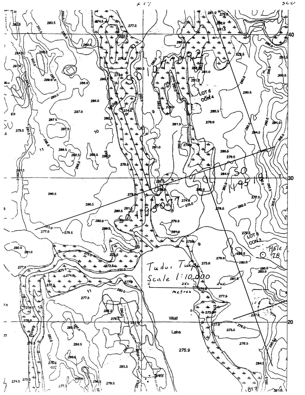
3 Introduction Diamond drilling was carried out in six holes on claims , and in the utheast part of Tudor Township, Ontario to test geophysical anomalies and dykes. A total of 871 feet was drilled. Property The property consisted of 44 claims containing 376 claim units at the time of drilling. The claims are numbered , to inclusive, to inclusive, to inclusive, , , to , to , , , , , to inclusive, , to inclusive and to in the uth east part of Tudor Township and the west part of Grimsthorpe Township, Southern Ontario Mining Division. They are held in the name of Lydia Diamond Exploration of Canada Ltd. An adjoining property in Grimsthorpe Township consisted of 9 claims containing 134 claim units at the time of drilling. The claims are numbered to inclusive and to inclusive in the north central part of Grimsthorpe Township, Southern Ontario Mining Division. They are held 50^o in the name of Emilia, Princess von Anhalt and 50^o in the name of Jurgen Freidman Prinz von Anhalt. Location and Access The Tudor property is located about 20 km north of Madoc, Ontario. Madoc lies at the junction of Highways 7 and 62. Highway 7 runs east from Toronto through Peterborough to Ottawa; Highway 62 runs north from Belleville to Bancroft. Madoc is about 41 km north of Belleville. Access to the property is by secondary township roads which run east from Highway 62. The Grimsthorpe Township property is located about 10 km east of Gilmour, Ontario. Gilmour lies east on Highway 62 on the Weslemkoon Lake Road about halfway between Madoc and Bancroft. Access to the property is by a forest access road which runs from the Weslemkoon Lake Road through the center of the property. Property locations are shown on the enclosed map
4 General Geology The property is underlain by a volcanic to sedimentary sequence intruded by mafic to granitic rocks. Metamorphic grade is generally high. The area is part of the theproterozoic Grenville province of the Precambrian shield. In general the east part of the property is underlain by mafic intrusive rocks of the Lingham Lake complex with mafic volcanics to the west and uth, with a narrow band of felsic volcanics followed by carbonate metasediments further west. There has been previous exploration in the area for gold and lead-zinc. Diamond Drilling Drilling was carried out by George Downing Estate Drilling of Hawkesbury, Ontario. Holes were logged and drillings supervised by Ardian Peshkepia M.Sc.. Jeremy S. Brett M.Sc. laid out the drill holes and was in overall charge of the program. Core was transported to and is stored in Lydia's core storage facility. Purpose of the drilling for each hole is given on the drill log. Drill logs and sections are included in Appendix I. A brief summary follows. Hole No. 78 Location E, N Azimuth 242 Dip-45* Core NQ Depth 116 ft. (35.36m) Purpose - Strike of 'E' dyke Hole No. 79 Location E, ON Azimuth 215 Dip-45* Core NQ Depth 156 ft. (47.55m) Purpose - Test anomaly P41 Hole No. 80 Location E, ON Azimuth 240 Dip-45* Core NQ Depth 135ft. (41.15m) Purpose - Test anomaly D12
5 Hole No. 81 Location E, N Dip - 90* Core NQ Depth 139 ft. (42.37m) Purpose - Test anomaly DI2 Hole No. 82 Location E, N Azimuth 270 Dip-45* Core NQ Depth 136ft. (41.45m) Purpose - test anomaly P40 Hole No. 83 Location E, N Dip - 90* Core NQ Depth 189 ft. (57.61m) Purpose - Test anomaly P41
6 Appendix I Drill Location Plans & Sections Drill Logs
7

8 jujgooooj r sjv rf b i-j--
9 BH78 LYDIA DIAMOND EXPLORATION LTD. WOLF LAKE PROPERTY, TUDOR TOWNSHIP, BANNOCKBURN, ONTARIO DIAMOND DRILLING LOG DIAMOND DRILL HOLE 78 Drilled by: George Downing Estate Drilling, Hawkesbury l Kalumet, Quebec Drill l Core Type: Longyear 70 Diamond Drill l NQ gauge core Date Drilled: August 2001 Location: Lot 8, Concession 3, Tudor Township, Ontario Claim: UTM Reference. Azimuth: 242 Dip: -45 Depth: 116 FT Drillhole Surveying: None Purpose of Hole: Strike determination of "E" dike Logged by: Ardian Peshkepia, M.Sc. Exploration Manager: Jeremy S. Brett, M.Sc. Interval Footage Rock Type Colour Grain Size Texture Structure Alteration Mineralization Notes 0-10' 10 Overburden 10-26' 26-31' 31-36' Mafic metavolcanics Metasediments? Meatvolcanics dark grey dark grey grey fine fine aphanitic banded aphanitic fabric quartz carbor veins silicification? rare sulfides rare sulfides pyrite along the fabric planes secondary biotite 1 mm 36-41' 41-43' 5 2 Metavolc/metased. Metavolcanics/ metasediments? grey light grey whitish fine fine aphanitic fabric silicification? silicification? rare sulfides shugary texture Pagel
10 BH " 8 Mafic metavolcanics grey fine aphanitic quartz carbonate veins brownish staining 51-65' 65-67' 67-91' ' ' Mafic intrusive Metavolcanics Mafic metavolcanics Mafic metavolcanics Metavolcanics/ metasediments greenish to black light grey whitish dark grey greyish green greyish black coarse fine fine fine fine aphanitic aphanitic aphanitic banded silicification? croos-cutting quartz carb, veins chlorite 5-1 Omm carb, veins thin sulfide veins Page 2
11 Dr. II H c le Sec Ho U 7 B So i i 9 jr y B l l u. d? r f w p O S ea /e l-200 O S" )* e. f r t 5
12 bh79 DIAMOND DRILLING LOG DIAMOND DRILL HOLE 79 Drilled by: George Downing Estate Drilling, Hawkesbury l Kalumet, Quebec Drill l Core Type: Longyear 70 Diamond Drill l NQ gauge core Date Drilled: August 2001 Location: Lot 8/Con 6 Claim: UTM Reference: mE; mN Azimuth: 215 Dip:-45 Depth: 156' Drillhole Surveying: None Purpose of Hole: Testing the ground geophysical anomaly (P41: Friedmar) Logged by: Ardian Peshkepia, M.Se. Exploration Manager: Jeremy S. Brett, M.Sc. Interval 0-5 Footage 5 Rock Type Overburden Colour Grain Size Texture Structure Alteration Mineralization Notes 5'-11' 11 '-67' Meta volcanics Dark grey Metavolcania Greyish Metavolcanic: Greyish Metavol/ metased? white black Massive Banded Banded Banding Strong fabric Strong Fabric 1-2 mm thick alternating pseudolayers Silicification Sericite? Chlorite, sericite? Pyrite, pyrrho. veinlets Disseminatec pyrite, pyrrho 5-1 (m sulfide Py. Po in patches disseminated sulfides 3" quartz veir at10', 6" quar vein at 11' Thin carbon, veins Metavolcanic Dark grey to black Aphanitic Fabric Strong Carbonate veins Page 1
13 bh Metavolcanici Metavolcanic Metavolcanici Dark grey to black Greyish black Greyish black Banding Banding Banding Fabric Silicification Minor fracture Silicification carbonate veins Py.Po, quartz mm to cm carb, veins ir scale veins Page 2
14 S 3-b" 0 W ;// A/*/* Sect: o H c t* 7? So 72^-^3 7? S U. J C r l "J O CSK /. 1C
15 bh79 DIAMOND DRILLING LOG DIAMOND DRILL HOLE 80 Drilled by: George Downing Estate Drilling, Hawkesbury l Kalumet, Quebec Drill l Core Type: Longyear 70 Diamond Drill l NQ gauge core Date Drilled: August 2001 Location: Lot 8/Con 6 Claim: UTM Reference: mE; mN Azimuth: 240 N Dip:-45 Depth: 135' Drillhole Surveying: None Purpose of Hole: Testing the ground geophysical anomaly (D12: Jeremiah) Logged by: Ardian Peshkepia, M.Se. Exploration Manager: Jeremy S. Brett, M.Sc. Interval 0-5' Footage 5 Rock Type Overburden Colour Grain Size Texture Structure Alteration Mineralization Notes 5'-63' Metavolcanic! Green Metavolcanic Black Metavolcanic Black Massive Massive Fabric Strong Fabric Fabric Silicification quartz-carb. veins.chlorite Silicification quartz veins Py.Po.Chp. in veinlets, patches dissem. sulphides Dense quartz-carb. veining Po^y^hp Page 1
16 oi S 00? : l J *r*j. hi l? od : j f (J g r*.
17 bh79 DIAMOND DRILLING LOG DIAMOND DRILL HOLE 81 Drilled by: George Downing Estate Drilling, Hawkesbury l Kalumet, Quebec Drill l Core Type: Longyear 70 Diamond Drill l NQ gauge core Date Drilled: August 2001 Location: Lot 8 /Con 6 Claim: UTM Reference: mE; mN Azimuth: NA Dip:-90 Depth: 139' Drillhole Surveying: None Purpose of Hole: Testing the ground geophysical anomaly (D12: Jeremiah) Logged by: Ardian Peshkepia, M.Se. Exploration Manager: Jeremy S. Brett, M.Se. Interval 0-9 Footage 9 Rock Type Overburden Colour Grain Size Texture Structure Alteration Mineralization Notes 9'-24' Metavolcanic Black Metavolcanic: Green Metavolcanic! Brownish Banded Massive massive Fabric Fabric Py.Po.Chp chlorite in patches carbonate up to 10mm Dense cross cutting quartz carb, veins secondary biotite Highly magnetic Secondary biotite along foliation plane Metavolcanic! Greenish Metavolcanic Black Massive Massive Aphanitic Carbonate veining Dense carb, veins Stockwork Patches of chlorite, potas. altera. Page 1
18 00 O! ^ O ^(* OOP':/ 'V t; " r0 /^ -'^V 6 /, 5: ^ ^? 7 OS /60?/' 7// l l f. vi 'S U{ y V w 3 J W.O /^^ o/vvu K^^.fc7 '/-'i? i
19 bh79 DIAMOND DRILLING LOG DIAMOND DRILL HOLE 82 Drilled by: George Downing Estate Drilling, Hawkesbury l Kalumet, Quebec Drill l Core Type: Longyear 70 Diamond Drill l NQ gauge core Date Drilled: August 2001 Location: Lot 7/Con 6 Claim: UTM Reference: mE; mN Azimuth: 270 Dip:-45 Depth: 136' Drillhole Surveying: None Purpose of Hole: Testing the ground geophysical anomaly (P40) Logged by: Ardian Peshkepia, M.Se. Exploration Manager: Jeremy S. Brett, M.Se. Interval Footage Rock Type Colour Grain Size Texture Structure Alteration Mineralization Notes Overburden 4'-16' Metavolcanic Metavolc? grained gabbro? Metavolcanic Altered Mafic rock Gabbro? Greenish grey Greenish Greenish Greenish Greenish white Medium Aphanitic Subhedral euhedral Fabric Fabric Chlorite? Carbonate veins Uralite? secondary biotite secondary biotite amphibole? secondary biotite uralitization Plagioclase secondary biotite Plagioclase recrystalized metavolcanic' Quartz veins Page 1
20 bh g Gabbro/ Greenish diorite? black Mafic intrusive Green gabbro?7volc' Mafic intrusive? Grey Medium Medium Massive amphibole uralite, biotite uralite/chlorite Secondary biotite secondary biotite chlorite? Highly altered rock Metavolcanic Green Aphanitic Fabric Metavolcanic Mafic dike? Mafic intrusivi gabbro? Greenish grey Grey-greenist Greenish -medium Aphanitic Massive Chlorite patches of secondary biotite silification biotite uralite Quartz carb, veins 5 mm thick quartz veins Highly alterec mafic rock Page 2
21 Dr, II Hele Hou 9^ /y 96*77 8 l u. do f l ^P C/ M r. Sea f r (! S
22 bh79 DIAMOND DRILLING LOG DIAMOND DRILL HOLE 83 Drilled by: George Downing Estate Drilling, Hawkesbury l Kalumet, Quebec Drill l Core Type: Longyear 70 Diamond Drill l NQ gauge core Date Drilled: September 2001 Location:Lot 8/Con 6 Claim: UTM Reference: mE; mN Azimuth: NA Dip:-90 Depth: 189' Drillhole Surveying: None Purpose of Hole: Testing the ground geophysical anomaly (P41: Friedmar) Logged by: Ardian Peshkepia, M.Se. Exploration Manager: Jeremy S. Brett, M.Sc. Interval Footage Rock Type Colour Grain Size Texture Structure Alteration (Mineralization Notes Overburden 8'-18' Metavolcanic Metavolcanic Grey Grey Massive Banded Fabric Silicification chlorite sericite? Silicified disseminated sulphides Pyrite Pervasive pyrite, pyrrho Metavolc? Greenish black Banded Inercalation of white and black bands " 23.5 Mafic dike Metavolc? Greenish brownish Greenish black Massive Banded Diabase dike Inercalation of white and black bands Page 1
23 bh Mafic dike Metavolc? Metavolcanic Metavolcanic Greenish brownish Greenish black greenish Dark grey black Massive Banded Massive Banded Thin carbon, veins, secon. biotite^ mm Silicified pyrrhotite pyrite Diabase dike Inercalation of white and black bands Metavolcanic Greenish grey Aphanitic quartz veins secondary biotite Page 2
24 y S, W J,,y Xp 5^ r* -ft- p? S?- 7 "t l o 7-0 //' J (7 O 3 /"H
25 ONTARIO MINISTRY Work Report Summary OF NORTHERN DEVELOPMENT AND MINES Transaction No: W Status: APPROVED Recording Date: 2002-FEB-20 Work Done from: 2001-AUG-15 Approval Date: 2002-FEB-21 to: 2001-SEP-10 Client(s): PRINZ, VON ANHALT PRINCESS, VON ANHALT LYDIA DIAMOND EXPLORATION OF CANADA LTD. Survey Type(s): PDRILL Work Report Details: Claim* Perform 53,238 32, ,741 Perform Approve S3,238 S ,741 Applied 51, S3,200 S ,600 S46 S ,096 Applied Approve 51,600 S800 S3,200 54,800 51,600 S46 S , Assign S3,238 S ,741 Assign Approve ,238 2, ,741 Reserve S754 Reserve Approve JUN MAR-27 S MAR-07 Due Date 2004-JUN JUN JUN AUG AUG AUG AUG JAN , , , , , , Status of claim is based on information currently on record. 31C12NE TUDOR Feb-22 12:04 Armstrong-d Page 1 of 1
26 Ministry of Northern Development and Mines Date: 2002-FEB-21 Ministere du Developpement du Nord et des Mines Ontario GEOSCIENCE ASSESSMENT OFFICE 933 RAMSEY LAKE ROAD, 6th FLOOR SUDBURY, ONTARIO P3E 6B5 LYDIA DIAMOND EXPLORATION OF CANADA LTD. SUITE 3009, PALACE PIER CT. TORONTO, ONTARIO M8V 3W9 CANADA Tel: (888) Fax:(877) Dear Sir or Madam Submission Number: Transaction Number(s): W Subject: Approval of Assessment Work We have approved your Assessment Work Submission with the above noted Transaction Number(s). The attached Work Report Summary indicates the results of the approval. At the discretion of the Ministry, the assessment work performed on the mining lands noted in this work report may be subject to inspection and/or investigation at any time. The quality of the drill hole plans is very poor. Future drill plans should be at a scale between 1:10 and 1:5000, show the magnetic north and the declination, and show the angles and depths of all drill holes. The dates of work performed must be properly reported on the work report. The dates of performance are the start of the drill program and the end of the drill program in the field. It does not include the report writing dates. In future submissions, please correctly fill in the proper dates. If you have any question regarding this correspondence, please contact LUCILLE JEROME by at lucille.jerome@ndm.gov.on.ea or by phone at (705) Yours Sincerely, Ron Gashinski Senior Manager, Mining Lands Section Cc: Resident Geologist Robert Allan Macgregor (Agent) Von Anhalt Princess (Claim Holder) Lydia Diamond Exploration Of Canada Ltd. (Assessment Office) Assessment File Library Von Anhalt Prinz (Claim Holder) Lydia Diamond Exploration Of Canada Ltd. (Claim Holder) Visit our website at Page: 1 Correspondence 10:16906

27 MINING LAND TENURE MAP Date l Time of Issue Sop TOWNSHIP/AREA TUDOR 10:03h Eastern PLAN M-0156 ADMINISTRATIVE DISTRICTS l DIVISIONS Mining Division Smithnin Ontdiio Lsml Titles/Reisislry Division HASTINGS Ministry of Natural Reurces District BANCROFT TOPOGRAPHIC LAND TENURE '*^^*h:^^k^.-mk}- -M,, ^.^,^^.;^33 S V\^f.:V;: \ A. n Q Q m a Q a G Q a a LAND TENURE WITHDRAWALS i?fs'ip31 ;v^ls^ IMPORTANT NOTICES LAND TENURE WITHDRAWAL DESCRIPTIONS fivtl- J-ii l /L* u iwj il-i i'i nil L uir. 'tt*. \f.h i IMPORTANT NOTICES o w w o o Gener til Infoim alion and Lintitalia ns fhi.'ia - l,l.,l,,,.1,i.l, Piiiumi l.-,, Moi.'m h.',.i.^t-hi-^rii l- T,.k f F(. tmlh1lc B9i.M* iut L unrrb lei: l llaul I1'j ^tl
Rubicon Minerals Corporation. Physical Work Submission Report June, RED LAKE PROPERTY MECHANICAL STRIPPING South Pipestone Bay
 Rubicon Minerals Corporation Physical Work Submission Report June, 2001 RED LAKE PROPERTY MECHANICAL STRIPPING South Pipestone Bay Ball Township Red Lake Mining Division NTS 52/N4 2.216 A /^ r--^'^-, t'n
Notes: Note. Township of GODSON Report NQ: 12. Diamond Dniiing. Hole NQ Footage Date. July/56. July/56. Aug/56. Aug/56. Claim NQ 487' K ' l-a
 Diamond Dniiing S2F«4NW«194 12 GODSON 010 Township of GODSON Report NQ: 12 Work performed by: KENNCO EXPLORATIONS (CANADA) LTD. Claim NQ Hole NQ Footage Date Note K 25434 l 487' July/56 l-a 48' July/56
RECEIVED. SEP f e REPORT ON FIELD OBSERVATIONS FOR COINCIDENT AEROMAGNETIC AND TILL SAMPLE RESULTS CLAIM SO , TUDOR TOWNSHIP, ONTARIO FOR
 REPORT ON FIELD OBSERVATIONS FOR COINCIDENT AEROMAGNETIC AND TILL SAMPLE RESULTS CLAIM SO 1077095, TUDOR TOWNSHIP, ONTARIO FOR LYDIA DIAMOND EXPLORATION OF CANADA LTD. SEPTEMBER 2nd, 2004 By Jeremy S.
Namex Explorations Inc. Report on Drill Holes PC & PC Post Creek Property Claim S.l , Norman Township Sudbury Mining District
 . 368 4: Namex Explorations nc. Report on Drill Holes PC - 12-06 & PC -- 13-06 Post Creek Property Claim S.l 094826, Norman Township Sudbury Mining District RECEVED DEC 1 0 =:~7 ntroduction GEOSCENCf ASSESSMENT
REPORT ON GEOLOGICAL MAPPING OF CLAIM SHAW TOWNSHIP PORCUPINE MINING DIVISION) NORTHEASTERN ONTARIO FOR LAURION GOLD INCORPORATED
 NORTHEASTERN ONTARIO FOR LAURION GOLD INCORPORATED") REPORT ON GEOLOGICAL MAPPING OF CLAIM 1180899 SHAW TOWNSHIP PORCUPINE MINING DIVISION) NORTHEASTERN ONTARIO * O Q Q fi FOR LAURION GOLD INCORPORATED Schumacher, ON November 29th, 2004 Leslie A. Tihor Tihor
REPORT ON GEOLOGICAL MAPPING OF CLAIM 1180899 SHAW TOWNSHIP PORCUPINE MINING DIVISION) NORTHEASTERN ONTARIO * O Q Q fi FOR LAURION GOLD INCORPORATED Schumacher, ON November 29th, 2004 Leslie A. Tihor Tihor
Geneva Lake Mine Property
 2 "-,." j, i.. \' i Fli FR l- ' 2 "- ''. -" ^tji. o -^' " - - - S? l GEOSCIENCE ASSESSMENT Reconnaissance" Prospecting and Geological Surveys on the j Geneva Lake Mine Property Hess TOWNSHIP Zn-Pb-Cu-Ag
Prospecting Report on Claim # on Bull's Eye Lake Property
 Prospecting Report on Claim #3009706 on Bull's Eye Lake Property By Eric Covington "RECEIVED OCT -7 200* GEOSCIENCE ASSESSMENT OFFICE September 27, 2004 31C07NE2001 2.28602 LOUGHBOROUGH 010 This report
RECEIVED. Report. Butt Township. District Of Nipissing. Southern Ontario Mining Division. Submitted By: Don K.D. Baxter, P.Eng.
 Report On Mining Claims 1077365, 1077366, 1077367, 1077370 Butt Township District Of Nipissing Southern Ontario Mining Division Submitted By: Don K.D. Baxter, P.Eng. Huntsville, Ontario AUGUST 27, 2001
Report On. Geology Survey. Beilby Lake Property. Churchill Township, Ontario. R.A. MacGregor, P. Eng. 41P11SE CHURCHILL 010
 -23782 Report On Geology Survey Beilby ake Property Churchill Township, Ontario By R.A. MacGregor, P. Eng. June 2, 22 41P11SE242 2.23782 CHURCHI 1 Index Page Introduction l ocation, Access and Ownership
FIRST YEAR ASSESSMENT REPORT PROSPECTING LICENCE 16512M MARYSTOWN AREA, BURIN PENINSULA NTS 1M/3
 FIRST YEAR ASSESSMENT REPORT OF PROSPECTING ON LICENCE 16512M MARYSTOWN AREA, BURIN PENINSULA NTS 1M/3 BY NATHANIEL NOEL MSc. FOR E. MICHELE NOEL MINERAL LICENCES: 16512 M WORK CONDUCTED: MID-SEPTEMBER
We are committed to providing accessible customer service. If you need accessible formats or communications supports, please contact us.
 We are committed to providing accessible customer service. If you need accessible formats or communications supports, please contact us. Nous tenons à améliorer l accessibilité des services à la clientèle.
RFHEIVED STRIPPING REPORT ON CLAIM
 RFHEIVED STRIPPING REPORT ON CLAIM 243429 NOV 2 e 2CO'i This report documents a mechanical stripping, geological mapping, and channel samplingi program carried out on claim 243429, Jacobson Township, Sault
DISCOVERY OF MINERALISED PORPHYRY & MAGNETITE-COPPER-GOLD AT KAMARANGAN
 MEDUSA MINING LIMITED ABN: 60 099 377 849 Unit 7, 11 Preston Street Como WA 6152 PO Box 860 Canning Bridge WA 6153 Telephone: +618-9367 0601 Facsimile: +618-9367 0602 Email: admin@medusamining.com.au Internet:
: Other [ ] 309.0' 349.0' 359.0' 349.0'
![: Other [ ] 309.0' 349.0' 359.0' 349.0'](/thumbs/88/117547893.jpg ": Other [ ] 309.0' 349.0' 359.0' 349.0'") 2F68NW8ee8 26 KAWASHEGAMUK LAKE 0 DIAMOND DRILLING AREA: KAWASHEGAMUK LAKE REPORT NO: 26 WORK PERFORMED FOR: International Platinum Corporation RECORDED HOLDER: Same as above [xx] : Other [ ] Claim Hole
2F68NW8ee8 26 KAWASHEGAMUK LAKE 0 DIAMOND DRILLING AREA: KAWASHEGAMUK LAKE REPORT NO: 26 WORK PERFORMED FOR: International Platinum Corporation RECORDED HOLDER: Same as above [xx] : Other [ ] Claim Hole
SUPPLEMENT TO MAGNETOMETER 6 ELECTROMAGNETIC SURVEY REPORT. DATED NOVEMBER l, 1973 CIGLEN INVESTMENTS LIMITED CLAIMS GROUP BAD VERMILLION LAKE AREA
 ^ A R l ^ 1974 010 PROJECTS UNIT SUPPLEMENT TO MAGNETOMETER 6 ELECTROMAGNETIC SURVEY REPORT DATED NOVEMBER l, 1973 CIGLEN INVESTMENTS LIMITED CLAIMS GROUP BAD VERMILLION LAKE AREA DISTRICT OF RAINY RIVER
Township of Powell Report NQ; 15
 41P15NE8376 15 POWELL 010 Diamond Drilling Township of Powell Report NQ; 15 Work performed by: British Matachewan Gold Mines Ltd. Claim N9 Hole NQ Footage Date Note M.R. 34252 2-64 1147' 1964 (D M.R. 40066
2013 GEOLOGICAL ASSESSMENT REPORT SHERIDAN HILL PROPERTY
 2013 GEOLOGICAL ASSESSMENT REPORT ON THE SHERIDAN HILL PROPERTY NEW WESTMINSTER MINING DIVISION BRITISH COLUMBIA NTS 092G07 49 16 31 NORTH LATITUDE, 122 39 48 WEST LONGITUDE PREPARED FOR Sheridan Hill
ASSESSMENT REPORT PROSPECTING PROGRAM ION/DIRTY JACK PROPERTY NELSON MINING DIVISION N.T.S. MAP SHEET 82F.023 UTM COORDINATES N E
 ASSESSMENT REPORT PROSPECTING PROGRAM ION/DIRTY JACK PROPERTY NELSON MINING DIVISION N.T.S. MAP SHEET 82F.023 UTM COORDINATES 5454800N - 0455235E Work Performed Summer 2007 OWNER >* ' Tom Kennedy >8 404-22
STURGEON BRIDGE PROPERTY. Fred Checkley Claims
 PROV.NCiA:- RECORDING OFFICE - SUDBURY RECEIVED DEC 2 3 2002 A.M. l o \ j jj *vv/}^ P.M. 7 8 9 IQ 11 I2 1 2[3 4 S 6 STURGEON BRIDGE PROPERTY Fred Checkley Claims The property lies in the north-central
Summary of Rover Metals Geologic Mapping Program at the Up Town Gold Project, Northwest Territories
 October 13, 2017 Summary of Rover Metals Geologic Mapping Program at the Up Town Gold Project, Northwest Territories Vancouver, British Columbia, Canada - Rover Metals Corp., Rover, is pleased to provide
Claim NQ. Hole NO. Footage. Date. Note. Diamond Drilling. Notes: 300' T. B M Feb/73 307' T. B Feb/73 F-3 T. B.
 42E15NE8081 16 BICKLE 010 Diamond Drilling Township of Bickle Report NQ; is Work performed by: Hudson Bay Expi. e Dev't Co. Ltd, Claim NQ Hole NO Footage Date Note T. B. 33892M- 6 338925 F-l 300' Feb/73
Report on Exploratory Drilling. Prospecting Claim Nos and
 Report on Exploratory Drilling Prospecting Claim Nos. 4212342 and 4212343 Glamorgan Township, Lot 34, Concession IV: Southern Ontario Mining Division Exploratory Drilling Program Site Work: November 11-17,2008
RECEIVED" MAY 17 :::i
 RECEIVED" MAY 17 :::i GEOSCPCE ASSESSMENT Sampling Program on Mining Claim L -1241983, Moen urcny TownuiiD, Larder lake Mining Division, District of Sudbury Table of Contents Paee Property Location Map
Nickel Division - Sudbury Operations
 * *-.. FALCONBRIDGE NICKEL MINES LIMITED Nickel Division - Sudbury Operations Falconbridge, Ontario 002261 GRAHAM 010 GEOLOGY OF TllE NORTH QUARTER OP LOT 2, CON. IV, GRAHAM TOWNSHIP, DISTRICT OP SUDBURY,
Mishi Lake Gold Property Mishibishu Lake Area, Wawa
 Mishi Lake Gold Property Mishibishu Lake Area, Wawa Location, Accessibility, Infrastructure and Local Resources The property is located 40 km west of Wawa, Ontario, in the Mishibishu Lake Area, Sault Ste.
We are committed to providing accessible customer service. If you need accessible formats or communications supports, please contact us.
 We are committed to providing accessible customer service. If you need accessible formats or communications supports, please contact us. Nous tenons à améliorer l accessibilité des services à la clientèle.
Wallbridge Mining Company Limited
 2 Wallbridge Mining Company Limited Magnetometer Geophysical Survey Performed by: Geoserve Canada Inc. Drury Township - November, 2002 RECEIVED JUL O 7 2003 GEOSCIENCE ASSESSMEJ*? of net. Prepared by:
Work Report #2 Mining Claims & MacGregor Township, G-062 May 11,2004 By: Marc Ciccarelli - Claim Holder
 9 2 7672 Work Report #2 Mining Claims 1247155 & 1247156 MacGregor Township, G-062 May 11,2004 By: Marc Ciccarelli - Claim Holder This report includes a brief geological description of the rocks on these
REPORT ON DIAMOND DRILLING SUBSTITUTION EAST PROPERTY CLAIMS AND HEBERT TOWNSHIP ONTARIO, CANADA
 REPORT ON DIAMOND DRILLING SUBSTITUTION EAST PROPERTY CLAIMS 1248920 AND 1248921 HEBERT TOWNSHIP ONTARIO, CANADA Adroit Resources Inc. Suite #610-1111 Melville Street Vancouver, British Columbia, Canada
Toronto, Canada March 4, 2013
 NEWS RELEASE SAS REPORTS ADDITIONAL DRILLING RESULTS FOR THE HISLOP NORTH AND SMOKE DEEP ZONES AND SIGNIFICANT INITIAL RESULTS FROM THE HISLOP PIT COMPLEX AND NEW SEDIMENT ZONE AT THE HOLLOWAY MINE Hislop
We are committed to providing accessible customer service. If you need accessible formats or communications supports, please contact us.
 We are committed to providing accessible customer service. If you need accessible formats or communications supports, please contact us. Nous tenons à améliorer l accessibilité des services à la clientèle.
Report. Mining Claim SO Butt Township. District of Nipissing. Southern Ontario Mining District. Richard Keevil ~ Geologist. August 29,2006.
 Report On Mining Claim SO 1077365 Butt Township District of Nipissing Southern Ontario Mining District ~ "'_I ""'..1 D I..:"'.U&O... ~u ~]. Richard Keevil ~ Geologist August 29,2006. Richard R. Keevil,
The MAPLE BAY PROJECT Copper Silver - Gold
 The MAPLE BAY PROJECT Copper Silver - Gold Good grade and tonnage potential within close proximity to Tidewater The Maple Bay Copper Silver Gold Project covers highly favourable geological host rocks of
-/ttr- Hor. - ill 86 A. II II II 111 li 111 DIAMOND DRILL CORE LOGGING SHEETS 9. Ol^**a. ILJJ If ^ /^jjg^jrs c DESCRIPTION ^~"~ ~.
 DIAMOND DRILL CORE LOGGING SHEETS 9 86 A PROPERTY: Solarus HOLE NO.: KL-04-01 LOCATION: Longlac LENGTH: 354.8 m PROJECT NUMBER: NORTHING: 1+40N ELEVATION: 0 UTM northing: 5514255 COLLAR ORIENTATION (AZIMUTH
Lands Parcels in IOL CO-20
 Lands Parcels in IOL CO-20 1 CO-20 The Izok Corridor Lupin - multi-million ounce past gold production (3.6 million oz of gold at average grade of 9.3 g/t Au) Approximately 1 million ounces of undeveloped
Area of COLLISHAW LAKE Report NO 19
 Diamond Drilling.....i mill l II l II11II III 53PI2NW00I5 S2PI2NW88I2E1 COLLISHAW LAKE 010 Area of COLLISHAW LAKE Report NO 19 Work performed by: Umex Corporation Limited Claim NO P 390911 Hole NQ Footage
The Cobalt Rainbow. Airborne geophysical maps show that a north trending aeromagnetic high suggests further undiscovered mineralisation.
 The Cobalt Rainbow The property is located on Greenstone Creek, approximately 4.8 kilometres south west of the creek mouth. The property is located about 24 km due west of Campbell River, in the east-central
COPPERSTONE RESOURCES AB INTERCEPTS ZONE OF CHALCOPYRITE-ARSENOPYRITE- BORNITE MINERALIZATION AT SVARTLIDEN IN FIRST DEEP DRILLHOLE FROM 720m-810m
 COPPERSTONE RESOURCES AB INTERCEPTS ZONE OF CHALCOPYRITE-ARSENOPYRITE- BORNITE MINERALIZATION AT SVARTLIDEN IN FIRST DEEP DRILLHOLE FROM 720m-810m In mid-january 2017 Copperstone Resource published a geological
DiaMine Exploration Inc. Pickle Lake Option Property
 DiaMine Exploration Inc. Pickle Lake Option Property Rock Sampling Program and Field Observations Claims 4249174, 4249175, 4249176 and 4249177, Kapkichi Lake Area (G-2081) And Claims 4249178, 4249179 and
PLACER DOME CANADA INC. PROPERTY: MCALPINE LAKE, ONTARIO PROJECT: #499 HOLE NO: CORE SIZE: NO. AZIMUTH: Degrees DIP: - 45 Degrees
 32L04SW0002 W9460.00060 WEST OF SUNDAY LAKE 010 PLACER DOME CANADA INC. PROPERTY: MCALPINE LAKE, ONTARIO PROJECT: #499 HOLE NO: 499-005 CORE SIZE: NO AZIMUTH: 180.00 Degrees DIP: - 45 Degrees LENGTH: 344.00
Work performed by: RALPH E. ALLERSTON (NEWMONT)
") 41Pt4NE8843 24 SOTHMAN 010 Diamond Drilling Township OF SOTHMAN Report NQ; Work performed by: RALPH E. ALLERSTON (NEWMONT) Claim N9 Hole NO Footage Date Note L. 332897 L. 332898 H-l-73 H-2-73 613' 587'
41Pt4NE8843 24 SOTHMAN 010 Diamond Drilling Township OF SOTHMAN Report NQ; Work performed by: RALPH E. ALLERSTON (NEWMONT) Claim N9 Hole NO Footage Date Note L. 332897 L. 332898 H-l-73 H-2-73 613' 587'
Queenston intersects Contact Zone on the Pandora Property and new gold zones in Kirkland Lake
 1 Queenston intersects Contact Zone on the Pandora Property and new gold zones in Kirkland Lake TORONTO, Ontario, March 7, 2003. Queenston Mining Inc. (QMI-TSX) reports diamond drill results on its 100%
TECK EXPLORATION LTD DIAMOND DRILL LOG
 Hole ST97-1 Sheet 1 of 8 42D9NW24 2.19129 PIC TECK EXPLORATION LTD. 1 DIAMOND DRILL LOG Job 163 H.T.S. 42 D/9 Property wnship. Claim No. Stenlund Pic wnship 18629/18622 Location: Line 923E.. Station 77N
QQQ-4 QQQ-3. Apr/78 Apr/78. Diamond Drilling. Claim N9 Hole NO Footage Date Note P ,0' P ' (2) Notes: (1) #132-78
 Notes: (1) #132-78") Diamond Drilling 42B01SE0018 22 PENHORWOOD 010 Township of PENHORWOOD Report NO 22 Work performed by: Geophysical Engineering Limited Claim N9 Hole NO Footage Date Note P 504953 P 504938 QQQ-4 QQQ-3 220,0'
Diamond Drilling 42B01SE0018 22 PENHORWOOD 010 Township of PENHORWOOD Report NO 22 Work performed by: Geophysical Engineering Limited Claim N9 Hole NO Footage Date Note P 504953 P 504938 QQQ-4 QQQ-3 220,0'
John A. Wakeford Noranda Exploration Co., Ltd, November 4, 1980 rinnnins, Ontario
 42CC1NEfc4e9 801101 ECHUM 010 " ' i-^y&sg?' '.. -.r. K;VW\\:.!^-*.]-^--'^-r-r^Pj^Q..-. ;,: v 1,;-'-,..- ^^-^^^^ysr-r^ijjfiv^jj. v -." ". '. ' "i - '' '. '':.;': s.'.ilv'., p...--'*l r-j@tw IP ^vt'.'v*:-^
Jess Lake Mackelcan Twp. -90 degrees
 FROM : PGEOPH1L FflX NO. : 757521123 Nov. 19 23 1:7PM PI Flag Resources: Hole no: Location: Claim no: Depth: Core size: Core stored: Dip: tarted: Finished: Core logged by: Jess Lake Mackelcan Twp JL-3-8
To test an EM conductor and provide geological information.
 Banting Township Property OPAP Final Submission 1998 DIAMOND DRILLING REPORT January 27, 1999. Objective: To test an EM conductor and provide geological information. Final results: Two holes were drilled
ASSESSMENT REPORT ON THE PEAVINE PROJECT. DGW & Associates # Alberni Street, Vancouver, British Columbia, V6E 4V2
 ASSESSMENT REPORT ON THE PEAVINE PROJECT KAMLOOPS MINING DIVISION BRITISH COLUMBIA NTS 082M 12 Latitude 51 36' 19.0"North -- Longitude --119 47' 27.0"West UTM Zone 11, NAD 83 5720827N 306744E Prepared
OSISKO INFILL 38.9 g/t Au OVER 13.7 METRES AT UNDERDOG Infill Drilling Continues to Intersect High Grade
 OSISKO INFILL 38.9 g/t Au OVER 13.7 METRES AT UNDERDOG Drilling Continues to Intersect High Grade (Toronto, December 5, 2018) Osisko Mining Inc. (OSK:TSX. "Osisko" or the "Corporation") is pleased to provide
NELSON GRANITE LIMITED. Test Quarrying, Sample Block Removal. Sawing and Polishing Tests. Mining Claim K-l Kilgour Lake Area NTS: 52K 4SW
 l 52K04SW2005 2.20708 KILGOUR LAKE 010 2.20708 NELSON GRANITE LIMITED Test Quarrying, Sample Block Removal Sawing and Polishing Tests Mining Claim K-l 149856 Kilgour Lake Area NTS: 52K 4SW Kenora Mining
1 CLAIMS GEOPHYSICAL REPORT ON BOYAL SITUATE NORTHEAST OF TILLICUM MOUNTAIN GOLD AREA BURTON - NAKUSP SIQCAEJ MINING DIVISION
 GEOPHYSICAL REPORT ON BOYAL 1 CLAIMS SITUATE NORTHEAST OF TILLICUM MOUNTAIN GOLD AREA BURTON - NAKUSP SIQCAEJ MINING DIVISION CONSULTING GEOLOGIST AUGUST 1983 VANCOUVER B *C INDEX INTRODUCTION ooa,.eoaaa.aaaoaaooaoa~ao~o
oci -?. Submitted by: Eduard Ludwig 1340 Delnite Road Timmins, Ontario P4N - 7C2 PRELIMINARY MAPPING REPORT ON THE BOBS LAKE PROPERTY
 PRELIMINARY MAPPING REPORT ON THE BOBS LAKE PROPERTY LOCATED IN WHITNEY TOWNSHIP PORCUPINE MINING DIVISION FOR LD3ERTY MINERAL EXPLORATION oci -?. GtOSGIENCE ASSESSMENT Submitted by: Eduard Ludwig 1340
We are committed to providing accessible customer service. If you need accessible formats or communications supports, please contact us.
 We are committed to providing accessible customer service. If you need accessible formats or communications supports, please contact us. Nous tenons à améliorer l accessibilité des services à la clientèle.
OSISKO INTERSECTS 2223 g/t Au OVER 2.0 METRES AT WINDFALL Infill Drilling Hits Bonanza Grade in Zone 27
 OSISKO INTERSECTS 2223 g/t Au OVER 2.0 METRES AT WINDFALL Infill Drilling Hits Bonanza Grade in Zone 27 (Toronto, January 7, 2019) Osisko Mining Inc. (OSK:TSX. "Osisko" or the "Corporation") is pleased
Ontario. Eric Taylor Manager of Development Approvals Planning Services Division Box 5000, Station A 200 Brady Street Sudbury, ON PSA 5P3
 ntario Ministry of Northern Development and Mines Ministere du Developpement du Nord et des Mines Eric Taylor Manager of Development Approvals Planning Services Division Box 5000, Station A 200 Brady Street
December 6th I960. President and Directors, Chipman Lake Mines Ltd. 25 King Street West, Toronto.
 OFFICE: EM, 3-3933 RES.: HU. 1-1265 "' Mfc 42A85NE0127 63.1089 GODFREY 010. D. President and Directors, Chipman Lake Mines Ltd. 25 King Street West, Toronto. December 6th I960 REPORT ON GEOPHYSICAL SURVEY
42E12NE WALTERS CONTENTS
 CONTENTS 42E12NE2021 2.28788 WALTERS 010 1. LOCATION MAP #1 2. LOCATION MAP #2 3. PROPERTY ACCESS 4. GEOLOGY 5. WORK S GEOLOGY 6. ASSAY SHEET 7. REMARKS 8. STATEMENT OF COSTS 9. WORK MAP 2. 287 88 C. PETTIT
Copperstone Technical Report Update on 2018 Drilling Campaign
 2018 Copperstone Technical Report Update on 2018 Drilling Campaign Chris McKnight Copperstone Resources AB 5/16/2018 Highlights Mineralisation consisting of interspersed chalcopyrite veins (assay results
Rapier Gold provides exploration update on the Pen Gold Project, 37.6 g/t sample taken in new target area
 Suite 2270-1055 W. Georgia Street P.O. Box 11144, Royal Centre Vancouver, BC V6E 3P3 Telephone: 604-569-0049 rapiergold.com October 4, 2013 TSX-V: RPR Rapier Gold provides exploration update on the Pen
Area of BURCHELL LAKE Report NQ, 18. Work performed by: COLDSTREAM COPPER MINES. Diamond Drilling. Claim N9. Hole NO. Date. Footage. Note.
 52B10SE0H1 18 BURCHELL LAKE 010 Diamond Drilling Area of BURCHELL LAKE Report NQ, 18 Work performed by: COLDSTREAM COPPER MINES Claim N9 Hole NO Footage Date Note TB 75398 S (75395) 60 60-A 60-B 346,0'
41O16SW MARION PROV NCE OF ONTAR. ieoscience ASSESSMENT. nmr**-
 41O16SW2005 2.22486 MARION 010. 22 4 8 PROV NCE OF ONTAR ieoscience ASSESSMENT nmr**- . MARION CLAIM BLOCK SoftMap Techndogies l ne eptesewwi by OiflDepartmefrtcf Natural Resoii'ces, and by S*M Scale 1:
LINGIG PORPHYRY COPPER DISCOVERY
 MEDUSA MINING LIMITED ABN: 60 099 377 849 Unit 7, 11 Preston Street Como WA 6152 PO Box 860 Canning Bridge WA 6153 Telephone: 618-9367 0601 Facsimile: 618-9367 0602 Email: admin@medusamining.com.au Internet:
LONG LAKE ZINC MINE. Selected References "Zinc and Lead Deposits of Canada'% Geol. Surv. Can., Econ. Geol. Series, No k 8, 1930, pp, H6-151.
 April,1952 31CI8NW8eie 63.3149 OLDEN 010 ^ LONG LAKE ZINC MINE Selected References Alcock, P.J., "Zinc and Lead Deposits of Canada'% Geol. Surv. Can., Econ. Geol. Series, No k 8, 1930, pp, H6-151. Harding,
OEOMAQNETIC SURVEI QUIBORD TOWNSHIP GROUP #2 HOLLINGER CONSOLIDATED GOLD MINES, LTD.
 OEOMAQNETIC SURVEI QUIBORD TOWNSHIP GROUP #2 HOLLINGER CONSOLIDATED GOLD MINES, LTD. 42Ae9SE0268 63.1502 GUIBORD (711(71 Introduction During the period January 5 - February 26, 1965, a magnetometer survey
For personal use only
 21 December 2017 MASSIVE SULPHIDES INTERSECTED IN DRILLING 15 hole, 2270m diamond drill program completed at Midrim Thick zones of massive sulphides intersected Core being logged and sampled with assays
Copper Reef to Drill Massive Sulphide Targets in Flin Flon
 12 Mitchell Road Tel: (204) 687-3500 Flin Flon, MB, R8A 1N1 CZC.CSE Fax: (204) 687-4762 copperreef.com February 28, 2019. Copper Reef to Drill Massive Sulphide Targets in Flin Flon Copper Reef Mining Corporation
We are committed to providing accessible customer service. If you need accessible formats or communications supports, please contact us.
 We are committed to providing accessible customer service. If you need accessible formats or communications supports, please contact us. Nous tenons à améliorer l accessibilité des services à la clientèle.
Prospecting Program on Mining Claims L & L , Lebel dfc Morrisette Townships, Larder Lake Mining Division, District of Timiskaming.
 Prospecting Program on Mining Claims L - 1242855 & L - 3011222, Lebel dfc Morrisette Townships, Larder Lake Mining Division, District of Timiskaming. Table of Context Page Claim Map l Introduction 2 Location
MORE HIGH-GRADE GOLD INTERSECTIONS FROM CITADEL S SHAYBAN PROJECT, SAUDI ARABIA
 Citadel Resource Group Limited ASX Release 7th July 2009 MORE HIGH-GRADE GOLD INTERSECTIONS FROM CITADEL S SHAYBAN PROJECT, SAUDI ARABIA Highlights: LATEST RC IN-FILL AND EXTENSIONAL DRILLING CONTINUES
KIRKLAND LAKE GOLD INTERSECTS NEW MINERALIZATION AT TAYLOR MINE, CONTINUES TO EXTEND PORPHYRY DEPOSITS TO DEPTH
 KIRKLAND LAKE GOLD INTERSECTS NEW MINERALIZATION AT TAYLOR MINE, CONTINUES TO EXTEND PORPHYRY DEPOSITS TO DEPTH Drilling identifies gold-bearing quartz veins at multiple locations up to 1.8 km east of
OSISKO INTERSECTS 36 g/t Au OVER 6.9 METRES AT LYNX
 OSISKO INTERSECTS 36 g/t Au OVER 6.9 METRES AT LYNX (Toronto, September 18, 2017) Osisko Mining Inc. (OSK:TSX. "Osisko" or the "Corporation") is pleased to provide new results from the ongoing drill program
Rockstar Gold Property Goudreau-Dog Lake Area, Wawa, Ontario. Argo Gold Inc. (ARQ)
") Rockstar Gold Property Goudreau-Dog Lake Area, Wawa, Ontario Argo Gold Inc. (ARQ) Location Map, Rockstar Gold Property Land Tenure, Rockstar Gold Property Regional Geology Michipicoten Greenstone Belt
Rockstar Gold Property Goudreau-Dog Lake Area, Wawa, Ontario Argo Gold Inc. (ARQ) Location Map, Rockstar Gold Property Land Tenure, Rockstar Gold Property Regional Geology Michipicoten Greenstone Belt
Observations on a Veined Section of Core Drilled at Blockhouse, Lunenburg County
 Report of Activities 2016-17 53 Observations on a Veined Section of Core Drilled at Blockhouse, Lunenburg County R. F. Mills and A. MacKay 1 The Blockhouse gold district (NTS 21A/08) lies approximately
Report On. Diamond Drilling Program. Tudor Township, Ontario. Lydia Consolidated Diamond Mines of Canada Ltd. May 17, 2001
 31C12NE2005 2.21476 TUDOR 010 Report On 7 6 Diamond Drilling Program Tudor Township, Ontario By Lydia Conlidated Diamond Mines of Canada Ltd. May 17, 2001 31C12NE2005 2.21476 TUDOR 0 10C INDEX Page Introduction
DIAMOND DRILL RECORD. Azimuth: 2700 Dip: 800 Total Depth: 600'(500'+ 100'deepening) Core Size: BQ Date Deepened: March 25, 2003
 Core Size: BQ Date Deepened: March 25, 2003") RECEIVED Company: Flag Reurces (1985) Ltd. DIAMOND DRILL RECORD Property: Rathbun Lake Hole No. RBL 3-2 Deepening p ri 7 - ^r i U t ^JL.J GEOSCIENCE ASSESSMENT QfFICE Page l Claim No. S.I 11736 Collar
RECEIVED Company: Flag Reurces (1985) Ltd. DIAMOND DRILL RECORD Property: Rathbun Lake Hole No. RBL 3-2 Deepening p ri 7 - ^r i U t ^JL.J GEOSCIENCE ASSESSMENT QfFICE Page l Claim No. S.I 11736 Collar
OSISKO INTERSECTS 31.4 g/t Au OVER 6.0 METRES AT WINDFALL
 OSISKO INTERSECTS 31.4 g/t Au OVER 6.0 METRES AT WINDFALL Drake Extended 100 Metres to NE Caribou Extension Confirmed to NE (Toronto, October 18, 2017) Osisko Mining Inc. (OSK:TSX, "Osisko" or the "Corporation")
NORTHQUEST LTD. ANNOUNCES DRILLING RESULTS FROM THE PISTOL BAY GOLD PROJECT, NUNAVUT, CANADA
 NORTHQUEST LTD. ANNOUNCES DRILLING RESULTS FROM THE PISTOL BAY GOLD PROJECT, NUNAVUT, CANADA PB-14-15 INTERSECTS 134.42 METRES GRADING 1.36 GRAMS GOLD PER TONNE AT THE VICKERS TARGET STRIKE LENGTH OF THE
65- H. Grant Harper, F.G.A.C., P.Eng, Economic Geologist LAKE TOWNSHIP PROPERTY ONTARIO. NOVEMBER 20, 1965 Willowdale, Ontario.
 65-3ici2Nwa7ea 63.405* LAKE 010 WHETSTONE LAKE MINES LIMITED LAKE TOWNSHIP PROPERTY ONTARIO NOVEMBER 20, 1965 Willowdale, Ontario. H. Grant Harper, F.G.A.C., P.Eng, Economic Geologist WHETSTONE LAKE MINES
EXPLOR INTERSECTS MULTIPLE COPPER ZONES GRADES UP TO 3.65% CU OVER 5.35 METERS ON THE CHESTER COPPER PROPERTY
 15 Gamble East Street - Suite 204 - Rouyn-Noranda (Canada) J9X 3B6 Listing (TSX-V = EXS) (OTCQB = EXSFF) (FSE & BE = E1H1) EXPLOR INTERSECTS MULTIPLE COPPER ZONES GRADES UP TO 3.65% CU OVER 5.35 METERS
WORK PERFORMED FOR: Dome Exploration (Canada) Limited. Footage. 101m
 Limited. Footage. 101m") 52N02NW9856 26 DENT 010 DIAMOND DRILLING TOWNSHIP: DENT REPORT N0:26 WORK PERFORMED FOR: Dome Exploration (Canada) Limited RECORDED HOLDER: Same as Above [xx] : Other [ j Claim No. Hole No. Footage Date
52N02NW9856 26 DENT 010 DIAMOND DRILLING TOWNSHIP: DENT REPORT N0:26 WORK PERFORMED FOR: Dome Exploration (Canada) Limited RECORDED HOLDER: Same as Above [xx] : Other [ j Claim No. Hole No. Footage Date
NEWS RELEASE Ocean Park Ventures Identifies Large Multi-Structure Sulfide Mineralized System Trapper Gold Project, British Columbia
 Suite 302 750 West Pender St Vancouver, BC V6C 2T7 Tel: 604-681-0084 Fax: 604-681-0094 www.oceanparkventures.com TSX-V SYMBOL: OCP NEWS RELEASE Ocean Park Ventures Identifies Large Multi-Structure Sulfide
Geology, Alteration and. Petrogenesis
 The Mutooroo Copper Deposit: Geology, Alteration and Petrogenesis Graham S. Teale Consultant t Andrew T. Price Havilah Resources NL The speaker would like to thank Havilah Resources NL for the opportunity
We are committed to providing accessible customer service. If you need accessible formats or communications supports, please contact us.
 We are committed to providing accessible customer service. If you need accessible formats or communications supports, please contact us. Nous tenons à améliorer l accessibilité des services à la clientèle.
Placer Dome Canada Ltd,
 530-012 530-011 151,18 l PEM9 H 0.0 Z 530-012 419000 Nti7io.ro NH70.00 miao.oo V C).49 o H O 151.18 75 Scole l.1000 O S Placer Dome Canada Ltd, Timnins Exploralion Office Box 670 South Porctpine, ON RON
SUMMARY REPORT. RE-ESTABLISH CLAIM BOUNDARY (Claim ) CARR TOWNSHIP (Larder Lake Mining Division) NTS (42 Al09) FOR
 CARR TOWNSHIP (Larder Lake Mining Division) NTS (42 Al09) FOR") 2.44330 " SUMMARY REPORT RE-ESTABLISH CLAIM BOUNDARY (Claim 3002288) CARR TOWNSHIP (Larder Lake Mining Division) NTS (42 Al09) FOR ST ANDREW GOLDFIELDS LTD. ""'1,.I Les 1. Kovacs, P. Geo For: St Andrew
2.44330 " SUMMARY REPORT RE-ESTABLISH CLAIM BOUNDARY (Claim 3002288) CARR TOWNSHIP (Larder Lake Mining Division) NTS (42 Al09) FOR ST ANDREW GOLDFIELDS LTD. ""'1,.I Les 1. Kovacs, P. Geo For: St Andrew
LITHOLOGY REPORT - Detailed -
 (m) (m) Lithology Sample # Length 50 0.00 11.76 10 Casing Minor Interval: 0.00 0.54 10A Casing above ground (Air) 0.54 11.76 10G Casing through gravel or overburden (Ground) 11.76 40.80 1c Interbedded
ATON RETURNS 22.2 METRES OF 2.77 GRAMS PER TONNE GOLD EQUIVALENT FROM HAMAMA WEST; VISIBLE GOLD DISCOVERED AT BOHLOG
 FOR IMMEDIATE RELEASE: ATON RETURNS 22.2 METRES OF 2.77 GRAMS PER TONNE GOLD EQUIVALENT FROM HAMAMA WEST; VISIBLE GOLD DISCOVERED AT BOHLOG Vancouver, April XX, 2017: Aton Resources Inc. (AAN: TSX-V) (
MODERN GEOPHYt INTRODUCTION
 MODERN GEOPHYt SUITE 5-13 ADELAIDE ST. E. TORONTO - ONTARIO 42A06SE8121 63.1009 ELDORADO 0 10 JU*Jkl.TJLA. JL JL^A^r GEOPHYSICAL SURVEYS ELECTROMAGNETIC (VERTICAL 8r HORIZONTAL) TELEPHONE: MAGNETIC EMPIRE
BLURTON CREEK NICKEL PROPERTY. (Minfile # 082LNW-039)
") 5489153 BLURTON CREEK NICKEL PROPERTY (Minfile # 082LNW-039) Mara Lake Area / Salmon Arm B.C NTS - 82L-11 (UTM 83/Z10, 357690E, 5614220N) Prepared by: Jim Cuttle, B.Sc., P.Geo. 86 Cloudburst Road Whistler,
5489153 BLURTON CREEK NICKEL PROPERTY (Minfile # 082LNW-039) Mara Lake Area / Salmon Arm B.C NTS - 82L-11 (UTM 83/Z10, 357690E, 5614220N) Prepared by: Jim Cuttle, B.Sc., P.Geo. 86 Cloudburst Road Whistler,
Elephant Mountain, Alaska Intrusive Related Gold Project July Option to Earn 100%
 Elephant Mountain, Alaska Intrusive Related Gold Project July 2018 Option to Earn 100% CORPORATE Corporate DISCLOSURE Disclosure The information contained herein, while obtained from sources which we believe
Prospecting Program on Mining Claim L , Bernhardt Township, Larder Lake Mining Division in the District of Timiskaming.
 Prospecting Program on Mining Claim L -1199563, Bernhardt Township, Larder Lake Mining Division in the District of Timiskaming. Table of Contents Pase Claim Map Geological Map Introduction Location & Access
FANCAMP EXPLORATION LTD.
 FANCAMP EXPLORATION LTD. Fancamp Exploration Ltd. Overview of Ontario Projects Prepared by: J. Kleinboeck, P.Geo. August 4 th, 2018 Dorothy Lake Project Comprised of 104 unpatented claims covering an
(1) NOTES: d> # DIAMOND DRILLING FOOTAGE. HOLE No, CLAIM No. DATE NOTE (1) (1) (1) (1) (1) Sept/81 Sept/81 K K (1)
 NOTES: d> # DIAMOND DRILLING FOOTAGE. HOLE No, CLAIM No. DATE NOTE (1) (1) (1) (1) (1) Sept/81 Sept/81 K K (1)") DIAMOND DRILLING 52F05SW0I11 37 tx>gpm LAKE 010 AREA! Dogpaw Lake REPORT No,: 37 WORK PERFORMED BY! Noranda Exploration Co. Ltd. CLAIM No. HOLE No, FOOTAGE DATE NOTE K 489272 K 489267 K 489276 K 489270
DIAMOND DRILLING 52F05SW0I11 37 tx>gpm LAKE 010 AREA! Dogpaw Lake REPORT No,: 37 WORK PERFORMED BY! Noranda Exploration Co. Ltd. CLAIM No. HOLE No, FOOTAGE DATE NOTE K 489272 K 489267 K 489276 K 489270
NOTES ON THE RESPONSE OF THE PECORS MAGNETIC ANOMALY
 L.E. Reed Geophysical Consultant Inc. 11331 Fourth Line Nassagaweya R.R. 2 Rockwood, Ont. N0B 2K0, Canada PHONE:905 854 0438 FAX: 905 854 1355 E-mail: lereed@aztec-net.com NOTES ON THE RESPONSE OF THE
We are committed to providing accessible customer service. If you need accessible formats or communications supports, please contact us.
 We are committed to providing accessible customer service. If you need accessible formats or communications supports, please contact us. Nous tenons à améliorer l accessibilité des services à la clientèle.
HOWE COPPER MINE PROJECT HIGH GRADE Cu-Ag with Au
 HOWE COPPER MINE PROJECT HIGH GRADE Cu-Ag with Au The Howe Copper Mine property is located approximately 55 kilometres northwest of Vancouver, BC. It is situated at 1431 metres elevation on the eastern
OSISKO INTERSECTS 37.0 g/t Au OVER 5.4 METRES AT OSBORNE-BELL Infill Drilling Continues to Confirm High-Grade
 OSISKO INTERSECTS 37.0 g/t Au OVER 5.4 METRES AT OSBORNE-BELL Infill Drilling Continues to Confirm High-Grade (Toronto, September 28, 2018) Osisko Mining Inc. (OSK:TSX. "Osisko" or the "Corporation") is
MONETA INTERCEPTS g/t GOLD INCLUDING g/t GOLD AT SOUTH WEST
 NEWS RELEASE 13/2018 Symbol: TSX: ME FOR IMMEDIATE RELEASE MONETA INTERCEPTS 25.00 m @ 2.48 g/t GOLD INCLUDING 4.50 m @ 5.00 g/t GOLD AT SOUTH WEST Toronto, Ontario September 13, 2018 - Moneta Porcupine
vox 1wo LOG NO: SEP 1 019% RD. &CTlON. JG-1, PILOT GOLD, PILOT GOLD 1 h 2. AND GOLD WING 1 TO 6 CLAIMS for HAROLD ADAMS Box 1329 Princeton, B.C.
 LOG NO: SEP 1 019% RD. &CTlON. JG-1, PLOT GOLD, PLOT GOLD 1 h 2. AND GOLD WNG 1 TO 6 CLAMS r Weyrnan Creek Area Kamloops Mining Division 82L-5W (50O22' N. Lat., 119O59' W. Long.) for HAROLD ADAMS Box 1329
Gold Mineralization Potential in a Wabigoon Subprovince Granite-Greenstone Terrane, International Falls Area, Minnesota
 Gold Mineralization Potential in a Wabigoon Subprovince Granite-Greenstone Terrane, International Falls Area, Minnesota Manitoba Ontario Mn The State of Minnesota is located in the north-central portion