EARTH INTRODUCTION. Michael H. Carr
|
|
|
- Anabel Copeland
- 6 years ago
- Views:
Transcription
1
2 EARTH Michael H. Carr INTRODUCTION The geologic evolution of Earth is vastly different from that of other planets. The surface of Earth is undergoing constant change; new crust is continually formed at mid-oceanic ridges and old crust is resorbed into the mantle at subduction zones; high ground is eroded by running water and the erosion products transported across the surface to be deposited in low areas; the surface rocks are chemically altered by interaction with the atmosphere and hydrosphere, and the weathered products become buried and reconstituted to form new high-temperature assemblages. On other terrestrial planets, with the only possible exception of Venus, because we know so little about it, the pace of geologic activity is orders of magnitude slower. Earth's distinctive geologic features and processes are the result primarily of plate tectonics-the lateral movement of large, rigid lithospheric plates with respect to one another-and the presence of a relatively thick atmosphere and hydrosphere. Life may have also had a secondary effect, by changing the chemistry of the atmosphere and near-surface waters. The results of plate tectonics are deformation, magmatic activity, and slow mixing of materials within the outer few hundred kilometers of the planet. The action of water tends to reduce surface relief and to redistribute and fractionate surface materials. Neither of the two processes appears to have operated on other planets for any significant length of time. There may have been incipient plate tectonics on Venus (Phillips et al., 198I), and water may occasionally have flowed across the surface of Mars, but in neither case were these processes sufficiently sustained to produce global modifications of the surface. The intent of this chapter is to provide some basic information about Earth and the nature of the geologic processes that have resulted in its present configuration so that its style of geologic activity can be contrasted with the other planets. The perspective is global. Specific processes such as sediment transport, generation of magma, and weathering are discussed only insofar as is necessary for depiction of the general geologic framework. The emphasis is on the forces that control the evolution of the entire planet and give Earth its distinctive geology. Plate tectonics is discussed in some detail because of its importance in understanding Earth's present tectonic framework, although to what extent plate tectonics has operated throughout the planet's history is still very uncertain. The early history of Earth also receives special emphasis because of its importance in understanding how Earth set off on an evolutionary path so different from that of the other planets. The chapter is somewhat shorter than the others because the subject has been treated so extensively elsewhere, and many of the sources quoted are secondary because of the vast literature on Earth. This section starts with a few general comments about the topography and physiography of the surface and then goes on to an account of plate tectonics. This mostly concerns the planet's recent history, although the discussion concludes with some extrapolations back 600 million years. Next follows an examination of Earth's interior, followed by a review of various theories for the origin of Earth. Earth's early history is then discussed and this leads us through the Archean and Proterozoic Eons up to the start of the Paleozoic Era where the plate tectonics section left off. The chapter concludes with a brief examination of the evolution of the atmosphere and hydrosphere.
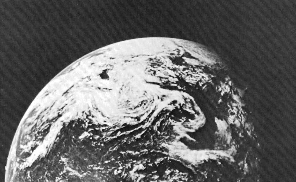
3 THE GEOLOGY OF THE TERRESTRIAL PLANETS GENERAL PROPERTIES Earth is slightly pear-shaped with an average equatorial radius of 6378 km and an average polar radius of 6275 km. The most distinctive feature of the surface is the division into land and sea. Only 29 percent of the solid surface is exposed; the rest is under water. The land is also unevenly distributed, with over 65 percent in the northern hemisphere. To emphasize the asymmetry, dividing Earth into two hemispheres, one with a pole near Spain at O0 longitude, 38ON, and the other with a pole near New Zealand, puts 81 percent of the land on the Spain-centered hemisphere. The distribution of land and sea roughly corresponds to the distribution of continental and oceanic crust. However, because the sea extends onto the continental margins, the fraction of Earth's surface that is continent (41 percent) significantly exceeds that which is land. The continents can be divided into three main components: (1) shield areas which consist mostly of exposed, highly deformed and metamorphosed Precambrian (>570 million years old) rocks, (2) platform areas, where the shieldlike basement is covered with a relatively thin (generally <2 km) veneer of mostly unmetamorphosed deposits of late Precambrian or younger age, and (3) linear ranges of highly folded and metamorphosed Phanerozoic rocks. These are in two main belts, one around the Pacific (Andes, Rockies, Alaska, Japan, and Philippines) and the other extending roughly east-west, south of Eurasia (Alps, Turkey, Iran, Himalayas, and Indonesia). The oceans can similarly be divided into three main components. The deep ocean basins constitute around 40 percent of the sea floor. They range in depth from 4 to 6 km and have low gradients broken only by an occasional volcanic mountain. The second major component consists of broad ridges that form an interconnected global network. The axes of the ridges are sites of plate divergence, where new lithosphere is currently being formed. Most ridges are 1000 to 4000 km across with elevations 1-2 km above the floors of the ocean basins. Along their axes is commonly a rift valley. The third and deepest parts of the oceans are within ocean trenches. These form where plates converge, and one plate dips under the other, dragging down the ocean floor. Examples are the Kermadec-Tonga trench north of New Zealand, and the Java trench south of Java and Sumatra. The relief forms of Earth are thus mainly linearmountain chains of folded and metamorphosed rocks, ocean ridges, and ocean trenches, separated by areas of low relief. This topographic style contrasts markedly with the other terrestrial planets on which circular impact structures dominate the landscape. Earth's topography is also mostly young, which is the reason why impact craters are rare. The ocean trenches are forming today, the ocean floors are mostly less than 200 million years old, and most of the extreme relief on the land results from volcanic and tectonic activity that occurred during the last 100 million years. The high rates of volcanism and deformation are complemented by high rates of erosion and deposition. Average erosion rates for North America are estimated at 3 x cmlyr (Menard, 1961). For comparison, erosion rates for the Chryse basin on Mars are estimated at no more than cmlyr (Arvidson et al., 1979). Rates for Mercury and the Moon are even lower. The hypsometric curve for Earth is markedly bimodal with one peak at sea level and a second at 4 km below sea level (fig. 5.1). The first peak results because 71 percent of the land is at an elevation within 1 km of sea level, a reflection of the efficacy of water in reducing relief on the land. The second peak at about 4 km below sea level is much broader than the first and is an indication of the average depth of the ocean basins. Extremes of elevations occur along plate boundaries; the highest mountains occur where surface materials are folded and squeezed between convergent plates, and the deepest ocean trenches are at subduction zones where one plate dips under another. The total relief is about 20 km, measured from the 8.85-km summit of Mount Everest to a depth of 11 km in the Marianas trench. The relief is in large part isostatically compensated. Topographic highs are at least partly compensated by low density rocks at depths. Similarly, topographic lows are partly compensated for by dense materials. Free-air gravity anomalies are thus mostly small and the free-air gravity is only poorly correlated with topography, in contrast to the close correlation on the other terrestrial planets. Most of the compensation appears to take place within 35 km of the surface, the mean thickness of the continental crust. Most of the tectonic activity of Earth, as indicated by both relief and earthquakes, is concentrated along plate margins (fig. 5.2). A narrow zone of relatively shallow earthquakes occurs along the axis of the oceanic ridges. Subduction zones, where old oceanic crust is being ingested into the mantle, are marked by intense seismic activity, much of it in relatively deep
4 EARTH Figure 5.1. Distribution of areas of solid Earth according to surface elevation. (A) Frequency distribution. (B) Cumulative hypsopraphic curve (Wyllie, 1971). Frequency percent area Cumulative frequency percent surface area of world Area (106 km2) (A) Cumulative area higher than each level (B) Figure 5.2. Plot of earthquake epicenters from 1961 to 1967 (Baranzangi and Dorman, 1969). Most occur at plate junctions so their locations outline plate boundaries. (>100 km) earthquakes. Transform faults, which form where plates slide by one another, are characterized by relatively shallow earthquakes. From maps of the incidence of earthquakes, therefore, the outline of the lithospheric plates can readily be discerned (fig. 5.2). The northern and western boundaries of the Pacific plate, for example, are delineated by seismic activity along subduction zones; the eastern margin is indicated by seismic activity along the western margin of North America and along the East Pacific Rise. Where two continents converge, as in the cases of Africa-Arabia and India approaching the southern edge of Eurasia, seismic activity is spread over a broad belt and plate boundaries are not clearly marked. Volcanic activity is also concentrated along plate boundaries. Of the more than 800 volcanoes active
5 THE GEOLOGY OF THE TERRESTRIAL PLANETS today, over 75 percent are along subduction zones that form the "ring of fire" around the Pacific. Volcanoes are also common along other convergent margins as in Indonesia, the Caribbean, and the Mediterranean. The distribution of active volcanoes may, however, be misleading as far as indicating where most volcanic activity occurs. Almost certainly most volcanism is along the mid-oceanic ridges, where high rates of volcanic activity have resulted in formation of the entire ocean floor within the last 200 million years. However, activity on the ridges is generally not localized at a point. Volcanoes on the ridges rarely rise above sea level, as in Iceland, so that named volcanoes astride oceanic ridges constitute only a small fraction of all the volcanoes known. Intra-plate volcanoes, such as those in Hawaii, are even less common. The relatively high rates of geologic activity coupled with interaction of the surface materials with the atmosphere and hydrosphere result in recycling of materials at rates that are comparable with, or shorter than, the age of Earth. Materials at or near the surface are reworked by the processes of weathering erosion, transport, deposition, metamorphism and so forth, but there is also a much longer term, deeper seated recycling caused by subduction of the lithosphere into the mantle and regeneration of lithosphere at spreading centers. As a result of the recycling, the crust can be envisaged as an array of different sized reservoirs (carbonates, shales, granites, oceans, etc.) with different elements moving from reservoir to reservoir on different time scales. Each element has a characteristic residence time in a given reservoir that depends on the amount of the element in the reservoir and the rate at which it is added and removed. Sodium, for example, has a residence time of lo8 years in the oceans, whereas iron may have a residence time of only a few hundred years (Siever, 1974). Quartz is recycled relatively rapidly, with the average quartz grain retracing its path through the geologic cycle every lo8 years (Pettijohn et al., 1972). Clearly the average residence t he of quartz in the various crustal reservoirs (mainly sandstone) is comparable to or less than this. On most other planetary bodies, 10 being the only exception, recycling rates are far slower, and average residence times probably far exceed the life of the planet. Accompanying the relatively near surface cycling of materials within the lithosphere is a much larger scale recycling of parts of the lithosphere through the upper mantle. Seismic tracing of subducted plates sug- gests that the outer km of the mantle, or 150 x lo9 km3, absorbs most of the ingested lithosphere. Assuming an average subduction rate of 2 cmlyr, a 100-km-thick lithosphere, and km as the length of the subduction zones, Siever (1974) estimated that 58 km3 of lithosphere is ingested each year. At this rate, complete turnover of material down to a depth of 350 km would take around 3 billion years, or almost the age of the planet. If the turnover depth is greater, the turnover rate is even slower. Earthquakes are detected to 700 km depth in some subducted zones, and mixing with the deeper mantle may occur. Subduction involves mostly oceanic crust (and upper mantle) but Armstrong (1968), Armstrong and Hein (1973), and O'Nions et al. (1979) argued that continental crust is also recycled. Their arguments are based on the strontium, lead, and neodymium isotope record, which indicates some degree of equilibration of isotopes between continental crust and mantle. Acknowledging that continental crust is not normally subducted because of its buoyancy, they suggested that recycling is effected by subduction of sediments derived from the continents and deposited on the ocean floor. They further argued that the rate of recycling of the continental crust has slowed with time and that most of the continental crust formed early in the history of the planet (>3 billion years ago). PLATE TECTONICS Our present perception of the geology of the Earth is dominated by the theory of plate tectonics. It provides a unifying framework within which all the numerous aspects of geology, from the chemistry of lavas to sedimentation rates, from styles of deformation to faunal migrations, assume a comprehensible whole. In essence, the outer rind of Earth is perceived as being divided into rigid plates that move laterally with respect to one another. Where plates diverge, at the mid-oceanic ridges, new materials form; where plates converge, at ocean trenches, near-surface materials may be ingested into the hotter mantle below; where plates slide by one another, large transform faults occur. There are at present six plates of continental dimensions or larger, and many smaller plates. Formulation of the Theory The theory of plate tectonics has had a revolutionary impact on geology. The story of how the theory evolved has been recounted in detail elsewhere
6 EARTH (Hallam, 1973; Condie, 1976; Wilson, 1968; Dewey, 1972; Wyllie, 1971) and is summarized only briefly here. Although the theory was formulated mainly in the 1960s, elements had been perceived much earlier. It was not until abundant paleomagnetic and seismic data became available and a vigorous exploration of the sea floor undertaken that the entire system could be visualized. As early as the mid-nineteenth century Snider (1858) published maps showing Africa and South America joined and attached to the other continents to form a single land mass which he suggested had broken apart in the great biblical flood. Taylor (1910) proposed that creep of Earth's crust was the cause of most of the mountain chains of Earth, and his maps of creep directions are remarkably similar to the present-day maps of plate motions. Wegener was, however, the most influential of the early "mobilists," publishing his ideas in several papers including the widely read book The Origin ofthe Continents and Oceans. In this book he postulated that before the Mesozoic era, all the continents formed one large supercontinent Pangaea. During the Mesozoic, the mass started to break up and the pieces slowly drifted apart to their present positions. Wegener's ideas met considerable resistance, particularly in North America, and although they were subsequently elaborated on and refined by various geologists (Du Toit, 1937; Holmes, 1944) before the second world war, they were never widely accepted. It was not until acquisition of paleomagnetic data in the 1950s that continental drift started to gain some respectability in the geologic community. Many rocks become permanently magnetized as they form and so record the relative position of the magnetic pole at the time of their formation. By the mid-1950s techniques had been developed whereby these fossil directions of magnetization could be measured on a range of rock types. Pioneering work by groups at Cambridge and the University of London showed a systematic shift of magnetic pole position with time (Blackett et al., 1960). Moreover, the pattern of the shift was different on the different continents, suggesting that the relative positions of the continents had changed. The most plausible explanation of the observations was continental drift (Runcorn, 1962). A puzzling aspect of these early ~aleoma~netic results was the mixed polarity of the directions of magnetization but this was shortly resolved as Cox et al. (1963) showed that Earth's magnetic field reverses polarity on a relatively short time scale, an observation that was to play a crucial role in achieving an understanding of the growth of the oceans. Meanwhile a vigorous exploration of the sea floor had begun. The vast system of interconnected midoceanic ridges had been discovered, and the ridges were found to be sites of high heat flow, active seismicity, local volcanism, and rifting. Mapping of the ridge system and its unique properties stimulated Hess (1962) to propose sea-floor spreading. He suggested that the ridges mark the positions of upwelling in the mantle, and that new crust forms at the ridges and is carried away on either side. Old oceanic crust, he proposed, is destroyed in the deep oceanic trenches. Most of the ocean floors are thus relatively young, having formed as a result of relatively recent volcanic activity along the ridges. Hess' ideas received strong support from paleomagnetic data. As noted above, periodic reversals of Earth's magnetic field had been conclusively demonstrated. Extensive surveying of the ocean floor revealed magnetic anomalies with a characteristic striped pattern adjacent to all the ridges examined. Vine and Matthews (1963) suggested that the magnetic anomalies were a record of the magnetic reversals that had occurred while the ocean floor was being formed. The floor in effect acted as a slowly moving tape recorder, maintaining a record of fluctuations in Earth's magnetic field from the present backwards in time, and could be used to calculate the spreading rates. Thus the stage was set for formulation of the theory of plate tectonics. Wilson (1965) proposed that the mobile belts of Earth, where much of the deformation, seismic, and volcanic activity occur, are interconnected and divide Earth's surface into several large rigid plates. He identified three types of mobile belts: mountain ranges, including island arcs; mid-oceanic ridges; and faults with large horizontal displacements. The faults he called transform faults since they transform the horizontal motions accompanying sea-floor spreading at the ridges and compressions at the island arcs into horizontal shear. Morgan (1968) and McKenzie and Parker (1967) took these ideas and analyzed the plate motions in quantitative terms by means of a theorem of Euler. The theorem states that motion of a rigid block on a sphere can be described by rotation about a single axis through the center of the sphere and that the amount of displacement of any part of the block varies according to its angular distance from the rotation pole. They asserted that spreading rates along the mid-oceanic ridges should vary in a systematic way with
7 THE GEOLOGY OF THE TERRESTRIAL PLANETS respect to the rotation poles of the rigid blocks. There followed a rapid testing of this theory against observed spreading rates, seismic activity, and location of plate boundaries. Variations in spreading rates predicted for the mid-atlantic and the Indian ocean ridges were confirmed by direct observation (Heirtzler et al., 1968). Le Pichon (1968) used the spreading rates and the directions of shear on transform faults to identify six major plates and their rotations with respect to one another. He was also able to trace the motions on a global scale back 70 million years. Meanwhile Isacks et al. (1968) had reinterpreted global seismic data in light of the new theory. They distinguished the rigid lithosphere from the more mobile underlying asthenosphere and showed that the seismic data were consistent with tension along the mid-ocean ridges, shear along the transform faults, and downbuckling of the lithosphere under island arcs. They identified the major zones of underthrusting and the directions of motions of the lithosphere into the regions now known as subduction zones. With these papers most of the major elements of plate tectonic theory were perceived, and the path of geology since that time has been largely a reinterpretation of all aspects of the field in light of the new theory. Present View Earth's surface appears to consist of several rigid plates of lithosphere delineated by the major earthquake belts (fig. 5.2). The lithosphere consists of both upper mantle and crust, and any one plate may contain both continental and oceanic crust. Plate boundaries do not necessarily coincide with continental boundaries, although some do; the continents are simply rafted along with the rest of the crust. The lithospheric plates slide over the more mobile asthenosphere, mostly at rates between 1 and 10 cmlyear, although the rates may be as high as 20 cmlyr. The plates range - in thickness from a few kilometers under the mid-oceanic ridges to more than one hundred kilometers under the continents. The lower boundary of the plates is not a compositional boundary but a mechanical one. The thin lithosphere close to the ridges yields by ductile flow at a relatively shallow depth because of the high heat flows; as the lithosphere is carried away from the ridges it cools and thickens, as ductile flow occurs at greater depths. In the Pacific basin, for example, 50-million-year-old lithosphere is 60 km thick, and 100-million-year-old lithosphere is 85 km thick (Leeds et al., 1974). At the mid-oceanic ridges, where the plates diverge, new oceanic crust and upper mantle is formed at the plate's trailing edges. Heat flow at the ridge crest is mostly in excess of 6 pcal/cm2/sec as compared with around 1 pcal/cm2/sec for oceanic crust 150 million years old (Sclater et al., 1980). Sclater and Francheteau (1970) suggested that the relief on the ridges is caused largely by thermal expansion of mantle materials as a result of the anomalously high heat flows and consequent high subsurface temperatures. The ridges are commonly offset by transform faults that are also the sites of shallow (<50 km) earthquakes. The most voluminous volcanic rocks erupted along the mid-oceanic ridges are low-k tholeiitic basalts. As the rocks cool through the Curie point for most magnetic minerals ( ' C), they become magnetized along the ambient field direction and are carried away from the ridge preserving a record of the eruption history. The ridge tholeiites generally have relatively high A1203 and Cr compared with island and continental tholeiites and relatively low K, Rb, Cs, Sr, Ba, Zr, U, Th, and REE, and low Sr87/Sr86 ratios, mostly in the range of to (Kay et al., 1970; Peterman and Hedge, 1971). While drill cores have not been obtained to any great depths on the ridges, sections of oceanic crust probably are preserved in the so-called ophiolite sequences found in many mountain belts (table 5.1). The sequences start with ultramafic igneous rocks at the base. These pass upward into gabbro, then into the sheeted complexes of Table 5.1. Typical Ophiolite Sequence Rock type Interpretation Cherts and reconstructed sea-floor sediments clays Basaltic lavas and pillow lavas Diabase dikes and sills Gabbros Cumulus peridotite Sheared peridotite Lavas mostly erupted at mid-oceanic ridges Feeders for the mid-0ceani.c ridge eruptions Rocks formed within magma chambers below the mid-oceanic ridges Rocks formed by crystal fractionation in the magma chamber Mantle rocks from the magma chamber walls
8 EARTH closely spaced diabase dikes, and ultimately into tholeiitic pillow lava. The latter may be overlain by sedimentary rocks that are presumably deposited on the ocean floor. The ophiolite sequences are believed to be pieces of ocean floor that originally formed along the mid-oceanic ridges, but later were thrust onto the continent at a zone of convergence. New plates form as old ones start to break up and drift apart. The rift valleys of Africa are, for example, believed to form along a zone of incipient divergence and are characterized by updoming, rifting, and volcanism. The continental-rift volcanic rocks are generally enriched in alkalis and rare earths in contrast to the alkali poor oceanic tholeiites. Silica-rich members such as trachyte and rhyolite are also much more common than along the mid-oceanic rises. The distinctive chemistry of the continental-rift volcanics probably results largely from their depth of origin (Green, 1972b); the continental magmas form at relatively great depths (>70 km) below a relatively cool and thick continental lithosphere, whereas the rise tholeiites have a relatively shallow depth of origin. The various alkali-rich magmas may form by removal of varying amounts of olivine, pyroxene, and garnet from the deep-seated melts (Green and Ringwood, 1968). Contamination of the magmas with the continental rocks may also add to the magmatic variety of the rift volcanic~. The rift valleys are also sites of clastic sedimentation, with possible formation of red beds, and sites of temporary lakes or arms of the sea, with accompanying formation of evaporites. If separation continues, then oceanic crust forms between the diverging continental masses and a series of distinct geologic environments are ultimately formed, as typified by the margins of the Atlantic Ocean. The former edge of the continent survives as the continental slope. Along the slope, the rifts and coarse clastic debris that formed during the early stages of separation are buried by younger, fine-grained sediments and turbidites. On the ocean side of the continental slope, mud, clay, and organic ooze bury the newly formed oceanic crust. Toward the continent, sedimentary sequences consisting of shallow-water sandstone, shale, and limestone, which are typical of quiet sedimentary environments, are deposited on the shelf. Being within a moving plate, the shelf experiences little tectonic or volcanic activity as it is passively rafted away from the divergent zone at the midoceanic ridge. At convergent plate junctions, geologic activity is far more complicated and varied. It is the processes at these junctions that ultimately result in the linear mountain chains and metamorphic belts of the world. The simplest form of convergent junction is one where a plate with oceanic crust rides under another plate (fig. 5.3). Complications arise when continents or island arcs are carried into the subduction zone to encounter the opposing plate. The continent or arc materials are relatively buoyant and so resist subduction. The horizontal motion of the plates is therefore translated into intense compression near the surface, overthrusting, and possibly a reversal in the direction of subduction. Deformation becomes extreme when two continental blocks collide, as in the case of India and Asia. Because the continental crust resists subduction, a substantial fraction of the continents survive from early in the planet's history and the continents may have grown periodically as new material was welded to the old in the convergence zones. Consuming plate margins may be either along the edge of a continent, as along the west coast of South America, or along island arcs separated from the con- I Open ocean: Trench 1 I I 1 I I I Arc-rear area (Continent or ocean basin) low TIP metamorphism Sedimentation Volcanism, plutonism high TIP metamorphism Increasing magmas 100km Asthenosphere Figure 5.3. Generalized section across an arc-trench system showing the relation of magmatism and metamorphism to the subduction zone (Hallam, 1973; after Dickinson, 1971~).
9 THE GEOLOGY OF THE TERRESTRIAL PLANETS tinents by marginal seas, as in the western Pacific. A trench, usually 5-8 km deep, normally forms where the plate being consumed dips under the opposing plate, and movement of the subducted slab can be traced to considerable depths by means of earthquakes. The earthquake hypocenters generally are located in a tabular volume, the Benioff zone, that dips under the arc or continental margin at a wide range of angles, but averaging around 45O. In some cases, as in the Mariana and Tonga arcs, and along the west coast of South America, earthquakes are detected in the Benioff zone to depths of 700 km; along other subduction zones such as the Aleutians, the earthquakes are mostly at depths less than 300 km. First motions of the earthquakes indicate tension within the slab near the axis of the trench and compression at greater depths (Oliver et al., 1973). In some arcs, as under the North Island of New Zealand, a gap in the Benioff zone suggests that a piece of lithosphere has detached from the main slab (Isacks et al., 1968; Oliver et al., 1973). As the downgoing slab moves into the subduction zone, pelagic sediments and slivers of oceanic crust are scraped off the downgoing plate and stacked in a sheared, telescoped sequence or melange on the opposing side of the trench. As the sequence is compressed and buried, it is metamorphosed under conditions of relatively low temperature, but high pressure, to form rocks typically of the blueschist or low greenschist facies. Such sequences can be recognized in the fossil record as a heterogeneous, sheared rock mass in which blocks of diverse types including greywacke, chert, greenstone, and serpentine are juxtaposed in an almost random fashion (Dickinson, a,b). Also incorporated almost intact may be ophiolite slices, representing the former ocean crust. Typical of such melanges is the Franciscan Formation of California, most of which is believed to have been plastered against the continental margin in a subduction zone parallel to the California coast in the Mesozoic (Hamilton, 1969). The thick stack of lowdensity rocks of the trench causes a negative gravity anomaly along its length, and if subduction slows or ceases, the sequence will rise isostatically. The trench area is also characterized by low heat flows because of the presence of the cold downgoing lithospheric slab. Beyond the trenches is a magmatic arc, which may form a string of islands or, where located on continental crust, a thick stack of subaerial volcanic rocks. Between the arc and the trench is the so-called, arc-trench gap, 75 to 275 km wide. This is a region of relatively quiet sedimentation between the zone of deformation just inside the trench and the active volcanic region that constitutes the arc. Fossil arc-trench gap sequences are thus relatively unmetamorphosed sequences of sedimentary rocks, sandwiched between the melanges of the subduction zone and the volcanics of the arc. Toward the arc they grade laterally into volcanic or volcaniclastic strata; the contact with the melange rocks is generally tectonic. The volcanic arcs themselves are generally about 75 km wide and the sites of both volcanism and intrusion of magma at depth. It is these arcs that make up the "ring of fire" around the Pacific. The extrusive~are typically andesitic, and the intrusives are granite and granodiorite, but variations occur. Where the arc is built on oceanic crust, the volcanics may contain significant amounts of tholeiitic basalt in addition to andesite; where the arc is on a continental margin, significant amounts of dacitic and rhyolitic products may be erupted. In general the K and Si content of the lavas of the arc increase with distance from the trench (Dickinson, 197 la). Much of the volcanism of the arcs is pyroclastic. Some of the volcanic products accumulate on the arcs in volcanic cones, but much is also dispersed over wide areas as ash. Where the arcs are deeply eroded, granite batholiths may be exposed together with metamorphic rocks of the upper greenschist and amphibolite facies, which formed at relatively high temperatures. Myashiro (1972, 1973) noted that metamorphic belts around the Pacific are commonly paired. One belt contains minerals typical of low temperatures and high pressures (glaucophane, lawsonite, aragonite, and jadeite) and the other parallel belt contains metamorphosed sediments and volcanics with minerals such as sillimanite, indicative of high temperatures. These two belts, he suggested, form respectively at the trenches and the arcs, indicating which side of a previous convergent junction was subducted. The region behind the arc (away from the trench) may evolve in two basically different ways. Behind some arcs, such as Japan (the Marianas and the Tonga-Kermadec chain) there is extension, and new oceanic crust and ocean basins are formed there (fig. 5.4). Where such an arc was originally along a continental margin, the result of the extension can be migration of the arc away from the continent to form a marginal ocean basin (Karig, 1971). In contrast, compression occurs behind other arcs, such as the Andes, and rocks in a broad belt behind the arc are folded and thrust onto the continental foreland (fig.
. Figure 5.")

10 EARTH Asthenosphere Figure 5.4. Generalized cross section across the edge of a continent bordered by an island arc. New oceanic crust is created between the arc and the continent by back-arc spreading (adapted from Dewey, 1979). Figure 5.5. Generalized cross section of an active continental margin where subduction results in cordilleran style tectonics inland (adapted from Dewey, 1979). Asthenosphere 5.5). The reason for the different back-arc tectonic environments is not clear. Coney (1971) proposed that the broad belt of cordilleran folding and overthrusting of Mesozoic age that extends down the western part of North America was caused by active driving of the continental North American plate over the underlying asthenosphere. He suggested that had the plate been stable with respect to the asthenosphere, island arcs would have migrated off the continental margin, and the cordilleran style of deformation would not have occurred. Molnar and Atwater (1978), on the other hand, demonstrated that back-arc spreading occurs where relatively old (>100 million years) lithosphere is being subducted, whereas cordilleran style tectonics develop where young lithosphere is being subducted. They attribute the different styles to differences in buoyancy of old and young lithosphere. The processes occurring at island arcs and active continental margins can, of themselves, lead to formation of mountain chains. However, many orogenic belts are the result of additional complications, particularly where island arcs or continents that are rafted along on moving plates encounter a subduction zone. In these cases, passive continental margins of the Atlantic-type are involved in the collisions. If the approaching continent meets oceanic crust of the opposing plate at the subduction zone, then oceanic crust may be thrust up onto the continent (fig. 5.6) to form a wedge of ophiolites as in Papua and New Caledonia. Continued convergence of the two plates must then result in reversal of the polarity of subduction, since the continental crust cannot be subducted. The continental margin thus changes from a passive margin to an active one with the oceanic crust thrust under it. Alternatively, the approaching continental margin may collide with an island arc at the subduction zone so that island-arc volcanics and sediments are thrust over the continental margin, which itself undergoes compressional deformation. Again, if the convergent motion is sustained, the polarity of the subduction must change. Dewey and Bird (1970) suggested that this occurred in north New Guinea in Miocene time. In both cases new material may be welded onto the continental margin. The final major way in which mountains are built is by collision of two continents; that is, where an inactive Atlantic-type of continental margin is driven toward a subduction zone on an active continental
11 THE GEOLOGY OF THE TERRESTRIAL PLANETS (A) Asthenosphere Figure 5.6. Possible sequence of events when a continent rafted along on a plate being subducted encounters the subduction zone. Oceanic crust is thrust onto the continental foreland as ophiolites (B) and ultimately the polariy of the subduction is reversed (C) (Dewey, 1979). margin (fig. 5.7). Collision causes the continental basement to be sheared and thrust in both directions away from the join. Slivers of oceanic crust may also be involved in the thrusting. The sediments on the former continental shelf become compressed and folded, then thrust to form gigantic nappes (detached and recumbent folds). Rapid erosion of the trapped, deformed, and uplifted rocks may result in deposition of a thick, sedimentary sequence composed of mixed rock-types termed molasse, adjacent to the growing pile of deformed rocks. Plutonic activity may occur at depths below the massive pile to form granitic batholiths. Eventually, the buoyancy of the continental masses prevents further underthrusting and what is left of the subducted plate may break off and sink into the asthenosphere (Isacks et al., 1968). Relative motion between the two continents ceases and the global motions of the plates must then become reorganized. The present Himalayan mountain chain is the result of such a continent-continent collision. India collided with Asia along a former subduction zone, south of Tibet, during the Cenozoic. A similar collision may now be occurring in the Mediterranean, although here the situation may be more complicated. Ophioliteblueschist zones are complexly interleaved with slivers of continental crystalline rocks and folded sediments, suggesting that several island arcs of microcontinents may have been trapped between the converging African and Eurasian masses (Dewey and Bird, 1970). Mountain belts can thus form in a variety of ways. New continental crust can be welded to old at active margins and old continents can become welded together along so-called suture belts during continentcontinent collisions. These collisional events, which result in reversal of the polarity of subduction or cessation of the relative motions of the two continental masses, must cause episodic large-scale reorganization of plate shapes and motions. Furthermore, the sizes and shapes of the plates are constantly changing as a general result of divergence and convergence. The African plate, for example, is presently growing larger as a result of spreading at the surrounding
12 EARTH Figure 5.7. Possible sequence of events in a continent-continent collision. The sedimentary sequence on the underriding plate becomesjuxtaposed with the sequence on the overriding plate, and slivers of oceanic lithosphere are caught between. The combined section is intensely folded and overthrust onto the continents. Ultimately deep burial, metamorphism and plutonic activity lead to suturing of the two plates and the global plate motions become reorganized. ow earthquakes divergent boundaries. Moreover, motion into a subduction zone is rarely at right angles; the resulting shear must be accommodated by transform motion along the plate boundaries. The plate geometry is thus constantly changing, and one of the tasks of geology is to reconstruct former configurations and trace how the surface evolved to its present state. Past Motions Smith et al. (1973) attempted to reconstruct world geography back to the beginning of the Phanerozoic on the basis of present-day plate geometries and motions, paleomagnetic data, location of orogenic belts, and indices of past climates. Some of the reconstructions are given in figures 5.8 and 5.9. Reconstructions for the last 250 million years-back to the Permian-can be made with some confidence because they are constrained by magnetic anomaly patterns on the ocean floors and by the present plate positions and spreading rates. During the Permian and Triassic all the continents formed essentially one supercontinent, termed Pangaea by Wegener (1966). The continental mass was crudely crescent-shaped with Eurasia forming the northern horn and the southern continents, which constituted a long-lived land mass termed Gondwanaland, forming the southern horn. Between the two horns was the ancient ocean of Tethys. The subsequent history of the continents can be described in terms of three main events: the opening of the Atlantic, the closing of Tethys, and the break-up and dispersal of Gondwanaland. The exact timing of the events is uncertain but the broad outlines are as follows. In the Jurassic ( million years ago), the north Atlantic started to open and Eurasia rotated clockwise toward Tethys, hinged on the western Mediterranean. By mid-cretaceous time (90 million years ago) the North Atlantic had grown to be km across, whereas Tethys had narrowed to less than 1000 km across in the Mediterranean and the Middle East. Also during the Cretaceous, Gondwanaland broke up and underwent rapid dispersal over the southern hemisphere. India started its northward drive toward Asia, South America split from Africa to form the South Atlantic, and Antarctica and Australia drifted away from Africa to the south and west. By the Eocene (50 million years ago), India was about to collide with Asia, only narrow disconnected remains of Tethys were trapped between the converging plates of Eurasia and Africa-Arabia, and the South Atlantic was over 1000 km wide. Since that time, further convergence of Africa-Arabia and India with Eurasia has resulted in formation of the almost continuous belt of mountains across southern Europe, Anatolia, Iran, and the Himalayas. Reconstructions for the pre-permian are far less certain because of the absence of surviving ocean floor of that age and our inability to extrapolate subsequent motions backwards as a result of all the continents being together in one land mass in the Permian. The reconstructions of Smith et al. (1973) for this period are based on the position of orogenic belts and on paleomagnetic data from the continents. The paleomagnetic data, however, give only paleolatitudes. The continents are positioned at the latitude necessary to place the magnetic pole at the geographic pole; longitudes are assigned somewhat arbitrarily. It appears
13 THE GEOLOGY OF THE TERRESTRIAL PLANETS (a) Tertiary, 50 my ago (b) Cretaceous, 100 my ago Figure 5.8. Con&uration (Smith et al., 1973). (c) Jurassic, 170 my ago (d) Triassic, 220 my ago of the continents back to Triassic time. The configuration is tightly constrained by data from the ocean Joors Figure 5.9. Possible configuration ofthe continents between the Permian and the Cambrian. The configuration is poorly constrained because of the lack of data from the ocean Joors (Smith et al., 1973). (e) Permian, 250 my ago (f) Lower Carboniferous, 340 my ago 60 N (g) Lower Devonian, 380 my ago (h) CambrianlLower Ordovician, 510 my ago 90
14 EARTH from the magnetic poles that the southern continental mass remained essentially intact throughout the Paleozoic. However, the northern continents successively broke up and reassembled. During most of the Paleozoic ( million years ago) Europe was separated from Asia by an ocean, which closed in the Permian to produce the Urals. During the Mississipian, northern Europe and North America were joined but separated from southern Europe by an ocean which finally closed during the Hercynian orogeny ( million years ago). Somewhat earlier, in the Ordovician, northern Europe had been separated from North America but fused with it during the Caledonian orogeny ( million years ago). Extrapolation back into the Precambrian is extremely speculative, but continuity of ancient (1.8 to 3.0 billion years) orogenic belts across Gondwanaland suggested that much of that land mass, at least, remained intact for most of the Proterozoic. Plate tectonics have clearly played a major role in the evolution of Earth during the last 500 million years. Much less clear is the role of plate tectonics before 500 million years ago, an era that constitutes almost 90 percent of the planet's history. The rest of this chapter discusses formation of Earth, then traces its history from the time of formation through the Archean and Proterozoic Eons to the start of the Phanerozoic. A continuing concern is the extent to which plate tectonics affected geologic evolution during the early periods. THE INTERIOR OF EARTH Although the results of geologic processes operating at Earth's surface can be observed directly, our knowledge of the interior is obtained by indirect means-from seismic data. Earth's moment of inertia, comparisons with meteorites, and study of inclusions in volcanic rocks. Division of Earth into crust, mantle, and core has been known for over 70 years from seismic data. The Mohorovicic discontinuity, or Moho, defines the base of the crust, which is generally at a depth of 5-7 km under the oceans and km under the continents. At the Moho both shear (S) and pressure (P) waves undergo an abrupt change in velocity, as a result of the compositional boundary between the ultramafic mantle and the more Si- and Al-rich rocks of the crust. The mantle extends from the Moho down to the Gutenberg discontinuity at a depth of around 2900 km. Below this depth, S- waves are not transmitted and P-waves undergo a sharp drop in velocity. The discontinuity separates a liquid, dominantly metal, outer core from the lower mantle. Other seismic discontinuities have been detected and will be discussed below. The variation of seismic velocities with depth is given in figure The distribution of density within Earth is constrained by the mass of Earth, its moment of inertia, the travel time of seismic waves (although the relation between elastic constants and density is not precisely known), and the free oscillations of Earth. The densities at the top of the mantle range from gm/cm3 and they increase slowly to a depth of 400 km, then more rapidly to a depth of 700 km below which they increase slowly to a value of 5-6 gm/cm3 at the base of the mantle. At the core boundary densityjumps to gm/cm3 and then increases steadily to a central density of gm/cm3 (Wyllie, 1971). In most models of the internal distribution of density the mantle constitutes around 67 percent of the mass of the planet, the core 32 percent, and the crust only about 0.5 percent. Internal temperatures are less well constrained. Deep temperatures (>300 km) have little influence on surface heat flow, which is quite well known. Most estimates of internal temperatures are based on theoretical models for the thermal evolution of Earth; methods that relate geophysical properties such as seismic wave velocities and electrical conductivity to temperature, or on petrologic arguments that relate the composition and depths of origin of magmas to phase relations in ultramafic magmas at different temperatures. Figure Variations of S- and P-wave velocities with depth within Earth (Wyllie, 1971). Seismic velocity (km Isec) I I I " Outer core Inner G **.* Gutenberg
15 THE GEOLOGY OF THE TERRESTRIAL PLANETS The total heat loss from Earth is around 1013 callsec, of which 70 percent is through the deep oceans and marginal basins and 30 percent is through the continents and continental shelves. Creation of new lithosphere accounts for 90 percent of the heat lost through the oceans and therefore, about 60 percent of the total heat lost. Only 20 percent of the heat loss is by conduction through the lithosphere (Sclater et al., 1980). The Crust Two major kinds of crust are distinguished, a thin oceanic crust and a thicker continental crust. The oceanic crust is relatively uniform in its properties. It consists of a basal layer, averaging 4.7 km thick, of gabbro and basalt with P-wave velocities of kmlsec. Above this is a layer of consolidated sediments and volcanics, averaging 1.7 km thick, with P-wave velocities in the 4-6 km/sec range (Turekian, 1976). This may be covered by a thin layer of unconsolidated sediments which becomes thinner toward the ridges. The total mass of the oceanic crust is estimated as 7 x loz4g (Turekian, 1976). Its composition (table 5.2) is reasonably well known, the crust having formed largely by eruptions of low-k tholeiitic basalt along the mid-oceanic ridges. Continental crust is more varied. A large fraction consists of stable, ancient, crystalline basement that may be partly overlain by relatively undeformed Phanerozoic sediments. Much of the basement appears to have formed by successive Precambrian orogenies that created linear belts of deformed and metamorphosed rocks of relatively uniform age. It is mostly km thick and has P-wave velocities of kmlsec. Overlying sediments, if present, have P-wave velocities mostly in the 2-4 kmlsec range. Welded to the central shields of the continents may be Phanerozoic orogenic belts and mountain chains. Paleozoic orogenic belts are generally underlain by crust that is similar in properties to that of the shields. Under the younger orogenic belts however, the crust is thicker, up to 100 km under the Himalayas. The greater thickness in these areas reflects isostatic compensation of the mountain chains by low-density roots. Areas of crustal extension, such as the Basin and Range Province of the United States and the African rift valleys, have unusually thin (<30 km) crusts. Because the continental crust is thicker than the oceanic crust it constitutes percent of the crustal mass, estimated at 2.5 x loz5 g. Heat flow in the continental crust averages 1.4 pcall cm2/sec, but varies according to age (Sclater et al., Table 5.2. Estimates of the Chemical Composition of the Crust Cfrom Condie, 1976). Major Elements Are Given in Weight Percent; Minor Elements in ppm. SiO2 Ti02 A1203 Fez03 FeO MgO CaO Nap0 K20 H20 Rb Sr Ba u Th Ni 1. Average continental crust. 1: 1 basalt-granite mixture assumed for lower crust. 2. Average continental crust assuming lower crust is granulitic. 3. Average oceanic crust. 4. Total Earth's crust assuming granulitic lower continental crust. 5. Total Earth's crust assuming granite-basalt mixture for lower continental crust.
16 EARTH 1980). In young orogenic belts the heat flow is mostly in the range of pcal/cm2/sec but it decreases to around 1.1 pcal/cm2/sec after a billion years. The areas of crustal extension have relatively high heat flows ( pcal/cm2/sec). The composition of the continental crust has been estimated in various ways. Estimates of the sedimentary layer (table 5.2) are based on the relative proportions of different sedimentary rocks observed at the surface and in drill holes. Sampling of the Canadian shield (Eade and Fahrig, 1971) and modeling the distribution of different rock types (Ronov and Yaroshevsky, 1969) show that the upper continental crust is close to granodiorite or quartz diorite in composition. The composition of the lower continental crust is more difficult to assess (two models are given in table 5.2). One assumes that the lower crust consists of a mixture of granitic and basaltic rocks. The other assumes that metamorphic rocks of the granulite facies in the Canadian shield, which appear to have formed at depths of km, can be taken as indicators of the composition of the lower crust (Eade and Fahrig, 1971). The granulite model is more Al- Si-rich and Fe-Mg-poor than the granite-basalt model. Both are consistent with the seismic velocities of the lower crust. Estimates of the relative abundances of different rock types and normative minerals for the crust as a whole (ocean and continent) are given in table 5.3. The normative mineralogy, with quartz and feldspar constituting 63 percent of the total, reflects the dominance of continental crust. The Mantle The composition and structure of the mantle are inferred from several kinds of data. First, its vertical density profile is constrained by the moment of inertia. Second, the variations in seismic properties give indications of the physical state and phase changes at different depths. Third, studies of phase equilibria suggest possible mineral assemblages at different depths and parent materials for magmas derived by partial melting and brought to the surface. Finally, certain ultramafic inclusions in some igneous rocks and kimberlites are demonstrably samples of the upper mantle as shown by the presence of high-pressure minerals such as diamonds, and of coexisting mineral pairs that provide a measure of the depth at which they crystallized. Table 5.3. Abundances of Main Rock Types and Minerals in the Crust (Data from Ronov and Yaroshevsky, 1969) Rocks Sedimentary Sands Clays and shales Carbonates (including salt-bearing deposits) Igneous Granites Granodiorites, diorites Syenites Basalts, gabbros, amphibolites, eclogites Dunites, peridotites Metamorphic Gneisses Schists Marbles Totals Sedimentary Igneous Metamorphic % Volume %Volume of crust Minerals of crust Quartz Alkali feldspar Plagioclase Micas Amphiboles Pyroxenes Olivines Clay minerals ( + chlorites) Calcite ( +aragonite) Dolomite Magnetite ( +titanomagnetite) Others (garnets, kyanite, andalusite, sillimanite, apatite, etc.) Totals Quartz + feldspar Pyroxene +olivine Hydrated silicates Carbonates Others
17 THE GEOLOGY OF THE TERRESTRIAL PLANETS Most parts of Earth have a relatively high seismic velocity zone that extends from the Moho down to depths of km. Pressure-wave velocities in this zone are mostly in the kmlsec range and shearwave velocities are around 4.6 kmlsec. This uppermost mantle together with the crust makes up the lithosphere. Beneath the rigid lithosphere, in most places, is a low-velocity layer that extends down to km (fig. 5.11). At the top of the layer, P- wave velocities are around 7.6 kmlsec and S-wave velocities are around 4.2 kmlsec. The seismic waves also have relatively high rates of attenuation. These properties suggest that the low-velocity layer is partly molten (1-10 percent liquid). It corresponds, in part, to the asthenosphere-the mobile layer over which glide the rigid plates of the lithosphere. The asthenosphere may, however, extend to greater depths in some places because earthquakes caused by subducted slabs of lithosphere moving down into the asthenosphere can be detected in some areas to depths of km. From the base of the low-velocity layer down to 400 km the S- and P-wave velocities increase slightly owing to the increasing pressure, but at 400 km there is a sharp discontinuity. Pressure-waves increase from 8.5 to 9.6 kmlsec and S-waves increase from 4.5 to 5.5 kmlsec. The velocity jump is probably caused by the transition from olivine, as the dominant mineral of the upper mantle, to spinel (Ringwood and Major, 100 Shear velocity (kmls) L, Figure Variations in shear wave velocities in the outer 500 km of Earth (Wyllie, 1971). 1970). Aluminum-rich pyroxene in the upper mantle may also be replaced by garnet below this discontinuity (Smith and Mason, 1970). Other discontinuities at 650 km and 1050 km are probably the result of phase changes also. The precise nature of the latter changes is not known, but it likely involves transformation of Fe-Mg silicates, in which Si is in 4-fold coordination, into denser phases with Si in 6-fold coordination. Theoretical studies of phase equilibria and the generation of basaltic magma, together with ultramafic inclusions carried up by deep-seated magmas and kimberlites give a good indication of upper mantle mineralogy (Smith, 1979). The mantle probably is complex, with a mineralogy that changes according to depth and location as might be expected from repeated episodes of partial melting and ingestion of the lithosphere. The dominant rock types are relative Ca-Alrich peridotite (rock composed chiefly of olivine), relative Ca-Al-poor harzburgite (peridotite consisting of olivine and orthopyroxene), and very small amounts of eclogite (clinopyroxene and garnet), dunite (nearly all olivine), and other ultramafic rocks. The peridotite has MgIFe ratios around 10 and generally contains spinel or garnet depending on their depth of formation. Ultramafic inclusions provide a basis for estimating the bulk composition of the upper mantle at depths less than 200 km (Boyd, 1973). Comparing table 5.2 with table 5.4 shows the extreme enrichment of the upper mantle in Mg with respect to the crust. Of special interest, because of their importance in understanding core formation and different models for accretion of Earth, are the chalcophile and siderophile elements. The FeINi ratios in mantlederived olivine are close to the cosmic ratios, which suggests that Ni has not been selectively removed from upper mantle silicates by partitioning between silicates and metal or sulfides. Any such partitioning would result in selective depletion of Ni in the silicates, which is not observed. Similarly, the noble metal contents of mantle derived inclusions are higher than would be expected for equilibration of the silicates of the mantle with sulfides or metal. These relations suggest first, that there is little sulfide or metal within the upper mantle, and second, that upper-mantle materials were never equilibrated with significant amounts of metal or sulfide at any time in the past. The upper-mantle materials are in disequilibrium with the core. Thus, either the ~i and noble metals now in the upper mantle were added after the core formed, or the core
18 EARTH Table 5.4. Some Estimates of the Bulk Composition of the Upper Mantle (Smith, 1977) pzo Si Ti A Cr Fen FeO MnO NiO MgO CaO Na K Note: Estimates are all from inclusions, except that given in column 1, which is a hypothetical rock, pyrolite, obtained by mixing one part basalt with three parts peridotite (Ringwood, 1975). 1. Average mantle pyrolite, Ringwood (1975). 2. Volatile-free, undepleted upper mantle from partial fusion-partial crystallization model for xenoliths at Kilbourne Hole, New Mexico. 3. Mean of 20 garnet peridotites from various countries. 4. Average garnet lherzolite in kimberlite. 5. Average of eight garnet lherzolite nodules at Lashaine, Tanzania. 6. Estimated undepleted upper mantle (Harris et al., 1967). formed after accretion was over and a barrier was continuity at 5200 km, does transmit S-waves, present between the upper mantle and the core- although at low velocities, suggesting that it is near forming materials at greater depths (Smith, 1977). the melting point or partly molten. While the core is Deeper in the mantle, P-wave velocities increase almost certainly rich in Fe and other siderophile eleprogressively as the density increases until they reach ments, it is less dense than a pure Fe-Ni liquid. The a value of around 13.7 kmlsec at the Gutenberg most likely explanation is that the core incorporates discontinuity, which marks the base of the mantle at significant amounts of sulfur (Murthy and Hall, 1972). a depth of 2920 km. The mineralogy of the lower Fe and Ni sulfides occur in most meteorites and their mantle is very uncertain. All the silicates normally incorporation into an accumulating Earth would have present in peridotites must transform to denser phases resulted in formation of liquids which could have sunk at depth, but precisely which phases cannot be to form the core. A sulfur content of 9-12 percent is specified, partly because of a lack of knowledge of sufficient to explain the low density. Ringwood (1977) phase equilibria at the prevailing high pressures. alternatively suggested that oxygen may be the cause Uncertainties also arise because the temperature pro- of the low density. file is poorly constrained, and because of the possibility that the MgISi and FeIMg ratios may vary considerably with depth (Smith, 1977). FORMATION OF EARTH The Core Earth is estimated to be 4.6 billion years old on the basis of the following evidence. (1) Most meteorites The core constitutes around 32 percent of the mass have solidification ages close to 4.6 billion years and of the planet and can be divided into inner and outer are thought to have accreted around the same time regions. The outer liquid core has P-wave velocities as Earth, and from the same primitive condensation mostly in the 8-10 krnlsec range and does not transmit products of the solar nebula. (2) The evolution of ter- S-waves. The inner core, defined by the Lehmann dis- restrial lead isotopes follows a curve which, when
19 THE GEOLOGY OF THE TERRESTRIAL PLANETS extrapolated back 4.6 billion years, matches the composition of primordial lead, as determined from U- deficient meteorites (Patterson, 1956). (3) Globally averaged U and Pb isotopic abundances in the crust give an age of 4.6 billion years. (4) The oldest rocks found on the lunar surface are 4.6 billion years old (Taylor, 1975). The oldest rocks found on Earth are close to 3.8 billion years old (Moorbath, 1976), and so postdate the formation of Earth by about 800 million years. Despite the lack of direct evidence from between 4.6 and 3.8 billion years ago, we can infer what might have happened during this early era from geochemical evidence, from modeling of Earth's accretion and its subsequent thermal history, and from conditions at the start of the geologic record 3.8 billion years ago. In recent years the sequence of condensation of materials from the solar nebula and their accretion to form meteorites and planets have received considerable attention. Lewis (1972), Grossman (1972), and Grossman and Larimer (1974) examined the condensation sequence in the primitive solar nebula. They assumed that the nebula was uniform in composition and that the temperature and pressure fell off with increasing distance from the proto-sun. According to their models, as the nebula cooled, different materials condensed: the refractory metals and Ca, Al, and Ti oxides first, then Mg silicates at intermediate temperatures, then Fe, and lastly the more volatile material such as Na, K, S, and Se. The condensed materials remained in contact with the nebula gas and were able to react with it in the later stages of condensation. Thus, some of the Fe metal that condensed was later oxidized or sulphurized to produce FeO and FeS. Condensation was arrested when the remaining nebula gas was removed by the solar wind. The solar system was thus left compositionally zoned, with dust in the inner solar system preferentially enriched with early, high-temperature condensates and the outer solar system enriched with low-temperature condensates. Accretion of the planets from these materials resulted in the planets closer to the Sun being formed from a larger proportion of the high-temperature fraction. How the planets accreted from the condensed dust is controversial. According to the inhomogeneous accretion model (Turekian and Clark, 1969), the planets accreted rapidly while condensation was occurring so that each developed an "onion ring" structure as successive condensation products accumulated. Accretion times required for Earth in their model are on the order of lo3 to lo4 years. This model has been criticized on several grounds, mainly because of the abundant evidence from meteorites of formation of planetesimals, up to hundreds of kilometers in diameter, as an intermediate stage in the formation of the planets, as originally suggested by Urey (1952), and because of dynamical problems inherent in such rapid accretion. According to the homogeneous accretion model, the planets accumulated slower than the material condensed. They formed from planetesimals-aggregates of the various materials that formed at different stages of the condensation sequence. The condensed particles are believed to have accumulated into clods as a result of gravitational instabilities in the nebular disc. As the clods grew in size, gravitational attraction and energy dissipation in a developing regolith probably allowed larger bodies to grow faster than the smaller (Hartmann, 1978). Ultimately, an array of planetesimals, tens to hundreds of kilometers in diameter formed, as is evident from the mineralogy of some meteorites, which clearly demonstrates that they formed within much larger bodies. Carbonaceous chondrites may be representative of the most primitive planetesimals; meteorites such as the basaltic and iron meteorites are the products of melting and fractionation within planetesimals. According to one model by Safronov (1977), a small number of planetesimals gained advantage over others, largely because of their size. They initially grew by low-velocity capture of other planetesimals in orbits similar to their own, but as their size grew, so did their zone of influence; capturing objects in orbits more and more dissimilar to their own. In the final growth stages of these protoplanets, their zones of influence greatly overlapped. Earth, for example, was able to capture objects in orbits that overlapped that of Mars, and vice versa. Safronov (1977) estimated that by these means 98 percent of Earth accumulated in lo8 years. Accretion times of that order must have caused substantial internal heating during the final stages of accretion, because re-radiation of collisional energy back to space is inefficient. Bulk Composition of Earth The bulk composition of Earth provides clues concerning formation of Earth and events that immediately followed. Smith (1977) critically examined different ways of estimating the bulk composition of Earth and provided estimates based on several different assumptions. Es-
20 EARTH timates of Earth's composition have been approached proportion of metal is based on modeling of Earth's in two basic ways. The first, exemplified by Gana- core. The resulting bulk composition is given in table pathy and Anders (1974), is to assume that Earth 5.5. formed in the same way as chondritic meteorites, by The estimates of bulk composition by Smith (1979) accretion of debris condensed from the primitive solar are based more directly on terrestrial evidence. Estinebula, then to calculate the proportion of the different mates are made of the crust and mantle composition components from the estimated abundance of certain from sampling of different rock types and geophyskey elements in Earth. The second technique, exem- ical evidence as outlined in the previous section. plified by Smith (1977), is to estimate the bulk com- Because of the lack of geochemical data on the core, position from estimates of the composition of the crust, however, Smith was forced to draw on analogies with mantle, and core, as described above, although here meteorites to estimate its composition. He examined also meteoritic data must be used, particularly to three models, each based on analogy of the inner core estimate the composition of the core. with a different type of meteorite. The results of his Ganapathy and Anders (1974) assumed that Earth modeling are also shown in table 5.5. Differences beformed from different materials that condensed out tween the Ganapathy and Anders model and the of the solar nebula as it cooled, according to the Smith model are elaborated on in Smith (1979) and scheme of Grossman and Larimer (1974). Then they will not be explored here. The models agree within used terrestrial evidence to estimate the relative pro- a factor of two for most elements. portions of the different components that accumulated Some general conclusions drawn by Smith (1979) to form Earth. The abundance of U in Earth (18 ppb from the bulk chemistry are as follows. (1) There was (Larimer, 1971)) is, for example, taken as an index only slight fractionation in the nebula of the early conof the overall abundance of the refractory elements. densate, silicate, and metal components although The fraction of volatile elements incorporated is Earth is substantially depleted with respect to C1 chonestimated from the Tl/U ratio in surface rocks, since drites in elements that condensed below 1000' C. (2) T1 tends to follow U in the geochemical cycle. The Major crustal-liquid differentiation of Earth resulted Table 5.5. Estimates of the Composition of Earth's Hydrosphere, Crust and Mantle, and Two Different Estimates of the Bulk Composition. Columns 1-4 are from Smith (1977), column 5 is from Ganapathy and Anders (1974). Abundances are given in weight fractions Hydrosphere Crust Mantle Bulk Bulk H ( - 5) 7.7( -5) C 2.8( - 5) ( -4) l.l(-3) N 1.6( - 5) 2.0( - 5) 1.0( -5) 2.2( - 5) 8.99( - 6) Na ( - 4) Mg 1.3( - 12) A1 1.O( - 9) Si 3.0( - 6) P 9.0( - 8) ( - 4) S 9.0( - 4) C ( -4) 2.3( -4) 1.6( -5) 2.49( - 5) K 4.0( - 4) ( - 4) 1.69( - 4) Ca 4.0( - 4) Ti l.o( -9) ( - 4) Cr 2.0( - 10) l.o( -4) Mn 4.0( - 10) ( - 4) 5.84( - 4) Fe 3.0( -9) Ni 7.0( - 9) 7.5( - 5) Zn 5.0( - 9) 7.0( - 5) 4.2( - 5) 4.0( - 5) 9.16( -5) U 3.0( -9) 1.3( -6) 2.8( - 7) 2.6( - 8) 1.8( -8)
21 THE GEOLOGY OF THE TERRESTRIAL PLANETS in preferential separation of elements that enter basaltic liquids, and these formed much of the crust and upper mantle. (3) Volatilization of a major fraction of Earth is ruled out except in the early stages of growth (i.e., the depletion of volatiles is the result of the process of accretion rather than of a subsequent event). (4) Substantial amounts of siderophile and chalcophile elements were retained in the upper mantle and crust at a late stage of accretion (did not all enter the core). (5) Major amounts of Ca, Al, Na, and Ti were retained in the lower mantle. To what extent the radial zoning is the result of heterogeneous accretion and how much is due to crystal-liquid segregation is not clear. Formation of the Core Formation of the core probably took place very early in Earth's history as a natural consequence of the thermal state of Earth during the late stages of accretion (Murthy, 1976), although other models such as early accretion of core-forming materials (Clark et al., 1972) and slow growth throughout geologic time (Runcorn, 1962a) have been proposed. Early core formation is indicated by the following lines of evidence. (1) Significant segregation of core material could not have taken place late in the planet's history for it would have greatly perturbed the evolution of Pb isotopes in the mantle since Pb preferentially enters metallic phases whereas U enters silicate phases (Oversby and Ringwood, 1971). (2) Because of the great release of energy during core formation, it almost certainly was over before formation of the oldest rocks presently preserved on the surface (3.8 billion years). (3) The older rocks have remanent magnetism. (4) Rb would have preferentially entered the core, but Rb-Sr systematics of mantle rocks give a mantle age of 4.45 billion years (Hurst, 1978). These lines of evidence suggest that mantle temperatures were high enough to cause extensive melting of silicates and complete melting of Fe and FeS within million years of planet formation. This timing is also consistent with evidence of accretion of some materials after core formation, as is implied by the abundances of siderophile and chalcophile elements in the upper mantle. Core formation was probably close to catastrophic. When temperatures reached the Fe-FeS eutectic, an iron-rich melt would have separated and descended toward the center of the planet as a result of its high density, thereby releasing gravitational energy. The energy released would have caused further melting, segregation, and energy release, resulting in a run- away effect. According to Murthy (1976) the total energy released is sufficient to raise the temperature of the entire planet by 1200' C. The extent to which the planet melted would have depended on the rate at which the core formed. The U-Pb systematics indicate that there was extensive melting, but evidence from the volatile elements is more equivocal. The upper mantle and crust are strongly depleted in alkalis and sulfur, carbon and nitrogen with respect to chondrites (Gast, 1960; Murthy and Hall, 1972) while other volatiles such as the halogens and water are in chondritic proportions. Such selective depletion, which appears unrelated to thermal volatility (Smith, 1979), is unlikely to have resulted from complete global melting. One possibility is that core formation took place after accretion and during the process only the interior was pervasively melted. Volatile elements from the interior were driven off, but a significant fraction was trapped in the cooler outer parts of the planet. A second possibility is that accretion continued after core formation was largely over. An excess of siderophile elements in lunar highland breccias has been attributed to large accretion of metal-rich planetesimals (Morgan et al., 1972; Ganapathy et al., 1973). The outer regions of Earth also appear to have excess siderophiles. Ringwood (1 966) estimated that the Ni content of the upper mantle is one to two orders of magnitude larger than if it were a silicate residue left behind after removal of siderophiles to form the core. Other siderophiles (Co, Cu, Au, Re, etc.) are similarly enriched. Murthy (1976) ascribed the enrichment to late accretion of metallic planetesimals and suggested a similar cause, late accretion, for enrichment of the outer parts of Earth in refractories (Gast, 1960).Al these late additions to the planet would have been mixed into the outer few hundred kilometers as a result of the high impact rate. Events subsequent to core formation are very hazy until a concrete record emerges from around 3.8 billion years ago. Murthy (1976) suggested that during the era of core formation a protocrust may have formed that was largely basic and ultrabasic in composition as a result of the pervasive mantle melting. Later, the high water content and high temperatures in the mantle may have been conducive to production of anorthositic melts, but Murthy (1976) doubted that Earth ever had an anorthositic outer layer like the Moon, because of Earth's steep pressure gradient. At depths greater than 35 km, sub-solidus reactions would tend to destroy the plagioclase-rich assemblages.


.")

22 EARTH He suggested, alternatively, that any early crust would have formed from Ca- and Fe-rich melts and been basic to ultrabasic in composition. However, any such crust would be unstable because of the high impact rates prior to 3.9 billion years ago and because the crust would have been thin as a result of high thermal gradients caused by residual heat from the early thermal events and higher U and K contents than at present. THE ARCHEAN The geologic record starts with the Archean, which extends-from-the time of formation of the oldest rocks, 3.8 billion years ago, until 2.5 billion years ago. Archean rocks are exposed within all the shield areas, but the largest exposures are in central and south Africa, western Australia, and around Hudson Bay in Canada (fig. 5.12). The oldest rock known is a billion-year-old metavolcanic boulder from a conglomerate in the Isua Series of West Greenland (Moorbath et al., 1977). Rocks in excess of 3 billion years have also been found in South Africa (Sinha, 1972), Zimbabwe (Hawkesworth et al., 1975), and Minnesota (Goldich and Hedge, 1974). The origin of Archean rocks is controversial. Ideas range from a view, on one extreme, that the Archean crust was stable, that all the continental material was in one supercontinent, and that this distribution reflects a global asymmetry imposed by early impacts (Goodwin, 1976). On the other extreme is a plate tectonic view, in which the Archean Eon is perceived as one in which numerous microcontinents repeatedly collided and broke apart at rates that far exceeded those in the Phanerozoic. All agree that heat flows during the Archean were substantially greater than at present, with estimates ranging from 2.5 to 5 times the present rate (Gast, 1960; Wasserburg et al., 1964). In this section the nature of the Archean rocks is reviewed, as well as some of the possible implications for both the tectonic environment and conditions at the surface. Most of the material is abstracted from reviews by Tarling (1978) and Windley (1976, 1977). Two kinds of Archean rock associations are generally distinguished, high-grade metamorphics and low-grade greenstone belts. In many areas both types occur, but the temporal and spatial relations between the two are not always clear. The most common type of rock in the high grade terranes are quartzofeldspathic gneisses of calc-alkaline affinity. The gneisses are typically foliated and banded at a scale of 1 cm OArchean crust acontinental crust Figure Distribution of exposed Archean crust in (A)Laurasia and (B) Gondwanaland (Goodwin, 1976). and commonly have undergone various degrees of partial melting so are penetrated by granite veins. Intercalated with the gneisses are a wide variety of metamorphosed volcanics and sediments. Included are amphibolite, which has a chemistry similar to modern tholeiites, marble, quartzite, and mica schist. Many of the schists are graphitic, although whether the graphite is biogenic or not is not known. Included also among the sediments are banded iron formations, which consist of alternating quartz-rich and iron-rich layers. These have no modern equivalent, but are almost ubiquitous in the Archean. They have been found in India, Zimbabwe, Norway, Sierra Leone, Guyana and elsewhere, many as economic deposits. Cloud (1968) suggested that the banded iron
Plate Tectonics. entirely rock both and rock
 Plate Tectonics I. Tectonics A. Tectonic Forces are forces generated from within Earth causing rock to become. B. 1. The study of the origin and arrangement of Earth surface including mountain belts, continents,
The Lithosphere and the Tectonic System. The Structure of the Earth. Temperature 3000º ºC. Mantle
 The Lithosphere and the Tectonic System Objectives: Understand the structure of the planet Earth Review the geologic timescale as a point of reference for the history of the Earth Examine the major relief
Plate Tectonics. Essentials of Geology, 11 th edition Chapter 15
 1 Plate Tectonics Essentials of Geology, 11 th edition Chapter 15 2 3 4 5 6 7 8 9 10 11 12 13 14 15 Plate Tectonics: summary in haiku form Alfred Wegener gave us Continental Drift. Fifty years later...
PLATE TECTONICS. Continental Drift. Continental Drift. Continental Drift. Continental Drift- Wegener s Evidence
 Continental Drift PLATE TECTONICS E.B. Taylor (1910) and Alfred Wegener (1915) published on Continental Drift. Continental Drift Wegener s evidence 1. Fit of the Continents 2. Fossil Evidence 3. Rock Type
Continental Drift and Plate Tectonics
 Continental Drift and Plate Tectonics Continental Drift Wegener s continental drift hypothesis stated that the continents had once been joined to form a single supercontinent. Wegener proposed that the
Plate Tectonics: A Scientific Revolution Unfolds
 Chapter 2 Lecture Earth: An Introduction to Physical Geology Eleventh Edition Plate Tectonics: A Scientific Revolution Unfolds Tarbuck and Lutgens From Continental Drift to Plate Tectonics Prior to the
10. Paleomagnetism and Polar Wandering Curves.
 Map of ocean floor Evidence in Support of the Theory of Plate Tectonics 10. Paleomagnetism and Polar Wandering Curves. The Earth's magnetic field behaves as if there were a bar magnet in the center of
Before Plate Tectonics: Theory of Continental Drift
 Before Plate Tectonics: Theory of Continental Drift Predecessor to modern plate tectonics Shape and fit of the continents was the initial evidence Snider-Pelligrini (1858) Taylor (1908) Wegner (1915) Fig.
Questions and Topics
 Plate Tectonics and Continental Drift Questions and Topics 1. What are the theories of Plate Tectonics and Continental Drift? 2. What is the evidence that Continents move? 3. What are the forces that
Plate Tectonics CHAPTER 17
 Plate Tectonics CHAPTER 17 Layers of the Earth A. Crust- solid, 5-70 km thick Moho Two Types of Crust: Oceanic- ocean floor, more dense then because of more iron Continental-dry land (mostly silicates
OCN 201 Seafloor Spreading and Plate Tectonics. Question
 OCN 201 Seafloor Spreading and Plate Tectonics Question What was wrong from Wegener s theory of continental drift? A. The continents were once all connected in a single supercontinent B. The continents
UNIT 6 PLATE TECTONICS
 UNIT 6 PLATE TECTONICS CONTINENTAL DRIFT Alfred Wegner proposed the theory that the crustal plates are moving over the mantle. He argued that today s continents once formed a single landmass, called Pangaea
Earth overall average density = 5.5 g/cm 3 Temp increases with depth, the thermal gradient 30 0 C/km Pressure and the density also increase with
 Plate Tectonics Earth Earth overall average density = 5.5 g/cm 3 Temp increases with depth, the thermal gradient 30 0 C/km Pressure and the density also increase with depth Spheroid: with a longer major
Physical Geology, 15/e
 Lecture Outlines Physical Geology, 15/e Plummer, Carlson & Hammersley Plate Tectonics: The Unifying Theory Physical Geology 15/e, Chapter 19 Plate Tectonics Plate Tectonics Earth s surface is composed
In the space provided, write the letter of the definition that best matches the term or phrase.
 Skills Worksheet Directed Reading Section: The Changing Continents 1. What is the result of slow movements of tectonic plates? RESHAPING EARTH S CRUST In the space provided, write the letter of the definition
Earth. Temp. increases with depth, the thermal gradient is 25 o C/km. Pressure and density also increase with depth.
 Plate Tectonics Earth Earth overall average density = 5.5 g/cm 3. Temp. increases with depth, the thermal gradient is 25 o C/km. Pressure and density also increase with depth. Spheroid: with a longer major
PHYSICAL GEOLOGY AND THE ENVIRONMENT (2 ND CANADIAN EDITION)
") Chapter 2: Plate Tectonics Chapter Summary: Plate tectonics is a theory that suggests Earth's surface is divided into several large plates that change position and size. Intense geologic activity occurs
Chapter 2: Plate Tectonics Chapter Summary: Plate tectonics is a theory that suggests Earth's surface is divided into several large plates that change position and size. Intense geologic activity occurs
5/24/2018. Plate Tectonics. A Scientific Revolution Unfolds
 1 Plate Tectonics A Scientific Revolution Unfolds 2 3 4 5 6 7 8 9 10 11 12 Chapter 2 Plate Tectonics From Continental Drift to Plate Tectonics Prior to the late 1960s, most geologists believed that the
What Are Tectonic Plates?
 Plate Tectonics The theory that the Earth s outermost layer is fragmented into a dozen or more large and small plates that move relative to one another as they ride on top of hotter, more mobile material.
Prentice Hall EARTH SCIENCE
 Prentice Hall EARTH SCIENCE Tarbuck Lutgens Chapter 9 Plate Tectonics 9.1 Continental Drift An Idea Before Its Time Wegener s continental drift hypothesis stated that the continents had once been joined
Prentice Hall EARTH SCIENCE
 Prentice Hall EARTH SCIENCE Tarbuck Lutgens Chapter 9 Plate Tectonics 9.1 Continental Drift An Idea Before Its Time Wegener s continental drift hypothesis stated that the continents had once been joined
Section 1: Continental Drift
 Plate Tectonics Section 1 Section 1: Continental Drift Preview Key Ideas Wegener s Hypothesis Sea-Floor Spreading Paleomagnetism Wegener Redeemed Continental Drift (Pangaea) Plate Tectonics Section 1 Key
Copyright McGraw-Hill Education. All rights reserved. No reproduction or distribution without the prior written consent of McGraw-Hill Education
 Copyright McGraw-Hill Education. All rights reserved. No reproduction or distribution without the prior written consent of McGraw-Hill Education Tibetan Plateau and Himalaya -southern Asia 11.00.a VE 10X
A) B) C) D) 4. Which diagram below best represents the pattern of magnetic orientation in the seafloor on the west (left) side of the ocean ridge?
 B) C) D) 4. Which diagram below best represents the pattern of magnetic orientation in the seafloor on the west (left) side of the ocean ridge?") 1. Crustal formation, which may cause the widening of an ocean, is most likely occurring at the boundary between the A) African Plate and the Eurasian Plate B) Pacific Plate and the Philippine Plate C)
1. Crustal formation, which may cause the widening of an ocean, is most likely occurring at the boundary between the A) African Plate and the Eurasian Plate B) Pacific Plate and the Philippine Plate C)
ANOTHER MEXICAN EARTHQUAKE! Magnitude 7.1, Tuesday Sept. 19, 2017
 ANOTHER MEXICAN EARTHQUAKE! Magnitude 7.1, Tuesday Sept. 19, 2017 Why is there no oceanic crust older than 200 million years? SUBDUCTION If new oceanic crust is being continuously created along the earth
Beneath our Feet: The 4 Layers of the Earty by Kelly Hashway
 Beneath our Feet: The 4 Layers of the Earty by Kelly Hashway The Earth is more than a giant ball made up of dirt, rocks, and minerals. The Earth may look like a giant ball from when looking at it from
Earth Movement and Resultant Landforms
 Earth Movement and Resultant Landforms Structure of the Earth Lithosphere : earth s crust Asthenosphere : upper mantle zone where material is near its melting point & acts almost like liquid (appprox.
Theory of Plate Tectonics
 Plate Tectonics Theory of Plate Tectonics Lithosphere is made of sections called plates that move around called continental drift Plates move because they float on the asthenosphere Most plates consist
Introduction To Plate Tectonics Evolution. (Continents, Ocean Basins, Mountains and Continental Margins)
") Introduction To Plate Tectonics Evolution (Continents, Ocean Basins, Mountains and Continental Margins) Geo 386 (Arabian Shield Course) Dr. Bassam A. A. Abuamarah Mohanna G E O 3 8 6 A R A B I A N G E
Introduction To Plate Tectonics Evolution (Continents, Ocean Basins, Mountains and Continental Margins) Geo 386 (Arabian Shield Course) Dr. Bassam A. A. Abuamarah Mohanna G E O 3 8 6 A R A B I A N G E
THE INTERNAL STRUCTURE OF THE EARTH
 UNIT 1 THE INTERNAL STRUCTURE OF THE EARTH 1.1.Earth s interior layers The interior of the Earth can be divided into layers according to: -Composition layers ( organized in order of increasing density
Chapter. Graphics by Tasa Graphic Arts. Inc.
 Earth Chapter Plate Science 9 Tectonics Graphics by Tasa Graphic Arts. Inc. 1 I. Earth s surface is made up of lithospheric plates. A. Lithospheric plates are composed of the crust and part of the upper
OCN 201: Seafloor Spreading and Plate Tectonics I
 OCN 201: Seafloor Spreading and Plate Tectonics I Revival of Continental Drift Theory Kiyoo Wadati (1935) speculated that earthquakes and volcanoes may be associated with continental drift. Hugo Benioff
Global Tectonics. Kearey, Philip. Table of Contents ISBN-13: Historical perspective. 2. The interior of the Earth.
 Global Tectonics Kearey, Philip ISBN-13: 9781405107778 Table of Contents Preface. Acknowledgments. 1. Historical perspective. 1.1 Continental drift. 1.2 Sea floor spreading and the birth of plate tectonics.
Unit Topics. Topic 1: Earth s Interior Topic 2: Continental Drift Topic 3: Crustal Activity Topic 4: Crustal Boundaries Topic 5: Earthquakes
 The Dynamic Earth Unit Topics Topic 1: Earth s Interior Topic 2: Continental Drift Topic 3: Crustal Activity Topic 4: Crustal Boundaries Topic 5: Earthquakes Topic 1: Earth s Interior Essential Question:
Plate Tectonics. Structure of the Earth
 Plate Tectonics Structure of the Earth The Earth can be considered as being made up of a series of concentric spheres, each made up of materials that differ in terms of composition and mechanical properties.
Mountain Building. Mountain Building
 Mountain Building Mountain building has occurred during the recent geologic past American Cordillera the western margin of the Americas from Cape Horn to Alaska Includes the Andes and Rocky Mountains Alpine
12/3/2014. Plate Tectonics: A Scientific Revolution Unfolds Earth Science, 13e Chapter 7. Continental drift: an idea before its time
 Plate Tectonics: A Scientific Revolution Unfolds Earth Science, 13e Chapter 7 Stanley C. Hatfield Southwestern Illinois College Continental drift: an idea before its time Alfred Wegener First proposed
Chapter 4 Rocks & Igneous Rocks
 Chapter 4 Rocks & Igneous Rocks Rock Definition A naturally occurring consolidated mixture of one or more minerals e.g, marble, granite, sandstone, limestone Rock Definition Must naturally occur in nature,
Structure of the Earth
 Structure of the Earth Compositional (Chemical) Layers Crust: Low density Moho: Density boundary between crust and mantle Mantle: Higher density High in Magnesium (Mg) and Iron (Fe) Core: High in Nickel
Chapter Two. Figure 02_02. Geography of the Ocean Basins. The Sea Floor
 Chapter Two The Sea Floor Geography of the Ocean Basins Figure 02_02 The world ocean is the predominant feature on the Earth in total area. In the Northern Hemisphere, 61% of the total area is ocean. In
Sir Francis Bacon, 1620, noted that the continental coasts on opposites sides of the Atlantic fit together like puzzle pieces.
 Plate Tectonics Sir Francis Bacon, 1620, noted that the continental coasts on opposites sides of the Atlantic fit together like puzzle pieces. Could North and South America once have been joined to Europe
In order to study Plate Tectonics, we must first
 TB Chapter 13 In order to study Plate Tectonics, we must first reorganize our layering system for the Earth: Old System 4 layers Crust (rigid) id) (rigid) Mantle (putty like) (semi rigid) Outer core (liquid)
Earthquakes. Earthquakes are caused by a sudden release of energy
 Earthquakes Earthquakes are caused by a sudden release of energy The amount of energy released determines the magnitude of the earthquake Seismic waves carry the energy away from its origin Fig. 18.1 Origin
Foundations of Earth Science Seventh Edition
 Chapter 5 Lecture Outline Foundations of Earth Science Seventh Edition Plate Tectonics: A Scientific Revolution Unfolds Natalie Bursztyn Utah State University From Continental Drift to Plate Tectonics
The Four Layers The Earth is composed of four different layers. The crust is the layer that you live on, and it is the most widely studied and
 Earth s Structure The Four Layers The Earth is composed of four different layers. The crust is the layer that you live on, and it is the most widely studied and understood. The mantle is much hotter and
Directed Reading. Section: Continental Drift. years ago? WEGENER S HYPOTHESIS
 Skills Worksheet Directed Reading Section: Continental Drift 1. Who obtained new information about the continents and their coastlines 400 years ago? 2. What did people notice when they studied new world
Plate Tectonics 22/12/2017
 Map of the tectonic plates. Plate Tectonics In 1912 the meteorologist Alfred Wegener independently developed what he called continental drift, (expanded in his 1915 book The Origin of Continents and Oceans).
NC Earth Science Essential Standards
 NC Earth Science Essential Standards EEn. 2.1 Explain how processes and forces affect the Lithosphere. EEn. 2.1.1 Explain how the rock cycle, plate tectonics, volcanoes, and earthquakes impact the Lithosphere.
I. Earth s Layers a. Crust: Earth s outside layer. Made of mostly rock. i. Continental: er; made of mostly granite, forms the continents and shallow
 I. Earth s Layers a. Crust: Earth s outside layer. Made of mostly rock. i. Continental: er; made of mostly granite, forms the continents and shallow sea beds, floats! ii. Oceanic: er; dense rock such as
Full file at
 Essentials of Oceanography, 10e (Trujillo/Keller) Chapter 2 Plate Tectonics and the Ocean Floor Match the term with the appropriate phrase. You may use each answer once, more than once or not at all. A)
Full file at
 Chapter 2 PLATE TECTONICS AND PHYSICAL HAZARDS MULTIPLE-CHOICE QUESTIONS 1. What direction is the Pacific Plate currently moving, based on the chain of Hawaiian Islands with only the easternmost island
12. The diagram below shows the collision of an oceanic plate and a continental plate.
 Review 1. Base your answer to the following question on the cross section below, which shows the boundary between two lithospheric plates. Point X is a location in the continental lithosphere. The depth
60% water. Big Bang: 14,000 millions years ago The Earth originated about 4,500 millions years ago its orbit allows water to exist in a liquid state!
 Ch2. The Sea Floor #1 Why geology of the oceans? Marine habitats are directly shaped by geological processes The form of the coastlines The depth of the water Type of bottom (muddy, sandy, rocky) #2 Geological
The Structure of the Earth and Plate Tectonics
 The Structure of the Earth and Plate Tectonics Structure of the Earth The Earth is made up of 4 main layers: Inner Core Outer Core Mantle Crust Crust Mantle Outer core Inner core The Crust This is where
FORCES ON EARTH UNIT 3.2. An investigation into how Newton s Laws of Motion are applied to the tectonic activity on Earth.
 FORCES ON EARTH UNIT 3.2 An investigation into how Newton s Laws of Motion are applied to the tectonic activity on Earth. USE THESE NOTES: OUR HOME PLANET EARTH: What do you know about our planet? SO.HOW
Review participation point: The evidence for a fluid outer core is:
 DDA1 Continental Drift to Plate Tectonics PS 100 Chapter 28 Review participation point: The evidence for a fluid outer core is: A. Average density of the earth is greater than the density of the crust.
Chapter 2 Plate Tectonics and the Ocean Floor
 Chapter 2 Plate Tectonics and the Ocean Floor Matching. Match the term or person with the appropriate phrase. You may use each answer once, more than once or not at all. 1. hydrothermal vents A. convergent
Geology 300, Physical Geology Spring 2019 Quiz Ch 19, Plate Tectonics Name
 Geology 300, Physical Geology Spring 2019 Quiz Ch 19, Plate Tectonics Name MULTIPLE CHOICE. Choose the one alternative that best completes the statement or answers the question. 1) The portion of a fracture
Chapter 7 Plate Tectonics. Plate tectonics accounts for important features of Earth s surface and major geologic events.
 Chapter 7 Plate Tectonics Plate tectonics accounts for important features of Earth s surface and major geologic events. 7-2 Alfred Wegener s Hypothesis of Continental Drift (1915) He noticed that the continents
Plate Tectonics. Earth has distinctive layers - Like an onion
 Plate Tectonics Earth has distinctive layers - Like an onion Earth s Interior Core: Metallic (Iron, Nickel) Inner (hot, solid, dense, Iron, Nickel) Outer (cooler, liquid, less dense) Crust (outermost layer):
Continental drift
 Plate Tectonics Continental drift Continental drift Continental drift Continental drift Continental drift Plate Tectonics Plate Tectonics Continental Drift and Paleomagnetism Paleomagnetism Renewed interest
TAKE HOME EXAM 8R - Geology
 Name Period Date TAKE HOME EXAM 8R - Geology PART 1 - Multiple Choice 1. A volcanic cone made up of alternating layers of lava and rock particles is a cone. a. cinder b. lava c. shield d. composite 2.
Evolution of Continents Chapter 20
 Evolution of Continents Chapter 20 Does not contain complete lecture notes. Mountain belts Orogenesis the processes that collectively produce a mountain belt Includes folding, thrust faulting, metamorphism,
5. Convergent boundaries produce a relatively low number of earthquakes compared to other boundaries. a. True
 1. Earth s crust is thinner than its mantle. ANSWER: True 2. The concept of isostacy states that high-density rock will stand higher than low-density rock, which explains the formation of subduction zones.
Grand Unifying Theory of everything... for the Geosciences, at least!
 Plate Tectonics: Grand Unifying Theory of everything... for the Geosciences, at least! The Earth s lithosphere, composed of Oceanic and continental crust, is broken up into pieces that move and interact
Plate Tectonics Tutoiral. Questions. Teacher: Mrs. Zimmerman. Plate Tectonics and Mountains Practice Test
 Teacher: Mrs. Zimmerman Print Close Plate Tectonics and Mountains Practice Test Plate Tectonics Tutoiral URL: http://www.hartrao.ac.za/geodesy/tectonics.html Questions 1. Fossils of organisms that lived
Plate Tectonics: A Unifying Theory
 Plate Tectonics: A Unifying Theory What is Plate Tectonics? - 7 large tectonic plates and many smaller ones that break up the lithosphere - Plates are brittle and float on asthenosphere and glide past
Plate Tectonic Vocabulary Chapter 10 Pages
 Name: Period: Plate Tectonic Vocabulary Chapter 10 Pages 239-260 Vocabulary Word What is this? What are some examples? What does it look like? (draw a picture or diagram) Continental drift Mid-ocean ridge
Forces That Shape Earth. How do continents move? What forces can change rocks? How does plate motion affect the rock cycle?
 Forces That Shape Earth How do continents move? What forces can change rocks? How does plate motion affect the rock cycle? Plate Motion Mountain ranges are produced by plate tectonics. The theory of plate
Ch 17 Plate Tectonics Big Idea: Most geologic activity occurs at the boundaries between plates.
 Ch 17 Plate Tectonics Big Idea: Most geologic activity occurs at the boundaries between plates. 17.1 Drifting Continents 17.2 Seafloor Spreading 17.3 Plate Boundaries 17.4 Causes of Plate Motions Learning
The Theory of Plate Tectonics Name
 The Theory of Plate Tectonics Name Intermediate Version Block CHAPTER 1 INTRODUCTION 1. The scientific theory that describes the movement of Earth s outer layer is called. CHAPTER 2 CONTINENTAL DRIFT:
USU 1360 TECTONICS / PROCESSES
 USU 1360 TECTONICS / PROCESSES Observe the world map and each enlargement Pacific Northwest Tibet South America Japan 03.00.a1 South Atlantic Arabian Peninsula Observe features near the Pacific Northwest
Lecture Outline Friday January 12 Friday January 19, 2018
 Lecture Outline Friday January 12 Friday January 19, 2018 Questions?? Key Points for today The structure of the Earth Introduction to Plate Tectonic Theory and Convection Chapter 2 Development of the Plate
Chapter 02 The Sea Floor
 Chapter 02 The Sea Floor Multiple Choice Questions 1. One of the following is not one of the world's major ocean basins: A. Atlantic Ocean B. Arctic Ocean C. Indian Ocean D. Antarctic Ocean E. Pacific
Alfred Wegener gave us Continental Drift. Fifty years later...
 CHAPTER 2 Plate Tectonics and the Ocean Floor Plate Tectonics: summary in haiku form Alfred Wegener gave us Continental Drift. Fifty years later... Words Chapter Overview Much evidence supports plate tectonics
Directed Reading. Section: The Theory of Plate Tectonics. to the development of plate tectonics, developed? HOW CONTINENTS MOVE
 Skills Worksheet Directed Reading Section: The Theory of Plate Tectonics 1. The theory that explains why and how continents move is called. 2. By what time period was evidence supporting continental drift,
Topic 5: The Dynamic Crust (workbook p ) Evidence that Earth s crust has shifted and changed in both the past and the present is shown by:
 Evidence that Earth s crust has shifted and changed in both the past and the present is shown by:") Topic 5: The Dynamic Crust (workbook p. 65-85) Evidence that Earth s crust has shifted and changed in both the past and the present is shown by: --sedimentary horizontal rock layers (strata) are found
Topic 5: The Dynamic Crust (workbook p. 65-85) Evidence that Earth s crust has shifted and changed in both the past and the present is shown by: --sedimentary horizontal rock layers (strata) are found
FORCES ON EARTH. An investigation into how Newton s Laws of Motion are applied to the tectonic activity on Earth.
 FORCES ON EARTH An investigation into how Newton s Laws of Motion are applied to the tectonic activity on Earth. GEOLOGY Geologists scientists who study the forces that make and shape the Earth Geologists
Plate Tectonics A Geologic Revolution
 Plate Tectonics A Geologic Revolution Earth s Structure Iron-nickel core Silicate Mantle Mohorovicic Discontinuity Asthenosphere Lithosphere Continental Drift the Great Debate Date Topic or Event Scientist
Geosphere Final Exam Study Guide
 Geosphere Final Exam Study Guide Chapter 1 Intro to Earth Systems 1. Name and describe Earth s 4 major spheres Geosphere-- nonliving, mostly solid rock divided into crust, mantle, and core Atmosphere a
PLATE TECTONICS. SECTION 17.1 Drifting Continents
 Date Period Name PLATE TECTONICS SECTION.1 Drifting Continents In your textbook, read about continental drift. Circle the letter of the choice that best completes each statement. 1. Early mapmakers thought
Directed Reading. Section: How Mountains Form MOUNTAIN RANGES AND SYSTEMS. Skills Worksheet
 Skills Worksheet Directed Reading Section: How Mountains Form 1. How high is Mount Everest? a. about 1980 km above sea level b. more than 8 km below sea level c. more than 8 km above sea level d. more
Crustal Boundaries. As they move across the asthenosphere and form plate boundaries they interact in various ways. Convergent Transform Divergent
 Name: Date: Period: Plate Tectonics The Physical Setting: Earth Science CLASS NOTES Tectonic plates are constantly moving and interacting As they move across the asthenosphere and form plate boundaries
Dynamic Crust Practice
 1. Base your answer to the following question on the cross section below and on your knowledge of Earth science. The cross section represents the distance and age of ocean-floor bedrock found on both sides
24. Ocean Basins p
 24. Ocean Basins p. 350-372 Background The majority of the planet is covered by ocean- about %. So the majority of the Earth s crust is. This crust is hidden from view beneath the water so it is not as
Plate Tectonics. I. The Discovery of Plate Tectonics II. A Mosaic of Plates III. Types of Plate Boundaries IV. How Plates Move
 Plate Tectonics I. The Discovery of Plate Tectonics II. A Mosaic of Plates III. Types of Plate Boundaries IV. How Plates Move I. The Discovery of Plate Tectonics A. Continental Drift (Alfred Wegener) Proposed
Section 10.1 The Nature of Volcanic Eruptions This section discusses volcanic eruptions, types of volcanoes, and other volcanic landforms.
 Chapter 10 Section 10.1 The Nature of Volcanic Eruptions This section discusses volcanic eruptions, types of volcanoes, and other volcanic landforms. Reading Strategy Previewing Before you read the section,
Chapter 4: Plate Tectonics
 Chapter 4: Plate Tectonics K2 in the Himalaya, inset round submersible (beneath the submarine) that went to the Marianas Trench in 1960 http://www.nydailynews.com/news/world/james-cameron-presents-record-setting-deep-sea-expedition-article-1.1215139
4 Layers of the earth 7 main plates of the earth 3 main plate boundaries 2 types of crust 3 main features of plate tectonics 3 main theorists and
 4 Layers of the earth 7 main plates of the earth 3 main plate boundaries 2 types of crust 3 main features of plate tectonics 3 main theorists and theories Human interaction The Earth is made up of 3 main
Full file at CHAPTER 2 The Way the Earth Works: Plate Tectonics
 CHAPTER 2 The Way the Earth Works: Plate Tectonics MULTIPLE CHOICE 1. Wegener proposed continental drift after he observed evidence from fossils, glacial deposits, and the fit of the continents that suggested
The Theory of Continental Drift. Continental Drift Discovery
 The Theory of Continental Drift Continental Drift Discovery The World ALFRED WEGENER THEORY OF CONTINENTAL DRIFT Found evidence for PANGAEA and proposed the theory of continental drift. Continental Drift
Earth s Structure and Surface
 Earth s Structure and Surface Structure of the Earth The earth is thought have originated about 4.5 billion years ago from a cloud or clouds of dust. The dust was the remains of a huge cosmic explosion
UNIT 4: Earth Science Chapter 12: Earth s Internal Processes (pages )
") CORNELL NOTES Directions: You must create a minimum of 5 questions in this column per page (average). Use these to study your notes and prepare for tests and quizzes. Notes will be turned in to your teacher
CORNELL NOTES Directions: You must create a minimum of 5 questions in this column per page (average). Use these to study your notes and prepare for tests and quizzes. Notes will be turned in to your teacher
Chapter 7 Plate Tectonics
 Chapter 7 Plate Tectonics Earthquakes Earthquake = vibration of the Earth produced by the rapid release of energy. Seismic Waves Focus = the place within the Earth where the rock breaks, producing an earthquake.
Refer to the map on page 173 to answer the following questions.
 Chapter 8-1 Plate Tectonics 1. Brainstorm the type of evidence that would indicate a climate change and how this evidence supports the theory of continental drift. Tropical fossils in cold regions Evidence
Origin of the Oceans II. Earth A Living Planet. Earthquakes and Volcanoes. Plate Tectonics II
 Origin of the Oceans II Plate Tectonics II Earth A Living Planet Heat of formation of the planet is trapped at center, gradually escaping Center is nickel and iron Earthquakes and Volcanoes 1 Tracing the
Essentials of Oceanography Eleventh Edition
 Chapter Chapter 1 2 Clickers Lecture Essentials of Oceanography Eleventh Edition Plate Tectonics and the Ocean Floor Alan P. Trujillo Harold V. Thurman Chapter Overview Much evidence supports plate tectonics
GO ON. Directions: Use the diagram below to answer question 1.
 d i a g n o s t i c t e s t : e a r t h a n d s p a c e s c i e n c e question 1. 1. What is the correct order (starting from the surface) of Earth s layers? A crust, outer core, inner core, mantle B mantle,
CONTENT. A. Changes in the Crust Facts Changes Construction and Destruction. B. Continental Drift What is it? Evidence
 Name Earth Science Date Period TOPIC THE DYNAMIC EARTH CONTENT A. Changes in the Crust Facts Changes Construction and Destruction B. Continental Drift What is it? Evidence C. Theory of Plate Tectonics
GENERAL GEOLOGY Fall Chapter 18: The Sea Floor. Partial Examination IV Study Guide Dr. Glen S. Mattioli
 GENERAL GEOLOGY 1113-005 Fall 2008 Partial Examination IV Study Guide Dr. Glen S. Mattioli Note that these are NOT questions, but rather are a list of topics that we have covered either in class or are