AN ARCHAEOLOGICAL SURVEY FOR CGG VERITAS MIDDLETON RANCH 3-D SEISMIC SURVEY IN CHAMBERS COUNTY, TEXAS. BVRA Project Number 10-21
|
|
|
- Jocelyn Cain
- 5 years ago
- Views:
Transcription
1
2 AN ARCHAEOLOGICAL SURVEY FOR CGG VERITAS MIDDLETON RANCH 3-D SEISMIC SURVEY IN CHAMBERS COUNTY, TEXAS BVRA Project Number Principal Investigator William E. Moore Prepared for CGG Veritas Town Park Drive Houston, Texas Prepared by Brazos Valley Research Associates 813 Beck Street Bryan, Texas
3 ABSTRACT An archaeological survey of a high probability area that was identified in a previous avoidance plan for the Middleton Ranch 3-D seismic survey project in Chambers County, Texas was examined by Brazos Valley Research Associates (BVRA) and Dixie Environmental Services Co., LP (DESCO). This study was carried out on July 20-23, 2010 for CGG Veritas of Houston. The permit application number for this project is SWG The area investigated consisted of seventy-one source point locations within an 890-acre tract. These areas are approximately thirty square meters in size, and the total number of acres for the areas physically investigated during this project is sixteen. No prehistoric or historic sites were found, and no artifacts were collected. Copies of the final report are on file at the United States Army Corps of Engineers, Galveston District (USACE), Texas Historical Commission (THC), Texas Archeological Research Laboratory (TARL), the Texas State Library, CGG Vertias, DESCO, and BVRA. ii
4 CONTENTS ABSTRACT... ii DEFINITION OF STUDY AREA... 1 MANAGEMENT SUMMARY... 4 CULTURAL CHRONOLOGY... 6 METHODS RESULTS RECOMMENDATIONS REFERENCES CITED Appendix I: Log of Points Investigated FIGURES Figure 1.General Location... 2 Figure 2. Project Area on Topographic Quadrangle Anahuac... 3 Figure 3. Topographic Coverage of Project Area... 5 Figure 4. Southeastern Region of Texas... 7 Figure 5. View of Marsh in the Project Area iii
5 DEFINITION OF STUDY AREA CGG Vertias of Houston, Texas plans to drill at seventy-one selected source points in a portion of a high probability area established during the preparation of the Middleton Ranch 3-D seismic project avoidance plan entitled Low Impact Methodology and Cultural Resources Avoidance Plan for CGG Veritas Middleton Ranch 3-D Seismic Project in Chambers County, Texas by William E. Moore and Edward P. Baxter (2009). The general location of the current survey and the area included in the previous avoidance plan are depicted in Figure 1 below. A stipulation of the avoidance plan was that an archaeological survey should be performed at any source point locations selected to be drilled in any areas determined to be high probability for an archaeological site as a result of the avoidance plan. The size of the areas investigated for this project consisted of a thirty square meter area centered on each of the source point locations (sixteen acres). The current project area for this archaeological survey is depicted on the USGS 7.5 topographic quadrangle Anahuac ( ) (Figure 2). 1
6 Figure 1.General Location 2

7 Figure 2. Project Area on Topographic Quadrangle Anahuac 3
8 MANAGEMENT SUMMARY This project was performed in order to identify any cultural resources that might be present at selected source point locations within a high probability area previously identified during the earlier avoidance plan for CGG Veritas of Houston, Texas. The seismic project area covered by the avoidance plan is depicted in Figure 3 of this report. William E. Moore was the Principal Investigator, and Edward P. Baxter was the Project Archaeologist. The field survey crew consisted of Phillip C. Bishop and J. P. Washington. The field survey involved 50 person hours and was performed on July 20-23, The regulatory agency is the USACE, and Jerry L. Androy is the agency representative for this project. This project will also be reviewed by the THC. 4
9 Figure 3. Topographic Coverage of Project Area 5
10 CULTURAL CHRONOLOGY The project area is located in the Southeastern Region of Texas as defined by the Texas Historical Commission (Figure 4). Detailed summaries of Southeast Texas prehistory have been prepared by various researchers with the most notable examples being the scholarly works by Lawrence E. Aten (1983a, 1983b) and Dee Ann Story, et al. (1990). In Ensor s (1991:5) prehistoric overview prepared for the Cypress Creek study, he states that the best chronological and stratigraphic data currently available for interpreting the successive cultural adaptations in Southeast Texas are found in the following sources: Wheat (1953), Shafer (1968, 1975, 1988), Patterson (1979, 1983), Hall (1981), Aten (1983b), and Ensor and Carlson (1988, 1989). It is generally accepted by most archaeologists that Southeast Texas prehistory is divided into three basic prehistoric periods: Paleo-Indian, Archaic, and Late Prehistoric. Some archaeologists (Kotter 1981) believed that there was a Formative Period that existed prior to Historic contact. More specific to the project area, however, is the chronology discussed by Ambler (1970:4-7). His comments are inserted into the general chronology below. Paleo-Indian Period The common conception of the Paleo-Indian period is the time following the last ice age in North America when man wandered about the continent in pursuit of mega fauna such as mammoth, mastodon, and now-extinct species of bison. Although not much is known about their diet, plants and other smaller animals were probably as important to the Paleo-Indians as an occasional mammoth or other large animal. Sites with in situ deposits dating to this period are few in number in Southeast Texas. Paleo-Indians are also noted for the manufacture of unique and distinctive projectile points. In Southeast Texas, a variety of Paleo-Indian points have been found, with most of the specimens obtained through surface collections. Two of the best-known types associated with this period in Southeast Texas are Clovis and Folsom. The San Patrice point is viewed as a transitional type between the Paleo-Indian period and the emerging Archaic Period. Descriptions of these and other types discussed in this report are described in Turner and Hester (1985) and Suhm and Jelks (1962). In Southeast Texas, the Paleo-Indian period is thought to have lasted about 2000 years, from 10,000 B.C. to 8000 B.C. (Ensor 1991:8). There are no known sites dating to this period in the project area. 6
11 Figure 4. Southeastern Region of Texas (after Moore 1989) 7
12 Archaic Period The Archaic period is generally defined as the period following the extinction of Pleistocene mega fauna during which small bands of hunters and gatherers roamed the countryside in search of plants and animals. During this time the overall population increased as evidenced by a greater number of sites. This period is divided into the Early, Middle, and Late periods. According to Ambler (1970:5), the term Archaic is used to refer to the pre-ceramic components found at several sites in the Wallisville Reservoir area. Sites containing Archaic materials in the Wallisville area are, according to Ambler, few in number. Sites cannot be classified simply on the basis of an absence of ceramics, because some shell middens may lack artifacts completely, and the ceramics that were present on the surface could have been taken from the site by collectors. Subsurface testing is needed to make this determination. The presence of dart points at shell middens, especially the Kent type, is an indicator of an Archaic occupation. There are no known pure Archaic sites in the project area. Late Prehistoric This period, also referred to as the Neo-Archaic, is marked by the addition of arrow points and the use of ceramics. Kotter (1981:33) believes few, if any, changes in subsistence strategies occurred during this time. The association of Gary points and ceramics strengthens his argument. No direct evidence of horticulture is known from this region. He also states that the Late Prehistoric period probably continued to the time of Historic contact. Ensor (1991:8) separates the Neo-Archaic into Early and Late Ceramic periods with the Early Ceramic Period dating from A.D. 400 to A.D. 800, and the Late Ceramic Period dating from A.D. 800 to A.D Cultural materials diagnostic of this period are common in the region. Late Prehistoric sites are found both along mainstream riverine and tributary environments indicating the same localities that were exploited during the Late Archaic Period were utilized. According to Ensor (1991:8), the Early Ceramic Period combines ceramics with Godley, Gary, and Kent dart points. Arrow points appeared during the latter part of the Late Prehistoric period beginning with Catahoula and Frilley types. Later, other types (from oldest to youngest) such as Alba, Bonham, Scallorn, Perdiz, and Cliffton were utilized. Pottery found at Late Prehistoric sites in the area consists of decorated and undecorated types with undecorated sandy-paste types being the most common. During the Late Prehistoric period in Southeast Texas there is a demonstrable relationship between this region and adjacent cultural areas. Trade and cultural borrowing with groups in East, North-Central, Southeast, and Coastal Texas is believed to have been present. Dates for this phase are estimated at A.D. 100 to A.D. 500 or later (Ambler 1970:5). Sixteen of the twenty-two prehistoric sites in the project area date to the Late Prehistoric period based on the presence of ceramics and arrow points. All of these sites are associated with shell middens that were probably occupied on a seasonal basis. Six of the shell middens did not yield diagnostic artifacts; therefore, the age of these sites is not known. 8
13 Formative Period This stage is viewed by Kotter (1981:34) as a time when changes in social and economic organization occurred. These changes were accompanied by a dependence on agriculture. The presence of mound and village sites in the area is viewed as evidence of this period. However, if agriculture was practiced in the region it was probably not widespread. Sorrow and Cox (1973) believe that evidence of this stage in the region may exist due to the large number of sites in the Navasota River Basin containing ceramics. There are no sites associated with this period in the project area. 9
14 METHODS During the development of the avoidance plan, the site records at the Texas Archeological Research Laboratory (TARL) and the Texas Archeological Sites Atlas were checked for the presence of previously recorded sites and other archaeological projects and surveys in the project area and vicinity. Not one of the points investigated was within fifty meters of any recorded cultural resource. Staked source point locations within the current project area were investigated by a surface inspection and shovel tests where appropriate. The majority of areas investigated were in settings where clay or water was present at or near the surface. Seventy-one source points were investigated. Forty-seven source points were investigated by a surface inspection and the remaining twenty-four were shovel tested (Figure 2). Shovel test depths ranged from 10 cm to 40 cm below the ground surface. Excavated earth from the tests was screened using ¼ inch hardware cloth, and the results documented on a field points of investigation log. The project was documented through a hand-held GPS, field notes, and digital photography. 10
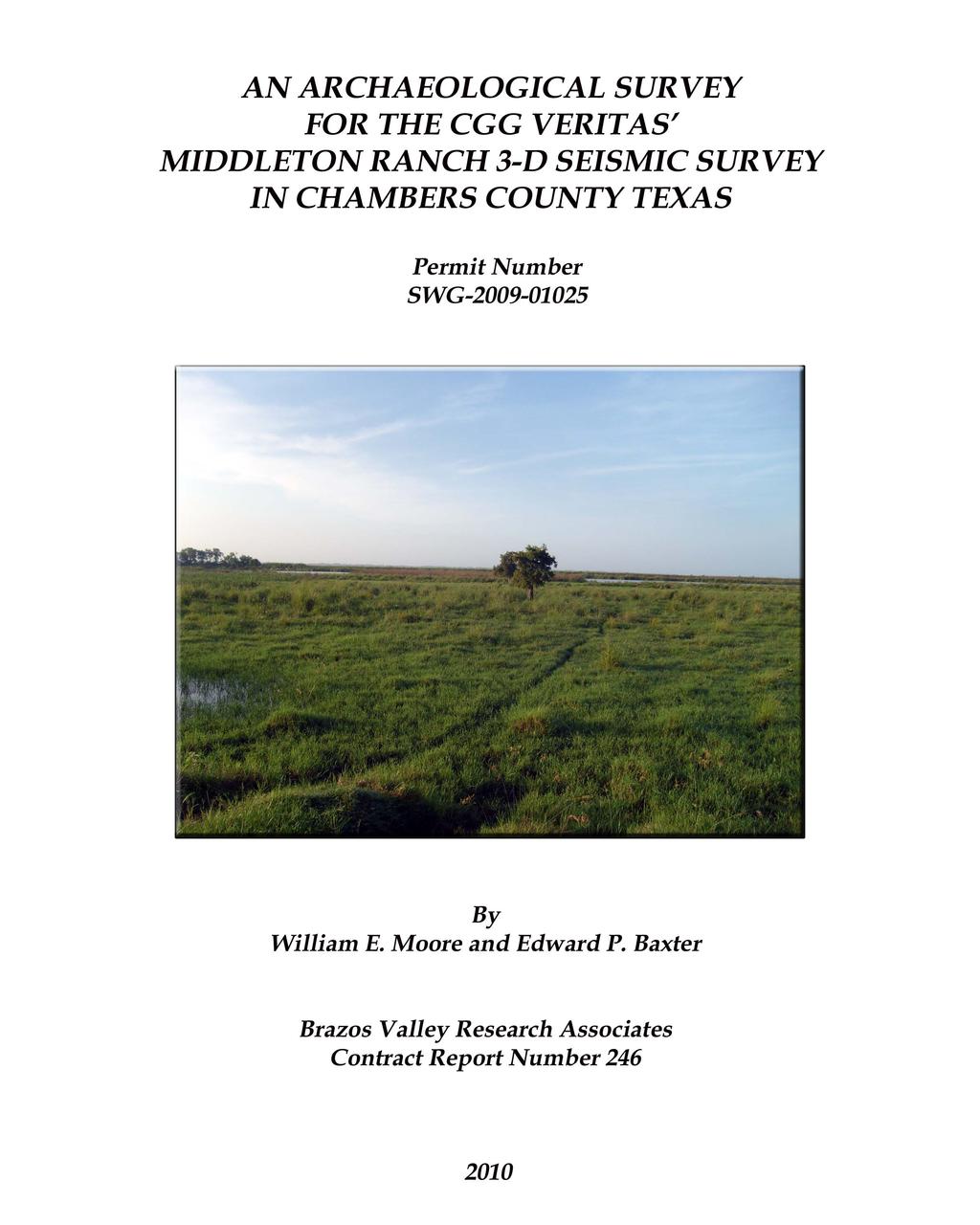
15 RESULTS During the process of preparing the avoidance plan, the site records at the Texas Archeological Research Laboratory were checked for the presence of known sites in the project area. The Texas Archaeological Sites Atlas (hereafter referred to as the Atlas) was checked for known sites and previous archaeological projects and sites in the project area and vicinity. Soils in the project area consist mainly of fine Spurger fine sandy loam (McB), Acadia silt loam (Ac), Harris clay (Ha), Kaman clay, frequently flooded (Ka), and two types of Vamont clay (VaA and VaB). Portions of the project area were in low-lying marshy areas, and this is illustrated in Figure 6. There are fifteen prehistoric sites in the vicinity of the current project area (Figure 2), and ten of these are located in close proximity to the source points investigated. Most of these sites are described by the recorders as shell middens. Not one of these will be affected by the seismic project as it is currently proposed. It is our opinion that the area investigated was probably not selected for habitation or other use by prehistoric groups because of better locations nearby and poor surface conditions. 11

16 Figure 5. View of Marsh in the Project Area 12
17 RECOMMENDATIONS No evidence of a prehistoric or historic site was found as a result of this survey. It is, therefore, recommended that the client be allowed to proceed with seismic operations as planned. Should evidence of an archaeological site be encountered during drilling, all work must stop until the THC can evaluate the situation. This survey was conducted in accordance with the Minimum Survey Standards as outlined by the THC. 13
18 REFERENCES CITED Ambler, J. R Additional Archeological Survey of the Wallisville Area, Southeast Texas. Texas Archeological Survey Report 6. The University of Texas at Austin. Aten, Lawrence E. 1983a Analysis of Discrete Habitation Units in the Trinity River Delta, Upper Texas Coast. Texas Archeological Research Laboratory, Occasional Papers Number 2, Austin. 1983b Indians of the Upper Texas Coast. Academic Press. Ensor, H. Blaine 1991 Archeological Survey of Cypress Creek from Spring Branch to Kuykendahl Road, Harris County, Texas. Archeological Surveys Number 8, Archeological Research Laboratory, Texas A&M University, College Station. Ensor, H. Blaine, and David L. Carlson 1988 The Crawford Site, 41PK69, Central Trinity River Uplands, Polk County, Texas. Contract Reports in Archaeology Number 4, Highway Design Division, Texas State Department of Highways and Public Transportation, Austin Alabonson Road: Early Ceramic Period Adaptation to Inland Coastal Prairie Zone, Southeast Texas. Reports of Investigations Number 8, Archeological Research Laboratory, Texas A&M University, College Station. Hall, Grant D Allens Creek: A Study in the Cultural Prehistory of the Lower Brazos River Valley, Texas. Texas Archeological Survey, Research Report 61, The University of Texas at Austin. Kotter, Steven M A Preliminary Assessment of the Cultural Resources within the Millican Project, Navasota River Basin, Brazos, Grimes, Leon, Madison, and Robertson Counties, Texas. Prewitt & Associates, Inc., Reports of Investigations Number 19. [According to the spine the date for this report is 1981, but on the title page the date is 1982] 14
19 Moore, William E., and Edward P. Baxter 2009 Low Impact Methodology and Cultural Resources Avoidance Plan for CGG Veritas Middleton Ranch 3-D Seismic Project in Chambers County, Texas. Brazos Valley Research Associates, Avoidance Plan Number 18. Patterson, Leland W A Review of the Prehistory of the Upper Texas Coast. Houston Archeological Society, Special Publication Prehistoric Settlement and Technological Patterns in Southeast Texas. Bulletin of the Texas Archeological Society 54: Shafer, Harry J An Archeological Survey of Wallisville Reservoir, Chambers County, Texas. Texas Archeological Salvage Project, Survey Report 12. The University of Texas at Austin Comments on Woodland Cultures of East Texas. Bulletin of the Texas Archeological Society 46: Archaeology in the San Jacinto River Basin: A Look Back After 20 Years. In A Collection of Papers Reviewing the Archeology of Southeast Texas, edited by Patricia Wheat and Richard L. Gregg, pp Houston Archeological Society, Report Number 5. Sorrow, William M., and Wayne N. Cox 1973 A Reconnaissance of the Archeological and Historical Resources of the Navasota River Basin, Texas. Texas Archeological Survey, Research Report 26, The University of Texas at Austin. Story, Dee Ann, Janice A. Guy, Barbara A. Burnett, Martha Doty Freeman, Jerome C. Rose, D. Gentry Steele, Ben W. Olive, and Karl G. Reinhard 1990 The Archeology and Bioarcheology of the Gulf Coastal Plain. Arkansas Archeological Survey, Research Series Number 38, Fayetteville. Suhm, Dee Ann, and Edward B. Jelks 1962 Handbook of Texas Archeology: Type Descriptions. Texas Archeological Society Special Publication Number 1, and Texas Memorial Museum Bulletin Number 4. Turner, Ellen Sue, and Thomas R. Hester 1985 A Field Guide to Stone Artifacts of Texas Indians. Texas Monthly Press, Austin. 15
20 Wheat, Joe Ben 1953 An Archeological Survey of the Addicks Dam Basin. Bureau of American Ethnology Bulletin 154:
21 Appendix I - Log of Points Investigated Investigation Number Source Point Number Shovel Test Depth Comments Date / cm edge of road (wet clay) 07/20/ /1509 no test marsh (mud and water) 07/20/ /1510 no test marsh (mud and water) 07/20/ /1511 no test marsh (mud and water) 07/20/ /1512 no test marsh (mud and water) 07/20/ /1513 no test marsh (mud and water) 07/20/ /1514 no test road bed (dredge spoil) 07/20/ / cm mixed marsh (water at 10 cm) 07/20/ /1511 no test water (yupon and cypress) 07/20/ / cm mud thicket (water at 5 cm) 07/20/ /1513 no test standing water 07/20/ / cm marsh and marsh grass (clay at surface) 07/20/ / cm silty clay (0-32 cm) 07/20/ / cm edge of road in pasture (clay at 20 cm) 07/20/ /1528 no test marsh (mud and water) 07/20/ / cm edge of canal (levee spoil) 07/20/ / cm marsh (mud present) 07/20/ / cm silt loam (wet clay at 20 cm) 07/22/ / cm wet clay at surface 07/22/ / cm silt loam (wet clay at 15 cm) 07/22/ /1518 no test marsh (wet clay at surface) 07/22/ /1525 no test marsh (wet clay at surface) 07/22/ / cm marsh (wet clay at surface) 07/22/ / cm marsh (wet clay at surface) 07/22/ / cm marsh (wet clay at surface) 07/22/ /1526 no test marsh and cypress (wet clay at surface) 07/22/ /1538 no test marsh (standing water) 07/22/ / cm sandy loam (clay at 10 cm) 07/22/ / cm wet clay at surface 07/22/ /1545 no test mud flat (silty soil and no vegetation) 07/22/ /1552 no test mud flat (silty soil and no vegetation) 07/22/ / cm marsh (sandy clay) 07/22/ /1548 no test marsh (standing water) 07/22/ /1549 no test marsh (standing water) 07/22/ /1540 no test road bed (shell and rock dredge) 07/22/ /1541 no test road bed (shell and rock dredge) 07/23/ /1542 no test road bed (shell and rock dredge) 07/23/ / cm base of slope (clay at 10 cm) 07/23/ /1557 no test pasture (wet clay at surface) 07/23/ /1556 no test marsh (standing water) 07/23/ /1550 no test marsh (standing water) 07/23/ /1559 no test marsh (standing water) 07/23/ / cm mowed pasture (hydric (fe) clay loam) 07/23/ /1518 no test marsh (standing water) 07/22/ /1519 no test marsh (standing water) 07/22/10
22 Investigation Number Source Point Number Shovel Test Depth Comments Date /1520 no test marsh (standing water) 07/22/ /1521 no test marsh (standing water) 07/22/ /1519 no test marsh (standing water) 07/22/ /1524 no test marsh (standing water) 07/22/ /1523 no test marsh (standing water) 07/22/ /1522 no test marsh (standing water) 07/22/ /1534 no test marsh (standing water) 07/22/ /1533 no test marsh (standing water) 07/22/ /1535 no test marsh (standing water) 07/22/ /1565 no test road bed (shell and rock dredge) 07/22/ /1564 no test marsh (standing water) 07/22/ /1563 no test marsh (standing water) 07/22/ /1560 no test marsh (standing water) 07/22/ /1536 no test marsh (standing water) 07/23/ /1537 no test marsh (standing water) 07/23/ /1546 no test marsh (standing water) 07/23/ / cm silt loam and sandy clay loam (clay at 25 cm) 07/23/ / cm silt loam and sandy clay loam (clay at 32 cm) 07/23/ / cm sandy loam (0-15 cm); clay at 20 cm 07/23/ / cm sandy loam (0-10 cm); clay at 12 cm 07/23/ /1561 no test marsh (standing water) 07/23/ /1553 no test marsh (standing water) 07/23/ /1547 no test marsh (standing water) 07/23/ / cm mottled hydric clay loam 07/23/ /1509 no test clay at surface 07/23/ /1510 no test clay at surface 07/23/10
AN ARCHAEOLOGICAL SURVEY FOR THE DCP MIDSTREAM THREE RIVERS PLANT TO CGP 51 PROJECT IN LIVE OAK COUNTY, TEXAS
 AN ARCHAEOLOGICAL SURVEY FOR THE DCP MIDSTREAM THREE RIVERS PLANT TO CGP 51 PROJECT IN LIVE OAK COUNTY, TEXAS By William E. Moore Brazos Valley Research Associates Contract Report Number 251 2011 AN ARCHAEOLOGICAL
AN ARCHAEOLOGICAL SURVEY FOR THE EASTHAM STATE PRISON FARM UNIT PROJECT IN HOUSTON COUNTY TEXAS
 AN ARCHAEOLOGICAL SURVEY FOR THE EASTHAM STATE PRISON FARM UNIT PROJECT IN HOUSTON COUNTY TEXAS Antiquities Permit 5693 By William E. Moore and Edward P. Baxter Brazos Valley Research Associates Contract
AN ARCHAEOLOGICAL SURVEY FOR THE GREENHOUSE ROAD PROJECT IN WESTERN HARRIS COUNTY, TEXAS. Brazos Valley Research Associates. Project Number 07-16
 AN ARCHAEOLOGICAL SURVEY FOR THE GREENHOUSE ROAD PROJECT IN WESTERN HARRIS COUNTY, TEXAS Brazos Valley Research Associates Project Number 07-16 Principal Investigator: William E. Moore Prepared for Bureau
AN ARCHAEOLOGICAL SURVEY OF SUEMAUR EXPLORATION & PRODUCTION LLC s PRIDE PROSPECT IN GALVESTON COUNY TEXAS
 AN ARCHAEOLOGICAL SURVEY OF SUEMAUR EXPLORATION & PRODUCTION LLC s PRIDE PROSPECT IN GALVESTON COUNY TEXAS By William E. Moore Brazos Valley Research Associates Contract Report Number 195 2008 AN ARCHAEOLOGICAL
AN ARCHAEOLOGICAL SURVEY FOR THE EASTHAM STATE PRISON FARM A-1 and 7-1 WELL LOCATIONS IN HOUSTON COUNTY TEXAS
 AN ARCHAEOLOGICAL SURVEY FOR THE EASTHAM STATE PRISON FARM A-1 and 7-1 WELL LOCATIONS IN HOUSTON COUNTY TEXAS Antiquities Permit 4813 By William E. Moore Brazos Valley Research Associates Contract Report
Starting at Rock Bottom: A Peculiar Central Texas PreClovis Culture
 Starting at Rock Bottom: A Peculiar Central Texas PreClovis Culture Background Brushy Creek grades, overall, west-northwest (WNW) to east-southeast (ESE) through the easternmost portions of the central
AN ARCHAEOLOGICAL SURVEY OF THE PROPOSED VETERANS RETIREMENT HOME PROJECT IN CENTRAL SOMERVELL COUNTY, TEXAS. Texas Antiquities Permit Number 2950
 AN ARCHAEOLOGICAL SURVEY OF THE PROPOSED VETERANS RETIREMENT HOME PROJECT IN CENTRAL SOMERVELL COUNTY, TEXAS Texas Antiquities Permit Number 2950 by William E. Moore Brazos Valley Research Associates Contract
THE TWO MOST SIGNIFICANT ARCHEOLOGICAL SITES IN KERR COUNTY, TEXAS ARE THE GATLIN SITE AND THE BEARING SINK HOLE SITE.
 WHAT ARE THE MOST IMPORTANT ARCHEOLOGY SITES IN KERR COUNTY? By Steve Stoutamire THE TWO MOST SIGNIFICANT ARCHEOLOGICAL SITES IN KERR COUNTY, TEXAS ARE THE GATLIN SITE AND THE BEARING SINK HOLE SITE. Map
JOURNAL HOUSTON ARCHEOLOGICAL SOCIETY
 r I 1...1 1 MIMMI. I JOURNAL HOUSTON ARCHEOLOGICAL SOCIETY April 1990 r t Punctated/Incised Pottery from Walker County, Texas Contents Relationships of Certain Dart Point Types in Southeast Texas Leland
AN ARCHAEOLOGICAL SURVEY FOR THE FORT GRIFFIN SPECIAL UTILITY DISTRICT WATER IMPROVEMENT PROJECT IN CALLAHAN AND EASTLAND COUNTIES, TEXAS
 AN ARCHAEOLOGICAL SURVEY FOR THE FORT GRIFFIN SPECIAL UTILITY DISTRICT WATER IMPROVEMENT PROJECT IN CALLAHAN AND EASTLAND COUNTIES, TEXAS Antiquities Permit 6236 By William E. Moore Brazos Valley Research
David Moore, PacifiCorp Cultural Resources Coordinator Denise DeJoseph, Project Archaeologist
 References DeJoseph, Denise 2011 Lewis River HPMP: Swift Camp FSC Survey Negative Results. Memo report submitted by Historical Research Associates to PacifiCorp, Portland, Oregon. Copies available at PacifiCorp,
A CULTURAL RESOURCES SURVEY FOR CITY OF NATALIA WASTEWATER IMPROVEMENT PROJECT IN MEDINA COUNTY, TEXAS
 A CULTURAL RESOURCES SURVEY FOR CITY OF NATALIA WASTEWATER IMPROVEMENT PROJECT IN MEDINA COUNTY, TEXAS Antiquities Permit 7473 By William E. Moore (Principal Investigator) Brazos Valley Research Associates
4.11 CULTURAL RESOURCES
 4.11 CULTURAL RESOURCES 4.11 CULTURAL RESOURCES This section summarizes the cultural resources of. Information reviewed for the summary includes the General Plan, published reports on archaeological research
MINNESOTA DEEP TEST PROTOCOL PROJECT
 MINNESOTA DEEP TEST PROTOCOL PROJECT Mn/DOT Agreement No. 85878 OSA License No. 04-030 Authorized and Sponsored by: MINNESOTA DEPARTMENT OF TRANSPORTATION FEDERAL HIGHWAY ADMINISTRATION Prepared by COMMONWEALTH
City of Lockport Historic Resources Survey - Section METHODOLOGY
 2.0 METHODOLOGY Clinton Brown Company PN 07-008 2-1 April 2011 2.0 METHODOLOGY This methodology statement is prepared as part of the project tasks. It outlines the research sources identified, field strategies,
Archaeological Survey and Evaluation at 8954 El Dorado Parkway, El Cajon, San Diego County, California
 April 16, 2013 Ms. Andrea Bitterling Helix Environmental Planning, Inc. 7578 El Cajon Blvd., Suite 200 El Cajon, California 91942 Re: Archaeological Survey and Evaluation at 8954 El Dorado Parkway, El
THE BERRYESSA CREEK SITE CA-SCL-593. Robert Cartier Richard San Filippo Archeological Resource Management 496 North Fifth Street San Jose, CA 95112
 THE BERRYESSA CREEK SITE CA-SCL-593 Robert Cartier Richard San Filippo Archeological Resource Management 496 North Fifth Street San Jose, CA 95112 ABSTRACT This presentation discusses the nature and chronology
JOURNAL HOUSTON AR CHEDLOGICAL SOCIETY
 1=1 1=1 JOURNAL HOUSTON AR CHEDLOGICAL SOCIETY Number 126 January 2000 I Bone Tempered Pottery from Pine Gully Park Houston Archeological Society Journal Number 126, January 2000 Contents Excavations at
Texas Prehistoric Archeology. TPWD Cultural Resources Coordinator (a.k.a. Archeologist)
") Texas Prehistoric Archeology TPWD Cultural Resources Coordinator (a.k.a. Archeologist) Prehistory Definition Prehistory is that time when man first came to North America (~12,000 BP [years before present])
Texas Prehistoric Archeology TPWD Cultural Resources Coordinator (a.k.a. Archeologist) Prehistory Definition Prehistory is that time when man first came to North America (~12,000 BP [years before present])
ACTON COMMUNITY WIDE ARCHAEOLOGICAL RECONNAISSANCE SURVEY. Town of Acton and PAL, Inc.
 ACTON COMMUNITY WIDE ARCHAEOLOGICAL RECONNAISSANCE SURVEY Town of Acton and PAL, Inc. Objectives and Scope of Work Four phase study; (1. research, 2. draft report outline, resource protection bylaw, 3.
PW Parkway ES Prince William County, Virginia WSSI #
 PW Parkway ES Prince William County, Virginia WSSI #15.3 Cultural Resources Site Assessment November 15 Prepared for: Prince William County Public Schools P.O. Box 39 Manassas, Virginia 1 Prepared by:
AN ARCHAEOLOGICAL SURVEY FOR THE COLEMAN COUNTY SPECIAL UTILITY DISTRICT PHASE 7 WATER LINE PROJECT IN COLEMAN COUNTY TEXAS
 AN ARCHAEOLOGICAL SURVEY FOR THE COLEMAN COUNTY SPECIAL UTILITY DISTRICT PHASE 7 WATER LINE PROJECT IN COLEMAN COUNTY TEXAS Antiquities Permit 5057 By William E. Moore Brazos Valley Research Associates
Archaeological Test Excavations at 41KF118 Kaufman County, Texas
 Index of Texas Archaeology: Open Access Gray Literature from the Lone Star State Volume 1990 Article 14 1990 Archaeological Test Excavations at 41KF118 Kaufman County, Texas John W. Clark, Jr. Follow this
JOURNAL HOUSTON ARCHEOLOGICAL SOCIETY
 I=1 I=1 I=1 I=1 I=1 =11 JOURNAL HOUSTON ARCHEOLOGICAL SOCIETY Number 110 December 1994 I=1 I=1 I= I=1 Prismatic Blades and Blade Core from 41HR184 Houston Archeological Society Journal Number 110, December
Archaeological Monitoring of Construction of a Six-Inch Force Main Sewer over Lookout Creek, Chattanooga, Hamilton County, Tennessee
 A Report Prepared for Hamilton County Engineering Department 300 Newell Tower 117 East Seventh Street Chattanooga, Tennessee 37402 Archaeological Monitoring of Construction of a Six-Inch Force Main Sewer
December 13, Kirk Shields Green Mountain Power 163 Acorn Lane Colchester, VT 05446
 December 13, 2017 Kirk Shields Green Mountain Power 163 Acorn Lane Colchester, VT 05446 RE: End of Field Letter for Archaeological Phase II Site Evaluation at Site VT-CH-1218 within the Proposed Milton
Appendix I-1: Archaeological Records Search
 Appendix I-1: Archaeological Records Search South Central Coastal Information Center California State University, Fullerton Department of Anthropology MH-426 800 North State College Boulevard Fullerton,
ARCHAEOLOGICAL SURVEY OF BANDERA CITY PARK, BANDERA COUNTY, TEXAS
 ARCHAEOLOGICAL SURVEY OF BANDERA CITY PARK, BANDERA COUNTY, TEXAS Ronald W. Burkett I / Center for Archaeological Research The University of Texas at San Antonio Archaeological Survey Report, No. 183 1989
AN ARCHAEOLOGICAL SURVEY FOR THE POYNER WATER SUPPLY CORPORATION WATER SYSTEM IMPROVEMENTS PROJECT IN ANDERSON COUNTY, TEXAS. BVRA Project 05-11
 AN ARCHAEOLOGICAL SURVEY FOR THE POYNER WATER SUPPLY CORPORATION WATER SYSTEM IMPROVEMENTS PROJECT IN ANDERSON COUNTY, TEXAS BVRA Project 05-11 Principal Investigator William E. Moore, RPA Prepared for
Additional Testing for Padre Dam Eastern Service Area Secondary Connection- Alternative Site Location, San Diego County, California
 Mark Niemiec Padre Dam Municipal Water District P.O. Box 719003 9300 Fanita Parkway Santee, California 92072 Re: Additional Testing for Padre Dam Eastern Service Area Secondary Connection- Alternative
4.3 CULTURAL RESOURCES
 4.3 CULTURAL RESOURCES This section of the EIR analyzes the proposed project s potential impacts on archaeological and paleontological resources. This analysis summarizes the findings of the Archaeological
AN HISTORICAL AND ARCHAEOLOGICAL ASSESSMENT OF THE PROPOSED SAN ANTONIO BOTANICAL CENTER. Stephen L. Black
 AN HISTORICAL AND ARCHAEOLOGICAL ASSESSMENT OF THE PROPOSED SAN ANTONIO BOTANICAL CENTER Stephen L. Black Center for Archaeological Research The University of Texas at San Antonio Archaeological Survey
Prehistoric Clay Sources: A Forensic Exercise in Geoarchaeology
 Prehistoric Clay Sources: A Forensic Exercise in Geoarchaeology Lynn Ketterhagen Faculty Sponsor: Dean Wilder, Department of Geography and Earth Science ABSTRACT The prehistoric Oneota culture of the Upper
ENGINEER S CERTIFICATION OF FAULT AREA DEMONSTRATION (40 CFR )
") PLATTE RIVER POWER AUTHORITY RAWHIDE ENERGY STATION BOTTOM ASH TRANSFER (BAT) IMPOUNDMENTS LARIMER COUNTY, CO ENGINEER S CERTIFICATION OF FAULT AREA DEMONSTRATION (40 CFR 257.62) FOR COAL COMBUSTION RESIDUALS
PLATTE RIVER POWER AUTHORITY RAWHIDE ENERGY STATION BOTTOM ASH TRANSFER (BAT) IMPOUNDMENTS LARIMER COUNTY, CO ENGINEER S CERTIFICATION OF FAULT AREA DEMONSTRATION (40 CFR 257.62) FOR COAL COMBUSTION RESIDUALS
CALIFORNIA AGRICULTURAL PR OPERTIES, IN C. GALE RANCH
 CALIFORNIA AGRICULTURAL PR OPERTIES, IN C. GALE RANCH LOCATION: The Ranch is located 6 Yi miles west of the City of Davis on the northwest corner of County Roads 29A and 92E in Yolo County. SIZE: 368.64
The Geology of Sebago Lake State Park
 Maine Geologic Facts and Localities September, 2002 43 55 17.46 N, 70 34 13.07 W Text by Robert Johnston, Department of Agriculture, Conservation & Forestry 1 Map by Robert Johnston Introduction Sebago
THE PROBABLE FUNCTION OF CERTAIN PERFORATED SHELLS FROM THE GALVESTON BAY AREA OF TEXAS Sayne B. Neyland and R.B. Worthington
 THE NEWSLETTER Of the Houston Archeological Society Number 8 April, 1962 (Published from time to time. Chairman of the Society, Alan R. Duke. Editorial committee, H. Mewhinney, L. E. Aten, Ivan Newlin.)
Work Conducted in August 2018
 Kelly Nieforth Economic Development Manager City of Oshkosh 215 Church Avenue Oshkosh, W 54903 August 31, 2018 RE: Update #9: August 1 to 31, 2018 Archaeological Data Recovery at the Golf Course Site (47WN0049)
Archaeological Survey and Assessment of Four Wastewater Interceptor Routes in Garner, Wake Co., N.C. (EPA C )
") Archaeological Survey and Assessment of Four Wastewater Interceptor Routes in Garner, Wake Co., N.C. (EPA C370623-02) By H. Trawick \vard R. P. Stephen Davis Prepared by the Research Laboratories of Anthropology
Archaeological Survey and Assessment of Four Wastewater Interceptor Routes in Garner, Wake Co., N.C. (EPA C370623-02) By H. Trawick \vard R. P. Stephen Davis Prepared by the Research Laboratories of Anthropology
Name: Date: Class: Louisiana: Our History, Our Home Chapter 1: Louisiana s Geography - Section 2: Natural Regions Guided Reading
 Instructions: Read the section and complete each item with words from the passages in this section. 1. The diversity of Louisiana s can surprise residents and visitors alike. 2. Physical geography is concerned
THE CROOKS GAP HOUSEPIT SITE AND OTHER NEARBY MID-HOLOCENE HOUSEPITS
 Volume 56(1 ), Spring 2012 The Wyoming Archaeologist THE CROOKS GAP HOUSEPIT SITE AND OTHER NEARBY MID-HOLOCENE HOUSEPITS by Craig S. Smith Marcia Peterson INTRODUCTION This article summarizes excavation
QUANTITY, MARCH 1962
 BASE-FLOW STUDIES, GUADALUPE RIVER COMAL COUNTY, TEXAS QUANTITY, MARCH 1962 TEXAS WATER COMMISSION BULLETIN 6503 MARCH 1965 TEXAS WATER COMMISSION Joe William D E 0. F. Dent Carter, Chairman Berger, Commissioner
AN ARCHAEOLOGICAL SURVEY FOR THE PROPOSED CITY OF GRANBURY WATER TREATMENT PLANT (HOOD COUNTY, TEXAS)
") AN ARCHAEOLOGICAL SURVEY FOR THE PROPOSED CITY OF GRANBURY WATER TREATMENT PLANT (HOOD COUNTY, TEXAS) Antiquities Permit 7273 By William E. Moore Principal Investigator Brazos Valley Research Associates
AN ARCHAEOLOGICAL SURVEY FOR THE PROPOSED CITY OF GRANBURY WATER TREATMENT PLANT (HOOD COUNTY, TEXAS) Antiquities Permit 7273 By William E. Moore Principal Investigator Brazos Valley Research Associates
ADDITIONAL PALEO-INDIAN BIFACE VARIABILITY IN NORTHWESTERN ONTARIO. William A. Ross ABSTRACT INTRODUCTION
 ROSS: NORTHWESTERN PALEO-INDIAN BIFACES 21 ADDITIONAL PALEO-INDIAN BIFACE VARIABILITY IN NORTHWESTERN ONTARIO William A. Ross ABSTRACT Two recently recovered bifaces, which can be assigned to the Paleo-Indian
Sediment Basin Project, Savannah Harbor, Georgia
 University of South Carolina Scholar Commons Research Manuscript Series Archaeology and Anthropology, South Carolina Institute of 11-1973 Sediment Basin Project, Savannah Harbor, Georgia Leland G. Ferguson
1.1 What is Site Fingerprinting?
 Site Fingerprinting Utilizing GIS/GPS Technology 1.1 What is Site Fingerprinting? Site fingerprinting is a planning tool used to design communities where protection of natural resources is the primary
West Galveston Bay Regional Sediment Management Plan (An Eco-geomorphologic Approach)
") West Galveston Bay Regional Sediment Management Plan (An Eco-geomorphologic Approach) Juan Moya, Matthew Mahoney and Mike Smith Restore America s Estuaries Conference Tampa, FL, October 23, 2012 Atkins
West Galveston Bay Regional Sediment Management Plan (An Eco-geomorphologic Approach) Juan Moya, Matthew Mahoney and Mike Smith Restore America s Estuaries Conference Tampa, FL, October 23, 2012 Atkins
Archaeological Predictive Modeling within the context of Paleo-river Terraces in the City of Prince George
 Archaeological Predictive Modeling within the context of Paleo-river Terraces in the City of Prince George Background The documented pre-contact archaeological record of the Interior Plateau of B.C. is
Early Archaic (8000 to 6000 years ago or 6000 to 4000 BC) Middle Archaic (6000 to 1800 years ago or 4000 BC to AD 200)
 Middle Archaic (6000 to 1800 years ago or 4000 BC to AD 200)") 1 Willamette Valley Archaeology 2 Excavated Sites in the Willamette Valley 3 4 Three Stage Chronology Early Archaic (8000 to 6000 years ago or 6000 to 4000 BC) Middle Archaic (6000 to 1800 years ago or
1 Willamette Valley Archaeology 2 Excavated Sites in the Willamette Valley 3 4 Three Stage Chronology Early Archaic (8000 to 6000 years ago or 6000 to 4000 BC) Middle Archaic (6000 to 1800 years ago or
An Intensive Archaeological Investigation of the Dunn-Meaney Property in Corpus Christi, Nueces County, Texas
 An Intensive Archaeological Investigation of the Dunn-Meaney Property in Corpus Christi, Nueces County, Texas by Sarah Wigley and Jason Perez REDACTED Principal Investigator Paul Shawn Marceaux Cen t er
Red River Levee Panel
 Red River Levee Panel Mississippi River Commission Monday, August 9, 2017 Red River Levees in LA & AR NONE along TX & OK Boarder Red River Levee Issues Caddo Levee Cherokee Park Authorization Bossier Levee
Objectives. Understand the different physical & human characteristics of each region
 TEXAS REGIONS Objectives Know the 4 regions of Texas Understand the different physical & human characteristics of each region Understand how physical differences affect human characteristics (way of life)
Project Background. March 9, Commissioners of Public Works 103 Saint Phillip Street Charleston, South Carolina 29203
 March 9, 2016 Commissioners of Public Works 103 Saint Phillip Street Charleston, South Carolina 29203 Attention: Reference: Mr. Frank Crawford Historic and Archaeological Properties Survey Dear Mr. Crawford:
AdditionalArch~eojogicaISiur\T~f
 AdditionalArch~eojogicaISiur\T~f /' In Th~eDrfComalW8tershed,ComalCoIlntf, Sufith.Central Texas of'!....",i" THOMAS C. KELLY and THOMAS R. HESTER Center for Archaeological Research TheUni\Tersity of Texas
NORTHWEST MENARD COUNTY, TEXAS Prepared for the City of Menard
 ... NATU AAtGAS PIPELINE SURVEY NORTHWEST MENARD COUNTY, TEXAS Prepared for the City of Menard Thomas C. Kelly and Fred Valdez, Jr. Center for Archaeological Research The University of Texas at San Antonio
Stabilization Study. Prepared For: The Town of Bethlehem. Henry Hudson Park Shoreline Stabilization Study. June 2011
 Henry Hudson Park Shoreline Stabilization Study Prepared For: The Town of Bethlehem 1 Company Introduction - OCC Ocean and Coastal Consultants (OCC) is a 50 person engineering consulting firm that specializes
ΛTKINS. Applications of Regional Sediment Management Concepts in Texas Estuarine Restoration Projects. Riparian Workshop Fort Worth, October 17, 2012
 Juan C Moya, PhD., PG Coastal Planning and Restoration Applications of Regional Sediment Management Concepts in Texas Estuarine Restoration Projects Riparian Workshop Fort Worth, October 17, 2012 West
RESULTS FROM THE TEXAS COASTAL SEDIMENT SOURCES: A GENERAL EVALUATION STUDY
 RESULTS FROM THE TEXAS COASTAL SEDIMENT SOURCES: A GENERAL EVALUATION STUDY JUAN MOYA KELSEY CALVEZ CRIS WEBER ANTHONY RISKO *KEVIN FRENZEL FREESE AND NICHOLS, INC. COASTAL AND WATERWAYS GROUP OBJECTIVES
ARCHAEOLOGICAL SURVEY FOR PROPOSED LANDFILL EXPANSION (PHASE I), CITY OF DEL RIO, VAL VERDE COUNTY, TEXAS
, CITY OF DEL RIO, VAL VERDE COUNTY, TEXAS") ARCHAEOLOGICAL SURVEY FOR PROPOSED LANDFILL EXPANSION (PHASE I), CITY OF DEL RIO, VAL VERDE COUNTY, TEXAS Ronald W. Burkett Center for Archaeological Research The University of Texas at San Antonio Archaeological
ARCHAEOLOGICAL SURVEY FOR PROPOSED LANDFILL EXPANSION (PHASE I), CITY OF DEL RIO, VAL VERDE COUNTY, TEXAS Ronald W. Burkett Center for Archaeological Research The University of Texas at San Antonio Archaeological
An Introduction to Field Explorations for Foundations
 An Introduction to Field Explorations for Foundations J. Paul Guyer, P.E., R.A. Paul Guyer is a registered mechanical engineer, civil engineer, fire protection engineer and architect with over 35 years
Inferring Geological Environments from Cultural Artifacts Part 1: Cultural Halls at the American Museum of Natural History
 GEOL 640: Geology through Global Arts and Artifacts Inferring Geological Environments from Cultural Artifacts Part 1: Cultural Halls at the American Museum of Natural History People are reliant on their
Sacred Lands File & Native American Contacts List Request
 Sacred Lands File & Native American Contacts List Request NATIVE AMERICAN HERITAGE COMMISSION 915 Capitol Mall, RM 364 Sacramento, CA 95814 (916) 653-4082 (916) 657-5390 Fax nahc@pacbell.net Information
A New Approach to Estimating Population Growth Along a Major Arterial Highway.
 . ABSTRACT In the last twenty years Texas has undergone extensive growth as people move across the country and relocate in the Lone Star State. Many of these new Texans choose suburbs outside major cities
Selected Archeological Terms
 Page 1 of 6 Selected Archeological Terms Links General Reference Bibliographies Glossaries Terms A b C D E F G H i j k l M N O P q R S T U V w x y z ADAPTATION: The process of change to better conform
8 th 12 th Designing a Monitoring Plan Mapping & Analysis (Activities 1 2)
") 8 th 12 th Designing a Monitoring Plan Mapping & Analysis (Activities 1 2) Objectives for All Activities - To be able to define and describe the purpose and uses of topographic maps. - To define rules
8 th 12 th Designing a Monitoring Plan Mapping & Analysis (Activities 1 2) Objectives for All Activities - To be able to define and describe the purpose and uses of topographic maps. - To define rules
April 9, Phosphate Mining and Reclamation Overview
 April 9, 2012 Phosphate Mining and Reclamation Overview Business & Mission Mosaic produces the majority of the phosphate used by American farmers Employs approximately 7,000 people worldwide, 3,000 in
A Phase I Archaeological Survey of Muir Knoll, University of Wisconsin-Madison, Dane County, Wisconsin
 A Phase I Archaeological Survey of Muir Knoll, University of Wisconsin-Madison, Dane County, Wisconsin Prepared For: The University of Wisconsin-Madison Prepared By: Amy L. Rosebrough Office of the State
Valley-Fill Sandstones in the Kootenai Formation on the Crow Indian Reservation, South-Central Montana
 DE-FG22-96BC14996--08 Valley-Fill Sandstones in the Kootenai Formation on the Crow Indian Reservation, South-Central Montana Quarterly Report April 1 - June 30, 1998 By David A. Lopez Work Performed Under
Part 1: Buildings to be Demolished. Submitted to
 Stage 1 & 2 Archaeological Assessment London Psychiatric Hospital 850 Highbury Avenue North City of London (Former London Township) Middlesex County, Ontario Part 1: Buildings to be Demolished Submitted
Grade 4-Social Studies Sparta Area School District
 1 Grade 4-Social Studies Sparta Area School District A.4.1 Use reference points, latitude and longitude, direction, size, shape, and scale to locate positions on various representations of the Earth s
Hydrogeological Assessment for Part of Lots 2 and 3, Concession 5, Township of Thurlow, County of Hastings 1.0 INTRODUCTION. 1.
 February 10,2017 25506400 Ontario Ltd. Foxboro, ON Attention: Brad Newbatt Re: Hydrogeological Assessment for Part of Lots 2 and 3, Concession 5, Township of Thurlow, County of Hastings 1.0 INTRODUCTION
Prehistory and History of Squaw Creek, Powder River Basin, Wyoming
 Prehistory and History of Squaw Creek, Powder River Basin, Wyoming Mavis Greer, Ph.D. and John Greer, Ph.D. Paper Presented at the 53 rd Annual Meeting of the Wyoming Archaeological Society Cheyenne, Wyoming
Quarterly Report April 1 - June 30, By: Shirley P. Dutton. Work Performed Under Contract No.: DE-FC22-95BC14936
 DE-FC22-95BC14936--18 Application of Advanced Reservoir Characterization, Simulation, and Production Optimization Strategies to Maximize Recovery in Slope, and Basin Clastic Reservoirs, West Texas (Delaware
KANSAS GEOLOGICAL SURVEY Open File Report LAND SUBSIDENCE KIOWA COUNTY, KANSAS. May 2, 2007
 KANSAS GEOLOGICAL SURVEY Open File Report 2007-22 LAND SUBSIDENCE KIOWA COUNTY, KANSAS Prepared by Michael T. Dealy L.G., Manager, Wichita Operations SITE LOCATION The site was approximately four miles
HISTORY OF CONSTRUCTION FOR EXISTING CCR SURFACE IMPOUNDMENT PLANT GASTON ASH POND 40 CFR (c)(1)(i) (xii)
(1)(i) (xii)") HISTORY OF CONSTRUCTION FOR EXISTING CCR SURFACE IMPOUNDMENT PLANT GASTON ASH POND 40 CFR 257.73(c)(1)(i) (xii) (i) Site Name and Ownership Information: Site Name: E.C. Gaston Steam Plant Site Location:
HISTORY OF CONSTRUCTION FOR EXISTING CCR SURFACE IMPOUNDMENT PLANT GASTON ASH POND 40 CFR 257.73(c)(1)(i) (xii) (i) Site Name and Ownership Information: Site Name: E.C. Gaston Steam Plant Site Location:
Evaluation/Monitoring Report No. 152
 Evaluation/Monitoring Report No. 152 150m west of 7 Portmore Rd. Portmore Lower Ballinderry County Antrim LICENCE NO.: AE/07/241 David McIlreavy 1 Site Specific Information Site Name Townland County :
Predictive Model for Archaeological Resources. Marine Corps Base Quantico, Virginia John Haynes Jesse Bellavance
 Predictive Model for Archaeological Resources Marine Corps Base Quantico, Virginia John Haynes Jesse Bellavance Report Documentation Page Form Approved OMB No. 0704-0188 Public reporting burden for the
Archaeological Survey of the Crystal City Municipal Landfill Extension, Zavala County, Texas
 Index of Texas Archaeology: Open Access Gray Literature from the Lone Star State Volume 2000 Article 2 2000 Archaeological Survey of the Crystal City Municipal Landfill Extension, Zavala County, Texas
Teacher s Guide for Dig
 Teacher s Guide for Dig February 2015: Yellow River Teacher's Guide prepared by E. Renee Heiss, writer and educator. A Downstream Journey Page 2 Chart The Yellow River is the second-longest river in China
 Red River Flooding June 2015 Caddo and Bossier Parishes Presented by: Flood Technical Committee Where the Rain Falls Matters I-30 versus I-20 I-20 Backwater and Tributary Floods (Localized) 2016 Flood
SURFICIAL LITHIC DEPOSITS AS EVIDENCE OF LAND-USE PATTERNS
 SURFICIAL LITHIC DEPOSITS AS EVIDENCE OF LAND-USE PATTERNS IN THE REGION OF COLONET, BAJA CALIFORNIA, MEXICO CARLOS FIGUEROA AUTONOMOUS UNIVERSITY OF BAJA CALIFORNIA ENSENADA, BAJA CALIFORNIA, MEXICO Land
CHAPTER 4. Blue Heron Site (47Je1001) 2003 Investigations. By Chrisie L. Hunter
 2003 Investigations. By Chrisie L. Hunter") CHAPTER 4 Blue Heron Site (47Je1001) 2003 Investigations By Chrisie L. Hunter Introduction The Blue Heron site (47Je1001) is on the property of the Crescent Bay Hunt Club, which is located in the NE 1/4
CHAPTER 4 Blue Heron Site (47Je1001) 2003 Investigations By Chrisie L. Hunter Introduction The Blue Heron site (47Je1001) is on the property of the Crescent Bay Hunt Club, which is located in the NE 1/4
Smith Collection. Arrow, Dart and Fragmented Projectile Points. Found Within the Lower Rio Grande Valley Region. Report prepared by:
 Smith Collection Arrow, Dart and Fragmented Projectile Points Found Within the Lower Rio Grande Valley Region Report prepared by: Roseann Bacha-Garza Report prepared under the supervision of: Dr. Russell
LABORATORY TECHNIQUES
 LABORATORY TECHNIQUES PURPOSE To acquaint the student with the methods and materials used in the processing, cataloging, preservation, and storage of artifacts and to provide hands-on experience with artifacts
LONG PRESTON DEEPS, RIBBLESDALE, NORTH YORKSHIRE
 LONG PRESTON DEEPS, RIBBLESDALE, NORTH YORKSHIRE Archaeological Watching Brief Oxford Archaeology North October 2011 ENVIRONMENT AGENCY Issue No: 2011 12/1231 OA North Job No: L10410 NGR: SD 8110 6090
McHenry County Property Search Sources of Information
 Disclaimer: The information in this system may contain inaccuracies or typographical errors. The information in this system is a digital representation of information derived from original documents; as
B. T. Brady, M. S. Bedinger, John Mikels, William H. Langer, and Deborah A. Mulvihill
 DEPARTMENT OF THE INTERIOR UNITED STATES GEOLOGICAL SURVEY TO ACCOMPANY WRI REPORT 83-4121-B MAP SHOWING GROUND-WATER LEVELS, SPRINGS. AND DEPTH TO GROUND WATER, BASIN AND RANGE PROVINCE, TEXAS by B. T.
MAPS AND THEIR CLASSIFICATION
 MAPPING MAPS AND THEIR CLASSIFICATION WHAT IS A MAP? A map is representation of the Earth's surface, showing how things are related to each other by distance, direction, and size. Maps are a way of showing
5 Significance of Geomorphology to Cultural Resources
 5 Significance of Geomorphology to Cultural Resources Introduction Objectives The last and most important objective of this study was to determine the archaeological significance of the geomorphic features,
Appendix 7A. Cultural Resources Documentation
 Appendix 7A Cultural Resources Documentation October 5, 2009 Mr. Douglas P. Mackey Historic Preservation Program Analyst, Archaeology New York State Office of Parks, Recreation and Historic Preservation
Flooding in Western North Carolina: Some Spatial, Hydrologic, and Seasonal Characteristics CAUTION!! Outline. Basic Flood Facts.
 Flooding in Western North Carolina: Some Spatial, Hydrologic, and Seasonal Characteristics J. Greg Dobson CAUTION!! National Environmental Modeling and Analysis Center RENCI at UNC-Asheville Engagement
Changes in Texas Ecoregions Copy the questions and answers
 Changes in Texas Ecoregions Copy the questions and answers 1. What are some kinds of damage that hurricanes cause? Roads and bridges might be washed away. Trees and power lines can be knocked down. Area
Changes in Texas Ecoregions
 Comment On Lesson Changes in Texas Ecoregions The state of Texas can be divided into 10 distinct areas based on unique combinations of vegetation, topography, landforms, wildlife, soil, rock, climate,
DATA REPORT GEOTECHNICAL INVESTIGATION GALVESTON CRUISE TERMINAL 2 GALVESTON, TEXAS
 DATA REPORT GEOTECHNICAL INVESTIGATION GALVESTON CRUISE TERMINAL 2 GALVESTON, TEXAS SUBMITTED TO PORT OF GALVESTON 123 ROSENBERG AVENUE, 8TH FLOOR GALVESTON, TEXAS 77553 BY HVJ ASSOCIATES, INC. HOUSTON,
CESPL-RG-A March 12, 2008 REGULATORY DIVISION MEMORANDUM. SUBJECT: Traditional Navigable Waters, Navigable In-Fact Determination for the Gila River
 CESPL-RG-A March 12, 2008 REGULATORY DIVISION MEMORANDUM SUBJECT: Traditional Navigable Waters, Navigable In-Fact Determination for the Gila River 1. To provide documentation to determine the status of
Mississippi Valley Archaeology Center 1725 State Street La Crosse, Wisconsin Phone: Web site:
 Mississippi Valley Archaeology Center 1725 State Street La Crosse, Wisconsin 54601 Phone: 608-785-6473 Web site: http://www.uwlax.edu/mvac/ The following lessons were created by Richard Neves, a teacher
NEWS RELEASE UNDER SECTION 404 OF THE CLEAN WATER ACT (33 USC 1344) ACTION NUMBER SPA ABQ
 ACTION NUMBER SPA ABQ") PUBLIC NOTICE Public Notice Issue Date: //6/07 Albuquerque District Comments due: /6/08 NEWS RELEASE UNDER SECTION 0 OF THE CLEAN WATER ACT ( USC ) ACTION NUMBER SPA-06-00-ABQ BANK STABILIZATION ALONG
PUBLIC NOTICE Public Notice Issue Date: //6/07 Albuquerque District Comments due: /6/08 NEWS RELEASE UNDER SECTION 0 OF THE CLEAN WATER ACT ( USC ) ACTION NUMBER SPA-06-00-ABQ BANK STABILIZATION ALONG
SAN FRANCISCO DISTRICT INFORMATION REQUESTED FOR VERIFICATION OF CORPS JURISDICTION
 DEPARTMENT OF THE ARMY SAN FRANCISCO DISTRICT, U.S. ARMY CORPS OF ENGINEERS 1455 MARKET STREET SAN FRANCISCO, CALIFORNIA 94103-1398 SAN FRANCISCO DISTRICT INFORMATION REQUESTED FOR VERIFICATION OF CORPS
THE QUATERNARY GEOLOGY OF NEWARK BAY AND KILL VAN KULL CHANNEL, NEW YORK AND NEW JERSEY. and
 THE QUATERNARY GEOLOGY OF NEWARK BAY AND KILL VAN KULL CHANNEL, NEW YORK AND NEW JERSEY Stephanie Beda, W. Bruce Ward, William Murphy, Robert Fleming, Gary Fleming, Beckett Boyd Earthworks LLC 27 Glen
3.3 CLIMATE, GEOLOGY, TOPOGRAPHY, AND SOILS CLIMATE GEOLOGY TOPOGRAPHY
 3.3 CLIMATE, GEOLOGY, TOPOGRAPHY, AND SOILS This section describes the climate, geology, topography, and soil resource characteristics of the Yolo Bypass Wildlife Area (Wildlife Area). Agricultural soil