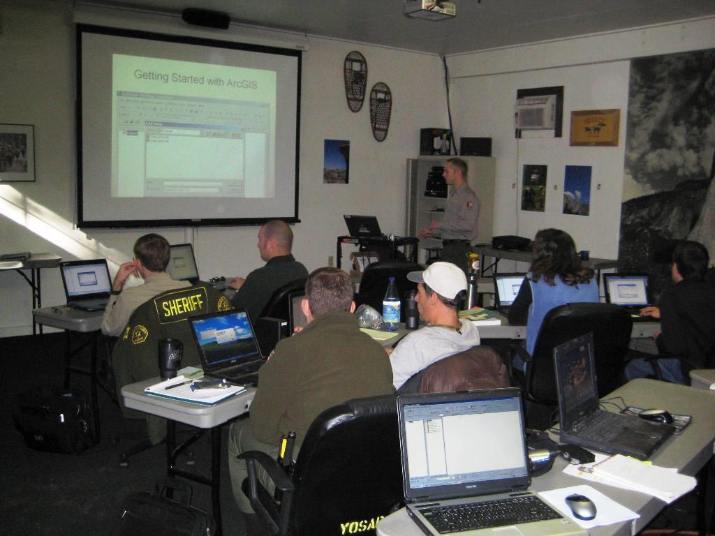
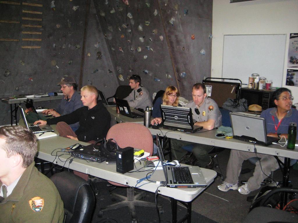
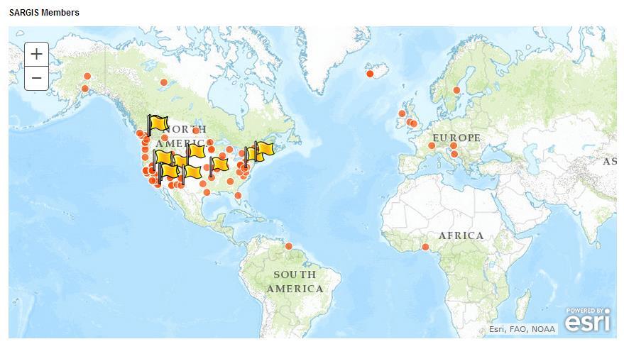
The 7th Annual SARGIS Workshop and Meeting. Welcome to SARGIS7!
|
|
|
- Harvey Barber
- 5 years ago
- Views:
Transcription


1 The 7th Annual SARGIS Workshop and Meeting Welcome to SARGIS7!
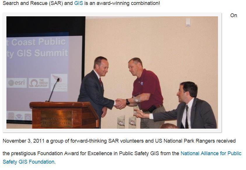
2 The National Alliance for Public Safety GIS Foundation is a 501 (C) (3) not-forprofit organization» OUR VISION A Nation of emergency responders and leaders equipped with the knowledge and skills in applying technology and data to change the outcome for survivors.» OUR MISSION To equip emergency management and public safety with the knowledge, skills, and resources to apply decision-support technology and data in enhancing preparedness and building a more resilient nation.
3
4 » All of our programs are driven and led by local, state, and tribal practitioners. Regional Leadership Teams Working Groups Virtual and In-Person Training +7,000 participants and growing
5 » Create a Fun and Safe Environment for Learning and Discussion» Learn from Other Public Safety and GIS Communities» Foster a Stronger SAR and GIS Community» Action Items!
6 » Map Products» GIS Resource Typing GIS Field Data Entry Technician GIS Technician GIS Analyst GIS Team Leader GIS Supervisor» Standard Operating Guidelines» Training Curriculum» Integrating Technologies: Cell phones, UAS, Social Media

7 Link: Operations Dashboard
8 » Thursday Training GIS Training with IGT4SAR» Friday Training GIS Training with IGT4SAR (Continued) OR Mapping Training with SAR Explorer US National Grid Training SARTopo Overview» Friday Plenary» Saturday Meeting» Sunday Meeting

9 Link: Detailed Agenda
10


11
12
13
14
15
16

17 US National SAR Conference South Lake Tahoe, NV - June 2012
18
19

20

21
22 Link

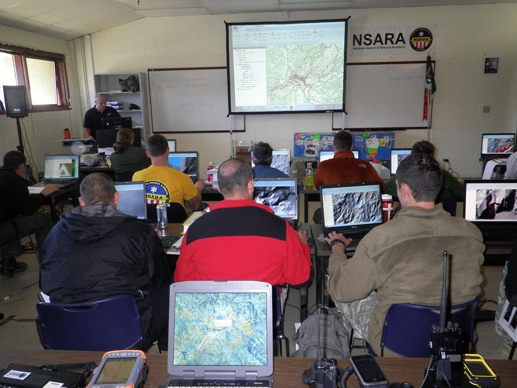
23 Using GIS for Search Ops MapSAR slides courtesy of Jon Pedder
24 Why GIS? Maps are key to SAR missions Limitations of current methods Data management Planning & analysis Situational awareness Field mobility Collaboration Benefits Time Integration with other platforms Resource Management Archival/History MapSAR slides courtesy of Jon Pedder
25 Supply and Demand Demand for Information Availability of Information Time UN OCHA Crisis Information Paradox, The Crisis Leader
26 The role of GIS in ICS Planning Digitize search assignments Print assignment maps Print briefing maps Load assignments onto GPS units Re-group GIS Briefing Download and plot GPS tracks and clues Update assignment status Debrief Operations Provide Ops and Search Teams assignment maps Skip section?
 + SAR-specific")
27 What makes up MapSAR / IGT for SAR? ArcGIS Desktop software Esri supports SAR teams (501c3 non profits) + SAR-specific add-ons to software Training manuals, webinars, videos
28


29 GIS creates dynamic maps Stores your local data in layers Maps are dynamic showing only what you need Stores data that describes the map locations
30 GIS maintains your data Your local data Trails and trailheads, landing zones, streams, roads, ridges, preplanned assignments* Helps create new data Organize, up-to-date, portable, and accessible


31 Spatial Analysis for SAR Statistical Search Area Mobility Model Elevation Difference Model Find Location Model Track Offset Model Hazardous Terrain Model Don Ferguson and IGT4SAR
32 After the search Debrief/Media materials Archive Database saved for historical reference

33 But who needs that?
34 What No internet? Working offline Base Data (MED) Simple needs electricity, laptop, printer No printer PDFs can be transported Keeping your stuff ready to deploy Connect to ArcGIS Online once internet becomes available

35 Our next steps

36
37 » Search GIS should be incorporated before, during, and after an operation GIS is not just for Planning Section anymore Search Theory will evolve with GIS» Rescue GIS can be used to optimize access and transport routes Think outside the box» Prevention Collect geographic information Use maps to raise awareness Participating in a GIS Supported Operation does not have to be difficult!

38 Your next steps 1. Go to Esri Non Profit Organization Program website $100 admin fee for ArcGIS Desktop

39 Your next steps 2. Download IGT4SAR or MapSAR IGT4SAR

40 Your next steps 3. WiSAR GIS Blog Sign-up for our discussion Group, ask questions, request help, training videos, and more
41 Your next steps 4. Training - Manuals - In-person - Videos: - Organize!


42 5. Collaborate NSF DDRI #
43


44

45
FINAL AGENDA SARGIS8 14 th 16 th November 2016 * Reston, Virginia. Day 1
 FINAL AGENDA SARGIS8 14 th 16 th November 2016 * Reston, Virginia Day 1 8:00am 8:45am 10:15am 10:45am 11:15am 11:45am 12:15pm Morning Plenary: All Audiences Registration and Welcome SARGIS8 Objectives
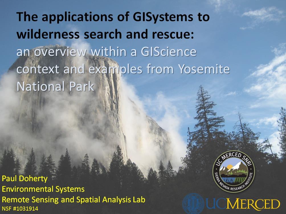
THE MOUNTAIN RESCUE ASSOCIATION MAPPING PLATFORM
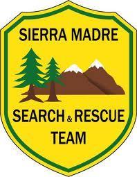
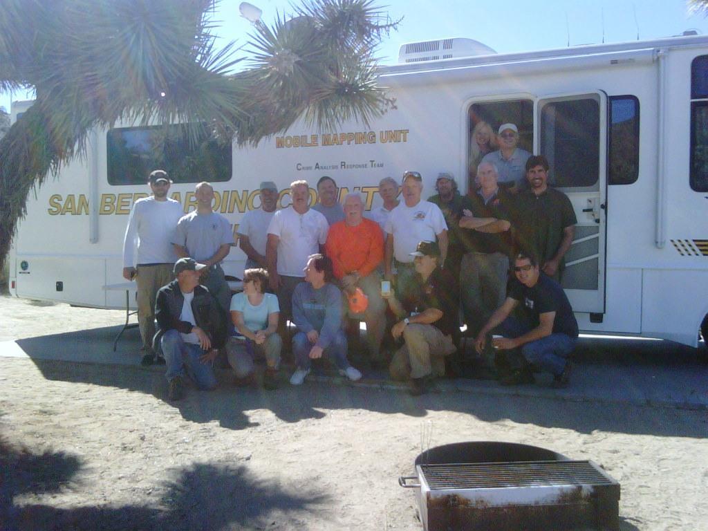
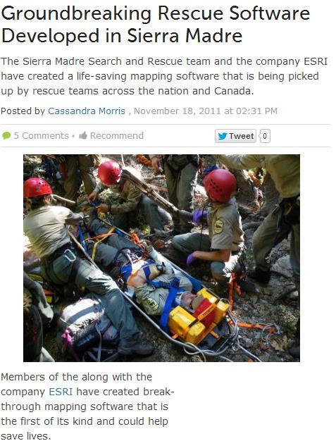
 THE MOUNTAIN RESCUE ASSOCIATION MAPPING PLATFORM Introduction Monty Bell, Mountain Rescue Association Paul Doherty, NAPSG Foundation http://www.napsgfoundation.org/ Jon Pedder Introduction Sierra Madre
Law Enforcement Solutions and Applications
 ArcGIS for Solutions and Applications Solutions and Applications ArcGIS for Platform ArcGIS for Collection of solutions and applications for law enforcement. Built on the ArcGIS platform. For any named
GIS Workshop Data Collection Techniques
 GIS Workshop Data Collection Techniques NOFNEC Conference 2016 Presented by: Matawa First Nations Management Jennifer Duncan and Charlene Wagenaar, Geomatics Technicians, Four Rivers Department QA #: FRG
Introduction to ArcGIS Maps for Office. Greg Ponto Scott Ball
 Introduction to ArcGIS Maps for Office Greg Ponto Scott Ball Agenda What is Maps for Office? Platform overview What are Apps for the Office? ArcGIS Maps for Office features - Visualization - Geoenrichment
Incorporating ArcGIS Pro in your Curriculum
 AAG, Boston 2017 April 5, 2017 Incorporating ArcGIS Pro in your Curriculum Geri Miller Agenda Concerns Acknowledged Learning curve ArcGIS Pro does not have all the tools (perception) Licensing and offline
Esri and GIS Education
 Esri and GIS Education Organizations Esri Users 1,200 National Government Agencies 11,500 States & Regional Agencies 30,800 Cities & Local Governments 32,000 Businesses 8,500 Utilities 12,600 NGOs 11,000
Techniques for Science Teachers: Using GIS in Science Classrooms.
 Techniques for Science Teachers: Using GIS in Science Classrooms. After ESRI, 2008 GIS A Geographic Information System A collection of computer hardware, software, and geographic data used together for
Continental Divide National Scenic Trail GIS Program
 CDNST Vision Statement: Provide the most accurate geospatial locational information of the Continental Divide Trail and nearby resources to the public as well as help provide internal management information
Geography for the 2020 Round of Census
 Boundaries Key Census Data EA Id Population Male Female EA Id Area EA Id Num HH Avg HH size Geography for the 2020 Round of Census Linda Peters, Esri lpeters@esri.com Integration of Statistical and Geospatial
Oakland County Parks and Recreation GIS Implementation Plan
 Oakland County Parks and Recreation GIS Implementation Plan TABLE OF CONTENTS 1.0 Introduction... 3 1.1 What is GIS? 1.2 Purpose 1.3 Background 2.0 Software... 4 2.1 ArcGIS Desktop 2.2 ArcGIS Explorer
GIS Applications on Environmental Education in Taiwan
 GIS Applications on Environmental Education in Taiwan Track: Education Authors: Yu-Chen Lai, Mei-Ling Yeh, Tien-Yin Chou Abstract GIS is a perfect vehicle to deliver environmental knowledge and spatial
No. of Days. Building 3D cities Using Esri City Engine ,859. Creating & Analyzing Surfaces Using ArcGIS Spatial Analyst 1 7 3,139
 Q3 What s New? Creating and Editing Data with ArcGIS Pro Editing and Maintaining Parcels Using ArcGIS Spatial Analysis Using ArcGIS Pro User Workflows for ArcGIS Online Organizations Q3-2018 ArcGIS Desktop
Land Navigation Table of Contents
 Land Navigation Table of Contents Preparatory Notes to Instructor... 1 Session Notes... 5 Learning Activity: Grid Reference Four Figure... 7 Learning Activity: Grid Reference Six Figure... 8 Learning Activity:
GIS Boot Camp for Education June th, 2011 Day 1. Instructor: Sabah Jabbouri Phone: (253) x 4854 Office: TC 136
 x 4854 Office: TC 136") GIS Boot Camp for Education June 27-30 th, 2011 Day 1 Instructor: Sabah Jabbouri Phone: (253) 833-9111 x 4854 Office: TC 136 Email: sjabbouri@greenriver.edu http://www.instruction.greenriver.edu/gis/ Summer
GIS Boot Camp for Education June 27-30 th, 2011 Day 1 Instructor: Sabah Jabbouri Phone: (253) 833-9111 x 4854 Office: TC 136 Email: sjabbouri@greenriver.edu http://www.instruction.greenriver.edu/gis/ Summer
CHAPTER 22 GEOGRAPHIC INFORMATION SYSTEMS
 CHAPTER 22 GEOGRAPHIC INFORMATION SYSTEMS PURPOSE: This chapter establishes the administration and use of to improve the quality and accessibility of Department s spatial information and support graphical
Lesson 16: Technology Trends and Research
 http://www.esri.com/library/whitepapers/pdfs/integrated-geoenabled-soa.pdf GEOG DL582 : GIS Data Management Lesson 16: Technology Trends and Research Overview Learning Objective Questions: 1. Why is integration
Esri Defense Mapping: Cartographic Production. Bo King
 Esri Defense Mapping: Cartographic Production Bo King Agenda Esri Defense Mapping: Cartographic Production Solution Overview Desktop Cartographic Production Workflow - Create Rapid Graphic Product On Demand
University of Lusaka
 University of Lusaka BSPH 315 Health Mapping & GIS Topic: Background of GIS Content: 1. Aim of the course 2. What do you know about GIS? 3. Difference between geographic data and geographic information
Mapping Secondary Cities for Resiliency and Emergency Preparedness
 Mapping Secondary Cities for Resiliency and Emergency Preparedness Secondary Cities Geospatial Training Workshop Pilot Project: Cusco, Peru June 29 July 3 2015 WHO ARE WE? Office of the Geographer (GGI)
VCCS Geospatial Institute 2011
 John McGee Jennifer McKee With support from: NSF DUE-0903270 Acquiring and Downloading Digital Data in partnership with: Geospatial Technician Education Through Virginia s Community Colleges (GTEVCC) Review
[DOC] GIS TRANING OPERATION MANUAL EBOOK
![[DOC] GIS TRANING OPERATION MANUAL EBOOK](/thumbs/79/79133035.jpg "[DOC] GIS TRANING OPERATION MANUAL EBOOK") 23 December, 2017 [DOC] GIS TRANING OPERATION MANUAL EBOOK Document Filetype: PDF 157.53 KB 0 [DOC] GIS TRANING OPERATION MANUAL EBOOK Learn GIS for free online from these university and institution. GIS
23 December, 2017 [DOC] GIS TRANING OPERATION MANUAL EBOOK Document Filetype: PDF 157.53 KB 0 [DOC] GIS TRANING OPERATION MANUAL EBOOK Learn GIS for free online from these university and institution. GIS
INDOT Office of Traffic Safety
 Intro to GIS Spatial Analysis INDOT Office of Traffic Safety Intro to GIS Spatial Analysis INDOT Office of Traffic Safety Kevin Knoke Section 130 Program Manager Highway Engineer II Registered Professional
GIS for Integrated Pest Management. Christina Hailey. Abstract:
 GIS for Integrated Pest Management Christina Hailey Abstract: At its formation in 1965, Harris County Mosquito Control (Houston, Texas) (HCMC) was primarily involved in the prevention and control of mosquito-borne
Creating a Staff Development Plan with Esri
 Creating a Staff Development Plan with Esri Michael Green David Schneider Guest Presenter: Shane Feirer, University of California Esri UC 2014 Technical Workshop Agenda What is a Staff Development Plan?
The Pace of Change Is Accelerating Creating Many Challenges
 VISION The Pace of Change Is Accelerating Creating Many Challenges Evidence Threatening Our Natural World and Our Future as Humans Social Conflict Mass Migration Ocean Acidification Food Population Urbanization
Transportation and Logistics Planning and Development Mapping Tool
 Transportation and Logistics Planning and Development Mapping Tool Doreen Gonzales-Gaboyan Business Development and Outreach Center for Innovation through Visualization and Simulation (CIVS) Purdue University
Developing a Community Geographical Information System (GIS) in Rural India
 in Rural India") Developing a Community Geographical Information System (GIS) in Rural India Before rushing off and describing the unique challenges of developing a small scale GIS system India I better first describe
Developing a Community Geographical Information System (GIS) in Rural India Before rushing off and describing the unique challenges of developing a small scale GIS system India I better first describe
Changes in Esri GIS, practical ways to be ready for the future
 Changes in Esri GIS, practical ways to be ready for the future John Sharrard, Esri April 16, 2015 The only thing that is constant is change. Heraclitus, ca. 500 B.C. My story (of experiencing change) Changes
GIS for Crime Analysis. Building Better Analysis Capabilities with the ArcGIS Platform
 GIS for Crime Analysis Building Better Analysis Capabilities with the ArcGIS Platform Crime Analysis The Current State One of the foundations of criminological theory is that three things are needed for
ArcGIS. for Server. Understanding our World
 ArcGIS for Server Understanding our World ArcGIS for Server Create, Distribute, and Manage GIS Services You can use ArcGIS for Server to create services from your mapping and geographic information system
E Geographic Information System. Created By: Freda Rocker Pearl River County Mapping
 E-9-1-1 Geographic Information System Created By: Freda Rocker Pearl River County Mapping frocker@pearlrivercounty.net Overview of Pearl River County E-9-1-1 Communications District GIS In 1998 the Pearl
Arcgis Tutorial Manual READ ONLINE
 Arcgis Tutorial Manual READ ONLINE ArcGIS Desktop 10 Trial Help - Note: The Quick Start Guide contains instructions that do not pertain to the trial edition. Many tutorials are found in the ArcGIS Desktop
Geo Business Gis In The Digital Organization
 We have made it easy for you to find a PDF Ebooks without any digging. And by having access to our ebooks online or by storing it on your computer, you have convenient answers with geo business gis in
Greg Collier, Battalion Chief Larry Fox, Captain Mount Laurel Fire Department
 Greg Collier, Battalion Chief Larry Fox, Captain Mount Laurel Fire Department Hurdles (NAVTEQ data Laurel Green example) Current software use map books field data (COP, OEM, disasters, critical infrastructure,
Arcmap Manual Esri 10 READ ONLINE
 Arcmap Manual Esri 10 READ ONLINE If searching for a book Arcmap manual esri 10 in pdf form, then you have come on to the loyal site. We present the utter release of this book in PDF, doc, DjVu, epub,
Google Maps and Beyond
 Google Maps and Beyond Aaron Paul First American Title apaul@firstam.com 2015 APRA Symposium Association of Professional Reserve Analysts May 2 nd, 2015 Google Maps and Beyond - Overview Business case
SHOW ME THE DATA. FEMA Region 6 Community Assistance Visits Findings Collector
 SHOW ME THE DATA FEMA Region 6 Community Assistance Visits Findings Collector Roberto Ramirez, CFM / ASFPM June 4, 2015 Topics of Discussion Overview of CAV Findings Collection project Why a GIS Based
IMPLEMENTING GOVERNMENT-WIDE ENTERPRISE GIS; THE FEDERATED MODEL
 IMPLEMENTING GOVERNMENT-WIDE ENTERPRISE GIS; THE FEDERATED MODEL James E. Mitchell, Ph. D. IT GIS Manager Louisiana Department of Transportation and Development presented at the ESRI International Users
No. of Days. ArcGIS 3: Performing Analysis ,431. Building 3D cities Using Esri City Engine ,859
 What s New? Creating Story Maps with ArcGIS Field Data Collection and Management Using ArcGIS Get Started with Insights for ArcGIS Introduction to GIS Using ArcGIS & ArcGIS Pro: Essential Workflow Migrating
No. of Days. ArcGIS Pro for GIS Professionals ,431. Building 3D cities Using Esri City Engine ,859
 What s New? Creating Story Maps with ArcGIS Field Data Collection and Management Using ArcGIS Get Started with Insights for ArcGIS Introduction to GIS Using ArcGIS & ArcGIS Pro: Essential Workflow Migrating
3/29/11. Why bother with tools? Incorporating Decision Support Tools into Climate Adaptation Planning. A Simplified Planning Process
 Incorporating Decision Support Tools into Climate Adaptation Planning Why bother with tools? Tools don t eliminate complexity but they can help deal with it" Tools can:"! Help incorporate science into
Diffusion of GIS in Public Policy Doctoral Program
 Diffusion of GIS in Public Policy Doctoral Program By Fulbert Namwamba PhD Southern University This presentation demonstrate how GIS was introduced in the Public Policy Doctoral Program at Southern University,
NAVAJO NATION PROFILE
 NAVAJO NATION PROFILE Largest land based area and federally recognized tribe in the United States Over 27,000 square miles (or 17.2 million acres with a population of over 300,000 people. Covers Arizona,
Progress Report. Flood Hazard Mapping in Thailand
 Progress Report Flood Hazard Mapping in Thailand Prepared By: Mr. PAITOON NAKTAE Chief of Safety Standard sub-beuro Disaster Prevention beuro Department of Disaster Prevention and Mitigation THAILAND E-mail:
7/25/15. Starts at 10am. Use Chat box to ask Questions
 Toggle Fullscreen mode with this button above 7/25/15 Use Chat box to ask Questions For assistance, call: 814-865-5355 Starts at 10am http://metrocount.com If you are reading this, then you are successfully
HURRICANE MATTHEW A GIS PERSPECTIVE GLYNN COUNTY GIS
 HURRICANE MATTHEW A GIS PERSPECTIVE GLYNN COUNTY GIS Situation September 25 th October 9 th 2016 Hurricane Matthew tracked its way up the east coast bringing hurricane force winds and flooding from Haiti
Steve Pietersen Office Telephone No
 Steve Pietersen Steve.Pieterson@durban.gov.za Office Telephone No. 031 311 8655 Overview Why geography matters The power of GIS EWS GIS water stats EWS GIS sanitation stats How to build a GIS system EWS
TRANSVERSE GIS FOR TOTAL E&P NIGERIA - GEOPS
 TRANSVERSE GIS FOR TOTAL E&P NIGERIA - GEOPS Marc Roussel / Total H. ANEKE (Manager Survey & Geomatics) J-M. AMOUROUX (Head of Geomatics and Affiliate Transverse GIS Coordinator) TEPNG/TS/ECP/Survey &
Oak Ridge Urban Dynamics Institute
 Oak Ridge Urban Dynamics Institute Presented to ORNL NEED Workshop Budhendra Bhaduri, Director Corporate Research Fellow July 30, 2014 Oak Ridge, TN Our societal challenges and solutions are often local
Introducing Spatial IQ
 Introducing Spatial IQ TM A Managed Services Approach to Enterprise GIS Let AppGeo be your bridge to the future. The Magic of Location AppGeo believes that information plus geography changes how we work
Your web browser (Safari 7) is out of date. For more security, comfort and. the best experience on this site: Update your browser Ignore
 is out of date. For more security, comfort and. the best experience on this site: Update your browser Ignore") Your web browser (Safari 7) is out of date. For more security, comfort and Activityengage the best experience on this site: Update your browser Ignore Introduction to GIS What is a geographic information
Your web browser (Safari 7) is out of date. For more security, comfort and Activityengage the best experience on this site: Update your browser Ignore Introduction to GIS What is a geographic information
Web GIS Patterns and Practices
 FedGIS Conference February 24 25, 2016 Washington, DC Web GIS Patterns and Practices Philip Heede Jay Theodore Witt Mathot Web GIS Transformation of the ArcGIS Platform Desktop Apps Web Maps Web Scenes
GIS as a Management Tool in Nepal Earthquake Response
 GIS as a Management Tool in Nepal Earthquake Response Presenter: Charlie Charping GIS Manager Samaritan s Purse A CASE STUDY & LESSONS LEARNED Presentation Agenda Samaritan s Purse Background The Case
Chapter 1 Overview of Maps
 Chapter 1 Overview of Maps In this chapter you will learn about: Key points when working with maps General types of maps Incident specific maps Map legend and symbols Map sources A map is a navigational
GIS Education Activities in Detroit Public Schools Preparing Students for Careers in the Geospatial Industry A Multi-Agency Collaboration
 GIS Education Activities in Detroit Public Schools Preparing Students for Careers in the Geospatial Industry A Multi-Agency Collaboration Marsha A. Lewis, Social Studies Curriculum Specialist, Detroit
Arcmap Manual Esri 10 READ ONLINE
 Arcmap Manual Esri 10 READ ONLINE Esri Store: Browsing ArcPad 10.2.2 - ArcPad is mobile field mapping and data collection software designed for GIS professionals. It includes advanced GIS and GPS capabilities
Rural GIS Applications Geospatial Technology Awareness
 Rural GIS Applications Geospatial Technology Awareness Mike Rudibaugh, Ph.D. Co-PI NSF GeoTech Center Geography/GIS Instructor Lake Land College mrudibau@lakeland.cc.il.us 217-234-5244 What is the GeoTech
Base Maps: Creating, Using & Participating
 Base Maps: Creating, Using & Participating Michael Fashoway & Erin Geraghty Montana Base Map Service Center 2010 MAGIP Technical Session October 28, 2010 What is a Base Map? Using a Base Map Creating a
FIRE DEPARMENT SANTA CLARA COUNTY
 DEFINITION FIRE DEPARMENT SANTA CLARA COUNTY GEOGRAPHIC INFORMATION SYSTEM (GIS) ANALYST Under the direction of the Information Technology Officer, the GIS Analyst provides geo-spatial strategic planning,
Creating Basemaps to Manage Buildings and Facilities
 Esri International User Conference San Diego, California Technical Workshops July 26, 2012 Creating Basemaps to Manage Buildings and Facilities Mark Stewart and Tamara Yoder Topics for this Session Overview
Hurricane Readiness for Coastal Communities
 Hurricane Readiness for Participant Guide Developed for: Federal Emergency Management Agency Emergency Management Institute 16825 South Seton Avenue Emmitsburg, MD 21727-8998 Developed by: C² Technologies,
ArcGIS Platform For NSOs
 ArcGIS Platform For NSOs Applying GIS and Spatial Thinking to Official Statistics Esri UC 2014 Demo Theater Applying GIS at the NSO Generic Statistical Business Process Model (GSBPM) 1 Specify Needs 2
Experiences and Directions in National Portals"
 FIG Seminar on e-land Administration Innsbruck/Austria 2-4 June 2004 "ESRI's Experiences and Directions in National Portals" Kevin Daugherty Cadastral/Land Records Manager ESRI Topic Points Technology
Course Description. Illicit Drug Labs A Safe Response for Public Safety Personnel. International Association of Fire Fighters
 Illicit Drug Labs A Safe Response for Public Safety Personnel Course Duration: 8 hours (1 day). Learning Objectives: Given an 8-hour course on illicit drug labs, students will be able to describe illicit
How does ArcGIS Server integrate into an Enterprise Environment? Willy Lynch Mining Industry Specialist ESRI, Denver, Colorado USA
 How does ArcGIS Server integrate into an Enterprise Environment? Willy Lynch Mining Industry Specialist ESRI, Denver, Colorado USA wlynch@esri.com ArcGIS Server Technology Transfer 1 Agenda Who is ESRI?
Introduction to GIS. Geol 4048 Geological Applications of Remote Sensing
 Introduction to GIS Geol 4048 Geological Applications of Remote Sensing GIS History: Before Computers GIS History Using maps for a long time Dr. Roger F. Tomlinson Father of GIS He was an English geographer
Leveraging Web GIS: An Introduction to the ArcGIS portal
 Leveraging Web GIS: An Introduction to the ArcGIS portal Derek Law Product Management DLaw@esri.com Agenda Web GIS pattern Product overview Installation and deployment Configuration options Security options
GIS and Community Health. GIS and Community Health. Institutional Context and Interests in GIS Development. GIS and Community Health
 GIS and Community Health GIS and Community Health Some critiques of GIS emphasize the potentially harmful social consequences of the diffusion of GIS technology, including reinforcing the power of state
Welcome to NR502 GIS Applications in Natural Resources. You can take this course for 1 or 2 credits. There is also an option for 3 credits.
 Welcome to NR502 GIS Applications in Natural Resources. You can take this course for 1 or 2 credits. There is also an option for 3 credits. The 1st credit consists of a series of readings, demonstration,
The Underutilization of GIS & How to Cure It. Adam Carnow Esri
 The Underutilization of GIS & How to Cure It Adam Carnow Esri What is GIS? A framework to organize, communicate, and understand the science of our world Business Intelligence (BI) is the set of
An introduction to ArcGIS Maps for Office. Scott Ball & Mike Flanagan
 An introduction to ArcGIS Maps for Office Scott Ball & Mike Flanagan Main takeaways for today Adding the where to your analysis You can learn a lot when you unlock the power of geography in your analytics
Web GIS Administration: Tips and Tricks
 EdUC 2017 July 8 th, 2017 Web GIS Administration: Tips and Tricks Geri Miller Agenda Concerns Acknowledged User Management Content Management Monitoring Licensing and logins Sophistication of IT support
ALLHAZ Field level Emergency Operations Concept
 ALLHAZ Field level Emergency Operations Concept Elizabeth Matlack Jackson State University Ed Collins Jackson State University Dave Kehrlein ESRI Professional Services Footer 1 Overview What is ALLHAZ?
Reimaging GIS: Geographic Information Society. Clint Brown Linda Beale Mark Harrower Esri
 Reimaging GIS: Geographic Information Society Clint Brown Linda Beale Mark Harrower Esri 8 billion = Number of basemap requests per month on AGOL 14,000 = Unique requests per second 12,000 = New Items
Improvement of the National Hydrography Dataset for US Forest Service Region 3 in Cooperation with the National Forest Service
 Improvement of the National Hydrography Dataset for US Forest Service Region 3 in Cooperation with the National Forest Service Christian L. DeCasas California State University, Northridge November 7 th,
Expanding Canada s Rail Network to Meet the Challenges of the Future
 Expanding Canada s Rail Network to Meet the Challenges of the Future Lesson Overview Rail may become a more popular mode of transportation in the future due to increased population, higher energy costs,
Enterprise GIS: Realizing a Return on Investment. EGUG Coeur D Alene, ID Tuesday, October 15, 2002
 Enterprise GIS: Realizing a Return on Investment EGUG 2002 - Coeur D Alene, ID Tuesday, October 15, 2002 Technology Technology is great fun, but we can drown in our technology. The fog of information can
Boundary and Annexation Survey (BAS)
") Boundary and Annexation Survey (BAS) New Mexico SDC Meeting Chris Wingate Geography Division U.S. Census Bureau 1 Agenda Boundary and Annexation Survey (BAS) BAS Overview American Community Survey (ACS)
Boundary and Annexation Survey (BAS) New Mexico SDC Meeting Chris Wingate Geography Division U.S. Census Bureau 1 Agenda Boundary and Annexation Survey (BAS) BAS Overview American Community Survey (ACS)
ArcGIS for Desktop. ArcGIS for Desktop is the primary authoring tool for the ArcGIS platform.
 ArcGIS for Desktop ArcGIS for Desktop ArcGIS for Desktop is the primary authoring tool for the ArcGIS platform. Beyond showing your data as points on a map, ArcGIS for Desktop gives you the power to manage
The Emerging Role of Enterprise GIS in State Forest Agencies
 The Emerging Role of Enterprise GIS in State Forest Agencies Geographic Information System (GIS) A geographic information system (GIS) is a computer software system designed to capture, store, manipulate,
Week 8 Cookbook: Review and Reflection
 : Review and Reflection Week 8 Overview 8.1) Review and Reflection 8.2) Making Intelligent Maps: The map sheet as a blank canvas 8.3) Making Intelligent Maps: Base layers and analysis layers 8.4) ArcGIS
DP Project Development Pvt. Ltd.
 Dear Sir/Madam, Greetings!!! Thanks for contacting DP Project Development for your training requirement. DP Project Development is leading professional training provider in GIS technologies and GIS application
CAS GE 365 Introduction to Geographical Information Systems. The Applications of GIS are endless
 Spring 2007 CAS GE 365 Introduction to Geographical Information Systems Boston University Department of Geography and Environment The Applications of GIS are endless images from www.esri.com CAS GE 365
What s New in Collector for ArcGIS (Aurora)
") What s New in Collector for ArcGIS (Aurora) Derek Law (dlaw@esri.com) Esri Apps Product Management @GIS_Bandit Oct 10 th, 2018 Agenda Product overview Use cases Preparing data for Collector for ArcGIS
What s New in Collector for ArcGIS (Aurora) Derek Law (dlaw@esri.com) Esri Apps Product Management @GIS_Bandit Oct 10 th, 2018 Agenda Product overview Use cases Preparing data for Collector for ArcGIS
Think Global, Map Local! Introducing the. Open Green Map
 Think Global, Map Local! Introducing the Open Green Map Green Map System: Promoting inclusive participation in sustainable community development since 1995 Engaging over 550 communities in 54 countries,
S/He reports to the Programme Effectiveness Manager. Lead, review and process the development of NO GIS framework and tools.
 GIS Coordinator Location: [Africa] [Ghana] Town/City: Accra Category: Knowledge Management GIS Coordinator To provide leadership and management to cluster staff (of 2 to 3 Area Programs) by ensuring that
SCAUG Community Maps Building a Living Atlas of the World
 SCAUG Community Maps Building a Living Atlas of the World Mark Stewart Topics: SCAUG ArcGIS Online Overview Community Maps Overview Community Maps Workflow Update Process Utilizing Your Contribution Community
Working with ArcGIS Online
 Esri International User Conference San Diego, CA Technical Workshops July 12, 2011 Working with ArcGIS Online Bern Szukalski, Deane Kensok Topics for this Session ArcGIS Online Overview ArcGIS Online Content
F14-1. Florida Assoc of Dist. Instructional Materials Admin, FL Assoc of Educators, National Assoc of Staff Development $
 LAKE COUNTY SCHOOLS 2014-15 Budget Worksheet FACILITY : PROFESSIONAL DEVELOPMENT FACILITY FUNCTION OBJECT PROJECT SUB-PROJEPROGRAM EXP TYPE ADDITIONAL DESCRIPTION AMOUNT 1 : PROFESSIONAL DEVELOPMENT 6200:
MOON MADNESS SCIENCE GRADES 3-5 JOYCE TATE & NANCY FARLEY. TIME ALLOTMENT: Two 45-minute classes (and one complete cycle of moon phases).
.") MOON MADNESS TIME ALLOTMENT: Two 45-minute classes (and one complete cycle of moon phases). OVERVIEW: The lessons contained in the Moon Mania CD are designed to help the student learn more about the earth
MOON MADNESS TIME ALLOTMENT: Two 45-minute classes (and one complete cycle of moon phases). OVERVIEW: The lessons contained in the Moon Mania CD are designed to help the student learn more about the earth
ESRI Delivering geographic information systems to millions of users
 Using Web GIS to Track Government Spending and Performance Eric Floss - ESRI April 12, 2010 ESRI Delivering geographic information systems to millions of users GIS Is Changing Everything How We Reason
King County Explorer Search and Rescue. Course B Map & Compass
 King County Explorer Search and Rescue Course B Map & Compass Disclaimer The intent of this presentation is to provide a basic overview of maps, compasses, and location finding. It is not meant to be a
ArcGIS Web Tools, Templates, and Solutions for Defence & Intelligence. Renee Bernstein Esri Solutions Engineer
 ArcGIS Web Tools, Templates, and Solutions for Defence & Intelligence Renee Bernstein Esri Solutions Engineer ArcGIS Solutions Includes 450+ Industry Focused Apps and Capabilities Organized by 9 Primary
Key Points Sharing fosters participation and collaboration Metadata has a big role in sharing Sharing is not always easy
 Sharing Resources Geoff Mortson esri, Inc. SDI Solutions Team Key Points Sharing fosters participation and collaboration Metadata has a big role in sharing Sharing is not always easy Data Sharing is Good
Teaching GIS for Land Surveying
 Teaching GIS for Land Surveying Zhanjing (John) Yu Evergreen Valley College, San Jose, California James Crossfield California State University at Fresno, Fresno California 7/13/2006 1 Outline of the Presentation
DATA SCIENCE SIMPLIFIED USING ARCGIS API FOR PYTHON
 DATA SCIENCE SIMPLIFIED USING ARCGIS API FOR PYTHON LEAD CONSULTANT, INFOSYS LIMITED SEZ Survey No. 41 (pt) 50 (pt), Singapore Township PO, Ghatkesar Mandal, Hyderabad, Telengana 500088 Word Limit of the
Geographic Information Systems (GIS) Officer
 Officer") Geographic Information Systems (GIS) Officer 2 Year Part-Time Position (3 days per week) The Nature Parks is an inspiring workplace and, as the largest employer on Phillip Island, offers a range of career
Geographic Information Systems (GIS) Officer 2 Year Part-Time Position (3 days per week) The Nature Parks is an inspiring workplace and, as the largest employer on Phillip Island, offers a range of career
ArcGIS is Advancing. Both Contributing and Integrating many new Innovations. IoT. Smart Mapping. Smart Devices Advanced Analytics
 ArcGIS is Advancing IoT Smart Devices Advanced Analytics Smart Mapping Real-Time Faster Computing Web Services Crowdsourcing Sensor Networks Both Contributing and Integrating many new Innovations ArcGIS
Discovery and Access of Geospatial Resources using the Geoportal Extension. Marten Hogeweg Geoportal Extension Product Manager
 Discovery and Access of Geospatial Resources using the Geoportal Extension Marten Hogeweg Geoportal Extension Product Manager DISCOVERY AND ACCESS USING THE GEOPORTAL EXTENSION Geospatial Data Is Very