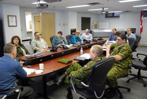
Health DWG ad-hoc. May 31 st, 2013 OGC-TC
|
|
|
- Dylan Sims
- 5 years ago
- Views:
Transcription
1 Health DWG ad-hoc May 31 st, 2013 OGC-TC
2 AGENDA 1. Welcome / Roundtable Introductions 2. Background of OGC and proposal of Health DWG 3. Toward an OGC Health DWG 4. Draft Health DWG Charter 5. Potential Health DWG Roles / Function 6. Regional Drivers / Health Threads 7. Identification of existing initiatives in different countries/regions a) Presentation on EO2HEAVEN Project Results (Earth Observation and Environmental Modelling for the Mitigation of Health Risks) 8. Identification of potential Health Threads / Focus Areas for OGC Health DWG 9. Identification of key barriers, needs, opportunities 10. General Discussion / Smorgusboard 11. Identification of participants, resources, co-chairs 12. What the OGC can provide 13. Next Steps and Close


3 Who has heard of the OGC? What most people think about standards work!

4 Or How Many Others View Standards SDI Copyright 2013 Open Geospatial Consortium Standard OGC Web Services


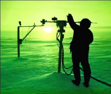


5 Across multiple domains Global challenges Use cases Example datasets Validate model Check compatibility sustained polar science campaign winter highways maintenance 2013 Open Geospatial Consortium

 Program Copyright 2013 Open Geospatial")
6 The OGC Vision Achieve the full societal, economic and scientific benefits of integrating location resources into commercial and institutional processes worldwide PortalU German Environmental Information Portal SURA Coastal Ocean Observing and Prediction (SCOOP) Program Copyright 2013 Open Geospatial Consortium


7 The OGC Mission To serve as a global forum for the collaboration of developers and users of spatial data products and services, and to advance the development of international standards for geospatial interoperability. Urban Model of Berlin based on OGC CityGML Copyright 2013 Open Geospatial Consortium Source:
8 The OGC Process Consensus and Collaboration Interoperability Requirements From members And Market Requirements Documented as Part of OGC Interoperability Activity Requirements used to Define new interface or Enhance existing Interface New or enhanced Interface provided to Community for Implementation Interface Implemented By Members, Tested And Documented Copyright 2013 Open Geospatial Consortium Members submit Interface for discussion And possible adoption Using OGC RFC/SWG processes


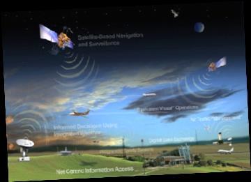
9 OGC Activities Driven by Community Needs Other Standards Organizations Education & Research Sustainable Development Infrastructure - Transportation Health E -Government Emergency Services, Disaster Management Consumer Services, Real Time Information Energy Geosciences Aviation Copyright 2013 Open Geospatial Consortium

10 Domain Working Groups (January 2013) Copyright 2013 Open Geospatial Consortium

11 Standards Working Groups (January 2013) Copyright 2013 Open Geospatial Consortium

12 Every DWG and SWG has a portal page Go to and select the WG of interest Copyright 2013 Open Geospatial Consortium

13 Emergency and Disaster Management Domain Working Group Forum for uniting communities of users including government agencies, industry, research organizations, non-governmental organizations and others. Promotes dialogue, collaboration and innovation concerning interoperability and standards harmonization within the EDM community.

14 Hydrology Domain Working Group Provide a venue and mechanism for seeking technical and institutional solutions to the challenge of describing and exchanging data describing the state and location of water resources, both above and below the ground surface. Coordination with WMO (c) 2012 Open Geospatial Consortium


15 Meteorology/Oceans DWG The OGC Meteorology and Oceanography DWG provides an open forum for work on meteorological and oceanographic data interoperability and a process to publish and revise OGC Best Practices and Standards thence giving a route for submission to WMO CBS for adoption. Copyright 2013 Open Geospatial Consortium 15


16 Earth System Science (ESS) DWG Coordination point for multiple DWGs working geosciences, environmental, and other activities related to the use of OGC standards Very recent: GeoSciML Discussions Copyright 2013 Open Geospatial Consortium
 Observations & Measurements (O&M) Sensor Planning Service (SPS) Sensor Observation Service (SOS) Catalogue Service Sensor Alert Service (SAS) --Complementary")
17 Domain of Interest: OGC Sensor Web Enablement Standards (SWE) Enable discovery and tasking of sensor assets, and the access and application of sensor observations for enhanced situational awareness Sensor Model Language (SensorML) Observations & Measurements (O&M) Sensor Planning Service (SPS) Sensor Observation Service (SOS) Catalogue Service Sensor Alert Service (SAS) --Complementary Standards-- IEEE 1451 smart sensor standard OASIS (alert) standards Copyright 2013 Open Geospatial Consortium


18 3D Information Management: Integration of 3D Built / Geospatial Worlds Interoperation across the AEC / CAD / Geospatial domains 3D City Models 3D Visualization and Portrayal Services Location Services Indoor Location / Navigation CityGML Discussions CityGML Utility ADE Extension Adapted from BuildingSmart Alliance presentation

19 Decision Support DWG Application fusion: 3d, location services, mass market CityGML, OpenStreetMap, Digital Terrain models, and OGC OpenLS, SOS, and candidate W3DS standards 2013Open Geospatial Consortium,
20 Toward a Health DWG Health related outcomes from previous OWS phases OGC Standards and Domain WGs (cross-pollination) OGC implementations in different regions (e.g. INSPIRE) Multiple Drivers exist at global, national, sub-national scales & varying time scales Policies for Health SDI and Data Standards vary by country/region Common barriers, needs, drivers continue to be identified Scientific research can inform, or depends upon, open map standards A wide range of health-related applications continue to be identified No existing platform for development of geospatial data standards in the public health domain; No existing international health-oriented SDI Draft Health DWG Charter introduced: OGC Doc. Number: GovFuture Webinar well received: Serving Public Health through Open Health Mapping Services, is available here:
21 Draft Health DWG Charter An OGC Health Domain Working Group would enable the identification and prioritization of use cases, business and technical requirements that will provide the most significant value, or mitigate the most significant risks in the public health arena. The suggested format for an OGC Health Domain Working Group is Public i.e. open to OGC members and non-members. This will enhance the opportunity for health sector, government agencies, and geospatial community to collaborate in: 1. User and Technical requirements gathering 2. Informing the development of standards 3. Facilitating exchange of knowledge, best practices 4. Demonstration through interoperability projects 5. Implementation of interoperable technical solutions Draft Charter for a Health DWG (Doc Ref #:
22 Potential Health DWG Role / Functions: Convene OGC members and non-members in public health domain Build Capacity for technical solutions, knowledge exchange, requirements gathering and prioritization Assimilate Inputs toward geospatial standards development, including data definitions, formats, and services for publishing, discovery, exchange, protection and queryability of geospatial information Spawn Demonstration Projects, Interoperability Experiments, and Interoperability Pilots Educate and Inform Public Health communities-of-practice Other?:
23 Regional Drivers / Health Threads a) b) c) Regional Drivers: a) b) Regional Drivers: Regional Drivers: a) b) c) Regional Drivers: a) b) c) a) b) c) Regional Drivers: a) b) Regional Drivers: Regional Drivers: a) b) c) Regional Drivers: a) b) c) Regional Drivers: a) b) c) Common Drivers / Focus for Health DWG Regional Drivers: a) b) c)


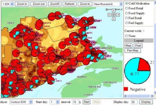


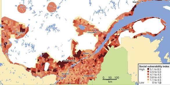

24 Monitor trends in chronic illness and infectious disease with WPS, WFS, WMS Time series pandemic surveillance with time-tag in WMS Model Climate Change and Health Impacts for Risk Assessment Prevention, Alerting, Response, Recovery Public education, resource planning (including vaccination campaigns) with WMS Assess Vulnerable Populations / Zones
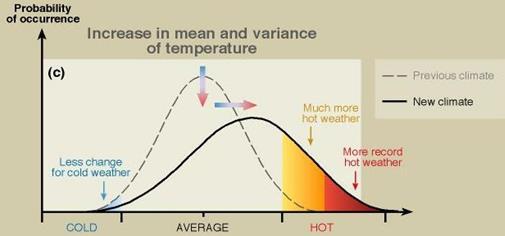
25 Statement of Needs / Strategic Objectives Address interoperability requirements e.g. support more effective health surveillance using open mapping standards to access distributed geospatial data pertaining to disease, disease vectors and vulnerable communities / populations. Support collaborative research into cumulative, synergistic, non-linear impacts to public health, for risk assessment and reduction Develop and support communication strategies and market research, including for take-to-market of OGC standards / OGC-compliant technologies which serve the health marketplace Support Policy, Research, Education including development of policy, research, best practices, and education in the use of open mapping standards to monitor trends and changes in public health, for risk identification, communication, and disease prevention. Support Cross-Border Surveillance initiatives including modeling, exercising, responding to cross-border health risks Advance best practices for visualization of Chronic and Infectious Diseases using open mapping standards including to support epidemiology, surveillance, control, treatment, prevention, and education activities Advance best practices for Public Health Management and Cost Reduction using open mapping standards including resource allocation for health emergencies, to protect vulnerable populations, and in response to changing geo-demographics Advance best practices for Adapting to Climate Change Impacts to Public Health using open mapping standards including modeling of climate impacts on public health, risk assessment and reduction (e.g. to heat events, reduced air quality, vector borne disease, floods, drought, fire, extreme weather, changes in food production and water quality, social impacts of displacement and exposure of vulnerable populations). This includes supporting efforts to standardize interoperable interfaces for health and climate models at a scale appropriate to decision making (regional and temporal) while protecting privacy of personal health information.
26 Health DWG Goals and Objectives: Your turn Potential Focus Areas / Priorities: Your turn
27 Identify existing initiatives using OGC Standards For example: in different countries/regions to support various health related applications EU INSPIRE GEOSS AIP, EO2Heaven Other? / your turn Capture Participant Inputs:
28 Presentation on EO2HEAVEN Project Results
29 Identification of key barriers, needs, and opportunities? Barriers and Needs:? Opportunities: Data standardization, integration, interoperability Cross-Border collaboration / communication Emergency / pandemic preparedness Health issues (e.g. chronic illness) Health Care Costs, Other?
30 General Discussion / Smorgusboard Key local and global Drivers Health DWG Goals and Objectives Parallel and Collaborative Initiatives a) b) c) Capture Participant Inputs: Use Cases / Business Needs Potential Champions / Key Users OGC & Health Information Standards of Interest Market Scope, Requirements Analysis Costs / benefits analysis Technical solutions value proposition
31 Potential participants / resources / co-chairs For example:? Health Authorities Disease Surveillance Agencies, Health Information Institutes Professional Health / Medical Associations National and Sub-National Governments Health Informatics solution providers Geospatial Vendor Community Research Community Capture participant inputs: Other Resources: For example: Publications, Web Sites, Services (OGC), Data Sources Capture Participant inputs: a) b) c)
32 What does the OGC provide? An agreed upon consensus process for defining, testing, documenting, and approving standards Staff knowledge, expertise and support to work with the members to facilitate the consensus process the culminates in approved and adopted standards. A process framework to encourage effectiveness and efficiency in advancing OGC member goals. A comprehensive Communications infrastructure. A consensus-based forum for conflict resolution Copyright 2013 Open Geospatial Consortium

33 OGC Structure Copyright 2013 Open Geospatial Consortium
 National Emergency Number Association (NENA) International Organization")
 Open Grid Forum (OGF) buildingsmart Alliance Web3D Consortium Copyright 2013 Open")
34 OGC Standards Alliance Partnerships Internet Engineering Task Force (IETF) Organization for the Advancement of Structured Information Standards (OASIS) National Emergency Number Association (NENA) International Organization for Standards (ISO) World Wide Web Consortium (W3C) World Meteorological Organization (WMO) IEEE Technical Committee 9 (Sensor Web) Open Grid Forum (OGF) buildingsmart Alliance Web3D Consortium Copyright 2013 Open Geospatial Consortium 34
35 Relationship with ISO TC-211 The OGC has a class A technical liaison agreement with TC 211. Governed by Terms of Reference (ToR) The coordination and communication is performed by the Joint Advisory Group (JAG) A number of OGC standards have been submitted into ISO and approved as ISO standards Web Map Service Simple Features Web Feature Service Filter Encoding GML Observations and Measurements Coordinate Reference Systems (aka Spatial Referencing by Coordinates) Copyright 2013 Open Geospatial Consortium 35
36 Next Steps and Close Next Steps: Summary of ad-hoc Amend Draft Health DWG Charter as needed Introduce a formal Charter within OGC Establish Listserve and Repository for Health DWG Points of Contact Facilitator: Eddie Oldfield, Spatial Quest Solutions Tel , eoldfield@bellaliant.net Member of OGC
OGC and GSDI: A Partnership in Advancing SDI Best Practices
 OGC and GSDI: A Partnership in Advancing SDI Best Practices GSDI 11 Workshop 1.4 SDI Challenges 15 June 2009 Mark Reichardt President and CEO mreichardt@opengeospatial.org +1 301 840-1361 Copyright 2009,
Mark E Reichardt. President & CEO Open Geospatial Consortium
 Mark E Reichardt President & CEO Open Geospatial Consortium mreichardt@myogc.org Agenda 0900-0915 Welcome and Introduction - Topic setting (Chair) 0915-0935 Ron Bloksma, The next step is interoperability
Pushing the Standards Edge: Collaborative Testbeds to Accelerate Standards Development and Implementation
 Pushing the Standards Edge: Collaborative Testbeds to Accelerate Standards Development and Implementation Mark E. Reichardt President mreichardt@opengeospatial.org 31 October 2006 2006 Open Geospatial
SDI and Beyond The Importance of Standards and Interoperability For Good Governance; Selected Examples
 SDI and Beyond The Importance of Standards and Interoperability For Good Governance; Selected Examples Trevor Taylor, Director, Member Services, Asia and the Americas Sao Paulo May 7 th, 2014 Why is Geospatial
Benefits of Open Standards how to engage with OGC
 Benefits of Open Standards how to engage with OGC Athina Trakas OGC, Inc. Director Business Development Europe atrakas@opengeospatial.org With support from Mark Reichardt (President & CEO) and Martin Klopfer
Spatially Enabled Society
 International Seminar on Land Administration Trends and Issues in Asia and the Pacific Region Spatially Enabled Society Abbas Rajabifard Vice Chair PCGIAP-WG3 Vice-President (President Elect), GSDI Association
7 11 August 2011, Vancouver. Don Brutzman, Benjamin Hagedorn. The OGC: Making Location Count
 OGC 3D Portrayal Interoperability Experiment, OGC 3D Summit 2011 SIGGRAPH 2011 7 11 August 2011, Vancouver Don Brutzman, Benjamin Hagedorn The OGC: Making Location Count What is the Open Geospatial Consortium?
Roadmap to interoperability of geoinformation
 Roadmap to interoperability of geoinformation and services in Europe Paul Smits, Alessandro Annoni European Commission Joint Research Centre Institute for Environment and Sustainability paul.smits@jrc.it
INSPIREd solutions for Air Quality problems Alexander Kotsev
 INSPIREd solutions for Air Quality problems Alexander Kotsev www.jrc.ec.europa.eu Serving society Stimulating innovation Supporting legislation The European data puzzle The European data puzzle 24 official
OGC and the Relevance of Standards for Environmental Matters
 and the Relevance of Standards for Environmental Matters Scott Simmons Executive Director, Standards Program, 1 December 2017 Copyright 2017 Open Geospatial Consortium So what brings so many standards
Oman NSDI Business Values and Future Directions. Hassan Alawi Alghazali Acting Director General National Spatial Data Infrastructure
 Oman NSDI Business Values and Future Directions Hassan Alawi Alghazali Acting Director General National Spatial Data Infrastructure Presentation Outline Geospatial Maturity Current Challenges NCSI s Role
March 10 OGC Technical Committee
 March 10 OGC Technical Committee Frascati 99 3 7 99 3 15 99 3 17 1 2010 OGC (Open Geospatial Consortium, Inc.) Technical Committee Frascati 2007 OGC OGC Sensor Web Enablement (SWE) 2.0 Attributes Usage
EXPECTATIONS OF TURKISH ENVIRONMENTAL SECTOR FROM INSPIRE
 EXPECTATIONS OF TURKISH ENVIRONMENTAL SECTOR FROM INSPIRE June, 2010 Ahmet ÇİVİ Tuncay DEMİR INSPIRE in the Eyes of MoEF Handling of Geodata by MoEF Benefits Expected TEIEN First Steps for INSPIRE Final
US National Spatial Data Infrastructure A Spatial Framework for Governance and Policy Development to Enable a Location-Based Digital Ecosystem
 GeoPlatform Workshop 7 Dec 2016, Department of the Interior Washington, D.C. US National Spatial Infrastructure A Spatial Framework for Governance and Policy Development to Enable a Location-Based Digital
Charter for the. Information Transfer and Services Architecture Focus Group
 for the Information Transfer and Services Architecture Focus Group 1. PURPOSE 1.1. The purpose of this charter is to establish the Information Transfer and Services Architecture Focus Group (ITSAFG) as
Standards in Action: The Canadian Geospatial Data Infrastructure (CGDI)
") Standards in Action: The Canadian Geospatial Data Infrastructure (CGDI) Craig Stewart ISO/TC211 Standards in Action Workshop, September 14, 2005 Presentation Outline Overview of SDIs Overview of Canada
Standards in Action: The Canadian Geospatial Data Infrastructure (CGDI) Craig Stewart ISO/TC211 Standards in Action Workshop, September 14, 2005 Presentation Outline Overview of SDIs Overview of Canada
Ministry of Health and Long-Term Care Geographic Information System (GIS) Strategy An Overview of the Strategy Implementation Plan November 2009
 Strategy An Overview of the Strategy Implementation Plan November 2009") Ministry of Health and Long-Term Care Geographic Information System (GIS) Strategy An Overview of the Strategy Implementation Plan November 2009 John Hill, Health Analytics Branch Health System Information
Ministry of Health and Long-Term Care Geographic Information System (GIS) Strategy An Overview of the Strategy Implementation Plan November 2009 John Hill, Health Analytics Branch Health System Information
BIM and INSPIRE, for a better integration of built infrastructures in their environment : the MINnD project
 BIM and INSPIRE, for a better integration of built infrastructures in their environment : the MINnD project François ROBIDA Christophe CASTAING Strasbourg, > 1 8 septembre 2017 ABOUT BIM Building Information
Global Challenges And Indian Initiatives *
 HIGH LEVEL FORUM ON GLOBAL GEOSPATIAL MANAGEMENT INFORMATION WORKING PAPER No. 15 First Forum Seoul, Republic of Korea, 24-26 October 2011 Global Challenges And Indian Initiatives * * Submitted by: Mr.
Open Geospatial Consortium activities in the Maritime domain
 Open Geospatial Consortium activities in the Maritime domain Scott Simmons Executive Director, Standards Program General Maritime efforts participants Alliance partners IHO ISO / TC 211 Members Danish
Open Geospatial Consortium Meteorology and Oceanography Domain Working Group progress report
 Open Geospatial Consortium Meteorology and Oceanography Domain Working Group progress report Twelfth Workshop on Meteorological Operational Systems ECMWF November 2009 Marie-Françoise Voidrot-Martinez,
Economic and Social Council
 United Nations Economic and Social Council Distr.: General 2 July 2012 E/C.20/2012/10/Add.1 Original: English Committee of Experts on Global Geospatial Information Management Second session New York, 13-15
GIS at UCAR. The evolution of NCAR s GIS Initiative. Olga Wilhelmi ESIG-NCAR Unidata Workshop 24 June, 2003
 GIS at UCAR The evolution of NCAR s GIS Initiative Olga Wilhelmi ESIG-NCAR Unidata Workshop 24 June, 2003 Why GIS? z z z z More questions about various climatological, meteorological, hydrological and
Conceptual Modelling within The OGC MetOcean Domain Working Group
 Conceptual Modelling within The OGC MetOcean Domain Working Group 21 st EGOWS Mtg, 1 st -4 th June 2010, ECMWF Dominic Lowe, dominiclowe@stfc.ac.uk British Atmospheric Data Centre, http://badc.nerc.ac.uk
Copernicus Big Data Workshop, Brussels, Belgium
 Copernicus Big Data Workshop, Brussels, Belgium 13 th March 2014 Bart De Lathouwer 2013 Open Geospatial Consortium Agenda Geospatial Big Data Open Geospatial Consortium s and Big Data Conclusions 2014
Open Geospatial Consortium Meteorology & Oceanography Domain Working Group Progress
 Open Geospatial Consortium Meteorology & Oceanography Domain Working Group Progress Chris Little, Co-Chair Met Ocean DWG (Marie-Françoise Voidrot, Météo-France, Co-Chair) ECWMF, Reading UK 2013-03-04/06
GIS Building Communities beyond National Borders (Building Successful Spatial Data Infrastructures) Nick Land, ESRI Europe
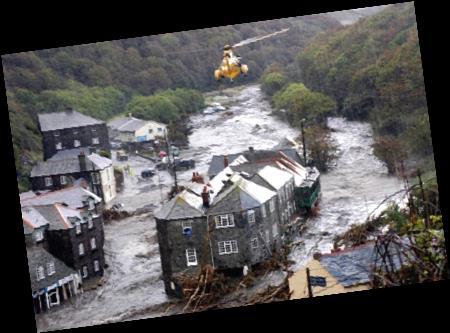
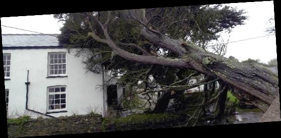
 Nick Land, ESRI Europe") GIS Building Communities beyond National Borders (Building Successful Spatial Data Infrastructures) Nick Land, ESRI Europe UK worst flooding in the last 60 years 350,000 households without drinking water
GIS Building Communities beyond National Borders (Building Successful Spatial Data Infrastructures) Nick Land, ESRI Europe UK worst flooding in the last 60 years 350,000 households without drinking water
2018/1 The integration of statistical and geospatial information. The Regional Committee of UN-GGIM: Americas:
 The following are the conclusions and recommendations of the Regional Committee of the United Nations on Global Geospatial Information Management for the Americas, during its Fifth Session, Thursday 8
UN-GGIM: Strengthening Geospatial Capability
 Fifth Plenary Meeting of UN-GGIM: Europe Brussels, 6-7 June 2018 UN-GGIM: Strengthening Geospatial Capability Walking the talk to leave no one behind Greg Scott, UN-GGIM Secretariat Environmental Statistics
OGC Standards Update 29 November 2018 Orlando
 OGC Standards Update 29 November 2018 Orlando Mark Reichardt mreichardt@opengeospatial.org +1 301 840-1361 OGC S INTEREST It s simple You have this or this and you need to make this... or this Courtesy
XXIII CONGRESS OF ISPRS RESOLUTIONS
 XXIII CONGRESS OF ISPRS RESOLUTIONS General Resolutions Resolution 0: Thanks to the Czech Society commends: To congratulate The Czech Society, its president and the Congress Director Lena Halounová, the
Inter-Programme Team on Space Weather Information, Systems and Services (IPT-SWISS)
") Inter-Programme Team on Space Weather Information, Systems and Services (IPT-SWISS) Toshiyuki KURINO WMO Space Programme Office WMO Space Programme OSCAR/Requirements (Observing Requirements Database)
Inter-Programme Team on Space Weather Information, Systems and Services (IPT-SWISS) Toshiyuki KURINO WMO Space Programme Office WMO Space Programme OSCAR/Requirements (Observing Requirements Database)
SMART CITIES NEED LOCATION DATA
 SMART CITIES NEED LOCATION DATA Carsten Rönsdorf 27 May 2015 Lisbon Future Cities need Location Data Geospatial World Forum 27 May 2015 Carsten Rönsdorf, Head of Advisory Services, OS International OFFICIAL
Climate Resilience Decision Making Framework in the Caribbean. A case of Spatial Data Management
 Climate Resilience Decision Making Framework in the Caribbean A case of Spatial Data Management Bishwa Pandey Sr. Data Management Specialist The World Bank Background The mission of The World Bank s Latin
FINDINGS OF THE ARCTIC METEOROLOGY SUMMIT
 FINDINGS OF THE ARCTIC METEOROLOGY SUMMIT 2018 WWW.FMI.FI CHAIR S SUMMARY: 1 2 3 We need to be curious to explore the known unknowns. Meteorology is an elemental part of international collaboration in
a national geological survey perspective François ROBIDA BRGM (French Geological Survey)
") a national geological survey perspective François ROBIDA BRGM (French Geological Survey) Pre-Conference Seminar on Socio-Economic Value of Geospatial for National and Regional Development 21 August 2017,
a national geological survey perspective François ROBIDA BRGM (French Geological Survey) Pre-Conference Seminar on Socio-Economic Value of Geospatial for National and Regional Development 21 August 2017,
Oman NSDI Supporting Economic Development. Saud Al-Nofli Director of Spatial Data Directorate General of NSDI, NCSI
 Oman NSDI Supporting Economic Development 2017 Saud Al-Nofli Director of Spatial Data Directorate General of NSDI, NCSI "It s critical to make correct decisions the first time to optimize the Investments
What s the problem? A Modern Odyssey in Search of Relevance. The search for relevance. Some current drivers for new services. Some Major Applications
 A Modern Odyssey in Search of Relevance FIG Working Week, Athens, 24 May 2004 Paul Kelly ANZLIC Executive Director The search for relevance 1. New expectations for spatial services 2. Are we ready to meet
Proposal for a DIRECTIVE OF THE EUROPEAN PARLIAMENT AND OF THE COUNCIL. establishing an infrastructure for spatial information in the Community
 Proposal for a DIRECTIVE OF THE EUROPEAN PARLIAMENT AND OF THE COUNCIL establishing an infrastructure for spatial information in the Community INSPIRE http://inspire.jrc.it/ Alessandro Annoni 1 EU Commission
Standards in support of UN-GGIM and sustainable development
 2 nd High 2Level nd High Forum Level on GGIM, Forum QNCC, on GGIM Doha, Qatar, 6 February 2013 QNCC, Doha, Qatar, 6 February 2013 Standards in support of UN-GGIM and sustainable development Olaf Østensen
Foundation Geospatial Information to serve National and Global Priorities
 Foundation Geospatial Information to serve National and Global Priorities Greg Scott Inter-Regional Advisor Global Geospatial Information Management United Nations Statistics Division UN-GGIM: A global
What is OneGeology in 2015?
 What is OneGeology in 2015? 25th May 2015 Marko Komac OneGeology Managing Director Presentation Outline Background quick OneGeology history Consortium The vehicle to achieve the goal Current status Where
8 th Arctic Regional Hydrographic Commission Meeting September 2018, Longyearbyen, Svalbard Norway
 8 th Arctic Regional Hydrographic Commission Meeting 11-13 September 2018, Longyearbyen, Svalbard Norway Status Report of the Arctic Regional Marine Spatial Data Infrastructures Working Group (ARMSDIWG)
Technical Specifications. Form of the standard
 Used by popular acceptance Voluntary Implementation Mandatory Legally enforced Technical Specifications Conventions Guidelines Form of the standard Restrictive Information System Structures Contents Values
Arctic Spatial Data Infrastructure Enabling Access to Arctic Location-Based Information
 Arctic Spatial Data Infrastructure Enabling Access to Arctic Location-Based Information Arctic SDI Side Event Co-Chairs: Arvo Kokkonen Arctic SDI Board Chair & Director General, National Land Survey of
ArcGIS for INSPIRE. Marten Hogeweg
 ArcGIS for INSPIRE Marten Hogeweg Please Take Our Survey on the App Download the Esri Events app and find your event Select the session you attended Scroll down to find the feedback section Complete answers
CONFERENCE STATEMENT
 Final draft CONFERENCE STATEMENT We, the elected representatives of Canada, Denmark/Greenland, the European Parliament, Finland, Iceland, Norway, Russia, Sweden and the United States of America; In collaboration
Implementing the Sustainable Development Goals: The Role of Geospatial Technology and Innovation
 Fifth High Level Forum on UN Global Geospatial Information Management Implementing the Sustainable Development Goals: The Role of Geospatial Technology and Innovation 28-30 November 2017 Sheraton Maria
OpenGeospatial Consortium Working Group Reports 3DIM, Urban planning, Land & Infrastructure
 OpenGeospatial Consortium Working Group Reports 3DIM, Urban planning, Land & Infrastructure Leif Granholm BIM Ambassador, Trimble October 30, 2014 Toronto 3DIM Charter The 3D Information Management (3DIM)
Background Document: Report of the Regional Committee of United Nations Global Geospatial Information Management for Asia and the Pacific
 Background Document: Report of the Regional Committee of United Nations Global Geospatial Information Management for Asia and the Pacific 1. Summary 1. This report highlights the activities carried out
Key Indicators for Territorial Cohesion & Spatial Planning Stakeholder Workshop - Project Update. 13 th December 2012 San Sebastián, Basque Country
 Key Indicators for Territorial Cohesion & Spatial Planning Stakeholder Workshop - Project Update 13 th December 2012 San Sebastián, Basque Country Key Aims Explore the use of territorial data in developing
Spatial data interoperability and INSPIRE compliance the platform approach BAGIS
 Spatial data interoperability and INSPIRE compliance the platform approach BAGIS BAGIS Voluntary, independent, public, non-profit organization; Organization with main mission to promote the growth of the
A Modern Odyssey in Search of Relevance
 A Modern Odyssey in Search of Relevance Paul KELLY, Australia Key words: Capacity building, GIM, spatial data infrastructure. SUMMARY A modern country has a voracious appetite for spatial information.
Report of the Regional Committee of UN-GGIM for Asia and the Pacific (UN-GGIM-AP)
") Report of the Regional Committee of UN-GGIM for Asia and the Pacific (UN-GGIM-AP) At the Eighth Session of UN-GGIM UN Headquarters, New York, 1 3 August 2018 About UN-GGIM-AP One of the five regional committees
Report of the Regional Committee of UN-GGIM for Asia and the Pacific (UN-GGIM-AP) At the Eighth Session of UN-GGIM UN Headquarters, New York, 1 3 August 2018 About UN-GGIM-AP One of the five regional committees
Exploit your geodata to enable smart cities and countries
 Exploit your geodata to enable smart cities and countries Carsten Rönsdorf, Head of Advisory Services Middle East Practice Manager Future Cities, standards and 3D 24 November 2014 Importance of Standards
Key Points Sharing fosters participation and collaboration Metadata has a big role in sharing Sharing is not always easy
 Sharing Resources Geoff Mortson esri, Inc. SDI Solutions Team Key Points Sharing fosters participation and collaboration Metadata has a big role in sharing Sharing is not always easy Data Sharing is Good
Geographic Information Infrastructure and Policy Framework for Sustainable Mountain Development in the Hindu Kush-Himalayas
 Geo SMART ASIA 2017 22-24 August, Kualalampur Geographic Information Infrastructure and Policy Framework for Sustainable Mountain Development in the Hindu Kush-Himalayas Basanta Shrestha, Director Strategic
UN-GGIM Arab States Meeting Welcome Address. Denise McKenzie Open Geospatial Consortium 21 February 2017 Doha, Qatar
 UN-GGIM Arab States Meeting Welcome Address Denise McKenzie Open Geospatial Consortium 21 February 2017 Doha, Qatar The Open Geospatial Consortium Not-for-profit, international voluntary consensus standards
KUNMING FORUM ON UNITED NATIONS GLOBAL GEOSPATIAL INFORMATION MANAGEMENT CITIES OF THE FUTURE: SMART, RESILIENT
 KUNMING FORUM ON UNITED NATIONS GLOBAL GEOSPATIAL INFORMATION MANAGEMENT CITIES OF THE FUTURE: SMART, RESILIENT and SUSTAINABLE Yunnan Zhenzhuang Guest House, Kunming, China 10 12 May 2017 BACKGROUND CONCEPT
UNESCO World Heritage Centre - Arab States Unit
 UNESCO World Heritage Centre - Arab States Unit Post-Conflict Reconstruction in the Middle East Context and in the Old City of Aleppo in Particular UNESCO Headquarter, 18-19 June 2015 ACTION PLAN resulting
What you always wanted to know about the OGC Programs, Process, Participation
 What you always wanted to know about the OGC Programs, Process, Participation UNIGIS International u_lecture, 25. March 2014 https://www3.gotomeeting.com/register/909498390 Dipl.-Geogr. Athina Trakas Open
A/AC.105/C.1/2016/CRP.17
 19 February 2016 English only Committee on the Peaceful Uses of Outer Space Scientific and Technical Subcommittee Fifty-third session Vienna, 15-26 February 2016 Item 11 of the provisional agenda Space
Swedish Spatial Data Infrastructure and the National Geodata Strategy
 Submitted to the United Nations Committee of Experts on Global Geospatial Information Management Seventh Session New York, August 2018 Registration number 519-2018/4327 Country Report, Sweden Swedish Spatial
Urban Climate Resilience
 Urban Climate Resilience in Southeast Asia Partnership Project Introduction Planning for climate change is a daunting challenge for governments in the Mekong Region. Limited capacity at the municipal level,
Outline National legislative & policy context Regional history with ESSIM ESSIM Evaluation Phase Government Integration via RCCOM Regional ICOM Framew
 What MSP Implementation could change in the Maritimes Region Tim Hall, Regional Manager Oceans and Coastal Management Division Ecosystem Management Branch Fisheries and Oceans Canada Maritimes Region BIO
An Agenda to Mainstream. Joel A. Tickner, ScD Sustainable Chemistry: The Way Forward September 24, 2015
 An Agenda to Mainstream Green Chemistry Joel A. Tickner, ScD Sustainable Chemistry: The Way Forward September 24, 2015 About the GC3 The Green Chemistry & Commerce Council (GC3) is a business-to-business
Complexity, Convergence, Divergence and the Geospatial Knowledge Economy: The Role of Standards
 Complexity, Convergence, Divergence and the Geospatial Knowledge Economy: The Role of Standards Mark Reichardt President & CEO mreichardt@opengeospatial.org +1 301 840-1361 Copyright 2014 Open Geospatial
OGC Meteorology and Oceanography Domain Working Group progress report
 OGC Meteorology and Oceanography Domain Working Group progress report 2 nd Workshop on the use of GIS/OGC standards in meteorology Marie-Françoise Voidrot-Martinez, Chris Little Co-chairs OGC Met Ocean
Climate Services for Health Open Geospatial Consortium (OGC) Health Summit Dublin, June 21, 2016
 Health Summit Dublin, June 21, 2016") Climate Services for Health Open Geospatial Consortium (OGC) Health Summit Dublin, June 21, 2016 Dr. Joy Shumake-Guillemot WMO/WHO Climate and Health Office Current and Future Climate Related Health Risks
Climate Services for Health Open Geospatial Consortium (OGC) Health Summit Dublin, June 21, 2016 Dr. Joy Shumake-Guillemot WMO/WHO Climate and Health Office Current and Future Climate Related Health Risks
BIM Week October 2013 Munich, GERMANY
 BIM Week October 2013 Munich, GERMANY Paul Scarponcini, PE, PhD Bentley Systems, Inc. COBie (for Buildings) Based on MVD of Building IFCs no geometry extended constraints, attributes, relationships Uses
Future Proofing the Provision of Geoinformation: Emerging Technologies
 Future Proofing the Provision of Geoinformation: Emerging Technologies An Exchange Forum with the Geospatial Industry William Cartwright Chair JBGIS Second High Level Forum on Global Geospatial Information
GIS in Weather and Society
 GIS in Weather and Society Olga Wilhelmi Institute for the Study of Society and Environment National Center for Atmospheric Research WAS*IS November 8, 2005 Boulder, Colorado Presentation Outline GIS basic
Overview of Geospatial Open Source Software which is Robust, Feature Rich and Standards Compliant
 Overview of Geospatial Open Source Software which is Robust, Feature Rich and Standards Compliant Cameron SHORTER, Australia Key words: Open Source Geospatial Foundation, OSGeo, Open Standards, Open Geospatial
Maanmittauspäivät 2018 Helsinki Maanmittauspäivät 2018 The Danish initiatives regarding open and free basic data including effect studies
 Maanmittauspäivät 2018 The Danish initiatives regarding open and free basic data including effect studies 22.03.2018 Agenda 1. Intro overall frame / selfie 2. Data Infrastructure 3. The Danish Digital
TRAITS to put you on the map
 TRAITS to put you on the map Know what s where See the big picture Connect the dots Get it right Use where to say WOW Look around Spread the word Make it yours Finding your way Location is associated with
Open spatial data infrastructure
 Open spatial data infrastructure a backbone for digital government Thorben Hansen Geomatikkdagene 2018 Stavanger 13.-15. mars Spatial Data Infrastructure definition the technology, policies, standards,
The National Integrated Drought Information System in the Midwest
 The National Integrated Drought Information System in the Midwest Advancing Drought Science and Preparedness Across the Nation Ohio River Basin Alliance Summit Thomas More College October 19, 2018 What
A proposal for building an infrastructure for European geospatial statistics. Marie Haldorson, Statistics Sweden Ekkehard Petri, Eurostat
 A proposal for building an infrastructure for European geospatial statistics Marie Haldorson, Statistics Sweden Ekkehard Petri, Eurostat What is geospatial statistics? The location, extent or spatial relations
Spatial Data Infrastructure Concepts and Components. Douglas Nebert U.S. Federal Geographic Data Committee Secretariat
 Spatial Data Infrastructure Concepts and Components Douglas Nebert U.S. Federal Geographic Data Committee Secretariat August 2009 What is a Spatial Data Infrastructure (SDI)? The SDI provides a basis for
Infrastructure for Spatial Information in Europe (INSPIRE) Steve Peedell
 Steve Peedell") Infrastructure for Spatial Information in Europe (INSPIRE) Steve Peedell European Commission DG Joint Research Centre Institute for Environment and Sustainability ESDI Action Overview JRC, European Commission
Infrastructure for Spatial Information in Europe (INSPIRE) Steve Peedell European Commission DG Joint Research Centre Institute for Environment and Sustainability ESDI Action Overview JRC, European Commission
Harmonizing spatial databases and services at local and regional level
 Harmonizing spatial databases and services at local and regional level A. Ionita 1, M. Caian 2, V. Vassilev 3, V. Craciunescu 2, I. Nedelcu 4 1 Research Institute for Artificial Intelligence, Bucuresti,
Geospatial Standards Support - An Overview. Marten Hogeweg & Satish Sankaran
 Geospatial Standards Support - An Overview Marten Hogeweg & Satish Sankaran Agenda Interoperability and Standards ArcGIS Open, Interoperable and Standards Compliant Esri Open initiatives Understanding
GEO Coastal Zone Community of Practice (CZCP)
") ! "#$%&" $'( )$*+,-.'// Global, regional and local trends in natural processes and human demands on coastal ecosystems jeopardize the ability of these ecosystems to support commerce, living resources,
! "#$%&" $'( )$*+,-.'// Global, regional and local trends in natural processes and human demands on coastal ecosystems jeopardize the ability of these ecosystems to support commerce, living resources,
Emerging issues to use geospatial initiatives in the societal context of disaster managing **
 ADVANCE UNEDITED VERSION UNITED NATIONS E/CONF.103/3/Add.1 ECONOMIC AND SOCIAL COUNCIL Tenth United Nations Regional Cartographic Conference for the Americas New York, 19-23, August 2013 Item 6 (a) of
Spatially enabling e-government through geo-services
 Spatially enabling e-government through geo-services Mauro Salvemini EUROGI PRESIDENT Professor at Sapienza Università di Roma (IT) 1 About the presentation Few information about Eurogi ; Some essential
The Process of Spatial Data Harmonization in Italy. Geom. Paola Ronzino
 The Process of Spatial Data Harmonization in Italy Geom. Paola Ronzino ISSUES Geospatial Information in Europe: lack of data harmonization the lack of data duplication of data CHALLENGES Challenge of INSPIRE:
The application of open standards to enhance the interoperability of geoscience information
 International Journal of Digital Earth ISSN: 1753-8947 (Print) 1753-8955 (Online) Journal homepage: http://www.tandfonline.com/loi/tjde20 The application of open standards to enhance the interoperability
GSDI Global Spatial Data Infrastructure. Convergences between Geo Spatial Communities: key decision for decision making
 GSDI Global Spatial Data Infrastructure Convergences between Geo Spatial Communities: key decision for decision making April 14 th 2010 Bas Kok GSDI Past-President Director of International Affairs, Dutch
The PREVIEW Global Risk Data Platform: a geoportal to serve and share global data on risk to natural hazards
 The PREVIEW Global Risk Data Platform: a geoportal to serve and share global data on risk to natural hazards Gregory Giuliani (UNEP/GRID-Geneva & University of Geneva/enviroSPACE ) http://www.grid.unep.ch
Open Data meets Big Data
 Open Data meets Big Data Max Craglia, Sven Schade, Anders Friis European Commission Joint Research Centre www.jrc.ec.europa.eu Serving society Stimulating innovation Supporting legislation JRC is Technical
Norwegian spatial data infrastructure supporting disaster risk management Norwegian Mapping Authority
 Norwegian spatial data infrastructure supporting disaster risk management Norwegian Mapping Authority Arvid Lillethun, Norwegian Mapping Authority Land and Poverty 2018 Conference, World Bank 19.-23. March
Discovery and Access of Geospatial Resources using the Geoportal Extension. Marten Hogeweg Geoportal Extension Product Manager
 Discovery and Access of Geospatial Resources using the Geoportal Extension Marten Hogeweg Geoportal Extension Product Manager DISCOVERY AND ACCESS USING THE GEOPORTAL EXTENSION Geospatial Data Is Very
Applying Open Standards in Oil Spill Responses
 Applying Open Standards in Oil Spill Responses George Percivall, OGC Chief Engineer Bart de Lathouwer, OGC Director Interoperability Program Athina Trakas, OGC Director European Services SLC Paris 18th
ACTION PLAN FOR WORLD HERITAGE IN LATIN AMERICA AND THE CARIBBEAN ( )
") Annex ACTION PLAN FOR WORLD HERITAGE IN LATIN AMERICA AND THE CARIBBEAN (2014-2024) The current Regional Action Plan for Latin America and the Caribbean for 2014-2024 has been elaborated by the State Parties
Annex ACTION PLAN FOR WORLD HERITAGE IN LATIN AMERICA AND THE CARIBBEAN (2014-2024) The current Regional Action Plan for Latin America and the Caribbean for 2014-2024 has been elaborated by the State Parties
INSPIRing Geospatial Framework For Local Administrations
 This project is financed by the European Union and the Republic of Turkey Presented at the FIG Congress 2018, May 6-11, 2018 in Istanbul, Turkey National Programme for Turkey 2010 Instrument for Pre-Accession
National Perspectives - Portugal. Margarida Almodovar
 National Perspectives - Portugal Margarida Almodovar margarida.almodovar@mam.gov.pt from base line to the external limit of the continental shelf behind 200 miles and according to UNCLOS definitions Economic
A proposal for building an infrastructure for European geospatial statistics
 A proposal for building an infrastructure for European geospatial statistics Marie Haldorson, Statistics Sweden Ekkehard Petri, Eurostat What is geospatial statistics? The location, extent or spatial relations
INSPIRE - A Legal framework for environmental and land administration data in Europe
 INSPIRE - A Legal framework for environmental and land administration data in Europe Dr. Markus Seifert Bavarian Administration for Surveying and Cadastre Head of the SDI Office Bavaria Delegate of Germany
Esri and GIS Education
 Esri and GIS Education Organizations Esri Users 1,200 National Government Agencies 11,500 States & Regional Agencies 30,800 Cities & Local Governments 32,000 Businesses 8,500 Utilities 12,600 NGOs 11,000
Applying Health Outcome Data to Improve Health Equity
 Applying Health Outcome Data to Improve Health Equity Devon Williford, MPH, Health GIS Specialist Lorraine Dixon-Jones, Policy Analyst CDPHE Health Equity and Environmental Justice Collaborative Mile High