DRAFT OCTOBER 2008 LETTER OF INTENT
|
|
|
- Annis Gaines
- 5 years ago
- Views:
Transcription
1 DRAFT OCTOBER 2008 LETTER OF INTENT LEHMAN COLLEGE OF THE CITY UNIVERSITY OF NEW YORK MASTER S PROGRAM IN GEOGRAPHIC INFORMATION SCIENCE (MGISc) DEPARTMENT OF ENVIRONMENTAL, GEOGRAPHIC AND GEOLOGICAL SCIENCES (EGGS) Proposed Implementation Date: Fall 2010 Prepared by : Juliana Maantay, Associate Professor Director of GISc Program Environmental, Geographic, and Geological Sciences Dept. Lehman College, City University of New York juliana.maantay@lehman.cuny.edu
2 Letter of Intent for Proposed Master s Degree Program in Geographic Information Science Lehman College, City University of New York Master s Degree Program In Geographic Information Science (MGISc) TABLE OF CONTENTS Overview of MGISc Program 3 I. PURPOSE AND GOALS 3 A. Program Structure 3 B. Program Purpose 4 II. NEED 5 III STUDENTS 6 A. Anticipated Student Body 6 B. Projected Enrollment 7 C. Admission Requirements 7 IV. CURRICULUM 8 A. Environmental and Health Spatial Sciences Track Description 8 B. Proposed Required and Elective Courses for MGISc with Environmental and Health Spatial Sciences Specialization Track 8 C. Proposed Student Schedule 9 D. Residency Requirements and Transfer Credits 10 V. FACULTY 10 A. Existing Faculty 10 B. Proposed Administrative Structure 11 C. Advisory Group 11 VI. COST ASSESSMENT 11 APPENDICES APPENDIX 1: EGGS Dept. existing GISc graduate courses 12 APPENDIX 2: New GISc graduate courses proposed by EGGS in support of the proposed Master s Degree Program in GISc 15 APPENDIX 3: Bio Sketches of GISc Faculty at Lehman 28 APPENDIX 4: Letters of Support for Proposed MGISc Program 30 Emerging Health Information Technologies, Inc. Montefiore Medical Center/Albert Einstein College of Medicine New York City Department of Health and Mental Hygiene (DOHMH) Wildlife Conservation Society (WCS) CUNY Graduate Center Earth and Environmental Science Doctoral Program NOAA-CREST (National Oceanic and Atmospheric Administration Cooperative Center for Remote Sensing Science and Technology) Lehman College Master s of Public Health Program New York City Department of Environmental Protection (DEP) 2
3 Letter of Intent for Proposed Master s Degree Program in Geographic Information Science Lehman College, City University of New York LETTER OF INTENT MASTER S DEGREE PROGRAM IN GEOGRAPHIC INFORMATION SCIENCE (MGISc) Overview of GISc Program: Lehman College s Department of Environmental, Geographic and Geological Sciences proposes an inter-disciplinary Master s degree program in Geographic Information Science, (MGISc). Geographic Information Science (GISc) has become one of the major disciplines involved in analysis of environmental, health, and other societal concerns, and thus is poised to become an increasingly integral part of all scientific endeavors having a spatial component. Geographic Information Science is a field of study encompassing spatial analysis, computerassisted cartography, geostatistics, and exploration and interpretation of geographic data. The intent of the proposed MGISc program is to prepare students to meet the demands and challenges of professional careers in the multidisciplinary field of Geographic Information Science, and to serve as a continuation of the educational pipeline from undergraduate to Master s and to advanced degrees beyond the Master s, including those available through the CUNY Graduate Center s Earth and Environmental Sciences Doctoral Program and other similar programs. The MGISc program will offer opportunities for students to engage in real-world GISc project work, and faculty-student research collaboration. Partnerships established through Lehman s existing GISc Certificate program with organizations and agencies will be continued and amplified, permitting students to experience working with professionals in the field, and contributing in a meaningful way to solving complex environmental and health problems. These partnership organizations and institutions include the New York Botanical Gardens; the Wildlife Conservation Society (the Bronx Zoo); the New York City Parks Dept.; the New York City Department of Environmental Protection; Montefiore Medical Center; the New York City Department of Health; several environmental consulting firms; non-profit environmental and community planning groups; and many other federal, state, and local governmental agencies. I. PURPOSE AND GOALS A. Program Structure Lehman College of the City University of New York proposes a new inter-disciplinary Master s degree program in Geographic Information Science, (MGISc). The curriculum comprises key elements that include existing courses and newly proposed courses for a specialization track in Environmental and Health Spatial Sciences. This new comprehensive program will enable students to develop the necessary theoretical, programmatic, and applied skills in the general area of spatial analysis that are necessary to succeed in the present day environmental industry. The breadth required to achieve the necessary strength involves the construction of academic links across the span of the earth sciences, health sciences, and geography at Lehman. The proposed specialization track achieves the necessary breadth through a commitment on the part of Lehman to arrange for specialized courses given by appropriate qualified adjuncts, professionals, and CUNY faculty from EGGS as well as other departments. This added flexibility is discussed as part of the programmatic structure. In this way, the MGISc program will have the inherent flexibility to adjust to the growing demands of the Geomatics and 3
4 Letter of Intent for Proposed Master s Degree Program in Geographic Information Science Lehman College, City University of New York Geographic Information Sciences leading to anticipated future tracks within the Master s Program (e.g., expanded areas of remote sensing, conservation geography/biogeography, water resources, climate change, and geo-spatial analysis). Lehman s existing graduate-level GISc courses will form the central core of the proposed GISc Master s program at Lehman. Faculty, research expertise, and laboratory space and equipment are already in place for the proposed GISc program at Lehman through the existing GISc Certificate program. Another basis of this program is provided by the vibrant and nationally-regarded National Oceanic and Atmospheric Administration Cooperative Remote Sensing Science and Technology (NOAA-CREST) Center at CCNY and Lehman. This unique 20 million dollar center has already created a series of courses and a network of faculty all focused on environmental issues thus forming a strong platform for the proposed new Master s Program. NOAA-CREST is one of only five Educational Partnership Programs supported by NOAA in the United States and is therefore one of the premier Centers for remote sensing and climate in a major urban setting. B. Program Purpose In recent decades, increasing attention has been given to global change as it influences local areas, and to the integration of local area information into the global system framework. This confluence has been driven in part by the growing necessity for the intelligent management of natural resources, and for developing optimal approaches to spatial management issues, such as coastal processes, surface and groundwater hydrology, urban public policy, sustainable development, growth management of megacities, health and the built environment, and in all phases of environmental remediation and modeling. The key to the effective management of resources revolves around an ability to utilize modern imaging, mapping and data assessment techniques. The new MGISc program is envisioned as an umbrella discipline that encompasses established fields such as earth science, environmental and urban geography, environmental health, geographic information science and remote sensing. There is a critical need to elevate the Masters-level curriculum within the City University of New York to meet growing sustainability issues. The proposed structure draws together existing talent and resources to create the necessary links between the earth sciences-public health-geography fields and established research areas, such as those developed under NOAA-CREST and the Urban GISc Laboratory at Lehman. Although students graduating with undergraduate degrees in earth and environmental science, geology, biology, chemistry, and other natural and social sciences, are well-grounded in the behavior of complex and dynamic systems, such as climate change, global warming, and resource management, there is a clear need for graduate work in the areas proposed for the MGISc, areas that deal specifically with spatial analysis, modeling and mapping, and geostatistical evaluation of current and future conditions. It is increasingly evident that solutions to environmental, industrial, and governmental needs require a cross-disciplinary array of scientific and analytical skills. As a consequence, a growing number of institutions have put in place multi-disciplinary Geomatics Programs, such as Geomatics at the University of Florida, the Master s of Geospatial Information Sciences (MSc) at the University of Texas, the Master s of Geographic Information Science (MGIS) program at the University of Minnesota, and the Master s of Science in Geographic Information Science at Indiana University-Purdue University Indianapolis (IUPUI). Such programs are flexible, providing a rigorous general training, while allowing a wide array of specializations. 4
5 Letter of Intent for Proposed Master s Degree Program in Geographic Information Science Lehman College, City University of New York II. NEED It has become crucial to train scientists who can perform research, analyses, and predictive modeling on the spatial aspects of environmental and health issues. This degree program will prepare students to do so and to enable them to take their place in industry, non-profit organizations, health care institutions, and governmental agencies, as well as in academia. Geographic Information Sciences is a growing and cutting edge field with numerous career possibilities and opportunities. Lehman College has graduated over 40 students from our 17-credit GISc Certificate Program since Many of these students wanted to continue on in a Master s degree program, but there is no such degree program at Lehman. In fact, there is no specialized Master s degree program in GISc offered on any CUNY campus, or anywhere in the NYC metropolitan region, although several colleges and universities offer general Geography Master s degrees, such as Hunter College and Rutgers University. The proposed MGISc program would address the important need of enabling students to achieve a Master s degree in GIScience without having to leave the NYC region, thus allowing NYC organizations, agencies, and companies to benefit from the talent pool created by this program. Since we started the GISc Certificate Program, it has attracted students from multiple disciplines and backgrounds, including biology, ecology, health sciences, anthropology, sociology, urban planning, architecture, political science, and computer science, in addition to the traditional geography and environmental science majors. We anticipate that a wide variety of students will continue to be attracted to the GISc Master s program, and we will continue to be able to draw on these diverse areas to increase the ranks of the students in the proposed MGISc program. Another focus of the MGISc Program is to attract local professionals experiencing a need to modernize their skills in the area of spatial analysis and presenting mapped information in an appropriate format. A significant proportion of students in our existing GISc Certificate Program is drawn from governmental agencies, medical institutions, and private environmental engineering firms who need to update and expand their knowledge base into the new area of spatial analysis. Many of these students, in particular the governmental agency employees, would strongly benefit from the opportunity to earn a Master s degree in this subject. An informal survey reveals that the majority of engineering firms and government agencies have only limited internal resources in Geographic Information System Programming, overlaying GIS maps with satellite information, performing important statistical evaluations of mapped data or presenting information in an appropriate GIS format. Many smaller companies depend on commercially available routines, for example existing Autocad or related structures that are edited to display relevant information. Most engineering professionals and company administrators see the need to both upgrade the capability of existing staff, and to work with a college to create specialized programs for their applications. Additionally, knowledge of GISc has become very important to community-based organizations, non-profit planning groups, and environmental and health advocacy groups, and has proven to be effective in presenting the community perspective on many local and widerscope issues. Many community-based organizations have expressed an interest in gaining expertise in GISc in order to produce spatial analyses and presentation maps in-house, and also to acquire the skills necessary to accurately interpret and critique spatial data produced by others (e.g., consultants and governmental agencies). The analyses necessary for community-based research pertain to urban planning and development problems, open space and preservation planning, environmental assessments, environmental justice evaluations, land use conflicts, zoning proposals, community health studies, accessibility measurements, among many other 5
6 Letter of Intent for Proposed Master s Degree Program in Geographic Information Science Lehman College, City University of New York community concerns that are eminently addressable through GISc. With GISc, the community has a more powerful voice and an increased ability to utilize quantitative and qualitative resources in order to participate more actively in the decision-making process. GISc can be an enormous benefit to the community: the proposed specialization track in environmental and health spatial sciences would help to address these important societal issues in a comprehensive and understandable way, while maximizing community involvement and participation. Additionally, GISc has proven to be a powerful means of fostering community-university partnerships in order to deal with these significant issues in a collaborative manner. The proposed Masters in GISc meets these needs at several levels. There is a baseline set of courses that are currently available at Lehman to allow individuals access at the entry level. There is also a proposed second tier that will address the common needs of local agencies designed to upgrade GISc capability over that of the introductory courses. Therefore, the GISc program is geared to address a wide variety of needs across the spectrum of GIS education. Due to the relationship between the EGGS Department s Urban GISc Lab and NOAA-CREST, Lehman can provide an added resource: the downloading of real-time data from the new NOAA-CREST satellite receiving station. This unique capability is not duplicated in the greater New York area, and is an ideal add-on to the GIS capability of the MGISc program. The MGISc program is also an excellent source for professional development and the continuing education mandates of the Center for Worker Education and Masters Programs in Education. Lehman s GISc Lab has already worked closely with community groups (such as For a Better Bronx and the South Bronx Environmental Justice Partnership); locally-based non-profit organizations (such as the Wave Hill Forestry Project and the Wildlife Conservation Society); as well as local governmental institutions (Bronx Borough President s Office, Bronx Parks Dept., Bronx Overall Economic Development Corporation, NYC Dept. of Health-Bronx office), and we expect that these relationships will continue to expand with the implementation of the MGISc program. The Lehman College mission specifically promotes the preparation of students to enable them to live and work in the global community through new interdisciplinary programs, a good example of which is the proposed MGISc program. According to the Vision Statement, The College s geographic information systems and numerous partnerships with schools, hospitals, social service and governmental agencies, small businesses, major corporations, and cultural and scientific institutions will contribute to the economic development of the region. Service learning and internship opportunities will be further developed to foster the engaged citizenship and commitment to public service embodied in its namesake, Herbert H. Lehman. We anticipate that much of the work that our prospective graduate students and GISc faculty will engage in will be very supportive of the Lehman mission and vision statements, especially regarding the commitment to public service, active citizenship, and the betterment of the community and quality of life for all New Yorkers. III. STUDENTS A. Anticipated Student Body Evidence for student interest in this area is clear. Lehman s existing GISc program, implemented in 2003, has awarded more than 40 certificates to undergraduate and graduate students, after students completed the 17-credit program. Another pipeline for students to enter the MGISc program is the new interdisciplinary Environmental Science major at in the EGGS Department in collaboration with the Departments of Biology, Chemistry, and Physics and Astronomy. These programs are inherently multi-disciplinary in their organizational structure and curriculum and provide a foundation for the proposed new Master s programs, as well as potential students. 6
7 Letter of Intent for Proposed Master s Degree Program in Geographic Information Science Lehman College, City University of New York The EGGS Department at Lehman College has introduced GIS and remote sensing courses in the last several years that have attracted many students to GIS technology. The proposed MGISc Master s degree program is a logical extension both from this standpoint and as an important advanced-degree area for NOAA-CREST students. And, as mentioned in the Needs section above, many of the students completing the GISc Certificate Program at Lehman would like to continue on in a Master s program in GISc, but are unable to do so due to lack of availability of such a program locally. There are also a number of environmental science-related programs at CUNY Community and Senior Colleges that make a possible pool of students for recruitment into the proposed program, as well as students from undergraduate degree programs in biology, ecology, anthropology, sociology, political science, health sciences, computer science, and other natural and social sciences, who currently form the preponderance of the student body in the GISc Certificate program. Students are likely to be drawn from all CUNY campuses, other local area colleges in Rockland, Westchester, and nearby New York and New Jersey counties. In addition, we expect that a significant portion of the Master s students in the GISc Program will be returning midcareer professionals, whose jobs include working with spatial information and who need to update and expand their knowledge base to enable them to do so effectively, or to manage those who do. It is envisioned that the entering class may attract approximately 10 students initially, but with appropriate outreach support by the College, enrollment is projected to grow swiftly in the near future. B. Projected Enrollment Projected Enrollment in MGISc at Lehman (full time students) Projected Enrollment Year 1 Year 2 Year 3 Year 4 Year 5 Number of Incoming Students Projected Total Enrollment These numbers are based on informal surveys of current and past GISc Certificate students at Lehman, and data from comparable Master s programs, and assumes an attrition rate of two students per year. C. Admission Requirements In order to be accepted to the MGISc program in the EGGS Department at Lehman College, students must: Possess a bachelor s degree (or its equivalent) from an accredited college or university; Have demonstrated the potential to successfully pursue graduate study that is, have attained a minimum undergraduate grade average of B in geography or a closely allied field, and a minimum grade average of B in the undergraduate record as a whole; Have taken a minimum of 18 credits of previous undergraduate work in Geography or a closely allied field, acceptable to the EGGS Department/MGISc program; Submit two letters of recommendation; If conditionally admitted, satisfy all conditions within three years. 7
8 Letter of Intent for Proposed Master s Degree Program in Geographic Information Science Lehman College, City University of New York IV. CURRICULUM Graduate courses in Geographic Information Science will be offered through Lehman s EGGS Department. A specialization track will be developed within the Proposed Master's Degree in Geographic Information Science (MGISc), called Environmental and Health Spatial Sciences. In the future, other specialization tracks may be developed, including ones focusing on conservation geography/biogeography, water resources, urban planning, climate change, and geo-spatial analysis. The Environmental and Health Spatial Sciences track proposed to be offered through Lehman s EGGS Department is outlined below. This track would entail credits: credits of required courses, and credits of GISc electives. A. Environmental and Health Spatial Sciences Track Description: The proposed Environmental and Health Spatial Sciences Track at Lehman College would include introductory courses in Geographic Information Science (GISc), spatial analysis, and environmental modeling, and expand upon existing course offerings to provide a concentration in geo-spatial sciences focusing on environmental and health issues. This focus would enable the integration of geo-spatial sciences and real-world applications in environmental analysis, risk and hazard assessment, public health, epidemiology, urban planning, urban geography, demographics, sociology, political science, ecology, biogeography, anthropology and archaeology, and other social and natural sciences. The program would examine the public policy connections and implications of GISc modeling and spatial analysis, and provide a broadbased framework in GISc theory and applied science. The required courses are listed below in Section IV B, and include Mapping Science; Principles of GISc; Remote Sensing; Geostatistics and Spatial Analytical Concepts; GISc Methods Seminar; and Special Topics in GISc: Environmental Modeling. Possible Electives for the Environmental and Health Spatial Sciences specialization include Environmental Health and GISc; Natural Hazards and Risk Assessment; Demography and Population Geography with GISc; Biogeography and GISc; and Urban Geography and GISc See Section IV B for the full list of possible courses, and Appendices 1 and 2 for more detailed course descriptions. GISc students at Lehman in the Environmental and Health Spatial Sciences specialization would be required to take a capstone experience course. There will be two options, either a project-oriented capstone experience or a thesis. The project-oriented option requires the Workshop in GISc Research (GEP 690), for 4 credits. The thesis option requires GEP 695, a 6- credit thesis research course. B. Proposed Required and Elective Courses for MGISc Environmental and Health Spatial Sciences Specialization Track Required: Credits/Hours GEP 504 Mapping Science (*) 3/4 GEP 505 Principles of GISc (*) 3/4 GEP 621 Remote Sensing (*) 4/6 GEP 630 Geostatistics and Spatial Analytical Concepts (^) 3/4 GEP 605 (650) Special Topics in GISc (Environmental Modeling) (*) 4/6 GEP 689 GISc Methods Seminar (^) 3/3 GEP 690 Workshop in GISc Research (*) 4/4 GEP 695, Thesis Research (~) 6 (may be substituted for GEP 690, and in lieu of one GISc elective course) 8
9 Letter of Intent for Proposed Master s Degree Program in Geographic Information Science Lehman College, City University of New York Total Required Course Credits Needed {Students who take GEP 695 (thesis option) are required to take 26 credits of required courses. Students who take GEP 690 (Capstone experience option) are required to take 24 credits of required courses.} Possible Electives (Partial List): GEP 602 Biogeography and GISc (*) 4/5 GEP 610 GIS and the Internet, and Desktop Mapping (~) 3/4 GEP 620 Demography and Population Geography with GIS (*) 3/4 GEP 624 Spatial Objects and Database Models for GISc (~) 3/4 GEP 630 Ethics and Legal Issues in GISc (~) 3/3 GEP 632 Environmental Health and GISc (*) 4/5 GEP 635 Natural Hazards and Risk Analysis (~) 3/4 GEP 640 Urban Geography and GISc (*) 3/4 GEP 641 Advanced Remote-Sensing (~) 4/5 GEP 660 Analytical Cartography and Scientific Visualization (~) 3/4 GEP 670 Seminar and Internship in GISc (^) 4/4 GEP 675 Field Surveying, GPS, and Data Acquisition Methods (^) 3/4 GEO 605 Advanced Earth and Environmental Sciences with GISc (*) 4/6 GEP 691 Independent Research in GISc (~) 3 or 4 Total Elective Course Credits Needed {Students who take GEP 695 are required to take 10 credits minimum of electives. Students who take GEP 690 are required to take 12 credits minimum of electives.} TOTAL FOR GISc MASTER S PROGRAM (minimum) 36 (*) = Existing Graduate Course in EGGS Dept. (^) = Proposed New Graduate Course for EGGS Dept. (See Curricula Change Forms) (~) = Proposed New Graduate Course under development. Of the required courses, five of the seven courses are existing at Lehman, and are currently offered at least once per academic year. Two of the required courses will be new (see Appendix 2 for the Curricula Change forms for these 2 courses). Additionally, four new elective courses have been developed, two were approved last year, and Curricula Change forms for the other two courses are also attached as part of Appendix 2. Several other new elective courses (as listed above) will be developed before the program s commencement. For the entire Environmental and Health Spatial Sciences specialization program, approximately six new courses will be necessary within the first 2 years of program implementation, in order to offer students all the required courses and a reasonable selection of electives appropriate to their interests. See Appendix 1 for Existing Graduate Level GISc courses, and Appendix 2 for the proposed new courses and Curricula Changes for these proposed new Graduate GISc courses. C. Proposed Student Schedule: It is expected that a full-time student will be able to complete all the requirements for the degree within four terms. Part-time students would likely need 5 or 6 terms to complete the requirements, taking between 6 and 7 credits each term. In the final term of the program, the student will take the GISc Research course, which is the capstone course of the degree, and entails the design and implementation of a substantive and comprehensive GISc research project. 9
10 Letter of Intent for Proposed Master s Degree Program in Geographic Information Science Lehman College, City University of New York Prior to the GISc Research course, students prepare for the capstone course by taking the GISc Methods course, and an advanced course in GISc modeling and spatial analysis. Students expecting to continue on to doctoral studies can elect to complete a 6-credit thesis option instead of taking the GISc Research course and one elective in their final term. Example of a Student Schedule (with the capstone research project option) Fall Spring Fall Spring Course Credits Course Credits Course Credits Course Credits Mapping Science GEP Principles of GISc GEP GISc Methods GEP Remote Sensing Geostatistics GEP GEP Elective 3-4 Elective 3-4 Elective 3-4 GISc Research GEP Spec. Topics GISc (Adv.) GEP 605 (650) 4 Elective 3-4 Total for Term # Total for Term # Total for Term # Total for Term #4 7-8 TOTAL CREDITS FOR MGISc PROGRAM = 36 (minimum) D. Residency Requirements and Transfer Credits Graduate students in the GISc program at Lehman must complete as matriculated students at Lehman at least half of the total graduate credits required to complete their program, OR 18 credits, whichever is greater. Six (6) credits of the residency requirement may be taken as permit classes at other CUNY colleges offering appropriate master s-level courses. Courses taken at other institutions can be applied to fulfill the GISc Master s degree requirements in the first term or two of attendance at Lehman as a matriculated student. Grades of B or better are required in order for courses to be eligible for transfer, and are subject to the approval of the student s graduate advisor at Lehman, and must also be approved by the Office of Graduate Studies. With appropriate permission, matriculated graduate students may apply as transfer credit towards their master s program a total of 12 credits of graduate courses completed prior to matriculation in the GISc program. Within the total of 12 credits may be included: courses applied toward a previously awarded graduate degree at Lehman or elsewhere (maximum of six credits); courses taken at Lehman College in a nonmatriculated status; and courses taken at other colleges where no degree has been awarded. See the Lehman College Graduate Bulletin for additional limitations regarding transfer credits. V. FACULTY A. Existing Faculty Currently, the EGGS Department has three tenured or tenure-track professors qualified to teach in the GISc program: Prof. Juliana Maantay, the Director of Lehman s GISc Program; Prof. Sunil Bhaskaran; and Prof. Yuri Gorokhovich. There are also two adjuncts who are qualified to teach some of the introductory courses and have been teaching them for several 10
11 Letter of Intent for Proposed Master s Degree Program in Geographic Information Science Lehman College, City University of New York terms now, and it is anticipated that they or similar other high-quality adjuncts will continue to be available to teach selected courses. EGGS also has a full-time Lab Technician who maintains the GISc Lab and works closely with the faculty in developing and updating lab exercises. The full-time faculty members and staff will be able to teach all the required courses and electives, in conjunction with a few adjuncts. See Appendix 3 for biosketches of full-time GISc faculty. B. Proposed Administrative Structure: The GISc Program will be administered by a coordinating committee, consisting of participating faculty and the GISc program director. The committee will oversee advisement, program development and recruitment. The GISc Program Director will be responsible for the day to day administration of the program. C. Advisory Group It is important to insure that the goals of the GISc program keep pace with the demands of industry and government. To this end an Advisory Committee will be created with representatives from industry, ESRI (the preeminent GIS company and industry standard), and local government agencies, not-for-profits, and other relevant institutions, in conjunction with the GISc Coordinating Committee. This group will also help to direct outreach to local industry and government to promote the objectives of the GISc program. VI. COST ASSESSMENT The proposed curriculum for the Environmental and Health Spatial Sciences specialization track is based on existing courses plus several new courses currently being considered for approval as part of this proposal. These courses currently are run with excess capacity, and it is anticipated that the additional students enrolled in the GISc Master s program will not necessitate the addition of extra sections of these classes. The proposed GISc program also does not require new laboratories or facilities. The existing GISc Lab in the EGGS Department is a state-of-the-art facility, and will not require any significant upgrading for the foreseeable future. There are currently 24 workstations in the GISc Lab, and generally at this time our lab sections contain about students. EGGS Department currently has a full-time laboratory technician, and this will be adequate to accommodate the additional enrollment due to the MGISc program. The administrative costs for the proposed program will be minimal since the program will make use of existing Lehman College administrative structure, including the existing support and secretarial staff, as well as the existing GISc Program Director. There will be a negligible impact on library resources due to the GISc program. DATE OF DEPARTMENTAL APPROVAL: September 24,
12 Letter of Intent for Proposed Master s Degree Program in Geographic Information Science Lehman College, City University of New York APPENDIX 1 Existing Graduate GISc Courses at Lehman College EGGS Dept. Required Courses for MGISc: GEP 504: Mapping Science: Applications and Analysis (3 credits, 4 hours) Course Description: This course provides a focus on mapping: how to use maps to obtain information about a wide variety of topics and how to create maps to display and analyze both quantitative and qualitative data. Discussions include mental maps, aerial photos, remotely-sensed images, computerassisted cartography, and Geographical Information Systems (GIS). Laboratory work includes digital map applications and GIS mapping exercises. GEP 505: Principles of Geographic Information Science (3 credits, 4 hours) Course Description: The use of Geographic Information Systems (GIS) in the teaching of Social, Earth and Life Sciences. Demographic Studies and Graphic Presentation of Demographic Analyses. The use of modern mapping techniques in studies of Earth Environment. GEP 605 (650): Special Projects in GISc: Environmental Analysis and Modeling with GISc (4 credits, 6 hours) Course Description: Use of Geographic Information Systems for conducting research and spatial analyses in the natural and social sciences. The advanced use of computer mapping and spatial analysis technologies for studying the physical and human components of the Earth environment. GEP 621: Principles and Applications in Remote Sensing (4 credits, 6 hours) Course Description: In this course, students are taught the fundamental concepts and principles of electromagnetic theory in remote sensing, becoming familiar with the characteristics, capabilities, and limitations of past, current, and planned future remote sensing systems, and develop practical skills in interpreting aerial photographs, satellite optical remote sensing data, and thermal and radar imagery. Students will also be exposed to a wide variety of applications in environmental mapping and monitoring, natural resources management, urban and regional planning, and global change research. Weekly assignments will be provided to develop skills in interpreting different types of images. A term project will be required to make use of remotely sensed data and digital image processing capabilities in one particular area of application. 12
13 Letter of Intent for Proposed Master s Degree Program in Geographic Information Science Lehman College, City University of New York GEP 690: Workshop in Geographic Information Science Research (4 credits, 4 hours may be taken for a total of 8 credits) Course Description: An advanced examination of mapping and of new computer-aided technologies in the natural and social sciences, including research design and methodology and designing and conducting an independent GIS research project, conforming to generally acceptable professional geographical practices and techniques, under the supervision of faculty. Elective Courses for MGISc: GEP 602: Biogeography and GISc (4 credits, 5 hours) Course Description: The methods and techniques used to examine the past and current distribution of organisms, in the context of geophysical, evolutionary, and ecological processes. Study of the geographic ranges of living organisms and discussion of numerous relevant topics. Lab work will provide students with hands-on experience using GISc to explore such concepts as species distribution, island biogeography, and community fragmentation. GEP 620: Demography and Population Geography w/gisc (3 credits, 4 hours) Course Description: The world s population in the context of geography and demography. The theoretical framework, defined by the fields of population geography and demography, will be studied and explored qualitatively and quantitatively. Data sources and acquisition, population metrics (growth, change distribution, and composition), population and food supply, mortality, fertility, and migration. Lab work will provide students with hands-on experience using GISc to explore demographic concepts. GEP 632: Environmental Health and GISc (4 credits, 5 hours) Course Description: This course explores the field of environmental health, especially focusing on spatial factors, medical geography, and the use of Geographic Information Science (GISc) to analyze relevant relationships between environmental impacts, diseases, demographics, socio-economic conditions, and the implications on public health and policy. Topics include environmental epidemiology, environmental toxicology, environmental justice, environmental policy, hazardous substances, air and water quality, food safety, global warming, population pressures, solid waste, occupational health, and risk assessment, as related to environmental health. Lab work uses GISc to examine and analyze environmental health, population, and built environment data for planning and research. 13
14 Letter of Intent for Proposed Master s Degree Program in Geographic Information Science Lehman College, City University of New York GEP 640: Urban Geography and GISc (new course, approved in spring 2007, offered in fall 2008, not listed in Graduate Bulletin yet) (3 credits, 4 hours) Course Description: This course covers the contribution of geographical concepts and methods to an understanding of contemporary and future urban problems. It applies the use of GISc to the study of the internal structure of cities and urban systems, including city dynamics, classic and postmodern models, central place theory, urban migration and mobility, race, ethnicity, and gender, urban migration, poverty, industrial and post-industrial urban societies, residential segregation, land use change, gentrification, urban and suburban sprawl, housing, urban environmental issues, and regional planning. Lab work involves using GISc to explore the form and function of urban areas, and to solve critical urban problems using spatial analysis. GEO 605: Advanced Earth and Environmental Sciences with Geographic Information Systems (4 credits, 6 hours) Course Description: This course explores earth and environmental sciences using advanced GIS applications and concepts, including environmental modeling and spatial analysis of landslides, earthquakes, soil erosion, stream sedimentation, groundwater flow, ecosystem stability, global climate change, and other earth processes. 14
15 Letter of Intent for Proposed Master s Degree Program in Geographic Information Science Lehman College, City University of New York APPENDIX 2 Proposed Graduate GISc Courses Required Courses: GEP 630: Geostatistics and Spatial Analytical Concepts (3 credits, 4 hours) Course Description: Explores the emerging fields of geostatistics and spatial analysis. Various quantitative techniques will be studied and applied to real-world geographic problems. Exploratory spatial data analysis (ESDA) will be done within multiple GIS packages such as ArcGIS and GeoDa. Traditional statistics (e.g. incidence ratio, correlation, regression) as well as geo-statistics such as spatially-lagged regression, spatial error model, and geographically weighted regression (GWR) will be performed within various packages including SPSS, GWRIII, GeoDa, ArcGIS, [R], and Excel. GEP 689: GISc Methods Seminar (3 credits, 3 hours) Course Description: Current and appropriate research methods in the field of Geographic Information Science. The nature of scientific research, defining geographic problems, issues of scale and resolution, formation of research design, scientific literature review, acquisition of relevant data, capturing information and mapping in GIS, analysis and interpretation of data, presenting scientific findings in written and oral formats. Elective Courses: GEP 670: Seminar and Internship Program in GISc (4 hours, 4 credits - may be requested for a total of 8 credits). Course Description: A review of current professional issues in the practice of the field of Geographic Information Science (GISc), with weekly work as an intern in one of the various governmental, non-profit, academic, or consulting organizations which utilize GISc as a planning or research method. Students are responsible for at least 150 hours of GISc-related project work, and for preparing a substantive paper and presentation of the work undertaken. This course may be repeated for a total of 8 credits. GEP 675: Field Surveying, GPS, and Data Acquisition Methods (3 credits, 4 hours) Course Description: The techniques and science behind field methods commonly used for the acquisition and creation of geo-spatial data. Various techniques for data capture as well as processing and analyzing the data within a geographic information system (GIS). Labs will focus on the hardware and software needed for data creation, the integration of this information into a coherent GIS, and 15
16 Letter of Intent for Proposed Master s Degree Program in Geographic Information Science Lehman College, City University of New York basic concepts of analysis including point-pattern analysis. Students will use GPS devices, mobile GIS, workstation GIS, as well as data from other sources including satellite and airborne remotely sensed data. Additional Graduate GISc Courses Under Development: Course Titles Course # # Cr/Hr GIS and the Internet, and Desktop Mapping GEP 610 3/4 Spatial Objects and Database Structures GEP 624 3/4 Ethics and Legal Issues in GISc GEP 634 3/3 Natural Hazards and Risk Analysis GEP 635 3/4 Advanced Remote-Sensing GEP 641 4/5 Analytical Cartography and Scientific Visualization GEP 660 3/4 Independent Research in GISc Research GEP or 4 Thesis Research GEP
17 Lehman College Department of Environmental, Geographic, and Geological Sciences - Curricular Change GEP 630 LEHMAN COLLEGE CITY UNIVERSITY OF NEW YORK DEPARTMENT OF ENVIRONMENTAL, GEOGRAPHIC, AND GEOLOGICAL SCIENCES CURRICULAR CHANGE Hegis Code: Program Code: 452/ Type of Change: New Course 2. Course Title and Description: GEP 630: Geostatistics and Spatial Analytical Concepts 4 hours, 3 credits (2 hours lecture, 2 hours lab) Explores the emerging fields of geostatistics and spatial analysis. Various quantitative techniques will be studied and applied to real-world geographic problems. Exploratory spatial data analysis (ESDA) will be done within multiple GIS packages such as ArcGIS and GeoDa. Traditional statistics (e.g. incidence ratio, correlation, regression) as well as geostatistics such as spatially-lagged regression, spatial error model, and geographically weighted regression (GWR) will be performed within various packages including SPSS, GWRIII, GeoDa, ArcGIS, [R], and Excel. 3. Rationale: Prerequisite: GEP 504 or departmental permission This course is designed in order to provide an introduction to geo-statistics and exploratory spatial data analysis and a solid understanding of its application for real-world problems. Additionally, the students will be exposed to a variety of software packages designed to analyze spatial data. This course is intended to serve as one of the required courses in the EGGS Department s graduate level certificate program in Geographic Information Science, and the proposed new Master s degree program in Geographic Information Science. 4. Academic Objectives: Through a series of lectures, GISc laboratory work, and the preparation and presentation of an independent project, students will have the opportunity to learn about major topics in geo-statistics and spatial analysis as well as their relevance to real-world problems. Key aspects of student support include: Fostering better understanding of geo-statistics and spatial analysis; Developing and enhancing computer literacy, and the ability to conduct data exploration via statistics and GISc; 17
18 Lehman College Department of Environmental, Geographic, and Geological Sciences - Curricular Change GEP 630 Improving research abilities; Ability to perform traditional statistics, geo-statistics within an understandable GIS framework. 5. Syllabus and Texts: Suggested Syllabus Topics: Introduction to geostatistics and spatial analysis Tabular data vs. spatial data Basic statistics I Basic statistics II Descriptive spatial statistics Exploratory spatial data analysis (ESDA) with GeoDa I ESDA with GeoDa II Point-pattern analysis Kriging Spatially lagged regression Spatial error model Geographically weighted regression (GWR) I Geographically weighted regression (GWR) II Using [R] for traditional statistics and geostatistics Suggested Texts: An Introduction to Applied Geostatistics, by Edward H. Isaaks and R. Mohan Srivastava, 1990, Oxford University Press Geographically Weighted Regression: The Analysis of Spatially Varying Relationships, 2002, by A. Stewart Fotheringham, Chris Brunsdon, Martin Charlton, Wiley Spatial Data Analysis: Theory and Practice, 2003, by Robert Haining, Cambridge University Press Spatially Integrated Social Science (Spatial Information Systems), 2003, by Michael F. Goodchild, Donald G. Janelle (Eds.), Oxford University Press Statistical Analysis of Geographic Information with ArcView GIS And ArcGIS, 2005, by David W. S. Wong and Jay Lee, Wiley 6. Effect on Curriculum Offerings Outside the Department: None. 7. Faculty: The course will be taught by members of the faculty of the Department of Environmental, Geographic, and Geological Sciences. 18
19 Lehman College Department of Environmental, Geographic, and Geological Sciences - Curricular Change GEP Estimated Enrollment and Frequency: Anticipated enrollment is 20 students. The course will be offered one time per year. Current mean enrollment in courses offered by the department: Date of Departmental Approval: September 24,
20 Lehman College Department of Environmental, Geographic and Geological Sciences - Curricular Change GEP 689 LEHMAN COLLEGE CITY UNIVERSITY OF NEW YORK DEPARTMENT OF ENVIRONMENTAL, GEOGRAPHIC, AND GEOLOGICAL SCIENCES CURRICULAR CHANGE Hegis Code: Program Code: 452/ Type of Change: New Course 2. Course Title and Description: GEP 689 Methods Seminar in Geographic Information Science (GISc) 4 hours, 3 credits 2 hours lecture, 2 hours lab per week Prerequisite: GEP 505 or Departmental Permission Current and appropriate research methods in the field of Geographic Information Science. The nature of scientific research, defining geographic problems, issues of scale and resolution, formation of research design, scientific literature review, acquisition of relevant data, capturing information and mapping in GIS, analysis and interpretation of data, presenting scientific findings in written and oral formats. 3. Rationale: This course is intended to meet the needs of students in the natural and social science disciplines that are linked to geographical location, within the context of promoting enhanced understanding of broad geographic concepts. A thorough understanding of mapping, spatial analysis, and new computer-aided geo-statistical methodologies is critical within many scientific disciplines. This course is one of the required courses in the proposed new Master s degree program in Geographic Information Science, and will prepare students to undertake the capstone GISc Research project in GEP 690, Workshop in GISc Research, or GEP 695, Thesis Research. 4. Academic Objectives: Through a series of lectures, GIS laboratory work, and the design of a GIS project, students will learn more advanced GIS techniques and their applications to geographic science problem-solving. Key aspects of student support include: Fostering better understanding of broad scientific concepts; Developing and enhancing computer literacy, and the ability to conduct data exploration and data visualization of complex geoscience information; 20
21 Lehman College Department of Environmental, Geographic and Geological Sciences - Curricular Change GEP 689 Improving research abilities, especially ability to use primary data and unconventional data sources; Learning practical applications of latest statistical and spatial analytical methods; Ability to translate GIS functions of spatial analysis and computer mapping to solving real-world problems in the geosciences. 5. Syllabus and Texts: Suggested Syllabus Topics: The Nature of Scientific Research Defining Geographic Problems Formation of the Research Design Conducting a Scientific Literature Review Acquisition of Relevant Data Automation in Geographic Research: Searching Sources, Information Capture, Mapping, and GIS Analysis and Interpretation of Data Writing Geographic Research Reports Presenting scientific findings in written and oral formats Suggested Texts: Introduction to Scientific Geographic Research, by L Haring, JF Lounsbury, JW Frazier, 1992, Wm. C. Brown Publishers, Dubuque, IA An Introduction to Scientific Research Methods in Geography, by D. Montello and P. Sutton, Sage Publications, Rationale for Prerequisite: The course will assume students possess an advanced understanding of Geographic Information Science concepts, and a working knowledge of GISc use, project design, and implementation. Therefore, an advanced GISc course or prior experience with GISc will be required. Departmental permission will allow participation in GEP 689 to students who have no formal coursework in GISc, but who exhibit expertise with GISc resulting from hands-on experience which equals or surpasses that achieved from the prerequisite course. 7. Effect on Curriculum Offerings Outside the Department: None 8. Faculty: The course will be taught by members of the faculty of the Department of Environmental, Geographic, and Geological Sciences. 21
22 Lehman College Department of Environmental, Geographic and Geological Sciences - Curricular Change GEP Estimated Enrollment and Frequency: Anticipated enrollment is 15 students. The course will be offered one time per year. Current mean enrollment in courses offered by the department: Date of Departmental Approval: September 24,
23 Lehman College Department of Environmental, Geographic, and Geological Sciences - Curricular Change GEP 670 LEHMAN COLLEGE CITY UNIVERSITY OF NEW YORK DEPARTMENT OF ENVIRONMENTAL, GEOGRAPHIC, AND GEOLOGICAL SCIENCES CURRICULAR CHANGE Hegis Code: Program Code: 452/ Type of Change: New Course 2. Course Title and Description: GEP 670: Seminar and Internship Program in Geography 4 hours, 4 credits A review of current professional issues in the practice of the field of Geographic Information Science (GISc), with weekly work as an intern in one of the various governmental, non-profit, academic, or consulting organizations which utilize GISc as a planning or research method. Students are responsible for at least 150 hours of GIScrelated project work, and for preparing a substantive paper and presentation of the work undertaken. This course may be repeated for a total of 8 credits. 3. Rationale: Prerequisite: GEP 505 or Departmental Permission This course is intended to meet the needs of students in the natural and social science disciplines that are linked to geographical location, within the context of promoting current professional practice and techniques in Geographic Information Science. This course is one of the electives in the proposed new interdisciplinary Master s degree program in Geographic Information Science, Engineering, and Technology. Internship opportunities are increasingly an important way for students to gain meaningful analytical and research experience. 4. Academic Objectives: Through a series of real-world GISc work-related projects, seminar discussions, and the preparation and presentation of a GISc project, students will have the opportunity to learn more advanced GIS techniques and their applications to geographic problem-solving. Key aspects of student support include: Fostering better understanding of broad scientific concepts; Developing and enhancing computer literacy, and the ability to conduct data exploration and data visualization of complex geoscience information; 23
24 Lehman College Department of Environmental, Geographic, and Geological Sciences - Curricular Change GEP 670 Improving research abilities, especially ability to use primary data and unconventional data sources; Learning practical applications of latest statistical and spatial analytical methods; Ability to translate GIS functions of spatial analysis and computer mapping to solving real-world problems in the geosciences. 5. Syllabus and Texts: Suggested Syllabus Topics: Current topics in the GISc field will be discussed and analyzed, depending on the students interests and background. Since this course will be offered as a tutorial, there will not be any set syllabus, but rather a custom-designed practicum for each individual student. Suggested Texts: Required texts will also vary with students enrolled in the course. 6. Rationale for Prerequisite: The course will assume students possess an advanced understanding of Geographic Information Science concepts, and a working knowledge of GISc use, project design, and implementation, such as that obtained in GEP 605. Therefore, an advanced GISc course or prior experience with GISc will be required. Departmental permission will allow participation in GEP 670 to students who have no formal coursework in GISc, but who exhibit expertise with GISc resulting from hands-on experience which equals or surpasses that achieved from the prerequisite course. 7. Effect on Curriculum Offerings Outside the Department: None. 8. Faculty: The course will be taught by members of the faculty of the Department of Environmental, Geographic, and Geological Sciences. 9. Estimated Enrollment and Frequency: Anticipated enrollment is 8 students. The course will be offered at least once per year. Current mean enrollment in courses offered by the department: Date of Departmental Approval: September 24,
25 Lehman College Department of Environmental, Geographic, and Geological Sciences - Curricular Change GEP 675 LEHMAN COLLEGE CITY UNIVERSITY OF NEW YORK DEPARTMENT OF ENVIRONMENTAL, GEOGRAPHIC, AND GEOLOGICAL SCIENCES CURRICULAR CHANGE Hegis Code: Program Code: 452/ Type of Change: New Course 2. Course Title and Description: GEP 675: Field Surveying, GPS, and Data Acquisition Methods 4 hours, 3 credits (2 hours lecture, 2 hours lab) The techniques and science behind field methods commonly used for the acquisition and creation of geo-spatial data. Various techniques for data capture as well as processing and analyzing the data within a geographic information system (GIS). Labs will focus on the hardware and software needed for data creation, the integration of this information into a coherent GIS, and basic concepts of analysis including point-pattern analysis. Students will use GPS devices, mobile GIS, workstation GIS, as well as data from other sources including satellite and airborne remotely sensed data. Prerequisite: NONE 3. Rationale: This course is designed in order to gain practical experience in data creation and field techniques as well as information integration and analysis. A thorough understanding of mapping, spatial analysis, and new computer-aided geo-statistical methodologies is critical within many scientific disciplines. This course is intended to serve as one of the electives in the EGGS Department s graduate level certificate program in Geographic Information Science, and the proposed new Master s degree program in Geographic Information Science. The material presented does not require specialized prior experience or background beyond that normally expected in graduate students. No prior experience with GISc is assumed for this class. 4. Academic Objectives: Through a series of lectures, fieldwork, and GISc laboratory work students will have the opportunity to learn about and practice common data creation techniques such as utilization of portable GPS devices and hand-held GIS, as well as statistical analysis and GISc techniques. Key aspects of student support include: Fostering better understanding of common data creation techniques; 25
26 Lehman College Department of Environmental, Geographic, and Geological Sciences - Curricular Change GEP 675 Developing and enhancing computer literacy through work with mobile GIS, workstation GIS, GPS, and other hardware/software systems; The ability to conduct field surveys; Improving research abilities; Ability to integrate primary data with cutting-edge GIS technology. 5. Syllabus and Texts: Suggested Syllabus Topics: Introduction to field methods Working with data and geo-spatial information Using Arcpad Field surveying techniques Overview of GPS GPS errors and biases Datums, coordinate systems, and map projections GPS positioning modes Satellite orbits GPS data integration Remotely sensed data General spatial analysis Point-pattern analysis Suggested Texts: Introduction to GPS: The Global Positioning System, 2 nd Edition, by Ahmed El-Rabbany, 2006, Artech House Publishers Global Positioning System: Theory and Practice, 5 th edition, by B. Hofmann-Wellenhof, H. Lichtenegger, J. Collins, 2004, Springer Intelligent Positioning: GIS-GPS Unification, by George Taylor, Geoff Blewitt, 2006, Wiley. Integrated Geospatial Technologies: A Guide to GPS, GIS, and Data Logging by Jeff Thurston, Thomas K. Poiker, J. Patrick Moore, 2003, Wiley. 6. Effect on Curriculum Offerings Outside the Department: None. 7. Faculty: The course will be taught by members of the faculty of the Department of Environmental, Geographic, and Geological Sciences. 8. Estimated Enrollment and Frequency: Anticipated enrollment is 20 students. The course will be offered one time per year. 26
27 Lehman College Department of Environmental, Geographic, and Geological Sciences - Curricular Change GEP 675 Current mean enrollment in courses offered by the department: Date of Departmental Approval: September 24,
28 Letter of Intent for Proposed Master s Degree Program in Geographic Information Science Lehman College, City University of New York APPENDIX 3 Bio Sketches of GISc Faculty at Lehman College s EGGS Dept. Juliana Maantay Dr. Juliana Maantay is an associate professor of urban and environmental geography at Lehman College, City University of New York, and director of Lehman s Geographical Information Science (GISc) Program, which she designed and established. She also is a faculty member in the Earth and Environmental Sciences Ph.D. program at the CUNY Graduate Center, the Master of Public Health Program at Lehman, and a research scientist with NOAA-CREST, the National Oceanic and Atmospheric Administration Center of Remote Sensing Science and Technology, at City College. Dr. Maantay has over 20 years experience as an urban and environmental planner and policy analyst with governmental agencies, nonprofit organizations, and private sector environmental and planning firms, and has been active in environmental justice research and advocacy for more than 15 years. She was the Director of the Center for a Sustainable Urban Environment at Hostos Community College, CUNY, where she developed and conducted a comprehensive GIS analysis of environment and health in the Bronx, a community-university partnership program of the United States Environmental Protection Agency. Her research on environmental health justice and related topics has been published in leading journals, including the American Journal of Public Health, Environmental Health Perspectives, Health and Place, Urban Geography, Applied Geography, and the Journal of Law, Medicine, and Ethics. Her book, GIS for the Urban Environment, was published in 2006 by ESRI Press (Environmental Systems Research Institute), and is currently specified for urban planning, public health, and geography courses in universities throughout the world. Maantay s other major research interests include the geo-spatial analysis of health disparities and the use of participatory GISc for community-based organizations, and she is a co-pi of the South Bronx Environmental Justice Partnership, with major funding from the NIEHS. Dr. Maantay serves on the Environmental Protection Agency s National Environmental Justice Advisory Council s Work Group in developing a nationally consistent screening method for environmental health justice communities, in the capacity of Geographic Information Science specialist. She has been invited to present her research at the National Research Council/National Academy of Sciences, the New York Academy of Sciences, National Institute of Environmental Health Sciences, the United Nations, NOAA, NASA, and numerous universities and public agencies. Maantay has designed curricula for and taught introductory courses in GIS; mapping science; cartography; environmental health and GIS; spatial analysis; urban planning with GIS; environmental geography; environmental modeling with GIS; GIS research methods; urban geography and GIS; and GIS for earth and environmental sciences. She has taught undergraduates, graduates, and doctoral students at Lehman, the Graduate Center, Hunter College, Hostos Community College, and Pratt Institute, and supervises the GISc Internship Program at Lehman. She holds an M. Phil. and a Ph.D. in urban environmental geography from Rutgers University, a Master of Urban Planning from New York University, an M.A. in environmental geography/geographic information systems from Hunter College/CUNY, and a B.Sc. in Environmental Analysis and Design from Cornell University. 28
29 Letter of Intent for Proposed Master s Degree Program in Geographic Information Science Lehman College, City University of New York Yuri Gorokhovich Dr. Yuri Gorokhovich is an assistant professor in Lehman College s EGGS Dept. He received an M.S. in Engineering/Marine Geology from Odessa State University (Ukraine), and a Ph.D. in Earth and Environmental Sciences from the Graduate Center of the City University of New York. He was a research scientist and manager of the GIS unit at the New York City Department of Environmental Protection, and an associate research scientist at CIESIN, Columbia University, and has taught at Lehman, Columbia, City College, and Purchase College, SUNY. His research interests include natural hazards and disasters, climatic studies, and Geographic Information Systems (GIS) modeling in applied geology and geography. Dr. Gorokhovich has taught Introduction to Geographic Information Systems; GIS Research, Environment, Infrastructure, Management; and Environmental Data Analysis; and is qualified to also teach mapping science; GIS research methods; field surveying; and natural hazards and risk analysis. Sunil Bhaskaran Dr Sunil Bhaskaran is an Assistant Professor at the Department of Environmental, Geographic and Geological Sciences, Lehman College, City University of New York (CUNY). Dr Bhaskaran has over 8 years of teaching and over 11 years of research experience in GIS & Remote Sensing. His research interests are in 'Image and Spatial Analysis (GIS) of Spaceborne and Airborne remotely sensed data and their integration and modeling with GIS for various applications. He has a doctorate in GIS and Remote Sensing from the School of Geomatic Engineering, University of New South Wales, Sydney, Australia. For his PhD, Dr Bhaskaran investigated the 'Integration of Remote Sensing and GIS data for Urban Fire Disaster Management'. Dr Bhaskaran has served as faculty at several Australian universities and has collaborated with federal and government agencies in Australia and abroad. Dr Bhaskaran has been awarded over $500, in research grants, including the prestigious Australian Research Council (ARC) award. He has delivered workshops in GIS and Remote Sensing to various agencies including the New South Wales Fire Brigades (NSWFB) and the Food and Agricultural Organisation (FAO). Dr Bhaskaran has taught GIS and Remote Sensing courses and also developed new university course on 'Web Based GIS' using ArcIMS. He has been the examiner/moderator of several Off and On Campus GIS/Remote Sensing courses at the university level. He has also developed many projects for high schools in Australia and has been a National and Regional Committee member on the Remote Sensing and Photogrammetry Division of the Spatial Sciences Institute (SSI), Australia. Dr Bhaskaran has over 40 research publications in journals and proceedings and is a member of several peer reviewed journals like International Journal of Remote Sensing, Advanced Space Research, Geomatica, International Journal of Geoinformatics. He was the guest editor of a special issue on 'Hyperspectral Remote Sensing' and is currently writing a book on 'Hyperspectral Remote Sensing' with Springer-Verlag. With the recently awarded Graduate Research Technology Initiative Award (GRITI), he is also developing a 'Remote Sensing Training' centre at Lehman with Professors Juliana and Heather Sloan. 29
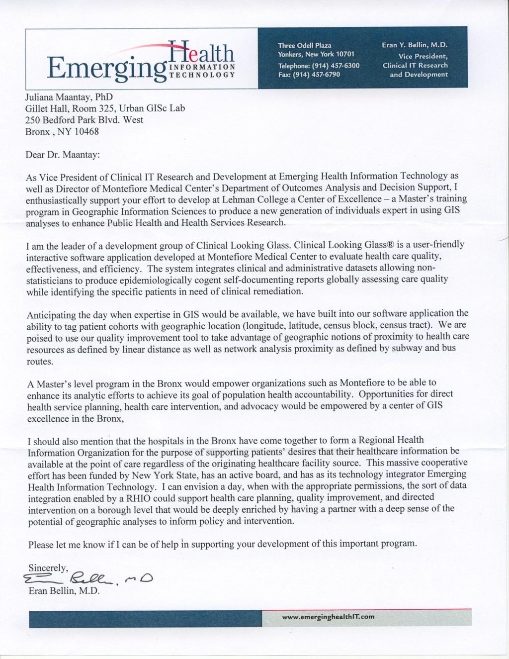
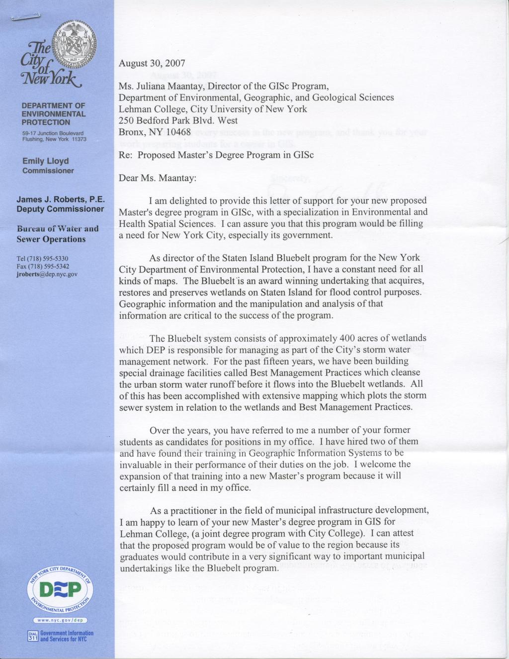
30 Letter of Intent for Proposed Master s Degree Program in Geographic Information Science Lehman College, City University of New York APPENDIX 4 LETTERS OF SUPPORT FOR PROPOSED GISc MASTER S PROGRAM Emerging Health Information Technologies, Inc. Montefiore Medical Center/Albert Einstein College of Medicine New York City Department of Health and Mental Hygiene (DOHMH) Wildlife Conservation Society (WCS) CUNY Graduate Center Earth and Environmental Science Doctoral Program NOAA-CREST (National Oceanic and Atmospheric Administration Cooperative Center for Remote Sensing Science and Technology) Lehman College Master s of Public Health Program New York City Department of Environmental Protection (DEP) 30
31
32
33
 Bureau of Environmental Surveillance and Policy 253 Broadway, CN-34C New York, NY 10007 (212) 788-1219 August 31, 2007 Juliana Maantay, Ph.D. Department of Environmental, Geographic and Geological Sciences Lehman College, City University of New York 309 Gillett Hall, 250 Bedford Park Blvd.")

34 THE CITY OF NEW YORK DEPARTMENT OF HEALTH AND MENTAL HYGIENE Michael R. Bloomberg Thomas R. Frieden, M.D., M.P.H. Mayor Commissioner nyc.gov/health Daniel Kass Bureau of Environmental Surveillance and Policy 253 Broadway, CN-34C New York, NY (212) August 31, 2007 Juliana Maantay, Ph.D. Department of Environmental, Geographic and Geological Sciences Lehman College, City University of New York 309 Gillett Hall, 250 Bedford Park Blvd. Bronx, NY Dear Dr. Maantay: I am the Assistant Commissioner for the Bureau of Environmental Surveillance and Policy at the NYC Department of Health and Mental Hygiene. Our work frequently involves the use of geographic information systems to support visualization and spatial analysis of the geographic distribution of hazards, exposures and health outcomes, and land use, built environment and other factors that may explain or be associated with them. Were Lehman College to develop a masters degree track in GIS that included training in epidemiology, general environmental science or data presentation, our Bureau would be delighted to consider students for internships, group or individual student projects. Each year, BESP funds two to four graduate student internships. Most recently, we hosted a French graduate student in public health geography, who worked on an analysis of housing and neighborhood predictors of carbon monoxide exposures, among other projects. BESP currently employs a spatial analyst. Interestingly, she has formal masters training in environmental science and epidemiology. Her GIS training has been largely on-the-job and through professional courses. We will be hiring an additional spatial analyst in the next few months, and are also searching for an Arc Server programmer with practical GIS-application experience. It is difficult to find ideal candidates for these positions, because it is rare that a single individual possesses background and experience in epidemiology, statistics, environmental science and GIS, and even rarer still someone who understands urban environmental concerns and New York City. I am heartened that your proposed masters program recognizes the importance of these inter-related sciences and skills. Best wishes in gaining approval for the masters program. Daniel Kass, Ph.D. (ABD), MSPH Assistant Commissioner
35
36
37
38
39
LEHMAN COLLEGE CITY UNIVERSITY OF NEW YORK DEPARTMENT OF ENVIRONMENTAL, GEOGRAPHIC, AND GEOLOGICAL SCIENCES CURRICULAR CHANGE
 LEHMAN COLLEGE CITY UNIVERSITY OF NEW YORK DEPARTMENT OF ENVIRONMENTAL, GEOGRAPHIC, AND GEOLOGICAL SCIENCES CURRICULAR CHANGE Hegis Code: 2206.00 Program Code: 452/2682 1. Type of Change: New Course 2.
LEHMAN COLLEGE OF THE CITY UNIVERSITY OF NEW YORK. 1. Type of Change: Change in Degree Requirements
 Alpha Number: Hegis Code 1214 Program Code: 30600 1. Type of Change: Change in Degree Requirements 2. From: [The curriculum consists of 45 graduate credits and includes core courses, an area of specialization,
I. Application for Registration of a New Program
 THE STATE EDUCATION DEPARTMENT / THE UNIVERSITY OF THE STATE OF NEW YORK / ALBANY, NY 12234 I. Application for Registration of a New Program This application is for New York degree-granting institutions
geographic patterns and processes are captured and represented using computer technologies
 Proposed Certificate in Geographic Information Science Department of Geographical and Sustainability Sciences Submitted: November 9, 2016 Geographic information systems (GIS) capture the complex spatial
GRADUATE CERTIFICATE PROGRAM
 GRADUATE CERTIFICATE PROGRAM GEOGRAPHIC INFORMATION SCIENCES Department of Geography University of North Carolina Chapel Hill Conghe Song, Director csong @email.unc.edu 919-843-4764 (voice) 919-962-1537
Geography (GEOG) Courses
 Courses") Geography (GEOG) 1 Geography (GEOG) Courses GEOG 100. Introduction to Human Geography. 4 (GE=D4) Introduction to the global patterns and dynamics of such human activities as population growth and movements,
Geography (GEOG) 1 Geography (GEOG) Courses GEOG 100. Introduction to Human Geography. 4 (GE=D4) Introduction to the global patterns and dynamics of such human activities as population growth and movements,
Advanced Readings. Environment and Land Use Concentration The following seminars and studios would apply
 Community Development and Housing Concentration URP 720 Urban Housing Policies URP 722 Community Development and Housing URP 724 Urban Revitalization Studio URP 726 Citizen Participation Strategies URP
The B.S.G.E. program is accredited by the Engineering Accreditation Commission of ABET,
 Geomatics Engineering The program of study leading to the Bachelor of Science in Geomatics Engineering (B.S.G.E.) deals with designing solutions to measure, map, model, analyze and graphically display
SOUTH DAKOTA BOARD OF REGENTS. Academic and Student Affairs ******************************************************************************
 SOUTH DAKOTA BOARD OF REGENTS Academic and Student Affairs AGENDA ITEM: 7 C (4) DATE: June 28-30, 2016 ****************************************************************************** SUBJECT: New Minor:
INTEGRATING GEOSPATIAL PERSPECTIVES IN THE ANTHROPOLOGY CURRICULUM AT THE UNIVERSITY OF NEW MEXICO (UNM)
") INTEGRATING GEOSPATIAL PERSPECTIVES IN THE ANTHROPOLOGY CURRICULUM AT THE UNIVERSITY OF NEW MEXICO (UNM) VERONICA ARIAS HEATHER RICHARDS JUDITH VAN DER ELST DEPARTMENT OF ANTHROPOLOGY MARCH 2005 INTEGRATING
INTEGRATING GEOSPATIAL PERSPECTIVES IN THE ANTHROPOLOGY CURRICULUM AT THE UNIVERSITY OF NEW MEXICO (UNM) VERONICA ARIAS HEATHER RICHARDS JUDITH VAN DER ELST DEPARTMENT OF ANTHROPOLOGY MARCH 2005 INTEGRATING
International Development
 International Development Office: The Payson Center for International Development and Technology Transfer, 300 Hébert Hall Phone: 504-865-5240 Fax: 504-865-5241 Website: www.payson.tulane.edu/ Program
1. Omit Human and Physical Geography electives (6 credits) 2. Add GEOG 677:Internet GIS (3 credits) 3. Add 3 credits to GEOG 797: Final Project
 2. Add GEOG 677:Internet GIS (3 credits) 3. Add 3 credits to GEOG 797: Final Project") The Department of Geography and the Office of Professional Studies propose to modify the Master of Professional Studies in Geospatial Information Sciences (GIS) as follows: 1. Omit Human and Physical Geography
The Department of Geography and the Office of Professional Studies propose to modify the Master of Professional Studies in Geospatial Information Sciences (GIS) as follows: 1. Omit Human and Physical Geography
Diffusion of GIS in Public Policy Doctoral Program
 Diffusion of GIS in Public Policy Doctoral Program By Fulbert Namwamba PhD Southern University This presentation demonstrate how GIS was introduced in the Public Policy Doctoral Program at Southern University,
Pathways. Pathways through the Geography Major
 Pathways through the Major majors may structure their course selections around a sub-field of. Pathways are suggestions for classes in, in related disciplines, and skills training. Each pathway includes
CERTIFICATE PROGRAM IN
 CERTIFICATE PROGRAM IN GEOGRAPHIC INFORMATION SCIENCE Department of Geography University of Utah 260 S. Central Campus Dr., Rm 270 Salt Lake City, UT 84112-9155 801-581-8218 (voice); 801-581-8219 (fax)
REGULATIONS FOR THE POSTGRADUATE DIPLOMA IN GEOGRAPHIC INFORMATION SYSTEMS (PDipGIS)
") 182 REGULATIONS FOR THE POSTGRADUATE DIPLOMA IN GEOGRAPHIC INFORMATION SYSTEMS (PDipGIS) (See also General Regulations) PDGIS 1 Admission requirements To be eligible for admission to studies leading to
182 REGULATIONS FOR THE POSTGRADUATE DIPLOMA IN GEOGRAPHIC INFORMATION SYSTEMS (PDipGIS) (See also General Regulations) PDGIS 1 Admission requirements To be eligible for admission to studies leading to
Environmental Studies Seminar
 Graduation Requirements In addition to the requirements listed below, students must satisfy: 1. the University regulations (see the Academic Regulations of the University section of this Calendar), 2.
MASTER OF APPLIED GEOGRAPHY (M.A.GEO.) MAJOR IN GEOGRAPHY RESOURCE AND ENVIRONMENTAL STUDIES
 MAJOR IN GEOGRAPHY RESOURCE AND ENVIRONMENTAL STUDIES") Master of Applied Geography (M.A.Geo.) Major in Geography Resource and Environmental Studies 1 MASTER OF APPLIED GEOGRAPHY (M.A.GEO.) MAJOR IN GEOGRAPHY RESOURCE AND ENVIRONMENTAL STUDIES Major Program
Master of Applied Geography (M.A.Geo.) Major in Geography Resource and Environmental Studies 1 MASTER OF APPLIED GEOGRAPHY (M.A.GEO.) MAJOR IN GEOGRAPHY RESOURCE AND ENVIRONMENTAL STUDIES Major Program
MASTER OF APPLIED GEOGRAPHY (M.A.GEO.) MAJOR IN GEOGRAPHIC INFORMATION SCIENCE
 MAJOR IN GEOGRAPHIC INFORMATION SCIENCE") Master of Applied Geography (M.A.Geo.) Major in Geographic Information Science 1 MASTER OF APPLIED GEOGRAPHY (M.A.GEO.) MAJOR IN GEOGRAPHIC INFORMATION SCIENCE Major Program The Master of Applied Geography
Master of Applied Geography (M.A.Geo.) Major in Geographic Information Science 1 MASTER OF APPLIED GEOGRAPHY (M.A.GEO.) MAJOR IN GEOGRAPHIC INFORMATION SCIENCE Major Program The Master of Applied Geography
School of Geography and Geosciences. Head of School Degree Programmes. Programme Requirements. Modules. Geography and Geosciences 5000 Level Modules
 School of Geography and Geosciences Head of School Degree Programmes Graduate Diploma: Dr W E Stephens Health Geography Research Environmental History and Policy (see School of History) M.Res.: M.Litt.:
Geography and Geographic Information Science (Geog)
") University of North Dakota 1 Geography and Geographic Information Science (Geog) http://www.arts-sciences.und.edu/geography Atkinson, Munski (Graduate Director), Niedzielski, Rundquist, Todhunter, Vandeberg
University of North Dakota 1 Geography and Geographic Information Science (Geog) http://www.arts-sciences.und.edu/geography Atkinson, Munski (Graduate Director), Niedzielski, Rundquist, Todhunter, Vandeberg
GEOGRAPHY, ENVIRONMENT, AND SUSTAINABILITY (GES)
") Geography, Environment, and Sustainability (GES) 1 GEOGRAPHY, ENVIRONMENT, AND SUSTAINABILITY (GES) GES 102 The Historical Geography of the Western World 3 A study of the geographical factors which combine
Geography, Environment, and Sustainability (GES) 1 GEOGRAPHY, ENVIRONMENT, AND SUSTAINABILITY (GES) GES 102 The Historical Geography of the Western World 3 A study of the geographical factors which combine
LEHMAN COLLEGE OF THE CITY UNIVERSITY OF NEW YORK DEPARTMENT OF CHEMISTRY CURRICULUM CHANGE
 LEHMAN COLLEGE OF THE CITY UNIVERSITY OF NEW YORK DEPARTMENT OF CHEMISTRY CURRICULUM CHANGE Name of Program and Degree Award: Chemistry BS Hegis Number: 1905 Program Code: 02663 Effective Term: Fall 2015
CHEMISTRY, B.S. (SCIENCE)
") Chemistry, B.S. (Science) 1 CHEMISTRY, B.S. (SCIENCE) Begin Campus: Any Penn State Campus End Campus: University Park Program Description This major provides a strong foundation in the theory and practice
Chemistry, B.S. (Science) 1 CHEMISTRY, B.S. (SCIENCE) Begin Campus: Any Penn State Campus End Campus: University Park Program Description This major provides a strong foundation in the theory and practice
Programme Study Plan
 Faculty of Social and Life Sciences Programme Study Plan Geographic Information Systems Programme Code: Programme Title: TGLIT Engineering: Surveying Technology and Geographical IT Credits: 180 Programme
CHEMISTRY, BS. Degree Requirements. Admissions. Policies. Requirements. Admissions & Policies. Teacher Licensure. BS without Concentration
 Chemistry, BS CHEMISTRY, BS Banner Code: SC-BS-CHEM Academic Advising Phone: 70-99-07 Email: sslayden@gmu.edu Website: cos.gmu.edu/chemistry/undergraduate-programs/ This program is approved by the American
Change the narrative for Chemistry, and change the major and minor requirements for Chemistry
 APC Document 37 Change the narrative for Chemistry, and change the major and minor requirements for Chemistry Effective Date: Fall 2016 1. Delete: On page 99-101, the Chemistry narrative, and the major
CAA 1 of 30. To: OAA Date: 6/14/2010. Cover Letter for Proposals from the Department of Geography
 1 of 30 To: OAA Date: 6/14/2010 Cover Letter for Proposals from the Department of Geography This is the transmittal cover letter to the Office of Academic Affairs that reflects the efforts by the Department
PLANNING (PLAN) Planning (PLAN) 1
 Planning (PLAN) 1") Planning (PLAN) 1 PLANNING (PLAN) PLAN 500. Economics for Public Affairs Description: An introduction to basic economic concepts and their application to public affairs and urban planning. Note: Cross-listed
Planning (PLAN) 1 PLANNING (PLAN) PLAN 500. Economics for Public Affairs Description: An introduction to basic economic concepts and their application to public affairs and urban planning. Note: Cross-listed
GEOGRAPHY (GE) Courses of Instruction
 Courses of Instruction") GEOGRAPHY (GE) GE 102. (3) World Regional Geography. The geographic method of inquiry is used to examine, describe, explain, and analyze the human and physical environments of the major regions of the
GEOGRAPHY (GE) GE 102. (3) World Regional Geography. The geographic method of inquiry is used to examine, describe, explain, and analyze the human and physical environments of the major regions of the
Core Courses for Students Who Enrolled Prior to Fall 2018
 Biostatistics and Applied Data Analysis Students must take one of the following two sequences: Sequence 1 Biostatistics and Data Analysis I (PHP 2507) This course, the first in a year long, two-course
Dr. Emily A. Fogarty, Coordinator History, Politics and Geography Dept School of Arts & Sciences
 Geography Dr. Emily A. Fogarty, Coordinator History, Politics and Geography Dept. Emily.Fogarty@farmingdale.edu 631-420-2739 School of Arts & Sciences The History, Politics and Geography Department offers
Geography Faculty: S. Tsutsui, Departmental Chair; G. Berlin, J. Byrkit, A. Lew, H. Salisbury, S. Swarts, G. Van Often.
 Geography 295 ANT 685 Graduate Research (1-6). ANT 697 Independent Study (1-3). ANT 698 Graduate Seminar (1-3). ANT 699 Thesis (1-6). Advisement Coordinators: L. McFarlane, M. Sanera. For faculty listing,
1. Pass GE1101E Geographical Journeys: Exploring World Environments. This will be counted towards the Faculty Core or UE requirements.
 H Geography At the Department of Geography, students are encouraged to develop a deeper and more critical understanding of both physical and human environments. Students will acquire knowledge, skills
Science, General. Program Description
 Program Description This program is designed to provide students with a basic science background, preparing them to move into a curriculum at a four-year institution leading to a degree in such fields
Will this program be printed in the Bulletin? Yes No
 NEW UNDERGRADUATE MINOR / CHANGE UNDERGRADUATE MINOR FORM Please fill out Section I. SECTION I: GENERAL INFORMATION Program: GEO Minor: Geography College: A&S Department: Geography Bulletin PP: 135 CIP
Bachelor of Science in Geography (Fall 2016) Student
 Student") Bachelor of Science in Geography (Fall 2016) Student Student ID# Anticipated Graduation Term Advisor Minimum GPA 2.00 Today's Date 2016-2017 Undergraduate Catalog Requirements System Gen Ed Requirements
Bachelor of Science in Geography (Fall 2016) Student Student ID# Anticipated Graduation Term Advisor Minimum GPA 2.00 Today's Date 2016-2017 Undergraduate Catalog Requirements System Gen Ed Requirements
Geography (GEOG) Introduction to Geography Global Change and Natural Disasters and Environmental Change
 Introduction to Geography Global Change and Natural Disasters and Environmental Change") Geography (GEOG) Head of Department: Professor Jeffrey P. Osleeb Department Office: Room 422, Philip E. Austin Building For major requirements, see the College of Liberal Arts and Sciences section of this
Geography (GEOG) Head of Department: Professor Jeffrey P. Osleeb Department Office: Room 422, Philip E. Austin Building For major requirements, see the College of Liberal Arts and Sciences section of this
CHEMISTRY, BS. Admissions. Policies. Degree Requirements. Admissions & Policies. Requirements. BS without Concentration.
 Chemistry, BS CHEMISTRY, BS Banner Code: SC-BS-CHEM Academic Advising Phone: 70-99-07 Email: sslayden@gmu.edu Website: cos.gmu.edu/chemistry/undergraduate-programs/ This program is approved by the American
GEOGRAPHY, B.A. COLLEGE OF LETTERS & SCIENCE BREADTH AND DEGREE REQUIREMENTS: BACHELOR OF ARTS (B.A.) UNIVERSITY GENERAL EDUCATION HOW TO GET IN
 UNIVERSITY GENERAL EDUCATION HOW TO GET IN") Geography, B.A. 1 GEOGRAPHY, B.A. Geography studies the interaction between people and their environments, including the ways in which people, environments, and their interactions vary from place to place
Geography, B.A. 1 GEOGRAPHY, B.A. Geography studies the interaction between people and their environments, including the ways in which people, environments, and their interactions vary from place to place
ENVIRONMENT AND NATURAL RESOURCES 3700 Introduction to Spatial Information for Environment and Natural Resources. (2 Credit Hours) Semester Syllabus
 Semester Syllabus") ENVIRONMENT AND NATURAL RESOURCES 3700 Introduction to Spatial Information for Environment and Natural Resources COURSE INSTRUCTOR: Dr. Kris Jaeger Assistant Professor 359 Kottman Hall (Mondays and Tuesdays)
ENVIRONMENT AND NATURAL RESOURCES 3700 Introduction to Spatial Information for Environment and Natural Resources COURSE INSTRUCTOR: Dr. Kris Jaeger Assistant Professor 359 Kottman Hall (Mondays and Tuesdays)
Programme title: MChem Chemistry (Mathematical and Computational Chemistry)
") Faculty of Life Sciences Programme Specification Programme title: MChem Chemistry (Mathematical and Computational Chemistry) Academic Year: 2018/19 Degree Awarding Body: Final and interim award(s): University
Faculty of Life Sciences Programme Specification Programme title: MChem Chemistry (Mathematical and Computational Chemistry) Academic Year: 2018/19 Degree Awarding Body: Final and interim award(s): University
CALIFORNIA STATE POLYTECHNIC UNIVERSITY, POMONA ACADEMIC SENATE ACADEMIC PROGRAMS COMMITTEE REPORT TO THE ACADEMIC SENATE AP
 CALIFORNIA STATE POLYTECHNIC UNIVERSITY, POMONA ACADEMIC SENATE ACADEMIC PROGRAMS COMMITTEE REPORT TO THE ACADEMIC SENATE AP-009-167 BS IN GEOGRAPHY GEOSPATIAL ANALYSIS OPTION Academic Programs Committee
COLLEGE OF PUBLIC AFFAIRS AND COMMUNITY SERVICE School of Public Administration Emergency Services Program Bachelor of Science in Emergency Management
 COLLEGE OF PUBLIC AFFAIRS AND COMMUNITY SERVICE School of Public Administration Emergency Services Program Bachelor of Science in Emergency Management (2015/2016 Catalog) Emergency Management develops
Fairmont State University
 Fairmont State University WV-HEPC Series 11 Intent to Plan (Section 5 of Series 11) Date: January 2018 Title of Degree: Location: Bachelor of Science (B.S.) Surveying & Geomatics Engineering Technology
Environmental Geography
 nvironmental Geography Master of Science Understanding the interactions between humans and their environment in space and time. Deciphering environmental processes and patterns often requires the bigger
GIScience in Urban Planning Education - Experience from University of Maryland
 GIScience in Urban Planning Education - Experience from University of Maryland February 3, 2007 University of Tokyo Qing Shen Professor of Urban Studies and Planning School of Architecture,
AGENDA Undergraduate Curriculum Committee 12 Oct 18 Walker Library, Room 475
 AGENDA 2018 2019 Undergraduate Curriculum Committee 12 Oct 18 Walker Library, Room 475 Call to Order: Approval of Minutes from September 14, 2018: Announcements: Previously Tabled Proposals: New Business:
Proposal for Revision to the Geographic Information Systems (GIS) Academic Certificate Community College of Philadelphia.
 Academic Certificate Community College of Philadelphia.") Proposal for Revision to the Geographic Information Systems (GIS) Academic Certificate Community College of Philadelphia February 24, 2010 Kathy Smith Chair, Social Science Contributors Christopher Murphy
Proposal for Revision to the Geographic Information Systems (GIS) Academic Certificate Community College of Philadelphia February 24, 2010 Kathy Smith Chair, Social Science Contributors Christopher Murphy
Advancing Green Chemistry Practices in Business
 Green Chemistry and Commerce Council: 6 th Annual GC3 Innovators Roundtable Advancing Green Chemistry Practices in Business Barbara Peterson, Ph.D. Marty Mulvihill, Ph.D. Program Director Executive Director,
Michael Thomas Sullivan
 Michael Thomas Sullivan michael.sullivan2@lc.cuny.edu Home Address 2319 Brigham Street Brooklyn, NY 11229 Cell (516) 729-8870 Academic Address Geographic Information Science Dept. Lehman College, CUNY
Degree Type Bachelor of Science (BS) Degree Title Biology
 Degree Title Biology") Degree Type Bachelor of Science (BS) Degree Title Biology Focus: Biological Science The Department of Biology is committed to excellence in instruction, scholarly accomplishment, research, professional
Degree Type Bachelor of Science (BS) Degree Title Biology Focus: Biological Science The Department of Biology is committed to excellence in instruction, scholarly accomplishment, research, professional
Complete version as of 1 October 2017
 Note: The legally binding versions are found in the University of Innsbruck Bulletins (in German). Appendix to the University of Innsbruck Bulletin of 3 June 2015, Issue 60, No. 457 Original version published
Space Syntax: Architecture and Cities MRes This programme information sheet includes details of the structure and content of the course.
 Space Syntax: Architecture and Cities MRes 2018-19 This programme information sheet includes details of the structure and content of the course. CONTENTS Overview 3 Structure 4 Content 5 Staff 6 Opportunities
Programme Specification MSc in Cancer Chemistry
 Programme Specification MSc in Cancer Chemistry 1. COURSE AIMS AND STRUCTURE Background The MSc in Cancer Chemistry is based in the Department of Chemistry, University of Leicester. The MSc builds on the
High School Counselor 2018 Packet
 High School Counselor 2018 Packet IESA is a National Center for Academic Excellence in Geospatial Science Education Lewis F. Rogers Institute for Environmental & Spatial Analysis The Lewis F. Rogers Institute
FORMAT 5 Submit originals and one copy and electronic copy to Governance/Faculty Senate Office ( electronic copy to
 FORMAT 5 Submit originals and one copy and electronic copy to Governance/Faculty Senate Office (email electronic copy to fysenat@uaf.edu) PROGRAM/DEGREE REQUIREMENT CHANGE (MAJOR/MINOR) SUBMITTED BY: Department
DRAFT SYLLABUS. Please use Blackboard to send messages.
 SYLLABUS Course Title: Geographic Information Systems and Spatial Analysis for Public Policy Academic Department/Course Number: PUBP 754 Semester/Year: Fall 2017 Building/Room: FH 307 Days/Time: W 4:30
Department of Geography
 Department of (College of Social and Behavioral Sciences) www.uni.edu/geography The Department of offers the following undergraduate and graduate programs and program certificate. Specific requirements
Urban Studies Applicable to students admitted in
 Urban Studies Applicable to students admitted in 2014-15 Major Programme Requirement Students are required to complete a minimum of 8 units of courses as follows: 1. Faculty Package: 9 Any three courses,
Curriculum map GEOGRAPHY
 Curriculum map Learning outcomes (LOs): Having completed a major in Geography, a student will be able to: 1. Demonstrate an understanding of the major biophysical and social patterns in the world, and
GEOLOGY. Bachelor of Science in Geology. Faculty. Programs Offered. Careers in Geology and Earth Science
 GEOLOGY DEPARTMENT OFFICE Darwin Hall 116 (707) 664-2334 www.sonoma.edu/geology DEPARTMENT CHAIR Matthew J. James ADMINISTRATIVE COORDINATOR Elisabeth Meyers EQUIPMENT TECHNICIAN Phillip R. Mooney Faculty
Rutgers-Newark PHYSICS RUTGERS THE STATE UNIVERSITY OF NEW JERSEY NEWARK
 THE STATE UNIVERSITY OF NEW JERSEY RUTGERS NEWARK Rutgers-Newark PHYSICS Number of programs offered.............. 4 Number of students in program........... 10 Average size of upper-level classes.............
FORMAT 5 Submit originals and one copy and electronic copy to Governance/Faculty Senate Office ( electronic copy to
 FORMAT 5 Submit originals and one copy and electronic copy to Governance/Faculty Senate Office (email electronic copy to jbharvie@alaska.edu) SUBMITTED BY: PROGRAM/DEGREE REQUIREMENT CHANGE (MAJOR) Department
Techniques for Science Teachers: Using GIS in Science Classrooms.
 Techniques for Science Teachers: Using GIS in Science Classrooms. After ESRI, 2008 GIS A Geographic Information System A collection of computer hardware, software, and geographic data used together for
Advancing Geoscientific Capability. Geological Survey of Finland
 Advancing Geoscientific Capability Geological Survey of Finland GTK in brief The Geological Survey of Finland (GTK) is one of the largest European centres of excellence in assessment, research and the
GEOGRAPHY COURSES UNDERGRADUATE GRADUATE CERTIFICATE FACULTY. Explanation of Course Numbers. Bachelor's program. Minors.
 GEOGRAPHY The Department of Geography is dedicated to achieving excellence in research and education through the diffusion of geographic knowledge that focuses on the relationships between the physical
GIS TECHNICIAN I GIS TECHNICIAN II
 GIS TECHNICIAN I GIS TECHNICIAN II CITY OF ROSEVILLE DEFINITION To perform a variety of technical office and field work duties related to the creation and maintenance of maps, tables, graphs and other
Joanne N. Halls, PhD Dept. of Geography & Geology David Kirk Information Technology Services
 Joanne N. Halls, PhD Dept. of Geography & Geology David Kirk Information Technology Services Geographic Information Systems manage and analyze data to solve spatial problems. Real World Abstraction Analysis
BACHELOR OF ARTS GEOGRAPHY
 BACHEL OF ARTS General Education Categories (4-5 credits total) FYS First Year Seminar W-I Written Communication - Level I OC Oral Communication PGR Personal Growth & Responsibility CEA Creative Expression
Welcome to the Department of Biological Sciences. Main Office: Conant Science 301 Mrs. Tracie Fagan Admin. Assistant Phone:
 Welcome to the Department of Biological Sciences Main Office: Conant Science 301 Mrs. Tracie Fagan Admin. Assistant Phone: 508-531-1358 The Department of Biological Sciences Small Classes Excellent New
GIS ADMINISTRATOR / WEB DEVELOPER EVANSVILLE-VANDERBURGH COUNTY AREA PLAN COMMISSION
 GIS ADMINISTRATOR / WEB DEVELOPER EVANSVILLE-VANDERBURGH COUNTY AREA PLAN COMMISSION SALARY RANGE INITIATION $43,277 SIX MONTHS $45,367 POSITION GRADE PAT VI The Evansville-Vanderburgh County Area Plan
EASTERN OREGON UNIVERSITY Chemistry-Biochemistry
 EASTERN OREGON UNIVERSITY Chemistry-Biochemistry PROGRAM OBJECTIVES The chemistry-biochemistry degree offered by the Department of Chemistry-Biochemistry prepares chemistry majors for graduate work in
Chemical Safety as a Core ACS Value: Report on the 2018 Safety Summit
 Chemical Safety as a Core ACS Value: Report on the 2018 Safety Summit Introduction In December 2016, the ACS Board of Directors adopted safety as one of the Society s core values, thus affirming that the
Molinaro Keyword: Geography. Associate Professors: Walasek, Ph.D.; (Chair), Wolf, Ph.D.
, Wolf, Ph.D.") 126 - Geography GENERAL INFO GRADUATE UNDREGRADUATE ADULT/NON-TRAD POLICIES STUDENT LIFE ADMISSIONS INTRODUCTION Degree Offered: Bachelor of Arts. Associate Professors: Walasek, Ph.D.; (Chair), Wolf, Ph.D.
126 - Geography GENERAL INFO GRADUATE UNDREGRADUATE ADULT/NON-TRAD POLICIES STUDENT LIFE ADMISSIONS INTRODUCTION Degree Offered: Bachelor of Arts. Associate Professors: Walasek, Ph.D.; (Chair), Wolf, Ph.D.
GIS Visualization: A Library s Pursuit Towards Creative and Innovative Research
 GIS Visualization: A Library s Pursuit Towards Creative and Innovative Research Justin B. Sorensen J. Willard Marriott Library University of Utah justin.sorensen@utah.edu Abstract As emerging technologies
Chemistry Brigham Young University Idaho
 Department of Chemistry Chemistry Introduction Chemistry is the study of matter, energy, and their transformations. The principles of this discipline serve as a theoretical basis for a wide variety of
Chemistry and Biochemistry
 Chemistry and Biochemistry Bachelor of Science Degree in Chemistry Degree Requirements University Core Curriculum Requirements 1 39 College of Science Academic Requirements 6 Biological Sciences - (3 hours
GEOLOGY & ENVIRONMENTAL GEOSCIENCES (GEOL)
") Geology & Environmental Geosciences (GEOL) 1 GEOLOGY & ENVIRONMENTAL GEOSCIENCES (GEOL) Faculty Professors: Christopher G. Daniel (Chair), Mary Beth Gray, Carl S. Kirby, R. Craig Kochel, Jeffrey M. Trop
Geology & Environmental Geosciences (GEOL) 1 GEOLOGY & ENVIRONMENTAL GEOSCIENCES (GEOL) Faculty Professors: Christopher G. Daniel (Chair), Mary Beth Gray, Carl S. Kirby, R. Craig Kochel, Jeffrey M. Trop
Faculty: Andrew Carr, Ryan Felix, Stephanie Gould, James Hebda, Karla McCain, John Richardson, Lindsay Zack
 CHEMISTRY Chair: Bradley Smucker (Fall 2017) and Andrew Carr (Spring 2018) Faculty: Andrew Carr, Ryan Felix, Stephanie Gould, James Hebda, Karla McCain, John Richardson, Lindsay Zack Adjunct Instructor:
Agricultural. Chemistry. Agricultural production: crops and livestock Agrichemicals development: herbicides, pesticides, fungicides, fertilizers, etc.
 Agricultural Agricultural production: crops and livestock Agrichemicals development: herbicides, pesticides, fungicides, fertilizers, etc. Agrichemicals testing Environmental testing Regulation Government:
GEOGRAPHY (GEOG) Geography (GEOG) 1. GEOG 11. Laboratory in Physical Geography. 1 Unit Prerequisite(s): GEOG 1; may be taken concurrently.
 Geography (GEOG) 1. GEOG 11. Laboratory in Physical Geography. 1 Unit Prerequisite(s): GEOG 1; may be taken concurrently.") Geography (GEOG) 1 GEOGRAPHY (GEOG) GEOG 1. Physical Geography: The Distribution of Natural Phenomena. 3 Units General Education Area/Graduation Requirement: Physical Science (B1), Summer Introductory
Geography (GEOG) 1 GEOGRAPHY (GEOG) GEOG 1. Physical Geography: The Distribution of Natural Phenomena. 3 Units General Education Area/Graduation Requirement: Physical Science (B1), Summer Introductory
COMMITTEE ON INSTRUCTION AND CURRICULUM
 ACADEMIC SENATE http://www.csueastbay.edu/senate 510-885-3671 COMMITTEE ON INSTRUCTION AND CURRICULUM 16-17 CIC 13 Monday, October 10, 2016 TO: FROM: SUBJECT: PURPOSE: ACTION REQUESTED: The Academic Senate
Section 2. Indiana Geographic Information Council: Strategic Plan
 Section 2. Indiana Geographic Information Council: Strategic Plan Introduction A geographic information system (GIS) is an automated tool that allows the collection, modification, storage, analysis, and
Lab Assistant: Kathy Tang Office: SSC 2208 Phone: ext
 The University of Western Ontario Department of Geography GEOGRAPHY 9110B: Introduction to Geographic Information Systems Lecture: Thursday 11:30 1:30pm, SSC #1004 Lab: Thursday 2:30 4:30pm, SSC #1316A
DIPLOMA IN GEOMATICS (NQF Level 6)
") DIPLOMA IN GEOMATICS ( 6) Programme Aims/Purpose: The Diploma in Geomatics programme was purposefully designed to prepare students for a career as survey technician, with specialised knowledge and skills
DIPLOMA IN GEOMATICS ( 6) Programme Aims/Purpose: The Diploma in Geomatics programme was purposefully designed to prepare students for a career as survey technician, with specialised knowledge and skills
Advanced Placement Human Geography
 Advanced Placement Human Geography I. Overview of the Course The purpose of the Advanced Placement (AP) Human Geography course is to introduce students to the systematic study of patterns and processes
Green Chemistry Commitment
 Info Kit Green Chemistry Commitment What is the Green Chemistry Commitment? The Green Chemistry Commitment (GCC) is a consortium program that unites the green chemistry community around shared goals and
COURSES OUTSIDE THE JOURNALISM SCHOOL
 COURSES OUTSIDE THE JOURNALISM SCHOOL Students are not limited to the science courses on this list and may select classes from additional specialties. In accordance with University policy, 400-level courses
ASSESSMENT OF STUDENT LEARNING Department of Geology University of Puerto Rico at Mayaguez. Progress Report
 ASSESSMENT OF STUDENT LEARNING Department of Geology University of Puerto Rico at Mayaguez Progress Report Period of Report August to December of 2004. Purpose of our Assessment The fundamental purpose
Department of Chemistry
 Department of Chemistry Brandon University Department of Chemistry Phone (204) 727-9677 Faculty of Science Fax (204) 728-7346 www.brandonu.ca/chemistry Mission Statement To provide a high quality of education
COLLEGE (check one): Arts and Sciences X Business Education Proposal Submitted By: Jodie Hayob Date Prepared:
: Arts and Sciences X Business Education Proposal Submitted By: Jodie Hayob Date Prepared:") UNIVERSITY OF MARY WASHINGTON PROGRAM CHANGE PROPOSAL Electronically submit this completed form with attachments in one file to the Chair of the College Curriculum Committee. COLLEGE (check one): Arts
UNIVERSITY OF MARY WASHINGTON PROGRAM CHANGE PROPOSAL Electronically submit this completed form with attachments in one file to the Chair of the College Curriculum Committee. COLLEGE (check one): Arts
B.S. Degrees from the Department of Chemistry and Biochemistry
 B.S. Degrees from the Department of Chemistry and Biochemistry 2015-2016 The Department of Chemistry and Biochemistry offers two B.S. degrees: a B.S. degree in Chemistry, and a B.S. degree in Biochemistry
DEPARTMENT of CHEMISTRY AND BIOCHEMISTRY
 DEPARTMENT of CHEMISTRY AND BIOCHEMISTRY ACADEMIC GUIDANCE 2015-2016 PROGRAMS B.S. in Chemistry B.A. in Chemistry B.S. in Biochemistry B.S. in Physical Sciences with specialization in Chemistry or Physics
HGP 470 GIS and Advanced Cartography for Social Science
 HGP 470 GIS and Advanced Cartography for Social Science Winter 2014 Instructor: Office: Tory 3-115 Telephone: 780-248-5758 E-mail: vukicevi@ualberta.ca Office hours: By appointment LECTURES AND LABS Lectures/Labs:
2.1.9 Expansion of Instructional GIS Lab Page 1 of 6. Fiscal Year 2002 Years Following Fiscal Year 2002 $61, $23,625.00
 2.1.9 Expansion of Instructional GIS Lab Page 1 of 6 Proposal for the Use of the FY2002 Technology Fee Submitting Organization: Anthropology and Geography Contact Person: Zhi-Yong Yin Email: gegzyy@panther.gsu.edu
Earth / Space Science Major for Secondary Education
 Earth / Space Science Major for Secondary Education FOR EDUCATION COURSES, Please refer carefully to the current Teacher Education Program Guidebook which can be viewed at http://www.calvin.edu/academic/education/programs/guidebook/guidebook.pdf
BACHELOR OF GEOINFORMATION TECHNOLOGY (NQF Level 7) Programme Aims/Purpose:
 Programme Aims/Purpose:") BACHELOR OF GEOINFORMATION TECHNOLOGY ( Level 7) Programme Aims/Purpose: The Bachelor of Geoinformation Technology aims to provide a skilful and competent labour force for the growing Systems (GIS) industry
BACHELOR OF GEOINFORMATION TECHNOLOGY ( Level 7) Programme Aims/Purpose: The Bachelor of Geoinformation Technology aims to provide a skilful and competent labour force for the growing Systems (GIS) industry
BSEE REQUIREMENTS
 College of Engineering The Klipsch School of Electrical and Computer Engineering BSEE REQUIREMENTS 2014-2015 This document presents a summary of the requirements for earning a Bachelor of Science degree
JOB DESCRIPTION. Research Associate - Urban Economy and Employment
 JOB DESCRIPTION Research Associate - Urban Economy and Employment 2 Research Associate Urban Economy and Employment About Us The Indian Institute for Human Settlements (IIHS) is a national education institution