Remote Sensing for Environment of Angkor Site (REAS) Cheng Wang
|
|
|
- Baldric Holland
- 5 years ago
- Views:
Transcription
 Cheng Wang wangcheng@radi.ac.")
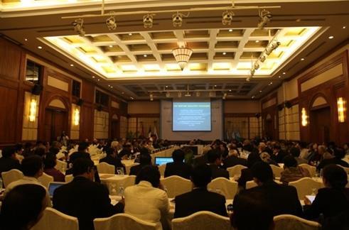
1 Remote Sensing for Environment of Angkor Site (REAS) Cheng Wang July 4, 2016


2 Outline Background REAS Project Current Progress

3 Research Background: Brief Review Kulun Mountain Angkor Wat
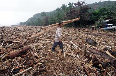
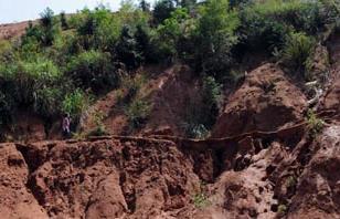
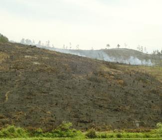
4 Deforestation Fires Soil erosion Challenges Flood Weathering denudation Collapse

 Intergovernmental Conference on Safeguarding and Developing")

5 Research Background: Brief Review Restoration and Protection of Angkor Site A national priority of Cambodia supported by UNESCO and over 20 its member countries. The Tokyo Declaration (Oct. 13, 1993) Intergovernmental Conference on Safeguarding and Developing Angkor Restoration of Preah Khan Temple and Phnom Bakheng by USA Restoration of the Terrace of Elephants by France Restoration of Ta Keo by the Chinese government Phnom Bakheng Bayon Ta Keo


6 Research Background: Brief Review Remote Sensing Applications on Angkor Site 1992, University of Arkansas (USA), Landsat TM, investigated AOI 1994, NASA Jet Propulsion Laboratory, Radar, revealed drainage network Landsat TM, Feb. 7,1989 Landsat ETM+, Jan. 31, , University of Florida, Landsat TM/ETM, land cover change monitoring 2010, Keio University (Japan), Landsat TM and SPOT-PAN, mapped geomorphology Landsat TM, Jan.10, 2002 Landsat ETM+, Feb 27, 2005


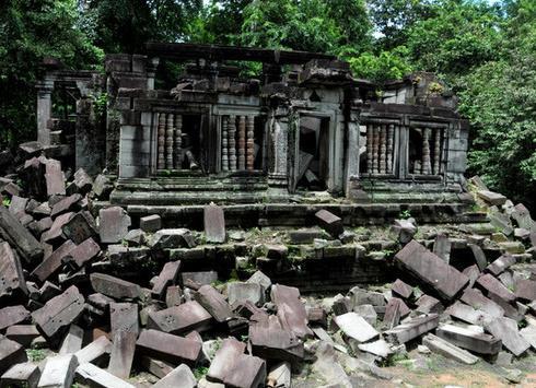
7 Research Background: Brief Review Airborne LiDAR Application on Angkor Site Airborne LiDAR was carried out in 2012 by a group organized by University of Sydney. The experts explored the earlier and secret Angkor ancient city hidden in the forest and Paddy for hundreds of years. Shaded relief map of terrain Green: previously-documented archaeological features; Red: newly-documented features indicative of an extensive urban layout. Oblique view of Angkor Wat Top: digital orthophoto with elevation derived from the lidar DSM; Bottom: DEM derived from the LiDAR.


 and")
8 Research Background: Challenges and Opportunities Challenges: Environmental deterioration in Angkor and neighboring areas Existing projects have focused on heritage restoration and protection, lacking of a systematic approach to solve the problems Geospatial technologies can provide a systematic approach for studying the complex natural environment and human-environment interactions in Angkor (400 km 2 ) and surrounding areas (5,000 km 2 )


9 Background Prof. Huodong Guo of HIST and RADI and Director BUN Narith of APSARA signed an MOU during the 37th session of the UNESCO World Heritage Committee in Phnom Penh, June 2013 Cambodian Deputy Prime Minister H. E. Dr. Sok An met with the HIST/RADI delegation, and expressed full support for the proposed collaborative project


10 Background June 2013, Siem Reap Determine research contents Forest dynamics monitoring Water system reconstruction Ground subsidence monitoring 3D reconstruction and visualization
 Project Start : July 2013 ;")

11 REAS Project: Project Information Project Title: Remote Sensing for Environment of Angkor Site (REAS) Project Start : July 2013 ; Project End: Dec Objectives: monitoring Angkor site and its surrounding environment better understanding the relationship between them
 Ground subsidence (loosen/ displacement ) Spatial database of")
 Policy recommendations for heritage protection and")

12 Remote Sensing for Environment of Angkor Site ( ) Forest ecosystem (deforestation/ fire) Water system (flood/soil erosion) Ground subsidence (loosen/ displacement ) Spatial database of Angkor Site 3D simulation and GIS Climate system (wind/ temperature/ Precipitation) Soils Rock Types Human Activity (tourism/ urbanization) Policy recommendations for heritage protection and sustainable development Training of heritage management personnel Multi-platform remote sensing data Basic geodata Auxiliary data Optical image Radar data LiDAR data Satellite platform Ground collection
 and surrounding areas (5,000 km 2 ).")
13 Space technologies provide a systematic approach for studying the complex natural environment and human-environment interactions in Angkor (400 km 2 ) and surrounding areas (5,000 km 2 ). Forest Rock Rock & soil soil Water Urban Sprawl
14 REAS Project: Project Information REAS Project Asst. Chief Scientist Executive secretary Chief Scientist Scientific Committee Part 1: Forest dynamics monitoring Part 2: Water system monitoring Part 3: Ground subsidence monitoring Part 4: 3D reconstruction and visualization Part 5: Spatial database of Angkor Site Part 6: Capacity building


15 REAS Project: Data Collection and Preparation Satellite/Sensor Acquired date Acquired date Acquired date 15 Landsat-TM imageries (30m) SPOT ; ; ;2.5m Quickbird ; ;0.6m ALOS-SAR;Radarsat-SAR ,30m,3m ASTER-DEM 2009-V1 product;30m Resolution 30 m 0.6 m TM SAR _ SPOT QB


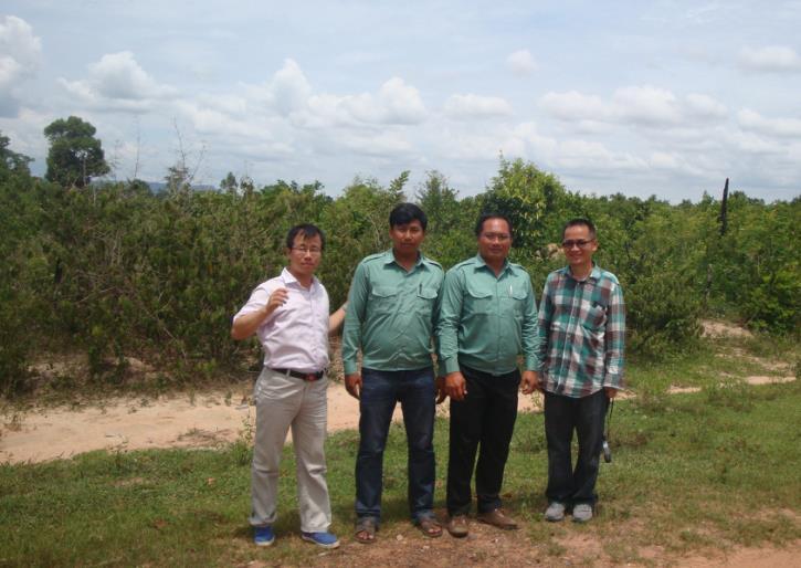
16 REAS Project: Field Work Oct. 2013, laser scanning and LUCC validation
17 Accuracy Assessment REAS Project: Field Work Oct. 2013, laser scanning and LUCC validation Point 3 Point 7 Point 11 sixteen field samples were validated in Nov only two samples (red dot) were misclassified
18 REAS Project: Current Results Land use/ land cover change mapping over 5000 km 2 area Forest area change analysis during the past 30 years Urban area change analysis during the past 30 years Ancient water system reconstruction Monitoring land subsidence from Spatial database designing for Angkor Site Capacity building

 Landsat")


")


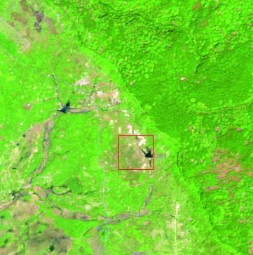
19 Research Progress: Land Cover Change Data source ( ) Landsat MSS Landsat TM HJ-1A Landsat LOI Classification Map (2009/01/05) Urban area: gradually increasing Forest area: unstable decreasing Water area : seasonal fluctuations
20 REAS Project Progress: Land cover change Accuracy Assessment Point 3 Point 7 sixteen field samples were validated in Nov only two samples (red dot) were misclassified Point 11

21 REAS Project Progress: Forest Change

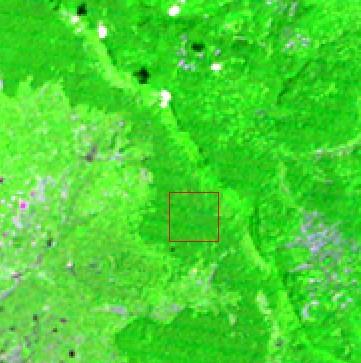
22 REAS Project Progress: Forest Change Forest changes during three periods ( ) Deforested area is 575 km 2 from 1989 to 2014, which occupied almost 35% of the total area. Reproduction area is 62 km 2 from 1989 to 2014, which is about 5% of the total area. 22% deforested area during the period of , while only 13% during the period of As time goes, deforestation spread form south to the north of Kulen mountain. Note:Kulen Mountain was defined in our study as the area with 40 m a.s.l.


23 REAS Project Progress: Forest Change


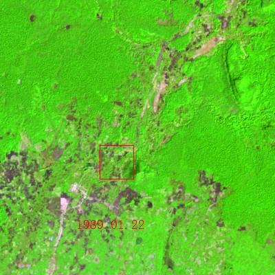
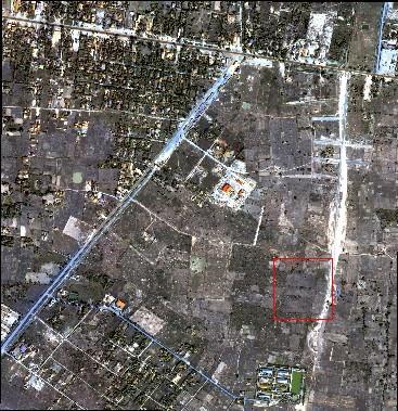
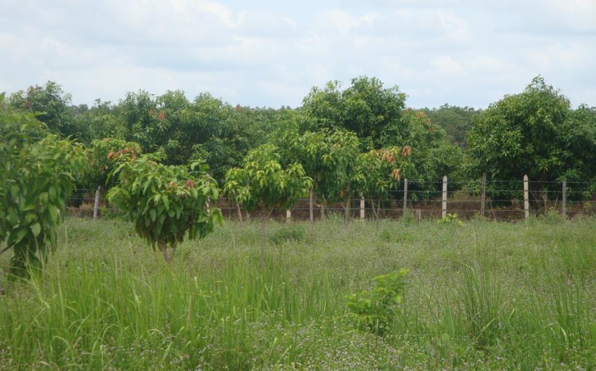
24 Research Progress: Economic Forest Extraction RS Data: ZY3 image (2 m), Jan. 5, 2014 Image Classifier: Object-Based Classifier Features used: Ndvi, Area, Home, Color, Smoothness, Compactness, Shape index, Rectangular fit 1989 LandSat TM Study Area: Kulen Mountain area from m above seal level LandSat LOI Forest areas of Kunlen Mountain mainly located above 40 m a.s.l. Frequent human activities are the main reason which led to forest changes during the past 30 years.


25 Research Progress: Economic Forest Extraction Classified objects Total Number : 345 Min. Area: Km 2 Max. Area: Km 2 Sum Area: Km 2 Area<0.03 km 2 : 298 (86.3%)


26 Research Progress: Economic Forest Extraction Road 67 buffer: 4 Km Count: 208 (60.29%) Area: 2.09 Km 2 (50%)


")
27 Research Progress: Economic Forest Extraction 1989 TM 2000 TM 2006 TM 2014 TM (30 m) 2014 ZY3 (2.1 m) (F-N-F): economic forest


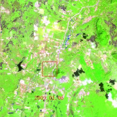
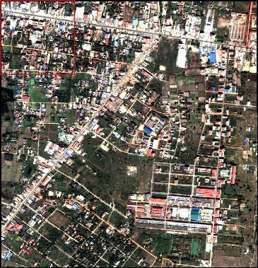
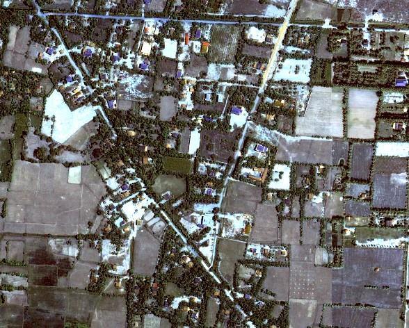
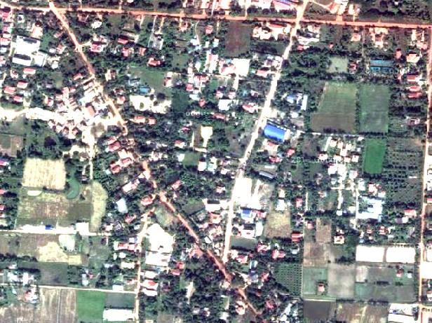
28 REAS Project Progress: Urban Change Siem Reap City Urban area: Before 2000, increased slowly (5.9%) , increased very fast, especially from 2002 to 2006 (48.8%) , increased slowing 15.5% from Expansion direction along the Siem Reap River (N-S) and the road (W-E)


29 REAS Project Progress: Urban Change
")
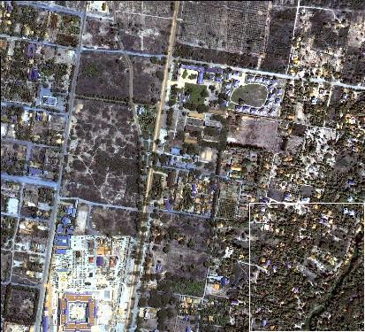

30 Quickbird (0.61m)
")
31 Quickbird (0.61m)
 Year Urban Crop")

32 REAS Project Progress: Urban Change Urban area change during in Siem Reap(km 2 ) Year Urban Crop & Grass Forest Water Vacant Road Total


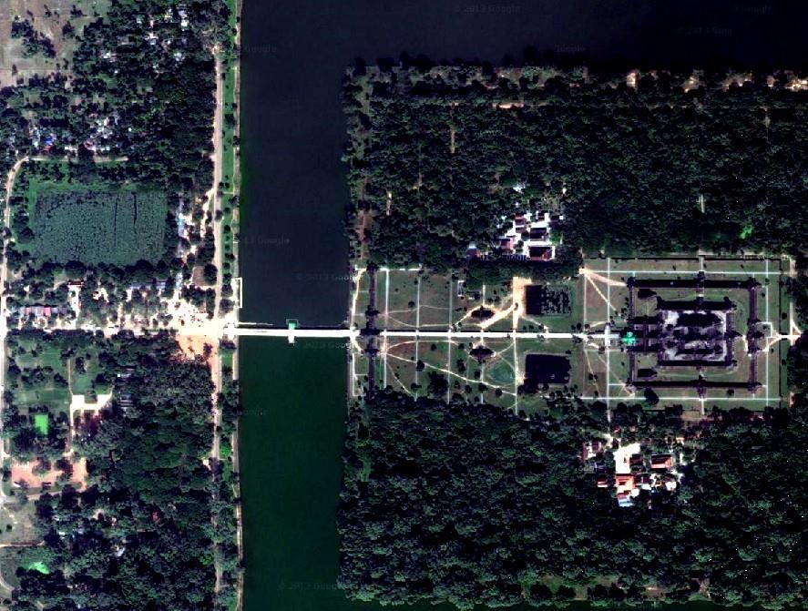
33 REAS Project Progress: Water Change Small changes, depends on the acquirsition time of the used image The changes are mainly distributed around Tonle Sap Lake and Angkor Wat


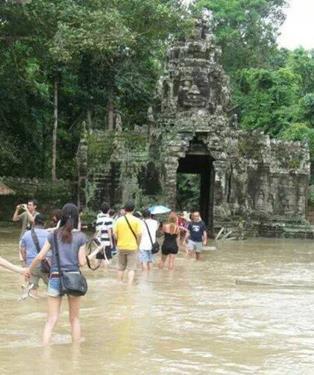
34 The flood of 2000 REAS Project Progress: Water Change (Top: TM images; Bottom: classification maps) Flood water covered 73% area of crop field and 37.7% area of forest


35 REAS Project Progress: Water Change


36 REAS Project Progress: Water Change 洞里萨湖面积可由 旱季的 2500km 2 增长 到雨季的 15000km 2
37 GLAS (Geoscience Laser Altimeter System) GLAS provided global measurements of the Earth s land surface topography, which was aboard the NASA Ice, Cloud, and land Elevation (ICESat) satellite Technical characteristics: Status Platform Wavelength Pulse frequency Pulse width Pulse form Gaussian Footprint diameter Transmit energy launched Jan space-borne 1064 nm (vegetation) 532 nm (atmosphere) 40 Hz 5 ns m 5 mj Along-track separation 170 m Cross-track max 15 km Cross-track min 2.5 km Repeat cycle 183 days Life-time 3 years
38 REAS Project Progress: Water Change Z 值 (m) 0-2 时间 GLAS 点数 ( 个 ) 均值 (m) 标准差 最小值 (m) 最大值 (m) 2004 年 2 月 月 月 年 2 月 月 月 年 2 月 月 月 年 3 月 年 2 月 月 洞里萨湖水位呈年际周期性波动 2008 年平均水位较 2004 年的平均水位变化了 5.0m 左右,2006 年 5 月份水位上升较明显 表中均值代表湖面的平均高程值即每年当月的高程值 最值分别为 GLAS 点中的最大 最小高程值

39 REAS Project Progress: Water Change 旱季 旱季转雨季 旱季, 水面从北向南持续升高, 年水位升高, 其中 2008 年 2 月份水位最高 雨季, 水面从北向南持续升高, 年水位升高, 其中 2004 年 10 月份水位最高 年际, 水位从北到南呈上升趋势,5 月份不明显可能和季节有关 雨季

40 Research Progress: Ground Subsidence Monitoring The first inversion of surface deformation using 42 scenes of TerraSAR-X images (3m) in the observation period of Although it is significant, the motion of relics and its surroundings is hampered by other movements triggered by urbanization, farming as well as surface erosion after wild-fires.


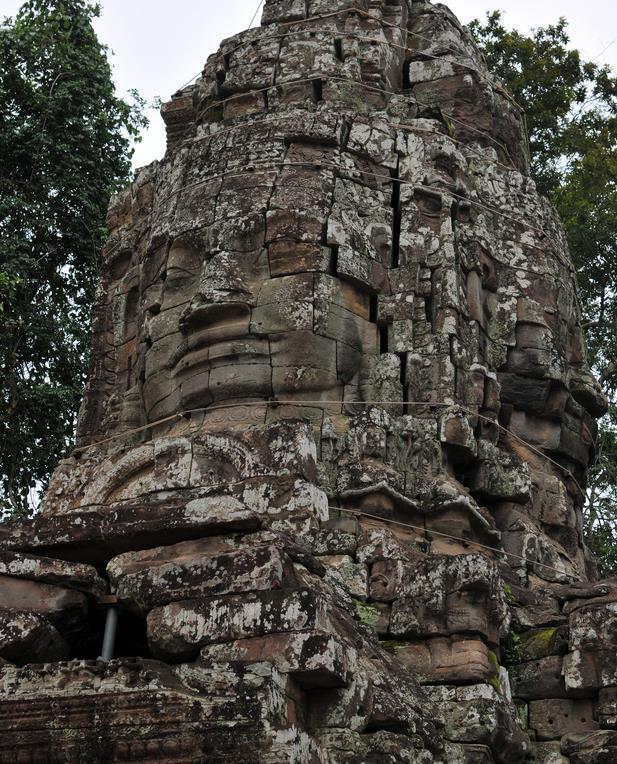
41 Research Progress: Ground Subsidence Monitoring Through the discussion with staffs from APSARA and field investigations, causes of temple collapse have been confirmed, including erosion, tree growth and motion heterogeneity Field campaign

 due to urbanization and groundwater")
42 Research Progress: Ground Subsidence Monitoring An improved PSInSAR model for the motion anomalies detection. Local ground sinking intersperse among the site (with values ranging from -15 to -2 mm/a) due to urbanization and groundwater pumping, marked by 1, 2 and 3.

43 Research Progress: Ground Subsidence Monitoring mm/ a Temple-level monitoring, e.g. Bakong Temple


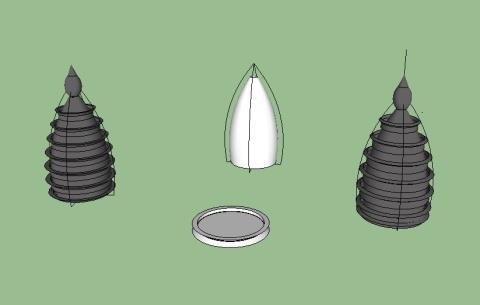
44 Research Progress: 3D Simulation and Spatial Information System A. 3D Modeling & Models Collecting 3D Modeling by multi-source data Rebuild 3D models based on different multi-source data, such as pictures, videos, CAD data, photogrammetric data. Models Collecting Collect some shared elements and models from the Internet to provide material for the 3D simulation system.


45 Research Progress: 3D Simulation and Spatial Information System B. Design and Implementation of Spatial Database Designed and implemented the spatial data tables of remote sensing images, vectors and 3d models of Angkor Site. Storaged the current multi-source data. Developed some database functions, such as information querying.


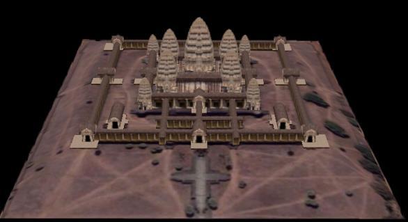
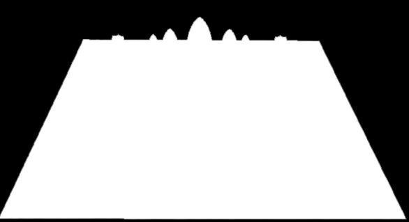
46 Research Progress: 3D Simulation and Spatial Information System C. System Implementation and Preliminary simulation Menus Tool bar LOGO Navigation panel Main viewer Function panels Copyright Status bar Main form of REAS

47 Research Progress: 3D Simulation and Spatial Information System Terrestrial Laser Scanning for 3D reconstruction of Ta Keo temple Range: 1km (max.) Pulse frequency:222k (max. )


48 Research Progress: Ancient Water System Reconstruction Data Collection RS data: 30m DEM, Landsat images Historical maps: Angkor area during the 9-14th centuries References: The natural environment and historical water management of Angkor The development of the water management system of Angkor a provisional model 9 th 10 th 13 th 14 th


49 Research Progress: Ancient Water System Reconstruction SPOT-5 image NDWI Decision Tree Improved DT

50 Research Progress: Ancient Water System Reconstruction


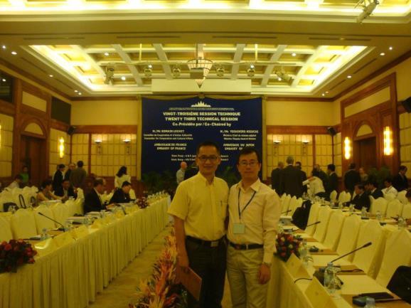
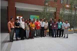
51 Exchange of Visit

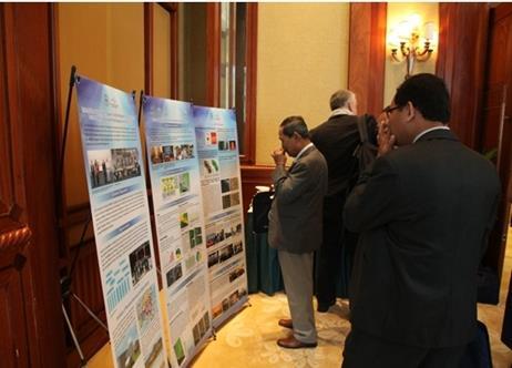

52 Exchange of Visit


53 Exchange of Visit June 2014 LUCC & land subsidence validation

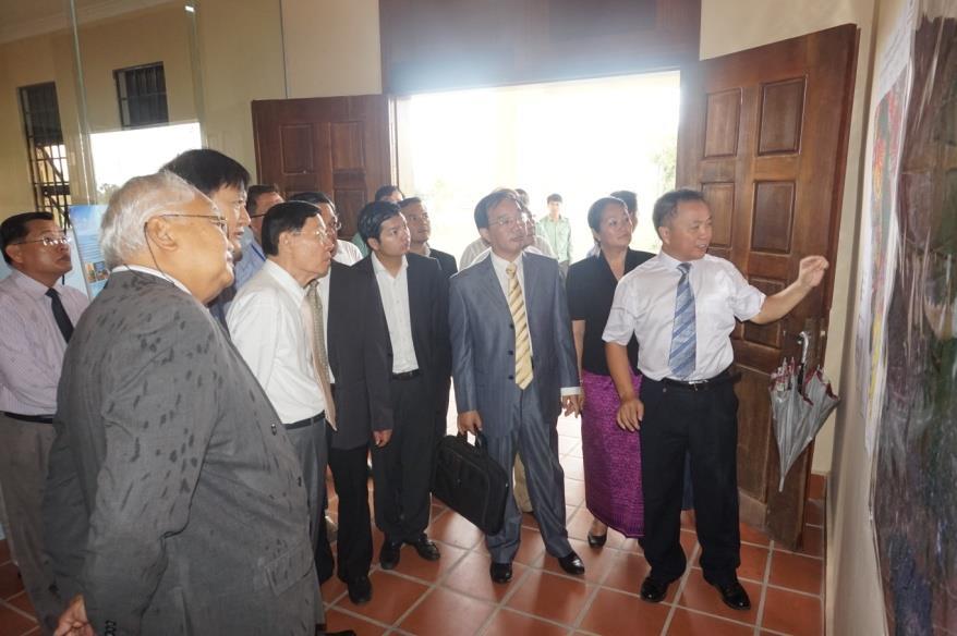
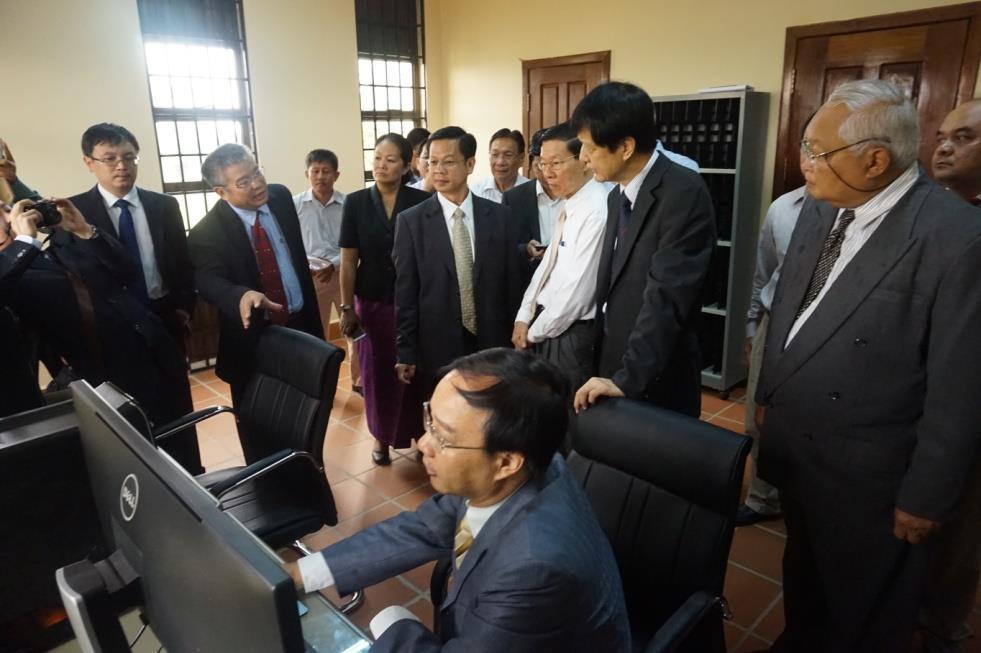
54 Exchange of Visit


55 Virtual Satellite Receiving Station
56 Thanks
GEOMATICS. Shaping our world. A company of
 GEOMATICS Shaping our world A company of OUR EXPERTISE Geomatics Geomatics plays a mayor role in hydropower, land and water resources, urban development, transport & mobility, renewable energy, and infrastructure
VISUALIZATION URBAN SPATIAL GROWTH OF DESERT CITIES FROM SATELLITE IMAGERY: A PRELIMINARY STUDY
 CO-439 VISUALIZATION URBAN SPATIAL GROWTH OF DESERT CITIES FROM SATELLITE IMAGERY: A PRELIMINARY STUDY YANG X. Florida State University, TALLAHASSEE, FLORIDA, UNITED STATES ABSTRACT Desert cities, particularly
GIS and Remote Sensing
 Spring School Land use and the vulnerability of socio-ecosystems to climate change: remote sensing and modelling techniques GIS and Remote Sensing Katerina Tzavella Project Researcher PhD candidate Technology
Remote Sensing I: Basics
 Remote Sensing I: Basics Kelly M. Brunt Earth System Science Interdisciplinary Center, University of Maryland Cryospheric Science Laboratory, Goddard Space Flight Center kelly.m.brunt@nasa.gov (Based on
THE USE OF GEOMATICS IN CULTURAL HERITAGE AND ARCHAEOLOGY FOR VARIOUS PURPOSES
 THE USE OF GEOMATICS IN CULTURAL HERITAGE AND ARCHAEOLOGY FOR VARIOUS PURPOSES FEBRUARY 2013 AL BEIDA GEOPLAN CONTENT Company Profile Concept Objectives and Strategies Data Production Methods Data Samples
Source mechanism solution
 Source mechanism solution Contents Source mechanism solution 1 1. A general introduction 1 2. A step-by-step guide 1 Step-1: Prepare data files 1 Step-2: Start GeoTaos or GeoTaos_Map 2 Step-3: Convert
Spatial Planning Platform Meeting
 Spatial Planning Platform Meeting August 1 st 2018 Part II Session 1 Design and Implementation of National and Regional Planning for Inclusive Growth Spatial info from space based technologies RESTEC (Remote
SPATIAL AND TEMPORAL MODELLING OF ECOSYSTEM SERVICES
 SPATIAL AND TEMPORAL MODELLING OF ECOSYSTEM SERVICES Solen Le Clec h, T.Decaëns, S. Dufour, M. Grimaldi, N. Jégou and J. Oszwald ACES Conference 2016 Jacksonville, Florida (USA). December, 5-9th : issues
Regional Centre for Mapping of Resources for Development (RCMRD), Nairobi, Kenya
, Nairobi, Kenya") Regional Centre for Mapping of Resources for Development (RCMRD), Nairobi, Kenya Introduction GIS ( 2 weeks: 10 days) Intakes: 7 th Jan, 4 th Feb,4 th March, 1 st April 6 th May, 3 rd June, 1 st July,
Regional Centre for Mapping of Resources for Development (RCMRD), Nairobi, Kenya Introduction GIS ( 2 weeks: 10 days) Intakes: 7 th Jan, 4 th Feb,4 th March, 1 st April 6 th May, 3 rd June, 1 st July,
Lesson 4b Remote Sensing and geospatial analysis to integrate observations over larger scales
 Lesson 4b Remote Sensing and geospatial analysis to integrate observations over larger scales We have discussed static sensors, human-based (participatory) sensing, and mobile sensing Remote sensing: Satellite
RADAR Remote Sensing Application Examples
 RADAR Remote Sensing Application Examples! All-weather capability: Microwave penetrates clouds! Construction of short-interval time series through cloud cover - crop-growth cycle! Roughness - Land cover,
Development of Tropical cyclone objective analysis technique based on FY serial satellite data
 2 nd International Workshop On Satellite Analysis of Tropical Cyclones (IWSATC-2) Update on Objective Satellite-Based TC Analysis Methods 18 February 2016 Honolulu, Hawaii, USA Development of Tropical
How to Construct Urban Three Dimensional GIS Model based on ArcView 3D Analysis
 How to Construct Urban Three Dimensional GIS Model based on ArcView 3D Analysis Ko Ko Lwin Division of Spatial Information Science Graduate School of Life and Environmental Sciences University of Tsukuba
Sustainable Cities and Communities based on Indicators on Urbanization 地理国情监测技术. Prof. Dr. John W. Z. SHI The Hong Kong Polytechnic University
 IAEG- SDGs WG on Geospatial Information, 1 st Expert Group Meeting 12-14 Dec 2016 Mexico City Measure 地理国情监测技术 Sustainable Cities and Communities 专业 based on Indicators on Urbanization Prof. Dr. John W.
Geospatial Big Data. Greg Scott Inter-Regional Advisor Global Geospatial Information Management United Nations Statistics Division. ggim.un.
 Geospatial Big Data Greg Scott Inter-Regional Advisor Global Geospatial Information Management United Nations Statistics Division Positioning geospatial information to address global challenges ggim.un.org
Xueshun Shen Minghuan Wang Chinese Academy of Meteorological Sciences China Meteorological Administration Feng Xiao Tokyo Inst. of Tech.
 Application of a high-resolution conservative advection scheme to GRAPES meso-scale scale model Xueshun Shen Minghuan Wang Chinese Academy of Meteorological Sciences China Meteorological Administration
Sources of Imagery and GIS Data Layers (Last updated October 2005)
") Sources of Imagery and GIS Data Layers (Last updated October 2005) The question of where to find data is one often asked by beginners in precision agriculture and other geospatial projects. The following
Sources of Imagery and GIS Data Layers (Last updated October 2005) The question of where to find data is one often asked by beginners in precision agriculture and other geospatial projects. The following
An analysis on the relationship between land subsidence and floods at the Kujukuri Plain in Chiba Prefecture, Japan
 doi:10.5194/piahs-372-163-2015 Author(s) 2015. CC Attribution 3.0 License. An analysis on the relationship between land subsidence and floods at the Kujukuri Plain in Chiba Prefecture, Japan Y. Ito 1,
Regional Centre for Mapping of Resources for Development (RCMRD), Nairobi, Kenya. Introduction GIS (2 weeks: 10 days)
, Nairobi, Kenya. Introduction GIS (2 weeks: 10 days)") Regional Centre for Mapping of Resources for Development (RCMRD), Nairobi, Kenya Introduction GIS (: 10 days) Intake Dates: 9 th Jan, 6 th Feb, 6 th Mar, 3 rd April, 8 th May, 5 th June, 3 rd July, 2017
Regional Centre for Mapping of Resources for Development (RCMRD), Nairobi, Kenya Introduction GIS (: 10 days) Intake Dates: 9 th Jan, 6 th Feb, 6 th Mar, 3 rd April, 8 th May, 5 th June, 3 rd July, 2017
Geomorphologic Mapping by Airborne Laser Scanning in Southern Victoria Land
 Geomorphologic Mapping by Airborne Laser Scanning in Southern Victoria Land Bea Csatho, Terry Wilson, Tony Schenk, Garry McKenzie, Byrd Polar Research Center, The Ohio State University, Columbus, OH William
sentinel-2 COLOUR VISION FOR COPERNICUS
 sentinel-2 COLOUR VISION FOR COPERNICUS SATELLITES TO SERVE By providing a set of key information services for a wide range of practical applications, Europe s Copernicus programme is providing a step
Historical background
 Space Technology for Disaster Management in Sri Lanka: Country profile, national perspectives & vision. Professor Ranjith Premalal De Silva Vice Chancellor Uva Wellassa University of Sri Lanka October
Manitoba s Elevation (LiDAR) & Imagery Datasets. Acquisition Plans & Opportunities for Collaboration
 & Imagery Datasets. Acquisition Plans & Opportunities for Collaboration") Manitoba s Elevation (LiDAR) & Imagery Datasets Acquisition Plans & Opportunities for Collaboration Manitoba Planning Conference May 2017 Presentation Outline Manitoba s Elevation (LiDAR) and Imagery Datasets
Manitoba s Elevation (LiDAR) & Imagery Datasets Acquisition Plans & Opportunities for Collaboration Manitoba Planning Conference May 2017 Presentation Outline Manitoba s Elevation (LiDAR) and Imagery Datasets
Geospatial technology for land cover analysis
 Home Articles Application Environment & Climate Conservation & monitoring Published in : Middle East & Africa Geospatial Digest November 2013 Lemenkova Polina Charles University in Prague, Faculty of Science,
USING GIS CARTOGRAPHIC MODELING TO ANALYSIS SPATIAL DISTRIBUTION OF LANDSLIDE SENSITIVE AREAS IN YANGMINGSHAN NATIONAL PARK, TAIWAN
 CO-145 USING GIS CARTOGRAPHIC MODELING TO ANALYSIS SPATIAL DISTRIBUTION OF LANDSLIDE SENSITIVE AREAS IN YANGMINGSHAN NATIONAL PARK, TAIWAN DING Y.C. Chinese Culture University., TAIPEI, TAIWAN, PROVINCE
Regional Centre for Mapping of Resources for Development (RCMRD), Nairobi, Kenya. Introduction GIS ( 2 weeks: 10 days)
, Nairobi, Kenya. Introduction GIS ( 2 weeks: 10 days)") Regional Centre for Mapping of Resources for Development (RCMRD), Nairobi, Kenya Introduction GIS ( 2 weeks: 10 days) Intakes: 8 th Jan, 6 th Feb,5 th March, 3 rd April 9 th, May 7 th, June 4 th, July
Regional Centre for Mapping of Resources for Development (RCMRD), Nairobi, Kenya Introduction GIS ( 2 weeks: 10 days) Intakes: 8 th Jan, 6 th Feb,5 th March, 3 rd April 9 th, May 7 th, June 4 th, July
Imagery and the Location-enabled Platform in State and Local Government
 Imagery and the Location-enabled Platform in State and Local Government Fred Limp, Director, CAST Jim Farley, Vice President, Leica Geosystems Oracle Spatial Users Group Denver, March 10, 2005 TM TM Discussion
An Automated Object-Oriented Satellite Image Classification Method Integrating the FAO Land Cover Classification System (LCCS).
.") An Automated Object-Oriented Satellite Image Classification Method Integrating the FAO Land Cover Classification System (LCCS). Ruvimbo Gamanya Sibanda Prof. Dr. Philippe De Maeyer Prof. Dr. Morgan De
An Automated Object-Oriented Satellite Image Classification Method Integrating the FAO Land Cover Classification System (LCCS). Ruvimbo Gamanya Sibanda Prof. Dr. Philippe De Maeyer Prof. Dr. Morgan De
Current Status of the Standardization of Geographical Names in Cambodia
 1 Current Status of the Standardization of Geographical Names in Cambodia His Excellency Ith Sotha, Under Secretary of States, MLMUPC Mr Chharom Chin, Deputy Director, Geography Department, MLMUPC Mr Narith
Themes for Geomatics Conference. Geodesy Themes
 Themes for Geomatics Conference Geodesy Themes Geodynamics o Modeling the Deformation of the Earth s Crust o Recent Advances in Geometric Approaches to Deformation Analysis o Monitoring Systems (Sensors
JAXA Status Report. JAXA Status Report. 4-6 April 2017 WMO ET-SAT
 JAXA Status Report JAXA Status Report 4-6 April 2017 WMO ET-SAT JAXA s Past, Current and Future Satellite/Sensor Activities ALOS-2 (CY 2014) GCOM-C (JFY 2017) GOSAT-2 (JFY 2018) Earth CARE/CPR (JFY 2019(TBC))
Physical Geography: Patterns, Processes, and Interactions, Grade 11, University/College Expectations
 Geographic Foundations: Space and Systems SSV.01 explain major theories of the origin and internal structure of the earth; Page 1 SSV.02 demonstrate an understanding of the principal features of the earth
Data Quality and Uncertainty
 Data Quality and Uncertainty The power of GIS analysis is based on the assembly of layers of data, but as data layers increase, errors multiply - quality decreases. Garbage in, garbage out. High quality
Easter Traditions 复活节习俗
 Easter Traditions 复活节习俗 1 Easter Traditions 复活节习俗 Why the big rabbit? 为什么有个大兔子? Read the text below and do the activity that follows 阅读下面的短文, 然后完成练习 : It s Easter in the UK and the shops are full of Easter
Geomatics: Geotechnologies in Action, Grade 12, University/College Expectations
 Geographic Foundations: Space and Systems SSV.01 explain how the earth is modelled for scientific and mapping purposes; SSV.02 demonstrate an understanding of basic spatial concepts; Page 1 SSV.03 explain
Luyi Sun & Jan-Peter Muller, Imaging Group, Mullard Space Science Laboratory, University College London
 Evaluation of the use of the sub-pixel Offset Tracking method with conventional dinsar techniques to monitor landslides in densely vegetated terrain in the Three Gorges Region, China Luyi Sun & Jan-Peter
ESTIMATION OF LANDFORM CLASSIFICATION BASED ON LAND USE AND ITS CHANGE - Use of Object-based Classification and Altitude Data -
 ESTIMATION OF LANDFORM CLASSIFICATION BASED ON LAND USE AND ITS CHANGE - Use of Object-based Classification and Altitude Data - Shoichi NAKAI 1 and Jaegyu BAE 2 1 Professor, Chiba University, Chiba, Japan.
Land Surface Remote Sensing II
 PROCEEDINGS OFSPIE Land Surface Remote Sensing II Thomas J. Jackson Jing Ming Chen Peng Gong Shunlin Liang Editors 13-16 October 2014 Beijing, China Sponsored by SPIE Cosponsored by State Key Laboratory
European Space Agency
 Guidelines - Guidelines how/when to interact during the WebEx session: - Due to the number of attendees, please keep always your webcam and microphone switched-off - You can use anytime the chat to all
Background. The agreement s initial duration was six years.
 Evaluation and Renewal of the International Centre on Space Technologies for Natural and Cultural Heritage (HIST) under the auspices of UNESCO, Beijing, China Background The International Centre on Space
Plenary Session 2, part 2 A European shared information system
 3 rd GMES Forum 5 6 June 2003 Athens Plenary Session 2, part 2 A European shared information system Gordon McInnes Deputy Director European Environment Agency 1 I keep six honest serving men. They taught
Tatsuo Sekiguchi* and Hiroshi Sato*
 by Tatsuo Sekiguchi* and Hiroshi Sato* ABSTRACT Landslides induced by heavy rainfall and earthquakes may result in disaster by destroying homes and buildings. High-fluidity landslides caused by liquefied
The Road to Data in Baltimore
 Creating a parcel level database from high resolution imagery By Austin Troy and Weiqi Zhou University of Vermont, Rubenstein School of Natural Resources State and local planning agencies are increasingly
An Approach to Estimate the Water Level and Volume of Dongting Lake by using Terra/MODIS Data
 National Institute for Environmental Studies, Japan An Approach to Estimate the Water Level and Volume of Dongting Lake by using Terra/MODIS Data 2002 Jan. Feb. Mar. Apr. May Jun. Jul. Aug. Sep. Oct. Nov.
Japan Construction Information Center
 Japan Construction Information Center A Framework for Data Coordination Method of Maintenance Data and 3D Conceptual Model on CIM Based Database July 2016 Japan Construction Information Center Foundation
National Remote Sensing Center of China. Space Technology for Sustainable Development in China Status, Achievements and Futures.
 National Remote Sensing Center of China Space Technology for Sustainable Development in China Status, Achievements and Futures Jing Li National Remote Sensing Center of China Ministry of Science and Technology,
Soil Erosion Calculation using Remote Sensing and GIS in Río Grande de Arecibo Watershed, Puerto Rico
 Soil Erosion Calculation using Remote Sensing and GIS in Río Grande de Arecibo Watershed, Puerto Rico Alejandra M. Rojas González Department of Civil Engineering University of Puerto Rico at Mayaguez.
Land cover/land use mapping and cha Mongolian plateau using remote sens. Title. Author(s) Bagan, Hasi; Yamagata, Yoshiki. Citation Japan.
 Bagan, Hasi; Yamagata, Yoshiki. Citation Japan.") Title Land cover/land use mapping and cha Mongolian plateau using remote sens Author(s) Bagan, Hasi; Yamagata, Yoshiki International Symposium on "The Imp Citation Region Specific Systems". 6 Nove Japan.
Title Land cover/land use mapping and cha Mongolian plateau using remote sens Author(s) Bagan, Hasi; Yamagata, Yoshiki International Symposium on "The Imp Citation Region Specific Systems". 6 Nove Japan.
3D Laser Scanning for Digital Preservation and Dissemination of Cultural Heritage
 3D Laser Scanning for Digital Preservation and Dissemination of Cultural Heritage Main scanned objects - Four Temples of Different Religions in Sofia Eng. Zlatan Zlatanov, Eng. Milush Blagoev, Irina Nikoevska
MONITORING AND MODELING NATURAL AND ANTHROPOGENIC TERRAIN CHANGE
 MONITORING AND MODELING NATURAL AND ANTHROPOGENIC TERRAIN CHANGE Spatial analysis and simulations of impact on landscape processess Helena MITASOVA, Russell S. HARMON, David BERNSTEIN, Jaroslav HOFIERKA,
History & Scope of Remote Sensing FOUNDATIONS
 History & Scope of Remote Sensing FOUNDATIONS Lecture Overview Introduction Overview of visual information Power of imagery Definition What is remote sensing? Definition standard for class History of Remote
Spanish national plan for land observation: new collaborative production system in Europe
 ADVANCE UNEDITED VERSION UNITED NATIONS E/CONF.103/5/Add.1 Economic and Social Affairs 9 July 2013 Tenth United Nations Regional Cartographic Conference for the Americas New York, 19-23, August 2013 Item
通量数据质量控制的理论与方法 理加联合科技有限公司
 通量数据质量控制的理论与方法 理加联合科技有限公司 通量变量 Rn = LE + H + G (W m -2 s -1 ) 净辐射 潜热 感热 地表热 通量 通量 通量 通量 Fc (mg m -2 s -1 ) 二氧化碳通量 τ [(kg m s -1 ) m -2 s -1 ] 动量通量 质量控制 1. 概率统计方法 2. 趋势法 3. 大气物理依据 4. 测定实地诊断 5. 仪器物理依据 '
Surface Connects Author Index
 Surface Connects Author Index Shixin WANG, Yi ZHOU, Gewei LI, Weiqi ZHOU, Yalan LIU & Shirong CHEN NETWORK PLATFORM OF REMOTE SENSING FOR NATURAL DISASTER MONITORING & INFORMATION SERVING AND ITS APPLICATIONS
Arctic Observing Systems Challenges, New opportunities and Integration
 Arctic Observing Systems Challenges, New opportunities and Integration Japan Norway Arctic Science Week 03 June 2016 By Stein Sandven, NERSC Building an integrated Arctic Observing System Need to collect,
2013 Esri Europe, Middle East and Africa User Conference October 23-25, 2013 Munich, Germany
 2013 Esri Europe, Middle East and Africa User Conference October 23-25, 2013 Munich, Germany Environmental and Disaster Management System in the Valles Altos Region in Carabobo / NW-Venezuela Prof.Dr.habil.Barbara
The Spatial Information Corridor Contributes to UNISPACE+50. JIANG HUI Director of Internation Cooperation Department
 The Spatial Information Corridor Contributes to UNISPACE+50 JIANG HUI Director of Internation Cooperation Department 01 02 03 What is Belt & Road Spatial Information Corridor? China put forward the "Belt
Monitoring Vegetation Growth of Spectrally Landsat Satellite Imagery ETM+ 7 & TM 5 for Western Region of Iraq by Using Remote Sensing Techniques.
 Monitoring Vegetation Growth of Spectrally Landsat Satellite Imagery ETM+ 7 & TM 5 for Western Region of Iraq by Using Remote Sensing Techniques. Fouad K. Mashee, Ahmed A. Zaeen & Gheidaa S. Hadi Remote
CAN THO URBAN DEVELOPMENT AND RESILIENCE PROJECT
 CAN THO URBAN DEVELOPMENT AND RESILIENCE PROJECT 1 Phnom Penh Can Tho City HCM City EAST SEA 2 1 3 Highest Water Level WATER LEVEL RAISE IN CAN THO DURING LAST 40 YEARS 4 2 Land subsidence a threat that
Building Institutional Capacity for Multi-Hazard Early Warning in Asia and the Pacific Subtitle
 Building Institutional Capacity for Multi-Hazard Early Warning in Asia and the Pacific Subtitle Title Keran Wang Chief, Space Applications Section ICT and Disaster Risk Reduction Division 22 May 2018 Pillar
Watershed Classification with GIS as an Instrument of Conflict Management in Tropical Highlands of the Lower Mekong Basin
 Page 1 of 8 Watershed Classification with GIS as an Instrument of Conflict Management in Tropical Highlands of the Lower Mekong Basin Project Abstract The University of Giessen is actually planning a research
Land subsidence at the Kujukuri Plain in Chiba Prefecture, Japan: evaluation and monitoring environmental impacts
 Land Subsidence, Associated Hazards and the Role of Natural Resources Development (Proceedings of EISOLS 2010, Querétaro, Mexico, 17 22 October 2010). IAHS Publ. 339, 2010. 293 Land subsidence at the Kujukuri
Geospatial workflows and potential applications to the Sustainable Development Goals of countries in West Asia
 Geospatial workflows and potential applications to the Sustainable Development Goals of countries in West Asia Ameer Abdulla, PhD Senior Advisor, European Topic Center for Spatial Analysis, Spain Associate
UNITED NATIONS E/CONF.96/CRP. 5
 UNITED NATIONS E/CONF.96/CRP. 5 ECONOMIC AND SOCIAL COUNCIL Eighth United Nations Regional Cartographic Conference for the Americas New York, 27 June -1 July 2005 Item 5 of the provisional agenda* COUNTRY
Data Quality and Uncertainty. Accuracy, Precision, Data quality and Errors
 Data Quality and Uncertainty The power of GIS analysis is based on the assembly of layers of data, but as data layers increase, errors multiply (and quality decreases). Garbage in, garbage out. High quality
Intelligent City Management
 Intelligent City Management Based on Land Cover Feature Changes Detected by Satellite Imagery Twenty First Century Aerospace Technology (21AT) www.21at.com.cn Geospatial World Forum 2016 Outline 01 Introduction
Uses of free satellite imagery for Disaster Risk Reduction (DRR)
") Centre of Applied Geoscience, Disaster Risk Reduction Research Group, School of Earth and Environmental Science, University of Portsmouth, UK Uses of free satellite imagery for Disaster Risk Reduction
Centre of Applied Geoscience, Disaster Risk Reduction Research Group, School of Earth and Environmental Science, University of Portsmouth, UK Uses of free satellite imagery for Disaster Risk Reduction
ESTIMATING LAND VALUE AND DISASTER RISK IN URBAN AREA IN YANGON, MYANMAR USING STEREO HIGH-RESOLUTION IMAGES AND MULTI-TEMPORAL LANDSAT IMAGES
 ESTIMATING LAND VALUE AND DISASTER RISK IN URBAN AREA IN YANGON, MYANMAR USING STEREO HIGH-RESOLUTION IMAGES AND MULTI-TEMPORAL LANDSAT IMAGES Tanakorn Sritarapipat 1 and Wataru Takeuchi 1 1 Institute
LAND COVER CATEGORY DEFINITION BY IMAGE INVARIANTS FOR AUTOMATED CLASSIFICATION
 LAND COVER CATEGORY DEFINITION BY IMAGE INVARIANTS FOR AUTOMATED CLASSIFICATION Nguyen Dinh Duong Environmental Remote Sensing Laboratory Institute of Geography Hoang Quoc Viet Rd., Cau Giay, Hanoi, Vietnam
Human influence on the record-breaking cold event in January of 2016 in Eastern China
 Human influence on the record-breaking cold event in January of 2016 in Eastern China Cheng Qian 1, Jun Wang 1, Siyan Dong 2, Hong Yin 2, Claire Burke 3, Andrew Ciavarella 3, Buwen Dong 4, Nicolas Freychet
Potential and Accuracy of Digital Landscape Analysis based on high resolution remote sensing data
 'Spatial Information for Sustainable Management of Urban Areas' Mainz, 2-4 February 2009, Germany Potential and Accuracy of Digital Landscape Analysis based on high resolution remote sensing data Dr. Matthias
EXTRACTION OF FLOODED AREAS DUE THE 2015 KANTO-TOHOKU HEAVY RAINFALL IN JAPAN USING PALSAR-2 IMAGES
 EXTRACTION OF FLOODED AREAS DUE THE 2015 KANTO-TOHOKU HEAVY RAINFALL IN JAPAN USING PALSAR-2 IMAGES F. Yamazaki a, *, W. Liu a a Chiba University, Graduate School of Engineering, Chiba 263-8522, Japan
Urban Planning Word Search Level 1
 Urban Planning Word Search Level 1 B C P U E C O S Y S T E M P A R E U O E U R B A N P L A N N E R T N S T D H E C O U N T Y G E R E R D W R E N I C I T Y C O U N C I L A A A S U G G C I L A G P R I R
ZRCSAZU. Remote sensing and Earth observation data at ZRC SAZU. dr. Tatjana Veljanovski Atrij ZRC Ljubljana
 ZRCSAZU Remote sensing and Earth observation data at ZRC SAZU dr. Tatjana Veljanovski 2016-06-08 Atrij ZRC Ljubljana Remote Sensing Department Remote Sensing Department 20 years of experience application,
Fundamentals of Remote Sensing
 Division of Spatial Information Science Graduate School Life and Environment Sciences University of Tsukuba Fundamentals of Remote Sensing Prof. Dr. Yuji Murayama Surantha Dassanayake 10/6/2010 1 Fundamentals
DAMAGE DETECTION OF THE 2008 SICHUAN, CHINA EARTHQUAKE FROM ALOS OPTICAL IMAGES
 DAMAGE DETECTION OF THE 2008 SICHUAN, CHINA EARTHQUAKE FROM ALOS OPTICAL IMAGES Wen Liu, Fumio Yamazaki Department of Urban Environment Systems, Graduate School of Engineering, Chiba University, 1-33,
ESM 186 Environmental Remote Sensing and ESM 186 Lab Syllabus Winter 2012
 ESM 186 Environmental Remote Sensing and ESM 186 Lab Syllabus Winter 2012 Instructor: Susan Ustin (slustin@ucdavis.edu) Phone: 752-0621 Office: 233 Veihmeyer Hall and 115A, the Barn Office Hours: Tuesday
Using object oriented technique to extract jujube based on landsat8 OLI image in Jialuhe Basin
 Journal of Image Processing Theory and Applications (2016) 1: 16-20 Clausius Scientific Press, Canada Using object oriented technique to extract jujube based on landsat8 OLI image in Jialuhe Basin Guotao
Modeling effects of changes in diffuse radiation on light use efficiency in forest ecosystem. Wei Nan
 Modeling effects of changes in diffuse radiation on light use efficiency in forest ecosystem Wei Nan 2018.05.04 1 Outline 1. Background 2. Material and methods 3. Results & Discussion 4. Conclusion 2 1
World Geography. WG.1.1 Explain Earth s grid system and be able to locate places using degrees of latitude and longitude.
 Standard 1: The World in Spatial Terms Students will use maps, globes, atlases, and grid-referenced technologies, such as remote sensing, Geographic Information Systems (GIS), and Global Positioning Systems
Introduction to Geographic Information Systems (GIS): Environmental Science Focus
: Environmental Science Focus") Introduction to Geographic Information Systems (GIS): Environmental Science Focus September 9, 2013 We will begin at 9:10 AM. Login info: Username:!cnrguest Password: gocal_bears Instructor: Domain: CAMPUS
Introduction to Geographic Information Systems (GIS): Environmental Science Focus September 9, 2013 We will begin at 9:10 AM. Login info: Username:!cnrguest Password: gocal_bears Instructor: Domain: CAMPUS
Multi-temporal archaeological and environmental prospection in Nasca (Peru) with ERS-1/2, ENVISAT and Sentinel-1A C-band SAR data
 with ERS-1/2, ENVISAT and Sentinel-1A C-band SAR data") 12-13 November 215 ESA-ESRIN, Frascati (Rome), Italy Day 1 Session: Historical Landscapes and Environmental Analysis Multi-temporal archaeological and environmental prospection in Nasca (Peru) with ERS-1/2,
12-13 November 215 ESA-ESRIN, Frascati (Rome), Italy Day 1 Session: Historical Landscapes and Environmental Analysis Multi-temporal archaeological and environmental prospection in Nasca (Peru) with ERS-1/2,
Vegetation Change Detection of Central part of Nepal using Landsat TM
 Vegetation Change Detection of Central part of Nepal using Landsat TM Kalpana G. Bastakoti Department of Geography, University of Calgary, kalpanagb@gmail.com Abstract This paper presents a study of detecting
Land Use / Land Cover Mapping in
 Land Use / Land Cover Mapping in Eastern and Southern African Regions RCMRD Experience by 6/24/2013, Nairobi Kenya Dr. Tesfaye Korme Director of RS, GIS and Mapping, RCMRD I. About RCMRD, Its Vision and
Dynamic Land Cover Dataset Product Description
 Dynamic Land Cover Dataset Product Description V1.0 27 May 2014 D2014-40362 Unclassified Table of Contents Document History... 3 A Summary Description... 4 Sheet A.1 Definition and Usage... 4 Sheet A.2
Monitoring the earth
 Monitoring the earth Name Date Technology has provided a way to monitor and see the ever-changing and often remote corners of the Earth. Satellite imagery, ocean buoys, and thermal imaging are all used
2 nd Japan and Republic of Korea LiDAR Survey Symposium
 2 nd Japan and Republic of Korea LiDAR Survey Symposium 2010 年 9 月 20 日 Prof. Woosug Cho wcho@inha.ac.kr Spacematics Lab Department of Civil Engineering Inha University Presentation on Current Status in
Overview of Remote Sensing in Natural Resources Mapping
 Overview of Remote Sensing in Natural Resources Mapping What is remote sensing? Why remote sensing? Examples of remote sensing in natural resources mapping Class goals What is Remote Sensing A remote sensing
CONSERVATIONISTS COLLABORATE TO SAVE GIANT PANDAS
 CASE STUDY CONSERVATIONISTS COLLABORATE TO SAVE GIANT PANDAS SMITHSONIAN NATIONAL ZOOLOGICAL PARK In July 2005, many Americans were delighted by new reports about the birth and early development of Tai
Application of remote sensing for agricultural disasters
 Application of remote sensing for agricultural disasters Bingfang Wu, Sheng Chang Institute of Remote Sensing and Digital Earth (RADI) Chinese Academy of Sciences (CAS) wubf@radi.ac.cn, changsheng@radi.ac.cn
REMOTE SENSING OF PERMAFROST IN NORTHERN ENVIRONMENTS
 REMOTE SENSING OF PERMAFROST IN NORTHERN ENVIRONMENTS What is permafrost? What can we monitor with satellite data? Permafrost is an Essential Climate Variable About 25 % of the land surface is underlain
Minnesota K-12 Academic Standards in Social Studies. Grade 4: Geography of North America
 Minnesota K-12 Academic s in Social Studies Grade 4: Geography of North America 4 Describe how people take 1. Democratic government action to influence a depends on informed and decision on a specific
Directed Reading. Section: Types of Maps
 Skills Worksheet Directed Reading Section: Types of Maps 1. What are some of the characteristics of an area shown on maps used by Earth scientists? a. types of animals, types of plants, types of minerals
SPACE & UPPER ATMOSPHERE RESEARCH COMMISSION (SUPARCO)
") SPACE & UPPER ATMOSPHERE RESEARCH COMMISSION (SUPARCO) Pakistan Space & Upper Atmosphere Research Commission (SUPARCO) is the national space agency, responsible for execution of space technology ad applications
SPACE & UPPER ATMOSPHERE RESEARCH COMMISSION (SUPARCO) Pakistan Space & Upper Atmosphere Research Commission (SUPARCO) is the national space agency, responsible for execution of space technology ad applications
INTEGRATION OF HIGH RESOLUTION QUICKBIRD IMAGES TO GOOGLEEARTH
 INTEGRATION OF HIGH RESOLUTION QUICKBIRD IMAGES TO GOOGLEEARTH M. Alkan a, *, U.G. Sefercik a, M. Oruç a a ZKU, Engineering Faculty, 67100 Zonguldak, Turkey - (mehmetalkan44@yahoo.com) Interactive Sessions,
Modeling urban growth pattern for sustainable archaeological sites: A case study in Siem Reap, Cambodia
 Modeling urban growth pattern for sustainable archaeological sites: A case study in Siem Reap, CHANVOLEAK OURNG; DANIEL S. RODRIGUES; LÍGIA T. SILVA; RUI A. R. RAMOS Engineering School Department of Civil
Background. Points of Discussion. Hydrographic Models
 Airborne Laser Remote Sensing Technology: Providing Essential Hydrologic Information in the 21 st Century Warwick Hadley, Optech Incorporated Presented by: Warwick Hadley Sales Manager, Middle East and
ECVs: What s operational and what still requires R&D?
 Glaciers_cci input on ECVs: What s operational and what still requires R&D? Frank Paul* Department of Geography, University of Zurich *on behalf of the Glaciers_cci consortium Google Earth Operational
Chapter 4. Mobile Radio Propagation Large-Scale Path Loss
 Chapter 4 Mobile Radio Propagation Large-Scale Path Loss The mobile radio channel places fundamental limitations on the performance. The transmission path between the T-R maybe very complexity. Radio channels
CLICK HERE TO KNOW MORE
 CLICK HERE TO KNOW MORE Geoinformatics Applications in Land Resources Management G.P. Obi Reddy National Bureau of Soil Survey & Land Use Planning Indian Council of Agricultural Research Amravati Road,