GIScience - Activities. Geomatics Department. Humboldt University Berlin. Tobia Lakes Patrick Hostert
|
|
|
- Ursula Harrell
- 6 years ago
- Views:
Transcription


1 Institute of Geography GIScience - Activities Geomatics Department Humboldt University Berlin Tobia Lakes Patrick Hostert GIScience Meeting, 2nd February 2007
2 Content Geomatics Department at the Humboldt University Introduction Research Teaching Discussion and Outlook 2
 + Geovisualisation and Cartography (Prof. Dransch) + Applied Geoinformatics (Prof.")
3 Geographical Institute at the Humboldt University Profile One of the oldest Geography departments in Germany (1810) Since 2003 situated in the Technology Park Adlershof Institute with departments of physical and human geography, didactics and... Geomatics department: head of department (Prof. Patrick Hostert) + Geovisualisation and Cartography (Prof. Dransch) + Applied Geoinformatics (Prof. Margraf) + Juniorprofessor for Geoinformatics (~ by the end of 2007) 3
 Cooperation with research institutions on Campus Adlershof Institutes of the")

4 Research at the Geomatics Department Land-use/land-cover change and metropolitan areas Spatial modeling Geodata-management and geo-visualisation (Geodata infrastructure) Cooperation with research institutions on Campus Adlershof Institutes of the Humboldt University of Berlin Part.: Informatics, Chemistry, Psychology and centre of multimedia learning German Aerospace Centre (Deutsches Zentrum für Luft- und Raumfahrt DLR) Part.: research on traffic, geoscientific remote-sensing, applied remote-sensing 4
5 Research: remote-sensing Focus: Remote Sensing for mapping land-use and landcover (changes) regional focal points are metropolitan areas worldwide (esp. Berlin), Eastern Europe and the European Mediterranean Variety of data (high resolution satellite data, hyperspectral data ) Development of methods and approaches (knowledgeand rule-based interpretation, Support Vector Machines, Spectroscopy, radiative transfer model ) Applied research: Mapping Sealing in Berlin 5


 DFG-funded")

6 Research: remote-sensing Metropolitan studies Project: Monitoring of the postsocialistic changes in Berlin on different levels of scale Landsat 5 data Lehrter Bahnhof (2005) DFG-funded Graduate School on Urban Ecology Shrinking Cities Source: Diermayer 6

7 Geomatics Department - Humboldt-Universität zu Berlin Mapping sealing in Berlin Data: SPOT 5, vector data (ISU, ALK ) Objective: development of a hybrid approach, multispectral classification and rule-based integration of additional geodata to map sealing => applied research TU Berlin Prof. Dr. Birgit Kleinschmit HU Berlin Prof. Dr. Patrick Hostert Digitale Dienste Berlin Dr. Bodo Coenradie Source: Damm et al. 7


8 Analysis of hyperspectral data Schöneberg Mitte Source: Hostert/Schiefer Data: HyMap-data Objective: Methodical research to differentiate types of sealings => methodical research 8


9 Land-use/land-cover changes Analysis of forest cover and forest fragmentation changes in post-socialist times (+ drivers) Crossborder study: Poland, Ukraine, Slovakia Non-Forest Unchanged Forest Disturbance Disturbance Disturbance before 1988 Landsat ETM+ (June 2000) Source: Kümmerle 9


10 Land-cover/land-use mapping DeSurvey: A Surveillance System for Assessing and Monitoring of Desertification largest concerted research action on desertification and land degradation in Europe monitoring of land degradation effects with Landsat data in Mediterranean landscape funded by: EU-FP6 Overgrazed Quercus coccifera shrublands m 5-15 m Source: Hostert/Sonnenschein Open Quercus coccifera forest 10

11 DHAKA-INNOVATE Informal settlements, economic and environmental change, and public health - Strategies to improve the quality of life in Dhaka (Bangladesh) => remote-sensing derived indicators and integrated GIS-based modelling Source: UNEP/GOOGLE Earth Berlin-Bielefeld Consortium DFG Priority Programme Megacities: Informal Dynamics of Global Change 11
12 Geodata management Remote Sensing = one important source of information for geographical research questions Integration with additional data Semantic/Syntactic interoperability within Geoinformatics 12


13 Modeling urban development Modeling post-socialistic urban development Objectives: => Qualification and validation of existing models => Integration of socio-economic and physical data => Management of unsure and imprecise data Comparison between Berlin and Warsaw (and Moscow?) Model: UrbanSIM Berlin Warsaw Moscow 13
14 Geodata Infrastructure Geodata Infrastructure of the Geographical Institute The aim: Improving the access and availability of data within the Geographical Institute heterogeneous data on distributed computers, data bases often project-based data data of interest for all, such as ATKIS, CORINE or the data of the Senate Department Software: Server GIS (ArcIMS 9.0 SP3, ArcSDE 9.0 SP3) => possible clients: ArcMap since 8.3, ArcCatalog since 8.3, ArcIMS since => Integration of external Web Services (e.g.senate Department)? ESRI Interoperability extension 14
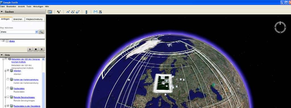
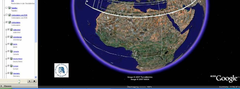
15 Geodata infrastructure in GoogleEarth Source: Beyer 15
16 Relevance of OGC for our research Heterogeneous data => Geographic objects, coordinate transformation service... Distributed systems, services => Web Services Specifications, GML... Concepts => OGC adds a conceptual approach to the dominating pragmatic and applied one 16
17 Teaching about 1500 students at the Geography Institute Geomatics for Bachelor, Master, Combined Master, (Diploma, Magister) in Geography Moduls of Geomatics also for students of Informatics and other disciplines Different types of teaching: Lectures, seminars, labs, project work, field work, excursions 17
18 Teaching Bachelor Introductions into Cartography and Geovisualisation Geoinformatics Remote Sensing Statistics Master Modules of Remote Sensing Geoinformatics Digital Image Processing Modeling Digital Photogrammetry Databases Hyperspektral data Distributed Systems Programminig (IDL )... Programming (VBA...) Geovisualisation... Statistics Geostatistics Multivariate statistics 18
19 Discussion and Outlook Teaching: One focus (should be) on OGC, because of increasing importance for future working fields of graduates knowledge to critically assess the applicability rather than being able to implement a web-service Geoinformatics in Geography: an integration of different sciences (data, models, scales ) Research: New conceptual approaches for distributed architectures Improved/increasing integration of space into workflows (GIS => Services) Communication: Between companies, research institutions, administrations on testbeds, examples, pros and cons 19
20 Thank you for your attention! Feel free to contact us: Prof. Dr. Patrick Hostert Dr. Tobia Lakes
Geoinformation Science at TU Berlin
 Technische Universität Berlin Department of Geoinformation Science Geoinformation Science at TU Berlin Prof. Dr. Thomas H. Kolbe Institute for Geodesy and Geoinformation Science Berlin University of Technology
Urban Mapping & Change Detection. Sebastian van der Linden Humboldt-Universität zu Berlin, Germany
 Urban Mapping & Change Detection Sebastian van der Linden Humboldt-Universität zu Berlin, Germany Introduction - The urban millennium Source: United Nations Introduction Text Source: Google Earth Introduction
Geomatics at HafenCity University Hamburg
 HCU HafenCity University Hamburg Geomatics at HafenCity University Hamburg Course information The broad spectrum that geomatics covers Geomatics is concerned with spatially orientated data, simply expressed
ISO Series Standards in a Model Driven Architecture for Landmanagement. Jürgen Ebbinghaus, AED-SICAD
 ISO 19100 Series Standards in a Model Driven Architecture for Landmanagement Jürgen Ebbinghaus, AED-SICAD 29.10.2003 The Company 100% SIEMENS PTD SIEMENS Business Services Shareholder & Strategic Business
Innovation in Land Management: Integrated Solutions For National Cadastre Projects
 Success With GIS Innovation in Land Management: Integrated Solutions For National Cadastre Projects XXIII International FIG Congress Munich These documents are only complete, when used in connection with
and Geoinformation Science
 Welcome to the Department of Geodesy Department of Geodesy Deputy Managing Director Department of Geodesy Technische Universität , Germany Germany s Capital and seat of government and largest city Population:
CARTOGRAPHY in a Web World
 CARTOGRAPHY in a Web World SENSE Research Cluster XIII meeting: Concepts and tools for spatial data visualization BAREND KÖBBEN kobben@itc.nl b.j.kobben@utwente.nl Agenda Short introduction to ITC and
Modern Education at Universities: Improvements through the Integration of a Spatial Data Infrastructure SDI into an e-learning Environment
 Modern Education at Universities: Improvements through the Integration of a Spatial Data Infrastructure SDI into an e-learning Environment Ingo Simonis Institute for Geoinformatics, University of Muenster
Statement on. Usage of BoK at our institute
 BoK workshop AGILE 2012, Avignon Statement on Usage of BoK at our institute Wolfgang Reinhardt AGIS / Institut für Angewandte Informatik Universität der Bundeswehr München Wolfgang.Reinhardt@unibw.de www.agis.unibw.de
Complete version as of 1 October 2017
 Note: The legally binding versions are found in the University of Innsbruck Bulletins (in German). Appendix to the University of Innsbruck Bulletin of 3 June 2015, Issue 60, No. 457 Original version published
The XXIV FIG International Congress April 2010, Sydney, Australia
 Impact of TEMPUS CARDS Project GIST- CroHE on the new MSc in Geoinformatics Curriculum and on the Implementation of Bologna Process at the Faculty of Geodesy, University of Zagreb, Croatia Damir Medak,
WEB-BASED SPATIAL DECISION SUPPORT: TECHNICAL FOUNDATIONS AND APPLICATIONS
 WEB-BASED SPATIAL DECISION SUPPORT: TECHNICAL FOUNDATIONS AND APPLICATIONS Claus Rinner University of Muenster, Germany Piotr Jankowski San Diego State University, USA Keywords: geographic information
GEOMATICS. Shaping our world. A company of
 GEOMATICS Shaping our world A company of OUR EXPERTISE Geomatics Geomatics plays a mayor role in hydropower, land and water resources, urban development, transport & mobility, renewable energy, and infrastructure
Basics of GIS reviewed
 Basics of GIS reviewed Martin Breunig Karlsruhe Institute of Technology martin.breunig@kit.edu GEODETIC INSTITUTE, DEPARTMENT OF CIVIL ENGINEERING, GEO AND ENVIRONMENTAL SCIENCES, CHAIR IN GEOINFORMATICS
Remote Sensing and EO activities at the University of Turku
 Remote Sensing and EO activities at the University of Turku Niina Käyhkö Associate Professor Department of Geography and Geology GEO meeting/syke May 23rd, 2018 Geospatial competence at the University
Programme Study Plan
 Faculty of Social and Life Sciences Programme Study Plan Geographic Information Systems Programme Code: Programme Title: TGLIT Engineering: Surveying Technology and Geographical IT Credits: 180 Programme
CARTOGRAPHIC SOCIETY OF THE SLOVAK REPUBLIC ACTIVITIES National Report for the 14 th General Assembly of the ICA
 CARTOGRAPHIC SOCIETY OF THE SLOVAK REPUBLIC ACTIVITIES 2003-2006 National Report for the 14 th General Assembly of the ICA Bratislava 2007 CARTOGRAPHIC SOCIETY OF THE SLOVAK REPUBLIC CARTOGRAPHIC SOCIETY
Land Administration and Cadastre
 Geomatics play a major role in hydropower, land and water resources and other infrastructure projects. Lahmeyer International s (LI) worldwide projects require a wide range of approaches to the integration
Spanish national plan for land observation: new collaborative production system in Europe
 ADVANCE UNEDITED VERSION UNITED NATIONS E/CONF.103/5/Add.1 Economic and Social Affairs 9 July 2013 Tenth United Nations Regional Cartographic Conference for the Americas New York, 19-23, August 2013 Item
E-Government and SDI in Bavaria, Germany
 135 E-Government and SDI in Bavaria, Germany Wolfgang STOESSEL, Germany Key words: GDI-BY, Bavaria, Spatial Data Infrastructure SUMMARY Spatial Data Infrastructure (SDI) is an important part of the e-government
Introduction to Coastal GIS
 Held on Tues, 1/8/13 through Thurs, 1/10/13 Location: Roger Williams University, Bristol, RI Audience: The intended audiences for this course are federal and state personnel, municipal staff and officials,
GEOGRAPHY (GE) Courses of Instruction
 Courses of Instruction") GEOGRAPHY (GE) GE 102. (3) World Regional Geography. The geographic method of inquiry is used to examine, describe, explain, and analyze the human and physical environments of the major regions of the
GEOGRAPHY (GE) GE 102. (3) World Regional Geography. The geographic method of inquiry is used to examine, describe, explain, and analyze the human and physical environments of the major regions of the
THE NEW CHALLENGES FOR THE HIGHER EDUCATION OF GEODESY IN UACEG SOFIA
 THE NEW CHALLENGES FOR THE HIGHER EDUCATION OF GEODESY IN UACEG SOFIA Ivan Kunchev University of Architecture, Civil Engineering and Geodesy, 1 Hristo Smirnenski Blvd., Sofia 1046, Bulgaria Abstract Report
Techniques for Science Teachers: Using GIS in Science Classrooms.
 Techniques for Science Teachers: Using GIS in Science Classrooms. After ESRI, 2008 GIS A Geographic Information System A collection of computer hardware, software, and geographic data used together for
Bachelor of Geospatial Science The University of the South Pacific
 Bachelor of Geospatial Science The University of the South Pacific Geospatial Science Unit School of Geography, Earth Science and Environment Aleen Elisha Prasad Inesha Manzini Semisi Ketenilagi Geospatial
University of Mining and Geology
 University of Mining and Geology University of Mining and Geology 1. Introduction 2. The study at UMG 3. The research at UMG 4. International Cooperation University of Mining and Geology 1. Introduction
CLICK HERE TO KNOW MORE
 CLICK HERE TO KNOW MORE Geoinformatics Applications in Land Resources Management G.P. Obi Reddy National Bureau of Soil Survey & Land Use Planning Indian Council of Agricultural Research Amravati Road,
URBAN MAPPING AND CHANGE DETECTION
 URBAN MAPPING AND CHANGE DETECTION Sebastian van der Linden with contributions from Akpona Okujeni Humboldt-Unveristät zu Berlin, Germany Introduction Introduction The urban millennium Source: United Nations,
GIScience in Urban Planning Education - Experience from University of Maryland
 GIScience in Urban Planning Education - Experience from University of Maryland February 3, 2007 University of Tokyo Qing Shen Professor of Urban Studies and Planning School of Architecture,
Ready for INSPIRE.... connecting worlds. European SDI Service Center
 Ready for INSPIRE Consultancy SOFTWARE T r a i n i n g Solutions... connecting worlds European SDI Service Center Increasing Added Value with INSPIRE and SDI Components INSPIRE In 2007, the European Commission
Curriculum for the degree study program "Geographical information science & systems (UNIGIS MSc)" Curriculum version 2016W
 Curriculum version 2016W") Curriculum for the degree study program "Geographical information science & systems (UNIGIS MSc)" Curriculum version 2016W published in the 201 st Bulletin of the Paris Lodron-University Salzburg (PLUS)
Curriculum for the degree study program "Geographical information science & systems (UNIGIS MSc)" Curriculum version 2016W published in the 201 st Bulletin of the Paris Lodron-University Salzburg (PLUS)
Current LCLUC challenges in SCERIN: Assessing Ecosystem Function and Processes
 Summary of the SCERIN 2 meeting Current LCLUC challenges in SCERIN: Assessing Ecosystem Function and Processes Katarzyna Ostapowicz Department of GIS, Cartography and Remote Sensing, Institute of Geography
Environmental Geography
 nvironmental Geography Master of Science Understanding the interactions between humans and their environment in space and time. Deciphering environmental processes and patterns often requires the bigger
DEPARTMENT OF GEOGRAPHY B.A. PROGRAMME COURSE DESCRIPTION
 DEPARTMENT OF GEOGRAPHY B.A. PROGRAMME COURSE DESCRIPTION (3 Cr. Hrs) (2340100) Geography of Jordan (University Requirement) This Course pursues the following objectives: - The study the physical geographical
Monitoring Land Cover and Land Use in Central Asia Remote Sensing Contributions from selected German projects
 Monitoring Land Cover and Land Use in Central Asia Remote Sensing Contributions from selected German projects NASA LCLUC Meeting, Tashkent, 11.-13.11.2013 Christopher Conrad University of Würzburg, Institute
RADAR BACKSCATTER AND COHERENCE INFORMATION SUPPORTING HIGH QUALITY URBAN MAPPING
 RADAR BACKSCATTER AND COHERENCE INFORMATION SUPPORTING HIGH QUALITY URBAN MAPPING Peter Fischer (1), Zbigniew Perski ( 2), Stefan Wannemacher (1) (1)University of Applied Sciences Trier, Informatics Department,
Curriculum map GEOGRAPHY
 Curriculum map Learning outcomes (LOs): Having completed a major in Geography, a student will be able to: 1. Demonstrate an understanding of the major biophysical and social patterns in the world, and
An analysis of Agile conferences papers: a snapshot of the GI&GIS research in Europe
 An analysis of Agile conferences papers: a snapshot of the GI&GIS research in Europe Pasquale Di Donato, Mauro Salvemini University of Rome La Sapienza Piazza Borghese 9 00186 Roma, Italy pasquale.didonato@uniroma1.it,
Curriculum for the Bachelor s Programme in Geography at the Faculty of Geo- and Atmospheric Sciences, University of Innsbruck
 Note: The following curriculum is a consolidated version. It is legally non-binding and for informational purposes only. The legally binding versions are found in the University of Innsbruck Bulletins
URBAN CHANGE DETECTION OF LAHORE (PAKISTAN) USING A TIME SERIES OF SATELLITE IMAGES SINCE 1972
 USING A TIME SERIES OF SATELLITE IMAGES SINCE 1972") URBAN CHANGE DETECTION OF LAHORE (PAKISTAN) USING A TIME SERIES OF SATELLITE IMAGES SINCE 1972 Omar Riaz Department of Earth Sciences, University of Sargodha, Sargodha, PAKISTAN. omarriazpk@gmail.com ABSTRACT
URBAN CHANGE DETECTION OF LAHORE (PAKISTAN) USING A TIME SERIES OF SATELLITE IMAGES SINCE 1972 Omar Riaz Department of Earth Sciences, University of Sargodha, Sargodha, PAKISTAN. omarriazpk@gmail.com ABSTRACT
Introduction to GIS Suchith Anand
 Introduction to GIS Suchith Anand Introduction What is GIS? Spatial Data Models Fundamental GIS Map generalization Applied GIS Future Study links What is a Map? A map is a visual representation of an area
IDEBarcelona: Cooperating for a Smart Region Infrastructure
 IDEBarcelona: Cooperating for a Smart Region Infrastructure Marta Codinachs Serra Diputació de Barcelona Territory and Sustainability Area Territorial Information Systems Department SMART CITY EXPO WORLD
Sustainable and Harmonised Development for Smart Cities The Role of Geospatial Reference Data. Peter Creuzer
 Sustainable and Harmonised Development for Smart Cities The Role of Geospatial Reference Data Peter Creuzer 1. Introduction - Smart Cities and Geodata 2. Geodata in Germany 3. Examples 4. Data and Service
European Spatial Data Research. EuroSDR. Prof. Dr. Ir. Joep Crompvoets. General Assembly CLGE Tirana 18 March
 EuroSDR Prof. Dr. Ir. Joep Crompvoets General Assembly CLGE - 2016 Tirana 18 March 2016 INTRODUCTORY QUESTIONS Who knows what is EuroSDR? Who does NOT know what is EuroSDR? Who is employed at mapping agencies?
Excel Geomatics: Offering Excellence with Unique Consultancy & Services
 Excel Geomatics: Offering Excellence with Unique Consultancy & Services Providing consultancy and value Added Services using Remote Sensing, Photogrammetry and LiDAR in areas such as Agriculture, Forestry,
Model Generalisation in the Context of National Infrastructure for Spatial Information
 Model Generalisation in the Context of National Infrastructure for Spatial Information Tomas MILDORF and Vaclav CADA, Czech Republic Key words: NSDI, INSPIRE, model generalization, cadastre, spatial planning
Faculty Environmental Sciences» Department Geosciences» Chair for Geoinformationsystems Developing Scientific GDI DGEO Workshop
 Faculty Environmental Sciences» Department Geosciences» Chair for Geoinformationsystems Developing Scientific GDI DGEO Workshop Lars Bernard, Stephan Mäs February 2013 TU Dresden GIS Team Chair Geoinformationsystems
School of Geography and Geosciences. Head of School Degree Programmes. Programme Requirements. Modules. Geography and Geosciences 5000 Level Modules
 School of Geography and Geosciences Head of School Degree Programmes Graduate Diploma: Dr W E Stephens Health Geography Research Environmental History and Policy (see School of History) M.Res.: M.Litt.:
SDI Standards at work
 SDI Standards at work Jan Juul Jensen Senior Technology Strategist Informi GIS Denmark Informi GIS Private held Limited Company Specialized in GIS 100+ employees HQ in Charlottenlund, Copenhagen Regional
The evolution of Geomatics at Delft University of Technology
 The evolution of Geomatics at Delft University of Technology 8 th European GIS Education Seminar September 7, 2012 Frans I. Rip, Edward Verbree (DUT) Overview 1.What: EduMapping the development of a GI
Technical Building Branches. Multidisciplinary Integration of Needs. Interdisciplinary Subject BUT
 Usage of a Multidisciplinary GIS Platform for the Design of Building Structures Dalibor Barton k, Ji í Bureš, Aleš Dráb, Miroslav Menšík Integration of Needs in Many Technical Building Branches Civil Engineering
2 nd EUROGI imagine Conference 2014 GI - Expertise Made in Europe 8 & 9 October 2014 in Berlin, Germany
 GEO-INFORMATION FOR JOB CREATION AND ECONOMIC GROWTH Conference block organised by the French Umbrella Association for Geospatial Information Moderator: Rapporteur: François Salgé AFIGéO Executive committee
NOKIS - Information Infrastructure for the North and Baltic Sea
 NOKIS - Information Infrastructure for the North and Baltic Sea Carsten Heidmann 1 and Jörn Kohlus 2 Abstract 1. General The initial motivation for the project NOKIS (German title: Nord- und Ostsee-Küsteninformationssystem)
Land Use / Land Cover Mapping in
 Land Use / Land Cover Mapping in Eastern and Southern African Regions RCMRD Experience by 6/24/2013, Nairobi Kenya Dr. Tesfaye Korme Director of RS, GIS and Mapping, RCMRD I. About RCMRD, Its Vision and
Monitoring of Settlement Development Methodological Problems and Solutions in Germany
 Monitoring of Settlement Development Methodological Problems and Solutions in Germany Gotthard Meinel Leibniz Institute for Ecological Urban and Regional Development (IOER), Germany/Dresden Overview LU-Problem
CARTOGRAPHY in a Web World
 CARTOGRAPHY in a Web World Nationale GI Minor BAREND KÖBBEN b.j.kobben@utwente.nl Agenda Short introduction to ITC and me Cartography: communicating spatial data Changing GIS & Cartography technology:
33 par&cipants 16 countries 5 sessions 16 presenta&ons
 33 par&cipants 16 countries 5 sessions 16 presenta&ons Collection development, facts, figures and trends DUTCH EXPERIENCES rich tradition of institutional map collecting, dating back already to the 16th
Paul B. Cote. Curriculum Vitae. Web Site:
 Contact: paulbcote@gmail.com Web Site: http://www.pbcgis.com Education: 1993 Master of City Planning, Massachusetts Institute of Technology: Concentration: Planning Support Systems. 1984 Bachelor of Arts,
ENV208/ENV508 Applied GIS. Week 1: What is GIS?
 ENV208/ENV508 Applied GIS Week 1: What is GIS? 1 WHAT IS GIS? A GIS integrates hardware, software, and data for capturing, managing, analyzing, and displaying all forms of geographically referenced information.
EuroGEOSS Protected Areas Pilot
 EuroGEOSS Protected Areas Pilot Max Craglia European Commission Joint Research Centre Part 1: the present MyNatura2000 Mobile app. Awareness raising & volunteered data collection. Natura2000 covers 18%
GIS at UCAR. The evolution of NCAR s GIS Initiative. Olga Wilhelmi ESIG-NCAR Unidata Workshop 24 June, 2003
 GIS at UCAR The evolution of NCAR s GIS Initiative Olga Wilhelmi ESIG-NCAR Unidata Workshop 24 June, 2003 Why GIS? z z z z More questions about various climatological, meteorological, hydrological and
Qualitative Spatio-Temporal Reasoning & Spatial Database Design
 Qualitative Spatio-Temporal Reasoning Focus on 2 research topics at the of the University of Liège J-P. Donnay P. Hallot F. Laplanche Curriculum in «Surveying & Geomatics» in the Faculty of Sciences of
Short Term Course GEOINFORMATION SCIENCE AND TECHNOLOGY REMOTE SENSING, GPS, & GIS APPLICATIONS. Duration: 20 Weeks Two Batches in an year
 Short Term Course on GEOINFORMATION SCIENCE AND TECHNOLOGY REMOTE SENSING, GPS, & GIS APPLICATIONS Duration: 20 Weeks Two Batches in an year Information Brochure Dr. R. Satheesh Centre for Remote Sensing
Semantic 3D City Models for Strategic Energy Planning in Berlin & London
 Semantic 3D City Models for Strategic Energy Planning in Berlin & London The content of this presentation is provided by Zhihang Yao, Robert Kaden, and Thomas H. Kolbe Chair of Geoinformatics, TU München
John A. Ritter, Ph.D. Oregon Institute of Technology
 Oregon Institute of Technology Department t of Geomatics A GIS Degree That Merges GIS with Surveying Presented By Presented By John A. Ritter, Ph.D. Oregon Institute of Technology Presentation Objectives
REMOTE SENSING FOR MEGACITIES RESEARCH
 1st EARSeL Workshop of the SIG Urban Remote Sensing 1 REMOTE SENSING FOR MEGACITIES RESEARCH Maik Netzband 1, Ellen Banzhaf 1 and Ulrike Weiland 1 1. Center for Environmental Research Leipzig-Halle GmbH,
Spatial Data Infrastructure for Prosperous Nepal
 Spatial Data Infrastructure for Prosperous Nepal Rabin K. SHARMA and Babu Ram ACHARYA, Nepal Key words: Metadata, Clearinghouse, Sustainable development, Good governance, SUMMARY This paper examines the
Urban Expansion of the City Kolkata since last 25 years using Remote Sensing
 [ VOLUME 5 I ISSUE 2 I APRIL JUNE 2018] E ISSN 2348 1269, PRINT ISSN 2349-5138 Urban Expansion of the City Kolkata since last 25 years using Remote Sensing Soumita Banerjee Researcher, Faculty Council
A GIS Tool for Modelling and Visualizing Sustainability Indicators Across Three Regions of Ireland
 International Conference on Whole Life Urban Sustainability and its Assessment M. Horner, C. Hardcastle, A. Price, J. Bebbington (Eds) Glasgow, 2007 A GIS Tool for Modelling and Visualizing Sustainability
Urban Mapping. Sebastian van der Linden, Akpona Okujeni, Franz Schug 11/09/2018
 Urban Mapping Sebastian van der Linden, Akpona Okujeni, Franz Schug 11/09/2018 Introduction to urban remote sensing Introduction The urban millennium Source: United Nations, 2014 Urban areas mark extremes
CAWa Central Asian Water. Training Course Geographical Information Systems in Hydrology
 CAWa Central Asian Water Training Course Geographical Information Systems in Hydrology 1 Place & Time Place to hold the workshop: Helmholtz Centre Potsdam GFZ German Research Center for Geosciences, Germany
How does ArcGIS Server integrate into an Enterprise Environment? Willy Lynch Mining Industry Specialist ESRI, Denver, Colorado USA
 How does ArcGIS Server integrate into an Enterprise Environment? Willy Lynch Mining Industry Specialist ESRI, Denver, Colorado USA wlynch@esri.com ArcGIS Server Technology Transfer 1 Agenda Who is ESRI?
GENERALIZATION IN THE NEW GENERATION OF GIS. Dan Lee ESRI, Inc. 380 New York Street Redlands, CA USA Fax:
 GENERALIZATION IN THE NEW GENERATION OF GIS Dan Lee ESRI, Inc. 380 New York Street Redlands, CA 92373 USA dlee@esri.com Fax: 909-793-5953 Abstract In the research and development of automated map generalization,
Plan4all (econtentplus project)
") Plan4all (econtentplus project) Karel CHARVAT 1, Tomáš MILDORF 2 1 Help service remote sensing, Ltd., Černoleská 1600, 256 01 Benešov u Prahy, Czech Republic charvat@bnhelp.cz 2 Department of Mathematics
Plan4all (econtentplus project) Karel CHARVAT 1, Tomáš MILDORF 2 1 Help service remote sensing, Ltd., Černoleská 1600, 256 01 Benešov u Prahy, Czech Republic charvat@bnhelp.cz 2 Department of Mathematics
ESRI Survey Summit August Clint Brown Director of ESRI Software Products
 ESRI Survey Summit August 2006 Clint Brown Director of ESRI Software Products Cadastral Fabric How does Cadastral fit with Survey? Surveyors process raw field observations Survey measurements define high-order
Dr.Sinisa Vukicevic Dr. Robert Summers
 Dr.Sinisa Vukicevic Dr. Robert Summers "Planning" means the scientific, aesthetic, and orderly disposition of land, resources, facilities and services with a view to securing the physical, economic and
Methodological Chain for Hydrological Management with Web-GIS Applications
 Advances in Geosciences Konstantinos Perakis & Athanasios Moysiadis, Editors EARSeL, 2012 Methodological Chain for Hydrological Management with Web-GIS Applications Alexandros Konstantinidis 1, Eleni Tzanou
The German GMES extension to support land cover data systems: Status and outlook
 The German GMES extension to support land cover data systems: Status and outlook Bergen, 2nd July 2010 Oliver Buck, EFTAS GmbH Co-Funded by the Federal Ministry of Economics and Technology (BMWi) via the
Geospatial capabilities, spatial data and services provided by Military Geographic Service
 Geospatial capabilities, spatial data and services provided by Military Geographic Service LtC Mariyan Markov PhD CONTENTS 1. INTRODUCTION - Workflow - Data sources remote sensing, direct field observation.
INTEROPERABILITY AND DATA HOMOGENIZATION
 Page 1 of 5 The Transnational Geo-portal Italian-Slovenian of the Cross-Border Park Area Eva Savina Malinverni DARDUS Università Politecnica delle Marche Ancona, IT e.s.malinverni@univpm.it INTRODUCTION
Compact guides GISCO. Geographic information system of the Commission
 Compact guides GISCO Geographic information system of the Commission What is GISCO? GISCO, the Geographic Information System of the COmmission, is a permanent service of Eurostat that fulfils the requirements
Data Origin. Ron van Lammeren CGI-GIRS 0910
 Data Origin Ron van Lammeren CGI-GIRS 0910 How to obtain geodata? Geo data initiative Executive Order 12906, "Coordinating Geographic Data Acquisition and Access: The National Spatial Data Infrastructure,"
EO Information Services. Assessing Vulnerability in the metropolitan area of Rio de Janeiro (Floods & Landslides) Project
 Project") EO Information Services in support of Assessing Vulnerability in the metropolitan area of Rio de Janeiro (Floods & Landslides) Project Ricardo Armas, Critical Software SA Haris Kontoes, ISARS NOA World
EO Information Services in support of Assessing Vulnerability in the metropolitan area of Rio de Janeiro (Floods & Landslides) Project Ricardo Armas, Critical Software SA Haris Kontoes, ISARS NOA World
GRADUATE CERTIFICATE PROGRAM
 GRADUATE CERTIFICATE PROGRAM GEOGRAPHIC INFORMATION SCIENCES Department of Geography University of North Carolina Chapel Hill Conghe Song, Director csong @email.unc.edu 919-843-4764 (voice) 919-962-1537
GeoHealth Applications Platform ESRI Health GIS Conference 2013
 GeoHealth Applications Platform ESRI Health GIS Conference 2013 Authors Thomas A. Horan, Ph.D. Professor, CISAT Director April Moreno Health GeoInformatics Ph.D. Student Brian N. Hilton, Ph.D. Clinical
Institute of Optical Sensor Systems German Aerospace Center
 DLR.de Chart 1 Institute of Optical Sensor Systems German Aerospace Center Dr. Anko Börner Institute of Optical Sensor Systems 15th February 2017 DLR.de Chart 2 DLR Deutsches Zentrum für Luft- und Raumfahrt
ESRI educational site license in Bahir Dar University. Tegegn Molla Abebe Mengaw Geospatial Data and Technology Center, BDU
 ESRI educational site license in Bahir Dar University Tegegn Molla Abebe Mengaw Geospatial Data and Technology Center, BDU September, 2016 Mission, Vision Purpose and Values of the GDTC Mission of GDTC
PaikkaOppi - a Virtual Learning Environment on Geographic Information for Upper Secondary School
 PaikkaOppi - a Virtual Learning Environment on Geographic Information for Upper Secondary School Jaakko Kähkönen*, Lassi Lehto*, Juha Riihelä** * Finnish Geodetic Institute, PO Box 15, FI-02431 Masala,
Harmonizing spatial databases and services at local and regional level
 Harmonizing spatial databases and services at local and regional level A. Ionita 1, M. Caian 2, V. Vassilev 3, V. Craciunescu 2, I. Nedelcu 4 1 Research Institute for Artificial Intelligence, Bucuresti,
Geography (GEOG) Introduction to Geography Global Change and Natural Disasters and Environmental Change
 Introduction to Geography Global Change and Natural Disasters and Environmental Change") Geography (GEOG) Head of Department: Professor Jeffrey P. Osleeb Department Office: Room 422, Philip E. Austin Building For major requirements, see the College of Liberal Arts and Sciences section of this
Geography (GEOG) Head of Department: Professor Jeffrey P. Osleeb Department Office: Room 422, Philip E. Austin Building For major requirements, see the College of Liberal Arts and Sciences section of this
Building a National Data Repository
 Building a National Data Repository Mladen Stojic, Vice President - Geospatial 1/30/2013 2012 Intergraph Corporation 1 Information has meaning and gives power only when shared and distributed. Information,
Interoperability of Spatial Planning Data
 INSPIRE Conference 2010, Krakow, Poland Interoperability of Spatial Planning Data European Network of Best Practices for Interoperability of Spatial Planning Information Tomas Mildorf mildorf@centrum.cz
enny Mills chool of Civil ngineering & eosciences ewcastle University
 Future of Surveying: Educating the future geospatial expert A Newcastle University perspective enny Mills chool of Civil ngineering & eosciences ewcastle University Future of surveying: Do we still need
GIS GIS.
 GIS 388 Vol., No.3, Autumn 2009 99-4 GIS Iranian Remote Sensing & GIS 2 * (GIS). GIS.2 389/5/6 : 389/2/6 :........ : 8878622 : GIS ( ) : * Email: PouriaAmirian@gmail.com ... (AQI) 2.(Cheng et al., 2007)..
Geographic Information for Economic and Spatial Decisions
 !"#$!%& ''"(')* +"&'",, *+""-./0 Geographic Information for Economic and Spatial Decisions Objectives The master is aimed at creating skilled professionals in Geographic Information, qualified to work
1. Omit Human and Physical Geography electives (6 credits) 2. Add GEOG 677:Internet GIS (3 credits) 3. Add 3 credits to GEOG 797: Final Project
 2. Add GEOG 677:Internet GIS (3 credits) 3. Add 3 credits to GEOG 797: Final Project") The Department of Geography and the Office of Professional Studies propose to modify the Master of Professional Studies in Geospatial Information Sciences (GIS) as follows: 1. Omit Human and Physical Geography
The Department of Geography and the Office of Professional Studies propose to modify the Master of Professional Studies in Geospatial Information Sciences (GIS) as follows: 1. Omit Human and Physical Geography
Module Name Module Code
 Module Name Module Code Digital Spatial Analysis - Practical Exercises AEF-EM013 Module Coordinator Dr. agr. Georg Hörmann Organizer Institute for Natural Resource Conservation - Hydrology and Water Resources
7 11 August 2011, Vancouver. Don Brutzman, Benjamin Hagedorn. The OGC: Making Location Count
 OGC 3D Portrayal Interoperability Experiment, OGC 3D Summit 2011 SIGGRAPH 2011 7 11 August 2011, Vancouver Don Brutzman, Benjamin Hagedorn The OGC: Making Location Count What is the Open Geospatial Consortium?
sentinel-2 COLOUR VISION FOR COPERNICUS
 sentinel-2 COLOUR VISION FOR COPERNICUS SATELLITES TO SERVE By providing a set of key information services for a wide range of practical applications, Europe s Copernicus programme is providing a step
Imagery and the Location-enabled Platform in State and Local Government
 Imagery and the Location-enabled Platform in State and Local Government Fred Limp, Director, CAST Jim Farley, Vice President, Leica Geosystems Oracle Spatial Users Group Denver, March 10, 2005 TM TM Discussion