BANGLADESH SURVEY OF BANGLADESH PREMISES
|
|
|
- Bennett Jenkins
- 6 years ago
- Views:
Transcription
1

2 BANGLADESH SURVEY OF BANGLADESH PREMISES
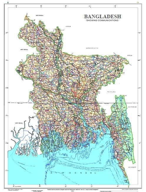
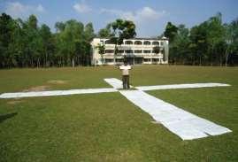
3 Survey of Bangladesh (SOB) is the National Mapping organization of Bangladesh SOB is carrying out all Geodetic activities of Bangladesh SOB is responsible for taking Aerial photographs in Bangladesh SOB Produces and Issues Maps & Map Data to the Users for various development activities
4 Preparation of Topographic Base Map of scale 1:25,000 Topographic Map of scale 1:5,000 (City area) Thematic Maps of various types and scales Horizontal and Vertical Control Points Establishment and Maintenance of GNSS CORS Determination of Mean Sea Level (MSL) GIS Database of scale 1:50,000, 1:25,000 and 1:5,000 Aerial Photographs Orthophotos Digital Terrain Model (DTM) Demarcation of International Boundary


")
")
5 GEODETIC ACTIVITIES ESTABLISHMENT OF NATIONAL HORIZONTAL DATUM Wettzell (Germany) Tsukuba (Japan) artebeesthoek (South Africa) Dhaka Yaragadee (Australia)


6 NATIONAL DATUM NATIONAL DATUM YARD Established: 1994 Horizontal Datum Gulshan, Dhaka Vertical Datum

 since 2007 for Tsunami Warning of Indian")
7 DETERMINATION OF MEAN SEA LEVEL (MSL) AND FIXATION OF VERTICAL DATUM Location:Chittagong Established: 1993 Data Records: Every 6 Sec The station is used by University of Hawaii Sea level centre as Global Sea level observing station (GLOSS) since 2007 for Tsunami Warning of Indian Ocean TIDAL STATION

 -")
8 GEODETIC CONTROL Netwark Horizontal Control Points 1 st Order Horizontal GCP nd Order Horizontal GCP Vertical Control Points 1st Order Vertical GCP nd Order Vertical GCP D Control Points(X,Y,Z) - 765

9 PERMANENT GNSS STATION (GNSS CORS) Six Permanent GNSS Stations Established at Dhaka, Khulna, Rajshahi, Rangpur, Moulvibazar & Chittagong Data Collected from Dec 2011 and Supplied to Various Public and private organizations

10 GNSS STATION Receiver : Trimble-Net R9 Technology: Trimble Pivot Platform Data acquisition Interval: 1 Second

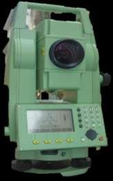


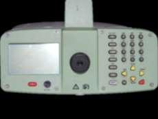


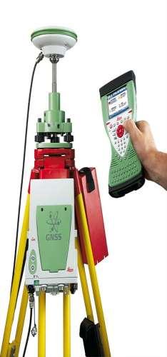
11 SURVEY EQUIPMENTS USED IN SOB Total Station Theodolite GNSS CORS Digital Level GNSS Receiver
12 CHRONOLOGICAL HISTORY OF AERIAL PHOTOGRAPHY AND SATELLITE IMAGERY IN BANGLADESH
13 Sl. No. Year Scale Name of Company Area :30,000 Capital Air Survey Limited, Canada All over the country :5,000 Bangladesh Air Force Dhaka City :50,000 1:30,000 1:15,000 Capital Ari Survey Limited, Canada Sundarban & Chittagong :50,000 1:15,000 IGN France All over the country :50,000 1:30,000 1:20,000 Finnmap International, Finland Coastal area, Jamuna & Surrounding :30,000 1:20,000 Quasco Company, Australia Chittagong, Cox s Bazar, Mymensingh :50,000 Finnmap International, Finland Coastal Area :25,000 Kevron Pvt Ltd. Australia All over the country :20,000 SOB/JICA/Asia Air Survey Dhaka City cm GSD 25cm GSD Passco Finnmap International All over the Country Chittagong, Khulna, Rajshahi, Barisal & Sylhet City
14 Sl. No. Year Scale Name of Company Area :50,000 Spot, France Sheet Size images of the riverine area m GSD Spot, France Along the International Boundary of Bangladesh m GSD Stereoscopic Digital Globe Along the Important rivers of Bangladesh


15 FLOW DIAGRAM OF SURVEYING AND MAPPING ACTIVITIES IN Sources Aerial Photographs Satellite Images Geodetic Control Point PROOF PHOTO Aerial Triangulation Stereo Plotting DTM Generation Orthophoto Generation Field Verification Photo GIS GIS Cartographic Database GIS Database Carto Carto Simplification and Smoothing Generalization Symbolization Print Printing of Hard Copy Map
16 PHOTOGRAMMETRIC ACTIVITIES Aerial Triangulation Digitization and Compilation Digital Surface Model Creation Digital Terrain Model Creation Orthophoto Generation Contour Generation Height Creation all over Bangladesh with respect to Mean Sea Level
17 GIS OUTPUT GIS Database with 11 Data sets, 68 Feature Class and 303 Feature Types GIS Basic Database for External Users Cartographic Database for Topographic Base Map Seamless Database for all over Bangladesh
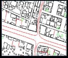
18 CARTOGRAPHIC OUTPUT Topographic Maps of Different Scales Thematic Maps According to requirements of stakeholders Administrative Maps Guide Maps of Important Cities
 Year of Acquisition 2010-11 Covering Area All over")
19 CHARACTERISTICS OF AERIAL PHOTOGRAPHS FOR 1:25,000 SCALE BASE MAP Spatial Resolution 50 cm GSD Radiometric Resolution 8 bit Number of Band 4 Bands (R,G,B,CIR) Year of Acquisition Covering Area All over Bangladesh
 Year of Acquisition 2010-11 Covering Area 5 Divisional Cities Pixel Size 6")
20 CHARACTERISTICS OF AERIAL PHOTOGRAPHS FOR 1:5,000 SCALE CITY MAPS Spatial Resolution 25 cm GSD Radiometric Resolution 8 bit Number of Band 4 Bands (R,G,B,CIR) Year of Acquisition Covering Area 5 Divisional Cities Pixel Size 6 Micron

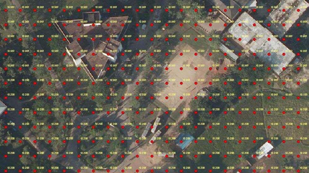
21 AERIAL PHOTO AND SATELLITE IMAGE TOGETHER SATELLITE IMAGE AERIAL PHOTO We are using satellite image and aerial photo data combined in a map.
22 IMAGE PROCESSING SOFTWARE Recently we purchased two image processing software to update our Base maps in reverine areas using satellite image. ERDAS Imagine Professional 2016 ENVI version 5.3 Apparently we are using monochromic/stereoscopi satellite data which were acquisitioned in differen years.


23 Satellite Images Spot Spatial Resolution 2.5 meter GS Radiometric Resolution 8 bit Number of Band 4 Bands Year of Acquisition 2010 Covering Area Along the Internation In the international border prepared Maps by using mon images We need to prepare Maps an using Stereoscopic Satellite

24 Satellite images World Vi Spatial Resolution 0.5 meter G Radiometric Resolution 8 bit Used to detect the area of rive To Incorporate and update river ba Number of Band 4 Bands (R,G,B; CIR) Year of Acquisition 2016 Area covered Along the Major Rivers erosion to the base maps

25 PHOTOGRAMMETRIC WORKFLOW Aerial Triangulation DTM Generation Stereo Plotting Orthophoto Generation


26
27 PHOTOGRAMMETRIC SOFTWARE Aerial Triangulation - Inpho Match version AT (03) Stereo Plotting - Summit Evolution version 6.1 (40) with Auto CAD Map 3D version 2011 (62) Summit Evolution version 7 (23) with Auto CAD Map 3D version 2016 (23) Summit Evolution version 7 with (02) Arc GIS 10.3 DTM & Orthophoto - Application Master includes (20) Match T DSM, DTM Edit & Ortho Master Ortho Vista includes SEAM Edit ( 10 no.)
28

29 Working procedure for making GIS and Cartographic Geodatabase from Photogrammetric Data and including Field Surveyed Data
30 AVAILABLE GIS SOFTWARE GIS GIS a Reviewer - 05 duction Manager - 02 k flow manager - 04 SDE
31 ATTRIBUTES OF A MAP


32 CARTOGRAPHIC WORKFLOW GIS MAP CARTOGRAPHIC GEODATABASE SYMBOLOGY ADDED MAP SYMBOLIZATION SYMBOL LIBRARY VISUAL SPECIFICATION GENERALIZED MAP EDITING & GENERALIZATION DELINEATION GUIDE MAP LAYOUT MARGINAL & GRID INFORMATION LAYOUT TEMPLATE & GRID TEMPLATE CARTOGRAPHIC MAP QUALITY ASSURANCE & PRINTING MAP
33 CARTOGRAPHIC SOFTWARE Arc GIS Production Mapping - 45

34 STORAGE SERVER Model: HP 580 G-7 Storage Capacity: 65 TB


35 PRINTING PRESS
36 Final Map

37 Publish Map 1:25,000 Scale 37

38 printed Map 1:5,000 Scale 38
39 hallenges- F Updating of Existing Topographic Base Map and GIS Database (using Stereoscopic Hig Resolution Multispectral Satellite Imagery) Extraction of Features using Satellite Imagery b state of the art technology Creation of Precise Digital Terrain Model Creation of 3D Model using Remote Sensin Technology
40 FUTURE PLAN Densification of GNSS CORS Network Establish National Spatial Data Infrastructure (NSDI) Aerial Survey using Unmanned Aerial Vehicle (UAV) Light Detection and Ranging (LiDAR) Survey Establishment of more tidal stations To carry out Gravity survey all over the country for determination of an accurate Geoid Model

41
UNITED NATIONS E/CONF.97/6/IP. 33
 UNITED NATIONS E/CONF.97/6/IP. 33 ECONOMIC AND SOCIAL COUNCIL Seventeenth United Nations Regional Cartographic Conference for Asia and the Pacific Bangkok, 18-22 September 2006 Item 7 of the provisional
GEOMATICS. Shaping our world. A company of
 GEOMATICS Shaping our world A company of OUR EXPERTISE Geomatics Geomatics plays a mayor role in hydropower, land and water resources, urban development, transport & mobility, renewable energy, and infrastructure
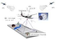
DMS-UAV Accuracy Assessment: AP20 with Nikon D800E
 DMS-UAV Accuracy Assessment: AP20 with Nikon D800E Joe Hutton, Greg Lipa, James Lutes, Omer Mian Applanix, William Chan - GeoPixel Air Introduction The Direct Mapping Solution for Unmanned Aerial Vehicles
UNITED NATIONS E/CONF.96/CRP. 5
 UNITED NATIONS E/CONF.96/CRP. 5 ECONOMIC AND SOCIAL COUNCIL Eighth United Nations Regional Cartographic Conference for the Americas New York, 27 June -1 July 2005 Item 5 of the provisional agenda* COUNTRY
Geospatial capabilities, spatial data and services provided by Military Geographic Service
 Geospatial capabilities, spatial data and services provided by Military Geographic Service LtC Mariyan Markov PhD CONTENTS 1. INTRODUCTION - Workflow - Data sources remote sensing, direct field observation.
USING GIS CARTOGRAPHIC MODELING TO ANALYSIS SPATIAL DISTRIBUTION OF LANDSLIDE SENSITIVE AREAS IN YANGMINGSHAN NATIONAL PARK, TAIWAN
 CO-145 USING GIS CARTOGRAPHIC MODELING TO ANALYSIS SPATIAL DISTRIBUTION OF LANDSLIDE SENSITIVE AREAS IN YANGMINGSHAN NATIONAL PARK, TAIWAN DING Y.C. Chinese Culture University., TAIPEI, TAIWAN, PROVINCE
DATA SOURCES AND INPUT IN GIS. By Prof. A. Balasubramanian Centre for Advanced Studies in Earth Science, University of Mysore, Mysore
 DATA SOURCES AND INPUT IN GIS By Prof. A. Balasubramanian Centre for Advanced Studies in Earth Science, University of Mysore, Mysore 1 1. GIS stands for 'Geographic Information System'. It is a computer-based
Yrd. Doç. Dr. Saygın ABDİKAN Öğretim Yılı Güz Dönemi
 Yabancı Dil III (YDL285) Introduction to Geomatics Yrd. Doç. Dr. Saygın ABDİKAN 2017-2018 Öğretim Yılı Güz Dönemi 1 géomatique Geo (Earth) + informatics Geodesy + Geoinformatics Geomatics: The mathematics
COUNTRY PRESENTATION ON MR JAYNAL ABEDIN JOINT SECRETARY ( WORKS & DEVELOPMENT ) MINISTRY OF DEFENCE
 MINISTRY OF DEFENCE") COUNTRY PRESENTATION ON By MR JAYNAL ABEDIN JOINT SECRETARY ( WORKS & DEVELOPMENT ) MINISTRY OF DEFENCE Bangladesh Geographical Location of Bangladesh Bangladesh Country at a Glance Physical Features 1,230
COUNTRY PRESENTATION ON By MR JAYNAL ABEDIN JOINT SECRETARY ( WORKS & DEVELOPMENT ) MINISTRY OF DEFENCE Bangladesh Geographical Location of Bangladesh Bangladesh Country at a Glance Physical Features 1,230
CLICK HERE TO KNOW MORE
 CLICK HERE TO KNOW MORE GENERALIZATION OF TOPOGRAPHIC DATABASE FOR SERVING GEOSPATIAL DATA FOR MILITARY AND SOCIO-ECONOMIC TASKS IN VIETNAM Speaker: Lieutenant Colonel, Nguyen Dinh Minh GENERAL STAFF -
PROJECT FOR THE PRODUCTION OF 1/1000 SCALE BASE MAPS FROM COLOUR IMAGES USING DIGITAL CAMERAS IN BURSA METROPOLITAN AREA (BMA) IN TURKEY
 IN TURKEY") PROJECT FOR THE PRODUCTION OF 1/1000 SCALE BASE MAPS FROM COLOUR IMAGES USING DIGITAL CAMERAS IN BURSA METROPOLITAN AREA (BMA) IN TURKEY Şenol KUŞCU, M.Sait AYIK, Eray CAN, Hasan Yasar ARKAYIN, Turkey
PROJECT FOR THE PRODUCTION OF 1/1000 SCALE BASE MAPS FROM COLOUR IMAGES USING DIGITAL CAMERAS IN BURSA METROPOLITAN AREA (BMA) IN TURKEY Şenol KUŞCU, M.Sait AYIK, Eray CAN, Hasan Yasar ARKAYIN, Turkey
To achieve these Global Sustainable Development Goals, geospatial data are crucial.
 To achieve these Global Sustainable Development Goals, geospatial data are crucial. 2 http://www.globalgoals.org/ HIGH INCOME NATION SUSTAINABLE GROWTH SOCIALLY INCLUSIVE 3 http://etp.pemandu.gov.my/ 12
The National Spatial Data Infrastructure of Zambia Shlomi SIVAN, Israel. Key words: National Land Audit, GIS, LIS, Common Spatial Data
 The National Spatial Data Infrastructure of Zambia Shlomi SIVAN, Israel Key words: National Land Audit, GIS, LIS, Common Spatial Data SUMMARY One of Zambia's important challenges is to recognize the title
Flood Mapping Michael Durnin October 9 th
 Michael Durnin October 9 th 2014 Leading Surveyors Company Profile Est. 1983 Celebrating 30 Years in Business Six Offices in UK & Ireland Over 30 Specialised Survey Services ISO 9001:2008 Registered Over
SOLUTIONS ADVANCED GIS. TekMindz are developing innovative solutions that integrate geographic information with niche business applications.
 ADVANCED GIS SOLUTIONS TekMindz are developing innovative solutions that integrate geographic information with niche business applications. TEK INDZ TM GIS Services Overview At the leading edge of geospatial
THE ESTABLISHMENT OF DIGITAL HIGH RESOLUTION GEODATABASES FOR WEBGIS: FROM DIGITAL CAMPUS TO DIGITAL NATIONAL PARK
 THE ESTABLISHMENT OF DIGITAL HIGH RESOLUTION GEODATABASES FOR WEBGIS: FROM DIGITAL CAMPUS TO DIGITAL NATIONAL PARK Y. C. Ding a, *, C. C. Huang a a Digital Earth Research Center (DERC), Chinese Culture
Country Report on SDI Activities in Singapore *
 UNITED NATIONS E/CONF.100/CRP.9 ECONOMIC AND SOCIAL COUNCIL Eighteenth United Nations Regional Cartographic Conference for Asia and the Pacific Bangkok, 26-29 October 2009 Item 7(a) of the provisional
Geospatial Data Infrastructure in Myanmar
 SURVEY DEPARTMENT Republic of the Union of Myanmar Geospatial Data Infrastructure in Myanmar 16-17 October, 2016 Kuala Lumpur, Malaysia Contents General description Organization Establishment of Myanmar
THE NEW TECHNOLOGICAL ADVANCES IN CARTOGRAPHY
 Distr.: LIMITED ECA/NRD/CART. 9/ETH. 6 October 1996 Original: ENGLISH Ninth United Nations Regional Cartographic Conference for Africa Addis Ababa, Ethiopia 11-15 November 1996 THE NEW TECHNOLOGICAL ADVANCES
Use of Elevation Data in NOAA Coastal Mapping Shoreline Products. Coastal GeoTools April 1, 2015
 Use of Elevation Data in NOAA Coastal Mapping Shoreline Products Coastal GeoTools April 1, 2015 - NOAA s Coastal Mapping Program & CUSP - Shoreline Uses, Delineation Issues, Definitions - Current Extraction
Integrating LiDAR data into the workflow of cartographic representation.
 Integrating LiDAR data into the workflow of cartographic representation. Cartographic Workflow I. 1 2 3 4 5 Surveying Vector (Nat. GDB) GPS, Laser Range Finder Yes/ No Scanning old maps LiDARflights Capture
1994: JV formed for civil engineering consultancy COWI/KX A/s, Denmark(51%) IFU, Denmark (24% ) IL&FS Infrastructure Dev Corp, India(25%)
 IFU, Denmark (24% ) IL&FS Infrastructure Dev Corp, India(25%)") Company Profile 1994: JV formed for civil engineering consultancy COWI/KX A/s, Denmark(51%) IFU, Denmark (24% ) IL&FS Infrastructure Dev Corp, India(25%) 1998: Start of mapping as a new segment of Business.
Company Profile 1994: JV formed for civil engineering consultancy COWI/KX A/s, Denmark(51%) IFU, Denmark (24% ) IL&FS Infrastructure Dev Corp, India(25%) 1998: Start of mapping as a new segment of Business.
Production Line Tool Sets
 Production Line Tool Sets Tools for high-quality database production and cartographic output Production Line Tool Sets Production Line Tool Sets (PLTS) by ESRI are a collection of software applications
THE CADASTRAL INFORMATION SYSTEM IN THE REPUBLIC OP SOUTH AFRICA
 I $:? Distr.: LIMITED ECA/NRD/CART.9/ORG.27 November 1996 Original: ENGLISH Ninth United Nations Regional Cartographic Conference for Africa Addis Ababa, Ethiopia 11-15 November 1996 THE CADASTRAL INFORMATION
REPUBLIC OF ZAMBIA MINISTRY OF LANDS, NATURAL RESOURCES AND ENVIRONMENTAL PROTECTION COUNTRY REPORT FOR THE
 REPUBLIC OF ZAMBIA MINISTRY OF LANDS, NATURAL RESOURCES AND ENVIRONMENTAL PROTECTION COUNTRY REPORT FOR THE 1 P a g e 48 th TECHNICAL COMMITTEE MEETING OF THE REGIONAL CENTRE OF RESOURCES FOR DEVELOPMENT
NCC roles in successful disaster response I.R.IRAN
 The Second UN-GGIM-AP Plenary Meeting NCC roles in successful disaster response I.R.IRAN Teheran Iran 28-30 October 2013 Ali Javidaneh Technical Deputy of National Cartographic Center (NCC) Outline Types
Generation and analysis of Digital Elevation Model (DEM) using Worldview-2 stereo-pair images of Gurgaon district: A geospatial approach
 using Worldview-2 stereo-pair images of Gurgaon district: A geospatial approach") 186 Generation and analysis of Digital Elevation Model (DEM) using Worldview-2 stereo-pair images of Gurgaon district: A geospatial approach Arsad Khan 1, Sultan Singh 2 and Kaptan Singh 2 1 Department
186 Generation and analysis of Digital Elevation Model (DEM) using Worldview-2 stereo-pair images of Gurgaon district: A geospatial approach Arsad Khan 1, Sultan Singh 2 and Kaptan Singh 2 1 Department
Country Report On Sdi Activities In Singapore ( )
") UNITED NATIONS E/CONF.102/IP.4 ECONOMIC AND SOCIAL COUNCIL Nineteenth United Nations Regional Cartographic Conference for Asia and the Pacific Bangkok, 29 October 1 November 2012 Item 6(b) of the provisional
UNITED NATIONS E/CONF.102/IP.4 ECONOMIC AND SOCIAL COUNCIL Nineteenth United Nations Regional Cartographic Conference for Asia and the Pacific Bangkok, 29 October 1 November 2012 Item 6(b) of the provisional
Performing Advanced Cartography with Esri Production Mapping
 Esri International User Conference San Diego, California Technical Workshops July 25, 2012 Performing Advanced Cartography with Esri Production Mapping Tania Pal & Madhura Phaterpekar Agenda Outline generic
QuestUAV DATAhawk PPK Accuracy Assessment and Validation
 QuestUAV DATAhawk PPK Accuracy Assessment and Validation Accuracy of 3.0cm(X), 3.3cm(Y), 3.9cm(Z) Nigel King 1, Kerstin Traut 2, Cameron Weeks 3, Chris Mills 4, Phil Mills 5, Ruairi Hardman 6, Stuart King
IMPLEMENTAION OF GIS TECHNOLOGY IN THE NILE AND ITS WADIS ABSTRACT
 IMPLEMENTAION OF GIS TECHNOLOGY IN THE NILE AND ITS WADIS Eng. NADIA M. ABD EI- SALAM 1 Dr. ABDEL AZIZ TAREK M. 2 ABSTRACT Traditional methods have been used for several years for map production of the
Fundamentals of Surveying (LE/ESSE ) Lecture 10
 Lecture 10") Fundamentals of Surveying (LE/ESSE 2620 3.0) Lecture 10 Topographic Mapping Dr.-Ing. Jianguo Wang Geomatics Engineering York University Fall 2017 1 10-1 Introduction Two main types of maps: Line maps Orthophotographic
Fundamentals of Surveying (LE/ESSE 2620 3.0) Lecture 10 Topographic Mapping Dr.-Ing. Jianguo Wang Geomatics Engineering York University Fall 2017 1 10-1 Introduction Two main types of maps: Line maps Orthophotographic
State of Israel Ministry of Housing and Construction Survey of Israel. The Hydrological project case
 State of Israel Ministry of Housing and Construction Survey of Israel The Hydrological project case Survey of Israel Content Introduction To the Survey of Israel The operation assumptions The main responsibilities
National Cartographic Center
 National Cartographic Center NCC activities and accomplishments Activities of national organizations, institutions and universities in field of geomatics Large scale maps Medium scale maps Small scale
Lecture 9: Reference Maps & Aerial Photography
 Lecture 9: Reference Maps & Aerial Photography I. Overview of Reference and Topographic Maps There are two basic types of maps? Reference Maps - General purpose maps & Thematic Maps - maps made for a specific
WELCOME: IGF 2015 : PRESENTATION
 WELCOME: IGF 2015 : PRESENTATION LARGE SCALE DTDB FOR SUSTAINABLE PLANNING & DESIGN OF COAL MINING by MajGen B D Sharma, Addl. Surveyor General Sh B Tripathy, Superintending Surveyor Jharkhand Geospatial
2013 Cartographic Country Report Uruguay **
 ADVANCE UNEDITED VERSION UNITED NATIONS _ STATISTICS DIVISION E/CONF.103/IP.5 Tenth United Nations Regional Cartographic Conference for the Americas New York, 19-23, August 2013 Item 6(b) of the provisional
INSTITUTE OF AERONAUTICAL ENGINEERING (Autonomous) Dundigal, Hyderabad
 Dundigal, Hyderabad") INSTITUTE OF AERONAUTICAL ENGINEERING (Autonomous) Dundigal, Hyderabad -00 0 CIVIL ENGINEERING TUTORIAL QUESTION BANK Course Name : Remote Sensing and GIS Course Code : A00 Class : IV B. Tech I Semester
INSTITUTE OF AERONAUTICAL ENGINEERING (Autonomous) Dundigal, Hyderabad -00 0 CIVIL ENGINEERING TUTORIAL QUESTION BANK Course Name : Remote Sensing and GIS Course Code : A00 Class : IV B. Tech I Semester
QUESTIONNAIRE THE CURRENT STATUS OF MAPPING IN THE WORLD
 QUESTIONNAIRE ON THE CURRENT STATUS OF MAPPING IN THE WORLD The questionnaire is intended to take stock of the current status of mapping in the world. The information collected will eventually be used
Part : General Situation of Surveying and Mapping. The Development of Surveying and Mapping in China. The contents
 The Development of Surveying and Mapping in China Dr. Ping Xiao China.P.R The contents Part : General Situation of Surveying and Mapping 1. The legal systems of surveying and mapping 2. The technologies
VHR in Cartography, Urban & Land planning. Introduction : Jean-Philippe Cantou, IGN Espace
 VHR in Cartography, Urban & Land planning Introduction : Jean-Philippe Cantou, IGN Espace Pleiades days 17th January 2012 1/11 Framework of the WG3 National spatial data infrastructure (NSDI) geographic
Application of high-resolution (10 m) DEM on Flood Disaster in 3D-GIS
 DEM on Flood Disaster in 3D-GIS") Risk Analysis V: Simulation and Hazard Mitigation 263 Application of high-resolution (10 m) DEM on Flood Disaster in 3D-GIS M. Mori Department of Information and Computer Science, Kinki University, Japan
Risk Analysis V: Simulation and Hazard Mitigation 263 Application of high-resolution (10 m) DEM on Flood Disaster in 3D-GIS M. Mori Department of Information and Computer Science, Kinki University, Japan
Overview of Remote Sensing in Natural Resources Mapping
 Overview of Remote Sensing in Natural Resources Mapping What is remote sensing? Why remote sensing? Examples of remote sensing in natural resources mapping Class goals What is Remote Sensing A remote sensing
Designing GIS Databases to Support Mapping and Map Production Charlie Frye, ESRI Redlands Aileen Buckley, ESRI Redlands
 Designing GIS Databases to Support Mapping and Map Production Charlie Frye, ESRI Redlands Aileen Buckley, ESRI Redlands 1 Designing GIS Databases to Support Mapping and Map Production Charlie Frye, ESRI
Presented to Sub-regional workshop on integration of administrative data, big data and geospatial information for the compilation of SDG indicators
 Presented to Sub-regional workshop on integration of administrative data, big data and geospatial information for the compilation of SDG indicators 23-25 April,2018 Addis Ababa, Ethiopia By: Deogratius
Innovation. The Push and Pull at ESRI. September Kevin Daugherty Cadastral/Land Records Industry Solutions Manager
 Innovation The Push and Pull at ESRI September 2004 Kevin Daugherty Cadastral/Land Records Industry Solutions Manager The Push and The Pull The Push is the information technology that drives research and
Digital Elevation Models (DEM)
") Digital Elevation Models (DEM) Digital representation of the terrain surface enable 2.5 / 3D views Rule #1: they are models, not reality Rule #2: they always include some errors (subject to scale and data
Digital Elevation Models (DEM) Digital representation of the terrain surface enable 2.5 / 3D views Rule #1: they are models, not reality Rule #2: they always include some errors (subject to scale and data
Performing Map Cartography. using Esri Production Mapping
 AGENDA Performing Map Cartography Presentation Title using Esri Production Mapping Name of Speaker Company Name Kannan Jayaraman Agenda Introduction What s New in ArcGIS 10.1 ESRI Production Mapping Mapping
COMPANY PROFILE. For PHOTOGRAMMETRY, LiDAR, BIM, UAV, GIS and SURVEYING SOLUTIONS. Submitted by MARVEL GEOSPATIAL SOLUTIONS PVT.LTD.
 COMPANY PROFILE For PHOTOGRAMMETRY, LiDAR, BIM, UAV, GIS and SURVEYING SOLUTIONS Submitted by MARVEL GEOSPATIAL SOLUTIONS PVT.LTD. Table of Contents 1. ABOUT US... 3 1.1 MISSION/VISION... 4 2. SERVICES
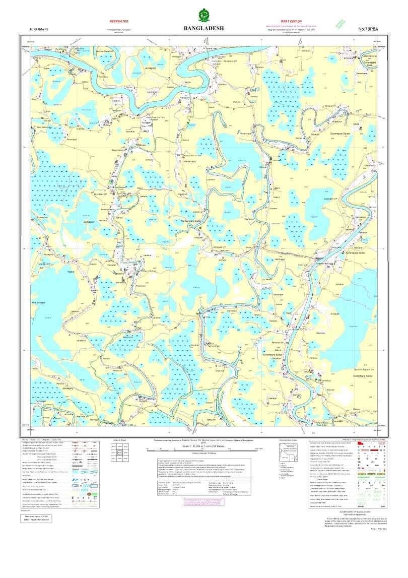
Reading a Map in Any Language. Kathy Sundstedt and Dawn Brown School not available. Content Area (Req.): Geography Unit (Opt.):
: Geography Unit (Opt.):") Instructional Sequence/Procedure (Req.): 1. Distribute one copy of Bangladesh map, written in Bengali, to each student group. 2. Optional project the same map on the wall from transparency, overhead projector,
Instructional Sequence/Procedure (Req.): 1. Distribute one copy of Bangladesh map, written in Bengali, to each student group. 2. Optional project the same map on the wall from transparency, overhead projector,
Ramani Geosystems. Putting Africa On The Map. Authorized Resellers
 Ramani Geosystems Putting Africa On The Map Authorized Resellers Ramani Profile Started in 1999 Aerial, Land Surveying & Mapping Solutions + 10 Countries in the region + 80 Staff working in projects Asset
The Integration of Land and Marine Spatial Data Set As Part of Indonesian Spatial Data Infrastructure Development
 UNITED NATIONS E/CONF.97/6/IP. 46 ECONOMIC AND SOCIAL COUNCIL Seventeenth United Nations Regional Cartographic Conference for Asia and the Pacific Bangkok, 18-22 September 2006 Item 7 of the provisional
VERY HIGH RESOLUTION SATELLITE DATA FOR CADASTRAL MAPPING
 132 Romuald Kaczynski, Michal Kedzierski Military University of Technology, Warsaw, Poland VERY HIGH RESOLUTION SATELLITE DATA FOR CADASTRAL MAPPING Kaczynski Romuald, Kedzierski Michal, 2013 В статье
COMPARISON OF THE RESULTS OBTAINED FROM THE AERIAL PHOTOGRAPHS AND SPOT STEREO IMAGES IN THE PRODUCTION OF 1: SCALED TOPOGRAPHICAL MAPS
 COMPARISON OF THE RESULTS OBTAINED FROM THE AERIAL PHOTOGRAPHS AND SPOT STEREO IMAGES IN THE PRODUCTION OF 1:50.000 SCALED TOPOGRAPHICAL MAPS Mahmut ÖZBALMUMCU Dr. Lt.Col. Photogrammetry Department The
VISUALIZING THE SMART CITY 3D SPATIAL INFRASTRUCTURE GEOSMART ASIA- 30 SEP, 2015
 www.aamgroup.com VISUALIZING THE SMART CITY 3D SPATIAL INFRASTRUCTURE GEOSMART ASIA- 30 SEP, 2015 Agenda AAM What is a Smart City? Data Acquisition 3D Modelling Benefits Questions AAM AAM is a Geospatial
 Boone County GIS has the right to inquire about and investigate the use of any requested products and deny access to anyone based on concerns relating to privacy, security, public health, public safety,
BOTSWANA-TOWARDS A NATIONAL GEO-SPATIAL DATA INFRASTRUCTURE
 BOTSWANA-TOWARDS A NATIONAL GEO-SPATIAL DATA INFRASTRUCTURE Bryson B. H. MOREBODI, Botswana Key words: ABSTRACT The paper will review geo-spatially-related work over the last ten years with particular
Stay of play in the Serbian geo-sector
 Stay of play in the Serbian geo-sector Republic Geodetic Authority, Serbia IGN France International, France INSPIRE Conference Florence, 27 th June 2013 Outline NSDI status Institutional framework Technical
Land Administration and Cadastre
 Geomatics play a major role in hydropower, land and water resources and other infrastructure projects. Lahmeyer International s (LI) worldwide projects require a wide range of approaches to the integration
SURVEYING Chapter 1 Introduction
 PHILADELPHIA UNIVERSITY Faculty of Engineering. Department of Civil Engineering. SURVEYING Chapter 1 Introduction Surveying : the art or science of measuring and representing natural and artificial features
The Next Generation GIS/LIS A Surveys Information System Integrated within a GIS
 The Next Generation GIS/LIS A Surveys Information System Integrated within a GIS Michael F. WEIR, USA Key words: Linking, Snapping, GIS, Measurements, Measurement Data, GIS Features, Spatial Quality. SUMMARY
Preparation of Database for Urban Development
 Preparation of Database for Urban Development By PunyaP OLI, 1. Chairman, ERMC (P) Ltd., Kathmandu, Nepal. Email: punyaoli@ermcnepal.com 2. Coordinator, Himalayan College of Geomatic Engineering and Land
Building a National Data Repository
 Building a National Data Repository Mladen Stojic, Vice President - Geospatial 1/30/2013 2012 Intergraph Corporation 1 Information has meaning and gives power only when shared and distributed. Information,
DATA DEVELOPMENT IN BRUNEI DARUSSALAM. Submitted by Survey Department, Brunei Darussalam **
 UNITED NATIONS E/CONF.97/6/IP. 45 ECONOMIC AND SOCIAL COUNCIL Seventeenth United Nations Regional Cartographic Conference for Asia and the Pacific Bangkok, 18-22 September 2006 Item 7 of the provisional
Integration Activities in Indonesia: The Integration of Land and Marine Spatial Data Sets as Part of Indonesian SDI Development
 Integration Activities in Indonesia: The Integration of Land and Marine Spatial Data Sets as Part of Indonesian SDI Development M. Arief Syafi i National Coordination Agency for Surveys and Mapping (B
STEREO ANALYST FOR ERDAS IMAGINE Stereo Feature Collection for the GIS Professional
 STEREO ANALYST FOR ERDAS IMAGINE Stereo Feature Collection for the GIS Professional STEREO ANALYST FOR ERDAS IMAGINE Has Your GIS Gone Flat? Hexagon Geospatial takes three-dimensional geographic imaging
Trimble s ecognition Product Suite
 Trimble s ecognition Product Suite Dr. Waldemar Krebs October 2010 Trimble Geospatial in the Image Processing Chain Data Acquisition Pre-processing Manual/Pixel-based Object-/contextbased Interpretation
GRAPHICAL PRESENTATION OF AGRO-CLIMATIC DATA. Table 1. Month wise average maximum and minimum temperature in Dhaka, Bangladesh
 GRAPHICAL PRESENTATION OF AGRO-CLIMATIC DATA Mirza Hasanuzzaman, PhD Assistant Professor Department of Agronomy Sher-e-Bangla Agricultural University There are different types of graph are used to present
EnvSci 360 Computer and Analytical Cartography
 EnvSci 360 Computer and Analytical Cartography Lecture 7 Mapping Images, Surfaces, and 3-D Data Brief Overview of Imagery What is Imagery? A spatial data model that defines space as an array of equally
DATA APPLIANCE FOR ARCGIS
 DATA APPLIANCE FOR ARCGIS Data Appliance for ArcGIS Provides Access to Multi-Scale Basemaps Down to Medium Scale Levels Worldwide And Large Scale for Most of the World The Data Appliance includes Several
Techniques for Science Teachers: Using GIS in Science Classrooms.
 Techniques for Science Teachers: Using GIS in Science Classrooms. After ESRI, 2008 GIS A Geographic Information System A collection of computer hardware, software, and geographic data used together for
GIS Workshop Data Collection Techniques
 GIS Workshop Data Collection Techniques NOFNEC Conference 2016 Presented by: Matawa First Nations Management Jennifer Duncan and Charlene Wagenaar, Geomatics Technicians, Four Rivers Department QA #: FRG
ISLAMIC REPUBLIC OF IRAN NATIONAL REPORT FOR PHOTOGRAMMETRY, REMOTE SENSING AND SPATIAL INFORMATION SCIENCE
 ISLAMIC REPUBLIC OF IRAN NATIONAL REPORT FOR PHOTOGRAMMETRY, REMOTE SENSING AND SPATIAL INFORMATION SCIENCE 2004-2008 A. Eslami Rad a, M. Sarpoulaki b a Director Technical Advisor, National Cartographic
Towards National Geographic Information System in Nepal
 2 nd High Level Forum on Global Geospatial Information Management, Qatar National Convention Centre, Doha, Qatar, 4 6 February, 2013 Towards National Geographic Information System in Nepal Krishna Raj
12/26/2012. Geographic Information Systems * * * * GIS (... yrezaei
 ( - Geographic Information Systems ( ( 1 2 3 Information System Data base DB IS IS DB (Knowledge ( ( (System (Information System - (Georefrence Analysis Data + Knowledge ======== Information 4 5 ( < 10%
Utilization and Provision of Geographical Name Information on the Basic Map of Japan*
 UNITED NATIONS WORKING PAPER GROUP OF EXPERTS NO. 1/9 ON GEOGRAPHICAL NAMES Twenty-eight session 28 April 2 May 2014 Item 9 of the Provisional Agenda Activities relating to the Working Group on Toponymic
QUALITY CONTROL ROLE IN PROCESS OF ESTABLISHMENT OF NSDI
 QUALITY CONTROL ROLE IN PROCESS OF ESTABLISHMENT OF NSDI S. Lemajić a,lj. Rašić b a Croatian Geodetic Institute, Savska 41/XVI, Zagreb, Croatia slavko.lemajic@cgi.hr b State Geodetic Administration, Lastovska
Chapter 1 Overview of Maps
 Chapter 1 Overview of Maps In this chapter you will learn about: Key points when working with maps General types of maps Incident specific maps Map legend and symbols Map sources A map is a navigational
ESRI Survey Summit August Clint Brown Director of ESRI Software Products
 ESRI Survey Summit August 2006 Clint Brown Director of ESRI Software Products Cadastral Fabric How does Cadastral fit with Survey? Surveyors process raw field observations Survey measurements define high-order
Aerial Photography and Imagery Resources Guide
 Aerial Photography and Imagery Resources Guide Cheyenne and Laramie County Cooperative GIS Created and Maintained by the GIS Coordinator for the Cooperative GIS Program May 2016 CHEYENNE / LARAMIE COUNTY
Popular Mechanics, 1954
 Introduction to GIS Popular Mechanics, 1954 1986 $2,599 1 MB of RAM 2017, $750, 128 GB memory, 2 GB of RAM Computing power has increased exponentially over the past 30 years, Allowing the existence of
Leveraging Geospatial Technology for Cadastral Surveys
 Matthew Delano, LS Geospatial World Forum January 2017 Leveraging Geospatial Technology for Cadastral Surveys Fit-for-Purpose Simple to start Can improve over time whenever necessary Meet the needs of
What is GIS? Introduction to data. Introduction to data modeling
 What is GIS? Introduction to data Introduction to data modeling 2 A GIS is similar, layering mapped information in a computer to help us view our world as a system A Geographic Information System is a
UPDATING MAPS USING HIGH RESOLUTION SATELLITE IMAGERY
 UPDATING MAPS USING HIGH RESOLUTION SATELLITE IMAGERY Muhamad Alrajhi, hurram Shahzad Janjua, Mohammad Afroz han, Abdalla Alobeid Dept. of Surveying and Mapping,Ministry of Municipal and Rural Affairs,
Basics of GIS reviewed
 Basics of GIS reviewed Martin Breunig Karlsruhe Institute of Technology martin.breunig@kit.edu GEODETIC INSTITUTE, DEPARTMENT OF CIVIL ENGINEERING, GEO AND ENVIRONMENTAL SCIENCES, CHAIR IN GEOINFORMATICS
BANGLADESH DIGITAL MAPPING ASSISTANCE PROJECT (BDMAP) Final Report
 Final Report") No. The People's Republic of Bangladesh Survey of Bangladesh (SOB) BANGLADESH DIGITAL MAPPING ASSISTANCE PROJECT (BDMAP) September 2013 Japan International Cooperation Agency (JICA) Asia Air Survey Co.,
No. The People's Republic of Bangladesh Survey of Bangladesh (SOB) BANGLADESH DIGITAL MAPPING ASSISTANCE PROJECT (BDMAP) September 2013 Japan International Cooperation Agency (JICA) Asia Air Survey Co.,
CROTIS AND VOGIS CROATIAN CONCEPT OF COOPERATIVE MAP PRODUCTION
 CROTIS AND VOGIS CROATIAN CONCEPT OF COOPERATIVE MAP PRODUCTION I. Vilus 1, I. Landek 1, Ž. Železnjak 2 1 State Geodetic Administration, Croatia 2 Ministry of Defence of the Republic of Croatia e-mail:
An Introduction to Geographic Information System
 An Introduction to Geographic Information System PROF. Dr. Yuji MURAYAMA Khun Kyaw Aung Hein 1 July 21,2010 GIS: A Formal Definition A system for capturing, storing, checking, Integrating, manipulating,
Coordinate systems, measured surveys for BIM, total station for BIM, as-built surveys, setting-out
 Coordinate systems, measured surveys for BIM, total station for BIM, as-built surveys, setting-out What is a BIM What does a BIM do Why use a BIM BIM Software BIM and the Surveyor How do they relate to
Spatial Information Management in the Context of Organizational Development the Approach in North-Rhine Westphalia, Germany
 Spatial Information Management in the Context of Organizational Development the Approach in North-Rhine Westphalia, Germany Dr. Jens Riecken DVW Vice President c/o Ministry of the Interior North-Rhine
New LPIS data and their quality control in Macedonia. Pavel TROJACEK & Adam ZLOTY EKOTOXA s.r.o.
 New LPIS data and their quality control 15th GeoCAP Conference, Taormina, Italy 18 20 November 2009 Outline of the presentation Intro: About Macedonia 1. Design of LPIS 2. LPIS methodology 3. New spatial
Academic Model in South Africa Some Background
 Academic Model in South Africa Some Background 6 Professional models. (Land, Hydro, Engineering, Photo, GISc) 4 Technologist Models. (Engineering, Mining, Photo, GISc) 4 Technician Models. (Engineering,
Imagery and the Location-enabled Platform in State and Local Government
 Imagery and the Location-enabled Platform in State and Local Government Fred Limp, Director, CAST Jim Farley, Vice President, Leica Geosystems Oracle Spatial Users Group Denver, March 10, 2005 TM TM Discussion
Advanced Image Analysis in Disaster Response
 Advanced Image Analysis in Disaster Response Creating Geographic Knowledge Thomas Harris ITT The information contained in this document pertains to software products and services that are subject to the
The National Spatial Reference System of the Future
 The National Spatial Reference System of the Future William Stone Southwest Region (AZ, NM, NV, UT) Geodetic Advisor william.stone@noaa.gov NOAA s National Geodetic Survey geodesy.noaa.gov Salt Lake City
Stellenbosch University Digital Elevation Model (SUDEM) 2013 Edition
 2013 Edition") Stellenbosch University Digital Elevation Model (SUDEM) 2013 Edition Adriaan van Niekerk Centre for Geographical Analysis Stellenbosch University 25 April 2014 CONTENTS CONTENTS... ii TABLES... iii FIGURES...
Stellenbosch University Digital Elevation Model (SUDEM) 2013 Edition Adriaan van Niekerk Centre for Geographical Analysis Stellenbosch University 25 April 2014 CONTENTS CONTENTS... ii TABLES... iii FIGURES...
NR402 GIS Applications in Natural Resources
 NR402 GIS Applications in Natural Resources Lesson 1 Introduction to GIS Eva Strand, University of Idaho Map of the Pacific Northwest from http://www.or.blm.gov/gis/ Welcome to NR402 GIS Applications in
Nineteen engineering disciplines are included in the Examination Syllabus issued by the Canadian Engineering Qualifications Board of Engineers Canada.
 INTRODUCTION Nineteen engineering disciplines are included in the Examination Syllabus issued by the Canadian Engineering Qualifications Board of Engineers Canada. Each discipline examination syllabus
NEPAL EARTHQUAKE 4D-IMADAS 2015 FOR RECONSTRUCTION INITIATIVE - FROM REMOTE SENSING TO 3D REMOTE MODELING -
 NEPAL EARTHQUAKE 4D-IMADAS 2015 FOR RECONSTRUCTION INITIATIVE - FROM REMOTE SENSING TO 3D REMOTE MODELING - - Hiroyuki Hasegawa - Center for South East Asian Studies (CSEAS) Kyoto University, - 46, Shimoadachi-cho,
A Detailed Examination of DTM Creation Methods and Sources. Study Area Overview
 A Detailed Examination of DTM Creation Methods and Sources Adam Mosbrucker & Melinda Lamb Geography 593: Dec. 2 nd, 2010 Study Area Overview Mt. St. Helens -active volcano many eruptions in the past 30