Shorelines: The Coastal Atlas of Ireland
|
|
|
- Dayna Collins
- 6 years ago
- Views:
Transcription

1 Shorelines: The Coastal Atlas of Ireland Dr Maxim Kozachenko, Department of Geography and the Coastal & Marine Research Centre, University College Cork INFOMAR Seminar 22 October 2014
2
3


4 Ireland is an island surrounded by ocean, with a high percentage of its population living in the coastal zone and has often been referred to as an island nation. The importance of the coastal zone to Ireland is extremely high, given its economic value from tourism and recreation, fishing, aquaculture, renewable energy, ports and linked industries and its environmental significance.
5

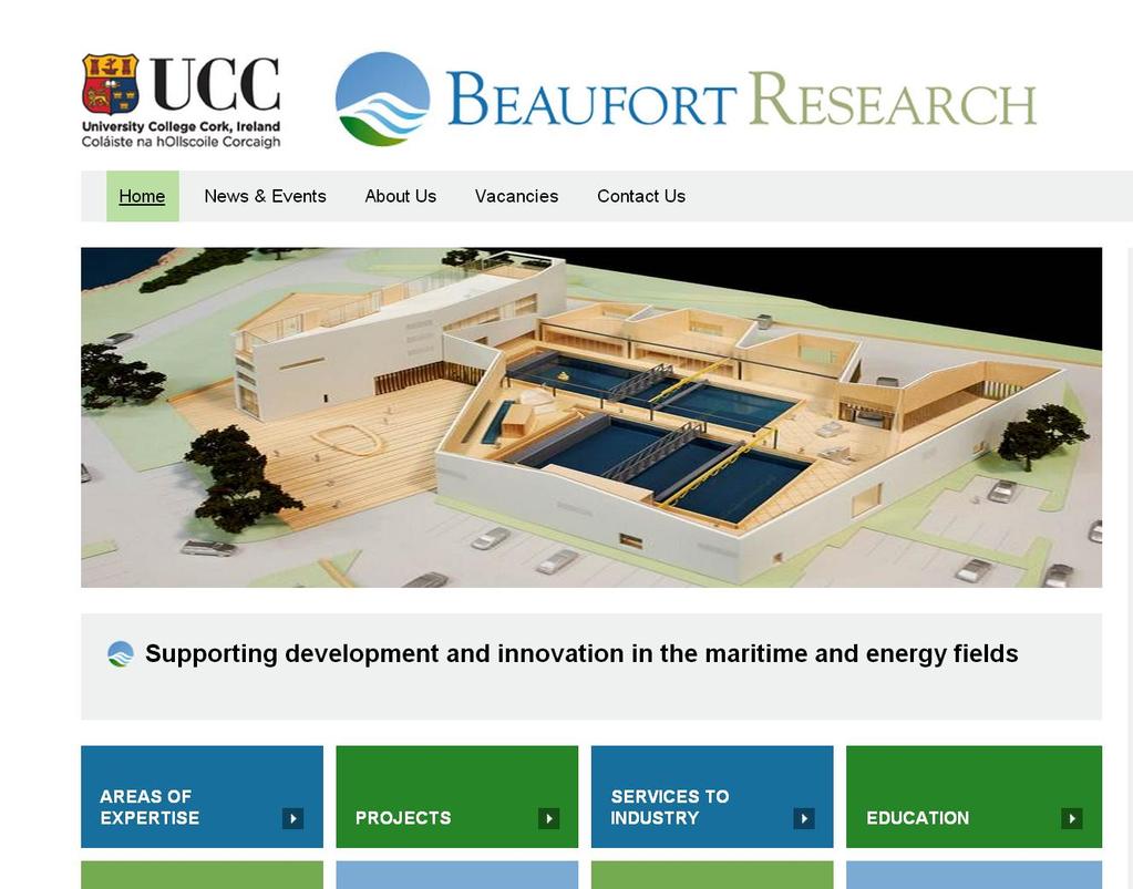
6 FUTURE Beaufort Laboratory Beaufort NMCI Naval Base Beaufort Research is dedicated to inter-disciplinary research and knowledge transfer supporting development and innovation in the maritime and energy fields.
 at University College Cork.")
7 WHERE WE ARE GOING It combines the excellent track record of the Hydraulics and Maritime Research Centre (HMRC), the Coastal and Marine Research Centre (CMRC) and the Sustainable Energy Research Group (SERG) at University College Cork. Supporting Amalgamation development of three internationally and innovation successful in the maritime entities (CMRC, and energy HMRC, fields SERG) 90 Cross-disciplinary Researchers 60 Associated Academic Researchers in UCC State-of-the-art building 4700m 2 Dedicated Labs, test facilities and offices 14.5m Funding from HEA, DCENR, DAFF, Bord Gais Ireland needs to be able to compete globally where new research in fields like sustainable energy and maritime science are concerned. The Government's Action Plan for Jobs 2013 recognises this and the UCC Beaufort building will play an important role in the marine energy sector and help to drive Ireland's economic recovery Taoiseach Enda Kenny, July 13
8
 European Level FP7- co-ordinating 3 and major partners in 15 projects INTERREG co-ordinating 2 and major partners in 7 projects ESA major partners in 4 projects Life+ - major")
9 HOW WE GOT TO WHERE WE ARE NOW 90 cross-disciplinary researchers across 13 thematic areas Successfully securing funding: (c.5m / annum recurrent) European Level FP7- co-ordinating 3 and major partners in 15 projects INTERREG co-ordinating 2 and major partners in 7 projects ESA major partners in 4 projects Life+ - major partners in 2 projects National Level National Ocean Test Facility Holders of Beaufort, Griffiths and Parsons national awards Significant research support won from EPA, Marine Institute, SEAI, GSI Direct industry funding energy, consultant engineers, environmental monitoring


10 WHERE WE ARE GOING To become a research and commercial cluster of world standing, by realising Ireland s potential in the global, maritime and energy markets of tomorrow.


11 HOW WE GOT TO WHERE WE ARE NOW Active engagement with industry waveberg


12 Policy Relevant Research WHERE WE ARE GOING
13 Shorelines: The Coastal Atlas of Ireland Although, there are existing guides about Ireland s coastal geology, physical geography and landscapes, these are fragmented and mostly of a local nature. Shorelines: The Coastal Atlas of Ireland will aim to fill this gap by looking at the shaping of the coastline of Ireland as a whole, from both the physical and human environmental perspectives.
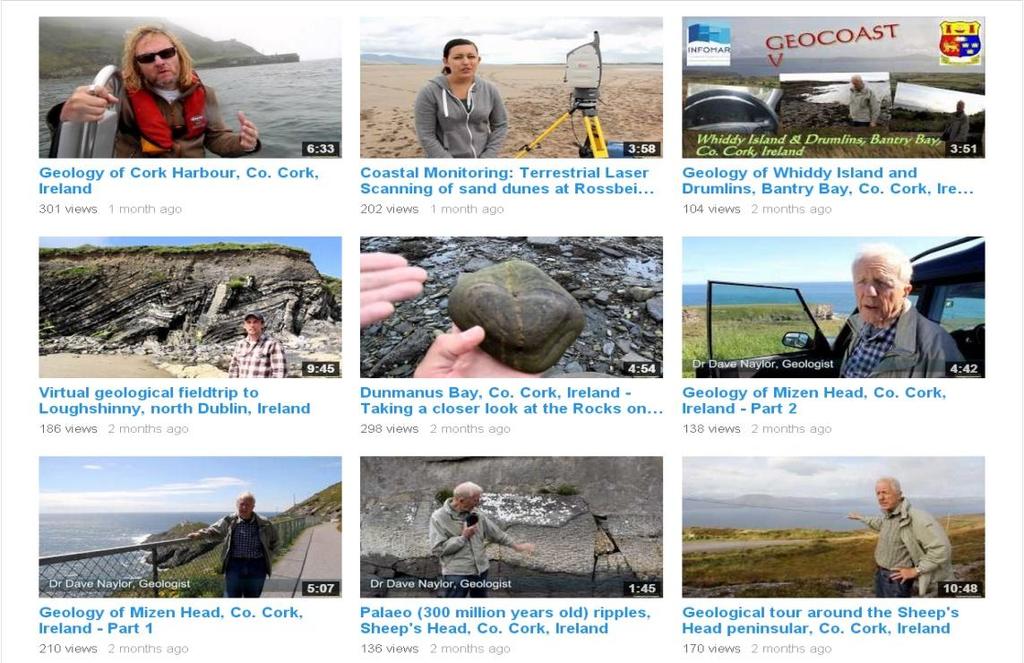
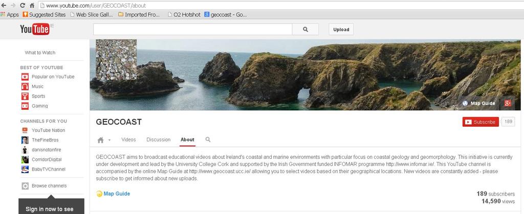
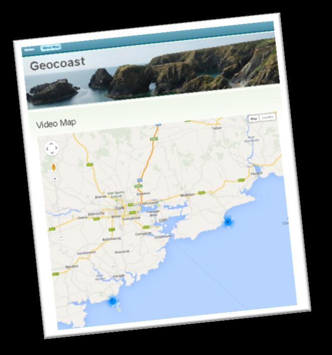
14 GEOCOAST

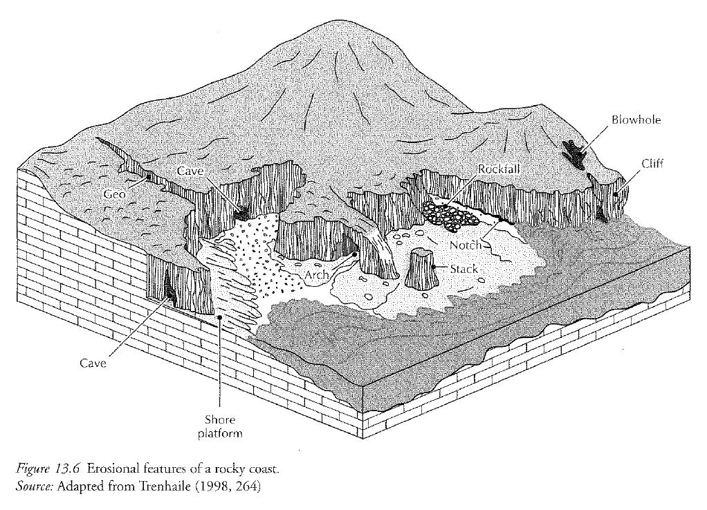
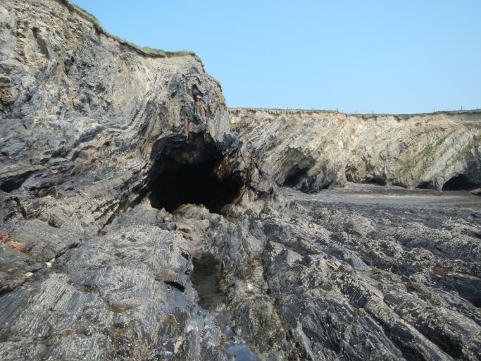
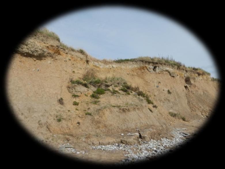
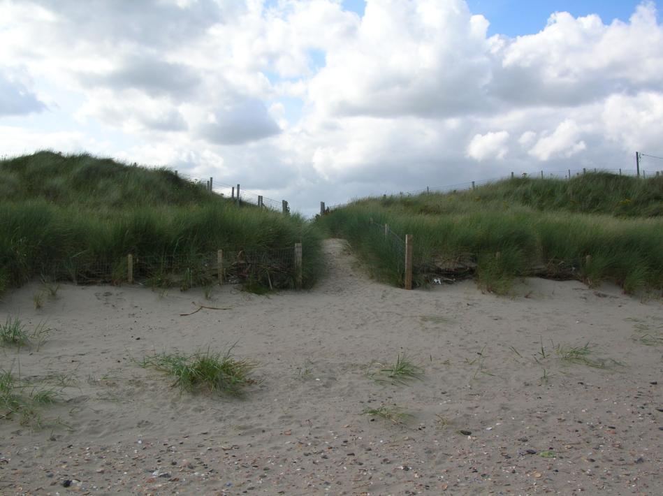
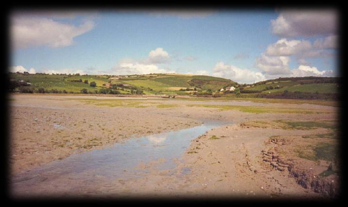
15 The aim of GEOCOAST: to raise peoples awareness, understanding and appreciation of Ireland s coastal and marine environments Target audience: general public + students of all levels.
16 The aim of GEOCOAST: contributes towards dissemination and outreach of scientific knowledge to the public through the use of modern day technology including online mapping and videos. Target audience: general public + students of all levels.


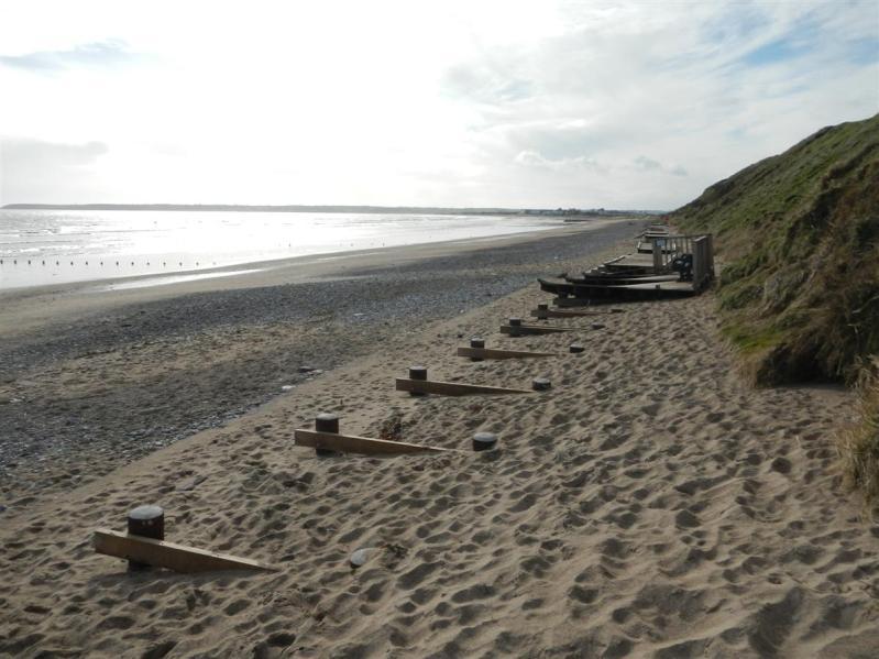
17 GEOCOAST is a tool for Engaging students in large classroom settings Virtual Fieldtrips

18 modern day technology including online mapping and videos
19

20 Mikhail Bulgakov: Manuscripts don't burn

21

22 GEOCOAST: Phase 2 Printed Book: Shorelines: The Coastal Atlas of Ireland
23 Shorelines: The Coastal Atlas of Ireland will contribute towards the dissemination and outreach of scientific knowledge about the coasts of Ireland and of the processes that are shaping them, to the broader public, government and decision makers. Shorelines: The Coastal Atlas of Ireland, a c.500 page, c.50-chapter publication, containing over 400 maps and illustrations, edited by UCC staff Val Cummins, Robert Devoy and Maxim Kozachenko (order TBC) involving the work of over 20 authors, will be published in October 2016.

24 GEOLOGY important control over Geomorphology / Landscape
25 Erosional

26 Depositional
27
28 Although, there are existing guides about Ireland s coastal geology, physical geography and landscapes, these are fragmented and mostly of a local nature. Shorelines: The Coastal Atlas of Ireland will aim to fill this gap by looking at the shaping of the coastline of Ireland as a whole, from both the physical and human environmental perspectives.
29 Target Audience for the Atlas: The General Public; Coastal professionals (e.g., Government policy/decision makers, planners, coastal managers at national and local government levels); School Teachers / University Lecturers; School and University Students.

30 Shorelines: The Coastal Atlas of Ireland This Atlas may help act as a guide for Ireland s national and local governments when making decisions about any future potential developments in the coastal zone.
31
32
33 Shorelines: The Coastal Atlas of Ireland. Linked Products: In relation to developing other electronic and visual presentations of the Atlas, then the work of the GEOCOAST project will be used. Short, additional documentary videos about coastal environments (both physical & human elements) will be developed, based upon expansion of the existing GEOCOAST YouTube Channel and the accompanying online Map Guide at This video material, covering Ireland s coastal zones, will be linked to thematic/ chapter elements in the hardcopy version of the Atlas.
34 GEOCOAST

35 This Facebook page has been created to promote the atlas and to keep you informed on our progress. If you have any questions or suggestions please feel free to get in touch.
Applying GIS to Coastal Management in Cork Harbour: the Corepoint experience
 Applying GIS to Coastal Management in Cork Harbour: the Corepoint experience Kathrin Köpke University College Cork, Ireland Thematic Conference: THE WATERFRONT MANAGEMENT AND GI (IT), 14 th -18 th November
MODELS AND TOOLS FOR GOVERNANCE OF
 Working Papers Collection No. 1/2015 MODELS AND TOOLS FOR GOVERNANCE OF THE ADRIATIC AND IONIAN SEAS www.unimc.it/maremap NATIONAL POLITICS AND EU POLITICS: THE MARITIME SPATIAL PLANNING AND INTEGRATED
Joanne N. Halls, PhD Dept. of Geography & Geology David Kirk Information Technology Services
 Joanne N. Halls, PhD Dept. of Geography & Geology David Kirk Information Technology Services Geographic Information Systems manage and analyze data to solve spatial problems. Real World Abstraction Analysis
CK107 BA in Geographical and Archaeological Sciences
 CK107 BA in Geographical and Archaeological Sciences CK107 BA in Geographical and Archaeological Science Geography and Archaeology are closely related disciplines, concerned with concepts of time and space
IMA s ROLE IN COASTAL AND OCEAN GOVERNANCE IN TRINIDAD AND TOBAGO
 IMA s ROLE IN COASTAL AND OCEAN GOVERNANCE IN TRINIDAD AND TOBAGO Presented by Rahanna Juman, Deputy Director (Ag.) About the Institute of Marine Affairs Institute of Marine Affairs (IMA) was established,
Introducing the. a partnership of
 Introducing the a partnership of Background Need for online atlas identified by managers and researchers to make coastal data available Shoreline data Ocean and coastal resources Sea-level rise potential
The National Spatial Strategy
 Purpose of this Consultation Paper This paper seeks the views of a wide range of bodies, interests and members of the public on the issues which the National Spatial Strategy should address. These views
The Socio Economic Development of the Marine Sector in the Atlantic Area. Stephen Hynes
 The Socio Economic Development of the Marine Sector in the Atlantic Area Stephen Hynes Overview SEMRU and its role in Marine Socioeconomic analysis Defining Ocean and Coastal Economies in the Atlantic
OUR COASTAL FUTURES. A Strategy for the Sustainable Development of the World s Coasts.
 OUR COASTAL FUTURES A Strategy for the Sustainable Development of the World s Coasts www.futureearthcoasts.org Iqaluit, Nunavut, Canada. Photo by Don Forbes Coastal zones are the frontline in our global
SPINCAM Kathy Belpaeme, province West-Flanders. Ostend, 16 februari 2016
 SPINCAM Kathy Belpaeme, province West-Flanders Ostend, 16 februari 2016 The Belgian coast in a glace www.kustatlas.be The atlas in 2004 The website in 2005: The same look and feel Available in 4 languages
Network of European Regions Using Space Technologies
 NEREUS Network of European Regions Using Space Technologies Core mission NEREUS WHAT IS SPACE ABOUT??? Spreading use of space technologies at regional level Stimulating the development of space applications
Marine Geomorphology as a Determinant for Essential Life Habitat III
 Marine Geomorphology as a Determinant for Essential Life Habitat III marinecoastalgis.net/aag08 10:10 Dawn Wright, Oregon 10:30 Will McClintock, California 10:50 Daniel Sampson, Massachusetts 11:10 Gary
RSC Analytical Division Strategy
 RSC Analytical Division Strategy 2013-2017 The Analytical Division aims to promote and support analytical chemistry at all levels from public outreach and school education to the most innovative and cutting
Green Chemistry Education
 Green Chemistry Education Poster presented at the IUPAC Congress/General Assembly July 2001 GREEN CHEMISTRY IN THE SCIENTIFIC CONTEXT The science of chemistry is central to addressing the problems facing
This course is held at Nova University of Lisbon for 2nd and 3rd degrees (Master and Ph.D.). It has has 64 hours in class; as each class has duration
. It has has 64 hours in class; as each class has duration") COURSE: EU Maritime Economy and Blue Growth Lecturer: Prof. Regina Salvador (Chair Holder) This course is held at Nova University of Lisbon for 2nd and 3rd degrees (Master and Ph.D.). It has has 64 hours
COURSE: EU Maritime Economy and Blue Growth Lecturer: Prof. Regina Salvador (Chair Holder) This course is held at Nova University of Lisbon for 2nd and 3rd degrees (Master and Ph.D.). It has has 64 hours
The ESPON Programme. Goals Main Results Future
 The ESPON Programme Goals Main Results Future Structure 1. Goals Objectives and expectations Participation, organisation and networking Themes addressed in the applied research undertaken in ESPON projects
Department Of Geography. MSc Applied GIS.
 Department Of Geography. MSc Applied GIS. This is a really exciting time to be in GIS, with new tools and new software allowing the application of GIS techniques to an ever-increasing range of fields.
Declaration Population and culture
 Declaration Population and culture The ministers of the parties to the Alpine Convention regard the socio-economic and socio-cultural aspects mentioned in Article 2, Paragraph 2, Item a., as being central
Aquaculture Spatial Planning: The case of Greece
 Aquaculture Spatial Planning: The case of Greece Nikos Anagnopoulos Panhellenic Association for Small-Medium sized Aquaculture Enterprises Panhellenic Association for Small-Medium sized Aquaculture Enterprises
Mediterranean Sea and Territorial Development, Opportunities and Risks
 EESC Hearing Towards an EU Macro-Regional Strategy for the Mediterranean Mediterranean Sea and Territorial Development, Opportunities and Risks Michaela Gensheimer Structure of Intervention Part I: What
Book Review: A Social Atlas of Europe
 Book Review: A Social Atlas of Europe Ferreira, J Author post-print (accepted) deposited by Coventry University s Repository Original citation & hyperlink: Ferreira, J 2015, 'Book Review: A Social Atlas
Of topic specific knowledge and understanding To encourage progressive development in 'thinking geographically'
 [August 2012] Content exemplars 1. Broad description of the content: Single paragraph, written with technical precision Content rigour (avoiding generic statements) Identifying the core of essential knowledge
MARINE STUDIES (MARINE SPATIAL PLANNING & MANAGEMENT) MASTER S DEGREE
 MASTER S DEGREE") MARINE STUDIES (MARINE SPATIAL PLANNING & MANAGEMENT) MASTER S DEGREE Influence, lead and provide decision making support for the management and planning of coastal and marine spaces. PROGRAM DESCRIPTION
MARINE STUDIES (MARINE SPATIAL PLANNING & MANAGEMENT) MASTER S DEGREE Influence, lead and provide decision making support for the management and planning of coastal and marine spaces. PROGRAM DESCRIPTION
Advancing Geoscientific Capability. Geological Survey of Finland
 Advancing Geoscientific Capability Geological Survey of Finland GTK in brief The Geological Survey of Finland (GTK) is one of the largest European centres of excellence in assessment, research and the
Aboriginal communities strengthen governance with location-based tools in the 21st century
 Aboriginal communities strengthen governance with location-based tools in the 21st century Today, Aboriginal communities are taking advantage of the geomatics technologies that underpin popular online
What s the problem? A Modern Odyssey in Search of Relevance. The search for relevance. Some current drivers for new services. Some Major Applications
 A Modern Odyssey in Search of Relevance FIG Working Week, Athens, 24 May 2004 Paul Kelly ANZLIC Executive Director The search for relevance 1. New expectations for spatial services 2. Are we ready to meet
The UK s Evolving Physical Landscape 3 days
 GCSE Geography Edexcel B The UK s Evolving Physical Landscape 3 days In-depth coverage of the physical fieldwork task required for Topic 6: Geographical Investigations, enabling students to get the grades
Marine/Maritime Spatial Planning Andrej Abramić
 Marine/Maritime Spatial Planning Andrej Abramić EcoAqua SUMMER SCHOOL: Ecosystem approach to aquaculture 26-29th of October 2015 Research and Technology to enhance excellence in Aquaculture development
Regional stakeholders strategy of Donegal County Council
 Regional stakeholders strategy of Donegal County Council Table of contents The template comprised five steps in the creation of this communication strategy: 1 Starting point. Communication objectives...
Coastal Systems and Landscapes 3 days
 AS Level Geography WJEC Coastal Systems and Landscapes 3 days This course is for Welsh schools. This in-depth course prepares students for the physical fieldwork focusing on the Coastal option, for Section
Marine Spatial Planning as an important tool for implementing the MSFD
 Marine Spatial Planning as an important tool for implementing the MSFD Risto Kalliola Tallinn, Nov. 16 th 2012 DEPARTMENT OF GEOGRAPHY AND GEOLOGY University of Turku, Finland Ten principles to provide
The Changing Physical Landscapes of the UK 3 days
 GCSE Geography Edexcel A The Changing Physical Landscapes of the UK 3 days In-depth coverage of fieldwork within a physical environment, required for Topic 7: Geographical Investigations - Fieldwork, enabling
INTERNATIONAL CULTURAL TOURISM CHARTER Managing Tourism at Places of Heritage Significance (1999)
") INTERNATIONAL CULTURAL TOURISM CHARTER Managing Tourism at Places of Heritage Significance (1999) Adopted by ICOMOS at the 12th General Assembly in Mexico, October 1999. INTRODUCTION The Charter Ethos
INTERNATIONAL CULTURAL TOURISM CHARTER Managing Tourism at Places of Heritage Significance (1999) Adopted by ICOMOS at the 12th General Assembly in Mexico, October 1999. INTRODUCTION The Charter Ethos
Key Indicators for Territorial Cohesion & Spatial Planning Stakeholder Workshop - Project Update. 13 th December 2012 San Sebastián, Basque Country
 Key Indicators for Territorial Cohesion & Spatial Planning Stakeholder Workshop - Project Update 13 th December 2012 San Sebastián, Basque Country Key Aims Explore the use of territorial data in developing
Al Ain Cultural Heritage Management Strategy 1/102
 AL AIN CULTURAL HERITAGE MANAGEMENT STRATEGY EXECUTIVE SUMMARY The cultural heritage of Al Ain is rich and varied; it consists of tangible and intangible resources and incorporates archaeological sites,
Report. Workshop 5: How can atlases help to organise and promote the seas?
 Workshop 5: How can atlases help to organise and promote the seas? Report 1. Three key messages included on the reporting slide for the last plenary session Atlases help people to visualise intuitively
Coastal Systems and Landscapes 3 days
 AS Level Geography Eduqas Coastal Systems and Landscapes 3 days Deliver two days of fieldwork within an inspiring physical environment. Prepare AS level students for Paper 1 Section B: Fieldwork Investigation
Subject Area: Geography
 Long Term Planning Overview Key Stage 3 Subject Area: Geography Academic : 08-9 7 Assessment Your Island Home the physical and human geography of the UK and will investigate weather patterns, population
38th UNWTO Affiliate Members Plenary Session Yerevan, Armenia, 4 October 2016
 38th UNWTO Affiliate Members Plenary Session Yerevan, Armenia, 4 October 2016 17:00-19:00 Open Debate 5: City Tourism Introduced and Moderated by Dr. Donald Hawkins George Washington University World urban
Geography Policy 2014
 Geography Policy 2014 DEFINITION Geography education should inspire in pupils a curiosity and fascination about the world and its people that will remain with them for the rest of their lives. Teaching
Jordan's Strategic Research Agenda in cultural heritage
 Jordan's Strategic Research Agenda in cultural heritage Analysis of main results Alessandra Gandini Amman, Jordan 3 rd November 2013 Main objectives The work performed had the main objective of giving
This table connects the content provided by Education Perfect to the NSW Syllabus.
 Education Perfect Geography provides teachers with a wide range of quality, engaging and innovative content to drive positive student learning outcomes. Designed by teachers and written by our in-house
The European territory: Strategic developmentd
 The European territory: Strategic developmentd Peter Mehlbye Workshop Strategic Development Catalonia 11 June 2002 THE LECTURE Structure I. Territorial trends II. Strategy for European spatial development
Coastal Guide ICZM Information System
 Coastal Guide ICZM Information System 1. Key data Project title: Implementing alternative strategies in Irish beach and dune management: involvement in sustainable coastal development Country: Ireland
EUSAIR on sea topics from Slovenian perspective
 MINISTRY OF FOREIGN AFFAIRS REPUBLIC OF SLOVENIA EUSAIR on sea topics from Slovenian perspective Mag. Andreja Jerina National Coordinator 4 EU MRS: 270 millions of population 19 MS 12 non MS Sea basin
Introduction to IMP: need and added value
 Introduction to IMP: need and added value Christophe Le Visage Consultant Stratégies Mer et Littoral 1 Summary IMP : Why? The case for integration 1 What is IMP? 2 Content, process IMP: Added Value 3 2
Mapping Maine s Working Waterfront: for Our Heritage and Economy
 Mapping Maine s Working Waterfront: for Our Heritage and Economy Abstract Mapping Maine s Working Waterfronts is a collaborative project led by the Island Institute that inventories the state s current
1. Pass GE1101E Geographical Journeys: Exploring World Environments. This will be counted towards the Faculty Core or UE requirements.
 H Geography At the Department of Geography, students are encouraged to develop a deeper and more critical understanding of both physical and human environments. Students will acquire knowledge, skills
European Migration to Tilting, Newfoundland
 European Migration to Tilting, Newfoundland Lesson Overview In this lesson, students will learn about historical connections between Tilting, Newfoundland and Labrador, and Ireland. Using the Canadian
National Perspectives - Portugal. Margarida Almodovar
 National Perspectives - Portugal Margarida Almodovar margarida.almodovar@mam.gov.pt from base line to the external limit of the continental shelf behind 200 miles and according to UNCLOS definitions Economic
ST AMBROSE CATHOLIC PRIMARY SCHOOL Geography Policy
 ST AMBROSE CATHOLIC PRIMARY SCHOOL Geography Policy 2017-2018 Our school policy is developed in accordance with the National Curriculum for Geography and Foundation Stage Curriculum for Understanding of
NOAA s OCM: Services, tools and collaboration opportunities & Puerto Rico s NE Marine Corridor as a case study
 NOAA s OCM: Services, tools and collaboration opportunities & Puerto Rico s NE Marine Corridor as a case study Dr. Antares Ramos Álvarez NOAA s Office of Coastal Management September 15 th, 2016 Conservation
An Environmental Profile of the Island of Jost Van Dyke, British Virgin Islands
 An Environmental Profile of the Island of Jost Van Dyke, British Virgin Islands Executive Summary including Little Jost Van Dyke, Sandy Cay, Green Cay and Sandy Spit This publication was made possible
MR. George ALEXAKIS, parallel session 3. "Mediterranean Sea Region. laying the conditions. for sustainable growth and jobs"
 parallel session 3 "Mediterranean Sea Region laying the conditions for sustainable growth and jobs" MR. George ALEXAKIS, elected Regional Councillor of Crete, Greece and representative of Crete in CRPM.
Seabed knowledge In support of UN SDGs
 Seabed knowledge In support of UN SDGs Evert Flier Fiskerifaglig forum 2. november 2017 Hydrography & small scale fishing Hydrography in Transition Serving the Maritime Community Hydrography in Transition
Arctic ecosystem services: TEEB Arctic Scoping study. Alexander Shestakov WWF Global Arctic Programme 3 December Arctic Biodiversity Congress
 Arctic ecosystem services: TEEB Arctic Scoping study Alexander Shestakov WWF Global Arctic Programme 3 December 20143 Arctic Biodiversity Congress Content 1. Project design 2. Approach 3. Challenges and
Marine Spatial Planning: A Tool for Implementing Ecosystem-Based Management
 Marine Spatial Planning: A Tool for Implementing Ecosystem-Based Management Steven Murawski, Ph.D., Ecosystem Goal Team Lead National Oceanic and Atmospheric Administration NOAA November 16, 2009 1 To
Outline National legislative & policy context Regional history with ESSIM ESSIM Evaluation Phase Government Integration via RCCOM Regional ICOM Framew
 What MSP Implementation could change in the Maritimes Region Tim Hall, Regional Manager Oceans and Coastal Management Division Ecosystem Management Branch Fisheries and Oceans Canada Maritimes Region BIO
CLLD Cooperation OFFER
 Title of the proposed project (English) CLLD Cooperation OFFER PARKS PROTECTION III - Management, Protection and Economic Development in Protected Areas Type of project (select as many as you want) Cooperation
MESM Track. Environmental Policy and Management
 MESM Track Environmental Policy and Management Overview This interdisciplinary track prepares students for positions requiring an ability to integrate natural science into policy development and implementation
CONFERENCE STATEMENT
 CONFERENCE STATEMENT We, the elected representatives from Canada, Denmark/Greenland, Finland, Iceland, Norway, Russia, Sweden and the United States of America; In collaboration with the indigenous peoples
Tourism. April State Planning Policy state interest guideline. Department of Infrastructure, Local Government and Planning
 Department of Infrastructure, Local Government and Planning State Planning Policy state interest guideline Tourism April 2016 Great state. Great opportunity. Preface Using this state interest guideline
EA SEA-WAY Project. 7 th Coordination Meeting. WP5 Development of sustainable passenger transport models for the Adriatic basin and capacity building
 EA SEA-WAY Project 7 th Coordination Meeting WP5 Development of sustainable passenger transport models for the Adriatic basin and capacity building 3 rd Cross Border Board Ravenna, January 26, 2016 The
PLANNING (PLAN) Planning (PLAN) 1
 Planning (PLAN) 1") Planning (PLAN) 1 PLANNING (PLAN) PLAN 500. Economics for Public Affairs Description: An introduction to basic economic concepts and their application to public affairs and urban planning. Note: Cross-listed
Planning (PLAN) 1 PLANNING (PLAN) PLAN 500. Economics for Public Affairs Description: An introduction to basic economic concepts and their application to public affairs and urban planning. Note: Cross-listed
Geography Undergraduate
 Geography Undergraduate Bristol pushes its students to try and help them reach their full potential. This means you re made to analyse, to challenge your preconceived ideas and to push yourself intellectually
Blue Growth: The Adriatic and Ionian Region
 Blue Growth: The Adriatic and Ionian Region Maritime Clusters: types of support and areas for cooperation AQUAE VENICE 2015 EXPO Matteo Bocci, Ecorys Venice, 28 th September 2015 Structure of this intervention
Curriculum rationale September 2018 Faculty: Geography Lead: C Tarpey
 Tarpey What is your curriculum statement for each key stage? KS3- Students will study a range of Human and Physical themes throughout Year 7 whilst developing a range of key geographical skills. All students
European Maritime Day conference 21 May Hon Karmenu Vella, Minister for Tourism welcome speech
 European Maritime Day conference 21 May 2013 Hon Karmenu Vella, Minister for Tourism welcome speech Commissioner Damanaki, Ministers, Distinguished speakers, Ladies and Gentlemen On behalf of Malta, I
Implementing the Sustainable Development Goals: The Role of Geospatial Technology and Innovation
 Fifth High Level Forum on UN Global Geospatial Information Management Implementing the Sustainable Development Goals: The Role of Geospatial Technology and Innovation 28-30 November 2017 Sheraton Maria
Country Fiche Lithuania
 Country Fiche Lithuania Updated June 2018 1. General information The Lithuanian maritime space is delimited by the Decree of the Government of the Republic of Lithuania of 6 December, 2004, No. 1597 and
AP Human Geography Syllabus
 AP Human Geography Syllabus Textbook The Cultural Landscape: An Introduction to Human Geography. Rubenstein, James M. 10 th Edition. Upper Saddle River, N.J.: Prentice Hall 2010 Course Objectives This
Dr. Biliana Cicin-Sain President, Global Ocean Forum 1
 Towards a Sustainable Development Goal on Oceans and Seas: Healthy, Productive and Resilient Oceans and Seas- Prosperous and Resilient Peoples and Communities Dr. Biliana Cicin-Sain President, Global Ocean
Central Baltic Programme
 Central Baltic Programme 2014-2020 About the Central Baltic Programme 2014-2020 Builds on the Central Baltic INTERREG IV A Programme 2007-2013 Cross-border cooperation projects in the central Baltic Sea
AlpFoodway a cross-disciplinary, transnational and participative approach to Alpine food cultural heritage
 AlpFoodway a cross-disciplinary, transnational and participative approach to Alpine food cultural heritage Cassiano Luminati Polo Poschiavo cassiano.luminati@polo-poschiavo.ch #AlpFoodway www.alpfoodway.eu
Coastal Mapping Follow on? Bruno Frachon Corine Lochet Gaël Morvan
 Coastal Mapping Follow on? Bruno Frachon Corine Lochet Gaël Morvan Shared objectives; IHO DG MARE CPMR Development of a Joint European Coastal Mapping Programme (JECMaP) within the IHO EU network with
Collaborative Systems for the Creation of Marine Services
 Collaborative Systems for the Creation of Marine Services INSPIRE 2016 Nuno Almeida Nuno Catarino Barcelona, 28 th September 2016 Elecnor Deimos is a trademark which encompasses Elecnor Group companies
Maanmittauspäivät 2018 Helsinki Maanmittauspäivät 2018 The Danish initiatives regarding open and free basic data including effect studies
 Maanmittauspäivät 2018 The Danish initiatives regarding open and free basic data including effect studies 22.03.2018 Agenda 1. Intro overall frame / selfie 2. Data Infrastructure 3. The Danish Digital
Information Needs & Information Seeking in Internet Era: A Case Study of Geographers in Maharashtra
 International Journal of Research in Library Science ISSN: 2455-104X Indexed in: IIJIF, ijindex, SJIF,ISI Volume 2,Issue 1 (January-June) 2016,99-108 Received: 7 May 2016 ; Accepted: 12 May 2016 ; Published:
Newslette. INFOMAR ANNUAL SEMINAR 2014 Save the Date - 22nd and 23rd October
 Newslette INFOMAR ANNUAL SEMINAR 2014 Save the Date - 22nd and 23rd October The Geological Survey of Ireland and the Marine Institute are delighted to announce the 2014 Annual INFOMAR Seminar. The two
13 th EUMETSAT User Forum in Africa
 13 th EUMETSAT User Forum in Africa GMES & Africa implementation in Western Africa Dogbeda M.Y. Azumah Regional Marine Centre University of Ghana Pictures zone UG GMES Presentation Layout UG G Project
Marine Spatial Planning in Hellas; Recent Facts and Perspectives
 XXV FIG CONGRESS Engaging the Challenges, Enhancing the Relevance Kuala Lumpur, Malaysia 16 21 June 2014 Marine Spatial Planning in Hellas; Recent Facts and Perspectives Mrs. Chaiditsa BOLANOU Surveying
ASEV - Partner presentation
 ASEV - Partner presentation Lorenzo Sabatini Head of RTD project area l.sabatini@asev.it 20th-21st February, 2017 Kickoff meeting - Porto About ASEV ASEV - Agenzia per lo Sviluppo Empolese Valdelsa Spa
Strategic Plan for the Geospatial Teaching, Research, and Outreach in CNR. The CNR Geospatial Steering Committee, March 31, 2008
 Strategic Plan for the Geospatial Teaching, Research, and Outreach in CNR The CNR Geospatial Steering Committee, March 31, 2008 Current Mission for the Geospatial Learning Center Established in 1995, the
Sample assessment task. Task details. Content description. Year level 7
 Sample assessment task Year level 7 Learning area Subject Title of task Task details Description of task Type of assessment Purpose of assessment Assessment strategy Evidence to be collected Suggested
Heritage and Cultural Tourism Management
 Unit 34: Heritage and Cultural Tourism Management Unit code: L/601/1757 QCF level: 4 Credit value: 15 Aim The aim of this unit is to enable learners to gain understanding of the heritage and cultural,
Programme Specification (Undergraduate) Chemistry
 Chemistry") Programme Specification (Undergraduate) BSc Chemistry This document provides a definitive record of the main features of the programme and the learning outcomes that a typical student may reasonably be
Programme Specification (Undergraduate) BSc Chemistry This document provides a definitive record of the main features of the programme and the learning outcomes that a typical student may reasonably be
Humanities. Description. - Civics - Economics - Geography - History. There are four areas of learning covered within the Year 9 Humanities subject:
 Humanities There are four areas of learning covered within the Year Humanities subject: - Civics - Economics - Geography - History Details of each of these areas is below. Civics The Year Civics curriculum
Public Participatory GIS (ppgis), training & webgis in Mare Nostrum. Anna Spiteri, IRMCo Haifa, Israel, 5th March 2013
, training & webgis in Mare Nostrum. Anna Spiteri, IRMCo Haifa, Israel, 5th March 2013") Public Participatory GIS (ppgis), training & webgis in Mare Nostrum Anna Spiteri, IRMCo Haifa, Israel, 5th March 2013 What is ppgis? Why do we need it? Who participates? Where do we do it? When do we do
Public Participatory GIS (ppgis), training & webgis in Mare Nostrum Anna Spiteri, IRMCo Haifa, Israel, 5th March 2013 What is ppgis? Why do we need it? Who participates? Where do we do it? When do we do
TOWARDS CLIMATE-RESILIENT COASTAL MANAGEMENT: OPPORTUNITIES FOR IMPROVED ICZM IN BELIZE
 TOWARDS CLIMATE-RESILIENT COASTAL MANAGEMENT: OPPORTUNITIES FOR IMPROVED ICZM IN BELIZE CHANTALLE SAMUELS Coastal Zone Management Authority and Institute The Caribbean Community Climate Change Centre VULNERABILITY
THE SEVILLE STRATEGY ON BIOSPHERE RESERVES
 THE SEVILLE STRATEGY ON BIOSPHERE RESERVES 1 VISION FOR BIOSPHERE RESERVES IN THE 21 ST CENTURY The international Seville Conference on Biosphere Reserves, organised by UNESCO, adopted a two-pronged approach,
ACKNOWLEDGEMENTS. Contributions from: Prof. Larry Hildebrand. Dr. David Obura CORDIO - Kenya
 ACKNOWLEDGEMENTS Contributions from: Prof. Larry Hildebrand World Maritime University, Malmo, Sweden Dr. David Obura CORDIO - Kenya Ms. Sibongile Manzana-Saruchera GIZ MARISMA Project, Benguela Current
Harmonising Marine Data Exchange in Ireland
 Harmonising Marine Data Exchange in Ireland Elizabeth O Dea, Edward Dwyer, Valerie Cummins, Declan Dunne Coastal & Marine Resources Centre, University College Cork, Naval Base, Haulbowline, Cobh, County
INFORMATION RESOURCES FOR MARINE AND AQUATIC SCIENCES RESEARCH IN TRINIDAD AND TOBAGO
 INFORMATION RESOURCES FOR MARINE AND AQUATIC SCIENCES RESEARCH IN TRINIDAD AND TOBAGO Introduction Sharida Hosein The University of the West Indies Campus Libraries St Augustine, Trinidad and Tobago. West
JOB DESCRIPTION. Research Associate - Urban Economy and Employment
 JOB DESCRIPTION Research Associate - Urban Economy and Employment 2 Research Associate Urban Economy and Employment About Us The Indian Institute for Human Settlements (IIHS) is a national education institution
GEOGRAPHY POLICY STATEMENT. The study of geography helps our pupils to make sense of the world around them.
 GEOGRAPHY POLICY STATEMENT We believe that the study of geography is concerned with people, place, space and the environment and explores the relationships between the earth and its peoples. The study
GIS Visualization: A Library s Pursuit Towards Creative and Innovative Research
 GIS Visualization: A Library s Pursuit Towards Creative and Innovative Research Justin B. Sorensen J. Willard Marriott Library University of Utah justin.sorensen@utah.edu Abstract As emerging technologies
SUBJECT : Geography Topics: Learning Outcomes:
 SUBJECT : Geography 2016-17 Yr7 What is geography and Britain? Students are introduced to the topic of geography and why it is so important to our everyday lives. Within the subject students explore the
Economic and Social Council
 United Nations Economic and Social Council Distr.: General 18 July 2016 Original: English Committee of Experts on Global Geospatial Information Management Sixth session New York, 3-5 August 2016 Item 2
EDUCATION PROGRAMS GUIDE
 EDUCATION PROGRAMS GUIDE Inner Space Center University of Rhode Island Graduate School of Oceanography innerspacecenter.org ABOUT THE ISC The Inner Space Center (ISC) is an international leader in ocean