This is why Esri is in business and how we look for great talent (data science or otherwise) accordingly. Esri focuses on mapping and data for
|
|
|
- Lynette Robyn Farmer
- 6 years ago
- Views:
Transcription
1 1

2 This is why Esri is in business and how we look for great talent (data science or otherwise) accordingly. Esri focuses on mapping and data for conservation, disaster aid and relief, climate change mitigation and adaptation, geodesigning land and ocean space use to more closely follow natural systems, protecting freshwater resources, in short, using maps and geographic analysis to make the world a better place. 2
 or what is still considered to be non-traditional (right) where data science is concerned.")
3 We tend to look for people with geography expertise and so are following data science trends within that discipline. We know that data professionals may be trained in at least one of two ways TRADITIONALLY (left) or what is still considered to be non-traditional (right) where data science is concerned. We at Esri realize that many students are still being trained under the T model, but are actually looking for Pi folks or Venn folks. Universities sticking to T may want to consider revamping curricula to be Pi or Venn. 3
 Annual Meeting (the")
4 Some issues being discussed at universities across the US that we know of. This comes from a data science panel session at the 2016 American Association of Geographers (AAG) Annual Meeting (the largest meeting of geographers in the world) 4

5 A very encouraging INDUSTRY trend is that GIS is becoming more and more OPEN, and we need the perspectives and expertise of data scientists. The main message of this slide is that GIS is becoming more integrated into open science. Some are still of a mind that GIS exists only to serve business communities such as insurance, retail, manufacturing, real estate, utilities, telecomm, banking, public works, etc. But Esri s goal (and we hope other geospatial companies agree) is to contribute to the 6 spokes coming out of the little cloud on the right of the slide, which are 6 principles of open science as expressed at RDA Plenary 7. This where GIS companies such as Esri will provide or enable open web services of GIS functions as well as open data. This is decidedly for serving the science that is going on in the Academia/ Government/Industry/Non-Profit sectors. So this is a new trend that is overtaking the closed, proprietary approach of the past with geospatial companies. Being open means that you have to be able to look under the hood and customize/fix/extend accordingly, which is part of data science in my view. Hence the slide is titled, Building GIS as Part of 'Open Science' [means] Providing a Platform for Open and Intelligent' Access [and this] Will Require Data Scientists" Twitter reference: 5
, all careening toward interoperability.")
6 This slide basically extends the idea of open to show how the geospatial industry is adopting open standards and open software, while focusing also on industry formats and integration of industry products (e.g., Esri, Microsoft, AutoCAD, Amazon Web Services, SAP HANA, IBM, Adobe often provide integration or crosswalks among their products), all careening toward interoperability. There may be detractors in the audience, but my point is that at least on the industry side there are those who are sincerely and actively trying to do this. And data scientists are at the core of it. 6

7 One of Esri s first ads with the words data science in the job title, so that we can readily attract top talent. At Esri we are seeing more and better applicants because of the term data science in our ads, which is recognizable and understood. And as Peter Fox may attest due to his curriculum at RPI, students have been duly prepared by their coursework and/or degrees specifically IN data science and are looking for data science jobs. I can speak only for Esri, but I believe that Microsoft is getting similar success by advertising explicitly for data scientists which Kristen Tolle may have spoken to. 7

8 This is where the prior job ad and all others come from 8
, reinventing themselves, and thus participating in our network.")
9 We also have a new Young Professionals Network (YPN). Note the faces. Not all young professionals need be young in age. We have a lot of mature people seeking new careers in GIS (including those with a data science emphasis), reinventing themselves, and thus participating in our network. YPN has both in-person and online/virtual components, including meet-ups at conferences that focus on the 5 white boxes. I would encourage those interested to check out the URL on the slide for more info or to join. 9

10 Esri provides resources not just for new professionals that we want to hire, but for those already in the profession seeking professional development, including those within our own company. For example, note this new MOOC on Skills for the Digital Earth which has quite a data science bent to it. 10

11 Please let people know that I am eager to answer questions should they want to contact me later. Thanks much! 11
geographic patterns and processes are captured and represented using computer technologies
 Proposed Certificate in Geographic Information Science Department of Geographical and Sustainability Sciences Submitted: November 9, 2016 Geographic information systems (GIS) capture the complex spatial
ENV208/ENV508 Applied GIS. Week 1: What is GIS?
 ENV208/ENV508 Applied GIS Week 1: What is GIS? 1 WHAT IS GIS? A GIS integrates hardware, software, and data for capturing, managing, analyzing, and displaying all forms of geographically referenced information.
June 19 Huntsville, Alabama 1
 June 19 Huntsville, Alabama 1 Real-Time Geospatial Data: The Fusion of PI and ArcGIS Enabling Smarter Facilities Management OSIsoft and Esri Mapping and Location Analytics Platform Supporting Your Use
SOUTH DAKOTA BOARD OF REGENTS. Academic and Student Affairs ******************************************************************************
 SOUTH DAKOTA BOARD OF REGENTS Academic and Student Affairs AGENDA ITEM: 7 C (4) DATE: June 28-30, 2016 ****************************************************************************** SUBJECT: New Minor:
METEOROLOGY What can I do with this major?
 METEOROLOGY What can I do with this major? WEATHER FORECASTING (non-media) Atmospheric pollution Aviation weather Marine weather Fire weather Surface transportation Agriculture Renewable energy Combat
CHARTING SPATIAL BUSINESS TRANSFORMATION
 CHARTING SPATIAL BUSINESS TRANSFORMATION An in-depth look at the business patterns of GIS and location intelligence adoption in the private sector EXECUTIVE SUMMARY The global use of geographic information
Joanne N. Halls, PhD Dept. of Geography & Geology David Kirk Information Technology Services
 Joanne N. Halls, PhD Dept. of Geography & Geology David Kirk Information Technology Services Geographic Information Systems manage and analyze data to solve spatial problems. Real World Abstraction Analysis
Geospatial Services in Special Libraries: A Needs Assessment Perspective
 Purdue University Purdue e-pubs Libraries Faculty and Staff Scholarship and Research Purdue Libraries 5-17-2013 Geospatial Services in Special Libraries: A Needs Assessment Perspective Ilana R. Barnes
Esri and GIS Education
 Esri and GIS Education Organizations Esri Users 1,200 National Government Agencies 11,500 States & Regional Agencies 30,800 Cities & Local Governments 32,000 Businesses 8,500 Utilities 12,600 NGOs 11,000
GIS Applications on Environmental Education in Taiwan
 GIS Applications on Environmental Education in Taiwan Track: Education Authors: Yu-Chen Lai, Mei-Ling Yeh, Tien-Yin Chou Abstract GIS is a perfect vehicle to deliver environmental knowledge and spatial
A Geographer s role in a Google Maps World. Jeremy Bartley ESRI
 A Geographer s role in a Google Maps World Jeremy Bartley ESRI 1 It is a good time to be a Geographer. 2 Microsoft, Google, Yahoo, and others are pushing geographic awareness to the general public Providing
1. Pass GE1101E Geographical Journeys: Exploring World Environments. This will be counted towards the Faculty Core or UE requirements.
 H Geography At the Department of Geography, students are encouraged to develop a deeper and more critical understanding of both physical and human environments. Students will acquire knowledge, skills
INTEGRATING GEOSPATIAL PERSPECTIVES IN THE ANTHROPOLOGY CURRICULUM AT THE UNIVERSITY OF NEW MEXICO (UNM)
") INTEGRATING GEOSPATIAL PERSPECTIVES IN THE ANTHROPOLOGY CURRICULUM AT THE UNIVERSITY OF NEW MEXICO (UNM) VERONICA ARIAS HEATHER RICHARDS JUDITH VAN DER ELST DEPARTMENT OF ANTHROPOLOGY MARCH 2005 INTEGRATING
INTEGRATING GEOSPATIAL PERSPECTIVES IN THE ANTHROPOLOGY CURRICULUM AT THE UNIVERSITY OF NEW MEXICO (UNM) VERONICA ARIAS HEATHER RICHARDS JUDITH VAN DER ELST DEPARTMENT OF ANTHROPOLOGY MARCH 2005 INTEGRATING
Putting the U.S. Geospatial Services Industry On the Map
 Putting the U.S. Geospatial Services Industry On the Map December 2012 Definition of geospatial services and the focus of this economic study Geospatial services Geospatial services industry Allow consumers,
Purpose Study conducted to determine the needs of the health care workforce related to GIS use, incorporation and training.
 GIS and Health Care: Educational Needs Assessment Cindy Gotz, MPH, CHES Janice Frates, Ph.D. Suzanne Wechsler, Ph.D. Departments of Health Care Administration & Geography California State University Long
Kenneth Melchert (Senior Statistician - Regional Liaison Officer)
") Sourcing Spatial Data from Local Government Getting the Data Right The Supplier s Perspective Presenter: Kenneth Melchert (Senior Statistician - Regional Liaison Officer) Information Products and Services
Sourcing Spatial Data from Local Government Getting the Data Right The Supplier s Perspective Presenter: Kenneth Melchert (Senior Statistician - Regional Liaison Officer) Information Products and Services
CALIFORNIA STATE POLYTECHNIC UNIVERSITY, POMONA ACADEMIC SENATE ACADEMIC PROGRAMS COMMITTEE REPORT TO THE ACADEMIC SENATE AP
 CALIFORNIA STATE POLYTECHNIC UNIVERSITY, POMONA ACADEMIC SENATE ACADEMIC PROGRAMS COMMITTEE REPORT TO THE ACADEMIC SENATE AP-009-167 BS IN GEOGRAPHY GEOSPATIAL ANALYSIS OPTION Academic Programs Committee
LEHMAN COLLEGE OF THE CITY UNIVERSITY OF NEW YORK. 1. Type of Change: Change in Degree Requirements
 Alpha Number: Hegis Code 1214 Program Code: 30600 1. Type of Change: Change in Degree Requirements 2. From: [The curriculum consists of 45 graduate credits and includes core courses, an area of specialization,
Ministry of ICT of I.R.IRAN
 The ECO 8/6 mill km 2 10 Slamic countries ~330 mill people Oil, Gas, Industries,Tourism 2 Issue transformation in last decade Problem solving needs more integrated approach More interaction &complexity
TRAITS to put you on the map
 TRAITS to put you on the map Know what s where See the big picture Connect the dots Get it right Use where to say WOW Look around Spread the word Make it yours Finding your way Location is associated with
Teaching GIS Technology at UW-Superior. Volume 9, Number 8: May 23, 2003
 Teaching GIS Technology at UW-Superior Volume 9, Number 8: May 23, 2003 William Bajjali University of Wisconsin, department of Biology and Earth Science, Superior, WI 54880 Abstract As educators, it is
GIS at UCAR. The evolution of NCAR s GIS Initiative. Olga Wilhelmi ESIG-NCAR Unidata Workshop 24 June, 2003
 GIS at UCAR The evolution of NCAR s GIS Initiative Olga Wilhelmi ESIG-NCAR Unidata Workshop 24 June, 2003 Why GIS? z z z z More questions about various climatological, meteorological, hydrological and
ArcGIS. for Server. Understanding our World
 ArcGIS for Server Understanding our World ArcGIS for Server Create, Distribute, and Manage GIS Services You can use ArcGIS for Server to create services from your mapping and geographic information system
Cooperation is the key, FIG can facilitate
 Cooperation is the key, FIG can facilitate Mikael Lilje Vice President 2017-2020 Head, Geodetic infrastructure, Swedish mapping, cadastral and land registration authority Presented at the GIS/RS Conference
GIS FOR PLANNING. Course Overview. Schedule. Instructor. Prerequisites. Urban Planning 792 Thursday s 5:30-8:10pm SARUP 158
 GIS FOR PLANNING Urban Planning 792 Thursday s 5:30-8:10pm SARUP 158 Schedule Class/Lab - SARUP 158 Thursdays 5:30pm - 8:10pm Office Hours - By Appointment Project Ideas - Week 4 Final - 5/10/2018 Instructor
Cutting Edge Engineering for Modern Geospatial Systems Rear Admiral Dr. S Kulshrestha, retd
 Cutting Edge Engineering for Modern Geospatial Systems Rear Admiral Dr. S Kulshrestha, retd 11 Jun 2015 GeoIntelligence Asia 2015 The technology would become so pervasive that it becomes a part of you
The B.S.G.E. program is accredited by the Engineering Accreditation Commission of ABET,
 Geomatics Engineering The program of study leading to the Bachelor of Science in Geomatics Engineering (B.S.G.E.) deals with designing solutions to measure, map, model, analyze and graphically display
Alluvium Consulting Australia Senior integrated water management specialist Position Description March 2018
 Alluvium Consulting Australia Senior integrated water management specialist Position Description March 2018 Overview of Alluvium We are an employee-owned consulting firm founded in 2006 to provide advice
Your web browser (Safari 7) is out of date. For more security, comfort and the best experience on this site: Update your browser Ignore
 is out of date. For more security, comfort and the best experience on this site: Update your browser Ignore") Your web browser (Safari 7) is out of date. For more security, comfort and the best experience on this site: Update your browser Ignore U NLO CKING THE EDUCATIO NAL PO TENTIAL O F CITIZEN SCIENCE Essays
Your web browser (Safari 7) is out of date. For more security, comfort and the best experience on this site: Update your browser Ignore U NLO CKING THE EDUCATIO NAL PO TENTIAL O F CITIZEN SCIENCE Essays
Department Of Geography. MSc Applied GIS.
 Department Of Geography. MSc Applied GIS. This is a really exciting time to be in GIS, with new tools and new software allowing the application of GIS techniques to an ever-increasing range of fields.
TANZANIA PETROLEUM DEVELOPMENT CORPORATION CAREER OPPORTUNITIES
 TANZANIA PETROLEUM DEVELOPMENT CORPORATION CAREER OPPORTUNITIES Tanzania Petroleum Development Corporation (TPDC) is a National oil company dealing with Oil and Gas exploration, development and production.
Developing a Tactical-Level Geospatial Course for Army Engineers
 Developing a Tactical-Level Geospatial Course for Army Engineers Jared L. Ware Geospatial Information Science Program Department of Geography and Environmental Engineering United States Military Academy
GIS and Community Health. GIS and Community Health. Institutional Context and Interests in GIS Development. GIS and Community Health
 GIS and Community Health GIS and Community Health Some critiques of GIS emphasize the potentially harmful social consequences of the diffusion of GIS technology, including reinforcing the power of state
GIS Certification: How will it be used to improve education?
 GIS Certification: How will it be used to improve education? Deidre Sullivan OSTO Workshop November 11, 2008 1 What is GIS? Geographic Information Systems It is a science, a tool, and a software It assists
STUDY GUIDE. Exploring Geography. Chapter 1, Section 1. Terms to Know DRAWING FROM EXPERIENCE ORGANIZING YOUR THOUGHTS
 For use with textbook pages 19 22. Exploring Geography Terms to Know location A specific place on the earth (page 20) absolute location The exact spot at which a place is found on the globe (page 20) hemisphere
Topic: Fundamentals of Topographic Map (Cartographic Technique) Honors
 Honors") SN Kansagra School Master lesson Plan : Geography Subject Teacher :- Sanjay Nath Topic: Fundamentals of Topographic Map (Cartographic Technique) Honors Materials (Teaching Aids): White board, Audio visual
SN Kansagra School Master lesson Plan : Geography Subject Teacher :- Sanjay Nath Topic: Fundamentals of Topographic Map (Cartographic Technique) Honors Materials (Teaching Aids): White board, Audio visual
THE NEW CHALLENGES FOR THE HIGHER EDUCATION OF GEODESY IN UACEG SOFIA
 THE NEW CHALLENGES FOR THE HIGHER EDUCATION OF GEODESY IN UACEG SOFIA Ivan Kunchev University of Architecture, Civil Engineering and Geodesy, 1 Hristo Smirnenski Blvd., Sofia 1046, Bulgaria Abstract Report
Careers in downstream satellite applications. Michael Lawrence Business Development Director. Deimos Space UK
 Careers in downstream satellite applications Michael Lawrence Business Development Director Deimos Space UK 1 Agenda 1. What is the downstream sector? 2. What kinds of jobs are available? 3. What do you
GIS Options RELU Upland Moorland Scoping Study Project CCG/SoG Working Paper, February 2005 Andy Turner
 GIS Options RELU Upland Moorland Scoping Study Project CCG/SoG Working Paper, February 2005 Andy Turner 1. Introduction This working paper outlines some Geographical Information System (GIS) options for
Headings: Content analysis Geographic information systems Job analysis Library schools/curriculum
 Pamela N. Schore. Geographic Information Systems (GIS) Competencies for Librarians. A Master s Paper for the M.S. in L.S degree. July, 2011. 23 pages. Advisor: Evelyn Daniel Geographic Information System
D O G W O O D P R O J E C T S
 M I N D F U L M A T T E R S D I G I T A L P U B L I S H E R & C O N S U L T A N T I N T R O D U C T I O N T O D O G W O O D P R O J E C T S F O U N D E R, J E F F P O S S I E L J E F F P O S S I E L, F
Incorporating ArcGIS Pro in your Curriculum
 AAG, Boston 2017 April 5, 2017 Incorporating ArcGIS Pro in your Curriculum Geri Miller Agenda Concerns Acknowledged Learning curve ArcGIS Pro does not have all the tools (perception) Licensing and offline
No. of Days. Building 3D cities Using Esri City Engine ,859. Creating & Analyzing Surfaces Using ArcGIS Spatial Analyst 1 7 3,139
 Q3 What s New? Creating and Editing Data with ArcGIS Pro Editing and Maintaining Parcels Using ArcGIS Spatial Analysis Using ArcGIS Pro User Workflows for ArcGIS Online Organizations Q3-2018 ArcGIS Desktop
Towards a better adoption of ISO/TC 211 standards: Courses on international standards in geomatics
 Towards a better adoption of ISO/TC 211 standards: Courses on international standards in geomatics Dr. Thierry Badard Centre for Research in Geomatics (CRG) University Laval, Québec, Canada Thierry.Badard@scg.ulaval.ca
Chemical Safety as a Core ACS Value: Report on the 2018 Safety Summit
 Chemical Safety as a Core ACS Value: Report on the 2018 Safety Summit Introduction In December 2016, the ACS Board of Directors adopted safety as one of the Society s core values, thus affirming that the
Map your way to deeper insights
 Map your way to deeper insights Target, forecast and plan by geographic region Highlights Apply your data to pre-installed map templates and customize to meet your needs. Select from included map files
XXIII CONGRESS OF ISPRS RESOLUTIONS
 XXIII CONGRESS OF ISPRS RESOLUTIONS General Resolutions Resolution 0: Thanks to the Czech Society commends: To congratulate The Czech Society, its president and the Congress Director Lena Halounová, the
Oakland County Parks and Recreation GIS Implementation Plan
 Oakland County Parks and Recreation GIS Implementation Plan TABLE OF CONTENTS 1.0 Introduction... 3 1.1 What is GIS? 1.2 Purpose 1.3 Background 2.0 Software... 4 2.1 ArcGIS Desktop 2.2 ArcGIS Explorer
RSC Analytical Division Strategy
 RSC Analytical Division Strategy 2013-2017 The Analytical Division aims to promote and support analytical chemistry at all levels from public outreach and school education to the most innovative and cutting
HOW TO IMPROVE LINKS BETWEEN SCHOOL GEOGRAPHY DEPARTMENTS AND LOCAL UNIVERSITY GEOGRAPHY and EDUCATION DEPARTMENTS
 CGEOG (TEACHER) ONLINE CPD MODULE HOW TO IMPROVE LINKS BETWEEN SCHOOL GEOGRAPHY DEPARTMENTS AND LOCAL UNIVERSITY GEOGRAPHY and EDUCATION DEPARTMENTS By Garry Atterton Chartered Geographer (Teacher) The
Your web browser (Safari 7) is out of date. For more security, comfort and. the best experience on this site: Update your browser Ignore
 is out of date. For more security, comfort and. the best experience on this site: Update your browser Ignore") Your web browser (Safari 7) is out of date. For more security, comfort and lesson the best experience on this site: Update your browser Ignore Political Borders Why are the borders of countries located
Your web browser (Safari 7) is out of date. For more security, comfort and lesson the best experience on this site: Update your browser Ignore Political Borders Why are the borders of countries located
FOSS4G 2010 presented by OSGeo Proposal
 FOSS4G 2010 presented by OSGeo Proposal About OSGeo China The China Chapter of OSGeo is formed by Chinese Active Users of Open Source Geospatial Software, hosted by National Remote Sensing Center of China
BACK TO SCHO O L W ITH
 Your web browser (Safari 7) is out of date. For more security, comfort and the best experience on this site: Update your browser Ignore BACK TO SCHO O L W ITH GEO - L ITERACY Essays on Geo-Literacy For
Better Topographic Map Production Using ArcGIS. A Comprehensive Solution for Mapping Organizations
 Better Topographic Map Production Using ArcGIS A Comprehensive Solution for Mapping Organizations The World Is Always Changing As a member of a national mapping organization, you know this is true. You
Techniques for Science Teachers: Using GIS in Science Classrooms.
 Techniques for Science Teachers: Using GIS in Science Classrooms. After ESRI, 2008 GIS A Geographic Information System A collection of computer hardware, software, and geographic data used together for
2007 / 2008 GeoNOVA Secretariat Annual Report
 2007 / 2008 GeoNOVA Secretariat Annual Report Prepared for: Assistant Deputy Minister and Deputy Minister of Service Nova Scotia and Municipal Relations BACKGROUND This report reflects GeoNOVA s ongoing
Geo Business Gis In The Digital Organization
 We have made it easy for you to find a PDF Ebooks without any digging. And by having access to our ebooks online or by storing it on your computer, you have convenient answers with geo business gis in
The Practice of Geospatial Leadership
 The Practice of Geospatial Leadership John P. Wilson, Ph.D. Professor of Spatial Sciences, Sociology, Architecture, Civil & Environmental Engineering, and Computer Science Founding Director, Spatial Sciences
11/3/17. PSYC 100 discussion sessions can help you explore some of these possibilities! What can I do with my degree? Non-Linear Career Path
 PSYC 100 discussion sessions can help you explore some of these possibilities! What can I do with my degree? Credit: Celeste Spier, former UNL psychology advisor } I won t get a job after I graduate. }
When Map Quality Matters
 When Map Quality Matters 50% 25% Powerful geospatial mapping tools for Adobe Creative Cloud and offline map solutions for mobile devices 20% When Map Quality Matters 10% We re focused on creating powerful
Creating a Staff Development Plan with Esri
 Creating a Staff Development Plan with Esri Michael Green David Schneider Guest Presenter: Shane Feirer, University of California Esri UC 2014 Technical Workshop Agenda What is a Staff Development Plan?
An introduction to ArcGIS Maps for Office. Scott Ball & Mike Flanagan
 An introduction to ArcGIS Maps for Office Scott Ball & Mike Flanagan Main takeaways for today Adding the where to your analysis You can learn a lot when you unlock the power of geography in your analytics
A GIS helps you answer questions and solve problems by looking at your data in a way that is quickly understood and easily shared.
 WHAT IS GIS? A geographic information system (GIS) integrates hardware, software, and data for capturing, managing, analyzing, and displaying all forms of geographically referenced information. GIS allows
Spatial Data Infrastructure Concepts and Components. Douglas Nebert U.S. Federal Geographic Data Committee Secretariat
 Spatial Data Infrastructure Concepts and Components Douglas Nebert U.S. Federal Geographic Data Committee Secretariat August 2009 What is a Spatial Data Infrastructure (SDI)? The SDI provides a basis for
Chemists. A guide for newcomers to British Columbia
 Contents 1. Working as a Chemist... 2 2. Skills, Education and Experience... 6 3. Finding Jobs... 7 4. Applying for a Job... 9 5. Getting Help from Industry Sources... 10 1. Working as a Chemist Job Description
UN-GGIM: Strengthening Geospatial Capability
 Fifth Plenary Meeting of UN-GGIM: Europe Brussels, 6-7 June 2018 UN-GGIM: Strengthening Geospatial Capability Walking the talk to leave no one behind Greg Scott, UN-GGIM Secretariat Environmental Statistics
S ui t e 2, Gr ound F l oor, T ower B usi ness Cent r e, T ower S t r eet, S wat ar B K R Mal t a T. ( ) / 5 E.
 / 5 E.") S ui t e 2, Gr ound F l oor, T ower B usi ness Cent r e, T ower S t r eet, S wat ar B K R 4 0 1 3 - Mal t a T. ( + 3 5 6 ) 2 1 2 3 2 2 2 4 / 5 E. j obs@ v acancy cent r e. com V A CA NCY CE NT R E. COM
S ui t e 2, Gr ound F l oor, T ower B usi ness Cent r e, T ower S t r eet, S wat ar B K R 4 0 1 3 - Mal t a T. ( + 3 5 6 ) 2 1 2 3 2 2 2 4 / 5 E. j obs@ v acancy cent r e. com V A CA NCY CE NT R E. COM
th Ave NW Norman, OK
 2004 Oklahoma Chapter SCAUG Steering Committee Shellie Willoughby Chair Oklahoma Conservation Commission (405) 521-4828 Joyce Green Past Chair (405) 366-5467 Kate Burch Sec/Tres. Topographic Mapping (405)
GIS Education Activities in Detroit Public Schools Preparing Students for Careers in the Geospatial Industry A Multi-Agency Collaboration
 GIS Education Activities in Detroit Public Schools Preparing Students for Careers in the Geospatial Industry A Multi-Agency Collaboration Marsha A. Lewis, Social Studies Curriculum Specialist, Detroit
2018 AWS Global Summit Sponsorship Overview
 2018 AWS Global Summit Sponsorship Overview 1 A W S G L O B A L S U M M I T S O V E R V I E W AWS Global Summits are free events designed to bring together the cloud computing community to connect, collaborate,
Innovation in Land Management: Integrated Solutions For National Cadastre Projects
 Success With GIS Innovation in Land Management: Integrated Solutions For National Cadastre Projects XXIII International FIG Congress Munich These documents are only complete, when used in connection with
Lesson 16: Technology Trends and Research
 http://www.esri.com/library/whitepapers/pdfs/integrated-geoenabled-soa.pdf GEOG DL582 : GIS Data Management Lesson 16: Technology Trends and Research Overview Learning Objective Questions: 1. Why is integration
JOB DESCRIPTION. Research Associate - Urban Economy and Employment
 JOB DESCRIPTION Research Associate - Urban Economy and Employment 2 Research Associate Urban Economy and Employment About Us The Indian Institute for Human Settlements (IIHS) is a national education institution
Chapter : 1 : Introduction of GIS
 History of GIS : Chapter : 1 : Introduction of GIS In 1960 the Department of Forestry and Rural Department of Canada has decided to pursue a large-scale project to manage the resources. The initial task
Bentley Map Advancing GIS for the World s Infrastructure
 Bentley Map Advancing GIS for the World s Infrastructure Presentation Overview Why would you need Bentley Map? What is Bentley Map? Where is Bentley Map Used? Why would you need Bentley Map? Because your
Dublin City Schools Social Studies Graded Course of Study Grade 5 K-12 Social Studies Vision
 K-12 Social Studies Vision The Dublin City Schools K-12 Social Studies Education will provide many learning opportunities that will help students to: develop thinking as educated citizens who seek to understand
1. Original Form Redesigned Form...5 III. Designs Created Using Supplied Text & Information. 1. Business Card STC Flyer...
 Table of Contents I. Introduction A. Foreword..........2 B. Conceptual Model.............3 II. Designs Based on an Existing Work A. Images 1. Scanning & Editing...4 2. Embellishments...4 B. F o r m M a
Section 2. Indiana Geographic Information Council: Strategic Plan
 Section 2. Indiana Geographic Information Council: Strategic Plan Introduction A geographic information system (GIS) is an automated tool that allows the collection, modification, storage, analysis, and
The Purpose of the Charter on Geographical Education
 2016 International Charter on Geographical Education Contents Purpose of the Charter on Geographical Education... 1 The Contribution of Geography to Education 3 Research in Geographical Education... 3
Write a report (6-7 pages, double space) on some examples of Internet Applications. You can choose only ONE of the following application areas:
 on some examples of Internet Applications. You can choose only ONE of the following application areas:") UPR 6905 Internet GIS Homework 1 Yong Hong Guo September 9, 2008 Write a report (6-7 pages, double space) on some examples of Internet Applications. You can choose only ONE of the following application
UPR 6905 Internet GIS Homework 1 Yong Hong Guo September 9, 2008 Write a report (6-7 pages, double space) on some examples of Internet Applications. You can choose only ONE of the following application
3/21/2019. Q: What is this? What is in this area of the country? Q: So what is this? GEOG 3100 Next Week
 Tuesday: Thursday: GEOG 3100 Next Week Discussion of The South region (in this room) GIS Computer Lab Time (ENV Building, Room 340 more on this in class on Tuesday next week) Ahead of this lab time, please
Application of Geospatial Technology in an Emergency Management Academic Program
 Application of Geospatial Technology in an Emergency Management Academic Program Author Edwin Leachman Visiting Assistant Professor Department of Emergency Administration and Management Arkansas Tech University
Economic and Social Council
 United Nations Economic and Social Council Distr.: General 2 July 2012 E/C.20/2012/10/Add.1 Original: English Committee of Experts on Global Geospatial Information Management Second session New York, 13-15
COLLEGE OF PUBLIC AFFAIRS AND COMMUNITY SERVICE School of Public Administration Emergency Services Program Bachelor of Science in Emergency Management
 COLLEGE OF PUBLIC AFFAIRS AND COMMUNITY SERVICE School of Public Administration Emergency Services Program Bachelor of Science in Emergency Management (2015/2016 Catalog) Emergency Management develops
The Integrated Ge spatial Information Framework to the strengthening of NSDI, Mongolia
 Young Geospatial Professionals Summit 21 NOV 2018 The Integrated Ge spatial Information Framework to the strengthening of NSDI, Mongolia BAYARMAA ENKHTUR Geospatial information and technology department
An Alternate Career Choice for the Geography Major: Map, GIS, or Geographic Information Librarianship
 An Alternate Career Choice for the Geography Major: Map, GIS, or Geographic Information Librarianship Katherine H. Weimer Texas A&M University Libraries SWAAG 2007 - Bryan, Texas Overview of today s talk
Where to find the Young Ones. Paula Dijkstra
 Where to find the Young Ones Paula Dijkstra paula.dijkstra@kadaster.nl Cadastre, Land Registry and Mapping Agency Cables and pipelines 2 The young ones, Darling we're the young ones, And young ones shouldn't
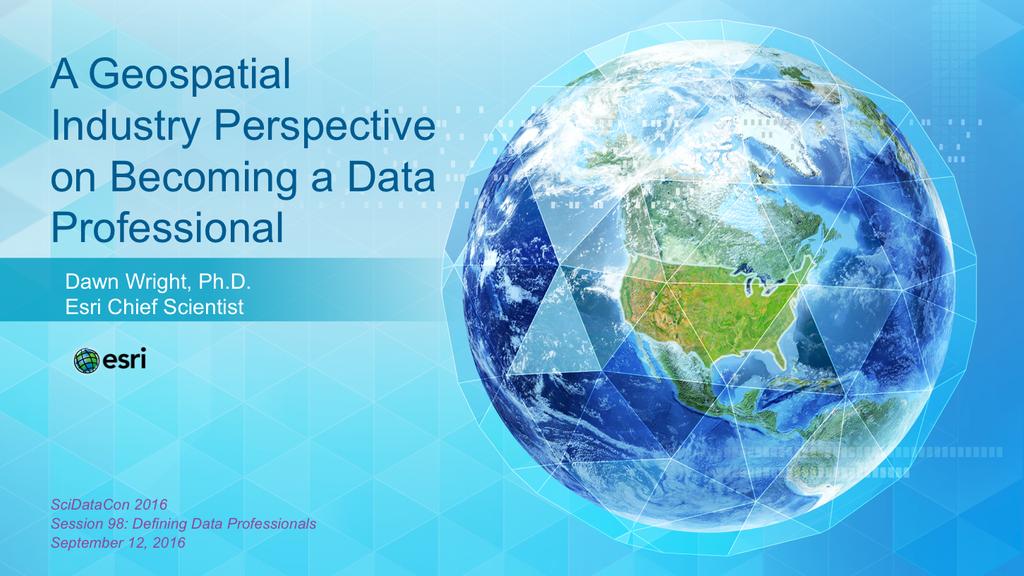
Conference panel Session 98, Defining Data Professionals A Geospatial Industry Perspective on Becoming a Data Professional
 Conference panel Session 98, Defining Data Professionals A Geospatial Industry Perspective on Becoming a Data Professional Dawn J. Wright, Environmental Systems Research Institute (aka Esri), Redlands,
A 'NEW GEOSPATIAL MODALITY'
 INTERVIEW A 'NEW GEOSPATIAL MODALITY' IN AN EXCLUSIVE WITH GEOSPATIAL WORLD, JACK DANGERMOND, PRESIDENT, Esri REFLECTS ON THE CHANGING CHARACTER OF GEOSPATIAL INDUSTRY AND PRIORITY AREAS FOR Esri JACK
THE DATA REVOLUTION HAS BEGUN On the front lines with geospatial data and tools
 THE DATA REVOLUTION HAS BEGUN On the front lines with geospatial data and tools Slidedoc of presentation for MEASURE Evaluation End of Project Meeting Washington DC May 22, 2014 John Spencer Geospatial
Spatial Data Availability Energizes Florida s Citizens
 NASCIO 2016 Recognition Awards Nomination Spatial Data Availability Energizes Florida s Citizens State of Florida Agency for State Technology & Department of Environmental Protection Category: ICT Innovations
GCSE Geography. Geography is the study of places and their people. It is about how people interact with their environment.
 GCSE Geography Geography is a very popular and sought after GCSE option at Bishop Stopfords. The 14-19 Curriculum has been revamped nationally and Geography is included in the English Baccalaureate. It
ABSTRACT TIES TO CURRICULUM TIME REQUIREMENT
 ABSTRACT LEARNING OBJECTIVES Many students have heard of Global Positioning Systems (GPS) as a navigation tool, but few know exactly what this complicated technology is, or how widespread are its applications
AAG Partnerships for. Sustainable Development in Africa: Geospatial Science & Technology for. Partnerships and Applications
 AAG Partnerships for Sustainable Development in Africa Geospatial Science & Technology for Sustainable Development in Africa: Partnerships and Applications Harvard University John F. Kennedy School of
Grade 2 Social Studies
 Grade 2 Social Studies Social Studies Grade(s) 2nd Course Overview This course provides an opportunity for students to explore their community and how communities operate. Scope And Sequence Timeframe
GEOGRAPHY (GE) Courses of Instruction
 Courses of Instruction") GEOGRAPHY (GE) GE 102. (3) World Regional Geography. The geographic method of inquiry is used to examine, describe, explain, and analyze the human and physical environments of the major regions of the
GEOGRAPHY (GE) GE 102. (3) World Regional Geography. The geographic method of inquiry is used to examine, describe, explain, and analyze the human and physical environments of the major regions of the
6 February 2018, Subject: FME World Tour 2018 At Sunway Resort Hotel & Spa
 6 February 2018, Subject: FME World Tour 2018 At Sunway Resort Hotel & Spa FME technology has evolved from the ETL (Extract Transform Load) software to the multi tool for connecting, transforming and automating
DIPLOMA IN GEOMATICS (NQF Level 6)
") DIPLOMA IN GEOMATICS ( 6) Programme Aims/Purpose: The Diploma in Geomatics programme was purposefully designed to prepare students for a career as survey technician, with specialised knowledge and skills
DIPLOMA IN GEOMATICS ( 6) Programme Aims/Purpose: The Diploma in Geomatics programme was purposefully designed to prepare students for a career as survey technician, with specialised knowledge and skills
MAKING LOCATION MATTER
 MAKING LOCATION MATTER Action to activate location data for people-centred policy CANBERRA ROUNDTABLE 18 OCTOBER 2017 DISCUSSION NOTES v6.0 Discussion overview and priority actions About the Roundtable
T H E D I G I T A L T A L E N T D I V I D E N D : S H I F T I N G G E A R S I N A C H A N G I N G E C O N O M Y
 THE DIGITAL TALENT DIVIDEND: SHIFTING GEARS IN A CHANGING ECONOMY T H E D I G I T A L T A L E N T D I V I D E N D : S H I F T I N G G E A R S I N A C H A N G I N G E C O N O M Y R E S E A R C H B Y : I