Global Expertise. Local Delivery.
|
|
|
- Wilfrid Gray
- 6 years ago
- Views:
Transcription
1 Surveys/Geomatics Global Expertise. Local Delivery.
2
3 One team. Infinite solutions. OPPOSITE CLOCKWISE FROM TOP LEFT: Dyer Mountain Ski Resort Lassen County, California Loblaws Richmond Road Ottawa, Ontario Fernley Levee Break Laser Scanning Fernley, Nevada Stantec, founded in 1954, provides professional design and consulting services in planning, engineering, architecture, surveying, economics, and project management. Continually striving to balance economic, environmental, and social responsibilities, we are recognized as a world-class leader and innovator in the delivery of sustainable solutions. We support public and private sector clients in a diverse range of markets in the infrastructure and facilities sector at every stage, from initial concept and financial feasibility to project completion and beyond. Firmly committed to continuous innovation, Stantec adopts a fully integrated approach to projects. Our multidisciplinary practice areas serve public and private sector clients in a diverse range of markets. We work in partnership with our clients as one team to offer infinite solutions.
4
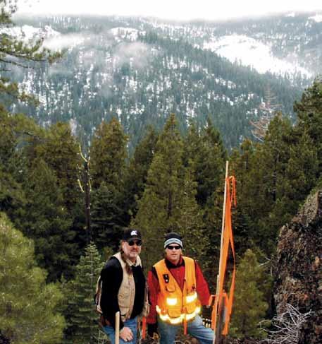
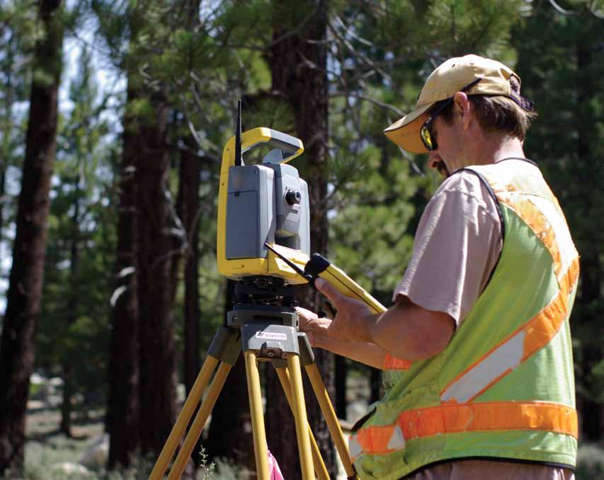
5 Surveys/Geomatics Stantec provides the full range of surveys/geomatics services encompassing the measurement, layout, representation, analysis, management, retrieval, and display of spatial information describing the earth s physical features, land parcel boundaries, and the built environment. The knowledge of Stantec s professional and technical surveys/geomatics staff is applied to services including boundary and cadastral surveys, ALTA/ACSM, topographic mapping, construction stakeout, geodetic and control surveys, route surveys, as-builts, water rights, photogrammetry, and hydrographic surveys, as well as subsurface utility engineering (SUE), Geographic Information System (GIS) services, and 3D laser scanning (3DLS). Specialized services include environmental surveying in support of projects involving remediation, landfills, unexploded ordnance, vegetation and habitat, wildlife, wildfire burns, wetlands, and more. OPPOSITE CLOCKWISE FROM TOP: Montgomery Estates South Lake Tahoe, California Orchard Hills Irvine, California Yucca Mountain GPS Survey Southern Nevada Our comprehensive surveys/geomatics services may be performed on a wide range of projects focusing on residential, commercial, industrial, transportation, utility and power, recreational, environmental, and institutional projects for public and private sector clients. Our staff is capable of effectively performing work in locations that range from major urban settings to the most remote and challenging environments by effectively addressing the logistical and safety considerations inherent in each situation.


6 surveys are accomplished for public and private sector clients Topographic Mapping Topographic mapping is the process of measuring three-dimensional locations of natural and manmade features within a site and preparing a graphic representation of the site s conditions. Topo maps have many uses and serve as the basis for land planning, route planning, civil engineering design, architectural design, watershed and drainage analysis, visualization renderings, and geological exploration. This mapping is integral to work on projects including residential, commercial, and industrial developments; airports; roads and highways; rail and light rail; recreation facilities; water and wastewater infrastructure; mining; and more. vegetation; and elevation information in the form of contour lines and spot elevations. The vertical information can be represented as a Digital Terrain Model (DTM) or Digital Elevation Model (DEM), along with horizontal information represented as CAD data, for direct use in design and planning application software. Top: Reno Tahoe International Airport Survey Reno, Nevada Bottom: North Carolina Department of Transportation Winston- Salem, North Carolina Field survey measurements are commonly made with conventional or GPS survey techniques or by 3D laser scanning to gather 3D locations for all features of interest. Specialized computer software is then used to process the data and create the topo maps. Topographic maps depict information on manmade features such as buildings, roadways, fences, and utilities; natural features such as watercourses and


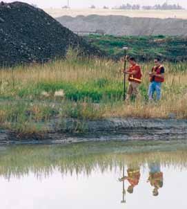
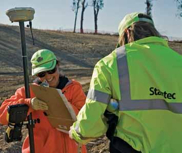
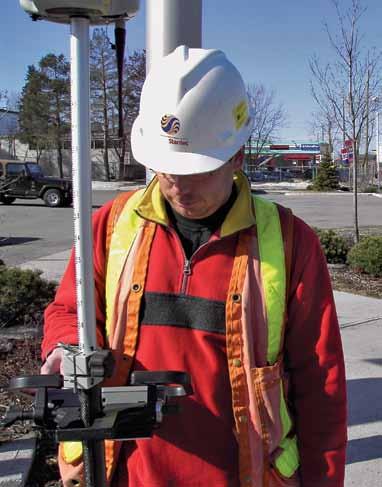
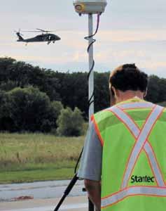
7 Geodetic and Control Surveys Stantec has extensive expertise in providing geodetic and control survey services, ranging from localized control networks for construction and mapping to permanent high-precision control stations for inclusion in regional or nationwide control networks. Work has been successfully performed on a wide range of projects for private, municipal, and government clients. Localized control work generally utilizes plane survey techniques, while those involving larger areas must incorporate geodetic survey principles to account for the size, shape, and characteristics of the earth. Stantec s geodesists and geodetic surveyors rely on satellite based GPS (Global Positioning System) technology and specialized techniques to achieve the required high-precision results for these large-scale projects. Control surveys support aerial mapping projects, where precise positions are set on temporary target panel points that will be visible in aerial imagery to guide photogrammetric mapping. GPS observations can also be made on ground control points during the photo mission for subsequent processing of airborne GPS data collected within the aircraft. Control surveys are provided to guide mapping and construction stakeout work for projects such as residential and commercial developments, roads and highways, underground infrastructure, utility transmission lines, airport facilities, and high-rise building construction. Top: GPS Control Network Ottawa, Ontario Bottom: Davison Army Airfield Fort Belvoir, Virginia


8 boundaries and retracements are necessary for public and private land Boundary Surveys Stantec s surveys/geomatics team provides the full range of boundary surveys for public and private sector clients. Services include subdivision platting, parcel maps and land divisions, boundary line adjustments and reversion to acreage, right-of-way surveys, boundary retracement, record of survey maps, legal descriptions, corner records, and more. Stantec s professional land surveyors oversee all aspects of boundary survey work including records research, field reconnaissance and monument survey ties, boundary calculations and resolution, and final preparation of maps, exhibits, or legal descriptions. Top: Canadian War Museum Ottawa, Ontario Bottom: Remote Boundary Survey Northern California Boundary survey projects can range widely in scope and complexity. Applications may be a simple retracement of an individual parcel boundary, or the creation of new parcels by subdividing land ranging from two to several thousand new lots. Easement descriptions are prepared for a wide range of needs and right-of-way surveys are performed for projects such as roadways, railroads and light rail, channels, utility transmission, and other infrastructure projects. Stantec employs state-of-the-art technology for field applications including conventional and GPS equipment, as well as specialized computer software for calculations and map preparation. Combining these resources with the knowledge of professional land surveyors and their extensive local knowledge in individual project locations allows Stantec to successfully address all aspects of boundary survey projects.
. They exist across the entire US, except for the 13 original colonies and Texas.")
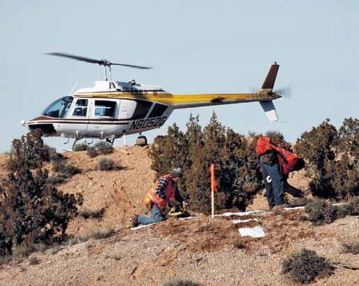
9 Cadastral and Retracement Surveys Cadastral surveys are based upon the US Public Land Survey System (PLSS), which was initiated by the Government Land Office (GLO) in the 18th Century and continued today by the Bureau of Land Management (BLM). They exist across the entire US, except for the 13 original colonies and Texas. Cadastral retracement surveys are needed for all projects that occur on US public lands and are regularly needed for private lands in otherwise unsurveyed rural areas, particularly in the US West. Surveyors must research and interpret original GLO field notes and plats and apply their full understanding of the BLM s Manual of Instructions for Public Lands. Fieldwork consists of retracing and recovering original GLO monuments or evidence of their existence and conducting surveys to determine their actual position. Original monuments that were obliterated must be reset according to BLM rules. Field data is then reduced and BLM procedures are used to subdivide the PLSS one-mile-square sections based on the location of the found or reset cadastral monuments. Stantec surveyors have considerable experience in the retracement and resurvey of cadastral surveys and regularly conduct this work in some of the most remote and difficult areas of the West. Top: Sanpete Mountain Boundary Utah
 Minimum Standard Detail Requirements.")

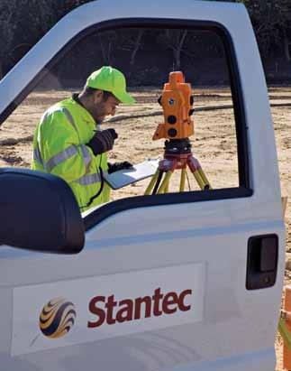
10 experience and technology promote accurate deliverables ALTA/ACSM Land Title Surveys left: Stantec Surveyor and Equipment Raleigh, North Carolina right: Glen Eagle Square Shopping Center Chadds Ford, Pennsylvania Stantec provides survey services that adhere to the American Land Title Association/American Congress on Surveying and Mapping (ALTA/ ACSM) Minimum Standard Detail Requirements. The resulting maps present the legal components of the property including record boundary, easements, rights-of-way, and other encumbrances, as well as the physical site conditions of improvements and potential patterns of use. Services for ALTA/ACSM land title surveys differ according to individual project needs and may include land area/boundary, monuments, topographic features, FEMA flood zone designations, site improvements, buildings, adjacent property owners, access, parking areas, utility locations, easements and rights-of-way, evidence of use patterns, and other specific requirements as requested. When research and field surveying tasks are completed, an official ALTA/ACSM Land Title Survey map is created to depict all required information. ALTA/ACSM land title surveys can be completed for many types of projects including commercial and industrial development, master planned communities, individual residences, retail and mall developments, and public utility facilities, to name a few. Stantec s surveys/geomatics professionals have extensive knowledge and experience with ALTA/ACSM national requirements, as well as the local conditions that allows them to effectively advise clients and address their specific project needs.

 coordinate")
11 Route Surveys Stantec s surveys/geomatics professionals provide a broad range of services for linear route projects including control surveys, route location support, right-of-way, cadastral and boundary surveys, legal descriptions, topographic mapping, GIS services, visual resource inventories, environmental resource mapping, agency permit support, land owner notification, photo simulations, construction stakeout, and construction as-built surveys. Specialized expertise is required to successfully address the particular needs of long-line route survey projects. The significant distances involved in many projects require special consideration of geodetic survey principles and the effective use of State Plane or UTM (Universal Transverse Mercator) coordinate systems. Widely varying terrain and land use conditions must be accommodated and remote project locations often provide special access, safety, and logistical consideration. Stantec s surveys/geomatics team members have the necessary experience and expertise in specialized route survey applications and can effectively provide the wide range of surveying and mapping services required to address specific project needs. left: Ely Energy Center Ely, Nevada right: ReTRAC Reno, Nevada


12 specialized skills are beneficial for all types of surveys Subsurface Utility Engineering Stantec provides site surveys, coordination with utility owners, and/or utility exposure to locate subsurface utilities during design and construction. The four levels of quality services are dependent on client need and may include locating, the highest level of accuracy; designating, which utilizes surface geophysical methods to identify utilities; surface visible survey, which involves verifying research completed from existing records out in the field; and records research, which is strictly the use of available utility records to establish underground utilities. Our highly skilled technicians then convert field data into CAD files for analysis, which shows the position of critical utilities in 3D, allowing for a more accurate pre-design base drawing. For subsurface features that cannot be magnetically located, Stantec utilizes its Ground Penetrating Radar (GPR), which is a non-invasive geophysical method for viewing subsurface features and is one of the most effective tools for subsurface mapping and designating. Stantec can provide subsurface utility engineering services for a variety of public and private projects including transportation, institutional, educational, development, and utility. Top: Subsurface Utility Engineering Raleigh, North Carolina Bottom: Subsurface Utility Engineering Raleigh, North Carolina The highest level of accuracy services includes locating, which is the actual exposure of the facility being surveyed and includes data such as material type, surface elevation, utility size and capacity, outside dimensions, and configurations. Typical designating is performed using various electromagnetic equipment.


13 Environmental Surveying Stantec has provided a variety of professional services for environmental surveying projects including remediation projects, wetland inventory and location surveys, hydrologic studies, soil sampling events, landfill closures, active landfills, stream relocation and stream-bank stabilization surveys, underground nuclear waste storage facility surveying, and monitoring well and core hold location mapping projects. Stantec can assist with Superfund remediation projects by providing surveying services to support the cleanup and disposal of contaminated soils and materials. These projects implement the use of surveying to provide topographic, volumetric, and boundary surveys, as well as construction staking services. Unexploded ordnance (UXO) projects involve the location and removal of unexploded ordnance and include surveying services to provide grid mapping and boundary surveying. Stantec can also provide active landfill and landfill closure surveys, which involve topographic, volumetric, and boundary surveys, as well as construction stakeout. Stantec professionals use conventional, GPS, and 3D laser scanning technology to produce 3D digital terrain mapping to provide our clients with topographic and volumetric information, which can be delivered in the most appropriate format for our client. Top: SWM Ditches RTK GPS Survey Virginia Beach, Virginia Bottom: Brian Head Alpine Creek Brian Head, Utah

 and contours of the bed and shore.")
14 Hydrographic Surveys Hydrographic surveys are performed to map shorelines and bed surfaces beneath a waterway or bodies of water including streams, channels, rivers, reservoirs, lakes, and ocean bays, as well as to establish water depth. Depending on the type of watercourse and the required information, a variety of techniques and watercrafts are used including motorized boats, pontoons, rafts, and SCUBA. Depth soundings are integrated with GPS positions to generate a digital terrain model (DTM) and contours of the bed and shore. Deliverables include DTM surfaces, thalweg profiles (deepest part of the channel), cross-sections, and water volumes. Stantec owns and operates several types of equipment specific to hydrographic surveying including boats and high frequency depth sounders coupled with dual-frequency GPS receivers. Stantec has experience providing hydrographic survey services for a variety of project types including environmental, transportation, and industrial applications. Projects have been completed for bridge design, outfall scour hole mapping, environmental impact assessments, water intake design, reservoir volumes, and road and canal design. left: Hydrographic Surveying Edmonton, Alberta right: Donner Lake Hydrographic Survey California

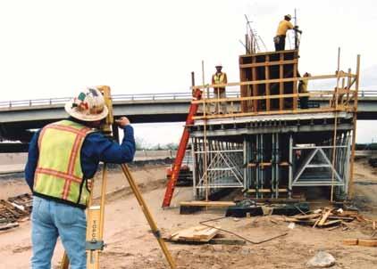
15 our services are employed from project inception to project completion Construction Stakeout Stantec s team of surveys/geomatics professionals provide the full range of construction stakeout services including earthwork grading and excavation, underground utilities, roadways and bridges, airport facilities, houses and buildings, tunnels, slope staking, and quantity surveying and calculations. Different techniques are used dependent on the project type and all have their own unique set of challenges. Slope staking requires knowledge of the theoretical location of daylight and catch points and is a specialized technique used for hillside projects. Airport stakeout is a very precise and higher level of survey, as are multi-acre buildings such as large warehousing projects that require a very accurate grade over a substantial area. Highrise construction stakeout requires guiding the placement of steel vertically and requires exact precision. For buildings and houses, our surveyors work initially on the plot plan, stake locations for buildings and infrastructure during construction, and also certify after construction that it meets the requirements of the plans. Roadway, channel, transmission line, utility/communications, and railroad staking is also performed to delineate grading and construction over long distances. Stantec has the experience in all types of construction stakeout projects to properly guide and verify construction. Top: Chester County YMCA East Goshen, Pennsylvania


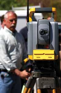
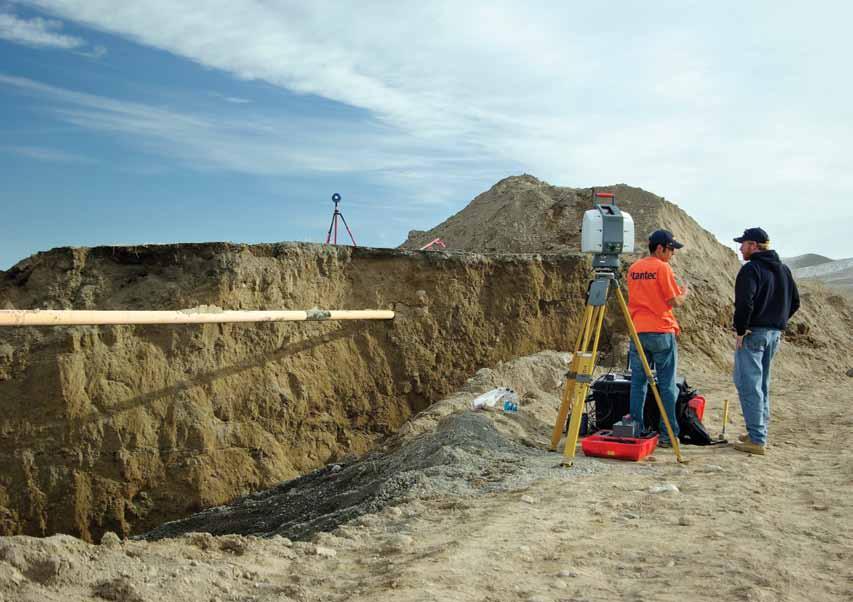
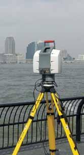
16 3D laser scanning and GIS systems are important new technologies 3D Laser Scanning left: Geological Mapping 3D Laser Scanning Portland, Colorado right: Cornell University Ithaca, New York 3DLS uses scanning instruments to transmit laser light and collect reflected return data, which is then processed to generate information about a target s surface. Stantec uses land based scanning techniques to produce 3D topographic visuals of the ground surface and the constructed environment. 3DLS uses time of flight measurements between the instrument and the target surface, creating myriad 3D points that are then analyzed and processed to create a highly accurate map product. Stantec utilizes 3DLS on projects that require high definition and precision using rapid data collection techniques. It is utilized for projects including as-built surveys, transportation projects, infrastructure, industrial inventories, environmental projects, power generation, and historical architectural surveying, to name a few. 3DLS is particularly effective in applications where access is limited or hazardous to survey personnel. The resulting digital data is compatible with design and analysis software such as CAD and GIS, enabling high definition digital terrain models (DTMs) and mapping products. Stantec s 3DLS capabilities and experience are regularly used to serve public and private sector clients throughout North America.


17 Geographic Information Systems Stantec provides Geographic Information System (GIS) services to develop spatial databases, provide custom programming services, perform system implementations, conduct end user training, and support effective analysis, presentation, and information management for a wide range of projects. GIS applications areas include urban planning and engineering, environmental resource mapping and analysis, right-of-way engineering, asset and facility management, utilities and infrastructure, power and telecommunications, route planning and selection, hydrology and watershed analysis and mapping, transportation planning and design, natural resource management, and 3D visualization. With GIS becoming a standard tool within agencies and organizations, there is a vast amount of readily available spatial data that can be acquired. In addition to compiling data from other sources, it is also possible to digitize older historical maps or aerial photographs. Stantec also has the capabilities to collect field data utilizing our extensive surveys/geomatics capabilities. Stantec applies ESRI, AutoDesk, Intergraph, Manifold, MapInfo, and other products to structure and enhance the data for GIS functions. We use mainstream database products and web technologies as platforms for our operations experience that applies to systems analysis and infinite solution recommendations for information management. Top left: Central North Valleys Water Demand Study Reno, Nevada top right: Millers Creek Watershed Improvement Plan Ann Arbor, Michigan Bottom: Oak Valley Master Development Calimesa, California


18 committed to excellence, consistency, and efficiency Photogrammetry Stantec offers aerial mapping through comprehensive soft-copy photogrammetric services, relying on specialized software and hardware, together with the experience of our mapping specialists. Projects range from drawings of simple planimetric features, such as building outlines and curb alignments, to detailed three-dimensional digital terrain modeling, which can be used to produce true-to-scale digital images, known as orthphotos. Specializing in aerial triangulation, digital terrain modeling, digital image stereo compilation, and orthophotography, Stantec provides these services as stand-alone projects or integrated with our overall surveying and engineering services. technology supports every effort, allowing us to provide enhanced efficiency, coordination, and cost-effectiveness. Stantec is keenly aware of the importance of gathering accurate data on schedule, whether we are providing photogrammetric services for our own in-house disciplines or directly for external clients. By offering the total range of services in-house, our clients are assured of our commitment to excellence and client satisfaction. Top: Water Street Mills Stonington, Connecticut Bottom: Orthophoto with Planimetric Overlay New York, New York Stantec s highly experienced mapping specialists furnish clients with totally integrated mapping services. Our photogrammetrists, certified by the American Society of Photogrammetry and Remote Sensing (ASPRS), work closely with our Professional Land Surveyors and their field survey crews for precision ground control and mapping QA/QC procedures. Sophisticated in-house
19 Front cover from left to right: Stantec Surveyor and Equipment Edmonton, Alberta Walton Developments Calgary, Alberta Orchard Hills Irvine, California Back cover from left to right: Muldrow Army Heliport Lexington, Oklahoma I-19/Duval Mine Road Interchange Sahuarita, Arizona Battery Park City As-Built New York, New York
20 CM-CD-MRC-2008JUN02-P1V1
Exploring the boundaries of your built and natural world. Geomatics
 Exploring the boundaries of your built and natural world Geomatics Before the Luxor brought magic to the Las Vegas strip and before the South LRT extension in Edmonton gave residents a new route to travel,
GEOMATICS SURVEYING AND MAPPING EXPERTS FOR OVER 35 YEARS
 GEOMATICS SURVEYING AND MAPPING EXPERTS FOR OVER 35 YEARS 2 GEOMATICS AND SURVEYING SOLUTIONS SPANNING THE ENTIRE PROJECT LIFECYCLE 1,000+ 250+ 24 Surveying professionals Active field crews Geomatics offices
IC ARTICLE LAND SURVEYORS
 IC 25-21.5 ARTICLE 21.5. LAND SURVEYORS IC 25-21.5-1 Chapter 1. Definitions IC 25-21.5-1-1 Application of chapter Sec. 1. The definitions in this chapter apply throughout this article. As added by P.L.23-1991,
SURVEYING Chapter 1 Introduction
 PHILADELPHIA UNIVERSITY Faculty of Engineering. Department of Civil Engineering. SURVEYING Chapter 1 Introduction Surveying : the art or science of measuring and representing natural and artificial features
GIS Geographical Information Systems. GIS Management
 GIS Geographical Information Systems GIS Management Difficulties on establishing a GIS Funding GIS Determining Project Standards Data Gathering Map Development Recruiting GIS Professionals Educating Staff
Technical Drafting, Geographic Information Systems and Computer- Based Cartography
 Technical Drafting, Geographic Information Systems and Computer- Based Cartography Project-Specific and Regional Resource Mapping Services Geographic Information Systems - Spatial Analysis Terrestrial
Professional Land Surveyor
 Professional Land Surveyor Professional Land Surveyors establish official land, air space, and water boundaries. They write descriptions of land for deeds, leases, and other legal documents; define air
STEREO ANALYST FOR ERDAS IMAGINE Stereo Feature Collection for the GIS Professional
 STEREO ANALYST FOR ERDAS IMAGINE Stereo Feature Collection for the GIS Professional STEREO ANALYST FOR ERDAS IMAGINE Has Your GIS Gone Flat? Hexagon Geospatial takes three-dimensional geographic imaging
GEOMATICS. Shaping our world. A company of
 GEOMATICS Shaping our world A company of OUR EXPERTISE Geomatics Geomatics plays a mayor role in hydropower, land and water resources, urban development, transport & mobility, renewable energy, and infrastructure
First on the Ground. Geomatics
 First on the Ground Geomatics Surveying and mapping solutions spanning the entire project lifecycle Part art, part science, part technology, the Geomatics profession is constantly evolving. From the very
SOLUTIONS ADVANCED GIS. TekMindz are developing innovative solutions that integrate geographic information with niche business applications.
 ADVANCED GIS SOLUTIONS TekMindz are developing innovative solutions that integrate geographic information with niche business applications. TEK INDZ TM GIS Services Overview At the leading edge of geospatial
Land Surveying. Knowledge. Commitment. Excellence.
 Land Surveying Knowledge. Commitment. Excellence. www.kcepc.com Land Surveying KC s land surveying group is a leading provider of boundary and topographic surveying, base mapping, right-of-way mapping
Geospatial Data, Services, and Products. National Surveying, mapping and geospatial conference
 Geospatial Data, Services, and Products Federal Programs -- USDA NRCS National Surveying, mapping and geospatial conference March 15, 2016 NRCS Applications using Geosaptial Products & Services Field
Teaching GIS for Land Surveying
 Teaching GIS for Land Surveying Zhanjing (John) Yu Evergreen Valley College, San Jose, California James Crossfield California State University at Fresno, Fresno California 7/13/2006 1 Outline of the Presentation
Louisiana Transportation Engineering Conference. Monday, February 12, 2007
 Louisiana Transportation Engineering Conference Monday, February 12, 2007 Agenda Project Background Goal of EIS Why Use GIS? What is GIS? How used on this Project Other site selection tools I-69 Corridor
STATEMENT OF QUALIFICATIONS
 STATEMENT OF QUALIFICATIONS GSP Consulting Gary Poland - President 2050 Longley Lane #1603 Reno, NV 89502 Phone: (775) 857-1362 Cell: (775) 240-5880 Synergy Mapping Laddie Kent Vice President 6551 S. Revere
Pierce Cedar Creek Institute GIS Development Final Report. Grand Valley State University
 Pierce Cedar Creek Institute GIS Development Final Report Grand Valley State University Major Goals of Project The two primary goals of the project were to provide Matt VanPortfliet, GVSU student, the
Land Administration and Cadastre
 Geomatics play a major role in hydropower, land and water resources and other infrastructure projects. Lahmeyer International s (LI) worldwide projects require a wide range of approaches to the integration
1.1 What is Site Fingerprinting?
 Site Fingerprinting Utilizing GIS/GPS Technology 1.1 What is Site Fingerprinting? Site fingerprinting is a planning tool used to design communities where protection of natural resources is the primary
Surveyors, Cartographers, Photogrammetrists, and Surveying and Mapping Technicians
 http://www.bls.gov/oco/ocos040.htm Surveyors, Cartographers, Photogrammetrists, and Surveying and Mapping Technicians * Nature of the Work * Training, Other Qualifications, and Advancement * Employment
UAV APPLICATIONS IN ENGINEERING. Presented By Wohnrade Civil Engineers, Inc.
 UAV APPLICATIONS IN ENGINEERING Presented By Wohnrade Civil Engineers, Inc. UAV BUSINESS STARTUP March 31, 2015 - Obtained DJI Inspire 1 Unmanned Aerial Vehicle (UAV) FAA requires Certificate of Authorization
T: E:
 PAS 128 UTILITY DETECTION AND MAPPING TOPOGRAPHICAL SURVEYS UTILITY RECORD SEARCHES AND DESK TOP STUDY SURFACE WATER DRAINAGE SURVEYS GROUND CLEARANCE SURVEYS MEASURED BUILDING SURVEYS LASER SCANNING UAV
UNITED NATIONS E/CONF.96/CRP. 5
 UNITED NATIONS E/CONF.96/CRP. 5 ECONOMIC AND SOCIAL COUNCIL Eighth United Nations Regional Cartographic Conference for the Americas New York, 27 June -1 July 2005 Item 5 of the provisional agenda* COUNTRY
Geographic Information Systems Conceptual Site Model for Ordnance and Explosives Remediation at the Formerly Used Defense Site Camp Beale
 Geographic Information Systems Conceptual Site Model for Ordnance and Explosives Remediation at the Formerly Used Defense Site Camp Beale Jeremy Gessaro The Formerly Used Defense Site Camp Beale Conceptual
LECTURE NOTE ENGINEERING SURVEYING
 LECTURE NOTE ENGINEERING SURVEYING LECTURE 1 Introduction: Surveying is defined as taking a general view of, by observation and measurement determining the boundaries, size, position, quantity, condition,
Great California Delta Trail Blueprint for Contra Costa and Solano Counties GIS AND MAPPING MEMORANDUM JULY 2010
 Great California Delta Trail Blueprint for Contra Costa and Solano Counties GIS AND MAPPING MEMORANDUM JULY 2010 {DRAFT} July 2010 Introduction Geographic Information Systems (GIS) are computer-based
Chapter 5 LiDAR Survey and Analysis in
 Chapter 5 LiDAR Survey and Analysis in 2010-2011 Christopher Fennell A surveyor s plat and town plan filed in 1836 set out an intended grid of blocks, lots, alleys, and streets for New Philadelphia. Geophysical,
Chapter 1 Overview of Maps
 Chapter 1 Overview of Maps In this chapter you will learn about: Key points when working with maps General types of maps Incident specific maps Map legend and symbols Map sources A map is a navigational
Flood Hazard Zone Modeling for Regulation Development
 Flood Hazard Zone Modeling for Regulation Development By Greg Lang and Jared Erickson Pierce County GIS June 2003 Abstract The desire to blend current digital information with government permitting procedures,
GIS-Based Sediment Quality Database for the St. Louis River Area of Concern (AOC): Overview Presentations and Demonstration
: Overview Presentations and Demonstration") GIS-Based Sediment Quality Database for the St. Louis River Area of Concern (AOC): Overview Presentations and Demonstration Judy L. Crane 1 and Dawn E. Smorong 2 1 Minnesota Pollution Control Agency, St.
GIS-Based Sediment Quality Database for the St. Louis River Area of Concern (AOC): Overview Presentations and Demonstration Judy L. Crane 1 and Dawn E. Smorong 2 1 Minnesota Pollution Control Agency, St.
Highland Lake Bathymetric Survey
 Highland Lake Bathymetric Survey Final Report, Prepared For: The Town of Highland Lake 612 Lakeshore Drive Oneonta, AL 35121 Prepared By: Tetra Tech 2110 Powers Ferry Road SE Suite 202 Atlanta, GA 30339
Surveying, Surveyors and. Systems. Curt Crow NOAA s National Geodetic Survey September 22, 2009 URISA New England, Bedford, NH
 Surveying, Surveyors and Geographic Information Systems Curt Crow NOAA s National Geodetic Survey September 22, 2009 URISA New England, Bedford, NH Surveying The technique and science of accurately determining
Surveying I. Unit - I. Different methods and instruments are being used to facilitate the work of
 Surveying I Unit - I Definition of Survey Surveying is the art of determining the relative positions of different objects on the surface of the earth by measuring the horizontal distances between them,
Ramani Geosystems. Putting Africa On The Map. Authorized Resellers
 Ramani Geosystems Putting Africa On The Map Authorized Resellers Ramani Profile Started in 1999 Aerial, Land Surveying & Mapping Solutions + 10 Countries in the region + 80 Staff working in projects Asset
Designing GIS Databases to Support Mapping and Map Production Charlie Frye, ESRI Redlands Aileen Buckley, ESRI Redlands
 Designing GIS Databases to Support Mapping and Map Production Charlie Frye, ESRI Redlands Aileen Buckley, ESRI Redlands 1 Designing GIS Databases to Support Mapping and Map Production Charlie Frye, ESRI
 Boone County GIS has the right to inquire about and investigate the use of any requested products and deny access to anyone based on concerns relating to privacy, security, public health, public safety,
Introduction to Geographic Information Systems
 Introduction to Geographic Information Systems What is GIS? GIScience, Geography and Cartography GIS Maps Why is it important? What is Driving GIS? Applications of GIS Case Studies Components of a GIS
Use of Government Land Office Surveys in Tribal GIS Land Management. Dustin Holt GIS Technician Choctaw Nation of Oklahoma
 Use of Government Land Office Surveys in Tribal GIS Land Management Dustin Holt GIS Technician Choctaw Nation of Oklahoma Ardmore Quadrangle - 1949 Different versions of the same map were printed in 1901,
Practical Uses of LiDAR in NL A Consultants Perspective
 Practical Uses of LiDAR in NL A Consultants Perspective Adam Anderson, R.P.F. President & CEO Presented by: Peter Davison, R.P.F. Photo Interpretation Specialist Introduction Resource Innovations Inc.
ESRI GIS For Mining Seminar, 10 th August, 2016, Nairobi, Kenya. Spatial DATA Solutions for Mining
 ESRI GIS For Mining Seminar, 10 th August, 2016, Nairobi, Kenya Spatial DATA Solutions for Mining Spatial Data Solutions for Mining Spatial - Data that identifies the geographic location of features &
High Speed / Commuter Rail Suitability Analysis For Central And Southern Arizona
 High Speed / Commuter Rail Suitability Analysis For Central And Southern Arizona Item Type Reports (Electronic) Authors Deveney, Matthew R. Publisher The University of Arizona. Rights Copyright is held
Appendix C. Questionnaire Summary of Responses Geographic Information Systems
 Appendix C Questionnaire Summary of Responses Geographic Information Systems 1. Is your agency using or planning use of GIS for: a. general mapping (e.g. highway routes, political boundaries, etc.) b.
DATA SOURCES AND INPUT IN GIS. By Prof. A. Balasubramanian Centre for Advanced Studies in Earth Science, University of Mysore, Mysore
 DATA SOURCES AND INPUT IN GIS By Prof. A. Balasubramanian Centre for Advanced Studies in Earth Science, University of Mysore, Mysore 1 1. GIS stands for 'Geographic Information System'. It is a computer-based
GIS Visualization: A Library s Pursuit Towards Creative and Innovative Research
 GIS Visualization: A Library s Pursuit Towards Creative and Innovative Research Justin B. Sorensen J. Willard Marriott Library University of Utah justin.sorensen@utah.edu Abstract As emerging technologies
HKND Group Ltd Grand Canal Project
 HKND Group Ltd Grand Canal Project General Overview of Aerial Survey Project Managua, Nicaragua September 21 st 2015 Presented by: Jeff Elliott Managing Director CSA Global About CSA Global CSA Global
Creating an On Target Geospatial Foundation for the Navajo Housing Authority
 Creating an On Target Geospatial Foundation for the Navajo Housing Authority 2012 Geospatial Excellence Awards MAPPS 2012 Geospatial Products and Services Excellence Awards 2012 Awards Entry Form Please
ESTABLISHING A GEODETIC CONTROL NETWORK TO SERVE AS PHOTOGRAMMETRIC CONTROL FOR A COUNTYW IDE GIS
 1992 PLSO Conference 61 ESTABLISHING A GEODETIC CONTROL NETWORK TO SERVE AS PHOTOGRAMMETRIC CONTROL FOR A COUNTYW IDE GIS By M ichael J. Stanoikovich M anager of Geodetic Services W oolpert G eographic
Model Setup IDM Vol 2: Process Model
 Model Setup IDM Vol 2: Process Model Gateway to Melbourne, Australia. Source: Fender Katsalidis, Architects Version 1.4 27 June 2017 Contents Model Setup Exchange Scenarios... 1 Overview... 1 Project Roles...
The Use of Geographic Information Systems (GIS) by Local Governments. Giving municipal decision-makers the power to make better decisions
 by Local Governments. Giving municipal decision-makers the power to make better decisions") The Use of Geographic Information Systems (GIS) by Local Governments Giving municipal decision-makers the power to make better decisions Case Study: Examples of GIS Usage by Local Governments in North
The Use of Geographic Information Systems (GIS) by Local Governments Giving municipal decision-makers the power to make better decisions Case Study: Examples of GIS Usage by Local Governments in North
Regional GIS Initiatives Geospatial Technology Center
 Regional GIS Initiatives Geospatial Technology Center Mr. Bobby Lear GIS Coordinator St. James Parish & Dr. Balaji Ramachandran Contractors Educational Trust Fund Endowed Professor Geomatics Program, Department
Sustainable and Harmonised Development for Smart Cities The Role of Geospatial Reference Data. Peter Creuzer
 Sustainable and Harmonised Development for Smart Cities The Role of Geospatial Reference Data Peter Creuzer 1. Introduction - Smart Cities and Geodata 2. Geodata in Germany 3. Examples 4. Data and Service
Phase One Development of a Comprehensive GIS for the Mentor Marsh and its Proximal Watershed
 FINAL REPORT Phase One Development of a Comprehensive GIS for the Mentor Marsh and its Proximal Watershed Lake Erie Protection Fund SG 120-99 Ohio State University Research Foundation RF 738027 December
Oregon Department of Transportation. Geographic Information Systems Strategic Plan
 Oregon Department of Transportation Geographic Information Systems Strategic Plan Adopted May, 2000 By the GIS Steering Committee Last printed 10/2/2012 4:20:00 PM Page Geographic Information Systems Strategic
MODERNIZATION OF THE MUNICIPAL MAPPING USING HIGH END GNSS SYSTEM AND GIS SOFTWARE
 MODERNIZATION OF THE MUNICIPAL MAPPING USING HIGH END GNSS SYSTEM AND GIS SOFTWARE Mr. R. A. R. Khan Assistant Engineer, Sewerage Utility Management Centre (SUMC) Municipal Corporation Of Greater Mumbai
indigeo Consultants Pvt Ltd Geophysical Surveys Geological Surveys GIS & Data Solutions Image Processing indigeo Company Profile, Page 1
 indigeo Consultants Pvt Ltd Geophysical Surveys Geological Surveys GIS & Data Solutions Image Processing MM Corner, 3 rd Floor #58, Banaswadi Main Road Bangalore 560033 INDIA Ph: +91 80 41638310 Mob: +91
To achieve these Global Sustainable Development Goals, geospatial data are crucial.
 To achieve these Global Sustainable Development Goals, geospatial data are crucial. 2 http://www.globalgoals.org/ HIGH INCOME NATION SUSTAINABLE GROWTH SOCIALLY INCLUSIVE 3 http://etp.pemandu.gov.my/ 12
Techniques for Science Teachers: Using GIS in Science Classrooms.
 Techniques for Science Teachers: Using GIS in Science Classrooms. After ESRI, 2008 GIS A Geographic Information System A collection of computer hardware, software, and geographic data used together for
Copernicus Overview. Major Emergency Management Conference Athlone 2017
 Copernicus Overview Major Emergency Management Conference Athlone 2017 Copernicus is a European programme implemented by the European Commission. The services address six thematic areas: land, marine,
An online data and consulting resource of THE UNIVERSITY OF TOLEDO THE JACK FORD URBAN AFFAIRS CENTER
 An online data and consulting resource of THE JACK FORD URBAN AFFAIRS CENTER THE CENTER FOR GEOGRAPHIC INFORMATION SCIENCE AND APPLIED GEOGRAPHICS DEPARTMENT OF GEOGRAPHY AND PLANNING THE UNIVERSITY OF
GEOGRAPHIC INFORMATION SYSTEMS Session 8
 GEOGRAPHIC INFORMATION SYSTEMS Session 8 Introduction Geography underpins all activities associated with a census Census geography is essential to plan and manage fieldwork as well as to report results
Manitoba s Elevation (LiDAR) & Imagery Datasets. Acquisition Plans & Opportunities for Collaboration
 & Imagery Datasets. Acquisition Plans & Opportunities for Collaboration") Manitoba s Elevation (LiDAR) & Imagery Datasets Acquisition Plans & Opportunities for Collaboration Manitoba Planning Conference May 2017 Presentation Outline Manitoba s Elevation (LiDAR) and Imagery Datasets
Manitoba s Elevation (LiDAR) & Imagery Datasets Acquisition Plans & Opportunities for Collaboration Manitoba Planning Conference May 2017 Presentation Outline Manitoba s Elevation (LiDAR) and Imagery Datasets
The following maps must be provided as a part of the ADA. The appropriate scale for each map should be determined at the pre application conference.
 Main Street @ Coconut Creek DRI QUESTION 9 MAPS The following maps must be provided as a part of the ADA. The appropriate scale for each map should be determined at the pre application conference. Map
MISSOURI LiDAR Stakeholders Meeting
 MISSOURI LiDAR Stakeholders Meeting East-West Gateway June 18, 2010 Tim Haithcoat Missouri GIO Enhanced Elevation Data What s different about it? Business requirements are changing.fast New data collection
Date of Report: EPA agreement number: Center Name and Institution of Ctr. Director: Identifier used by Center for Project: Title of Project:
 Date of Report: March 31, 2003 EPA agreement number: R829515C003 Center Name and Institution of Ctr. Director: Rocky Mountain Regional Hazardous Substance Research Center, Colorado State University, Fort
GIS Needs Assessment. for. The City of East Lansing
 GIS Needs Assessment for The City of East Lansing Prepared by: Jessica Moy and Richard Groop Center for Remote Sensing and GIS, Michigan State University February 24, 2000 Executive Summary At the request
Guidelines for Site-Specific Seismic Hazard Reports for Essential and Hazardous Facilities and Major and Special-Occupancy Structures in Oregon
 Guidelines for Site-Specific Seismic Hazard Reports for Essential and Hazardous Facilities and Major and Special-Occupancy Structures in Oregon By the Oregon Board of Geologist Examiners and the Oregon
Great Lakes Update. Geospatial Technologies for Great Lakes Water Management. Volume 149 October 4, US Army Corps of Engineers Detroit District
 Volume 149 October 4, 2002 US Army Corps of Engineers Detroit District Great Lakes Update Geospatial Technologies for Great Lakes Water Management The U.S. Army Corps of Engineers (USACE) serves an important
GIS = Geographic Information Systems;
 What is GIS GIS = Geographic Information Systems; What Information are we talking about? Information about anything that has a place (e.g. locations of features, address of people) on Earth s surface,
CENSUS MAPPING WITH GIS IN NAMIBIA. BY Mrs. Ottilie Mwazi Central Bureau of Statistics Tel: October 2007
 CENSUS MAPPING WITH GIS IN NAMIBIA BY Mrs. Ottilie Mwazi Central Bureau of Statistics E-mail: omwazi@npc.gov.na Tel: + 264 61 283 4060 October 2007 Content of Presentation HISTORICAL BACKGROUND OF CENSUS
PENNSYLVANIA DEPARTMENT OF TRANSPORTATION ENGINEERING DISTRICT 3-0
 PENNSYLVANIA DEPARTMENT OF TRANSPORTATION ENGINEERING DISTRICT 3-0 LYCOMING COUNTY S.R.15, SECTION C41 FINAL HYDROLOGIC AND HYDRAULIC REPORT STEAM VALLEY RUN STREAM RELOCATION DATE: June, 2006 REVISED:
Preparation of Database for Urban Development
 Preparation of Database for Urban Development By PunyaP OLI, 1. Chairman, ERMC (P) Ltd., Kathmandu, Nepal. Email: punyaoli@ermcnepal.com 2. Coordinator, Himalayan College of Geomatic Engineering and Land
State of Israel Ministry of Housing and Construction Survey of Israel. The Hydrological project case
 State of Israel Ministry of Housing and Construction Survey of Israel The Hydrological project case Survey of Israel Content Introduction To the Survey of Israel The operation assumptions The main responsibilities
A Broad View of Geospatial Technology & Systems
 A Broad View of Geospatial Technology & Systems Pete Large Vice President, Trimble On the shoulders of giants 1 Since their time, our ability to generate geospatial information has grown exponentially
THE USE OF GEOMATICS IN CULTURAL HERITAGE AND ARCHAEOLOGY FOR VARIOUS PURPOSES
 THE USE OF GEOMATICS IN CULTURAL HERITAGE AND ARCHAEOLOGY FOR VARIOUS PURPOSES FEBRUARY 2013 AL BEIDA GEOPLAN CONTENT Company Profile Concept Objectives and Strategies Data Production Methods Data Samples
presents challenges related to utility infrastructure planning. Many of these challenges
 1 Introduction: - a. Purpose According to U.S. Census Bureau the population of stark county was 367,585 in 1990, and in 2000 it was increase to 378,098. Thus County is experiencing a growth that presents
NAVAJO NATION PROFILE
 NAVAJO NATION PROFILE Largest land based area and federally recognized tribe in the United States Over 27,000 square miles (or 17.2 million acres with a population of over 300,000 people. Covers Arizona,
Instituting Land Use Controls (LUCs) for Environmental Compliance and Planning
 for Environmental Compliance and Planning") Eleventh Air Force Instituting Land Use Controls (LUCs) for Environmental Compliance and Planning Robert Beachler GeoBase Administrator 611 Civil Engineer Squadron Elmendorf AFB, AK As of: 1 Agenda Introduction
Eleventh Air Force Instituting Land Use Controls (LUCs) for Environmental Compliance and Planning Robert Beachler GeoBase Administrator 611 Civil Engineer Squadron Elmendorf AFB, AK As of: 1 Agenda Introduction
MAPS AND THEIR CLASSIFICATION
 MAPPING MAPS AND THEIR CLASSIFICATION WHAT IS A MAP? A map is representation of the Earth's surface, showing how things are related to each other by distance, direction, and size. Maps are a way of showing
MAPPS 2012 Geospatial Products and Services Excellence Awards Awards Entry Form
 MAPPS 2012 Geospatial Products and Services Excellence Awards 2012 Awards Entry Form Please include a copy of this document with the project/product submission Entry Information Submission Number: 1741558
Basic Principles of Surveying and Mathematics
 AMRC 2012 MODULE 1 Basic Principles of Surveying and Mathematics CONTENTS Overview... 1-1 Objectives... 1-1 Procedures... 1-1 1.1 Surveying Defined... 1-3 1.2 Types of Surveys... 1-5 1.3 Precision and
The National Spatial Data Infrastructure of Zambia Shlomi SIVAN, Israel. Key words: National Land Audit, GIS, LIS, Common Spatial Data
 The National Spatial Data Infrastructure of Zambia Shlomi SIVAN, Israel Key words: National Land Audit, GIS, LIS, Common Spatial Data SUMMARY One of Zambia's important challenges is to recognize the title
ADMINISTRATION DEPARTMENT Land Management Information Center. An Inventory of Its Records
 MINNESOTA HISTORICAL SOCIETY Minnesota State Archives ADMINISTRATION DEPARTMENT Land Management Information Center An Inventory of Its Records OVERVIEW OF THE RECORDS Agency: Series Title: Land Management
ENV208/ENV508 Applied GIS. Week 1: What is GIS?
 ENV208/ENV508 Applied GIS Week 1: What is GIS? 1 WHAT IS GIS? A GIS integrates hardware, software, and data for capturing, managing, analyzing, and displaying all forms of geographically referenced information.
1994: JV formed for civil engineering consultancy COWI/KX A/s, Denmark(51%) IFU, Denmark (24% ) IL&FS Infrastructure Dev Corp, India(25%)
 IFU, Denmark (24% ) IL&FS Infrastructure Dev Corp, India(25%)") Company Profile 1994: JV formed for civil engineering consultancy COWI/KX A/s, Denmark(51%) IFU, Denmark (24% ) IL&FS Infrastructure Dev Corp, India(25%) 1998: Start of mapping as a new segment of Business.
Company Profile 1994: JV formed for civil engineering consultancy COWI/KX A/s, Denmark(51%) IFU, Denmark (24% ) IL&FS Infrastructure Dev Corp, India(25%) 1998: Start of mapping as a new segment of Business.
P R O U D LY C A N A D I A N
 P R O U D LY C A N A D I A N 1.855.423.3185 info@rmegeomatics.com AERIAL SURVEYING IMAGING TERRAIN ANALYSIS WHO WE ARE HSE & REGULATORY CLIENT INDUSTRIES RME Geomatics (formerly NGF Geomatics) was founded
APPLICATION TO AMEND THE FUTURE LAND USE MAP (FLUM) SMALL SCALE
 SMALL SCALE") DEPARTMENT OF DEVELOPMENT & PLANNING 825 Ohio Avenue - Lynn Haven, FL 32444 (850) 265-2961 - (850) 265-3478 APPLICATION TO AMEND THE FUTURE LAND USE MAP (FLUM) SMALL SCALE Deadline to submit is 30 days
DEPARTMENT OF DEVELOPMENT & PLANNING 825 Ohio Avenue - Lynn Haven, FL 32444 (850) 265-2961 - (850) 265-3478 APPLICATION TO AMEND THE FUTURE LAND USE MAP (FLUM) SMALL SCALE Deadline to submit is 30 days
StreamStats: Delivering Streamflow Information to the Public. By Kernell Ries
 StreamStats: Delivering Streamflow Information to the Public By Kernell Ries U.S. Department of the Interior U.S. Geological Survey MD-DE-DC District 410-238-4317 kries@usgs.gov StreamStats Web Application
Construction Project Data Management
 Construction Project Data Management Establishing Foundations for an Asset Database Scot Twining Project Activities Supported by GIS Cadastral Mapping Proposed Pipeline Route Selection Right Of Way Acquisition
GIS. in the City of Lewiston Maine
 GIS in the City of Lewiston Maine The purpose of this slideshow is to provide an overview of the city GIS and how it is used, maintained and accessed in-house as well as by the public. Please simply hit
Building a National Data Repository
 Building a National Data Repository Mladen Stojic, Vice President - Geospatial 1/30/2013 2012 Intergraph Corporation 1 Information has meaning and gives power only when shared and distributed. Information,
Canadian Board of Examiners for Professional Surveyors Core Syllabus Item C 5: GEOSPATIAL INFORMATION SYSTEMS
 Study Guide: Canadian Board of Examiners for Professional Surveyors Core Syllabus Item C 5: GEOSPATIAL INFORMATION SYSTEMS This guide presents some study questions with specific referral to the essential
GIS Changing the World GIS Day November 15, 2017
 + GIS Changing the World GIS Day November 15, 2017 + Growing Up On The Farm 3 Geographic Information in DNR A 75 year history of mapping and GIS. Forest type map from 1944. State of Washington - Division
GIS in Community & Regional Planning
 GIS in Community & Regional Planning The The role role of of GIS GIS in in Re-writing the the Zoning Bylaw for for the the City City of of Vernon LandInfo Technologies Presentation Overview The GIS Initiative
Unit 1, Lesson 2. What is geographic inquiry?
 What is geographic inquiry? Unit 1, Lesson 2 Understanding the way in which social scientists investigate problems will help you conduct your own investigations about problems or issues facing your community
Graduate Courses Meteorology / Atmospheric Science UNC Charlotte
 Graduate Courses Meteorology / Atmospheric Science UNC Charlotte In order to inform prospective M.S. Earth Science students as to what graduate-level courses are offered across the broad disciplines of
GIS Monroe Geographic Information System March 14, 2018
 GIS Monroe Geographic Information System March 14, 2018 Goals Maintain Enterprise/County-wide geo-database Increase spatial accuracy of data Build and acquire more data layers Increase use of GIS; as another
Fugro Geospatial: Turning Spatial Data into Knowledge
 Fugro Geospatial: Turning Spatial Data into Knowledge 2016 Fugro Geospatial, GIS and Consultants Locations Variety of Collection Platforms Traditional Mapping Traditional Mapping Imagery Photogrammetric
Fairmont State University
 Fairmont State University WV-HEPC Series 11 Intent to Plan (Section 5 of Series 11) Date: January 2018 Title of Degree: Location: Bachelor of Science (B.S.) Surveying & Geomatics Engineering Technology
What is GIS? Introduction to data. Introduction to data modeling
 What is GIS? Introduction to data Introduction to data modeling 2 A GIS is similar, layering mapped information in a computer to help us view our world as a system A Geographic Information System is a
Florida Department of Transportation s
 Controls Conference - Hyatt Regency Savannah, Georgia - April 14-18, 2013 Florida Department of Transportation s 1) Virtual R/W Application Development 2) 3D Utility Mapping for 3D Design Update John Krause,