Modular multi-purpose offshore platforms, the TROPOS Project Approach
|
|
|
- Hugo Lyons
- 6 years ago
- Views:
Transcription


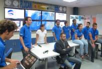
1 Modular multi-purpose offshore platforms, the TROPOS Project Approach Eduardo Quevedo TROPOS Coordination Team
2 CONTENT CONTENT 1. Introduction 2. Challenges 3. Objectives 4. Consortium 5. Plans 6. Progress 7. Conclusions
 50 M Regional")


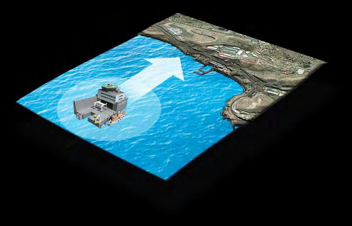
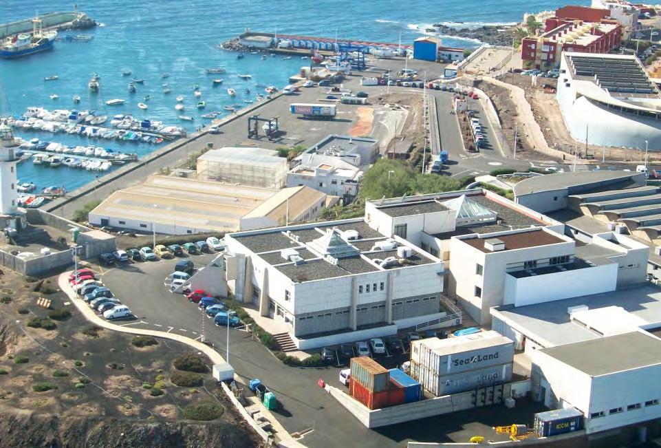
3 INTRODUCTION - PLOCAN National Government (50%) 50 M Regional Government (50%) Main objective : design and construction of an offshore platform for Research & Innovation in the marine science and technologies. The PLOCAN Platform will be a fixed structure Located off the East coast of the Gran Canaria Island Distance from the coast: 4km Depths around 30m. Fernando Montecruz
4 INTRODUCTION Where we are Fernando Montecruz
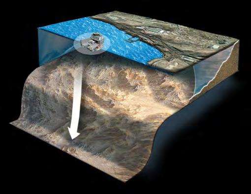

5 INTRODUCTION Where we are Fernando Montecruz
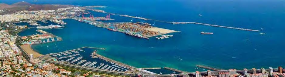
6 INTRODUCTION Where we are

7 INTRODUCTION Where we are
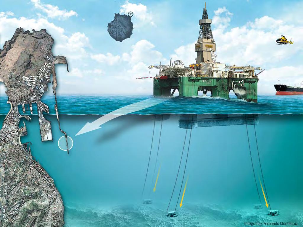
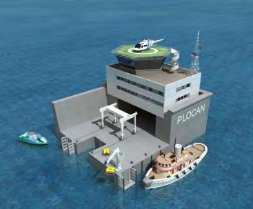
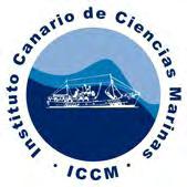
8 INTRODUCTION What we do Fernando Montecruz

9 INTRODUCTION What we do Fernando Montecruz

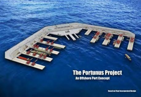
10 CHALLENGES Year 2005 More than half of the population lived within 200 km of the coast Year 2025 Number of citizens living in these areas will be doubled Challenge: To share sites, infrastructures and costs in diverse activities to be implemented offshore Multi-Use Oceanic Platforms Concept


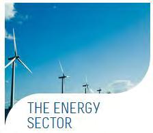
11 CHALLENGES 1.- Offshore Renewable Energies

12 CHALLENGES Energy evolution Necessity for space management Annual offshore wind capacity will increase from 1.1 GW in 2011 to 6.5 GW in 2020, an average net increase of 21.5% per year The space should be shared
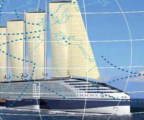
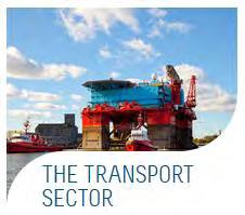
13 CHALLENGES 2.- Maritime Transport


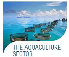
14 CHALLENGES 3.- Offshore Aquaculture Thomas Bjørkan


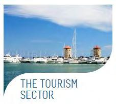
15 CHALLENGES 4.- Leisure

16 CHALLENGES Multi-use oceanic Platform - Hybrids, synergies - Why not?, Business model


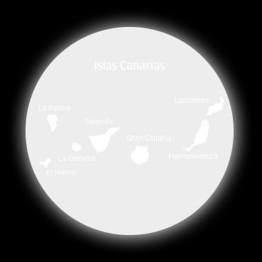
17 3 funded projects CHALLENGES OCEAN : Multi-use offshore platforms
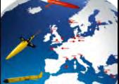
18 OBJECTIVES Three offshore platform designs for Mediterranean, Subtropical and Tropical scenarios Integration among renewable energies, offshore aquaculture, transport and leisure Assess the economic feasibility and viability Develop environmental impact methodology and assessment


19 1 Public Consortium 1 Association 7 Universities 3 Research Organizations 2 Enterprises 4 SMEs CONSORTIUM

20 Work packages PLANS


21 Work plan 36 months WPs WP1 Management stages PLANS Sent deliverable Deliverable to be sent WP2 WP3 WP4 WP5 WP6 WP7 WP8 M1-M6 M7-M12 M12-M18 M19-M24 M25-M30 M31-M36

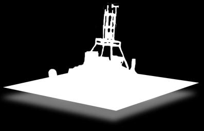
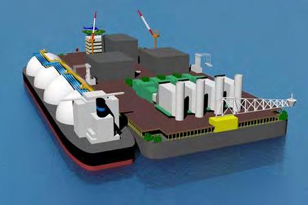
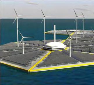
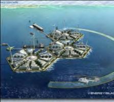
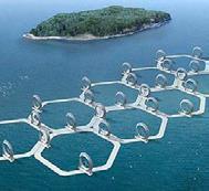
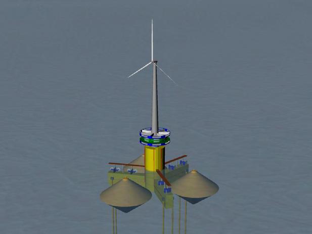
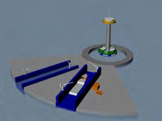
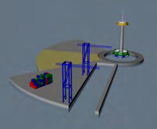
22 Modular approach PROGRESS
23 PROGRESS Modular approach - Artistic representation

")
24 PROGRESS Modular approach The TEAL (Transport, Energy, Aquaculture and Leisure) Components Leisure


25 PROGRESS Modular Approach - The Example of the Canary Islands Transport - Existing Port Infrastructures


26 PROGRESS Modular Approach - The Example of the Canary Islands Energy - Local mix of resources - Example of Annual Average Wind Speed


27 PROGRESS Modular Approach - The Example of the Canary Islands Aquaculture - Local market and several studies carried out


28 PROGRESS Modular Approach - The Example of the Canary Islands Leisure - Local economy mainly based on tourism


29 PROGRESS Modular Approach - The Example of the Canary Islands 4 possible locations have been defined as an initial draft Aquaculture 4 Gran Canaria island 1 Transport 3 Leisure 2 Energy

30 GIS Decision Tool PROGRESS


31 PROGRESS GIS Decision Tool First approach providing the Gebco 0.8 bathymetry Canary Islands Greece Taiwan

32 PROGRESS Crete (Greece)


33 PROGRESS Taiwan Penghu Archipelagos 50x50 Km Green Island 50x50 Km LiuChiuYu 50x50 Km

34 PROGRESS Definition of extreme concepts The Leisure Case

35 PROGRESS Definition of extreme concepts The Industrial Case

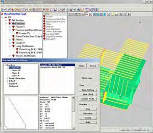
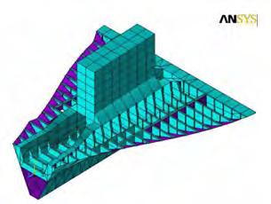

36 PROGRESS Modular Approach Technological aspects Technologies being defined at the moment
37 CONCLUSIONS The TROPOS Project will deliver 3 offshore platform designs defined by regions: Mediterranean Greece Tropical Taiwan Subtropical Canary Islands The TROPOS Project will show different sectors working together in an offshore platform: Transport Energy Aquaculture Leisure


38 INTRODUCTION Here we are INTRODUCTION Here we are THANK
Mediterranean Sea and Territorial Development, Opportunities and Risks
 EESC Hearing Towards an EU Macro-Regional Strategy for the Mediterranean Mediterranean Sea and Territorial Development, Opportunities and Risks Michaela Gensheimer Structure of Intervention Part I: What
Aquaculture Spatial Planning: The case of Greece
 Aquaculture Spatial Planning: The case of Greece Nikos Anagnopoulos Panhellenic Association for Small-Medium sized Aquaculture Enterprises Panhellenic Association for Small-Medium sized Aquaculture Enterprises
EA SEA-WAY Project. 7 th Coordination Meeting. WP5 Development of sustainable passenger transport models for the Adriatic basin and capacity building
 EA SEA-WAY Project 7 th Coordination Meeting WP5 Development of sustainable passenger transport models for the Adriatic basin and capacity building 3 rd Cross Border Board Ravenna, January 26, 2016 The
Entrepreneurship on islands and other peripheral regions. Specific Contract No 6511 implementing Framework contract No CDR/DE/16/2015/
 Entrepreneurship on islands and other peripheral regions Specific Contract No 6511 implementing Framework contract No CDR/DE/16/2015/ Aims of this study: To analyse the particular challenges and obstacles
SPLAN-Natura Towards an integrated spatial planning approach for Natura th January, 2017 Brussels. Commissioned by DG Environment
 SPLAN-Natura 2000 Towards an integrated spatial planning approach for Natura 2000 Commissioned by DG Environment 17 th January, 2017 Brussels V. Simeonova (Ph.D.) Drivers towards integrating Biodiversity
Central Baltic Programme
 Central Baltic Programme 2014-2020 About the Central Baltic Programme 2014-2020 Builds on the Central Baltic INTERREG IV A Programme 2007-2013 Cross-border cooperation projects in the central Baltic Sea
Seabed knowledge In support of UN SDGs
 Seabed knowledge In support of UN SDGs Evert Flier Fiskerifaglig forum 2. november 2017 Hydrography & small scale fishing Hydrography in Transition Serving the Maritime Community Hydrography in Transition
EUSAIR on sea topics from Slovenian perspective
 MINISTRY OF FOREIGN AFFAIRS REPUBLIC OF SLOVENIA EUSAIR on sea topics from Slovenian perspective Mag. Andreja Jerina National Coordinator 4 EU MRS: 270 millions of population 19 MS 12 non MS Sea basin
Publishable Summary. Summary Description of the project context and main objectives
 Publishable Summary Summary Description of the project context and main objectives Tsunamis are low frequency but high impact natural disasters. In 2004, the Boxing Day tsunami killed hundreds of thousands
Oceans in transition
 Oceans governance Oceans in transition OECD: Ocean industry value-added projected to double by 2030 from ~USD 1.5 to 3.0 trillion However, meeting anticipated demand for ocean space and resources will
Introduction to IMP: need and added value
 Introduction to IMP: need and added value Christophe Le Visage Consultant Stratégies Mer et Littoral 1 Summary IMP : Why? The case for integration 1 What is IMP? 2 Content, process IMP: Added Value 3 2
How to integrate maritime cultural heritage into maritime spatial planning?
 2ND SUBMARINER Conference #BetterOff Blue17 Creating synergies for a biobased society How to integrate maritime cultural heritage into maritime spatial planning? Susanne Altvater, s.pro 28.09.2017 #BetterOffBlue17
Marine Spatial Planning: A Tool for Implementing Ecosystem-Based Management
 Marine Spatial Planning: A Tool for Implementing Ecosystem-Based Management Steven Murawski, Ph.D., Ecosystem Goal Team Lead National Oceanic and Atmospheric Administration NOAA November 16, 2009 1 To
MODELS AND TOOLS FOR GOVERNANCE OF
 Working Papers Collection No. 1/2015 MODELS AND TOOLS FOR GOVERNANCE OF THE ADRIATIC AND IONIAN SEAS www.unimc.it/maremap NATIONAL POLITICS AND EU POLITICS: THE MARITIME SPATIAL PLANNING AND INTEGRATED
Oman NSDI Business Values and Future Directions. Hassan Alawi Alghazali Acting Director General National Spatial Data Infrastructure
 Oman NSDI Business Values and Future Directions Hassan Alawi Alghazali Acting Director General National Spatial Data Infrastructure Presentation Outline Geospatial Maturity Current Challenges NCSI s Role
National Perspectives - Portugal. Margarida Almodovar
 National Perspectives - Portugal Margarida Almodovar margarida.almodovar@mam.gov.pt from base line to the external limit of the continental shelf behind 200 miles and according to UNCLOS definitions Economic
Marine/Maritime Spatial Planning Andrej Abramić
 Marine/Maritime Spatial Planning Andrej Abramić EcoAqua SUMMER SCHOOL: Ecosystem approach to aquaculture 26-29th of October 2015 Research and Technology to enhance excellence in Aquaculture development
BOSNIA AND HERZEGOVINA
 Studies to support the development of sea basin cooperation in the Mediterranean, Adriatic and Ionian, and Black Sea CONTRACT NUMBER MARE/2012/07 - REF. NO 2 REPORT 1 - ANNEX 2.2 COUNTRY FICHE - ANNEX
The GMES/MyOcean Marine Service and its applications
 The GMES/MyOcean Marine Service and its applications P.Y. Le Traon (Ifremer) P. Bahurel (Mercator Ocean) First BreTel Workshop May 31st, 2012 - St Malo Outline The GMES Marine Service and MyOcean What
Benefits of Spatial Collaboration in Arctic Research Project Using ArcGIS Online
 Benefits of Spatial Collaboration in Arctic Research Project Using ArcGIS Online Dr. Nataliya Marchenko Prof. Aleksey Marchenko The University Centre in Svalbard, Longyearbyen, Norway Arctic Technology
Earth Observation and GEOSS in Horizon Copernicus for Raw Material Workshop 5 th September 2016
 Earth Observation and GEOSS in Horizon 2020 Copernicus for Raw Material Workshop 5 th September 2016 Gilles OLLIER Head of Sector -Earth observation Directorate Environment Unit I.4 Climate Actions and
European Maritime Day conference 21 May Hon Karmenu Vella, Minister for Tourism welcome speech
 European Maritime Day conference 21 May 2013 Hon Karmenu Vella, Minister for Tourism welcome speech Commissioner Damanaki, Ministers, Distinguished speakers, Ladies and Gentlemen On behalf of Malta, I
CONFERENCE STATEMENT
 CONFERENCE STATEMENT We, the elected representatives from Canada, Denmark/Greenland, Finland, Iceland, Norway, Russia, Sweden and the United States of America; In collaboration with the indigenous peoples
MARITIME SPATIAL PLANNING FOR SUSTAINABLE BLUE ECONOMIES
 MARITIME SPATIAL PLANNING FOR SUSTAINABLE BLUE ECONOMIES Content of newsletter Alternative scenarios for Blue Growth (p. 4) Map based platform to help communication (p. 5) Booklets of marine nature and
Marine Spatial Planning Leslie-Ann McGee Battelle Memorial Institute
 Marine Spatial Planning Leslie-Ann McGee Battelle Memorial Institute Rev061708 1 Marine Spatial Planning What is it? Why is it different? Where is it currently being employed? What is happening in the
The Socio Economic Development of the Marine Sector in the Atlantic Area. Stephen Hynes
 The Socio Economic Development of the Marine Sector in the Atlantic Area Stephen Hynes Overview SEMRU and its role in Marine Socioeconomic analysis Defining Ocean and Coastal Economies in the Atlantic
The ESPON Programme. Goals Main Results Future
 The ESPON Programme Goals Main Results Future Structure 1. Goals Objectives and expectations Participation, organisation and networking Themes addressed in the applied research undertaken in ESPON projects
Geographical Information Systems Energy Database Report. WP1 T1.3- Deliverable 1.9
 Geographical Information Systems Energy Database Report WP1 T1.3- Deliverable 1.9 March 2015 1 314164 (ENER/FP7/314164) Project acronym: InSMART Project full title: Integrative Smart City Planning Coordination
Implementation of the Political Declaration on energy cooperation between the North Seas Countries. Support Group 1 on Maritime Spatial Planning
 Implementation of the Political Declaration on energy cooperation between the North Seas Countries Support Group 1 on Maritime Spatial Planning Work Programme 1. Work area as outlined in Annex I to the
VULNERABILITY ASSESSMENT OF EASTERN CRETAN BEACHES (GREECE) TO SEA LEVEL RISE
 TO SEA LEVEL RISE") VULNERABILITY ASSESSMENT OF EASTERN CRETAN BEACHES (GREECE) TO SEA LEVEL RISE I.N. Monioudi, A. Karditsa, G. Alexandrakis, S.E. Poulos, A.F. Velegrakis, O.P. Andreadis, G. Ghionis, S. Petrakis2, D. Sifnioti,
VULNERABILITY ASSESSMENT OF EASTERN CRETAN BEACHES (GREECE) TO SEA LEVEL RISE I.N. Monioudi, A. Karditsa, G. Alexandrakis, S.E. Poulos, A.F. Velegrakis, O.P. Andreadis, G. Ghionis, S. Petrakis2, D. Sifnioti,
Options in Capacity Building. Underpinning the Blue Economy. Slide 1/78. Derrick R. Peyton. 14 th MACHC Meeting. IIC Technologies. December 9-13, 2013
 Options in Capacity Building Underpinning the Blue Economy Derrick R. Peyton IIC Technologies 14 th MACHC Meeting December 9-13, 2013 Slide 1/78 Overview Blue Economy Defined Challenges (SDI, MSDI, Standards)
PURR: POTENTIAL OF RURAL REGIONS UK ESPON WORKSHOP Newcastle 23 rd November Neil Adams
 PURR: POTENTIAL OF RURAL REGIONS UK ESPON WORKSHOP Newcastle 23 rd November 2012 Neil Adams PURR: Potential of Rural Regions Introduction Context for the project A spectrum of knowledge Rural Potentials
SUBJECT: Non paper on the size, nature and dynamics of the blue economy, 15 September 2015, prepared by DG MARE
 SUBJECT: Non paper on the size, nature and dynamics of the blue economy, 15 September 2015, prepared by DG MARE Comments Directorate-General for Maritime Policy (DGPM) and Statistics Portugal (INE) 24
Blue Growth: The Adriatic and Ionian Region
 Blue Growth: The Adriatic and Ionian Region Maritime Clusters: types of support and areas for cooperation AQUAE VENICE 2015 EXPO Matteo Bocci, Ecorys Venice, 28 th September 2015 Structure of this intervention
Economic Development and Transport in New Zealand. Thomas Simonson 4/7/2016
 Economic Development and Transport in New Zealand Thomas Simonson 4/7/2016 Definitions > Economics is about people and communities, and the skills, equipment and resources they acquire to pursue their
Country Fiche Estonia
 Country Fiche Estonia Deleted: October Updated May 2018 Deleted: 7 1. General information Size of internal waters (to the baseline) and territorial sea (12-nm zone from the baseline) approximately 25 200
Country Fiche Estonia
 Country Fiche Estonia Updated October 2017 1. General information Size of internal waters (to the baseline) and territorial sea (12-nm zone from the baseline) approximately 25 200 km 2. Exclusive economic
ALASKA DEEP-DRAFT ARCTIC PORT EVALUATION
 ALASKA DEEP-DRAFT ARCTIC PORT EVALUATION Joint Study of Federal and State June 20, 2012 Opportunity and Constraint Warming of Arctic region is leading to new maritime opportunities. Thawing of permafrost
Shorelines: The Coastal Atlas of Ireland
 Shorelines: The Coastal Atlas of Ireland Dr Maxim Kozachenko, Department of Geography and the Coastal & Marine Research Centre, University College Cork INFOMAR Seminar 22 October 2014 Ireland is an island
E x a m p l e s o f t o o l s f o r s e a s i t u a t i o n a l a w a r e n e s s u s i n g C M E M S d a t a. Copernicus EU
 E x a m p l e s o f t o o l s f o r s e a s i t u a t i o n a l a w a r e n e s s u s i n g C M E M S d a t a Copernicus EU Copernicus EU Copernicus EU www.copernicus.eu S e a S i t u a t i o n a l A w
The World Bank Senegal Tourism and Enterprise Development Project (P146469)
") Public Disclosure Authorized AFRICA Senegal Trade & Competitiveness Global Practice IBRD/IDA Investment Project Financing FY 2017 Seq No: 1 ARCHIVED on 03-Nov-2017 ISR29333 Implementing Agencies: Republic
Public Disclosure Authorized AFRICA Senegal Trade & Competitiveness Global Practice IBRD/IDA Investment Project Financing FY 2017 Seq No: 1 ARCHIVED on 03-Nov-2017 ISR29333 Implementing Agencies: Republic
Economic Benefit Study on Value of Spatial Information Australian Experience
 Economic Benefit Study on Value of Spatial Information Australian Experience Dr Zaffar Sadiq Mohamed-Ghouse Director, International Relations Cooperative Research Centre for Spatial Information zsadiq@crcsi.com.au
Key Indicators for Territorial Cohesion & Spatial Planning Stakeholder Workshop - Project Update. 13 th December 2012 San Sebastián, Basque Country
 Key Indicators for Territorial Cohesion & Spatial Planning Stakeholder Workshop - Project Update 13 th December 2012 San Sebastián, Basque Country Key Aims Explore the use of territorial data in developing
Marine Base Maps in Coastal Norway: A Case for Developing Sustainable Blue Growth in Coastal Communities
 Marine Base Maps in Coastal Norway: A Case for Developing Sustainable Blue Growth in Coastal Communities Minika Ekanem Project Manager IMDIS 2018 The Norwegian Coastal Areas 422 municipalities in Norway
BURGAS CASE STUDY: LAND-SEA INTERACTIONS. Dr. Margarita Stancheva
 BURGAS CASE STUDY: LAND-SEA INTERACTIONS Dr. Margarita Stancheva Name of presentation NEED FOR COHERENCE BETWEEN LAND AND SEA ACTIVITIES Name presenter Burgas is the fourth largest city in Bulgaria and
Applied Geoscience and Technology Division SOPAC. Joy Papao, Risk Information Systems Officer
 Joy Papao, Risk Information Systems Officer Secretariat of the Pacific Community SPC 22 Pacific Island States Head office in Noumea, New Caledonia 2 Regional offices (Pohnpei and Honiara) 600 staff 9 Technical
Climate Change Impacts, Adaptation and Vulnerability: Small Islands - South West Pacific
 Climate Change Impacts, Adaptation and Vulnerability: Small Islands - South West Pacific Penehuro F. Lefale Lead Author (LA), Chapter 16 Manager, International Cooperation & Development NZ Meteorological
Marine Spatial Planning as an important tool for implementing the MSFD
 Marine Spatial Planning as an important tool for implementing the MSFD Risto Kalliola Tallinn, Nov. 16 th 2012 DEPARTMENT OF GEOGRAPHY AND GEOLOGY University of Turku, Finland Ten principles to provide
This course is held at Nova University of Lisbon for 2nd and 3rd degrees (Master and Ph.D.). It has has 64 hours in class; as each class has duration
. It has has 64 hours in class; as each class has duration") COURSE: EU Maritime Economy and Blue Growth Lecturer: Prof. Regina Salvador (Chair Holder) This course is held at Nova University of Lisbon for 2nd and 3rd degrees (Master and Ph.D.). It has has 64 hours
COURSE: EU Maritime Economy and Blue Growth Lecturer: Prof. Regina Salvador (Chair Holder) This course is held at Nova University of Lisbon for 2nd and 3rd degrees (Master and Ph.D.). It has has 64 hours
EU HOs in Mediterranean and Black Sea (MBS) CROATIA FRANCE GREECE ITALY MALTA X SLOVENIA X SPAIN ROMANIA X
 CROATIA FRANCE GREECE ITALY MALTA X SLOVENIA X SPAIN ROMANIA X") EU HOs in Mediterranean and Black Sea (MBS) CROATIA FRANCE GREECE ITALY MALTA X SLOVENIA X SPAIN ROMANIA X Croatia Current status of hydrographic survey in acc. IHO C-55 pub. criteria Croatia Croatia by
EU HOs in Mediterranean and Black Sea (MBS) CROATIA FRANCE GREECE ITALY MALTA X SLOVENIA X SPAIN ROMANIA X Croatia Current status of hydrographic survey in acc. IHO C-55 pub. criteria Croatia Croatia by
Copernicus Academy. Roles and responsibilities of the Copernicus Academy. user uptake. Focus Data uptake, capacity building and skills development
 Copernicus Academy user uptake Roles and responsibilities of the Copernicus Academy The European Commission has launched two Networks, the Copernicus Relays and the Copernicus Academy, to contribute on
NORTH VANCOUVER ISLAND MARINE PLAN: OVERVIEW 2015
 NORTH VANCOUVER ISLAND MARINE PLAN: OVERVIEW 2015 North Vancouver Island Marine Plan Overview Refers to: Marine Planning Partnership Initiative. 2015. North Vancouver Island Marine Plan. Copyright 2015
1 st Six Weeks # of Days. Unit # and Title Unit 1 Geography Overview
 1 st Six Weeks # of Days Unit # and Title Unit 1 Geography Overview Orange Grove ISD Instructional Planning Information and Process Standards The Process Standards Must Be Included in Each Unit # of Class
Paul Bridge Meteorologist Vaisala/UKMO Work Groups/Committees: WMO/TRB/AMS
 Paul Bridge Meteorologist Vaisala/UKMO Work Groups/Committees: WMO/TRB/AMS Introduction (a) Identify and establish, if possible, inventories of transport networks in the ECE region which are vulnerable
Maritime Spatial Planning: Transboundary Cooperation in the Celtic Seas Looking Ahead
 Maritime Spatial Planning: Transboundary Cooperation in the Celtic Seas Looking Ahead Looking ahead MSP in the context of the European Maritime and Fisheries Fund (EMFF) and beyond SIMCelt Final Conference
Digital Development of Territories. Pedro Leite Member of the Board of Directors
 Digital Development of Territories Pedro Leite Member of the Board of Directors Digital Development of Territories Pedro Leite Member of the Board of Directors Azores Archipelago 9 islands located in the
Copernicus the EU's Earth Observation Programme
 Copernicus the EU's Earth Observation Programme Cristina Ananasso Copernicus Unit I2 DG GROW Status Overview, Nov 2016 Horizon 2020 Info Day - Rome Follow us on: Copernicus EU CopernicusEU www.copernicus.eu
Network of European Regions Using Space Technologies
 NEREUS Network of European Regions Using Space Technologies Core mission NEREUS WHAT IS SPACE ABOUT??? Spreading use of space technologies at regional level Stimulating the development of space applications
MR. George ALEXAKIS, parallel session 3. "Mediterranean Sea Region. laying the conditions. for sustainable growth and jobs"
 parallel session 3 "Mediterranean Sea Region laying the conditions for sustainable growth and jobs" MR. George ALEXAKIS, elected Regional Councillor of Crete, Greece and representative of Crete in CRPM.
ADRIPLAN: an EU funded pilot project on MSP in the Adriatic Ionian Region Pierpaolo Campostrini CORILA and CNR-ISMAR
 ADRIPLAN: an EU funded pilot project on MSP in the Adriatic Ionian Region Pierpaolo Campostrini CORILA and CNR-ISMAR ADRiatic Ionian maritime spatial PLANning ADRIPLAN PROJECT ADRIPLAN has the objective
Ocean planning as a tool for blue growth and smart specialization - Frederico Cardigos -
 Luís Quinta Ocean planning as a tool for blue growth and smart specialization - Frederico Cardigos - European Maritime Day, 20 of May Marine and Maritime Innovation in the Outermost Regions: blue growth
NOAA Surface Weather Program
 NOAA Surface Weather Program Maintenance Decision Support System Stakeholder Meeting #9 Jim O Sullivan NOAA Surface Weather Program Manager NWS Office of Climate, Water, and Weather Services September
Opening their Shells Getting commercial clammers involved in marine spatial planning
 Opening their Shells Getting commercial clammers involved in marine spatial planning Ed Lewandowski Coastal Communities Development Specialist University of Delaware/Delaware Sea Grant Highlights Background
Temporal and Spatial Distribution of Tourism Climate Comfort in Isfahan Province
 2011 2nd International Conference on Business, Economics and Tourism Management IPEDR vol.24 (2011) (2011) IACSIT Press, Singapore Temporal and Spatial Distribution of Tourism Climate Comfort in Isfahan
Voices from Private Sector: Insights for Future NSDI Development in Indonesia
 Voices from Private Sector: Insights for Future NSDI Development in Indonesia Ta n d a n g Yu l i a d i D w i P u t ra, Ryosuke S h i b a s a k i I n st i t u t e o f I n d u st r i a l S c i e n c e,
UN-GGIM: Strengthening Geospatial Capability
 Fifth Plenary Meeting of UN-GGIM: Europe Brussels, 6-7 June 2018 UN-GGIM: Strengthening Geospatial Capability Walking the talk to leave no one behind Greg Scott, UN-GGIM Secretariat Environmental Statistics
China-ASEAN Advanced Academy on Oceans Law and Governance 7-16 November 2016, NISCSS, Haikou
 China-ASEAN Advanced Academy on Oceans Law and Governance 7-16 November 2016, NISCSS, Haikou Topics to cover Why ocean? The importance of the oceans Why ocean governance? Key concerns affecting the oceans
The Platform Generation. Derek Law and Ebony Wicks
 The Platform Generation Derek Law and Ebony Wicks GIS Provides the Framework and Process For Applying Geography Analysis and Interpretation Design and Planning Creating Understanding Modeling and Predicting
MARINE SPATIAL PLANNING
 MARINE SPATIAL PLANNING Washington Uses Spatial Planning to Honor its Pacific Coast and Offshore Waters Past, Present and Future The Washington State Pacific Coast and offshore waters are diverse in both
Marine Spatial Planning in the Baltic Sea Region
 Marine Spatial Planning in the Baltic Sea Region Towards coherence and cross-border solutions in Baltic Maritime Spatial Plans Coordinator & Project manager Dr Ingela Isaksson Swedish Agency for Marine
The North Atlantic Oscillation: Climatic Significance and Environmental Impact
 1 The North Atlantic Oscillation: Climatic Significance and Environmental Impact James W. Hurrell National Center for Atmospheric Research Climate and Global Dynamics Division, Climate Analysis Section
HF radarcontribution to South Africa Blue Economy
 HF radarcontribution to South Africa Blue Economy Anton G Kjelaas1, Andres Alonso- Martirena2, Chad Whelan3 South Africa- Norway Science Week 2016 Oct 31- Nov 4 2016 1 2 3 BLUE ECONOMY Sustainable use
CX Debate Topic Analysis
 CX Debate Topic Analysis Larry McCarty lmac916@gmail.com or larry.mc@excite.com Resolved: The United States federal government should substantially increase its nonmilitary exploration and/or development
NREL, Intro to GIS for Wind Energy Siting for IGERT Wind NSF
 NREL, 2010 Intro to GIS for Wind Energy Siting for IGERT Wind NSF Challenge: How to encourage offshore wind in the US while managing ecological responsibility and ocean use conflicts? Introduction NREL,
Introduction to EMODnet
 Introduction to EMODnet Antonio Novellino Torino, 14-15 Ottobre 2015 What is EMODnet? Initiated by the European Commission in response to the EU Future Maritime Policy and Blue Growth, launched in June
Major human activities affecting Norwegian coastal marine ecosystems; present status and challenges
 Major human activities affecting Norwegian coastal marine ecosystems; present status and challenges Erlend Moksness PICES Annual Meeting - Science Board Symposium 26. October 2009, Jeju, Korea FUTURE:
GEBCO 2013 TSCOM. EMODNET Hydrography status report
 www.emodnet-hydrography.eu GEBCO 2013 TSCOM EMODNET Hydrography status report Eric Moussat, Ifremer on behalf of the Emodnet consortium 1 Background and objectives EU proposed to take steps in 2008 towards
Land Use in the context of sustainable, smart and inclusive growth
 Land Use in the context of sustainable, smart and inclusive growth François Salgé Ministry of sustainable development France facilitator EUROGI vice president AFIGéO board member 1 Introduction e-content+
- West Africa. Abuja, Nigeria May Fredericton Canada Heeswijk The Netherlands Washington DC United States Adelaide Australia
 A Case Study in Land and Sea Data Interoperability Patricia GASPAR(Netherlands), Andrew HOGGARTH(Canade), Gordon JOHNSTON(UK), Charles de JONG(Netherlands) - West Africa Abuja, Nigeria - 6-10 May 2013
Zoning for the Seychelles Marine Spatial Planning Intiative: process, types, and tools
 Zoning for the Seychelles Marine Spatial Planning Intiative: process, types, and tools To: MSP Technical Working Group From: MSP Technical Team Date: 4 July 2014 Table of Contents 1. Introduction and context...
Briefing. H.E. Mr. Gyan Chandra Acharya
 Briefing by H.E. Mr. Gyan Chandra Acharya Under-Secretary-General and High Representative for the Least Developed Countries, Landlocked Developing Countries and Small Island Developing States Briefing
MECANISMS FOR PRODUCTION AND DISSEMINATION OF WEATHER WARNING IN COMOROS. By MOHAMED Hamid NATIONAL METEOROLOGICAL SERVICE IN COMOROS
 MECANISMS FOR PRODUCTION AND DISSEMINATION OF WEATHER WARNING IN COMOROS By MOHAMED Hamid NATIONAL METEOROLOGICAL SERVICE IN COMOROS PRETORIA, SOUTH AFRICA, 18 22 Novembre 2013 The Comoros Islands are
EMODnet High Resolution Seabed Mapping - further developing and providing a high resolution digital bathymetry for European seas
 EMODnet High Resolution Seabed Mapping - further developing and providing a high resolution digital bathymetry for European seas EGU Fall 2017 meeting New Orleans USA, December 2017 Schaap Dick MARIS,
A Walk through TRIDEC s intermediate Tsunami Early Warning System
 Collaborative, Complex and Critical Decision-Support in Evolving Crisis A Walk through TRIDEC s intermediate Tsunami Early Warning System M. Hammitzsch, S. Reißland, and M. Lendholt EGU General Assembly,
Putting the U.S. Geospatial Services Industry On the Map
 Putting the U.S. Geospatial Services Industry On the Map December 2012 Definition of geospatial services and the focus of this economic study Geospatial services Geospatial services industry Allow consumers,
Climate Classification Chapter 7
 Climate Classification Chapter 7 Climate Systems Earth is extremely diverse No two places exactly the same Similarities between places allow grouping into regions Climates influence ecosystems Why do we
APPLICATION OF GIS FOR ASSESSING PRAWN FARM DEVELOPMENT IN TULLY-CARDWELL, NORTH QUEENSLAND. Zainul Hidayah
 APPLICATION OF GIS FOR ASSESSING PRAWN FARM DEVELOPMENT IN TULLY-CARDWELL, NORTH QUEENSLAND Zainul Hidayah Department of Marine Science and Technology Trunojoyo University Jl. Raya Telang No 2 Kamal Bangkalan
ADRIPLAN: a Pilot Project on MSP implementation in the AdriaticIonian Region
 The Eleventh International Training Workshop Integrated Maritime Strategy and Marine Spatial Planning in the Mediterranean & the Black Sea Dalyan, Turkey 20 Sept 2016 ADRIPLAN: a Pilot Project on MSP implementation
Newsletter # 2. Pilot sites in Greece. December 2018
 A HarmonizEd framework to Mitigate coastal EroSion promoting ICZM protocol implementation Newsletter # 2 December 2018 View of a beach in Ammolofi ( Paggaio Municipality ) Pilot sites in Greece 1. Name
BRINGING MARINE DATA ASSETS TO THE FUTURE INTERNET
 ENVIROfying the Future Internet BRINGING MARINE DATA ASSETS TO THE FUTURE INTERNET Leveraging the Future Internet for the Marine Usage Area Dr.Conor Delaney Galway Bay Smart Bay - Ireland MARINE SCENARIOS
BY: Daniel Kwame Ladzagla (Bsc Eng.,Msc I.T) The Energy Centre, KNUST-Kumasi. July 27 Dakar, Senegal
 The Energy Centre, KNUST-Kumasi. July 27 Dakar, Senegal") 1 BY: Daniel Kwame Ladzagla (Bsc Eng.,Msc I.T) The Energy Centre, KNUST-Kumasi July 27 2016 @ Dakar, Senegal Presentation Outline 2 The Energy Center Work Package(WP) WP Implementation IntiGIS Model Methodology
1 BY: Daniel Kwame Ladzagla (Bsc Eng.,Msc I.T) The Energy Centre, KNUST-Kumasi July 27 2016 @ Dakar, Senegal Presentation Outline 2 The Energy Center Work Package(WP) WP Implementation IntiGIS Model Methodology
Integrated Strategies in regional development
 Inspire policy making by territorial evidence ESPON Seminar Territories Acting for Economic Growth: Using territorial evidence to meet challenges towards 2020 Integrated Strategies in regional development
REQUEST FOR PROPOSALS
 GRANDE CACHE REGIONAL DINOSAUR TRACKS FOUNDATION REQUEST FOR PROPOSALS Grande Cache Regional Dinosaur Tracks Feasibility Study Box 300 Grande Cache, AB. T0E 0Y0 INTRODUCTION AND SUMMARY The ( Foundation
Ensuring Access to Marine Areas for Offshore Oil and Gas
 Ensuring Access to Marine Areas for Offshore Oil and Gas Paul Holthus Executive Director World Ocean Council paul.holthus@oceancouncil.org The international business alliance for Corporate Ocean Responsibility
Marine Spatial Planning in Hellas; Recent Facts and Perspectives
 XXV FIG CONGRESS Engaging the Challenges, Enhancing the Relevance Kuala Lumpur, Malaysia 16 21 June 2014 Marine Spatial Planning in Hellas; Recent Facts and Perspectives Mrs. Chaiditsa BOLANOU Surveying
Spatial Data Infrastructure in the Pacific
 Spatial Data Infrastructure in the Pacific. Sachindra Singh Senior Geospatial Systems Architect ICT for Development, Geoscience Division Pacific Community (SPC) OrganisationalBackground SPC - The Pacific
Mermaid. The most sophisticated marine operations planning software available.
 Mermaid The most sophisticated marine operations planning software available. Mojo Maritime / Marine economic risk management aid Mermaid : marine economic risk management aid The most sophisticated marine
The inland water related tourism in South Africa by 2030 in the light of global change
 The inland water related tourism in South Africa by 2030 in the light of global change KSA 2 Water-Linked Ecosystems T4: Green economy and sustainable (green) innovations K5/2620 How can natural capital
Spatial Data Availability Energizes Florida s Citizens
 NASCIO 2016 Recognition Awards Nomination Spatial Data Availability Energizes Florida s Citizens State of Florida Agency for State Technology & Department of Environmental Protection Category: ICT Innovations