and Geoinformation Science
|
|
|
- Solomon Stone
- 6 years ago
- Views:
Transcription
1 Welcome to the Department of Geodesy Department of Geodesy Deputy Managing Director Department of Geodesy Technische Universität

2 , Germany Germany s Capital and seat of government and largest city Population: 3.4 million people from 180 different countries Student population: around 130,000 young people 3 universities, 7 polytechnic colleges, 4 colleges of arts, more than 60 non-university research institutions Humboldt Universität zu Technische Universität Freie Universität hu/lage/hu-lage.png 2
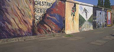
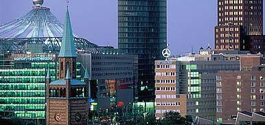


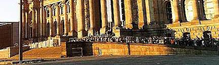

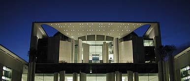


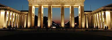
3 Eastside-Gallery Potsdamer Platz Reichstag Gendarmen Market Charlottenburg Castle Brandenburg Gate Memorial Church Federal Chancellery 3


4 200 Years of Tradition Founding of the predecessors of the TU : Mining Academy, Building Academy, Vocational Academy 1879 Unification into Royal Technical College of Closure of the Technical College of and reestablishment under the new name: Technische Universität 1950 Establishment of the Faculty for Humanities 2001 Concentration of teaching and research into 8 faculties 2006 Aggregation of those 8 faculties into 7 4
 radiotelegraphy Georg Schlesinger(1874 1949) machine tool design and factory management Hermann Föttinger(1877 1945) Georg Schlesinger")
 Konrad Zuse (1910 1996) first freely programmable computing machine Gerhard Ertl (1936 - ) chemical processes on hard surfaces (Nobel Prize in 2007) Konrad")
5 Great personalities and famous inventors Adolf Miethe ( ) three-colour photography, rotogravure printing, flashlight Alois Riedler ( ) motor vehicle construction Adolf Slaby ( ) radiotelegraphy Georg Schlesinger( ) machine tool design and factory management Hermann Föttinger( ) Georg Schlesinger fully-automatic gear box Hans Geiger ( ) measurement instrument for detecting ionizing radiation, Geiger Counter Ernst Ruska ( ) electron microscope (Nobel Prize in 1986) Konrad Zuse ( ) first freely programmable computing machine Gerhard Ertl ( ) chemical processes on hard surfaces (Nobel Prize in 2007) Konrad Zuse 5
6 General Statistics Summer 2012 Winter 2011 TU Number of Students abs. % abs. % , ,0 Foreign Students , ,3 Male , ,8 Female , ,2 Freshman 867 2, ,7 Regular Externally funded Professors Research Associates Technical and Administrative Staff as of May/June
7 The Administration President Head of the University internal and external representation Prof. Dr. Jörg Steinbach Vice-Presidents Three Vice-Presidents, each with an individual range of duties Chancellor Administration and budget planning 7 Schools / Faculties I II III IV V VI VII 7
8 Planning - Building - Environment Dean: Prof. Dr. Johann Köppel 8 Departments / Institutes: Applied Geoscience Architecture Civil Engineering Geodesy Landscape Architecture and Environmental Planning Ecology Sociology Urban and Regional Planning 8


9 Department of Geodesy EGA Geodesy and Adjustment Theory GIS Geoinformation Technology SGN Planetary Geodesy SGN Space Geodesy SGN Precision Navigation and Positioning SGN Physical Geodesy Prof. Dr. Frank Neitzel M.Sc. Claus Nagel Prof. Dr. Jürgen Oberst Prof. Dr. Harald Schuh Prof. Dr. Roman Galas Prof. Dr. Frank Flechtner 9


10 Sph here of Observati on Sphere of Influen nce Sphere of Design Planetary Geodesy Prof. Dr. Oberst Satellite Geodesy Prof. Dr. Schuh Physical Geodesy Prof. Dr. Flechtner Precision Navigation & Positioning i Prof. Dr. Galas Geodesy & Adjustment Theory Prof. Dr. Neitzel Geoinfo ormation Technol ogy M. Sc. Nagel 10


11 Department e t of Geodesy and Geoinformation o o Science ce maintains close relationships with German Aerospace Center (DLR) GeoForschungsZentrum (GFZ) Potsdam Research Alliance in / Brandenburg The students greatly benefit from the relationships 11


12 Activities of the Department - Education M.Sc. Geodesy International Program English as Language of Instruction Four Terms with an Total Amount of 120 ECTS Points No Tuition Fees 30 college places each year Mentoring Program 12
13 Curriculum 4 th Term 30 ECTS Points s Dissertation Specialized Subjects 2 nd / 3 rd Term 60 ECTS Points Geoinformation Technology Space Geodesy and Navigation Engineering Surveying and Estimation Theory Computer Vision and Remote Sensing Elective Section 1 st Term 30 ECTS Points Foundation Section 13
14 Foundation Section 1 st Semester: Choose Modules with a Volume of at least 30 ECTS Points (5 out of 6) FOU Geoinformation Technology (6) FOU Adjustment Calculation I (6) FOU Geo Databases (6) FOU Introduction to Satellite Geodesy (6) FOU CV1 Photogrammetric Computer Vision (6) FOU Geophysical Investigation (6) 14
15 Activities of the Department - Research Geoinformation Technology Topics: Geospatial Information Modeling Spatial Data Acquisition and Analysis Management of Geodata; Spatial Databases Visualisation of Geoinformation; Cartography, Multimedia Spatial Data Infrastructures 3D City Models and Digital Globes 15


16 Space Geodesy and Navigation Topics: Planetary Geodesy Satellite Geodesy Physical Geodesy Earth and Planetary Research Precision Navigation and Positioning Global Navigation Satellite Systems Calculations of Satellite Orbits Current and Future Trends in Navigation Space Geodesy and Navigation Data Communication and Signal Analysis of Global Navigation Systems 16


 Measurement- and")
17 Geodesy and Adjustment Theory Topics: Estimation Theory Engineering Surveying Geodetic Sensors Deformation Analysis Transformation of Geodetic Networks 3D Measurement Structural Health Monitoring (SHM) Measurement- and Model-based Structural Analysis (MeMoS) 17


18 Computer Vision and Remote Sensing Topics: Image Analysis Remote Sensing InSAR Hot Topics in Computer Vision Hot Topics in Image Analysis 18
19 Welcome to TU Deputy Managing Director Department of Geodesy Technische Universität
Basics of GIS reviewed
 Basics of GIS reviewed Martin Breunig Karlsruhe Institute of Technology martin.breunig@kit.edu GEODETIC INSTITUTE, DEPARTMENT OF CIVIL ENGINEERING, GEO AND ENVIRONMENTAL SCIENCES, CHAIR IN GEOINFORMATICS
GIScience - Activities. Geomatics Department. Humboldt University Berlin. Tobia Lakes Patrick Hostert
 Institute of Geography GIScience - Activities Geomatics Department Humboldt University Berlin Tobia Lakes Patrick Hostert GIScience Meeting, 2nd February 2007 Content Geomatics Department at the Humboldt
ECTS School of Rural and Surveying Engineering. 1 st SEMESTER Ι. Mandatory Courses A/A Code Courses Hours ECTS
 ECTS School of Rural and Surveying Engineering 1 st SEMESTER Ι. Mandatory Courses 1. 6209 Linear Algebra and Analytical 4 4,0 Geometry 2. 6210 Analysis 5 4,5 3. 6211 Introduction to Informatics 4 4,0 4.
Geomatics at HafenCity University Hamburg
 HCU HafenCity University Hamburg Geomatics at HafenCity University Hamburg Course information The broad spectrum that geomatics covers Geomatics is concerned with spatially orientated data, simply expressed
Geoinformation Science at TU Berlin
 Technische Universität Berlin Department of Geoinformation Science Geoinformation Science at TU Berlin Prof. Dr. Thomas H. Kolbe Institute for Geodesy and Geoinformation Science Berlin University of Technology
THE NEW CHALLENGES FOR THE HIGHER EDUCATION OF GEODESY IN UACEG SOFIA
 THE NEW CHALLENGES FOR THE HIGHER EDUCATION OF GEODESY IN UACEG SOFIA Ivan Kunchev University of Architecture, Civil Engineering and Geodesy, 1 Hristo Smirnenski Blvd., Sofia 1046, Bulgaria Abstract Report
Department of Information Technology and Electrical Engineering. Master of Science. Quantum Engineering
 Department of Information Technology and Electrical Engineering Master of Science Quantum Engineering Welcome The second quantum revolution The Master of Science in Quantum Engineering at ETH Zurich was
COURSE CONTENT for Computer Science & Engineering [CSE]
![COURSE CONTENT for Computer Science & Engineering [CSE]](/thumbs/92/110586049.jpg "COURSE CONTENT for Computer Science & Engineering [CSE]") COURSE CONTENT for Computer Science & Engineering [CSE] 1st Semester 1 HU 101 English Language & Communication 2 1 0 3 3 2 PH 101 Engineering Physics 3 1 0 4 4 3 M 101 Mathematics 3 1 0 4 4 4 ME 101 Mechanical
COURSE CONTENT for Computer Science & Engineering [CSE] 1st Semester 1 HU 101 English Language & Communication 2 1 0 3 3 2 PH 101 Engineering Physics 3 1 0 4 4 3 M 101 Mathematics 3 1 0 4 4 4 ME 101 Mechanical
Statement on. Usage of BoK at our institute
 BoK workshop AGILE 2012, Avignon Statement on Usage of BoK at our institute Wolfgang Reinhardt AGIS / Institut für Angewandte Informatik Universität der Bundeswehr München Wolfgang.Reinhardt@unibw.de www.agis.unibw.de
First International Conference on Smart Data and Smart Cities, 30 th UDMS September 7 9, 2016, University of Split, Croatia
 First International Conference on Smart Data and Smart Cities, 30 th UDMS September 7 9, 2016, University of Split, Croatia First International Conference on Smart Data and Smart Cities was held in Split,
Mississippi State University Student Credit Hour Production by Academic Year
 Agricultural & Biological Engineering Agricultural Economics Agricultural Info Science & Education Animal & Dairy Science BioChemistry & Molecular Biology Entomology & Plant Pathology Food, Nutrition &
The XXIV FIG International Congress April 2010, Sydney, Australia
 Impact of TEMPUS CARDS Project GIST- CroHE on the new MSc in Geoinformatics Curriculum and on the Implementation of Bologna Process at the Faculty of Geodesy, University of Zagreb, Croatia Damir Medak,
GIS = Geographic Information Systems;
 What is GIS GIS = Geographic Information Systems; What Information are we talking about? Information about anything that has a place (e.g. locations of features, address of people) on Earth s surface,
GEOGRAPHY (GE) Courses of Instruction
 Courses of Instruction") GEOGRAPHY (GE) GE 102. (3) World Regional Geography. The geographic method of inquiry is used to examine, describe, explain, and analyze the human and physical environments of the major regions of the
GEOGRAPHY (GE) GE 102. (3) World Regional Geography. The geographic method of inquiry is used to examine, describe, explain, and analyze the human and physical environments of the major regions of the
Informal Translation
 Informal Translation Examination regulations for the consecutive Master's program Geodetic Engineering in the Faculty of Agriculture at the University of Bonn On September 11, 2017 47th issue No. 25 September
CARTOGRAPHY in a Web World
 CARTOGRAPHY in a Web World SENSE Research Cluster XIII meeting: Concepts and tools for spatial data visualization BAREND KÖBBEN kobben@itc.nl b.j.kobben@utwente.nl Agenda Short introduction to ITC and
International Research Experience Program IREP. at Technische Universität Darmstadt, Germany
 International Research Experience Program IREP at Technische Universität Darmstadt, Germany Contents Welcome to TU Darmstadt The City of Darmstadt What is IREP? The Program Research opportunities Program
Techniques for Science Teachers: Using GIS in Science Classrooms.
 Techniques for Science Teachers: Using GIS in Science Classrooms. After ESRI, 2008 GIS A Geographic Information System A collection of computer hardware, software, and geographic data used together for
Faculty Demographics - Fall 2017 (Full-time, Professor to Instructor Rank, Inst'l and research)
") Faculty Demographics - Fall 2017 (Full-time, Professor to Instructor Rank, Inst'l and research) Faculty Demographics -- College of Agriculture Status Faculty Demographics -- College of Architecture, Planning
Faculty Demographics - Fall 2017 (Full-time, Professor to Instructor Rank, Inst'l and research) Faculty Demographics -- College of Agriculture Status Faculty Demographics -- College of Architecture, Planning
Graduate Education in Institute of Chemistry, Chinese Academy of Sciences
 At 2014 IUPAC World Polymer Congress (MACRO 2014) July 6-11, Chiang Mai, Thailand Graduate Education in Institute of Chemistry, Chinese Academy of Sciences Jiasong He Institute of Chemistry, Chinese Academy
Yrd. Doç. Dr. Saygın ABDİKAN Öğretim Yılı Güz Dönemi
 Yabancı Dil III (YDL285) Introduction to Geomatics Yrd. Doç. Dr. Saygın ABDİKAN 2017-2018 Öğretim Yılı Güz Dönemi 1 géomatique Geo (Earth) + informatics Geodesy + Geoinformatics Geomatics: The mathematics
2 nd EUROGI imagine Conference 2014 GI - Expertise Made in Europe 8 & 9 October 2014 in Berlin, Germany
 GEO-INFORMATION FOR JOB CREATION AND ECONOMIC GROWTH Conference block organised by the French Umbrella Association for Geospatial Information Moderator: Rapporteur: François Salgé AFIGéO Executive committee
KAZAN NATIONAL RESEARCH TECHNOLOGICAL UNIVERSITY
 KAZAN NATIONAL RESEARCH TECHNOLOGICAL UNIVERSITY Introduction & Collaboration Opportunities А. Belyakov, R. Ilyasov WWW.KNRTU.RU 26.1.12 26.1.12 26.1.12 XXVII WORLD UNIVERSIADE 2013 June 14, 1890 INTEGRATED
Programme Study Plan
 Faculty of Social and Life Sciences Programme Study Plan Geographic Information Systems Programme Code: Programme Title: TGLIT Engineering: Surveying Technology and Geographical IT Credits: 180 Programme
ICT Networking for Overcoming Technical and Social Barriers in Instrumental Analytical Chemistry Education
 ICT Networking for Overcoming Technical and Social Barriers in Instrumental Analytical Chemistry Education University of Nis City of Nis - History RECTORY BUILDING BANOVINA built in 1889 Location of Government
Technical Building Branches. Multidisciplinary Integration of Needs. Interdisciplinary Subject BUT
 Usage of a Multidisciplinary GIS Platform for the Design of Building Structures Dalibor Barton k, Ji í Bureš, Aleš Dráb, Miroslav Menšík Integration of Needs in Many Technical Building Branches Civil Engineering
Different Models of the Curriculum for the Higher Education of Surveying & Mapping in China
 Different Models of the Curriculum for the Higher Education of Surveying & Mapping in China NING Jinsheng, LIU Yanfang, LIU Yaolin, China P. R. Key words: curriculum, common foundation, distinguished feature
CAWa Central Asian Water. Training Course Geographical Information Systems in Hydrology
 CAWa Central Asian Water Training Course Geographical Information Systems in Hydrology 1 Place & Time Place to hold the workshop: Helmholtz Centre Potsdam GFZ German Research Center for Geosciences, Germany
PROFESSIONAL-CLERICAL RATIO REPORT
 PROFESSIONAL-CLERICAL RATIO REPORT UNIVERSITY OF HAWAI I FY 2005-06 University Budget Office University of Hawai i September 2006 File Reference: Management and Planning Support Folder, Courses Reports
GIScience in Urban Planning Education - Experience from University of Maryland
 GIScience in Urban Planning Education - Experience from University of Maryland February 3, 2007 University of Tokyo Qing Shen Professor of Urban Studies and Planning School of Architecture,
enny Mills chool of Civil ngineering & eosciences ewcastle University
 Future of Surveying: Educating the future geospatial expert A Newcastle University perspective enny Mills chool of Civil ngineering & eosciences ewcastle University Future of surveying: Do we still need
REGULATIONS FOR THE POSTGRADUATE DIPLOMA IN GEOGRAPHIC INFORMATION SYSTEMS (PDipGIS)
") 182 REGULATIONS FOR THE POSTGRADUATE DIPLOMA IN GEOGRAPHIC INFORMATION SYSTEMS (PDipGIS) (See also General Regulations) PDGIS 1 Admission requirements To be eligible for admission to studies leading to
182 REGULATIONS FOR THE POSTGRADUATE DIPLOMA IN GEOGRAPHIC INFORMATION SYSTEMS (PDipGIS) (See also General Regulations) PDGIS 1 Admission requirements To be eligible for admission to studies leading to
Joanne N. Halls, PhD Dept. of Geography & Geology David Kirk Information Technology Services
 Joanne N. Halls, PhD Dept. of Geography & Geology David Kirk Information Technology Services Geographic Information Systems manage and analyze data to solve spatial problems. Real World Abstraction Analysis
University of Mining and Geology
 University of Mining and Geology University of Mining and Geology 1. Introduction 2. The study at UMG 3. The research at UMG 4. International Cooperation University of Mining and Geology 1. Introduction
CALIFORNIA STATE POLYTECHNIC UNIVERSITY, POMONA ACADEMIC SENATE ACADEMIC PROGRAMS COMMITTEE REPORT TO THE ACADEMIC SENATE AP
 CALIFORNIA STATE POLYTECHNIC UNIVERSITY, POMONA ACADEMIC SENATE ACADEMIC PROGRAMS COMMITTEE REPORT TO THE ACADEMIC SENATE AP-009-167 BS IN GEOGRAPHY GEOSPATIAL ANALYSIS OPTION Academic Programs Committee
VEER SURENDRA SAI UNIVERSITY OF TECHNOLOGY: BURLA NOTICE. 1 st SEMESTER. (B.Tech./B.Arch./ Int. M.Sc./ MCA/ M.Phil./ Ph.D.
 VEER SURENDRA SAI UNIVERSITY OF TECHNOLOGY: BURLA NOTICE No. : VSSUT/Exams./ 3742 / 2018, Dated: 11.10.2018 The Mid-Semester Examinations of November- 2018 for all courses which was scheduled to be held
SDI Development in the Russian Federation
 , the Russian Federation Key words: SDI development, the Russian Federation SUMMARY A reform in the field of spatial data is gathering headway in Russia. Creation of a single agency, which united state
3D MAPS SCALE, ACCURACY, LEVEL OF DETAIL
 26 th International Cartographic Conference August 25 30, 2013 Dresden, Germany 3D MAPS SCALE, ACCURACY, LEVEL OF DETAIL Prof. Dr. Temenoujka BANDROVA Eng. Stefan BONCHEV University of Architecture, Civil
Mississippi State University Student Credit Hour Production by Academic Year
 Agricultural & Biological Engineering Agricultural Economics Animal & Dairy Science Undergraduate 0.00 687.50 441.00 1128.50 Graduate 83.00 81.00 68.00 232.00 Total 83.00 768.50 509.00 1360.50 Undergraduate
Increasing GI awareness in local authorities in Poland experiences from the INSPIRE Academy training programme
 Increasing GI awareness in local authorities in Poland experiences from the INSPIRE Academy training programme http://www.akademiainspire.pl Maria Andrzejewska, Monika Rusztecka UNEP/GRID-Warsaw Centre,
GRADUATE CERTIFICATE PROGRAM
 GRADUATE CERTIFICATE PROGRAM GEOGRAPHIC INFORMATION SCIENCES Department of Geography University of North Carolina Chapel Hill Conghe Song, Director csong @email.unc.edu 919-843-4764 (voice) 919-962-1537
International Development
 International Development Office: The Payson Center for International Development and Technology Transfer, 300 Hébert Hall Phone: 504-865-5240 Fax: 504-865-5241 Website: www.payson.tulane.edu/ Program
BACHELOR OF GEOINFORMATION TECHNOLOGY (NQF Level 7) Programme Aims/Purpose:
 Programme Aims/Purpose:") BACHELOR OF GEOINFORMATION TECHNOLOGY ( Level 7) Programme Aims/Purpose: The Bachelor of Geoinformation Technology aims to provide a skilful and competent labour force for the growing Systems (GIS) industry
BACHELOR OF GEOINFORMATION TECHNOLOGY ( Level 7) Programme Aims/Purpose: The Bachelor of Geoinformation Technology aims to provide a skilful and competent labour force for the growing Systems (GIS) industry
Institute of Geography and Spatial Planning (Portugal
 Institute of Geography and Spatial Planning (Portugal Institutional Information (Last update at: 05/0/015) School/Department name (Native language) AESOP reg Number AESOP Member Status University Address
Surveying, Mapping and Remote Sensing (LIESMARS), Wuhan University, China
, Wuhan University, China") Name: Peng Yue Title: Professor and Director, Institute of Geospatial Information and Location Based Services (IGILBS) Associate Chair, Department of Geographic Information Engineering School of Remote
Name: Peng Yue Title: Professor and Director, Institute of Geospatial Information and Location Based Services (IGILBS) Associate Chair, Department of Geographic Information Engineering School of Remote
Environmental Geography
 nvironmental Geography Master of Science Understanding the interactions between humans and their environment in space and time. Deciphering environmental processes and patterns often requires the bigger
«Geodesy, Cartography, Geoinformatics and Cadastre. From idea to application» 2 nd International Conference on Applied Science
 ГеоКа 2017 GeoCa Санкт-Петербург November 8 10 Saint-Petersburg «Geodesy, Cartography, Geoinformatics and Cadastre. From idea to application» 2 nd International Conference on Applied Science Organizers
Faculty of Science and Technology Parthenope University Napoli
 Faculty of Science and Technology Parthenope University Napoli First Level Degree Course in COMPUTER SCIENCE (class L-31 DM 17) Years I and II running Computer Architecture with laboratory INF/01 12 Mathematics
Earth / Space Science Major for Secondary Education
 Earth / Space Science Major for Secondary Education FOR EDUCATION COURSES, Please refer carefully to the current Teacher Education Program Guidebook which can be viewed at http://www.calvin.edu/academic/education/programs/guidebook/guidebook.pdf
CARTOGRAPHY in a Web World
 CARTOGRAPHY in a Web World Nationale GI Minor BAREND KÖBBEN b.j.kobben@utwente.nl Agenda Short introduction to ITC and me Cartography: communicating spatial data Changing GIS & Cartography technology:
Introduction to GIS Suchith Anand
 Introduction to GIS Suchith Anand Introduction What is GIS? Spatial Data Models Fundamental GIS Map generalization Applied GIS Future Study links What is a Map? A map is a visual representation of an area
Geospatial Science and Technology Model Courses and Certificate:
 Geospatial Science and Technology Model Courses and Certificate: Guidelines and Tools to Align Curriculum to Workforce Needs Ann Johnson Associate Director gisajohnson@delmar.edu Funded by National Science
Prof. Dr. Leo Gros. Europa Fachhochschule Fresenius
 Prof. Dr. Leo Gros Vice President Europa Fachhochschule Fresenius University of Applied Sciences Idstein, Germany 0049-6126-9352-60 gros@fh-fresenius.de 1 COMENIUS 2.1. Project CITIES CITIES - Chemistry
SOUTH DAKOTA BOARD OF REGENTS. Academic and Student Affairs ******************************************************************************
 SOUTH DAKOTA BOARD OF REGENTS Academic and Student Affairs AGENDA ITEM: 7 C (4) DATE: June 28-30, 2016 ****************************************************************************** SUBJECT: New Minor:
Geographic Information for Economic and Spatial Decisions
 !"#$!%& ''"(')* +"&'",, *+""-./0 Geographic Information for Economic and Spatial Decisions Objectives The master is aimed at creating skilled professionals in Geographic Information, qualified to work
Department of Geosciences
 Department of Geosciences Department of Geosciences Interim Department Head: Dr. John Rodgers Office: 08 Hilbun Undergraduate Coordinator: Dr. Andrew Mercer Academic Coordinator: Tina Davis B.S. and M.S.
Will this program be printed in the Bulletin? Yes No
 NEW UNDERGRADUATE MINOR / CHANGE UNDERGRADUATE MINOR FORM Please fill out Section I. SECTION I: GENERAL INFORMATION Program: GEO Minor: Geography College: A&S Department: Geography Bulletin PP: 135 CIP
Urban Studies Applicable to students admitted in
 Urban Studies Applicable to students admitted in 2014-15 Major Programme Requirement Students are required to complete a minimum of 8 units of courses as follows: 1. Faculty Package: 9 Any three courses,
National Spatial Data Infrastructure International workshop 9 th June, 2015 Terelj Hotel, Mongolia
 1 st session: NSDI policy, planning and the legal framework Formation of NSDI policy and legal framework in Mongolia Khurelshagai Ayurzana, Director General, Administration of Land Affairs, Geodesy and
CONTENT. 2 Subject Aims 2. 6 Assessment Strategies 5. 7 Maintaining Standards 5. 9 Annexes 8
 CONTENT Page No Foreword III 1 Introduction 1 1.1 Subject Benchmark statement 1 1.2 Nature and Extent of the Subject 2 2 Subject Aims 2 3 Subject Knowledge and Understanding 3 4 Skills and Attitudes 4
UNITED NATIONS E/CONF.96/CRP. 5
 UNITED NATIONS E/CONF.96/CRP. 5 ECONOMIC AND SOCIAL COUNCIL Eighth United Nations Regional Cartographic Conference for the Americas New York, 27 June -1 July 2005 Item 5 of the provisional agenda* COUNTRY
PROFESSIONAL-CLERICAL RATIO REPORT
 PROFESSIONAL-CLERICAL RATIO REPORT UNIVERSITY OF HAWAI I FY 2008-09 University Budget Office University of Hawai i September 2009 File Reference: Management and Planning Support Folder, Faculty/Staff Reports
Torge Geodesy. Unauthenticated Download Date 1/9/18 5:16 AM
 Torge Geodesy Wolfgang Torge Geodesy Second Edition W DE G Walter de Gruyter Berlin New York 1991 Author Wolfgang Torge, Univ. Prof. Dr.-Ing. Institut für Erdmessung Universität Hannover Nienburger Strasse
MULTIPLE CHOICE. Choose the one alternative that best completes the statement or answers the question.
 Practice Chapter 1 Exam Name MULTIPLE CHOICE. Choose the one alternative that best completes the statement or answers the question. 1) The historic diffusion of HIV/AIDS in the United States is an example
THE BRITISH CARTOGRAPHIC SOCIETY
 THE BRITISH CARTOGRAPHIC SOCIETY Prof. László Zentai, Head of Department Eotvos University Department of Cartography and Geoinformatics Pazmany Peter Setany 1/A H-1117 Budapest Hungary Secretary-General
Sharing and Utilizing Night Light Remote Sensing Images of Luojia 1-01 (LJ1-01) for SDGs. Prof. Huayi Wu Vice Director, LIESMARS, Wuhan University
 for SDGs. Prof. Huayi Wu Vice Director, LIESMARS, Wuhan University") . Sharing and Utilizing Night Light Remote Sensing Images of Luojia 1-01 (LJ1-01) for SDGs Prof. Huayi Wu Vice Director, LIESMARS, Wuhan University Luojia 1-01 Night-time Light Remote Sensing Satellite
. Sharing and Utilizing Night Light Remote Sensing Images of Luojia 1-01 (LJ1-01) for SDGs Prof. Huayi Wu Vice Director, LIESMARS, Wuhan University Luojia 1-01 Night-time Light Remote Sensing Satellite
CONFLICT MANAGEMENT (BEG499CM) (Elective)
 (Elective)") CONFLICT MANAGEMENT (BEG499CM) (Elective) Year: 4 Teaching Examination Scheme Schedule Hours/week Final Internal Assessments Theory Practical Theory Practical Marks Marks L T P Duration Marks Duration
CONFLICT MANAGEMENT (BEG499CM) (Elective) Year: 4 Teaching Examination Scheme Schedule Hours/week Final Internal Assessments Theory Practical Theory Practical Marks Marks L T P Duration Marks Duration
International Semester Modeling and Simulation in Chemical and Process Engineering
 International Semester Modeling and Simulation in Chemical and Process Engineering October March Internationales Zentrum Clausthal (IZC) International Center Clausthal (IZC) Clausthal University of Technology
Photogrammetry and Remote Sensing Beyond the Centenary
 Photogrammetry and Remote Sensing Beyond the Centenary Norbert Pfeifer Vienna University of Technology Institute of Photogrammetry and Remote Sensing I.P.F. Statements Photogrammetry is completed Professor
Future Satellite Gravity Missions
 Towards a Roadmap for Future Satellite Gravity Missions, Graz, September 2009 Future Satellite Gravity Missions Activities in Germany Jürgen Müller 1, Nico Sneeuw 2, Frank Flechtner 3 1 Institut für Erdmessung,
CIVIL ENGINEERING (Cont d) The location of Easton is most favorable for an Engineering School.
 The location of Easton is most favorable for an Engineering School.") CIVIL ENGINEERING (Cont d) 1886-1887 Civil Engineering. This course, leading to the degree of Civil Engineering (CE), is comprehensive and thorough including not only studies in Civil Engineering, but
CIVIL ENGINEERING (Cont d) 1886-1887 Civil Engineering. This course, leading to the degree of Civil Engineering (CE), is comprehensive and thorough including not only studies in Civil Engineering, but
FIRST-TIME STUDENTS BY PRIMARY MAJOR
 COLLEGE OF ARTS AND SCIENCES Natural Resources and Conservation. 03.0103 Environmental Studies 0 0 0 0 0 0 0 1 0 0 0 0 1 03 Subtotal 0 0 0 0 0 0 0 1 0 0 0 0 1 Computer and Information Sciences and 11.0101
ECTS CREDITS ALLOCATION FOR THE ERASMUS+ PROGRAMME-SCHOOL OF MINING AND METALLURGICAL ENGINEERING ECTS ALLOCATION AS FOLLOWS:
 NATIONAL TECHNICAL UNIVERSITY OF ATHENS SCHOOL OF MINING AND METALLURGICAL ENGINEERING ERASMUS+ ACADEMIC COMMITTEE email:secretary@metal.ntua.gr Tel: +30210-772-2067 ECTS CREDITS ALLOCATION FOR THE ERASMUS+
XXIII CONGRESS OF ISPRS RESOLUTIONS
 XXIII CONGRESS OF ISPRS RESOLUTIONS General Resolutions Resolution 0: Thanks to the Czech Society commends: To congratulate The Czech Society, its president and the Congress Director Lena Halounová, the
Land Use / Land Cover Mapping in
 Land Use / Land Cover Mapping in Eastern and Southern African Regions RCMRD Experience by 6/24/2013, Nairobi Kenya Dr. Tesfaye Korme Director of RS, GIS and Mapping, RCMRD I. About RCMRD, Its Vision and
Prof Chryssy Potsiou, FIG President
 THE VALUE OF GEOSPATIAL DATA AND ROLE OF SURVEYORS IN SUSTAINABLE DEVELOPMENT Prof Chryssy Potsiou, FIG President National Technical University of Athens School of Rural and Surveying Engineering, Greece
Table 1. Number and Percent of Women Faculty in Science/Engineering by Department, 2001* Division/Department Women Men % Women
 Table 1. Number and Percent of Women Faculty in Science/Engineering by Department, 2001* Division/Department Women Men % Women Physical Sciences 40.00 412.12 8.8% Biological Systems Engineering 0.00 15.25
High School Counselor 2018 Packet
 High School Counselor 2018 Packet IESA is a National Center for Academic Excellence in Geospatial Science Education Lewis F. Rogers Institute for Environmental & Spatial Analysis The Lewis F. Rogers Institute
Dr. Li, Pengde Deputy to National Peoples Congress of China Deputy Administrator, NASG, China President, UN-GGIM-AP
 Surveying and Mapping Capacity Building and Geo-Information Service in China Dr. Li, Pengde Deputy to National Peoples Congress of China Deputy Administrator, NASG, China President, UN-GGIM-AP 2013 2 12
geographic patterns and processes are captured and represented using computer technologies
 Proposed Certificate in Geographic Information Science Department of Geographical and Sustainability Sciences Submitted: November 9, 2016 Geographic information systems (GIS) capture the complex spatial
European Spatial Data Research. EuroSDR. Prof. Dr. Ir. Joep Crompvoets. General Assembly CLGE Tirana 18 March
 EuroSDR Prof. Dr. Ir. Joep Crompvoets General Assembly CLGE - 2016 Tirana 18 March 2016 INTRODUCTORY QUESTIONS Who knows what is EuroSDR? Who does NOT know what is EuroSDR? Who is employed at mapping agencies?
An Introduction to Geographic Information System
 An Introduction to Geographic Information System PROF. Dr. Yuji MURAYAMA Khun Kyaw Aung Hein 1 July 21,2010 GIS: A Formal Definition A system for capturing, storing, checking, Integrating, manipulating,
Curriculum Vitae. Dr. Danqing (Dana) Xiao. Ph.D. in Department of Geography, University of California Santa Barbara.
 Xiao. Ph.D. in Department of Geography, University of California Santa Barbara.") Curriculum Vitae Dr. Danqing (Dana) Xiao Personal Information Assistant Professor Department of Environmental, Geographical, and Geological Sciences (EGGS), Bloomsburg University of Pennsylvania Research
Curriculum Vitae Dr. Danqing (Dana) Xiao Personal Information Assistant Professor Department of Environmental, Geographical, and Geological Sciences (EGGS), Bloomsburg University of Pennsylvania Research
Earth / Space Science Major for Secondary Education
 Earth / Space Science Major for Secondary Education FOR EDUCATION COURSES, Please refer carefully to the current Teacher Education Program Guidebook which can be viewed at http://www.calvin.edu/academic/education/programs/guidebook/guidebook.pdf
Curriculum Vitae. Bernd Schulze
 Curriculum Vitae Bernd Schulze 1 Personal Details Name: Bernd Schulze Mailing address: TU Berlin Inst. of Mathematics MA 6-2 Strasse des 17. Juni 136 D-10623 Berlin Germany E-mail: bschulze@math.tu-berlin.de
VEER SURENDRA SAI UNIVERSITY OF TECHNOLOGY: BURLA NOTICE
 VEER SURENDRA SAI UNIVERSITY OF TECHNOLOGY: BURLA NOTICE Memo. No. : VSSUT/Exams./ / 2017, Dated: 08 / 09 /2017 The Mid-Semester Examination of November- 2017 for 1 st Semester B.Tech./ M.Tech./ B.Arch./
PROFESSIONAL-CLERICAL RATIO REPORT
 PROFESSIONAL-CLERICAL RATIO REPORT UNIVERSITY OF HAWAI I FY 2009-10 University Budget Office University of Hawai i August 2010 File Reference: Management and Planning Support Folder, Faculty/Staff Reports
CARTOGRAPHIC INFORMATION MANAGEMENT IN COLOMBIA REACH A LEVEL OF PERFECTION
 CARTOGRAPHIC INFORMATION MANAGEMENT IN COLOMBIA REACH A LEVEL OF PERFECTION Jaime Alberto Duarte Castro 1 Carrera 30 No. 48 51 Bogotá - Colombia, jduarte@igac.gov.co Claudia Inés Sepúlveda Fajardo 2 Carrera
2 nd Semester. Core Courses. C 2.1 City and Metropolitan Planning. Module 1: Urban Structure and Growth Implications
 2 nd Semester Core Courses C 2.1 City and Metropolitan Planning Module 1: Urban Structure and Growth Implications Growth of cities; cities as engine of growth; urban sprawl; land value, economic attributes
St. James C of E Primary School
 St. James C of E Primary School Geography Policy St. James C of E Primary School Geography Policy Written by: Lisa Harford Written: April 2016 Reviewed: April 2018 1. Introduction Geography is concerned
Grand Challenges in GIScience: UCGIS experiences
 Grand Challenges in GIScience: UCGIS experiences 2006-2010 Tim Nyerges University of Washington University Consortium of Geographic Information Science (UCGIS) AAG Annual Meeting April 17, 2010 Outline
Academic Model in South Africa Some Background
 Academic Model in South Africa Some Background 6 Professional models. (Land, Hydro, Engineering, Photo, GISc) 4 Technologist Models. (Engineering, Mining, Photo, GISc) 4 Technician Models. (Engineering,
College of Professional Studies Undergraduate Conversion from Quarters to Semesters. Course Equivalency Table: E G. ECN: Economics
 College of Professional Studies Undergraduate Conversion from s to s Equivalency Table: E G As of fall 2016, Northeastern University s College of Professional Studies undergraduate programs converted from
DEPARTMENT OF GEOGRAPHY B.A. PROGRAMME COURSE DESCRIPTION
 DEPARTMENT OF GEOGRAPHY B.A. PROGRAMME COURSE DESCRIPTION (3 Cr. Hrs) (2340100) Geography of Jordan (University Requirement) This Course pursues the following objectives: - The study the physical geographical
FREQUENTLY ASKED QUESTIONS
 Academics 1 A R E Y O U R T E A C H E R S C E R T I F I E D? O u r C r u s a d e r t e a c h i n g s t a f f i s 1 0 0 % c e r t i f i e d t h r o u g h t h e s t a t e o f L o u i s i a n a. W e n o t
State Appropriated Education & General FTE
 AGRICULTURE Dean's Office - Agriculture $0 0.00 $0 0.00 $0 0.00 $71,854 0.60 $104,346 2.64 Development - Agriculture 0 0.00 0 0.00 0 0.00 0 0.00 0 0.00 Summer School - Agriculture 14,131 0.44 0 0.00 0
American-German Stratospheric Observatory for Infrared Astronomy (SOFIA) Science Mission Operations Briefing
 Science Mission Operations Briefing") American-German Stratospheric Observatory for Infrared Astronomy (SOFIA) Science Mission Operations Briefing Prof. Dr. Hans-Peter Röser and Helen Hall June 20, 2009 www.irs.uni-stuttgart.de 1 Agenda Who
American-German Stratospheric Observatory for Infrared Astronomy (SOFIA) Science Mission Operations Briefing Prof. Dr. Hans-Peter Röser and Helen Hall June 20, 2009 www.irs.uni-stuttgart.de 1 Agenda Who
$1.0600/$100 (proposed rate for maintenance and operations) School Debt Service Tax Approved by Local Voters
 School Debt Service Tax Approved by Local Voters") NOTICE OF PUBLIC MEETING TO DISCUSS BUDGET AND PROPOSED TAX RATE The Fort Bend Independent School District will hold a public meeting at 5:30 PM, June 11, 2018 in the Board Room of the Administration Building,
NOTICE OF PUBLIC MEETING TO DISCUSS BUDGET AND PROPOSED TAX RATE The Fort Bend Independent School District will hold a public meeting at 5:30 PM, June 11, 2018 in the Board Room of the Administration Building,
Research Group Cartography
 Research Group Cartography Research Group Cartography Towards supporting wayfinding LBS components 1. Mobile devices 2. Communication Network 3. Positioning Component 4. Service and Application Provider
UNIVERSITY OF SPATIAL ENGINEERING. PROF. DR. VICTOR JETTEN DRS. TINY LUITEN MBA
 UNIVERSITY OF SPATIAL ENGINEERING. PROF. DR. VICTOR JETTEN DRS. TINY LUITEN MBA 5. PRACTICAL INFO 1. WHY ON EARTH SPATIAL ENGINEERING? 4. WHAT IS THERE AFTER YOU FINISH? 2. WHAT CAN YOU DO? 3. HOW TO BECOME