ANTABIF: Antarctic Biodiversity Information Facility
|
|
|
- Alexander Gray
- 6 years ago
- Views:
Transcription

1 ANTABIF: Antarctic Biodiversity Information Facility DryValleys, 2012

2 Our vision: Antarctic biodiversity data are open, linked, useful, interoperable and safe.
3 What s ANTABIF? David B, Danis B, Griffiths HJ
4 What s ANTABIF? Born as Census of Antarctic Marine Life as the data, visualization and analysis component David B, Danis B, Griffiths HJ
5 What s ANTABIF? Born as Census of Antarctic Marine Life as the data, visualization and analysis component Free and open access to biodiversity data: taxonomy and biogeography David B, Danis B, Griffiths HJ
6 What s ANTABIF? Born as Census of Antarctic Marine Life as the data, visualization and analysis component Free and open access to biodiversity data: taxonomy and biogeography SCAR-MarBIN => ANTABIF projects David B, Danis B, Griffiths HJ
7 What s ANTABIF? Born as Census of Antarctic Marine Life as the data, visualization and analysis component Free and open access to biodiversity data: taxonomy and biogeography SCAR-MarBIN => ANTABIF projects Science, conservation and management David B, Danis B, Griffiths HJ
8 What s ANTABIF? Born as Census of Antarctic Marine Life as the data, visualization and analysis component Free and open access to biodiversity data: taxonomy and biogeography SCAR-MarBIN => ANTABIF projects Science, conservation and management Networked community developments David B, Danis B, Griffiths HJ
9 What s ANTABIF? Born as Census of Antarctic Marine Life as the data, visualization and analysis component Free and open access to biodiversity data: taxonomy and biogeography SCAR-MarBIN => ANTABIF projects Science, conservation and management Networked community developments Scientific impact: Citations : 423, Publications: 58, H-Index: 11 David B, Danis B, Griffiths HJ
10 What s ANTABIF? Born as Census of Antarctic Marine Life as the data, visualization and analysis component Free and open access to biodiversity data: taxonomy and biogeography SCAR-MarBIN => ANTABIF projects Science, conservation and management Networked community developments Scientific impact: Citations : 423, Publications: 58, H-Index: 11 David B, Danis B, Griffiths HJ
11 Progress: Taxonomy 17,098 taxa The first dynamic Register of Antarctic Marine Species Taxonomic backbone Board of 64 editors Feeds World Register of Marine Species, Catalogue of Life and Encyclopedia of Life

12 Progress: Taxonomy 17,098 taxa The first dynamic Register of Antarctic Marine Species Taxonomic backbone Board of 64 editors Feeds World Register of Marine Species, Catalogue of Life and Encyclopedia of Life
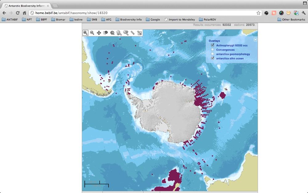
13 Progress: Biogeography Single access to 900 datasets 2.5 million records Data back to 1900 (Pygoscelis adeliae) Spatial data on over 5000 taxa Downloadable Interoperable Free and open
 Spatial data on over 5000 taxa")
14 Progress: Biogeography Single access to 900 datasets 2.5 million records Data back to 1900 (Pygoscelis adeliae) Spatial data on over 5000 taxa Downloadable Interoperable Free and open
15 progress: ANTABIF Architecture
16 progress: ANTABIF Architecture
17 progress: ANTABIF Architecture data.biodiversity.aq
18 progress: ANTABIF Architecture data.biodiversity.aq ipt.biodiversity.aq
19 progress: ANTABIF Architecture data.biodiversity.aq ipt.biodiversity.aq afg.biodiversity.aq
20 progress: ANTABIF Architecture data.biodiversity.aq ipt.biodiversity.aq afg.biodiversity.aq atlas.biodiversity.aq
21 progress: ANTABIF Architecture data.biodiversity.aq ipt.biodiversity.aq afg.biodiversity.aq atlas.biodiversity.aq mars.biodiversity.aq
22 progress: ANTABIF Architecture MODULAR ARCHITECTURE data.biodiversity.aq ipt.biodiversity.aq afg.biodiversity.aq atlas.biodiversity.aq mars.biodiversity.aq ANTABIF

23 progress: ANTABIF Architecture data.biodiversity.aq ipt.biodiversity.aq MODULAR ARCHITECTURE ed) Data discovery afg.biodiversity.aq atlas.biodiversity.aq mars.biodiversity.aq ANTABIF
24 progress: ANTABIF Architecture data.biodiversity.aq MODULAR ARCHITECTURE Data discovery ipt.biodiversity.aq afg.biodiversity.aq ed) Data visualization A atlas.biodiversity.aq mars.biodiversity.aq ANTABIF
 Data visualization A atlas.biodiversity.aq mars.biodiversity.aq ANTABIF")
25 progress: ANTABIF Architecture data.biodiversity.aq MODULAR ARCHITECTURE Data discovery ipt.biodiversity.aq afg.biodiversity.aq Data products ed) Data visualization A atlas.biodiversity.aq mars.biodiversity.aq ANTABIF
26 data.biodiversity.aq data discovery interface visualize occurrence data on map view taxonomic data download data view metrics send feedback access technical documentation
 Your data DwC-A IPT")

27 Data flow (user s point of view) Your data DwC-A IPT ANTABIF standardize upload publish publish Data Paper
28
29
30
31
32
33
34
35
36 ipt.biodiversity.aq Integrated Publishing Toolkit standardize and clean your data manage primary biodiversity data manage associated metadata choose collaborators generate and submit a Data Paper push data and metadata to Information Systems
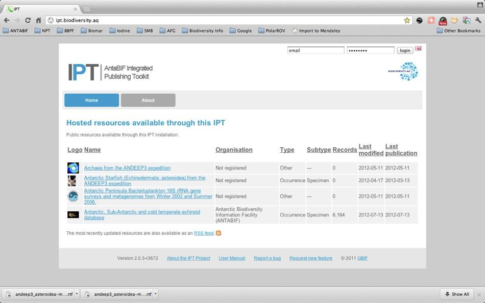
37 ipt.biodiversity.aq
38 ipt. biodiversity.aq
39 ipt. biodiversity.aq
40 ipt. biodiversity.aq
41 ipt. biodiversity.aq

42 Reward data publishing Metadata document Data Paper
43 Proof of concept
44 Proof of concept
45 Proof of concept
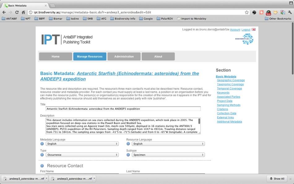
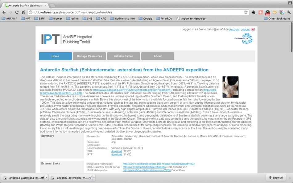
46 Proof of concept ZooKeys 185: (2012) doi: /zookeys Antarctic Starfish (Echinodermata: asteroidea) from the ANDEEP3 expedition 73 DAtA PAPEr A peer-reviewed open-access journal Launched to accelerate biodiversity research Antarctic Starfish (Echinodermata, Asteroidea) from the ANDEEP3 expedition Bruno Danis 1, Michel Jangoux 2, Jennifer Wilmes 2 1 ANTABIF, 29, rue Vautier, 1000, Brussels, Belgium 2 Université Libre de Bruxelles, 50, av FD Roosevelt, 1050, Brussels, Belgium Corresponding author: Bruno Danis (bruno.danis@gmail.com) Academic editor: Vishwas Chavan Received 13 March 2012 Accepted 18 April 2012 Published 23 April 2012 Citation: Danis B, Jangoux M, Wilmes J (2012) Antarctic Starfish (Echinodermata: asteroidea) from the ANDEEP3 expedition. ZooKeys 185: doi: /zookeys Abstract This dataset includes information on sea stars collected during the ANDEEP3 expedition, which took place in The expedition focused on deep-sea stations in the Powell Basin and Weddell Sea. Sea stars were collected using an Agassiz trawl (3m, mesh-size 500µm), deployed in 16 stations during the ANTXXII/3 (ANDEEP3, PS72) expedition of the RV Polarstern. Sampling depth ranged from 1047 to 4931m. Trawling distance ranged from 731 to 3841m. The sampling area ranges from -41 S to -71 S (latitude) and from 0 to -65 W (longitude). A complete list of stations is available from the PANGAEA data system ( including a cruise report ( The dataset includes 50 records, with individual counts ranging from 1-10, reaching a total of 132 specimens. The andeep3-asteroidea is a unique dataset as it covers an under-explored region of the Southern Ocean, and that very little information was available regarding Antarctic deep-sea starfish. Before this study, most of the information available focused on starfish from shallower depths than 1000m. This dataset allowed to make unique observations, such as the fact that some species were only present at very high depths (Hymenaster crucifer, Hymenaster pellucidus, Hymenaster praecoquis, Psilaster charcoti, Freyella attenuata, Freyastera tuberculata, Styrachaster chuni and Vemaster sudatlanticus were all found below -3770m), while others displayed remarkable eurybathy, with very high depths amplitudes (Bathybiaster loripes (4842m), Lysasterias adeliae (4832m), Lophaster stellans (4752m), Cheiraster planeta (4708m), Eremicaster crassus (4626m), Lophaster gaini (4560m) and Ctenodiscus australis (4489m)). Even if the number of records is relatively small, the data bring many new insights on the taxonomic, bathymetric and geographic distributions of Southern starfish, covering a very large sampling zone. The dataset also brings to light six species, newly reported in the Southern Ocean. The quality of the data was controlled very thoroughly, by means of on-board Polarstern GPS systems, checking of identification by a renowned specialist (Prof. Michel Jangoux, Université Libre de Brux- Copyright Bruno Danis et al. This is an open access article distributed under the terms of the Creative Commons Attribution License 3.0 (CC- BY), which permits unrestricted use, distribution, and reproduction in any medium, provided the original author and source are credited.
47 Proof of concept ZooKeys 185: (2012) doi: /zookeys Antarctic Starfish (Echinodermata: asteroidea) from the ANDEEP3 expedition 73 DAtA PAPEr A peer-reviewed open-access journal Launched to accelerate biodiversity research Antarctic Starfish (Echinodermata, Asteroidea) from the ANDEEP3 expedition Impact Factor: Bruno Danis 1, Michel Jangoux 2, Jennifer Wilmes 2 1 ANTABIF, 29, rue Vautier, 1000, Brussels, Belgium 2 Université Libre de Bruxelles, 50, av FD Roosevelt, 1050, Brussels, Belgium Corresponding author: Bruno Danis (bruno.danis@gmail.com) Academic editor: Vishwas Chavan Received 13 March 2012 Accepted 18 April 2012 Published 23 April 2012 Citation: Danis B, Jangoux M, Wilmes J (2012) Antarctic Starfish (Echinodermata: asteroidea) from the ANDEEP3 expedition. ZooKeys 185: doi: /zookeys Abstract This dataset includes information on sea stars collected during the ANDEEP3 expedition, which took place in The expedition focused on deep-sea stations in the Powell Basin and Weddell Sea. Sea stars were collected using an Agassiz trawl (3m, mesh-size 500µm), deployed in 16 stations during the ANTXXII/3 (ANDEEP3, PS72) expedition of the RV Polarstern. Sampling depth ranged from 1047 to 4931m. Trawling distance ranged from 731 to 3841m. The sampling area ranges from -41 S to -71 S (latitude) and from 0 to -65 W (longitude). A complete list of stations is available from the PANGAEA data system ( including a cruise report ( The dataset includes 50 records, with individual counts ranging from 1-10, reaching a total of 132 specimens. The andeep3-asteroidea is a unique dataset as it covers an under-explored region of the Southern Ocean, and that very little information was available regarding Antarctic deep-sea starfish. Before this study, most of the information available focused on starfish from shallower depths than 1000m. This dataset allowed to make unique observations, such as the fact that some species were only present at very high depths (Hymenaster crucifer, Hymenaster pellucidus, Hymenaster praecoquis, Psilaster charcoti, Freyella attenuata, Freyastera tuberculata, Styrachaster chuni and Vemaster sudatlanticus were all found below -3770m), while others displayed remarkable eurybathy, with very high depths amplitudes (Bathybiaster loripes (4842m), Lysasterias adeliae (4832m), Lophaster stellans (4752m), Cheiraster planeta (4708m), Eremicaster crassus (4626m), Lophaster gaini (4560m) and Ctenodiscus australis (4489m)). Even if the number of records is relatively small, the data bring many new insights on the taxonomic, bathymetric and geographic distributions of Southern starfish, covering a very large sampling zone. The dataset also brings to light six species, newly reported in the Southern Ocean. The quality of the data was controlled very thoroughly, by means of on-board Polarstern GPS systems, checking of identification by a renowned specialist (Prof. Michel Jangoux, Université Libre de Brux- Copyright Bruno Danis et al. This is an open access article distributed under the terms of the Creative Commons Attribution License 3.0 (CC- BY), which permits unrestricted use, distribution, and reproduction in any medium, provided the original author and source are credited.
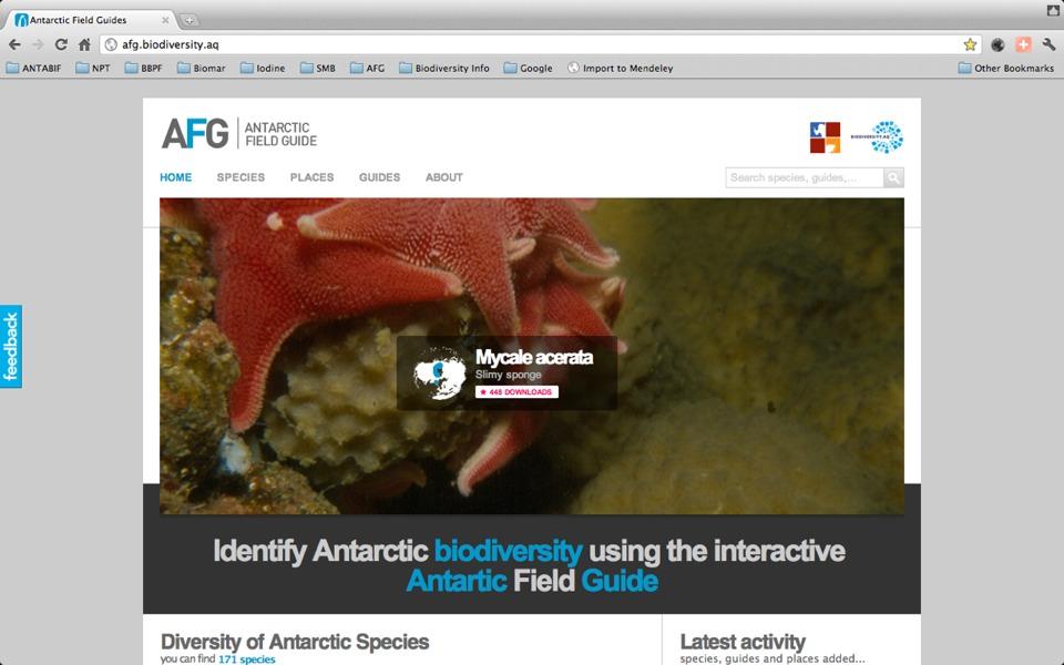
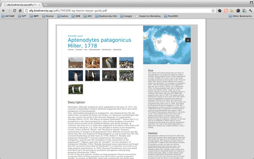
48 afg. biodiversity.aq Identification aid High quality (useful) pictures Expert Descriptions Built on-the-fly from various sources Generates a pdf for taxa/area of interest
49 afg. biodiversity.aq

50 afg. biodiversity.aq
51 afg. biodiversity.aq
52 atlas.biodiversity.aq
53 atlas.biodiversity.aq Biogeographic Atlas of the Southern Ocean
54 atlas.biodiversity.aq Biogeographic Atlas of the Southern Ocean Redo of Hedgepeth 1969 Folio
55 atlas.biodiversity.aq Biogeographic Atlas of the Southern Ocean Redo of Hedgepeth 1969 Folio Predictive approach
56 atlas.biodiversity.aq Biogeographic Atlas of the Southern Ocean Redo of Hedgepeth 1969 Folio Predictive approach Static and dynamic versions
57 atlas.biodiversity.aq Biogeographic Atlas of the Southern Ocean Redo of Hedgepeth 1969 Folio Predictive approach Static and dynamic versions Modelization loops are ready
58 94 Interpolated data layers Slope Bathymetry Chlorophyll Distance to the continent Distance to bird colonies Distance to ice Distance to shelf Distance to canyon Floor temperature... + ANTABIF Occurrence records

59 94 Interpolated data layers Slope Bathymetry Chlorophyll Distance to the continent Distance to bird colonies Distance to ice Distance to shelf Distance to canyon Floor temperature... + ANTABIF Occurrence records

60 94 Interpolated data layers Slope Bathymetry Chlorophyll Distance to the continent Distance to bird colonies Distance to ice Distance to shelf Distance to canyon Floor temperature... + ANTABIF Occurrence records
61 R-functions GUI for BRT and GDM
62 R-functions GUI for BRT and GDM
63 mars.biodiversity.aq
64 mars.biodiversity.aq Microbial Antarctic Resource System
65 mars.biodiversity.aq Microbial Antarctic Resource System The organisms are small but their environmental impacts are critical to many Antarctic ecosystems
66 mars.biodiversity.aq Microbial Antarctic Resource System The organisms are small but their environmental impacts are critical to many Antarctic ecosystems They are the dominant and most diverse form of life in the oceans and in the various microbial habitats on the continent
67 mars.biodiversity.aq Microbial Antarctic Resource System The organisms are small but their environmental impacts are critical to many Antarctic ecosystems They are the dominant and most diverse form of life in the oceans and in the various microbial habitats on the continent Access to their diversity is becoming cost-effective and increasing exponentially
68 mars.biodiversity.aq
69 mars.biodiversity.aq Integrate Antarctic microbial DNA sequence data in ANTABIF
70 mars.biodiversity.aq Integrate Antarctic microbial DNA sequence data in ANTABIF Phased approach:
71 mars.biodiversity.aq Integrate Antarctic microbial DNA sequence data in ANTABIF Phased approach: Step 0: data description and discovery
72 mars.biodiversity.aq Integrate Antarctic microbial DNA sequence data in ANTABIF Phased approach: Step 0: data description and discovery Step 1: microbial sequence and habitat metadata
73 mars.biodiversity.aq Integrate Antarctic microbial DNA sequence data in ANTABIF Phased approach: Step 0: data description and discovery Step 1: microbial sequence and habitat metadata Step 2: sequence data
74 mars.biodiversity.aq Integrate Antarctic microbial DNA sequence data in ANTABIF Phased approach: Step 0: data description and discovery Step 1: microbial sequence and habitat metadata Step 2: sequence data Step 3: batch sequence data processing
75 mars.biodiversity.aq Integrate Antarctic microbial DNA sequence data in ANTABIF Phased approach: Step 0: data description and discovery Step 1: microbial sequence and habitat metadata Step 2: sequence data Step 3: batch sequence data processing Step 4: customized sequence data processing
76 mars.biodiversity.aq
77 mars.biodiversity.aq Potential applications:
78 mars.biodiversity.aq Potential applications: Is there a biogeography of Antarctic microbes?
79 mars.biodiversity.aq Potential applications: Is there a biogeography of Antarctic microbes? Document Antarctic bioprospecting activities
80 mars.biodiversity.aq Potential applications: Is there a biogeography of Antarctic microbes? Document Antarctic bioprospecting activities Assess bioindicating value of microbial diversity as early warning system of ecosystems shifts

81 In the pipeline
82 in the pipeline Interactive Identification keys Spatially explicit gazetteer Genomics/Proteomics (mars paving the way) Expeditions DBs more...

83 Thanks and image NY Times
Antarctic Marine Biodiversity Data Now Online
 Contact: Bruno Danis +32(2)6274139 bruno.danis@scarmarbin.be EMBARGOED UNTIL 9 a.m ECT, March 31 2009 Antarctic Marine Biodiversity Data Now Online An efficient network of specialists, data and tools to
Trophic ecology of Southern Ocean sea stars inferred from stable isotopes ratios of C and N
 Trophic ecology of Southern Ocean sea stars inferred from stable isotopes ratios of C and N Baptiste Le Bourg, Alice Blanchard, Bruno Danis, Quentin Jossart, Gilles Lepoint, Camille Moreau, Loïc N. Michel
BIOGEOGRAPHIC ATLAS OF THE SOUTHERN OCEAN
 Census of Antarctic Marine Life SCAR-Marine Biodiversity Information Network BIOGEOGRAPHIC ATLAS OF THE SOUTHERN OCEAN CHAPTER 2.1 Data and Mapping. Van de Putte A.P., Griffiths H.J., Raymond B., Danis
Ice matters. Arctic and Antarctic under-ice communities linking sea ice with the pelagic food web
 Ice matters Arctic and Antarctic under-ice communities linking sea ice with the pelagic food web Hauke Flores, J. A. van Franeker, C. David, B. Lange, V. Siegel, E. A. Pakhomov, U. Bathmann... Hauke.flores@awi.de
the map Redrawing Donald Hobern takes a look at the challenges of managing biodiversity data [ Feature ]
![the map Redrawing Donald Hobern takes a look at the challenges of managing biodiversity data [ Feature ]](/thumbs/82/86628837.jpg "the map Redrawing Donald Hobern takes a look at the challenges of managing biodiversity data [ Feature ]") Redrawing the map Donald Hobern takes a look at the challenges of managing biodiversity data 46 Volume 12 > Number 9 > 2008 www.asiabiotech.com Cicadetta sp., Canberra, Australia, December 2007 Photograph
Redrawing the map Donald Hobern takes a look at the challenges of managing biodiversity data 46 Volume 12 > Number 9 > 2008 www.asiabiotech.com Cicadetta sp., Canberra, Australia, December 2007 Photograph
WORKSHOP ON BIOREGIONALISATION OF THE SOUTHERN OCEAN (Brussels, Belgium, 13 to 17 August 2007) Executive Summary. Report of the Workshop
 Executive Summary. Report of the Workshop") ANNEX 9 WORKSHOP ON BIOREGIONALISATION OF THE SOUTHERN OCEAN (Brussels, Belgium, 13 to 17 August 2007) Executive Summary Report of the Workshop EXECUTIVE SUMMARY (This summary is not a document adopted
ANNEX 9 WORKSHOP ON BIOREGIONALISATION OF THE SOUTHERN OCEAN (Brussels, Belgium, 13 to 17 August 2007) Executive Summary Report of the Workshop EXECUTIVE SUMMARY (This summary is not a document adopted
Future Ocean Floor Mapping: Ocean Stewardship & Initial Industry Contributions. U.S Hydro Galveston, TX March 23, 2017 David Millar - Fugro
 Future Ocean Floor Mapping: Ocean Stewardship & Initial Industry Contributions U.S Hydro 2017 - Galveston, TX March 23, 2017 David Millar - Fugro Presentation Outline The Need for Ocean Mapping GEBCO GEBCO
Antarctic marine explorers reveal first biological changes after collapse of polar ice shelves 25 February 2007
 Antarctic marine explorers reveal first biological changes after collapse of polar ice shelves 25 February 2007 shows nowhere on Earth warming more quickly than this corner of Antarctica, a continent 1.5
European Commission STUDY ON INTERIM EVALUATION OF EUROPEAN MARINE OBSERVATION AND DATA NETWORK. Executive Summary
 European Commission STUDY ON INTERIM EVALUATION OF EUROPEAN MARINE OBSERVATION AND DATA NETWORK Executive Summary by NILOS Netherlands Institute for the Law of the Sea June 2011 Page ii Study on Interim
Blue and Fin Whale Habitat Modeling from Long-Term Year-Round Passive Acoustic Data from the Southern California Bight
 DISTRIBUTION STATEMENT A. Approved for public release; distribution is unlimited. Blue and Fin Whale Habitat Modeling from Long-Term Year-Round Passive Acoustic Data from the Southern California Bight
Global Distribution of Northern Fur Seals (2013)
") Dataset ID: Kaschner-001 Global Distribution of Northern Fur Seals (2013) Description: This dataset shows the modelled distribution of Northern fur seals (Callorhinus ursinus). AquaMaps (www.aquamaps.org)
Dataset ID: Kaschner-001 Global Distribution of Northern Fur Seals (2013) Description: This dataset shows the modelled distribution of Northern fur seals (Callorhinus ursinus). AquaMaps (www.aquamaps.org)
BIOGEOGRAPHIC ATLAS OF THE SOUTHERN OCEAN
 Census of Antarctic Marine Life SCAR-Marine Biodiversity Information Network BIOGEOGRAPHIC ATLAS OF THE SOUTHERN OCEAN CHAPTER 5.14. SOUTHERN OCEAN BIOGEOGRAPHIC PATTERNS IN PYCNOGONIDA. Soler-Membrives
Bathymetry. EMODnet Stakeholder Conference & Sea-basin Workshops February Bathymetry
 EMODnet Stakeholder Conference & Sea-basin Workshops 14-15 February 2017 Arctic checkpoint Belinda Kater On behalf of all Checkpoints http://www.emodnet.eu 1 ? is the study of the "beds" or "floors" of
Using seascapes to help predict Australia s benthic marine habitat diversity in the development of a national system of marine protected areas
 Using seascapes to help predict Australia s benthic marine habitat diversity in the development of a national system of marine protected areas A.D. Heap 1, T. Whiteway 1, V. Lucieer 2, S. Nichol 1 1. Geoscience
Agenda Item F.4.c Supplemental Public Comment 3 November 2016
 Agenda Item F.4.c Supplemental Public Comment 3 November 2016 Stand up for California's seafloor A starfish, coral and a green spotted rockfish. (Photo Courtesy of Oceana) Available at: http://fw.to/04jcx6y
Data archiving and dissemination, sample information, scientists ashore, and multibeam bathymetric collection and data processing (Raineault) 10
 10") Cover: Seafloor image (~0.5 m across) of a methane hydrate shelf above bubble streams discovered on dive H1517 at Astoria Canyon on the southern canyon floor, 850 m depth. 3d background image of Astoria
Cover: Seafloor image (~0.5 m across) of a methane hydrate shelf above bubble streams discovered on dive H1517 at Astoria Canyon on the southern canyon floor, 850 m depth. 3d background image of Astoria
Introduction: The Gulf of Mexico Alliance. The Gulf GAME project MERMAid and PHINS Results & Conclusions What s next? Examples
 AAG Las Vegas March 25, 2009 Introduction: Ocean governance and Ecosystem-Based Management The Gulf of Mexico Alliance Habitat Identification and Characterization The Gulf GAME project MERMAid and PHINS
MAR110 Lecture #3 Ocean Bathymetry / Plate Tectonics
 1 MAR110 Lecture #3 Ocean Bathymetry / Plate Tectonics Ocean Basin Geographic Zones The geographic zones of the North Atlantic are identified in the bird s eye view of the sea floor above. Below is shown
GBIF Global Biodiversity Information Facility. Dmitry Schigel, Tim Hirsch Arctic data and Global Biodiversity Information Facility
 GBIF Global Biodiversity Information Facility Dmitry Schigel, Tim Hirsch Arctic data and Global Biodiversity Information Facility WHAT IS GBIF? Intergovernmental collaboration founded in 2001 on the recommendation
BIOGEOGRAPHIC ATLAS OF THE SOUTHERN OCEAN
 Census of Antarctic Marine Life SCAR-Marine Biodiversity Information Network BIOGEOGRAPHIC ATLAS OF THE SOUTHERN OCEAN CHAPTER 10.2. PELAGIC REGIONALISATION. Raymond B., 2014. In: De Broyer C., Koubbi
BIOGEOGRAPHIC ATLAS OF THE SOUTHERN OCEAN
 Census of Antarctic Marine Life SCAR-Marine Biodiversity Information Network BIOGEOGRAPHIC ATLAS OF THE SOUTHERN OCEAN CHAPTER 9.4. CONSERVATION AND MANAGEMENT. Grant S.M., Koubbi P., Penhale P., 2014.
Innovation. The Push and Pull at ESRI. September Kevin Daugherty Cadastral/Land Records Industry Solutions Manager
 Innovation The Push and Pull at ESRI September 2004 Kevin Daugherty Cadastral/Land Records Industry Solutions Manager The Push and The Pull The Push is the information technology that drives research and
P r o d u c t p o r t f o l i o a n d d a t a a c c e s s
 P r o d u c t p o r t f o l i o a n d d a t a a c c e s s Copernicus Environment Service Copernicus EU Copernicus EU Copernicus EU www.copernicus.eu I N T R O D U C T I O N O F U S E C A S E User Uptake
Hydrologic CTD Dataset Obtained through Chinese Antarctic Expeditions
 Journal of Global Change Data & Discovery. 2017, 1(2): 157-164 DOI:10.3974/geodp.2017.02.04 www.geodoi.ac.cn 2017 GCdataPR Global Change Research Data Publishing & Repository Hydrologic CTD Dataset Obtained
Into the Digital Age the GEBCO Digital Atlas
 1983-2003 1983 * Digitisation of the GEBCO Fifth Edition - 1993 1993 * Initialisation of the GEBCO Digital Atlas 1993 * Updating the GEBCO Digital Atlas - 2003 Revised Bathymetry - contours Creation of
The story of sharing environmental data
 The story of sharing environmental data Kallio, Pyhälahti, Harju, Teiniranta, Lahtinen, Finnish Environment Institute SYKE OKFestival, Finnish Open Data, 18. Sep 2012 Contents Call for environmental knowledge
GBIF Info Session Brussels, 22 October 2010 BBPF
 GBIF Info Session Brussels, 22 October 2010 1 Agenda Part I Digitization Projects Saproxylic Beetles - Patrick Grootaert IFBL Plants (1939-1971) - Leo VanHecke Aves Birds Observations - Jean-Yves Paquet
The European Marine Observation and Data Network. EU-China Blue Year Event 1 June,
 The European Marine Observation and Data Network EU-China Blue Year Event 1 June, 2017 secretariat@emodnet.eu info@emodnet.eu There is only one Earth, with only one history, and we get only one chance
BIOL 101 Introduction to Biological Research Techniques I
 BIOL 101 Introduction to Biological Research Techniques I 1. Develop a research plan including hypothesis, controls and procedures. 2. Conduct a primary literature review relating to their research project.
Marine Spatial Planning: A Tool for Implementing Ecosystem-Based Management
 Marine Spatial Planning: A Tool for Implementing Ecosystem-Based Management Steven Murawski, Ph.D., Ecosystem Goal Team Lead National Oceanic and Atmospheric Administration NOAA November 16, 2009 1 To
Atlas of Living Scotland New data infrastructure for research and citizen science
 Atlas of Living Scotland New data infrastructure for research and citizen science John Sawyer and Rachel Stroud CEO NBN Trust, j.sawyer@nbn.org.uk Who is the National Biodiversty Network? The National
Experiences and Directions in National Portals"
 FIG Seminar on e-land Administration Innsbruck/Austria 2-4 June 2004 "ESRI's Experiences and Directions in National Portals" Kevin Daugherty Cadastral/Land Records Manager ESRI Topic Points Technology
Korean Arctic Research 2015 update
 FARO Annual Meeting, ASSW 2016 Fairbanks, Alaska, 12 March 2016 Korean Arctic Research 2015 update International Cooperation Department Korea Polar Research Institute Outline KOPRI and Korean Arctic research;
Introduction to IsoMAP Isoscapes Modeling, Analysis, and Prediction
 Introduction to IsoMAP Isoscapes Modeling, Analysis, and Prediction What is IsoMAP To the user, and online workspace for: Accessing, manipulating, and analyzing, and modeling environmental isotope data
Appendix I: Geographic Information System Data Sources
 Appendix I: Geographic Information System Data Sources Draft Environmental Impact Statement/Overseas Environmental Impact Statement Hawaii-Southern California Training and Testing TABLE OF CONTENTS...
Introduction After reviewing the classification of continental margins (not plate margins) in your textbook, answer the following questions:
 in your textbook, answer the following questions:") Investigating the continental margins of North America using GeoMapApp. This exercise is designed to familiarize you with the features of continental margins. Through the analysis of color-coded bathymetric
Investigating the continental margins of North America using GeoMapApp. This exercise is designed to familiarize you with the features of continental margins. Through the analysis of color-coded bathymetric
Coastal Mapping Follow on? Bruno Frachon Corine Lochet Gaël Morvan
 Coastal Mapping Follow on? Bruno Frachon Corine Lochet Gaël Morvan Shared objectives; IHO DG MARE CPMR Development of a Joint European Coastal Mapping Programme (JECMaP) within the IHO EU network with
Biodiversity of the Southern Ocean
 Biodiversity of the Southern Ocean Series Editor Françoise Gaill Biodiversity of the Southern Ocean Bruno David Thomas Saucède First published 2015 in Great Britain and the United States by ISTE Press
Marine ecosystem mapping at the Prince Edward Islands
 Marine ecosystem mapping at the Prince Edward Islands Biodiversity Planning Forum NBA special session June 2018 R Adams, C von der Meden, A Dayaram, K Sink, A Lombard, A Bosman, M Dopolo, F Fourie, L Harris,
Biodiversity Information Service in China: The Architecture and Techniques
 Biodiversity Information Service in China: The Architecture and Techniques Experiences from the Construction of NSII Zheping Xu(xuzp@ibcas.ac.cn), Keping Ma,Haining Qin,Jinzhong Cui Institute of Botany,
The study of insect species diversity and modern approaches
 The study of insect species diversity and modern approaches Humala A.E. Forest Research Institute Karelian Research Centre RAS Petrozavodsk, RUSSIA The main idea and aim of any research TO FILL THE GAPS
EuroGEOSS for Drought - Linking the European Drought Observatory to global and local scales
 EuroGEOSS for Drought - Linking the European Drought Observatory to global and local scales Barbara Hofer, Stefan Niemeyer, EC-JRC INSPIRE Conference 2010 Cracow June 24, 2010 Drought Relevance Droughts
Research Programme Polar, Marine and Coastal Systems. Current and future Arctic research priorities of Germany Nicole Biebow, AWI
 Research Programme Polar, Marine and Coastal Systems Current and future Arctic research priorities of Germany Nicole Biebow, AWI Arctic Science and Technology (S&T) Collaboration and Engagement Workshop,
EM ice thickness measurements during GreenICE 2004 field campaign
 EM ice thickness measurements during GreenICE field campaign Latitude ( N).... Ice thickness (m).. Longitude ( E) GreenICE Deliverable D Christian Haas October Executive summary This report summarizes
BIOGEOGRAPHIC ATLAS OF THE SOUTHERN OCEAN
 Census of Antarctic Marine Life SCAR-Marine Biodiversity Information Network BIOGEOGRAPHIC ATLAS OF THE SOUTHERN OCEAN CHAPTER 12. CONCLUSIONS: PRESENT AND FUTURE OF SOUTHERN OCEAN BIOGEOGRAPHY. Koubbi
An introduction to the Data Library PANGAEA. Stefanie Schumacher, Rainer Sieger & Hannes Grobe (2010)
") An introduction to the Data Library PANGAEA Stefanie Schumacher, Rainer Sieger & Hannes Grobe (2010) Data sharing and archiving Nature: Vol 461, 10 September 2009 doi:10.1038/461145a DFG Recommendations
An introduction to the Data Library PANGAEA Stefanie Schumacher, Rainer Sieger & Hannes Grobe (2010) Data sharing and archiving Nature: Vol 461, 10 September 2009 doi:10.1038/461145a DFG Recommendations
*CETAF : DOI: /RG
 Consortium of European Taxonomic Facilities STRATEGY AND STRATEGIC DEVELOPMENT PLAN * Executive Summary Exploring and documenting diversity in nature *CETAF Strategy and Strategic Development Plan 2015-2025:
Mapping Undersea Feature Names in S-100. UFNPT at SCUFN 31 Wellington, New Zealand October, 2018
 Mapping Undersea Feature Names in S-100 UFNPT at SCUFN 31 Wellington, New Zealand October, 2018 Content - Update about UFNPT - Discovery of Undersea Features - excercise Work Plan of the UFNPT November
The Atlas Aspect of the Atlas of Living Australia
 The Atlas Aspect of the Atlas of Living Australia Lee Belbin lee@blatantfabrications.com Melbourne Museum, July 28, 2010 The Atlas is funded by the Australian Government under the National Collaborative
Established Global bathymetry yproducts. Undersea feature names. Capacity building
 IHO IOC Established 1903 Global bathymetry yproducts Undersea feature names Capacity building A GEBCO data GEBCO s d t sets t and d products d t Global bathymetric grids Global set of bathymetric contours
Infrastructure for Spatial Information in Europe (INSPIRE)
") Infrastructure for Spatial Information in Europe (INSPIRE) 2011 GISCO Working Party 8-9.3.2012 INSPIRE is about improving access to spatial information: the environment doesn t stop at borders EU Geoportal
Infrastructure for Spatial Information in Europe (INSPIRE) 2011 GISCO Working Party 8-9.3.2012 INSPIRE is about improving access to spatial information: the environment doesn t stop at borders EU Geoportal
Submarine-Based Acoustic Doppler Current Profiler (ADCP) Measurements of the Upper Arctic Ocean
 Measurements of the Upper Arctic Ocean") Submarine-Based Acoustic Doppler Current Profiler (ADCP) Measurements of the Upper Arctic Ocean Robin D. Muench Earth & Space Research 1910 Fairview Ave. E. Suite 102 Seattle, WA 98102-3620 Phone: (206)726-0501;
Submarine-Based Acoustic Doppler Current Profiler (ADCP) Measurements of the Upper Arctic Ocean Robin D. Muench Earth & Space Research 1910 Fairview Ave. E. Suite 102 Seattle, WA 98102-3620 Phone: (206)726-0501;
National Marine Sanctuary Program
 National Marine Sanctuary Program NMSP/USGS Joint Seabed Mapping Initiative: September 2004 AA National Ocean Service National Marine Sanctuaries Interim Report September 2004 Background: Since 2002,
OCEANOGRAPHIC DATA MANAGEMENT
 OCEANOGRAPHIC DATA MANAGEMENT Presented to: Environmental Disaster Data Management Meeting Russ Beard Director, National Coastal Data Development Center Interim Science Coordinator, Gulf Restoration Council
Jacqueline M. Grebmeier Chesapeake Biological Laboratory University of Maryland Center for Environmental Science, Solomons, MD, USA
 Update on the Pacific Arctic Region Synthesis Activity as part of the ICES/PICES/PAME Working Group on Integrated Ecosystem Assessment of the Central Arctic Ocean (WGICA) Jacqueline M. Grebmeier Chesapeake
SCAR XXXI & Open Science Conference
 Scientific Committee on Antarctic Research (SCAR) SCAR XXXI & Open Science Conference Buenos Aires - Argentina, 2010 Antarctica Witness to the Past and Guide to the Future Second Circular Event Dates 1)
1) make sure folks know what s available in terms of geospatial data and resources that could contribute to their decision support toolkits;
 make sure folks know what s available in terms of geospatial data and resources that could contribute to their decision support toolkits;") Introduction 1 2001 It was born out of the recognition that several of the regions prominent resource management agencies have similar, if not shared, requirements for GIS data. Some of the underlying
Introduction 1 2001 It was born out of the recognition that several of the regions prominent resource management agencies have similar, if not shared, requirements for GIS data. Some of the underlying
Bathymetric Maps and Plate Tectonics. CPO Science
 Bathymetric Maps and Plate Tectonics CPO Science Key Questions What is a bathymetric map? What is plate tectonics, and what are the chief tectonic plates of Earth s lithosphere? What will Earth s surface
Exploring the Future of Scientific Research in Antarctica
 ATCM XXXIX- CEP XIX, Santiago, Chile, 2016 SCAR Science Lecture Exploring the Future of Scientific Research in Antarctica Jerónimo López-Martínez Universidad Autónoma de Madrid, Spain President of SCAR
Status of implementation of the INSPIRE Directive 2016 Country Fiches. COUNTRY FICHE Netherlands
 Status of implementation of the INSPIRE Directive 2016 Country Fiches COUNTRY FICHE Netherlands Introduction... 1 1. State of Play... 2 1.1 Coordination... 2 1.2 Functioning and coordination of the infrastructure...
Brian D. George. GIMS Specialist Ohio Coastal Atlas Project Coordinator and Cartographer. Impacts and Outcomes of Mature Coastal Web Atlases
 Ohio Coastal Atlas Project Brian D. George GIMS Specialist Ohio Coastal Atlas Project Coordinator and Cartographer Ohio Department of Natural Resources Office of Coastal Management Sandusky, OH Impacts
Evolution and Biodiversity in Antarctic (EBA) Pete Convey Co-Chair EBA British Antarctic Survey
 Pete Convey Co-Chair EBA British Antarctic Survey") Evolution and Biodiversity in Antarctic (EBA) Pete Convey Co-Chair EBA British Antarctic Survey Antarctica and the sub-antarctic: a model for future changes in Antarctica Climate change Non-native species
Evolution and Biodiversity in Antarctic (EBA) Pete Convey Co-Chair EBA British Antarctic Survey Antarctica and the sub-antarctic: a model for future changes in Antarctica Climate change Non-native species
Creating an e-flora for South Africa
 SANBI POLICY DOCUMENT DIVISION: Biosystematics Research and Biodiversity Collections EFFECTIVE DATE: 1 April 2014 Compiler: Marianne le Roux & Janine Victor POLICY NUMBER: LAST AMENDED: Creating an e-flora
Marine Spatial Planning, a Norwegian user case NSHC33
 Marine Spatial Planning, a Norwegian user case NSHC33 Marine Spatial Management Tool Support the marine spatial planning process with updated and reliable geospatial information Marine management is important
Australia report
 Australia 2014-2015 report AUS GEOTRACES meetings and workshops: AGU Fall Meeting (San Francisco, USA, Dec 2014) ACCOMC-CGASM annual meeting (Aspendale, Victoria, Nov 2014) APICS (Melbourne, Australia),
an accessible interface to marine environmental data Russell Moffitt
 an accessible interface to marine environmental data Russell Moffitt The Atlas Project GOAL: To provide a single point of access to oceanographic and environmental data for use by marine resource researchers,
Sample file. Teacher Guide ... Before You Teach. Our resource has been created for ease of use by both TEACHERS and STUDENTS alike.
 8 7 9 10 12 13 14 11 Introduction T his resource provides ready-to-use information and activities for remedial students in grades five to eight. Written to grade and using simplified language and vocabulary,
CTD Data RV Heincke HE479
 CTD Data RV Heincke HE479 Data Processing Report Contents 1 Introduction 1 2 Workflow 1 3 Cruise details 3 4 Sensor Layout 3 5 Processing 3 6 Results 5 Contact: Andreas Wisotzki Alfred-Wegener-Institute
From the Venice Lagoon Atlas towards a collaborative federated system
 From the Venice Lagoon Atlas towards a collaborative federated system City of Venice Alessandro Mulazzani CORILA Consortium for Coordination of Research Activities Concerning the Venice Lagoon System ISMAR-CNR
NOAA Deep Sea Coral Research and Technology Program
 NOAA Deep Sea Coral Research and Technology Program Robert McGuinn, Conservation Biologist Data System Manager Robert.McGuinn@noaa.gov 843-762-8640 Presentation Update: 03/23/2015 NOAA - NMFS DSC-RTP Tom
EXPECTATIONS OF TURKISH ENVIRONMENTAL SECTOR FROM INSPIRE
 EXPECTATIONS OF TURKISH ENVIRONMENTAL SECTOR FROM INSPIRE June, 2010 Ahmet ÇİVİ Tuncay DEMİR INSPIRE in the Eyes of MoEF Handling of Geodata by MoEF Benefits Expected TEIEN First Steps for INSPIRE Final
SCAR XXXI & Open Science Conference
 Scientific Committee on Antarctic Research (SCAR) SCAR XXXI & Open Science Conference Buenos Aires - Argentina, 2010 Antarctica Witness to the Past and Guide to the Future First Circular Event Dates 1)
INSPIRE implementation in the Turkish Ministry of Environment and Urbanization Producing and Publishing Environmental Data
 INSPIRE implementation in the Turkish Ministry of Environment and Urbanization Producing and Publishing Environmental Data Ezgi Sarmusak Urban Planner, MoEU Sibel Süer Toybıyık - Assistant Expert, MoEU
Digital Elevation Model (DEM) of Sable Island Bank and adjacent areas
 of Sable Island Bank and adjacent areas") GEOLOGICAL SURVEY OF CANADA OPEN FILE 5348 Digital Elevation Model (DEM) of Sable Island Bank and adjacent areas K.J. Webb and E.L. King 2014 GEOLOGICAL SURVEY OF CANADA OPEN FILE 5348 Digital Elevation
GEOLOGICAL SURVEY OF CANADA OPEN FILE 5348 Digital Elevation Model (DEM) of Sable Island Bank and adjacent areas K.J. Webb and E.L. King 2014 GEOLOGICAL SURVEY OF CANADA OPEN FILE 5348 Digital Elevation
EMODnet data. Flanders Marine Institute. Simon Claus. A. Giorgetti, D. Schaap, A. Novellino, A. Pititto, H.Lilis, V. Henry, T.
 EMODnet data Simon Claus A. Giorgetti, D. Schaap, A. Novellino, A. Pititto, H.Lilis, V. Henry, T. Schmitt Flanders Marine Institute EMODnet data themes Types of Data Vocabularies Data Exchange Format Metadata
CTD Data RV Heincke HE496
 CTD Data RV Heincke HE496 Data Processing Report Contents 1 Introduction 1 2 Workflow 1 3 Cruise details 3 4 Sensor Layout 3 5 Processing 3 6 Results 5 Contact: Andreas Wisotzki Alfred-Wegener-Institute
A Journey from Data to Knowledge
 A Journey from Data to Knowledge Ian Bruno Cambridge Crystallographic Data Centre @ijbruno @ccdc_cambridge Experimental Data C 10 H 16 N +,Cl - Radspunk, CC-BY-SA CC-BY-SA Jeff Dahl, CC-BY-SA Experimentally
Observing the ice-covered oceans around Antarctica by profiling floats
 Observing the ice-covered oceans around Antarctica by profiling floats Annie Wong, Stephen Riser School of Oceanography University of Washington, USA Aug 1 2007 Since 2007, UW has deployed 83 profiling
DATA and KNOWLEDGE INFRASTRUCTURE ANALYTICS, KNOWLEDGE DISSEMINATION
 DATA and KNOWLEDGE INFRASTRUCTURE ANALYTICS, KNOWLEDGE DISSEMINATION Contributors from multiple sectors add to Map of Life Consumers use Map of Life knowledge for societal needs BUT TO PROPERLY USE THESE
GEBCO 2013 TSCOM. EMODNET Hydrography status report
 www.emodnet-hydrography.eu GEBCO 2013 TSCOM EMODNET Hydrography status report Eric Moussat, Ifremer on behalf of the Emodnet consortium 1 Background and objectives EU proposed to take steps in 2008 towards
Antarctic Marine Explorers Reveal First Hints of Biological Change After Collapse of Polar Ice Shelves
 www.coml.org For Immediate Release: 12 p.m. EDT / 5 p.m. GMT Sunday Feb. 25, 2007 www.awi.de/en Contacts: Mr. Terry Collins, +1-416-878-8712; +1-416-538-8712; terrycollins@rogers.com Dr. Julian Gutt, +49-471-4831-1333,
Mapping ecosystem services provided by benthic habitats in the European Atlantic Ocean
 Mapping and Assessment Ecosystem Services and Links to Good Environmental Status Mapping ecosystem services provided by benthic habitats in the European Atlantic Ocean Ibon Galparsoro, Angel Borja and
The Arctic Crossroads
 The Arctic Crossroads The Influence of the Mendeleev Ridge and the Chukchi Borderland on the Large-scale Circulation of the Arctic Ocean Rebecca Woodgate and Knut Aagaard, University of Washington Jim
Web-based benthic databases: availability for science and quality issues. Sabine Cochrane (& friends) Akvaplan-niva Framsenteret, Tromsø
 Akvaplan-niva Framsenteret, Tromsø") Web-based benthic databases: availability for science and quality issues Sabine Cochrane (& friends) Akvaplan-niva Framsenteret, Tromsø Outline Background What are benthic data? From paper to hard-disk
Web-based benthic databases: availability for science and quality issues Sabine Cochrane (& friends) Akvaplan-niva Framsenteret, Tromsø Outline Background What are benthic data? From paper to hard-disk
Vision: The National Oceanography Centre will, by 2015, be recognised as the world-leading Centre for integrated ocean sciences and technology".
 National Oceanography Centre from coast to deep ocean Waterfront Campus, Southampton Vision: Joseph Proudman Building, Liverpool The National Oceanography Centre will, by 2015, be recognised as the world-leading
Form 4 of Schedule 5 of the Exclusive Economic Zone and Continental Shelf (Environmental Effects Permitted Activities) Regulations 2013
 Regulations 2013") FORM 4 Permitted activities: Post-activity report Form 4 of Schedule 5 of the Exclusive Economic Zone and Continental Shelf (Environmental Effects Permitted Activities) Regulations 2013 How to use this
FORM 4 Permitted activities: Post-activity report Form 4 of Schedule 5 of the Exclusive Economic Zone and Continental Shelf (Environmental Effects Permitted Activities) Regulations 2013 How to use this
Search for the Gulf of Carpentaria in the remap search bar:
 This tutorial is aimed at getting you started with making maps in Remap (). In this tutorial we are going to develop a simple classification of mangroves in northern Australia. Before getting started with
Blue and Fin Whale Habitat Modeling from Long-Term Year-Round Passive Acoustic Data from the Southern California Bight
 DISTRIBUTION STATEMENT A. Approved for public release; distribution is unlimited. Blue and Fin Whale Habitat Modeling from Long-Term Year-Round Passive Acoustic Data from the Southern California Bight
Identifying and characterizing biodiversity hotspots in the BCLME: its relevance in the light of climate change
 Identifying and characterizing biodiversity hotspots in the BCLME: its relevance in the light of climate change Kirkman SP 1, Yemane D 2, Kathena J 3, Mafwila S 4, Nsiangango S 5, Samaai T 1, Singh L 2
Impact of Climate Change on Polar Ecology Focus on Arctic
 Impact of Climate Change on Polar Ecology Focus on Arctic Marcel Babin Canada Excellence Research Chair on Remote sensing of Canada s new Arctic Frontier Takuvik Joint International Laboratory CNRS & Université
Sensitivity of Satellite Altimetry Data Assimilation on a Naval Anti-Submarine Warfare Weapon System
 Sensitivity of Satellite Altimetry Data Assimilation on a Naval Anti-Submarine Warfare Weapon System Steven Mancini LCDR, USN Advisor: Prof. Peter Chu Second Readers: Dr. Charlie Barron Eric Gottshall,
Enabling Access to Arctic Location Based Information - the Arctic SDI
 Enabling Access to Arctic Location Based Information - the Arctic SDI Jani Kylmäaho Head of Arctic SDI Geoportal WG National Land Survey of Finland SAO Chair, WG Chairs and Executive Secretaries meeting
Citation for published version (APA): Andogah, G. (2010). Geographically constrained information retrieval Groningen: s.n.
: Andogah, G. (2010). Geographically constrained information retrieval Groningen: s.n.") University of Groningen Geographically constrained information retrieval Andogah, Geoffrey IMPORTANT NOTE: You are advised to consult the publisher's version (publisher's PDF) if you wish to cite from
University of Groningen Geographically constrained information retrieval Andogah, Geoffrey IMPORTANT NOTE: You are advised to consult the publisher's version (publisher's PDF) if you wish to cite from
Iceland. Licensing of the Dreki Area. Thorarinn Arnarson
 Iceland Licensing of the Dreki Area Thorarinn Arnarson Stavanger 6 June 2011 Presentation topics Licensing Environmental conditions Geological and geophysical data Second Icelandic licensing round northern
Empowered lives. Resilient nations. Data for People and Planet. powered by
 Empowered lives. Resilient nations. Data for People and Planet powered by Overview As we enter the fourth industrial revolution, technology is revolutionizing our ability to map nature. Satellite data
Results of oceanographic analyses conducted under JARPA and possible evidence of environmental changes.
 SC/D06/J30 Results of oceanographic analyses conducted under JARPA and possible evidence of environmental changes. Tomowo Watanabe*, Takashi Yabuki**, Toshio Suga**, Kimio Hanawa**, Koji Matsuoka*** and
Name/ Affiliation: Ben Enticknap, Fishery Project Coordinator Alaska Marine Conservation Council Address: PO Box Anchorage, AK 99510
 Habitat Areas of Particular Concern (HAPC) Proposal Name/ Affiliation: Ben Enticknap, Fishery Project Coordinator Alaska Marine Conservation Council Address: PO Box 101145 Anchorage, AK 99510 Please check
CTD Data RV Heincke HE503
 CTD Data RV Heincke HE503 Data Processing Report Contents 1 Introduction 1 2 Workflow 1 3 Cruise details 3 4 Sensor Layout 3 5 Processing 3 6 Results 5 Contact: Andreas Wisotzki Alfred-Wegener-Institute
MARINE GEOLOGY & GEOGRAPHY
 MARINE GEOLOGY & GEOGRAPHY Bathymetry BATHYMETRY BATHYMETRY THE UNDERWATER EQUIVALENT TO TOPOGRAPHY THE STUDY OF WATER DEPTH A BATHYMETRIC MAP SHOWS FLOOR RELIEF OR TERRAIN AS CONTOUR LINES Bathymetry