Spatial planning and open space
|
|
|
- Esther Long
- 6 years ago
- Views:
Transcription
1 Spatial planning and open space integration in urban Ethiopia: A sustainable accessibility exegesis. Tendayi Gondo Department of Urban and Regional Planning, University of Venda, Private Bag X5050, Thohoyandou 0950, Limpopo Province, South Africa. tendayi.gondo@univen.ac.za OR gondotee@gmail.com REAL CORP paper presentation, 16 May, 2012
2 Introduction and background Urbanization Changing lifestyles Diversity A new call for sustainable urban development Urban planning practices of many cities are in constant mutation owing to a myriad of driving forces. Planning and management of urban greening is of utmost significance to urban sustainable development With this new thinking, it is also strongly beleived that developing more sustainable cities is not just about improving the abiotic and biotic aspects of urban life, it is also about the social aspects of city life (Mahdavinejad and Abedi, 2011). Such a social focus encompasses among other aspects people s satisfaction, experiences and perceptions of the quality of their everyday environments (Chiesura, 2004).
3 Public open space versus space users What Urbanization has created Two scenarios worth noting Open space Users Open space Users
4 The challenge The design of public and green spaces has emmetrged and one importatnt area of particular interest for landscape architects and planners in recent years (Oguz, 2000; Chiesura, 2004). It is now beleived that sustainability indicators for urban development should include more parameters about public spaces and green open areas, as well as indexes reflecting citizens satisfaction and perception of their living environments (Chiesura, 2004). A number of challenges that confront spatial planners and / or urban designers in creating inclusive urban spaces for contemporary and future use have however been noted. scholars Urban designers are still far from finding answers to the following daunting questions; How well to predict the use of spaces they have created? How certain they can be that a place designed for certain types of activity and occupation will serve its users needs well? HOW TO CREATE URBAN SPACES THAT ARE SUSTAINABLY ACCESSIBLE????
5 Defining sustainable accessibility?????? 1? 2?? 3
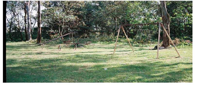
6 Study Purpose This analysis sought to assess the accessibility and attractiveness of public open spaces in a sample of FOUR cities and / or towns in Ethiopia. It also sought to decipher factors that explained the current level of accessibility to public openspaces. Open spaces are in this analysis refer to recreational facilities such as public parks, playgrounds and amusement centers and residential gree space.
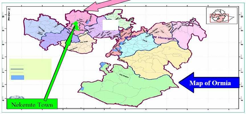
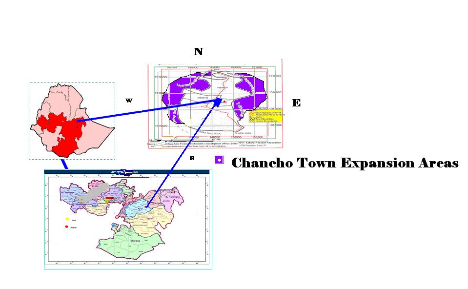
7 The Method Observation was used as a way of understanding the interaction betwee people and space. In addition to observed behavior of space users as well as the recording of size and typology of public open space facilities, a questionnaire was administers to a smaple of random observed space users. This was done to comprehensively capture both that passive and active interaction between people and space. A total of 451 questionnaires were administered with the help of Urban Management Masters (UMM) students at the Ethiopian Civil Service University (ECSU) in Such a survey was conducted in four selected cities and / or towns including the capital city of Addis Ababa, the city of Dire Dawa, and the two towns of Nekemte and Chancho.
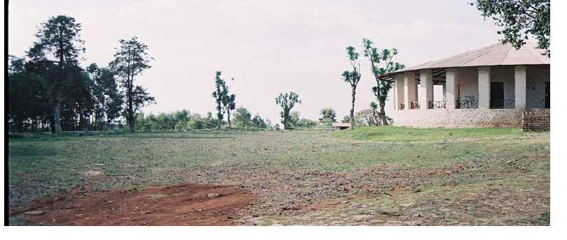
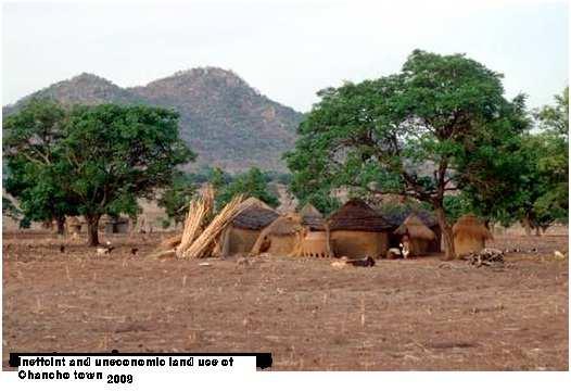
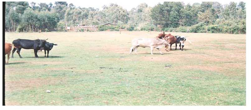
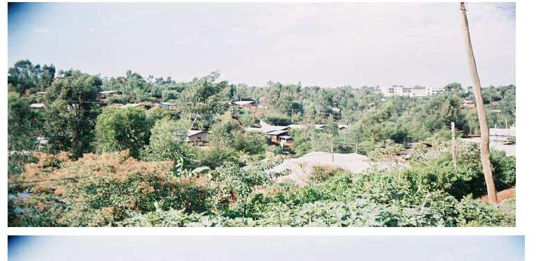
8 Name of City / town Number of surveyed open space users Dire Dawa 112 observed space users surveyed in the city s 5 out of 9 kebeles General characteristics of city / town Urban landscape characteristics charcteristics It is the second bisggest city (after Addis Ababa the capital). The total urban population is inhabitants. Dire Dawa covers a total area of hactares of which hactares is urban. Nekemte town 100 observed space users surveyed in the twon s 7 out of a total of 12 Kebeles It is the administrative capital of Wellega zone in Oromia Regional State. The town is 331km away from the country s capital Addis Ababa. Its population stood at approximately in According to the current urban master plan, the town occupies hactares of land of whicxh 627 hactares is urban land. Urban agricutures constitute 1.24% of urban land; Urban forest 32.5 percent; Open space 5.6%, Sportfields 0.5%; the built environment 60.1%. Chancho town 67 observed space users surveyed in the twons 3 out of a total of 5 kebeles. Addis Ababa 172 observed space users surveyed in a sample of kebeles of the city s 3 out of 10 subcities of Yeka, Lideta and Bole It is the administrative capital of Gololcha Woreda in Oromia Reginal State. The town is located 307 km to the South-East capital city of Addis Ababa According to the CSA report of 2007, the towns gross population density stood at people per km 2. It is the capital city of Ethiopia. The estimated total population of the city in 2008 was (FDREPC, 2008). The covers apprimately 493 hactares of land.?
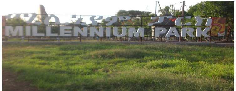
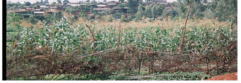
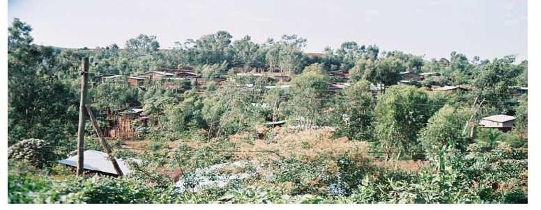
9 DIRE DAWA
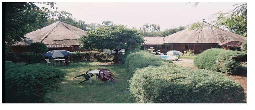
10
11
12 Empirical model specification The adopted model assumed the following statistical formula; Y = β 0 + β 1 x 1 + β 2 x 2 + β 3 x 3 + β 4 x 4 + β 5 x 5 + β 6 x 6 + β 7 x 7 + ui Y = Probability of an urban citizen agrees that the surrounding public spaces are accessible (i.e. probability / Agree = 1) X 1 = Type of user (1 = occassional user; 10 = frequent user) X 2 = Typology of public space (3 = public parks; 2 = playgrounds; 3 = residential green spaces) X 3 = Size of parcel (1 = small; 10 = large) X 4 = Observed open-space function (0 = serving its purpose; 1 = not serving its purpose) X 5 = Income status (0 = low; 1 = high) X 6 = Distance to open space facility (0 = next to neighbourhood; 10 = far away from neighbourhood) X 7 = Size of urban area (population equivalent on a 5 point likert scale; 1 = small / Chancho town; 5 = large / Addis Ababa) X 8 = Aesthetic appeal / attractiveness of open space (0 = less appealing / attractive; 10 more appealing / attractive) Model Evaluation Parameters in logistic regression model were estimated using the maximum likelihood method. The statistical significance of each coefficient was evaluated using the Wald test. The enumerated regression coeficients represent the change in the logit of the probability from a unit change in the associated predictor, assuming other factors are constant. The goodness-of-fit test of the regression model in this study was analyzed using; 1. The Omnibus test, which is a likelihood ratio chi-square test that test whether the coefficients of the variables in the model are all jointly equal to zero. 2.The Hosmer & Lemeshaw (H-L) goodness-of-fit test, which examines the null hypothesis that the model adjust well to the data and 3. The Cox and Snell (1989) and Nagelkerke (1991) two descriptor measures that reveal the amount of variation in the outcome variable that is explained by the models (Long, 1997; Hosmer and Lameshaw, 2000).
13 Results and Discussion B S.E. Wald Df p-value Exp(B) Type of user Typology of public space Size of parcel Observed open space function Income status Distance to open space facility Size of urban area Aesthetic appeal / attractiveness Constant Table 2. Test parameters for the binary logistic model.
14 Results and Discussion Results reveal that out of the 451 surveyed urban inhabitants in four sampled cities and / or towns of Ethiopia, a total of 80.3 % believed that public open spaces were not easily accessible. People who regularly use observed public open spaces were times (ie. Exp B = 1.027) more likely to agree that such facilities were easily accessible that those who seldom use them. Accessibility to public open spaces was also found to vary significantly with the typology of public space (p < 0.05). The negative beta estimate reveals that public parks were dismissed as highly inaccessible (in relative terms) as compared to play grounds and residential green open spaces. Another significant factor (p < 0.01) was the size of the observed size of the land parcel. Large public open space facilities were largely dismissed as inaccessible when compared with small ones (β = ).
15 Results and discussion Study results also revealed that about 31, 9% of the sampled respondents were using public open spaces where elements of serving an unintended function were observed and recorded. Such unintended functions included illegal disposal of solid waste, unauthorized urban farming activities, illegal structures (housing and informal business) and livestock grazing. The binary logistic results revealed that respondents who were observed using public open spaces which had an element of not serving the intended purpose were times more likely to dismiss the concerned parcel as inaccessible. Such a finding was very significant (p < 001). Open space users who belonged to a low income bracket were times more likely to dismiss the public open space more inaccessible than those who occupied the high income bracket. As expected, open space users who defined surrounding public open spaces as being far away from the own neighbourhoodswere times more likely to dismiss such facilities as more inaccessible than those who felt that such facilities were within reach (β = -2.5; p < 0.001). Users from the much bigger cities of Addis Ababa and Dire Dawawere more likely to identify their publiblicopen spaces as in accessible than those who came from the much smaller towns of Nekemteand Chancho. These results were however not significant (p > 0.5).
16
17 Results and discussion Another significant factor (p < 0.001) was the attractiveness and / or aesthetic appeal associated with the concerned public open spaces. Many users felt that the public open spaces were less attractive and less aesthetically appealing. Since the beta estimate is positive, such users were times likely to dismiss such public facilities as inaccessible more than those who thought otherwise. Several reasons were advanced. Most users felt that the bulk of public open spaces were not monitored and maintained regularly. Most facilities were characterised as dirty owing to indiscriminate disposal of solid waste. The supportive infrastructures such as access roads, equipment for public toilets and water taps was also reported to be in dire state.
18 Concluding remarks Using accessibility to public open space facilities as a predictor variable, this analysis sought assess the extent to which a sample of four Ethiopian towns and / or cities were designed according to human scale and other aspirations. Results revealed that most public open spaces are less attractive and difficult to access. At a more general level, three major factors are to blame. These include absence of a land use (re)mixing strategy, weak development controls that have seen some open spaces giving way to illegal land uses and the general absence of quality infrastructure in existing open spaces. The most affected households reside in poor neighbourhoods. Only a spatial planning strategy that is guided by a known land use (re) mixing strategy would ensure improved accessibility to open spaces. Such an effort however needs to be complemented by strategies that strive to strengthen the current development control mechanisms and the fortressing of open spaces that are under immense pressure from other competing uses. A major facelift on the attractiveness of existing open spaces through the provision of quality infrastructure is also required.
19 THANK YOU FOR YOUR ATTENTION!!!
CHAPTER 4 HIGH LEVEL SPATIAL DEVELOPMENT FRAMEWORK (SDF) Page 95
 Page 95") CHAPTER 4 HIGH LEVEL SPATIAL DEVELOPMENT FRAMEWORK (SDF) Page 95 CHAPTER 4 HIGH LEVEL SPATIAL DEVELOPMENT FRAMEWORK 4.1 INTRODUCTION This chapter provides a high level overview of George Municipality s
CHAPTER 4 HIGH LEVEL SPATIAL DEVELOPMENT FRAMEWORK (SDF) Page 95 CHAPTER 4 HIGH LEVEL SPATIAL DEVELOPMENT FRAMEWORK 4.1 INTRODUCTION This chapter provides a high level overview of George Municipality s
CLAREMONT MASTER PLAN 2017: LAND USE COMMUNITY INPUT
 Planning and Development Department 14 North Street Claremont, New Hampshire 03743 Ph: (603) 542-7008 Fax: (603) 542-7033 Email: cityplanner@claremontnh.com www.claremontnh.com CLAREMONT MASTER PLAN 2017:
Thoughts toward autonomous land development. Introduction
 Thoughts toward autonomous land development Spatial Transformation of Regular grid Irrigation Frameworks Bangkok and Cairo A Work in Progress Information based on student workshop June 2009 and earlier
It is clearly necessary to introduce some of the difficulties of defining rural and
 UNIT 2 CHANGING HUMAN ENVIRONMENTS G2 Theme 2 Investigating Settlement Change in MEDCs 2.1 What are the distinctive features of settlements? It is clearly necessary to introduce some of the difficulties
Developing Quality of Life and Urban- Rural Interactions in BSR
 Developing Quality of Life and Urban- Rural Interactions in BSR Sakari Saarinen Union of the Baltic Cities, Commission on Environment Seminar on Quality of Life in Small Communities, 27 May 2010, Kärdla,
Subject: Note on spatial issues in Urban South Africa From: Alain Bertaud Date: Oct 7, A. Spatial issues
 Page 1 of 6 Subject: Note on spatial issues in Urban South Africa From: Alain Bertaud Date: Oct 7, 2009 A. Spatial issues 1. Spatial issues and the South African economy Spatial concentration of economic
MULTINOMIAL LOGISTIC REGRESSION
 MULTINOMIAL LOGISTIC REGRESSION Model graphically: Variable Y is a dependent variable, variables X, Z, W are called regressors. Multinomial logistic regression is a generalization of the binary logistic
Advanced Quantitative Data Analysis
 Chapter 24 Advanced Quantitative Data Analysis Daniel Muijs Doing Regression Analysis in SPSS When we want to do regression analysis in SPSS, we have to go through the following steps: 1 As usual, we choose
Foreword. Vision and Strategy
 GREATER MANCHESTER SPATIAL FRAMEWORK Friends of Walkden Station Consultation Response January 2017 Foreword Friends of Walkden Station are a group of dedicated volunteers seeking to raise the status and
Spatial Analysis of Public Services (schools) in Nablus City Using the Tool of Geographic Information System (GIS)
 in Nablus City Using the Tool of Geographic Information System (GIS)") http://www.ierek.com/press ISSN (Print: 2537-0154, online: 2537-0162) International Journal on: The Academic Research Community Publication Spatial Analysis of Public Services (schools) in Nablus City
http://www.ierek.com/press ISSN (Print: 2537-0154, online: 2537-0162) International Journal on: The Academic Research Community Publication Spatial Analysis of Public Services (schools) in Nablus City
Chapter 1: Introduction to Safety and Ethics
 Core Curriculum Standards Met by Each Chapter On the Right Trail meets Utah s Social Studies Core Curriculum Standards for grades 3-7. Each chapter has specific standard objectives, which are met by the
A Review of Concept of Peri-urban Area & Its Identification
 A Review of Concept of Peri-urban Area & Its Identification Ar. Manita Saxena Research Scholar Department of Architecture and Planning M.A.N.I.T, Bhopal Dr. Supriya Vyas Assistant Professor, Department
KUNMING FORUM ON UNITED NATIONS GLOBAL GEOSPATIAL INFORMATION MANAGEMENT CITIES OF THE FUTURE: SMART, RESILIENT
 KUNMING FORUM ON UNITED NATIONS GLOBAL GEOSPATIAL INFORMATION MANAGEMENT CITIES OF THE FUTURE: SMART, RESILIENT and SUSTAINABLE Yunnan Zhenzhuang Guest House, Kunming, China 10 12 May 2017 BACKGROUND CONCEPT
A Critical Review of the Application of Planning Standards and Norms in the Planning of Bahir Dar and Hawassa Cities, Ethiopia
 A Critical Review of the Application of Planning Standards and Norms in the Planning of Bahir Dar and Hawassa Cities, Ethiopia Mulugeta Worku Fetene (Corresponding author) School of Graduate studies, Ethiopian
Discerning sprawl factors of Shiraz city and how to make it livable
 Discerning sprawl factors of Shiraz city and how to make it livable 1. Introduction: Iran territory has now been directly affected by urban land-uses which are shaping landscapes in cities and around them.
The Governance of Land Use
 The planning system The Governance of Land Use United Kingdom Levels of government and their responsibilities The United Kingdom is a unitary state with three devolved governments in Northern Ireland,
The National Spatial Strategy
 Purpose of this Consultation Paper This paper seeks the views of a wide range of bodies, interests and members of the public on the issues which the National Spatial Strategy should address. These views
Generic Success Criteria
 Generic Success Criteria Significance I can identify a short term and long term impact that a development/event/issue has/had locally/globally. I can discuss (verbally, graphically, etc.) how a development/event/issue
ACCESSIBILITY TO SERVICES IN REGIONS AND CITIES: MEASURES AND POLICIES NOTE FOR THE WPTI WORKSHOP, 18 JUNE 2013
 ACCESSIBILITY TO SERVICES IN REGIONS AND CITIES: MEASURES AND POLICIES NOTE FOR THE WPTI WORKSHOP, 18 JUNE 2013 1. Significant differences in the access to basic and advanced services, such as transport,
Bishkek City Development Agency. Urban Planning Bishkek
 Bishkek City Development Agency Urban Planning Bishkek Bishkek City Development Agency Official name City budget Population Area GRP Import value Export value External trade turnover Foreign direct investments
BIG IDEAS. Area of Learning: SOCIAL STUDIES Urban Studies Grade 12. Learning Standards. Curricular Competencies
 Area of Learning: SOCIAL STUDIES Urban Studies Grade 12 BIG IDEAS Urbanization is a critical force that shapes both human life and the planet. The historical development of cities has been shaped by geographic,
Summary and Statistical Report of the 2007 Population and Housing Census Results 1
 Summary and Statistical Report of the 2007 Population and Housing Census Results 1 2 Summary and Statistical Report of the 2007 Population and Housing Census Results This document was printed by United
THE ROLE OF SMALL TOWNS IN ECONOMIC DEVELOPMENT OF VILLAGES OF PENETRATION AREAS: THE CASE STUDY OF THE CITY OF NOSRAT ABAD
 THE ROLE OF SMALL TOWNS IN ECONOMIC DEVELOPMENT OF VILLAGES OF PENETRATION AREAS: THE CASE STUDY OF THE CITY OF NOSRAT ABAD Mohammad Mehdi Pour Arbabi 1, Gholam Reza Miri 2*, Mehdi Khosravi 3 1 MSc student
Measuring Perceived Accessibility to Urban Green Space: An Integration of GIS and Participatory Map
 Measuring Perceived Accessibility to Urban Green Space: An Integration of GIS and Participatory Map Fariba Sotoudehnia, Lex Comber 1,2 Department of Geography, University of Leicester, UK ABSTRACT Urban
Logistic Regression. Continued Psy 524 Ainsworth
 Logistic Regression Continued Psy 524 Ainsworth Equations Regression Equation Y e = 1 + A+ B X + B X + B X 1 1 2 2 3 3 i A+ B X + B X + B X e 1 1 2 2 3 3 Equations The linear part of the logistic regression
Understanding and Measuring Urban Expansion
 VOLUME 1: AREAS AND DENSITIES 21 CHAPTER 3 Understanding and Measuring Urban Expansion THE CLASSIFICATION OF SATELLITE IMAGERY The maps of the urban extent of cities in the global sample were created using
Riga. Riga City Planning Region. Legal framework
 Riga http://www.rpr.gov.lv/ Riga City Planning Region Riga Planning Region as a territory is situated in the central part of Latvia, and its centre is Riga - the capital of Latvia. Riga is internationally
National planning report for Denmark
 National planning report for Denmark from the Minister for Environment and Energy Local identity and new challenges Summary 2000 1 CONTENTS 4 PREFACE: REGIONAL DEVELOPMENT AND SPATIAL PLANNING 6 1. BALANCED
SAHEL AND. Club WEST AFRICA
 SAHEL AND Club WEST AFRICA Informing policies for Africa s urban future Africa is projected to have the fastest urban growth rate in the world by 2050, Africa s cities will be home to an additional 950
Shaping Your Neighbourhood
 Shaping Your Neighbourhood Building a Core Sustainable Neighbourhood Action Plan Nov. 25 & 26, 2006 Welcome! Peter Russell Planner, Holland Barrs Planning Group Inc. Role in this project: Work with the
Local Area Key Issues Paper No. 13: Southern Hinterland townships growth opportunities
 Draft Sunshine Coast Planning Scheme Review of Submissions Local Area Key Issues Paper No. 13: Southern Hinterland townships growth opportunities Key Issue: Growth opportunities for Southern Hinterland
Park Users Characteristics That Influence Satisfaction In Urban Parks In Kisumu County, Kenya
 Park Users Characteristics That Influence Satisfaction In Urban Parks In Kisumu County, Kenya Judith Ochengo MA, Geography Department, Kenyatta University Philomena Muiruri Thomas Kibutu Lecturer, Geography
Dependent Variable Q83: Attended meetings of your town or city council (0=no, 1=yes)
") Logistic Regression Kristi Andrasik COM 731 Spring 2017. MODEL all data drawn from the 2006 National Community Survey (class data set) BLOCK 1 (Stepwise) Lifestyle Values Q7: Value work Q8: Value friends
Logistic Regression Kristi Andrasik COM 731 Spring 2017. MODEL all data drawn from the 2006 National Community Survey (class data set) BLOCK 1 (Stepwise) Lifestyle Values Q7: Value work Q8: Value friends
Data Collection. Lecture Notes in Transportation Systems Engineering. Prof. Tom V. Mathew. 1 Overview 1
 Data Collection Lecture Notes in Transportation Systems Engineering Prof. Tom V. Mathew Contents 1 Overview 1 2 Survey design 2 2.1 Information needed................................. 2 2.2 Study area.....................................
SOCIO-ECONOMIC IMPACTS OF FLOODING IN DIRE DAWA, ETHIOPIA
 SOCIO-ECONOMIC IMPACTS OF FLOODING IN DIRE DAWA, ETHIOPIA Alemu Yonas Tadesse * Supervisor: Prof. A.W. Jayawardena ** MEE08182 ABSTRACT Dire Dawa, the second largest city of Ethiopia, has been suffering
Assesment on Urban Density and Land Use Efficiency in the Ethiopian Cities
 Assesment on Urban Density and Land Use Efficiency in the Ethiopian Cities Abaynew Wudu Belete Researcher, Urban Development Policy Study and Research Department, Federal Democratic Republic of Ethiopia
Tackling urban sprawl: towards a compact model of cities? David Ludlow University of the West of England (UWE) 19 June 2014
 19 June 2014") Tackling urban sprawl: towards a compact model of cities? David Ludlow University of the West of England (UWE) 19 June 2014 Impacts on Natural & Protected Areas why sprawl matters? Sprawl creates environmental,
Tackling urban sprawl: towards a compact model of cities? David Ludlow University of the West of England (UWE) 19 June 2014 Impacts on Natural & Protected Areas why sprawl matters? Sprawl creates environmental,
Preparing the GEOGRAPHY for the 2011 Population Census of South Africa
 Preparing the GEOGRAPHY for the 2011 Population Census of South Africa Sharthi Laldaparsad Statistics South Africa; E-mail: sharthil@statssa.gov.za Abstract: Statistics South Africa (Stats SA) s Geography
RESIDENTIAL SATISFACTION IN THE CHANGING URBAN FORM IN ADELAIDE: A COMPARATIVE ANALYSIS OF MAWSON LAKES AND CRAIGBURN FARM, SOUTH AUSTRALIA
 RESIDENTIAL SATISFACTION IN THE CHANGING URBAN FORM IN ADELAIDE: A COMPARATIVE ANALYSIS OF MAWSON LAKES AND CRAIGBURN FARM, SOUTH AUSTRALIA by Michael Chadbourne BEPM (Hons) University of Adelaide Thesis
Uganda - National Panel Survey
 Microdata Library Uganda - National Panel Survey 2013-2014 Uganda Bureau of Statistics - Government of Uganda Report generated on: June 7, 2017 Visit our data catalog at: http://microdata.worldbank.org
Valuation of environmental amenities in urban land price: A case study in the Ulaanbaatar city, Mongolia
 1989 1990 1991 1992 1993 1994 1995 1996 1997 1998 1999 2000 2001 2002 2003 2004 2005 2006 2007 2008 2009 2010 2011 Population Valuation of environmental amenities in urban land price: A case study in the
Engagement on Strategies to Overcome Inequality
 Engagement on Strategies to Overcome Inequality Civil Society Engagement with Poverty Julian Sendin 1-2 June 2017 Kievits Kroon Country Estate, Pretoria, South Africa 1. Ndifuna Ukwazi Ndifuna Ukwazi is
Too Close for Comfort
 Too Close for Comfort Overview South Carolina consists of urban, suburban, and rural communities. Students will utilize maps to label and describe the different land use classifications. Connection to
Study Election Mode of Domicied Workers in Makassar City Region
 Study Election Mode of Domicied Workers in Makassar City Region Rais Rachman 1, Herman Parung 2, Slamet Trisutomo 3 and Nur Ali 4 1 Doctoral Course Student, Civil Engineering Departement, Hasanuddin University,
Travel behavior of low-income residents: Studying two contrasting locations in the city of Chennai, India
 Travel behavior of low-income residents: Studying two contrasting locations in the city of Chennai, India Sumeeta Srinivasan Peter Rogers TRB Annual Meet, Washington D.C. January 2003 Environmental Systems,
Urban White Paper on Tokyo Metropolis 2002
 Urban White Paper on Tokyo Metropolis 2002 By Bureau of City Planning Tokyo Metropolitan Government Part I. "Progress in IT and City Building" Effects of computer networks on cities and cities' response
CHAPTER VIII FARM IMPLEMENTS, DRAUGHT ANIMALS AND STORAGE FACILITIES
 CHAPTER VIII FARM IMPLEMENTS, DRAUGHT ANIMALS AND STORAGE FACILITIES 1. INTRODUCTION Agriculture is the single largest sector in the Ethiopian economy. The position of the agricultural sector for the past
Neighbourhood accessibility and sustainable development in Nigeria
 International Journal of Development and Sustainability ISSN: 2186-8662 www.isdsnet.com/ijds Volume 7 Number 6 (2018): Pages 2004-2016 ISDS Article ID: IJDS18020303 Neighbourhood accessibility and sustainable
Class Notes: Week 8. Probit versus Logit Link Functions and Count Data
 Ronald Heck Class Notes: Week 8 1 Class Notes: Week 8 Probit versus Logit Link Functions and Count Data This week we ll take up a couple of issues. The first is working with a probit link function. While
CHANGES IN THE STRUCTURE OF POPULATION AND HOUSING FUND BETWEEN TWO CENSUSES 1 - South Muntenia Development Region
 TERITORIAL STATISTICS CHANGES IN THE STRUCTURE OF POPULATION AND HOUSING FUND BETWEEN TWO CENSUSES 1 - South Muntenia Development Region PhD Senior Lecturer Nicu MARCU In the last decade, a series of structural
Summary and Implications for Policy
 Summary and Implications for Policy 1 Introduction This is the report on a background study for the National Spatial Strategy (NSS) regarding the Irish Rural Structure. The main objective of the study
Tourism. April State Planning Policy state interest guideline. Department of Infrastructure, Local Government and Planning
 Department of Infrastructure, Local Government and Planning State Planning Policy state interest guideline Tourism April 2016 Great state. Great opportunity. Preface Using this state interest guideline
This table connects the content provided by Education Perfect to the NSW Syllabus.
 Education Perfect Geography provides teachers with a wide range of quality, engaging and innovative content to drive positive student learning outcomes. Designed by teachers and written by our in-house
New Partners for Smart Growth: Building Safe, Healthy, and Livable Communities Mayor Jay Williams, Youngstown OH
 New Partners for Smart Growth: Building Safe, Healthy, and Livable Communities Mayor Jay Williams, Youngstown OH The City of Youngstown Youngstown State University Urban Strategies Inc. Youngstown needed
Measuring Disaster Risk for Urban areas in Asia-Pacific
 Measuring Disaster Risk for Urban areas in Asia-Pacific Acknowledgement: Trevor Clifford, Intl Consultant 1 SDG 11 Make cities and human settlements inclusive, safe, resilient and sustainable 11.1: By
Identification of the quality of urban life assessment aspects in residential neighbourhoods in Doha
 The Sustainable City IX, Vol. 1 391 Identification of the quality of urban life assessment aspects in residential neighbourhoods in Doha R. Qawasmeh Department of Architecture and Urban Planning, Qatar
SPURRING NATION S ECONOMY THROUGH SmartKADASTER
 SPURRING NATION S ECONOMY THROUGH SmartKADASTER SR MOHAMAD KAMALI BIN ADIMIN DIVISION DIRECTOR (CADASTRE) DEPARTMENT OF SURVEY AND MAPPING MALAYSIA THE NEED TO TRANSFORM TRANSFORMATION AGENDA EMPOWERING
Trip Generation Model Development for Albany
 Trip Generation Model Development for Albany Hui (Clare) Yu Department for Planning and Infrastructure Email: hui.yu@dpi.wa.gov.au and Peter Lawrence Department for Planning and Infrastructure Email: lawrence.peter@dpi.wa.gov.au
Typical information required from the data collection can be grouped into four categories, enumerated as below.
 Chapter 6 Data Collection 6.1 Overview The four-stage modeling, an important tool for forecasting future demand and performance of a transportation system, was developed for evaluating large-scale infrastructure
NATURE AND EXTENT OF PROPOSED DEVELOPMENT. Amount of Development Development Zones Distribution of Density Policies
 NATURE AND EXTENT OF PROPOSED DEVELOPMENT Amount of Development Development Zones Distribution of Density Policies DRAFT POOLBEG PLANNING SCHEME Amount of Development 78 4.1 The rationale for the overall
Problems In Large Cities
 Chapter 11 Problems In Large Cities Create a list of at least 10 problems that exist in large cities. Consider problems that you have read about in this and other chapters and/or experienced yourself.
8 Nominal and Ordinal Logistic Regression
 8 Nominal and Ordinal Logistic Regression 8.1 Introduction If the response variable is categorical, with more then two categories, then there are two options for generalized linear models. One relies on
What Explains the Effectiveness of Hot Spots Policing And What New Strategies Should we Employ?
 What Explains the Effectiveness of Hot Spots Policing And What New Strategies Should we Employ? David Weisburd Executive Director Center for Evidence-Based Crime Policy George Mason 1 The Effectiveness
A Remote Sensing and GIS approach to trace the Densification in Residential Areas
 A Remote Sensing and GIS approach to trace the Densification in Residential Areas Valliappan AL Assistant Professor, School of Planning and Architecture, Vijayawada, India. Date:11/03/2015 What is Densification?
MODULE 1 INTRODUCING THE TOWNSHIP RENEWAL CHALLENGE
 MODULE 1 INTRODUCING THE TOWNSHIP RENEWAL CHALLENGE FOCUS OF THE MODULE Township renewal challenges and developmental outcomes covered in this module: Historical origins of townships and the inherited
R E SEARCH HIGHLIGHTS
 Canada Research Chair in Urban Change and Adaptation R E SEARCH HIGHLIGHTS Research Highlight No.8 November 2006 THE IMPACT OF ECONOMIC RESTRUCTURING ON INNER CITY WINNIPEG Introduction This research highlight
Tourism in Peripheral Areas - A Case of Three Turkish Towns
 Turgut Var Department of Recreation, Park and Tourism Sciences Ozlem Unal Urban planner Derya Guven Akleman Department of Statistics Tourism in Peripheral Areas - A Case of Three Turkish Towns The objective
Measurement of the Urban-Housing Deficit:
 Measurement of the Urban-Housing Deficit: Strategies, tools and sources of information The International Network for Urban and Regional Statistics Standing Committee of the International Association for
accessibility accessibility by-pass bid-rent curve bridging point administrative centre How easy or difficult a place is to reach.
 accessibility accessibility How easy or difficult a place is to reach. How easy or difficult it is to enter a building. administrative centre bid-rent curve The function of a town which is a centre for
Indicator : Average share of the built-up area of cities that is open space for public use for all, by sex, age and persons with disabilities
 Goal 11: Make cities and human settlements inclusive, safe, resilient and sustainable Target 11.7: By 2030, provide universal access to safe, inclusive and accessible, green and public spaces, in particular
The UN-GGIM: Europe core data initiative to encourage Geographic information supporting Sustainable Development Goals Dominique Laurent, France
 INSPIRE conference Strasbourg 6 September 2017 The UN-GGIM: Europe core data initiative to encourage Geographic information supporting Sustainable Development Goals Dominique Laurent, France Introduction
Council Workshop on Neighbourhoods Thursday, October 4 th, :00 to 4:00 p.m. Burlington Performing Arts Centre
 Council Workshop on Neighbourhoods Thursday, October 4 th, 2012 1:00 to 4:00 p.m. Burlington Performing Arts Centre Agenda Introductions Warm-Up Exercise Presentation Exercise Neighbourhood Planning Break
Modeling and Predicting of Future Urban Growth in the Charleston, South Carolina Area
 Modeling and Predicting of Future Urban Growth in the Charleston, South Carolina Area Jeffery Allen Testimony presented to the U.S. Commission on Ocean Policy January 15, 2002 Charleston, South Carolina
A Method for Mapping Settlement Area Boundaries in the Greater Golden Horseshoe
 A Method for Mapping Settlement Area Boundaries in the Greater Golden Horseshoe Purpose This paper describes a method for mapping and measuring the lands designated for growth and urban expansion in the
Cultural Routes of the Council of Europe - Glossary
 Cultural Routes of the Council of Europe - Glossary Below is a collection of terms linked to Cultural Routes of the Council of Europe. The glossary is taken from the book Cultural Routes management: from
Land Use of the Geographical Information System (GIS) and Mathematical Models in Planning Urban Parks & Green Spaces
 and Mathematical Models in Planning Urban Parks & Green Spaces") Land Use of the Geographical Information System (GIS) and Mathematical Models in Planning Urban Key words: SUMMARY TS 37 Spatial Development Infrastructure Linkages with Urban Planning and Infrastructure
Land Use of the Geographical Information System (GIS) and Mathematical Models in Planning Urban Key words: SUMMARY TS 37 Spatial Development Infrastructure Linkages with Urban Planning and Infrastructure
November 29, World Urban Forum 6. Prosperity of Cities: Balancing Ecology, Economy and Equity. Concept Note
 November 29, 2010 World Urban Forum 6 Prosperity of Cities: Balancing Ecology, Economy and Equity Concept Note 1 CONTENT Thematic Continuity Conceptualizing the Theme The 6 Domains of Prosperity The WUF
Risk-based land use and spatial planning
 Risk-based land use and spatial planning Miho OHARA International Centre for Water Hazards and Risk Management (ICHARM) Public Works Research Institute PWRI), Japan Under the auspices of UNESCO Introduction
A Framework for the Study of Urban Health. Abdullah Baqui, DrPH, MPH, MBBS Johns Hopkins University
 This work is licensed under a Creative Commons Attribution-NonCommercial-ShareAlike License. Your use of this material constitutes acceptance of that license and the conditions of use of materials on this
Urban Expansion. Urban Expansion: a global phenomenon with local causes? Stephen Sheppard Williams College
 Urban Expansion: a global phenomenon with local causes? Stephen Sheppard Williams College Presentation for World Bank, April 30, 2007 Presentations and papers available at http://www.williams.edu/economics/urbangrowth/homepage.htm
A Study on the Hedonic Analysis of Housing Market in the U-City
 A Study on the Hedonic Analysis of Housing Market in the Jiseon. Kim, Kabsung. Kim, and Seungbee. Choi Abstract The concept of is to integrate ubiquitous information technology services to our city space
Geodatabase for Sustainable Urban Development. Presented By Rhonda Maronn Maurice Johns Daniel Ashney Jack Anliker
 Geodatabase for Sustainable Urban Development Presented By Rhonda Maronn Maurice Johns Daniel Ashney Jack Anliker Objective Build a Geodatabase that will enable urban planners to create and assess the
Sharthi Laldaparsad Statistics South Africa, Policy Research & Analysis. Sub-regional workshop on integration of administrative data,
 Sub-regional workshop on integration of administrative data, big data and geospatial information for the compilation of SDG indicators and International Workshop on Global Fundamental Geospatial Data Themes
CLLD Cooperation OFFER
 Title of the proposed project (English) CLLD Cooperation OFFER PARKS PROTECTION III - Management, Protection and Economic Development in Protected Areas Type of project (select as many as you want) Cooperation
Dr.Sinisa Vukicevic Dr. Robert Summers
 Dr.Sinisa Vukicevic Dr. Robert Summers "Planning" means the scientific, aesthetic, and orderly disposition of land, resources, facilities and services with a view to securing the physical, economic and
The importance of visioning in urban strategic planning By Peter Robinson. MILE Master Class Urban Strategic Planning March 2016
 The importance of visioning in urban strategic planning By Peter Robinson MILE Master Class Urban Strategic Planning March 2016 Typical strategic planning process Where are we now? Where are we going?
Transport Planning in Large Scale Housing Developments. David Knight
 Transport Planning in Large Scale Housing Developments David Knight Large Scale Housing Developments No longer creating great urban spaces in the UK (Hall 2014) Transport Planning Transport planning processes
Promoting synergy between airports and cities to achieve sustainable development
 Promoting synergy between airports and cities to achieve sustainable development Content 1. Airports / Aviation 2. Urbanization 3. Shared Threads & Opportunities 4. Synergistic Development for Sustainability
2040 MTP and CTP Socioeconomic Data
 SE Data 6-1 24 MTP and CTP Socioeconomic Data Purpose of Socioeconomic Data The socioeconomic data (SE Data) shows the location of the population and employment, median household income and other demographic
INTERNATIONAL CULTURAL TOURISM CHARTER Managing Tourism at Places of Heritage Significance (1999)
") INTERNATIONAL CULTURAL TOURISM CHARTER Managing Tourism at Places of Heritage Significance (1999) Adopted by ICOMOS at the 12th General Assembly in Mexico, October 1999. INTRODUCTION The Charter Ethos
INTERNATIONAL CULTURAL TOURISM CHARTER Managing Tourism at Places of Heritage Significance (1999) Adopted by ICOMOS at the 12th General Assembly in Mexico, October 1999. INTRODUCTION The Charter Ethos
Sample assessment task. Task details. Content description. Year level 7
 Sample assessment task Year level 7 Learning area Subject Title of task Task details Description of task Type of assessment Purpose of assessment Assessment strategy Evidence to be collected Suggested
TRIP GENERATION MODEL FOR THE CORE AREA OF THIRUVANANTHAPURAM CITY
 ISSN (Online) : 2319-8753 ISSN (Print) : 2347-6710 International Journal of Innovative Research in Science, Engineering and Technology An ISO 3297: 2007 Certified Organization, Volume 2, Special Issue
A Preliminary Model of Community-based Integrated Information System for Urban Spatial Development
 A Preliminary Model of Community-based Integrated Information System for Urban Spatial Development Bauni HAMID 1, Devin DEFRIZA 2 1 2 CAITAD (Center of Applied Information Technology in Planning and Design),
The Role of Urban Planning and Local SDI Development in a Spatially Enabled Government. Faisal Qureishi
 The Role of Urban Planning and Local SDI Development in a Spatially Enabled Government Faisal Qureishi 1 Introduction A continuous increase in world population combined with limited resources has lead
Summary. Recommendations on the Fifth Policy Document on Spatial Planning September 2001
 Summary Recommendations on the Fifth Policy Document on Spatial Planning September 2001 2 Introduction In December 2000 the Dutch Cabinet issued Part 1 of the Fifth National Policy Document on Spatial
Legal problems of environmental management. Spatial planning and space management. M. Gajewski 2014 / 2015
 Legal problems of environmental management Spatial planning and space management M. Gajewski 2014 / 2015 Course contents (in brief) Constitutional basis of the environment protection system. General principles
Urban Planning Word Search Level 1
 Urban Planning Word Search Level 1 B C P U E C O S Y S T E M P A R E U O E U R B A N P L A N N E R T N S T D H E C O U N T Y G E R E R D W R E N I C I T Y C O U N C I L A A A S U G G C I L A G P R I R
Evaluating Multi-dimensional Human Needs in Open Spaces: Taman Tasik Shah Alam, Selangor, Malaysia
 Available Online at www.e-iph.co.uk ASEAN-Turkey ASLI QoL2015: AQoL2015Izmir 2 nd ABRA International Conference on Quality of Life Dokuz Eylul Universitesi, Izmir, Turkey, 09-14 Dec. 2015 Evaluating Multi-dimensional
Forecasts for the Reston/Dulles Rail Corridor and Route 28 Corridor 2010 to 2050
 George Mason University Center for Regional Analysis Forecasts for the Reston/Dulles Rail Corridor and Route 28 Corridor 21 to 25 Prepared for the Fairfax County Department of Planning and Zoning Lisa
Urbanization and Sustainable Development of Cities: A Ready Engine to Promote Economic Growth and Cooperation
 Urbanization and Sustainable Development of Cities: A Ready Engine to Promote Economic Growth and Cooperation Wan Portia Hamzah Institute of Strategic and International Studies (ISIS) Malaysia 10 September