Participatory Mapping for Drought Resilience in Jalna District, Maharashtra, India
|
|
|
- Neil Singleton
- 6 years ago
- Views:
Transcription
1 Participatory Mapping for Drought Resilience in Jalna District, Maharashtra, India Work in progress Line J. Barkved (NIVA), Armando LaMadrid (CICERO), Ulka Kelkar (TERI), Karianne debruin (CICERO), Guro Aandahl (NIBR), Suruchi Bhadwal (TERI), Trond Vedeld (NIBR) 20 th March 2013 European Climate Change Adaptation Conference (ECCA) Hamburg
 A need to better understand the perspectives and responses of local communities and")
 & bottom-up participatory approaches 9 rural villages in the drought-prone Jalna district,")
2 EVA project Pilot project: Extreme Risks, Vulnerabilities and Community-Based Adaptation (EVA) in India ( ) A need to better understand the perspectives and responses of local communities and policymakers to plan for changes in climatic extremes Interdisciplinary approach using top-down (modeling) & bottom-up participatory approaches 9 rural villages in the drought-prone Jalna district, Maharashtra, India
3 Focus How can rural communities in Maharashtra adapt to extreme drought? Does participatory mapping serve a useful tool to understand local experiences and perceptions and foster community-based adaptation to extreme drought?


4 Extreme drought and adaptation Droughts are a natural phenomena Climate change may alter magnitude and frequency of extreme droughts UNISDR (2009) Understanding and managing changing risks Building resilience is essential - the capacity to deal with change SREX (2012)

5 Drought a multi-dimensional phenomena (Source: National Drought Mitigation Center, University of Nebraska-Lincoln, U.S.A.)
6 Participatory mapping A set of approaches and techniques that combines tools of modern cartography with participatory methods to represent the spatial knowledge of local communities 1 Different types from low tech (mapping on the ground) to more high tech (PGIS) Typical applications in literature: resource mapping, natural resource management, forest, floods. less on participatory drought mapping 1: source:
7 Level of precision Depends on the objective Who is it important for, and why? (source: McCall 2006)

8 Jalna district, Maharashtra, India


9 Jalna district 3 clusters: Bhokardan, Jafrabad, Badnapur. 3 villages in each clusters Dryland, drought prone Semi-arid monsoon climate, erratic rainfall Fall in groundwater level ( ) Source: Agricultural livelihood - Cash crops include in particular cotton
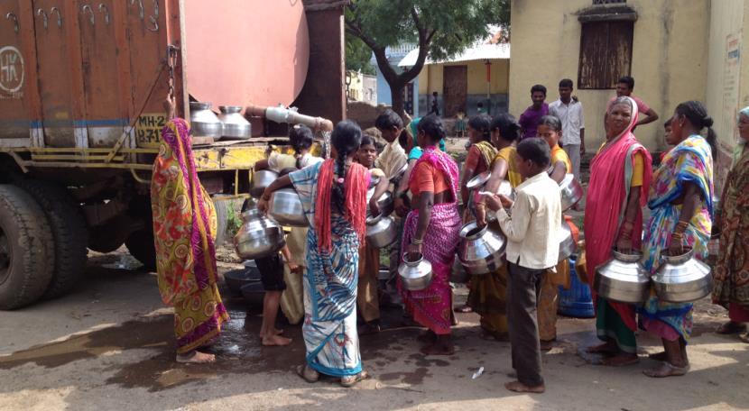
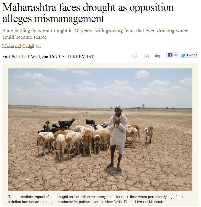
10 : worst drought since 1972
11 Participatory drought mapping Photo-mapping with satellite imagery printed on A0-sized posters Groups of 8-12 persons with facilitation Sequence of events - Sep 2012: Introduction to the activity in the villages Community resource mapping - Digitizing of first mapping - Feb 2013: Validating of digitization with the community Mapping of drought zones - Digitizing of second mapping - Validating with the community, and evaluation of adaptation options


12 Sep 2013: Resource mapping Showed interest in the satellite images Mapping the villages boundary was an engaging and tedious task - discussions Different experiences in terms of participation between the villages


13 Feb 2013: Mapping drought zones Discussing drought and mapping drought zones Drought associated with water availability Spatial variances associated with soil quality In most of the groups, one or two often did most of the drawing

14 Facilitation How much? Who speaks? Who is holding the pen?
15 Applied as part of an integrated study with a variety of approaches and tools Participatory mapping Other participatory tools Household survey and interviews GIS Field measurements Secondary data and modeling
16 Theoretical context From Moser & Ekstrom (2010)
17 Key points - what have we learned so far? Visualizing community members spatial knowledge provide insight of local variations in perceptions and experienced impacts and vulnerabilities to drought Satellite imagery provided a form of familiarization and intuitiveness Mapping as a process about more than the map itself. A base for dialogue Maps are not neutral objects separate from the social context Ethical concerns the power of maps, role of facilitation Activation of local knowledge
18 Thank you for your attention Contact: Line Barkved (NIVA) - line.barkved@niva.no EVA Project leader: Trond Vedeld (NIBR) - trond.vedeld@nibr.no EVA website:
Final Report on WP2.3 Mapping of drought vulnerability and risk. Line Barkved (NIVA), Karianne de Bruin (CICERO), Bård Romstad (CICERO)
, Karianne de Bruin (CICERO), Bård Romstad (CICERO)") Final Report on WP2.3 Mapping of drought vulnerability and risk Line Barkved (NIVA), Karianne de Bruin (CICERO), Bård Romstad (CICERO) Title: Mapping of drought vulnerability and risk Authors: Line Barkved
Final Report on WP2.3 Mapping of drought vulnerability and risk Line Barkved (NIVA), Karianne de Bruin (CICERO), Bård Romstad (CICERO) Title: Mapping of drought vulnerability and risk Authors: Line Barkved
Final Report on WP 1 Climate variability, change and extremes in Jalna. Author: Saurabh Bhardwaj (TERI)
") Final Report on WP 1 Climate variability, change and extremes in Jalna Author: Saurabh Bhardwaj (TERI) 1 Extreme Risks, Vulnerabilities and Community- Based Adaptation in India (EVA): a Pilot Study Final
Final Report on WP 1 Climate variability, change and extremes in Jalna Author: Saurabh Bhardwaj (TERI) 1 Extreme Risks, Vulnerabilities and Community- Based Adaptation in India (EVA): a Pilot Study Final
Jakarta, Indonesia,29 Sep-10 October 2014.
 Regional Training Course on Sampling Methods for Producing Core Data Items for Agricultural and Rural Statistics Jakarta, Indonesia,29 Sep-0 October 204. LEARNING OBJECTIVES At the end of this session
Vulnerability and Adaptation to Climate Change
 Vulnerability and Adaptation to Climate Change Prof. Dr. Christoph Görg Department of Social Sciences, University of Kasssel Head of Department Environmental Politics, UFZ Leipzig 1 Introduction: Climate
Building Resilience Through Translocality
 Building Resilience Through Translocality Climate Change, Migration and Social Resilience in Rural Thailand Kayly Ober & Luise Porst Patrick Sakdapolrak, Sopon Naruchaikusol, Simon Alexander Peth, Till
DROUGHT ASSESSMENT USING SATELLITE DERIVED METEOROLOGICAL PARAMETERS AND NDVI IN POTOHAR REGION
 DROUGHT ASSESSMENT USING SATELLITE DERIVED METEOROLOGICAL PARAMETERS AND NDVI IN POTOHAR REGION Researcher: Saad-ul-Haque Supervisor: Dr. Badar Ghauri Department of RS & GISc Institute of Space Technology
Water Resource & Management Strategies
 Water Resource & Management Strategies National Conference on Integrated Water Resource Management for enhancing Farmers' Income March 22, 2017, Hotel Park, New Delhi Nalin Rawal Chief Business head Agribusiness
Chisoni Mumba. Presentation made at the Zambia Science Conference 2017-Reseachers Symposium, th November 2017, AVANI, Livingstone, Zambia
 Application of system dynamics and participatory spatial group model building in animal health: A case study of East Coast Fever interventions in Lundazi and Monze districts of Zambia Chisoni Mumba Presentation
Geographical knowledge and understanding scope and sequence: Foundation to Year 10
 Geographical knowledge and understanding scope and sequence: Foundation to Year 10 Foundation Year 1 Year 2 Year 3 Year 4 Year 5 Year 6 Year level focus People live in places Places have distinctive features
Mesonets and Drought Early Warning
 Mesonets and Drought Early Warning Stuart A. Foster Kentucky Climate Center Western Kentucky University 2017 Regional Mesonet Partners Workshop Champaign, Illinois March 23, 2017 Maximizing the Value of
NORTH VISTA SECONDARY SCHOOL HUMANITIES DEPARTMENT SECONDARY 3 EXPRESS HUMANITIES (GEOGRAPHY) 2272/02 CONTENT OUTLINE Term 1
 2272/02 CONTENT OUTLINE Term 1") NORTH VISTA SECONDARY SCHOOL HUMANITIES DEPARTMENT SECONDARY 3 EXPRESS HUMANITIES (GEOGRAPHY) 2272/02 CONTENT OUTLINE 2019 Term 1 Week Learning Outcomes Skills to be covered Assignment Test Project 1-2
NORTH VISTA SECONDARY SCHOOL HUMANITIES DEPARTMENT SECONDARY 3 EXPRESS HUMANITIES (GEOGRAPHY) 2272/02 CONTENT OUTLINE 2019 Term 1 Week Learning Outcomes Skills to be covered Assignment Test Project 1-2
Country Presentation-Nepal
 Country Presentation-Nepal Mt.Everest, Shiva Pd. Nepal, DHM South Asia Drought Monitor Workshop Dhaka Bangladesh 2 th April 215 Overview Brief Climatology Climate activities- DHM PPCR (Pilot Program for
CLIMATE RESILIENT ALTITUDINAL GRADIENTS (CRAGs)
") CLIMATE RESILIENT ALTITUDINAL GRADIENTS (CRAGs) BUILDING CLIMATE CHANGE RESILIENCE IN THE KIVU- RUSIZI WATERSHEDS Great Lake Conference Entebbe 2017 Chris Magero WHAT ARE CRAGs? Climate-Resilient Altitudinal
CLIMATE RESILIENT ALTITUDINAL GRADIENTS (CRAGs) BUILDING CLIMATE CHANGE RESILIENCE IN THE KIVU- RUSIZI WATERSHEDS Great Lake Conference Entebbe 2017 Chris Magero WHAT ARE CRAGs? Climate-Resilient Altitudinal
Participants. Participatory Mapping. Village : Date : Page : / No. Name Job Gender. Entered by. Interviewer. Author. Checked by
 Participatory Mapping Author Interviewer Entered by Checked by Original or Copy O C File name Checked by Has been written on back? Y N Has been copied? Village Participants No. Name Job Gender 1 2 3 4
Drought Assessment under Climate Change by Using NDVI and SPI for Marathwada
 Available online at www.ijpab.com ISSN: 2320 7051 Int. J. Pure App. Biosci. SPI: 6 (1): 1-5 (2018) Research Article Drought Assessment under Climate Change by Using NDVI and SPI for Marathwada A. U. Waikar
GEOGRAPHY. Parts/Units Topics Marks. Part A Fundamentals of Human Geography 35. Map Work 5. Part B India: People and Economy 35
 GEOGRAPHY Course Structure Parts/Units Topics Marks Part A Fundamentals of Human Geography 35 Unit 1 Unit 2 Unit 3 Unit 4 Unit 5 Human Geography People Human Activities Transport, Communication & Trade
Year 9 plan Victorian Curriculum: Humanities Semester Two (Geography/Economics and Business)
") Year 9 plan Victorian Curriculum: Humanities Semester Two (Geography/Economics and Business) Implementation year: School name: Kyabram P-12 College Prepared By: Rowena Morris Identify Curriculum Curriculum
Year 9 plan Victorian Curriculum: Humanities Semester Two (Geography/Economics and Business) Implementation year: School name: Kyabram P-12 College Prepared By: Rowena Morris Identify Curriculum Curriculum
Hazard monitoring by using new generation satellite data: Pakistan Metrological Department s perspective
 Hazard monitoring by using new generation satellite data: Pakistan Metrological Department s perspective Ms. Humeira Hafeez Pakistan Meteorological Department Top Three Hazards Monsoon Activity Tropical
Advancing Geoscientific Capability. Geological Survey of Finland
 Advancing Geoscientific Capability Geological Survey of Finland GTK in brief The Geological Survey of Finland (GTK) is one of the largest European centres of excellence in assessment, research and the
Geography General Course Year 12. Selected Unit 3 syllabus content for the. Externally set task 2019
 Geography General Course Year 12 Selected Unit 3 syllabus content for the Externally set task 2019 This document is an extract from the Geography General Course Year 12 syllabus, featuring all of the content
Public Disclosure Copy
 Public Disclosure Authorized AFRICA Zambia Environment & Natural Resources Global Practice Recipient Executed Activities Investment Project Financing FY 2013 Seq No: 9 ARCHIVED on 27-Dec-2017 ISR30903
GIS as a tool for rural livelihoods enhancement planning
 GIS as a tool for rural livelihoods enhancement planning (Case study of Alosylat region -Shareg Alnil-Sudan) Almojtaba M. H. Hassabo Federal Ministry of Agriculture Sudan A research submitted to the Development
Urban Climate Resilience
 Urban Climate Resilience in Southeast Asia Partnership Project Introduction Planning for climate change is a daunting challenge for governments in the Mekong Region. Limited capacity at the municipal level,
Application of remote sensing for agricultural disasters
 Application of remote sensing for agricultural disasters Bingfang Wu, Sheng Chang Institute of Remote Sensing and Digital Earth (RADI) Chinese Academy of Sciences (CAS) wubf@radi.ac.cn, changsheng@radi.ac.cn
INTEGRATING CLIMATE VULNERABILITY & RISK ASSESSMENT INTO URBAN SPATIAL PLANNING PROCESS
 INTEGRATING CLIMATE VULNERABILITY & RISK ASSESSMENT INTO URBAN SPATIAL PLANNING PROCESS (CASE STUDY: BLITAR CITY, EAST JAVA, INDONESIA) SHINTA MICHIKO PUTERI, ST, MT. DR. IR. DENNY ZULKAIDI, MUP. WRITER
Climate Change & Disaster Risk Reduction in Urban Informal Settlements - Seminar Summary Report
 Norwegian University of Life Sciences Faculty of Social Sciences The Department of International Environment and Development Studies (Noragric) 2015 ISSN: 2464-1537 Courting Catastrophe Project Report
SDC s Global Programme Climate Change
 SDC s Global Programme Climate Change SDC activities and strategies in the KHK region Indus Forum Workshop Switzerland 13 October 2016 ABOUT SDC IN INDIA BACKGROUND A technical cooperation partner of India
USE OF GEOREFERENCE INFORMATION FOR DRM Arnob Bormdoi Research Associate, GIC
 USE OF GEOREFERENCE INFORMATION FOR DRM Arnob Bormdoi Research Associate, GIC CONTENTS INTRODUCTION THE IMPORTANCE OF SPATIAL INFORMATION CASE STUDIES SUMMARY INTRODUCTION The process of defining how raster
Factors that Shape Places Stage 3 Geography
 Factors that Shape Places Stage 3 Geography Summary This unit is written for Stage 3 "Factors that shape places". It is a Geographical Inquiry, enabling students to work through the 3 stages of inquiry;
Use of Geospatial data for disaster managements
 Use of Geospatial data for disaster managements Source: http://alertsystemsgroup.com Instructor : Professor Dr. Yuji Murayama Teaching Assistant : Manjula Ranagalage What is GIS? A powerful set of tools
DATA DISAGGREGATION BY GEOGRAPHIC
 PROGRAM CYCLE ADS 201 Additional Help DATA DISAGGREGATION BY GEOGRAPHIC LOCATION Introduction This document provides supplemental guidance to ADS 201.3.5.7.G Indicator Disaggregation, and discusses concepts
Adaptation Strategies Of Indigenous Communities To Climate Change: A Case Study Of Dhading District Of Nepal By Sony Baral
 Adaptation Strategies Of Indigenous Communities To Climate Change: A Case Study Of Dhading District Of Nepal By Sony Baral If you are searched for a ebook by Sony Baral Adaptation Strategies of Indigenous
Zambia Strengthening Climate Resilience (PPCR Phase II) (P127254)
 (P127254)") Public Disclosure Authorized AFRICA Zambia Environment & Natural Resources Global Practice Recipient Executed Activities Investment Project Financing FY 2013 Seq No: 11 ARCHIVED on 20-Dec-2018 ISR34595
Public Disclosure Authorized AFRICA Zambia Environment & Natural Resources Global Practice Recipient Executed Activities Investment Project Financing FY 2013 Seq No: 11 ARCHIVED on 20-Dec-2018 ISR34595
Geospatial Technologies for Resources Planning & Management
 Geospatial Technologies for Resources Planning & Management Lal Samarakoon, PhD Director, Geoinformatics Center Asian Institute of Technology, Thailand Content Geoinformatics for SDG Information Integration
DROUGHT INDICES BEING USED FOR THE GREATER HORN OF AFRICA (GHA)
") DROUGHT INDICES BEING USED FOR THE GREATER HORN OF AFRICA (GHA) Christopher Oludhe IGAD Climate Prediction and Applications Centre (ICPAC) Inter-Regional Workshop on Indices and Early Warning Systems for
DROUGHT INDICES BEING USED FOR THE GREATER HORN OF AFRICA (GHA) Christopher Oludhe IGAD Climate Prediction and Applications Centre (ICPAC) Inter-Regional Workshop on Indices and Early Warning Systems for
Leveraging Geospatial Technology for Cadastral Surveys
 Matthew Delano, LS Geospatial World Forum January 2017 Leveraging Geospatial Technology for Cadastral Surveys Fit-for-Purpose Simple to start Can improve over time whenever necessary Meet the needs of
Space Application in Support of Land Management for SDG Implementation
 Space Application in Support of Land Management for SDG Implementation Regional Expert Workshop on Land Accounting for SDG Monitoring and Reporting 26 September 2017 Space Application Section Information
Exploring Social Capital in Busan and Gimhae, Korea:
 Exploring Social Capital in Busan and Gimhae, Korea: Perspectives from Social Trust and Social Risk Kazuo Ueda 1. Introduction My field of research is Risk Management and Insurance at Senshu University.
COUNTRY PRESENTATION ON MR JAYNAL ABEDIN JOINT SECRETARY ( WORKS & DEVELOPMENT ) MINISTRY OF DEFENCE
 MINISTRY OF DEFENCE") COUNTRY PRESENTATION ON By MR JAYNAL ABEDIN JOINT SECRETARY ( WORKS & DEVELOPMENT ) MINISTRY OF DEFENCE Bangladesh Geographical Location of Bangladesh Bangladesh Country at a Glance Physical Features 1,230
COUNTRY PRESENTATION ON By MR JAYNAL ABEDIN JOINT SECRETARY ( WORKS & DEVELOPMENT ) MINISTRY OF DEFENCE Bangladesh Geographical Location of Bangladesh Bangladesh Country at a Glance Physical Features 1,230
Grant 0299-NEP: Water Resources Project Preparatory Facility
 Document Produced under Grant Project Number: 45206 May 2016 Grant 0299-NEP: Water Resources Project Preparatory Facility Final Report Volume 3 East Rapti (1 of 9) Prepared by Pvt. Ltd. For Ministry of
Climate Change Vulnerability Assessment in Thailand. Kampanart PiyathamrongchaI Naresuan University
 Climate Change Vulnerability Assessment in Thailand Kampanart PiyathamrongchaI Naresuan University Outline Background Objectives Concept and technique to assess climate change vulnerability Discussion
Core Courses for Students Who Enrolled Prior to Fall 2018
 Biostatistics and Applied Data Analysis Students must take one of the following two sequences: Sequence 1 Biostatistics and Data Analysis I (PHP 2507) This course, the first in a year long, two-course
Public Disclosure Copy
 Public Disclosure Authorized EAST ASIA AND PACIFIC Vietnam Environment & Natural Resources Global Practice IBRD/IDA Investment Project Financing FY 2016 Seq No: 1 ARCHIVED on 03-Nov-2016 ISR25240 Implementing
Journal of Pharmacognosy and Phytochemistry 2017; 6(4): Sujitha E and Shanmugasundaram K
: Sujitha E and Shanmugasundaram K") 2017; 6(4): 452-457 E-ISSN: 2278-4136 P-ISSN: 2349-8234 JPP 2017; 6(4): 452-457 Received: 01-05-2017 Accepted: 02-06-2017 Sujitha E Research Scholar, Department of Soil and Water Conservation Engineering,
2017; 6(4): 452-457 E-ISSN: 2278-4136 P-ISSN: 2349-8234 JPP 2017; 6(4): 452-457 Received: 01-05-2017 Accepted: 02-06-2017 Sujitha E Research Scholar, Department of Soil and Water Conservation Engineering,
GenEd Courses offered by Dept. of Geography, Presidency University
 GenEd Courses offered by Dept. of Geography, Presidency University (All the Courses are offered to both Science and Humanities Students) Semester Course No. Course Name Maximum No. of Students (originally
GIS in Weather and Society
 GIS in Weather and Society Olga Wilhelmi Institute for the Study of Society and Environment National Center for Atmospheric Research WAS*IS November 8, 2005 Boulder, Colorado Presentation Outline GIS basic
Role of GIS and Remote Sensing to Environment Statistics
 United Nations Economic Commission for Africa Role of GIS and Remote Sensing to Environment Dozie Ezigbalike Data Management Coordinator A Definition Environment statistics are statistics that describe
Use of Geospatial Data: Philippine Statistics Authority 1
 Use of Geospatial Data: Philippine Statistics Authority 1 1 Presentation by Lisa Grace S. Bersales at the UNSC 2016 side event on Geospatial information and earth observations: supporting official statistics
DIPLOMA IN DISASTER MANAGEMENT. (Non-Semester) (With effect from the academic year )
 (With effect from the academic year )") DIPLOMA IN DISASTER MANAGEMENT (Non-Semester) (With effect from the academic year 2013-14) Eligibility for the Course Candidate should have passed the Higher Secondary Examination conducted by the Board
DIPLOMA IN DISASTER MANAGEMENT (Non-Semester) (With effect from the academic year 2013-14) Eligibility for the Course Candidate should have passed the Higher Secondary Examination conducted by the Board
VILLAGE INFORMATION SYSTEM (V.I.S) FOR WATERSHED MANAGEMENT IN THE NORTH AHMADNAGAR DISTRICT, MAHARASHTRA
 FOR WATERSHED MANAGEMENT IN THE NORTH AHMADNAGAR DISTRICT, MAHARASHTRA") VILLAGE INFORMATION SYSTEM (V.I.S) FOR WATERSHED MANAGEMENT IN THE NORTH AHMADNAGAR DISTRICT, MAHARASHTRA Abstract: The drought prone zone in the Western Maharashtra is not in position to achieve the agricultural
VILLAGE INFORMATION SYSTEM (V.I.S) FOR WATERSHED MANAGEMENT IN THE NORTH AHMADNAGAR DISTRICT, MAHARASHTRA Abstract: The drought prone zone in the Western Maharashtra is not in position to achieve the agricultural
Environmentally-induced Population Displacements: Conclusions from PERN s Online Seminar
 Environment, Forced Migration & Social Vulnerability International Conference 9-11 October 2008 Bonn, Germany www.efmsv2008.org Environmentally-induced Population Displacements: Conclusions from PERN s
Drought risk assessment using GIS and remote sensing: A case study of District Khushab, Pakistan
 15 th International Conference on Environmental Science and Technology Rhodes, Greece, 31 August to 2 September 2017 Drought risk assessment using GIS and remote sensing: A case study of District Khushab,
Study of Hydrometeorology in a Hard Rock Terrain, Kadirischist Belt Area, Anantapur District, Andhra Pradesh
 Open Journal of Geology, 2012, 2, 294-300 http://dx.doi.org/10.4236/ojg.2012.24028 Published Online October 2012 (http://www.scirp.org/journal/ojg) Study of Hydrometeorology in a Hard Rock Terrain, Kadirischist
INDIANA ACADEMIC STANDARDS FOR SOCIAL STUDIES, WORLD GEOGRAPHY. PAGE(S) WHERE TAUGHT (If submission is not a book, cite appropriate location(s))
 WHERE TAUGHT (If submission is not a book, cite appropriate location(s))") Prentice Hall: The Cultural Landscape, An Introduction to Human Geography 2002 Indiana Academic Standards for Social Studies, World Geography (Grades 9-12) STANDARD 1: THE WORLD IN SPATIAL TERMS Students
Prentice Hall: The Cultural Landscape, An Introduction to Human Geography 2002 Indiana Academic Standards for Social Studies, World Geography (Grades 9-12) STANDARD 1: THE WORLD IN SPATIAL TERMS Students
Measuring Disaster Risk for Urban areas in Asia-Pacific
 Measuring Disaster Risk for Urban areas in Asia-Pacific Acknowledgement: Trevor Clifford, Intl Consultant 1 SDG 11 Make cities and human settlements inclusive, safe, resilient and sustainable 11.1: By
El Nino 2015: The Story So Far and What To Expect Next
 El Nino 2015: The Story So Far and What To Expect Next The El Nino Event of 2015-2016 The 2015/16 El Nino Event Officially declared in March 2015 Now approaching peak intensity Expected to last through
Health and Medical Geography (GEOG 222)
") Spring 2019 Class meets: Tuesdays and Thursdays 12:30-1:45pm Carolina Hall Room 220 Instructor: Michael Emch Email: emch@unc.edu Course Objectives Health and Medical Geography (GEOG 222) This course is
Spring 2019 Class meets: Tuesdays and Thursdays 12:30-1:45pm Carolina Hall Room 220 Instructor: Michael Emch Email: emch@unc.edu Course Objectives Health and Medical Geography (GEOG 222) This course is
El Nino 2015: The Story So Far and What To Expect Next
 El Nino 2015: The Story So Far and What To Expect Next The El Nino Event of 2015-2016 The 2015/16 El Nino Event Officially declared in March 2015 Now approaching peak intensity Expected to last through
IDB s Emerging and Sustainable Cities Initiative. Challenges and lessons learnt
 IDB s Emerging and Sustainable Cities Initiative Challenges and lessons learnt 1. Introduction 2. Quick example: Joao Pessoa 3. Challenges and Lessons learnt 1. Introduction 2. Quick example: Joao Pessoa
Geographic Information Infrastructure and Policy Framework for Sustainable Mountain Development in the Hindu Kush-Himalayas
 Geo SMART ASIA 2017 22-24 August, Kualalampur Geographic Information Infrastructure and Policy Framework for Sustainable Mountain Development in the Hindu Kush-Himalayas Basanta Shrestha, Director Strategic
Rainfall Analysis in Mumbai using Gumbel s Extreme Value Distribution Model
 Rainfall Analysis in Mumbai using Gumbel s Extreme Value Distribution Model S. Sangita Mishra 1, M. Solapure 2, R. Satpathy 3, K. Phadtare 4, S. Pawar 5 1 Assistant Professor, 2,3,4,5 Undergraduate students
Report. Developing a course component on disaster management
 Report Developing a course component on disaster management By Chira Prangkio Tawee Chaipimonplin Department of Geography, Faculty of Social Sciences, Chiang Mai University Thailand Presented at Indian
Land Administration and Cadastre
 Geomatics play a major role in hydropower, land and water resources and other infrastructure projects. Lahmeyer International s (LI) worldwide projects require a wide range of approaches to the integration
The World Bank Community Development Program Support Project-Phase III (P144637)
") Public Disclosure Authorized AFRICA Cameroon Social, Urban, Rural and Resilience Global Practice Global Practice IBRD/IDA Investment Project Financing FY 2016 Seq No: 4 ARCHIVED on 20-Jun-2017 ISR27942
Public Disclosure Authorized AFRICA Cameroon Social, Urban, Rural and Resilience Global Practice Global Practice IBRD/IDA Investment Project Financing FY 2016 Seq No: 4 ARCHIVED on 20-Jun-2017 ISR27942
Key elements An open-ended questionnaire can be used (see Quinn 2001).
.") Tool Name: Risk Indexing What is it? Risk indexing is a systematic approach to identify, classify, and order sources of risk and to examine differences in risk perception. What can it be used assessing
Tool Name: Risk Indexing What is it? Risk indexing is a systematic approach to identify, classify, and order sources of risk and to examine differences in risk perception. What can it be used assessing
DEVELOPMENT OF FLOOD HAZARD VULNERABILITY MAP FOR ALAPPUZHA DISTRICT
 DEVELOPMENT OF FLOOD HAZARD VULNERABILITY MAP FOR ALAPPUZHA DISTRICT Ciya Maria Roy 1, Elsa Manoj 2, Harsha Joy 3, Sarin Ravi 4, Abhinanda Roy 5 1,2,3,4 U.G. Student, Department of Civil Engineering, MITS
Geospatial Data Mining to Explore Watershed Development in Rainfed Regions
 Geospatial Data Mining to Explore Watershed Development in Rainfed Regions S. Nallan 1, L. Armstrong 1, Andreas Neuhaus 1,2, B. Croke 3, N. Dunstan 1,4 1 School of Computer and Security Science, Edith
GEOMATICS. Shaping our world. A company of
 GEOMATICS Shaping our world A company of OUR EXPERTISE Geomatics Geomatics plays a mayor role in hydropower, land and water resources, urban development, transport & mobility, renewable energy, and infrastructure
Geography. Programme of study for key stage 3 and attainment target (This is an extract from The National Curriculum 2007)
") Geography Programme of study for key stage 3 and attainment target (This is an extract from The National Curriculum 2007) Crown copyright 2007 Qualifications and Curriculum Authority 2007 Curriculum aims
Geography Programme of study for key stage 3 and attainment target (This is an extract from The National Curriculum 2007) Crown copyright 2007 Qualifications and Curriculum Authority 2007 Curriculum aims
INTERNATIONAL JOURNAL OF GEOMATICS AND GEOSCIENCES Volume 4, No 1, 2013
 INTERNATIONAL JOURNAL OF GEOMATICS AND GEOSCIENCES Volume 4, No 1, 2013 Copyright by the authors - Licensee IPA- Under Creative Commons license 3.0 Research article ISSN 0976 4380 Geo-informatics application
Switching to AQA from Edexcel: Draft Geography AS and A-level (teaching from September 2016)
") Switching to AQA from Edexcel: Draft Geography AS and A-level (teaching from September 2016) If you are thinking of switching from OCR to AQA (from September 2016), this resource is an easy reference guide.
Switching to AQA from Edexcel: Draft Geography AS and A-level (teaching from September 2016) If you are thinking of switching from OCR to AQA (from September 2016), this resource is an easy reference guide.
Key Dates. Project Development Objectives. Components. Overall Ratings
 Public Disclosure Authorized EAST ASIA AND PACIFIC Philippines Water Global Practice IBRD/IDA Investment Project Financing FY 2018 Seq No: 2 ARCHIVED on 20-Jun-2018 ISR33067 Implementing Agencies: Department
The World Bank Community Development Program Support Project-Phase III (P144637)
") Public Disclosure Authorized AFRICA Cameroon Social, Urban, Rural and Resilience Global Practice Global Practice IBRD/IDA Investment Project Financing FY 2016 Seq No: 6 ARCHIVED on 27-Jun-2018 ISR33107
Public Disclosure Authorized AFRICA Cameroon Social, Urban, Rural and Resilience Global Practice Global Practice IBRD/IDA Investment Project Financing FY 2016 Seq No: 6 ARCHIVED on 27-Jun-2018 ISR33107
MODELING RUNOFF RESPONSE TO CHANGING LAND COVER IN PENGANGA SUBWATERSHED, MAHARASHTRA
 MODELING RUNOFF RESPONSE TO CHANGING LAND COVER IN PENGANGA SUBWATERSHED, MAHARASHTRA Abira Dutta Roy*, S.Sreekesh** *Research Scholar, **Associate Professor Centre for the Study of Regional Development,
Temperature ( C) Map 1. Annual Average Temperatures Are Projected to Increase Dramatically by 2050
 Map 1. Annual Average Temperatures Are Projected to Increase Dramatically by 2050") CO UNT RY S NA P SHO T India s Hotspots The Impact of Temperature and Precipitation Changes on Living Standards Climate change is already a pressing issue for India. Temperatures have risen considerably
CO UNT RY S NA P SHO T India s Hotspots The Impact of Temperature and Precipitation Changes on Living Standards Climate change is already a pressing issue for India. Temperatures have risen considerably
Climate Change: bridging scientific knowledge and public policy. Forum Parliament House, Canberra 18 March 2010
 Climate Change: bridging scientific knowledge and public policy Forum Parliament House, Canberra 18 March 2010 Opening Comments Prof. Peter Coaldrake Chair Universities Australia Session 1 Climate change
MS.ESS3.C: Human Impacts on Earth Systems
 Disciplinary Core Idea MS.ESS3.B: Natural Hazards Mapping the history of natural hazards in a region, combined with an understanding of related geologic forces can help forecast the locations and likelihoods
Transboundary water management with Remote Sensing. Oluf Jessen DHI Head of Projects, Water Resources Technical overview
 Transboundary water management with Remote Sensing Oluf Jessen DHI Head of Projects, Water Resources Technical overview ozj@dhigroup.com Transboundary water management Water management across national
Drought History. for the Low Rolling Plains of Texas. Prepared by the South Central Climate Science Center in Norman, Oklahoma
 Drought History for the Low Rolling Plains of Texas Prepared by the South Central Climate Science Center in Norman, Oklahoma May 28, 2013 http://southcentralclimate.org/ info@southcentralclimate.org (This
Drought History. for the Edwards Plateau of Texas. Prepared by the South Central Climate Science Center in Norman, Oklahoma
 Drought History for the Edwards Plateau of Texas Prepared by the South Central Climate Science Center in Norman, Oklahoma May 28, 2013 http://southcentralclimate.org/ info@southcentralclimate.org (This
Grant agreement number:
 EU Framework Programme 7 theme Community-based management of environmental challenges; funding scheme Research for the benefit of specific groups - Civil Society Organisations. Grant agreement number:
Remote sensing technique to monitoring the risk of soil degradation using NDVI
 Remote sensing technique to monitoring the risk of soil degradation using NDVI Ahmed Asaad Zaeen Remote sensing Unit, College of Science, University of Baghdad, Iraq ahmed_a_z@scbaghdad.com Abstract. In
SCENT: A Smart Toolbox for Engaging Citizens into a People Centric Observation Web. INSPIRE 2016 Conference Barcelona, 28 September 2016
 SCENT: A Smart Toolbox for Engaging Citizens into a People Centric Observation Web INSPIRE 2016 Conference Barcelona, 28 September 2016 Summary SCENT Facts & figures Motivation SCENT @ a glance SCENT objectives
12/05/2016. The First step in Adaptation to future climate change Reduce Vulnerability and Exposure to present Climate Variability (IPCC 2014)
") Integrating CCA, DRR and L+D to Address Emerging Challenges due to Slow Onset Processes Joy Jacqueline Pereira (Project Leader), SEADPRI-Universiti Kebangsaan Malaysia, Nguyen Van Thang (Collaborator),
Integrating CCA, DRR and L+D to Address Emerging Challenges due to Slow Onset Processes Joy Jacqueline Pereira (Project Leader), SEADPRI-Universiti Kebangsaan Malaysia, Nguyen Van Thang (Collaborator),
Rural Coastal Community Resilience: Adapting to Rising Seas and Salinization on the Albemarle Pamlico Peninsula
 Rural Coastal Community Resilience: Adapting to Rising Seas and Salinization on the Albemarle Pamlico Peninsula MAT THEW JURJONAS, DOCTORAL STUDENT ERIN SEEKAMP, PHD DEPARTMENT OF PARKS, RECREATION, AND
Progress Report. Flood Hazard Mapping in Thailand
 Progress Report Flood Hazard Mapping in Thailand Prepared By: Mr. PAITOON NAKTAE Chief of Safety Standard sub-beuro Disaster Prevention beuro Department of Disaster Prevention and Mitigation THAILAND E-mail:
What is Spatial Planning?
 Spatial Planning in the context of the Responsible Governance of Tenure What is Spatial Planning? Text-only version This course is funded by the European Union through the EU-FAO Improved Global Governance
Drought History. for Southeast Oklahoma. Prepared by the South Central Climate Science Center in Norman, Oklahoma
 Drought History for Southeast Oklahoma Prepared by the South Central Climate Science Center in Norman, Oklahoma May 28, 2013 http://southcentralclimate.org/ info@southcentralclimate.org (This page left
WAPICHAN TERRITORIAL GOVERNANCE MODEL. South Central and South Rupununi Districts Toshaos Councils, Region 9, GUYANA
 WAPICHAN TERRITORIAL GOVERNANCE MODEL South Central and South Rupununi Districts Toshaos Councils, Region 9, GUYANA Chief Kokoi, COP13 Cancún, 11 December 2016 CONTENTS OF OUR TERRITORIAL GOVERNANCE PLAN:
Use of Climate information in Disaster Risk Management in Zimbabwe
 Use of Climate information in Disaster Risk Management in Zimbabwe WMO Regional Technical Meeting & User/CONOPS Workshop, 28 th October 2015 Lameck Betera Department of Civil Protection Institutional Arrangements
Use of GIS in road sector analysis
 Use of GIS in road sector analysis Uwe Deichmann, DECRG March 30, 2007 Transport Forum and Learning Week 2007 Transport Measurement Matters Indicators of Performance and Impact Geographic information Using
1990 Intergovernmental Panel on Climate Change Impacts Assessment
 1990 Intergovernmental Panel on Climate Change Impacts Assessment Although the variability of weather and associated shifts in the frequency and magnitude of climate events were not available from the
Drought History. for the Oklahoma Panhandle. Prepared by the South Central Climate Science Center in Norman, Oklahoma
 Drought History for the Oklahoma Panhandle Prepared by the South Central Climate Science Center in Norman, Oklahoma May 28, 2013 http://southcentralclimate.org/ info@southcentralclimate.org (This page
Rainfall variation and frequency analysis study in Dharmapuri district, India
 Indian Journal of Geo Marine Sciences Vol. 45 (11), November 216, pp. 156-1565 Rainfall variation and frequency analysis study in Dharmapuri district, India V. Rajendran 1*, R. Venkatasubramani 2 & G.
Mapping Water Resources and Reservoirs for Climate Resilience in Zambezi River Basin
 Mapping Water Resources and Reservoirs for Climate Resilience in Zambezi River Basin Corné van der Sande, NEO BV Senior Advisor Earth Observation Services for Monitoring Drought and Water Resources in
Drought History. for the Northern Mountains of New Mexico. Prepared by the South Central Climate Science Center in Norman, Oklahoma
 Drought History for the Northern Mountains of New Mexico Prepared by the South Central Climate Science Center in Norman, Oklahoma May 28, 2013 southcentralclimate.org info@southcentralclimate.org (This
Master Syllabus Department of Geography GEOG 121: Geography of the Cultural Environment Course Description
 Master Syllabus Department of Geography GEOG 121: Geography of the Cultural Environment Course Description Geography of the Cultural Environment utilizes qualitative methods to investigate relationships
The maps in this resource can be freely modified and reproduced in the classroom only.
 Teacher's Notes In this activity, students work collaboratively to explore sections of old and new maps. By closely examining these documents, students learn to see maps as more than just tools for locating
Managing Risk for Development
 International Policy Workshop World Development Report 2014 Managing Risk for Development Do we understand the drivers of risk? Prof. Dr. Joern BIRKMANN UNU-EHS, Bonn, Germany birkmann@ehs.unu.edu Increasing
CLICK HERE TO KNOW MORE
 CLICK HERE TO KNOW MORE Geoinformatics Applications in Land Resources Management G.P. Obi Reddy National Bureau of Soil Survey & Land Use Planning Indian Council of Agricultural Research Amravati Road,