Advanced Vectors. Table of Contents
|
|
|
- Eleanore Bennett
- 6 years ago
- Views:
Transcription
1 Advanced Vectors Table of Contents I. Location and Distance on Earth 2 Introduction Determining Latitude Latitude and the North Star Determining Longitude Longitude and Time Using Earth's Grid System Google Earth II. Map Reading and Land Navigation 14 Introduction Maps Map Colors and Symbols Scale Location Contour Lines Examining Contour Lines Terrain Features The Orienteering Compass Putting it together - Using the Map and Compass Navigating by Terrain Feature Appendix I. Sample Orienteering Map...40 Appendix II. Common Map Symbols..41 1
 above the horizon. 4.")
2 Advanced Vectors I. Location and Distance on Earth Objectives: 1. Explain the grid system used for locating places and features on Earth. 2. Use Earth's grid system to accurately locate a place or a feature. 3. Explain the relationship between latitude and the angle of the North Star (Polaris) above the horizon. 4. Explain the relationship between longitude and solar time. A. Introduction Globes and maps each have a system of north-south and east-west lines called the Earth's grid that forms the basis for locating points on Earth (Figure 1). The grid is, in effect, much like a large sheet of graph paper that has been laid over the surface of Earth. Using the system is very similar to using a graph; that is, the position of a point is determined by the intersection of two lines. Latitude is north-south distance on Earth. The lines (circles) of the grid that extend around Earth in an east-west direction are called parallels of latitude. Parallels of latitude mark north and south distance from the equator on Earth's surface. As their name implies, these circles are parallel to one another. Two places on Earth, the North Pole and the South Pole, are exceptions. They are points of latitude rather than lines. Figure 1 - Earth's grid system 2
3 Longitude is east-west distance on Earth. Meridians of longitude are each halves of circles that extend from the North Pole to the South Pole on one side of Earth. Meridians of longitude mark east and west distance from the prime meridian on the Earth's surface. Adjacent lines of longitude are farthest apart on the equator and converge as they approach the poles. The intersection of a parallel of latitude with a meridian of longitude determines the location of a point on Earth's surface. Earth's shape is nearly spherical (actually, it is an oblate spheroid). Since parallels and meridians mark distances on a sphere, their designation, like distance around a circle, is given in degrees (º). For more precise location, a degree can be broken down into sixty equal parts called minutes (') and a minute of angle can be divided into sixty parts called seconds ("). Thus, 31º10'20" means 31 degrees, 10 minutes, and 20 seconds. The type of map or globe used determines the accuracy to which a place may be located. On detailed maps, it is often possible to estimate latitude and longitude to the nearest degree, minute, and second. On the other hand, when using a world map or globe, it may only be possible to estimate latitude and longitude to the nearest whole degree or two. Figure 2 In addition to showing location on Earth, latitude and longitude can be used to determine distance. Knowing the shape and size of Earth, the distance in miles or kilometers covered by a degree of latitude or longitude has been calculated. These measurements provide the foundation for navigation. B. Determining Latitude The equator is a circle drawn on a globe that is equally distant from both the North and South poles. It divides the globe into two equal halves called hemispheres. The equator serves as the beginning point for determining latitude and is assigned the value 0º00'00" latitude. Latitude is distance north and south of the equator measured as an angle in degrees from the center of the Earth (Figure 2). 3
 or S (if they are south of the equator). 1.")
4 Latitude begins at the equator, extends north to the North Pole, designated 90º00'00" N latitude, and also extends to the South Pole, designated 90º00'00" S latitude. With the exception of the equator, the poles and all parallels of latitude are designated either N (if they are north of the equator) or S (if they are south of the equator). 1. Refer to a globe or map and locate the equator. Figure 3 represents Earth with point B at its center. Sketch and label the equator on the diagram in Figure 3. Also label the north and south hemisphere. 2. On Figure 3, make an angle by drawing a line from point A on the equator to point B (the center of the Earth). Then extend the line from point B to point C in the Northern Hemisphere. The angle you have drawn (<ABD) is 45º. Therefore, by definition of latitude, Point C is at 45º N latitude. 3. Draw a line on Figure 3 parallel to the equator that also goes through Point C. All points on this line are 45º N latitude. 4. Using a protractor, measure <ABD on Figure 3. Then draw a line parallel to the equator that also goes through point D. Label the line with its proper latitude. Angle = 90º above the horizon Horizon To Polaris To Polaris London, England North Pole C Angle = 0º above the horizon B A D South Pole Figure 3 4
5 On a map or globe, parallels may be drawn at any interval. 5. How many degrees of latitude separate the parallels on the map you are using? 6. Keep in mind that the lines of latitude are parallel to the equator and each other. Locate some other prominent parallels on the map. Sketch and label a few of these parallels on Figure Use Figure 4 to answer the following questions: a. Accurately draw and label the following additional parallels of latitude: 5ºN latitude 10ºS latitude 25ºN latitude b. Write out the latitude for each designated point as was done for points A and B Point A 30ºN Point D Point B 5ºS Point E Point C Point F C A F D E B Figure 4 8. Use a globe or map to locate the cities listed below and give their latitude to the nearest degree. Indicate N or S and include the word "latitude". Moscow, Russia: Durban, South Africa: 5
6 Braintree, MA: Quito, Ecuador: 9. Use a globe or map and give the name of a city or feature that is as far south of the equator as Braintree is north. 10. The farthest one can be from the equator is: a. 45º of latitude b. 90º of latitude c. 180º of latitude 11. There are four special parallels of latitude marked and named on most globes. Use a globe or map to locate the following special parallels and indicate the name given to each. 66º30'00" N latitude 23º30'00" N latitude 66º30'00" S latitude 23º30'00" S latitude Latitude and the North Star These days, most ships use GPS devices to determine their location. However, early explorers were well aware of the concept of latitude and could use the angle of the North Star (Polaris) above the horizon to determine their north-south position in the Northern Hemisphere. As shown on Figure 4, someone standing at the North Pole would look overhead (90º angle above the horizon) to see Polaris. Their latitude is 90º00'00" N. On the other hand, someone standing on the equator, 0º00'00" latitude, would observe Polaris on the horizon. Use Figure 4 to answer the following questions. 12. At what angle above the horizon would someone standing at Point C see Polaris?. 13. What is the angle (measured from the horizon) for Polaris at the following cities? Fairbanks, AK: St. Paul, MN: 6

7 New Orleans, LA: Sao Paulo, Brazil: Braintree, MA: C. Determining Longitude Meridians are the north-south lines on the globe that converge at the poles and are farthest apart on the equator. They are used to determine longitude, which is distance east and west on Earth. Each meridian is a half circle on one side of the globe. Figure 5 Notice on the globe that all meridians are alike. The choice of "zero longitude" was arbitrary. The meridian that was chosen by international agreement in 1884 to be 0 00'00" longitude passes through the Royal Astronomical Observatory at Greenwich, England. This internationally accepted reference for longitude is named the Prime Meridian. Longitude is distance, measured as an angle in degrees east and west of the prime meridian. 7

8 Longitude begins at the prime meridian and extends to the east and to the west, half way around the Earth to the '00" meridian, which is directly opposite the prime meridian. All meridians, with the exception of the prime meridian and the 180 meridian are designated either E or W. 14. Locate the prime meridian on a globe or map. Sketch and label it on the diagram of the Earth, Figure Label the Eastern Hemisphere and Western Hemisphere on Figure 3. Figure 6 - The Prime Meridian 16. How many degrees of longitude separate each of the meridians on the globe or map you are using?. 17. Keep in mind that meridians are farthest apart at the equator and converge at the poles. Sketch and label several meridians on Figure Use Figure 7 to answer the next two questions. a. Accurately draw and label the following additional meridians of longitude on Figure 7: o 35 W longitude 10 E longitude 40 W longitude b. Write out the longitude for each designated point as was done for points A and B. Point A 30ºE Point D Point B 5ºS Point E Point C Point F D C F A Figure 7 E B 8
9 19. Use a globe or map to locate the cities listed below and give their longitude to the nearest degree. Indicate either E or W and include the word "longitude" Wellington, New Zealand: Honolulu, Hawaii: Braintree, Mass.: 20. Give the name of a city or feature that is as far east of the prime meridian as Braintree is west. 21. The farthest one can be east or west of the prime meridian is: a. 45º of longitude b. 90º of longitude c. 180º of longitude Longitude and Time Time, while independent of latitude, is very much related to longitude. This fact allows for time to be used in navigation to accurately determine one's location. Knowing the difference in time between two places, one with known longitude, the longitude of the second place can be determined. Time on Earth can be kept in two ways. Solar time uses the position of the sun in the sky to determine time. Standard time, the system used throughout most of the world, divides the globe into 24 standard time zones. Everyone living within the same standard time zone keeps the clock set the same. Of the two, solar time is used to determine longitude. The following basic facts are important to understanding time: Earth rotates on its axis from west to east or counterclockwise when viewed from above the North Pole. It is noon, solar time, on the meridian that is directly facing the sun (the sun has reached its highest point in the sky or zenith) and midnight on the meridian on the opposite side of Earth. The time internal from one noon by the sun to the next noon averages 24 hours and is known as the mean solar day. Earth turns through 360 of longitude in one mean solar day, which is equivalent to 15 of longitude per hour or 1 of longitude every 4 minutes. Places that are east or west of each other, regardless of the distance, have different solar times. For example, people located to the east of the noon meridian have already experienced noon; their time is afternoon [P.M - 9
![post (after) meridiem (the noon meridian)].](/docs-images/72/67197382/images/10-0.jpg "People living west of the noon meridian have yet to reach")
 meridiem (the noon meridian)].")


 23.")
10 post (after) meridiem (the noon meridian)]. People living west of the noon meridian have yet to reach noon; their time is before noon [A.M. - ante (before) meridiem (the noon meridian)]. Time becomes later going eastward and earlier going westward. MIDNIGHT Figure 8 6 A.M. 3 P.M. 7 A.M. 2 P.M. 8 A.M. 1 P.M. 9 A.M. 10 A.M. 11 A.M. Noon TO SUN 22. What would be the solar time of a person living 1 of longitude west of the noon meridian? Solar time: (A.M., P.M.) 23. What would be the solar time of a person locate 4 of longitude east of the noon meridian? Solar time: (A.M., P.M.) 10
11 24. If it is noon, solar time, at 70 W longitude, what is the solar rime at each of the following locations? SOLAR TIME 72 W longitude 65 W longitude 90 W longitude 110 E longitude Early navigators had to wait for the invention of accurate clocks called chronometers before they could determine their longitude. Today, most navigation is done using GPS but ships still carry chronometers as a back-up system. The ship-board chronometer is set to keep the time at a known place on Earth, for example, the prime meridian. If it is noon by the sun where the ship is located, and at that same instant the chronometer indicates that it is 8 A.M. on the prime meridian, the ship must be 60 of longitude (4 hours difference X 15 per hour) east (the ship's time is later) of the prime meridian. The difference in time need not be in whole hours. Thirty minutes difference in time between two places would be equivalent to 7.5 of longitude, twenty minutes would equal 5 and so on. 25. It is exactly noon by the sun at a ship's location. What is the ship's longitude if, at that instant, the time on the prime meridian is the following (Note: Drawing a diagram showing the prime meridian, the ship's location east or west of the prime meridian, and the difference in hours may be helpful): 6:00 P.M. 1:00 A.M. Midnight 2:30 P.M. 3:30 A.M. 11


12 D. Using Earth's Grid System Using both parallels of latitude and meridians of longitude, you can accurately locate any point on the surface of Earth. 26. Using Figure 9, determine the latitude and longitude of each of the lettered points. As a guide, Point A has already been done for you. Remember to indicate whether the point is N or S latitude and E or W longitude. Convention dictates that latitude is listed first. Point A: 30 N latitude Point B: Point C: Point D: Point E: 60 E longitude 27. D A C E B Figure 9 12
13 27. Label the following points on Figure 9: Point F: 15 S latitude, 75 W longitude Point G: 45 N latitude, 0 longitude Point H: 30 S latitude, 60 E longitude Point I: 0 latitude, 30 E longitude 28. Use a globe or map to determine the latitude and longitude of the following cities: Kansas City, MO: Miami, FL: Oslo, Norway: Auckland, New Zealand: Quito, Ecuador: Cairo, Egypt: 29. Determine the city or feature at the following locations: 19 28' N latitude, 99 09' W longitude 41 52' N latitude, 12 37' E longitude 1 30' S latitude, 33 00' E longitude E. Extension Explore Google Earth (download at This is a great way to explore places around the globe from a "bird's eye" view. 13

14 II. Map Reading and Land Navigation Objectives: 1. Explain the different types of maps and their usage. 2. Explain the concept of map scale. 3. Explain how contour lines are drawn and be able to use contours to determine elevation, relief, and slope. 4. Accurately measure horizontal and vertical distance on a topographic map. 5. Identify the parts and explain the function of an orienteering compass. 6. Accurately orient a topographic map. 7. Use a map and compass to determine an azimuth. 8. Explain the difference between magnetic north, grid north, and true north. 9. Given a map and compass, accurately triangulate your position. 10. Use an orienteering map and compass to locate points within a woodland environment. A. Introduction Several years ago I was hiking in the White Mountains when I came across two backpackers who were obviously in distress. One was nursing a leg injury and the two were trying to get back to the trailhead by the shortest route possible. They had a GPS device (that they didn't know how to use) and a road map (that they didn't know how to read) and they were tremendously lost and beginning to panic. After a brief conversation, I determined that these two had been stumbling through the woods for hours moving in exactly the wrong direction. I gave them an extra compass I had along with a quick period of instruction on how to use it and the map and sent them on their way. If you don't know where you are, you can't get where you're going (you can read that literally and metaphorically). The purpose of this unit is to provide you tools that you can use to avoid getting lost and to navigate in any environment. B. Maps Road maps (Figure 1) work just fine if you are in a car but they are planimetric which means they show topography in a dead-flat perspective. Hills and valleys don't mean much if you are in a car but they sure do if you are walking. For any kind of wilderness travel, you need a map that shows all the ups and downs. This is where topographic maps come in handy. Figure 1 14
. Cartographers (map makers) use these photos to construct topographic maps in a variety of scales.")

15 Figure 2 shows the same area in relief. It should be obvious why there are no roads leading directly west from North Conway. All modern maps are made from aerial photographs that give a precise picture of the land (Figure 3). Cartographers (map makers) use these photos to construct topographic maps in a variety of scales. Figure 2 Figure 3 Topography means "shape of the land". Each topographic map shows, to scale, the width, length, and variable height of the land above a datum or reference plane - generally average sea level. The maps, which are also referred to as quadrangles, are two-dimensional representations of the three-dimensional surface of Earth. To facilitate their use, topographic maps follow a similar format. In addition to standard colors and symbols, each contains information about there area mapped is located, date when the mapping was done or revised, scale, north arrow, and names of adjoining quadrangle maps. Obtain a copy of a topographic map and examine it. Use this map to answer questions below. DO NOT WRITE OR MAKE MARKS ON THE MAPS!!!! 1. What is the name of the map? 15
16 Notice the small reference map and compass arrow in the lower margin of the map. 2. In what part of the state (North, Central, Southwest, etc.) is the area covered by your map located? The names of adjoining maps are given along the four margins and four corners of the map. 3. What is the name of the map that adjoins the northeast corner of your map? Information about when the area was surveyed and the map published is provided in the margin of the map. 4. When was the area surveyed? When was the map published? If the map has been revised, when was the revision complete? Surveyed: Published: Revised: Since the geographic North Pole and the magnetic North Pole of the Earth do not coincide, the north arrow on a topographic map often shows the difference between true north (TN) and magnetic north (MN) for the map area. This difference in degrees is called the magnetic declination. 5. What is the magnetic declination of the area shown on your map? Map Colors and Symbols Each symbol and color used on a U.S. Geological Survey topographic map has a meaning. Refer to Appendix II and examine the standard USGS map symbols. Use these to answer the following questions: 6. In general, what color(s) are used for the following types of features? Highways and Roads Buildings: Urban Areas: Wooded Areas: Water Features: 16
17 Scale Many people have built or seen scale model airplanes or cars that are miniature representations of the actual objects. Maps are similar in that they are "scale models" of Earth's surface. Each map will have a map scale that expresses the relation between distance on the map to the true distance on Earth's surface. Different map scales depict an area on Earth with more or less detail. On a topographic map, scale is usually indicated in the lower margin and is expressed in two ways. Fractional scale (e.g. 1:24,000 or 1/24,000) means that a distance of one unit on the map represents a distance of 24,000 of the same units on the ground. For example, one inch on the map represents 24,000 inches on the ground. One of your thumb lengths on the map equals 24,000 of your thumb lengths on the ground. Etc. Maps with small fractional scales (fractions with large numbers in the denominator, e.g. 1/250,000) cover large areas. Those with large fractional scales (fractions with small numbers in the denominator, e.g. 1/1,000) cover small areas. See Figure 4. Graphic or bar scale is a bar that is divided into segments that show the relation between distance on the map to actual distance on Earth. (See Figure 6). Scale showing miles, feet and kilometers are generally included. The left side of the bar is often divided into fractions to allow for more accurate measurement of distance. The graphic scale is more useful that the fractional scale for measuring distances between points. Graphic scales can be used to make your own "map ruler" for measuring distances on the map using a piece of paper or string. 1:250,000 scale 1 x 2 4,580-8,669 sq. miles 1:100,000 scale 30' x 1 1,568-2,240 sq. miles Figure 4 1:62,500 scale 15' x 15' sq. miles 1:24,000 scale 7.5' x 7.5' sq. miles 17
? B. Which of these maps covers more square miles? 8.")
18 7. Examine the topographic map as well as the large wall maps and write out the fractional scale for each in the spaces below: Topographic map: Wall map: A. Which of these maps has the smallest scale (largest denominator in the fractional scale)? B. Which of these maps covers more square miles? 8. Depending on the map scale, one inch on a topographic map represents various distances on Earth. Convert the following scales: Scale 1 inch on the map represents 1:24,000 1:63,600 1:250, Use the graphic scale provided on your topographic map to construct a "map ruler" in miles and measure the following distances that are represented on the map. Width of the map along the south edge = miles Length of the map along the east edge = miles 10. How many square miles are represented on your topographic map? miles 2 Figure 5 - small scale map of Braintree. 18

 and the Military Grid Reference System (MGRS). Latitude and Longitude.")
19 Figure 6 - large scale map of Braintree. Figure 7 - Typical graphic scale Location One of the most useful functions of a topographic map is determining the precise location of a feature on Earth's surface. The most common method for designating the location of a point is latitude and longitude. Other methods include the Universal Transverse Mercator system (UTM) and the Military Grid Reference System (MGRS). Latitude and Longitude. Topographic maps are bounded by parallels of latitude on the north and south and by meridians of longitude on the east and west. The latitudes and longitudes covered by the quadrangles are printed at the four corners of the map in degrees, minutes, and seconds and are indicated at internals along the margins. Maps that cover 15 minutes of latitude and 15 minutes of longitude are called 15- minute series topographic maps. A 7 1/2 minute series topographic map covers 7 1/2 minutes of latitude and 7 1/2 minutes of longitude. Use the North Conway West Quadrangle topographic map to answer the following questions: 11. What are the latitudes of the southern edge and the northern edge of the map to the nearest 1/2 minute of latitude? Latitude of southern edge: 19
20 Latitude of northern edge: 12. How many total minutes of latitude does the map cover? 13. What are the longitudes of the eastern and western edges of the map to the nearest 1/2 minute of longitude? Longitude of eastern edge: Longitude of western edge: 14. How many minutes of longitude does the map cover? 15. The map is a - minute series topographic map because it covers minutes of latitude and minutes of longitude. *16. The total minutes of latitude and total minutes of longitude covered by the map are equal. Why is the appearance of the map rectangular rather than square? 17. Use the North Conway West Quadrangle map to determine the latitude and longitude (to the nearest minute) for the following features: Gravel pit, western edge of map: North Conway Hospital: Summit of North Moat Mountain: Intersection of Ellis and Saco rivers: Contour Lines Depicting the height or elevation of the land, thereby showing the shape of landforms, is what makes a topographic map unique. A contour line is a line drawn on a topographic map that connects all points that have equal elevations above or below a datum or reference plane on Earth's surface. The reference plane from which elevations are measured for most topographic maps is mean sea level (MSL). 20

21 Contour lines must conform to certain guidelines. Here are the most important ones: 1. A contour line connects points of equal elevation. 2. A contour line never branches or splits. 3. Steep slopes are shown by closely spaced contours. 4. Contour lines never cross. 5. Hills are represented by a concentric series of closed contour lines. 6. When contour lines cross streams, they form a "V" that points upstream. The contour interval is the vertical difference in elevation between adjacent contour lines. All contour lines are multiples of the contour interval. For example, for a contour interval of 20 feet, the lines may read 420', 440', 460', etc. Most maps use the smallest contour interval possible to provide the greatest detail for the surface that is being mapped. The contour interval of a topographic map is usually indicated in the lower margin on the map. The contour interval should always be known before using a topographic map. To help determine the elevation of the contour lines on most topographic maps every fifth contour line, called an index contour, is printed as a bold line and the elevation of the line is indicated. Reference points of elevation, called bench marks (BM), are also often present on the map and can be used to establish elevations. Contour lines that are close together indicate a steep slope (vertical change in elevation per horizontal distance or, rise over run!), while widely spaced lines show a gradual slope. Consequently, the "shading" which results from closely spaced contour lines allows for the recognition of such features as hills, valleys, ridges, etc. Relief is defined as the difference in elevation between two points on a map. Total relief is the difference between the highest and lowest points on a map. Local relief refers to the difference in elevation between two specified points, for example, a hill and a nearby valley. (For extra review on contour lines go to: 21


22 Figure 8 N Shaded relief photo of Mt. St. Helens, Washington. North is towards the lower right. Figure 9 - Topographical map of Mt. St. Helens. North is at the top of the map. Notice how close together the contour lines are around the inside of the crater. Figure 10 - Ground photo of Mt. St. Helens. The camera is pointing almost due south. 22


23 B A C E D B A D C E Figure 11 Topographic Map and corresponding photograph of Franconia Ridge, New Hampshire. North is to the left. Eagle Lake (D) is located on a spur or finger leading west from the summit of Mt. Lafayette. Notice how the contour lines V upstream for Walker Brook (E). 23
24 Examining Contour Lines Use the topographic map in Figure 11 to answer the following questions: 18. What contour interval has been used on the map? 19. Write the letter "S" on the map in the area that has the steepest slope. 20. Give the elevations for the following points: Summit of Mt. Lafayette: Eagle Lake: The "W" in Walker Brook: 21. What is the total relief shown on the map (highest elevation minus lowest elevation): Use the North Conway West Quadrangle topographic map to answer the following questions: 22. What is the datum that has been used for determining the elevations on the map? 23. What is the contour interval of the map? 24. What is the total relief shown on the map? 25. What is the elevation of the exact center of the map? 26. Determine the elevation for the following features: Gravel pit, western edge of map: North Conway Hospital: Summit of North Moat Mountain: Intersection of Ellis and Saco rivers: 27. West of its intersection with the Ellis River, in what general direction is the Saco River flowing? 28. In what general direction is the Swift River (lower left corner of map) flowing? 24
25 29. What is the straight-line distance, in feet, between the summit of North Moat Mountain and Thorn Hill (north-central part of map). 30. What is the straight-line distance, in miles, between the summit of Mt. Pickering (north western part of map) and the summit of White Horse Ledge (central part of map). C. Terrain Features Terrain features are identified in the same manner on all maps, regardless of the contour interval, but you must realize that a hill in the Rocky Mountains will be much bigger than one in south Florida. You must be able to recognize all the terrain features to locate a point on the ground or to navigate from one point to another. The five major terrain features are: Hill, Ridge, Valley, Saddle, and Depression. The three minor terrain features are: Draw, Spur (or Finger) and Cliff. Terrain features can be learned using the fist or hand to show what each would look like on the ground. Figure 12 25


26 Hill - a point or small area of high ground. When you are on a hilltop, the ground slopes down in all directions. Ridge - a line of high ground with height variations along its crest. The ridge is not simply a line of hills; all points of the ridge crest are higher than the ground on both sides of the ridge. Figure 12 Valley - reasonably level ground bordered on the sides by higher ground. A valley may or may not contain a stream course. A valley generally has maneuver room within its confines. Contour lines indicating a valley are U-shaped and tend to parallel a stream before crossing it. The course of the contour line crossing the stream always points upstream. 26


27 Figure 13 Saddle - a dip or low point along the crest of a ridge. A saddle is not necessarily the lower ground between two hilltops; it may be a break along an otherwise level ridge crest. When you are standing in a saddle, the land slopes up in two directions and down in two direction. Figure 14 Depression - a low point or hole in the ground, surrounded on all sides by higher ground. Figure 15 27
.")

28 Minor terrain features Although these features are not as important as the major terrain features, navigators can plan routes more successfully if they can identify all the terrain features their routes will cross over. Draw - similar to a valley but smaller. Draws are often found along the sides of ridges and usually have water flowing in them (stream beds). Contour lines indicating a draw are shaped like a "V" with the point of the "V" toward the head of the draw (high ground). When you are standing in a draw, the land slopes down in three directions and up in one direction. Figure 16 Spur (or Finger) a usually short, continuously sloping line of higher ground, normally jutting out from the side of a ridge. A spur is often formed by two thoroughly parallel streams cutting draws down the side of a ridge. When you are standing on a spur, the land slopes down in three directions and up in one direction. Figure 17 28


29 Cliff a vertical or near-vertical slope. A cliff may be shown on a map by contour lines being close together, touching, or by a ticked "carrying" contour line. The ticks always point toward lower ground. Figure 18 29

30 31. Refer to the north part of the North Conway Quadrangle map and the figure below to identify the terrain features associated with the letter. A. B. C. D. E. F. G. H. F G C D A E B H A Figure 19 30
31 D. The Orienteering Compass The compass was originally discovered by the Chinese 5000 years ago. Today, compasses come in a variety of forms for use on land, above and below the sea and in the air. Examples of activities in which compasses are used include: Hiking - Mountaineering Cycling - Surveying Driving - Military Sailing - Scuba Diving Flying - Orienteering The compass is graduated in degrees. There are 360 in the compass circle or rose. (Some military compasses are graduated in mils with 6,400 mils in the compass circle but, that degree of accuracy is not often needed). The cardinal directions North, South, East, and West are each 90 apart. Figure 20 31

32 Parts of the orienteering compass B C F E Fig. 21 D A G A - Base Plate. This is the mounting for the Compass Housing. It also displays other information such as a scale and a ruler. B - Compass Housing. Contains a magnetic bar called the needle and defines the points of a compass on a rotating bezel ring. C - Needle or North Seeking Arrow. The needle is magnetized and always aligns itself with the Earth's magnetic field. The red end of the needle always seeks north. D - Direction of Travel Arrow. Indicates the direction along which you wish to travel or take a bearing. The arrow is fixed within the base plate and the sides of the base plate run parallel to the arrow. E - Index Line - Line used to set compass bearings. It is connected to the Direction of Travel Arrow. "Read Bearing Here" is a big hint. F - Orienting Arrow. Fixed to the compass housing, usually in red. G - Compass Scale. Nearly all compasses have a centimeter scale along the edge of the base plate to enable you to measure distances. Used in conjunction with the scale at the bottom of the map, the compass scale enables you to calculate the distance on the ground. 32

 from your current location.")
33 Points to note: Stand clear of metal objects when using the compass. They will cause the needle to deviate and create inaccurate bearings. Objects as small as belt buckles can make a difference. Don't stand beneath high-tension power lines when using your compass. These power lines can generate strong magnetic fields which can cause the needle to deviate. Hold the compass as flat as possible to allow the needle to move freely. Look after your compass - try to avoid dropping or knocking it. Store away from other compasses and electrical equipment. Your compass may need replacing if a large air bubble forms in the Compass Housing. Setting a bearing or azimuth Say, for example, you want to travel directly west (270 ) from your current location. Setting your compass is a simple process: Step 1 - Hold the compass parallel to the ground and spin the rotating bezel ring until 270 lines up with the Index Line. Step 2 - Rotate your whole body (not just your hand or arm) left or right until the needle lines up with the orienting arrow in the compass housing ("Red in the Shed". You are now facing due west (magnetic). To measure a bearing to a particular landmark or object, simply reverse the procedure above. Hold the compass parallel to the ground and point the Direction of Travel Arrow directly at the landmark. Without moving the compass housing, rotate the bezel ring until the orienting arrow lines up underneath the magnetic needle ("Red in the Shed"). Read your bearing off the index line ("Read bearing here"). Declination or Magnetic Variation The Geographic North Pole (or True North) is defined by the latitude 90 N and is the axis of the Earth's rotation. The Magnetic North Pole is where the Earth's magnetic field points vertically downward. To the chagrin of many navigators, these points are generally, but not precisely, aligned. The lines of longitude that border a typical topographical map are aligned with True North. Other lines on the map, Universal Transverse Mercator (UTM) or Military Grid Reference System (MGRS) lines are aligned toward Grid North. Figure 22 33
, you can see information on the UTM Grid Declination and the 1987 Magnetic North Declination.")
34 The difference in degrees between True North, Grid North, and Magnetic North is called magnetic variation and it must be accounted for when navigating with a map. In the marginal data on the North Conway West Quadrangle (Figure 23), you can see information on the UTM Grid Declination and the 1987 Magnetic North Declination. What this means is that on this map, UTM Grid North is located 1 31' West of True North. Magnetic North is located 16 30' West of True North. Doing the math, Magnetic North is located approx. 15 West of UTM Grid Figure 23 North. In other parts of the country or the world, the magnetic variance differs so it is vital to know this information any time you are navigating in a particular area. It can always be found in the marginal data on a quality topographical map. 15 True North Magnetic North 16.5 Grid North 1.5 Figure 24 - Magnetic Variance for North Conway West Quadrangle E. Putting it together - Using the Map and Compass Since most topographical maps are marked with Grid lines, it is usually far easier to navigate using Grid North as your reference line vice True North. Any azimuth you measure from the map must be converted into a magnetic azimuth before you can use it on the ground. Any azimuth you measure with your compass must be converted into a grid azimuth before you can use it on the map. Here's an example: 15 GN 95 On your map, you select two points and, using a protractor, you measure an angle between them of 95. To convert that to a magnetic azimuth, you must ADD the 15 GM (grid-magnetic) angle. This gives you a magnetic azimuth of

35 To go from magnetic to grid, do the opposite. 15 GN 120 Using your compass, you measure an azimuth of 120 to a particular hill top. To convert that to a grid azimuth, you must SUBTRACT the GM angle giving you a grid azimuth of 105. Use the North Conway West Quadrangle and a protractor to answer the following questions: 32. You are located at the summit of North Moat Mountain. What are the grid and magnetic azimuths to the following points? Grid Magnetic Summit of South Moat Mountain Summit of White Horse Ledge Summit of Mt. Pickering Why is this useful? If you are traveling through an area (hiking, biking, canoeing, attacking military foes, etc.), there may not be too many road signs. You'll need to read the map and be comfortable converting grid azimuths to magnetic azimuths and vice versa. Triangulation Using the process described above in reverse provides you with the skill to locate or confirm your position on a map. Refer, once again, to the North Conway West Quadrangle. Let's say you have been floating down the Saco River for a few hours and you are not exactly sure of your location. You 35
36 suspect that you are somewhere south west of North Conway but you are not exactly sure where. Your goal is to determine where you are as accurately as possible. Pulling up on a sand bar and looking to the west, the Moat Mountain Range is the dominant terrain feature. There are three prominent peaks on this ridgeline: North, Middle, and South Moat Mountains. You are going to use two of these prominent terrain features to triangulate your position. Step 1 Using your compass (which, as you'll recall, measures magnetic azimuths), you take the following readings: Magnetic Azimuth to North Moat Mountain: 289 Magnetic Azimuth to South Moat Mountain: 259 Step 2 Convert the magnetic azimuths to grid azimuths. In North Conway, Magnetic North is 15 West of Grid North so you have to SUBTRACT the GM angle. Grid Azimuth to North Moat Mountain: 274 Grid Azimuth to South Moat Mountain: 244 Step 3 Up to this point, you have the angle measurements from your location to the two known points. It is more helpful to have the angle measurements from the two known points to your (unknown) location. To find these, you take the BACK AZIMUTHs of the grid azimuths you just converted. This is done by adding or subtracting 180 to the grid azimuths. If your azimuth > 180, SUBTRACT 180. If your azimuth is < 180, ADD 180. (If the number you come up with is > 360 or a negative number, you've screwed it up). Back Azimuth from North Moat Mountain: 94 Back Azimuth from South Moat Mountain: 64 (Picture it this way: You have two buddies, one at the summit of North Moat Mountain and the other at the summit of South Moat. The guy on North Moat would measure a grid azimuth to your position of 94 ; the guy on South Moat would measure 64 ) Step 4 Place a protractor over the summit of North Moat Mountain and tick off an angle of 94. Extend a line (LIGHTLY! IN PENCIL ON MY MAPS!) from the summit of North Moat through the 94 tick, and across the Saco River. Do the same with the data for South Moat. The intersection of these two lines is your location. 36
.")
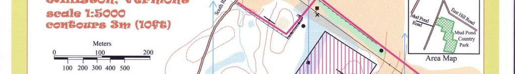
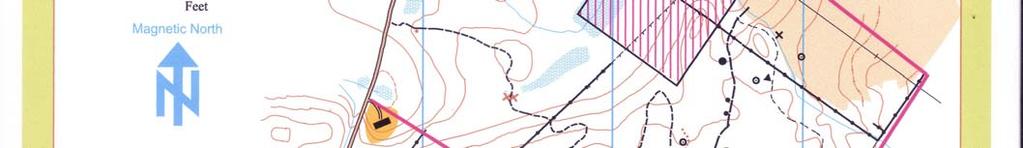
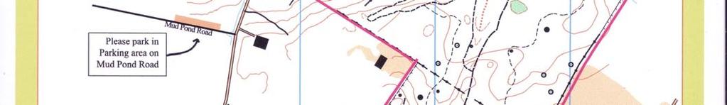
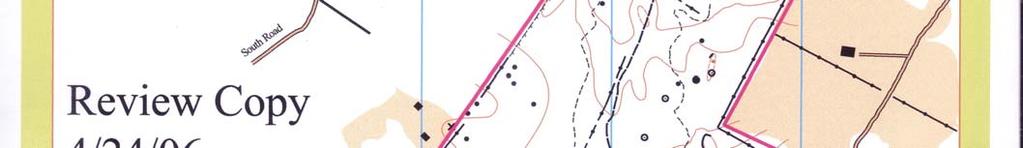
37 Like any outdoor skill, you can only become good at this if you practice. You will only practice this if you have a need to be good at it. That's enough on triangulation Your location F. Navigating by Terrain Features The last type of map we will look at is an orienteering map (see Appendix 1). Listed below are some key differences between orienteering maps and USGS quadrangle maps: USGS Orienteering Purpose 3D representation of terrain for general purposes 3D representation of terrain for fine navigation purposes Scale 1;24,000+ 1:5,000-1:15,000 Contour Interval 25 feet or greater Typically 5 meters Orientation True North Magnetic North (no declination!) Survey Method Primarily aerial Aerial base map, photography extensive field surveh Update period years 1-5 years Accuracy Often very inaccurate, particularly with manmade structures, roads, etc. Very accurate 37
 is the key to success in this sport.")
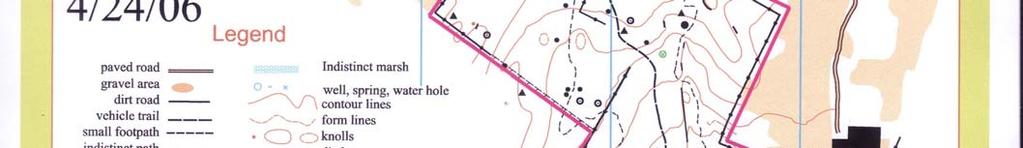
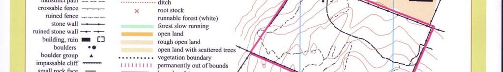
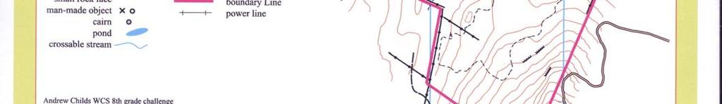
38 Orienteering is a sport where the athletes run through the woods to try and find a series of control points as quickly as possible. Being able to recognize terrain features on the go (along with being a fast runner!) is the key to success in this sport. Another key to success in orienteering is to keep your map (and yourself) "oriented". Since orienteering maps are oriented towards magnetic north, this is a simple process: Step 1 - set your compass so that 0 is aligned with the index line. Step 2 - lay the edge of the compass along one of the north-south lines on the map. Step 3 - spin both map and compass until the needle lines up with north. If you know where you are and know where you want to go, an oriented map will keep you on the right path. 3 D C A E 2 B 1 38
39 33. Identify the terrain feature associated with the letter on the orienteering map above. A. B. C. D. E. 34. In a well-written paragraph, describe a walk along the path (in red) above. Start at point 1 and then proceed to 2 and 3. Describe the general direction you would be heading, the rough distance you would cover, the slope (steep/gentle, uphill/downhill), the type of vegetation you would be moving through, and at least four prominent terrain features (hill, saddle, spur, etc) you would encounter along the way. Refer to the marginal data in the lower right part of the map for assistance. More detail is better than less. 39

40 Appendix 1 40

41 Appendix 2 41
Using Map and Compass Together
 Using Map and Compass Together In situations where you foresee a potential evacuation on foot, where there are no roads, and no indication as to the direction of travel (i.e., road signs), it is recommended
Compass Basics. Quick Map Basics Review For Compass Use
 Compass Basics Quick Map Basics Review For Compass Use A topographic map tells you where things are and how to get to them, whether you're hiking, biking, hunting, fishing, or just interested in the world
Chapter 3 Models of the Earth. 3.1 Finding Locations on the Earth. 3.1 Objectives
 Chapter 3 Models of the Earth 3.1 Finding Locations on the Earth 3.1 Objectives Explain latitude and longitude. How can latitude and longitude be used to find locations on Earth? How can a magnetic compass
Topographic Map Series:
 DEFINITION OF A MAP A MAP IS A GEOGRAPHIC PREPRESENTATION OF A PORTION OF THE EARTH S SURFACE DRAWN TO SCALE, AS SEEN FROM ABOVE. IT S USES COLORS, SYMBOLS AND LABELS TO REPRESENT FEATURES FOUND ON THE
APPENDIX A GLOSSARY. Appendix A.1
 APPENDIX A GLOSSARY Appendix A.1 Appendix A.2 Back Bearing A back bearing is measured from the object to your position. It is the exact opposite of a direct bearing. Base Line An imaginary line on the
Orienteering Maps & Map Reading Latitude and Longitude Scale
 Orienteering Maps & Map Reading A map is a two-dimensional representation of the three-dimensional world you'll be hiking in. All maps will have some basic features in common and map reading is all about
Map Reading & Compass Use
 Spring 2013 Kestrel Land Trust Page 2 / 10 Contents Map Basics... 3 Map Types... 3 Terrain Association... 4 Estimating Distance: Pacing... 4 Contour Lines... 5 Navigating with a Compass... 6 Compass Types...
What is a map? A Map is a two or three-dimensional model or representation of the Earth s surface. 2-Dimensional map
 What is a map? A Map is a two or three-dimensional model or representation of the Earth s surface. 2-Dimensional map What is a Map Projection? Planar Projection Projection A Projection is a mathematical
Lab Topographic Maps. Name: Partner: Purpose. Background Information
 Lab Topographic Maps Name: Partner: Purpose The purpose of this lab is to familiarize you with graphic representations of the Earth s surface primarily maps. Simple line maps show the spatial relationship
B. Topographic maps are also called. contour maps
 Topographic Maps Introduction A. Topographic maps are essential tools in geologic and engineering studies because they show the configuration of Earth's surface in remarkable detail and permit one to measure
Topographic Maps and Landforms Geology Lab
 Topographic Maps and Landforms Geology Lab Ray Rector: Instructor Today s Lab Activities 1) Discussion of Last Week s Lab 2) Lecture on Topo Maps and Elevation Contours 3) Construct Topographic Maps and
Latitude and Longitude
 U n i t 3 M a p p i n g P a g e 1 Latitude and Longitude Note: These coordinates are always expressed LATITUDE/LONGITUDE!!! Coordinate System: Using and to find your position on Earth. LATITUDE LATITUDE
Chapter 3 SECTION 1 OBJECTIVES
 Chapter 3 SECTION 1 OBJECTIVES Distinguish between latitude and longitude and locate coordinates on maps. Explain how latitude and longitude can be used to locate places on Earth s surface. Explain the
California Cadet Corps Curriculum on Maps and Navigation. Map Reading LEADERS KNOW THE WAY
 California Cadet Corps Curriculum on Maps and Navigation Map Reading LEADERS KNOW THE WAY 5/22/2017 Map Reading Agenda A1. Introduction to Maps A2. Topographical Map Basics A3. Elevation and Terrain Features
Activities: Map and Compass
 Activities: Map and Compass Determining General Directions Modified with permission from Outdoor Living Skills Series: Map and Compass, Missouri Department of Conservation Overview: Students use the sun
CHAPTER 2 SKILL SHEET 2: CELESTIAL NAVIGATION
 CHAPTER 2 SKILL SHEET 2: CELESTIAL NAVIGATION Before the invention of GPS technology, how were people on ships far at sea, out of the sight of land, able to tell where they were? For thousands of years
Laboratory Exercise #2 Introduction to Quadrangle Maps
 page - Laboratory Exercise #2 Introduction to Quadrangle Maps A. Introduction to Quadrangle Maps The United States Geological Survey has developed a nationwide series of quadrangle maps that cover small
King County Explorer Search and Rescue. Course B Map & Compass
 King County Explorer Search and Rescue Course B Map & Compass Disclaimer The intent of this presentation is to provide a basic overview of maps, compasses, and location finding. It is not meant to be a
Navigating with Map & Compass. Nevada County Sheriff s Search & Rescue
 Navigating with Map & Compass Nevada County Sheriff s Search & Rescue Objectives Very Practical Teach you how to go from point A to point B Go from the wilderness (real world) to a map and visa versa Agenda
Relative and Absolute Directions
 Relative and Absolute Directions Purpose Learning about latitude and longitude Developing math skills Overview Students begin by asking the simple question: Where Am I? Then they learn about the magnetic
Basic Map Skills for the Outdoors
 Geography 80-20 80% of what there is to know, for 20% of the sweat Basic Map Skills for the Outdoors Map Scale Map source: US Geological Survey Four ways to indicate map scale: Representative fraction
Laboratory Exercise #2 Introduction to Quadrangle Maps
 page - 1 Laboratory Exercise #2 Introduction to Quadrangle Maps A. Introduction to Quadrangle Maps The United States Geological Survey has developed a nationwide series of quadrangle maps that cover small
USING THE MILITARY LENSATIC COMPASS
 USING THE MILITARY LENSATIC COMPASS WARNING This presentation is intended as a quick summary, and not a comprehensive resource. If you want to learn Land Navigation in detail, either buy a book; or get
Topographic Maps Self-Instruction Lab (2016 edition) Geology 100 David Harbor s Section. 12 inches x 1 mile
 Geology 100 David Harbor s Section. 12 inches x 1 mile") Topographic Maps Name Self-Instruction Lab (2016 edition) Geology 100 David Harbor s Section Topographic maps are an important aid for a geologist, but maps are also useful for hikers, bicyclists, and
Topographic Maps Name Self-Instruction Lab (2016 edition) Geology 100 David Harbor s Section Topographic maps are an important aid for a geologist, but maps are also useful for hikers, bicyclists, and
Navigating for Scouts A Self-teaching Guide to Navigation with Map and Compass
 Don Burgess, November 2003 Materials topographic maps Navigating for Scouts A Self-teaching Guide to Navigation with Map and Compass metric ruler orienteering compass 30 M/5 Hamilton-Burlington 41 I/13
Mapping Earth. How are Earth s surface features measured and modeled?
 Name Mapping Earth How are Earth s surface features measured and modeled? Before You Read Before you read the chapter, think about what you know about maps Record your thoughts in the first column Pair
REVISION: MAPWORK 18 SEPTEMBER 2014
 REVISION: MAPWORK 18 SEPTEMBER 2014 Lesson Description In this lesson we revise: Various mapwork calculations Summary Relative Position Bearing is the angular (angle) distance between two points True Bearing
BUSH NAV BUSH NAV DAY Navigation for Bush Navigation Day. November. WhitehorseD AY. Section 1 Registration, Maps & Checkpoints
 BUSH DAY Navigation for Bush Navigation Day Robert Kirwan, Nunawading SES W NW N NE E If you have little or no bush navigation experience then you will have been teamed up with members that have that experience
LAND NAVIGATION 2-1. DEFINITION
 LAND NAVIGATION MAPS Cartography is the art and science of expressing the known physical features of the earth graphically by maps and charts. No one knows who drew, molded, laced together, or scratched
Geology 101 Lab Worksheet: Topographic Maps
 Geology 101 Lab Worksheet: Topographic Maps Name: Refer to the Topographic Maps Lab for the information you need to complete this worksheet (http://commons.wvc.edu/rdawes/g101ocl/labs/topomapslab.html).
The Tacoma Mountaineers Wilderness Navigation
 The Tacoma Mountaineers Wilderness Navigation Navigation Fundamentals Navigation in mountainous terrain and wilderness areas requires a set of skills, of which using a map and compass is only one part.
56H. This system allows definition of points on the Earth s surface to within 100 meters. Page 20. Navigation Systems Basics of Maps
 Grid References Many maps are provided with the standard grid overlaying them. This provides a simple and accurate method for finding features on the map. It is a network of intersecting parallel lines
USING THE MILITARY LENSATIC COMPASS
 USING THE MILITARY LENSATIC COMPASS WARNING This presentation is intended as a quick summary, and not a comprehensive resource. If you want to learn Land Navigation in detail, either buy a book; or get
Earth Science Regents Reading Topographic Maps
 Earth Science Regents Reading Topographic Maps Name Period Quick Tutorial on Degrees, Minutes, and Seconds of Latitude and Longitude A degree of latitude on the surface of the earth is about 70 miles long.
Practice Packet Topic 2: Measuring Earth
 Practice Packet Topic 2: Measuring Earth Vocabulary: Lesson 1: Lesson 2: Name: Lesson 3: Mini Lesson: Latitude Longitude Pre-Test 1. To locate exact places on the earth, one must look at a. The intersecting
Butte County Fire Department
 Butte County Fire Department Basic Land Navigation Verification Sheet I verify that Print Supervisor s name has completed the Print Employee s name Basic Land Navigation self study guide on. Date Attached
EARTH SCIENCE KEY UNIT 2-H
 EARTH SCIENCE KEY UNIT 2-H UNIT 2 MODELS & DIMENSIONS OF EARTH I. Model = ANYTHING THAT REPRESENTS THE PROPERTIES OF AN OBJECT OR SYSTEM A. Types and examples of models: 1. PHYSICAL Provides us with information
Background Information
 Oceanography LAB #1: Marine Charts and Navigation Background Information Latitude and Longitude A coordinate is an address a means of designating location. Most coordinate systems involve a network of
Red Star Navigation. Bearings:
 Red Star Navigation Bearings: The main focus in Red Star Navigation is how to use a compass and in particular compass bearings. It is important for cadets to describe bearings as this will assist them
Date: UNI. world. *Dedicated to
 Name: Date: UNI IT THREE 2D and 3D model s of the natural world *Dedicated to Name: Date: ABSTRACT T AND RATIONALE A topographic map is a type of map that depicts the detail and quantitative representation
2 Mapping Earth Reading Essentials. 2. Contrast What is the difference between a map view and a profile view?
 Mapping Earth Maps What do you think? Read the three statements below and decide whether you agree or disagree with them. Place an A in the Before column if you agree with the statement or a D if you disagree.
What Is a Globe? Hemispheres. Main Idea Globes and maps provide different ways of showing features of the earth. Terms to Know
 r Main Idea Globes and maps provide different ways of showing features of the earth. Terms to Know hemisphere latitude longitude scale bar scale relief elevation contour line What Is a Globe? A globe is
2. What does the map scale tell the map reader? a ratio between the actual distance on the ground and the length given to that distance on a map
 AP Human Geography - Damon Name Unit 1 - Intro to Human Geography Hour Map and Globe Skills Review Note: All links in this packet are found on our Wikispace under Map and Globe Skills Review First, read
Scientists observe the environment around them using their five senses.
 Earth Science Notes Topics 1: Observation and Measurement Topic 2: The Changing Environment Review book pages 1-38 Scientists observe the environment around them using their five senses. When scientists
What is a map? Understanding your map needs
 What is a map? A map is simply a drawing or picture of a landscape or location. Maps usually show the landscape as it would be seen from above, looking directly down. As well as showing the landscape of
Tonight. {01} The map. Relative space. What does a map do? Types of maps GEOG 201 2/17/2010. Instructor: Pesses 1
 Tonight {01} The map What makes a map Measuring the Earth Map Interpretation & GPS Spring 2010 M. Pesses What does a map do? Shows where things are Shows spatial (topological) relationships Shows patterns,
***When doing the lab report write-up, be sure to follow the guidelines.***
 Topographic Maps Lab Vocabulary: topography - study of the shapes and features of the earth's surface elevation - height above sea level bench mark - a point that has been accurately measured for its position
CHAPTER EXIT CHAPTER. Models of Earth. 3.1 Modeling the Planet. 3.2 Mapmaking and Technology. 3.3 Topographic Maps CHAPTER OUTLINE
 EXIT CHAPTER.1 Modeling the Planet.2 Mapmaking and Technology. Topographic Maps CHAPTER OUTLINE CHAPTER.1 Modeling the Planet A flat of Earth is a convenient tool, but it can distort the shape, distance,
The ABC's of Compass and Map STUDENT WORKBOOK
 The ABC's of Compass and Map STUDENT WORKBOOK 1 EXERCISE 1: Compass Part Identification Directions: Match the terms below with the correct parts on the compass diagram. NOTES: A. Azimuth Ring B. Compass
ORIENTEERING. The challenge is to use the map to decide the best route to complete the course in the quickest time. Orienteering Map. Compass.
 ORIENTEERING Orienteering is similar to a cross-country race but you navigate using a map instead of following a set course. It is an outdoor sport where competitors navigate their own way, you can run,
Test Bank Chapter 2: Representations of Earth
 Multiple Choice Test Bank Chapter 2: Representations of Earth 1. A rhumb line on a Mercator projection is a line of. a. true size b. true shape c. true compass bearing d. true location 2. Maximum longitude
In order to be adequately prepared for a test on this topic you should be able to:-
 Topic 2: MAPPING In order to be adequately prepared for a test on this topic you should be able to:- 1. Find and also provide both FOUR and SIX figure Area and Grid References 2. Calculate distances both
COORDINATE SYSTEMS: LOCATING YOURSELF ON A SPHERE
 NAME DATE PARTNER(S) COORDINATE SYSTEMS: LOCATING YOURSELF ON A SPHERE Activity 1: Getting Your Bearings 1. Close your eyes and point to the north. Did you point up? Why or why not? Up is the #1 answer.
Chapter 1 Overview of Maps
 Chapter 1 Overview of Maps In this chapter you will learn about: Key points when working with maps General types of maps Incident specific maps Map legend and symbols Map sources A map is a navigational
AS 410 Land Navigation. Chpt 4-1
 AS 410 Land Navigation Chpt 4-1 Overview Types of Maps Map Legends / Scales Latitude and Longitude Orienteering Why? Why important to learn how to read a compass and map? No cell phone coverage Mountain
OA Guide to Map & Compass. The Backpacker's Field Manual by Rick Curtis
 OA Guide to Map & Compass part of The Backpacker's Field Manual by Rick Curtis Published by Random House 1998 This material is taken from Chapter 6 - Wilderness Travel from The Backpackers Field Manual
Regents Earth Science Unit 1 Earth Dimensions
 Regents Earth Science Unit 1 Earth Dimensions www. BarnesWeb.org 2014-15 edition Name: Name: OBJECTIVES Correctly define: isolines, gradient, topographic map, contour interval, hachured lines, profile,
Meridian Circle through Zenith, North Celestial Pole, Zenith Direction Straight Up from Observer. South Celestial Pole
 Chapter 3 How Earth and Sky Work- Effects of Latitude In chapters 3 and 4we will learn why our view of the heavens depends on our position on the Earth, the time of day, and the day of the year. We will
Map Skills Lesson 1. Materials: maps, pencils, Lesson 1 Worksheet, strips of paper, grid paper
 Map Skills Lesson 1 Use cardinal directions, map grids, scales, and titles to locate places on a map. Interpret a map using information from its title, compass rose, scale, and legend. Vocabulary: map,
Topographic Maps: Background
 Topographic Maps: Background Introduction From Dr. Terry Swanson, University of Washington, ESS 101 Lab, Geologic Techniques, and Dr. David Kendrick, Hobart and William Smith Colleges, Geneva, NY Geoscientists
Understanding Projections
 GEOGRAPHY SKILLS 1 Understanding Projections The earth is a sphere and is best shown as a globe. For books and posters, though, the earth has to be represented as a flat object. To do this, mapmakers create
MAPPING THE EARTH HOW DO YOU FIND A LOCATION ON THE EARTH?
 MAPPING THE EARTH HOW DO YOU FIND A LOCATION ON THE EARTH? UNIT TOPICS TOPIC 1: LATITUDE & LONGITUDE TOPIC 2: FIELD MAPS TOPIC 3: TOPOGRAPHIC MAPS TOPIC 4: NYS LANDSCAPES TOPIC 1: LATITUDE & LONGITUDE
Geographic Grid. Locations Feature 1 Feature 2 Feature 3
 Geographic Grid Name The geographic grid refers to the internationally-recognized system of latitude and longitude used to location positions on Earth's surface. Accurate use of this coordinate system
HOW TO TRAVEL ON EARTH WITHOUT GETTING LOST
 HOW TO TRAVEL ON EARTH WITHOUT GETTING LOST Using a globe to learn how a position on Earth can be described. Rui Dilão, Instituto Superior Técnico Curriculum topic latitude, longitude, coordinate system
Topographic Maps. More than a Road Map
 Topographic Maps More than a Road Map What is a Topographic Map? Scaled representation of features on the surface of the Earth such as roads, rivers, and plains Provides information about land elevations
Topographic Maps. Take Notes as you view the slides
 Topographic Maps Take Notes as you view the slides Lesson Objectives Define a topographic map and state its uses. Describe how contour lines show the elevations, shape, and slope of the land. Identify
Coach Answers Part 2 Zombie 17 COACH ANSWERS (Questions and answers with explanations) Part 2
 Part 2") Zombie 17 COACH ANSWERS (Questions and answers with explanations) Part 2 44. The Brain Building looks fairly new. Based on the map, what is the most recent year in which it could have been constructed?
Zombie 17 COACH ANSWERS (Questions and answers with explanations) Part 2 44. The Brain Building looks fairly new. Based on the map, what is the most recent year in which it could have been constructed?
What is Geography? Lecture 1 The Earth As A Rotating Planet. What is Geography? What is geography? Subfields of Geography?
 Lecture 1 The Earth As A Rotating Planet Geog210 Physical Geography What is Geography? Much more than place names and locations The study of spatial variation How and why things differ from place to place
Section 2. Locating Astronomical Objects in the Night Sky What Do You See? What Do You See? Think About It. Investigate.
 Section 2 Locating Astronomical Objects in the Night Sky Section 2 Locating Astronomical Objects in the Night Sky What Do You See? What Do You See? Learning Outcomes In this section, you will Construct
From Science Olympiad Student Center
 1 of 10 3/5/13 8:18 AM Forums Wiki Test Exchange Image Gallery Score Tracker Road Scholar From Science Olympiad Student Center In Road Scholar, Forum Threads Tests There are no images available for this
Map Skills Test. 1. What do we call a person who makes maps? a. mapographer b. cartographer c. geologist d. archaeologist
 Map Skills Test 1. What do we call a person who makes maps? a. mapographer b. cartographer c. geologist d. archaeologist 2. What is the name of the 0 latitude line? a. Equator b. Arctic Circle c. First
EROSIONAL FEATURES. reflect
 reflect Have you ever looked at the land around you and wondered what processes shaped what you see? Perhaps you see mountains, valleys, rivers, or canyons. Do you know how long these geologic features
OA Guide to Map & Compass - Part 1
 OA Guide to Map and Compass - Part 1 OA Guide to Map & Compass - Part 1 part of The Backpacker's Field Manual by Rick Curtis published by Random House 1998 Buy it now at Amazon.com This material is taken
1. Identify the Earth motion that provides the basis for our system of local time and time zones.
 Base your answers to questions 1 through 4 on the map below and on your knowledge of Earth science. The map shows the four time zones and some latitude and longitude lines across the continental United
Earth s Time Zones. Time Zones In The United States
 Name: Mr. DeLeo Date: Period: Earth s Time Zones Goal: Students will understand why humans have developed time zones on Earth, and how to figure out time at different positions on Earth. Background: One
Butte County Fire Department
 Butte County Fire Department Basic Land Navigation Verification Sheet I verify that Print Supervisor's name Print Employee's name has completed the Basic Land Navigation self study guide on Date Attached
UNIT 1C. USING TOPOGRAPHIC MAPS WHERE IN THE WORLD... ARE YOU?
 UNIT 1C. USING TOPOGRAPHIC MAPS WHERE IN THE WORLD... ARE YOU? TIME 60-90 minutes LEVEL All BENCHMARKS Next Generation Science Standards MS-LS1.D Science & Engineering Practices Developing and Using Models
Chapter 3 Geographic Location Systems
 Chapter 3 Geographic Location Systems In this chapter you will learn about: Latitude and longitude Universal Transverse Mercator (UTM) U.S. Public Land Survey Other geographic location systems Geographic
Map Skills Unit. Note taking unit
 Map Skills Unit Note taking unit Introduction To learn about the Earth, we are going to learn about two geographic tools you can use.globes and maps. Globe A globe is a round model of the planet Earth
11. ALPINE GLACIAL LANDFORMS
 Geomorphology 11. Alpine Glacial Landforms 11. ALPINE GLACIAL LANDFORMS 40 Points One objective of this exercise is for you be able to identify alpine glacial landforms and measure their characteristics.
FIRST GRADE 1 WEEK LESSON PLANS AND ACTIVITIES
 FIRST GRADE 1 WEEK LESSON PLANS AND ACTIVITIES UNIVERSE CYCLE OVERVIEW OF FIRST GRADE UNIVERSE WEEK 1. PRE: Describing the Universe. LAB: Comparing and contrasting bodies that reflect light. POST: Exploring
Chapter 02 Maps. Multiple Choice Questions
 Chapter 02 Maps Multiple Choice Questions 1. Every projection has some degree of distortion because A. a curved surface cannot be represented on a flat surface without distortion. B. parallels and meridians
Mapping Earth Review Note Cards
 Review Note Cards Spheres of Earth Atmosphere- Layer of gases Hydrosphere- All liquid water Lithosphere- Solid surface Biosphere-Living Portion Cryosphere-Ice Portion Evidence that the Earth is Round The
Mapping Earth. Technology and Mapmaking
 CHAPTER 1 LESSON 2 Mapping Earth Technology and Mapmaking Key Concepts What can a topographic map tell you about the shape of Earth s surface? What can you learn from geologic maps about the rocks near
World Time-Day Calculator Lab
 Background: Time zones around the Earth are bounded by imaginary lines called lines of longitude, or meridians. On a globe or map of the world, they are the lines that are perpendicular to the equator.
Erosional Features. What processes shaped this landscape?
 Have you ever looked at the land around you and wondered what processes shaped what you see? Perhaps you see mountains, valleys, rivers, or canyons. Do you know how long these geologic features have been
Map Skills and Geographic Tools
 Name: Period: Map Skills and Geographic Tools TEKS: 8.9C interpret topographic maps and satellite views to identify land and erosional features and predict how these features may be reshaped by weathering
Complete Sun Sight Reduction Procedure
 Caution...2 Usage...2 Conventions...2 Assumptions...2 Explanation...2 Sight #...2 DR Latitude/DR Longitude...2 Date...2 GMT/UT...3 Hs...3 D. R. I. P. S...3 Index Error...3 Complete Sun Sight Reduction
Guided Notes Unit 1. Maps & Measurements
 Guided Notes Unit 1 Maps & Measurements Checkpoint Questions Deep Space 1) In which list are celestial features correctly shown in order of increasing size? a. galaxy solar system universe planet b. solar
ANSWER SHEET PART 1 BASIC LAND NAVIGATION
 ANSWER SHEET PART 1 BASIC LAND NAVIGATION 1. Knowing these four basic skills, it is impossible to be totally lost; what are they? a. Track Present Location / Determine Distance / Sense of Direction / How
Use your text to define the following term. Use the terms to label the figure below. Define the following term.
 Mapping Our World Section. and Longitude Skim Section of your text. Write three questions that come to mind from reading the headings and the illustration captions.. Responses may include questions about
GPS Measurement Protocol
 GPS Measurement Protocol Purpose To determine the latitude, longitude, and elevation of your school and of all your GLOBE sites Overview The GPS receiver will be used to determine the latitude, longitude
CELESTIAL COORDINATES
 ASTR 1030 Astronomy Lab 27 Celestial Coordinates CELESTIAL COORDINATES GEOGRAPHIC COORDINATES The Earth's geographic coordinate system is familiar to everyone - the north and south poles are defined by
FIND PLACES ON GLOBES USING LATITUDE
 GLOBES, MAPS & GRAPHS FIND PLACES ON GLOBES USING LATITUDE AND LONGITUDE LINES FIND PLACES ON MAPS USING A GRID SYSTEM NAME SEVERAL TYPES OF MAP PROJECTIONS AND EXPLAIN THEIR BENEFITS AND SHORTCOMINGS
OCN 201 LAB FALL 2003 POLYNESIAN AND WESTERN NAVIGATION
 Name: OCN 201 LAB FALL 2003 POLYNESIAN AND WESTERN NAVIGATION INTRODUCTION People have been sailing the seas for thousands of years, during most of which time they relied on the sun and the stars to navigate
Unit I: Earth Dimensions. Review Book pp.19-30
 Unit I: Earth Dimensions Review Book pp.19-30 Objective #1 Describe the actual shape of the Earth and explain 3 pieces of evidence for its actual shape. Earth s Shape The Earth appears to be the shape
Location and Distance on Earth (Chapter 22 part 1)
") GEOLOGY 306 Laboratory Instructor: TERRY J. BOROUGHS NAME: Location and Distance on Earth (Chapter 22 part 1) For this assignment you will require: a calculator, protractor, and a metric ruler, and an
GEOLOGY 306 Laboratory Instructor: TERRY J. BOROUGHS NAME: Location and Distance on Earth (Chapter 22 part 1) For this assignment you will require: a calculator, protractor, and a metric ruler, and an
Earth Science Unit 1 Test
 Earth Science Unit 1 Test Multiple Choice Identify the choice that best completes the statement or answers the question. 1. The study of meteorology involves the study of a. climate. c. animals. b. outer
Introduction to Geography
 Introduction to Geography ropic of Cancer 3½ N Arctic Circle 90 N Prime Meridian 0 Arctic Ocean Mississippi R. Appalachian Mts. Europe Rocky Mountains N. America Atlantic Gulf of Ocean Mexico Caribbean
Map and Compass Skills
 Map and Compass Skills Grade levels: 5-12 In a Nutshell Given a map and compass, students will be able to find a location on the map, chart a course to that location with the compass, and find that location