ESPA Deltas: ASSESSING HEALTH, LIVELIHOODS, ECOSYSTEM SERVICES AND POVERTY ALLEVIATION IN POPULOUS DELTAS
|
|
|
- Homer Ross Harris
- 6 years ago
- Views:
Transcription
1 : ASSESSING HEALTH, LIVELIHOODS, ECOSYSTEM SERVICES AND POVERTY ALLEVIATION IN POPULOUS DELTAS Presented by Prof. Robert J. Nicholls University of Southampton
2 Plan Introduction Consortium Project Details Concluding Remarks

3 Threatened Deltas Population potentially displaced by current sea level trends to 2050 Extreme = >1 million; High = 1 million to 50,000; Medium = 50,000 to 5,000 people Source: IPCC AR4 using data in Ericson et al. (2006)
4 Main Study Site Pakistan New Delhi India Nepal China Kathmandu R. Ganges R. Brahmaputra Thimphu Bhutan India R. Meghna Burma Dhaka Bangladesh
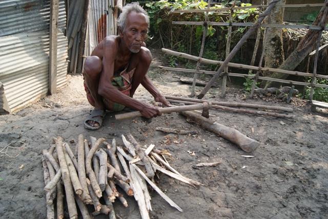
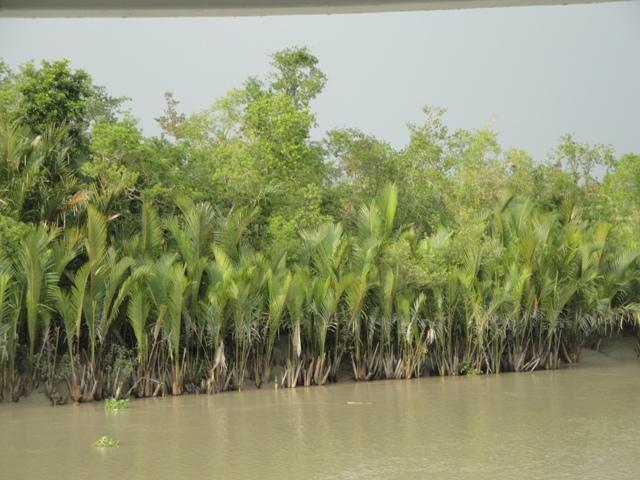
5 Bangladesh Case Study Area
6 ESPA Delta: Project Aims In Coastal Bangladesh To engage relevant stakeholders throughout the project via participatory methods. To understand the present relationship between ecosystem services and human well-being and health. To predict how these ecosystem services might evolve over the coming years and decades (up to 50 years). To analyse how policy can influence these outcomes and promote ecosystem services and human well-being and health. To select robust policies that are effective across the range of uncertainty. More Broadly To test the transferability of these methods to other populated deltas.

7 ESPA Delta: Example Questions Who are the poor? What are the Ecosystem Services? How and why are these Ecosystem Services changing? What is the role of biophysical change and Ecosystem Services? What implications do the changes have for the poor? How can policy promote ecosystem services and poverty alleviation?
8 Methodological Principles Transition into practice Interdisciplinary: Socio-Economic, Biophysical, Legal Context Multi-scale: Nested study domains Global Ganges- Brahmaputra basin, Bay of Bengal, National, Study Area, Subdivisions of study area, Trans-boundary issues Integrative: Linking model domains, integrated modelling to address policy questions, scenario development, policy testing and sensitivity analysis (with new model development, where necessary) Transferable: Tested conceptually in two other (Indian) sites

9 Key Ecosystem Services Source: BRAC (2007)

10 Example Delta Ecosystem Activities
11 THE CONSORTIUM UK Partners University of Southampton PI Robert Nicholls University of Oxford (Scenario Development) Exeter University (Ecosystem Services and Poverty) Dundee University (Legal context) Hadley Centre MET office (Climate Change Modelling) Plymouth Marine Laboratories (Fisheries Modelling) National Oceanography Centre Liverpool (Marine Modelling)
12 THE CONSORTIUM Indian Partners IIT Roorkee Lead Nayan Sharma PI (Hydrological Modelling) Cotton College, Guwahati (Social Economic context) Aaranyak (Social Economic context) Jadavpur University (Mangrove/Ecological Modelling)
13 THE CONSORTIUM Bangladeshi Partners Institute of Water and Flood Management, Bangladesh University of Engineering and Technology (BUET) Prof Rahman Lead PI Bangladesh Institute of Development Studies (BIDS): (Policy) Institute of Livelihood Studies (ILS): (Livelihood) Ashroy Foundation: (Social Survey) Institute of International Centre for Diarrhoeal Disease Research, Bangladesh (ICDDR,B) : (Health) Center for Environmental and Geographic Information Services (CEGIS): (GIS, Database) Bangladesh Agricultural University (Fisheries, Agriculture) Bangladesh Agricultural Research Institute (BARI): Agriculture) Technological Assistance for Rural Advancement (TARA): Fisheries/ecology Mohammad Shahad Mahabub Chowdhury (IUCN): ecology Kazi Matin U Ahmed (Dhaka University): Ground Water
14 Project Structure
15 Work Package 1 - Governance Quality of the legal, institutional and policy context: Management of Ecosystem Services (e.g. freshwater, forestry, pollution control, fisheries, protected areas); Extent to which people can escape from poverty (e.g. property rights, control of monopolies, disaster management, availability of information, access to justice); Mediation processes between them (as elucidated in WP2) Engagement with relevant stakeholders - key for: understanding reality of governance context; future policy drivers; scenario development; and research relevance

16 Critical Stakeholder Interventions Nicholls Consortia Presentation ESPA Consortia Workshop Sept 2012
 Economic trends/gdp Commodity pricing Socio-economics Governance Trans boundary issues Intervention testing (WP6) Running policy interventions on the model Conducting policy")
17 Three Key Stakeholder interventions Initial Policy Questions (WP2) Salinity impacts on rice Development of agro-business Coastal defence options Impacts of upstream interventions Development of Scenarios (WP4) Economic trends/gdp Commodity pricing Socio-economics Governance Trans boundary issues Intervention testing (WP6) Running policy interventions on the model Conducting policy sensitivity analysis Handling Uncertainty

18 Scenario Building (WP4)
19 Work Package 2 Model Conceptualisation Hypotheses Investigating four mechanisms known to mediate between wellbeing and the environment: Seasonality Mobility Property rights Moral economy Each of these mechanisms has positive or negative impacts on the ability of ecosystem services to alleviate poverty depending on characteristics of the: Socio-ecological system Ecosystem service Social status
20 Work Package 2 Applied to 10 socio-ecological systems 1. Mangrove-dominated (Sundarban Impact Zone) 2. Wetland ecosystem services and associated livelihoods 3. Agriculturally dominated incomes (within and outside of polders) 4. Livestock-related livelihoods on newly-accreted charlands 5. Inland capture fisheries 6. Inland culture fisheries 7. Aquaculture systems (shrimp, prawn and crab collection and fattening) 8. Offshore capture fisheries 9. Peri-urban areas 10. Urban areas
21 Work Package 3 Socio-Economic Analysis and Model Aim: To quantify the relationship between poverty and ecosystem services building on WP2. Analysing census data over time to create poverty maps. Examining fertility rates by urban/rural and province for projections Reviewing best software for projections Preparing demographic projections Planning surveys with WP2

22 Bangladesh Case Study Area (about 250 Unions and data for three census periods)
 PML Sea level, storms BUET NOC PML Delta")


23 WP5 Integrated Biophysical Model (incomplete missing Mangrove model) PML Sea level, storms BUET NOC PML Delta Model FVCOM Bay Bengal Model GCOMS Met Office GCMs/ RCMs Hadley Centre Temperature, rainfall Catchment Models GWAVA / INCA (Oxford) Groundwater (BUET Morphodynamics (Soton) Water, sediment Freshwater, sediment, nutrients Primary productivity Oxford Buet Soton IITR Crop Models CROPWAT, AquaCrop, MAXENT Coastal Fisheries Model Size-based models Soton BARI BAU PML TARA BAU IUCN
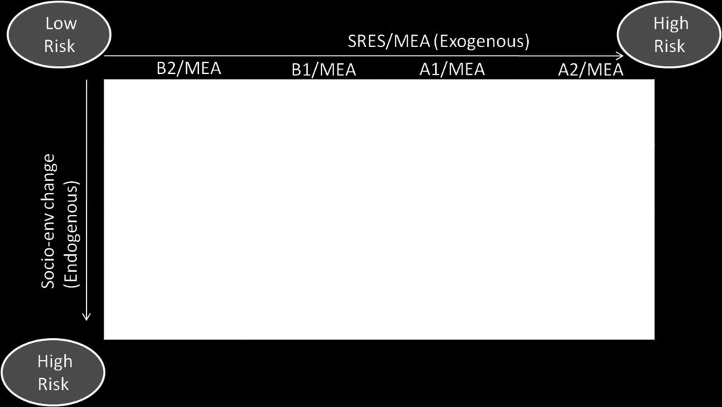
24 Work Package 4 Integration and Scenarios Aim Develop scenarios to analyse future outcomes Develop an integrated modelling framework of socioecological systems Tasks Establish baseline status from observations Develop exogenous and endogenous scenarios Develop integrated model framework of socioecological systems building on WP3/WP5 Apply framework in Vensim Outcomes Assessment of scenario development tools South-Asian ecosystem services scenarios
25 ES flows Coastal fishery Magnitude/frequency of cyclones + Sea Level Rise + Social model Land erosion Market price of fish + Employment + opportunities Market price of tourist attractions Population number + Primary + production Nutrients + Nutrition + Mangrove model X Biomass Production rate + + Fish capture Biomass of Fish stock No of Tourists + + X Mortality rate + Hazardous Substances
26 How to consider the ES flows spatially? Inland + Mangrove Inland only river forest settlement ~250 unions shrimp farming agricultural field Mangrove forest Inland + Mangrove + Coastal Inland + Coastal Coastal waters


27 Database for Project Organised by CEGIS, Bangladesh About 400 existing data layers available Augmented with Project data and results
28 Short-term Scientific Outputs Fast Track papers (within first 12 months) An assessment of the key policy issues concerning ecosystem services and poverty alleviation in coastal Bangladesh (WP1) A review of the state of coastal Bangladesh with a focus on ecosystem services and poverty alleviation (WP2) A review of the trends in ecosystem services in coastal Bangladesh: A preliminary assessment (WP5)
 Assessment of Coastal Ecosystem component in Changed hydrological condition (WP5) Application of remote sensing and GIS in measuring water quality of the major water bodies in the Ganges delta")
29 Short-term Scientific Outputs Conference Papers ICWFM 2013 (4th) to be held in Bangladesh: March 2013 Loss of Ecosystem Services in Shrimp Aquaculture area and its impact on livelihood of Poor People (WP2) Assessment of Coastal Ecosystem component in Changed hydrological condition (WP5) Application of remote sensing and GIS in measuring water quality of the major water bodies in the Ganges delta (WP5) Changes in the Biomass Content in Sundarban Area: A Remote Sensing Approach (WP5) Spatial and Temporal Trend of tidal range and salinity in the Bengal Delta (WP5) Application of FVCOM in Simulating the Ecosystem Parameters in the Coastal region of the Bay of Bengal : Developing a Model of the Region

30 CONCLUDING REMARKS The ESPA Delta project is making significant progress across a broad range of academic areas including: Analysis of governance Participatory methods Ecosystem services and human well-being in deltas Integrated assessment methods All this work is focussed on understanding the relationship between ecosystem services and poverty alleviation in deltas and the potential role of policy in shaping outcomes Early outputs will be available in Spring 2013 Thanks to all the Consortium members.
31 : ASSESSING HEALTH, LIVELIHOODS, ECOSYSTEM SERVICES AND POVERTY ALLEVIATION IN POPULOUS DELTAS Presented by Prof. Robert J. Nicholls University of Southampton
King s Research Portal
 King s Research Portal DOI: 10.1016/j.ecss.2016.08.017 Document Version Peer reviewed version Link to publication record in King's Research Portal Citation for published version (APA): Nicholls, R. J.,
Exploring the impacts of future global change on mangrove-fishery-community linkages
 Exploring the impacts of future global change on mangrove-fishery-community linkages Rachel Seary University of Cambridge/ UNEP-WCMC Supervisors: Dr Tom Spencer, Dr Mike Bithell & Dr Chris McOwen Photograph:
Mapping and Assessment of Ecosystems and their Services
 Mapping and Assessment of Ecosystems and their Services ALTER-Net Conference 2013: Science underpinning the EU 2020 Biodiversity Strategy. April 2013 Gent Joachim MAES 1 This presentation is based on the
*X208/11/01* X208/11/01 GEOGRAPHY INTERMEDIATE 2 NATIONAL QUALIFICATIONS 2014 THURSDAY, 29 MAY 9.00 AM AM
 X208/11/01 NATIONAL QUALIFICATIONS 2014 THURSDAY, 29 MAY 9.00 AM 11.00 AM GEOGRAPHY INTERMEDIATE 2 Candidates should answer four questions: Section A Question 1 and Question 2 AND Section B any two questions
This table connects the content provided by Education Perfect to the NSW Syllabus.
 Education Perfect Geography provides teachers with a wide range of quality, engaging and innovative content to drive positive student learning outcomes. Designed by teachers and written by our in-house
Topic 4: Changing cities
 Topic 4: Changing cities Overview of urban patterns and processes 4.1 Urbanisation is a global process a. Contrasting trends in urbanisation over the last 50 years in different parts of the world (developed,
COUNTRY PRESENTATION ON MR JAYNAL ABEDIN JOINT SECRETARY ( WORKS & DEVELOPMENT ) MINISTRY OF DEFENCE
 MINISTRY OF DEFENCE") COUNTRY PRESENTATION ON By MR JAYNAL ABEDIN JOINT SECRETARY ( WORKS & DEVELOPMENT ) MINISTRY OF DEFENCE Bangladesh Geographical Location of Bangladesh Bangladesh Country at a Glance Physical Features 1,230
COUNTRY PRESENTATION ON By MR JAYNAL ABEDIN JOINT SECRETARY ( WORKS & DEVELOPMENT ) MINISTRY OF DEFENCE Bangladesh Geographical Location of Bangladesh Bangladesh Country at a Glance Physical Features 1,230
COASTAL VULNERABILITY DUE TO SEA-LEVEL RISE HAZARDS IN THE BANGLADESH DELTA: BAND-AID
 Band-Aid Project NASA NASA ESA ESA JAXA NASA/DLR COASTAL VULNERABILITY DUE TO SEA-LEVEL RISE HAZARDS IN THE BANGLADESH DELTA: BAND-AID R. Rietbroek, B. Uebbing, C.K. Shum, V. Ballu, S. Calmant, J. Duan,
Vulnerability of Bangladesh to Cyclones in a Changing Climate
 Vulnerability of Bangladesh to Cyclones in a Changing Climate Susmita Dasgupta Kiran Pandey Mainul Huq Zahirul Huq Khan M.M. Zahid Ahmed Nandan Mukherjee Malik Fida Khan 2010 Bangladesh: Tropical Cyclone
Indicators of sustainable development: framework and methodologies CSD Indicators of sustainable development 1996
 Indicators of sustainable development: framework and methodologies CSD Indicators of sustainable development 1996 Keywords: mountain areas, mountain development, natural resources management, sustainable
Overview of proposed approach to the Desktop Study to inform discussion
 LTAS Phase 2: Climate Change Implications for the Human Settlements sector in South Africa Overview of proposed approach to the Desktop Study to inform discussion Project Team Project Lead: Crispian Olver
Climate change, ocean acidification and individual-based models: Why the little things matter
 Climate change, ocean acidification and individual-based models: Why the little things matter Author Richards, Russell, Meynecke, Olaf, Chaloupka, M, Tomlinson, Rodger Benson Published 2012 Conference
The Added Value of Geospatial Data in a Statistical Office. Pedro Diaz Munoz Director Sectoral and Regional Statistics EUROSTAT European Commission
 The Added Value of Geospatial Data in a Statistical Office Pedro Diaz Munoz Director Sectoral and Regional Statistics EUROSTAT European Commission Why integrate Responsibility of all the information we
GMES and AFRICA Support Programme 1st technical committee meeting
 GMES and AFRICA Support Programme 1st technical committee meeting Developing an Earth Observation Operational Application for Coastal Ecosystems Mapping, Monitoring and Assessment of the Northern African
Poverty and Hazard Linkages
 Poverty and Hazard Linkages Global Risk Identification Programme Proposal Development Coordination Meeting Friday, 19 May 2006 CIESIN Earth Institute Columbia University www.ciesin.columbia.edu Data Improvements
Advancing Geoscientific Capability. Geological Survey of Finland
 Advancing Geoscientific Capability Geological Survey of Finland GTK in brief The Geological Survey of Finland (GTK) is one of the largest European centres of excellence in assessment, research and the
Geospatial Technologies for Resources Planning & Management
 Geospatial Technologies for Resources Planning & Management Lal Samarakoon, PhD Director, Geoinformatics Center Asian Institute of Technology, Thailand Content Geoinformatics for SDG Information Integration
Impact of Coastal Flooding on Land use Pattern Considering Climate Change
 Impact of Coastal Flooding on Land use Pattern Considering Climate Change Pronab Kumar Halder Institute of Water and Flood Management (IWFM), Bangladesh University of Engineering and Technology (BUET),pronab.halder@gmail.com
Assessment and valuation of Ecosystem Services for decision-makers
 Assessment and valuation of Ecosystem Services for decision-makers An introduction to the ARIES approach Ferdinando Villa *, Ken Bagstad Gary Johnson, Marta Ceroni *Basque Center for Climate Change, Bilbao,
Regional Plan 4: Integrating Ecosystem Services Mapping into Regional Land Use Planning
 Rural-Urban Outlooks: Unlocking Synergies (ROBUST) ROBUST receives funding from the European Union s Horizon 2020 research and innovation programme under grant agreement No 727988.* October 2018 Natural
Fig 1. Steps in the EcoValue Project
 Assessing the Social and Economic Value of Ecosystem Services in the Northern Forest Region: A Geographic Information System (GIS) Approach to Landscape Valuation Principal Investigator(s): Dr. Matthew
Liana Talaue McManus. Division of Marine Affairs and Policy Rosenstiel School of Marine & Atmospheric Science University of Miami
 Liana Talaue McManus Division of Marine Affairs and Policy Rosenstiel School of Marine & Atmospheric Science University of Miami Outline 1. Coasts as vulnerable & resilient social ecological systems 2.
Vulnerability Assessment of Cyclonic Hazards in Coastal Region of Bangladesh
 Urban and Regional Planning 2018; 3(2): 34-43 http://www.sciencepublishinggroup.com/j/urp doi: 10.11648/j.urp.20180302.11 ISSN: 2575-1689 (Print); ISSN: 2575-1697 (Online) Vulnerability Assessment of Cyclonic
Assessing and mapping ecosystem services in a small islands state
 Assessing and mapping ecosystem services in a small islands state Mario V. Balzan Laboratory of Terrestrial Ecology, Institute of Applied Science, MCAST, Malta. E-mail: mario.balzan@mcast.edu.mt SGA Mentoring
M14/3/GEOGR/SP2/ENG/TZ0/XX/Q GEOGRAPHY STANDARD LEVEL PAPER 2. Monday 19 May 2014 (morning) 1 hour 20 minutes INSTRUCTIONS TO CANDIDATES
 1 hour 20 minutes INSTRUCTIONS TO CANDIDATES") M14/3/GEOGR/SP2/ENG/TZ0/XX/Q 22145203 GEOGRAPHY STANDARD LEVEL PAPER 2 Monday 19 May 2014 (morning) 1 hour 20 minutes INSTRUCTIONS TO CANDIDATES Do not open this examination paper until instructed to do
M14/3/GEOGR/SP2/ENG/TZ0/XX/Q 22145203 GEOGRAPHY STANDARD LEVEL PAPER 2 Monday 19 May 2014 (morning) 1 hour 20 minutes INSTRUCTIONS TO CANDIDATES Do not open this examination paper until instructed to do
Morphological Changes of the Offshore Islands of Western Part of Meghna Estuary over the Years
 Journal of Modern Science and Technology Vol. 6. No. 2. June 2018 Issue. Pp.0-0 Morphological Changes of the Offshore Islands of Western Part of Meghna Estuary over the Years Faisal Mohammad Alvee 1, Sayedul
and the Myanmar economy World Water Day, 2018
 and the Myanmar economy World Water Day, 2018 Hannah.baleta@panda.org Three key messages Myanmar is growing economically and developing socially with a large dependency on natural resources such as the
Millennium Ecosystem Assessment
 Millennium Ecosystem Assessment Global Data Challenges from an MA perspective Global Spatial Data and Information User Workshop 21-23 September 2004! What is the MA?! How and what kinds of data does it
Semester: Two. Study Hours: 28 contact/80 independent BSU Credits: 10 ECTS: 5
 BATH SPA UNIVERSITY Erasmus, exchange & study abroad module catalogue Geography: semester 2 Modules at Bath Spa University are usually worth either 10, 20 or 40 credits. If you are using the European Credit
INDIANA ACADEMIC STANDARDS FOR SOCIAL STUDIES, WORLD GEOGRAPHY. PAGE(S) WHERE TAUGHT (If submission is not a book, cite appropriate location(s))
 WHERE TAUGHT (If submission is not a book, cite appropriate location(s))") Prentice Hall: The Cultural Landscape, An Introduction to Human Geography 2002 Indiana Academic Standards for Social Studies, World Geography (Grades 9-12) STANDARD 1: THE WORLD IN SPATIAL TERMS Students
Prentice Hall: The Cultural Landscape, An Introduction to Human Geography 2002 Indiana Academic Standards for Social Studies, World Geography (Grades 9-12) STANDARD 1: THE WORLD IN SPATIAL TERMS Students
CLIMATE RESILIENT ALTITUDINAL GRADIENTS (CRAGs)
") CLIMATE RESILIENT ALTITUDINAL GRADIENTS (CRAGs) BUILDING CLIMATE CHANGE RESILIENCE IN THE KIVU- RUSIZI WATERSHEDS Great Lake Conference Entebbe 2017 Chris Magero WHAT ARE CRAGs? Climate-Resilient Altitudinal
CLIMATE RESILIENT ALTITUDINAL GRADIENTS (CRAGs) BUILDING CLIMATE CHANGE RESILIENCE IN THE KIVU- RUSIZI WATERSHEDS Great Lake Conference Entebbe 2017 Chris Magero WHAT ARE CRAGs? Climate-Resilient Altitudinal
AS & A2 Geography for OCR. Tailored Courses. Slapton Ley
 AS & A2 Geography for OCR Tailored Courses Slapton Ley Please visit http://www.field-studies-council.org/outdoorclassroom/geography/aqa/ for alternative A-level AQA programmes OVERVIEW Since the assessment
Natural Resource Management Strategy. Southern Tasmania. Summary. Natural Resource Management Strategy for Southern Tasmania Summary
 Natural Resource Management Strategy Summary Southern Tasmania 2015 2020 Natural Resource Management Strategy for Southern Tasmania 2015 2020 - Summary i Disclaimer In developing this Strategy, every effort
Improving global coastal inundation forecasting WMO Panel, UR2014, London, 2 July 2014
 Improving global coastal inundation forecasting WMO Panel, UR2014, London, 2 July 2014 Cyclone Sidr, November 2007 Hurricane Katrina, 2005 Prof. Kevin Horsburgh Head of marine physics, UK National Oceanography
Linking the value of ocean space and marine ecosystem to coastal reclamation planning: A case study of Xiamen
 Linking the value of ocean space and marine ecosystem to coastal reclamation planning: A case study of Xiamen Benrong Peng, PhD Coastal and Ocean Management Institute, Xiamen University (COMI) Nov. 20,
World Geography. WG.1.1 Explain Earth s grid system and be able to locate places using degrees of latitude and longitude.
 Standard 1: The World in Spatial Terms Students will use maps, globes, atlases, and grid-referenced technologies, such as remote sensing, Geographic Information Systems (GIS), and Global Positioning Systems
UNIT 11 SOUTH ASIA SG 1 - PHYSICAL GEOGRAPHY & THE ENVIRONMENT
 UNIT 11 SOUTH ASIA SG 1 - PHYSICAL GEOGRAPHY & THE ENVIRONMENT I. PHYSICAL GEOGRAPHY TAKE OUT YOUR PHYSICAL MAP OF SOUTH ASIA A. The Himalayan Mountains form the northern boundary of the region (color
Paper Reference. Paper Reference(s) 1312/4H Edexcel GCSE Geography A Higher Tier. Monday 11 June 2007 Afternoon Time: 1 hour 15 minutes
 1312/4H Edexcel GCSE Geography A Higher Tier. Monday 11 June 2007 Afternoon Time: 1 hour 15 minutes") Centre No. Paper Reference Surname Initial(s) Candidate No. 1 3 1 2 4 H Signature Paper Reference(s) 1312/4H Edexcel GCSE Geography A Higher Tier Paper 4H Monday 11 June 2007 Afternoon Time: 1 hour 15
Centre No. Paper Reference Surname Initial(s) Candidate No. 1 3 1 2 4 H Signature Paper Reference(s) 1312/4H Edexcel GCSE Geography A Higher Tier Paper 4H Monday 11 June 2007 Afternoon Time: 1 hour 15
Weather Climate Science to Service Partnership South Africa
 PROJECTS UNDERWAY Title of the Weather Climate Science to Service Partnership South Africa Together, building on an existing strong partnership, South African Weather Service and the Met Office will build
I CAN DO sheets Southchurch High School
 Rate your confidence in the following topic content and geographical skills by ticking the appropriate column beside each point: Red = Not confident Yellow = Almost there Green = Confident Changing landscapes
Simulating urban growth in South Asia: A SLEUTH application
 Simulating urban growth in South Asia: A SLEUTH application Gargi Chaudhuri* 1 1 1725 State St., 2022 Cowley Hall, Department of Geography and Earth Science, University of Wisconsin-La Crosse *Email: gchaudhuri@uwlax.edu
FDES: Chapter 1. Overview of Environment Statistics Characteristics and Challenges. FDES: Framework for the Development of Environment Statistics
 FDES: Chapter 1 Overview of Environment Statistics Characteristics and Challenges FDES: Framework for the Development of Environment Statistics 6. 2. Environment Environmental Protection, Resources and
Analysis of Historical Pattern of Rainfall in the Western Region of Bangladesh
 24 25 April 214, Asian University for Women, Bangladesh Analysis of Historical Pattern of Rainfall in the Western Region of Bangladesh Md. Tanvir Alam 1*, Tanni Sarker 2 1,2 Department of Civil Engineering,
CLLD Cooperation OFFER
 Title of the proposed project (English) CLLD Cooperation OFFER PARKS PROTECTION III - Management, Protection and Economic Development in Protected Areas Type of project (select as many as you want) Cooperation
Asia Protected Areas Charter
 資料 3-1 Asia Protected Areas Charter The Asia Challenge Asia is the world s most rapidly growing region as well as one of the most bio-diverse. This dynamic development has led to unprecedented growth,
CAN THO URBAN DEVELOPMENT AND RESILIENCE PROJECT
 CAN THO URBAN DEVELOPMENT AND RESILIENCE PROJECT 1 Phnom Penh Can Tho City HCM City EAST SEA 2 1 3 Highest Water Level WATER LEVEL RAISE IN CAN THO DURING LAST 40 YEARS 4 2 Land subsidence a threat that
IMPACT ON WATER CYCLE
 CLIMATE CHANGE PATTERN IN BANGLADESH and IMPACT ON WATER CYCLE MD. MAFIZUR RAHMAN KAZI SHAMIMA AKTER CLIMATE CHANGE PATTERN IN BANGLADESH IMPACT ON WATER CYCLE First Edition: December 2011 Published by:
EFFECTIVE TROPICAL CYCLONE WARNING IN BANGLADESH
 Country Report of Bangladesh On EFFECTIVE TROPICAL CYCLONE WARNING IN BANGLADESH Presented At JMA/WMO WORKSHOP ON EFFECTIVE TROPICAL CYCLONE WARNING IN SOUTHEAST ASIA Tokyo, Japan,11-14 March 2014 By Sayeed
WwNP / NCM - A Lead Local Flood Authority Guide
 www.conwy.gov.uk/flooding https://flooding.reporting.conwy.gov.uk/en - to report flooding online WwNP / NCM - A Lead Local Flood Authority Guide 3 rd May 2018 Shaun Wasik - CCBC Pedr Jones Waterco Ltd.
MALDIVES. Regional Expert Workshop On Land Accounting For SDG Monitoring & Reporting (25-27 th Sept 2017) - Fathimath Shanna, Aishath Aniya -
 - Fathimath Shanna, Aishath Aniya -") MALDIVES Regional Expert Workshop On Land Accounting For SDG Monitoring & Reporting (25-27 th Sept 2017) - Fathimath Shanna, Aishath Aniya - ABOUT MALDIVES Approximately 860 km long and 120 km wide Consists
MALDIVES Regional Expert Workshop On Land Accounting For SDG Monitoring & Reporting (25-27 th Sept 2017) - Fathimath Shanna, Aishath Aniya - ABOUT MALDIVES Approximately 860 km long and 120 km wide Consists
Disaster Management & Recovery Framework: The Surveyors Response
 Disaster Management & Recovery Framework: The Surveyors Response Greg Scott Inter-Regional Advisor Global Geospatial Information Management United Nations Statistics Division Department of Economic and
The known requirements for Arctic climate services
 The known requirements for Arctic climate services based on findings described in STT White paper 8/2015 Johanna Ekman / EC PHORS STT Regional drivers The Arctic region is home to almost four million people
SEEA Experimental Ecosystem Accounting
 SEEA Experimental Ecosystem Accounting Sokol Vako United Nations Statistics Division Training for the worldwide implementation of the System of Environmental Economic Accounting 2012 - Central Framework
Economic Benefit Study on Value of Spatial Information Australian Experience
 Economic Benefit Study on Value of Spatial Information Australian Experience Dr Zaffar Sadiq Mohamed-Ghouse Director, International Relations Cooperative Research Centre for Spatial Information zsadiq@crcsi.com.au
Low Density Areas : Places of Opportunity. Enrique Garcilazo, OECD Directorate for Public Governance and Territorial Development
 Low Density Areas : Places of Opportunity Enrique Garcilazo, OECD Directorate for Public Governance and Territorial Development Open Days, Brussels, 11 th October, 2016 Outline 1. Performance low density
Climate Change Impacts, Adaptation and Vulnerability: Small Islands - South West Pacific
 Climate Change Impacts, Adaptation and Vulnerability: Small Islands - South West Pacific Penehuro F. Lefale Lead Author (LA), Chapter 16 Manager, International Cooperation & Development NZ Meteorological
Modeling the Change of Mangrove Forests in Irrawaddy Delta, South Myanmar
 International Journal of Sciences: Basic and Applied Research (IJSBAR) ISSN 2307-4531 (Print & Online) http://gssrr.org/index.php?journal=journalofbasicandapplied ---------------------------------------------------------------------------------------------------------------------------
THE ROLE OF GEOSPATIAL AT THE WORLD BANK
 THE ROLE OF GEOSPATIAL AT THE WORLD BANK INSPIRE Conference Barcelona, Spain September 26, 2016 Kathrine Kelm Senior Land Administration Specialist Global Land and Geospatial Unit The World Bank Group
Department of Geography: Vivekananda College for Women. Barisha, Kolkata-8. Syllabus of Post graduate Course in Geography
 India: Regional Problems and Resource management Module 11 (Full Marks 50) Unit I: Region and Regionalisation 1.1 Various bases of regionalisation of India; problems of identification and delineation.
Migration Modelling using Global Population Projections
 Migration Modelling using Global Population Projections Bryan Jones CUNY Institute for Demographic Research Workshop on Data and Methods for Modelling Migration Associated with Climate Change 5 December
PREDICTING CHANGE OF FUTURE CLIMATIC EXTREMES OVER BANGLADESH IN HIGH RESOLUTION CLIMATE CHANGE SCENARIOS
 PREDICTING CHANGE OF FUTURE CLIMATIC EXTREMES OVER BANGLADESH IN HIGH RESOLUTION CLIMATE CHANGE SCENARIOS Mohammad Alfi Hasan 1 *, A. K. M. Saiful Islam 2 and Bhaski Bhaskaran 3 1 Institute of Water and
Vietnam Coastal Erosion - Cause and Challenges -
 Administration of Sea and Islands Center for Oceanography University of Transport and Communications, Hanoi Vietnam Vietnam Coastal Erosion - Cause and Challenges - Presenters: Pham Hoang KIEN Le Van CONG
Assessing Social Vulnerability to Biophysical Hazards. Dr. Jasmine Waddell
 Assessing Social Vulnerability to Biophysical Hazards Dr. Jasmine Waddell About the Project Built on a need to understand: The pre-disposition of the populations in the SE to adverse impacts from disaster
Vulnerability and Adaptation to Climate Change
 Vulnerability and Adaptation to Climate Change Prof. Dr. Christoph Görg Department of Social Sciences, University of Kasssel Head of Department Environmental Politics, UFZ Leipzig 1 Introduction: Climate
ROLE OF SPATIAL PLANNING TOOLS AT MESO-SCALE IN THE MANAGEMENT OF NATURAL RESOURCES, LESSONS LEARNT FROM AFRICAN COUNTRIES
 6th Nov, 2012 ROLE OF SPATIAL PLANNING TOOLS AT MESO-SCALE IN THE MANAGEMENT OF NATURAL RESOURCES, LESSONS LEARNT FROM AFRICAN COUNTRIES Masoom Hamdard Environmental Planning and Assessment for Adaptation
G E O G RAP H Y Geomorphology: Climatology : Oceanography: Geographic Thought : Population Geography :
 GEOGRAPHY SYALLABUS Geomorphology: Fundamental concepts; Endogenetic and Exogenetic forces; Denudation and weathering; Geosynclines, continental drift and plate tectonics; Concept of geomorphic cycle;
Note on Definition of Socio-Ecological Landscape Unit, SELU Classification and its Policy Application
 Note on Definition of Socio-Ecological Landscape Unit, SELU Classification and its Policy Application Alessandra Alfieri, Daniel Clarke and Ivo Havinga, United Nations Statistics Division and Jean Louis
Land Accounts - The Canadian Experience
 Land Accounts - The Canadian Experience Development of a Geospatial database to measure the effect of human activity on the environment Who is doing Land Accounts Statistics Canada (national) Component
Introduction to the Science of Climate Change
 Climate Change Capacity Building Program for Journalists March 28-29, 2016, Asia Pacific Hotel - Road 2, House 2, Baridhara, Introduction to the Science of Climate Change Dr. A.K.M. Saiful Islam Professor
MESMA: An integrated tool box to support an ecosystem based spatial management of marine areas
 MESMA: An integrated tool box to support an ecosystem based spatial management of marine areas Stelzenmüller, V., Stamford, T., Vassilopoulou, V., Kastanevakis, S., Vincx, M, Vanaverbeke, J., Rabaut, M.,
Demonstration Test Catchments building our capacity for catchment management
 Demonstration Test Catchments building our capacity for catchment management Bob Harris A joint project of Defra, WAG and the Environment Agency The BIG Challenges http://www.defra.gov.uk/evidence/science/how/strategy.htm
The Impact of Geography in South and East Asia
 The Impact of Geography in South and East Asia Gobi desert, Mongolia Essential Question: How does the geography of SE Asia impact trade and the distribution of population throughout the region? (AKS #52a)
The Changing Scenario in Environment of Namkhana Island, South 24 Parganas, West Bengal A Review
 International Journal of Research in Social Sciences Vol. 8 Issue 5, May 2018, ISSN: 2249-2496 Impact Factor: 7.081 Journal Homepage: Double-Blind Peer Reviewed Refereed Open Access International Journal
COMMON CONCEPTUAL AND OPERATIONAL FRAMEWORKS FOR RESEARCH AND SUSTAINABLE MANAGEMENT OF NESTED SOCIO-ECOLOGICAL SYSTEMS ACROSS LARGE WATERSHEDS
 COMMON CONCEPTUAL AND OPERATIONAL FRAMEWORKS FOR RESEARCH AND SUSTAINABLE MANAGEMENT OF NESTED SOCIO-ECOLOGICAL SYSTEMS ACROSS LARGE WATERSHEDS Angheluta VADINEANU 1 & Nusret KARAKAYA 2 1 Department of
Use of Geospatial data for disaster managements
 Use of Geospatial data for disaster managements Source: http://alertsystemsgroup.com Instructor : Professor Dr. Yuji Murayama Teaching Assistant : Manjula Ranagalage What is GIS? A powerful set of tools
The inland water related tourism in South Africa by 2030 in the light of global change
 The inland water related tourism in South Africa by 2030 in the light of global change KSA 2 Water-Linked Ecosystems T4: Green economy and sustainable (green) innovations K5/2620 How can natural capital
COASTAL FLOOD RISK MODELING TOOL (Preliminary assessment of impact of climate change in north Jakarta coastal area)
") COASTAL FLOOD RISK MODELING TOOL (Preliminary assessment of impact of climate change in north Jakarta coastal area) Prof. Dr. rer.nat. Muh Aris Marfai, M.Sc Dr. Philip Ward Workshop-Seminar Jakarta Climate
COASTAL FLOOD RISK MODELING TOOL (Preliminary assessment of impact of climate change in north Jakarta coastal area) Prof. Dr. rer.nat. Muh Aris Marfai, M.Sc Dr. Philip Ward Workshop-Seminar Jakarta Climate
BLUEFIELDS EMERGENCY PLATFORM:
 BLUEFIELDS EMERGENCY PLATFORM: Community Early Warning Systems for Mitigating Hydro-Meteorological Impacts in Bluefields, Jamaica T. Hyman, J. Horney, B. Carby, K. Miller, M. Taylor OUTLINE Background
Climate Services in Practice UK Perspective
 Climate Services in Practice UK Perspective Chris Hewitt ICCS, Columbia University, October 2011 Overview Perspectives on: Why have a climate service? What is a climate service? UK activities Examples
16540/14 EE/cm 1 DG E 1A
 Council of the European Union Brussels, 5 December 2014 (OR. en) 16540/14 ENV 965 CULT 139 NOTE From: To: Subject: General Secretariat of the Council Delegations Charter of Rome on Natural and Cultural
Geographic Information Infrastructure and Policy Framework for Sustainable Mountain Development in the Hindu Kush-Himalayas
 Geo SMART ASIA 2017 22-24 August, Kualalampur Geographic Information Infrastructure and Policy Framework for Sustainable Mountain Development in the Hindu Kush-Himalayas Basanta Shrestha, Director Strategic
Data sources and classification for ecosystem accounting g
 Data sources and classification for ecosystem accounting Ken Bagstad 23 February 2015 Wealth Accounting and the Valuation of Ecosystem Services www.wavespartnership.org Data sources and classification
The Council Study: Social assessment approach and methodology
 Preliminary draft for internal discussion The Council Study: Social assessment approach and methodology Vientiane, September 24 2015 Social /economic assessment team Basin Development Plan (BDP) Programme
IGAD Climate Prediction and Applications Centre Monthly Bulletin, August 2014
 IGAD Climate Prediction and Applications Centre Monthly Bulletin, 1. HIGHLIGHTS/ ACTUALITES Rainfall activities were mainly observed over the central parts of the northern sector and western parts of equatorial
Spatial Analysis of Natural Hazard and Climate Change Risks in Peri-Urban Expansion Areas of Dakar, Senegal
 1 Spatial Analysis of Natural Hazard and Climate Change Risks in Peri-Urban Expansion Areas of Dakar, Senegal URBAN WEEK 2009 BBL Preston Lounge Thursday, March 12, 2009 Christian Hoffmann GeoVille group
Assessing the impact of seasonal population fluctuation on regional flood risk management
 Assessing the impact of seasonal population fluctuation on regional flood risk management Alan Smith *1, Andy Newing 2, Niall Quinn 3, David Martin 1 and Samantha Cockings 1 1 Geography and Environment,
Framework for the Basin-Wide Socio-Economic Analysis of Four Proposed Sediment Diversions. August 4, 2015
 Framework for the Basin-Wide Socio-Economic Analysis of Four Proposed Sediment Diversions August 4, 2015 Proposed Sediment Diversions Mid-Breton Mid-Barataria Lower Barataria Lower Breton Overview of Presentation
Impact of Climate Change on Riverbank Erosion
 International Journal of Sciences: Basic and Applied Research (IJSBAR) ISSN 2307-4531 http://gssrr.org/index.php?journal=journalofbasicandapplied Impact of Climate Change on Riverbank Erosion Most. Nazneen
Paper Reference. Paper Reference(s) 1312/2F Edexcel GCSE Geography A Foundation Tier. Monday 11 June 2007 Afternoon Time: 1 hour 15 minutes
 1312/2F Edexcel GCSE Geography A Foundation Tier. Monday 11 June 2007 Afternoon Time: 1 hour 15 minutes") Centre No. Paper Reference Surname Initial(s) Candidate No. 1 3 1 2 2 F Signature Paper Reference(s) 1312/2F Edexcel GCSE Geography A Foundation Tier Paper 2F Monday 11 June 2007 Afternoon Time: 1 hour
Centre No. Paper Reference Surname Initial(s) Candidate No. 1 3 1 2 2 F Signature Paper Reference(s) 1312/2F Edexcel GCSE Geography A Foundation Tier Paper 2F Monday 11 June 2007 Afternoon Time: 1 hour
Georeferencing and Satellite Image Support: Lessons learned, Challenges and Opportunities
 Georeferencing and Satellite Image Support: Lessons learned, Challenges and Opportunities Shirish Ravan shirish.ravan@unoosa.org UN-SPIDER United Nations Office for Outer Space Affairs (UNOOSA) UN-SPIDER
PURR: POTENTIAL OF RURAL REGIONS UK ESPON WORKSHOP Newcastle 23 rd November Neil Adams
 PURR: POTENTIAL OF RURAL REGIONS UK ESPON WORKSHOP Newcastle 23 rd November 2012 Neil Adams PURR: Potential of Rural Regions Introduction Context for the project A spectrum of knowledge Rural Potentials
Understanding Weather and Climate Risk. Matthew Perry Sharing an Uncertain World Conference The Geological Society, 13 July 2017
 Understanding Weather and Climate Risk Matthew Perry Sharing an Uncertain World Conference The Geological Society, 13 July 2017 What is risk in a weather and climate context? Hazard: something with the
National Disaster Management Centre (NDMC) Republic of Maldives. Location
 Republic of Maldives. Location") National Disaster Management Centre (NDMC) Republic of Maldives Location Country Profile 1,190 islands. 198 Inhabited Islands. Total land area 300 sq km Islands range b/w 0.2 5 sq km Population approx.
National Disaster Management Centre (NDMC) Republic of Maldives Location Country Profile 1,190 islands. 198 Inhabited Islands. Total land area 300 sq km Islands range b/w 0.2 5 sq km Population approx.
Assessment Objectives Grid for Geography - G1. Summer Application Skills Total. (a) (b) (c) (a)
 (b) (c) (a)") Assessment Objectives Grid for Geography - G1 Summer 2014 Question 1 Knowledge and Understanding Application Skills Total Key Question (a) 0 2 3 5 1.5 (b) 8 2 10 1.3 (c) 7 3 10 1.4 15 7 3 25 Question 2
Assessment Objectives Grid for Geography - G1 Summer 2014 Question 1 Knowledge and Understanding Application Skills Total Key Question (a) 0 2 3 5 1.5 (b) 8 2 10 1.3 (c) 7 3 10 1.4 15 7 3 25 Question 2
PÀ ÁðlPÀ gádå G À Áå ÀPÀgÀ CºÀðvÁ ÀjÃPÉë KARNATAKA STATE ELIGIBILITY TEST FOR LECTUERSHIP
 PÀ ÁðlPÀ gádå G À Áå ÀPÀgÀ CºÀðvÁ ÀjÃPÉë KARNATAKA STATE ELIGIBILITY TEST FOR LECTUERSHIP Subject: GEOGRAPHY Subject Code: 08 Note: There will be two question papers, Paper-II and Paper-III. Paper II will
Measuring Disaster Risk for Urban areas in Asia-Pacific
 Measuring Disaster Risk for Urban areas in Asia-Pacific Acknowledgement: Trevor Clifford, Intl Consultant 1 SDG 11 Make cities and human settlements inclusive, safe, resilient and sustainable 11.1: By
Measuring ecosystems and biodiversity and related goods and services
 Measuring ecosystems and biodiversity and related goods and services World Bank, WAVES Partnership Meeting Michael Bordt, EASD Statistics Canada March 30, 2011 Outline What exists already in Canada and
GIS and Coastal Nutrients Luke Cole
 GIS and Coastal Nutrients Luke Cole Human population density has been widely utilized as a valid predictor of terrestrial nitrogen loads into marine systems. As 50% of the world s population lives within
DETERMINE OF REGIONAL DEVELOPMENT STRATEGIES IN IZMIR
 Sukran Yalpir Asli Bozdag Saban Inam DETERMINE OF REGIONAL DEVELOPMENT STRATEGIES IN IZMIR Globalization INTRODUCTION Economic pressure cause Economic migration cause cause Spatial organizations Spatial
Geospatial workflows and potential applications to the Sustainable Development Goals of countries in West Asia
 Geospatial workflows and potential applications to the Sustainable Development Goals of countries in West Asia Ameer Abdulla, PhD Senior Advisor, European Topic Center for Spatial Analysis, Spain Associate