GI Interoperability in Europe
|
|
|
- Sabrina Andrews
- 6 years ago
- Views:
Transcription
1 GI Interoperability in Europe Lars Bernard European Commission DG Joint Research Centre Institute for Environment and Sustainability, ESDI Action Ispra, Italy
2 1) INSPIRE Outline 2) Interoperating Geoinformation Services in an European cross border SDI 2) The EU-Geo-Portal a first component of the ESDI 3) Interoperability awareness 4) Conclusions & lessons learned
3 EU policies and GI Increasing interest for the spatial dimension: GI-GIS needed at a European level to Assess needs Formulate the policy Monitor its implementation Evaluate its effectiveness Inform European Citizens,... GI-GIS explicitly required in EU directives/regulations Water Framework directive, Habitat, Urban, Noise,
4 But only islands Data policy restrictions pricing, copyright, access rights, licensing policy Lack of co-ordination across boarders between levels of government Lack of standards and their use incompatible information incompatible information systems fragmentation of information redundancy In summary: no infrastructure Lack of data EU has islands of data of different standards and quality...
5 Need for action! INSPIRE INfrastructure for SPatial InfoRmation in Europe Without a co-ordinated framework as minimum common denominator for all Member States the problems will persist. INSPIRE launched in September
6 INSPIRE Framework Objectives & Principles Make relevant, harmonised spatial data available for Community Environmental Policy (formulation, implementation, monitoring and evaluation) and for the citizen... through the establishment of integrated geoinformation services, based upon a distributed network of databases, linked by common standards to ensure compatibility. Linked to legal basis and policy measures Pan-European harmonisation of metadata / datasets / services (as far as necessary) in an European Spatial Data Infrastructure (ESDI)
7 INSPIRE Framework Scope Existing digital spatial data (exception: essential datasets) Public sector Protection of the environment, Sustainable development, Integration Data policy Licensing framework for sharing between public bodies Publish, discover and view services free of charge No charging constraints on access Implementing provisions Establishment of Committee, Monitoring and Reporting Stepwise approach
8 INSPIRE principles 1. Spatial data should be collected once and maintained at the level where this can be done most effectively. 2. It must be possible to combine seamlessly spatial data from different sources across the EU and share it between many users and applications. 3. It must be possible for spatial data collected at one level of government to be shared between all the different levels of government. 4. Spatial data needed for good governance should be available on conditions that are not restricting its extensive use. 5. It should be easy to discover which spatial data is available, to evaluate its fitness for purpose and to know which conditions apply for its use.
9 INSPIRE complements other key Information Directives... Copyright Databases Exploitation of Public Sector Information Environmental Information WFD Habitats Data Protection INSPIRE Enabled Access Noise Ratification of Aarhus
10 INSPIRE - Organisation Driving Forces: European Commission (DG Environment, EuroStat, JRC), EEA, GMES-Initiative INSPIRE Expert Group (Member States, Umbrella organisation in the area of environment and GI) JRC/IES (coordination, technical & scientific secretary)

11 Data resources Local data National and Subnational SDI INSPIRE Information Flow INSPIRE specifications request for information services Discovery Service Technical Integration/ harmonisation Users Government & Administrations Utility & Public Services Commercial & Professional Users National and Subnational SDI European Data Harmonised Data policy Research European Data ESDI National and Subnational SDI Local data Collaborative agreements delivery of information services CEN / ISO / OGC NGOs and not-for-profit orgs Citizens
12 Steps towards the ESDI From discovery of GI resources to Full Interoperability of GI services Standardisation Harmonisation Integration Metadata Discovery Service Data Policies Licensing Framework Coordinating structures Geodetic Framework Seamless data Quality insurance (Updating, Certification) Semantics Catalog Services View Service Query Service Object Access Service Geo-Processing services (Coordinate- Transformation, Generalisation )
13 INSPIRE Schedule/Outlook Oct 2002 : final position papers May 2003 : Internet consultation June 2003 : Extended impact assessment First quarter 2004 : Interservice consultation 2004 : Adoption of proposal by EC 2006 : Adoption of INSPIRE Pre-implementation phase : Implementation of framework
14 JRC Technical Support of the INSPIRE pre-implementation phase, e.g.: Close Relationship to CEN/ISO/OGC Chair of OGC-ISO/TC211 Joint Advisory Group Support of ISO, CEN, and OGC outreach Host of 19th Plenary of ISO/TC211 (Baveno, Italy) Workshops on connecting RSDI (1 st in 1/2003) Cross border pilot European Geoportal First prototype in 11/2003 Outreach AGILE 2004, 10 th EC-GI & GIS.. interoperability awareness

15 Background Interoperating GI services in EU RSDI A cross border study Discussions with stakeholders on realizing a NRW- NL cross border GDI since almost one year Technical Workshop in Ispra in Jan on connecting European RSDI showed that only a few cross-border linkages can be realized in the moment
16 Interoperating GI services in EU RSDI Cross Border RSDI Study (March - June 2003) Funded by EU-INTERREG, NL, and NRW: A) Study on different stakeholders and their needs on a cross border SDI B) Organization plan for a sustainable cross border SDI C) Pilot on easy-to-reach cross border SDI applications D) Presentation of the results on the 2nd NRW-NL Geo-Conference in June 2003 (Münster)
17 Objectives Interoperating GI services in EU RSDI A cross border study Prove and demonstrate the applicability of state of the art technology and GI standards: proving that it is simple and easy to achieve proving that technology and standards are practical and applicable, experience is available proving that Cross Border partnership leads to better results reporting the current technical potentials of cross border RSDI and the open development and research issues apply the INSPIRE recommendations
18 Cross Border RSDI Prototype Scope of the Pilot: Offering cross border geo-information by providing cross border Web Mapping Services (WMS) and Web Catalog Services (WCatS) Providing topographic data and road data by different WMS Accessible through universal clients in HTML-browser and allowing seamless usage of linked WMS
19 Cross Border RSDI Prototype Technologies Internet Catalog Service Find Publish Bind Client Geoinformation Resources
20 Cross Border RSDI Prototype Technologies Web Catalog Service (WcatS): Standardizes the way a client searches for metadata descriptions on spatial data or services Parameters include the query language used, the desired verbosity of the result, etc. Catalog servers manage metadata descriptions based on a metadata schema, e.g. ISO Basic operations: GetCapabilities TransactionService GetRecord DescribeRecordType Catalog Service
21 Cross Border RSDI Prototype Technologies OpenGIS Web Map Service (WMS) Standardizes the way in which clients request maps Parameters include: named layers, size and area of the returned map, spatial reference system, etc. A WMS has 3 operations: GetCapabilities GetMap GetFeatureInfo Geoinformation Resources
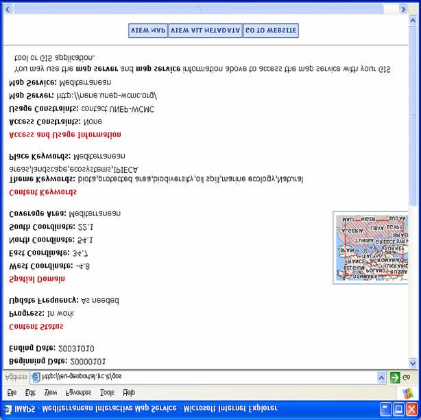
 Metadata for Datasets")


</title> <date datetype=\"creation\">2003-01-11")

22 Topography Cross Border RSDI Prototype Data Road Food-and-mouth disease cases (fictive) Metadata for Datasets and Services (ISO 19115) <servicetype> <namevalue>wms</namevalue> <namenamespace/> </servicetype> <servicetypeversion>1.1.0</servicetypeversion> <servicetypeversion>1.1.1</servicetypeversion> <citation> <title>xtrawms - GDI Testbed II (2nd Rev)</title> <date datetype="creation"> :00:00</date> <citedresponsibleparty> <individualname>reinhard Erstling</individualName> <organisationname>interactive instruments GmbH</organisationName> <positionname>geschäftsführer</positionname> <contactinfo> <phone>
23 Cross Border RSDI Prototype Overview: Catalog Services CS / CS Client NL NCGI WRS Client NRW CeGi WRS NRW CeGi
24 Showcase NL-NRW Cross-Border Risk Management This case is added to a web-accessible map server (*) by a veterinary from the Dutch environmental authority (*) the MKZ map server; food-and-mouth-disease is mond en klauwzeer in dutch Operator NL WMS - MKZ Data NL Geodan
25 Cross Border RSDI Prototype Overview: Mapping Services WMS - Road/Topo/NUTS NL Geodan WMS Client IfGI WMS - MKZ Data NL Geodan WMS - Topo Data NRW AED WMS - Road Data NRW ii

26 Showcase NL-NRW Cross-Border Risk Management In the Netherlands a case of food-and-mouth-disease has been detected.

27 Showcase NL-NRW Cross-Border Risk Management The Dutch veterinary calls its German colleague in North- Rhine Westphalia to inform him about the developments and discuss measures

28 Showcase NL-NRW Cross-Border Risk Management The German veterinary in North-Rhine Westphalia starts his Web Browser and opens a Cross-Border GDI Portal


29 Showcase NL-NRW Cross-Border Risk Management He opens a catalog client to search for information about the food-and-mouth-disease in Gelderland He uses the keywords: Gelderland Maul- und Klauenseuche and finds the mond en klauwzeer map server in the Netherlands (due to the availability of multi-language metadata)


30 Showcase NL-NRW Cross-Border Risk Management The veterinary in North-Rhine Westphalia opens his favourite web mapping client He adds the MKZ-Layer from the map server found by his search WMS - NUTS NL Geodan WMS Client IfGI WMS - MKZ Data NL Geodan


31 Showcase NL-NRW Cross-Border Risk Management The veterinary sees a map with one or more symbols representing MKZ cases He clicks on one symbol to retrieve additional information about the particular case

32 Showcase NL-NRW Cross-Border Risk Management The veterinary now uses the catalogue client again to search for road data in both the Netherlands and North- Rhine Westphalia

33 Showcase NL-NRW Cross-Border Risk Management He finds two map servers and adds layers from these servers to his map
34 Together with his colleague in the Netherlands he identifies a location that needs closer inspection (the closest border crossings from the reported cases where control points shall be established; no control points on highways) Showcase NL-NRW Cross-Border Risk Management
35 As he zooms in to this area, more details are shown on the map (topographic layers) Both operators can now identify and discuss in detail where the control points should be established, etc. Showcase NL-NRW Cross-Border Risk Management
36 Showcase NL-NRW Cross-Border Risk Management After the discussion is finished and the measures have been agreed upon, both veterinaries continue to communicate with the required authorities in their region (e.g. police, road administration, etc.) In order to do this successfully and efficiently, a presentation of the same information in the native language of the respective region is essential support for multiple languages is a key aspect for cross-border activities

37 The situation as seen by the operator in the Netherlands Showcase NL-NRW Cross-Border Risk Management
38 Cross Border RSDI Prototype Conclusions Major Achievements: Up-to-date geo-information is available across borders / pan-european using existing GI-specifications and standards Collaboration is possible on a shared and common information level (Low-key) semantic interoperability is achieved through the use of mapping services No pre-installed software is required, just a web browser and an internet connection
39 Cross Border RSDI Prototype Conclusions What was required to make these applications work: Usage of common technical specifications and standards Web Map Service Catalog Service Common base information models and their encoding Availability of the required datasets via the internet All services support a common Coordinate Reference System (CRS) Multi-language support in Web Map Services and the metadata useful lessons for the EU Geoportal
40 EU Geo-Portal - Motivation Recommended by INSPIRE WGs Architecture and Standards and Implementing Strategy GINIE Project Supported by the INSPIRE Internet consultation One entrance point to the up-coming ESDI to support the search and access to geoinformation resources in the ESDI Evaluation and demonstration of current developments and their potentials Motivation of national and regional SDI-development
41 EU Geo-Portal Does not contradict the Idea of the ESDI, being based on distributed geoinformation services ( INSPIRE-consultation) A Geo-Portal realizes a thematic and/or regional view on the SDI (environmental portal, national portal, etc.). Has an important teaching, learning, and motivation effects : what happens? what is already feasible? who is already taking part? (= my GI resources should also be connected)
42 EU Geo-Portal - Requirements In chronological order (1/2): Based on distributed geodata & GI services (no local copies )! Publish and search geoinformation Access to further relevant resources (Documentation, FAQ, links, ) Integration of distributed portrayal services (Web Mapping Services) Provide multilingual Thesauri and Gazetteer
43 EU Geo-Portal - Requirements In chronological order (2/2): Multilingualism Application, Thesauri, Metadata, Attribute identifiers of geodata or services up to which granularity?!? Support of AAA services (Authorisation, Access, Account); perhaps Pricing- and Ordering Services user profiles Access on further geoprocessing services (classification, coordinate transformation, etc.) and GI service chaining according to user needs
44 EU Geo-Portal - Components Web Browser (Thin Client)
45 EU Geo-Portal - Prototyp Requirements for the prototype: Publish of Geoinformation (geodata and GI services) by registering metadata Search for geoinformation Access to further relevant resources (Documentation, FAQ, links, ) Integration of distributed portrayal services (Web Mapping Services) same techniques as used in the cross border prototype
46 EU Geo-Portal - Prototyp JRC JRC
47 EU Geoportal Prototyp - Standards OGC Web Services WMS 1.x.x Metadaten (ISO) 19115:2003 using the categories recommended by INSPIRE this Metadata needs to be provided to register your service or dataset Geographic names for Gazetteer NIMA

48 EU Geo-Portal Prototype

49 Searching data on biodiversity

50 Search results

51 See metadata

52 View map

53 Zoom map and select NATURA2000


54 Zoom and query NATURA 2000

55 Add new WMS (CORINE Land Cover)
56 Issues / Lessons learnt In a European context, built-in support for multiple languages is required in technical specifications like Web Map Service and Catalog Service The higher the structural and semantical similarity of the information on both sides of the border, the easier it is to exploit cross-border data (e.g. layer classification) Integration by mapping does result in maps with heterogeneous mapping styles not necessarily a problem
57 Issues / Lessons learnt Metadata Lack in collecting and providing of Metadata - thus use of metadata can hardly be proven Further need on tools to support (semi-) automatic collection and maintenance of metadata Missing support to combine ISO and 19119; Standards not always sufficient Multilingualism Harmonising Of used Schemata und Categories Used Vocabularies in Thesauri and Gazetteer ( semantic Interoperability)
58 Issues / Lessons learnt ISO-Standards and OGC-Specifications are a good & important tool for Interoperability, but it needs some additional glue Definition of CRS, Scale-Hints, layer names Certification of services ( CITE) Quality measurement of distributed(!) services Long-lasting Specifications ESDI Technical Guidelines; support to harmonise additional specifications on European level Futher development of specifications (incl. feedback to ISO & OGC!!) by European and national SDI-Projects
59 Create awareness on interoperability Pre-conference Tutorial -Technical Foundations of Interoperability for Geoinformation and Workshop - SDI & Interoperability for Geoinformation April '04 at 7th AGILE 2004 (Heraklion, GR) Workshop on national and regional Geo-Portals June '04 at 10th EC-GI & GIS Workshop, (Warsaw, PL)
60 Thank You for Your Attention! Questions & Comments?! contacts in the ESDI team: Alessandro Annoni Lars Bernard Ioannis Kanellopoulos Paul Smits
")
61 Cross Border RSDI Prototype Common CRS (ETRS89 + UTM32)

62 The use of open specifications allows the integration in standard GIS products, too Showcase NL-NRW Cross-Border Risk Management
Roadmap to interoperability of geoinformation
 Roadmap to interoperability of geoinformation and services in Europe Paul Smits, Alessandro Annoni European Commission Joint Research Centre Institute for Environment and Sustainability paul.smits@jrc.it
Implementing strategy for the Infrastructure for Spatial Information in Europe - INSPIRE Paul Smits
 Implementing strategy for the Infrastructure for Spatial Information in Europe - INSPIRE Paul Smits European Commission DG Joint Research Centre Institute for Environment and Sustainability Ispra, Italy
Towards a European Spatial Data Infrastructure
 Towards a European Spatial Data Infrastructure Paul Smits, Alessandro Annoni, Lars Bernard, Ioannis Kanellopoulos, Michel Millot, Steve Peedell European Commission DG Joint Research Centre Institutefor
INSPIRE - A Legal framework for environmental and land administration data in Europe
 INSPIRE - A Legal framework for environmental and land administration data in Europe Dr. Markus Seifert Bavarian Administration for Surveying and Cadastre Head of the SDI Office Bavaria Delegate of Germany
North-Rhine Westphalia: Building a Regional SDI in a Cross-Border Environment / Ad-Hoc Integration of SDIs: Lessons learnt
 North-Rhine Westphalia: Building a Regional SDI in a Cross-Border Environment / Ad-Hoc Integration of SDIs: Lessons learnt Jens Riecken 1, Lars Bernard 2, Clemens Portele 3, Albert Remke 4 1 Surveying
Infrastructure for Spatial Information in Europe (INSPIRE) Steve Peedell
 Steve Peedell") Infrastructure for Spatial Information in Europe (INSPIRE) Steve Peedell European Commission DG Joint Research Centre Institute for Environment and Sustainability ESDI Action Overview JRC, European Commission
Infrastructure for Spatial Information in Europe (INSPIRE) Steve Peedell European Commission DG Joint Research Centre Institute for Environment and Sustainability ESDI Action Overview JRC, European Commission
INSPIRE General Introduction & Service Architecture
 INSPIRATION Spatial Data Infrastructure in the Western Balkans INSPIRE General Introduction & Service Architecture 1st National INSPIRATION Workshop Croatia November 21-22, 2012 A multi-countryprojectfunded
INSPIREd solutions for Air Quality problems Alexander Kotsev
 INSPIREd solutions for Air Quality problems Alexander Kotsev www.jrc.ec.europa.eu Serving society Stimulating innovation Supporting legislation The European data puzzle The European data puzzle 24 official
Proposal for a DIRECTIVE OF THE EUROPEAN PARLIAMENT AND OF THE COUNCIL. establishing an infrastructure for spatial information in the Community
 Proposal for a DIRECTIVE OF THE EUROPEAN PARLIAMENT AND OF THE COUNCIL establishing an infrastructure for spatial information in the Community INSPIRE http://inspire.jrc.it/ Alessandro Annoni 1 EU Commission
I&CLC2000 in support to new policy initiatives (INSPIRE, GMES,..)
") I&CLC2000 in support to new policy initiatives (INSPIRE, GMES,..) Manfred Grasserbauer, Director Joint Research Centre Institute for Environment and Sustainability 1 IMAGE 2000 European mosaic of satellite
I&CLC2000 in support to new policy initiatives (INSPIRE, GMES,..) Manfred Grasserbauer, Director Joint Research Centre Institute for Environment and Sustainability 1 IMAGE 2000 European mosaic of satellite
INSPIRE Basics. Vlado Cetl European Commission Joint Research Centre. https://ec.europa.eu/jrc/
 INSPIRE Basics Vlado Cetl European Commission Joint Research Centre https://ec.europa.eu/jrc/ Serving society Stimulating innovation Supporting legislation Outline SDI? Why European SDI? INSPIRE Policy
reviewed paper EU-Project: Cross-border Spatial Information System with High Added Value (CROSS-SIS) Stefan SANDMANN
 Stefan SANDMANN") reviewed paper EU-Project: Cross-border Spatial Information System with High Added Value (CROSS-SIS) Stefan SANDMANN Surveying and Mapping Agency NRW, Bonn, Muffendorfer Str. 19-21, Germany, sandman@lverma.nrw.de
reviewed paper EU-Project: Cross-border Spatial Information System with High Added Value (CROSS-SIS) Stefan SANDMANN Surveying and Mapping Agency NRW, Bonn, Muffendorfer Str. 19-21, Germany, sandman@lverma.nrw.de
Spatial Data Infrastructure Concepts and Components. Douglas Nebert U.S. Federal Geographic Data Committee Secretariat
 Spatial Data Infrastructure Concepts and Components Douglas Nebert U.S. Federal Geographic Data Committee Secretariat August 2009 What is a Spatial Data Infrastructure (SDI)? The SDI provides a basis for
Technical Specifications. Form of the standard
 Used by popular acceptance Voluntary Implementation Mandatory Legally enforced Technical Specifications Conventions Guidelines Form of the standard Restrictive Information System Structures Contents Values
Infrastructure for Spatial Information in Europe (INSPIRE)
") Infrastructure for Spatial Information in Europe (INSPIRE) 2011 GISCO Working Party 8-9.3.2012 INSPIRE is about improving access to spatial information: the environment doesn t stop at borders EU Geoportal
Infrastructure for Spatial Information in Europe (INSPIRE) 2011 GISCO Working Party 8-9.3.2012 INSPIRE is about improving access to spatial information: the environment doesn t stop at borders EU Geoportal
Ready for INSPIRE.... connecting worlds. European SDI Service Center
 Ready for INSPIRE Consultancy SOFTWARE T r a i n i n g Solutions... connecting worlds European SDI Service Center Increasing Added Value with INSPIRE and SDI Components INSPIRE In 2007, the European Commission
econtentplus GS Soil
 econtentplus GS Soil General aims Assessment and strategic development of INSPIRE compliant Geodata-Services for European Soil Data BPN on basis of the EU 2007/2/EC (INSPIRE) Directive for Annex III theme
Paper UC1351. Conference: User Conference Date: 08/10/2006 Time: 8:30am-9:45am Room: Room 23-B (SDCC)
") Conference: User Conference Date: 08/10/2006 Time: 8:30am-9:45am Room: Room 23-B (SDCC) Title of Paper: Increasing the Use of GIS in the Federal Government Author Name: Miss Abstract This presentation
Conference: User Conference Date: 08/10/2006 Time: 8:30am-9:45am Room: Room 23-B (SDCC) Title of Paper: Increasing the Use of GIS in the Federal Government Author Name: Miss Abstract This presentation
Web Portal to European Soil Database
 Web Portal to European Soil Database A step towards harmonization of Soil Information in Europe Marc Van Liedekerke, Panos Panagos, Jean Dusart Soils Portal: http://eusoils.jrc.it Data The European Soil
INSPIRE Directive. Status June 2007
 INSPIRE Directive INfrastructure for SPatial InfoRmation in Europe Status June 2007 European Commission Directorate-General Environment Research, Science and Innovation Unit Rue de la Loi, 200 1049 Brussels
Spatial Data Infrastructures in Greece: State of play Spring 2003
 Spatial Data Infrastructures in : State of play Spring 2003 Country report on SDI elaborated in the context of a study commissioned by the EC (EUROSTAT & DGENV) in the framework of the INSPIRE initiative
The state-of-the-art of the Finnish SDI. Arctic SDI WG Meeting
 The state-of-the-art of the Finnish SDI Arctic SDI WG Meeting Moscow 8.9.2011 Esa Tiainen Development Centre 1 NATIONAL LAND SURVEY DOWN TO EARTH Contents Legal framework Coordination structure Network
Adding value to Copernicus services with member states reference data
 www.eurogeographics.org Adding value to Copernicus services with member states reference data Neil Sutherland neil.sutherland@os.uk GIS in the EU 10 November 2016 Copyright 2016 EuroGeographics 61 member
TIM-online A part of the egovernment strategy by the Federal State North-Rhine Westphalia
 TIM-online A part of the egovernment strategy by the Federal State North-Rhine Westphalia Stefan Sandmann Surveying and mapping agency of North - Rhine Westphalia Muffendorfer Straße 19 21, D-53177 Bonn
European Directive (2007/2/EC) INSPIRE sharing data in an interoperable way
 INSPIRE sharing data in an interoperable way") European Directive (2007/2/EC) INSPIRE sharing data in an interoperable way Robert Tomas 7 th European Conference on Regional Geoscientific Cartography and Information Systems Bologna, 12 th -15 th June
European Directive (2007/2/EC) INSPIRE sharing data in an interoperable way Robert Tomas 7 th European Conference on Regional Geoscientific Cartography and Information Systems Bologna, 12 th -15 th June
The German GDI a public-private cooperation project. Heinz BRÜGGEMANN Surveying and Mapping Agency NRW, Germany
 The German GDI a public-private cooperation project Heinz BRÜGGEMANN Surveying and Mapping Agency NRW, Germany Definition of Grimm Public tasks are all action lines..., which are handled by public actors,
SDI-Challenges European perspective
 THE HIGH LEVEL FORUM ON GLOBAL GEOSPATIAL INFORMATION MANAGEMENT Seoul, Republic of Korea, 24-26 October 2011 Session 1: Challenges in geospatial policy formation and institutional arrangements SDI-Challenges
Technical Framework Methodology as a core of building up the NSDI NSDI Implementation Specifics in Serbia
 Technical Framework Methodology as a core of building up the NSDI NSDI Implementation Specifics in Serbia Luka Jovičić SDI Consultant@ Gramont Ltd. Aleksandar Dedić RGA NSDI department Dragica Pajić RGA
ESBN. Working Group on INSPIRE
 ESBN Working Group on INSPIRE by Marc Van Liedekerke, Endre Dobos and Paul Smits behalf of the WG members WG participants Marc Van Liedekerke Panos Panagos Borut Vrščaj Ivana Kovacikova Erik Obersteiner
SWEDISH SDI DEVELOPMENT & IMPLEMENTATION OF INSPIRE
 SWEDISH SDI DEVELOPMENT & IMPLEMENTATION OF INSPIRE Christina Wasström, Lantmäteriet, 801 82 Gävle, Sweden, christina.wasstrom@lm.se ABSTRACT The Swedish Government and Parliament has given Lantmäteriet
The Process of Spatial Data Harmonization in Italy. Geom. Paola Ronzino
 The Process of Spatial Data Harmonization in Italy Geom. Paola Ronzino ISSUES Geospatial Information in Europe: lack of data harmonization the lack of data duplication of data CHALLENGES Challenge of INSPIRE:
Arctic Spatial Data Infrastructure Enabling Access to Arctic Location-Based Information
 Arctic Spatial Data Infrastructure Enabling Access to Arctic Location-Based Information Arctic SDI Side Event Co-Chairs: Arvo Kokkonen Arctic SDI Board Chair & Director General, National Land Survey of
Geological information for Europe : Towards a pan-european Geological Data Infrastructure
 Geological information for Europe : Towards a pan-european Geological Data Infrastructure Integrating geoscientific information for EU competitiveness Co-funded by the European Union European societal
Faculty Environmental Sciences» Department Geosciences» Chair for Geoinformationsystems Developing Scientific GDI DGEO Workshop
 Faculty Environmental Sciences» Department Geosciences» Chair for Geoinformationsystems Developing Scientific GDI DGEO Workshop Lars Bernard, Stephan Mäs February 2013 TU Dresden GIS Team Chair Geoinformationsystems
Status of implementation of the INSPIRE Directive 2016 Country Fiches. COUNTRY FICHE Netherlands
 Status of implementation of the INSPIRE Directive 2016 Country Fiches COUNTRY FICHE Netherlands Introduction... 1 1. State of Play... 2 1.1 Coordination... 2 1.2 Functioning and coordination of the infrastructure...
Building a National Data Repository
 Building a National Data Repository Mladen Stojic, Vice President - Geospatial 1/30/2013 2012 Intergraph Corporation 1 Information has meaning and gives power only when shared and distributed. Information,
GIS Building Communities beyond National Borders (Building Successful Spatial Data Infrastructures) Nick Land, ESRI Europe
 Nick Land, ESRI Europe") GIS Building Communities beyond National Borders (Building Successful Spatial Data Infrastructures) Nick Land, ESRI Europe UK worst flooding in the last 60 years 350,000 households without drinking water
GIS Building Communities beyond National Borders (Building Successful Spatial Data Infrastructures) Nick Land, ESRI Europe UK worst flooding in the last 60 years 350,000 households without drinking water
NAG-City Expert Workshop Oslo 8-9. October 2012 SOSI standards and mapping for Europe (INSPIRE)
") NAG-City Expert Workshop Oslo 8-9. October 2012 SOSI standards and mapping for Europe (INSPIRE) Per Ryghaug, Geomatics The Norwegian national standard on geographic information - SOSI Started in 1984 NGU
NAG-City Expert Workshop Oslo 8-9. October 2012 SOSI standards and mapping for Europe (INSPIRE) Per Ryghaug, Geomatics The Norwegian national standard on geographic information - SOSI Started in 1984 NGU
INSPIRing Geospatial Framework For Local Administrations
 This project is financed by the European Union and the Republic of Turkey Presented at the FIG Congress 2018, May 6-11, 2018 in Istanbul, Turkey National Programme for Turkey 2010 Instrument for Pre-Accession
Interoperable Services for Web-Based Spatial Decision Support
 Interoperable Services for Web-Based Spatial Decision Support Nicole Ostländer Institute for Geoinformatics, University of Münster Münster, Germany ostland@uni-muenster.de SUMMARY A growing number of spatial
The Swedish National Geodata Strategy and the Geodata Project
 The Swedish National Geodata Strategy and the Geodata Project Ewa Rannestig, Head of NSDI Co-ordination Unit, Lantmäteriet, ewa.rannstig@lm.se Ulf Sandgren, Project Manager Geodata Project, Lantmäteriet,
INSPIRing effort. Peter Parslow Ordnance Survey December Various European approaches to managing an SDI
 INSPIRing effort Peter Parslow Ordnance Survey December 2015 Various European approaches to managing an SDI WHAT IS INSPIRE? A European Union Directive A community effort: http://inspire.ec.europa.eu/
Data Origin. Ron van Lammeren CGI-GIRS 0910
 Data Origin Ron van Lammeren CGI-GIRS 0910 How to obtain geodata? Geo data initiative Executive Order 12906, "Coordinating Geographic Data Acquisition and Access: The National Spatial Data Infrastructure,"
SDI in Lombardia (Italy(
 SDI in Lombardia (Italy( Italy) Andrea Piccin European SDI Best Practice Awards 2009 - Learning from Best Practices Turin, 26th and 27th November 2009 Lombardia, in Italy, is 4 th Region for territorial
EuroSDR (European Spatial Data Research)
") EuroSDR (European Spatial Data Research) ROLLING RESEARCH PLAN 2015-2018 EuroSDR Secretariat Public Governance Institute KU Leuven Parkstraat 45 bus 3609 3000 Leuven Belgium Tel.: +32 16 32 31 80 Fax:
EuroSDR (European Spatial Data Research) ROLLING RESEARCH PLAN 2015-2018 EuroSDR Secretariat Public Governance Institute KU Leuven Parkstraat 45 bus 3609 3000 Leuven Belgium Tel.: +32 16 32 31 80 Fax:
Data Origin. How to obtain geodata? Ron van Lammeren CGI-GIRS 0910
 Data Origin How to obtain geodata? Ron van Lammeren CGI-GIRS 0910 Spatial Data interest Improvement of policy making. ± 90% of all information used by government has spatial characteristics SPATIAL INFORMATION
INTEROPERABILITY AND DATA HOMOGENIZATION
 Page 1 of 5 The Transnational Geo-portal Italian-Slovenian of the Cross-Border Park Area Eva Savina Malinverni DARDUS Università Politecnica delle Marche Ancona, IT e.s.malinverni@univpm.it INTRODUCTION
Ministry of ICT of I.R.IRAN
 The ECO 8/6 mill km 2 10 Slamic countries ~330 mill people Oil, Gas, Industries,Tourism 2 Issue transformation in last decade Problem solving needs more integrated approach More interaction &complexity
Geospatial Information Management, a Feasible Tool for Small Island Developing States?
 Geospatial Information Management, a Feasible Tool for Small Island Developing States? Hartmut Müller FIG Pacific Small Island Developing States Symposium, Policies and Practices for Responsible Governance
INSPIRE Monitoring and Reporting Implementing Rule Draft v2.1
 INSPIRE Infrastructure for Spatial Information in Europe INSPIRE Monitoring and Reporting Implementing Rule Draft v2.1 Title INSPIRE Monitoring and Reporting Implementing Rule v2.1 Creator DT Monitoring
Modern Education at Universities: Improvements through the Integration of a Spatial Data Infrastructure SDI into an e-learning Environment
 Modern Education at Universities: Improvements through the Integration of a Spatial Data Infrastructure SDI into an e-learning Environment Ingo Simonis Institute for Geoinformatics, University of Muenster
Demonstration of a local SDI solution with several stakeholders in pilot areas in line with EU best practices
 EU Twinning project for the Agency of Land Relations and Cadaster (ALRC)- Organization, Streamlining and Computerization Process in Mapping in the Republic of Moldova. Demonstration of a local SDI solution
Model Generalisation in the Context of National Infrastructure for Spatial Information
 Model Generalisation in the Context of National Infrastructure for Spatial Information Tomas MILDORF and Vaclav CADA, Czech Republic Key words: NSDI, INSPIRE, model generalization, cadastre, spatial planning
EuroGeographics & INSPIRE. Nick Land, Executive Director of EuroGeographics
 EuroGeographics & INSPIRE Nick Land, Executive Director of EuroGeographics EuroGeographics A growing association 49 Members, 42 countries Topographic mapping, cadastre, land registry + Networked organisation
Think Local - Act Global a Nordic Perspective
 Think Local - Act Global a Nordic Perspective OGC Nordic Forum Jari Reini 20-21.5.2014 OGC Nordic Forum? OGC Nordic Forum addresses OGC outreach and education needs of government, academic, research and
Plan4all (econtentplus project)
") Plan4all (econtentplus project) Karel CHARVAT 1, Tomáš MILDORF 2 1 Help service remote sensing, Ltd., Černoleská 1600, 256 01 Benešov u Prahy, Czech Republic charvat@bnhelp.cz 2 Department of Mathematics
Plan4all (econtentplus project) Karel CHARVAT 1, Tomáš MILDORF 2 1 Help service remote sensing, Ltd., Černoleská 1600, 256 01 Benešov u Prahy, Czech Republic charvat@bnhelp.cz 2 Department of Mathematics
Open Data meets Big Data
 Open Data meets Big Data Max Craglia, Sven Schade, Anders Friis European Commission Joint Research Centre www.jrc.ec.europa.eu Serving society Stimulating innovation Supporting legislation JRC is Technical
Geological applications using geospatial standards an example from OneGeology-Europe and GeoSciML
 Geological applications using geospatial standards an example from OneGeology-Europe and GeoSciML John Laxton 1, Jean-Jacques Serrano 2, Agnes Tellez-Arenas 2 1 British Geological Survey, Edinburgh, United
Spatially enabling e-government through geo-services
 Spatially enabling e-government through geo-services Mauro Salvemini EUROGI PRESIDENT Professor at Sapienza Università di Roma (IT) 1 About the presentation Few information about Eurogi ; Some essential
Recommendations for INSPIRE Spatial Data Services
 INSPIRE Infrastructure for Spatial Information in Europe Recommendations for INSPIRE Spatial Data Services Title Creator Recommendations for INSPIRE Spatial Data Services Spatial Data Services Working
Appropriation Directions for 2007
 INSPIRE in Sweden An Important Part of the National Geodata Strategy Monica Lagerqvist Nilsson Appropriation Directions for 2007 A commission to investigate the necessity to adjust the Swedish legislation
Update on INSPIRE; interoperable framework for natural hazards
 Update on INSPIRE; interoperable framework for natural hazards Robert Tomas EC-DG Joint Research Centre 16 th Meeting of Working Group F on Floods 2014, Rome www.jrc.ec.europa.eu Serving society Stimulating
Spatially Enabled Society
 International Seminar on Land Administration Trends and Issues in Asia and the Pacific Region Spatially Enabled Society Abbas Rajabifard Vice Chair PCGIAP-WG3 Vice-President (President Elect), GSDI Association
Status of implementation of the INSPIRE Directive 2016 Country Fiches. COUNTRY FICHE Malta
 Status of implementation of the INSPIRE Directive 2016 Country Fiches COUNTRY FICHE Malta Introduction... 1 1. State of Play... 2 1.1 Coordination... 2 1.2 Functioning and coordination of the infrastructure...
EXPECTATIONS OF TURKISH ENVIRONMENTAL SECTOR FROM INSPIRE
 EXPECTATIONS OF TURKISH ENVIRONMENTAL SECTOR FROM INSPIRE June, 2010 Ahmet ÇİVİ Tuncay DEMİR INSPIRE in the Eyes of MoEF Handling of Geodata by MoEF Benefits Expected TEIEN First Steps for INSPIRE Final
Increasing GI awareness in local authorities in Poland experiences from the INSPIRE Academy training programme
 Increasing GI awareness in local authorities in Poland experiences from the INSPIRE Academy training programme http://www.akademiainspire.pl Maria Andrzejewska, Monika Rusztecka UNEP/GRID-Warsaw Centre,
Regional Spatial Data Infrastructures What Makes them Possible?
 Article for Geoinformatics June 2007 Regional Spatial Data Infrastructures What Makes them Possible? by Sam Bacharach Executive Director Outreach Open Geospatial Consortium, Inc. (OGC) INTRODUCTION The
Implementing INSPIRE Geoportal in Turkey
 Implementing INSPIRE Geoportal in Turkey Gencay SERTER City and Regional Planner 1 Presentation Plan Introduction INSPIRE and Turkey Importance of al Spatial Planning Portal Logical&Legal Hierarchy GeoPortal
Establishing the National Spatial Data Infrastructure (NSDI) for Norway a joint effort by many stakeholders SPATIAL DATA FOR BENEFIT OF THE SOCIETY
 for Norway a joint effort by many stakeholders SPATIAL DATA FOR BENEFIT OF THE SOCIETY") Establishing the National Spatial Data Infrastructure (NSDI) for Norway a joint effort by many stakeholders SPATIAL DATA FOR THE BENEFIT OF SOCIETY OUTLINE Political background Norway digital - The Norwegian
Establishing the National Spatial Data Infrastructure (NSDI) for Norway a joint effort by many stakeholders SPATIAL DATA FOR THE BENEFIT OF SOCIETY OUTLINE Political background Norway digital - The Norwegian
Global Geospatial Information Management Country Report Finland. Submitted by Director General Jarmo Ratia, National Land Survey
 Global Geospatial Information Management Country Report Finland Submitted by Director General Jarmo Ratia, National Land Survey Global Geospatial Information Management Country Report Finland Background
Major Opportunities in Spatial Data Infrastructure Communities
 Major Opportunities in Spatial Data Infrastructure Communities Bas Kok President GSDI June 17 th 2008 FIG Working Week: Integrating Generations 14-19 June 2008 Stockholm, Sweden http://www.gsdi.org 1 GSDI
Spatial data interoperability and INSPIRE compliance the platform approach BAGIS
 Spatial data interoperability and INSPIRE compliance the platform approach BAGIS BAGIS Voluntary, independent, public, non-profit organization; Organization with main mission to promote the growth of the
Standards in Action: The Canadian Geospatial Data Infrastructure (CGDI)
") Standards in Action: The Canadian Geospatial Data Infrastructure (CGDI) Craig Stewart ISO/TC211 Standards in Action Workshop, September 14, 2005 Presentation Outline Overview of SDIs Overview of Canada
Standards in Action: The Canadian Geospatial Data Infrastructure (CGDI) Craig Stewart ISO/TC211 Standards in Action Workshop, September 14, 2005 Presentation Outline Overview of SDIs Overview of Canada
The INSPIRE Community Geoportal
 Infrastructure for Spatial Information in the European Community The INSPIRE Community Geoportal Gianluca Luraschi EC INSPIRE GEOPORTAL TEAM European Commission Joint Research Centre Institute for Environment
A multilingual/multicultural semantic-based approach to improve Data Sharing in a SDI
 A multilingual/multicultural semantic-based approach to improve Data Sharing in a SDI Monica De Martino, Riccardo Albertoni IMATI-CNR-GE Institute of Applied Mathematics and Information Technologies, Dept.Genoa,
Analys av GIS-användning inom offentlig sektor i Norden
 Analys av GIS-användning inom offentlig sektor i Norden Henning Sten Hansen, Line Hvingel and Lise Schrøder Aalborg Universitet Jönköping, Sweden 30 March 2011 Overview The Danish and Swedish approaches
Implementation of Inspire in Denmark - How we get it flying! Olav Eggers National Survey & Cadastre -Denmark
 Implementation of Inspire in Denmark - How we get it flying! Olav Eggers oe@kms.dk National Survey & Cadastre -Denmark Introduction Overview Infrastructure for Spatial Information Act National Survey and
Recommendations for INSPIRE Spatial Data Services
 INSPIRE Infrastructure for Spatial Information in Europe Recommendations for INSPIRE Spatial Data Services Title Creator Recommendations for INSPIRE Spatial Data Services Spatial Data Services Working
Who are we? Use of German State s Rhineland-Palatinate Spatial Data Infrastructure for e-government INSPIRE. Topics of Presentation INSPIRE
 Who are we? University of Applied Sciences, Mainz, Germany Institute for Spatial Information and Surveying Technology Use of German State s Rhineland-Palatinate Spatial Data Infrastructure for e-government
EMMA : ECDC Mapping and Multilayer Analysis A GIS enterprise solution to EU agency. Sharing experience and learning from the others
 EMMA : ECDC Mapping and Multilayer Analysis A GIS enterprise solution to EU agency. Sharing experience and learning from the others Lorenzo De Simone, GIS Expert/ EMMA Project Manager 2014 GIS Workshop,
INSPIRE and egovernment policies: a common governance for a wider public sector information infrastructure
 INSPIRE and egovernment policies: a common governance for a wider public sector information infrastructure Gabriele Ciasullo Leonardo Donnaloia Antonio Rotundo 2 EU needs and actions Reference document
OPEN GOVERNMENT - BENEFITS OF INSPIRE IN THE PUBLIC SECTOR
 Brussels, 04th March 2013 - Daniela Hogrebe and André Caffier from GDI-DE 1 OPEN GOVERNMENT - BENEFITS OF INSPIRE IN THE PUBLIC SECTOR Powered by INSPIRE Open Government 2 SDI is a fundament of transparent
E-Government and SDI in Bavaria, Germany
 135 E-Government and SDI in Bavaria, Germany Wolfgang STOESSEL, Germany Key words: GDI-BY, Bavaria, Spatial Data Infrastructure SUMMARY Spatial Data Infrastructure (SDI) is an important part of the e-government
SDI Standards at work
 SDI Standards at work Jan Juul Jensen Senior Technology Strategist Informi GIS Denmark Informi GIS Private held Limited Company Specialized in GIS 100+ employees HQ in Charlottenlund, Copenhagen Regional
INDONESIA S S UPDATE: GEOSPATIAL INFORMATION FOR SUSTAINABLE DEVELOPMENT RELATED TO INA SDI Dr. Asep Karsidi, M.Sc
 INDONESIA S S UPDATE: GEOSPATIAL INFORMATION FOR SUSTAINABLE DEVELOPMENT RELATED TO INA SDI Dr. Asep Karsidi, M.Sc GEOSPATIAL INFORMATION AGENCY 08 August, 2012 OUTLINE 1. Transformation Bakosurtanal into
THE WASHINGTON COASTAL ATLAS
 THE ICAN COASTAL ATLAS MEDIATOR PROTOTYPE AND CONNECTING THE WASHINGTON COASTAL ATLAS Liz O Dea 1, Yassine Lassoued 2, Tanya Haddad 3, Declan Dunne 2 1 GIS Services Unit, WA State Dept. of Ecology 2 Coastal
Geo Web Services: An NSDI-Embedded Approach
 Geo Web Services: An NSDI-Embedded Approach Christine Najar 1, Christine Giger 1 Francois Golay 2, Camilla Moreni 2, Marc Riedo 2 1 Institute for Geodesy and Photogrammetry Swiss Institute of Technology
The contribution of EUREF to Inspire
 EUREF2010 SYMPOSIUM The contribution of EUREF to Inspire J. Torres, V. Bitenc, A. Caporali, P. Cruddace, L. Engberg, B. Garayt and H. Habrich (members of TWG-RS) June 2-4, 2010 Gävle 1 EUREF2010 SYMPOSIUM
IDEBarcelona: Cooperating for a Smart Region Infrastructure
 IDEBarcelona: Cooperating for a Smart Region Infrastructure Marta Codinachs Serra Diputació de Barcelona Territory and Sustainability Area Territorial Information Systems Department SMART CITY EXPO WORLD
Portals: Standards in Action
 Portals: Standards in Action David Danko ISO TC 211 Metadata Project Leader GIS Standards Consultant-ESRI. Metadata Portals Portal gateway, place of entry Producers Advertise, expose products Share information
Sharing soil information with the help of INSPIRE, key challenges with soil data management
 Sharing soil information with the help of INSPIRE, key challenges with soil data management Katharina Feiden e-mail: gssoil@portalu.de GS Soil: project outline GS Soil: Assessment and strategic development
SITR-IDT The Spatial Data Infrastructure of Sardinia Region
 ITALY LOCAL AUTHORITY FOR MUNICIPALITIES, FINANCES AND URBAN PLANNING REGIONAL DEPARTMENT FOR CARTOGRAPHY AND INFORMATION SYSTEMS SITR-IDT The Spatial Data Infrastructure of Sardinia Region Content of
INSPIRE implementation in the Turkish Ministry of Environment and Urbanization Producing and Publishing Environmental Data
 INSPIRE implementation in the Turkish Ministry of Environment and Urbanization Producing and Publishing Environmental Data Ezgi Sarmusak Urban Planner, MoEU Sibel Süer Toybıyık - Assistant Expert, MoEU
Sustainable and Harmonised Development for Smart Cities The Role of Geospatial Reference Data. Peter Creuzer
 Sustainable and Harmonised Development for Smart Cities The Role of Geospatial Reference Data Peter Creuzer 1. Introduction - Smart Cities and Geodata 2. Geodata in Germany 3. Examples 4. Data and Service
Upgrade the Datasets in NSDI for Smarter Services with the Cases of China
 Upgrade the Datasets in NSDI for Smarter Services with the Cases of China By Dr. JIANG Jie Dept of GeoInformaiton Service Platform National Geomatics Center of China October 7, 2015 Jeju, Republic of Korea
ESDIN Results from a Crossborder INSPIRE Preparatory Project. Jörgen Hartnor, Lantmäteriet.
 ESDIN Results from a Crossborder INSPIRE Preparatory Project Jörgen Hartnor, Lantmäteriet www.esdin.eu Ett econtentplus Best Practice Network projekt September 2008 February 2011 Coordinated by EuroGeographics
European Location Framework data in the ArcGIS platform
 European Location Framework data in the ArcGIS platform Presentation to: Author: Date: INSPIRE Conference 2016 Clemens Portele 26 September 2016 Why ELF? Global (e.g. UN GGIM) Regional Europe (INSPIRE
Land Use and Land cover statistics (LUCAS)
") EUROPEAN COMMISSION EUROSTAT Directorate E: Sectoral and regional statistics Doc. ENV/DIMESA/7.1/2012 Original in EN Agenda point 7.1 Land Use and Land cover statistics (LUCAS) DIMESA Directors' Meeting
EUROPEAN COMMISSION EUROSTAT Directorate E: Sectoral and regional statistics Doc. ENV/DIMESA/7.1/2012 Original in EN Agenda point 7.1 Land Use and Land cover statistics (LUCAS) DIMESA Directors' Meeting
Status of implementation of the INSPIRE Directive 2016 Country Fiches. COUNTRY FICHE Ireland
 Status of implementation of the INSPIRE Directive 2016 Country Fiches COUNTRY FICHE Ireland Introduction... 1 1. State of Play... 2 1.1 Coordination... 2 1.2 Functioning and coordination of the infrastructure...
Relevant INSPIRE clusters/themes
 Relevant INSPIRE clusters/themes Marine and Atmosphere Cluster (III-13) Atmospheric conditions (AC) Ozone, composition (SO2, CH4, CO2), aerosols (III-14) Meteorological geographical features (MF) Temperature,