Any progress in the reduction of poverty in South Asia?
|
|
|
- Morris Greene
- 5 years ago
- Views:
Transcription

1 UNGIWG BANGKOK 30 NOV 2007
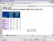
2 Any progress in the reduction of poverty in South Asia? 1 12

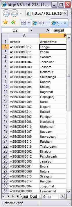
3 Indicator Unit Area ID, Name Data Value Subgroups Time Period Data Source

4 MDG 1 Eradicate Extreme Poverty People living on less than one dollar a day % 50 Baseline and target ? 25 SOUTH ASIA
5 What is the HDI trend in Nepal? 2 12
6 Nepal HDI 1996

7 Nepal HDI 2001

8 Nepal HDI 2001
9 GLOBAL South Asia GER Girls GER, Girls High High Medium Medium Low Low No data No data
10 REGIONAL South Asia Nepal GER Girls GER, Girls High High Medium Medium Low Low No data No data
11 NATIONAL Nepal Far-Western Region Mid-Western Region Western Region GER Girls GER, Girls High High Medium Medium Low Low No data No data Central Region Eastern Region
12 ZONES Nepal Eco-Development Zones Far-Western Mountain Eco-Zone Mid-Western Mountain Eco-Zone Far-Western Far-Western Hill Region Eco-Zone Mid-Western Region Far-Western Terai Eco-Zone Western Mountain Eco-Zone Mid-Western Hill Eco-Zone Mid-Western Terai Eco-Zone Western Region Western Hill Eco-Zone Central Mountain Eco-Zone Western Terai Eco-Zone GER Girls GER, Girls High High Medium Medium Low Low No data No data Central Eco-Zone CentralHillRegion Central Terai Eco-Zone Eastern Mountain Eco-Zone Eastern Region Eastern Hill Eco-Zone Eastern Terai Eco-Zone
13 DISTRICTS Nepal - Morang Eastern Mountain Eco-Zone Eastern Hill Eco-Zone Eastern Terai Eco-Zone GER Girls GER, Girls High High Medium Medium Low Low No data No data Morang
14 SUB-DISTRICTS Nepal Village Development Councils GER Girls GER, Girls High High Medium Medium Low Low No data No data VDC

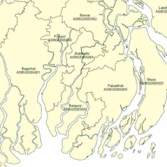
15 INFRASTRUCTURE Nepal Schools, Health Posts, Roads Girls per School High, >150 Medium, Low, < 75 GER Girls GER, Girls High High Medium Medium Low Low No data No data Health Posts Rivers Roads Schools Note: The boundaries and names shown and the designations used on this map do not imply official endorsement or acceptance by the United Nations.
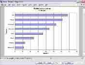
16 Where should early child care programmes be targeted in Tanzania? 3 12
17 TANZANIA Early Child Care Composite Index Mara Kagera Mwanza Shinyanga Births attended by trained personnel Arusha Kilimanjaro Kigoma Tanga Tabora Singida Dodoma Northern Region Western Region Southern Region Dar Es Salaam Pwani Rukwa Per cent Mbeya Low Medium High Very high No data Northern Pemb Pemba Morogoro Iringa Lindi Ruvuma Mtwara
18 TANZANIA Early Child Care Composite Index Mara Kagera Mwanza Shinyanga Births attended by trained personnel Arusha Kilimanjaro Kigoma Tanga Tabora Singida Low birth weight Dodoma Northern Region Western Region Southern Region Dar Es Salaam Pwani Rukwa Per cent Mbeya Low Medium High Very high No data Northern Pemb Pemba Morogoro Iringa Lindi Ruvuma Mtwara
19 TANZANIA Early Child Care Composite Index Mara Kagera Mwanza Shinyanga Births attended by trained personnel Arusha Kilimanjaro Kigoma Tanga Tabora Low birth weight Underweight Singida Dodoma Northern Region Western Region Southern Region Dar Es Salaam Pwani Rukwa Per cent Mbeya Low Medium High Very high No data Northern Pemb Pemba Morogoro Iringa Lindi Ruvuma Mtwara
20 TANZANIA Early Child Care Composite Index Mara Kagera Mwanza Shinyanga Births attended by trained personnel Arusha Kilimanjaro Kigoma Tanga Tabora Low birth weight Underweight Diarrhoea cases Singida Dodoma Northern Region Western Region Southern Region Dar Es Salaam Pwani Rukwa Per cent Mbeya Low Medium High Very high No data Northern Pemb Pemba Morogoro Iringa Lindi Ruvuma Mtwara
21 TANZANIA Early Child Care Composite Index Mara Kagera Mwanza Shinyanga Births attended by trained personnel Arusha Kilimanjaro Kigoma Tanga Tabora Low birth weight Underweight Diarrhoea cases DPT immunization Singida Dodoma Northern Region Western Region Southern Region Dar Es Salaam Pwani Rukwa Per cent Mbeya Very low Low Medium High No data Northern Pemb Pemba Morogoro Iringa Lindi Ruvuma Mtwara
22 TANZANIA Early Child Care Composite Index Source: TZA_DHS96, Demographic Health Survey, National Bureau of Statistics, Tanzania, 1996 Area Kilimanjaro D'Salaam Pwani Tabora Mara Mbeya Mwanza Ruvuma Lindi Mtwara Arusha Morogoro Shinyanga Dodoma Tanga Kagera Rukwa Singida Iringa Kigoma Births attended Index Diarrhoea cases Index DPT imm Index Low birth weight Index Underweight Index Composite Index


23 TANZANIA Early Child Care Composite Index Mara Kagera Mwanza Shinyanga Arusha Kilimanjaro Kigoma Tanga Tabora Singida Dodoma Northern Region Western Region Southern Region Dar Es Salaam Pwani Rukwa Index Very low Low Medium High No data Northern Pemb Pemba Mbeya Morogoro Iringa Lindi Ruvuma Mtwara
24 What is the trend in under-five mortality in Uganda? 4 12
 1988 DHS (d) 1995 DHS (i) 1988 DHS (i) 1995 DHS (d) ln(z) = y = bo + b1x + b2f(x,k1) + b3f(x,k2) +.")
25 UGANDA Under-Five Mortality Rate 1969 census Connecting the dots does not work! 1992 IHS (i) 1988 DHS (d) 1995 DHS (i) 1988 DHS (i) 1995 DHS (d) ln(z) = y = bo + b1x + b2f(x,k1) + b3f(x,k2) bnf(x,kn-2) where z is the under-five mortality rate, x is the year, kj is the knot j, b* are the parameters estimated using regression
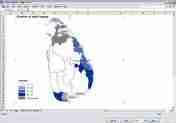
26 Where do the most people live in India? 5 12
27 INDIA Display time series of data in maps
28 INDIA Population Density 1901
29 INDIA Population Density 1911
30 INDIA Population Density 1921
31 INDIA Population Density 1931

32 INDIA Population Density 1941
33 INDIA Population Density 1951
34 INDIA Population Density 1961
35 INDIA Population Density 1971
36 INDIA Population Density 1981
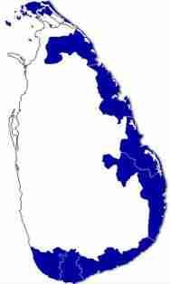
37 INDIA Population Density 1991
38 INDIA Population Density 2001
39 INDIA Zoom-in through levels of data in maps
40 INDIA Population Density L02 States Zoom-in to state level
41 Population Density L02 States INDIA


42 Population Density L03 Districts INDIA Districts of the State of Tamil Nadu

43 Population Density L04 Sub-districts INDIA Sub- Districts of the State of Tamil Nadu

44 INDIA 48,594 children
45 How many children are at risk from a tsunami in southern India? 6 12

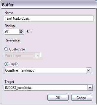

46 INDIA 2,265,000 children


47
48 How does DevInfo integrate vector and raster maps? 7 12

49 Panel with themes, layers, features, insets


50 Add raster images from satellite maps Add map insets
51
52
53 What is the DevInfo digital map library? 7 12
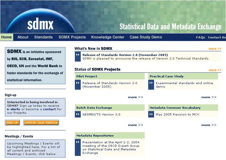
54
55
56
57

58


59
60
61 What statistical standards are implemented by DevInfo? 8 12

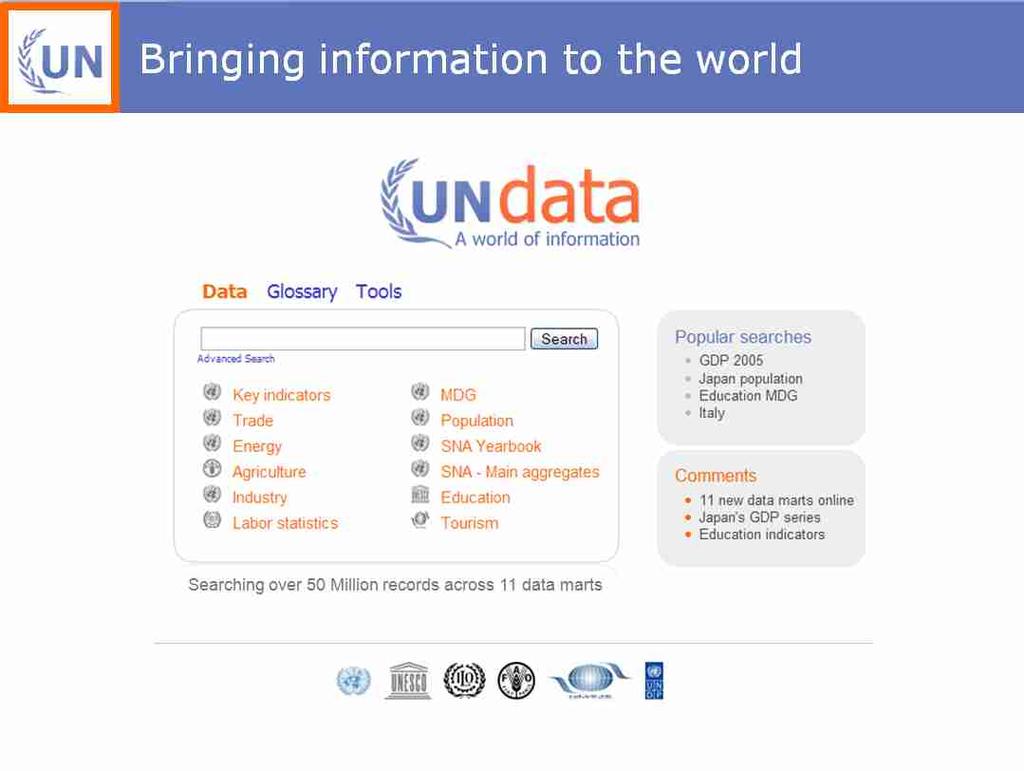
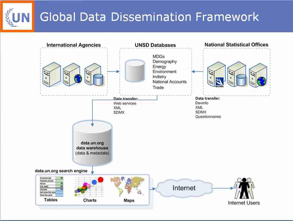
62 Indicator SDMX

63 Area UNSDI


64 Source DDI / DC Type International dataset Publisher UN Statistics Division Title MDG Data set Year 2006 Observation Country Data
65 What types of data are stored in DevInfo? 9 12


66 Census Population census once every decade Surveys Periodic household surveys on various topics Records Administrative records from various government departments Reports Flagship reports by international agencies with detailed analysis of specific development issues
67 How many countries have adapted DevInfo? 10 12


68 ChildInfo UNICEF developed a database to monitor the World Summit for Children offered to the UN system DevInfo v ChildInfo upgraded and launched with UNDG endorsement in April 2004 UN Endorsement Endorsed by the United Nations to assist Member States in Monitoring human development DevInfo v New web-enabled version developed and launched with broad government and UN support in May 2006


69 90 national adaptations + Partnerships with national statistics organizations and UN agencies
70 What is the UN Data portal? 11 12
71
72
73 DevInfo 2007 activities? 12 12
74
75 Lisbon ISI London DFID Geneva UNHCR HMN UofM GP EmergencyInf o Luxmbrg Eurostat Brussels EC OECD Sym Rome Moscow Regional FAO Forum WFP Paris ISTAT San Diego OECD UNGIWG ESRI User Paris 21 Conference New York UN UNDG UNICEF Wash DC SDMX World Bank Dakar EmergencyInfo Bangkok Amman Maputo UN RDT SADC EI EmergencyInfo UNAIDS Hub Arab Stats Delhi Istanbul Dubai OECD Forum UNOPS UNCT Hanoi World Bank MFDR UNGIWG Singapore UNSD EmergencyInf o Manila UNSD ICMDGS Fiji EmergencyInf o
76

77 devinfo.org
78
THE UNITED REPUBLIC OF TANZANIA MINISTRY OF WORKS, TRANSPORT AND COMMUNICATION TANZANIA METEOROLOGICAL AGENCY
 THE UNITED REPUBLIC OF TANZANIA MINISTRY OF WORKS, TRANSPORT AND COMMUNICATION TANZANIA METEOROLOGICAL AGENCY CLIMATE OUTLOOK FOR TANZANIA MARCH MAY, 2018 MASIKA RAINFALL SEASON Highlights for March May,
How to Develop Master Sampling Frames using Dot Sampling Method and Google Earth
 How to Develop Master Sampling Frames using Dot Sampling Method and Google Earth Issei Jinguji. Agricultural statistics. JICA expert. Project for Capacity Development for the ASDP Monitoring and Evaluation
THE UNITED REPUBLIC OF TANZANIA MINISTRY OF WORKS, TRANSPORT AND COMMUNICATION TANZANIA METEOROLOGICAL AGENCY
 THE UNITED REPUBLIC OF TANZANIA MINISTRY OF WORKS, TRANSPORT AND COMMUNICATION TANZANIA METEOROLOGICAL AGENCY Telegrams:"METEO"DAR ES SALAAM. Telex: 41442 HEWA Telephone: 255 (0) 22 2460718 Telefax: 255
Spatial plotting in R
 Spatial plotting in R Contents Introduction................................................. 1 Plotting various spatial objects...................................... 1 2 2 Using plot().............................................
THE UNITED REPUBLIC OF TANZANIA 2014/15 ANNUAL AGRICULTURAL SAMPLE SURVEY REPORT
 THE UNITED REPUBLIC OF TANZANIA 2014/15 ANNUAL AGRICULTURAL SAMPLE SURVEY REPORT Ministry of Agriculture, Livestock and Fisheries; Ministry of Agriculture and Natural Resource, Zanzibar; Ministry of Livestock
Urbanisation in Tanzania
 Working paper E-40104-TZA-1/2/3 Urbanisation in Tanzania Population Growth, Internal Migration and Urbanisation in Tanzania 1967-2012: A Census-Based Regional Analysis Tanzania s Urban Population, 1967-2012
Spatially Explicit Burden Estimates of Malaria in Tanzania: Bayesian Geostatistical Modeling of the Malaria Indicator Survey Data
 Spatially Explicit Burden Estimates of Malaria in Tanzania: Bayesian Geostatistical Modeling of the Malaria Indicator Survey Data Laura Gosoniu 1, Amina Msengwa 2, Christian Lengeler 1, Penelope Vounatsou
What s new (or not so new) in Population and Poverty Data Initiatives
 in Population and Poverty Data Initiatives") What s new (or not so new) in Population and Poverty Data Initiatives Deborah Balk Global Spatial Data and Information User Workshop 21 September 2004 Evolution in global collection of population and poverty
What s new (or not so new) in Population and Poverty Data Initiatives Deborah Balk Global Spatial Data and Information User Workshop 21 September 2004 Evolution in global collection of population and poverty
The United Republic of Tanzania
 The United Republic of Tanzania CRIME AND TRAFFIC INCIDENTS STATISTICS REPORT JANUARY TO DECEMBER 2016 January 2017 Vision To be a professional, modern, and community-centered Police Force that plays
COASTAL MANAGEMENT IN TANZANIA
 COASTAL MANAGEMENT IN TANZANIA Presented by: Ms. Flora D. Akwilapo UN-NF ALUMNI MEETING NAIROBI 11-15 JULY 2011 THE COASTAL AREA OF TANZANIA The coastal area of Tanzania encompasses Five Regions of Tanga,
URBAN PLANNING STUDY FOR TANZANIA IMPACT AND EFFECTIVENESS OF URBAN PLANNING ON CITY SPATIAL DEVELOPMENT. BACKGROUND PROFILE OF CITIES October 2017
 URBAN PLANNING STUDY FOR TANZANIA IMPACT AND EFFECTIVENESS OF URBAN PLANNING ON CITY SPATIAL DEVELOPMENT BACKGROUND PROFILE OF CITIES October 2017 Prepared by: Chyi-Yun Huang Dr. Ally Namangaya MaryGrace
THE DATA REVOLUTION HAS BEGUN On the front lines with geospatial data and tools
 THE DATA REVOLUTION HAS BEGUN On the front lines with geospatial data and tools Slidedoc of presentation for MEASURE Evaluation End of Project Meeting Washington DC May 22, 2014 John Spencer Geospatial
Integration of Geo spatial and Statistical Information: The Nepelese Experience
 Integration of Geo spatial and Statistical Information: The Nepelese Experience Krishna Raj B.C. Joint Secretary Ministry of Land Reform and Management, Nepal 11 June, 2014 Presentation Outline The Country
FIG Asia Pacific Capacity Development Network
 FIG Asia Pacific Capacity Development Network Report to the 41th General Assembly FIG Congress 2018, Istanbul - Turkey Rob Sarib Chair FIG Asia Pacific Capacity Development Network (AP CDN) Story of the
A/AC.105/C.1/2012/CRP.10
 A/AC.105/C.1/2012/CRP.10 1 February 2012 English only Committee on the Peaceful Uses of Outer Space Scientific and Technical Subcommittee Forty-ninth session Vienna, 6-17 February 2012 Item 6 of the provisional
Poverty and malnutrition in Tanzania: New approaches for examining trends and spatial patterns
 This is the final report of the project Agricultural marketing, poverty, and malnutrition: Evidence from spatial and temporal patterns. This project was implemented by the International Food Policy Research
CENSUS MAPPING WITH GIS IN NAMIBIA. BY Mrs. Ottilie Mwazi Central Bureau of Statistics Tel: October 2007
 CENSUS MAPPING WITH GIS IN NAMIBIA BY Mrs. Ottilie Mwazi Central Bureau of Statistics E-mail: omwazi@npc.gov.na Tel: + 264 61 283 4060 October 2007 Content of Presentation HISTORICAL BACKGROUND OF CENSUS
Assisting Countries in the Collection and Analysis of National Statistics
 Assisting Countries in the Collection and Analysis of National Statistics Peter O. Way, Ph.D., Chief International Programs Center U.S. Census Bureau Censuses in the 21 st Century: Improving Data Utilization
Space Application in Support of Land Management for SDG Implementation
 Space Application in Support of Land Management for SDG Implementation Regional Expert Workshop on Land Accounting for SDG Monitoring and Reporting 26 September 2017 Space Application Section Information
THE SALB PROJECT: STATE OF PROGRESS IN ASIA AND THE PACIFIC SINCE THE 8 th SEASC
 THE SALB PROJECT: STATE OF PROGRESS IN ASIA AND THE PACIFIC SINCE THE 8 th SEASC Chandima Subasinghe 1, Yaniss Guigoz 2, Lal Samarakoon 1, Steeve Ebener 2 1 Geoinformatics Center, Asian Institute of Technology
SPATIAL DISTRIBUTION OF MALARIA INDICATOR IN TANZANIA
 SPATIAL DISTRIBUTION OF MALARIA INDICATOR IN TANZANIA Benedict C. Mugambi Complete Author s Name i SPATIAL DISTRIBUTION OF MALARIA INDICATOR IN TANZANIA Dissertation supervised by Professor Jorge Mateu,
ACKNOWLEDGMENTS. This paper is based on research funded by the Rockefeller Foundation. I would
 ACKNOWLEDGMENTS This paper is based on research funded by the Rockefeller Foundation. I would like to thank Todd Benson and Jordan Chamberlin for their kind assistance in constructing the GIS market access
Developing a global, people-based definition of cities and settlements
 Developing a global, people-based definition of cities and settlements Cooperation between: Directorate General for Regional and, Joint Research Centre, EUROSTAT (European Commission, European Union) OECD,
March 2007 The Survey Department of Sri Lanka
 Contribution of Survey Department of Sri Lanka for Mitigation of Disasters in Sri Lanka K.A.U.N.Kasthuri Deputy Surveyor General (Information Technology) March 2007 The Survey Department of Sri Lanka 1
Country Report Nepal Geospatial Data Sharing Initiatives of Survey Department Supporting Disaster Management
 Third JPTM Step 2 for Sentinel Asia 6-8 July, 2010 Manila, The Philippines Country Report Nepal Geospatial Data Sharing Initiatives of Survey Department Supporting Disaster Management Durgendra M Kayastha
Towards National Geographic Information System in Nepal
 2 nd High Level Forum on Global Geospatial Information Management, Qatar National Convention Centre, Doha, Qatar, 4 6 February, 2013 Towards National Geographic Information System in Nepal Krishna Raj
Developing a global, peoplebased definition of cities and settlements
 Developing a global, peoplebased definition of cities and settlements By Lewis Dijkstra, Lewis.Dijkstra@ec.europa.eu Head of the Economic Analysis Sector DG for Regional and Urban Policy, Regional & Urban
THE CLIMATOLOGICAL REGIONS OF TANZANIA BASED ON THE RAINFALL CHARACTERISTICS
 INTERNATIONAL JOURNAL OF CLIMATOLOGY Int. J. Climatol. 19: 69 80 (1999) THE CLIMATOLOGICAL REGIONS OF TANZANIA BASED ON THE RAINFALL CHARACTERISTICS C.P.K. BASALIRWA a, *, J.O. ODIYO b, R.J. MNGODO b and
HIGH RESOLUTION MAPPING OF MNH OUTCOMES IN EAST AFRICA
 HIGH RESOLUTION MAPPING OF MNH OUTCOMES IN EAST AFRICA Ruktanonchai C 1, Pezzulo C 1, Nove A 2, Matthews Z 3, Tatem A 1 1 Geography & Environment, University of Southampton, Southampton, UK 2 Social Statistics
ANALYSIS OF RAINFALL CHARACTERISTICS IN TANZANIA FOR CLIMATE CHANGE SIGNALS'/
 ANALYSIS OF RAINFALL CHARACTERISTICS IN TANZANIA FOR CLIMATE CHANGE SIGNALS'/ PROJECT REPORT UNIVERSITY OF NAIROBI SCHOOL OF PHYSICAL SCIENCES DEPARTMENT OF METEOROLOGY EMANUEL TUMAINI I 45/60021/2009
Millions of Mappers Making a Difference
 Millions of Mappers Making a Difference Hundreds of Mappers: Uganda Open Mapping Program Learning through Serious Gaming: Open by geospatial technologies for disaster Bernard J MUHWEZI management practitioners
Developing Database and GIS (First Phase)
") 13.3 Developing Database and GIS (First Phase) 13.3.1 Unifying GIS Coordinate System There are several data sources which have X, Y coordinate. In one study, UTM is used, in the other study, geographic
13.3 Developing Database and GIS (First Phase) 13.3.1 Unifying GIS Coordinate System There are several data sources which have X, Y coordinate. In one study, UTM is used, in the other study, geographic
MOZAMBIQUE: Institutional Arrangements and Achievements
 UN-International Strategy for Disaster Reduction Global Platform for Disaster Risk Reduction- First Session MOZAMBIQUE: Institutional Arrangements and Achievements on Implementation of Hyogo Framework
Weather Climate Science to Service Partnership South Africa
 PROJECTS UNDERWAY Title of the Weather Climate Science to Service Partnership South Africa Together, building on an existing strong partnership, South African Weather Service and the Met Office will build
Crowdsourcing approach for large scale mapping of built-up land
 Crowdsourcing approach for large scale mapping of built-up land Kavinda Gunasekara Kavinda@ait.asia Geoinformatics Center Asian Institute of Technology, Thailand. Regional expert workshop on land accounting
Public Expenditure Review (In Two Volumes) Volume 2: Statistical Appendix
 Volume 2: Statistical Appendix") Public Disclosure Authorized Public Disclosure Authorized Public Disclosure Authorized Public Disclosure Authorized Report No. 16578-TA Tanzania Public Expenditure Review (In Two Volumes) Volume 2: Statistical
Public Disclosure Authorized Public Disclosure Authorized Public Disclosure Authorized Public Disclosure Authorized Report No. 16578-TA Tanzania Public Expenditure Review (In Two Volumes) Volume 2: Statistical
Maps & Surveys Malawi
 Maps & Surveys Malawi If searched for the ebook Maps & Surveys Malawi in pdf format, in that case you come on to the right site. We furnish the complete release of this ebook in DjVu, epub, doc, txt, PDF
The Efforts of Building GIS Infrastructure in a Newly Independent State: The case of Timor Leste *
 UNITED NATIONS E/CONF.100/IP.12 ECONOMIC AND SOCIAL COUNCIL Eighteenth United Nations Regional Cartographic Conference for Asia and the Pacific Bangkok, 26-29 October 2009 Item 7(b) of the provisional
Accelerating Infrastructure Capacity Development. JICA Ethiopia Office April 28, 2015 Addis Ababa
 Accelerating Infrastructure Capacity Development JICA Ethiopia Office April 28, 2015 Addis Ababa 2 Japan s basic policy of assistance for Africa Boost the growth of Africa through trade and investment
The World Bank Health System Performance Reinforcement Project (P156679)
") Public Disclosure Authorized AFRICA Cameroon Health, Nutrition & Population Global Practice IBRD/IDA Investment Project Financing FY 2016 Seq No: 3 ARCHIVED on 14-Apr-2017 ISR27518 Implementing Agencies:
Public Disclosure Authorized AFRICA Cameroon Health, Nutrition & Population Global Practice IBRD/IDA Investment Project Financing FY 2016 Seq No: 3 ARCHIVED on 14-Apr-2017 ISR27518 Implementing Agencies:
Welcome. C o n n e c t i n g
 Welcome C o n n e c t i n g YOU D i s c i p l i n e s Why is This Meeting......So Important Now? OUR WORLD Is Increasingly Challenged The Evidence Is Clear We Need Better Understanding and More Collaboration
Use of Geospatial Data: Philippine Statistics Authority 1
 Use of Geospatial Data: Philippine Statistics Authority 1 1 Presentation by Lisa Grace S. Bersales at the UNSC 2016 side event on Geospatial information and earth observations: supporting official statistics
BULLETIN. World Health Organization, Western Pacific Regional Office, Manila, Philippines Issue 12 April 2007 ISSN
 BULLETIN World Health Organization Regional Office for the Western Pacific Expanded Programme on Immunization World Health Organization, Western Pacific Regional Office, Manila, Philippines Issue 12 April
Uganda - National Panel Survey
 Microdata Library Uganda - National Panel Survey 2013-2014 Uganda Bureau of Statistics - Government of Uganda Report generated on: June 7, 2017 Visit our data catalog at: http://microdata.worldbank.org
WORLD COUNCIL ON CITY DATA
 WORLD COUNCIL ON CITY DATA WCCD ISO 37120 STANDARDIZED CITY DATA TO MEET UN SDG TARGETS UN WORLD DATA FORUM Presented by: James Patava www.dataforcities.org @wccitydata PUBLICATION OF THE FIRST ISO STANDARD
A subregional. hunger index for Nepal. Nepal Food Security Monitoring System (NeKSAP)
") A subregional hunger index for Nepal Nepal Food Security Monitoring System (NeKSAP) WFP Nepal, 2009 A sub regional hunger index for Nepal Acknowledgement This report was prepared by Siemon Hollema and
A subregional hunger index for Nepal Nepal Food Security Monitoring System (NeKSAP) WFP Nepal, 2009 A sub regional hunger index for Nepal Acknowledgement This report was prepared by Siemon Hollema and
Integrating Official Statistics and Geospatial Information NBS Experience
 Integrating Official Statistics and Geospatial Information NBS Experience Presented by Eng. Reda AL Sabbagh Director of IT Dept. Prepared by Eng. Adham Makky GIS Specialist Topics to be covered: Background
Challenges and Potentials of Place Based Information Management in Nepal"
 Nineteenth United Nations Regional Cartographic Conference for Asia and the Pacific, Bangkok, Thailand, 29 October 1 November 2012 Challenges and Potentials of Place Based Information Management in Nepal"
Qatar Statistical Geospatial Integration
 Qatar Statistical Geospatial Integration A Presentation by the Ministry of Development Planning & Statistics (MDPS), State of Qatar http://www.mdps.gov.qa (Fourth UN-GGIM Arab States Committee Meeting,
Zambia: A financial landscape ripe with opportunity May 11, 2016
 Zambia: A financial landscape ripe with opportunity May 11, 2016 www.themix.org 1 An ecosystem to develop the Digital Finance sector and to support all stakeholders Policy and regulation Customer Adoption
Mission Report. Charles Brigham Reese GIS Specialist, UN Statistics Division
 Mission Report on The Geographic Preparatory Activities for the 2010 Population and Housing Census of Sri Lanka United Nations Statistics Division (22 24 September 2008) By Charles Brigham Reese GIS Specialist,
Techniques for Science Teachers: Using GIS in Science Classrooms.
 Techniques for Science Teachers: Using GIS in Science Classrooms. After ESRI, 2008 GIS A Geographic Information System A collection of computer hardware, software, and geographic data used together for
VALIDATION OF SATELLITE RAINFALL ESTIMATES USING GAUGE RAINFALL OVER TANZANIA MOHAMED MOHAMED HAMIS REGISTRATION NO: I45/84346/2012
 VALIDATION OF SATELLITE RAINFALL ESTIMATES USING GAUGE RAINFALL OVER TANZANIA BY MOHAMED MOHAMED HAMIS REGISTRATION NO: I45/84346/2012 A PROJECT SUBMITTED TO THE DEPARTMENT OF METEOROLOGY IN PARTIAL FULFILLMENT
GEOGRAPHIC INFORMATION SYSTEMS Session 8
 GEOGRAPHIC INFORMATION SYSTEMS Session 8 Introduction Geography underpins all activities associated with a census Census geography is essential to plan and manage fieldwork as well as to report results
Small Area Estimates of Poverty Incidence in the State of Uttar Pradesh in India
 Small Area Estimates of Poverty Incidence in the State of Uttar Pradesh in India Hukum Chandra Indian Agricultural Statistics Research Institute, New Delhi Email: hchandra@iasri.res.in Acknowledgments
Methodological issues in the development of accessibility measures to services: challenges and possible solutions in the Canadian context
 Methodological issues in the development of accessibility measures to services: challenges and possible solutions in the Canadian context Alessandro Alasia 1, Frédéric Bédard 2, and Julie Bélanger 1 (1)
Building Institutional Capacity for Multi-Hazard Early Warning in Asia and the Pacific Subtitle
 Building Institutional Capacity for Multi-Hazard Early Warning in Asia and the Pacific Subtitle Title Keran Wang Chief, Space Applications Section ICT and Disaster Risk Reduction Division 22 May 2018 Pillar
Population growth, internal migration, and urbanisation in Tanzania,
 Working paper Population growth, internal migration, and urbanisation in Tanzania, 1967-2012 Phase 2 (Final report) Hugh Wenban-Smith September 2015 POPULATION GROWTH, INTERNAL MIGRATION AND URBANISATION
UN-GGIM: Strengthening Geospatial Capability
 Fifth Plenary Meeting of UN-GGIM: Europe Brussels, 6-7 June 2018 UN-GGIM: Strengthening Geospatial Capability Walking the talk to leave no one behind Greg Scott, UN-GGIM Secretariat Environmental Statistics
Overview of Technical Advisory Missions
 Expert Group Meeting (EGM) on Georeferenced Information Systems for Disaster Risk Management (Geo-DRM) and sustaining the Community of Practice (COP) 23-25 April 2014 Bangkok Overview of Technical Advisory
Use of GIS in road sector analysis
 Use of GIS in road sector analysis Uwe Deichmann, DECRG March 30, 2007 Transport Forum and Learning Week 2007 Transport Measurement Matters Indicators of Performance and Impact Geographic information Using
Spatially Enabled Society
 International Seminar on Land Administration Trends and Issues in Asia and the Pacific Region Spatially Enabled Society Abbas Rajabifard Vice Chair PCGIAP-WG3 Vice-President (President Elect), GSDI Association
Brazil Paper for the. Second Preparatory Meeting of the Proposed United Nations Committee of Experts on Global Geographic Information Management
 Brazil Paper for the Second Preparatory Meeting of the Proposed United Nations Committee of Experts on Global Geographic Information Management on Data Integration Introduction The quick development of
The Global Statistical Geospatial Framework and the Global Fundamental Geospatial Themes
 The Global Statistical Geospatial Framework and the Global Fundamental Geospatial Themes Sub-regional workshop on integration of administrative data, big data and geospatial information for the compilation
Building Institutional Capacity for Multi-Hazard Early Warning in Pacific Countries Subtitle
 Building Institutional Capacity for Multi-Hazard Early Warning in Pacific Countries Subtitle Title Keran Wang Chief, Space Applications Section ICT and Disaster Risk Reduction Division 30 March 2018 Slide
Economic and Social Council
 United Nations Economic and Social Council Distr.: General 23 May 2012 Original: English E/CONF.101/100 Tenth United Nations Conference on the Standardization of Geographical Names New York, 31 July 9
Operational Definitions of Urban, Rural and Urban Agglomeration for Monitoring Human Settlements
 Operational Definitions of Urban, Rural and Urban Agglomeration for Monitoring Human Settlements By Markandey Rai United Nations Human Settlements Programme PO Box-30030 Nairobi, Kenya Abstract The United
Geospatial Technologies for Resources Planning & Management
 Geospatial Technologies for Resources Planning & Management Lal Samarakoon, PhD Director, Geoinformatics Center Asian Institute of Technology, Thailand Content Geoinformatics for SDG Information Integration
Pioneering Geothermal Development in Tanzania Geothermal Exploration Drilling Activities
 Pioneering Geothermal Development in Tanzania Geothermal Exploration Drilling Activities GGDP Round table, 19.11.2013, The Hague Dr. Horst Kreuter, Director, Geothermal Power Tanzania Ltd Geothermal in
Earth Observation for Sustainable Development to Support Land Use Planning in Urban Areas
 Background Image Source bbc.co.uk Human Planet 2011 BBC Earth Observation for Sustainable Development to Support Land Use Planning in Urban Areas Thomas Häusler, Sharon Gomez, Fabian Enssle GAF AG Land
Development of spatial health data infrastructure (SHDI) at Vadu Health and Demographic Surveillance Site (HDSS, Vadu) using open source technologies.
 at Vadu Health and Demographic Surveillance Site (HDSS, Vadu) using open source technologies.") Development of spatial health data infrastructure (SHDI) at Vadu Health and Demographic Surveillance Site (HDSS, Vadu) using open source technologies. Dr. Anand Akmanchi, Lecturer, Geoinformatics Mr. Vivek
Development of spatial health data infrastructure (SHDI) at Vadu Health and Demographic Surveillance Site (HDSS, Vadu) using open source technologies. Dr. Anand Akmanchi, Lecturer, Geoinformatics Mr. Vivek
Presented to Sub-regional workshop on integration of administrative data, big data and geospatial information for the compilation of SDG indicators
 Presented to Sub-regional workshop on integration of administrative data, big data and geospatial information for the compilation of SDG indicators 23-25 April,2018 Addis Ababa, Ethiopia By: Deogratius
UNIT 11 INTER STATE AND INTER DISTRICT IMBALANCES
 UNIT 11 INTER STATE AND INTER DISTRICT IMBALANCES Inter State and Inter District Imbalances Structure 11.0 Objectives 11.1 Introduction 11.2 Conceptual Bases to Understand the Issues of Regional Imbalances
Dar es Salaam - Reality Check Workshop
 Dar es Salaam - Reality Check Workshop hosted by GIZ and Dar es Salaam City Council Introduction: Key Urban Characteristics of Dar es Salaam Challenges and Opportunities for Resilient Development in the
RESAP Progress Report
 RESAP Progress Report December 2016 to October 2017 Presentation to the Twenty-first session of the Intergovernmental Consultative Committee on the Regional Space Applications Programme for Sustainable
Analysis of the Sediment Production Characteristics by the Satellite Image - Case Study in Tanzania Hiroshi OGAWA(1), Hiroyuki KATHURO(1),
, Hiroyuki KATHURO(1),") Analysis of the Sediment Production Characteristics by the Satellite Image - Case Study in Tanzania Hiroshi OGAWA(1), Hiroyuki KATHURO(1), Yoshihiro MOTOKI(1),Kiyotaka ONO(2) Kazuo ISONO(2), Masahiro YAMAGUCHI(3),
Analysis of the Sediment Production Characteristics by the Satellite Image - Case Study in Tanzania Hiroshi OGAWA(1), Hiroyuki KATHURO(1), Yoshihiro MOTOKI(1),Kiyotaka ONO(2) Kazuo ISONO(2), Masahiro YAMAGUCHI(3),
Acknowledgments xiii Preface xv. GIS Tutorial 1 Introducing GIS and health applications 1. What is GIS? 2
 Acknowledgments xiii Preface xv GIS Tutorial 1 Introducing GIS and health applications 1 What is GIS? 2 Spatial data 2 Digital map infrastructure 4 Unique capabilities of GIS 5 Installing ArcView and the
Data literacy in politics and international
 internet resources Lisa DeLuca United Nations Online data repositories and resources Data literacy in politics and international relations research is an important skill for university students and academic
GEO-INFORMATICS AND SPACE TECHNOLOGY FOR PROPERTIES DIGITAL TAX MAP : CASE STUDY ON LOCAL ADMINISTRATIVE WONG KONG MUNICIPALITY, PHITSANULOK, THAILAND
 GEO-INFORMATICS AND SPACE TECHNOLOGY FOR PROPERTIES DIGITAL TAX MAP : CASE STUDY ON LOCAL ADMINISTRATIVE WONG KONG MUNICIPALITY, PHITSANULOK, THAILAND Vicharn Amarakul Regional Center of Geo-Informatics
Poverty Maps: Uses and Caveats. Tara Vishwanath Lead Economist World Bank
 Poverty Maps: Uses and Caveats Tara Vishwanath Lead Economist World Bank Uses of Poverty Maps A visual illustration of estimated poverty indices at DS division level or below (currently excluding N-E E
Groundwater vulnerability to geogenic contaminants: a case study, Tanzania
 36th WEDC International Conference, Nakuru, Kenya, 2013 DELIVERING WATER, SANITATION AND HYGIENE SERVICES IN AN UNCERTAIN ENVIRONMENT Groundwater vulnerability to geogenic contaminants: a case study, Tanzania
Georeferencing and Satellite Image Support: Lessons learned, Challenges and Opportunities
 Georeferencing and Satellite Image Support: Lessons learned, Challenges and Opportunities Shirish Ravan shirish.ravan@unoosa.org UN-SPIDER United Nations Office for Outer Space Affairs (UNOOSA) UN-SPIDER
Botswana National Spatial Plan Botsreal Property Forum- 30 May, 2018
 Botswana National Spatial Plan 2036 Botsreal Property Forum- 30 May, 2018 What is the National Spatial Plan? A framework and process for planning that is: National (to guide national development policies,
Inventory of United Nations Resolutions on Cartography Coordination, Geographic Information and SDI 1
 Inventory of United Nations Resolutions on Cartography Coordination, Geographic Information and SDI I. Resolutions on Cartography Coordination and Establishment of United Nations Regional Cartographic
Poverty Mapping, Policy Making and Operations
 Poverty Mapping, Policy Making and Operations Some Applications from Kenya (DECDG) Using Poverty Maps to Design Better Policies and Interventions Washington DC May 11, 2006 Outline Poverty Mapping process
COORDINATION WITH OTHER ACTIVITIES OF THE WMO TROPICAL CYCLONE PROGRAMME. (Submitted by the WMO Secretariat) Summary and Purpose of Document
 Summary and Purpose of Document") ESCAP/WMO TYPHOON COMMITTEE FORTY-NINTH SESSION 21-24 FEBRUARY 2017 YOKOHAMA, JAPAN FOR PARTICIPANTS ONLY WRD/TC.49/16 13 February 2017 ENGLISH ONLY COORDINATION WITH OTHER ACTIVITIES OF THE WMO TROPICAL
ESCAP/WMO TYPHOON COMMITTEE FORTY-NINTH SESSION 21-24 FEBRUARY 2017 YOKOHAMA, JAPAN FOR PARTICIPANTS ONLY WRD/TC.49/16 13 February 2017 ENGLISH ONLY COORDINATION WITH OTHER ACTIVITIES OF THE WMO TROPICAL
Economic and Social Council
 United Nations Economic and Social Council Distr.: General 18 July 2016 Original: English Committee of Experts on Global Geospatial Information Management Sixth session New York, 3-5 August 2016 Item 2
NATIONAL REPORT TO THE 7 TH SOUTHERN AFRICAN AND ISLANDS HYDROGRAPHIC COMMISSION
 THE UNITED REPUBLIC OF TANZANIA SAIHC7-5.3M NATIONAL REPORT TO THE 7 TH SOUTHERN AFRICAN AND ISLANDS HYDROGRAPHIC COMMISSION TO BE HELD IN LA REUNION, 14 TH 17 TH SEPTEMBER, 2009 PREPARED BY IGNATIOUS
The Integrated Ge spatial Information Framework to the strengthening of NSDI, Mongolia
 Young Geospatial Professionals Summit 21 NOV 2018 The Integrated Ge spatial Information Framework to the strengthening of NSDI, Mongolia BAYARMAA ENKHTUR Geospatial information and technology department
Geospatial activities during the 47 th UN Statistical Commission
 Geospatial activities during the 47 th UN Statistical Commission A Summary Rolando Ocampo Alcántar April 2016 47 th Session of the United Nations Statistical Commission Side Events Friday Seminar on Emerging
WMO LC-LRFMME and Seasonal Climate Outlook for ONDJFM 2015/16
 WMO Lead Centre for Long-Range Forecast Multi-Model Ensemble WMO LC-LRFMME and Seasonal Climate Outlook for ONDJFM 2015/16 Daeun Jeong and WMO LC-LRFMME team The Winter South Asian Climate Outlook Forum
Fundamental Operational
 Common Operational & Datasets Fundamental Operational Datasets https://www.humanitarianresponse.info/applications/data Kristina MacKinnon (OCHA) UNGIWG, New York, May 15, 2014 Common Operational Datasets
JOINT STRATEGIC NEEDS ASSESSMENT (JSNA) Key findings from the Leicestershire JSNA and Charnwood summary
 Key findings from the Leicestershire JSNA and Charnwood summary") JOINT STRATEGIC NEEDS ASSESSMENT (JSNA) Key findings from the Leicestershire JSNA and Charnwood summary 1 What is a JSNA? Joint Strategic Needs Assessment (JSNA) identifies the big picture in terms of
JOINT STRATEGIC NEEDS ASSESSMENT (JSNA) Key findings from the Leicestershire JSNA and Charnwood summary 1 What is a JSNA? Joint Strategic Needs Assessment (JSNA) identifies the big picture in terms of
Disaster Management and Spatial Data An Experience of Sri Lanka for Joint project team meeting 2012
 Disaster Management and Spatial Data An Experience of Sri Lanka for Joint project team meeting 2012 1 by Padma Kumara Withana Provincial Surveyor General Uva Province 2 Out line ü Introduction ü Natural
Climate variability and satellite observed vegetation responses in Tanzania
 Seminar series nr 205 Climate variability and satellite observed vegetation responses in Tanzania Wilbert Timiza 2011 Department of Earth and Ecosystem Sciences Physical Geography and Ecosystems Analysis
HCSS: Geography: Homes & Habitats Project: Creating and Publishing a City Tour in Google Earth Using Tour Builder & Lonely Planet Guides
 HCSS: Geography: Homes & Habitats Project: Creating and Publishing a City Tour in Google Earth Using Tour Builder & Lonely Planet Guides You and your partner will use Tour Builder to tell the story of
Market access and rural poverty in Tanzania
 Market access and rural poverty in Tanzania Nicholas Minot International Food Policy Research Institute 2033 K St. NW Washington, D.C., U.S.A. Phone: +1 202 862-8199 Email: n.minot@cgiar.org Contributed
Status of Catchment based Water Resources Management in Uganda. Leo Mwebembezi Principal Water Officer DWRM/MWE
 LEARNING WORKSHOP ON COMMUNITY PARTICIPATION IN WATER RESOURCES MANAGEMENT AT MOROGORO TOHEL, MOROGORO, SEPTEMBER 14, 16, 2010 Status of Catchment based Water Resources Management in Uganda Leo Mwebembezi
Spatial Variation in Local Road Pedestrian and Bicycle Crashes
 2015 Esri International User Conference July 20 24, 2015 San Diego, California Spatial Variation in Local Road Pedestrian and Bicycle Crashes Musinguzi, Abram, Graduate Research Assistant Chimba,Deo, PhD.,
UN GGIM and National SDI Strategy
 MSDI Open Forum on 26 th January 2016 Contributing to the successful delivery of MSDI UN GGIM and National SDI Strategy Hiroshi Murakami Deputy Administrator Geospatial Information Authority of Japan Geospatial