European Forum for Geography & Statistics Conference 2018
|
|
|
- Horatio Perkins
- 5 years ago
- Views:
Transcription

1 European Forum for Geography & Statistics Conference 2018 Welcome speech Dr. Janusz Dygaszewicz EFGS President Director of ICT Systems, Geostatistics and Census Department Statistics Poland Helsinki, Finland, October 2018
. The long-established partnership between the Finnish statistical and mapping community.")

2 EFGS 2018 Finding the future together The Conference is hosted by Statistics Finland (StatFI) and the National Land Survey of Finland (NLS-FI). The long-established partnership between the Finnish statistical and mapping community. A good example of collaboration between statistical and mapping institutions. A modern congress venue in the heart of Helsinki - Marina Congress Center Congratulations and an expression of my gratitude to Organizers of the Conference!
, employees of mapping authorities and also Eurostat.")
3 WHAT IS THE EUROPEAN FORUM FOR GEOGRAPHY AND STATISTICS (EFGS) Since 1998 a network of experts primarily working in European National Statistical Institutes (NSI). Mainly GIS specialists but also statisticians, researchers working in National Statistical Institutes (NSIs), employees of mapping authorities and also Eurostat. Voluntary work done by devoted experts with visionary ideas who exchange ideas among network, to provide spatial statistics for Europe. Also countries outside Europe are active in EFGS and therefore the EFGS is also a good platform to expand activity to a global forum.
4 SOME FACTS ABOUT EFGS The first meeting of EFGS took place in Kongsvinger, Norway, in The first news at EFGS webpage was released on 6 June 2010 r. Today EFGS has national contact persons from more than 40 states and territories. EFGS is also on Facebook. There are no bindings for membership, except that national contact persons has to be employees at either national statistical institutes or national mapping or cadaster agencies.
.")
5 EFGS ACTIVITIES The main goal - to promote the integration of statistical and geospatial information in public sector information and the use of GIS in NSIs. EFGS acts as a reference group for Eurostat and the project group for the GEOSTAT projects. Status of the official Observer Organization of UN-GGIM: Europe (2015). EFGS President the Member of the Executive Committee of UN-GGIM: Europe - UN-GGIM: Europe ExCom (2016). EFGS President represented EFGS during the 8th Session of the United Nations Committee of Experts on Global Geospatial Information Management (UN-GGIM), NY Members of the EFGS active participate in many initiatives on European and global level. The EFGS website which is the reference point for geospatial statistics, is maintained, updated and developed by members of the EFGS.
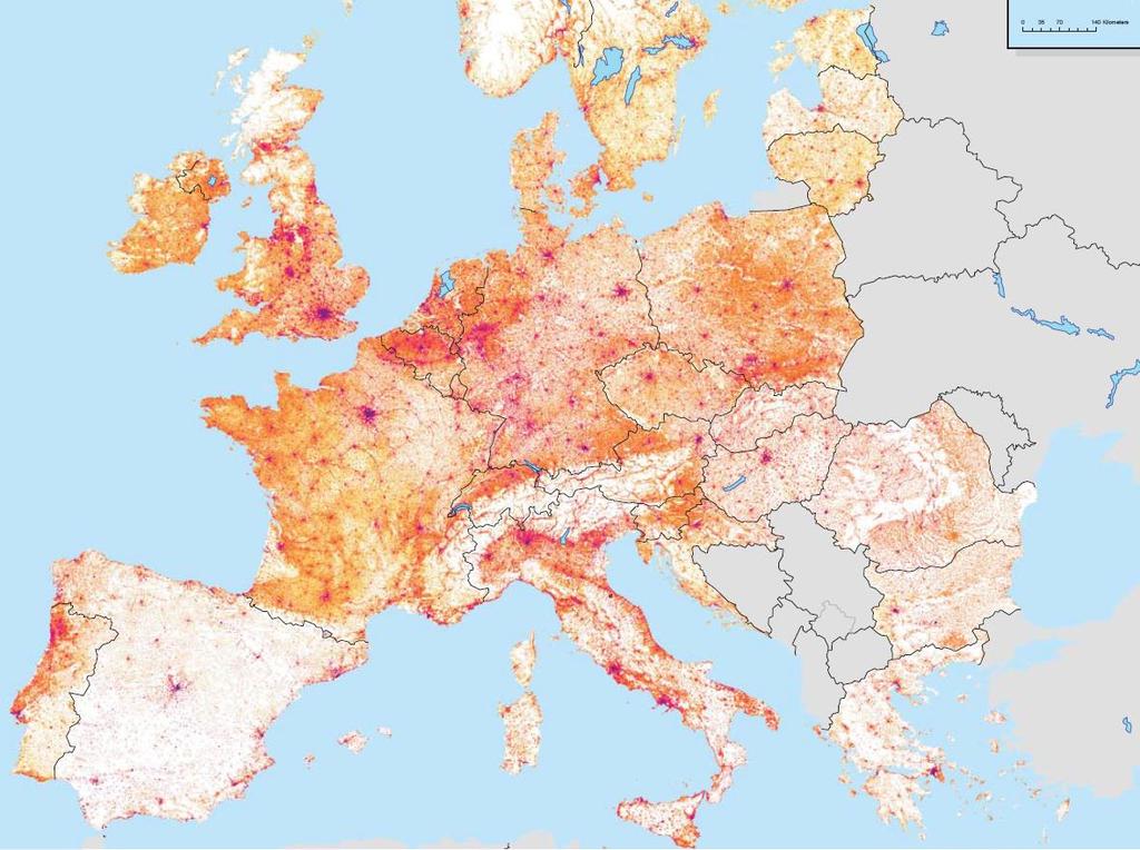
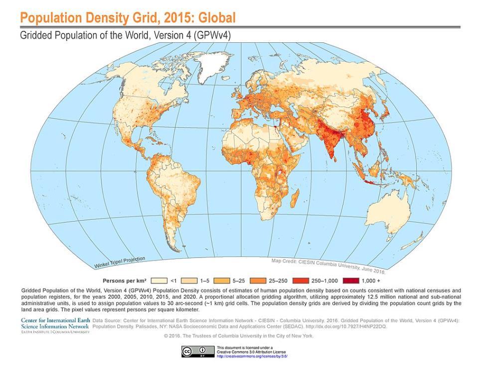
6 EFGS ACHIEVEMENTS Creation of model for a point-based geocoding infrastructure for statistics as the base for the collection and dissemination of statistical data. (GEOSTAT 2 project). Recommendations on the improvement of the GSBPM to make it more adequate from the point of view of geospatially related statistical production processes (GEOSTAT 2 project). Preparation of the Handbook of spatial statistics to promote, develop and consolidate the use of specific statistical methods for geospatial analysis (INSEE, EFGS, Eurostat). Population distribution in 1 km² grid for Europe.
7
8
.")
9 EFGS CURRENT WORK PROGRAMME Development of the best practices in the production of geostatistics in Europe. Development of partnership between NSIs and NMCAs on equal terms. A fully geocoded 2021 population and housing census. Development of the GSGF Europe - Implementation guide for the Global Statistical Geospatial Framework in Europe (GEOSTAT 3 project). Practical tests of integration of geography and statistics by calculation of some spatial SDG indicators in Europe. (GEOSTAT 3 project).
10 EFGS CHALLENGES Harmonization a statistical reference system with a geodetic reference system on the base of The 10 Level Model and Global Statistical Geospatial Framework. Supporting Eurostat and NSIs for a fully geocoded 2021 population and housing census. Spatial statistical indicators for Sustainable Development Goals. Works on cooperation and common approach to linking statistical data with geospatial data with UN-GGIM Europe and Eurogeographics.
11 EFGS CONFERENCES The annual EFGS conferences are one of the main events for raising awareness among the community. In recent years the conference has attracted an expanding attendance. The EFGS 2018 conference has more than 200 participants from 46 countries across all continents! A list of previous conferences: EFGS 2008 Bled, Slovenia EFGS 2009 The Hague, The Netherlands EFGS 2010 Tallinn, Estonia EFGS 2011 Lisbon, Portugal EFGS 2012 Prague, The Czech Republic EFGS 2013 Sofia, Bulgaria EFGS 2014 Krakow, Poland EFGS 2015 Vienna, Austria EFGS 2016 Paris, France EFGS 2017 Dublin, Ireland

12 1 ST EFGS CONFERENCE BLED, 2008

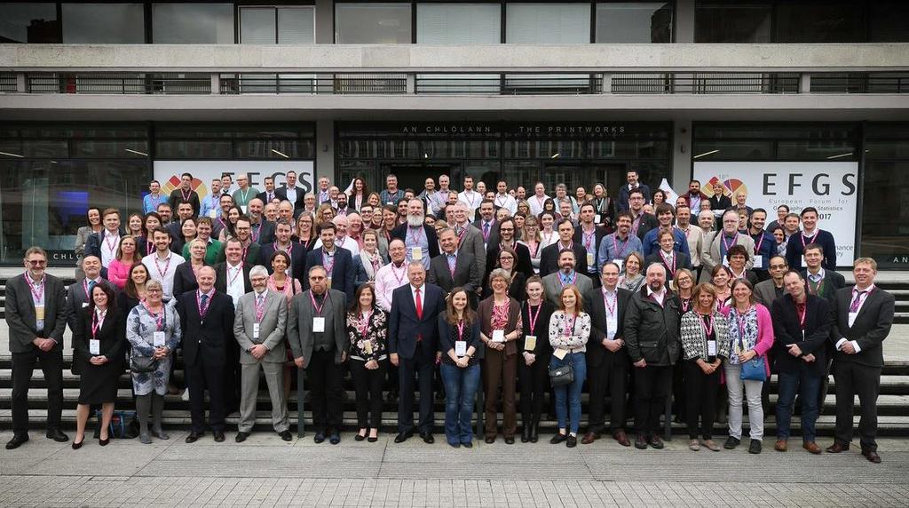
13 10 TH EFGS CONFERENCE DUBLIN, 2017
14 THE 2018 CONFERENCE MOTTO FINDING THE FUTURE TOGETHER
15 THE 2018 CONFERENCE AWARD The Lars H. Backer Prize

16 Vision without action is a daydream. Action without vision is a nightmare Lars Henrik Backer initiator, one of the founders and the long-standing executive director of the EFGS. The Lars H. Backer Prize in memoriam of Lars H. Backer is awarded for major contributions to the development of a geospatial foundation for official statistics or for significantly improving the relevance of geospatial statistics for evidenced-based decision making.


17 LARS H. BACKER PRIZE The prize was awarded to: Marja Tammilehto-Luode from Statistics Finland - the 1 st edition during the EFGS 2016 conference in Paris. Ekkehard PETRI from Eurostat & Pier-Giorgio Zaccheddu from UN GGIM Europe/The Federal German Agency for Cartography - the 2 nd edition during EFGS 2017 in Dublin. 3 rd edition the winner is It will be announced tommorow! during conference dinner.
18 Thank you for your attention! ENJOY THE EFGS 2018 CONFERENCE! Janusz Dygaszewicz Ph.D. Eng. EFGS President Director of ICT Systems, Geostatistics and Census Department Statistics Poland
The European Forum for Geospatial Statistics Benefits and challenges of INSPIRE in the field of statistics
 INSPIRE Conference 2016 Barcelona, Spain 26th 30th September 2016 The European Forum for Geospatial Statistics Benefits and challenges of INSPIRE in the field of statistics Janusz Dygaszewicz EFGS President
The Combination of Geospatial Data with Statistical Data for SDG Indicators
 Session 3: Sustainable Development Goals, SDG indicators The Combination of Geospatial Data with Statistical Data for SDG Indicators Pier-Giorgio Zaccheddu (with the assistance of Francisco Vala & Cátia
The Combination of Geospatial Data with Statistical Data for SDG Indicators
 Session x: Sustainable Development Goals, SDG indicators The Combination of Geospatial Data with Statistical Data for SDG Indicators Pier-Giorgio Zaccheddu Fabio Volpe 5-8 December2018, Nairobi IAEG SDG
Common geographies for dissemination of SDG Indicators
 5 th High Level Forum on United Nations GGIM, Mexico 2017 Common geographies for dissemination of SDG Indicators Understanding statistical and geodetic division of territory Janusz Dygaszewicz Central
UN-GGIM: Europe Work Group on Data Integration. Facilitating the wider utilization of geospatial information to produce indicators
 UN-GGIM: Europe Work Group on Data Integration Facilitating the wider utilization of geospatial information to produce indicators IAEG SDG WG GI, Meeting 06-08.12.2018, NY Copyright 2013 EuroGeographics
A proposal for building an infrastructure for European geospatial statistics
 A proposal for building an infrastructure for European geospatial statistics Marie Haldorson, Statistics Sweden Ekkehard Petri, Eurostat What is geospatial statistics? The location, extent or spatial relations
Bengt Kjellson Chair of the Executive Committee UN-GGIM: Europe. 2 nd Joint UN-GGIM: Europe ESS Meeting 11 th March 2016, Luxembourg
 Bengt Kjellson Chair of the Executive Committee UN-GGIM: Europe 2 nd Joint UN-GGIM: Europe ESS Meeting 11 th March 2016, Luxembourg A global geospatial mandate At its 47th plenary in July 2011, ECOSOC,
A proposal for building an infrastructure for European geospatial statistics. Marie Haldorson, Statistics Sweden Ekkehard Petri, Eurostat
 A proposal for building an infrastructure for European geospatial statistics Marie Haldorson, Statistics Sweden Ekkehard Petri, Eurostat What is geospatial statistics? The location, extent or spatial relations
IAEG SDGs WG GI, , Mexico City
 IAEG SDGs WG GI, 12-14.12.2016, Mexico City UN-GGIM:Europe s perspective and activities to support better integration of geospatial information and statistics and the UN SDG monitoring Pier-Giorgio Zaccheddu,
CES Seminar 2016: Geospatial information services based on official statistics Key issues from the session II papers
 Norbert Rainer 64 th plenary session of the Conference of European Statisticians 28 April 2016, Paris CES Seminar 2016: Geospatial information services based on official statistics Key issues from the
Principle 3: Common geographies for dissemination of statistics Poland & Canada. Janusz Dygaszewicz Statistics Poland
 Principle 3: Common geographies for dissemination of statistics Poland & Canada Janusz Dygaszewicz Statistics Poland Reference materials Primary: Ortophotomap, Cadastral Data, Administrative division borders,
Project EuroGeoNames (EGN) Results of the econtentplus-funded period *
 Results of the econtentplus-funded period *") UNITED NATIONS Working Paper GROUP OF EXPERTS ON No. 33 GEOGRAPHICAL NAMES Twenty-fifth session Nairobi, 5 12 May 2009 Item 10 of the provisional agenda Activities relating to the Working Group on Toponymic
UNITED NATIONS Working Paper GROUP OF EXPERTS ON No. 33 GEOGRAPHICAL NAMES Twenty-fifth session Nairobi, 5 12 May 2009 Item 10 of the provisional agenda Activities relating to the Working Group on Toponymic
Use of the ISO Quality standards at the NMCAs Results from questionnaires taken in 2004 and 2011
 Use of the ISO 19100 Quality standards at the NMCAs Results from questionnaires taken in 2004 and 2011 Eurogeographics Quality Knowledge Exchange Network Reference: History Version Author Date Comments
Final report for the Expert Group on the Integration of Statistical and Geospatial Information, May 2015
 Final report for the Expert Group on the Integration of Statistical and Geospatial Information, May 2015 Global geographic classification and geocoding practices Executive summary This final report was
2018/1 The integration of statistical and geospatial information. The Regional Committee of UN-GGIM: Americas:
 The following are the conclusions and recommendations of the Regional Committee of the United Nations on Global Geospatial Information Management for the Americas, during its Fifth Session, Thursday 8
Sustainable Development Goals UN-GGIM Task Team
 Sustainable Development Goals UN-GGIM Task Team Executive Committee Meeting, 1. June 2016 Kristian Møller Copyright 2013 EuroGeographics Developments Creation of the One pager and matrix Reviewed by UN-GGIM:
UN-GGIM & UN SDGs - better integration of geospatial information and statistics to support the UN SDG monitoring
 UN-GGIM & UN SDGs - better integration of geospatial information and statistics to support the UN SDG monitoring Pier-Giorgio Zaccheddu, International affairs @ BKG Content Connecting geospatial and statistical
Report of the Regional Committee of UN-GGIM for Asia and the Pacific (UN-GGIM-AP)
") Report of the Regional Committee of UN-GGIM for Asia and the Pacific (UN-GGIM-AP) At the Eighth Session of UN-GGIM UN Headquarters, New York, 1 3 August 2018 About UN-GGIM-AP One of the five regional committees
Report of the Regional Committee of UN-GGIM for Asia and the Pacific (UN-GGIM-AP) At the Eighth Session of UN-GGIM UN Headquarters, New York, 1 3 August 2018 About UN-GGIM-AP One of the five regional committees
Some practices of Geospatial coding and referencing statistics in Finland and in Europe
 Some practices of Geospatial coding and referencing statistics in Finland and in Europe Marja Tammilehto-Luode UN Expert Group on the Integration of Statistical and Geospatial Information 30.10. 1.11.2013
Colin Bray, OSi CEO. Collaboration to develop a data platform for geospatial and statistical information in Ireland
 Colin Bray, OSi CEO Collaboration to develop a data platform for geospatial and statistical information in Ireland Organisations Ireland s National Mapping Agency Established in 1824 Operates under the
EuroGeoSurveys An Introduction
 EGS -ASGMI Workshop, Madrid, 2015 EuroGeoSurveys An Introduction 40 Years Listening to the Beat of the Earth Click to edit Master title Albania style EuroGeoSurveys Austria Lithuania Luxembourg Belgium
Implementing the Sustainable Development Goals: The Role of Geospatial Technology and Innovation
 Fifth High Level Forum on UN Global Geospatial Information Management Implementing the Sustainable Development Goals: The Role of Geospatial Technology and Innovation 28-30 November 2017 Sheraton Maria
GSDI Global Spatial Data Infrastructure. Convergences between Geo Spatial Communities: key decision for decision making
 GSDI Global Spatial Data Infrastructure Convergences between Geo Spatial Communities: key decision for decision making April 14 th 2010 Bas Kok GSDI Past-President Director of International Affairs, Dutch
Integration for Informed Decision Making
 Geospatial and Statistics Policy Intervention: Integration for Informed Decision Making Greg Scott Global Geospatial Information Management United Nations Statistics Division Department of Economic and
Report on the establishment of UN GGIM: Europe Item 14. 4th session of the Committee of Experts on UN-GGIM
 Report on the establishment of UN GGIM: Europe Item 14 1 Why regional European committees of UN GGIM? In the ECOSOC resolution 2011/24 on the UN GGIM: Emphasizes the importance of promoting national, regional
Census GIS. Planning and funding. by Vilni Verner Holst Bloch, Norway Diana Makarenko-Piirsalu, Estonia. Georgian Delegation Study Visit at SA
 1 Census GIS Planning and funding by Vilni Verner Holst Bloch, Norway Diana Makarenko-Piirsalu, Estonia Georgian Delegation Study Visit at SA Tallinn, Estonia, 13.12 17.12.2010 Vilni Verner Holst Bloch
KUNMING FORUM ON UNITED NATIONS GLOBAL GEOSPATIAL INFORMATION MANAGEMENT CITIES OF THE FUTURE: SMART, RESILIENT
 KUNMING FORUM ON UNITED NATIONS GLOBAL GEOSPATIAL INFORMATION MANAGEMENT CITIES OF THE FUTURE: SMART, RESILIENT and SUSTAINABLE Yunnan Zhenzhuang Guest House, Kunming, China 10 12 May 2017 BACKGROUND CONCEPT
Economic and Social Council
 United Nations Economic and Social Council Distr.: General 18 July 2016 Original: English Committee of Experts on Global Geospatial Information Management Sixth session New York, 3-5 August 2016 Item 2
Introducing Geospatial Components into GSBPM Janusz Dygaszewicz
 Introducing Geospatial Components into GSBPM Janusz Dygaszewicz 11 13 April 2018 Geneva - ModernStats World Workshop 2018 The proposal of the GSBPM model improvement in terms of spatial component of the
GROUP ON INTEGRATION OF STATISTICAL AND GEOSPATIAL INFORMATION GT-IIEG
 UN-GGIM: Americas WORKING GROUP ON INTEGRATION OF STATISTICAL AND GEOSPATIAL INFORMATION GT-IIEG Bogotá, Colombia August, 2018 www.dane.gov.co Working group GT-IIEG Objective: To raise awareness and promote
Colin Bray, OSi CEO. Articulating the Data Needs for SDGs. Collaboration in Ireland
 Ireland Colin Bray, OSi CEO Articulating the Data Needs for SDGs Collaboration in Ireland Articulating the Data Needs for SDGs Ireland Introduction Collaboration between the Irish National Mapping Agency
The Global Statistical Geospatial Framework and the Global Fundamental Geospatial Themes
 The Global Statistical Geospatial Framework and the Global Fundamental Geospatial Themes Sub-regional workshop on integration of administrative data, big data and geospatial information for the compilation
UN Resolution on GGRF ( and its implementation in Europe)
") Presented at the FIG Working Week 2017, UN Resolution on GGRF ( and its implementation in Europe) May 29 - June 2, 2017 in Helsinki, Finland Markku Poutanen, FGI Contents Global Geodetic Reference Frame
Presented at the FIG Working Week 2017, UN Resolution on GGRF ( and its implementation in Europe) May 29 - June 2, 2017 in Helsinki, Finland Markku Poutanen, FGI Contents Global Geodetic Reference Frame
Economic and Social Council
 United Nation E/C.20/2012/4/Add.1 Economic and Social Council Distr.: General 2 July 2012 Original: English Committee of Experts on Global Geospatial Information Management Second session New York, 13-15
Cooperation is the key, FIG can facilitate
 Cooperation is the key, FIG can facilitate Mikael Lilje Vice President 2017-2020 Head, Geodetic infrastructure, Swedish mapping, cadastral and land registration authority Presented at the GIS/RS Conference
European Spatial Data Research. EuroSDR. Prof. Dr. Ir. Joep Crompvoets. General Assembly CLGE Tirana 18 March
 EuroSDR Prof. Dr. Ir. Joep Crompvoets General Assembly CLGE - 2016 Tirana 18 March 2016 INTRODUCTORY QUESTIONS Who knows what is EuroSDR? Who does NOT know what is EuroSDR? Who is employed at mapping agencies?
Activities relating to the Working Group on Toponymic Data Files and Gazetteers*
 UNITED NATIONS WORKING PAPER GROUP OF EXPERTS NO. 10 ON GEOGRAPHICAL NAMES Twenty-seventh session 30 July and 10 August 2012, New York Item 3 of the Provisional Agenda Reports of the working groups Activities
Swedish examples on , and
 Swedish examples on 11.2.1, 11.3.1 and 11.7.1 Marie Haldorson, Director Seminar in Nairobi 7 Dec 2018 SDG Indicator Tests by Countries in Europe GEOSTAT 3: ESS Project with a purpose to guide countries
Directorate C: National Accounts, Prices and Key Indicators Unit C.3: Statistics for administrative purposes
 EUROPEAN COMMISSION EUROSTAT Directorate C: National Accounts, Prices and Key Indicators Unit C.3: Statistics for administrative purposes Luxembourg, 17 th November 2017 Doc. A6465/18/04 version 1.2 Meeting
Report of Uruguay The National Spatial Data Infrastructure
 Report of Uruguay The National Spatial Data Infrastructure Prepared for High-Level Forum on Global Geospatial Information Management (GGIM) and Inaugural Session of the UN Committee of Experts on GGIM
Economic and Social Council
 United Nations Economic and Social Council Distr.: General 21 May 2012 Original: English E/CONF.101/91 Tenth United Nations Conference on the Standardization of Geographical Names New York, 31 July 9 August
UN-GGIM: Strengthening Geospatial Capability
 Fifth Plenary Meeting of UN-GGIM: Europe Brussels, 6-7 June 2018 UN-GGIM: Strengthening Geospatial Capability Walking the talk to leave no one behind Greg Scott, UN-GGIM Secretariat Environmental Statistics
The Global Statistical Geospatial Framework. Martin Brady Director Geospatial Solutions Australian Bureau of Statistics Australia
 The Global Statistical Geospatial Framework Martin Brady Director Geospatial Solutions Australian Bureau of Statistics Australia Outline 1. Origins of the Global Statistical Geospatial Framework 2. Global
UN-GGIM: Europe GRF-Europe. Markku Poutanen
 UN-GGIM: Europe GRF-Europe Markku Poutanen Global Geodetic Reference Frame GGRF The UN Committee of Experts on Global Geospatial Information Management (UN-GGIM) decided in July 2013 to formulate and facilitate
Coordination of United Nations Activities related to Geospatial Information Management
 Coordination of United Nations Activities related to Geospatial Information Management UNGIWG UNITED NATIONS GEOGRAPHIC INFORMATION WORKING GROUP THE UNITED NATIONS COMMITTEE OF EXPERTS ON GLOBAL GEOSPATIAL
8 th Arctic Regional Hydrographic Commission Meeting September 2018, Longyearbyen, Svalbard Norway
 8 th Arctic Regional Hydrographic Commission Meeting 11-13 September 2018, Longyearbyen, Svalbard Norway Status Report of the Arctic Regional Marine Spatial Data Infrastructures Working Group (ARMSDIWG)
3 rd World Chemistry Conference and Exhibition
 WCCE 2019 - June 13-15, 2019 Brussels, Belgium WCCE- 2019 3 rd World Chemistry Conference and Exhibition June 13-15, 2019 Brussels, Belgium http://wcce-2019.com/ INVITATION Innovinc International welcomes
Economic and Social Council
 United Nations E/CN.3/2019/31 Economic and Social Council Distr.: General 19 December 2018 Original: English Statistical Commission Fiftieth session 5-8 March 2019 Item 4(i) of the provisional agenda*
Second Administrative Level Boundaries (SALB) initiative & geographic names in cartography. Geospatial Information Section
 initiative & geographic names in cartography. Geospatial Information Section") Second Administrative Level Boundaries (SALB) initiative & geographic names in cartography Geospatial Information Section Introduction Goals Global agenda How does SALB work? Latest News on geographic
Second Administrative Level Boundaries (SALB) initiative & geographic names in cartography Geospatial Information Section Introduction Goals Global agenda How does SALB work? Latest News on geographic
Working Group on Geographical Information Systems for Statistics
 Working Group on Geographical Information Systems for Statistics Joint meeting with the National Statistical Institutes and the National Mapping Agencies on 8 and 9 March 2010 in Luxembourg, BECH building,
Rules of the territorial division
 Rules of the territorial division Janusz Dygaszewicz Central Statistical Office of Poland Jerusalem, 4-7 December 2016 Rules of territory division (the Polish case) The area of each unit of territorial
PAN AMERICAN INSTITUTE OF GEOGRAPHY AND HISTORY Specialized Organization of the OAS
 PAN AMERICAN INSTITUTE OF GEOGRAPHY AND HISTORY Specialized Organization of the OAS 10 th UNRCC Americas United Nations, New York, 20 August 2013 PAIGH, SIRGAS, PC-IDEA and GeoSUR 2013-2015 Joint Action
A donor partner view. Olaf Magnus Østensen. 'Modernization of spatial data infrastructure to reduce risks and impacts of floods'
 A donor partner view Olaf Magnus Østensen 'Modernization of spatial data infrastructure to reduce risks and impacts of floods' About the EEA Grants programme http://eeagrants.org/ Beneficiary country Donor
Geography for the 2020 Round of Census
 Boundaries Key Census Data EA Id Population Male Female EA Id Area EA Id Num HH Avg HH size Geography for the 2020 Round of Census Linda Peters, Esri lpeters@esri.com Integration of Statistical and Geospatial
Background Document: Report of the Regional Committee of United Nations Global Geospatial Information Management for Asia and the Pacific
 Background Document: Report of the Regional Committee of United Nations Global Geospatial Information Management for Asia and the Pacific 1. Summary 1. This report highlights the activities carried out
UN GGIM and National SDI Strategy
 MSDI Open Forum on 26 th January 2016 Contributing to the successful delivery of MSDI UN GGIM and National SDI Strategy Hiroshi Murakami Deputy Administrator Geospatial Information Authority of Japan Geospatial
EuroGeoSurveys & ASGMI The Geological Surveys of Europe and IberoAmerica
 EuroGeoSurveys & ASGMI The Geological Surveys of Europe and IberoAmerica Geological Surveys, what role? Legal mandate for data & information: Research Collection Management Interpretation/transformation
Major Opportunities in Spatial Data Infrastructure Communities
 Major Opportunities in Spatial Data Infrastructure Communities Bas Kok President GSDI June 17 th 2008 FIG Working Week: Integrating Generations 14-19 June 2008 Stockholm, Sweden http://www.gsdi.org 1 GSDI
UN-GGIM:Americas Regional Report
 UN-GGIM:Americas Regional Report 2016-2017 Seventh Session of UN-GGIM 2-4 August 2017, United Nations Headquarters, New York. Rolando Ocampo President of UN-GGIM: Americas Content Activities, Areas of
SDG s and the role of Earth Observation
 SDG s and the role of Earth Observation Christian Heipke IPI - Institute for Photogrammetry and GeoInformation Leibniz Universität Hannover Germany Secretary General, ISPRS 1. No Poverty 2. Zero Hunger
Arctic Spatial Data Infrastructure Enabling Access to Arctic Location-Based Information
 Arctic Spatial Data Infrastructure Enabling Access to Arctic Location-Based Information Arctic SDI Side Event Co-Chairs: Arvo Kokkonen Arctic SDI Board Chair & Director General, National Land Survey of
Inventory of United Nations Resolutions on Cartography Coordination, Geographic Information and SDI 1
 Inventory of United Nations Resolutions on Cartography Coordination, Geographic Information and SDI I. Resolutions on Cartography Coordination and Establishment of United Nations Regional Cartographic
40 Years Listening to the Beat of the Earth
 EuroGeoSurveys The role of EuroGeoSurveys in Europe-Africa geoscientific cooperation 40 Years Listening to the Beat of the Earth EuroGeoSurveys 32 Albania Lithuania Austria Luxembourg Belgium The Netherlands
Summary of Global Mapping Forum 2003 in Okinawa and its Outcomes
 Summary of Global Mapping Forum 2003 in Okinawa and its Outcomes 1 Summary of Global Mapping Forum 2003 in Okinawa and its Outcomes Hidetoshi NAKAJIMA Abstract Global Mapping Forum 2003 in Okinawa was
CONFERENCE STATEMENT
 Final draft CONFERENCE STATEMENT We, the elected representatives of Canada, Denmark/Greenland, the European Parliament, Finland, Iceland, Norway, Russia, Sweden and the United States of America; In collaboration
Compact guides GISCO. Geographic information system of the Commission
 Compact guides GISCO Geographic information system of the Commission What is GISCO? GISCO, the Geographic Information System of the COmmission, is a permanent service of Eurostat that fulfils the requirements
Geospatial Information and Sustainable Development (Rio+20) A Belgian perspective
 A Belgian perspective") Geospatial Information and Sustainable Development (Rio+20) A Belgian perspective In the resolution adopted by the General Assembly, The future we want World leaders acknowledged the need to further mainstream
Geospatial Information and Sustainable Development (Rio+20) A Belgian perspective In the resolution adopted by the General Assembly, The future we want World leaders acknowledged the need to further mainstream
The UN discusses Global Geospatial Information Management
 The UN discusses Global Geospatial Information Management Just like statistics, every country must have authoritative, trusted, maintained, definitive mapping data Professor Paul Cheung, Director, United
EUROGEONAMES (EGN) - THE IMPLEMENTATION OF AN INSPIRE SERVICE
 - THE IMPLEMENTATION OF AN INSPIRE SERVICE") CO-152 EUROGEONAMES (EGN) - THE IMPLEMENTATION OF AN INSPIRE SERVICE ZACCHEDDU P.G.(1), OVERTON D.(2) (1) Federal Agency for Cartography and Geodesy (BKG), FRANKFURT AM MAIN, GERMANY ; (2) EuroGeographics,
CO-152 EUROGEONAMES (EGN) - THE IMPLEMENTATION OF AN INSPIRE SERVICE ZACCHEDDU P.G.(1), OVERTON D.(2) (1) Federal Agency for Cartography and Geodesy (BKG), FRANKFURT AM MAIN, GERMANY ; (2) EuroGeographics,
Economic and Social Council 2 July 2015
 ADVANCE UNEDITED VERSION UNITED NATIONS E/C.20/2015/11/Add.1 Economic and Social Council 2 July 2015 Committee of Experts on Global Geospatial Information Management Fifth session New York, 5-7 August
CEMAT results - over the years
 CEMAT results - over the years Technical Conference on Functional Areas capitalization of local potential within the territorial development policies in Europe European Conference of Ministers responsible
The European height reference system and its realizations
 The European height reference system and its realizations Martina Sacher, Gunter Liebsch EUREF symposium 2015 Tutorial Height & Gravity June 02, Leipzig, Germany Contents 1. UELN-forerunner - Steps of
SDI-Challenges European perspective
 THE HIGH LEVEL FORUM ON GLOBAL GEOSPATIAL INFORMATION MANAGEMENT Seoul, Republic of Korea, 24-26 October 2011 Session 1: Challenges in geospatial policy formation and institutional arrangements SDI-Challenges
UN-GGIM: An Overview Stefan Schweinfest, Director (UNSD) Bangkok, 27 March 2015
 Bangkok, 27 March 2015") UN-GGIM: An Overview Stefan Schweinfest, Director (UNSD) Bangkok, 27 March 2015 ggim.un.org UN-GGIM: A global initiative Formal inter-governmental UN Committee of Experts to: Discuss, enhance and coordinate
UN-GGIM: An Overview Stefan Schweinfest, Director (UNSD) Bangkok, 27 March 2015 ggim.un.org UN-GGIM: A global initiative Formal inter-governmental UN Committee of Experts to: Discuss, enhance and coordinate
Welcome. C o n n e c t i n g
 Welcome C o n n e c t i n g YOU D i s c i p l i n e s Why is This Meeting......So Important Now? OUR WORLD Is Increasingly Challenged The Evidence Is Clear We Need Better Understanding and More Collaboration
Standards in support of UN-GGIM and sustainable development
 2 nd High 2Level nd High Forum Level on GGIM, Forum QNCC, on GGIM Doha, Qatar, 6 February 2013 QNCC, Doha, Qatar, 6 February 2013 Standards in support of UN-GGIM and sustainable development Olaf Østensen
Egypt Public DSS. the right of access to information. Mohamed Ramadan, Ph.D. [R&D Advisor to the president of CAPMAS]
![Egypt Public DSS. the right of access to information. Mohamed Ramadan, Ph.D. [R&D Advisor to the president of CAPMAS]](/thumbs/89/98483713.jpg "Egypt Public DSS. the right of access to information. Mohamed Ramadan, Ph.D. [R&D Advisor to the president of CAPMAS]") Egypt Public DSS ì the right of access to information Central Agency for Public Mobilization and Statistics Arab Republic of Egypt Mohamed Ramadan, Ph.D. [R&D Advisor to the president of CAPMAS] Egypt
Egypt Public DSS ì the right of access to information Central Agency for Public Mobilization and Statistics Arab Republic of Egypt Mohamed Ramadan, Ph.D. [R&D Advisor to the president of CAPMAS] Egypt
EMEA Rents and Yields MarketView
 Dec-94 Dec-95 Dec-96 Dec-97 Dec-98 Dec-99 Dec-00 Dec-01 Dec-02 Dec-03 Dec-04 Dec-05 Dec-06 Dec-07 Dec-08 Dec-09 Dec-10 Dec-11 Dec-12 Dec-94 Dec-95 Dec-96 Dec-97 Dec-98 Dec-99 Dec-00 Dec-01 Dec-02 Dec-03
RISK ASSESSMENT METHODOLOGIES FOR LANDSLIDES
 RISK ASSESSMENT METHODOLOGIES FOR LANDSLIDES Jean-Philippe MALET Olivier MAQUAIRE CNRS & CERG. Welcome to Paris! 1 Landslide RAMs Landslide RAM A method based on the use of available information to estimate
Concept note. High-Level Seminar: Accelerating Sustainable Energy for All in Landlocked Developing Countries through Innovative Partnerships
 Concept note High-Level Seminar: Accelerating Sustainable Energy for All in Landlocked Developing Countries through Innovative Partnerships Date: 24 and 25 October 2016 Venue: Conference Room C3, Vienna
UN-GGIM: Europe ExCom 1 June 2016 Francfort Work Group A «Core Data» Status and Progress François Chirié, France
 UN-GGIM: Europe ExCom 1 June 2016 Francfort Work Group A «Core Data» Status and Progress François Chirié, France Plan The Core Data Scope Deliverable 7-8 June 2016 WGA workshop to investigate work plans
Swedish Spatial Data Infrastructure and the National Geodata Strategy
 Submitted to the United Nations Committee of Experts on Global Geospatial Information Management Seventh Session New York, August 2018 Registration number 519-2018/4327 Country Report, Sweden Swedish Spatial
The EuCheMS Division Chemistry and the Environment EuCheMS/DCE
 The EuCheMS Division Chemistry and the Environment EuCheMS/DCE EuCheMS Division on Chemistry and the Environment was formed as a FECS Working Party in 1977. Membership: 37 members from 34 countries. Countries
Chair: Enrico Rispoli. Commission 3 Spatial Information Management Presentation
 Chair: Enrico Rispoli Commission 3 Spatial Information Management Presentation 1 Agenda Commission 3 Meeting Helsinki, 31.05.2017 - Greetings of the chair and focus on working plan; - Organization of Commission
Economic and Social Council
 United Nations Economic and Social Council Distr.: General 2 July 2012 E/C.20/2012/10/Add.1 Original: English Committee of Experts on Global Geospatial Information Management Second session New York, 13-15
1) United Nations Committee of Experts on Global Geospatial Information Management (UN-GGIM)
 United Nations Committee of Experts on Global Geospatial Information Management (UN-GGIM)") International Workshop on Legal and Policy Frameworks for Geospatial Information Management Licensing of Geospatial Information 7 9 November 2017 Tianjin Zhengxie Club Hotel Tianjin, China Outline of presentation
International Workshop on Legal and Policy Frameworks for Geospatial Information Management Licensing of Geospatial Information 7 9 November 2017 Tianjin Zhengxie Club Hotel Tianjin, China Outline of presentation
MANUAL ON THE BSES: LAND USE/LAND COVER
 6. Environment Protection, Management and Engagement 2. Environmental Resources and their Use 5. Human Habitat and Environmental Health 1. Environmental Conditions and Quality 4. Disasters and Extreme
Land Use and Land cover statistics (LUCAS)
") EUROPEAN COMMISSION EUROSTAT Directorate E: Sectoral and regional statistics Doc. ENV/DIMESA/7.1/2012 Original in EN Agenda point 7.1 Land Use and Land cover statistics (LUCAS) DIMESA Directors' Meeting
EUROPEAN COMMISSION EUROSTAT Directorate E: Sectoral and regional statistics Doc. ENV/DIMESA/7.1/2012 Original in EN Agenda point 7.1 Land Use and Land cover statistics (LUCAS) DIMESA Directors' Meeting
E-SURFMAR Report. Jean ROLLAND Gilbert EMZIVAT Pierre BLOUCH Jon TURTON
 E-SURFMAR Report Jean ROLLAND Gilbert EMZIVAT Pierre BLOUCH Jon TURTON DBCP 30 WEIHAI 27-31 October 2014 E-SURFMAR EUMETNET members 31 European Meteorological Services. Austria, Belgium, Croatia, Cyprus,
Geospatial Enabling Resilient Development. Latin America Geospatial Forum Río de Janeiro September 2013
 Geospatial Enabling Resilient Development Latin America Geospatial Forum Río de Janeiro September 2013 Presentation Index INEGI /SNIEG Geostatistical Frame - Georeferenciation Issues Legal Framework Mexican
Statement by the Representative of the Republic of Korea at the Second UN conference on Landlocked Developing Countries November 4, 2014
 Statement by the Representative of the Republic of Korea at the Second UN conference on Landlocked Developing Countries November 4, 2014 Mr. Secretary General, Excellencies and Distinguished Delegates,
FIG Asia Pacific Capacity Development Network
 FIG Asia Pacific Capacity Development Network Report to the 41th General Assembly FIG Congress 2018, Istanbul - Turkey Rob Sarib Chair FIG Asia Pacific Capacity Development Network (AP CDN) Story of the
Current LCLUC challenges in SCERIN: Assessing Ecosystem Function and Processes
 Summary of the SCERIN 2 meeting Current LCLUC challenges in SCERIN: Assessing Ecosystem Function and Processes Katarzyna Ostapowicz Department of GIS, Cartography and Remote Sensing, Institute of Geography
Geospatial Information Management in the Americas: Lessons for the Post-2015 development agenda
 Geospatial Information Management in the Americas: Lessons for the Post-2015 development agenda Rolando Ocampo President, UN-GGIM: Americas October 2014 The integration of statistical and geographical
E-SURFMAR Report. Jean ROLLAND Michel TREMANT Pierre BLOUCH Jon TURTON
 E-SURFMAR Report Jean ROLLAND Michel TREMANT Pierre BLOUCH Jon TURTON DBCP 29 PARIS 23-27 September 2013 E-SURFMAR EUMETNET Members 29 European Meteorological Services. Austria, Belgium, Croatia,Cyprus,
Study Visit University of Applied Sciences Utrecht Netherlands
 Study Visit University of Applied Sciences Utrecht Netherlands Directorate-General for Territorial Development Lisbon 1 April 2014 1 Agenda Presentation Cadastre Department Surveying / Geodesy Department
Geospatial Information and Services for Disasters (GIS4D)
") Geospatial Information and Services for Disasters (GIS4D) 31 July 2017 Tae Hyung KIM ICT and Disaster Risk Reduction Division (IDD) UNESCAP 1 About ESCAP Who is ESCAP? United Nations Economic and Social
Geospatial Information and Services for Disasters (GIS4D) 31 July 2017 Tae Hyung KIM ICT and Disaster Risk Reduction Division (IDD) UNESCAP 1 About ESCAP Who is ESCAP? United Nations Economic and Social
The Pan American Institute of Geography and History (PAIGH) North America National Mapping Meeting May 10, 2018
 North America National Mapping Meeting May 10, 2018") The Pan American Institute of Geography and History (PAIGH) North America National Mapping Meeting May 10, 2018 Pan American Institute of Geography and History (PAIGH) PAIGH was founded in 1928 and their
The Pan American Institute of Geography and History (PAIGH) North America National Mapping Meeting May 10, 2018 Pan American Institute of Geography and History (PAIGH) PAIGH was founded in 1928 and their
Key Elements of the Geographical Information System of Mexico *
 UNITED NATIONS E/CONF.99/IP.1 ECONOMIC AND SOCIAL COUNCIL Ninth United Nations Regional Cartographic Conference for the Americas New York, 10-14 August 2009 Item 7(a) of the provisional agenda Strategy,
AD HOC DRAFTING GROUP ON TRANSNATIONAL ORGANISED CRIME (PC-GR-COT) STATUS OF RATIFICATIONS BY COUNCIL OF EUROPE MEMBER STATES
 STATUS OF RATIFICATIONS BY COUNCIL OF EUROPE MEMBER STATES") Strasbourg, 29 May 2015 PC-GR-COT (2013) 2 EN_Rev AD HOC DRAFTING GROUP ON TRANSNATIONAL ORGANISED CRIME (PC-GR-COT) STATUS OF RATIFICATIONS BY COUNCIL OF EUROPE MEMBER STATES TO THE UNITED NATIONS CONVENTION
Strasbourg, 29 May 2015 PC-GR-COT (2013) 2 EN_Rev AD HOC DRAFTING GROUP ON TRANSNATIONAL ORGANISED CRIME (PC-GR-COT) STATUS OF RATIFICATIONS BY COUNCIL OF EUROPE MEMBER STATES TO THE UNITED NATIONS CONVENTION