Handbook on territorial cohesion. Application of territorial approaches in developments supported by the public sector
|
|
|
- Domenic Floyd
- 5 years ago
- Views:
Transcription
1
2
3 Handbook on territorial cohesion Application of territorial approaches in developments supported by the public sector
4 The preparation of this Handbook was financed by the State Secretariat of Regional Development and Construction of the Ministry for National Development and Economy (MNDE) The compilation of the Handbook and the coordination of tasks related to its publication were carried out by the Spatial Planning and Assessment Directorate of VÁTI Hungarian Public Nonprofit Company for Regional Development and Town Planning (VÁTI). Project coordinator of MNDE: Edited by: Authors: Professional proofreaders: Translator: Language proofreader: Press work: Cover design: Cover photos: Mónika Botka, with contributions from Álmos Virág, Dóra Hajek Márton Péti (VÁTI), with contributions from VÁTI: Györgyi Szilágyi, Géza Salamin, Nándor Horkay nfgm: Mónika Botka; VÁTI: Márton Péti, Györgyi Szilágyi, Géza Salamin, Ádám Radvánszki; with contributions by (MNDE): Dóra Hajek, Álmos Virág with contributions by (VÁTI): Nándor Horkay, Attila Sütő, Réka Prokai, Balázs Szabó, Bence Mészáros, Krisztina Magócs, Szabina Körtélyesi, Anett Madarász, Judit Ricz, Zsolt Czene, Tamás Czira Bálint Csatári, Iván Illés, Károly Jávor avalon Consulting Bt. Sarolta Németh delounge Creativ Studio Mátyás Sain Dániel Somogyi-Tóth ( ISBN: Ministry for National Development and Economy VÁTI Hungarian Public Nonprofit Company for Regional development and Town Planning NFGM, VÁTI Nonprofit Ltd.,
5 Handbook on territorial cohesion Table of content Preface 5 I Introduction 6 II The meaning of territorial cohesion 10 II.1 The interpretation of territorial cohesion in Europe 10 II.2 Hungarian interpretation of territoriality and territorial cohesion 14 ii.2.1 Territorial cohesion in the national development concepts 14 ii.2.2 Territorial cohesion in national strategies and programmes 15 ii.2.3 Four main areas of territorial cohesion 17 III Opportunities for the implementation of territorial cohesion 32 III.1 Territorial approach in the development of strategies 32 III.2 The territorial approach in project development 49 iii.2.1 Development projects with positive territorial impact 50 iii.2.2 Development projects with positive territorial synergy 60 iii.2.3 Projects implementing the principles of sustainable land use 67 iii.2.4 The contribution of development projects to achieving national territorial objectives 82 iii.2.5 The relevance of territorial cohesion in the individual phases of the lifecycle of project development 90 III.3 The enforcement of territorial cohesion in the implementation of programmes and in the management of funding 95 iii.3.1 Territorial approach for programme managers and subsidy managers 97 iii.3.2 Appearance of the territorial approach in tenders and projects 100 III.4 Territorial approach in the monitoring and evaluation processes 109 iii.4.1 Monitoring and evaluation of spatial processes 109 iii.4.2 Targeted territorial cohesion tests, review of the enforcement of territorial objectives 111 iii.4.3 Territorial impact analyses 113 iii.4.4 Impact evaluations in certain key areas 115 iii.4.5 Monitoring of policies, strategies, programmes from territorial aspects 118 IV Effective best practices in development projects development schemes enforcing territorial approach 120 V Appendices 148 V.1 List of abbreviations 148 V.2 List of definitions 149 V.3 Bibliography 161 V.4 Main data of projects included in the Handbook as examples 162 Márton Péti: I, II.2.1, II.2.3, III.1, III.2.3-5; III.3-4; co-author: III.2.1-2, IV / Györgyi Szilágyi: III.2.2, III.3-4, IV.; co-author: I, II.2.2-3, III.2.1, III / Géza Salamin: III.2.1, III.4, IV.1.; co-author: II.1, II.2.1, II.2.3, III.2.4 / Mónika Botka: II.2.2; co-author: I, II.1, II.2.1, II.2.3, III.2.2, III.2.4-5, III.3-4./ Nándor Horkay co-author: II.2.3, III.2.2, III.3 / Ádám Radvánszki: II.1; co-author: II.2.1, III.4 / Attila Sütő co-author: III.2.4, III.2.3 / Balázs Szabó co-author: IV / Réka Prokai co-author: IV / Dóra Hajek co-author: IV 3
6 Preface 4
7 Handbook on territorial cohesion Preface Nowadays, the term territorial cohesion has been increasingly used in Hungary and in the European Union. However, due to the lack of a standard definition, its application in practice raises many questions. That is why this Handbook aims to provide a Hungarian interpretation of cohesion, taking the potential areas and methods of application into account. Furthermore, the importance of territorial cohesion and the benefits of the application thereof are supported by the presentation of successfully implemented projects. Our intention is to encourage the use of a territorial approach in development programmes and projects, thus increasing their efficiency and efficacy. The increased application of territorial thinking is supported by the fact that Hungary is comprised of areas with very diverse geographic, economic and social characteristics; and there are strong socio-economic development disparities between the various areas, which are unfortunately further increasing, rather than decreasing. The successful handling of this disadvantageous trend requires differentiated spatial policy and development policy. The National Spatial Development Concept, laying down the foundations for Hungarian spatial development policy, follows this principle; in its vision, it aims at sustainable development without significant territorial disparities. The medium-term and long-term basic principles and objectives of spatial development are defined to achieve this overall objective. With Hungary s accession to the European Union, financial resources were made available that created opportunities to encourage the renewal, development and competitiveness of our country as never before. In order to be able to utilise these funds efficiently, it is important to enforce our territorial policy goals. It is essential that the developments can correspond and harmonise with territorial characteristics. Furthermore, the role of the regions, micro-regions, regions of national importance and towns has to be strengthened. Balanced, harmonious and sustainable territorial development is served by the fact that territorial cohesion was defined as a horizontal policy to be enforced in every planning document and development in the course of using the structural and cohesion funds in the period between 2007 and Hungarian spatial development faces an important task during the EU presidency in the first half of 2011; the revision, renewal and submission of the Territorial State and Perspective of the European Union and the Territorial Agenda, which form the future of the Community. A system of territorial cohesion approaches and practical application of its aspects was elaborated, which is new and unique in Hungary and in other EU member states. With the publication and distribution of this Handbook to as many people as possible, our intention was the dissemination of our knowledge and experience, which helps the reader to prepare and implement well-considered, territorially-integrated, programmes and developments. I wish you great success in making use of this Handbook and its information! Dr. Péter Szaló State Secretary for Regional Development 5
8 Introduction I Introduction The aim of this Handbook In order to promote territorial cohesion, the public sector has to apply a territorial approach in the organisation and development of its activities. A well-known territorial cohesion objective is to support regions lagging behind, but this is in fact, a much broader term that also includes other interesting and beneficial ambitions for communities. The aim of this Handbook is to provide an insight into the interpretation of territorial cohesion for experts working in the field of public sector development. The goal is to promote territorial cohesion in various development activities and to enable experts to carry out their activities based on a territorial approach. In the interdisciplinary area of development policy, the co-operation between various professions and the application of a geographic approach are preconditions for a successful enforcement of territorial cohesion. This rather complex task assumes diverse expertise and teamwork, which, in practice, is not always available in the planning-development work. Hence, this Handbook tries to present the basic ideas and explain them with the help of many examples. The content can be understood and applied even without a deep knowledge of geography, economics, sociology, landscape and environmental studies or engineering. The main target groups of the Handbook are: Sectoral policy and development policy-makers (e.g.: experts in ministries or governmental bodies involved in strategic planning and development policy, as well as advisory organisations supporting their work) Municipalities as well as regional and spatial management organisations formulating sectoral developments for a region or an area (e.g.: planning experts in regional development agencies and micro-regional associations, the planners of Regional Associations (such as the Balaton or Lake Tisza Development Council), planning experts in municipalities, as well as advisory organisations supporting their work) Developers, project owners implementing public or private investments, competing for funds (e.g.: people working at the development or operation departments of municipalities, enterprises, and advisors supporting project applications and project management) It is important to stress that the target audience of the present Handbook goes beyond the experts involved in planning and implementing spatial development policy. This Handbook primarily concerns the planning and implementation of public or private interest programmes and projects supported within sectoral policies other than spatial development policy. The support might be in the form of public funding (e.g. based on calls for proposals) or other involvement of the public sector (e.g.: regulation). 6
9 Handbook on territorial cohesion To some extent, almost every development has the potential to apply the principles of territorial cohesion, regardless of its size and theme. Simply, a territorial approach needs to be taken to each development. The Handbook aims to assist in this regard. The importance of the application of territorial cohesion With the change of regime in 1989, the Hungarian spatial development policy was also restructured; today s institutional system of spatial development and development policy has been shaped in the period since. An important milestone in this process was Hungary s accession to the EU, accordingly, a separate chapter is dedicated to the EU-wide interpretation of the notion of territorial cohesion. A huge amount of knowledge and expertise gathered over the past fifteen years since the change of regime can be utilised for the renewal of spatial development and development policy as well as for an improvement in efficiency and efficacy. A key element is the territorial co-ordination of the various developments as well as the reinforcement of the territorial approach concerning investments and their expected impacts on the catching up of certain regions. The territorial approach in developments has had a 150-year history in Hungary. The last major milestone in this long period was Hungary s accession to the EU. A significant amount of the EU development funds that have been made available since the accession does not support sectoral developments anymore, but are allocated to regional programmes. Well before the EU accession, at the beginning of the 1990 s, the social, economic and environmental crises following the change of regime gave rise to the restructuring of place-based developments; since these crisis situations showed territorial features never seen before (e.g.: the crisis of the heavy industry, unemployment, loss of markets). The attempts at crisis management in the 1990s also contributed to the establishment of the Hungarian institutional background of spatial development. The challenges facing these institutions regarding spatial development and development policy have been constantly increasing over the years. Although some of the crisis symptoms originating from the years following the change of regime were mitigated, they were replaced by new social, economic and environmental conflict situations. It is important to realise that these new phenomena, such as climate change, the danger of ethnic conflicts, the protection of national minorities, questions related to the integration with Hungarians living outside the borders and the new phenomenon of the financial and economic crisis, all exhibit territorial characteristics. Consequently, no adequate response can be given to these challenges without a territorial and geographical approach. It is not only new challenges that require the application of a geographical approach, but also the fact that, even at European level, Hungary has uniquely diverse natural, economic and social potential. 7
10 Introduction Stronger application of a geographical approach would contribute to the more efficient utilisation of huge reserves, which would increase the efficiency of the Hungarian development policy and the positive territorial and social impacts of developments. This can be achieved if the projects build on local characteristics and are connected to the social and economic potentials of the area. Today, the critically disadvantageous effects of the current global processes can be best mitigated by well-organised area-based economy and a society with members who are able to recognise their own interests, living and consuming in a conscious manner. In order to achieve this, special attention has to be paid to the establishment of spatial systems with a highest possible level of social and economic autonomy, sound internal markets and rational self-sufficiency. At the same time, spatial structures have to be able to meet global challenges, too. Therefore, the competitiveness of these regions has to be ensured by promoting innovation skills, or by introducing special regional products. However, this requires a thorough knowledge of the geographical context and the regional characteristics. Not only the local society, economy and the natural and built environment benefit from the promotion of the territorial approach, but also the developers. The territorial approach does not have significant extra costs, especially, if applied at the early stage of developments. In fact, in most cases it results in savings and in the increase of cost efficiency and efficacy. Examples are simple tools such as the employment of local, regional labour and subcontractors, the provision of community transport to get to various institutions, the utilisation of advantages deriving from other investments in the area. Structure and use of this Handbook Chapter II of the Handbook presents the Hungarian and international interpretations of territorial cohesion and its main basic documents. Each subchapter of Chapter III titled Opportunities for the Implementation of Territorial cohesion addresses a different target group, with targeted messages: Subchapter III.1 Territorial approach in the Development of Strategies presents the enforcement methods of territorial cohesion to professionals involved in the planning of sectoral policies and programmes. Subchapter III.2 The Territorial approach in Project Development provides an introduction to the project-level interpretation of territorial cohesion to project owners, applicants and project managers. Subchapter III.3 Establishing territorial cohesion in the implementation of programmes in the management of funding details the aspects to be applied by experts involved in the field of launching calls for proposals or managing/controlling programmes. Subchapter III.4 Territorial approach in the monitoring and evaluation processes reveals the applicable approaches and tasks in connection with territorial cohesion for experts involved in programme implementation, monitoring and evaluation. 8
11 Handbook on territorial cohesion The last, fourth chapter, titled Best practices in development projects enforcing territorial approach presents implemented, funded projects. These case studies demonstrate in practice, how it is possible to apply several different aspects of territorial cohesion at the same time. A glossary of abbreviations and expressions is included in the Appendices. The expressions listed in the Appendix are highlighted in the Handbook. In order to facilitate better understanding of the recommended methods, real life examples are provided in highlighted text boxes and charts. In case of best practices, relevant data is provided for easy identification of the programmes or projects described. It is recommended that development policy stakeholders not only read their relevant targeted messages, but that they familiarise themselves with the entire Handbook; since this will provide them with an overall picture of the full range of development policy activities and their system of territorial thinking. Consequently, the readers will be able to place their own activities in the system and will come to know the interrelations of their work, no matter which field they are involved in: planning or managing support, or gaining public funding for development projects via applications. 9
12 The meaning of territorial cohesion II The meaning of territorial cohesion II.1 The interpretation of territorial cohesion in Europe Territorial aspects and priorities are expressed primarily in spatial policy and in cohesion policy. These two main branches of territorial approaches are still separate, but are undergoing continuous harmonisation. Cohesion policy is carried out at European Union level. Spatial policy is mainly subject to national competence, but the EU provides a definite framework (Structural Funds and their utilisation), and formulates strategic guidelines and recommendations. Therefore, co-operation at EU level is essential for the successful and efficient implementation of territorial objectives. The European Union puts a special emphasis on cohesion policy in order to create social, economic and territorial cohesion. Today, cohesion policy has become one of the EU s community policy objectives. The EU pays particular attention to the reduction of socio-economic disparities and supports the development of disadvantaged regions with considerable funds. The EU s cohesion policy basically follows the regional territorial classification (NUTS) and aims at the reduction of the development disparities at the level of planning-statistical regions and countries. Before 2007, in the previous development periods, the European Union used to initiate targeted pilot interventions to address territorial development problems. One of these highlighted topics was to tackle urban development problems; the URBAN programme aimed to deal with the problems of various urban districts in an integrated way. Since 2007, integrated urban development actions have been incorporated in the Member States operational programmes financed from EU funds. In the field of rural development, the LEADER programme (Liaison Entre Actions pour le Development de ł Economie Rurale - links between actions for the development of the rural economy) was a similar community initiative. In the European Union the legal and administrative role of borders have decreased significantly, but to a certain extent their dividing role still remained. In order to improve this situation, the European Union established the INTERREG community initiative, which became the third objective of regional policy for the period of This so-called territorial co-operation supports cross-border co-operation as well as transnational cooperation involving several regions and countries. Cohesion policy, as a community policy is adjusted to the seven-year budgetary periods of the European Union, therefore, the current regulations define the directions and scope of developments until Discussions concerning the framework after 2013 are still at the initial stage, and thus may be influenced by various factors. 10
13 Handbook on territorial cohesion At present, the Community Strategic Guidelines (CSG) formulate the directions of intervention for the actual content of the cohesion policy, therefore, in course of the planning and implementation of the programme period , the aspects set out in the CSG have to be taken into consideration. The CSG provides overall guidelines for the achievement of the Lisbon Strategy goals in areas of cohesion, growth and employment. Consequently, it has more of a macroeconomic approach, identifying the main economic development directions for the Member States for the programming period of , but at the same time the CSG contains several references with a significant impact on spatial development planning. It lies in the nature of the CSG that the territorial objectives, such as urban development, the diversification of rural areas and territorial (cross-border, transnational and interregional) co-operations are defined in a general, comprehensive and indirect manner. The Member States and regions are obliged to take these objectives into account when using the resources from the Structural and Cohesion Funds. European territorial thinking is not limited to the convergence of disadvantaged regions approach of the cohesion policy. Although shaping territorial policy and implementing the territorial approach in the frame of national interventions falls within the competence of the Member States, it was recognised in the mid-1990s that the joint consideration and management of cross-border and cross-regional social, economic and environmental processes are crucial for the sustainable development of the entire European Union. Consequently, beside the fact that cohesion policy, as a community policy represents an important tool for addressing territorial problems at European level, the Member States also co-ordinate their activities for identifying policy objectives and tools. Even though spatial policy does not fall within the competence of the European Union, the EU ministers responsible for spatial development hold an informal meeting every six months, during which they discuss the common spatial development principles, the common European spatial challenges and the responses to them. Based on these results, they harmonise their activities and commit themselves to implementing these common objectives within their means and competences. Social, economic and environmental processes do not stop at borders; they have a cross-border impact. The policy interventions have to consider these processes; it is necessary to provide joint and co-ordinated responses to common problems. The European Spatial Development Perspectives (ESDP) adopted by the ministers responsible for spatial development in 1999 in Potsdam was the first significant EU territorial document. The ESDP established three underlying principles for territorial development in the EU: the polycentric urban network and the establishment of a balanced urban-rural relationship, parity of accessibility to infrastructure and knowledge, and the wise management of natural and cultural assets. These objectives reflected the challenges the then-15 members of the EU were facing at the time, but even today, with 27 Member States, these goals remain. 11
14 The meaning of territorial cohesion The ESDP provided an important impetus for European territorial research. It is important to stress this since, although partial information on certain topics provided some base for planning before, the lack of a detailed, extensive research of the European processes resulted in an inability to identify the right responses for real processes. The European Spatial Planning Observation Network (ESPON), a result of the ESDP, contributed to a more standardised interpretation and evaluation of the European processes. The ESPON programme explores the territorial dimension of various social, economic, environmental processes, as well as the impact of European policies. Based on the ESPON results, the Member States considered the territorial state and perspectives of the enlarged European Union. In May 2007, at an informal meeting held in Leipzig, the ministers responsible for spatial development discussed the Territorial State and Perspectives of the EU (TSP). The Member States agreed on the main European trends and challenges, furthermore, they stressed the importance of co-ordinated actions and defined common objectives in order to achieve a higher level of co-operation. They approved the evaluation of the situation together with the Territorial Agenda of the European Union and the Leipzig Charter on sustainable European cities. The former document establishes the most important common territorial objectives and those responsible for implementing them, while the later one defines the framework for integrated and inclusive urban development. Although the co-ordination between Member States in the field of spatial policy has improved and is being continually strengthened, the common interpretation of territorial cohesion remains a special issue within EU institutions. Both in the European Parliament and in the European Commission the need arose for a new, standardised interpretation of territorial cohesion. In order to create a common interpretation, the European Commission published a Green Paper on Territorial Cohesion Turning Territorial Diversity into Strength in October 2008, which stresses the territorial diversity of the EU and added that territorial cohesion is about ensuring the harmonious development of all EU territories, and about making sure that their citizens are able to make the most of the inherent features of these territories. The Green Paper suggests that diversity should actually be transformed into an asset and competitive advantage that contributes to the sustainable development of the entire EU. This communication by the Commission did not establish the common interpretation of territorial cohesion; rather, it provided a framework for further discussions. Besides the above mentioned definition, various other interpretations are included in the Green Paper. Accordingly, in the course of the debates within the EU, territorial cohesion means either the incorporation of territorial aspects within sectoral policies, or the utilisation of unique local characteristics within the European spatial structures, the mobilisation of territorial capital, or the separate handling of areas with special geographical characteristics. The Green Paper may still be subject to change as a result of an extensive public debate, 12
15 Handbook on territorial cohesion but concerning the fact that the interpretation of territorial cohesion is beyond the traditional approach of the convergence of disadvantaged regions, the quantitative equalisation of economic performance and the elimination of development disparities of regions, little amendment is expected. The new approach puts the special characteristics of the regions and territories in foreground, and emphasises the idea that every region has to base its development on its own characteristics and exploit the opportunities of its diversity. This means that it is not sufficient to address spatial challenges by the quantity of development funds, but greater emphasis must be put on recognising and utilising the unique territorial features, thus implementing qualitative development. A common interpretation of territorial cohesion is necessary for many reasons. On the one hand, the pending Lisbon Treaty, which was approved in 2007, defines the operational reform of the European Union; and complements the joint responsibilities of social and economic cohesion by the third dimension, territorial cohesion, and puts it within the shared competence between the European Commission and the Member States. To date, the principle of social and economic cohesion has served as a base for cohesion policy. The Treaty approved in Lisbon in 2007 complemented these two objectives with territorial cohesion. Although the ratification of the Lisbon Treaty is still uncertain, and the practical consequences of ratification are unclear, the European competence in territorial cohesion and spatial policy is expected to strengthen. However, in order to achieve this, it is vital to face the common European challenges with an accepted common European interpretation. After 2013, cohesion policy is expected to be shaped alongside a common European interpretation of territorial cohesion. The necessity of a common European interpretation is most of all highlighted by the fact that state borders decreasingly represent boundaries for social, economic and environmental processes, thus, the effect of separate national policies concerning the reduction of territorial challenges is decreasing. Common problems require common solutions. Also, the harmonised utilisation of common characteristics may significantly help the EU to cope with the challenges of the global economy. At the moment, the future of the Lisbon Treaty and the consequent changes in the competences of the various territorial levels and institutions (regions, Member States, European Commission, and European Parliament) are uncertain, but the real-life social and economic processes require harmonised actions, the promotion of interests and the implementation of common European objectives, thus working towards the establishment of territorial cohesion locally. 13
16 The meaning of territorial cohesion II.2 Hungarian interpretation of territoriality and territorial cohesion The basis for Hungarian territorial cohesion policy is the National Spatial Development Concept (NSDP), which was updated in The NSDP in accordance with the National Development Policy Concept (NDPC) of 2005 calls for the horizontal management of territoriality and territorial approach in sectoral policies. Its main message is that sectoral developments have to include place-based concepts, and they have to contribute to enforcing national objectives for spatial development. This political direction for spatial development was drawn up in the NSDP in accordance with the interpretation of territorial cohesion published by the European Commission. In recent years, further initiatives for spatial development and development policy serving to interpret and apply territorial cohesion have been made based on this concept. These initiatives can also provide useful examples at a European level. II.2.1 Territorial cohesion in the national development concepts The NSDP defines spatial development principles and objectives for the mid and long term, specifies territorial objectives which are to be enforced in the sectoral development policies and aids regional planning by designating directions for development. By doing so, it makes it possible to deal consistently with territorial issues both in sectoral policies and in national and territorial programmes; it also ensures that there is a territorial understanding of national development planning. In accordance with the vision of spatial policy, it is necessary to ensure the country s spatial harmony by creating balanced, sustainable spatial development. In order to do this, the long-term objectives for the new policy are intended to strengthen regional competitiveness, convergence between regions, sustainable spatial development and increased integration into the European region. This is complemented by the objective of decentralization, which is one of the most important prerequisites for competitiveness and sustainability. One basic aspect of territorial cohesion also presented in the NSDP is the territorial approach, which considers the disparities between areas and within areas, as well as their capacities and development potentials. The territorial approach must penetrate into all sectoral policies and has to call forth a territorial, geographical approach in the planning of each sectoral policy. Territorial cohesion calls for the establishment of harmonious connections between the economy, society and the environment within regions, and for the creation of harmonious and prospering economic and social connections between different areas. It encourages the discovery of internal resources of areas to create sustainability, to improve the regions and to create and sustain conditions for competitiveness. The objectives for territorial cohesion are not simply to be interpreted in terms of territorial units of public administration or statistics. As circumstances may require, certain measures may be adapted to the natural spatial arrangement of territorial features (e.g. landscapes and catchment areas). 14
 levels.")

17 Handbook on territorial cohesion In order to create territorial cohesion, multi-level and multi-player governmental action is required together with horizontal and vertical coordination. Vertical coordination means co-operation between central and various local (e.g. governmental, regional, county-wide, micro-regional and other) levels. Horizontal coordination means joining forces, co-operation and partnership between the stakeholders at each level (e.g. at the level of settlements, dialogue between the municipality, local entrepreneurs and NGOs, as well as increasingly involving the local community and target groups). Vertical and horizontal co-ordination in realising territorial cohesion (Szilágyi, Gy. 2009) II.2.2 Territorial cohesion in national strategies and programmes After its conceptual interpretation, territorial cohesion also appeared at strategic and operational levels. Important planning documentations in Hungary at the level of concepts, strategies and operational programmes (Botka, M., Szilágyi, Gy. 2009) 15
18 The meaning of territorial cohesion The New Hungary Development Plan (NHDP), informing about the use of EU funds in the period between , based also on the NSDP, as well as the New Hungary Rural Development Strategic Plan (NHRDSP), promoting agricultural and rural development, give further details concerning the opportunities for creating territorial cohesion. The special focus on territorial cohesion is justified by the fact that there are considerable disparities in Hungary between the social and economic performance of regions with diverse geographic, economic and social characteristics, and this leads to social tensions. Unfortunately, these disparities in development are growing. This is reflected in the increasing trend for several regions and settlements to be unable to renew from their own resources: their financial options are limited and their ability to enforce their interests is also weak. The other problem is the lack of territorial harmonization of developments, which reduces the efficiency of each project and often results in contradictory impacts. It can be considered to be a real innovation in development policy that NHDP and NHRDSP treat the concept of territorial cohesion as what is known as a horizontal objective alongside equal opportunities and sustainability. This means that territorial cohesion must be considered in the case of each programme or project supported by EU funds, similarly to the principles of equal opportunities and sustainability which have been taken into consideration for some time now. Tools for enforcing territorial cohesion as a horizontal objective in the implementation of NHDP To represent the territorial interests of planning-statistical regions: - the development of separate operational programmes; - the allocation of resources based on the development characteristics of regions; - participation in decision-making for supporting developmental needs financed by the sectoral programmes. As an initiative to close the gaps between the country s 33 most disadvantaged micro-regions and the rest, the New Hungary Closing Up Programme ensures: - EU applications set aside only for the municipalities of relevant micro-regions; - favourable conditions in the systems of applications compared to other applicants. Urban development activities reconsidered from a territorial point of view: - For applications with the aim of settlement development, towns with populations above a certain number must prepare an integrated urban development Strategy (UDS) that forecasts a well-considered, harmonized implementation of developments for seven years in advance, at settlement level. By accepting the amendments of Act LXXVIII of 1997 on the Formation and Protection of the Built Environment, all settlements with town status are obliged to prepare an UDS. Advisory networks organized on a territorial basis: The various regional advisory networks can also contribute to the effective implementation of territorial cohesion as a horizontal objective. Most of these networks were established to facilitate the implementation of the NHDP. The advisors task is to inform regional stakeholders and help them if necessary with project development and implementation. 16

19 Handbook on territorial cohesion II.2.3 Four main areas of territorial cohesion Hungarian experts in spatial development have developed professional methodological guidelines related to the interpretation of territorial cohesion and its implementation in development policy (e.g. in applications). According to this, territorial cohesion has four related but separate subject areas or groups of aspects. Each field might be considered to be a separate point of view for the interpretation of territorial cohesion. These subject areas are indicated below. The chapter presenting the interpretation of territorial cohesion at project level introduces these subject areas in more detail via concrete examples. The various aspects of territorial cohesion detailed below can be applied at all levels of public-sector decision-making: in sectoral policies, development programmes and projects. At the same time, the enforcement of each of these aspects can be the most effective at a particular level of decision-making. The figure below illustrates this: The importance of aspects of interpretation of territorial cohesion in Hungary at each decision-making level of development policy (The darker the given factor is, the more significant it is.) (Péti, M. 2009) (1) Positive territorial impact of the developments In relation to the economic, social and environmental impacts occurring in the development areas, the fundamental aim is that they should be positive. Territorial impacts can be divided according to the main factors below: A positive territorial impact on the economy might appear for example in establishing fruitful business co-operations between the enterprises in the area. 17
20 The meaning of territorial cohesion A positive territorial impact on employment might result in an increase in the number of local employees or for example, in the growth of the number of graduate-level jobs in the area. A positive territorial impact on the quality of life may manifest in several different ways: for example, in a healthier and more pleasant living environment. An example for a positive territorial impact on accessibility and infrastructure coverage might be the improvement of the accessibility of some areas, settlements or public services. The territorial impacts can be primarily felt in the settlements directly influenced by the development and in their surroundings. When approving applications, as well as in the case of granting other type of assistance by the public sector, it is especially important to require from the beneficiary to ensure that their development will produce as many targeted or additional territorial impacts as possible. The public sector s own projects for public purposes must also be created accordingly. (2) Creating territorial synergies from the developments For territorial synergies, it is necessary for a given development to be interconnected with others. By facilitating territorial synergies, a development activity multiplies its positive effects together with other projects and programmes concurrently planned, implemented or with ones that are to be implemented in the future. Certainly, an additional objective is to avoid a situation as far as possible in which the developments weaken each other s positive impact within the given region. The prerequisite for territorial synergies is that the developments should fit in with the economic, social and environmental features of their respective areas, and should be focussed on dealing with problems identified by the local community. This approach can ensure that the developments are embedded in the economy and society of the regions involved in order to enrich those areas by becoming properly integrated within them. As a consequence, it becomes possible to avoid a situation where the developments bring no positive effects. In the practice of spatial development, territorial synergies can be implemented in different ways. One type of territorial synergy arises when a project facilitates the implementation of the objectives of various regional programmes. For example, a well-planned school development project can serve regional community development and educational objectives at the same time. In addition to enhancing the quality of education in the area, school development can contribute to enhancing social life in the region for example by establishing community spaces. Projects with synergies are not simply those which fit in with written programme documentation. Synergies are also created if, for example, after a public consultation, a project is modified in accordance with the ideas of local people. For example, when an industrial site to be established will be surrounded by green areas upon the request of 18
21 Handbook on territorial cohesion local residents (even if it is not required by the authorities), or if office hours are adjusted to the needs of local people when renovating a public office building. In an ideal case, not only the intent is corrected this way, but the intent itself is created and shaped with input from the community affected. Another type of territorial synergy is when various projects support each other, so increasing their efficiency. For example, a project of vocational training and a project supporting the search for employment can generate better results together in improving the employment situation in the area than if just one of them is implemented. Synergies might also appear between programmes. A good example for this might be if a national funding programme can be harmonized with a national public works programme in the way that funding is channelled jointly into regions with low wages and facing employment problems. The two programmes together can lead to better results in improving the income situation and employment of the local people in the regions involved than if they were implemented separately. Such development synergies are useful because the competitiveness and sustainability of an entire region can be improved with their help. Therefore, there is little point in supporting two services developed in parallel for the same market or resources in the area (since enterprises compete); but if the services have special profiles which did not exist in the area before, in addition to the competition, the supply to and competitiveness of, the area will improve. As another example, promoting the attractiveness of an area by rural development or environmental protection projects will increase the competitiveness of tourism products and the efficiency of ongoing tourist developments in the same region. Therefore, it is worth combining these projects and harmonizing their timeframes. Developing public service institutions is another example often mentioned, since if it is harmonised at a regional level, it could lead to significant cost savings by preventing the renovation and maintenance of similar and low standard institutions in several neighbouring settlements. A large scale development in a region is clearly positive for the economy and society there, but it is also useful for the project owner. For example, if developments are agreed upon in advance informally with interested parties, local residents and partners besides the obligatory official procedures, various opinions can be duly considered, and thus less hindrance might occur from the side of the authorities and local people at a later stage. If developments are adjusted to suit local conditions, operational efficiency can be increased. For example, if a tourism development activity is based on the authentic local landscape and not on artificially established attractions and has a unique, organic character, it will be more attractive. In addition, due to the fact that project owners co-operate with the regional stakeholders, they can become familiar with each others concepts on regional development. If people get to know each other, it might lead to co-operation and an impact that could not have been reached with isolated initiatives. 19
22 The meaning of territorial cohesion (3) Development compliance with the principles of sustainable land use and sustainable management of spatial activities The principles of sustainable land use are primarily relevant in the case of development activities of a physical, material nature. By applying the principles of sustainable land use, development projects can be realised which are safe, and which protect the area s resources and public goods by using those in an efficient and sustainable way, as well as development activities which encourage equal opportunities. The principles of land use are complemented by several principles such as a preference for brown-field investments, sustainable modes of transport, and Ensuring access to community goods. These principles strive to strengthen sustainability in the area (e.g. by encouraging the use of regional resources within the area). The following are the main principles of sustainable land use: In changing land use, the protection of green surfaces and areas adjoining the countryside Ensuring access to public property, protecting and enlarging areas with community access, Ensuring access to locations and events of public interest The use of local and regional resources and a contribution to maintaining them Improving knowledge of local assets and responsibility for them Decreasing regular daily, weekly travel and delivery needs Publicising sustainable modes of transport, reducing individual motorized transport Improving transport safety, reducing transport-related damage Enforcing these principles of land use is primarily important for the close surroundings and the development area. Project owners living outside the area are not always interested in this and therefore, they often forget to apply these principles. Thus when allocating public funds and other support for the public sector, it must be checked if the development activities funded comply with the principles of sustainable land use. (4) How development projects contribute to achieving national territorial objectives Complying with national and European territorial objectives is the most important issue for creating territorial cohesion. Development activities initiated by public funds or other community contributions shall be implemented to facilitate the achievement of territorial objectives. The territorial objectives of national significance are defined by the National Spatial Development Concept (NSDC) in Hungary. The NSDC approved in 1998 and updated in 2005 sets the mid- and long term objectives of the Hungarian spatial and regional development policy. The objectives serve to implement territorial harmony in Hungary. The New Hungary Development Plan (NHDP) for the use of EU funds in the period also adopts the territorial objectives of the NSDC and defines these at a strategic level. 20
23 Handbook on territorial cohesion Complying with the national spatial policy objectives also gives the developer the advantage that both in the area concerned and on higher levels, the acceptance of the development scheme will be wider. Thus the realisation of the project will face less restrictive factors. These territorial objectives are presented below: 1. National convergence In order to integrate Hungary into its immediate (Central Europe and the Carpathian Basin) and more extended surroundings (Europe), it is of key importance to expand and deepen international economic, social, professional and political relationships in a targeted and innovative way. The improvement of the international competitiveness and the Central European role of Budapest are among the measures which aim at helping the country close the gap with others at the international level. 2. Convergence for disadvantaged regions There are significant regional disparities within Hungary. Out of the seven NUTS II level statistical-planning regions of the country, six belong to what are known as convergence regions: these are in need of development in order to close the gap at the EU level, and only one region, Central Hungary including Budapest, the capital city belongs among the more developed regions. The regional disparities need to be reduced in order to establish a harmonic spatial structure in Hungary, to create social and economic cohesion and to ensure that the economy runs efficiently. When helping less developed regions to close the gap with Central Hungary, efforts must be made to strengthen or establish viable economic and social elements, while preventing the most disadvantaged regions from becoming separated. This way, with the help of financial aid, these regions can achieve a higher quality of life and better living conditions. Interventions attracting external resources and strengthening the ability to maintain the regional resources can help to achieve this objective (e.g. human resource development, business environment development, assigning commercial and economic functions to brown-field sites, and development schemes for making urban areas more attractive). Another important criterion for reducing regional inequalities is to help those regions close the gap primarily Northern Great Plain, Southern Great Plain, Northern Hungary and Southern Transdanubia which have permanently lagged behind in social and economic respects, to encourage intervention to expand employment, improve accessibility and mitigate disadvantages arising from the fact that they are in a peripheral location. 21
24 The meaning of territorial cohesion Regions of Hungary under the objective of competitiveness and convergence 3. Convergence for disadvantaged micro-regions and settlements In addition to helping Hungary to close the gap with the EU average, emphasis is also placed on mitigating territorial disparities within the regions. Suitable conditions must be ensured for the socio-economically most disadvantaged micro-regions as well as that the less accessible settlements in peripheral areas can become integrated into the region s economic and social life. The main conditions for convergence are that these regions should retain their resources (especially local people) and be able to use and produce new resources. Disadvantaged micro-regions with opportunity for a convergence complex programme Most disadvantaged micro-regions Disadvantaged micro-regions Micro-regions not concerned Beneficiary micro-regions. Source: Government decree No. 311/2007 (XI.17) An important element of an integrated spatial structure is to mitigate the social and economic disparities between areas in a relatively advantaged situation located near developed areas and regions seriously lagging behind in peripheral areas, by providing essential conditions (accessibility to public services, water, electricity, asphalted road, etc.). Besides conventional infrastructural development investments, it is very important to retain local people, especially educated workers, by expanding employment and improving accessibility to public services. However, the most important factor is to stimulate activity and economic activities of businesses in the area. 22
25 Handbook on territorial cohesion Disadvantaged settlements in social, economic and infrastructural respects and with unemployment exceeding the national average, as well as disadvantaged settlements in social, economic and infrastructural respects or with unemployment exceeding the national average. Source: Government decree no. 240/2006. (XI. 30.) 4. Development poles To avoid restricting development exclusively to the capital city Budapest and its surroundings, poles catalysing development for the whole country are necessary. Regional centres can play the role of development poles: Debrecen, Miskolc, Szeged, Pécs, Győr, Budapest, and in the region of Central Transdanubia Székesfehérvár and Veszprém together (these two cooperate as development co-centres). Such poles are able to attract capital, development and innovation and to allocate these within their regions, thus promoting development (e.g. through a supplier network growing in the area to serve large companies which have located to these poles). Furthermore, these companies might be able to retain even the best qualified workers in the area by providing a high standard of education (R&D sector and higher education institutions), cultural events, services and jobs. These functions can be implemented by Ensuring accessibility to the pole cities (modernization of their transport connections) and by strengthening their developed and diverse informational and communication infrastructure, central function and cultural role. Thus, the best case scenario is that the development of regional centres must reflect the development needs which have arisen in their extended region. It is important that a pole, in addition to its general central role, is defined by some special commercial or service provider activities, industry or field of research and development, as a focus for development (i.e. Miskolc Mechatronika, Pécs cultural services). 5. Strengthening the relationships between towns and networking During the development of the settlement network, attention must be paid to strengthening the relationships between settlements and encouraging co-operation. It is especially important to promote the share of functions between towns those which create and spread innovation and generate development in their vicinity at a national and cross- 23
26 The meaning of territorial cohesion border level. In terms of the distribution of functions, it is worthwhile having some towns which develop specific industrial and service provider roles, thus becoming an irreplaceable and useful member of the network of towns. Of course, all this only works if co-operation is supported by suitable informational, communication and transport links between the towns (in this respect, community transport connections are also important). Regarding the competitiveness of the regions, it is very important that the pole towns and larger towns with county status as regional sub-centres can cooperate within a network. What are known as development axes, which run alongside the roads between towns, are also of similar significance. The positive impacts from the development of the capital city and the pole towns can reach outlying regions of the country via these axes, thus promoting a spatial structure that is more harmonious and efficient than the existing one. The cross-border and international economic, cultural and professional relationships of town networks are of key importance in establishing a relationship that is in harmony with the immediate and extended environment in the country and which promotes mutual development. 6. Establishing and renewing an integrated system of connections between urban and rural areas Small and medium-sized towns have a key role in developing rural areas that are often in peripheral areas. Strengthening the co-operation between regional centres and their catchment areas, by establishing a new, integrated system of relationships between urban and rural areas ensure that these regions can close the gap with others. Therefore, the central functions of the urban centres must be strengthened, especially in the fields of public administration services, education, health care, organizing cultural events and business services. Furthermore, their role as a provider and organizer in the area must also be improved. The urban economy must provide jobs for employees in those rural areas which face a lack of employment on a seasonal or ongoing basis. However, this central role only works if rural areas have access to the towns, which can be provided by suitable transport infrastructure, for example. Furthermore, when organising urban public services, it must always be taken into consideration that they should also be adjusted to meet the needs of people coming from the settlements of the area, because the towns are also service providers for them: when determining office hours, easy access by community transport, bicycle storage or car parking, or outreach and mobile services. Rural settlements traditionally provide their towns with agricultural produce. Today, rural areas can be a place for recreation, holidays and to enjoy a clean environment, residential areas which provide a high quality of life, as well as a location for creativity and research and development. That is why it is important to prevent the spatial separation of rural and urban functions. If certain urban environmental elements such as dense building or industrial production are present in the rural areas to a great extent, then other rural attractions and functions might disappear. 24

27 Handbook on territorial cohesion Towns relying on the products of the rural areas and rural areas relying on the services of the town, as a linked economic unit are best able to resist unfavourable global economic processes and can establish sustainable economic systems. Thus the origin and quality of goods can be verified, demand is steady and there are no unnecessary transport costs. One of the important elements in the renewal of this urban-rural connection is restarting production and sales in the area, where rural areas are service providers and the towns are the main location for consumption and markets. Urban network (>20 thousand inhabitants) Rural micro-regions Urban micro-regions Budapest and its agglomeration Poles and their regions The network of Hungarian towns and the catchment area of poles, urban areas and Budapest. Source: NSDC, (Poles and their areas HCSO boundaries; town network TEIR) 7. Addressing environmental and social problems in towns Towns can still be considered to be junctions of social and economic activities with concentrated problems. There is a need for town rehabilitation interventions which develop infrastructure and human resources in order to strengthen social connections and social cohesion within towns (primarily in the medium-sized and large towns which are most often subject to urban problems). Within this, a key objective is integrated social town rehabilitation which includes the multi-faceted renovation of rundown urban residential areas (traditionally built-in of urban nature or segregated) and housing estates under threat of becoming rundown. It also includes stimulating economic activities, actions against social segregation and improving the physical environment (renovating building stocks, revitalizing brown-field crisis areas and protecting and increasing green areas, etc). When dealing with urban problems, the following have to be taken into consideration and require solutions: to prevent excessive built up density, to limit urban sprawl; to develop environmental-friendly modes of transport; to promote the social integration of special groups (e.g. groups subject to segregation); to develop community; to preserve local identity; to improve public safety. 25
28 The meaning of territorial cohesion 8. Change in the functions of rural areas In underdeveloped rural areas which face social and economic problems, rural development activity over and above the agricultural sector is necessary. Development schemes are intended to establish sustainable systems which help the disadvantaged region to close the gap by using the specific local social, economic and environmental resources in an efficient way and preserving assets. Therefore, it is necessary to gradually widen the functions of the areas and involve new resources (e.g. tourism and alternative sources of income), or even in many cases, to change functions completely (e.g. by establishing functions for living, holiday sites and tourism). Besides new functions, renewing the traditional agricultural and food industry functions is also an issue for development in these areas (renewal might mean solutions requiring employment and small plants processing local products). One essential prerequisite for social and economical convergence is that rural areas can retain their population, especially qualified people. To achieve this, it is essential to ensure suitable living and working conditions and to improve infrastructural conditions and accessibility to public services. It is important that development work should be based on the initiatives of a wide ranging partnership, aiming to preserve local identity, traditions and assets. Despite common and general development objectives, rural areas do not constitute a homogeneous group. Characteristics are different in all regions and types of areas, thus solutions need to be specifically adapted to the area in question. In areas with micro-villages, the most serious problem is that they lose their population, and as a consequence, institutions and public services gradually disappear, the natural and built environments deteriorate and traditional land use loses its importance (animal husbandry, horticulture, vineyards and orchards). In these areas, the problems which need to be addressed are the ageing of the population, unemployment and social and ethnic segregation. The key aims of development in these cases to mention just a few are to improve accessibility, to support telework and distance learning, to provide suitable education and health care services, to encourage local traditional handicraft and cottage industries, small-scale farming close to nature (especially organic farming) and processing, as well as to develop the infrastructure and services required for tourism. 26


 and preserving the assets they")

29 Handbook on territorial cohesion Micro-villages and areas with micro-villages. Source: NSDC, (Settlement: settlements with a population below 500 people. Micro-region: micro-regions where the proportion of micro-villages exceeds 20% of the settlements in the micro-region.) The areas with farms typical of the Great Plain have partly lost their traditional agricultural functions over recent years. Buildings on the farms have deteriorated, the infrastructure is underdeveloped and in most cases, there are serious social and economic problems (subsistence, low quality of life, segregation, crime, etc.). It is possible to foster farm renewal by establishing new functions (modern farming, holiday resorts and accommodation, catering) and preserving the assets they represent (man-made heritage, traditional farming). Settlements and areas with farms. Source: NSDC, (Settlement: the number of population in the outlying areas is at least 200 people and their proportion is min. 2%, based on the census data as of Micro-region: micro-regions where the proportion of settlements with farms exceeds 50% of the settlements in the micro-region.) Farm renovated for catering and a farm for sale in the Danube-Tisza Interfluve (Homokhátság) (Czene, Zs., Sain, M., 2008) 27

30 The meaning of territorial cohesion Areas with a high proportion of ethnic minorities are based on cultural relations that enable regional and settlement development, while taking into consideration traditions and specific features. In order to retain population, it is necessary to strengthen national cultural identity and an awareness of belonging to the region, as well as to develop cultural life and culture in the mother tongue. Renewal of these areas can be greatly helped by developing an alternative heritage tourism based on folk-ethnic traditions and unique cultural assets, and by facilitating development resources coming from the mother country, as well as economic-cultural co-operation with local stakeholders. Greek Croatian German Romanian Rusin Serbian Slovakian Slovenian Double of the national average Areas and settlements with a high proportion of ethnic minorities. Source: NSDC, (The proportion of people declaring that they belong to some ethnic group is min. double the national average (4.6%), based on the census data as of 2001.). In areas with a high proportion of Roma population, ethnic segregation, low levels of qualifications, high unemployment and increasing social problems (crime and alcoholism etc.) present serious difficulties. In these areas, it is necessary to develop multi-faceted programmes which address the challenges of employment, training and aid, the self-organization of communities, preservation of culture, inclusion of the Roma population, and the social integration of Roma and non-roma populations. Settlements and regions with high proportions of Roma population. Source: NSDC, (Methodology: Micro-region: micro-regions where the proportion of people stating to be Roma exceeds the double of the national average at the time of census in Settlement: settlements where the proportion of people stating to be Roma is more than three times the national average at the time of census in 2001.) 28
.")
31 Handbook on territorial cohesion In areas rich in natural and cultural regional assets, satisfying the need for a healthy living environment and recreation, interest in traditions, the demand for local handicrafts and cottage industry products are increasingly turning into resources. In these areas the most important task is to preserve assets and protect them from further damage (e.g. from industry, agriculture, urbanization and transport-intensive tourism). The various regional assets (e.g. landscape, natural and cultural heritage, specific traditional cultivation methods and production areas and tangible cultural assets) can be used as resources in developing the regions; they can be drawn on to create products in the fields of tourism, recreation, handicraft and cottage industries or food industries. Areas rich in natural regional and cultural assets. Source: NSDC, (When establishing this spatial category, the following factors were considered: national parks, landscape protection area, major bodies of water, forest (forested area in the included micro-regions is at least double the national average, 28%) and mountains (according to the height of the included micro-region above sea level). Settlements that have at least two of the above factors are part of areas rich in natural regional and cultural assets. 9. Sustainable development of environmentally sensitive regions of national importance These areas considered to be key areas in terms of spatial development have unique natural and cultural assets. Therefore, when drawing up and implementing development programmes, efforts must be made to preserve these vulnerable ecological systems and to consider how to manage them sustainably, to establish farming methods complying with landscape and ecological characteristics and to ensure the protection of cultural heritage. The Balaton region which makes up one third of the income from Hungary s tourism is the most significant tourism destination after Budapest. The fact that the area could potentially become less attractive is an issue of national importance and thus it has to be prevented on the national level, too. Due to the fact that tourism is seasonal and concentrates on certain areas, tourism at Balaton is hard to maintain. The basic objective of development here is to create a sustainably competitive Balaton region by preserving environmental and landscape assets, diversifying what is on offer to tourists and using a wider range of the characteristics of the area. Therefore, it is necessary among other tasks to 29
, to develop a transport network in compliance with environmental")
32 The meaning of territorial cohesion plan a range of tourism-related options distinguished by areas, to lengthen the season by creating whole-year programme packages, to expand tourism relying on the characteristics of areas further away from the lake, to actively preserve the landscape of Balaton-felvidék (Balaton Highland), to develop a transport network in compliance with environmental requirements, and to preserve a high standard of cultural heritage. Landscape in the Balaton region (Hamar, J. 2008) The area along the River Tisza must be treated as a single unit; this is justified by the social and economic disadvantages arising from its rural characteristics and by the problems of environmental threats to be resolved caused by floods, inundation, drought and climate change generally. The basic objective of the development work here is to ensure the operability of the system of regions and to establish the conditions for sustainable social and economic development, while taking into consideration ecological criteria as much as possible. Helping the area close the gap and develop in a sustainable way is closely connected to the government s multi-faceted, key priority programme the Amendment of the Vásárhelyi Scheme (VTT). The main objective of this plan is to provide a high standard flood protection using new means and to improve the management of water resources; these are prerequisites for the harmonious development of the area. Improving the external accessibility of the regions along the River Tisza, developing ecotourism along the river s course, creating opportunities for shipping on the Tisza and expanding employment could all help to overcome social and economic disadvantages. The Danube also known as Helsinki Corridor VII is one of the most significant transport and ecological axes in Europe. The key objective of the development of the Hungarian areas along the Danube is to improve the conditions for river navigation and to ensure that the interventions of spatial and rural development are in harmony with regional characteristics and ecological issues. In order to achieve these objectives, it is necessary to guarantee a suitable international fairway, to build and strengthen the systems of flood protection and water resource management, to use natural and cultural resources in compliance with sustainability, to rehabilitate the Danube and its tributaries and to preserve biodiversity. 30


33 Handbook on territorial cohesion In the area of Homokhátság between the Danube and the River Tisza, there has been a dramatic drop in the water table as a result of climate change, causing animal husbandry to decrease, which in turn has led to a deficiency in fertiliser. Public safety has also deteriorated, thus endangering the security of agricultural production and the viability of farms. Finally, these all have led to further migration of the population and deterioration of the landscape. The most important tasks for development of this area is to encourage structural changes in agriculture in order to adjust to environmental factors, to improve poor water management on the ridge, to promote change to the functions of farms (e.g. farmbased tourism), to improve living condition through infrastructural development and to protect special natural assets. Settlements in the area of Balaton, Danube Valley, areas along the River Tisza and Homokhátság between the Danube and the River Tisza. (Danube Valley, areas along the River Tisza: The micro-regions by the Danube and the River Tisza. Balaton region: the area of Balaton Resort Zone of High Importance. Homokhátság between the Danube and the River Tisza: The settlements in the typical areas of Homokhátság are the settlements that belong to the area of Homokhátság according to the five spatial factors (relief water management; based on the physical variety of soils; agricultural production; nature protection and spatial development), based on the methodological boundaries applied in the preliminary feasibility study of the programme titled Sustainable Development of Homokhátság between the Danube and the River Tisza 31
 III.")
34 Opportunities for the implementation of territorial cohesion III Opportunities for the implementation of territorial cohesion Activities of development policy stakeholders in a development cycle according to the current practice. This Handbook describes the implementation of territorial cohesion according to the activities shown on the diagram (Péti, M. Szilágyi, Gy. 2009) III.1 Territorial approach in the development of strategies In this chapter several obvious recommendations are laid down concerning the use of a geographical approach in planning processes and the implementation of territorial cohesion principles. Certain ideas may seem self-evident; nevertheless, it is worth collecting them as experience shows that rarely do planning procedures representing a territorial approach appear in Hungarian sectoral and territorial plans. The use of the territorial and geographical approach should not be an end in itself. Our recommendations seek to facilitate the preparation of methodologically better designed planning documents and support schemes in order to help public sector interventions to tackle the problems of certain areas and to adapt to the specific conditions of these areas. The implementation of territorial cohesion is explained below according to specific steps of public planning processes. Public sector plans may mean plans of a certain sector for the whole country or plans concerning a specific region, town or village. Plans include longterm concepts (for approximately 15 years), medium-term strategies and programmes (7 years) and short-term (3 4 years) programmes and action plans (1-2 years). Public planning processes nowadays adhere to rules of systematic strategic planning. Therefore, every planning process consists of the same main steps. This chapter presents the implementation of territorial cohesion according to these steps (see the following diagram). 32
 The preliminary step of the planning process is the identification of stakeholders, i.e. responsible, interested and concerned parties and target groups of planning.")
35 Handbook on territorial cohesion General steps of strategy development; in this chapter the implementation of territorial cohesion is described according these steps (Péti, M. 2009) The preliminary step of the planning process is the identification of stakeholders, i.e. responsible, interested and concerned parties and target groups of planning. Current expectations of a communicative and iterative planning process demand that planners regularly communicate with these groups and also initiate dialog between the groups themselves. The first step of planning is the analysis and assessment of the situation, which is followed by the determination of objectives and principles. The next step is the identification of tools to reach the goals, which is basically the definition of specific interventions. Interventions are usually grouped into priorities. The last phase is the description of the circumstances of implementation. These circumstances include the institutional system responsible for implementation, applicable rules and in the case of programmes, the listing of financing requirements. The importance of certain steps varies between the various levels of the plans: in long-term concepts the emphasis is laid on the determination of objectives and principles, whereas the most important aspect of short-term programmes is the determination of tools and implementation. Planning processes are often supported by various procedures designed to control and improve the adequacy and legitimacy of planning (e.g. ex-ante evaluation) or to ensure that aspects of environmental protection and sustainability are taken into consideration in the plans (e.g. strategic environmental assessment). 33
36 Opportunities for the implementation of territorial cohesion Territorial Partnership and Communication during Planning During the establishment of the planning partnership (i.e. the identification of all interested and concerned parties and potential target groups of development projects and regulations specified in the plan) it is necessary to involve the management, NGOs and businesses of respective areas and settlements. It is crucial that representatives of counties and regions and, if possible, representatives of local government associations and major towns (development centres, towns with county rights) become partners in sectoral planning. Special attention should be devoted to planning dialogs with areas and settlements that are especially important from the point of view of sectoral planning (e.g. settlements along transport corridors or at risk of flooding). In the case of planning processes of regions and settlements, territorial partnership can be established by involving the representatives of lower level territorial units (e.g. in the case of regions by involving counties or micro-regions, in the case of towns by involving districts or parts of the towns) and of neighbouring areas and settlements. Naturally, not only various institutions should participate in the partnership and dialog, but also entities for which plans of the public sector are drawn up: economic stakeholders, citizens and NGOs representing the interests thereof. The participation of these stakeholders is facilitated by several forums established during the planning process. Thus, parties have the opportunity to engage already in the assessment of the situation and the determination of objectives. At such personal meetings or forums on the internet or through other media, it is also important to ensure that participants represent the whole area or the whole country as much as possible. Lack of interest is not reason enough for the failure to engage members of the civil society and economic stakeholders. Planners are responsible for finding the ways and tools of encouraging a wide range of interested parties to participate actively in these forums. Territorial approaches to the situation analysis and assessment (territorial categories) Analyses of the situation forming the basis of the planning will examine the spatial structure of the specific area or in the case of sectoral plans, often the whole country. Territorial disparities of certain phenomena and processes should be pointed out. In the assessment phase of sectoral planning processes, the spatial structure shall be analysed first of all on the level of territorial units relevant to the respective sector (e.g. water management shall use river basin districts, ecological surveys shall use landscape mosaics and employment plans shall use catchment areas of workplaces). Such territorial units can usually differ from administrative units. However, every sectoral plan should include analyses broken down to micro-regions (or other administrative units). This is important as the territorial harmony of development ideas of certain sectors can be achieved only if 34
37 Handbook on territorial cohesion all the sectoral plans include a territorial breakdown and specifies key objectives for each territorial level. Thus, territorial and sectoral strategies can be adjusted to each other. Social-economic characteristics can be examined on the level of administrative units based on statistical indicators. If we are interested in territorial disparities of certain phenomena and processes, in Hungary the best way to analyse the majority of social and economic events and processes is on the level of micro-regions, as often significant territorial disparities occur within counties or regions. Of course, significant differences can occur also within micro-regions, as a result of the fact that urban and rural regions are obviously different from each other. Therefore, it is worth studying the disparities of certain social and economic phenomena on the level of settlements. In general, during the territorial situation analysis of a certain sectoral development, the assessment should be carried out on the level where results of the development are to be expected (e.g. in the case of developing primary health care the arrangement of medical practices of settlements is examined, in the case of developing network infrastructure, micro-regional infrastructure coverage indicators are studied). In the analysis phase of territorial planning processes, several factors and sectors have to be taken into consideration simultaneously, and the regional characteristics are examined not only from the point of view of one sector. This may be facilitated by applying a general geographical approach that considers all environmental, economic, socio-cultural characteristics and processes of the areas. The general geographical approach groups areas into one category which are similar in many (e.g. both social and economic) respects. Thus, so called complex spatial categories can be determined. Certain complex spatial categories require significantly different types of intervention (e.g. disadvantaged areas in terms of employment, education and infrastructure need vocational training and economic development focusing on job creation, while areas struggling with environmental problems and the decline of tourism require the development of environmental infrastructure and economic activities less dependent on tourism demand). During territorial planning, the area on which the planning process focuses shall not be handled as a homogenous unit. In Hungary, territorial plans usually cover one region, county or micro-region. As pointed out above, Hungarian regions and counties are made up by markedly different types of areas and settlements, therefore the above mentioned complex territorial categories can be distinguished within every region and county in the course of territorial planning. Applying geographical approach is also important during micro-regional planning, where it is used to establish complex settlement types rather than region types. 35
 0 1000 1000 2000 2000 3000 3000 Examples of patterns of an indicator shown on different territorial levels (Guest")
38 Opportunities for the implementation of territorial cohesion Examples of patterns of an indicator shown on different territorial levels (The number of registered unemployed per one thousand year old inhabitants in 2008, source of data: TEIR, KSH - TSTAR) Examples of patterns of an indicator shown on different territorial levels (Guest nights at commercial accommodations per one thousand inhabitants in 2008, source of data: TEIR, KSH - TSTAR) Following the situation analysis, the situation assessment should point out areas and settlements showing unique sectoral characteristics compared to the national sectoral average and should not be confined to drawing conclusions concerning only the whole country (e.g. employment rates vary widely with some areas having extremely low employment levels). Up-to-date assessments are compiled by a partnership comprising a wide range of interested parties and stakeholders, as the situation assessment should be accepted by the development parties of the area, country or sector. Only a set of objectives based on the adopted assessment of the situation can be acceptable for stakeholders of the area, and this should form the basis of a jointly adopted and widely known planning document. Therefore, the situation assessment (e.g. the result of a SWOT analysis) is never the theoretical work of an expert, but the joint product of an entire area, country or sector. Partners involved in the situation assessment concerning national and sectoral plans shall be selected taking into account territorial aspects (see the previous sections about partnerships). An essential and common step of situation assessments is the identification of external factors (external factors are grouped into opportunities and threats by the widespread situation assessment tool, the SWOT analysis). External factors should also be identified geographically. This means that factors which occur in neighbouring areas or outside the country and have an effect on the specific area should also be included in the situation assessment (e.g. an opportunity may mean the completion of a transport corridor reaching the border of the neighbouring territorial unit, and a threat may mean an internal crisis spreading over the border from a neighbouring country). The situation assessment should perform comparisons, which represent an opportunity to implement territorial cohesion. This helps to decide whether a certain factor is favourable or unfavourable. The basis of the comparison should always be the national average (or the average 36

39 Handbook on territorial cohesion of a specific planning territorial unit), but the average of the ten new Member States and the overall EU average is also worth mentioning. This method reveals cases where although a specific phenomenon is favourable compared to the national average and thus it can be considered a strength compared to European figures, it is still regarded as a weakness (e.g. the GDP of the Western Transdanubia region). The required steps shall be planned during the situation assessment taking into account several factors (e.g. the development of Western Transdanubia still remains an objective, but it should be achieved by promoting competitiveness and strengthening already existing economic advantages of the region, while in less developed regions, the first aim is to ensure mass employment and an adequate level of education). Preparing the Territorial Content of Strategies: Territorial Objectives and Preferences In a country with such diverse territorial characteristics as Hungary, no sector or area can draw up a strategy without defining territorial objectives. Instead of focusing on entire planning territorial units, territorial objectives cover certain territories within them. These subterritories may be specific areas or settlements or groups thereof, as well as certain types of areas or settlements (e.g. less favoured areas, urban networks). Territorial objectives may also focus on the relationship between areas and settlements (e.g. balanced relationship between urban and rural regions based on the mutual provision of services). Types of Territorial Objectives (Péti, M. 2009) Regional Organisation and Territorial Objectives of Sectoral Strategies As it was stated in the new National Spatial Development Concept in 2005, in Hungary, in line with EU policies, regional decentralisation is a very important political goal. Consequently, regions today have become the most important forums of spatial and regional development. Regions are responsible for spatial development programmes with the biggest budget, and the decision about the allocation of the majority of national and European Union spatial development funds is also made on a regional level. In order to ensure the harmony of territorial and sectoral development strategies and programmes, it would be useful to include regional chapters in national sectoral programmes. 37
40 Opportunities for the implementation of territorial cohesion Besides ensuring harmony between plans, another important reason for adding regional messages to sectoral strategies and programmes is to prepare development objectives and tools that are adjusted to characteristics of the region and differentiated by areas. However, it is essential to keep in mind the Hungarian characteristic mentioned above, i.e. that the country s regions consist of areas showing significantly different features. Therefore, the regional organisation of a sectoral strategy has to avoid handling a certain region as a homogenous territorial unit. Regional management is necessary for organising the implementation, and in some cases it also plays an important part in preparing professional messages of the strategy. Territorial Objectives in Territorial Plans In almost every case, territorial plans can and must determine objectives focusing only on certain territories of the area. This method leads to the determination of territorial objectives. Territorial objectives of territorial plans are complex goals, defining objectives for several sectors. For example, improving access to public services in micro-villages of a region may be an objective concerning multiple sectors: ICT (creating the opportunity of remote administrative services), transport (faster and more frequent public transport connections, reconstruction of roads), health care, education and administration (organisation of local medical practices and mobile services, adjusting office hours to the requirements of citizens in micro-villages). Territorial Objectives in the Operational Programme. Hungary Croatia Cross-border Co-operation Programme Similarly to other cross-border and regional programmes, this programme also comprises environmental, tourism, economic and social development areas. However, focusing on opportunities and tasks of the river Drava and the surrounding areas, which are the most important jointly managed territories of the two countries, gives this programme its distinctive flavour. Only together can the two countries exploit the possibilities offered by unique natural and landscape characteristics of the Drava Valley and bear the environmental responsibility efficiently. Environment-related developments and the outstandingly important tourism priority of the programme all strive for environmental protection and the sustainable development of the naturalenvironmental system formed by and around the river. These efforts are also supported by economic development. The real novelty of the programme was to define the first project as the preparation of the detailed landscape and tourism territorial plan of the area around the Danube, Drava and Mura rivers. This project designates future applications ideal and desirable territories as well as territories and zones to be supported or avoided. However, it was also important to realise that defining a territorial focus simultaneously restricts eligible areas of development (and consequently the possible scope of beneficiaries), and this may lead to strong resistance. Fortunately, in this programme, based on the partnership of the stakeholders, the territorial focus could be defined by making only few compromises. Territorial Content in the Set of Objectives and the Use of Territorial Preferences Besides determining an independent territorial objective, another method of defining territorial objectives is to determine the territorial characteristics of general (not territorial) objectives or to assign territorial preferences to the objectives. (For example the general 38

41 Handbook on territorial cohesion aim of improving accessibility can mean different things: in rural areas it means making the actual place of the provision of public services more accessible, whilst in towns it means making transport connections between different parts of the town faster. Also, the general objective of improving the quality of the environment may be focused on highly vulnerable key areas, for example, on Lake Balaton or areas along the Tisza river.) The National Spatial Development Concept (NSDP) provides planners with a diversified set of territorial objectives. It defines objectives for certain areas (e.g. development centres) or special areas types (e.g. rural areas) on the one hand, and territorial objectives for certain sectors on the other hand. Environment and Energy Operational Programme (EEOP) The EEOP is part of the New Hungary Development Plan (NHDP), it is financed by European Union funds and gives a good example of sectoral objectives with a territorial focus. The EEOP is a typical sectoral development programme aiming for environmental protection objectives (e.g. prevention, savings). However, territorial aspects appear in some objectives in the form of using region types defined in the National Spatial Development Concept. Priorities, which facilitate the implementation of objectives of the EEOP, also apply a territorial breakdown, although these categories only adhere to specific environmental protection and water management region types (e.g. especially important river basin districts, protected areas of the NATURA 2000 network). Nevertheless, areas more or less correspond to region types and territorial objectives of the Lake Balaton region, territories along the Danube and Tisza rivers and other areas rich in landscape assets defined in the National Spatial Development Concept. Territorial aspects determine eligibility, so they restrict certain priorities and structures and exclude settlements that are not situated in the respective area. Territorial Cohesion as a Horizontal Objective Horizontal objectives belong to a special type of objectives in modern strategic planning. Horizontal objectives are required to influence every intervention of a programme, irrespective of the actual ( vertical ) objective the intervention is trying to achieve. In the framework of the programme, no intervention that does not adhere to horizontal objectives shall be performed. Territorial Cohesion as a Horizontal Objective (Péti, M. 2009) 39
42 Opportunities for the implementation of territorial cohesion To date, Hungarian strategic planning and development processes have been usually required to define the two European Union horizontal policies, namely equal opportunities and sustainability, as horizontal objectives of the programmes. Territorial cohesion can also be defined as a horizontal aim. Although the New Hungary Rural Development Strategic Plan (NHRDSP) also lists territorial cohesion among horizontal policies, the best example for using it as a horizontal objective is presented by the New Hungary Development Plan (NHDP), which describes the use of European Union funds granted to Hungary in the period of The four-pillar approach of horizontal objectives of territorial cohesion used in this Handbook (territorial effects, territorial synergy, principles of sustainable land use, national territorial objectives) has been introduced by operational programmes of the NHDP and territorial cohesion guidebooks facilitating their implementation. Similarly to every other strategic goal, target conditions should be assigned also to horizontal objectives. The process of reaching these targets has to be measured by indicators and described by target values of these indicators (e.g. territorial development disparities measured by the GDP of respective areas shall not increase, or the decision on the use of at least half of the sources of the programme shall be made on a regional level). Territorial cohesion as a horizontal objective will govern all developments, i.e. it has to be applied as a horizontal planning aspect. The aim is to carry out sectoral developments that are in harmony with each other where they are most needed or where they can be implemented most efficiently within each area. For example, during the determination of new industrial investments, besides industrial aspects like transport facilities or sources of energy and raw materials, the need for the convergence of disadvantaged areas and the employment needs of such areas should also be taken into account. Likewise, in the case of transport developments, the construction of international transport corridors should be started in areas where they improve the accessibility of remote and poorly accessible places, and territories not struggling with such problems can follow later on. 40
43 Handbook on territorial cohesion Central Transdanubian Operational Programme Territorial approach and the implementation of territorial aspects in order to strengthen territorial cohesion In order to strengthen territorial cohesion, territorial thinking and the application of territorial approach are of key importance in all special fields of development policy, as well as at all levels of planning, implementation, project development, monitoring and checking. Due to the territorial logic of the regional OPs, it plays a more important role than sectoral OPs. During the implementation of the objectives of the Central Transdanubian Operational Programme (CTOP), special attention must be paid to the implementation of (1) the objectives of territorial cohesion and the (2) horizontal principle of territorial approach (territorial approach, territorial focus points, territorial integration, principles for land use) in accordance with the horizontal policy of the NHDP. Accordingly, the CTOP implements the objective of the territorial cohesion and the principle of territorial approach in the NHDP horizontally, adopts the related messages of the NHDP, and specifically complements the elements that are especially relevant from the aspect of the intervention logic of the CTOP. Considering the principle of territorial approach means that during the planning, implementing, assessing and monitoring of the operational programme and its priority axes, operations and projects, special attention must be paid to the territorial approach, ensuring its real implementation. This includes: ensuring adequate expertise; creating data collection required for measurement; applying and testing for the principle when working out, monitoring and assessing specific action plans; as well as when developing, assessing projects and examining them for impact assessment; furthermore, representing territorial objectives and principles in the institutional system of programme implementation and monitoring. CTOP developments must be in accordance with the system of objectives of the national territorial policy defined in the NHDP, as well as with the characteristics of the region and the regional systems. Therefore the CTOP developments to be implemented in the convergence target area must be in accordance with the set of criteria below: Decentralisation to create economic, innovation and educational/cultural focus points in the convergence target area; Close-up of the most disadvantaged areas and improvement of unfavourable socio-economic indicators thereof, in the convergence target area; Development of town network connections, emergence of the functions of towns serving their area, managing urban socioenvironmental problems; Introduction and development of new characteristic and sustainable functions of rural areas; Implementation of the territorial priorities of certain sectors. Development co-centres (Székesfehérvár, Veszprém), towns with county status functioning as regional sub-centres (Tatabánya, Dunaújváros) and medium-sized towns that are the most suitable for innovation are in the territorial and settlement development focus of the Central Transdanubian region. At regional level: areas struggling with the economic, social and environmental heritage of industrialization by the socialist era, areas falling behind or stagnant, with a settlement structure of micro-villages in certain areas, primarily with agricultural traditions, areas of national importance in terms of development, and areas with special natural/landscape features and high tourism or economic growth potential (areas around Lake Balaton, the Danube Bend and Lake Velence; medium-height mountains (Bakony, Vértes, Gerecse); areas along the main road No. 8), the development of which is of key importance. Applying the principles of land use of the regional OP guarantees the sustainable, safe and efficient land use of the developments that also preserve assets and serve equal opportunities. Consequently, the developments serve the following: brown-field land use, availability of and access to, natural and cultural assets, representing public property - and public services, also for people with reduced mobility, choice of sites, regional public administration and organization of public services that implement equal opportunities, sustainability, preservation of assets and safety, efficient and sustainable use of local resources, raising local environmental awareness, strengthening responsibility for regional assets, reduction of time spent on everyday travelling, use of travelling time, safety and sustainability of travelling, reduction of private motorized transport, mitigation of the risk of environmental, technical and public safety damage caused by transport and the carriage of goods. Territorial Cohesion as a Horizontal Objective in the NHDP Central Transdanubia Regional Development Operational Programme 41

44 Opportunities for the implementation of territorial cohesion Implementation of the Territorial Approach in the Operational Programme Hungary Croatia Crossborder Co-operation Programme A good example of the general, horizontal implementation of the territorial approach, where the approach is applied in every element of the programme and not just in theory, is presented by the Hungary Croatia Cross-border Co-operation Programme for the period until In order to apply territorial aspects, the document defines horizontal objectives and specific factors that can be evaluated during the selection of projects in calls for proposals. - Territorial horizontal objectives - Maximising cross-border effects - Principles of land use - Establishment of sustainability of natural and sensitive border areas - Introduction and promotion of Hungarian Croatian bilingualism The programme defines the foundation of common structures (infrastructure, institutional networks, joint products, etc.) in order to maximise cross-border effects as a horizontal objective of the programme. In order to realise horizontal objectives, various criteria have been defined for every intervention area (application group). These criteria describe the requirements of projects having a real cross-border effect. For example, in the case of the tourism priority, basic requirements include that the development focuses on both Hungarian and Croatian (joint) destinations, the target group of tourists crosses the border, and network infrastructure development projects are carried out on both sides of the border according to the predefined rate. Territorial Cohesion Tools for Reaching the Objectives: Area Priorities In order to realise territorial cohesion, not only territorial objectives, but also tools of reaching these goals have to be defined during the planning process. The most important tools of the current strategic planning and development systems are state interventions carried out in the form of various subsidies. Interventions of the programmes are usually grouped into priorities according to the different sectors they affect (e.g. human infrastructure development, development of human resources). Priorities integrated on a territorial basis (Péti, M. 2009) 42
45 Handbook on territorial cohesion It is especially true for territorial plans that priorities should be drawn up based on regions and region types, not on the basis of sectors. Priorities that focus on individual regions take into account interventions carried out in several sectors. They try to coordinate the various sectoral interventions so that these actions will build on each other and mutually strengthen each other s results. Consequently, these priorities can serve development goals of the area much more efficiently than isolated sectoral interventions. For example, the social development of a region is most effectively promoted by tools (i.e. integrated complex interventions for the whole area) that include both providing proper housing opportunities, education and jobs on the one hand, and eliminating detrimental segregation on the other hand. All these efforts should be supported by complex projects of a territorial priority. Therefore, the target group does not have to prepare separately for Ensuring housing facilities, education and the creation of jobs as the failure to implement any single element of the complex project would make the whole intervention pointless. 43
46 Opportunities for the implementation of territorial cohesion Regional Spatial Development Operational Programmes (RSDOP) Typical examples for the determination of territorial priorities are domestic regional spatial development operational programmes. After 2007, it has become inevitable to introduce the programme-based use of national regional development resources. This was necessary first of all because the amount of national decentralised regional development funds significantly decreased when Hungary became eligible for European Union development resources. The previous method of the allocation of funds ensured the balanced distribution of subsidies among micro-regions. The allocation of funds was not based on the regional programmes, this would not have been possible due to the methodological characteristics of these programmes. However, this practice became unsustainable after the significant reduction of funds; the use of resources had to be restricted to certain areas or subjects. The crucial question was which areas and subjects should be supported from the scarcely available resources in order to best serve the development objectives of the National Spatial Development Concept. The answer was provided by the introduction of the new planning method of regional spatial development operational programmes. Every region prepared their two-year programmes. The vast majority of funds were distributed among territorial priorities, structures and components (e.g. structures targeting areas of micro-villages or areas with a high proportion of Roma people), where eligible activities were defined based on characteristics of the region types. The programme comprised mainly activities that could not be financed from EU funds. Planners of the regions were expected to outline and determine region types of priorities based on region types of the National Spatial Development Concept, taking into consideration regional characteristics. For example in the Central Transdanubia region regeneration of micro-villages, while in the Southern Great Plain region areas of traditional homesteads have been incorporated in the programme as a subsidy component. Territorial priorities include several interventions, the common characteristic of which is their purpose to develop the specific region type (e.g. function change of rural regions). For example, the priority of development of rural regions include many activities: developing the local provision of infrastructure, the support of public and voluntary work, crime prevention, improvement of wastewater treatment, renovation of buildings in micro-villages and supporting community planning among others. During the allocation of funds, projects carrying out more activities of a priority, i.e. complex projects are preferred. Some activities of territorial priorities of the regional spatial development operational programmes may be incorporated in several different priorities. However, such reoccurring activities gain area-specific emphases in different priorities. For example crime prevention in priorities of rural regions focuses mainly (but not exclusively) on developing neighbourhood watch networks, whereas in cities, priorities focus on the establishment of surveillance systems. Some difficulties are still encountered during the implementation of regional spatial development operational programmes planned using the new methodology. The reason for this lies in the fact that this approach requires a change of attitude from both spatial development experts and the institutional system. Such difficulties can be overcome by the openness of planners and the promotion of innovative thinking. 44
47 Handbook on territorial cohesion Integrated Urban Development Strategy (IUDS) IUDS is the current example of interventions integrating the development activities of more sectors on a territorial basis. IUDS originates in the previous EU development cycle ( ). Aspects to be examined in an urban development application were laid down in that period. In the NHDP planning period, it has become part of the eligibility criteria for urban regeneration applications of a certain group of towns to prepare an IUDS. Urban development activities financed by NHDP regional operational programmes should be in line with both the IUDS and the so called Action Area Plan (ATP) drawn up for the part of the town where developments are going to be implemented. IUDS is a medium-term (7-8 years) programme focusing on development, and it strives to strengthen area-based planning in towns that applies the territorial approach, to determine objectives of the specific district of the town, and to achieve these goals in the medium term. Local NGOs, professional organisation, economic stakeholders and citizens (and in the case of Budapest, chief architects of the districts and representatives of public bodies) should also be involved in the preparation of the IUDS. The IUDS ensures that the developments to be carried out in a town are reasonable, sound, feasible and are in harmony with the area and with each other. Its aim is to facilitate that the development activities established a healthy town structure in the long term by examining towns on the level of districts and determining district-specific objectives. A district-based strategy results in the establishment of synergies between development objectives and the developments implemented in line with the goals; moreover, comprehensive partnership ensures the acceptance of these development projects. Therefore, IUDS should become more than just a mandatory part of calls for proposals in the field of urban regeneration. The aim is to turn this document into a development strategy which applies the integrated approach and lists development activities that towns wish to implement in the medium term. For this purpose, the Parliament adopted an amendment of the Building Act stipulating that every town is obliged to prepare an IUDS in the future. Thus the number of settlements having an IUDS is going to increase significantly. To further disseminate the positive increments of an alignment with the IUDS in the framework of territorial cohesion, it is essential that the connection with the IUDS is examined and assessed not only in the case of urban regeneration calls for proposals, but also in the case of other development projects financed by the means of subsidies. 45
48 Opportunities for the implementation of territorial cohesion Development of the Most Disadvantaged Areas. New Hungary Close-Up Programme (NHCP) The programming of the most disadvantaged areas may serve as an example of territorial integration of activities carried out in various sectors for the purposes of the development of the area. In the case of the most disadvantaged areas, various co-financed European Union programmes (NHDP, Social Renewal OP, NHDP Social Infrastructure OP, NHDP Regional OP) provide the framework for interventions that all focus on the convergence of one specific area, i.e. a disadvantaged micro-region. Planning documents have been recently completed about the use of EU funds of the NHDP for the most disadvantaged micro-regions. Programmes for the disadvantaged areas have been planned on micro-regional level, using tools of community planning with the participation of local stakeholders (municipalities, NGOs and other regional stakeholders), planning experts, responsible ministries and the representatives of ministries related to the programmes. These programmes are linked to project packages. Project packages of areas are implemented by using resources of sectoral and regional operational programmes of the NHDP. Within the NHCP, disadvantaged micro-regions may apply for funding for investments to develop basic infrastructure and public services, human resources and for the improvement of the competitiveness of the area. Financial Planning Applying Territorial Approach Territorial approach is also to be used during the establishment of the financial background necessary for the realisation of plans, irrespective of the actual type of plans (sectoral or territorial). Financial resources should be broken down to areas. At least in the case of national sectoral plans, it is useful to apply the more-and-more widespread regional breakdown. Thus funds granted to certain regions can be compared and estimated. Naturally the use of this method is recommended not only on the regional level, but for other types of areas as well (e.g. specific areas, areas along the Danube, etc.). The area-based breakdown of the costs related to the plan makes it transparent what amount of the resources of the plan is used for the contribution to the management of certain key national territorial problems (e.g. resources of economic development programmes spent on disadvantaged areas) or to the efforts to adequately exploit territorial characteristics (e.g. resources of economic development programmes spent on competitiveness centres). Financial Planning of the NHDP. The territorial breakdown of the NHDP financial plan stipulated that a significant part of development resources should be spent in the framework of regional programmes. Specifically, half of the resources granted to Hungary from the European Regional development Fund (which constitutes a part of the EU Structural Funds and finances the NHDP) have to be used in regional programmes. In the history of granting assistance to Hungary from Structural Funds, this resulted in a previously unprecedented rate of regional decentralisation of development funds. However, sectoral operational programmes of the NHDP have not established regional financial frameworks. 46
49 Handbook on territorial cohesion Planning financial resources can be used, besides compiling territorial statistics, for giving preference to certain areas during implementation. This can be achieved by determining the minimum percentage of funds of a priority that must be spent in certain areas or region types. Development of the Most Disadvantaged Areas. New Hungary Close-Up Programme (NHCUP) Certain amounts were allocated to disadvantaged areas from resources of the respective operational programmes. These amounts (so called dedicated funds) can only be used in the area defined. Consequently, projects of programmes targeting disadvantaged areas do not have to compete with the applications coming from other regions. Financial planning can also ease the implementation of projects in certain regions. The usual procedure is to permit bigger funding rates for projects in the respective areas. The classification of beneficiary areas In Hungary, applications from the disadvantaged regions and settlements (defined as such by the Government decree 311 of 2007 (XI.17) on the classification of beneficiary areas and the Government decree 240 of 2006 (XI.30) on the classification of settlements lagging behind in terms of social-economic and infrastructure situation and burdened with unemployment over the national average) are allowed to contribute a smaller proportion of own resources compared to other areas and settlements. These preferences are applied by both domestic decentralised and European Union funds. Planning of programme implementation that applies the territorial approach During the establishment of the institutional system responsible for implementation, territorial aspects should be taken into consideration during the organisation of decisionmaking and operational implementation steps. In decision-making institutions, territorial aspects need to be considered in the establishment of the monitoring committees of programmes. Monitoring committees of sectoral plans should include representatives of government bodies responsible for territorial policy, regions and key areas and towns of the specific sector. It is also important that committees responsible for funding decisions adopted during the implementation process of sectoral programmes (e.g. committees evaluating applications) include members representing governmental territorial policy, regions or other areas. The establishment of institutions responsible for the operational implementation is also recommended to be carried out with the use of the territorial approach. Institutions responsible for the preparation of the calls for proposals, the organisation of the evaluation of applications, the provision of professional support for project development and payments should be easily accessible. This can be facilitated by electronic administration; however, a good project always requires personal consultation. The opportunity for a personal meeting should 47
50 Opportunities for the implementation of territorial cohesion be granted approximately equally to all potential beneficiaries regardless of where they live in the country. A network of experts covering the whole country and supporting the implementation of the sectoral plan is perhaps the most efficient solution. The system of territorial offices founded by Váti Non-profit Ltd. during the implementation of the first NDP provides an example. The system has been established to promote the above mentioned goals. It is essential to ensure not only the balanced distribution of implementation and consultation capacity within an area or the country, but also to provide a pool of experts capable of collecting data and information concerning the specific sector. Thus experts can be engaged in the evaluation of the plan s implementation and the preparation of the next plan and furthermore, they can provide territorial data and information. Establishment of Procedures Complementary to the Application of the Territorial Approach (Ex-Ante Evaluations, Strategic Environmental Assessments) Ex-ante programme evaluation is becoming ever more widespread in Hungarian planning processes. During the planning of EU-funded programmes it is always mandatory to prepare ex-ante evaluations. Enforcing territorial cohesion has to be a separate aspect in the exante evaluation of plans and programmes. This is especially inevitable if territorial cohesion is also a general horizontal objective of the actual programme. During the ex-ante evaluation of programmes, strategies and sectoral policies, it is also possible to perform an ex-ante territorial impact assessment. (Territorial impact assessments are discussed in details in the chapters about territorial impacts of projects and monitoring and evaluation systems of programmes.) Both an EU directive and a Hungarian government decree stipulate that the adoption of plans and programmes should be preceded by strategic environmental assessments. Strategic environmental assessments and other impact assessments related to the plans should take into account the different impacts of plans and programmes in different areas. During strategic environmental assessments, environmental impacts of every plan and programme should be analysed based on the significantly different environmental conditions and landscape ecology structures of areas. In the case of every national sectoral plan and programme, it is necessary to analyse environmental impacts affecting various natural-geographical landscapes and landscape types. 48
51 Handbook on territorial cohesion III.2. The territorial approach in project development According to the Hungarian interpretation, territorial cohesion at a project level is understood in accordance with the four subject areas already mentioned above. These subject areas were defined by and introduced into the practice of development policy planning by the operational programmes of the New Hungary Development Plan and the Territorial cohesion Guidelines, which also contributed to their implementation. These subject areas can be seen as aspects of territorial cohesion. The subject areas are interrelated and there is no clear dividing line between them. (1) The fact that the territorial approach is becoming well-accepted in Hungary is increasing the positive territorial impact of development projects. (2) Territorial thinking is spreading: as a result, the various development activities are well received and accepted in the regions; they complement each other and are appropriate to the regional characteristics, thus leading to territorial synergies. (3) Applying the principles of sustainable land use while the development runs its course ensures efficient and safe land use and organisation of territorial processes which serve sustainability and equal opportunities. (4) The national spatial development objectives help to establish an integrated spatial structure in Hungary. The territorial objectives focus on a number of types of regions of national importance. The national territorial objectives include the convergence of disadvantaged areas. All development activities promote the implementation of one or more of these territorial objectives. Certainly, territorial cohesion cannot be guaranteed for all development activities at the same level. Furthermore, there are some development issues that cannot be interpreted or are very difficult to interpret via a territorial approach, because they must be implemented uniformly (e.g. central methodological or IT-related development in higher education or access for the disabled). It must be emphasized however, that the subject areas of territorial cohesion can be considered for most projects. If these issues are thought over at the outset, they can contribute to more successful, more sustainable projects. A territorial approach does not require significant extra resources, especially if this approach is taken into consideration from the start of planning. Extra costs which may arise will be largely compensated by the fact that using this approach will have positive impact on the efficiency of the developments. The four subject areas of territorial cohesion which have already been mentioned are described below in greater detail. 49
52 Opportunities for the implementation of territorial cohesion III.2.1. Development projects with positive territorial impact In the interpretation of territorial cohesion, efforts to have development activities in various sectors bring about positive territorial impacts are of particular importance. What is a territorial impact? Development projects always have impact on their environment and stakeholders, institutions, companies or the lives of citizens connected with them in some way. The way in which this impact is felt can be sectoral-thematic (e.g. building a new hospital can affect the health care system throughout the country), but they can also be of a territorial kind. Taking this example of building a hospital, it can have impact on the citizen living nearby, the economy of the area and the settlement environment. Accordingly, with a slight simplification, the impact of interventions can be divided into two large groups: sectoral impact and territorial impact. The sectoral impact of an intervention does not arise only in the environment of the development, but also in the given country within the sectoral structure, or even in larger geographical units in some cases. The territorial impact typically takes place in the immediate or extended geographical environment where the project has been implemented, and it does not only affect sectoral stakeholders, but also social, environmental and economic stakeholders alike. Taking another approach, those impacts can be considered to be territorial in nature which arise selectively according to the area i.e. the impact on certain settlements, regions, or region types differs. For this reason, it is not useful to consider all interventions to be one that brings about a territorial impact; at the planning stage, it is only worth focusing on those interventions which have the most significant territorial impact. When assessing the impact of projects, it is necessary to determine what is known as net territorial impact. Net impact is exclusively attributed to the given project without any contribution from other processes. For example, if unemployment decreases in a settlement due to the appearance of a new industrial employer, it could be the impact of the new employer alone (net impact), but it might be that the project could only bring about this impact together with other processes (e.g. at the same time of the investment, some of the unemployed were able to find jobs in another settlement). In the latter case, the net impact of the project is less than the change in the employment situation of the settlement, and change should not be attributed to the impact of the project. Types of intervention and their impact Although an intervention has an impact in several directions in its immediate geographical environment (society, economy and environment), the importance of these impacts can vary depending on the nature of the intervention. For example, while construction-type investments can have 50
53 Handbook on territorial cohesion significant environmental impacts, human resource developments (e.g. training) have effects on people and are only able to impact the environment in as much as they change people s behaviour. It is important to note that not only developmental interventions, but often regulatory activities or even institutional development activities (reorganisation) can have a territorial impact. Beyond establishing an institutional system with a direct territorial nature (e.g. designating the institutions of regions or setting up a municipal system), highly varied sectoral regulations can have an impact on different areas to a different extent. For example, if a regulation arises from agricultural policy which makes the sales, export or mechanised cultivation of potatoes easier or more difficult, it might be advantageous or disadvantageous for potato-producing areas (Kiskunság Bács-Kiskun County, Nyírség Szabolcs-Szatmár-Bereg County, the Somogyi Hills), and primarily for farmers. However, depending on how significant the regulation is, the impact could have a much wider scope, by affecting the income levels of people living in the regions. Clearly, it is not only public sector interventions that have an impact: the market sector is the most important player in the territorial development in market economies. There may be some justification for considering (monitoring and assessing) territorial impact in all cases, but in the case of developments implemented from public funds, it must be a basic requirement to estimate the territorial impact related to various subsystems beforehand, to evaluate them ex-post and to systematically feed this information back into decision-making. Positive impact or negative impact? The objective of development projects supported or financed by the state or other public sector players is typically not to implement the project, but to bring about some impact. (A good example of this is subsidizing an investment that stimulates the economy and creates jobs. In this case, it is not the direct impact of the investment the improvement of a company s profitability that motivates the state to bear the costs, but rather it is the expected or assumed impact. The impact expected from the company is that it will employ more people in the future, perhaps to create an opportunity for small businesses in the surrounding area to act as suppliers, which can in turn generate income and create jobs in the region.) When allocating state aid, it is not enough to consider impact related to the original objective, since there are good grounds for considering other territorial impacts. A good example of this is to establish a chemical plant on real estate close to the town centre. Although it will employ a further 50 people after the completion of the development, it will also spoil the historical appearance of the settlement (or at least its image) and air quality, resulting in a decline in tourism in a town in which tourism provides a living indirectly for 1000 people). It is necessary to identify points of reference for assessing the positive or negative territorial impact anticipated. A good point of reference may be to assess whether impacts help to achieve the objectives set in the development plan documents for the area concerned (where ideally objectives serve public interests). For example, if the support 51
54 Opportunities for the implementation of territorial cohesion of high-tech industries is a development objective set down in the micro-regional and regional concept, and the county master plan provides the option for institutional land use, then, as part of funding to SMEs for job creation, it is not practical to subsidize a tyre processing plant, and neither it is worthwhile for the municipality to permit this activity. (The integration of development activities and local, regional objectives will be outlined in the chapter on territorial synergies.) It is not only possible to measure territorial impact at a project level, but also at programme and Sectoral policy levels (see the chapter titled A Territorial approach in Strategy Development). Direct or indirect impact? A project can have direct and indirect territorial impact. For example, in the case of an industrial new-build project, a direct territorial impact is the impact of the buildings on the appearance of the settlement, their use of space, or the increase in traffic in the settlement caused by deliveries to the new production plant. The indirect territorial impact brought about in the case of projects is not a consequence of project interventions. Indirect territorial impact arises due to factors influenced by, but not part of the project. A project involving the construction of an industrial new build can also serve as an example for indirect impact: a production plant to be established by the project provides higher levels of more secure income than has been typical for the area for local semi-skilled workers with low levels of qualifications. This may result in a situation where farmers in the region cannot find seasonal workers or only for higher wages, thus reducing the profitability of agricultural entrepreneurs in the area. In this example, there is a positive direct territorial impact together with a negative indirect territorial impact. When assessing territorial impact, not only the direct impacts are to be considered, but also all foreseeable indirect territorial impacts. How to assess the territorial impact of subsidies? It is of fundamental importance that territorial impact is identified and ideally quantified during the various stages of the planning and decision-making processes for awarding aid. In order to identify the impact at project level, it is reasonable to address the following questions: a. question to be answered when planning or developing a project: What should the project be like so that it can be more beneficial for the social, economic and built environment of the area involved? 52
55 Handbook on territorial cohesion b. question to be answered during decision-making related to funding (or in the case of an application, during project selection): Which project should be funded an order of preference based on the highest potential benefit to the surrounding environment? c. question to be answered when evaluating the results: What did the given project bring to the area? What should be done differently in the future? Importance of impacts In relation to the importance of the impacts, three issues are to be considered: The geographical scope of the development The size of the area concerned: for example, in the case of a primary school development, an entire settlement can be affected (or an entire district in the case of Budapest). However, a secondary school development may have a much wider territorial impact: it might affect the applicant settlement, neighbouring settlements, and even the micro-region. In the case of Budapest, one or more districts might be affected. This should be illustrated on a map. The direction and intensity of the impacts In all cases, an assessment is to be made of whether each impact is positive or negative. As already explained above, a project may affect more than one factors: a project might have negative and positive, direct and indirect territorial impact, (e.g. a bus parts factory creates new jobs, but it attracts workers away from other small enterprises). In many cases, it is hard to support the intensity of the impact with quantified data, but in all cases, it can be determined at the level of the particular project, which impact is more intense. For example, as a result of a green-field investment, there is the positive impact of 25 new jobs created, but there is also a negative impact of the increased built-up density adjacent to a protected area. Sustainability of the impact It is of particular importance how durable or temporary and how spread in space and time an impact will be. Quantitative and qualitative impacts A territorial impact can mean quantitative changes that can be described by qualitative and quantifiable indicators (e.g. the quantitative impact of extending the mains sewerage system is the increase in sewerage taken away from the settlement and the decreased emission of substances which pose an environmental burden. A less quantifiable qualitative impact is the sense of having a more pleasant environment and improved living conditions). 53

56 Opportunities for the implementation of territorial cohesion Identifying the impacts Development projects may have an impact on the local or regional society (e.g. improving local public safety, decreasing movement away from certain residential areas of the settlement, increasing movement into the settlement), on the economy (e.g. creating jobs for local people), or on the environment (e.g. increasing the burden on groundwater in the area, due to expanding industrial production). The geographical area of the main (potential) territorial impact from projects (Salamin, G. 2009) With the help of the issues below, it is fairly straightforward to define what the advantages are for a given development and what positive impact it has for the surroundings and the region itself. 1. Local and regional impact on employment The impact of projects on employment is an important aspect arising in all systems of tendering. Among the issues of territorial cohesion, (in contrast with the general assessment regarding employment), primarily the impact on local and regional employment are considered. This evaluation takes into consideration the local and regional jobs directly or indirectly created or retained as a result of the project. Accordingly, the main issues for evaluation are as follows: the local and regional nature of employment and management: e.g. in the case of a fairly large company, middle level managers do not come from the parent company which has its head office abroad,, but they are local professionals and the employees are also from the immediate area the volume of local, regional employment: e.g. how many jobs are created and retained as part of / as a result of the project or does the impact of employment affect one or more settlements or micro-regions? (This is especially relevant in the case of large-scale investments.) 54
57 Handbook on territorial cohesion does the employment resolve the labour market problems in the area? e.g. in an area with a high unemployment rate, does the development require workers with similar qualifications to those of the unemployed? Royal Press Hungary Ltd. (Nagybörzsöny) Establishing new premises for printing industry and packaging technology 90% of the people employed by Royal Press Ltd. were previously unemployed. Recruitment took place through the Labour Office. The employment policy of the company is special in the respect that the proportion of disabled workers is remarkably high. It is especially true of the premises in Nagybörzsöny. There, 20 30% of the workers are disabled, and furthermore, most of the workers are disadvantaged (95% have completed 8 years of primary school, 75% are women and 70% are above 50). The managing director of the company explained that these disadvantaged workers are employed partly due to the nature of the work to be done and partly due to the subsidies the can be claimed when such workers are employed. There are several employees who did not even register at the local job centre because they had lost hope of finding a job. Thus, the investment effectively contributed to the reintegration of workers previously pushed out of the labour market in the area. 2. Impact on local and regional economy It is worth assessing economic impact in two main areas: the impact of the development on regional economic activity e.g. the impact on economic activity based on the economic weight of the organization receiving funding in the settlement or micro-region; if the development is implemented, how the relations with suppliers and sub-contractors are shaped based on their location (premises) 55
58 Opportunities for the implementation of territorial cohesion Bergholz establishing a common co-operation fund (Austria) In Vorarlberg, Austria, the typically wild and beautiful coniferous woods with slow-growing but strong trees in the high mountains play a significant role in reducing damage caused by avalanches and mudslides. However, the costs of silviculture are very high in this region due to the steep gradients, while the market price for timber is low. Consequently, demand for cheap timber from outside the area is increasing, while the income of local foresters is decreasing. Firstly, this requires the transport of high volumes of timber, and secondly, it could lead to changes to land use or composition of tree species resulting to an unfamiliar landscape, as a consequence of which the risk of natural damage will increase, and at the same time, the landscape could lose its typical natural beauty. If this situation had been handled at silviculture-environmental, i.e. at sectoral level with strict regulations on nature protection and silviculture, it would have not mitigated the economic problems, rather it would have a neutral, or even negative impact on the economy of the area in the long term. Bergholz ( A high-scale regional co-operation with significant territorial impact was intended to solve these challenges. The partners involved were nine local timber producing companies, all the eight settlements that are located in the valley and four agricultural/silvicultural communities. The main objective of the project was to maintain the original state and protective function of the forests. To achieve this nature protection objective, an intersectoral solution was put together, due to which the utilisation of local timber grew significantly. Native timber is used to produce high quality products with a brand name locally. A marketing organization financed by the partnership deals with the joint sales of quality controlled products. It is undisputable that the impact of the project has stimulated the economy and had a positive impact on the environment in the whole area. Co-operation has been created which adds value and involves forestry companies, wood-mills, carpentries, joineries and last but not least, construction companies as partners. The project is not only important from the viewpoint of nature protection and sustainable economic growth for enterprises, but also has a social impact in the whole valley. The presence of SMEs is underpinned, and more than 50 jobs requiring expertise were retained or created. The increased demand for local timber in and outside the area is certainly satisfied by the strictly regulated sustainable cultivation of the protective forests. other impact of development activity on the economic environment e.g. impact which stimulates nearby companies, investments, demand or the impact on the economic structure of the area (stabilising or renewing it by widening the range of choice or emphasizing a given sector) 56
 (Ajka) Purchasing machinery to expand the capacity of die-casting Setting up the plastics industrial activity which helps to provide a living from several resources has served")
59 Handbook on territorial cohesion SKS Szerszámkészítő Ltd. (tool making company) (Ajka) Purchasing machinery to expand the capacity of die-casting Setting up the plastics industrial activity which helps to provide a living from several resources has served the economic diversification of the town and also increased employment. Due to the end of aluminium metallurgy and lignite mining together with recession in other heavy industrial sectors traditionally present in Ajka (glass industry and aluminium production), it was important to retain the qualified, experienced workers and to mitigate the problems of employing surplus industrial workers. The German owner of the firm established his own plant in the micro-region, in Noszlop, 10 km from the town, where industrial employment in die-casting is also important. The company provides work for suppliers in Hungary. 3. Impact on accessibility and infrastructural coverage In the case of transport infrastructure development, changes to the accessibility of the central settlement, institutions or services must be assessed: it is necessary to indicate what destinations can be reached more quickly as a result of the investment (in which settlements and parts of settlements). Pannonmill Plc. (Csorna) Technological modernization of an obsolete mill As part of this investment, the company renovated and widened the road leading to the new mill and established public utilities. When establishing the public utilities, in their calculations on capacity, they took into account the demand from enterprises for sites nearby. This commitment from Pannonmill was of great help for the municipality as the municipality would have not been able to provide the necessary own contribution, which is a precondition for receiving national funding for road and public utilities projects. The new mill ( Accessibility may be improved by ICT developments which make remote administration, services and telework possible. In these cases, it is worth assessing the scope of services available without travelling (e.g. the number of users and how far they live from where the services are located). In the case of many other infrastructural or other types of development (e.g. rearranging opening hours), the group of citizens and organisations (as well as their places of residence and locations of head offices) which will probably benefit from the developments can be identified. All development projects related to institutions and services can be assessed which are related to public functions or affect a significant portion of the local population (e.g. setting up educational and cultural institutions or extending their opening hours). At the project planning stage, it is worth indicating the area on a map, and thus helping to quantify the impact (e.g. how many people live in the area and how many institutions there are). 57
60 Opportunities for the implementation of territorial cohesion 4. Impact on the quality of life, and as a result of the project, on the services available in the area or settlements The impact on the quality of life is demonstrated by the fact that the local people evaluate the quality of their place of residence to be better or worse with respect to the development. For example, a development project can improve the appearance of a part of a settlement, as a result of which the community functions of that location are enhanced by better, more attractive and more functional spaces. In many cases, improved quality of life involves improved provision of services, either as new services appear, or as already existing services improve by having their scope widened and quality upgraded. Theatre plays with guest actors in the Cultural Centre at Dunakeszi (Hungary) In recent years, the population of Dunakeszi, situated in the catchment area of Budapest, has undergone dynamic growth due to the joint direct impact of regional development projects. With the growing population, demand has arisen for better quality services which have not previously been available. To meet this demand, a series of theatre productions were organized in the local cultural centre with guest performances by actors from Budapest. Obviously, the provision of theatre performances is not only important in Budapest, but also outside the city, which was demonstrated by the fact that the series of plays was included in the event calendar of several settlements near Dunakeszi. Today, one of the components of the quality of life receiving increasing emphasis is human health and a healthy environment from both psychological and physiological points of view. This means that one of the most important elements of a territorial impact relating to the quality of life is improving the local environment. The impact related to the quality of life is the easiest type of impact to identify, but the hardest to measure. The impact of development activities on the quality of life and provision of services can be identified and measured with the help of the following questions: How does it contribute to improving the quality of life? Whose quality of life will be improved? What areas are involved? (map) How does it improve the provision of services? (quantitative [number of users] and qualitative [the quality of the service] changes) Who benefits from them? If there was a preliminary satisfaction survey conducted in relation to the quality of life, would the impact of the project meet the requirements related to the quality of life? 58
 Establishing a recycling plant for organic agricultural waste The compost plant in question has considerably improved the quality of life of people living in the settlement, by")
61 Handbook on territorial cohesion Uralgo Ltd. (Nyírbátor) Establishing a recycling plant for organic agricultural waste The compost plant in question has considerably improved the quality of life of people living in the settlement, by significantly reducing odours arising from waste treatment. Seven to eight companies of the unit have also resolved agricultural waste treatment issues; therefore, the impact is also significant from an environmental point of view. Nyírbátor biogas plant (herbator.hu) Pannonmill Malomipari Plc. (Csorna) Technological modernisation of an obsolete mill (Hungary) The old mill of Pannonmill Public Limited Company was located in a built-up area, and so created a significant burden for local roads. In addition, dust, vibration and noise pollution also caused significant problems. The original capacity of 60 tons of the mill was expanded to 100 tons during the socialist era, but the mill was located in an isolated area. The new mill was built in the neighbourhood of the industrial park, next to the railway station in Csorna, 500 m from the residential area, complying with all environmental requirements. The activity ceased at the previous premises, thus the investment had positive impact on the traffic and the look of the town due to reduced dust and noise pollution. All this happened in a way that it was not the main objective of the funding or the project. Kalória Sütőipari és Kereskedelmi Ltd. (baking industry and commercial ltd. company, Kunszentmiklós -- Hungary) Purchasing machinery to modernise an industrial bakery As a result of the investment, the burden on the direct (workplace) and indirect environment (settlement) has been reduced by 10 30%, despite the fact that this was not the primary objective of the funding or the project. Due to regulated control of the modern production lines, the emission of solid waste material and combustion products has been reduced. Waste products from manufacture are collected by a licensed waste treatment company. The technology applied in the plant complies with the strictest EU and national regulations on clean air and noise protection. 5. Other impacts (positive changes affecting the natural and settlement environment of the area or local people and organisations) These include all other positive outputs from projects which bring favourable changes to the local people or organisations, or in the natural and settlement environment. An example case is if the project owner supports the social life in the locality or brings new, positive elements to the image of the settlement. 59
62 Opportunities for the implementation of territorial cohesion CURVER Magyarország Ltd. (Ebes - Hungary) Expanding capacity by establishing a new production hall and warehouse The investor implementing this development is not only present in the settlement, but around the year 2000, they supported local sports by sponsoring the football team. This sponsorship may continue with the development. Ex-ante and ex-post territorial impact evaluation In many cases, one or two of the issues listed can be evaluated with regard to a given development. For example, in the case of projects with the clear objective of creating jobs, impact on local and regional employment can be plainly observed (of course, it is important to bear in mind that job creation can be based on workforce mobility and suchlike). It also happens often that some development activity results in one or more territorial impact without having these as its main objective. For example, the development of a company s premises if also involves the development of green areas might contribute to improve the quality of life, but through its purchases and subcontractors it might affect the economy of the area, too (e.g. the number of suppliers will grow due to the increased production/processing volumes). In the case of large-scale development projects, it is justified to involve a regional development expert in the field of geographical analysis and planning in identifying the territorial impact. In the case of such large-scale projects, it is practical to have a separate chapter for the local and regional impact of the development anticipated, in the project documentation (e.g. in the feasibility study). III.2.2 Development projects with positive territorial synergy What does territorial synergy mean? The term synergy is of Greek origin and was used in medical science to describe the phenomenon that various modes of curing are more effective if used at the same time. This medical term demonstrates the meaning of territorial synergy, one of the most important dimensions of territorial cohesion. Territorial synergy is the impact various regional stakeholders (and their development activities) have on each other in course of their cooperation in an area, a settlement or a region. Stakeholders of a certain region include: decision-makers (municipalities, regional branches and institutions of national organisations, development agencies, micro-regional associations) and experts from the public sector; NGO s; enterprises, other stakeholders in the economy; in broader terms, organisations implementing development projects in the area; and inhabitants. 60
63 Handbook on territorial cohesion These stakeholders influence each other s activities; together they have an effect on the area (in a positive or a negative way,) so, they create territorial synergy. The term territorial synergy applies when: Several stakeholders in the area are involved in the same development; they cooperate in order to achieve a common goal, and consequently they all contribute to the implementation of a given development. These stakeholders might try to achieve their own legitimate objectives set out in the region s spatial development documents, or other objectives. Various development projects are implemented in parallel in the area, with different objectives, but these activities have an impact on each other; and in an ideal case they strengthen each other. In terms of territorial synergy, various aspects of a development activity can be assessed: the extent to which it is embedded in the area, justification, level of integration and sustainability in the area. Positive or negative synergy? In order to generate positive synergies and to avoid ungrounded, overlapping, parallel investments, it is crucial to make a plan for embedding the development into the local social, economic and natural environment. Furthermore, it is necessary to adjust the investment to development activities by other project owners as well as to other regional or sectoral development activities and objectives. The possibility of negative territorial synergy has to be considered as well, since an investment might even hinder the area s or settlement s development if the project owner does not take the activities of other stakeholders in the area into account, or if the development is not adjusted to the objectives set out in the area s development Strategy documents. In the case of large-scale investments with a considerable budget, or investments with an area-wide impact, territorial synergy assessment is of major importance in order to avoid parallel services or activities. (For example in case of a health care delivery centre). Of course, this does not imply that in case of project applications for small-scale investments territorial synergy assessment can be omitted, on the contrary; there are certain cases, when the assessment of this dimension of territorial cohesion is inevitable (i.e. support for SME technology development should not conflict with job creation initiatives of an area). Aspects of territorial synergy assessment For better understanding territorial synergy is presented through the following assessment aspects: 1. The development s alignment to the relevant development strategies and development objectives set out in planning documents The co-ordination and integration of development work in an area falls primarily into the competence of micro-regional, county-level or regional development councils or munici- 61
64 Opportunities for the implementation of territorial cohesion palities. An area s or settlement s development objectives are formulated in the planning documents approved by these bodies. In an ideal situation, the area s or settlement s stakeholders are involved in the drafting of the planning documents, and they all know them. Consequently, in order to promote long-lasting synergy effects, it is crucial to support project applications that are in line with the area s approved development documents. In case of Hungary, usually the following documents might serve as a base for the alignment assessment: Sectoral development strategies and concepts relevant to the project theme (e.g.: in case of the re-cultivation of waste dumps the National Waste Management Programme) Overall strategic objectives and priorities formulated in the approved regional development planning documents of micro-regional associations, counties and regions (regional, county and micro-regional (spatial) development concepts and programmes) Example of a disadvantageous solution regarding territorial cohesion (Hungary) As formulated in the Harmonised strategic programme of the micro-regions of Fejér county, one of the region s main objectives was to shift the local economy into a more knowledge-based, innovative direction. According to the situation analysis the strategy is based on, the present lack of a knowledge-based, innovative economy can be felt in the county s industry, which endangers competitiveness in the long run. Another important strategic goal is the mitigation of territorial disparities in order to support the catching up of the southern part of Fejér County. Despite this, an investment aimed at production capacity increase received support in Fejér county, which was implemented by a (at Fejér county level) significant industrial enterprise. However, this development does not change the original, assembling profile of the enterprise; it still does not carry out any innovation activity. The location of the investment does not have a positive impact on territorial disparities either, since it is in the more-developed part of the county, rather than in the peripheral south. Settlement development concept or the integrated urban development strategy (e.g.: if a municipality intends to implement a road construction development on urban land, or carry out a community transport development, it is necessary to demonstrate that the development is in line with the transport development strategy of the settlement or with the integrated urban development strategy (if there is one). A special concept and programme for the regions of nation-wide significance (e.g.: Balaton region). 2. The alignment of the development to recently implemented projects, or to projects currently being implemented or prepared in the area This aspect has to be assessed especially in the case of projects that are implemented in the same or in a neighbouring region, micro-region or settlement and have a theme similar to that of the planned project. The efficacy and the impact of a project can be significantly influenced by the connected activities of the development stakeholders in the region, or by co-operating with them during project planning and implementation. Different development activities can affect each other in many ways: 62
65 Handbook on territorial cohesion They are each other s precondition; they complement each other. For example, it is impossible, or it is not worth implementing a road construction on urban land unless the public utilities have already been modernised in the framework of a previous project. In order to make sure that an engineering factory applying a new technology actually improves the employment situation in the area without being forced to employ guest workers, an adequate retraining programme for the local unemployed might be required. In order to ensure that this same company will strengthen the regional economy, it may be necessary to improve the technology applied by the small-sized spare part manufacturing businesses which act as its subcontractors. A market-based service (cinema) or a public service (clinic) can really serve the local inhabitants only if adequate transport facilities are established (public transport, bicycle path) without spoiling the quality of life with increased car traffic in the neighbourhood. The improvement of a group of historic buildings into a tourist attraction can be efficiently supported by the management of the surrounding public spaces, the establishment of green areas, the provision of related marketing activities, as well as the establishment and improvement of tourist accommodation. In case of projects with similar themes, the effects of the primary, direct and targeted objectives might either strengthen or weaken each other. For example, two tourist attraction development projects in an area might be able to achieve the critical size, which results in the increase of visitors across the whole area, while only one tourist attraction would not be able to attract visitors. A logical negative example in the tourism industry would be if two accommodation units with the same target groups are supported in the same settlement; this would create a competition between the two service providers, which mitigates the efficient utilisation of public funds. Between 2004 and 2008, 8 projects were implemented in the framework of the first National Development Plan Regional Operational Programme in Szeged, Hungary (with a total financial support of 300 million HUF) which aimed at the strengthening of the co-operation between local stakeholders and higher education institutions. A joint result of these projects was that some partial solutions for the structural problems of employment could be found, which was perceived in the decrease of unemployment (although, the actual link between the change in the unemployment rate and the project results still need to be proved by thorough evaluations). An important factor that contributed to this success was probably the fact that the projects in Szeged complemented each other and involved a wide range of activities: they dealt with law school students and medical students in various topics. Furthermore, with the co-operation of local stakeholders a greater emphasis was put on practice-oriented and experience-based education. The projects may strengthen each other s secondary, derived or indirect positive social and environmental impacts. For example, as part of a technology development project, a factory chimney was modernised for environmental purposes. In parallel, in the framework of a transportation reorganisation project in the same settlement, cycling and public transport was promoted, and hence car traf- 63
66 Opportunities for the implementation of territorial cohesion fic was reduced. This way the two projects, which originally did not primarily aim at environmental objectives, jointly improved the air quality in the settlement, more than they would have separately. The assessment of this aspect can be based on the number and type of related projects that are implemented or are planned to be carried out in the area. 3. Social, professional and legal legitimacy of the development Efficient communication is vital between the area s stakeholders in order to promote synergy; the information provision about the development plans to the affected inhabitants and professional organisations, negotiations with them and their acceptance are all important factors. The acceptance of the development scheme by the local general public, its legitimacy are of crucial importance for the project implementation because the lack of local support, or the inhabitants disapproval concerning the development can cause serious hindrance to the project implementation or operation. Many notorious examples could be listed to support this since these demonstrations are popular topics in the media. An example is the Pest section of the M0 bypass, against which environmentalist groups protested; and following the completion of the construction works, the inhabitants disapproved of the fact that the overpass does not have any side-walk. A similar case was the inhabitants and professional organisations protests against the radar station in Tudes and the straw-burning power plant in Szerencs. In extreme cases, protests might lead to long-lasting legal procedures; hence the lack of acceptance might become the biggest hindrance to the implementation. The lack of the support of experts usually has a less visible form. It is important to note though that the objections of some well-known and reputable professional organisations might reach the general public and might stir up the disapproval of the inhabitants. Legal legitimacy or meeting the legal obligations represents a basic criterion in all support schemes; consequently it is expedient to consider these obligations in the project planning and preparation phase. To sum up, the legal and social legitimacy of the projects is extremely important, because it influences the implementation of the project. Furthermore, the local social and professional stakeholders often provide information relevant to the project preparation, which facilitates a smoother, more efficient and more sustainable development. Suitable methods to ensure legitimacy might include public consultation forums, publications in the local newspaper or on the municipality s homepage and professional debates concerning the project. It is important to reach all (in terms of the territorial impacts of the project) relevant stakeholders in the area. (See Territorial impacts ). 64
67 Handbook on territorial cohesion Example of a disadvantageous solution regarding territorial cohesion (Hungary) In a Hungarian settlement situated in a World Heritage protected zone and in a wine-growing area, a biomassburning power plant project was planned. Construction permits for the planned development were issued, the implementation was started. However, wine-growing organisations and other NGO s believed that the World Heritage values were put in danger and protested against the power plant in various forums. These protests received a strong media presence and as a result, the financial investor terminated his financing contract and the implementation was put on hold in the field-preparation phase. Inquiries were held about the lawfulness of the construction permit procedure, which did not find any irregularities. In addition to this, the environmental sustainability of this development was also a subject of debate among renewable energy professionals. Discussions concerned the planned method of operation; it was based on burning biomass produced for this purpose, instead of using by-products. The other objection was the extremely large capacity; in order to utilise it, biomass would be delivered to the location of the power plant from a long distance away. In order to promote territorial sustainability, biomass as a renewable energy, should be used where it is produced. These problems result in the assumption that the favourable environmental impacts of renewable energy do not necessarily balance the harm caused by production and transport. In course of the negotiations, the investor considered capacity reduction. The social acceptance of the investment is still ambivalent. The development brought long-existing conflicts to surface in the area. Those making their living from tourism and wine-growing believe that the development of the region has to be based on these activities. However, in other settlements in this World Heritage area, the economic weight of these activities is insignificant. According to opinion polls, among those living in the traditionally-industrial settlement and its vicinity that would benefit the most from the planned power plant, the vast majority is in favour of the development. However, the majority of the people living in settlements further away from the planned power plant or those appreciating the area for its world-famous wines, worry about the region s World Heritage values. This debate revealed the insufficiency of Hungarian legislation concerning the management of World Heritage sites. The timely, partnership-based involvement of the inhabitants in the region, the municipalities and enterprises probably would have mitigated the risks caused by the legislative shortcomings. Furthermore, this way the compromises acceptable for the professional interest groups could have been outlined at an earlier stage. 4. Co-operation with the municipalities in the region The co-operation with the municipalities and other institutions in the region might establish relationships that go beyond the promotion of the local legitimacy of the development project. The municipalities and other institutions in a region might actively contribute to the implementation of an investment. Examples for this include: a municipality establishes basic infrastructure in order to attract investors to the local industrial park; an investor provides shuttle bus service for its workers in co-operation with the local transport company; a training programme is launched that fits the investor s profile with the support of the local employment centre. It is very important, that as a result of a successful co-operation, the public (municipal) and private development activities build on each other s results and impacts. Consequently, there are more incidental benefits derived from these developments, because they are implemented in a synergic and integrated way. 65
68 Opportunities for the implementation of territorial cohesion The multipurpose micro-regional association of Kunszentmárton (Kunszentmárton, Öcsöd) The labour market reintegration of the Roma population in Tiszazug (Hungary) The selection of the participants who identified themselves as Roma required very thorough preparation. Several stakeholders, including the representatives of the local Roma minority self-government, were involved in the selection process since they know best the local Roma population s living conditions and intentions. Their co-operation was vital to identify team leaders accepted by the selected participants to assist in the implementation of the training programme. From the co-operation point of view, the project is considered to be a very positive initiative, since the local stakeholders (employment centre, municipalities, Roma minority self-governments) were able to work together in planning and implementing a project. In course of the co-operation every municipality in the impact area of the development has to be addressed, in spite of the fact that the implementation of the development project is usually located in one settlement. This way it can be avoided that an educational, social or health care service provider does not cover the entire micro-region, or unnecessary parallel services are provided. Such an operation and development co-operation model was established in Hungary several years ago in the framework of the multipurpose micro-regional associations of municipality institutions, supported also by state incentives. Still, the success of the model depends first of all on the partnership and co-operation attitude of the municipalities. The co-operation between municipalities guarantees that inhabitants of several settlements will benefit from the public service hence developed. For instance, in case of public service provided in a town, a community transport stop or parking facility should be established near the service point for people arriving from long distances, and also, the opening hours of offices have to be adjusted to their needs. 5. The involvement of the regional stakeholders, information provision, dissemination of experience Development projects can be more successful and more beneficial for the area if the regional stakeholders are informed about the planned activities and their results, or if other stakeholders (civil organisations, interest groups, enterprises) can participate in the objectives of the development scheme or learn from the experience from implementation. Obviously, considering regional development, it is more beneficial if a development activity is embedded in the local economy and connects to it in several ways; if an investor uses the labour force, services, suppliers in the relevant area and the development is not only about renting space in the local industrial park or paying local taxes. Furthermore, a more embedded development is more likely to stay in the region; the operation will not be pulled out from the region due to changes in the global economy. The involvement of the regional stakeholders contributes to the success of the development project, consequently, it might be of advantage for an outside investor to put time into this co-operation. The advantages for the developer can be summarised as follows: the area- or settlement specific knowledge of the locals improve the results of the development project because they have a better understanding of the local needs and 66
69 Handbook on territorial cohesion requests, and as users of the development, they are able to identify aspects less obvious for an outside developer; the involvement of local community members in the planning and implementation of the development increases acceptance, because this way the regional population treats the development as their own, consequently, they will more likely support rather than hinder it; the involvement of the regional stakeholders contributes to the utilisation of local resources (both natural and human), which often is more cost-efficient and, at the same time, also improves the local acceptance of the project. The involvement of the regional stakeholders is important for every project, but it is important to stress that this applies even more to projects using outside resources. The application of this aspect of territorial synergy can be measured by various factors such as: the number of civil organisations involved in the project, negotiations held with local civil organisations, local enterprises involved in the development, as well as projectrelated negotiations held with local enterprises, and most importantly, the number of people who were present and their remarks made. Bosch Power Tool Ltd. (Miskolc, Hungary) Establishment of adequate manufacturing conditions for power tools The employment of skilled workforce represents an ongoing problem for the company. In relation to employment, there is a shortage of professionals even in some areas of physical work, such as reach truck operator and welder. Reacting to the market needs, the employment centre launched reach truck operator and welder trainings, but the majority of those successfully graduating from this course went to work to Transdanubia or abroad hoping for a better salary. Unfortunately, this meant that these professions remained scarce in the region. Employment problems do not only effect blue-collar but also white collar workers. In order to eliminate the gap between the employers requirements and the employees qualifications, a co-operation between the University of Miskolc and Bosch was initiated, which resulted in the establishment of the Robert Bosch Department of Mechatronics at the University. Job fair at the Robert Bosch Department of Mechatronics ( III.2.3 Projects implementing the principles of sustainable land use The principles of sustainable land use were laid down by the National Spatial Development Concept (NSDC), following the example of European countries with strong planning traditions. These principles were later incorporated into the Hungarian strategies and programmes related to the use of European Union funds (and based mainly on the NSDP). Consequently, they have become an integral part of territorial cohesion, a horizontal objective of the New Hungary Development Plan (NHDP) and the New Hungary Rural Development Strategic Plan (NHRDSP). 67
70 Opportunities for the implementation of territorial cohesion The principles of land use convey important messages for national spatial planning and town planning, determining the location and mode of construction activities. Due to Hungarian legislation, laws based on spatial and town planning activities require the designation of regulation zones on the map, and unfortunately, they are mainly unable to handle general, theoretical approaches, such as the principles of land use. Therefore, it is crucial that at least development activities funded by public funds and other community contributions take into account the principles of sustainable land use. In a Hungarian context, it would already be an important result if the land use of public development projects represented a good example to every other type of investment. The principles of land use of the National Spatial Development Concept promote the establishment of sustainable, effective and safe land use providing equal opportunities. They support development projects which prefer the use of local resources, support the extension of green areas, raise awareness of local natural and cultural assets and protect these assets, improve the accessibility of public services and mitigate the detrimental effects of traffic. Adhering to the principles facilitates the smooth adjustment of development activities to social, economic and cultural characteristics of their natural and built environment. The use of the principles of land use is recommended first of all during technical-physical development activities (construction, modernisation, conversion, regeneration of green areas) or development projects organising processes of the geographical area (organisation of transport, public services and training). Criteria for the Assessment of the Principles of Land Use 1. Changes of Land Use Social and economic processes in Hungary often lead to unfavourable changes in land use. These include the following phenomena: The rate of land use is constantly increasing despite the fact that the population of Hungary is shrinking and its economic performance is not constantly and significantly on the rise. An increasing share of land yet unbuilt on is becoming areas of artificial surfaces and the changes in land use decrease the extent of semi-natural areas (e.g. as arable land is turned into industrial fields, or neighbouring territories into districts of the town). It is mainly the ecosystem, flora and fauna which suffer from the shrinking of semi-natural areas; however, the changing natural environment indirectly and nowadays to an increasing extent, also affects the social and economic environment. Today this manifests first of all in disasters and emergencies caused by the climate change. 68
 Example of an unfavourable solution considering territorial cohesion (Hungary) A pool was built around a thermal well.")
71 Handbook on territorial cohesion A part of the city of Pécs in 1997 and 2009 (Pécs Exclusiv Atlasz 1999/ Google Earth) Example of an unfavourable solution considering territorial cohesion (Hungary) A pool was built around a thermal well. Initially, the pool was free of charge, and even later its fee was very low. The bathing resort was not especially attractive, but the alleged curative effects, the adventure of openair night-time bathing and the sight of unique formations formed by minerals in the water still attracted tourists. After 2000, the municipality sold the area and the developer started to build a bathing complex including several different pools and adjoining hotel and apartments. Significant previously semi-natural areas were covered during the construction. Though buildings were designed to harmonize with the environment, green-field investments are always controversial and the current case was no exception. Access to public assets such as the former bathing areas and the cosy sight of the baths disappeared in their original form. However, it must be added that the number of visitors has risen considerably due to the investment. The type of visitors has obviously changed completely: backpackers were replaced by more well-off groups, who enjoy the special services of the spa resort, the five star hotel and the luxury apartments. The real question is how the spa resort is integrated into the landscape and the society and economy of the area. In the case of such unique assets of national importance (like for example the shores of Lake Balaton), not only the interests of the town and its area, but also interests of the whole nation have to be taken into account when deciding on the advantages and disadvantages of the development: is it really worth it, for some new jobs and revenues from guest nights in a hotel, the longer-term sustainability of which is not even certain. Green-field investments are far more popular than brown-field investments. The main reason for this is that usually green-field investments represent the cheapest solution as legislators barely make developers pay for direct natural and indirect economic and social damage they have caused. However, for local communities, brown-field investment would clearly be more favourable since this would not mean construction in a natural area but instead, the regeneration of an area the original function of which is deteriorating. brown-field investments contribute to the solution of an existing problem, or at least do not generate a new one. Unfortunately, in many cases, local communities do not recognise this principle, and in the hope of inviting in an investor and increasing tax revenues and the number of jobs in the short term, they themselves designate areas for green-field investments. However, the majority of successful green-field investments sooner or later surely turn into run-down brown-field areas in need of renewal. In many cases, brown-field areas would be more favourable for the developer as well, as it already has infrastructure and often the site preparation (e.g. remediation) is already 69


72 Opportunities for the implementation of territorial cohesion completed; furthermore, for certain (educational, cultural, social, tourist, trade and research and development) purposes, real estate forming an integral part of the town is much more suitable. In order to let the developer exploit these advantages, local communities have to provide investors with adequate information and allowances. A good example for the use of brownfield areas: Buildings of the former Ganz Electric Works turned into Millenáris Park in Budapest ( Besides the rate of increase in built-up land, the height of buildings is also growing ever faster, even in areas, where this is detrimental to the micro-climate (forming obstacles in the way of air flows facilitating the ventilation of the town), to the landscape or sight. An example for the latter is the constant rise of the height of buildings on the coast of Lake Balaton, which robs tourists, local residents and owners of older holiday houses of their former view. Buildings higher than the trees of an area and situated outside towns completely change the character of the landscape, destroy its attractiveness, which is otherwise one of the most important tourism, recreational, holiday and residential features as well as an integral part of the quality of life. Inside cities, vertical growth should be reconsidered in order to preserve liveable spaces. Overcrowded and closed townscapes easily lead to mental and social problems (e.g. crime), whereas spacious, wellkept semi-natural spaces can become the main venues of community activities. It would be essential to ensure that at least development projects financed by public funds or otherwise supported by the public sector do not contribute to the above mentioned unfavourable trends. Public development activities should set an example in avoiding unfavourable land use. Moreover, they should result in favourable changes solving the problems described above. In order to mitigate these processes and problems, in the case of every development project including significant construction works, the following should be examined: Are there any brown-field areas that could be used for the development? Is the site covered by buildings or other infrastructure elements? And as a result, how would the proportion of territories covered by artificial surfaces change? How would the height of the building(s) change? What would be the short-term and long-term consequences of the change of land use? A green-field development project induces further green-field development investments. 70
73 Handbook on territorial cohesion This is clearly demonstrated by industrial parks and their surroundings or shopping malls, where usually several other businesses follow the first entrepreneur. Therefore, development activities which cause only the necessary increase in the rate of built-up areas are considered successful efforts. Those development activities where the implementation involves reconstruction or finding new uses for existing buildings, or demolishing and reusing damaged buildings do not result in the increase of built-up areas or extend the area of biologically-active territories (green areas, line of trees, lawns, water, grassy ditches, etc.). Example of an unfavourable solution considering territorial cohesion (Hungary) A small Hungarian town amended its municipal spatial plan in order to permit the use of areas along the river bank for industrial activities. Thus, investments are implemented in green-field areas on the flood plains along the river. Consequently, due to the water present at the area, significant environmental changes have been introduced during the preparation of the area. 21,000 square metres have been filled up and foundations were laid 13.5 metres deep. Following the first investment, several adjoining territories were turned into an industrial park by the municipality. Many abandoned industrial and mining sites left from the socialist era can be found in the town; the structure of the town is characterised by several districts separated by green areas. The factory built in a green area weakens this otherwise ecologically and aesthetically advantageous feature, as it breaks up a green area not yet built on between two districts and a national public road. At the end of the day, an area has been built on unnecessarily in a town already rich in brown- field territories. Moreover, the preparation of the land for industrial production also required considerable investment. 2. Access to Public Properties, Public Assets and Public Institutions and the Extension of Areas of Public/Community accessibility Public properties include natural areas in general and forests, lawns, peaks, viewpoints, coasts, islands, protected areas open to the public, historic buildings and objects that form a part of the cultural heritage, townscapes and even unique views like the view of the coast of Lake Balaton or the Danube bend and the night sky without light pollution. All these public properties should be accessible for the public as they are not only the property of certain persons, communities, businesses or towns, but joint treasures of the whole nation. Public/community accessibility means that the treasure of interest is available to every member of the community under the same conditions. The development of such objects shall not restrict the opportunity to approach or look at them. 71
 The walking route built in Egerszalók together with the spa and wellness centre is 2.")

74 Opportunities for the implementation of territorial cohesion Municipality of Egerszalók Infrastructural development of the natural and tourist assets of Egerszalók salt hill and the surrounding beehive stones and the opportunity to visit them (Hungary) The walking route built in Egerszalók together with the spa and wellness centre is 2.9 km long, and during a pleasant one hour walk, it reveals the famous salt hill next to Egerszalók and the unique beehive stones of the area. In this way, it makes a series of public properties accessible and significantly improves their availability, which had been damaged by the spa investment. The investment is worth 600 million HUF and was funded by the Regional Development Operational Programme. During the planning of the walking route, visiting area and the connected facilities, a very important factor to be taken into account was that facilities were in harmony with the landscape and that the environmental pressure was minimised. For example, beehive stones are protected by wooden barriers and warning signs. This is a good example of the way to preserve the partial availability of public properties even in cases when significant investments based on them hinder the access to these assets. The walking route ( Besides public properties, public institutions also require community accessibility; access to them cannot be restricted. The usual accessibility of a public institution by public transport, wheelchair or bicycle cannot be hindered by a development project. This should not even be disturbed during construction works. Unfortunately, it often happens that it is actually the pedestrians, cyclists and people using public transport or disabled-accessible routes who are forced to make lengthy detours to reach the public institutions, while authorities take every possible measure to maintain the normal traffic conditions for cars. One of the tools of ensuring accessibility include the opening hours of these facilities, and especially adjusting those to local needs. Interests of natural or environmental protection, tourism and the economy often collide, when it comes to ensuring the accessibility of public properties. Preliminary evaluation of all aspects and organisation of the necessary negotiations contribute to balancing territorial, economic and professional interests. 72

75 Handbook on territorial cohesion Example of an unfavourable solution considering territorial cohesion (Hungary) The new overpass of the M0 motorway, which has recently been built without any side-walk, also demonstrates the importance of accessibility on foot and by bicycle. On this overpass, without the pavement, pedestrians have to walk on the road to reach public institutions, for example the school. The preliminary examination of land use aspects would have helped to avoid extra work. Overpass without a side-walk ( If a development project improves public/community accessibility and provides an opportunity for the public to visit previously closed Public properties, it can be considered a successful result. An example case is when a development scheme results in the exhibition of state or church treasures that could not be visited by the public before. The situation is similar when previously closed parts of forests, parks, coasts or green areas within the city are opened up to the public, even if these territories are owned by a private business. Development projects restricting existing community accessibility have extremely detrimental effects. Examples include fencing off a part of a forest or a coast (especially the shoreline of Lake Balaton) or introducing entrance fees higher than what would cover maintenance of the public property in the case of public properties which could be visited free of charge previously. 3. Contributing to the Local Use of Local and Regional Resources For to ensure a regional economy less vulnerable to external factors, it is important for developers to utilise local (human, land or mineral) resources to the greatest possible extent. Preference should be given to those development schemes which exploit local resources to a large extent and in a diverse way and which keep materials, energy, incomes, knowledge and information flows in the area as long as possible. This can be explained by the following factors: Areas should strive for the largest possible rate of local processing of local mineral and energy resources. The higher the processing-level of the products that leave a region, the more added value is created there, and therefore, the larger the income generated for the region. The production of such goods provides jobs for more local workers, so there is a better chance of generating higher income locally. For example biomass used 73
76 Opportunities for the implementation of territorial cohesion for the production of renewable energy will benefit the area less, if it is processed in a far-away power plant. Local production of the energy is more advantageous. It is favourable if the flow of material consisting of production, extraction, processing of raw materials, use, consumption of goods, and waste-management (which often comprise a cyclical process) takes place to the largest possible extent within the borders of the same region. For example, the flow of material can mean the following cycle: food is produced from agricultural products, during consumption, these goods generate waste, and finally after decomposition, they provide nutrients for agriculture. Likewise, water in a catchment area is turned into sewage in the course of use by residents and later it is channelled back to surface waters. After the use of produced fossil fuels, gaseous and solid particles precipitate. At the end of the life cycle of a machine, it is disposed of in a landfill or its materials are reused. The need for keeping flows of material and closing their cycles within the area is easily proven by examples. If the cycle of the biomass does not close locally, if the agricultural by-product is not processed locally, resources from the soil of the area leave that area for good. If the waste produced in a region is not treated locally, it generates income and establishes new jobs elsewhere. (However, exceptions do exist. For example, it can be to a certain extent justified that the sewage and waste generated around Lake Balaton is treated elsewhere considering that the lake in question is especially sensitive and is already submitted to extreme domestic use but only to the point that it overburdens the environment of less sensitive neighbouring areas. In the case of incomes, the aim is to minimise the amounts of money unnecessarily leaving the region. The extra revenue of a development project should be used locally, not in other areas. The outflow of revenues and the remote generation and use of profits constitute a serious problem for Hungarian regions as it deprives them of significant development resources. Areas could gain a major competitive edge by using the knowledge and information locally. It is of great importance that locally produced innovations should be first of all used locally. For producers, innovation can mean adding a new substance during the production process. Other local producers can also switch to the new, more competitive technology, thus strengthening their competitiveness. Consequently, the region can become a leader (innovation pole) of the specific industry. Only after this has taken place should the knowledge be passed on to other competitor regions. (However, it should be added that it is not easy to start the spread of innovation within an area, as revealing an innovation weakens the competitiveness of the innovator compared to other local businesses. Appropriate regional innovation management could help to overcome these difficulties.) 74
77 Handbook on territorial cohesion Nevertheless, beyond this, regions have to be open towards each other. Isolation would significantly ruin the chances of knowledge synergy, network co-operation and the foundation of clusters. It is also crucial that the young members of the intellectual elite participate in the local labour market and public life, and their knowledge is only transferred to other places after it has been exploited in their region. In order to encourage the local use of their knowledge, staying in the area has to become an attractive alternative. It is evidently in the interest of every region to use local resources locally; obvious positive effects, such as increasing and maintaining the local employment rate, local profits and meeting local social needs justify this effort. However, it should also be added that adverse effects (e.g. environmental problems) may also occur. For the sake of global sustainability, such difficulties should be tackled locally; they must not be passed on to other regions. Locally revealing positive effects are also favourable from the perspective of developers. They can reduce transport costs and strengthen the local acceptance of the development schemes. Local services are easier to control, the communication is less burdensome with local partners, changing demand can be responded to faster and this can even simplify stock management. Communities and towns can persuade developers by providing adequate information and allowances. On the other hand, development projects financed by public funds should be implemented only this way. Example of an unfavourable solution considering territorial cohesion (Hungary) The only buyer of products made in a factory established in a little town in Nógrád County is a German car parts supplier. This constitutes a stable market for the company, with the opportunity for further expansion. Suppliers of the factory are an Italian and a Turkish company. They supply raw materials for the production. Accordingly, the company has no relevant supplier relationships locally, that is a traditional industrial town, nor in the region and not even in the country. The majority of employees are not residents of the town (which is struggling with high unemployment rate), many of them commute from the former site of the factory. 75

78 Opportunities for the implementation of territorial cohesion Creaton AG (Lenti) Establishment of the tile factory (Hungary) The main reason for the establishment of the factory was the high quality basic material that can be found next to Lentiszombathely, a part of the town of Lenti. This resource is sufficient for profitable production for hundreds of years. After geological surveys and the purchase of lands, the factory was built basically 200 metres away from the mine as a green-field investment. As a result, highly processed Zala clay leaves the area. Lenti tile factory ( Example of an unfavourable solution considering territorial cohesion (Hungary) A car parts supplier factory in Fejér County imports hazardous chemicals from France that are necessary for the production. Due to transport costs, every time it has to order a larger amount than what is necessary based on monthly consumption needs (the validity of chemicals expire within 4 months). The amount of chemicals used cannot always be planned precisely, but as a consequence of the time needed for the order and carriage of these materials, a significant amount should be transported somewhat regularly. Therefore, in some cases considerable stock is accumulated, which cannot be used because of the expiration of the validity period. This results in extra costs, represents a transport risk, generates hazardous waste that requires treatment and transposes environmental threats of a hazardous material produced in another country to this area. Local resources can be involved not only through the network of suppliers, subcontractors and raw materials, and not even in the case of constructions and production processes only, but also for the maintenance and operation of completed development projects. It is useful to take into account the exploitation of local resources not only during the application for funds, but also for their actual use irrespective of the type of work: employment in the public interest or voluntary work. A very important amendment of the rules of European Union funds is that for certain types of developments, some costs of own activities have been included in the list of eligible costs (e.g. wages, material costs). Thus, some of the maintenance and operational activities if performed by the applicants themselves may contribute to the reduction of the proportion of mandatory own resources or to the decrease of overall project costs. 76

79 Handbook on territorial cohesion 4. Improving Knowledge About Local Assets and Heightening the Sense of Responsibility for Them Development projects should contribute to the promotion of knowledge about areas constituting the living space of inhabitants and emphasize the importance of consciousness and responsibility for preserving landscape, environmental and cultural assets. Consciousness and responsibility related to local assets strengthen the long-term sustainability of local assets and local identity. Nowadays, the presentation of natural and cultural assets especially, raising awareness of environmental protection is highly popular, but in many cases, it is only confined to the transfer of general information and no emphasis is laid on local assets. It would be important to acquaint people not only with general principles of environmental protection, such as not dropping litter, saving water and protecting the environment, etc. Besides, the inhabitants should be provided specific environmental information concerning their own region, too. Such information may include the location of illegal landfills situated in the neighbourhood and who uses them, the source of the drinking water, the main quantitative and qualitative problems of the local catchment, what citizens can do about it, what the outstanding natural assets of the area are, how they should be protected in everyday life, what condition public parks are in and what could improve their state. A natural asset, the geological formation of Hegyestű in the Balaton Highland (Hamar, J ) 77
80 Opportunities for the implementation of territorial cohesion Regional identity can be strengthened by increasing the level of knowledge about local natural and cultural assets. This also improves potentials of the area because feeling more responsible and attached to local assets, inhabitants will use opportunities near their home to a greater extent. Development projects should point out these connections to the people. For example, in the case of the establishment of a landfill or a sewage treatment plant, it is reasonable to show the resulting improvements in the state of the environment and waters in the region. Or a food producing factory may emphasise how its planned activities are harmonized with local agricultural and food production traditions. This is naturally the easiest if it is really local products that are manufactured in a factory. It gives an opportunity to show the way of a product from the producer to the processor and further on to the consumer, and demonstrates that this cycle may start and end within the same region it is not inevitable to meet our needs with products from the other end of the world. Extract from Why should we buy local products? Because it helps to preserve household objects, technologies and traditional motives on the verge of disappearing. Because it guarantees that the buyer gets high quality, valuable products for the price. Because it gives local producers an opportunity to co-operate. Because it feels good to have a real home-made chicken soup in a restaurant. Because it is pleasant to see our own town s name on the packaging. Because the product was made in a cosy little workshop and not in a huge impersonal factory. Because it is unique and interesting for visitors and they spread the word and return for the sake of it. Because it has a marketing potential. Because we can be proud of it. Because it cannot be bought anywhere else. Another useful method for heightening the sense of responsibility of individuals is to include stakeholders in the development. For example, if volunteers participate in building a pavement or the cultivation of a landfill is followed by cleaning the forest and it is done by local residents. Trainings and education providing the local population with information related to geographical characteristics, unique social, economic, environmental features and cultural heritage of the area, or heightening the sense of responsibility concerning public properties and public assets are considered favourable efforts considering the fact that human resource development is usually not focused on these aims; it is rather an effort to transfer general knowledge. For example, the introduction of a new curriculum should focus on explaining connections between local environmental assets and elements in the course of transferring local historical and geographical knowledge and raising awareness of environmental protection, public sanitation and hygiene. Moreover, it should teach traditional professions and techniques coming from the region in vocational training taking into account labour market needs. 78

81 Handbook on territorial cohesion Promenade above the Trees (Austria) The Sauwald region in Austria is not a closed forest, rather an alpine landscape covered by mountain meadows and small groups of trees. The rural characteristic of the area is a strength that has been considered a weakness for years. The business environment is rather restricted; it is made up of small enterprises employing 2-3 persons. The objective and perspective of the region is summarised in the following slogan: Recreational centre of the 21st century. In the framework of the project, locals have built a so called tree-stratum promenade, which was in accordance with the vision defined by the region and with the sustainable use of local potentials, and which aimed at the increase of tourism in the first place. The promenade above the trees was built using local products, wood and builders. One of the routes goes through younger forests approximately 10 metres above ground, the other one is 170 metres long and its maximum height is 24 meters. The promenade consists of diverse attractions, like a suspension bridge, a 60 m long slide, a wooden labyrinth, two Tarzan houses providing accommodation (36 beds), a fox hole and areas designed for the safe practice of balancing. An amplification system makes sounds of the forest more audible. Promenade above the trees (A selection of Leader+ best practices ) The investment is very popular both among tourists and the local people. The revenue from tourism is spent on expanding the promenade. The innovative wooden construction of the promenade was built using the traditional crafts and techniques of local carpenters. This significantly increases the added value of the region. The project, besides being a huge new source of income by developing tourism in the area, and besides generating profit and obviously providing an opportunity for entertainment, also serves educational purposes. The promenade, which is built at the level of the treetops, provides information about the biology of trees, various tree types, their economic role and the life cycle of forests. The educational use of the promenade significantly raises the awareness of visitors (both coming individually and with a group from educational institutions) about environmental protection and turns their attention to the information about and protection of, natural assets. 5. Reduction of Regular Daily and Weekly Travel and Transport Needs Saving time on travel and transport would leave more time for meeting social and cultural needs of the society. Furthermore, reducing regular travel and transport needs would also ease environmental pressures. Reduction of regular travel and transport needs may have many forms: Ensuring the opportunity for telework; in the case of part-time employment, working in time blocks; distance education; accommodation at the workplace or in its neighbourhood; creating jobs for previously commuting local residents; rational planning of transport; and employing subcontractors who are nearest to the site, etc. 79
82 Opportunities for the implementation of territorial cohesion The actual reduction can be measured by the number of local residents relieved of the need to commute, the changes of the time spent by the daily or weekly commuting, the changes of the distance travelled during the daily or weekly commuting, and changes of the number or rate of inhabitants using sustainable modes of transport (walking, bicycle, regular transport services of employers) for regular travelling. Development projects with a positive impact include among others, investments to provide services locally (in the town or district), so that both the time and distance of travelling and commuting necessary for reaching these services are reduced, or development schemes which create jobs that offer people, who would otherwise commute from the region, a local employment alternative (in their own settlement). Negative examples include situations when a daily or weekly used commercial unit or service provider leaves the centre of the town, thus deteriorating the accessibility of its services, or if a factory built during a new development requires the daily or weekly transport of employees. 6. Promotion of Sustainable Modes of Transport, Reduction of Private Motorised Transport Using public transport and alternative modes of transport (shared taxi, shared use of cars of persons travelling in the same direction, i.e. car sharing services, transport services provided by the village caretaker) or private non-motorised modes of transport (bicycle, roller skates, walking, etc.) instead of private motorised transport (mainly cars) significantly mitigates environmental pressures. This is especially important in towns in order to establish cleaner and healthier living conditions. Noise pollution from traffic, the risk of accidents, maintenance costs of overused infrastructure, time wasted in traffic jams and the disturbance of the ecosystem and the landscape should be significantly reduced. To achieve this goal, it would be important that at least development projects financed by public funds or otherwise supported by the public sector encouraged the use of the above mentioned modes of transport. Municipality of Rábapatona Development of Public Transport in the Urban Agglomeration of Győr (Hungary) The consortium of 11 villages around Győr was granted non-refundable funding of 230 million HUF for the modernisation of public transport in the framework of the West Pannon Operational Programme of the New Hungary Development Plan. This money is used for new bus stops in villages around Győr, and waiting areas and bus bays are built in new roads of the villages. New facilities are made accessible for the disabled, hearing and visually impaired people according to the respective European Union standards. Furthermore, existing waiting areas are renovated and several roads are reconstructed in the course of the modernisation programme. The programme strives to make public transport an attractive alternative and to avoid the massive influx of cars into the town every morning from villages of the agglomeration. Its aim is to encourage people to take the bus instead. It is important that in order to solve problems of the traffic and commuting, developers did not opt for improving the opportunities of car traffic. 80
 The transport development concept of Szeged prefers public transport in general and electric vehicles tram and trolleybus in particular, as they do not pollute the air.")
83 Handbook on territorial cohesion Municipality of Szeged Development of Electric Public Transport in Szeged (Hungary) Tram network reconstruction ( The transport development concept of Szeged prefers public transport in general and electric vehicles tram and trolleybus in particular, as they do not pollute the air. The long-term aim is to establish a zero emission zone in the city centre, the area encircled by Tisza Lajos Boulevard. However, this required the complex development of the transport system of Szeged. Currently, passengers of many densely populated districts have to use buses to get to the city centre. Even natural gas fuelled buses pollute the air, and in peak hours they are also inching towards their destination in traffic jams. The municipality wishes to encourage the largest possible proportion of local residents to use public transport. However, this requires the significant improvement of the quality of public transport. This is exactly what the municipality expects from the EU major project. The spread of sustainable modes of transport as the two examples above demonstrated can be facilitated by giving them preference during transport development. The development of the infrastructure may also serve cyclists by the construction of bicycle stands and bicycle routes. Among the sustainable modes of transport, first of all bicycles and public transport are most familiar. However, other forms of alternative motorised modes of transport also exist, such as special transport services for employees or private car sharing. Other examples include bus service to remote farms or to special events. The other method is to restrict the use of private motorised modes of transport. This includes the designation of traffic-free areas, where only pedestrians, cyclists and public transport vehicles are allowed to go, or the introduction of a London-type congestion charge for entering certain areas by car. It is also useful to build bypasses and determine silent zones. Establishment of traffic-free zones in entire villages or areas represents a very important tourism opportunity and can also generate income. Hungarian and European Union funds both contain calls for proposals, the expressed aim of which is the promotion of sustainable modes of transport. However, not only the development schemes having this specific objective contribute to the achievement of this goal. Besides the establishment of the basic infrastructure, it is also inevitable to change the attitude of people and build smaller elements of the infrastructure. Such development activities 81
84 Opportunities for the implementation of territorial cohesion include for example, in relation to bicycle transport: the construction of a bicycle stand, and cyclist shower and changing room. These development projects are usually small-scale, their realisation often does not require any resources, but these factors are just as important as the existence of the basic infrastructure. The change of the attitude can also be achieved by simple methods that are suitable for every situation, such as the organisation of a competition in order to promote the use of bicycles to get to work (see: As there is a wide variety of implementation opportunities, many projects could facilitate the use of this principle. The construction of a building paying special attention to the storage of bicycles and accessibility by public transport may be considered a favourable development. Good examples are also development schemes of public transport that ensure the transport and storage of bicycles, and development projects targeting transport infrastructure that take into account the needs of pedestrians, cyclists and passengers of public transport vehicles (the construction of pavements for roads, bicycle lanes and routes, pedestrian crossings, surmountable curbs and noise protection walls). 7. Mitigation of Damages Caused by Traffic The mitigation of environmental, technical and public safety damage caused by traffic and the carriage of goods is an important prerequisite of the establishment of a more efficient economy and a safer and cleaner environment. These goals may be achieved by high quality public roads, rails and waterways, the use of environmentally friendly vehicles, the increase of the number of infrastructure elements improving transport safety (putting up signs indicating speed limit) or the replacement by railway or the temporary restriction of lorries with large axle loads. Positive investments include road constructions resulting in better transport safety on the renovated parts, or if a road is developed by building a bypass instead of widening its parts within the town. These aspects should be taken into account not only in the case of traffic development. In the case of the development of industrial or trading sites financed by public funds or otherwise supported by the public sector, it would be preferred, if the transport of goods was not restricted to lorries damaging residential areas and posing a risk of accidents. III.2.4 The contribution of development projects to achieving national territorial objectives As presented in the introduction, the project-level enforcement of national territorial objectives is one of the best known and traditional areas of territorial cohesion. For instance, the territorial objective of the convergence of disadvantaged areas has a long history in Hungarian spatial development. A short introduction has already been provided about the defined list of interventions aimed at supporting the development of not only the disadvantaged areas, but also of vari- 82
85 Handbook on territorial cohesion ous other types of areas defined in the National Spatial Development Concept (NSDC). Consequently, the location and impact area of projects of public interest and supported by public funds have to be implemented in types of areas with development themes similar to the objectives of the project. A positive example is the support of production capacity building in disadvantaged areas with higher unemployment rates aimed at creating a lot of labour-based, but not knowledge-based jobs for the unskilled. However, innovative development projects requiring significant R&D activities should be established near to regions with universities, in order to make these institutions benefit from production capacities. If it is not worth or not possible to implement the project or its impact area in a type of region with a similar development theme, then the project itself should be adjusted to the characteristics of the type of area it is located in. So, the project should satisfy the development needs of the relevant sector and the area at the same time. For example, a railway development implemented in the area of Lake Balaton should serve the transport development objectives of the region, not only the objectives of the railway industry. It should contribute to the realisation of a full circle of railway lines around the lake, or facilitate parking or bicycle storage, and railway transport should be turned into a tourism attraction itself, with a modern, attractive, well-maintained, safe infrastructure and rolling stock with local characteristics. A fast train connection to Budapest and other Hungarian towns as well as to international destinations should be ensured. Its costumer information, schedule and tariff system should be harmonised with bus and boat transport in the Balaton Region. The following table helps a better understanding of the project-level contribution to national territorial objectives through qualitative questions and examples. category QUALITATIVE QUESTIONS COMMENTS National convergence Does the implemented project introduce a new technology, procedure, work method, form of service or activity that is globally competitive and has high added value? Does the project contribute to the strengthening of Hungary s international position, competitiveness, transnational and cross-border relations? Does the project contribute to an improvement in the quality of human resources in order to enhance Hungary s global competitiveness? A project is positive if it shifts the activities in the direction of production of competitive products (including intangible products) and service provision (e.g.: training) in the long term. A project is especially positive if it results in a patenting procedure. Examples for projects contributing to the achievement of this objective: projects aimed at the marketing of products of Hungarian companies and institutions on the European and global market, and enhancing the relations between Hungarian and foreign companies and institutions. Examples for projects contributing to the achievement of this objective: projects encouraging students to gain international experience; projects focusing on internationally competitive knowledge. 83
86 Opportunities for the implementation of territorial cohesion category QUALITATIVE QUESTIONS COMMENTS Convergence of disadvantaged regions (Mitigation of regional disparities) Convergence of disadvantaged micro-regions and settlements (mitigation of disparities within a region) Development poles Does the project contribute to the enhancement of the region s innovation potential? Is the project implemented in a competitiveness target region able to relay innovation in the region, in the medium term? Does the implemented project introduce a new technology, procedure, work method, form of service or activity in the region? Does the project contribute to the improvement of the key factors to enhance the region s competitiveness? Is the project based on the region s internal characteristics? Does the project help to mitigate the region s socio-economic disparities? Examples for projects contributing to the achievement of this objective: projects enhancing the profile of a manufacturer with new research innovation activities, innovation projects aimed at the establishment of the co-operation between research institutes and universities and enterprises. A project can be considered positive if it introduces a new technology, procedure, work method or form of service previously unknown in the region. The project is remarkably positive if it introduces a new technology, procedure, work method or form of service previously unknown in the convergence target area (it was previously only applied in Budapest). Examples for projects contributing to the achievement of this objective: projects contributing to the development of key factors to enhance regional competitiveness, such as business infrastructure, quality of human resources. Examples for projects contributing to the achievement of this objective: projects contributing to the balance of supply and demand in the labour market, projects aimed at the structural change of the economy or the diversification of a company. Examples for projects contributing to the achievement of this objective: projects helping the socialeconomic convergence of disadvantaged regions, such as initiatives aimed at the improvement of the region s accessibility, the development of the local business environment as well as the development of the local industry. Is it implemented in a disadvantaged micro-region within the region? Yes/No. Does the project implemented in Projects aimed at the establishment of (in the a pole area facilitate a faster, more region) new public services and other service provision. convenient and more varied utilisation of public and other services and Examples for projects contributing to the achievement community functions, (e.g.: services of this objective: projects facilitating better ac- in the field of culture, recreation cessibility of public services with local and inter-city and sports) for the inhabitants in public transport (e.g.: initiatives facilitating parking the region? and community transport accessibility). Does the project implemented in a pole area contribute to the strengthening of the region s role Examples for projects contributing to the achievement as a knowledge centre (an area or of this objective: projects establishing co-op- regional centre, concentrating higher eration between enterprises, education institutions education institutions, typically and municipalities; projects implemented by foreign universities, and the stakeholders companies, which are based on the employment of of the R&D sector) or as an primarily local, secondarily Hungarian labour force, economic attraction zone and the thus decreasing the migration of skilled labour force enhancement of production of high abroad. added-value products, as well as to the increase in jobs requiring highly qualified experts? 84
87 Handbook on territorial cohesion Strengthening the relationships between towns, networking Establishing and renewing an integrated system of connections between urban and rural regions category QUALITATIVE QUESTIONS COMMENTS Development poles Does the project implemented in a pole area contribute to the establishment and maintenance of liveable housing environment (liveable housing environment: high proportion of green areas, accessibility of community functions) Examples for projects contributing to the achievement of this objective: projects improving and renewing the state of the settlement s environment, developing the accessibility and the transport system of the regional centre. Is the project implemented in cooperation with several towns, or is it necessary, or results in co-operation? Does it rely on the characteristics and resources (labour force, market, Yes/no. suppliers, etc.) of other towns (other than the location of the implementation) in the region? Does the project implemented in towns create jobs requiring skilled or highly qualified work force? Does the project contribute to a division of functions (public services, business services) between towns, and as a result, to the quality improvement of the provision of services? Does the project facilitate a faster, more convenient and more varied utilisation of public and other services for people living outside the towns? Examples for projects contributing to the achievement of this objective: project aimed at retaining skilled work force. Examples for projects contributing to the achievement of this objective: projects implemented in co-operation with several urban municipalities establishing functions such as higher education, R&D, business services and business oriented spatial development, but also, other education, health care, social and cultural functions. Examples for projects contributing to the achievement of this objective: projects aimed at providing mobile services or services facilitating mobility (e.g.: mobile library, mobile post office, village caretaker service, community transport for a faster and more convenient accessibility of locations); projects based on home-working; projects aimed at prevention providing mobile services A project can be considered positive, if it has some elements aimed at/resulting in the improvement of physical accessibility (improvement of the quality and frequency of community transport) The project is remarkably positive if it has some elements not only aimed at/resulting in the improvement of physical accessibility, but also, virtual accessibility. 85
88 Opportunities for the implementation of territorial cohesion category QUALITATIVE QUESTIONS COMMENTS Establishing and renewing an integrated system of connections between urban and rural regions Addressing environmental and social problems in towns Does the project implemented in rural regions contribute to the conservation of the heritage of the micro-region and to boosting its cultural life? Does the implemented project rely on the labour force, the living environment characteristics and the suppliers of the surrounding settlements (villages or towns)? Does the urban project result in a decrease in the pressure on the environment; do the new functions introduced have a reduced overall pressure on the environment compared to the former ones? In connection with the urban project, is previously used land (e.g.: brown-field) utilised that is out of use at the present time? Does the project contribute to the renewal of the building stock in the town s disadvantaged and degraded areas? Does it contribute to the quality improvement of their housing conditions? Examples for projects contributing to the achievement of this objective: projects targeting directly this objective (projects involving the local communities, projects aimed at the marketing of cultural heritage, traditions and local characteristics of rural regions for tourism,) but also, projects related to the development of the handicraft industry, establishment of local producers fairs, development of human infrastructure A project can be considered positive if it includes activities aimed at the protection of the tangible and monumental cultural heritage of the given rural region. Also, projects establishing a new cultural supply element in the rural micro-region with activities aiming at the protection of these. A project can be considered positive if it relies on at least some of the factors and aspects mentioned (labour force, living environment characteristics and suppliers). Examples for projects contributing to the achievement of this objective: projects favouring railway transport rather than road transport. Urban projects using existing technologies and production processes in a more material and energy efficient way. Projects enabling pedestrian or bicycle commuting (e.g.: establishment of a bicycle storage space connected to a building). Projects contributing to the reduction of emissions, noise pollution, transport requirements, as well as projects containing elements with these objectives. A project can be considered positive, if it aims at the establishment of a community access area on a brown-field site; A project is remarkably positive, if it aims at the establishment of a community access area on a brownfield site in such a way that it results in the increase of green spaces. Examples for projects contributing to the achievement of this objective: projects containing environmental-friendly, energy-efficient solutions; projects aimed at the renewal of the housing conditions as well as the involvement of the area s inhabitants (based on personal responsibility) in the renewal of the area. 86
89 Handbook on territorial cohesion category QUALITATIVE QUESTIONS COMMENTS Change in the functions of rural regions Areas with micro-villages Change in the functions of rural regions: Areas with farms Do the projects implemented in areas with micro-villages increase the number of services available locally to the inhabitants of microvillages, or do they contribute to a regular, high quality provision of services important for the population? As a result of the projects implemented in areas with micro-villages, are new housing or holiday facilities established? Do the projects implemented in areas with micro-villages improve the accessibility between micro-villages and the micro-regional centre? Do the projects implemented in areas and settlements with farms improve the accessibility between the outskirts of residential areas and the settlement centres? In connection with the project, are there any new activities created assisting in the change of functions on farms? In connection with the project implemented in farming areas, are there any activities created improving services, profitability and environmental sustainability? Examples for projects contributing to the achievement of this objective: projects focusing on certain target groups (young people, senior citizens) with community building and cultural impact; projects realised in regions with micro-villages which organise the workforce of their area. Examples for projects contributing to the achievement of this objective: Projects increasing the standard and the seasonal population; projects implementing new, marketable activity in a micro-village: projects resulting in the establishment of new housing or holiday functions, projects aimed at establishing a transparent real estate market, contributing to the increase in the value of properties. Examples for projects contributing to the achievement of this objective: projects aimed at the increase of the frequency of service, the reduction of transfers, establishing the infrastructure for non-motorised transport modes such as pedestrian, bicycle and horse. Examples for projects contributing to the achievement of this objective: projects aimed at the increase of the frequency of service, the reduction of transfers, establishing a better provision of infrastructure for non-motorised modes of transport such as pedestrian, bicycle and horse Examples for projects contributing to the achievement of this objective: Projects implementing new, marketable activity on farms: projects resulting in the establishment of new housing or holiday facilities targeting tourism, projects aimed at establishing a transparent real estate market, projects contributing to the increase in value of properties. Examples for projects contributing to the achievement of this objective: construction of local internal (in the settlement or micro-region) road system (pedestrian, riding horses, carts or bicycles) utilisation of renewable resources (sun collector, sun battery, biomass, wind-wheel, geothermic energy), composting, rainwater collection, utilisation of existing in-ground water fountains, application of alternative wastewater management, food production for local/ settlement/micro-regional purposes. 87
90 Opportunities for the implementation of territorial cohesion category QUALITATIVE QUESTIONS COMMENTS Change in the functions of rural regions: Areas with a high proportion of ethnic minorities Change in the functions of rural regions: Areas with a high proportion of Roma population Change in the functions of rural regions: Areas rich in natural and cultural regional assets Does the project implemented in areas with a high proportion of ethnic minorities utilise the region s special resources (special language knowledge, international relationships, handicraft, folk traditions and folk art) or supports their development? Does the project implemented in areas with a high proportion of Roma population create long term employment? Does the project implemented in areas with a high proportion of Roma population directly support the participation of local youth in education, or the local employment of skilled workers or graduates? Does the project implemented in areas with a high proportion of Roma population utilise the area s special resources? In connection with projects implemented in areas with a high proportion of Roma population is any co-operation between the Roma and non-roma population created? Does the project implemented in areas rich in natural and cultural regional assets utilise the area s special resources? Does the project implemented in areas rich in natural and cultural regional assets require the reconstruction of premises where manufacturing or service provision is carried out, or the establishment of green-field premises? Does the landscape asset change as a result of this project? Examples for projects contributing to the achievement of this objective: projects building on the special characteristics of the community (e.g.: language, traditions); projects aimed at the strengthening the relationship between the minority group and their motherland, projects making the area more attractive for enterprises and investors in the mother country. Yes/no Examples for projects contributing to the achievement of this objective: projects aimed at the social and labour market reintegration of the Roma population, in the implementation of which qualified persons of Roma origin take part; training projects providing initiatives to stay (housing and other benefits) for the participants. Examples for projects contributing to the achievement of this objective: projects building on the employment of the unskilled, inexperienced Roma population; projects based on traditional gypsy trades, folklore and folk art. Examples for projects contributing to the achievement of this objective: projects implemented with the co-operation of the municipalities and their institutions, NGO s, Roma self-government; projects aimed at the joint employment of the local Roma and non-roma population. Examples for projects contributing to the achievement of this objective: projects promoting the sustainable use of landscape assets; projects contributing to attitude forming in connection to landscape assets. A project can be considered positive if it does not require the use of new land. A project is remarkably positive if it results in the reduction of built up areas; projects implementing an intervention by the development of brown-field areas which have an importance in improving the landscape. 88
91 Handbook on territorial cohesion category QUALITATIVE QUESTIONS COMMENTS Change in the functions of rural regions: Areas rich in natural and cultural regional assets Sustainable development of environmentally sensitive regions of national importance In connection with projects implemented in areas rich in natural and cultural regional assets will a unique landscape asset (such as, landscape, listed building, waterside, body of water, forest, land use connected to agricultural districts, traditional agricultural and forestry cultivation, ethnic values) be developed? Does the project implemented in a region of national importance serve a measure formulated in the region s complex programme? Do development projects implemented in the Balaton region of national importance increase tourism outside the season or the cooperation among stakeholders of the tourism industry? Do the projects implemented in the Lake Balaton region support the enforcement of the special development aspects of the lakeside settlements? (establishment of settlement centres; the reduction of car traffic and road transport; establishment of quiet rest areas; improvement of pedestrian and bicycle opportunities; the increase of the community accessible areas, the increase in green areas in general and especially when adjusted into the ecological network of the area; the reduction of built up areas. Examples for projects contributing to the achievement of this objective: projects aimed at the sustainable development and usage of an attraction based on landscape assets, thus improving a tourist attraction in the area or in its settlements; projects promoting the region by strengthening the branding of the area and its products. Projects aimed at educating the local people about the recognition of landscape assets and the importance of their conservation; projects promoting environmental protection by attitude shaping; projects aimed at settlement renewal based on preserving local assets, presenting cultural heritage (peasant houses turned into museums, exhibitions displaying local characteristics) Examples for projects contributing to the achievement of this objective: projects adjusted to the objectives of the complex programmes defined for the region of national importance; projects implemented with the co-operation of several settlements municipalities, enterprises and NGO s in order to achieve a common objective based on concrete measures set out in the complex programme of the region. Examples for projects contributing to the achievement of this objective: projects implemented in co-operation between lakeside settlements and settlements further away, aimed at the mitigation of seasonality by developing the available range of tourism services rather than improving lakeside tourism; projects aimed at a more evenly timed spread of tourism by increasing the number of visitors in the pre-, and post- season tourism; projects aimed at tourism attraction development by settlement development actions and provision of services. Projects satisfying several principles listed above can be considered positive. 89

92 Opportunities for the implementation of territorial cohesion III.2.5 The relevance of territorial cohesion in the individual phases of the lifecycle of project development It will be possible to establish territorial cohesion in the complete cycle of project-level developments, and also in each development phase, and in the individual phases different aspects of territorial cohesion will be emphasised. Relative significance of the aspects of territorial cohesion in the individual life phases of the development projects (The darker the given factor is, the more significant it is.) (Péti, M. 2009) First, starting phase: planning development projects In the planning phase of the projects, the most important task regarding territorial cohesion is to prepare the project for favourable territorial impacts and to conduct an ex ante territorial impact analysis. To this effect, at first the social, economic and environmental features of the wider environment, settlement and area of the project must be explored as well as the impacts made on them by the development. Among the economic considerations, the most important one is to explore the situation of the local labour market. In relation to this, it must be examined whether a labour force with adequate qualifications is available, and if not, whether the need for such a labour force may be satisfied through training and education, and whether such training may be ensured within the frames of the development. The methods of achieving the most favourable economic impacts in the development area must also be examined; whether enterprises may be found locally or in the area, which are either suppliers or those that provide business and other services, and which might be able to support the continuation of the planned activities. It must be examined whether adequate transport connections exist (roads, railways, 90
93 Handbook on territorial cohesion community transport), and if not, through what developments such connections may be built and whether these could be undertaken and supported within the frames of the development. In addition to transport connections, naturally other infrastructural coverage (water, sewage, electricity supply and telecommunications) must also be surveyed. In the case of infrastructure, it is also worth examining whether or not the establishment of adequate coverage improves the supply to groups of residents, institutions or economic organisations independent from the development. The largest possible groups of such nature must be affected favourably by the development. It is evident that in the case of certain market-based developments (the best example is retail trade) the survey of local consumers and market is of primary importance, and already now the investors are the best-prepared to examine this factor. From the social aspect, it is important to know what educational institutions operate in the area that could ensure the supply of labour force. It is important to examine whether the daily commuting of the labour force is ensured and whether the project development can contribute to it. It is important to know the local residential functions found in the smaller neighbourhoods and settlement parts, and whether the area has mostly workplace, service, residential or resort functions. For instance, if a factory imposing significant environmental load on such a settlement part which has a residential function, it may generate conflicts, while a development project Ensuring office jobs may be very favourable as it reduces the requirement of labour commuting. Environmental impacts, in the case of certain projects, are mandatory to assess through exante environmental impact analysis. However, it is not only recommended in these cases; such surveys are worth conducting whenever the environment-health conditions of residential areas, or the state of forests and agricultural areas or nature preservation areas is expected to deteriorate; or if, in relation to this, a protest may be anticipated on the part of local residents, professional and civil organisations or producers. If such phenomena prevail, the surveys are worth conducting even if the development does not exceed official emission standards of environmental load, or even if the necessary authority permits could be obtained. Once the impacts are established, it is worth surveying the solutions through which the objectionable impacts may be reduced to acceptable levels. For impact assessment, it must be examined whether the local environment protection infrastructure (waste management and sewage treatment, noise protection) is able to handle the emissions caused by the activities and how the local environment can bear the load caused by the development, or the development itself may help bear the load. In relation to these points, not only the environmental impacts of the activities to be continued are questionable, but also the impacts of the necessary movement of goods and transport, and the ability to satisfy the demand for water are uncertain, as well as the impacts of the development site on the appearance of the settlement and the landscape. 91
94 Opportunities for the implementation of territorial cohesion Ensuring territorial synergy of the project in the course of planning. In relation to this issue, the development planning documents of the settlement or the region must be analysed to assess whether the project is able to contribute to the achievement of the set objectives. If it is, the development can probably receive more support from the regional public sector stakeholders and the chances of a successful application for funds will be higher. It is also important to be aware of the local people s opinion concerning the development. For this, first the local people and the public in the area must be informed of the purpose and impacts of the development. Such information, for instance, may be provided through the local media or in public forums. After such information is provided, people s opinions and possible proposals by the locals may be surveyed in the form of public opinion polls or also in public forums. The public forums and ex ante consultations with the public sector stakeholders of the development may help find such development solutions based on compromise that most of the stakeholders and the local people would be willing to support. It is not accidental that one of the most important development principles of the EU concerns partnership. Proper partnerships highly increase the efficiency of developments. Therefore, when any development is being implemented, as many local and territorial professional and civil organisations and enterprises as possible should be involved as partners, who may help to find solutions that best fit the local features and will be most accepted by the society. Partnerships may appear even in those projects where we would not think them relevant at first. Thus, for instance, it is worth cooperating with the local settlement or environment protection parties even in the course of a sewage treatment project, or in the case of a road development or commercial development project, this circle may be extended to local cycling organisations, community transport companies and organisations representing the interests of the disabled. In order to ensure synergy, we should also explore development projects in regions with a similar subject matter, under implementation or planned; mostly the local governments are able to provide information on such developments. It is important to know to what extent the development is able to complement the other development activities in the region, or to what extent it will compete with them. In this latter case, it is rather exceptional that the development project is successful in receiving funds from public money (e.g.: funding in tenders). An example can be the case when the development introduces significant innovation in the settlement and in the area, which allows it to achieve some competitive edge or gives the whole settlement and the region a competitive advantage. 92
95 Handbook on territorial cohesion Matching the project plan to the principles of sustainable land use and sustainable management of spatial activities In planning the construction tasks of the projects, attention should be paid to sustainable land use and sustainable management of spatial activities, in particular to the preference of brown-field developments, to protecting public property areas and to the improvement of their accessibility. The application of renewable energies, recycling of wastes and by-products or the re-use of the various objects will contribute to the possible most effective utilisation of local resources. If the project is able to employ a highly qualified labour force, it will encourage knowledge retention, as local intellectuals will stay in this location. Planning projects to achieve national territorial objectives. In order to fulfil territorial objectives, it is an obvious requirement to position the projects in region types, whose development objectives (so-called intervention topics specified in the National Spatial Development Concept) the project adjusts to, based on its own subject. Therefore, for instance, village hospitality, as an alternative income generation method should be supported in micro-villages and farm areas rich in landscape assets. This issue can also be approached from the point of view that in addition to sectoral interventions, the project plans should be elaborated also in a manner that they facilitate the development objectives of the relevant region type (i.e. of the site of the development), according to the specifications by the National Spatial Development Concept. Therefore, for instance, the development of public services in micro-villages and farm areas should be extended to the introduction of installed or mobile services, and should allow remote administration while school and kindergarten developments should go hand in hand with a school bus service. Second phase: implementation of development projects In the implementation phase, the following will be added to the aspects of territorial cohesion described in the case of project planning: The involvement of local enterprises in the implementation will reinforce the favourable follow-through territorial economic impacts, but also complies with the sustainable land use principle which encourages keeping revenues within the area. Using local raw materials in implementation and the employment of local labour force facilitate the enforcement of the sustainable land use principle which encourages using local resources. In the course of the implementation of the development project, we can analyse as a new aspect of territorial synergy, whether public work or voluntary work may be involved in the case of development projects by the public sector. 93
96 Opportunities for the implementation of territorial cohesion Third phase: operation of the developments In the phase of operation, further aspects of territorial cohesion are added to the ones described in the case of project planning. Most of the new aspects rely on launching such territorial processes in the operation phase of the development that can be even larger in scale and more varied than could be foreseen in the planning phase. This way, operation enforcing territorial cohesion is on the one hand better nested in the regional economy and society, and on the other hand, it is also able to increase the competitiveness of the whole area, for instance through the following factors: It has favourable territorial economic impacts, if the operation of a development activity relies on the services or supply activities of local enterprises and helps keep revenues within the area. The operation of a development can have favourable spatial-economic impacts and can keep revenues within the region if it is able to facilitate territorial economic cooperation focusing on certain themes, for instance, between producers of a certain plant or manufacturers of certain products. This way, for instance, it may help generate territorial or local product clusters, thus increasing the competitiveness of the whole area. It is favourable if the project is able to effectively exploit the resources within the area and utilise those within the region. This occurs for instance, if a facility created by the project or another facility in the area may utilise or process the generated byproducts, waste or energy generated from waste. This, naturally, has positive impacts on the economy. Through an operation responsible for local society, for instance, sponsoring, Ensuring community locations, arranging events, training and voluntary work and scholarship programmes, the development project may help build local social capital and keep knowledge in place. If successful operation draws into its area other activities of similar subject matter and innovation activities built on those, it serves to increase and exploit local resources and knowledge. It may trigger the specialization of the region, therefore, it may also increase its competitiveness. Territorial synergy can be encouraged if maintenance tasks are carried out by public or voluntary work. If the experience gained in a development activity is disclosed to the public of the area and its professional and civil organisations, it may also have an impact on the reinforcement of territorial synergy. Acceptance may be increased through information events and documents, further support may be obtained and further developments may be generated. 94
97 Handbook on territorial cohesion Fourth, closing and feedback phase: evaluation of project developments Mainly in the case of public-purpose investments, but also in the case of all other publicly financed development projects or ones assisted by the public sector in any other way, ex post evaluation is important after implementation, at the end of the development project cycle. Regarding ex post territorial evaluations of development projects, primarily the territorial impacts of the implemented development must be focussed on. The ex post evaluation is the task of the organisation responsible for managing the given funding, and for the planning and implementation of the programme which has granted the funds. An ex post evaluation should be carried out only for already operating and commissioned development, at the earliest one or two years after closing the development activity and its implementation. (For the subject matter of the ex post projectlevel territorial impact evaluation, see also the section discussing the territorial impacts.) III.3 The enforcement of territorial cohesion in the implementation of programmes and in the management of funding The implementation of the programmes in most of the cases means the allocation of the financial support. For the purpose of granting funding, calls for proposals may be issued, but the funding may be allocated without tendering, i.e. a competitive bidding procedure, so for instance, on a normative basis, too. Also, some large projects of public interest, designated in advance, may also be supported, also without a competitive tender. However the funding is allocated, the fund managers always have some freedom to decide which areas they want to place their funds in, and in what form. Their freedom is naturally limited if the funding is allocated along a programme, in which case they can only elaborate and apply the interpretation of the content of the programme in their work. It is one of the reasons why it is very important to ensure that territorial cohesion appears in the objective and principle system of each programme to provide guidance for implementation. The interpretation of territorial cohesion has become more manifold and its application wider in recent years, and it is increasingly emphasized both in the support programmes and in the tenders issued for the support of projects. Territorial cohesion may traditionally appear in the area-based demarcation of funding, examples of which include the tenders issued for the disadvantaged areas of the settlements of the Homokhátság between the Danube and the River Tisza. Another frequent form of its enforcement is the preference of the applicants of certain areas in the case of such funding which may be used anywhere in the area (this is the so-called territorial preference). By now these two traditional forms have been supplemented by new possibilities since territorial cohesion as a horizontal support principle emerged, and several subject matters and aspects of territorial cohesion have appeared among the conditions of funding and the evaluation criteria. 95

 Levels of the appearance of territorial cohesion in the development system of")
98 Opportunities for the implementation of territorial cohesion The relevance of territorial cohesion along the general programme implementation steps (Péti, M. Szilágyi, Gy. 2009) Levels of the appearance of territorial cohesion in the development system of New Hungary Development Plan (St = strategies, Pr = programmes) (Botka, M. 2009) 96
99 Handbook on territorial cohesion III.3.1 Territorial approach for programme managers and subsidy managers The programme manager organisations, which elaborate the condition systems of subsidies in detail, are actually the most important stakeholders in the enforcement of territorial cohesion as their activities define the final form of enforcement. The programme executors must be aware in all cases that a well thought-out project that is (also) based on territorial aspects will be clearly more successful and sustainable than other projects. Thus, the enforcement of territorial cohesion will increase the success of their own work. The national territorial objectives, and the territorial objectives and principles of funding programmes must also be handled on the level of the calls for proposals, and the projects implemented from funding through tenders must be made accountable for the application of objectives and principles. Regardless of whether it is a territorial or sectoral programme, or what kinds of procedures are used to implement it, in the course of implementation, territorial cohesion may be taken into account almost in all cases. The instruments for that purpose are described below. The scope of instruments supporting the enforcement of territorial cohesion in programme implementation may be compiled partly based on the type of the supported activities and partly on the expectations formulated in the funding programme document. The enforcement of territorial aspects may be achieved by programme implementation basically in two ways, which may be used at the same time: Incentive (e.g.: applicants who meet defined criteria or comply more closely than other project owners shall be preferred in the decision or given a higher score or more funding); or as an eligibility criterion (e.g.: only developments that will be implemented in certain regions may apply). An important work phase of programme implementation is the preparation of calls for proposals. The main instruments of the enforcement of territorial cohesion in calls for proposals are as follows: Actual area-based limitation of the funding available for projects: Through exclusion or the area-based separation of sources of funds, e.g.: the funding may be used only in the settlements in the area of Balaton; Through the differentiation of the subsidy rates, e.g.: the highest 95% subsidy rate may be granted only to the most disadvantaged micro-areas. Relative area-based limitation of the funding available for projects Conditions related to territorial position, e.g.: in the projects of micro-regions, at least half of the territorial local governments must be involved as partners, secondary schools of the same profile cannot be developed in two neighbouring ar- 97
100 Opportunities for the implementation of territorial cohesion eas of the same micro-region, the same partnership of micro-regions may submit only one application, and a company may appear as partner only in one application by a micro-region; Other regulations for regions, e.g.: the project of a partnership of micro-regions should contain a minimum of three different activities, out of which at least one has to be related to human resource development. The area-based preference of projects in the selection of projects deserving funding: Actual area-based benefits as a criterion of the evaluation of applications, e.g.: the settlements in areas with micro-villages are given extra two points, or out of projects achieving the same score the one should be supported which is situated in a region with micro-villages; Relative area-based benefits as a criterion of the evaluation of applications, e.g.: Brown-field projects are preferred to green-field ones, or developments implemented with the co-operation of several settlements to ones which are to be implemented by a single settlement. Introduction of other, new criteria preferring territorial cohesion into the selection of projects deserving funding, e.g.: it is preferred if the project utilises local resources. Because of the territorial restrictions or preferences applicable in tenders, the list of settlements belonging to the individual preferred region types are important accessories of the programmes promoting territorial cohesion and of the calls for proposals. Theoretically, not only a settlement (or a micro-regional) level demarcation could be applied, but the experience gained in programme implementation shows that in Hungary, this procedure is by far the easiest to apply. All other methods of location identification (e.g. geographical regions, surrounding catchment areas) cause difficulties unfortunately both for the staff of the executive organisations and the applicants, and result in cases that are not possible to clearly asses. In addition to area-based restrictions or preferences, the aspects of territorial cohesion integrated into the evaluation criteria of applications are also important instruments of enforcement. Therefore, the calls for proposals must be compiled to ensure that in the submitted application documents, the project owners position their developments to match the local social, economic and environmental circumstances, and provide information on how their planned projects will contribute to territorial cohesion. It is very important to be able to measure this contribution as this is the only way to determine the extent of preference (e.g.: exactly how many scores are deserved by the territorial cohesion performance of the project out of the maximum additional scores available). Indicators supplied by the project serve to ensure the possibility of measurement. Therefore, in the calls for proposals, projects should 98
101 Handbook on territorial cohesion be requested to also supply the territorial cohesion indicators. Such indicator may include, for instance, the size of the renewed brown-field area or the proportion of the built-in greenfield area, or the number of jobs created for local residents (as opposed to the total number of jobs created which also includes the employees arriving from distant regions). Typically, in the case of a domestic source of funds, no programming activities are related to the utilisation of funds. A concern for territorial cohesion is also important in the case of such subsidies. In such cases, determining the relevant criteria belongs fully to the competency of the programme management organisation, and there is no such programme-level communication that would help this. Funding key areas in Hungary Tenders launched for key areas have been among the best practices of territorial approach for a long time in the course of the utilisation of the domestic source of funds. Tenders have been regularly issued for the development of the Szigetköz and the Mosoni-Danube, in the case of which the activities eligible for support, adjusted to local peculiarities, were mainly related to nature preservation and environment protection, water management and sustainable agricultural management, although tourism and eco-tourism related activities also appeared. From the aspect of compliance with territorial objectives, the call for proposals supporting the water management activities of the Homokhátság was similarly favourable; however, this has not been regularly issued. In general it can be concluded that in considering the key areas and region types with pronounced characteristics there are tenders that are and were issued by taking into account spatial aspects (however, it is an unfortunate fact that the extent of such support is continuously decreasing). Most of these areas have an independent spatial programme (e.g.: Long-term Development Concept, Strategy and Detailed Development Plan of the Balaton region, the complex development of the Homokhátság area between the Danube and the River Tisza), but the sources necessary for the implementation of the programmes are available only occasionally. Management of decentralised development funding in 2009 In 2009, according to the plans, the decentralised source of funds intended to be granted by the domestic budget for the local governments for the purpose of spatial development would have been used along the regional development operational programmes of the regions (RSDOP). In many cases, however, thus could not happen. The territorial messages formulated in the RSDOPs could still be asserted through the procedures of the calls for proposals in the course of the placement of funds, as those projects were preferred in granting the subsidies which had a more extensive territorial impact, territorial synergy and that were related to the development of the individual national region types defined in the RSDOPs. For the time being, in the preparation of the application documentation, the biggest emphasis is still on the financial aspects, even compared to the criteria surveying the professional performance of the project. This is thought to change soon as public interest in development policy is increasing. What is actually realised from the used public funds and with what efficiency are questions of growing significance. With professional aspects increasingly valued, the import of the territorial cohesion aspects will also grow. In parallel with this, we can also expect the applicants to lay more emphasis on the enforcement of the aspects of territorial cohesion. 99
102 Opportunities for the implementation of territorial cohesion At present, only a low though continuously growing - number of calls for proposals include the complex selection criteria system of territorial cohesion. As long as the enforcement of the territorial cohesion programme in implementation is in this test phase, and as long as the tendering systems have no uniform requirements to account for the territorial cohesion criteria, the enforcement of territorial cohesion depends less on the obligations in place than on the applicant s own decision. Therefore, it is the responsibility primarily of the programme-implementing parties to ensure that applicants do not regard territorial cohesion as a burden, but as an instrument through which their project will be better, more successful and efficient. To this end, programme implementation must be able (and at the same time willing and motivated) to provide efficient project-level territorial cohesion consulting for project developers and potential applicants. Also, with its advice it may help the practical application of territorial cohesion in the developments and implementation of projects. In the case of the various types of developments, the aspects of territorial cohesion may and must be taken into account to different extents and in various forms, which are affected by the nature of the activities eligible for support and the maximum subsidy amount available to be granted. The requirements imposed upon the applicants must be defined in harmony with the rate of subsidy that can be granted, and it is important to make sure that the input expected from the applicants with regards to time as well as financial and additional administrative tasks is not excessive. At the same time, in the ex ante estimation of inputs, it must also be taken into account that the application of the criteria system of territorial cohesion would result in far better, easier to implement and more sustainable projects, while the support of well-planned projects which can be implemented without problems is also in the interest of the programme implementation organisations. III.3.2 Appearance of the territorial approach in tenders and projects It is important to ensure that all territorial cohesion requirements formulated in the programme documents are integrated into the application documentation and that these appear in a uniform and consequent manner. Therefore, the enforcement of territorial cohesion must be followed through the action plans, calls for proposals, application forms of calls for proposals, guidelines and annexes of these (e.g.: feasibility study). This seems obvious, but experience shows that it is a frequently committed mistake that territorial cohesion does not appear in all elements of this chain and this makes work more difficult both for the applicants and the evaluators of the applications. It is described below how the criteria contributing to the enforcement of territorial cohesion into the application and project documentation can be integrated: 100
103 Handbook on territorial cohesion A professional evaluation criteria concerning territorial cohesion must be created and the applicants must be requested to provide information in the documentation about conformity with the criteria. Naturally, applicants must be made familiar with the evaluation criteria used in the appraisal of their applications. This way the applicants may find out how they could formulate their projects according to the criteria of territorial cohesion, and they may be motivated to do so by the extra scores. If nothing is available other than the evaluation criteria (e.g. methodology guides to territorial cohesion), this will be their only assistance in the area-focussed formulation of their projects. As in the case of all other evaluation criteria, for the criteria of territorial cohesion clear, to-the-point, brief and possibly quantifiable questions must be asked and answers should be given. The often subjective aspects of territorial cohesion (e.g.: whether the project has a favourable impact on local society) must be tried to break down into simple, yes or no questions, and this often helps make the evaluation process more objective. Territorial cohesion in NHDP ROP tourism and environment development tenders in the planning period The integration of territorial cohesion as the third horizontal policy into the EU s tendering systems started as early as the first action planning period of the implementation of the NHDP (between 2007 and 2008), and at that time, typically, not in a uniform format. The best examples of integration are the tourism and environment development tenders of the regional operational programmes, in which the aspects of territorial cohesion appeared primarily as evaluation criteria. As part of the professional evaluation criteria system, the project owners applying for the structure had to present in their applications the information necessary for the evaluation of the territorial cohesion criteria listed in the evaluation table. It is remarkable that in the case of the following tourism tender, the total sum of the scores available to the questions related to the enforcement of territorial cohesion is higher than the scores that can be granted for the other two traditional horizontal policies (equal opportunities and sustainability), which also means that the programme implementing parties and the authors of tenders deemed the criteria of territorial cohesion quite important from the feasibility aspect of the developments. Naturally, to be able to answer and analyse the criteria included in the evaluation table, the various parts of the application documentation (e.g.: data form completion guide, feasibility study, template, etc.) contained the necessary expectations, and information and a separate guide for applicants helped both also the evaluators interpret correctly the criteria of territorial cohesion. 101
104 Opportunities for the implementation of territorial cohesion Assessment of territorial aspects 6 Contribution to territorial objectives: Does the development contribute to the national territorial objectives - of national importance from the aspects of tourism development - of the NHDP relevant for the location (settlement/micro-region) of the implementation? Territorial synergy: (1) Does the project have any connection to other implemented/planned projects - resulting in a multiplicator effect, with subject different from tourism - in the settlement, micro-region? Has it been appropriately introduced 2? (2) Does the project have impact that strengthens other developments (with subject other than tourism), connection to the priorities of Hungarian EU planning documents of outside the ROP, connection to strategic objectives accepted for the settlement/area? Territorial impacts: (1) Were the expected and predictable direct and indirect economic and social impacts of the project on the region/settlement adequately detailed and thorough from methodological aspects? (territorial, social, economic impacts) (2) The development contributes to the support of local/regional economy, the purchases and sales of local/regional service providers and special products. To retain micro-regional resources? (3) As a result of the project, will the quality of life improve, will the infrastructure for community use be developed, and will the local workforce be employed? Implementing the principles for land use from tourism aspect: Does the project promote the implementation of the NHDP principles for land use? (e.g. it does not increase built-up density, does not reduce nature areas, improves access to public properties, encourages and enables access and local transport on foot, by bicycle, by public transport and alternative modes of transport, reduces travel and delivery needs, deepens knowledge on the region and increases public responsibility) If access to public properties decreases, no points can be awarded to the Implementation of the horizontal objectives of territorial cohesion. 1 Project data sheet 3, 4.1, 4.2, 5.2. MT Project data sheet, points , 5.2., 5.4. EMT/MT Project data sheet 4.1, 4.2., 5.2. MT Project data sheet 5.2. MT The criteria system of territorial cohesion in the call for proposals in tourism entitled Development of the infrastructure and quality of territorial services increasing the value of accommodation and tourism products offered in the regional operational programmes 102
105 Handbook on territorial cohesion 10) Assessment of territorial aspects Is the development/investment implemented in a geographical area of national importance? Does the development contribute to the national territorial objectives of the NHDP relevant for the location (settlement/micro-region) of the implementation? Managing urban environmental-social problems; The recovery of sustainability of the Balaton region/areas along the River Tisza/the Danube; Sustainable use of areas rich in regional assets; Change in the functions of areas with farms; Change in the functions of areas with micro-villages. Convergence for the most disadvantaged micro-regions (in accordance with Gov. decree 64/2004 (IV.15.)) Territorial synergy: (1) Does the project have any connection to other similar environmental development projects in the settlement, region? Has it been appropriately introduced? (2) Does the project have an impact that strengthens other developments, a connection to the priorities of Hungarian EU planning documents of outside the ROP, or a connection to strategic objectives accepted for settlement/ regional development? Territorial impacts: Were the expected and predictable direct and indirect economic and social impacts of the project on the region/settlement adequately detailed and thorough from a methodological point of view? (1) The development contributes to the support of the local/ regional economy, cooperation, the purchases and sales of local/ regional service providers and special products, to retention and use of the human, organisational and financial resources in the micro-region? (2) As a result of the project, will community life be improved, will the infrastructure for community use be developed (apart from environmental development), will local workforce be employed, will tax revenues increase, will there be donations, settlement marketing, or other positive territorial impacts? 0.5 points if it contributes to at least two national territorial objectives Managing urban environmental-social problems; The recovery of sustainability of the Balaton region/areas along the River Tisza/the Danube; Sustainable use of areas rich in regional assets; Change in the functions of areas with farms; Change in the functions of areas with micro-villages. 1 point if it contributes to the following territorial objective: Convergence for the most disadvantaged micro-regions (in accordance with Gov. decree 64/2004 (IV.15.)) 0.5 points can be awarded if at least 2 of the listed factors are proved to be relevant for the application. 1 point can be awarded if at least 4 of the listed factors are relevant for the application. There are projects recently implemented or under implementation/preparation that are different from the environmental development subject of the application and that strengthen the development of the applicant, or to the enforcement of which the development of the applicant contributes There are development planning documents of settlements or micro-regions accepted with which the development concepts are in accordance. The project also connects to the objectives, priorities of the New Hungary Rural Development Programme ( ), or the Fishery Operational Programme ( ), or a sectoral operational programme of the NHDP. The project reflects the collaboration of various settlements (e.g. due to partners, location). Is there a private investment that will be implemented as a result of or in direct connection with the development to be implemented? 0.5 points can be awarded if at least 2 of the listed six factors are proved to be relevant for the application. 1 point can be awarded if at least 4 of the listed six factors are relevant for the application. 1.5 points can be awarded if at least 6 of the listed six factors are proved to be relevant for the application. The development is proved - via adequate supporting factors - to contribute to the following factors: (1) The development contributes to the retention of the social resources of the affected settlement/micro-region in the area, to utilisation of micro-regional resources (e.g. NGOs, working hours of the local people, local capital). (2) The development contributes to support the local/regional economy, to the use of local/regional services and products, to the permanent collaboration of subcontractors or purchases within the settlement, micro-region, to the creation of a local cluster of products As a result of the project, the following will be implemented in settlement(s) or microregion(s) where project implementation is located: (3) Infrastructural development for public use (e.g. road, stop, car park, etc., other elements apart from the primary objective of the given environmental development project) (4) The quality of life of the local people will be improved (access to various services, community life) (5) Other positive territorial impact (increase of min. 10% in tax revenues, donations, support for spatial development NGOs, reputation of the settlement, etc.). (6) New jobs for workforce living in the settlement, area 0.5 points can be awarded if at least 2 of the listed five factors are proved to be relevant for the application. 1 point can be awarded if at least 4 of the listed five factors are relevant for the application. As a result of the project, in accordance with the NHDP principles for land use: max. 1.5 points max. 1 point max. 1.5 points 0-5 Project data sheet 3., 4.2. Project data sheet Project data sheet Principles for land use: Does the project promote the implementation of the NHDP principles for land use? (e.g. it does not increase built-up density, does not reduce nature areas, improves access to public properties, encourages and enables access and local transport on foot, by bicycle, by public transport and alternative modes of transport, reduces travel and delivery needs, deepens knowledge of the region and increases public responsibility) If access to public properties decreases, no points can be awarded to this factor. (1) The built-up density of the affected land will not increase and the extension of the lands open to the public and areas close to nature (in accordance with the Act on Nature Protection, nature areas, forests, planting trees, water surface, reedy area, fruit-garden, vineyard, line of trees, lawn, grassland, pastureland, green area on urban land) will not decrease. (2) As a result of the development, public access to public properties (forests, peaks, viewpoints, waterside, islands, protected areas open to the public, historic buildings and objects that form a part of the cultural heritage, night sky) and events of public interest will be ensured or improved. If access to public properties decreases, no points can be awarded to this factor. (3) Access to the mentioned locations and the local sustainable transport will be improved (walking, bicycle, alternative modes of transport and public transport), the rate of individual motorized transport will be reduced. (4) Regular travel and delivery needs will be reduced (e.g. those of employees), or these needs can be met by sustainable modes of transport. (5) Knowledge of the local area and responsibility for the public properties of the local community will increase. max. 1 point Project data sheet 4.2 The criteria system of territorial cohesion parametered through yes-no questions in the calls for proposals for environmental development of the regional operational programmes in the action plan period 103
106 Opportunities for the implementation of territorial cohesion By analogy of guidelines related to equal opportunities and sustainability, guidelines to territorial cohesion may also be used to help applicants. A good example for that is that the Ministry for National Development and Economy, together with the Spatial Planning and Evaluation Directorate of VÁTI Ltd., since 2007 has prepared various versions of a methodology guide for territorial cohesion explicitly for the NHDP applicants, which partially have been integrated in the course of into tender documentation of the NHDP (e.g.: EEOP). The territorial cohesion criteria, compiled based on the guidelines and applicable in tenders will be standardised in 2009 with equal opportunities and sustainability instruments within one document to ensure their synergy and lack of overlapping. nemzeti fejlesztési és gazdasági minisztérium területfejlesztési és építésügyi szakállamtitkárság Egységes szerkezetbe foglalt területi kohéziós útmutató Budapest, május Készült a Nemzeti Fejlesztési és Gazdasági Minisztérium (NFGM) Területfejlesztési és Építésügyi Szakállamtitkársága megbízásából és támogatásával. Szakmai témafelelős (NFGM): Szakmai témafelelős (VÁTI): Szerzők (NFGM és VÁTI): Botka Mónika; közreműködött: Hajek Dóra, Virág Álmos, Kovács-Nagy Rita, Sára János Péti Márton; közreműködött: Salamin Géza, Szilágyi Györgyi, Horkay Nándor Botka Mónika, Hajek Dóra, Virág Álmos, Szilágyi Györgyi, Péti Márton, Salamin Géza, Sütő Attila, Horkay Nándor, Prokai Réka Methodology guide helping the enforcement of the horizontal objective of territorial cohesion, for applicants invited in the frames of NHDP and NHRDSP, May
107 Handbook on territorial cohesion It is practical to request information already on the application data forms about how the project complies with the evaluation criteria of territorial cohesion. Information supplied this way is stored electronically today in most of the cases, which makes data processing as well as the analysis of the enforcement of territorial cohesion significantly easier, in particular the joint assessment of several projects as well as the programmelevel analyses. III/5. Connection to the national territorial objectives that are not for convergence: based on the Parliament resolution (97/2005. (XII.25.) on the National Spatial Development Concept Does the application contribute to the given territorial objective of the NSDC? Creating a competitive area of metropolis in Budapest Strengthening the development poles and developing the urban network of connections Integrated development areas (and subject areas) of national importance Areas along the borders Integrated development of rural areas by territory Sustainable use of local values and resources in areas rich in natural and cultural regional assets Revitalisation of areas with farms Retaining people in the whole area of Homokhátság between the Danube and the River Tisza, stopping the degradation processes of nature Creating value preservation, change of functions and equal opportunities in areas with micro-villages Developing rural areas populated with ethnic minorities Socio-economic integration of areas with high proportion of Roma population Does not belong to the category of areas of the NSDC How does it contribute to the territorial objectives of the NSDC: no no no yes yes no no yes no no FALSE IV/7. The regional system of connections of the development The nature of cooperation between settlements: How many settlements are affected? there is no regional connection there is no regional connection The nature of other regional connection: There are projects recently implemented or under implementation/preparation in the area that strengthen the development of the applicant, or to the enforcement of which the development of the applicant contributes There are development planning documents of settlements or micro-regions accepted with which the development concepts are in accordance. The development is in accordance with the objectives of the development plan document of the county or the area of national importance. The project is in accordance with and connects to an EU development, strengthening its impact. The development contributes to the support of local/regional economy, the purchases and sales of local/regional service providers and special products (e.g. in the case of a social land programme, market development) The development contributes to retain the resources of the affected settlement/ micro-region in the area, to utilise local, micro-regional resources Other: Description of regional connections and regional project connections: 105
108 Opportunities for the implementation of territorial cohesion V/2. Territorial impacts: As a result of the project, infrastructural development for public use will be implemented in settlement(s) or microregion(s) where project implementation is located (e.g. road, stop, car park, etc., other elements apart from the primary objective of the given environmental development project). As a result of the project, the quality of life of the local people will be improved in settlement(s) or micro-region(s) where project implementation is located (access to various services, community life). As a result of the project, other positive territorial impact will arise in settlement(s) or micro-region(s) where project implementation is located (increase in tax revenues, the reputation of the settlement, etc.). The project contributes to expand employment in settlement(s) or micro-region(s) where project implementation is located. As a result of the project, the ability of the settlement, micro-region to retain people will increase. Detailing territorial impact (how is it achieved?), and the description of other territorial effects: V/3. Environmental impact and sustainability: The built-up density of the affected lands does not increase. As a result of the development, green areas with public access and areas close to nature (in accordance with the Act on Nature Protection, nature areas, forests, planting trees, water surface, reedy area, fruit-garden, vineyard, line of trees, lawn, grassland, pastureland, green area on urban land) will be expanded. As a result of the development, public access to public properties (forests, peaks, viewpoints, waterside, islands, protected areas open to the public, historic buildings and objects that form a part of the cultural heritage, night sky) and events of public interest will be ensured or improved. Access to the mentioned locations and the local sustainable transport will be improved (walking, bicycle, alternative modes of transport and public transport), the rate of individual motorized transport will be reduced. Regular travel and delivery needs will be reduced (e.g. those of employees, products to be processed), these needs can be met by sustainable modes of transport. Knowledge on the local area and responsibility for the public properties of the local community will increase. The development contributes to decrease the environmental, technical, public safety damage and the risk of damage caused by transport and the carriage of goods. The development increases the efficiency of energy management. The development prevents the effects of water and other natural damages, mitigates the risk of danger. Other: The development reduces the pressure on the environment (waste-water, waste, emissions). Details of the data form prepared in connection with the RSDOP programme Other documents of the application package must also comply with the criteria. Out of these, the feasibility study, or ex ante feasibility study may be highlighted. These documents allow greater elaboration than the data form does, which is also often necessary in the case of the novel and complex criterion of territorial cohesion. 106
109 Handbook on territorial cohesion 6. DETAILED DESCRIPTION OF THE SELECTED VERSION DETAILED TECHNICAL DESCRIPTION OF THE SELECTED VERSION INSTITUTIONAL, FUNCTIONAL, OPERATIONAL ANALYSIS (BUSINESS MODEL) SUMMARY OF THE ENVIRONMENTAL IMPACTS AND ENFORCEMENT OF THE ENVIRONMENTAL DIMENSION. OF SUSTAINABILITY CONTRIBUTION TO THE HORIZONTAL OBJECTIVE OF TERRITORIAL COHESION INTRODUCTION OF EQUAL OPPORTUNITIES 6.4 Contribution to the horizontal objective of territorial cohesion When working out and assessing the projects, the contribution to the horizontal territorial objectives and priorities defined in the NHDP must be considered. A) Contribution to national territorial objectives Provide a short description (approx. 1,000 characters) of how the project contributes to the implementation of max. three national territorial objectives. A project might be attributable to more than one national territorial objectives, but it might happen that a project does not contribute to any national territorial objectives. Of the national territorial objectives defined in the NHDP, the following can be considered when planning and implementing the environmental development measures: - Managing urban environmental-social problems; - The recovery of sustainability of the Balaton region/areas along the River Tisza/River Danube; - Sustainable use of areas rich in regional assets; - Change in the functions of areas with farms; - Change in the functions of areas with micro-villages; - Convergence for the beneficiary areas defined in Gov. decree 311/2007. (IX.17.) on the classification of beneficiary areas for spatial development B) Territorial synergy Territorial synergy means the resultant of positive impacts, that was created due to the connection of measures during the joint implementation of various initiatives and which is stronger than the separate impacts achieved by the supported interventions. Provide a short description (approx. 1,000 characters) of whether the project meets any of the synergic criteria below; if so, how. A project might meet more than one criterion. - There are projects recently implemented or under implementation/preparation that differ from the environmental development subject of the application and strengthen the applicant s development. Or the applicant s development contributes to the implementation of other projects. - The development concepts are in accordance with approved development planning documents of settlements or micro-regions. - The project also connects to the objectives and priorities of the New Hungary Rural Development Programme ( ), or the Fishery Operational Programme ( ), or any sectoral operational programme of the NHDP. - The project reflects the collaboration of various settlements (e.g. due to partners, location). - There is a private investment that will be implemented as a result of or in direct connection with the development to be implemented. Details from the document entitled Guide to preparing feasibility studies ( Applicable within the frames of regional operational programmes in the elaboration of sewage discharge and treatment project proposals ) 107
110 Opportunities for the implementation of territorial cohesion For the area-based requirements or preferences of tenders, the necessary list of settlements must be compiled, based on which the project owner can identify whether it belongs into a given region type. Experience has shown that a simple reference to legal regulations (e.g.: on the demarcation of disadvantaged areas) or planning documentation (e.g.: NSDC farm areas) will not replace all this. Simple references do not make the work of applicants simpler, but require further information to be obtained, which does not contribute to the service-provision nature of programme implementation. The list of settlements make the situation of the executive organisations and applicants easier by Ensuring that both parties are able to clearly trace whether or not the applicant actually meets the defined conditions, i.e. whether it belongs to the examined region type. The list of settlements and areas must be made public and accessible for the applicants (e.g.: as part of the application documentation, on the website of the tendering organisation, etc.). The application documentation may contain territorial cohesion eligibility criteria and binding undertakings. For instance: the applicant undertakes to employ five permanently unemployed persons living in the development site for at least five years; ensures bicycle storage for the employees suitable to store ten bicycles and bicycle parking with a storage capacity of 20 bicycles for the users of the service; creates 300 m 2 of community access green area as part of the development; within five years, places orders in a total value of HUF ten million with at least five different local enterprises, suppliers or service providers; at least 50% of products distributed or served are local products. The fulfilment of such undertakings must be checked during the project maintenance period. As these undertakings are novel and require the applicants to acquire a completely new point of view, the problems related to the fulfilment of undertakings must not be followed by strict penalties, but professional support has to be provided by the programme executors. The territorial cohesion indicators serving the monitoring of the enforcement of territorial cohesion are typically ratios related to an region type (e.g.: general length of stay for tourists at lake Balaton), or general indicators that are broken down per area (e.g.: job creation by the project and out of this, the number of jobs created for the unemployed of disadvantaged areas). Applicants must indicate their contributions to the assets. It is practical for the data provided by the applicants to be checked by programme managers and application evaluators, for instance, to be compared to similar data of the Hungarian Central Statistical Office (HCSO) (as it often happens that the number of guest nights requested to be supplied for tourism developments is higher for one single attraction in the application documentation than in the whole settlement according to the data from HCSO). 108
111 Handbook on territorial cohesion By providing a well and consequently compiled documentation, recording the enforcement of territorial cohesion in the tenders and its evaluation in the course of project selection cannot represent a considerable additional burden for applicants, evaluators and programme executors. At the same time, the enforcement of territorial cohesion is necessary not only in the compilation of the application documentation and for its evaluation, but in the case of a winning application in the course of implementation and sustainment. It is especially important in the case of support where the project documentation defines the circumstances of implementation to a less significant extent, i.e. not all of the stakeholders and factors concerned in the implementation are known. For instance, at this point the employment of local enterprises and suppliers becomes possible, or making a decision on how accessibility is ensured by using alternative forms of transport. In fact, in the course of implementation, another thinking process starts concerning territorial cohesion, and on how its aspects can be implemented in everyday practice. III.4 Territorial approach in the monitoring and evaluation processes Measuring the impacts of the development programmes is of utmost importance in relation to the operational programmes, and is also encouraged by the European Commission. The analyses and evaluations cannot be imagined without spatial examinations per area and the importance of this is again elevated by the strengthening intention of the European Union as well as Hungary to assert territorial cohesion. The most important source of information of evaluations is the monitoring systems, gathering the data of the implementation of programmes. The monitoring systems must be prepared for serving the spatial reviews. III.4.1 Monitoring and evaluation of spatial processes The territorial monitoring of the development programmes and funding must be continuous and the evaluation must be regular in order to ensure the successful spatial coordination of the various development policy activities. The various types of spatial evaluations of social, economic and environmental processes related to individual programmes and independent from them are described below. The follow-up of spatial processes, and the monitoring of territorial social-economic processes as well as the status of the environmental and the physical spatial structure are indispensable for the assessment of the achievement of the territorial policy objectives, for supporting efficient decision-making and for the enhancement and correction of the objectives and instrument system. This activity is supported by legal regulations: based on 109
112 Opportunities for the implementation of territorial cohesion Act XXI of 1996 on Spatial Development and Physical Planning, the Report on the changes of spatial processes and the enforcement of the spatial development policy, prepared every four years, provides an evaluation of the social, economic, and environmental spatial structure, on the fulfilment of the national territorial objectives, and on the changes of instrument and institution system of spatial development. In line with this, the report covers the evaluation of the implementation of the National Spatial Development Concept, and the survey of spatial development and of spatial planning as well as the institutional system of implementation in general. The report evaluates the contribution of the funding used in Hungary to the creation of a harmonic spatial structure (basically based on the amounts spent). Sewage Technical infrastructure Human infrastructure Agro-investments Environment protection Economic competitiveness Waste SME development Tourism The map describing the distribution of the funding received by the individual target areas from the year 2005, document titled REPORT on the changes of spatial processes and the enforcement of the spatial development policy The monitoring of the spatial processes is supported by several IT systems whose primary objective is to gather spatial data at a national level. The National Spatial development and Physical Planning System (TEIR) contains mainly absolute (i.e. without calculation, e.g.: number of residents, number of unemployed) data obtained from data owners, related to public administration units settlements, micro-regions, etc. that can be queried. The Spatial Development Monitoring and Evaluation System (T-MÉR), a planning-support tool currently under development and commissioning, is the source of specific indicators (i.e. calculated indicators, e.g.: ratio of urban residents, ratio of unemployed) relying on the data from TEIR. Both systems contain information that is accessible for the public ( however, there is also data the access to which requires separate entitlement. 110
113 Handbook on territorial cohesion III.4.2 Targeted territorial cohesion tests, review of the enforcement of territorial objectives In the case of financial supports monitored with programmed indicators reflecting professional performance, regular territorial cohesion tests may be conducted. As a result of such tests, the territorial cohesion performance of the various development topics may be assessed. The results of programme implementation are examined on the level of the individual regions and micro-regions, in the region types adequate to the national spatial objectives, and if possible, these are compared to the actual spatial processes. The fundamental question of the tests is whether the results of the programme are adjusted to the national territorial objectives formulated in the National Spatial Development Concept. In the case of a human resources development programme, for instance, the following questions arise: (1) Did the performance of the programme occur in micro-regions, regions, where there are high ratios of residents with low levels of qualifications? (2) In those micro-regions where the programme shows high performance, can any changes be measured in the status of qualifications? (3) Can above-average performance be stated in the most disadvantaged areas, where one of the main courses of development is actually, the improvement of education? In the case of EU programmes, it is practical to conduct the territorial cohesion tests regularly in line with the two-yearly Action plan periods. The Ministry for National Development and Economy (State Secretariat of Regional Development and Construction) and the Spatial Planning and Evaluation Directorate of VÁTI Nonprofit Ltd. launched such pilot territorial cohesion tests in 2009 with the purpose of determining the territorial cohesion performance of the developments within the EU. In these reviews, there is less emphasis on the size of the amounts spent; the focus is rather on the results and the presentation of the professional performance measurable with output indicators. Fast, habitual and, as according to plans, regular analyses of quantified data cannot include deeper, qualitative analyses, these later ones have to be conducted as part of the interim and ex post programme evaluations. 111
114 Opportunities for the implementation of territorial cohesion below -6% (decrease exceeding national average) increase over 100% (HCSO) No subsidy was given below 4,2 (below national average) 4,3-20 over 20 (NDP I ROP) Change in the number of commercial accommodation capacity (source: HCSO) between 2004 and 2008 (%), and the number of accommodation units per micro-region supported in the frameworks of the 1st National Development Plan ( ) Regional Operational Programme (Source: The study titled Overview analysis of the indicator system of NDP I ROP ). The ROP supports for accommodation development indicate through the average change in accommodation that a high rate of accommodation developments were noted in areas where such capacity increased. This fact may also refer to the fact that the programme significantly contributes to the increase of accommodation capacity. below -5% (decrease exceeding national average) increase over 5% (HCSO) No subsidy was given below 408 capita (below national average) over 1000 capita (NDP I ROP) Changes in the number of children attending kindergarten and school (source: HCSO) between 2004 and 2008 (%), and the number of children provided for / studying in educational institutions supported in the framework of the 1st National Development Plan ( ) Regional Operational Programme (Source: The study titled Overview analysis of the indicator system of NDP I ROP ). The majority of the educational institutions supported by ROP are located in micro-regions, where the decrease of the number of children attending kindergarten and school was more significant than the national average. 112
115 Handbook on territorial cohesion Cohesion reports in the European Union Article 159 of the Amsterdam Treaty obliges the Commission to prepare a report every three years on the status of the economic and social cohesion within the European Union and to make a proposal on further steps and possible development of the cohesion policy. The cohesion reports shed light on the disparities within the EU member states, regionally and between the individual member-states through various analyses. They show quite a strong territorial approach as they examine a significant part of the phenomenon at the regional level. The cohesion reports go beyond economic and social cohesion, supplement and reinforce them with the regional approach. As the objective of the cohesion policy is to facilitate a more balanced development through the decrease of the existing disparities, the prevention of the emergence of territorial inequalities and a more consistent linking of the sectoral and regional policies also affecting the individual areas, the reports present the subject matter of territorial cohesion serving to monitor that. For more details on the cohesion reports, visit the official website of the European Union. ( III.4.3 Territorial impact analyses The implementation of each programme must be evaluated regularly, but at least in advance (ex-ante) interim (mid-term) and subsequently (ex-post). The purpose of programme evaluation is to provide continuous feedback to the programming cycle, and to ensure a more efficient use of the supporting grants. In the course of programme evaluation, significant emphasis must be put on the review of results achieved in each region, and the identification of the territorial impacts strengthening and triggering each other. The identification of territorial impacts must be integrated into the regular evaluation activities of the programmes. In the course of the territorial impact evaluations, the territorial patterns of the developments implemented in the framework of various calls for proposals (or in other words, support structures or components) must be explored as well as the territorial reasons for progress or stagnation. The Territorial Impact Assessment (TIA), the independent tool of territorial impact analysis, was created to measure and take into account the territorial impacts of the sectoral policies and the related programmes. In recent years, in the European Union, TIA, regarded as a tool supporting territorial cohesion, has been given extremely high professional and sectoral policy attention in spite of the fact that its accurate interpretation and methodology have not been created to date. The history of spatially oriented evaluations goes back a long way, however, the explicit recommendation to use TIA first appeared in the European Spatial Development Perspective (ESDP) document. 113
116 Opportunities for the implementation of territorial cohesion ESPON and TEQUILA model The programme of the European Spatial Planning Observation Network (ESPON), having lain right from the beginning, significant emphasis on the analysis of the territorial impacts of sectoral policies, plays an important role in the methodological development of the territorial impact analyses. The spatial analysis research programme, created to support the shaping of European politics, gave a separate priority to this subject matter in its first cycle, which lasted until In the frame of the second priority, it implemented a total of 11 research-analysis projects to investigate the territorial impacts of the various sectoral policies, from the structural funds through fishing, agrarian policy to transport development. In its new cycle lasting until 2013, the programme also deals with the topic of territorial impact analysis, first in the framework of the TIPTAP (Territorial Impact Package for Transport and Agricultural Policies) project. The result of the ESPON is the model of territorial impact analysis, abbreviated as TEQUILA (Territorial Efficiency Quality Identity Layered Assessment Model). According to its creators, the point of the greatly simplified model is that it analyses the impacts of the sectoral policies and measures differences across regions in three spatial dimensions derived from the concept of territorial cohesion. Such dimensions are as follows: Territorial quality: Quality of the living and working environment; comparison of living conditions between the areas; equal access to public services and knowledge. Territorial efficiency: Resource efficiency (energy, land, natural resources); presence of social capital; competitiveness of economic structure; the attractiveness of the area and its internal and external accessibility. Territorial identity: The presence of social capital; the ability to create a common future vision; local knowledge and special local features; productive talent and competitive advantages in the regions. For the individual dimensions, the model defines different, more or less quantifiable criteria per subject, which are then taken into account with different weight. The steps of this include (1) assessment of the general impact and (2) territorial differentiation of the impact. In the application of TEQUILA: (1) the sensitivity of the individual regions to the criteria is assessed; (2) the regional impacts of the individual Sectoral policy interventions are assessed. The model offers a theoretical framework only for the modelling of the impacts made on the individual regions of the European Union (NUTS2 level). In addition to that, it also contains another, deeper interpretation of the territorial structures and territorial relations. This new form of evaluation, proposed for institutionalisation (TIA), is being developed currently under this name within an EU initiative, but it is important to mention that it has substantial precedents also in domestic spatial development, and a number of efforts have been made to evaluate the territorial impacts initiated by the ministries responsible for spatial development. 114
117 Handbook on territorial cohesion The ex ante and ex post territorial impact evaluation of programmes and projects Hungarian (VÁTI) model The method, through which the territorial impacts of developments have been identified mainly on the project and partly on the programme level, has been established in the evaluation practice of territorial impacts by VÁTI Nonprofit Ltd., looking back to almost half a decade. The essence of the method is analysis and evaluation applying so-called participation tools, involving the concerned parties, the expected impacts of a development project, or group of development activities, supported from given public funds with regards to the following factors (ex post evaluation), and what impacts the project is expected to make. Impact on local / regional employment Impact on local / regional economy Impact on accessibility and infrastructural coverage Impact on the quality of life and new services emerging in the region or locality as a result of the project Other impacts (positive changes affecting the natural and built environment of the project site, or the residents and organisations there) Each of the above impacts are identified along three dimensions and in all cases, in light of the relevant national, spatial development objectives, and supported by mapping tools: The direction and (+/-) intensity of the impact The geographical scope of the development The sustainability of the impact For the material of previous impact analyses see: The chapter of this Handbook on projectlevel territorial impacts was also prepared based on this experience. (Source: VÁTI Salamin, G., 2009.) III.4.4 Impact evaluations in certain key areas In certain key region types, we should conduct separate evaluations. These evaluations may be carried out as part of the mandatory programme evaluations, but it is better if we examine the development of these region types taking into account multiple programmes or the entire development policy. In the following areas, programme evaluations per region type is especially important: One of the ways of territorial evaluation is to assess urban development impacts. Cities nowadays are key sites of development policy, the engines of development and have key importance in increasing the competitiveness and employment of regions. A significant part of the development interventions are concentrated into cities and urban areas; therefore, these developments influence also the system of relations between cities and their regions, and consequently, an emphasis on cities in development policy is important in establishing territorial cohesion. The impacts of the various programmes made on the development of cities should be analysed separately, by means of thematic evaluations, within the frame of programme evaluations. 115
118 Opportunities for the implementation of territorial cohesion The analysis of the impacts made on the development of rural areas may also be a standard component of programme evaluations. The purpose of the evaluations is to explore to what extent the interventions contributed to the change of functions of rural areas, to what degree urban-rural relations were renewed in the course of interventions and to how much the concept of sustainability was asserted. As a result of the complexity of the problems of rural areas, it is especially important to analyse harmony between the individual sectoral interventions (agriculture, rural development, environment protection). Through the evaluation, the regions can be identified which have been able to renew. The most important problems of rural areas must be given top priority in the course of evaluation, particularly employment, the ability to retain population and accessibility to services. The targets of the evaluation of the integrated development regions of national importance include those areas which are designated by the national regional policy, which cross regional borders, have national significance and require joint management; in the first place, the Balaton region, and the areas along the river Tisza and the river Danube. It must be analysed how the national territorial objectives are fulfilled in the key region types, as well as how the EU and national development programmes and tender funds may contribute to these objectives. This is an important issue also for the reason that the programmes of these areas have no separate budget, and the achievement of their development objectives is mostly served by the programmes independent from regional decision-making. In the case of these region types - due to their special features particular emphasis should be put on the spatially integrated environmental and sustainability evaluations as well as on landscape loadability studies which help the selection of optimal sites for developments and ensure the inclusion of ecological aspects. (Good examples for these comprehensive key area evaluations are provided by the joint initiative of the Ministry for National Development and Economy, VÁTI Ltd. Spatial Planning and Evaluation Directorate and Balaton Development and Integration Ltd.: the pilot operation of the Balaton Regional development Policy, Monitoring and Evaluation Plan system. This initiative was launched in 2009.) 116
(source: VÁTI (2008): Calculation based on the annual territorial evaluation of national support systems serving spatial development directly and indirectly in year 2007)")

119 Handbook on territorial cohesion Resources spent on tourism and environmental protection within the total amount of public development funds with a territorial impact (HUF thousand/inhabitant) in the Balaton Key Resort Area (BKÜ)(source: VÁTI (2008): Calculation based on the annual territorial evaluation of national support systems serving spatial development directly and indirectly in year 2007) Scheme of the operation of the Balaton Region Development Policy Monitoring and Evaluation Plan (BMÉT) (VÁTI, 2008) The continuation of the evaluation of the disadvantaged areas is justified by the fact that in Hungary, development disparities between the various regions have not decreases but in fact, increased in the last 15 years and that the objective to integrate the disadvantaged areas is a key task in the NHDP. The purpose of the evaluation is to monitor and assess the extent to which the interventions of the NHDP have contributed to the integration of the disadvantaged micro-regions and settlements, and how efficiently the regions concerned have managed to use the resources, as well as to see whether the integrated programmes, built on one another, have been suitable for the management of the complex problems in this specific region. 117
120 Opportunities for the implementation of territorial cohesion III.4.5 Monitoring of policies, strategies, programmes from territorial aspects The monitoring activities related to the programmes follow through the full life- cycle of the programmes and projects, however, this happens in different ways in the cases of national and EU sources of funding. The most significant difference appears in the system of data provision and the support by IT. In this respect, the EU s support system is more favourable in terms of enforcing territorial cohesion because the Unified Monitoring Information System (EMIR) in addition to monitoring the progress of the financed projects(from acceptance to disbursement) contains data about the projects, as much as sufficient for preparing the territorial evaluations. In addition to the support funds (i.e. input indicators), the EU s funding systems record also those indicators that measure the professional performance of the implemented developments (output and result indicators; however, in reality, the upload of these indicators is incomplete). The data of projects implemented from domestic funding are also recorded (although often only the amount of the awarded funds), but since these are not put into a standardised database, their analysis is a more complex and time-consuming process. Regardless of whether funding is national or from the EU, there are basic information and data that are necessary for territorial analyses. The most important ones include: Among the project data, from the territorial aspect, one of the most important data is the location of project implementation, which in many cases differs from the registered seat of the implementation of the project. The fixed site of implementation may extend to several settlements and micro-regions especially in the case of implementation in a consortium however, in all cases a main location must be designated in such data. In addition to naming the main location, regarding territorial evaluations, it is important to record also the settlements providing the sites. No evaluations whatsoever, including territorial evaluations, can be conducted without the availability of quantifiable results of project implementation in the form of output and result indicators. Financial data are not sufficient for the evaluation. In addition, the indicators must be gathered in a standard way so that the values may be compared and summed across the various projects (e.g.: the development of roads is defined by all projects in km, and not in square meters or meters). We must note that the national systems often lack the collection of results, and frequently, it is only the financial data which is available about the projects. In the EU s indicator systems there are some tasks to be carried out in relation to standardisation. At the same time, significant improvement is expected in both systems. For the time being, very few output- and result indicator based analysis and evaluations have been prepared. (See the study titled Overview analysis of the indicator system of NDP I ROP prepared by VÁTI in year 2009). The quantified evaluation of the programmes mostly apply exclusively to financial data, and the statements made concerning territorial cohesion mostly refer to this (i.e. how much money was spent in the various locations). 118
121 Handbook on territorial cohesion From the aspect of territorial cohesion, it is of utmost importance to ensure that the special data related to the enforcement of territorial cohesion, i.e. information on meeting the criteria of territorial cohesion will appear on the project data forms and will thus be put into the IT systems. (For instance, whether the construction project is green or brown-field, how the site of implementation meets the national objectives related to the region type, if the project owner is in connection with other local organisations, whether there was an ex ante discussion with the residents, etc.) The display of the data depends on the authors of the form; there can be textual descriptions, or simple choice ( checkbox ). (For some examples of such data forms, see the previous chapter dealing with the call for proposals.) The widening of the interpretation of territorial cohesion indicates significant changes in the monitoring systems too, and considerably more territorial data will be fed into the system. Among these, maybe the most important is the itemised list of the settlements of region types (e.g.: areas largely inhabited by Roma population, the Balaton region, areas along the river Tisza, etc.), which allows the execution of enquiries relevant to the region types, which in turn allows the programme management organisations to analyse the territorial aspects of the use of funds already in the implementation phases of the programmes. It is even more important from the aspect of analysing the enforcement of territorial cohesion to ensure that the promised undertakings related to territorial cohesion recorded in the programmes become measurable and monitored. The most important tools for this purpose may be the territorial cohesion indicators, which apply to only some area or region type (e.g.: length of roads renovated or built by local governments in the outlying, farm area of towns) or are recorded in regional breakdown (e.g.: length of roads built per region). It is important to make sure that the programme indicators would be in harmony with the data of the statistical databases. (E.g.: databases handled by the Hungarian Central Statistical Office (HCSO). Consequently, the indicators provided on the level of projects can be compared to the data of larger or other regional units (e.g.: number of guest nights in a supported guesthouse, based on EMIR data and guest nights in the settlement of a guesthouse based on HCSO data). 119
122 Opportunities for the implementation of territorial cohesion IV Effective best practices in development projects development schemes enforcing territorial approach The territorial impact of developing a chestnut processing plant 1. Project data Project title: A complex programme of chestnut processing from production to sales Beneficiary: Sarkpont Plc. Source of funds: Phare 1997 programme, Rural development sub-programme, Product development component (HU ) Total costs of the project: EUR 311,200 Project implementation period: Introduction of the project The investment supported within the Phare programme is part of a series of projects made up of several elements. One of its main elements is a new 366 m 2 chestnut processing plant and a new refrigerating plant with their modern equipment. The project was implemented in the outskirts of the village of Kadarkút. In addition, a chestnut plantation of 8 hectares was also established to ensure base material in adequate quantity for the increased capacity. Within the project and in the apiary (bee farm) on the adjacent land, further developments were implemented; a new system of bee hives and processing unit was established. The refrigerating plant of Sarkpont Plc. ( 3. The background of the project The chestnut processing company of Sarkpont Plc. in Somogy County is a dynamically growing firm. The company purchases the raw material (chestnut) from Italy and from three chestnut-growing areas of Hungary: Somogy, Zala and the surroundings of Kőszeg. The major part of domestic chestnut production is processed by Sarkpont Plc. The company is in contact with buyers and not with producers, which means about Hungarian companies typically with small capital. Two thirds of the clients of the company are multinational commercial companies (Tesco, Cora, Profi, Match). The remaining one third is sold to hotels and confectioneries suppliers, occasionally to restaurants and 1 or 2 refrigerating plants. The sales are dominantly domestic; the company exports only to 120
123 Handbook on territorial cohesion those regions of the neighbouring countries which have Hungarian populations. This is because the end-product (mashed chestnut) is otherwise not so well-known or popular in neighbouring countries. The domestic chestnut market - of which Sarkpont has about 30% share - is dominated by 4 or 5 companies. The competitive advantage of the company is quality, which if improved, has further market opportunities. With its previous capacity, it was becoming more and more difficult for the company to meet the increasing market demand; it could not exploit the new opportunities offered by the market. Installing a new refrigerating system and plant has enabled the freezing of other vegetable and fruit products, thus widening the range of products, which ensures a market and job opportunities for producers in a wider area. 4. Methods of implementing territorial cohesion through the project a) The territorial synergy of the development The territorial synergy of a development activity cannot be measured based on the information from the beneficiary and investor only. Therefore it is necessary to find and ask the stakeholders, who are or were in connection with the investor and the investment. From among the stakeholders, the municipality is the most competent party to assess the relationship between the public interest in the settlement and the investment. In this project, the enhancement of processing capacities of agricultural products that conform with the landscape suits the developmental concepts of the settlement and the region, and supports their objectives. Making the agriculture and the food industry competitive was also among the developmental objectives of Somogy County and the South Transdanubian Region during the respective period. In economic terms, the settlement considers this besides tourism as an opportunity to break-out, by strengthening and expanding the production of crops (fruit and vegetables, berries, chestnut) that are more in harmony with the local landscape characteristics as an alternative to large-field arable land cultivation. For all this, the new investment creates good storage and processing capacity and market at the same time. The land used is also designated by the master plan to be a zone for agricultural processing. It is important that the plant - considering its size and volume - is compatible with the other direction of settlement development, the development of tourism. b) Positive territorial impact of the project - economic impacts The most important impact of the project clearly has an effect on the regional economy. Direct impact: The value creation of the company is a determining factor in the economic production of the settlement, but also, of the area (both in terms of sales revenue and profit). The increase in the sales revenue of the company was already visible after the investment, but the real growth can only be expected in two or three years. 121

124 Development schemes From a regional perspective, the most important impacts of Sarkpont Plc. manifest in their making connections and creating markets. The company is considered to be a reliable market for the area in the first year, and, in all likelihood, for chestnut producers located in further areas at a later stage. The impact of the processing and the refrigerating plants in creating markets via their purchase of raw material has been insignificant in the area as yet. Most of the chestnut purchased in Hungary - which makes up only 20% of all the total purchase of raw material - come from the South Transdanubian Region and the West Transdanubian Region. As almost all the domestic chestnut sold for processing are purchased by Sarkpont Plc., the map indicating the production volume of sweet chestnut well illustrates the network of connections of the company for domestic raw material purchase. The network of connections of Sarkpont Plc. for domestic raw material purchase and the quantity of chestnut production broken down by counties (2001) (Salamin, G. Nagy, A. 2004) However, based on their plans to diversify the use of refrigerating capacity, the company will probably intend to buy the agricultural products (fruits and vegetables) of the county in greater volumes, and this way it will improve the sales possibilities of agricultural products in the closer surrounding area. Considering the spatial scope of the project s impact, a more extended territorial effect can be felt only in the purchase of chestnut. Other purchases by the company (production auxiliary materials, services, packaging, etc.) have their impact rather on the closer surrounding area, as the purchases of almost HUF 50 million per year are mostly connected to Somogy County. c) Positive territorial impact of the project - impact on employment Before the implementation of the project (1999), the company employed 3 people full time. This number grew to 10 full-time and seasonal workers (for one and a half months) by The company planned to hire 2-5 more workers as a result of the increasing use of production capacities established by As a result of the project, the beneficiary undoubtedly contributed to mitigating the employment problems of the settlement and the region, but the level of employment was yet insignificant that time. The map below illustrates the territorial scope of the impact on employment. 122
 This slight impact on employment is explained by the fact that the purchase of competitive technology inevitably increases workforce intensity, i.e. less human work is necessary for one unit of production.")
125 Handbook on territorial cohesion The employment catchment area of Sarkpont Plc. (Salamin, G. 2004) This slight impact on employment is explained by the fact that the purchase of competitive technology inevitably increases workforce intensity, i.e. less human work is necessary for one unit of production. However, from the point of view of sustainability, it is essential that production should be implemented by a high standard of tools and technology. Sarkpont Plc. also contributes to improve the employment of the area indirectly, through its supplier partners. d) Positive territorial impact of the project - environmental impacts NSDC output indicators - compulsory The number of people attending the cultural events with regional impact, newly introduced in development poles and large towns (persons) The number of people using social and health care services established/supported as a result of the development implemented in middle and small-sized towns (persons) The number of people directly affected by/provided with the public utilities established as a result of the development implemented in middle and small-sized towns (waste water management, pre-supply with public utilities, public lighting, construction of electric and gas network, modernisation of the drinking water network and the system providing drinking water) (persons) The number of people living in the part(s) of the settlement directly affected by the management of public spaces and the expansion of green areas established as a result of the development implemented in middle and small-sized towns (persons) Jobs created as a result of the development implemented in middle and small-sized towns (pieces) The number of people attending events that preserve traditions and strengthen the local identity, supported in rural areas and in rural areas with specific characteristics (persons) The number of people using mobile social and health care services established in rural areas and in rural areas with specific characteristics (persons) The number of people directly affected by/provided with public utilities development implemented in rural areas and in rural areas with specific characteristics (waste water management, pre-supply with public utilities, construction of public lighting, electric and gas network, modernization of the drinking water network and the system providing drinking water (persons) The number of jobs - engaged by local people - created in rural areas and in rural areas with specific characteristics (number of jobs) Spatial result indicators of the RSDOP 123
126 Development schemes In the project, one of the partners of the beneficiary was the bee-keeper in the land adjacent to the plant, who developed and built his system of bee-hives and processing (honey separating and bottling) unit within the project. The chestnut plantation established by Sarkpont Plc. and the other chestnut plantation that is to be started because of the plant in the future might become ideal sources for honey production, while bee-keeping, through the work of bees delivering pollen, contributes to the fructification of chestnut trees, and consequently, chestnut production. Bee-keeping has the same positive external impact on the other fruit plantations in the vicinity, which contributes to the efficiency of the agricultural production in the area. The environmental impact of the project s physical and spatial presence and extension - due to the size of the investment - is not considered to be a considerable interruption in the rural cultural landscape of the area of Zselic. At the same time, the project slightly changed the character of its direct environment - forest and agricultural lands are adjacent to populated areas in the outskirts. As the new plant was not built on high ground, the clean and modern building is not obtrusive in the landscape. The sewage disposal of the plant has been established in such a way that it practically does not generate dangerous waste; due to its technology, there are no significant emissions. e) Positive territorial impact of the project - the impact of the development on infrastructural coverage and accessibility, quality of life The project is basically not a public investment and not infrastructural either, but through positive externalities it has had favourable impact on the infrastructural development of its direct environment. The establishment and presence of the plant promote the development of public utilities in relevant part of the settlement by using the existing public utility services more effectively (electricity, water), by developing the quality and capacity of public utilities (extension of electricity) and by significantly financing the building of further public utilities (gas, sewage). Through the development of public utilities, the project contributes to the improvement of the quality of life of a dozen of people living in the related part of the settlement. The investment gave momentum to the economy of the settlement, the company might also give an impulse to other investors. In addition, the positive reputation of the company might be considered to have another impact on the social and economic environment. The presence of the company definitely improves the image of the settlement and its area. f) Positive territorial impact of the project - the territorial scope of the project Concerning the territorial scope, various spheres can be found around the premises of the project. The company can be considered to be a market in terms of employment, for the neighbouring settlements and the centre of the region, in terms of purchase, primarily for Somogy County; while in terms of purchasing the raw material, for the chestnut produc- 124
127 Handbook on territorial cohesion ers of the entire South Transdanubia and West Transdanubia. In the future, as a result of a widening range of products - freezing and selling fruit and vegetables - the company will become a buyer from several farmers in the area, and in that way, the impact on its direct environment (micro-region, county) might be stronger. The aspects of land use in the rehabilitation of the historic centre of Gyula 1. Project data Project title: Rehabilitation of the historic centre of Gyula Beneficiary: The Municipality of the town of Gyula Source of funds: National Development Plan, ROP 2.2 Rehabilitation of urban areas Total costs of the project: HUF 1,083,673,559 Grant awarded: HUF 975,306,203 Project implementation period: Introduction of the project The Municipality of the town of Gyula submitted its application titled Rehabilitation of the historic centre of Gyula within the ROP 2.2 Rehabilitation of urban areas of the 1st National Development Plan. During the almost 18 months long period of the investment, the main square of the town, Kossuth Square was fully renovated and access for the disabled was improved. Traffic control was reconsidered, thus the area suitable for pedestrian and cycling traffic was extended and the number of parking spaces was increased. Investors converted rundown public spaces into a venue for events and a walking street, after landscaping. As a result of the development, the proportion of green areas significantly increased and emphasis was put on the introduction of Gyula as a spa town due to its large amount of water surfaces. 3. The background of the project Gyula, with its population of 33,000 people, is situated in the south-eastern part of the Great Plain in Békés County, near the Romanian border. It is one of the most popular holiday towns in Hungary, the tourism centre of Békés County. Tourism has long been significant in the life of the town, so the municipality also does its best to continuously develop it in the settlement. As a part of this effort, public spaces and architectural monuments are renovated. Preparing for the available funds due to the accession to the European Union, the leaders of Gyula already drafted town development plans at the beginning of the millennium. Therefore, when the NDP calls for proposals appeared, they submitted applications within all operational programmes, and were awarded funds in eight cases. The most significant of these applications was the rehabilitation of the historic centre - regarding both the area of intervention and the costs of investment. 125

 4.")
128 Development schemes The public square located in the heart of Gyula was in great need of renovation as environmental conditions were especially bad in this part of the town. Increasing motor-vehicle traffic and related pollution, deterioration of buildings and obsolescence, underdevelopment and backwardness due to lack of investments were typical. Among the business enterprises operating in the area, there was a relatively large number of restaurants and entertainment venues due to the tourist characteristics of the town, but there were no specialised retail services typical of a city centre established. Kossuth Square in Gyula ( 4. Methods of implementing territorial cohesion through the project a) How the project contributes to territorial synergy fitting with regional and sectoral development strategies The need to solve the above-mentioned problems was already defined in the urban development concept approved at the beginning of the millennium where the basic objectives were to improve the living conditions of the citizens, to further develop the medicinaltourist and recreational characteristics and to ensure a pleasing and attractive environment by preserving cultural and natural values. The rehabilitation of the town centre, i.e. Kossuth Square contributes to implement these objectives. b) How the project contributes to favourable land use change of areas close to nature with community access In the rehabilitation of urban areas it is always important to increase green areas with the intervention, as much as possible, since people prefer spending time in public spaces with a high proportion of green areas. At Kossuth Square, 11,000 m 2 was converted into grass lawn areas, the size of green surface of the square grew by a total of 2,000 m 2. The existing full-grown trees in good condition were also kept, thus making the square attractive already in the beginning. Planting flower beds was successful, as proven by the fact that Gyula won the 2007 competition titled For Flowery Hungary. Besides the green areas, water surfaces are also characteristic elements of public spaces. People like relaxing and spending time near fountains and lakes. During the investment, new water surface of a total of 700 m 2 was established, which is unique in Hungary. 126
129 Handbook on territorial cohesion In addition to solving traffic problems, the objective was to establish a square that serves as a 21st-century gate for the town. Designers established a simple square with geometrical shapes, considering complete cleanness and clarity. Within the investment, an area of 157 hectares, 7% of the town centre was renovated. Due to the developments, the square is also easily accessible for wheelchairs and prams. c) How the project contributes to favourable land use raising awareness for natural and cultural values in the area The local characteristics drawn upon especially in shaping the square might primarily help make the local people and tourists aware of the values and characteristics of the area. It can be emphasized that when planning the vegetation, local characteristics were considered, thus plants typical of the area were planted. Furthermore, it was an important aspect in the establishment of Kossuth Square that it must reflect the fact that Gyula is a spa town; that is why the designers included a greater-than-usual proportion of water surfaces. d) How the project contributes to favourable land use retaining and using the resources of the area For the municipality of Gyula it was an important aspect that local people should be involved in the preparation of the project, so the applications within the NDP - thus the rehabilitation of the historic centre, too - were prepared by a group of staff at the municipality and the institutions, and they asked external companies for assistance only in few cases when the completed applications were checked. Construction was implemented by the consortium called Gyula Kapuja (The Gate of Gyula), which was comprised of entrepreneurs from the area (it was of course possible, because this consortium submitted the most favourable offer). e) How the project contributes to favourable land use keeping the flow of materials within the area The fact that a significant part of the almost 5,000 m 3 of materials was ground up and reused in the construction works helped to keep the flow of materials in the region. f) How the project contributes to favourable land use promoting sustainable transport, reducing individual motorized transport One of the priorities of the project was to reduce motor-vehicle traffic and to promote bicycle traffic. Consequently, a new traffic system was established on the road that previously bore the largest amount of traffic in the town. The central elements of the new traffic system are the roundabout replacing the previous crossing and the bicycle paths throughout the square. The roundabout has a mitigating effect on the traffic; the bicycle paths encourage the local people to choose the more environmentally friendly bicycle transport instead of cars. With a consideration of the increased bicycle traffic, bicycle stands for more than hundred bicycles were placed at various points of the town. 127
130 Development schemes As a result of the conversion of the square, the surface for road transport reduced by 2,500 m 2, while the surface for bicycle paths increased by 650 m 2, and accessible pedestrian surface increased by more than 3,000 m 2. Unfortunately, the development of sustainable (pedestrian and bicycle) transport alone could not solve the parking situation that had been already inadequate; which can also be explained by the large number of tourists coming by cars. Therefore, in the vicinity of the site of development, a total of 84 new parking spaces were established. At the same time, parking was controlled and efficient actions were taken against those violating the parking regulations. g) How the project contributes to favourable land use mitigating the damage caused by transport and the carriage of goods One of the main points incorporated in the design of the square was to change the transport network, so the previous crossing was replaced by a roundabout. The roundabout makes the traffic in a crossing faster as traffic flow is almost continuous (while at the traffic lights cars from one direction are moving, while cars from the other direction have to stop). At the same time, it also mitigates traffic, because all vehicles coming from any direction are forced to decrease their speed, but their movement is still continuous. The established network of bicycle paths also contributes to the safety of transport. Previously, cyclists had to proceed in dense traffic, which was very risky. This situation was alleviated by the bicycle paths that cross the square at several points, on both sides of Vértanúk Road and at the roundabout. For the safety of pedestrians, there are zebra crossings more frequently than usual - allocated on the roads crossing the square, and the speed of passing traffic has also been reduced. h) Positive territorial impact of the project - economic impacts Due to the rehabilitation of the historic centre and other urban development projects the look of the settlement has entirely changed. The town has become busy and lively, the several historic monuments and attractions are embedded in a stylish and refined environment that attracts tourists. Since the development was implemented, there have definitely been more tourist visits to the town and revenues from tourism have grown by about HUF 30 million. Undoubtedly, the developments have played a major role in the positive changes of these data. It can also be measured that the value of real estates in the vicinity has increased, which encourages further development, renovation and construction in the future. In the town centre, for example, the number of quality restaurants has increased since the renovation. These developments based on each other and strengthening each others impacts due to the central role of Gyula in tourism in the region can be expected to have positive impacts on the economic life of the extended region of the town. 128
131 Handbook on territorial cohesion The synergic effects of the reconstruction of the Art Nouveau baths in Szerencs 1. Project data Project title: The reconstruction of the Art Nouveau baths in Szerencs Beneficiary: The Municipality of the town of Szerencs Source of funds: Regional development Operational Programme Development of tourist attractions. The identification no. of the project: ROP /31. Total costs of the project: HUF 465,000,000 Grant awarded: HUF 330,000,000 Project implementation period: April 2006 December Introduction of the project The reconstruction of the town centre started in the 1990s, in the framework of a multiphase complex development programme. One element of this programme is the project titled reconstruction of the Art Nouveau baths, which contains several project parts. Beyond settlement development, the project objective is to increase tourist attraction. The project consisted of three parts; the reconstruction of the baths, the reconstruction of the facade and the roof of the Roman Catholic Church, and the reconstruction of the Castle garden. The most important element of the project was the complete external and internal renovation and preparation for operation of the former village baths built at the beginning of the 1900s. In one wing of the building, offices were established for civil organisations, also, the Tourist Information Point operated by the Rákóczi Wine Route Association. In the side and back wings and the basement of the building, the baths were renovated with the establishment of services meeting the requirements of a modern bathing facility. The whole building is accessible for people with reduced mobility, thus services can be provided to the elderly and people with disabilities. The Roman Catholic church, which is a listed building, is located directly adjacent to the baths. The external renovation of the church was also part of the project. The third part of the project was the reconstruction of the garden of the Rákóczi Castle, which serves as a cultural centre of the town. The garden was opened together with the church garden and the area surrounding the baths. The park reconstruction was carried out based on the landscape gardening plans approved by the Cultural Heritage Protection Office; many new plants were planted, and the walkways and the pond in the castle were reconstructed. With the extension of the Castle garden, a garden of two hectares in the town centre is now available for use by the inhabitants and visitors. 129


132 Development schemes 3. The background of the project Szerencs is located in the northern region of Hungary, in Borsod-Abaúj-Zemplén County, and is the centre of Szerencs micro-region, one of the 33 most disadvantaged micro-regions, with 18 settlements and 48,000 inhabitants. The settlement and its micro-region are lagging behind in economic and social development, but it has significant tourism attraction potential owing to its natural and cultural assets. At the time of the project development, this tourist potential was mostly unexploited. The town is often referred to as the Gateway to Hegyalja. Its socio-economic situation is somewhat better than that of other settlements in its vicinity. It is located north of the Hungarian Great Plain, at the foot of the Zemplén Mountains; it is part of the Tokaj-Hegyalja Historical Wine Region, which has been listed as a World Heritage site since 2002 in the category cultural landscape, and belongs to the World Heritage protected zone. The town plays an important role in the agricultural sector, and also, it has a strong industrial history. There are several medieval monuments in the town centre, which were the sites of important historical events. The settlement structure, typical for medieval market towns in the Felvidék (North Hungarian) area, remained almost untouched. Buildings defining the town s style mostly originate from the beginning of the 20th century; with some reconstruction work, they could still satisfy today s requirements for a long time. Also, there are green spaces in the downtown area that are not too big, but could serve as a defining element for the town centre. The bath in Szerencs before and after the development ( 130
133 Handbook on territorial cohesion 4. Methods of implementing territorial cohesion through the project a) How the project contributes to territorial synergy After achieving a World Heritage status, tourism development became a priority in the Tokaj-Hegyalja area. Today, only the area s world famous Tokaj wine attracts visitors, but this usually includes a stay of just a day or two in the area. Thus, the most important problem the tourism industry faces in this high-potential region is the low number of guest nights. The reasons for that are: the high potentials of the region (special landscape assets, rich cultural heritage) are not properly utilised, an inadequate quantity and quality of services are provided; and also the fact that none of the assets alone represent an important enough attraction to attract visitors for an extended stay. Encouraging complementary and integrated tourism developments of the settlements in the area might be a solution to this situation. This will make it possible that visitors to Tokaj-Hegyalja will not only stay for more than one or two days in a settlement famous for its viticulture, but also visit the other settlements of the area where, besides wine tourism, they can encounter activities and services built on local values and characteristics, which will make them stay longer. Its prerequisite is that settlements in the area should be developed in accordance with their unique tourism features. Furthermore, coordinated marketing activity that properly presents the services and activities is also essential. For complex tourism development, the collaboration of the area s stakeholders municipalities and stakeholders in the economy and in the civil sector and the harmonization of their developments are important in order to use available funds within the system of regional development with adequate efficiency. b) How the project contributes to territorial synergy alignment with regional and sectoral development strategies Within this, the programme was implemented in the 1st NDP ROP 1.1 Development of tourist attractions measure. Therefore, in the assessment, the project in Szerencs was in good position as a World Heritage site and as a settlement with a historic town centre that is highly valuable from the perspective of tourism. The Economic Development Concept of Borsod-Abaúj-Zemplén County, one of the priorities of which is complex development of tourism, is part of the Spatial development Concept of the county. Within this priority, the concept says that it is practical to apply a certain concentration of the targeted area that might also function as a guiding principle in the use of funds. One of the targeted areas is the development of Tokaj-Hegyalja, the promotion of wine tourism and related developments that strengthen it. The convergence programme of the Szerencs micro-region was completed in It also handles tourism development as a separate priority, within which one of the field of interventions is the establishment of tourist facilities. Regarding this field of intervention, the renovation of a bath as a project under preparation is given as an example. 131
134 Development schemes The convergence development programme of Szerencs micro-region Intervention area Objective Reason B/2. Establishing tourism facilities Strategic objective: To strengthen the competitiveness of the economy in accordance with its characteristics and traditions. Specific objective: To increase the tourist attraction factor of the micro-region by developing key facilities The most important directions for the development of Szerencs micro-region are the wine-growing and fruit growing sectors and tourism. Szerencs micro-region has several natural, cultural and architectural places of interest. There are attractions in each settlement that are or might be, valuable elements of the facilities for tourists in the micro-region. Despite the good characteristics, it is typical of the tourism of the micro-region that tourists visiting the area stay for a relatively short time in the micro-region and their willingness to spend is low due to the lack of complex programme packages and diverse and high level services. Within the number of guests visiting the area, there is a small proportion of foreign tourists compared to the national average. Besides establishment and offering programme packages it is very important that the buildings and other facilities functioning to implement these programmes should be established. The facilities that are home to the large-scale programmes established in the micro-region are attractive on their own and might attract visitors interested in the given subject. Buildings, openair facilities suitable for accommodating conferences and events provide the opportunity to establish new programmes and extend the tourist season. Only low capacities are available for cultural, conference and event tourism today and they are appropriate only for small events. Their locations are concentrated in Szerencs. In addition, it must be assessed in the field of active and wine tourism which key developments might contribute to increase the attraction of the micro-region. The Rákóczi Castle and the bath in Szerencs are under development. Based on all of these points, it is necessary to select the facilities that deserve attention at micro-regional level in the field of tourism, to plan new facilities based on needs and to prepare and implement the necessary developments. Extract from the convergence programme of Szerencs micro-region The long term concept of the town for settlement development was also completed in 2004 at the same time as the preparation of the bath project. This development concept served as a basis for the preparation of the master plan of the town based on the Government Decree on National Requirements of Spatial Planning and Construction. The master plan created a framework for the further elements that complement and strengthen the current project of the complex town centre rehabilitation programme. Several of these projects that were prepared during the period of the renovation of the bath and submitted in 2008 were awarded funds. As a consequence, between 2009 and 2011, the high standard renovation of several central streets and small green areas can be implemented based on the uniform design plan, Kossuth Square adjacent to the bath will be reconstructed into a central place for events, and the listed buildings of the town centre will be renovated including also the management of their environment. c) How the project contributes to territorial synergy social acceptability of the development locally The development implemented an objective that was long-awaited by the residents of the town. The baths were built in 1912 and operated until the end of the 1970s. Then they were partially used differently from the original function, and from the middle of the 1980s, the building was completely unused, and its condition rapidly deteriorated. The leadership of the settlement was informed of the need of the local people to urge renovation of the building at all forums at public hearings, in the local press. The municipality had already applied funding for the renovation of the building within the PHARE programme in 2002 without success. Following this, the local people were generally satisfied with the EU funds received in
135 Handbook on territorial cohesion There is a biweekly local public newspaper in Szerencs, the Szerencsi Hírek (Szerencs News), and Szerencs TV provides local people with information in a news programme every two weeks. The local people were informed about the planned developments, hence also about the development of the bath in the preparation period. In addition to the written and the electronic press, the management of the town holds a public hearing every year. The minutes of the public hearing below also includes information related to the development of the bath and other development concepts. Minutes Of the public hearing held in Szerencs on 27 November 2006 by the body of representatives of the town of Szerencs Developments under way: The renovation of the bath, which costs HUF 400 million. Hopefully the building will be renovated by next autumn; the renovation of the Kisboldogasszony church and the castle garden, the construction of the World Heritage Gate and the renovation of the market. Unfortunately, there were no calls for tenders from which the market could have been renovated. That is why the municipality started renovation from its own resources. They would like to build a pavilion with the involvement of entrepreneurs. They insist on planting flowers and converting the place into a park. Memorials are necessary where we can commemorate our history. The renovation of the park in Ond will continue. He thanks the organizers for their work and the attendants for their interest in relation to the urban cultural events. Szerencs was the location of several international meetings. Today the people and children of sister towns visit our town. An extract related to the bath in Szerencs from the minutes of a public hearing held in Szerencs in 2006 There have also been two short films made about the project. One of them demonstrates the period of implementation from beginning to end, the other presents the micro-region and the characteristics of the settlements, and also gives information on the services available as a result of the development. The latter is in three languages, and is a significant marketing tool in itself. The website of the development was prepared, and the interactive, touch screen Tourist Information Point, operated by the Rákóczi Wine Route Association, which plays a significant role in the marketing activity, was established with the support of the programme. The developments of the recent years were adequately prepared by the spatial development concept in 2004 (in addition to the previous developments), and in 2006, by the public consultation process before the approval of the municipal spatial plan. With this process, the needs and expectations of the local people, the civil and entrepreneurial sector and the various professional organisations were extensively surveyed and documented. d) How the project contributes to territorial synergy the involvement of the area s stakeholders The baths-renovation project was based on the collaboration of the local and regional stakeholders and civil organizations even in the preparation period. It was especially important - in addition to the generally-expected obligations, to co-operate and provide information when the EU funds were used - due to the project content, as in one wing of the building, rooms 133

136 Development schemes for civil organizations were established. Thus in the period of project development, the plans were reconciled with 20 local and regional civil organizations and associations, which was also documented in the application in the form of a co-operation agreement and letter of intent. The Roman Catholic Congregation in Szerencs and the Rákóczi Wine Route Association took part in the implementation of the project as supported partners. This organization alone has 20 permanent and 30 voluntary members, who are partly stakeholder enterprises in the services offered by the wine region of Tokaj-Hegyalja, and partly supporters organized to promote these services and to preserve traditions. e) How the project contributes to territorial synergy related regional developments A complex tourism development programme titled In co-operation for Tokaj World Heritage was implemented at the same time as the project. Within this, the 13 settlements belonging to the wine region of Tokaj implemented a collaborative tourism-development programme. In order to avoid overlapping and oversupply in certain partial areas when compiling the programme, the other developments in the area were considered; for example, the plan of the renovation of the baths in Szerencs that was already known at the preparation phase. Within the common project, among others, a symbolic building, the World Heritage Gate and tourist reception building was included in the Gateway to Hegyalja in Szerencs, the Museum of the Hungarian Language was built in Sátoraljaújhely-Széphalom and a water and bicycle-tourism centre was built in Bodrogkeresztúr. The Szilvásfürdő rest area was renovated in Mád, a wine tourist centre was established in Tokaj, wine-houses and a wine museum were established in Tarcal, Tolcsva, Legyesbénye. The afore-mentioned and further elements of the project and the developments mostly aimed at developing accommodation and catering facilities implemented between 2004 and 2008 by the entrepreneurial sector (Tarcal Degenfeld Castle Hotel, Andrássy Mansion, the Mansion in Mád, Oroszlános Inn in Tállya, etc.) and the other separate development programmes of the municipalities (e.g. the conference centre, the theatre established with the renovation of the synagogue in Tokaj) really complement each other, they contribute to the objective to make Tokaj-Hegyalja a place worth staying for an extended period. Oroszlános Inn in Tállya ( 134
137 Handbook on territorial cohesion The alignment to the national territorial objectives of building a fish-pond in Tiszafüred 1. Project data Project title: Within the investment in aquaculture, investment in new productive fish-ponds of 32.5 hectares in Tiszafüred Beneficiary: TISZA-TAVI HALÁSZATI Ltd. Source of funds: National Development Plan, ARDOP 1.3. Structural support for the fishery sector Total costs of the project: HUF 182,000,000 Grant awarded: HUF 83,719,629 Project implementation period: March 2005 November Introduction of the project Within the project, a fish pond with a total area of 32.5 hectares for intensive fish production was established. It consists of a pre-raiser and what is known as a stretching pond of 7 hectares, and a lake surface of 25.5 hectares suitable for raising fish for the market. On the shores of the lakes, an area of 1,000 m 2 made of concrete for loading and a warehouse of 240 m 2 for storing fodder were established. In spring, carp fry with an average weight of 50 grams each are put into the pre-raising pond. These will grow to an average weight of grams each by autumn. They will then be transferred to the raising pond, where they can reach a marketable weight of 2.5 kg. Besides carp, herbivorous carp and grass carp, as well as predatory pike-perch and catfish are put into the water, although in fewer numbers than carp. To ensure market safety, several species of fish are bred. The fish pond ( 3. The background of the project Investors established the pond on a 40-hectare plot of private property. This land was of very low value 3 to 6 golden crowns saline arable land. Arable land of such quality cannot be farmed efficiently. It frequently had inland waters or underground waters or due to standing water it was covered with reed for years. Previously although rarely it had been sowed, but it never produced one ton of wheat per hectare, thus not even the cultivation costs were covered. As there was no sound demand for agricultural crops, the ideas of the farmers to build water utilities for watering were not implemented either, because the return on the investment of building public utilities was questionable. After all this, the investor thought that only fish production would be profitable on this land and he submitted the application within ARDOP to implement his idea. 135
138 Development schemes 4. Methods of implementing territorial cohesion through the project a) Contribution to national territorial objectives sustainable development of areas along the River Tisza The location of the project is Tiszafüred, which is situated in the Northern Great Plain Region. Both in the objectives for the areas along the River Tisza defined in NSDC and in the development plan documents, it was determined that the competitiveness of the region can be ensured by competitive economic and human resources development based on ecologically sustainable relationships of the management of water resources, environmental management and land use. Evolving fresh-water fish production serves these objectives from all aspects. Therefore, it is worth developing this activity in the region, and it would be worth concentrating most developments of national fresh-water fish production into this area. For that matter, freshwater fish production has a 100-year history in the region, but previously it mainly covered natural water fisheries, the profitability of which was significantly below the output of industrial fish production. At the location of the development, geographic, water and climate characteristics are favourable for traditional fish breeding and intensive industrial and natural water fish production and fishing. Favourable ecological attributes and available technological knowledge provide a suitable basis for the intent that the sector would play a larger role in the agriculture of the area in the coming years. The sector might be an important element in regional economy in micro-regions and settlements that suit this purpose. b) Contribution to national territorial objectives convergence for areas disadvantaged from social and economic aspects The location of the development is the centre of the micro-region of Tiszafüred, which is one of the most disadvantaged micro-regions in Hungary. In this situation, all new investments are important, especially those implemented by local stakeholders and those creating jobs. Within the project, five jobs were created, but seasonal employment is also considerable, because, in the periods of fishing, the fish farm can ensure work for people. They could be unskilled, disadvantaged people, thus improving their individual prospects. c) Contribution to national territorial objectives change in the functions of rural regions Underdeveloped rural regions can be integrated into economic and social life through spatially integrated, sustainable development schemes, and by means of complex convergence covering several issues. In the rural micro-region of Tiszafüred, complex convergence can be implemented by creating harmonious collaboration between nature, society and the economy, the rehabilitation of flood areas, the recovery of healthy operation of the river and landscape, creating specific agricultural, local industrial, tourism and service structure that serve the lives of local people. In the course of this, local traditions and the region s specific resources must be preserved. Alternative sources of income emerging in agricul- 136
139 Handbook on territorial cohesion tural areas based traditionally on arable farming can also contribute to this purpose. The development of the fishery sector is basically such an alternative source of income fitting well with the characteristics of the region. d) Territorial synergy connection to the micro-region s own development objectives Although the project was financed from the national programme of ARDOP, it is fortunate that it also serves the development objectives of the micro-region which is the location of the development. The development plan of the micro-region forecasts structural change on some lowquality arable lands. As opposed to arable land, pasture and forest land use would be increased and artificial water surfaces would be established for economic purposes, thus contributing to creating the conditions for sustainable regional development. For that matter, it appears in the development programme of the micro-region that there is no significant demand for the produce from low quality arable lands either in local or non-local markets. Furthermore, the intensity of land cultivation is more significant (over-cultivation, and due to homogeneous crop structure, overuse of land is typical) than the results would make it necessary. The present structure of land use does not meet the requirements of subsistence, efficient production or adequate use of landscape. This project supports the implementation of the objectives of the programme, as it implements a change in land use on saline arable land with poor characteristics, which is also in line with the development programme of the micro-region. The territorial impacts of the biogas plant in Pálhalma 1. Project data Project title: The establishment of the biogas plant in Pálhalma Beneficiary: Pálhalmai Agrospeciál Ltd. Location of project implementation: Dunaújváros, Pálhalma Source of funds: 1st NDP, EPIOP Environmental friendly development of energy management Total costs of the project: HUF 2,269,945,820 Grant awarded: HUF 1,051,389,444 Project implementation period: June December Introduction of the project The biogas plant cost about HUF 2.5 billion to construct in the Újgalambos farm near Dunaújváros and was brought into use in December In the plant, 6 million m 3 biogas is produced per year from thousand tons of organic waste (besides manure, liquid manure, kitchen and food industry wastes and slaughter-house by-products are processed) as well as maize for silage. The biogas is then burnt to produce electricity of 12,600 MWh and heat energy of 11,000 MWh. To produce biogas, four high-capacity fer- 137
140 Development schemes menters are used. The fermented biomass with high content value is recycled to the company s cultivation, thus reducing use of artificial fertilizers. The green electricity, which is enough for a town with about 15,000 people, is generated by gas engines. The heat arising from this process will be used at the company s own premises, to heat and cool the animal farm among other structures. The generated electricity is fed into the retail network to meet the demands of several thousand households. 3. The background of the project Biomass of a total of 200 billion tons are produced all over the world, and only 2% of this will be used to produce human food and animal feed. One of the possible ways to use a part of the remaining 98% is electricity production if the plants established for this purpose produce biogas from biomass. The biogas industry is based on an environmental friendly and CO 2 -neutral technology, through the application of which the emission of greenhouse gases can be reduced. In addition, biogas can also be used for several purposes, as electricity, bio fuel and/or bio methane can also be produced. Hungary is poor in fossil fuels, but its agricultural characteristics are good, so it is worth developing and introducing modern biotechnological processes. However, the number of operating biogas plants is low in Hungary, and most of the 15 such plants were established to treat sewage-sludge. Only six plants process organic substance from agriculture although plants and food industry by-products are also excellent base materials. There are several animal farms with large livestock in Pálhalma and in its vicinity, Ensuring jobs for several hundred people. During the operation of the farms, large quantities of manure are produced, and the owners have to take care of its treatment. Before the investment, neutralizing this organic waste caused more and more problems, so the managers of Pálhalmai Agrospeciál Ltd. decided to build a high-capacity modern biogas plant, which not only solves the problems of treating the waste, but also generates electricity and heat energy. 4. Methods of implementing territorial cohesion through the project a) Positive territorial impacts regional economic impact The development achieves the most significant economic impact by making use of the waste coming from the livestock farms in the area, thus reducing the costs of neutralizing manure, which has to be borne by the farms. The alternative to the biogas power plant would have been a manure destructor of several billion forints, but it would have less helped the farming of agricultural businesses in the area and it would have less reduced the costs of waste management. If the investment had not been implemented, the enterprises dealing with cultivation in the area could have faced the difficulties of the sales of animal feed, as the problems in animal husbandry could have led to the reduction in livestock and thus in the need for animal feed. Even in the best possible case, this might cause temporary crisis for farmers producing animal feed until they find new crops or a new market. 138
141 Handbook on territorial cohesion In addition to the sales of electricity, the company has significant revenues from processing waste from external sources, and the disposal of food-based waste. In addition, Austria buys locally unused emission allowances from the company between 2008 and 2012 in line with an intergovernmental agreement. These revenues enable the company to make further investments, the impact of which will generate further economic development in the area. b) Positive territorial impacts regional impact on employment The impact of the investment on employment can be said to be significant because, although only 5 or 6 full-time workers are needed for the operation of the biogas plant, it has indirect impact on keeping many more jobs. With the establishment of the biogas plant, the jobs became safer for not only the company s own workers, but also for the workers employed at the other livestock farms, since appropriate organic waste treatment was one of the key issues of survival for livestock farms. c) Positive territorial impacts regional environmental impacts During the operation of the biogas plant, the manure goes through the process of fermentation, the end-product of which is known as fermentation rot; a substance directly delivered to arable lands. The bio fertilizer produced this way is a rich, sublimated substance to improve the soil. Through its use, the quantity of artificial fertilizers can be significantly reduced, hence reducing the emissions of CO 2, N 2 O, CO, NO x, while improving biodiversity, the quality of surface and underground waters, generally the quality of the environment. By returning the substance back to the arable lands, the circulation, the continuous renewal of biomass can be also ensured. The project contributes to the improvement of the quality of the regional as well as the global environment. By using the biogas in plants, the environmental risks arising from collecting and storing waste is reduced, because at the waste sites, where a part of the used substances would have been delivered if the biogas plant had not been built, methane, one of the most significant greenhouse gases, is produced during the decomposition of organic substances. Due to further development, the waste heat generated by the gas engines will be also used, thus replacing large quantities of natural gas. As the biogas plant uses renewable energy, it alleviates air pollution of 35.5 tons of carbon dioxide emissions per year. If it had not been built, only power plants using fossil fuels could have produced this volume of energy with the carbon dioxide emission of this quantity. d) Positive territorial impact the impact of the development on infrastructural coverage and quality of life The project did not have a great impact on infrastructural coverage, because the developments (building wiring for feeding electricity back) included only the infrastructure used by the project owner, thus direct community use does not take place. It can be mentioned as indirect public use that the section of wiring built at the costs of the project owner en- 139
142 Development schemes sures the delivery of green energy to consumers in the country. Electricity flows through the national network are publicly regulated, but without this section, it would not be possible to deliver the renewable energy of the plant. The costs of construction were not financed by the state or from EU funds. However, its impact on the quality of life is extremely significant. Previously, the manure with straw and liquid manure waited for months to be delivered away while continuously emitting methane and foul smells, thus causing significant problems to the local people. Now it ferments without smells in a hermetically sealed fermenter. At this point, we should mention an interesting fact which affects the society of the whole country, and influences not only the region and territorial cohesion, namely, that Pálhalmai Agrospeciál Ltd as a 100% state-owned company employs several hundred prisoners. In order for these prisoners to be able to carry out their duties, continuous training and further training are required, which significantly contributes to the re-socialisation of prisoners, enabling them to make their own living, and hence, to the safety and stability of the society in their environment. However, it is a fact that these impacts are not primarily regional, because they rather appear at the place of residence of former prisoners and not in the area of the development. e) Positive territorial impacts the territorial scope of the project Based on the impacts on employment, economy, environment and the quality of life, the project has a micro-regional scope. Employing prisoners affects the whole country. Some environmental impacts (i.e. those reducing the emissions of greenhouse gases) of the project even go beyond national boundaries. The view on the biogas plant ( f) How the project contributes to favourable land use retaining and using the resources of the area and retaining the flow of materials and energy within the area The project is a good example of how to exploit a phenomenon that causes environmental and economic problems in an area as local resources in a sustainable way. In this case, the organic substance, the manure originating locally turns out to form resources. As a result of the project, the flow and circulation of organic substances could be retained within the area. For that matter, due to the project, a significant part of the manure coming from the area of the project is used locally. The manure is generally used locally, anyway, but it 140
143 Handbook on territorial cohesion usually means delivering the manure to the arable lands to improve the producing power of the soil. This project is much more efficient and diverse than the previous ones, and it introduces a processing method that is gentler to the environment of other regions. The manure resources that are used in agricultural production can further be used in the area of the development, at the same place they came from. At the same time, due to the project, the manure provides further resources, electricity, for its extended environment. Excess energy is produced while there is no need for the resources of other areas and the transportation thereof. In addition, due to the utilization, some harmful substances are also processed; they do not reach other areas and do not pollute their natural and living environment. Tourism development of Kis-Balaton 1. Project data Project title: Tourism development of Kis-Balaton Beneficiary: The Western Transdanubian Directorate for Environmental Protection and Water Management Source of funds: National Development Plan, ROP 1.1 Development of tourist attractions Total costs of the project: HUF 228,755,879 Grant awarded: HUF 223,036,982 Project implementation period: Introduction of the project The Western Transdanubian Directorate for Environmental Protection and Water Management (KÖVÍZIG) set the objective of extensively introducing their activities and results related to the water management of Kis-Balaton, as Hungary s outstanding natural value. Within the scope of this objective, they focused on the better use and more versatile utilization of the tourist attraction of Kis-Balaton, the promotion of tourism in the area and the reduction of seasonality in the region. In order to implement all these, they established the required service background of a high standard and developed diverse programmes within the project. The development includes three large independent units: the development of the Kis-Balaton House, the Kányavár Island and their areas, as well as the construction of bicycle paths. 141
 and its function in the protection of water quality, but also to demonstrate historical and")
144 Development schemes Kis-Balaton House from a bird s eye view (The Western Transdanubian Directorate for Environmental Protection and Water Management) When building the Kis-Balaton house, the objective was not only to introduce the natural values of the Kis-Balaton Water Protection System (KBWPS) and its function in the protection of water quality, but also to demonstrate historical and ethnographical relations, as well as to establish a cultural centre. The multi-functional Kis-Balaton House was opened on 20th August Its exhibition rooms and exhibits needed renovation and new functions had to be developed. The renewed exhibition was opened to visitors on 1st July The development of Kányavár Island and the construction of the bicycle path made it possible to give better information on the nature protection area of Kis-Balaton and to demonstrate it safely from an environmental point of view. The Kis-Balaton House is primarily to provide information related to KBWPS, but it also plays an important role in environmental education with its exhibitions and interactive programmes. 3. The background of the project From the middle of the 19th century, the water quality protection function of Kis-Balaton and the surrounding groves stopped as a result of artificial controlling activities, thus endangering the water quality of Balaton. The Kis-Balaton Water Protection System established at the mouth of the River Zala at Balaton restores conditions similar to the natural ones 200 years ago, functioning as a filter field for the water of the River Zala flowing into Balaton. Construction works commenced as early as 1981, but the construction of the 2nd phase of the system is still under way. 142
145 Handbook on territorial cohesion Kis-Balaton was declared to be a protected area in 1951, it is one of Hungary s most important nature protection areas, and is the most typical hatching site for the Great White Egret (Egretta alba). Kis-Balaton is strictly protected, and in the past, was closed to the public. Previously, the public had very limited possibilities to get to know the values of this protected area; before the development only Kányavár Island could be visited. 4. Methods of implementing territorial cohesion through the project a) Positive territorial impact of the project - The impact of the development on the quality of life and infrastructural coverage The project made the water playground consisting of several parts stretching between the Kis-Balaton House and the chapel freely accessible to the public. It is important that the local people should be able to use this recreational infrastructure. The children from the kindergarten in Zalavár frequently come to visit the place, and not only tourists, but also the children from this area like playing here. b) How the project contributes to territorial synergy alignment with regional and sectoral development strategies The project was awarded EU funds in an application in the field of tourism in the 1st National Development plan. The prerequisite for funds was that the project had to contribute to the objectives set in the 1st NDP by the Hungarian tourism sector. However, the project not only serves these sectoral objectives, but also the specific development objectives for Balaton included in the planning documents, thus resulting in positive territorial synergy. The facilities in Kányavár Island operate for about six months of the year, and the demonstration house is open almost all the year round (from 1st March to 30th November), the employment of workers is ensured during this period. The specific problem of the Balaton region is that employment is seasonal, which is caused by the significant role of the highly seasonal tourism at Balaton in the regional employment. An important development objective of the Balaton region is to increase employment outside the tourist season, to which as far is possible this project will also contribute. Beyond this, the project largely serves the tourism development objectives of the Balaton region. The subject of the developments related to cycling is well connected to the ambition to make the Balaton region a real cycling region and to support primarily but not exclusively tourist cycling in all respects. The project also meets the important development concepts of ecotourism at Balaton. The project also contributes to other special tourism development principles at Balaton: the developments in the area serve to increase the standard of tourism services; contribute to extend the growth of tourism services to the settlements of Balaton without a shorefront; to lengthen the very short, altogether two-month-long tourist season. 143

 How the project contributes to favourable land use access to Public properties Visits to the area of KBWPS are still limited in order to free the areas close to nature from excessive anthropogenic")
146 Development schemes c) How the project contributes to territorial synergy alignment with other regional projects There are several initiatives to utilize the existing bicycle paths and other routes suitable for cycling as a network for tourism purposes in the Balaton region. Several projects in the planning or implementation phase serve this purpose, which perfectly suit the cycling developments of this project. d) How the project contributes to favourable land use access to Public properties Visits to the area of KBWPS are still limited in order to free the areas close to nature from excessive anthropogenic disturbance. As a result of the development, however, it became possible for the public to access more parts of this national property along the constructed bicycle path, in addition to the Kányavár Island, which was open to the public earlier, too. The sustainability, protection and pristine nature of Kis-Balaton will also be ensured after the development, because, although visitors to the area can look at and ramble over a relatively large area, they do so along a designated path and do not overburden the natural environment. Kányavár Island (The Western Transdanubian Directorate for Environmental Protection and Water Management, The objective of building the infrastructure on Kányavár Island was to attract more visitors to see the unique fauna and flora and to relax in this pleasant environment. Within the development, infrastructure suitable for the disabled was also constructed in order to ensure access to the island; as the bridge structure leading to the island is unique, accessibility for people with reduced mobility was ensured by an electric ferry that carries visitors to the island on demand. Within this development, a lookout tower was built on the existing floodgate (the structure of the floodgate is also visible) next to the bicycle path. From the tower, the visitors can see the 1st phase of Kis-Balaton (Lake Hídvégi), its fauna and flora and the surrounding natural area. 144
 An alternative way to increase the areas open to the public is ensured by web cameras located in the closed nature protection area.")
 The visitors of the Kis-Balaton House can also see")
147 Handbook on territorial cohesion The lookout tower next to the bicycle path (VÁTI Nonprofit Ltd.) An alternative way to increase the areas open to the public is ensured by web cameras located in the closed nature protection area. With the help of these controllable cameras the visitors can see unique closed nature areas while sitting in a stationary boat in front of the display. Anchored boat in front of the displays of web cameras (The Western Transdanubian Directorate for Environmental Protection and Water Management) The visitors of the Kis-Balaton House can also see areas that are closed for the public; three times a week, on two days, KÖVÍZIG organizes bus safaris for visitors at times published in advance. The route of the tour is fixed, lasting about hours. The visitors can get to know the area by listening to a guided tour (available in three languages) on portable, personal equipment with headphones. e) How the project contributes to favourable land use change of areas close to nature with community access The development of the Kis-Balaton House and the Kányavár Island was implemented in an area already in use, so they did not need enlargement. Within the construction of the bicycle path, the existing dam crown was asphalted. Consequently, it can be said that the three ele- 145


148 Development schemes ments of the development (the development of the Kis-Balaton House, the Kányavár Island and their environment, and the construction of the bicycle path) did not result in any occupation of area at the expense of the nature area, thus the developments did not disturb the ecological network. f) How the project contributes to favourable land use raising awareness and responsibility for natural and cultural assets in the area In addition to the usual functions, the playground established within the project serves to familiarise the children and adults with the values found in their own living environment by demonstrating the circulation, strength and usability of the water in a playful way. On the playground, in addition to the various toys, shady seating areas were also established for visitors in need of some rest. The dissemination of knowledge is for both the local people and the tourists, as both groups use the playground. Thus both the local people and the visitors can get to know the natural assets of the area, the reason for their strict protection, and the function of the natural system and nature protection of the area. Thus they become aware of these assets, and can recognize the reason for their protection. This contributes to the fact - especially in the case of local people - that they can appreciate the natural assets of the area as their own. As a consequence, the increasing responsibility for the area s assets can characterize the way of life of the local residents and the visits of the tourists. This responsible attitude promotes the sustainment of assets to a great extent. Water playground (The Western Transdanubian Directorate for Environmental Protection and Water Management, VÁTI Nonprofit Ltd.) At the exhibition of the Kis-Balaton House, the visitors can get a picture of the history of the Kis-Balaton up to the present day, they can learn about the fauna and flora of the nature area and the water world of the Kis-Balaton. The demo board in the reception hall brings the surrounding area and the Kis-Balaton closer to the visitors. The flora of Kis-Balaton and the habitat of reedy areas with dioramas are located here and in the exhibition rooms, and protected species and other fish in the area and the water fauna are shown in short films. At the same time, the exhibition also shows the cultural assets of the area: commemorates István Fekete, the writer, who is inseparable from Kis-Balaton (showing details from the movies The Hut of Uncle Matula [ Matula bácsi kunyhója ] and Tüskevár ), visitors can see burial sites uncovered during the archaeological excavations made in the area of the 146


, and the first Kis-Balaton Days programme was organized on 19-20th September 2008.")
149 Handbook on territorial cohesion demonstration house and can get to know the history of Zalavár. The chapel, the Cyril and Methodius monument and the archaeological excavations near the house also emphasize the memories of the past. Water world, Demo board, The Hut of Uncle Matula ( Matula bácsi kunyhója ), Uncovered burial places (The Western Transdanubian Directorate for Environmental Protection and Water Management, VÁTI Nonprofit Ltd.) Within the development, brochures, maps, postcards, video and DVD were made about Kis-Balaton and the Kis-Balaton House (the publications are available in the Kis-Balaton House and the tourist centre of the area), and the first Kis-Balaton Days programme was organized on 19-20th September At this event, the handicraftsmen of the surrounding settlements demonstrated folk crafts, and the visitors were familiarised with Kis-Balaton through nature protection and archaeological presentations. g) How the project contributes to favourable land use publicising sustainable transport, reducing individual motorized transport With the construction of the bicycle path, the project contributed to the popularization of sustainable transport. The objective of building the bicycle path was to show the 1st phase of Kis-Balaton (Lake Hídvégi) and to improve the way it can be presented. The path starts at about 250 m from the Cyclists House and goes along an asphalted dam to the byroad between Zalavár and Balatonmogyoród; its length is nearly 5 km. The cycle path was opened to the public in May In connection with the established bicycle path, the Kis-Balaton Cyclists House was constructed, where visitors can rent bicycles (20 for adults and 20 for children). Another important feature of the cycling-related development of the project is that the newly-opened section can be potentially connected to other existing bicycle paths and roads suitable for cycling in the area, thus extending the possibilities for recreation and cycling for transportation purposes. Cyclists House, The beginning of the bicycle path, Bicycles (The Western Transdanubian Directorate for Environmental Protection and Water Management, VÁTI Nonprofit Ltd.) 147
150 Development schemes V Appendices V.1 List of abbreviations Abbreviation Content AP Action Plan ARDOP Agricultural and Rural development Operational Programme CSG Community Strategic Guidelines CTOP Central Transdanubian Operational Programme EEOP Environment and Energy Operational Programme EMIR Egységes Monitoring Információs Rendszer (Unified Monitoring Information System) ESDP European Spatial Development Perspectives ESPON European Spatial Planning Observation Network EU European Union GDP Gross Domestic Product Green Paper Green Paper on Territorial Cohesion Turning Territorial Diversity into Strength HCSO Hungarian Central Statistical Office IUDS Integrated Urban Development Strategy KBWPS Kis-Balaton Water Protection System KIOP Environment Protection and Infrastructure Operational Programme KÖVÍZIG Directorate For Environmental Protection And Water Management LEADER Liaison Entre Actions pour le Development de ł Economie Rurale, (links between actions for the development of the rural economy) MD Most Disadvantaged MNDE Ministry for National Development and Economy I. NDP 1st. National Development Plan ( ) NDP National Development Plan NUTS Nomenclature des Unités Territoriales Statistiques (Nomenclature of territorial units for statistics) NDPC National Development Policy Concept NHDP New Hungary Development Plan NHRDSP New Hungary Rural Development Strategic Plan NPBC National Parameter Book Of Construction NSDC National Spatial Development Concept OP Operational Programme PHARE Poland and Hungary Assistance for the Reconstruction of the Economy RAP Regional Action Plan ROP I. NFT ROP Regional Operational Programme RSDOP Regional Spatial Development Operational Programme R&D Research & Development SEA Strategic Environmental Assessment SIOP Social Infrastructure Operational Programme SME Small and medium sized enterprises SROP Social Renewal Operational Programme SWOT Strengths-Weaknesses-Opportunities-Threats TEIR National Spatial Development and Physical Planning Information System TIA Territorial Impact Assessment TIPTAP Territorial Impact Package for Transport and Agricultural Policies TSP Territorial State and Perspectives of the EU ÚMVP New Hungary Rural development Programme VÁTI SPAD VÁTI Nonprofit Ltd. Spatial Planning and Assessment Directorate VTT Amendment of the Vásárhelyi Scheme 148
151 Handbook on territorial cohesion V.2 List of definitions Accessibility: The concept of accessibility expresses the possibilities, the time required for, the costs and quality of access to the various target areas and places of activities. accessibility may be realised through transport or IT-supported remote administration. For instance, faster access at lower costs creates the possibility of using some locations as premises of plants, and through this, the intensification of economic activities. Action plan period: The time period of the implementation of the Action plans. The consecutive Action plan periods between years 2007 and 2013: , , Action plan: An operative planning document recording the conditions and rules of the use of the subsidies of priorities which serve the implementation of the operative programmes of the New Hungary Development Plan. The Action plans are for a period of 2-3 years, and they describe the individual tender structures and projects. Application or application material or application documentation: the entirety of the documents submitted by the applicant (Project data form, appendices, CD disk). Brown- field: a previously used, currently unused or underutilised area, which is not under agricultural cultivation or forestry, and is not covered by natural flora or urban-land green areas. Typically, most of its area is covered by artificial surface cover, built-up or covered areas, it is often a former industrial territory, economic area, railways area situated in urban territory, or decommissioned abandoned army barracks. Call for proposals: A document package related to the submission of an application and containing all of the conditions of applying for funding, which also includes all forms related to the submission of an application. Its most important documents include the invitation to tender, the application form and the application guide. The latter in all cases contains the evaluation criteria of the application. Communicative and iterative planning: The concept, emphasising the role of communication in planning, is related to the community planning approach and the concept of strategic planning. In the selection of the objectives and instruments to be formulated for the community of a given territorial unit, in addition to the assessment of the external and internal real processes and trends, the survey and assessment of the interests, values, viewpoints and expectations of the community members and of the internal and involved stakeholders are of fundamental importance, and in particular, the identification of the common parts of these as the basis of common objectives and strategies. In this respect, communication between the various stakeholders concerned is a defining element of the planning process, which is supported by an expert in planning who moderates and offers factual information and alternatives. Communicative planning may be supported by a number of tools and methods, giving voice to the involved actors, and urging activities and common thinking in relation to the various phases. As planning related to a given area concerns several levels of administration-power, sectors and groups of actors, apart from the group-dynamic tools, of particular importance are the institutional tools of communication in the wider sense, divided up into phases in time, which ensure iteration between the concerned stakeholders in a transparent and to some extent, regulated manner. Community policy: The community policies of the European Union supplement the national policies of member-states followed in a given area. The objective of the community policy is to position tasks at community level according to the principle of subsidiarity that may be carried out there more efficiently. Competitiveness target region: The regional competitiveness and employment objective concern areas not affected by the Community s convergence objective, i.e. those regions, where the GDP per capita is higher than 75% of the average of the EU 25 member states. Convergence regions: Regions where the GDP per capita is lower than 75% of the average of the EU-25. These regions belong under the 1st main objective of the European Union s regional policy ( Support- 149
152 Appendices ing and development of the most disadvantages regions ). Except the Central Hungary, all regions of Hungary belong in this category. Decentralisation: An organisational change in state administration when the powers and competences are shared, and the right of decision-making is transferred to local (territorial) organisations. Decentralised development funding: A central budgetary source of financial support within state administration, the management of which was referred into the competency of a territorial organisation. The management of these support funds means the regulation and administration of their use, which most often takes place in the frame of operating tendering systems. Development pole: Knowledge-intensive units of the networks of settlements and centres concentrating high added-value sectors and qualified labour force to a higher extent, which are able to transmit the impulse of development to the region supplied through their spill-over impacts as well as to network units of lower hierarchical level situated within their reach. Development stakeholders: Development stakeholders are representatives of the decision-makers and analysing-planning experts of the development process, of companies which are the direct and indirect target groups of the development, other economic organisations, civil organisations, state and local governmental institutions as well as of the public. If the development covers one area, the development stakeholders represent the managers, institutions, civil organisations and population of the given region (e.g. spatial development council and local governments). Disadvantaged (favoured) micro-regions / areas and settlements: Currently in Hungary, there are 174 statistical micro-regions. The way of grouping of settlements into micro-regions is included in the annex to Act CVII of 2004 concerning the multi-purpose micro-regional associations of settlements. The Parliament Resolution No. 67/2007. (VI. 28.) is about regional development funds and the principles of decentralisation, as well as the system of conditions regarding the classification of micro-regions as disadvantaged (therefore, by development policy, favoured) areas. By areas favoured from the aspect of spatial development, we mean the micro-regions in a more disadvantageous situation based on the classification of territorial development. The classification of micro-regions based on territorial development with the exception of microregions including a city of county rank has been determined based on a complex indicator created from economic, infrastructural, social, welfare and employment indicators (five indicator groups). Based on the above, the disadvantaged / favoured micro-region is a collective term which has four distinctive groups that are subsets of one another: a) Those micro-regions must be classified as Disadvantaged (D) favoured micro-regions, whose complex indicator is lower than the average of the complex indicator of all the other micro-regions. The number of micro-regions in this category: 94. IMPORTANT! As a considerable share of the 94 disadvantaged (D) micro-regions belongs also to the 47 most disadvantaged (MD) micro-regions, the number of those micro-regions which belong only into D, and do not qualify for MD is 47 (hereinafter referred to as: D 47 ). b) Within the disadvantaged micro-regions, the micro-regions with the lowest complex indicator must be classified as the most disadvantaged (MD) micro-regions. The population of these micro-regions is 15% of the population of the entire country. The number of micro-regions in this category: 47. IMPORTANT!: As the 47 MD micro-region also contains the 33 MD micro-regions that are necessary to be dealt with within a complex programme, the number of only those MD micro-regions which do not belong under a complex programme is 14 (hereinafter referred to as: MD 14 ). 150
153 Handbook on territorial cohesion c) Micro-regions belonging under a complex programme: for the micro-regions having the lowest complex indicator even within the most disadvantaged micro-regions, in which 10% of the population of the country lives, a complex programme must be elaborated to ensure their convergence fundamentally based on European Union funds, and the implementation of such programmes must be supported as a top priority. The population of such micro-regions makes up 10% of the population of Hungary. The number of micro-regions in this category: 33 (hereinafter referred to as: MD 33 ). The title of the complex programme: New Hungary Convergence Programme. d) In those regions where the population of the disadvantaged micro-regions does not reach 30% of the population of the entire region, the regional development councils may designate regionally disadvantaged micro-regions in order to strengthen cohesion within the region. Within the country, three regions may and have designated regionally disadvantaged micro-regions: The regionally disadvantaged micro-regions of the Central Hungary Region: Cegléd, Nagykáta, Aszód, and Dabas micro-regions (Res. No. 4/2008. (II.01.)). The regionally disadvantaged micro-regions of the Central Transdanubian Region: Ajka, Pápa, Zirc, Adony, and Dorog micro-regions (Res. No. 144/2007. (XI.30.)). The regionally disadvantaged micro-regions of the Western Transdanubian Region: Tét, Celldömölk, Lent, and Pannonhalma micro-regions (Res. No. 87/2007. (XII.18.)). The total number of regionally disadvantaged micro-regions is 13 and are found in the three regions mentioned above. Applications by the regionally disadvantaged micro-regions may be considered to be included among the preferred areas! IMPORTANT! The list of disadvantaged ( D 47 ), most disadvantaged ( MD 14 ) and most disadvantaged micro-regions also to be treated under a complex programme ( MD 33 ) is contained by Annex No 2 to Government Decree No 311/2007. (XI.17.). However, the list of regionally disadvantaged micro-regions is not included in this Decree because concerning those, separate decisions were made by the regional development councils. There are also settlements which are not situated in the area of favoured micro-regions, but are regarded disadvantaged. Therefore, it is justified to differentiate between settlements disadvantaged from the social-economic and infrastructure aspect and / or settlements severely affected by significant unemployment. The list of these settlements is contained by Government Decree No. 240/2006. (XI. 30.). Those settlements must be classified as disadvantaged from the social-economic and infrastructural aspect whose complex indicator is lower than the value of the complex indicator measured for all of the settlements. Those settlements must be classified as severely affected by significant unemployment where the calculated indicator of the unemployment rate exceeds 1.75 times the national average. Economic stakeholders: The economic stakeholders of a development process include development stakeholders connected to, operating in or influencing the economic sector. European Regional Development Fund, ERDF: the most important financial instrument of financing the community regional policy founded in Its purpose is to reinforce the economic and social cohesion of the European Union through the elimination of disparities between the regions. (source: RKK glossary) European Social Fund, ESF: One of the EU structural funds. It was founded with the Treaty of Rome, and it started its operation in Its purpose is to mitigate the difference in the welfare and living standards of the EU member states and regions and through this, to strengthen economic and social cohesion. (source: RKK glossary) 151
154 Appendices Ex ante and ex post (territorial impact) evaluation of programmes: see programme assessment. Feasibility study: The feasibility study, based on professional and financial data, examines and designates the possibilities of the implementation (technical or other detailed professional planning, execution and operation) of a project. It takes into account certain future factors as well, such as interest rates, operation costs and amortisation. The feasibility study investigates the possible solutions, needs, outlines several alternatives and a proposed solution, justifying the option. In the tender systems of the NHDP it is mandatory to prepare feasibility studies, and the information included in those are aspects considered in the evaluation of applications. Geographical approach: The geographical approach of practical development activities means that we view developments together with their respective environment. In a geographical approach, we apply the knowledge of the various sectors together and we synthesise the information on the social, economic and environmental structures of the development environment, and interpret it in the context of time and processes. Green-field: Projects involving building the construction site of which is an area which has not been previously built up or paved. It is typically agricultural land or forested area, other type of semi-natural area or green area on urban land, but may be an unbuilt-up estate designated for construction. Green Paper on Territorial Cohesion Turning Territorial Diversity into Strength: A communication of the European Commission with the main objective to clarify and specify the concept of territorial cohesion and to fill it with content. The document was published in October 2008, and its social debate was closed in February The objective of territorial cohesion is to ensure the harmonic development of all areas and to allow that citizens living there may optimally utilise the characteristics of these areas. It means that diversity is transformed into such a benefit that contributes to the sustainable development of the EU as a whole. Guide for Applicants: The document containing the detailed conditions of applying for funding. Horizontal objective: An objective cutting across the complete system of objectives (and later the implementation) of the programming and planning process and of the planning documents, which has to serve the assertion of an approach embracing all of the courses of development. The horizontal objective must be served by the accomplishment of all objectives and the realisation of all priorities. Indicators: Indicators defined in the development planning document, and measuring the fulfilment of the individual objectives or the execution of the interventions. In the course of planning, target values are assigned to the indicators, which are also recorded in the programme document. The indicators and target values may describe the direct outputs of the individual interventions (output indicators, e.g.: 2 km renewed road section), may refer to results achieved by one or more interventions (result indicators, e.g.: access to a settlement on road may shorten by 20 minutes), and can measure the effect of the intervention, i.e. to what extent the interventions contribute to the achievement of the individual objectives (impact indicators, e.g.: the number of jobs accessible for the employees of the area through commuting is doubled). All of the projects supported within the framework of the programme must contribute to the indicator values defined on the programme level. Therefore, programme monitoring measures result indicators, but especially output indicators also on the project level. Instruments: in the development processes designated by strategic planning, instruments are interventions to achieve the objectives (e.g. subsidies, regulations). Integrated urban development strategy: The integrated urban development strategy is a document focusing on medium-term development (for a period of 7-8 years) the objective of which is to reinforce a place-based, spatial perspective in urban planning, to define the objectives for individual urban areas, and the medium-term implementation of these goals. 152
155 Handbook on territorial cohesion Interim (mid-term) programme evaluation: see programme assessment INTERREG: one of the so-called Community Initiative Programmes of the European Union, which supports cross-border, transnational and interregional co-operation, thus encouraging the balanced development of the multi-regional areas. Since 2007, as the third priority of the EU regional policy, it has been operating as a Territorial Co-operation objective (funded from the European Regional Development Fund (ERDF)). Leipzig Charter: The Leipzig Charter, discussing the sustainability of European cities, is the document of the member-states, which was elaborated with the extensive and clear-cut participation of the European key stakeholders. Aware of the challenges and opportunities as well as the different historical, economic, social and environmental background of European cities, the ministers of the member states responsible for urban development agree on common urban development concepts and strategies. Municipal spatial plan: the settlement structureplan, the regulation framework plan and the regulation plan (source: Act LXXVIII of 1997). The regulation plan is part of the municipal spatial plan, depicting the utilisation and building in of the settlement s public administration area as well as the building regulations determining the specific local requirements, rights and obligations related to the protection of natural, landscape and built assets of the environment on a map, as a drawing through. National Development Policy Concept: A planning document, which sets out the long-term objectives of development policy at the national level. The Hungarian Parliament approved it in a resolution in 2005; it is the antecedents to and basis of, the NHDP in planning. National Spatial Development Concept: A planning document, which sets out the objectives of the spatial development policy at national level, in the long and medium terms, defined in Act XXI of 1996 on spatial development and physical planning. The Hungarian Parliament approved it in a resolution, the last time in Place-based approach: By place-based approach we mean a space based way of thinking, and the place based approach to various phenomena and developments. The term place basis may not only mean public administration or statistical area units, but, as required, may adjust to the natural space organisations of the territorial phenomena (e.g.: landscapes, conurbations). See also geographical approach. Principles of sustainable land use and sustainable management of spatial activities: The principles of land use regulate the spatial activities and processes which are supported by the public sector financially or in other ways. Through their implementation, the space may be used safely and efficiently, and in a sustainable manner that preserves values and ensures the equal opportunity of access. The principles regulate the selection of sites for technical-physical phenomena (e.g.: roads, buildings and cultivated areas) produced by the society and the economy, the organisation of territorial administration (e.g.: delineation of public administration units, territorial competency of various regulations), and the regular spatial movements of the economy and society (travelling, transport), as well as the relation of the society and economy of the area to the regional resources and values (land use, protection). Through these principles, Brown-field developments should be preferred, as well as the provision of community access to natural watersides, the utilisation of own regional resources, the local processing of wastes and polluting materials which have been generated in the area, community transport instead of individual motorised transport, decreasing travel and transport needs, and Ensuring that during the reorganisation of administrative borders will not change the national-ethnic proportions of the territorial units. The land use principles in a plan must be taken into account in all of the interventions favoured by the plan. The fulfilment of the Land use principles unfortunately are hard to measure for the time being, as the monitoring systems of the programmes do not record data relevant to that (e.g. whether a project involves green-field or Brown-field construction activities). As the land use principles apply to the actual (geographical, physical) space, the land use principles recorded in the area spatial development plan provide a connection 153
156 Appendices to the activities of the area physical planning and settlement arrangement plans: the individual concrete spatial development interventions may be implemented only in compliance with the land use principles. Land use principles recorded in territorial plans were first stated in the year 2005 NSDC. The most detailed list of the land use principles valid for the whole country is included in the background material of the year 2005 NSDC (included in the electronically published NSDC). There are good examples for land use principles explicitly tailor-made for one area in the different spatial development planning documents of the Balaton region, suffering from a number of problems of land use (e.g. excessive level of built-in areas, access to the lake shore, intensive weekly and seasonal long-distance commuting) (Balaton Region Strategy , Balaton Region Long-term Spatial development Concept). (Source: based on Péti, M ) Priority: A group of planned interventions formulated in various programmes, and a level of the systemisation of development tools. Programme monitoring: Financial and professional data gathered in the course of the execution of the development programmes about the individual interventions, their resource requirements and professional performances. These data are also called the indicators of the programmes. Programme monitoring gathers indicator values of all projects supported within the given programme. The monitoring data are gathered by the programme executors in the monitoring systems connected to the programme, and the systems in most of the cases are supported by an IT system. The monitoring data are usually published in regular monitoring reports and processed as part of the programme evaluations. See also the entries of indicators and programme evaluation. Programme: Action plan, which records the parameters of the development tools: the individual interventions (that are mostly arranged into so-called priorities), as well as the objectives, content, target group, resource requirement, responsible person and schedule of the individual interventions. Programme evaluation: The evaluation of the planning and implementation phase of the development programmes, which provides a feedback for performing these phases. In the course of the evaluation, mostly the relevance and efficiency of the programmes, i.e. the responses of the programmes to actual problems and possibilities, are evaluated, as well as the efficiency of the programmes. The evaluation mostly relies on the data gathered in the course of programme monitoring, but in its analyses it also uses statistical indicators and qualitative data. The individual evaluations look for an answer for pre-defined, so-called evaluation questions. The evaluations, based on their schedule, may be: (1) ex ante programme evaluations, which are carried out after the completion of programme planning and prior to the commencement of programme implementation, and their result is channelled into the programme document and the formulation of programme management; (2) interim evaluations in the process of programme execution, which influence the method of implementation, (3) ex post evaluations follow the closure of the programme implementation and its results help the upcoming programming cycles. The programme evaluations are mandatory processes in the development cycles financed by the European Union. Project: An individual system of processes, which is a group of controlled and coordinated tasks, marked with start and end dates, meeting specific requirements including time, cost and resource limits in order to achieve an objective. (Source: ISO 8402 (1994) Quality Management and Quality Assurance Vocabulary.) Project data form: This document contains the data of the applicant and of the project as well as the description of the project as a whole and its individual parts. The completion of the document is the applicant s task. Provision of infrastructure: Public access to public utilities and transport infrastructure. Subject to the type of infrastructure, it may be measured with different indicators, e.g.: the coverage of the sewage system, the proportion of paved roads within rural areas. 154
157 Handbook on territorial cohesion Public money/funding: all financial sources that are disbursed from the financial systems of the local governments, the central budget or the European Union. Public property: The value of natural and built environment, typical examples include: nature preservation areas under protection and open to visitors, shorelines, forests, monuments, archaeological sites, tangible cultural heritage, and the night sky without light pollution. Public sector: the entirety of the organisations Ensuring the satisfaction of public needs and requirements (community, and collective needs). Public need is a requirement which is deemed to be a community need by a community (political) decision, and therefore its satisfaction is fundamentally (but not necessarily entirely) financed from public money. Quality of life: Includes the factors influencing people s sense of well-being. Examples for the most important factors: - Cleanliness of the living, recreational and working environment, and the consequent aesthetic experience - The existence and quality of relations within and between communities, and their tensions - The possibility of realising one s desired way of life - The extent of leisure time, and the variety of possibilities to spend it - The conditions of work (The quality of life also includes the components of living standards, which refer to the level of the satisfaction of the needs in a society, mostly expressed in financial terms.) Region/Area: part of the geographical space, which may be demarcated based on a social-economic principle. It is the summary of the various social spatial categories and area units (region, county, microregion, agglomeration, joint settlements, etc.). (Source: NSDC glossary) Regional development: In the global sense, the entirety of development concepts projected to an area unit, and of the planning and implementation of activities aiming at the development of a defined area. In a narrower sense it indicates the development activities affecting the planning-statistical regions of Hungary (or any country), and the planning and implementation of regional operational programmes (ROP or RTOP) defining the sources available here. Regional economic activity: The economic activity of an area includes the productivity of the economic stakeholders of the given area, as well as the frequency of the market and production relations and marketing co-operation between them. Regional potential: those specific characteristics of a given area or region that may become resources of development if certain conditions are fulfilled (e.g. existence of adequate capabilities or economicsocial-environmental processes). Regional stakeholders: see development stakeholders. Regional structures: The environmental (artificial and natural), social and economic systems of an area/ region. Regional (territorial) competitiveness: in addition to the competitiveness of the companies of a given area, it also includes whether the given area is attractive as a living environment, as a location for investments (attracting capital), or as a tourism target area etc., and whether, above all, it is suitable for obtaining and keeping territorial functions. The competitiveness of the regions, areas, and settlements is to be measured in the success of not only their companies, but their citizens, institutions and civil organisations. (Source: NSDC.) Region type (spatial categories): a group of areas with similar characteristics or struggling with similar problems that significantly influence their development chances. The individual region types need similar 155
158 Appendices interventions. These categories do not define exclusively the respective nature of an area, and may overlap each other. The typical dimension of their appearance is micro-region or settlement group. (source: NSDC glossary). Spatial category is the collective name of various region types and settlement types. In the definition and demarcation of spatial categories used in spatial planning several (social, economic, environmental) criteria are used, and in the case of the spatial categories of other sectors only a few sectoral criteria dominate. For instance, the areas belonging to the spatial category of disadvantaged areas used by spatial planning lag behind the national average values describing these factors, both regarding their infrastructures and qualifications, while in the spatial categories of the Sectoral policy of water management, only the aspect of hydrogeology dominate (e.g. flood plain, areas free of floods). Regular travel and transport needs: Travelling needs arising in the normal activities of the public. Such normal activities include: going to work (commuting and out of town assignments), using public services (education, healthcare, social institutions), public utility and public administration cases, satisfaction of cultural and recreational needs (with travelling related to recreation) or satisfaction of consumption needs (shopping). Regular transport needs arise in the operation of economic organisations and institutions, in the case of the movements of material and goods between the place of processing and use, and between the markets. Rural regions/areas: In accordance with the National Spatial Development Concept approved in 2005, the rural regions are made up by those micro-regions in which (1) the density of the population is lower than 120 inhabitants/km 2, and (2) in which the density of the population is lower than 120 inhabitants/km 2 and there is a settlement within the micro-region with a population above 20 thousand (rural region with an urban-like centre). (Micro-regions with a density of population higher than 120 inhabitants/km 2 belong among urban-like micro-regions). Sectoral development: the entirety of the development concepts (typically, of national level) of a given sector policy, or sectoral branch concentrating on its own speciality and the implementation of this speciality. In the process of determining the courses of development, objectives and priorities, the basic principle of arrangement is a sectoral approach, i.e. instead of the regions and territorial differences, the development objectives and intervention areas, formulated per sub-sector and partial topic. Sectoral planning: Planning activity, related to the individual sectoral policies, sectoral specialities, and as such, transmitting the approach of an individual sector. Its subject matter (as opposed to the complex subject of spatial planning affecting several sectors, environmental, social, economic structures,) covers only one sector. Sectoral policies: The strategic document elaborated for the various sectors (typically but not necessarily, ministries) for medium- and long-term, concerning the intended development courses and conceptual visions of the given sector. Sectoral strategies: The development strategy of a sector. Sectoral strategies typically record the objectives and tools of developments, and their system of objectives in most cases is built on situation analysis and situation assessment. It often arranges the interventions, which represent the development tools, into priorities and defines the conditions, responsible parties, resource requirements and schedule of the individual interventions. In Hungary, there is no standardised regulation for sectoral planning, therefore, sectoral strategies with different names, time-frames, structures and levels of detail are in force. Semi-natural areas: protected natural areas as per the Nature Preservation Act (Act LIII of 1996 on the protection of nature) (protected natural areas: declared protected or highly protected by the law or other legal regulations (land under special nature protection)), and for the purpose of this Handbook, the areas of forests, water surfaces, sedge-marshes, grasslands, meadows, grazing-land belong here. For the purpose of this Handbook, this category includes all biologically active surfaces covered with non-natural vegetation as well as areas of tree plantations, orchards, vineyards, alleys and the green areas 156
159 Handbook on territorial cohesion on urban land. Settlement type: a group of settlements distinguished based on special characteristics of their history, settlement image/layout, size and demography, position within the settlement hierarchy, or possibly based on functional role, i.e. which have similar features along one (or more) of the listed characteristics. Situation analysis and situation assessment: A situation analysis in the planning of development policy means the analysis of the external and internal relations of a territorial unit or a sector, prior to the designation of objectives. A situation assessment that is based on a situation analysis qualifies the phenomena explored in the course of the situation analysis, usually comparing them to something (e.g.: to the values of other territorial units, countries, or the national or EU average). Situation assessment and situation analysis are collectively known as status report. Spatial Development Concept: In Act XXI of 1996 (on spatial development and physical planning), a defined territorial planning document in compliance with the provisions of KTM Decree No. 1998/18. The Spatial development Concept, which typically relies on situation analysis and situation assessment, records the long-term objectives and development principles of a territorial unit. Spatial development: (1) As Sectoral policy and activity system, spatial development is the overall monitoring, and evaluation of the social, economic and environmental territorial processes with regards to the country and its areas, the definition of the necessary planned courses of intervention; also, the definition, harmonisation and implementation of the short-term, medium-term and long-term overall development objectives, concepts and measures within the framework of the development programmes, and the assertion of these in other sectoral decisions. (2) In a narrower sense, it means a development activity, the circle of those development interventions and related activities that explicitly (primarily) serve territorial objectives, through which the community sector deliberately influence the territorial distribution and operation of the various activities and phenomena, or which implement the integrated development of a given area unit (region, county, micro-region) embracing several special fields. (Source: NSDC glossary.) Spatial development plans: Act XXI of 1996 on spatial development and physical planning identifies the spatial development concept and programme per spatial development planning document-type. In addition to the legal categories, this Handbook regards also the regional operational programmes and operational programmes for border regions financed from EU resources as spatial development plans. The spatial development plans mainly deal with the desired future of the environmental, social, economic structures, spatial structures, and the steps leading to that. Unlike physical plans, these do not define exact territorial demarcation, neither the possible technical-physical parameters of the built environment. Spatial Development Programme: Territorial planning document in compliance with the provisions of KTM Decree No. 1998/18, in Act XXI of 1996 (on spatial development and physical planning). According to the Hungarian legal regulations, the spatial development programme may be a medium-term strategic programme (briefly: strategy) and a short-term operational programme. The programme records the tools necessary for accomplishing the objectives formulated in the Spatial development Concept, and if necessary, gives further details concerning those objectives for the period of the programme. The programmes nowadays typically arrange the development interventions, which represent the tools, into priorities (previously, partial and sub-programmes). The programmes always include the names of the persons responsible for the individual interventions, as well as their schedule and timeframes. The spatial development operational programme of a region (RTOP) is not identical to the region s regional operational programme related to NHDP (ROP), as the former is about the usage of domestic funds, while the latter concerns the development sources of the EU. Spatial planning: Spatial planning is included within planning, and a territorial (spatial) dimension is 157
160 Appendices its notable peculiarity compared to the planning activities of other, sectoral policies. Regional (national) planning and settlement planning are among its components. Spatial planning itself is the definition of the entirety of the strategic planning cycle (situation assessment, creation of future vision, definition of objectives and priorities, steps of strategic and operative planning, feedback, assessment, monitoring), the enhancement of the future of a region/settlement as an integrated system. In the course of planning, the area/settlement is to be handled integrated as a social, economic entity; and the physical frames of these. Territorial approach, as a dimension, may also appear in the planning of various sectoral policies (sectoral), however in spatial planning, spatiality (as the system of society, economy and environment organised as per area) is the determining and primary aspect. The objectives and tasks formulated in the course of the planning activities must reflect the will of the community of the area/settlement; the public must be informed on the decisions by the participants of the development as well as of the concrete steps of the planning process. (Source: NSDC glossary.) Spatial structure, territorial structure: The environmental, social and economic systems of an area. An operable system made up by spatial objects and the relations and connections between them; a complex spatial category the interpretation and description of which are strongly determined by the manner and way of approach. In regional research, it is the entirety of the ( regional ) disparity and parity characteristics that are mostly revealed through breaking up the areas to delineated spatial units and usually, by means of evaluating and exploring a key feature. (Source: NSDC glossary.) State interventions: The state interventions of development policy are the instruments of the reallocation and stabilization functions of the state. Their goal is to counter-balance the operation failures of the markets, to provide for social and welfare expenses through the reallocation of income, to ensure the even growth of the economy, full employment and price stability and to preserve the internal and external financial balance. This is ensured through the shaping of the budgetary policy (all of the decisions on state income and expenditure, as well as their balance) and monetary policy (all of the goals and instruments of the government - central bank through which it regulates the money market). Strategic environmental assessment (SEA): Environmental analysis, reaching over the individual projects and carried out on the strategic level, and on the level of programmes and plans. (As opposed to Environmental Impact Assessment aiming at individual projects EIA.) An SEA aims at maximising the favourable environmental impacts and minimising the unfavourable ones. The analysis takes place after the commencement of planning and prior to implementation. The findings of the SEA are channelled into the creation of the programme documents and the method of execution, as well as the monitoring of programmes and evaluation. Certain SEAs take into account, in addition to the environmental considerations of the developments, the wider sustainability aspects of the projects. In the EU it is mandatory to carry out SEAs for programmes and plans; in Hungary it is regulated by Government Decree No. 2/2005 (I.11) on the environmental analysis of certain plans and programmes. Strategy: A planning document recording the tools serving the development objectives and the achievement of the objective of development policy. An territorial unit or a sector may also have a strategy. See also the entries of spatial development programme and sector strategies. Structural Funds: The Structural Funds are the most important financial instruments of the regional policy of the European Union. Its objective is to reduce the development disparities between the regions and the member states and to finance measures facilitating economic, social and territorial cohesion. The objectives of the European regional policy are financed from the Structural Funds, as well as the community initiatives. (Source: RKK glossary.) Sustainable modes of transport: railway, road and water transport, as well as bicycle transport, pedestrian and other non-motorised individual transport, and alternative forms of transport (e.g.: taxi, shared taxi, transport arranged by village administrator service, shared vehicle services). 158
161 Handbook on territorial cohesion Sustainable spatial development (spatial sustainability), and its principles: The meaning of sustainability defined in relation to the conditions of a specific area (the counterpart of the global interpretation of sustainability) is a balance of the economic, social, environmental structures of a region that is sustainable also in the long-term. Sustainable areas utilise their internal resources (e.g. minerals, knowledge, labour force, cultural heritage) at the highest level of autonomy (about which the stakeholders of the area make decisions). Such utilization does not cause any damage to the resources and the heritage. A sustainable region tries to handle its problems arising from the relations between its social, economic and environmental structures (e.g. disposal of hazardous waste generated by industrial production) as much as possible, within its area, and does not transfer such problems to other areas. A sustainable area makes an effort to be self-supplying to the highest possible extent in providing energy, materials and products necessary for everyday life and production, and to ensure that the processing and recycling chains and cycles would be as close to production and exploitation as possible and would remain inside the area. A sustainable area is capable for reproduction in terms of both its demography and biomass, and its society is able to renew its knowledge and skills (innovation). (source: Péti, M. 2005) SWOT: A situation assessment technique used in strategic planning, from the first letter of the English words Strengths, Weaknesses, Opportunities and Threats. It gathers the main internal (strengths and weaknesses) and the main external factors (opportunities and threats) of the special field/sector/territorial unit forming the subject of the situation analysis. Factors that can be influenced within the competency of the executors of the plans may be regarded as internal factors, external factors are outside this competency. Synergy: Synergy means the advantage arising from a concentrated positioning through which the operation of the components of a system becomes more efficient, as their joint strength will be bigger than the simple sum of the individual parts. The concept of synergy expressed in mathematical language 2+2>4. (Source: Regionális Tudományi Tanulmányok, 2005: Regionális tudományi kislexikon.) Territorial Agenda: The territorial timetable of the European Union was approved in May 2007 as a joint undertaking of ministers responsible for spatial development. The document set forth the new European spatial development guidelines, which stipulate such a development policy that is based on spatial diversity, and serves the objective of stronger European competitiveness. The signatory ministers, and upon the request of the member states, the European Commission are responsible for execution. Territorial capital: This concept is quite similar to the concept of local characteristics, local milieu. In a given unit of space, or living space we are necessarily stuck together, and the characteristic features and circumstances of the place are fundamental for us; consequently, the interventions coming from outside also have to take these into account. Territorial capital has an impact both on the internal and external efficiency of the companies. (Source: RKK glossary.) Territorial cohesion: We know several definitions of this concept, and as it is also described in this Handbook its interpretation continues to be the subject of professional and political debates. According to Illés, I. (2009), debates and professional literature have outlined basically three political courses and thematic foci up to date: (1) A more specific assertion of the territorial aspects in the development of sectors, i.e. the requirement that the various sectoral or other EU and national policies, in the creation of measures, programmes and instruments, the territorial impacts must be taken into account to a higher extent, and the consideration of these should become one of the fundamental elements of the decisionmaking process. It also involves the spatial dimension and impacts to become one of the fundamental elements of coordination in the conciliation of various sectoral policies. (2) Overall and integrated spatial planning. Territorial cohesion, as a development policy embracing the EU, the member states, or the regions within that, taking into account their special features and interrelations. While the previous point contributes to the integrated development policy through the impact analysis and the coordination of 159
162 Appendices sectors and sectoral policies from the territorial aspect, the second interpretation wishes to assert the same through the interrelated planning and development of the various areas. This, on the one hand, means that spatial policy and development cannot be limited to less developed regions, or ones with specific geographical features, but must be extended to all areas, regions, in such a way that the development of all of them would be based on their special features and at the same time would supplement one another and contribute to the development of the other areas, regions. (3) Equal consideration of the geographically disadvantageous features in funding policy. This political tendency sets out more limited objectives than the previous two, namely, that the cohesions policy of the EU would not provide support merely based on the GDP per capita indicator, representing the level of development and income, or ensure preferences through regulation to the individual regions, but to regions with geographical disadvantageous features, such as mountains, islands, areas with rough climate, periphery, very remote location, and to areas exposed to various natural disasters. Such favours or supports to a limited extent have already existed, but this effort is made obviously to ensure supports or favours integrated into the system and of the same weight as economic and social disadvantage. (Source: Illés, I ) This Handbook introduces the four criteria of territorial cohesion to be asserted in the course of the Hungarian development activities: (1) to achieve favourable territorial impacts of the developments; (2) to ensure the favourable territorial synergies of developments; (3) to enforce the principles of land use; (4) and to ensure that developments contribute to the political targets of national spatial development. Territorial/regional disparities: Differences apparent in the economic, social or environmental condition and processes of settlements or regions. Territorial disparities are usually described by using statistical indicators suitable for the measurement of economic, social or environmental situations (e.g.: difference between the value of investment in certain areas, the qualification indicators of their inhabitants, and the coverage of the sewage system in their settlements). Territorial impact analysis (Territorial impact assessments): The exploration of the impacts of a significant project or programme on the territorial structures. The subjects of the impact analysis include the social, environmental and economic structures of the area, as well as the relations of these inside and outside the region. The impact analysis may take place in advance, prior to the intervention and or ex post. Territorial impacts: All of the positive and negative environmental, economic, social impacts made by a development intervention on a territorial unit representing the wider environment of that intervention (projects, programmes). Territorial objectives, complex territorial objective and sectoral territorial objective: Territorial objectives are objectives focussed on a particular area or region type, which influence indirectly the spatial system of the country or a region through the development of the area concerned. (Source: NSDC glossary.) The complex territorial objective contains goals that may be reached clearly only through the integration of several interventions (e.g. creating the integrated farming of river valleys through the introduction of water regulation methods helping the farming of flood areas, the training of agricultural producers and encouraging their co-operation). A sectoral territorial objective also focuses on an area or region type, but its accomplishment requires the instruments of the given sector only (e.g. increasing the flood safety of the river valleys through the elimination of floods). Territorial plans: The spatial development and physical planning documents of given area units (country, region, county, key area, micro-region) defined in Act XXI of 1996 (act on spatial development and physical planning). From a professional aspect, the regional operational programmes financed by the EU and the operational programmes of border areas may also be regarded as territorial plans (spatial development plan), although the scope of the Act is not extended to these. URBAN: it is one of the so-called Community Initiative Programmes of the European Union the purpose of which is to support the revitalisation of deteriorating city sections in an integrated approach (financed from the European Regional Development Fund (ERDF)). 160
163 Handbook on territorial cohesion V.3 Bibliography - Az Országgyűlés 97/2005. (XII.25.) OGY. határozatával elfogadott JELENTÉS a területi folyamatok alakulásáról és a területfejlesztési politika érvényesüléséről - Czira, T. Jusztin, V. Sóvágó, K. (2004): A társadalmi-gazdasági és környezeti hatásértékelés szerepe a területi tervezésben. in: Területi statisztika, VII/1 p. 3 - Faragó, L. (2001): SWOT elemzés a területi stratégiák kialakításának folyamatában. in: Falu város régió, pp /2005. downloadable from no. 3-4/ - Gothenburg strategy (A Sustainable Europe for a Better World: A European Union Strategy for Sustainable Development) _0264en01.pdf - Green Paper on Territorial cohesion, ESDP: European Spatial development Perspective, ESPON 2006 programme, reports on territorial impact assessments - ESPON: Territorial impact Package for Transport and Agricultural Policies (TIPTAP), Interim Report ESPON, Illés, I. (2009): A területi kohézió fogalma és szerepe az EU regionális politikájában (Kézirat). MTA Regionális Kutatások Központja, Budapest Pécs - Lisszaboni Szerződés d=534812&catalognbr=fx-ac hu-c - A lisszaboni stratégia új kezdete Leipzig Charta on Sustainable European Cities, Nagy, A. Czira T. et al (2008): Országos Területi Helyzetkép. VÁTI-NFGM, Budapest - Nagy, A. Czira T. et al (2009): A hazai területfejlesztési támogatási rendszer átfogó értékelése VÁTI-NFGM, Budapest - Péti, M. (2005): A stratégiai környezeti vizsgálat a fenntartható területi tervezés szolgálatában. in: Falu város régió, sz old. / számtól letölthető/ - Salamin, G. et al (2005): Országos Területfejlesztési Koncepció VÁTI-NFGM, Budapest - Salamin, G. Péti, M. Czira, T. (2005): Paradigmaváltás küszöbén. in: Az új Országos területfejlesztési koncepció és a területi tervezés. Területi statisztika, (8. évf.) 5. sz old. - Salamin, G. (2006): A területi tervezés kihívásai és feladatai. in: Területi Statisztika 5. sz. - Ricz, J. - Salamin, G. et al (2009): Kézikönyv az Európai Unió Területi Agendájának hazai érvényesítéséhez VÁTI-NFGM - Territorial Agenda of The European Union, May-2007-accessible.pdf - The Territorial State and Perspectives of the European Union,
164 Appendices V.4 Main data of projects included in the Handbook as examples Text box eample, where to be found in the document Bergholz: establishing a common cooperation fund (impact on local, regional economic activity) Bosch Power Tool Ltd. (Miskolc) Establishment of adequate manufacturing conditions for power tools (involvement of the regional stakeholders, information provision, dissemination of experience) Creaton AG (Lenti) Establishment of the tile factory (Contribution to the Local Use of Local and Regional Resources) CURVER Hungary Ltd. (Ebes) Expanding capacity by establishing a new production hall and warehouse (Other impacts (positive changes affecting the natural and settlement environment of the area or local people and organisations)) Municipality of Egerszalók: Infrastructural development of the natural and tourism assets of Egerszalók salt hill and the surrounding beehive stones and the opportunity to visit them (Access to Public properties, Public Assets and Public Institutions and the Extension of Areas of Community accessibility) Car parts supplying factory in Fejér County, environmental impacts of hazardous chemicals. (Contribution to the Local Use of Local and Regional Resources) Kalória Sütőipari és Kereskedelmi Ltd. (baking industry and commercial company, Kunszentmiklós) Purchasing machinery to modernise an industrial bakery (Impact on the quality of life, and on the services available) Amount of funding received EAGGF: EUR National funding: EUR TRFC: HUF Other funding: HUF TRFC: HUF TRFC: HUF GFC: HUF NDP ROP: Ft N.A. TFC: HUF Source of information LEADER+ Magazine, , LEADER+ in action VÁTI TII TUÉI (Theme manager: Eszter Dobozi, team leader: Tamás Czira) (2007): Micro-regional assessment of the territorial impact on employment of 17 best practice large-scale investments aiming at the increase of employment. Budapest. pp VÁTI TII TUÉI (Theme manager: Eszter Dobozi, team leader: Tamás Czira) (2007): Micro-regional assessment of the territorial impact on employment of 17 best practice large-scale investments aiming at the increase of employment. Budapest. pp VÁTI TII TUÉI (Theme manager: Eszter Dobozi, team leader: Tamás Czira) (2007): Micro-regional assessment of the territorial impact on employment of 17 best practice large-scale investments aiming at the increase of employment. Budapest. pp =2323&articleID=5807&ctag=articlel ist&iid=1 aspx VÁTI SPAD VÁTI TII TUÉI (Theme manager: Eszter Dobozi, team leader: Tamás Czira) (2007): Micro-regional assessment of the territorial impact on employment of 17 best practice large-scale investments aiming at the increase of employment. Budapest. pp
165 Handbook on territorial cohesion Text box eample, where to be found in the document The multipurpose micro-regional association of Kunszentmárton (Kunszentmárton, Öcsöd) The labour market reintegration of the Roma population in Tiszazug (Co-operation with the municipalities in the region) Pannonmill Malomipari Plc. (Csorna) - Technological modernization of an obsolete mill (Impact on accessibility and infrastructural coverage) (Impact on the quality of life, and on the services available) Municipality of Rábapatona: Development of Public Transport in the Urban Agglomeration of Győr (Promotion of Sustainable modes of transport, Reduction of Private Motorised Transport) Royal Press Hungary Ltd. (Nagybörzsöny) Establishing new premises for printing industry and packaging technology (Local and regional impact on employment) Municipality of Szeged: Development of Electric Public Transport in Szeged (Promotion of Sustainable modes of transport, Reduction of Private Motorised Transport) Between 2004 and 2008, 8 projects were implemented in the framework of the first National Development Plan Regional Operational Programme in Szeged aimed at the strengthening of the co-operation between local stakeholders and higher education institutions. (The alignment of the development to recently implemented projects, or to projects presently being implemented or prepared in the area) Promenade above the trees - Sauwald region in Austria (Improving Knowledge About Local Assets and Heightening the Sense Responsibility for Them) Amount of funding received PHARE: EUR ,55 National co-financing: EUR ,45 AVOP: HUF NHADP WTDOP: HUF TRFC: HUF HUF 35.4 billion FT I. NDP ROP: approx. HUF EAGGF: EUR National funding: EUR Source of information VÁTI TII TUÉI (Theme manager: Eszter Dobozi, team leader: Tamás Czira) (2007): Micro-regional assessment of the territorial impact on employment of 17 best practice large-scale investments aiming at the increase of employment. Budapest. pp VÁTI TII TUÉI (Theme manager: Eszter Dobozi, team leader: Tamás Czira) (2007): Micro-regional assessment of the territorial impact on employment of 17 best practice large-scale investments aiming at the increase of employment. Budapest. pp VÁTI TII TUÉI (Theme manager: Eszter Dobozi, team leader: Tamás Czira) (2007): Micro-regional assessment of the territorial impact on employment of 17 best practice large-scale investments aiming at the increase of employment. Budapest. pp szegedi_nagyprojekt_atalakulo_kozlekedes Project data of the Regional Operational Plan of the 1 st. National Development Plan SELECTION from the best practices implemented in the framework of the Leader+ programme, 2008/3 163
166 Appendices Text box eample, where to be found in the document SKS Szerszámkészítő Ltd. (tool making company) (Ajka) Purchasing machinery to expand the capacity of die-casting (Impact on local and regional economy) Uralgo Ltd. (Nyírbátor) Establishing a recycling plant for organic agricultural waste (Impact on the quality of life, and on the services available) Theatre plays with guest actors in the Cultural Centre at Dunakeszi (Impact on the quality of life, and on the services available) Amount of funding received TFC: HUF GFC: HUF TRFC: HUF N.A. Source of information VÁTI TII TUÉI (Theme manager: Eszter Dobozi, team leader: Tamás Czira) (2007): Micro-regional assessment of the territorial impact on employment of 17 best practice large-scale investments aiming at the increase of employment. Budapest. pp VÁTI TII TUÉI (Theme manager: Eszter Dobozi, team leader: Tamás Czira) (2007): Micro-regional assessment of the territorial impact on employment of 17 best practice large-scale investments aiming at the increase of employment. Budapest. pp VÁTI SPAD 164
167 Handbook on territorial cohesion Cover photos (from right to left): 1 Tihany Peninsula at Lake Balaton 2 University of Debrecen 3 Kisköre Reservoir 4 Danube Bend (Börzsöny Mountains, Hegyestető, Mount Szent Mihály) 5 Sárospatak, Rákóczi Castle 6 Danube-Tisza Interfluve 7 Megyeri Bridge 8 Roman Catholic Cathedral of Pécs, Szent István Square 9 Szigetköz 10 Agárd Castle Photos by Dániel Somogyi-Tóth ( 165
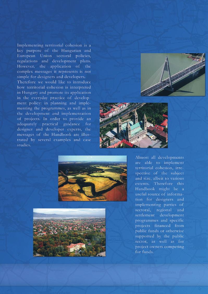
168
COUNCIL OF THE EUROPEAN UNION. Brussels, 2 May /14 CULT 68
 COUNCIL OF THE EUROPEAN UNION Brussels, 2 May 2014 9129/14 CULT 68 NOTE from: General Secretariat of the Council to: Permanent Representatives Committee (Part 1) / Council No. prev. doc.: 8892/14 CULT
The National Spatial Strategy
 Purpose of this Consultation Paper This paper seeks the views of a wide range of bodies, interests and members of the public on the issues which the National Spatial Strategy should address. These views
MiniStRy of national DevelopMent, MiniStRy for national economy. Regional Status Report of Hungary
 MiniStRy of national DevelopMent, MiniStRy for national economy Regional Status Report of Hungary 2010 Ministry of National Development, Ministry for National Economy Regional Status Report of Hungary
Shetland Islands Council
 Shetland Islands Council Response to EU Green Paper on Territorial Cohesion Shetland Islands Council is strongly in favour of a territorial dimension to cohesion policy and welcomes the Commission s consultation
Launch of the ESPON 2013 Programme. European observation network on territorial development and cohesion
 Launch of the ESPON 2013 Programme European observation network on territorial development and cohesion Framework conditions for the ESPON 2013 Programme Policy development in use of territorial evidence
THE SEVILLE STRATEGY ON BIOSPHERE RESERVES
 THE SEVILLE STRATEGY ON BIOSPHERE RESERVES 1 VISION FOR BIOSPHERE RESERVES IN THE 21 ST CENTURY The international Seville Conference on Biosphere Reserves, organised by UNESCO, adopted a two-pronged approach,
Key Indicators for Territorial Cohesion & Spatial Planning Stakeholder Workshop - Project Update. 13 th December 2012 San Sebastián, Basque Country
 Key Indicators for Territorial Cohesion & Spatial Planning Stakeholder Workshop - Project Update 13 th December 2012 San Sebastián, Basque Country Key Aims Explore the use of territorial data in developing
Local Development Pilot Project: Island of Cres. Ranka Saračević Würth, Ministry of Culture, Republic of Croatia
 Local Development Pilot Project: Island of Cres Ranka Saračević Würth, Ministry of Culture, Republic of Croatia BACKGROUND, RATIFICATION OF THE FARO CONVENTION BY REPUBLIC OF CROATIA The Framework Convention
16540/14 EE/cm 1 DG E 1A
 Council of the European Union Brussels, 5 December 2014 (OR. en) 16540/14 ENV 965 CULT 139 NOTE From: To: Subject: General Secretariat of the Council Delegations Charter of Rome on Natural and Cultural
National planning report for Denmark
 National planning report for Denmark from the Minister for Environment and Energy Local identity and new challenges Summary 2000 1 CONTENTS 4 PREFACE: REGIONAL DEVELOPMENT AND SPATIAL PLANNING 6 1. BALANCED
Declaration Population and culture
 Declaration Population and culture The ministers of the parties to the Alpine Convention regard the socio-economic and socio-cultural aspects mentioned in Article 2, Paragraph 2, Item a., as being central
The European territory: Strategic developmentd
 The European territory: Strategic developmentd Peter Mehlbye Workshop Strategic Development Catalonia 11 June 2002 THE LECTURE Structure I. Territorial trends II. Strategy for European spatial development
OPINION. Results of EU Structural Policy in NSPA
 OPINION on the future European Cohesion Policy of the Northern Sparsely Populated Areas (NSPA) of Finland and Sweden with the contribution of North Norway The remote Northern Sparsely Populated Areas (NSPA)
Third Cohesion report February 2004
 February 2004 A new partnership for cohesion Convergence, Competitiveness and Co-operation METREX meeting S. Sebastian, Luisa Sanches DG REGIO The 3rd CR structure 1. Analysis of situation and trends in
Highlands and Islands European Partnership Response to the Green Paper on Territorial Cohesion
 Highlands and Islands European Partnership Response to the Green Paper on Territorial Cohesion 1 I. Introduction The Highlands & Islands European Partnership (HIEP) is a partnership between the key public
Strengthening the cooperation in the region: Carpathian, Tisa,, Danube and Black Sea areas
 Strengthening the cooperation in the region: Carpathian, Tisa,, Danube and Black Sea areas 14th October 2009 SEE Annual Conference Advancing development through transnational cooperation in South East
National Spatial Development Perspective (NSDP) Policy Coordination and Advisory Service
 Policy Coordination and Advisory Service") National Spatial Development Perspective (NSDP) Policy Coordination and Advisory Service 1 BACKGROUND The advances made in the First Decade by far supersede the weaknesses. Yet, if all indicators were
National Spatial Development Perspective (NSDP) Policy Coordination and Advisory Service 1 BACKGROUND The advances made in the First Decade by far supersede the weaknesses. Yet, if all indicators were
PART A Project summary
 PART A Project summary A.1 Project identification Project title Project acronym Name of the lead partner organisation in English Specific objective Demonstrattion AF DAF Partner 1.1. Improving innovation
The ESPON Programme. Goals Main Results Future
 The ESPON Programme Goals Main Results Future Structure 1. Goals Objectives and expectations Participation, organisation and networking Themes addressed in the applied research undertaken in ESPON projects
New Prospects for Peripheral Rural Regions Helmut Hiess Glasgow, 19th of May 2010
 New Prospects for Peripheral Rural Regions Helmut Hiess Glasgow, 19th of May 2010 ÖROK: Organisation & Tasks Austrian Conference on Spatial Planning (ÖROK, since 1971): Joint organisation by Federal level,
COUNCIL OF EUROPE S SPATIAL DEVELOPMENT POLICY
 ESPON 2103 Programme Open Seminar Territorial Challenges and Cooperation in a Wider Europe Portorož, 2-3 June 2008 COUNCIL OF EUROPE S SPATIAL DEVELOPMENT POLICY Maria José Festas Senior Advisor, Directorate
Natura 2000 and spatial planning. Executive summary
 Natura 2000 and spatial planning Executive summary DISCLAIMER The information and views set out in this study are those of the author(s) and do not necessarily reflect the official opinion of the Commission.
The Euroregion, which puts into practice the determination for active cooperation, has led to concrete actions such as:
 Contribution of the Euroregion Pyrenees-Mediterranean to the conclusions of the 5th report on economic, social and territorial cohesion: the future of the cohesion policy A. Introduction The Euroregion
KUNMING FORUM ON UNITED NATIONS GLOBAL GEOSPATIAL INFORMATION MANAGEMENT CITIES OF THE FUTURE: SMART, RESILIENT
 KUNMING FORUM ON UNITED NATIONS GLOBAL GEOSPATIAL INFORMATION MANAGEMENT CITIES OF THE FUTURE: SMART, RESILIENT and SUSTAINABLE Yunnan Zhenzhuang Guest House, Kunming, China 10 12 May 2017 BACKGROUND CONCEPT
Land Use in the context of sustainable, smart and inclusive growth
 Land Use in the context of sustainable, smart and inclusive growth François Salgé Ministry of sustainable development France facilitator EUROGI vice president AFIGéO board member 1 Introduction e-content+
THE ROLE OF SPATIAL PLANNING IN INTEGRATED COASTAL ZONE MANAGEMENT RECOMMENDATIONS FROM THE INTERREG III B BALTCOAST PROJECT
 THE ROLE OF SPATIAL PLANNING IN INTEGRATED COASTAL ZONE MANAGEMENT RECOMMENDATIONS FROM THE INTERREG III B BALTCOAST PROJECT DISCUSSION PAPER FOR THE TRANSNATIONAL WORKING GROUP DECEMBER 2004 CONTENT 1.
CEMAT results - over the years
 CEMAT results - over the years Technical Conference on Functional Areas capitalization of local potential within the territorial development policies in Europe European Conference of Ministers responsible
SPLAN-Natura Towards an integrated spatial planning approach for Natura th January, 2017 Brussels. Commissioned by DG Environment
 SPLAN-Natura 2000 Towards an integrated spatial planning approach for Natura 2000 Commissioned by DG Environment 17 th January, 2017 Brussels V. Simeonova (Ph.D.) Drivers towards integrating Biodiversity
What is Spatial Planning?
 Spatial Planning in the context of the Responsible Governance of Tenure What is Spatial Planning? Text-only version This course is funded by the European Union through the EU-FAO Improved Global Governance
Developing Quality of Life and Urban- Rural Interactions in BSR
 Developing Quality of Life and Urban- Rural Interactions in BSR Sakari Saarinen Union of the Baltic Cities, Commission on Environment Seminar on Quality of Life in Small Communities, 27 May 2010, Kärdla,
PROTOCOL ON THE IMPLEMENTATION OF THE ALPINE CONVENTION OF 1991 RELATING TO SPATIAL PLANNING AND SUSTAINABLE DEVELOPMENT
 PROTOCOL ON THE IMPLEMENTATION OF THE ALPINE CONVENTION OF 1991 RELATING TO SPATIAL PLANNING AND SUSTAINABLE DEVELOPMENT SPATIAL PLANNING AND SUSTAINABLE DEVELOPMENT" PROTOCOL Preamble The Republic of
Experience and perspectives of using EU funds and other funding for the implementation of district renovation projects
 Experience and perspectives of using EU funds and other funding for the implementation of district renovation projects Ministry of the Interior of Lithuania Regional policy department Administration, coordination,
MR. George ALEXAKIS, parallel session 3. "Mediterranean Sea Region. laying the conditions. for sustainable growth and jobs"
 parallel session 3 "Mediterranean Sea Region laying the conditions for sustainable growth and jobs" MR. George ALEXAKIS, elected Regional Councillor of Crete, Greece and representative of Crete in CRPM.
Implementation of the ESPON 2020 cooperation program. 16 January 2017 Anneloes van Noordt
 Implementation of the ESPON 2020 cooperation program 16 January 2017 Anneloes van Noordt Outline! ESPON Cooperation Program! Specific Objectives! Applied Research! Targeted Analysis! Database & Tools!
State initiative following up the 2006 national planning report
 18 ness districts and public institutions, should be integrated with the opportunities for public transport services. State initiative following up the 2006 national planning report The Ministry of the
TOWARDS STRATEGIC SPATIAL PLANNING IN JAMAICA: THE NATIONAL SPATIAL PLAN
 TOWARDS STRATEGIC SPATIAL PLANNING IN JAMAICA: THE NATIONAL SPATIAL PLAN JIEP 5th Biennial Conference on the Environment: Balancing National Development and Environmental Protection June 6, 2011 Jamaica
The Swedish National Geodata Strategy and the Geodata Project
 The Swedish National Geodata Strategy and the Geodata Project Ewa Rannestig, Head of NSDI Co-ordination Unit, Lantmäteriet, ewa.rannstig@lm.se Ulf Sandgren, Project Manager Geodata Project, Lantmäteriet,
Concept note. High-Level Seminar: Accelerating Sustainable Energy for All in Landlocked Developing Countries through Innovative Partnerships
 Concept note High-Level Seminar: Accelerating Sustainable Energy for All in Landlocked Developing Countries through Innovative Partnerships Date: 24 and 25 October 2016 Venue: Conference Room C3, Vienna
European Regional and Urban Statistics
 European Regional and Urban Statistics Dr. Berthold Feldmann berthold.feldmann@ec.europa.eu Eurostat Structure of the talk Regional statistics in the EU The tasks of Eurostat Regional statistics Urban
CHAPTER 4 HIGH LEVEL SPATIAL DEVELOPMENT FRAMEWORK (SDF) Page 95
 Page 95") CHAPTER 4 HIGH LEVEL SPATIAL DEVELOPMENT FRAMEWORK (SDF) Page 95 CHAPTER 4 HIGH LEVEL SPATIAL DEVELOPMENT FRAMEWORK 4.1 INTRODUCTION This chapter provides a high level overview of George Municipality s
CHAPTER 4 HIGH LEVEL SPATIAL DEVELOPMENT FRAMEWORK (SDF) Page 95 CHAPTER 4 HIGH LEVEL SPATIAL DEVELOPMENT FRAMEWORK 4.1 INTRODUCTION This chapter provides a high level overview of George Municipality s
ACTION PLAN FOR WORLD HERITAGE IN LATIN AMERICA AND THE CARIBBEAN ( )
") Annex ACTION PLAN FOR WORLD HERITAGE IN LATIN AMERICA AND THE CARIBBEAN (2014-2024) The current Regional Action Plan for Latin America and the Caribbean for 2014-2024 has been elaborated by the State Parties
Annex ACTION PLAN FOR WORLD HERITAGE IN LATIN AMERICA AND THE CARIBBEAN (2014-2024) The current Regional Action Plan for Latin America and the Caribbean for 2014-2024 has been elaborated by the State Parties
Spatial planning policies and conceptions on the European level influences on national spatial planning systems
 Karina M. Pallagst Spatial planning policies and conceptions on the European level influences on national spatial planning systems Despite of its informal character, spatial planning on the European level
Poland, European Territory, ESPON Programme Warsaw, 2 July 2007 STRATEGY OF THE ESPON 2013 PROGRAMME
 Poland, European Territory, ESPON Programme 2007-2013 Warsaw, 2 July 2007 STRATEGY OF THE ESPON 2013 PROGRAMME Territory matters Regional diversity as asset Territorial potentials increasing in importance
No 4 February ESPON: A New and Practical European Research Agenda for Territorial Planning and Development. Cliff Hague Brendan Bartley
 No 4 February 2010 ESPON: A New and Practical European Research Agenda for Territorial Planning and Development Cliff Hague Brendan Bartley ICLRD Briefing Paper Series ESPON: A New and Practical European
RURAL-URBAN PARTNERSHIPS: AN INTEGRATED APPROACH TO ECONOMIC DEVELOPMENT
 RURAL-URBAN PARTNERSHIPS: AN INTEGRATED APPROACH TO ECONOMIC DEVELOPMENT William Tompson Head of the Urban Development Programme OECD Public Governance and Territorial Development Directorate JAHRESTAGUNG
2. Defining fisheries areas
 What does fisheries area mean in the context of the EFF? Axis 4 of the European Fisheries Fund (EFF) is different from the other three Axes in that it targets fisheries areas (it is titled Sustainable
73/2011 Coll. ACT PART ONE LABOUR OFFICE OF THE CZECH REPUBLIC
 The ASPI system as amended on 25 August 2015 up to Chapter 86/2015 Coll. and 29/2015 Coll.m.s. 73/2011 Coll. - On the Labour Office of the Czech Republic and amending related acts as last amended, the
Economic and Social Council
 United Nation E/C.20/2012/4/Add.1 Economic and Social Council Distr.: General 2 July 2012 Original: English Committee of Experts on Global Geospatial Information Management Second session New York, 13-15
PURR: POTENTIAL OF RURAL REGIONS UK ESPON WORKSHOP Newcastle 23 rd November Neil Adams
 PURR: POTENTIAL OF RURAL REGIONS UK ESPON WORKSHOP Newcastle 23 rd November 2012 Neil Adams PURR: Potential of Rural Regions Introduction Context for the project A spectrum of knowledge Rural Potentials
General considerations of regional policy
 General considerations of regional policy Lect. PhD. Claudia Bentoiu Dimitrie Cantemir Christian University Assoc.PhD. Cristina Athu Dimitrie Cantemir Christian University Lect.PhD. Andreea Monica Predonu
The view of Europaforum Northern Sweden concerning the future of EU cohesion policy
 Northern Sweden 2008-01-31 The view of Europaforum Northern Sweden concerning the future of EU cohesion policy Europaforum Northern Sweden Europaforum Northern Sweden is a partnership and network for councillors
Legal problems of environmental management. Spatial planning and space management. M. Gajewski 2014 / 2015
 Legal problems of environmental management Spatial planning and space management M. Gajewski 2014 / 2015 Course contents (in brief) Constitutional basis of the environment protection system. General principles
COSTA RICA Limon City-Port Project
 photos by Stefania Abakerli COSTA RICA Limon City-Port Project 2008 2013 Cecilia Corvalan William Reuben Stefania Abakerli Background Request from GoCR following Caldera-Port Concession Reform Since the
International Guidelines on Access to Basic Services for All
 International Guidelines on Access to Basic Services for All Presentation and initials lessons from implementation Accessibility to services in regions and cities : measures and policies, OECD 18 June
Briefing. H.E. Mr. Gyan Chandra Acharya
 Briefing by H.E. Mr. Gyan Chandra Acharya Under-Secretary-General and High Representative for the Least Developed Countries, Landlocked Developing Countries and Small Island Developing States Briefing
Entrepreneurship on islands and other peripheral regions. Specific Contract No 6511 implementing Framework contract No CDR/DE/16/2015/
 Entrepreneurship on islands and other peripheral regions Specific Contract No 6511 implementing Framework contract No CDR/DE/16/2015/ Aims of this study: To analyse the particular challenges and obstacles
THE ROLE OF REGIONAL SPATIAL PLANNING IN SUPPORTING LONG-TERM ECONOMIC GROWTH IN NORTHERN IRELAND
 THE ROLE OF REGIONAL SPATIAL PLANNING IN SUPPORTING LONG-TERM ECONOMIC GROWTH IN NORTHERN IRELAND Jenny Pyper Director 6 th Annual ICLRD Conference 20 January 2011 PURPOSE OF REGIONAL PLANNING Framework
Tackling urban sprawl: towards a compact model of cities? David Ludlow University of the West of England (UWE) 19 June 2014
 19 June 2014") Tackling urban sprawl: towards a compact model of cities? David Ludlow University of the West of England (UWE) 19 June 2014 Impacts on Natural & Protected Areas why sprawl matters? Sprawl creates environmental,
Tackling urban sprawl: towards a compact model of cities? David Ludlow University of the West of England (UWE) 19 June 2014 Impacts on Natural & Protected Areas why sprawl matters? Sprawl creates environmental,
Economic and Social Council
 United Nations Economic and Social Council Distr.: General 2 July 2012 E/C.20/2012/10/Add.1 Original: English Committee of Experts on Global Geospatial Information Management Second session New York, 13-15
Presentation by Thangavel Palanivel Senior Strategic Advisor and Chief Economist UNDP Regional Bureau for Asia-Pacific
 Presentation by Thangavel Palanivel Senior Strategic Advisor and Chief Economist UNDP Regional Bureau for Asia-Pacific The High-Level Euro-Asia Regional Meeting on Improving Cooperation on Transit, Trade
Key Indicators for Territorial Cohesion and Spatial Planning in Preparing Territorial Development Strategies
 ESPON Evidence in a North European Context Challenges and Opportunities for Territorial Development and Cohesion in a North European Macro Region, 10-11 April, 2014, Vilnius, Lithuania Key Indicators for
have been a number of high level and expert reviews including the most recent, the Marmot review.
 QUESTIONS 5. Role of GPs and GP practices in public health: Are there additional ways in which we can ensure that GPs and GP practices will continue to play a key role in areas for which Public Health
SPIMA Spatial dynamics and strategic planning in metropolitan areas
 Targeted Analysis SPIMA Spatial dynamics and strategic planning in metropolitan areas Executive Summary Conference version 1 February 2018 0 1. Background To address the challenges of metropolitan development
Carpathians Unite mechanism of consultation and cooperation for implementation of the Carpathian Convention
 Carpathians Unite mechanism of consultation and cooperation for implementation of the Carpathian Convention Zbigniew Niewiadomski, UNEP/GRID-Warsaw Centre First Joint Meeting of the Carpathian Convention
Alps Results from the ESPON Project. Common spatial perspectives for the Alpine area. Towards a common vision
 Results from the ESPON Project Alps 2050 Common spatial perspectives for the Alpine area. Towards a common vision Tobias Chilla, University of Erlangen Cooperation Alps 2020+ 1 & 2 October 2018 Salzburg
National Land Use Policy and National Integrated Planning Framework for Land Resource Development
 Title National Land Use Policy and National Integrated Planning Framework for Land Resource Development Duration: 32 Weeks Objective: Adoption of appropriate land use planning approaches to: Maintain the
Use and demand of regions and cities
 Use and demand of regions and cities > Roger Read > Deputy Director of Physical Planning Strathclyde Regional Council 1976-1996 > Secretary General METREX 1996-present > METREX - founded in 1996 > 50+
INTERNATIONAL CULTURAL TOURISM CHARTER Managing Tourism at Places of Heritage Significance (1999)
") INTERNATIONAL CULTURAL TOURISM CHARTER Managing Tourism at Places of Heritage Significance (1999) Adopted by ICOMOS at the 12th General Assembly in Mexico, October 1999. INTRODUCTION The Charter Ethos
INTERNATIONAL CULTURAL TOURISM CHARTER Managing Tourism at Places of Heritage Significance (1999) Adopted by ICOMOS at the 12th General Assembly in Mexico, October 1999. INTRODUCTION The Charter Ethos
Territorial Cohesion Current Views of the Commission and the Member States of the European Union
 Territorial 2.1 Introduction Cohesion 7 2 Territorial Cohesion Current Views of the Commission and the Member States of the European Union Karl Peter Schön 2.1 Territorial Cohesion A New Concept Combining
PROGRAM OF THE RUSSIAN FEDERATION CHAIRMANSHIP OF THE ARCTIC COUNCIL IN
 PROGRAM OF THE RUSSIAN FEDERATION CHAIRMANSHIP OF THE ARCTIC COUNCIL IN 2004-2006 The Arctic Council is a unique forum for interaction between the governments of the Arctic States, the Permanent Participants
Sustainable tourism in for Sustaibale Danang
 Sustainable tourism in for Sustaibale Danang A case study of Balearic Ecotax in Spain toward Sustainable tourism Miki Yoshizumi Associate Professor College of Gastronomy Management Ritsumeikan University
MODELS AND TOOLS FOR GOVERNANCE OF
 Working Papers Collection No. 1/2015 MODELS AND TOOLS FOR GOVERNANCE OF THE ADRIATIC AND IONIAN SEAS www.unimc.it/maremap NATIONAL POLITICS AND EU POLITICS: THE MARITIME SPATIAL PLANNING AND INTEGRATED
Law on Spatial Planning
 UNITED NATIONS United Nations Interim Administration Mission in Kosovo UNMIK NATIONS UNIES Mission d Administration Intérimaire des Nations Unies au Kosovo PROVISIONAL INSTITUTIONS OF SELF GOVERNMENT Law
Jordan's Strategic Research Agenda in cultural heritage
 Jordan's Strategic Research Agenda in cultural heritage Analysis of main results Alessandra Gandini Amman, Jordan 3 rd November 2013 Main objectives The work performed had the main objective of giving
TranSMEC Transnational Support Method for European Cooperation
 TranSMEC Transnational Support Method for European Cooperation Targeted Analysis 2013/2/7 (Draft) Final Report Version 02/08/2011 1 This report presents the draft final results a Targeted Analysis conducted
Proposal for a DIRECTIVE OF THE EUROPEAN PARLIAMENT AND OF THE COUNCIL. establishing an infrastructure for spatial information in the Community
 Proposal for a DIRECTIVE OF THE EUROPEAN PARLIAMENT AND OF THE COUNCIL establishing an infrastructure for spatial information in the Community INSPIRE http://inspire.jrc.it/ Alessandro Annoni 1 EU Commission
The Governance of Land Use
 The planning system Levels of government and their responsibilities The Governance of Land Use COUNTRY FACT SHEET NORWAY Norway is a unitary state with three levels of government; the national level, 19
Management Planning & Implementation of Communication Measures for Terrestrial Natura 2000 Sites in the Maltese Islands Epsilon-Adi Consortium
 Management Planning & Implementation of Communication Measures for Terrestrial Natura 2000 Sites in the Maltese Islands Epsilon-Adi Consortium Briefing Meetings, February 2013 CT3101/2011, MEPA, Malta
Community Engagement in Cultural Routes SiTI Higher Institute on Territorial Systems for Innovation Sara Levi Sacerdotti
 Transnational Workshop Wroclaw, 7th-8th December 2016 Community Engagement in Cultural Routes SiTI Higher Institute on Territorial Systems for Innovation Sara Levi Sacerdotti levi@siti.polito.it TAKING
Low Density Areas : Places of Opportunity. Enrique Garcilazo, OECD Directorate for Public Governance and Territorial Development
 Low Density Areas : Places of Opportunity Enrique Garcilazo, OECD Directorate for Public Governance and Territorial Development Open Days, Brussels, 11 th October, 2016 Outline 1. Performance low density
Urbanization and Sustainable Development of Cities: A Ready Engine to Promote Economic Growth and Cooperation
 Urbanization and Sustainable Development of Cities: A Ready Engine to Promote Economic Growth and Cooperation Wan Portia Hamzah Institute of Strategic and International Studies (ISIS) Malaysia 10 September
Summary. Recommendations on the Fifth Policy Document on Spatial Planning September 2001
 Summary Recommendations on the Fifth Policy Document on Spatial Planning September 2001 2 Introduction In December 2000 the Dutch Cabinet issued Part 1 of the Fifth National Policy Document on Spatial
DETERMINE OF REGIONAL DEVELOPMENT STRATEGIES IN IZMIR
 Sukran Yalpir Asli Bozdag Saban Inam DETERMINE OF REGIONAL DEVELOPMENT STRATEGIES IN IZMIR Globalization INTRODUCTION Economic pressure cause Economic migration cause cause Spatial organizations Spatial
National Perspectives - Portugal. Margarida Almodovar
 National Perspectives - Portugal Margarida Almodovar margarida.almodovar@mam.gov.pt from base line to the external limit of the continental shelf behind 200 miles and according to UNCLOS definitions Economic
Policy framework The Netherlands and the Polar Regions, Summary and priorities
 Policy framework The Netherlands and the Polar Regions, 2011-2015 Summary and priorities The policy outlined in this Policy Framework for the Polar Regions (2011-2015) is part of the government s orientation
OPEN DAYS 2011 LOCAL EVENTS COUNTRY LEAFLET. Bratislava Region Košice Region Nitra Region Trenčin Region SLOVAKIA
 OPEN DAYS 2011 LOCAL EVENTS COUNTRY LEAFLET Bratislava Region Košice Region Nitra Region Trenčin Region SLOVAKIA INDEX I. Regional Partnerships Official Partners of the OPEN DAYS 2011 Bratislava Region...
SWEDISH SDI DEVELOPMENT & IMPLEMENTATION OF INSPIRE
 SWEDISH SDI DEVELOPMENT & IMPLEMENTATION OF INSPIRE Christina Wasström, Lantmäteriet, 801 82 Gävle, Sweden, christina.wasstrom@lm.se ABSTRACT The Swedish Government and Parliament has given Lantmäteriet
The Governance of Land Use
 The planning system The Governance of Land Use United Kingdom Levels of government and their responsibilities The United Kingdom is a unitary state with three devolved governments in Northern Ireland,
OFFICIAL GAZETTE OF THE REPUBLIC OF KOSOVA / No. 30 / 23 AUGUST 2013, PRISTINA LAW NO. 04/L-174 ON SPATIAL PLANNING LAW ON SPATIAL PLANNING
 OFFICIAL GAZETTE OF THE REPUBLIC OF KOSOVA / No. 30 / 23 AUGUST 2013, PRISTINA LAW NO. 04/L-174 ON SPATIAL PLANNING Assembly of Republic of Kosovo; Pursuant to Article 65 (1) of the Constitution of Republic
Regional stakeholders strategy of Donegal County Council
 Regional stakeholders strategy of Donegal County Council Table of contents The template comprised five steps in the creation of this communication strategy: 1 Starting point. Communication objectives...
Territorial Cooperation within the Northern Periphery and the Arctic
 Territorial Cooperation within the Northern Periphery and the Arctic 12 March 2013 / By Silvia Curbelo Betancort North charr project, Landösjön lake, Sweden. Source: North Periphery Programme Today we
CONFERENCE STATEMENT
 Final draft CONFERENCE STATEMENT We, the elected representatives of Canada, Denmark/Greenland, the European Parliament, Finland, Iceland, Norway, Russia, Sweden and the United States of America; In collaboration
6 th GLOBAL SUMMIT ON URBAN TOURISM 4 6 December 2017, Kuala Lumpur (Malaysia)
") 6 th GLOBAL SUMMIT ON URBAN TOURISM 4 6 December 2017, Kuala Lumpur (Malaysia) SUMMARY/CONCLUSIONS Esencan TERZIBASOGLU Director Destination Management and Quality eterzibasoglu@unwto.org 6TH GLOBAL SUMMIT
6 th GLOBAL SUMMIT ON URBAN TOURISM 4 6 December 2017, Kuala Lumpur (Malaysia) SUMMARY/CONCLUSIONS Esencan TERZIBASOGLU Director Destination Management and Quality eterzibasoglu@unwto.org 6TH GLOBAL SUMMIT
Spatial Planning in the Republic of Armenia
 Spatial Planning in the Republic of Armenia According to the Law of the Republic of Armenia on Urban Development, the main issues of the Republic s spatial development and actions for their solution are
INSPIRE Monitoring and Reporting Implementing Rule Draft v2.1
 INSPIRE Infrastructure for Spatial Information in Europe INSPIRE Monitoring and Reporting Implementing Rule Draft v2.1 Title INSPIRE Monitoring and Reporting Implementing Rule v2.1 Creator DT Monitoring
Integrated Territorial Development Strategies in Greece under economic crisis
 Integrated Territorial Development Strategies in Greece under economic crisis INTERSTRAT Interactive Workshop, Warsaw, 12.10.2011 Stella Kyvelou, Assistant Professor, Panteion University, Director of Greek
Building the Sustainable Network of Settlements on the Caspian Sea Region of Kazakhstan
 Building the Sustainable Network of Settlements on the Caspian Sea Region of Kazakhstan Introduction The Ecological Zoning and Identification of Ecological Capacity of Natural and Socio- Economic Potential
HELSINKI COMMISSION Baltic Marine Environment Protection Commission
 HELSINKI COMMISSION Baltic Marine Environment Protection Commission HELCOM RECOMMENDATION 24/10 Adopted 25 June 2003, having regard to Article 20, Paragraph 1 b) of the 1992 Helsinki Convention IMPLEMENTATION
Economic development in rural regions in the EU: empirical findings and theories
 Economic development in rural regions in the EU: empirical findings and theories Presentation at the IAMO Forum 2013 Rural areas in transition, June 19-21, 2013 Dr. Ida Terluin, Agricultural Economics
SPATIAL PLANNING AND REGIONAL DEVELOPMENT OF GREECE
 SPATIAL PLANNING AND REGIONAL DEVELOPMENT OF GREECE by Evangelos Baltas General Secretary, Ministry for the Environment, Physical Planning & Public Works This article analytically presents the historical