KING COUNTY GIS: REGIONAL COORDINATION AND RETURN ON INVESTMENT
|
|
|
- Jack Fleming
- 5 years ago
- Views:
Transcription

1 KING COUNTY GIS: REGIONAL COORDINATION AND RETURN ON INVESTMENT Exploring GIS Potential for Northwestern Ontario May 13, 2015 Dennis R. Higgins, Jr., GISP Client Services Manager King County GIS Center Seattle, WA, USA
2

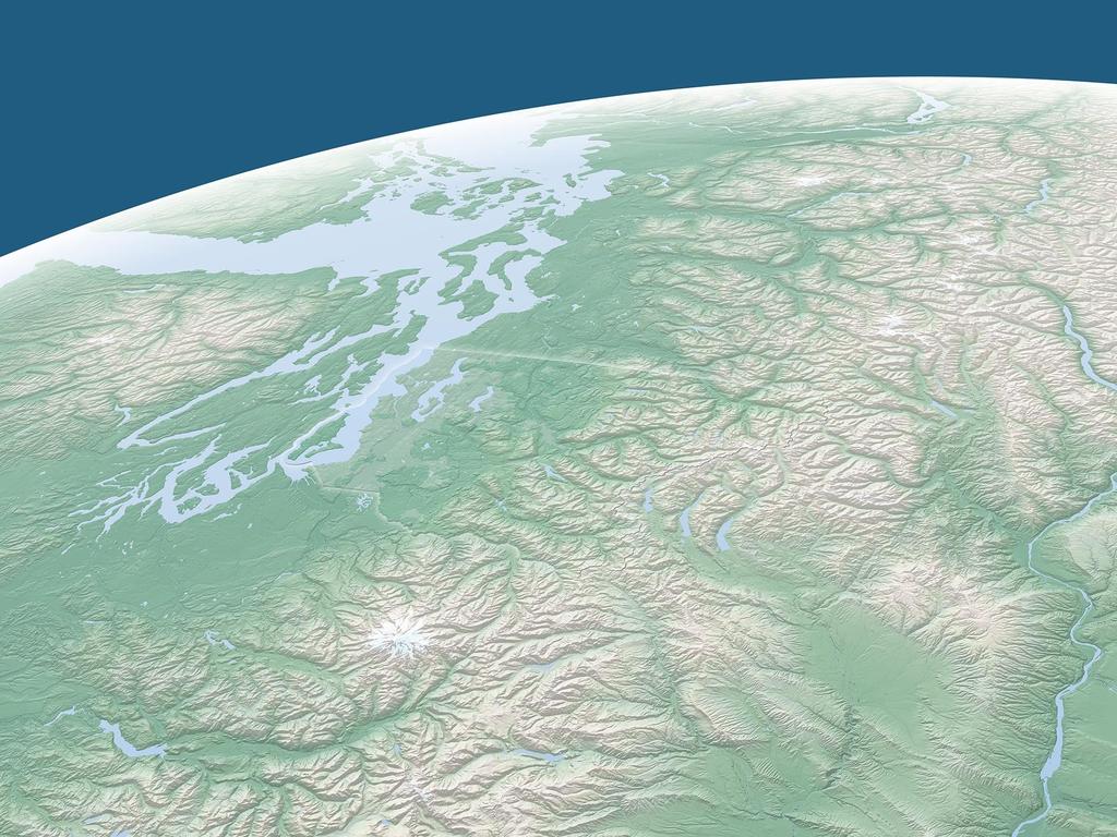
3 KING COUNTY, WASHINGTON, USA Population: 2,044,000 (14th most populous US county) Area: 5,520 sq. km. (the size of Delaware) Topography: sea level to 2,400 m. 39 incorporated cities; many more muni. service districts Economic engine of the NW US Viable agricultural and private forestry areas Remote wilderness & watershed lands Microsoft Boeing Paccar Nordstrom's Amazon Starbucks Port of Seattle Weyerhaeuser Univ. of Washington
4 King County GIS - Development History: Originated with 1992 PlanGraphics study 1992 Benefit Cost Analysis PlanGraphics identified 126 business applications and a $22 million capital cost estimate King County Seattle Metro merger 1993 joint King County Metro GIS scoping plan reduced $6.8 million scope approved by King County Council GIS capital project executed 1997 KCGIS O&M begins 2002 KCGIS Consolidation implemented
5 King County GIS 1992 GIS ROI Estimate
6 2015 KCGIS State of Development: 500+/- desktop GIS users 100,000 annual internal web based GIS user sessions 2.2 million annual external web based GIS user sessions 50 GIS professionals Supporting 35 county departments and offices Contracted GIS support for four cities, two sewer/water districts Data sharing agreements with 29 of 39 cities Client Services provides ad-hoc support

7 KCGIS Center & Agency GIS End-Users

8 KCGIS Center Achievements: Infrastructure DES Maintains: 1. Election Districts 2. Voter Precincts KCGIS Center DNRP GIS Unit Maintains: 1. Hydrography 2. Sampling Sites 3. Sewer Lines 4. Parks & Trails DOT Maintains 1. Street Centerline 2. Street Addresses 3. Transit data Posts Newly Maintained Data Access all GIS Data Posts Newly Maintained Data Access all GIS Data Posts Newly Maintained Data Access all GIS Data KC Assessor Maintains: 1. Parcel Data 2. Parcel Annotation Access all GIS Data KCGIS Data Warehouse (Managed by KCGIS Center) Access all GIS Data Posts Newly Maintained Data Other KCGIS Departments, Countywide GIS End-Users, & the General Public Posts Newly Maintained Data Access all GIS Data DDES Maintains: 1. Comp Plan Zones 2. Land Use Zones 3. Hazard Zones 4. Wetlands Posts Newly Maintained Data Access all GIS Data QC & Monitor all Public Library GIS Data for Standards & Quality Posts Newly Maintained Data (Future) Access KCGIS Data Future Regional GIS Partners Maintain: 1. Local zoning 2. Local land use 3. Other Local Data KCGIS Center: 1. Manages Data mainained by other Departments 2. Maintains Data acquired from other Agencies 3. QC's & Monitors all Dept. data posted to KCGIS Data Warehouse 4. KCGIS Database Administration 5. System Administration 6. Metadata management 7. Maintains standard KCGIS data access front end-user applications KCGIS Data Warehouse Maintenance & Access Architecture Note: Only sample data maintenance responsibilities are shown
9 Infrastructure 5 Data Steward departments maintain core KCGIS data KCGIS Center manages data integration routines KCGIS Center manages Data Warehouse and Portal to ensure accessibility for 500+ internal users and thousands of external users
10 KCGIS Center Achievements: Governance The King County Geographic Information System (KCGIS) is a coordinated regional geographic information resource, organized to meet the business needs of King County, local agencies, and the general public. KCGIS is comprised of both the King County GIS Center (responsible for core GIS resources and enterprise services for the entire County) and business specific activity in various GIS units distributed across other County departments. The King County GIS Center annual work plan and budget is approved by the KCGIS Technical Committee, comprised of 35 voting members, one from each contributing agency.

11 KCGIS Center Governance: 35 Agencies
12 KCGIS Center Achievements: Regional Data Coordination 5 Data Steward departments maintain core KCGIS data KCGIS Center manages data integration routines, metadata, integrity and completeness checks KCGIS Center manages Data Warehouse and Portal to ensure accessibility for 500+ users Hundreds of thousands of external users 2015 Imagery Acquisition Program: $1.2 M cost; 95 partner agencies including neighboring counties Kitsap, Snohomish and Pierce; High resolution natural color orthoimagery, infrared orthoimagery, and supplemental vector products (such as impervious mapping)

13 KCGIS Center Achievements: Regional Data Coordination

14 KCGIS Center Challenges: Regional Data Coordination Bad Historic Survey Data

15 KCGIS Center Achievements: Training Program To ensure a viable and cost-effective GIS training program for King County To support GIS development within the region.and beyond Opening these classes to non-county employees enables us to hold them more frequently New relationship with TeachMeGIS, Inc. Have laptop, will travel
16 KCGIS Center Achievements: Client Services Fee-based ad-hoc on-call GIS service Special support for King Co. agencies Local cities & counties Utilities, school districts, special districts, tribes Federal & state agencies Private business Private individuals, students
17 But where are we really on the optimal development of GIS in King County? What was (is) our ROI?
18 Why GIS ROI Documentation Studies? State of Oregon
19 GIS ROI Documentation Study Breakthrough New Zealand
20 KCGIS GIS ROI Study Project Conceived during 2009 URISA AC in Anaheim Approach finalized during 2009 ULA in Seattle State of Oregon & King County joint funding KCGIS 2010 Priority Initiative Managed by KCGIS Center
21 KCGIS GIS ROI Study May 2010 RFP sent to targeted consultants June 2010 consultant selection August 2010 contract signed July 2010 work began September & October 2011 Preliminary Results Released March 2012 Final Report Published

22 KCGIS GIS ROI Study Consultant Team from UW Evans School of Public Affairs: Benefit-Cost Analysis Center Dr. Richard W. Zerbe, Professor of Public Affairs
23 KCGIS GIS ROI Study Methodology: With versus without research design. Qualitative interviews: 20; Quantitative surveys: 200 What would have happened if KCGIS applications had not been implemented and how is King County better off having them? Literature review and qualitative interviews will identify key benefits associated with GIS applications (e.g., increased productivity). Questionnaire will allow assessment of the extent to which these benefits have been realized across different groups of users of GIS applications, as opposed to what these users would have done in the absence of GIS applications. By comparing the with and without scenarios, we can assess and monetize the added value of the GIS applications to compare to the costs of implementation, maintenance, and/or additional training.
24 KCGIS GIS ROI Study: Methodology With or without survey methodology: How has GIS altered agency output levels? Benefits associated with FTE reductions to produce the same (pre-gis) level of output Benefits associated with enhanced production with the same FTE levels Three stage analysis: Interview agency heads and key employees to assess the types of applications and business uses. Interviews were used to build an employee survey. Employees and managers across King County responded to the survey to record their pre and current (or with vs. without) GIS productivity by output types. Interview and survey results were compiled by output type, agency, and productivity levels. Results were then monetized. Monetized benefits compared to detailed GIS capital O&M, and end-user costs
25 KCGIS GIS ROI Study: Methodology PERTINENT SURVEY QUESTIONS Please estimate the number of each output you currently produce (in 2010), being clear about the time frame (per day, per year, etc.). Also state the total number of outputs from your agency (if known), and the number of employees and full-time employees (FTEs) currently working on producing this output. If you answered that you did not produce a given output in the previous section, you may skip the personal production questions. How many units of this output do you personally produce? Choose # of units: How many units of this output do you personally produce Per Unit of Time: What percent of your time do you spend producing each output now? (%) What percent of your time do you spend producing each output now: Per Unit of Time: Number of Employees in your workgroup (including you) currently producing this output: Total FTEs in your workgroup (including you) currently producing this output:
26 KCGIS GIS ROI Study: Methodology PERTINENT SURVEY QUESTIONS Again, the outputs commonly produced by your agency are listed below in the first column. If you were not present when the output was produced without GIS, please answer No to the first question but provide your best estimate for the remaining questions. For each output, please indicate how having GIS has impacted labor productivity for you personally and for your agency overall. Did you personally produce this output without GIS? How many units of this output did you personally produce prior to GIS? Choose # of units: How many units of this output did you personally produce Per Unit of Time prior to GIS:?What percent of your time did you spend producing each output prior to GIS? What percent of your time did you spend producing each output Prior to GIS: Per Unit of Time: Number of Employees in your workgroup (including you) producing this output prior to GIS? Total FTEs in your workgroup (including you) producing this output prior to GIS?

27 KCGIS GIS ROI Study Results
28 KCGIS GIS ROI Study Results The most conservative estimate presented finds that the use of GIS has produced approximately $775 million in net benefits over the eighteen year period from 1992 to Thus a reasonable estimate of total gains is between $180 million and $87 million in The most conservative benefit-cost ratio is 6.98:1.0; assuming outputs have equal value returns a benefit-cost ratio of 13.36:1.0.
29 KCGIS GIS ROI Study Results
30 KCGIS GIS ROI Study Questions & Answers: At what stage is KCGIS in the total potential business use of GIS? Are the KCGIS results good? How do we know? Do we need similar studies of other large counties? What about a single latitudinal study of mid-sized cities in Washington & Oregon? Are government agency officials not now compelled to pursue full GIS development?
31 URISA s GIS Management Institute How will the GMI Operate? URISA Education ULA & UMA GMBOK: GISCI GIS Managers Certification Component GMCM: Geospatial Management Competency Model GIS Management Body of Knowledge GIS Management Educational Program Accreditation GCMM: GIS Capability Maturity Model Future: ROI Services Other Accreditation Benchmarking Municipal GIS Operations GCMM Accreditation

32 URISA s GIS Management Institute Who will use the GMI, and why? Babinski s Theory of GIS Management: As GIS Operational Maturity Improves, ROI Increases
33 ROI Study Acknowledgement: State of Oregon GIS and Cy Smith, Oregon GIO KCGIS Technical Committee Richard O. Zerbe & UW GIS ROI Study Team KCGIS Center Interview team: George Horning, Manager Greg Stought, Enterprise Services Manager Dennis Higgins, GISP, Client Services Manager Debbie Bull, GIS DBA Greg Babinski, GISP, Finance & Marketing Manager Questions, Comments & Discussion Learn More: ArcNews: Summer 2012: Access full report on King County web site:
34 Dennis R. Higgins, Jr., GISP Client Services Manager King County GIS Center 201 South Jackson Street, Suite 706 Seattle, WA
Using ROI Methodology to Measures the Benefits of King County GIS
 Using ROI Methodology to Measures the Benefits of King County GIS 2012 Washington GIS Conference Tacoma, Washington May 9, 2012 Greg Babinski, MA, GISP Finance & Marketing Manager King County GIS Center
URISA QUESTIONNAIRE DRAFT MUNICIPAL GIS CAPABILITY MATURITY MODEL
 URISA DRAFT MUNICIPAL GIS CAPABILITY MATURITY MODEL QUESTIONNAIRE G. BABINSKI, GISP, KING COUNTY GIS CENTER JULY 29, 2010 Participant Identification: Name of Municipal GIS Organization: Name of Participant:
Providing Public Access to King County GIS Data. Presented by: Michael Jenkins King County GIS Center Seattle, WA
 Providing Public Access to King County GIS Data Presented by: Michael Jenkins King County GIS Center Seattle, WA King County, Washington Microsoft Boeing Amazon.Com Starbucks Port of Seattle Weyerhauser
GIS Capability Maturity Assessment: How is Your Organization Doing?
 GIS Capability Maturity Assessment: How is Your Organization Doing? Presented by: Bill Johnstone Principal Consultant Spatial Vision Group November 8, 2018 1. Motivation for Capability Maturity Models
King County GIS Center 2018 Esri User Conference San Diego, California July 12, 2018
 Greg Babinski, MA, GISP Marketing & Business Development Manager URISA Past-President King County GIS Center 2018 Esri User Conference San Diego, California July 12, 2018 Geography has always been a major
GIS ADMINISTRATOR / WEB DEVELOPER EVANSVILLE-VANDERBURGH COUNTY AREA PLAN COMMISSION
 GIS ADMINISTRATOR / WEB DEVELOPER EVANSVILLE-VANDERBURGH COUNTY AREA PLAN COMMISSION SALARY RANGE INITIATION $43,277 SIX MONTHS $45,367 POSITION GRADE PAT VI The Evansville-Vanderburgh County Area Plan
GIS Geographical Information Systems. GIS Management
 GIS Geographical Information Systems GIS Management Difficulties on establishing a GIS Funding GIS Determining Project Standards Data Gathering Map Development Recruiting GIS Professionals Educating Staff
GIS Monroe Geographic Information System March 14, 2018
 GIS Monroe Geographic Information System March 14, 2018 Goals Maintain Enterprise/County-wide geo-database Increase spatial accuracy of data Build and acquire more data layers Increase use of GIS; as another
Exploring GIS Potential for Northwestern Ontario Land Information Ontario
 Exploring GIS Potential for Northwestern Ontario Land Information Ontario May 13, 2015 The LIO Vision LIO Vision: That all geographic information about Ontario is fully integrated and accessible LIO Goal:
Information. Information Technology. Geographic. Services (GIS) 119 W Indiana Ave Deland, FL 32720
 119 W Indiana Ave Deland, FL 32720") Information Technology Geographic Information Services (GIS) 119 W Indiana Ave Deland, FL 32720 A GIS consists of 5 primary components: Hardware Software People Data Methods or Business Processes --- Hardware
Information Technology Geographic Information Services (GIS) 119 W Indiana Ave Deland, FL 32720 A GIS consists of 5 primary components: Hardware Software People Data Methods or Business Processes --- Hardware
To: Ross Martin, Lisa Stapleton From: Brad Lind Subject: Joint Funding Agreement with USGS for 2012 Imagery Date: March 14, 2012.
 To: Ross Martin, Lisa Stapleton From: Brad Lind Subject: Joint Funding Agreement with USGS for 2012 Imagery Date: March 14, 2012 Attached are two copies of the Joint Funding Agreement (JFA) between SanGIS
Strategic Plan
 2013-2015 Strategic Plan April 23, 2014 Introduction The Indiana Geographic Information Council's (IGIC) 2013-2015 Strategic Plan establishes a path of action to meet opportunities and challenges of applying
STATE GEOGRAPHIC INFORMATION DATABASE
 STATE GEOGRAPHIC INFORMATION DATABASE Data Information and Knowledge Management STATE GEOGRAPHIC INFORMATION DATABASE EXECUTIVE SUMMARY Utah has developed one of the most comprehensive statewide GIS resources
2013 NASCIO Award Submission Category: Cross-Boundary Collaboration and Partnerships. Project Title: Public Safety and Enterprise GIS in Tennessee
 2013 NASCIO Award Submission Category: Cross-Boundary Collaboration and Partnerships Project Title: Public Safety and Enterprise GIS in Tennessee State of Tennessee, Board of Parole State of Tennessee,
Utilizing GIS Technology for Rockland County. Rockland County Planning Department Douglas Schuetz & Scott Lounsbury
 Utilizing GIS Technology for Rockland County Rockland County Planning Department Douglas Schuetz & Scott Lounsbury Presentation Agenda Introduction What is GIS What can GIS do GIS Efforts for BOE Resources
GIS Changing the World GIS Day November 15, 2017
 + GIS Changing the World GIS Day November 15, 2017 + Growing Up On The Farm 3 Geographic Information in DNR A 75 year history of mapping and GIS. Forest type map from 1944. State of Washington - Division
The Indiana Data Sharing Initiative and the IndianaMap. Cross-Boundary Collaboration and Partnerships. State of Indiana
 The Indiana Data Sharing Initiative and the IndianaMap Cross-Boundary Collaboration and Partnerships State of Indiana Brian Arrowood, CIO James Sparks, GIO EXECUTIVE SUMMARY Under the collaboration oriented
Indiana GIS Resources
 Indiana GIS Resources National Association of Water Companies September 21, 2017 Jim Sparks Indiana Geographic Information Officer ABOUT THE INDIANA GEOGRAPHIC INFORMATION OFFICE I.C. 4-23-7.3 Indiana
OC Enterprise GIS. Kevin Hills, PLS Cameron Smith, GISP. OC Survey
 OC Enterprise GIS Kevin Hills, PLS Cameron Smith, GISP OC Survey Discussion Points Background & Organizational Structure of OCPW Past practices prior to Enterprise Wide GIS License (ELA) Participating
FIRE DEPARMENT SANTA CLARA COUNTY
 DEFINITION FIRE DEPARMENT SANTA CLARA COUNTY GEOGRAPHIC INFORMATION SYSTEM (GIS) ANALYST Under the direction of the Information Technology Officer, the GIS Analyst provides geo-spatial strategic planning,
Statewide Topographic Mapping Program
 Statewide Topographic Mapping Program February 28, 2018 www.dotd.la.gov Outline Purpose of the Statewide Topographic Mapping Program History Breakdown of R.S. 48:36 - Topographic Mapping Statewide Topographic
GIS Needs Assessment. for. The City of East Lansing
 GIS Needs Assessment for The City of East Lansing Prepared by: Jessica Moy and Richard Groop Center for Remote Sensing and GIS, Michigan State University February 24, 2000 Executive Summary At the request
Building an Enterprise GIS for Chicago s Water Reclamation District
 Building an Enterprise GIS for Chicago s Water Reclamation District Presenters Presented at the 2010 ESRI User Conference Authored and Presented By Sanjay Patel, PE, CEM, CMRP Metropolitan Water Reclamation
John Laznik 273 Delaplane Ave Newark, DE (302)
") Office Address: John Laznik 273 Delaplane Ave Newark, DE 19711 (302) 831-0479 Center for Applied Demography and Survey Research College of Human Services, Education and Public Policy University of Delaware
Office Address: John Laznik 273 Delaplane Ave Newark, DE 19711 (302) 831-0479 Center for Applied Demography and Survey Research College of Human Services, Education and Public Policy University of Delaware
CHAPTER 22 GEOGRAPHIC INFORMATION SYSTEMS
 CHAPTER 22 GEOGRAPHIC INFORMATION SYSTEMS PURPOSE: This chapter establishes the administration and use of to improve the quality and accessibility of Department s spatial information and support graphical
THE ROLE OF GEOSPATIAL AT THE WORLD BANK
 THE ROLE OF GEOSPATIAL AT THE WORLD BANK INSPIRE Conference Barcelona, Spain September 26, 2016 Kathrine Kelm Senior Land Administration Specialist Global Land and Geospatial Unit The World Bank Group
GIS Certification: How will it be used to improve education?
 GIS Certification: How will it be used to improve education? Deidre Sullivan OSTO Workshop November 11, 2008 1 What is GIS? Geographic Information Systems It is a science, a tool, and a software It assists
GIS Building Communities beyond National Borders (Building Successful Spatial Data Infrastructures) Nick Land, ESRI Europe
 Nick Land, ESRI Europe") GIS Building Communities beyond National Borders (Building Successful Spatial Data Infrastructures) Nick Land, ESRI Europe UK worst flooding in the last 60 years 350,000 households without drinking water
GIS Building Communities beyond National Borders (Building Successful Spatial Data Infrastructures) Nick Land, ESRI Europe UK worst flooding in the last 60 years 350,000 households without drinking water
Section 2. Indiana Geographic Information Council: Strategic Plan
 Section 2. Indiana Geographic Information Council: Strategic Plan Introduction A geographic information system (GIS) is an automated tool that allows the collection, modification, storage, analysis, and
MAPPS 2012 Geospatial Products and Services Excellence Awards Awards Entry Form
 MAPPS 2012 Geospatial Products and Services Excellence Awards 2012 Awards Entry Form Please include a copy of this document with the project/product submission Entry Information Submission Number: 1741558
GIS FOR MAZOWSZE REGION - GENERAL OUTLINE
 GIS FOR MAZOWSZE REGION - GENERAL OUTLINE S. Bialousz 1), K Mączewski 2), E. Janczar 2), K. Osinska-Skotak 1) 1) Warsaw University of Technology, Warsaw, Poland 2) Office of the Surveyor of the Mazowieckie
GIS for the Beginner on a Budget
 GIS for the Beginner on a Budget Andre C. Bally, RLA, GIS Coordinator, Harris County Public Infrastructure Department Engineering Division This presentation, GIS for Beginners on a Budget. will briefly
UTAH S STATEWIDE GEOGRAPHIC INFORMATION DATABASE
 UTAH S STATEWIDE GEOGRAPHIC INFORMATION DATABASE Data Information and Knowledge Management NASCIO Awards 2009 STATE GEOGRAPHIC INFORMATION DATABASE B. EXECUTIVE SUMMARY Utah has developed one of the most
Regional GIS Initiatives Geospatial Technology Center
 Regional GIS Initiatives Geospatial Technology Center Mr. Bobby Lear GIS Coordinator St. James Parish & Dr. Balaji Ramachandran Contractors Educational Trust Fund Endowed Professor Geomatics Program, Department
Integrated infrastructure planning at metropolitan scale. QII implementation metro-wide (horizontal and vertical coordination)
") Session 10: Working Across Political and Interjurisdictional Boundaries to Realize QII Mats Andersson Integrated infrastructure planning at metropolitan scale QII implementation metro-wide (horizontal
Session 10: Working Across Political and Interjurisdictional Boundaries to Realize QII Mats Andersson Integrated infrastructure planning at metropolitan scale QII implementation metro-wide (horizontal
Introduction. Elevation Data Strategy. Status and Next Steps
 1 2 Introduction Elevation Data Strategy Status and Next Steps 3 Canada is the 2nd largest country in the world - 9.9 million sq km Surrounded by 3 oceans with 202 000 km of coastline Population over 35
CHARTING SPATIAL BUSINESS TRANSFORMATION
 CHARTING SPATIAL BUSINESS TRANSFORMATION An in-depth look at the business patterns of GIS and location intelligence adoption in the private sector EXECUTIVE SUMMARY The global use of geographic information
Continental Divide National Scenic Trail GIS Program
 CDNST Vision Statement: Provide the most accurate geospatial locational information of the Continental Divide Trail and nearby resources to the public as well as help provide internal management information
State Geographic Information Consolidation Implementation Plan
 State Geographic Information Consolidation Implementation Plan As Directed by Session Law 2008-0107 Section 6.13 Prepared By: State Chief Information Officer Geographic Information Coordinating Council
BOWIE SENIORS COMPUTER CLUB
 BOWIE SENIORS COMPUTER CLUB Meeting Minutes for May 5, 2016 Through the efforts of Program Chairman Dan Lee, we had Patrick T. Callahan, GIS Manager of the Prince George's County Office of Information
SOUTH DAKOTA BOARD OF REGENTS. Academic and Student Affairs ******************************************************************************
 SOUTH DAKOTA BOARD OF REGENTS Academic and Student Affairs AGENDA ITEM: 7 C (4) DATE: June 28-30, 2016 ****************************************************************************** SUBJECT: New Minor:
Kansas Next Generation 911 Data Remediation Program. Esri Imagery Forum June 26, 2016
 Kansas Next Generation 911 Data Remediation Program Esri Imagery Forum June 26, 2016 Kansas NextGen 911 Project Overview Development of statewide Emergency Services IP Network (ESINet) GIS database development,
Geographic Information System Services. Strategic Plan FY
 Geographic Information System Services Strategic Plan FY 2011 2012 Drafted by: Gary Palmer, Assistant Town Manager Major Sections: History Mission, Vision, Values Strategic Issues Performance Measurement
D2E GIS Coordination Initiative Functional Transformation Kick-Off Meeting
 D2E GIS Coordination Initiative Functional Transformation Kick-Off Meeting GIS Functional Transformation Kick-Off Meeting May 13, 2008 D2E GIS Coordination Initiative Functional Transformation Kick-Off
The GIS Path Forward Saskatchewan s Geomatics Strategic Plan
 The GIS Path Forward Saskatchewan s Geomatics Strategic Plan John Potter, SK Ministry of Central Services Office of Geomatics Coordination Sept.17/13 Table of Contents 1. 2011-2016, Geomatics Strategic
Oregon Department of Transportation. Geographic Information Systems Strategic Plan
 Oregon Department of Transportation Geographic Information Systems Strategic Plan Adopted May, 2000 By the GIS Steering Committee Last printed 10/2/2012 4:20:00 PM Page Geographic Information Systems Strategic
The purpose of this report is to recommend a Geographic Information System (GIS) Strategy for the Town of Richmond Hill.
 Strategy for the Town of Richmond Hill.") Staff Report for Committee of the Whole Meeting Department: Division: Subject: Office of the Chief Administrative Officer Strategic Initiatives SRCAO.18.12 GIS Strategy Purpose: The purpose of this report
Staff Report for Committee of the Whole Meeting Department: Division: Subject: Office of the Chief Administrative Officer Strategic Initiatives SRCAO.18.12 GIS Strategy Purpose: The purpose of this report
RETA 6422: Mainstreaming Environment for Poverty Reduction Category 2 Subproject
 RETA 6422: Mainstreaming Environment for Poverty Reduction Category 2 Subproject A. Basic Data 1. Subproject Title: Poverty-Environment Mapping to Support Decision Making 2. Country Director: Adrian Ruthenberg
OREGON POPULATION FORECAST PROGRAM
 OREGON POPULATION FORECAST PROGRAM PROGRAM OVERVIEW BACKGROUND Beginning in 1973 with the passage of Senate Bill (SB) 100, Oregon s growth management system has relied on population forecasts as the primary
Kansas Next Generation 911
 Kansas Next Generation 911 Kansas Next Generation 911 the largest IT project in state history* the largest GIS project in state history* * could be...has not been fact checked Project overview Primary
Who has the data? Results of Maryland s 3-Week Statewide GIS Inventory Challenge. This is your state. This is your inventory.
 Who has the data? Results of Maryland s 3-Week Statewide GIS Inventory Challenge This is your state. This is your inventory. Maryland s Need for GIS Inventory Maryland had no central repository for its
An online data and consulting resource of THE UNIVERSITY OF TOLEDO THE JACK FORD URBAN AFFAIRS CENTER
 An online data and consulting resource of THE JACK FORD URBAN AFFAIRS CENTER THE CENTER FOR GEOGRAPHIC INFORMATION SCIENCE AND APPLIED GEOGRAPHICS DEPARTMENT OF GEOGRAPHY AND PLANNING THE UNIVERSITY OF
ISO Series Standards in a Model Driven Architecture for Landmanagement. Jürgen Ebbinghaus, AED-SICAD
 ISO 19100 Series Standards in a Model Driven Architecture for Landmanagement Jürgen Ebbinghaus, AED-SICAD 29.10.2003 The Company 100% SIEMENS PTD SIEMENS Business Services Shareholder & Strategic Business
Creating A-16 Compliant National Data Theme for Cultural Resources
 Creating A-16 Compliant National Data Theme for Cultural Resources Cultural Resource GIS Facility National Park Service John J. Knoerl Deidre McCarthy Paper 169 Abstract OMB Circular A-16 defines a set
GIS and Governing Anchorage. GIS Critical for Efficient, Transparent Government How is GIS Program Doing Where can GIS Program Take us
 GIS and Governing Anchorage GIS Critical for Efficient, Transparent Government How is GIS Program Doing Where can GIS Program Take us Municipality of Anchorage Office of Economic And Community Development
State GIS Officer/GIS Data
 State GIS Officer/GIS Data This Act creates the position of state Geographic Information Systems (GIS) officer. The Act: requires the state GIS officer to adopt or veto the GIS data standards and a statewide
1) make sure folks know what s available in terms of geospatial data and resources that could contribute to their decision support toolkits;
 make sure folks know what s available in terms of geospatial data and resources that could contribute to their decision support toolkits;") Introduction 1 2001 It was born out of the recognition that several of the regions prominent resource management agencies have similar, if not shared, requirements for GIS data. Some of the underlying
Introduction 1 2001 It was born out of the recognition that several of the regions prominent resource management agencies have similar, if not shared, requirements for GIS data. Some of the underlying
Conference at a Glance
 Conference at a Glance 8:30 AM MONDAY ROOM 333 ROOM 327/328 ROOM 238 ROOM 296/298 WELCOME and KEYNOTE SPEAKER MICHAEL MILASKA 10 AM BREAK 10:30 AM Web Applications I 12 PM 1:30 PM Intro to R Data Science
Purpose Study conducted to determine the needs of the health care workforce related to GIS use, incorporation and training.
 GIS and Health Care: Educational Needs Assessment Cindy Gotz, MPH, CHES Janice Frates, Ph.D. Suzanne Wechsler, Ph.D. Departments of Health Care Administration & Geography California State University Long
MISSOURI LiDAR Stakeholders Meeting
 MISSOURI LiDAR Stakeholders Meeting East-West Gateway June 18, 2010 Tim Haithcoat Missouri GIO Enhanced Elevation Data What s different about it? Business requirements are changing.fast New data collection
Geospatial Data, Services, and Products. National Surveying, mapping and geospatial conference
 Geospatial Data, Services, and Products Federal Programs -- USDA NRCS National Surveying, mapping and geospatial conference March 15, 2016 NRCS Applications using Geosaptial Products & Services Field
7 GEOMATICS BUSINESS SOLUTIONS - ANNUAL REPORT 2006
 7 GEOMATICS BUSINESS SOLUTIONS - ANNUAL REPORT 2006 The Planning and Economic Development Committee recommends the adoption of the recommendation contained in the following report November 30, 2006, from
SWEDISH SDI DEVELOPMENT & IMPLEMENTATION OF INSPIRE
 SWEDISH SDI DEVELOPMENT & IMPLEMENTATION OF INSPIRE Christina Wasström, Lantmäteriet, 801 82 Gävle, Sweden, christina.wasstrom@lm.se ABSTRACT The Swedish Government and Parliament has given Lantmäteriet
David Lanter PhD GISP. Information Security Risks and Controls of Public Geospatial Datasets July 17, 2014
 David Lanter PhD GISP Information Security Risks and Controls of Public Geospatial Datasets July 17, 2014 This Presentation CDM Smith applies GIS and develops custom applications producing, deploying and
THE SPATIAL DATA WAREHOUSE OF SEOUL
 THE SPATIAL DATA WAREHOUSE OF SEOUL Jae-Ho Han The Seoul Metropolitan Government Seoul City Hall, Taepyeongno 1(il)-ga, Jung-gu, Seoul 100-744, Korea djhjha@hanmail.net Impyeong Lee Dept. of Geoinformatics,
Office of Technology Partnerships GIS Collaboration
 Office of Technology Partnerships GIS Collaboration State GIS Update April 21, 2017 Mark Holmes, GISP Outline MGF Upgrade Project Census Programs Imagery Update LiDAR Update Open Discussion 2 MGF Background
ORTHOPHOTO PROGRAM FREQUENTLY ASKED QUESTIONS
 ORTHOPHOTO PROGRAM FREQUENTLY ASKED QUESTIONS June 4, 2014 Document Purpose The Florida Department of Revenue (DOR) regularly receives questions regarding its orthophoto program. This document answers
A Summary of State DOT GIS Activities. Presented at the 2000 AASHTO GIS-T Symposium Minneapolis, MN
 A Summary of State DOT GIS Activities Presented at the 2000 AASHTO GIS-T Symposium Minneapolis, MN Information Sources E-mail survey of state DOT GIS managers 49 State DOTs responded in 2000 Results compared
Water Data Sharing an Update
 Water Data Sharing an Update By David R. Maidment Leader, CUAHSI Hydrologic Information System Project and Director, Center for Research in Water Resources, University of Texas at Austin Prepared for Subcommittee
Maryland State Geographic Information Committee
 MD IMAP 3.0 Next generation of MD imap platform running on Esri s ArcGIS Enterprise Promoting authoritative data sharing among State agencies via Portal for ArcGIS Centralization of GIS infrastructure
SPATIALIST: Describing and Analysing the current SDI-status in Flanders (Belgium)
") SPATIALIST: Describing and Analysing the current SDI-status in Flanders (Belgium) J. Crompvoets, E. Dessers, K. Janssen, D. Vandenbroucke, G. Vancauwenberghe, T. Geudens - SPATIALIST - Zero measurement
SPATIALIST: Describing and Analysing the current SDI-status in Flanders (Belgium) J. Crompvoets, E. Dessers, K. Janssen, D. Vandenbroucke, G. Vancauwenberghe, T. Geudens - SPATIALIST - Zero measurement
Department Mission: Mandated Services: Department Overview: Successes and Challenges:
 Department: Information Technology FY 2019 Proposed Budget Department Mission: Klamath County Information Technology delivers business services that empower, support and serve all county departments in
"GIS-Sofia" Ltd. geospatial data integration in SOFCAR geographic information system and providing services March 2018, Sofia
 "GIS-Sofia" Ltd. geospatial data integration in SOFCAR geographic information system and providing services Geographical Information System Sofia " Ltd....the beginning... Established in 1999, as a Sofia
SHAWN J. MUELLER 2003
 SHAWN J. MUELLER 2003 2238 7 th Ave. N.W. Calgary, AB T2N 0Z6 Canada Telephone: 403.220.0635 Email: sjmuelle@ucalgary.ca Citizenship: Canadian Languages: English (mother tongue), German (read, write, speak)
SOLUTIONS ADVANCED GIS. TekMindz are developing innovative solutions that integrate geographic information with niche business applications.
 ADVANCED GIS SOLUTIONS TekMindz are developing innovative solutions that integrate geographic information with niche business applications. TEK INDZ TM GIS Services Overview At the leading edge of geospatial
GIS-T 2010 Building a Successful Geospatial Data Sharing Framework: A Ohio DOT Success Story
 GIS-T 2010 Building a Successful Geospatial Data Sharing Framework: A Ohio DOT Success Story ODOT District 2 GIS John Puente District 1 GIS Coordinator\ Planning Administrator 2 Interoperability 3 District
ADDRESSING THE DATA AND INFORMATION NEEDS FOR GOOD GOVERNANCE, SHARING EXPERIENCES FROM COTE D IVOIRE. 20 April 2016 to 22 April 2016 ADDIS ABABA
 20 April 2016 to 22 April 2016 ADDIS ABABA ADDRESSING THE DATA AND INFORMATION NEEDS FOR GOOD GOVERNANCE, SHARING EXPERIENCES FROM COTE D IVOIRE Dr. Edouard FONH-GBEI Director General of CNTIG, General
Putting the U.S. Geospatial Services Industry On the Map
 Putting the U.S. Geospatial Services Industry On the Map December 2012 Definition of geospatial services and the focus of this economic study Geospatial services Geospatial services industry Allow consumers,
Methodological issues in the development of accessibility measures to services: challenges and possible solutions in the Canadian context
 Methodological issues in the development of accessibility measures to services: challenges and possible solutions in the Canadian context Alessandro Alasia 1, Frédéric Bédard 2, and Julie Bélanger 1 (1)
Preparing the GEOGRAPHY for the 2011 Population Census of South Africa
 Preparing the GEOGRAPHY for the 2011 Population Census of South Africa Sharthi Laldaparsad Statistics South Africa; E-mail: sharthil@statssa.gov.za Abstract: Statistics South Africa (Stats SA) s Geography
Integrating Official Statistics and Geospatial Information NBS Experience
 Integrating Official Statistics and Geospatial Information NBS Experience Presented by Eng. Reda AL Sabbagh Director of IT Dept. Prepared by Eng. Adham Makky GIS Specialist Topics to be covered: Background
BRIDGING THE GEOSPATIAL DIGITAL DIVIDE: WORLD BANK-UNGGIM PARTNERSHIP
 BRIDGING THE GEOSPATIAL DIGITAL DIVIDE: WORLD BANK-UNGGIM PARTNERSHIP 5 TH HIGH LEVEL FORUM ON UNITED NATIONS GLOBAL GEOSPATIAL INFORMATION MANAGEMENT Mexico City, Mexico 28-30 November 2017 Kathrine Kelm
Experiences and Directions in National Portals"
 FIG Seminar on e-land Administration Innsbruck/Austria 2-4 June 2004 "ESRI's Experiences and Directions in National Portals" Kevin Daugherty Cadastral/Land Records Manager ESRI Topic Points Technology
Anchorage, Alaska. Case Study. Nearly everyone in Anchorage, Alaska, can tell you what happens the first Saturday
 Goals Leverage spatial and related data to improve municipal business practices. Improve access to municipal GIS data. Promote coordinated and effective use of GIS and database technology throughout the
Enhancing the Geospatial Validity of Meta- Analysis to Support Ecosystem Service Benefit Transfer
 Enhancing the Geospatial Validity of Meta- Analysis to Support Ecosystem Service Benefit Transfer Robert J. Johnston Clark University, USA Elena Besedin Abt Associates, Inc. Ryan Stapler Abt Associates,
The 2020 Census Geographic Partnership Opportunities
 The 2020 Census Geographic Partnership Opportunities Web Adams Geographer, U.S. Census Bureau New York Regional Office 1 Geographic Partnership Opportunities The 2020 Census Local Update of Census Addresses
MACo Briefing General Assembly of Maryland
 MACo Briefing General Assembly of Maryland House Environment & Transportation Committee 1/22/2019 Introduction to Maryland Counties Maryland has 23 counties plus Baltimore City (which is legally both a
INSPIRing effort. Peter Parslow Ordnance Survey December Various European approaches to managing an SDI
 INSPIRing effort Peter Parslow Ordnance Survey December 2015 Various European approaches to managing an SDI WHAT IS INSPIRE? A European Union Directive A community effort: http://inspire.ec.europa.eu/
SECTION DESCRIPTION PAGE I. BUDGET INTRODUCTION... 1 II. FISCAL YEAR 2017 BUDGET ANALYSIS... 2 III. FINAL OPERATING BUDGET... 3
 2018 SECTION DESCRIPTION PAGE I. BUDGET INTRODUCTION... 1 II. FISCAL YEAR 2017 BUDGET ANALYSIS... 2 III. FINAL OPERATING BUDGET... 3 IV. GENERAL FUND 001 DESCRIPTIONS... 4 Background Information The Four
Internal Audit Report
 Internal Audit Report Right of Way Mapping TxDOT Internal Audit Division Objective To determine the efficiency and effectiveness of district mapping procedures. Opinion Based on the audit scope areas reviewed,
Report from the Geographic Information Coordinating Council
 Report from the Geographic Information Coordinating Council Presented by: Dr. Lee Mandell, Chair North Carolina Geographic Information Coordinating Council What is GIS? Geography plays a role in nearly
Building a national spatial data infrastructure. Thorben Hansen, Head of Division Danish Agency for Data Supply and Efficiency
 Building a national spatial data infrastructure Thorben Hansen, Head of Division Danish Agency for Data Supply and Efficiency About Spatial Data Infrastructure Spatial data come from many sources and is
2010 Census Data Release and Current Geographic Programs. Michaellyn Garcia Geographer Seattle Regional Census Center
 2010 Census Data Release and Current Geographic Programs Michaellyn Garcia Geographer Seattle Regional Census Center 2010 Center of Population Located approximately 2.7 miles northeast of Plato, Missouri
Innovation in Land Management: Integrated Solutions For National Cadastre Projects
 Success With GIS Innovation in Land Management: Integrated Solutions For National Cadastre Projects XXIII International FIG Congress Munich These documents are only complete, when used in connection with
ESRI educational site license in Bahir Dar University. Tegegn Molla Abebe Mengaw Geospatial Data and Technology Center, BDU
 ESRI educational site license in Bahir Dar University Tegegn Molla Abebe Mengaw Geospatial Data and Technology Center, BDU September, 2016 Mission, Vision Purpose and Values of the GDTC Mission of GDTC
2018/1 The integration of statistical and geospatial information. The Regional Committee of UN-GGIM: Americas:
 The following are the conclusions and recommendations of the Regional Committee of the United Nations on Global Geospatial Information Management for the Americas, during its Fifth Session, Thursday 8
Economic and Social Council
 United Nations Economic and Social Council Distr.: General 18 July 2016 Original: English Committee of Experts on Global Geospatial Information Management Sixth session New York, 3-5 August 2016 Item 2
NEEA Refresh aka 3D Nation Requirements and Benefits Study. Allyson Jason, Carol Ostergren, Xan Fredericks and Lou Driber November 9, 2017
 + NEEA Refresh aka 3D Nation Requirements and Benefits Study Allyson Jason, Carol Ostergren, Xan Fredericks and Lou Driber November 9, 2017 + 2 Study Context Background The National Enhanced Elevation
Global Geospatial Information Management Country Report Finland. Submitted by Director General Jarmo Ratia, National Land Survey
 Global Geospatial Information Management Country Report Finland Submitted by Director General Jarmo Ratia, National Land Survey Global Geospatial Information Management Country Report Finland Background
Megan Durden, North Carolina State Archives Butch Lazorchak, Library of Congress Mark Myers, Kentucky State Archives Best Practices Exchange, Helena,
 GIS are from Mars, Archivists are from Venus: Linking State Government Geospatial Professionals and their Cultural l Heritage Counterparts Megan Durden, North Carolina State Archives Butch Lazorchak, Library