September 6, City of Thornton 9500 Civic Center Drive Thornton, CO (303) RE: Maverik Thornton, CO - Drainage Report
|
|
|
- MargaretMargaret Tucker
- 5 years ago
- Views:
Transcription
1

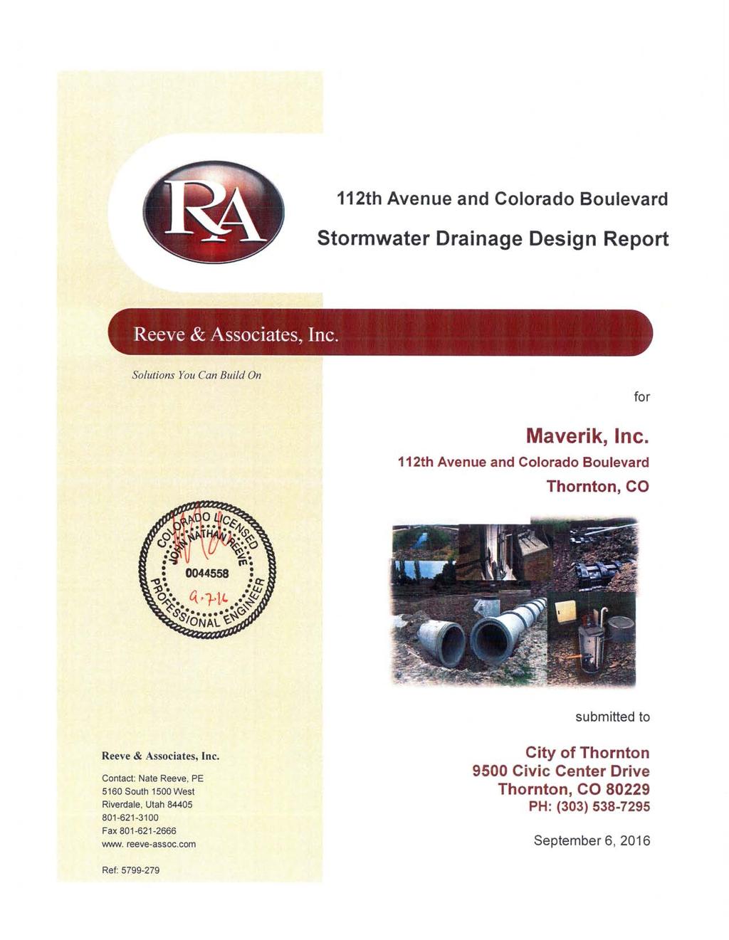
2 September 6, 2016 City of Thornton 9500 Civic Center Drive Thornton, CO (303) RE: Maverik Thornton, CO - Drainage Report As per your request, we are submitting to you the drainage report and calculations of the drainage design for the Maverik located at 112 th Avenue and Colorado Blvd in Thornton, CO. The storm water generated onsite will sheet flow to newly installed inlet boxes. The inlet boxes are equipped with a sump and snout that will filter the storm water from hydrocarbons and other pollutants. After passing through the filtration process, the storm water will be directed to an above ground open detention basin that has been sized for the WQCV, EURV, and 100-year volume per USDCM and City of Thornton criteria. Once the storm water is in the detention system, it will be gravity fed towards a control box that is equipped with an orifice plate that has been sized to control the outflow at rates of 0.10 cfs for WQCV, 0.20 cfs for EURV, and 5.20 cfs for the 100-yr volume. The storm water hydraulic and hydrology calculations including the basin sizing and orifice plate are discussed in this report. If you have any questions, or we can be of further assistance, please let us know. Sincerely, Nate Reeve, P.E. Principal Engineer Reeve & Associates, Inc. nreeve@reeve-assoc.com Anna Newman, E.I.T. Project Engineer Reeve & Associates, Inc. anewman@reeve-assoc.com Solutions You Can Build On Civil Engineering / Land Planning / Structural Engineering / Landscape Architecture / Land Surveying 5160 South 1500 West Riverdale, Utah Tel: Fax: ogden@reeve-assoc.com Website:
3
4 Stormwater Drainage Design Report 1.0 Introduction 1.1 Purpose The purpose of this drainage report is to reflect proposed changes to the current drainage patterns associated with the proposed Maverik located on 112 th Avenue and Colorado Boulevard in Thornton, CO. Proposed changes to the property include construction of a 5,518 sq. ft. Maverik convenience store with fuel pumps and associated utility service connections. The detention basin and associated facilities have been designed for a full build-out scenario. 1.2 General Property Description At the request of Thornton City, Reeve & Associates has prepared the following Storm Drainage Design Report for the proposed Maverik located on 112 th Avenue and Colorado Boulevard in Thornton, Colorado. The site is located in the northwest quarter of section 7, township 2 south, and range 67 west. Figure 1 in the Appendix contains a general location map that shows the proposed location and surrounding properties. A private storm sewer system will collect stormwater runoff from the proposed development. The storm sewer system will discharge into a private detention pond located on the south end of the property. An outlet pipe from the detention pond will outlet to the public right of way located along the east side of Colorado Boulevard. 1.3 Pre-developed Drainage Characteristics The existing site is currently undeveloped and consists mostly of dry weeds and sandy loam with the soil type being C/D. The existing runoff from this property is one basin(ex-1) and sheet flows to the south west and out the access of the adjacent property owner as outlined in this section and depicted on the predevelopment drainage plan located in the Appendix; with design point Z being the outfall of the basin. The property is bordered to the north by 112 th Avenue to the west by Colorado Boulevard, to the south by commercial developments (Conoco Gas Station), and to the east by a baseball field and church. The pre-developed stormwater runoff leaves the site without the use of engineered quality or detention facilities. 4
5 Stormwater Drainage Design Report 1.4 Post-developed Drainage Characteristics The proposed site will operate as a Maverik Convenience Store with vehicle fueling stations. The entire parcel sits on 3.04 acres. The site will contain 54,208 s.f. of hard surface area, 54,208 s.f. of landscaped area and 5,518 s.f. of building area. The proposed grading will divide the site into eleven drainage basins and seven design points as outlined in this section and depicted on the developed drainage plan located in the Appendix. Basin R-1 encompasses 0.12 acres of landscape between the onsite curb and gutter and the adjacent property owner to the east. Stormwater generated in this basin will sheet flow undetained to the east and then to the south and follow its historical pattern into Colorado Blvd. Basin R-2 encompasses 0.24 acres of landscape and a small area of sidewalk between the onsite curb and gutter and Colorado Boulevard right of way. Stormwater generated in this basin will sheet flow undetained into the curb and gutter within the right-of-way and into the southwest corner of the lot and into Colorado Blvd. Basin R-3 encompasses 0.14 acres of landscape to the south of the property and in between the adjacent property owner to the south. Stormwater generated in this basin will sheet flow undetained into the right-of-way and into the southwest corner of the lot and into Colorado Blvd. Basin R-4 encompasses 0.10 acres of asphalt paving on the southwest corner of the lot. Stormwater generated in this basin will sheet flow undetained into the curb and gutter within the right-of-way in Colorado Blvd. Basin B-1 encompasses 0.31 acres of parking and drive aisles of the proposed convenience store. Stormwater generated in this basin will sheet flow to a low point on the curb with an inlet box titled A. The water will be conveyed by a private storm sewer system to the private detention pond. Basin B-2 encompasses 0.15 acres of parking, drive aisles and building from the proposed convenience store. Stormwater generated in this basin will sheet flow to a low point on the curb with an inlet box titled A. The water will be conveyed by a private storm sewer system to the private detention pond. Basin B-3 encompasses 0.32 acres of parking, drive aisles and landscape of the proposed convenience store. Stormwater generated in this basin will sheet flow to a low point on curb with an inlet box titled B. The water will be conveyed by a private storm sewer system to the private detention pond. 5
6 Stormwater Drainage Design Report Basin B-4 encompasses 0.10 acres of parking, drive aisles, building and landscape of the proposed convenience store. Stormwater generated in this basin will sheet flow to a low point on curb with an inlet box titled C. The water will be conveyed by a private storm sewer system to the private detention pond. Basin B-5 encompasses 0.30 acres of parking and drive aisles. Stormwater generated in this basin will sheet flow to a low point on curb with an inlet box titled E. The water will be conveyed by a private storm sewer system to the private detention pond. Basin B-6 encompasses 0.67 acres of parking and drive aisles and landscape for the proposed convenience store. Stormwater generated in this basin will sheet flow to a low point on curb with an inlet box titled D. The water will be conveyed by a private storm sewer system to the private detention pond. Basin B-7 encompasses 0.53 acres of detention pond. This has been sized to detain the 100-year storm event per COT code with an outlet structure and orifice plates for the WQCV, EURV and 100-year storm event. It will be landscaped per COT code. Pipe P1 conveys the stormwater from Basin B-1 from the inlet box A. This pipe also carries the water from Basin B-2. Pipe P2 conveys the stormwater from Basin B-3 from the inlet box B. Pipe P3 conveys the stormwater from Basin B-4 from the inlet box C. This pipe also carries the water from Basin B-3, B-2 and B-1. Pipe P4 conveys the stormwater from B-6 from the inlet box D. This pipe also carries the water from Basin B-4, B-3, B-2 and B-1. Pipe P5 conveys the stormwater from B-5 from the inlet box E. This pipe also carries the water from Basin B-6, B-4, B-3, B-2 and B-1. Pipe P6 conveys the stormwater from B-7, the detention pond. Ultimately, all storm water runoff from this site is conveyed to the South Platte River. Once completed, 0.65 cfs and 1.17 cfs will exit the site untreated during the 5-yr and 100-yr storms respectively with the majority of it passing through landscape areas. The remaining storm water from hard surface areas will be directed to a private detention pond that is sized for the WQCV, EURV and 100- yr volumes. It will release 0.3 cfs and 5.20 cfs into the Colorado Blvd right-ofway during the 5-year and 100-year storm events respectively. 6
7 Stormwater Drainage Design Report 1.5 Water Quality Post-development stormwater runoff will be collected via curb and gutter and private combination curb inlets throughout the property. A private storm sewer system will convey storm water flows to the private detention pond facility located along the northeast property line. The detention pond will provide storage for the water quality capture volume of acre-feet or 3,659 c.f. with a water surface elevation of and the EURV storage has also been provided with a volume of acre-feet or 7,318 c.f. with an elevation of An outlet structure within the detention pond will provide water quality and staged release of stored stormwater that meets the City of Thornton Storm Drainage Design requirements. Because the 5-yr, and 100-yr design storm event developed flows are larger than the pre-developed site runoff totals, the detention pond outlet structure also reduces the release rates of the post-developed flows to the pre-developed rates. The pond will provide storage for the 5-yr design storm event and the water quality volume of acre-feet or 13,024 c.f. with a water surface elevation of The pond will also provide storage for the 100-yr, design storm event with a volume of acre-feet or 18,687 c.f. with a water surface elevation of During the 100-yr design storm event, the pond outlet structure will provide a release rate of 5.2 cfs which is less than the predeveloped outflow of 16.1 cfs provided the UD-Detention analysis of the detention pond volume. A private 15 RCP pipe will connect to the outlet structure and release into a sidewalk chase drain and into the curbline along the north side of Colorado Boulevard. See Hydraulic Calculations located in the Appendix for more details regarding detention pond design. 1.6 Hydrology Calculations The City of Thornton Storm Drainage Design, Grading, and Water Quality Technical Criteria within the City of Thornton Standards and Specifications was used to perform hydrology calculations. The Rational Method has been used to compute storm water runoff, as preferred for drainage areas less than 100-acres. Design storms with the 5-yr, and 100-yr, occurrence intervals were used. Weighted or composite C values for the site were calculated using the following formula. 7
8 Stormwater Drainage Design Report 5-year, and 100-yr, flows for the proposed site are summarized in the Appendix. Table 1 shows a comparison between pre-development discharges and postdevelopment discharges from the project site. Tablie 1: Peak Discharge Comparison Pre-Development Discharge (cfs) Post-Development Discharge (cfs) Discharge Difference (cfs) Q5 Colorado Blvd Q100 Colorado Blvd Pipe and inlet capacity calculations were performed at each design point as shown on the drainage plan. Storm sewer for this project was designed to convey the required 10-yr storm even with a surcharge hydraulic grade line not less than one foot below finished grade. Hydrologic and hydraulic calculations are located in the Appendix. All assumptions shall be field verified by the contractor prior to commencing construction, and discrepancies shall be reported to the engineer immediately for review. 1.7 Floodplain Statement According to the Federal Emergency Management Agency (FEMA), as depictured on Flood Insurance Rate Map (FIRM) 08001C0314H with an effective date of March 5, 2007, the site lies within areas determined to be outside the 500- year floodplain. 1.8 Erosion Control It is respectfully requested that an erosion control plan be submitted in conjunction with the final grading plan and not be required to be submitted with this drainage report. Erosion control will be implemented in 2 phases. Phase 1 is during construction and Phase 2 is post-construction. 8
9 Stormwater Drainage Design Report Phase 1 erosion control components include the following. Two 25 x 20 construction entrances with 8 compacted clean gravel will be placed at the construction accesses to reduce amounts of sediment tracked onto roadways. A concrete wash area will be placed on site to contain concrete waste. A silt fence will be placed at the perimeter of the site as a dust control measure. A temporary drainage ditch will be created prior to installation of infrastructure to provide a path for storm water and prevent runoff to adjacent property. Inlet protection bmps will be implemented at all inlets to prevent sediment from entering storm drain system. In addition to these components, streets will be swept within 1,000 feet of construction entrances daily if necessary. Phase 2 erosion control components include a snout and sump filter on strategically placed inlet box and extended detention basin. Snout and sump filter will be placed on inlet box that directly outlets to detention basin to filter hydrocarbons and other contaminants from entering the detention basin. Extended detention basin provides water quality volume as well as EURV. 1.9 Summary Developed runoff generated from the project site during the 100-yr. design storm event are anticipated to be less than or equal to the pre-developed runoff rates. Prior to being released off-site, runoff will be treated via a private detention pond and water quality facility, while a small percentage of the site s runoff will discharge (un-detained) to the adjacent right-of-way or adjacent properties. Downstream of the detention pond, a private 15 RCP pipe and sidewalk chase drain will convey treated runoff into the Colorado Boulevard right of way. A series of private combination inlets will collect runoff in multiple locations on site and convey the runoff to the proposed private detention pond east of the Maverik building. The storm sewer has been designed to handle developed flows in the required 10-yr. design storm event condition within minimal surcharge. Since the site s anticipated developed runoff rate is less than the allowed predevelopment runoff rate, development on this site as described in the enclosed drainage plan is not anticipated to adversely impact downstream stormwater infrastructure. Upon the completion of construction, if conditions or outfall locations differ from the assumptions stated within this drainage study, an amendment to this report must be completed. Maverik Inc. will be responsible for any maintenance on the drainage facilities. 9
10 Stormwater Drainage Design Report APPENDIX 10

11 Stormwater Drainage Design Report Figure 1 Vicinity Map 12 th Avenue and Colorado Boulevard Project Site The project site is located at 112 th Avenue and Colorado Boulevard.in Thornton, CO. 11
12 12 Stormwater Drainage Design Report

13 13 Stormwater Drainage Design Report

14 14 Stormwater Drainage Design Report

15 15 Stormwater Drainage Design Report
16 16 Stormwater Drainage Design Report
17 17 Stormwater Drainage Design Report
18 18 Stormwater Drainage Design Report
19 19 Stormwater Drainage Design Report
20 20 Stormwater Drainage Design Report
21 21 Stormwater Drainage Design Report
22 22 Stormwater Drainage Design Report
23 23 Stormwater Drainage Design Report
24 24 Stormwater Drainage Design Report
25 25 Stormwater Drainage Design Report
26 26 Stormwater Drainage Design Report
27 27 Stormwater Drainage Design Report
28 28 Stormwater Drainage Design Report
29 29 Stormwater Drainage Design Report
30 30 Stormwater Drainage Design Report
31 31 Stormwater Drainage Design Report
32 32 Stormwater Drainage Design Report
33 33 Stormwater Drainage Design Report
34 Storm Runoff Calculations Maverik, Inc 112th Avenue & Colorado Boulevard 9/6/2016 TJH Basin Designation EX-1 Composite 'C' Factors - Pre & Post-Development GRASS ROOFS PAVEMENT GRAVEL COMPOSITE C FACTOR Grass Roofs Paved Gravel Total 5-YR 10-YR 100-YR 5-YR 10-YR 100-YR 5-YR 10-YR 100-YR 5-YR 10-YR 100-YR 5-YR 10-YR 100-YR % IMPERVIOUS 0.00 R-1 R-2 R-3 R-4 B-1 B-2 B-3 B-4 B-5 B-6 B-7 * EX = existing * R = undetained * B = detained Basin Designation EX-1 Time of Concentration Slope C5 Acre Length (ft) Slope % Ti (min) Length (ft) Vel. (fps) Tt (min.) Total (ft/ft) R R R min. assumed R min. assumed B min. assumed B min. assumed B min. assumed B min. assumed B min. assumed B min. assumed B min. assumed * EX = existing * R = undetained * B = detained Design Point Z A B C E D * EX = existing * R = undetained * B = detained Design Storm: 5-Year Runoff Basin Area (ac) Coeff. (c) Tc C*A I (in./hr.) Q (cfs) Sum Area Max (Tc) EX R-1 R-2 R-3 R-4 B-1 B-2 B-3 B-4 B-5 B-6 B Sum C*A Total Q (cfs) Passby Q (cfs)
35 Design Storm: 10-Year Runoff Design Point Basin Area (ac) Coeff. (c) Tc C*A I (in./hr.) Q (cfs) Sum Area Max (Tc) Sum C*A Total Q (cfs) EX Z R R R R A B B B B C B E B D B B * EX = existing * R = undetained * B = detained Design Point Basin EX-1 Z R-1 R-2 R-3 R-4 A B-1 B-2 B B-3 C B-4 E B-5 D B-6 B-7 Design Storm: 100-Year Runoff Area (ac) Coeff. (c) Tc C*A I (in./hr.) Q (cfs) Sum Area Max (Tc) Sum C*A Total Q (cfs) Passby Q (cfs) Sum Area Max (Tc) Sum C*A Total Q (cfs) A B-1 + B B B C B D B E B FOR PIPE CAPACITY CALCULATIONS P1 P2 P3 P4 P5 Sum Area (Tc) Sum C*A I (in./hr) P6 See UD-Detention Spreadsheet Total Q (cfs) Z post See UD-Detention Spreadsheet 5.20
36 Inlet Management Worksheet Protected INLET NAME Inlet A Inlet B Inlet C Inlet D Inlet E ed Site Type (Urban or Rural) URBAN URBAN URBAN URBAN URBAN Inlet Application (Street or Area) STREET STREET STREET STREET STREET Hydraulic Condition In Sump On Grade On Grade On Grade On Grade Inlet Type Denver No. 16 Combination Denver No. 16 Combination Denver No. 16 Combination Denver No. 16 Combination Denver No. 16 Combination USER-DEFINED INPUT User-Defined Design Flows Minor Q Known (cfs) Major Q Known (cfs) Bypass (Carry-Over) Flow from Upstream Receive Bypass Flow from: Minor Bypass Flow Received, Q b (cfs) Major Bypass Flow Received, Q b (cfs) No Bypass Flow Received No Bypass Flow Received No Bypass Flow Received Inlet B Inlet C Watershed Characteristics Subcatchment Area (acres) Percent Impervious NRCS Soil Type Watershed Profile Overland Slope (ft/ft) Overland Length (ft) Channel Slope (ft/ft) Channel Length (ft) Minor Storm Rainfall Input Design Storm Return Period, T r (years) One-Hour Precipitation, P 1 (inches) C 1 C 2 C 3 User-defined C User-defined 5-yr C 5 User-defined T c Major Storm Rainfall Input Design Storm Return Period, T r (years) One-Hour Precipitation, P 1 (inches) C 1 C 2 C 3 User-defined C User-defined 5-yr C 5 User-defined T c CALCULATED OUTPUT Minor Total Design Peak Flow, Q (cfs) Major Total Design Peak Flow, Q (cfs) Minor Flow Bypassed Downstream, Q b (cfs) Major Flow Bypassed Downstream, Q b (cfs) Minor Storm (Calculated) Analysis of Flow Time C C 5 Overland Flow Velocity, Vi Channel Flow Velocity, Vt Overland Flow Time, Ti Channel Travel Time, Tt Calculated Time of Concentration, T c T c (Equation 5-5 USDCM) Recommended T c T c selected by User Design Rainfall Intensity, I Calculated Local Peak Flow, Q p Major Storm (Calculated) Analysis of Flow Time C C 5 Overland Flow Velocity, Vi Channel Flow Velocity, Vt Overland Flow Time, Ti Channel Travel Time, Tt Calculated Time of Concentration, T c T c (Equation 5-5 USDCM) Recommended T c T c selected by User Design Rainfall Intensity, I Calculated Local Peak Flow, Q p N/A N/A N/A N/A N/A N/A N/A N/A N/A N/A N/A N/A N/A N/A N/A N/A N/A N/A N/A N/A N/A N/A N/A N/A N/A N/A N/A N/A N/A N/A N/A N/A N/A N/A N/A N/A N/A N/A N/A N/A N/A N/A N/A N/A N/A N/A N/A N/A N/A N/A N/A N/A N/A N/A N/A N/A N/A N/A N/A N/A N/A N/A N/A N/A N/A N/A N/A N/A N/A N/A N/A N/A N/A N/A N/A N/A N/A N/A N/A N/A N/A N/A N/A N/A N/A N/A N/A N/A N/A N/A N/A N/A N/A N/A N/A N/A N/A N/A N/A N/A N/A N/A N/A N/A N/A N/A N/A N/A N/A N/A N/A N/A N/A N/A N/A N/A N/A N/A N/A N/A N/A N/A
37 ALLOWABLE CAPACITY FOR ONE-HALF OF STREET (Minor & Major Storm) (Based on Regulated Criteria for Maximum Allowable Flow Depth and Spread) 112th Avenue & Colorado Boulevard Basin 1 Inlet at Design Point A Gutter Geometry (Enter data in the blue cells) Maximum Allowable Width for Spread Behind Curb T BACK = 0.0 ft Side Slope Behind Curb (leave blank for no conveyance credit behind curb) S BACK = ft/ft Manning's Roughness Behind Curb (typically between and 0.020) n BACK = Height of Curb at Gutter Flow Line H CURB = 6.00 inches Distance from Curb Face to Street Crown T CROWN = 40.0 ft Gutter Width W = 1.50 ft Street Transverse Slope S X = ft/ft Gutter Cross Slope (typically 2 inches over 24 inches or ft/ft) S W = ft/ft Street Longitudinal Slope - Enter 0 for sump condition S O = ft/ft Manning's Roughness for Street Section (typically between and 0.020) n STREET = Minor Storm Major Storm Max. Allowable Spread for Minor & Major Storm T MAX = ft Max. Allowable Depth at Gutter Flowline for Minor & Major Storm d MAX = inches Allow Flow Depth at Street Crown (leave blank for no) check = yes MINOR STORM Allowable Capacity is based on Depth Criterion Minor Storm Major Storm MAJOR STORM Allowable Capacity is based on Depth Criterion Q allow = SUMP SUMP cfs INLET IN A SUMP OR SAG LOCATION Lo (C) H-Curb W W P H-Vert Wo Lo (G) Design Information (Input) MINOR MAJOR Denver No. 16 Combination Type of Inlet Type = Denver No. 16 Combination Local Depression (additional to continuous gutter depression 'a' from 'Q-Allow') a local = inches Number of Unit Inlets (Grate or Curb Opening) No = 1 1 Water Depth at Flowline (outside of local depression) Ponding Depth = inches Grate Information MINOR MAJOR Override Depths Length of a Unit Grate L o (G) = feet Width of a Unit Grate W o = feet Area Opening Ratio for a Grate (typical values ) A ratio = Clogging Factor for a Single Grate (typical value ) C f (G) = Grate Weir Coefficient (typical value ) C w (G) = Grate Orifice Coefficient (typical value ) C o (G) = Curb Opening Information MINOR MAJOR Length of a Unit Curb Opening L o (C) = feet Height of Vertical Curb Opening in Inches H vert = inches Height of Curb Orifice Throat in Inches H throat = inches Angle of Throat (see USDCM Figure ST-5) Theta = degrees Side Width for Depression Pan (typically the gutter width of 2 feet) W p = feet Clogging Factor for a Single Curb Opening (typical value 0.10) C f (C) = Curb Opening Weir Coefficient (typical value ) C w (C) = Curb Opening Orifice Coefficient (typical value ) C o (C) = Low Head Performance Reduction (Calculated) MINOR MAJOR Depth for Grate Midwidth d Grate = ft Depth for Curb Opening Weir Equation d Curb = ft Combination Inlet Performance Reduction Factor for Long Inlets RF Combination = Curb Opening Performance Reduction Factor for Long Inlets RF Curb = Grated Inlet Performance Reduction Factor for Long Inlets RF Grate = MINOR MAJOR Total Inlet Interception Capacity (assumes clogged condition) Q a = cfs Inlet Capacity IS GOOD for Minor and Major Storms(>Q PEAK) Q PEAK REQUIRED = cfs Copy of UD-Inlet_v4.03.xlsm, Inlet A 9/7/2016, 10:45 AM
38 Project: Inlet ID: ALLOWABLE CAPACITY FOR ONE-HALF OF STREET (Minor & Major Storm) (Based on Regulated Criteria for Maximum Allowable Flow Depth and Spread) 112th Avenue & Colorado Boulevard Inlet B Gutter Geometry (Enter data in the blue cells) Maximum Allowable Width for Spread Behind Curb T BACK = 0.0 ft Side Slope Behind Curb (leave blank for no conveyance credit behind curb) S BACK = ft/ft Manning's Roughness Behind Curb (typically between and 0.020) n BACK = Height of Curb at Gutter Flow Line H CURB = 6.00 inches Distance from Curb Face to Street Crown T CROWN = 40.0 ft Gutter Width W = 1.50 ft Street Transverse Slope S X = ft/ft Gutter Cross Slope (typically 2 inches over 24 inches or ft/ft) S W = ft/ft Street Longitudinal Slope - Enter 0 for sump condition S O = ft/ft Manning's Roughness for Street Section (typically between and 0.020) n STREET = Minor Storm Major Storm Max. Allowable Spread for Minor & Major Storm T MAX = ft Max. Allowable Depth at Gutter Flowline for Minor & Major Storm d MAX = inches Allow Flow Depth at Street Crown (leave blank for no) check = yes MINOR STORM Allowable Capacity is based on Spread Criterion Minor Storm Major Storm MAJOR STORM Allowable Capacity is based on Spread Criterion Q allow = cfs Minor storm max. allowable capacity GOOD - greater than the design flow given on sheet 'Inlet Management' Major storm max. allowable capacity GOOD - greater than the design flow given on sheet 'Inlet Management' INLET ON A CONTINUOUS GRADE Design Information (Input) MINOR MAJOR Denver No. 16 Combination Type of Inlet Type = Denver No. 16 Combination Local Depression (additional to continuous gutter depression 'a') a LOCAL = inches Total Number of Units in the Inlet (Grate or Curb Opening) No = 1 1 Warning 1 Length of a Single Unit Inlet (Grate or Curb Opening) L o = ft Warning 1 Width of a Unit Grate (cannot be greater than W, Gutter Width) W o = ft Clogging Factor for a Single Unit Grate (typical min. value = 0.5) C f -G = Clogging Factor for a Single Unit Curb Opening (typical min. value = 0.1) C f -C = Street Hydraulics: OK - Q < Allowable Street Capacity' MINOR MAJOR Total Inlet Interception Capacity Q = cfs Total Inlet Carry-Over Flow (flow bypassing inlet) Q b = cfs Capture Percentage = Q a /Q o = C% = % Warning 1: Dimension entered is not a typical dimension for inlet type specified. Copy of UD-Inlet_v4.03.xlsm, Inlet B 9/7/2016, 10:45 AM
39 Project: Inlet ID: ALLOWABLE CAPACITY FOR ONE-HALF OF STREET (Minor & Major Storm) (Based on Regulated Criteria for Maximum Allowable Flow Depth and Spread) 112th Avenue & Colorado Boulevard Inlet C Gutter Geometry (Enter data in the blue cells) Maximum Allowable Width for Spread Behind Curb T BACK = 0.0 ft Side Slope Behind Curb (leave blank for no conveyance credit behind curb) S BACK = ft/ft Manning's Roughness Behind Curb (typically between and 0.020) n BACK = Height of Curb at Gutter Flow Line H CURB = 6.00 inches Distance from Curb Face to Street Crown T CROWN = 10.0 ft Gutter Width W = 1.50 ft Street Transverse Slope S X = ft/ft Gutter Cross Slope (typically 2 inches over 24 inches or ft/ft) S W = ft/ft Street Longitudinal Slope - Enter 0 for sump condition S O = ft/ft Manning's Roughness for Street Section (typically between and 0.020) n STREET = Minor Storm Major Storm Max. Allowable Spread for Minor & Major Storm T MAX = ft Max. Allowable Depth at Gutter Flowline for Minor & Major Storm d MAX = inches Allow Flow Depth at Street Crown (leave blank for no) check = yes MINOR STORM Allowable Capacity is based on Spread Criterion Minor Storm Major Storm MAJOR STORM Allowable Capacity is based on Spread Criterion Q allow = cfs Minor storm max. allowable capacity GOOD - greater than the design flow given on sheet 'Inlet Management' Major storm max. allowable capacity GOOD - greater than the design flow given on sheet 'Inlet Management' INLET ON A CONTINUOUS GRADE Design Information (Input) MINOR MAJOR Denver No. 16 Combination Type of Inlet Type = Denver No. 16 Combination Local Depression (additional to continuous gutter depression 'a') a LOCAL = inches Total Number of Units in the Inlet (Grate or Curb Opening) No = 1 1 Warning 1 Length of a Single Unit Inlet (Grate or Curb Opening) L o = ft Warning 1 Width of a Unit Grate (cannot be greater than W, Gutter Width) W o = ft Clogging Factor for a Single Unit Grate (typical min. value = 0.5) C f -G = Clogging Factor for a Single Unit Curb Opening (typical min. value = 0.1) C f -C = Street Hydraulics: OK - Q < Allowable Street Capacity' MINOR MAJOR Total Inlet Interception Capacity Q = cfs Total Inlet Carry-Over Flow (flow bypassing inlet) Q b = cfs Capture Percentage = Q a /Q o = C% = % Warning 1: Dimension entered is not a typical dimension for inlet type specified. Copy of UD-Inlet_v4.03.xlsm, Inlet C 9/7/2016, 10:46 AM
40 Project: Inlet ID: ALLOWABLE CAPACITY FOR ONE-HALF OF STREET (Minor & Major Storm) (Based on Regulated Criteria for Maximum Allowable Flow Depth and Spread) 112th Avenue & Colorado Boulevard Inlet D Gutter Geometry (Enter data in the blue cells) Maximum Allowable Width for Spread Behind Curb T BACK = 0.0 ft Side Slope Behind Curb (leave blank for no conveyance credit behind curb) S BACK = ft/ft Manning's Roughness Behind Curb (typically between and 0.020) n BACK = Height of Curb at Gutter Flow Line H CURB = 6.00 inches Distance from Curb Face to Street Crown T CROWN = 40.0 ft Gutter Width W = 1.50 ft Street Transverse Slope S X = ft/ft Gutter Cross Slope (typically 2 inches over 24 inches or ft/ft) S W = ft/ft Street Longitudinal Slope - Enter 0 for sump condition S O = ft/ft Manning's Roughness for Street Section (typically between and 0.020) n STREET = Minor Storm Major Storm Max. Allowable Spread for Minor & Major Storm T MAX = ft Max. Allowable Depth at Gutter Flowline for Minor & Major Storm d MAX = inches Allow Flow Depth at Street Crown (leave blank for no) check = yes MINOR STORM Allowable Capacity is based on Spread Criterion Minor Storm Major Storm MAJOR STORM Allowable Capacity is based on Depth Criterion Q allow = cfs Minor storm max. allowable capacity GOOD - greater than the design flow given on sheet 'Inlet Management' Major storm max. allowable capacity GOOD - greater than the design flow given on sheet 'Inlet Management' INLET ON A CONTINUOUS GRADE Design Information (Input) MINOR MAJOR Denver No. 16 Combination Type of Inlet Type = Denver No. 16 Combination Local Depression (additional to continuous gutter depression 'a') a LOCAL = inches Total Number of Units in the Inlet (Grate or Curb Opening) No = 1 1 Warning 1 Length of a Single Unit Inlet (Grate or Curb Opening) L o = ft Warning 1 Width of a Unit Grate (cannot be greater than W, Gutter Width) W o = ft Clogging Factor for a Single Unit Grate (typical min. value = 0.5) C f -G = Clogging Factor for a Single Unit Curb Opening (typical min. value = 0.1) C f -C = Street Hydraulics: OK - Q < Allowable Street Capacity' MINOR MAJOR Total Inlet Interception Capacity Q = cfs Total Inlet Carry-Over Flow (flow bypassing inlet) Q b = cfs Capture Percentage = Q a /Q o = C% = % Warning 1: Dimension entered is not a typical dimension for inlet type specified. Copy of UD-Inlet_v4.03.xlsm, Inlet D 9/7/2016, 10:46 AM
41 Project: Inlet ID: ALLOWABLE CAPACITY FOR ONE-HALF OF STREET (Minor & Major Storm) (Based on Regulated Criteria for Maximum Allowable Flow Depth and Spread) 112th Avenue & Colorado Boulevard Inlet E Gutter Geometry (Enter data in the blue cells) Maximum Allowable Width for Spread Behind Curb T BACK = 0.0 ft Side Slope Behind Curb (leave blank for no conveyance credit behind curb) S BACK = ft/ft Manning's Roughness Behind Curb (typically between and 0.020) n BACK = Height of Curb at Gutter Flow Line H CURB = 6.00 inches Distance from Curb Face to Street Crown T CROWN = 20.0 ft Gutter Width W = 1.50 ft Street Transverse Slope S X = ft/ft Gutter Cross Slope (typically 2 inches over 24 inches or ft/ft) S W = ft/ft Street Longitudinal Slope - Enter 0 for sump condition S O = ft/ft Manning's Roughness for Street Section (typically between and 0.020) n STREET = Minor Storm Major Storm Max. Allowable Spread for Minor & Major Storm T MAX = ft Max. Allowable Depth at Gutter Flowline for Minor & Major Storm d MAX = inches Allow Flow Depth at Street Crown (leave blank for no) check = yes MINOR STORM Allowable Capacity is based on Spread Criterion Minor Storm Major Storm MAJOR STORM Allowable Capacity is based on Spread Criterion Q allow = cfs Minor storm max. allowable capacity GOOD - greater than the design flow given on sheet 'Inlet Management' Major storm max. allowable capacity GOOD - greater than the design flow given on sheet 'Inlet Management' INLET ON A CONTINUOUS GRADE Design Information (Input) MINOR MAJOR Denver No. 16 Combination Type of Inlet Type = Denver No. 16 Combination Local Depression (additional to continuous gutter depression 'a') a LOCAL = inches Total Number of Units in the Inlet (Grate or Curb Opening) No = 1 1 Warning 1 Length of a Single Unit Inlet (Grate or Curb Opening) L o = ft Warning 1 Width of a Unit Grate (cannot be greater than W, Gutter Width) W o = ft Clogging Factor for a Single Unit Grate (typical min. value = 0.5) C f -G = Clogging Factor for a Single Unit Curb Opening (typical min. value = 0.1) C f -C = Street Hydraulics: OK - Q < Allowable Street Capacity' MINOR MAJOR Total Inlet Interception Capacity Q = cfs Total Inlet Carry-Over Flow (flow bypassing inlet) Q b = cfs Capture Percentage = Q a /Q o = C% = % Warning 1: Dimension entered is not a typical dimension for inlet type specified. Copy of UD-Inlet_v4.03.xlsm, Inlet E 9/7/2016, 10:46 AM
42 DETENTION BASIN STAGE-STORAGE TABLE BUILDER Project: 112th Ave & Colorado Blvd Basin ID: Detention Basin Depth Increment = 0.2 ft Optional Optional Example Zone Configuration (Retention Pond) Stage - Storage Stage Override Length Width Area Override Area Volume Volume Description (ft) Stage (ft) (ft) (ft) (ft^2) Area (ft^2) (acre) (ft^3) (ac-ft) Required Volume Calculation Micropool Selected BMP Type = EDB ISV Watershed Area = 3.37 acres Watershed Length = 556 ft Watershed Slope = ft/ft Watershed Imperviousness = 75.00% percent Percentage Hydrologic Soil Group A = 0.0% percent , Percentage Hydrologic Soil Group B = 15.0% percent , Percentage Hydrologic Soil Groups C/D = 85.0% percent , , Desired WQCV Drain Time = 40.0 hours , , Location for 1-hr Rainfall Depths = Thornton - Thornton City Office , , Water Quality Capture Volume (WQCV) = acre-feet Optional User Input Zone 1 (WQCV) , , Excess Urban Runoff Volume (EURV) = acre-feet 1-hr Precipitation , , yr Runoff Volume (P1 = 0.95 in.) = acre-feet inches , , yr Runoff Volume (P1 = 1.35 in.) = acre-feet inches , , yr Runoff Volume (P1 = 1.61 in.) = acre-feet inches Zone 2 (EURV) , , yr Runoff Volume (P1 = 2.03 in.) = acre-feet inches Floor , , yr Runoff Volume (P1 = 2.32 in.) = acre-feet inches , , yr Runoff Volume (P1 = 2.66 in.) = acre-feet inches , , yr Runoff Volume (P1 = 3.33 in.) = acre-feet inches Zone 3 (100-year) , , Approximate 2-yr Detention Volume = acre-feet , , Approximate 5-yr Detention Volume = acre-feet , , Approximate 10-yr Detention Volume = acre-feet , , Approximate 25-yr Detention Volume = acre-feet , , Approximate 50-yr Detention Volume = acre-feet , , Approximate 100-yr Detention Volume = acre-feet , , , , Stage-Storage Calculation , , Zone 1 Volume (WQCV) = acre-feet , , Zone 2 Volume (EURV - Zone 1) = acre-feet , , Zone 3 Volume (100-year - Zones 1 & 2) = acre-feet , , Total Detention Basin Volume = acre-feet , , Initial Surcharge Volume (ISV) = 11 ft^ , , Initial Surcharge Depth (ISD) = 0.33 ft , , Total Available Detention Depth (H total) = 3.04 ft , , Depth of Trickle Channel (H TC) = 0.50 ft , , Slope of Trickle Channel (S TC) = ft/ft , , Slopes of Main Basin Sides (S main) = 4 H:V , , Basin Length-to-Width Ratio (R L/W) = , , , , Initial Surcharge Area (A ISV) = 33 ft^ , , Surcharge Volume Length (L ISV) = 5.8 ft , , Surcharge Volume Width (W ISV) = 5.8 ft , , Depth of Basin Floor (H FLOOR) = 1.86 ft , , Length of Basin Floor (L FLOOR) = ft , , Width of Basin Floor (W FLOOR) = 57.3 ft , , Area of Basin Floor (A FLOOR) = 18,481 ft^ , , Volume of Basin Floor (V FLOOR) = 11,937 ft^ , , Depth of Main Basin (H MAIN) = 0.35 ft , , Length of Main Basin (L MAIN) = ft , , Width of Main Basin (W MAIN) = 60.2 ft , , Area of Main Basin (A MAIN) = 19,566 ft^ , , Volume of Main Basin (V MAIN) = 6,743 ft^ , , Calculated Total Basin Volume (V total) = acre-feet , , , , , , , , , , , , , , , , , , , , , , , , , , , , , , , , , , , , , , , , , , , , , , , , , , , , , , UD-Detention_v3.02.xlsm, Basin 7/26/2016, 1:26 PM
43 Area (acres) Volume (ac-ft) Length, Width (ft.) Area (sq.ft.) DETENTION BASIN STAGE-STORAGE TABLE BUILDER User Defined Stage-Area Boolean for Message 0 Equal Stage-Area Inputs Watershed L:W 1 CountA Calc_S_TC 1.86 H_FLOOR L_FLOOR_OTHER 0.33 ISV 0.33 ISV Floor 2.04 Zone 1 (WQCV) 2.04 Zone 1 (WQCV) 2.62 Zone 2 (EURV) 2.62 Zone 2 (EURV) 2.69 Floor 3.05 Zone 3 (100-yea 3.05 Zone 3 (100-year) Stage (ft) Length (ft) Width (ft) Area (sq.ft.) Stage (ft.) Area (acres) Volume (ac-ft) UD-Detention_v3.02.xlsm, Basin 7/26/2016, 1:26 PM
 2.62 0.168 Orifice Plate Zone 3 (100-year) 3.05 0.186 Weir&Pipe (Restrict) Example Zone Configuration (Retention Pond) 0.")
44 Detention Basin Outlet Structure Design Project: 88th & Pecos Maverik Fueling Station Basin ID: Full Build-Out Detention Basin Stage (ft) Zone Volume (ac-ft) Outlet Type Zone 1 (WQCV) Orifice Plate Zone 2 (EURV) Orifice Plate Zone 3 (100-year) Weir&Pipe (Restrict) Example Zone Configuration (Retention Pond) Total 24 User Input: Orifice at Underdrain Outlet (typically used to drain WQCV in a Filtration BMP) Calculated Parameters for Underdrain Underdrain Orifice Invert Depth = N/A ft (distance below the filtration media surface) Underdrain Orifice Area = N/A ft 2 Underdrain Orifice Diameter = N/A inches Underdrain Orifice Centroid = N/A feet User Input: Orifice Plate with one or more orifices or Elliptical Slot Weir (typically used to drain WQCV and/or EURV in a sedimentation BMP) Calculated Parameters for Plate Invert of Lowest Orifice = 0.00 ft (relative to bottom of basin at Stage = 0 ft) WQ Orifice Area per Row = N/A ft 2 Depth at top of Zone using Orifice Plate = 2.62 ft (relative to bottom of basin at Stage = 0 ft) Elliptical Half-Width = N/A feet Orifice Plate: Orifice Vertical Spacing = N/A inches Elliptical Slot Centroid = N/A feet Orifice Plate: Orifice Area per Row = N/A inches Elliptical Slot Area = N/A ft 2 User Input: Stage and Total Area of Each Orifice Row (numbered from lowest to highest) Row 1 (required) Row 2 (optional) Row 3 (optional) Row 4 (optional) Row 5 (optional) Row 6 (optional) Row 7 (optional) Row 8 (optional) Stage of Orifice Centroid (ft) Orifice Area (sq. inches) Stage of Orifice Centroid (ft) Orifice Area (sq. inches) Row 9 (optional) Row 10 (optional) Row 11 (optional) Row 12 (optional) Row 13 (optional) Row 14 (optional) Row 15 (optional) Row 16 (optional) User Input: Vertical Orifice (Circular or Rectangular) Calculated Parameters for Vertical Orifice Not Selected Not Selected Not Selected Not Selected Invert of Vertical Orifice = N/A N/A ft (relative to bottom of basin at Stage = 0 ft) Vertical Orifice Area = N/A N/A ft 2 Depth at top of Zone using Vertical Orifice = N/A N/A ft (relative to bottom of basin at Stage = 0 ft) Vertical Orifice Centroid = N/A N/A feet Vertical Orifice Diameter = N/A N/A inches User Input: Overflow Weir (Dropbox) and Grate (Flat or Sloped) Calculated Parameters for Overflow Weir Zone 3 Weir Not Selected Zone 3 Weir Not Selected Overflow Weir Front Edge Height, Ho = 2.62 N/A ft (relative to bottom of basin at Stage = 0 ft) Height of Grate Upper Edge, H t = 3.05 N/A feet Overflow Weir Front Edge Length = 6.00 N/A feet Over Flow Weir Slope Length = 6.02 N/A feet Overflow Weir Slope = N/A H:V (enter zero for flat grate) Grate Open Area / 100-yr Orifice Area = N/A should be > 4 Horiz. Length of Weir Sides = 6.00 N/A feet Overflow Grate Open Area w/o Debris = N/A ft 2 Overflow Grate Open Area % = 70% N/A %, grate open area / total area Overflow Grate Open Area with Debris = N/A ft 2 Debris Clogging % = 50% N/A % User Input: Outlet Pipe w/ Flow Restriction Plate (Circular Orifice, Restrictor Plate, or Rectangular Orifice) Calculated Parameters for Outlet Pipe w/ Flow Restriction Plate Zone 3 Restrictor Not Selected Zone 3 Restrictor Not Selected Depth to Invert of Outlet Pipe = 0.00 N/A ft (distance below bottom of basin at Stage = 0 ft) Outlet Orifice Area = 0.63 N/A ft 2 Outlet Pipe Diameter = N/A inches Outlet Orifice Centroid = 0.41 N/A feet Restrictor Plate Height Above Pipe Invert = 9.00 inches Half-Central Angle of Restrictor Plate on Pipe = 2.09 N/A radians User Input: Emergency Spillway (Rectangular or Trapezoidal) Calculated Parameters for Spillway Spillway Invert Stage= 3.10 ft (relative to bottom of basin at Stage = 0 ft) Spillway Design Flow Depth= 0.66 feet Spillway Crest Length = 8.00 feet Stage at Top of Freeboard = 4.76 feet Spillway End Slopes = 4.00 H:V Basin Area at Top of Freeboard = 0.58 acres Freeboard above Max Water Surface = 1.00 feet Routed Hydrograph Results Design Storm Return Period = WQCV EURV 2 Year 5 Year 10 Year 25 Year 50 Year 100 Year 500 Year One-Hour Rainfall Depth (in) = Calculated Runoff Volume (acre-ft) = OPTIONAL Override Runoff Volume (acre-ft) = Inflow Hydrograph Volume (acre-ft) = Predevelopment Unit Peak Flow, q (cfs/acre) = Predevelopment Peak Q (cfs) = Peak Inflow Q (cfs) = Peak Outflow Q (cfs) = Ratio Peak Outflow to Predevelopment Q = N/A N/A N/A Structure Controlling Flow = Plate Plate Plate Overflow Grate 1 Overflow Grate 1 Overflow Grate 1 Overflow Grate 1 Outlet Plate 1 Spillway Max Velocity through Grate 1 (fps) = N/A N/A N/A Max Velocity through Grate 2 (fps) = N/A N/A N/A N/A N/A N/A N/A N/A N/A Time to Drain 97% of Inflow Volume (hours) = Time to Drain 99% of Inflow Volume (hours) = Maximum Ponding Depth (ft) = Area at Maximum Ponding Depth (acres) = Maximum Volume Stored (acre-ft) =
![AREA [ft^2], VOLUME [ft^3] OUTFLOW [cfs] PONDING DEPTH [ft] FLOW [cfs] Detention Basin Outlet Structure Design 25 20 15 10 5 500YR COUNTA IN for Basin Tab = 1 Ao Dia WQ Plate Type Vert Orifice 1 Vert](/docs-images/88/115899541/images/45-1.jpg "Orifice 2 500YR Count_Underdrain OUT = 0 0.11 eter = 3/8 inch) 2 1 1 100YR IN Count_WQPlate = 1 0.14 ter = 7/16 inch) 100YR OUT Count_VertOrifice1 = 0 0.")
45 AREA [ft^2], VOLUME [ft^3] OUTFLOW [cfs] PONDING DEPTH [ft] FLOW [cfs] Detention Basin Outlet Structure Design YR COUNTA IN for Basin Tab = 1 Ao Dia WQ Plate Type Vert Orifice 1 Vert Orifice 2 500YR Count_Underdrain OUT = eter = 3/8 inch) YR IN Count_WQPlate = ter = 7/16 inch) 100YR OUT Count_VertOrifice1 = eter = 1/2 inch) Outlet Plate 1 Outlet Plate 2 Drain Time Message Boolean 50YR IN Count_VertOrifice2 = ter = 9/16 inch) 4 1 5yr, <72hr 0 50YR OUT 25YR IN Count_Weir1 = eter = 5/8 inch) >5yr, <120hr 0 25YR OUT Count_Weir2 = er = 11/16 inch) Max Depth Row 10YR Count_OutletPipe1 IN = eter = 3/4 inch) WQCV 200 Watershed Constraint Check 10YR Count_OutletPipe2 OUT = er = 13/16 inch) 2 Year 244 Slope YR IN COUNTA_2 (Standard FSD Setup)= eter = 7/8 inch) EURV 259 Shape YR OUT MaxPondDepth_Error? FALSE 0.67 er = 15/16 inch) 5 Year 269 2YR IN Hidden Parameters & Calculations 0.76 meter = 1 inch) 10 Year 279 Spillway Depth 2YR OUT /16 inches) 25 Year EURV IN WQ Plate Flow at 100yr depth = = 1-1/8 inches) 50 Year 298 EURV OUT CLOG #1= 35% /16 inches) 100 Year Z1_Boolean WQCV IN C dw #1 = = 1-1/4 inches) 500 Year Z2_Boolean WQCV OUT C do #1 = /16 inches) Zone3_Pulldown Message 1 Z3_Boolean Overflow Weir #1 Angle = = 1-3/8 inches) 1 Opening Message CLOG #2= #VALUE! /16 inches) Draintime Running C dw #2 = #VALUE! 1.73 = 1-1/2 inches) Outlet Boolean Outlet Rank Total (1 to 4) C do #2 = #VALUE! /16 inches) Vertical Orifice Overflow Weir #2 Angle = #VALUE! 2.03 = 1-5/8 inches) Vertical Orifice Boolean Underdrain Q at 100yr depth = /16 inches) Overflow Weir Max Depth 0.1 VertOrifice1 Q at 100yr depth = = 1-3/4 inches) Overflow 1 Weir yr Depth 10 VertOrifice2 Q at 100yr depth = /16 inches) TIME [hr] Outlet Pipe Freeboard EURV_draintime_user = 2.72 = 1-7/8 inches) Outlet Pipe Spillway 3.5 Count_User_Hydrographs /16 inches) 0 Spillway Length 500YR CountA_3 (EURV & 100yr) = eter = 2 inches) Button Visibility Boolean 100YR CountA_4 (100yr Only) = gular openings) 1 Button_Trigger 50YR YR 10YR 5YR 2YR EURV WQCV 0 Underdrain 1 WQCV Plate 0 EURV-WQCV Plate 0 EURV-WQCV VertOrifice 1 Outlet 90% Qpeak 0 Outlet Undetained DRAIN TIME [hr] User Area [ft^2] 6, Interpolated Area [ft^2] Volume [ft^3] 5, Outflow [cfs] 4, , , , PONDING DEPTH [ft]
46 Detention Basin Outlet Structure Design Outflow Hydrograph Workbook Filename: Storm Inflow Hydrographs The user can override the calculated inflow hydrographs from this workbook with inflow hydrographs developed in a separate program. SOURCE WORKBOOK WORKBOOK WORKBOOK WORKBOOK WORKBOOK WORKBOOK WORKBOOK WORKBOOK WORKBOOK Time Interval TIME WQCV [cfs] EURV [cfs] 2 Year [cfs] 5 Year [cfs] 10 Year [cfs] 25 Year [cfs] 50 Year [cfs] 100 Year [cfs] 500 Year [cfs] 4.77 min 0:00: :04: Hydrograph 0:09: Constant 0:14: :19: :23: :28: :33: :38: :42: :47: :52: :57: :02: :06: :11: :16: :21: :25: :30: :35: :40: :44: :49: :54: :59: :04: :08: :13: :18: :23: :27: :32: :37: :42: :46: :51: :56: :01: :06: :10: :15: :20: :25: :29: :34: :39: :44: :49: :53: :58: :03: :08: :12: :17: :22: :27: :31: :36: :41: :46: :51: :55: :00: :05: :10: :14: :19: :24: :29: :33: :38: :43:


47 1 2 6/2/2015 7:10:47 AM A B C D 0" 1" 2" SEAL DATE STATUS DATE REVISION PROJECT NUMBER????? FILE DRAWN BY R. Hansen CHECKED BY J.Nate Reeve, P.E. SCALE As indicated PRE-DEVELOPED DRAINAGE PLAN THORNTON MAVERIK 112TH AVENUE & COLORADO BOULEVARD THORNTON, COLORADO PERMIT SET
48


49
Stormwater Drainage Design Report. Reeve & Associates, Inc. Maverik, Inc. 88th Avenue and Pecos Street. Thornton, CO
 88th Avenue and Pecos Street Stormwater Drainage Design Report Reeve & Associates, Inc. Solutions You Can Build On for Maverik, Inc. 88th Avenue and Pecos Street Thornton, CO submitted to Reeve & Associates,
EROSION CONTROL NARRATIVE
 EROSION CONTROL NARRATIVE Erosion and sediment control has been designed for the Willow Bend Phase I Subdivision according to UDFCD and the City of Thornton criteria, in order to minimize erosion and sediment
City of Thornton Attn: Tim Semones Development Engineeering 9500 Civic Center Dr. Thornton, CO 80229
 Development Engineering Land Surveying Construction Administration District Services October 20, 2017 City of Thornton Attn: Tim Semones Development Engineeering 9500 Civic Center Dr. Thornton, CO 80229
FINAL DRAINAGE REPORT Villages at Riverdale Carriage Homes Thornton, CO
 FINAL DRAINAGE REPORT Villages at Riverdale Carriage Homes Thornton, CO October 14, 2016 Revised: March 30, 2017 JN: 15096 Prepared for: PCS Group, Inc. 1001 16 th Street #3 B-180 Denver, CO 80265 P: 303.561.4905
EROSION CONTROL NARRATIVE
 EROSION CONTROL NARRATIVE Erosion and sediment control has been designed for the Willow Bend Phase I Subdivision according to UDFCD and the City of Thornton criteria, in order to minimize erosion and sediment
DRAINAGE REPORT FOR THORNTON SELF STORAGE THORNTON, COLORADO
 DRAINAGE REPORT FOR THORNTON SELF STORAGE THORNTON, COLORADO Prepared by: Bowman Consulting 603 Park Point Dr. Suite 100 Golden, CO 80401 (303)-801-2900 June 29, 2015 Revised August 14, 2015 CERTIFICATE
STREUVER FIDELCO CAPPELLI, LLC YONKERS DOWNTOWN DEVELOPMENT PHASE 1. DRAFT ENVIRONMENTAL IMPACT STATEMENT For: PALISADES POINT
 STREUVER FIDELCO CAPPELLI, LLC YONKERS DOWNTOWN DEVELOPMENT PHASE 1 DRAFT ENVIRONMENTAL IMPACT STATEMENT For: PALISADES POINT Prepared by: PAULUS, SOKOLOWSKI & SARTOR STORMWATER MANAGEMENT 1. Methodology
BROADSTONE VANTAGE POINT APARTMENTS NE corner of S. Parker Road, and E. Cottonwood Drive Parker, Colorado
 BROADSTONE VANTAGE POINT APARTMENTS NE corner of S. Parker Road, and E. Cottonwood Drive Parker, Colorado PRELIMINARY DRAINAGE REPORT Strategic Land Solutions, Inc. JN: 16-002-15 Report Date/History: July
ARTICLE 5 (PART 2) DETENTION VOLUME EXAMPLE PROBLEMS
 DETENTION VOLUME EXAMPLE PROBLEMS") ARTICLE 5 (PART 2) DETENTION VOLUME EXAMPLE PROBLEMS Example 5.7 Simple (Detention Nomograph) Example 5.8 Offsite and Unrestricted Areas (HEC-HMS) Example 5.9 Ponds in Series w/ Tailwater (HEC-HMS) Example
ARTICLE 5 (PART 2) DETENTION VOLUME EXAMPLE PROBLEMS Example 5.7 Simple (Detention Nomograph) Example 5.8 Offsite and Unrestricted Areas (HEC-HMS) Example 5.9 Ponds in Series w/ Tailwater (HEC-HMS) Example
INFLOW DESIGN FLOOD CONTROL SYSTEM PLAN 40 C.F.R. PART PLANT YATES ASH POND 2 (AP-2) GEORGIA POWER COMPANY
 GEORGIA POWER COMPANY") INFLOW DESIGN FLOOD CONTROL SYSTEM PLAN 40 C.F.R. PART 257.82 PLANT YATES ASH POND 2 (AP-2) GEORGIA POWER COMPANY EPA s Disposal of Coal Combustion Residuals from Electric Utilities Final Rule (40 C.F.R.
INFLOW DESIGN FLOOD CONTROL SYSTEM PLAN 40 C.F.R. PART 257.82 PLANT YATES ASH POND 2 (AP-2) GEORGIA POWER COMPANY EPA s Disposal of Coal Combustion Residuals from Electric Utilities Final Rule (40 C.F.R.
STORMWATER REPORT FRITO LAY SUBDIVISION NO. 3
 STORMWATER REPORT FRITO LAY SUBDIVISION NO. 3 May 2018 STORMWATER REPORT I. Subdivision Data a. The parcel is adjacent to the existing Frito Lay property in Topeka; and the subject plat application encompasses
******************* Project Description ******************* File Name... NAAF Stormwater Improvement Project 11_21_2014.SPF
 Autodesk Storm and Sanitary Analysis 2014 - Version 8.1.62 (Build 1) ----------------- *** Project Description *** File Name... NAAF Stormwater Improvement Project 11_21_2014.SPF Analysis Options Flow
Stormwater Guidelines and Case Studies. CAHILL ASSOCIATES Environmental Consultants West Chester, PA (610)
") Stormwater Guidelines and Case Studies CAHILL ASSOCIATES Environmental Consultants West Chester, PA (610) 696-4150 www.thcahill.com Goals and Challenges for Manual State Stormwater Policy More Widespread
Stormwater Guidelines and Case Studies CAHILL ASSOCIATES Environmental Consultants West Chester, PA (610) 696-4150 www.thcahill.com Goals and Challenges for Manual State Stormwater Policy More Widespread
Section 4: Model Development and Application
 Section 4: Model Development and Application The hydrologic model for the Wissahickon Act 167 study was built using GIS layers of land use, hydrologic soil groups, terrain and orthophotography. Within
Wellsgate Terrace SPECIFICATIONS.
 GRADING NOTES: 1. LOT GRADING SHALL BE COMPLETED TO PROVE SUFFICIENT DIRT ON EACH PAD TO ACHIEVE THE CRITICAL PAD GRADES AND SPOT GRADES ON EACH LOT. AFTER ACHIEVING CRITICAL PAD GRADES INDICATED ON THIS
BRANDON LAKES AVENUE PRE AND POST CONDITIONS DRAINAGE REPORT
 BRANDON LAKES AVENUE PRE AND POST CONDITIONS DRAINAGE REPORT Hillsborough County Public Works County Center, 22nd Floor 601 E. Kennedy Blvd. Tampa, FL 33602 BRANDON LAKES AVENUE DRAINAGE IMPROVEMENTS Capital
Stage Discharge Tabulation for Only Orifice Flow
 Stage Discharge Tabulation for Only Orifice Flow DEPTH STAGE DISCHARGE (meters) (feet) (meters) (feet) (m 3 /s) (ft 3 /s) 0 0.20 0.40 0.60 0.80 1.00 1.20 1.40 1.60 1.80 2.00 0.7 1.3 2.0 2.6 3.3 3.9 4.6
Continuing Education Course #101 Drainage Design with WinTR-55
 1 of 5 Continuing Education Course #101 Drainage Design with WinTR-55 1. WinTR-55 uses the Kinematic Wave method for calculating storm runoff rates and volumes. 2. According to the Velocity Method, the
LOCATED IN INDIAN RIVER COUNTY PREPARED FOR S.J.R.W.M.D. AND F.W.C.D. DECEMBER, 2003 Updated 2007 Updated May 2014 PREPARED BY
 FELLSMERE WATER CONTROL DISTRICT EAST MASTER DRAINAGE PLAN AND STORMWATER HYDROLOGIC ANALYSIS OF THE GRAVITY DRAINAGE SYSTEM LOCATED BETWEEN THE EAST BOUNDARY, LATERAL U, THE MAIN CANAL, AND DITCH 24 LOCATED
WATER MANAGEMENT REPORT FOR PAGE ESTATES
 WATER MANAGEMENT REPORT FOR PAGE ESTATES SLB Consulting of SW Florida, LLC PO Box 2826 Bonita Springs, FL. 34133 Phone: 239-948-9566 sandra@slbconsult.com C.O.A. # 25395 September 1, 2014 Sandra L. Bottcher
CITY OF CAPE CORAL STORMWATER MASTER PLAN PHASE II - PART 1 BASINS 4, 10, & 14 SUB-BASIN DRAINAGE IMPROVEMENTS HYDRAULIC ANALYSIS SUMMARY
 CITY OF CAPE CORAL STORMWATER MASTER PLAN PHASE II - PART 1 BASINS 4, 10, & 14 SUB-BASIN DRAINAGE IMPROVEMENTS HYDRAULIC ANALYSIS SUMMARY Cape Coral, FL Prepared for: The City of Cape Coral Public Works
Hydrology Study Report
 Hafeez Consulting www.hafeezconsulting.com Civil/ Structural Engineering, Design & Construction 1451 S. Hacienda St. Anaheim CA 92804 (714) 225-4565 Fax (714)917-2977 engineer@hafeezconsulting.com Hydrology
APPENDIX B DRAINAGE REPORT
 APPENDIX B DRAINAGE REPORT B-1 South Lamar Blvd. Transportation Corridor Study Drainage Report Prepared for: City of Austin and HDR, Inc. Prepared by: and Services, Inc. Final 07-09-2015 Michael C. Meriwether,
Continuing Education Associated with Maintaining CPESC and CESSWI Certification
 Continuing Education Associated with Maintaining CPESC and CESSWI Certification Module 2: Stormwater Management Principles for Earth Disturbing Activities Sponsors: ODOTs Local Technical Assistance Program
3301 East 120 th Avenue Assited Living & Memory Care
 UTILITY REPORT FOR 3301 East 120 th Avenue Assited Living & Memory Care 1 st Submittal January 23, 2016 2 nd Submittal March 04, 2016 Prepared for: 3301 E. 120 th Ave, LLC. 8200 E. Maplewood Ave., Suite
WATERVIEW EAST PRELIMINARY DRAINAGE REPORT EL PASO COUNTY, COLORADO
 WATERVIEW EAST PRELIMINARY DRAINAGE REPORT EL PASO COUNTY, COLORADO PROJECT NO. 181710214 Prepared for: CPR ENTITLEMENTS 31 N. TEJON, SUITE 500 COLORADO SPRINGS, CO 80903 719.377.0244 Prepared by: STANTEC
WQ Outlet Design Single Orifice Orifice diameter = 24. Perforated riser/orifice Plate Outlet area per perforation row = 4
 These calculations should be used when designing the outlet structures for extended wet and dry detention basins (Sections 4. 7 and 4.8). The water quality outlet size and the trash rack design will vary
Project Description. Project Options. End Analysis On... Apr 26, :00:00. Rainfall Details
 Project Description File Name... 323 - Att Pond 3 East PIPES ONLY.SPF Project Options Flow Units... Elevation Type... Hydrology Method... EPA SWMM Infiltration Method... Link Routing Method... Enable Overflow
Appendix B Equations and Examples
 Equations and Examples Purpose The purpose of this appendix is to provide background equations and example problems for clarity of calculations used throughout the manual. This appendix is divided into
D. B. G R A Y E N G I N E E R I N G I N C.
 STORMWATER MANAGEMENT REPORT 948 Hunt lub Road Ottawa, Ontario Report No. 12020-SWM August 27, 2012 Revised April 21, 2014 Revised December 9, 2014 Revised April 14, 2015 D. B. G R A Y E N G I N E E R
Drainage Study for Civic Center Way
 Drainage Study for 23401 Civic Center Way P.C.C.E. INC. CIVIL ENGINEERING AND DESIGN Drainage Study for 23401 Civic Center Way WHOLE FOODS AT THE PARK Prepared by: P.C.C.E. INC STEPHEN R. SMITH, P.E. 23801
INTRODUCTION TO HYDROLOGIC MODELING USING HEC-HMS
 INTRODUCTION TO HYDROLOGIC MODELING USING HEC-HMS By Thomas T. Burke, Jr., PhD, PE Luke J. Sherry, PE, CFM Christopher B. Burke Engineering, Ltd. October 8, 2014 1 SEMINAR OUTLINE Overview of hydrologic
UTILITY REPORT FOR THORNTON SELF STORAGE THORNTON, COLORADO
 UTILITY REPORT FOR THORNTON SELF STORAGE THORNTON, COLORADO Prepared by: Bowman Consulting 63 Park Point Dr. Suite 1 Golden, CO 841 (33)-81-29 June 29, 215 Revised August 14, 215 Revised September 3, 215
Stormwater Capacity Analysis for Westover Branch Watershed
 Stormwater Capacity Analysis for Westover Branch Watershed Pimmit Run Little Pimmit Run, Mainstem Stohman's Run Gulf Branch Pimmit Run Tributary Little Pimmit Run, W. Branch Little Pimmit Run, E. Branch
Coal Combustion Residuals Unit Inflow Design Flood Control System Plan
 Coal Combustion Residuals Unit Inflow Design Flood Control System Plan Virginia Electric and Power Company Chesterfield Power Station Upper (East) Pond Chesterfield County, Virginia GAI Project Number:
Materials. Use materials meeting the following.
 208.01 Section 208. SOIL EROSION AND SEDIMENTATION CONTROL 208.01 Description. Install and maintain erosion and sedimentation controls to minimize soil erosion and to control sedimentation from affecting
Eastlake Assited Living & Memory Care
 UTILITY REPORT FOR Eastlake Assited Living & Memory Care 1 st Submittal January 23, 2016 2 nd Submittal March 04, 2016 June 7, 2016 Final Submittal August 08, 2016 Prepared for: 3301 E. 120 th Ave, LLC.
Final Drainage Report
 Final Drainage Report Expo Rail Operations and Maintenance Facility Santa Monica, California Prepared for: Exposition Metro Line Construction Authority Prepared by: W2 Design, Inc. 50 S. De Lacey Avenue
Submitted to: St. Johns River Power Park New Berlin Road Jacksonville, FL 32226
 RUN-ON/RUN-OFF CONTROL SYSTEM PLAN RUN-ON AND RUN-OFF CONTROL SYSTEM PLAN St. Johns River Power Park Byproduct Storage Area B Phase I Development Submitted to: St. Johns River Power Park 11201 New Berlin
Chapter 7 Mudflow Analysis
 Chapter 7 Mudflow Analysis 7.0 Introduction This chapter provides information on the potential and magnitude of mud floods and mudflows that may develop in Aspen due to rainfall events, snowmelt, or rain
Appendix E Guidance for Shallow Flooding Analyses and Mapping
 Appendix E Guidance for Shallow Flooding Analyses and Mapping E.1 Introduction Different types of shallow flooding commonly occur throughout the United States. Types of flows that result in shallow flooding
A HYDROLOGIC STUDY OF THE EFFECTS OF URBAN DEVELOPMENT ON STORM RUNOFF: A CASE STUDY IN QUEENS, NY ABSTRACT
 154 A HYDROLOGC STUDY OF THE EFFECTS OF URBAN DEVELOPMENT ON STORM RUNOFF: A CASE STUDY N QUEENS, NY Monica Tsang-Rakovan, Kevin J. Phillips, Khalid Bajwa, John Ferrelli, Fanning, Phillips and Molnar Fanning,
The effectiveness of the Natural Resource Conservation Service (NRCS) and Huff rainfall distribution methods for use in detention basin design
 and Huff rainfall distribution methods for use in detention basin design") Scholars' Mine Masters Theses Student Theses and Dissertations Spring 2010 The effectiveness of the Natural Resource Conservation Service (NRCS) and Huff rainfall distribution methods for use in detention
Scholars' Mine Masters Theses Student Theses and Dissertations Spring 2010 The effectiveness of the Natural Resource Conservation Service (NRCS) and Huff rainfall distribution methods for use in detention
HYDROLOGY REPORT Tentative Tract No. 5978
 ATTACHMENT 5 October 2016 HYDROLOGY REPORT Tentative Tract No. 5978 City of Simi Valley County of Ventura Prepared For: Landsea Holdings Corporation 7525 Irvine Center Drive Suite 200 Irvine, CA 92618
Basic Hydraulics June 2007
 Basic Hydraulics www.concrete-pipe.org June 2007 2007 Overview Open Channel Flow Manning Equation Basic Culvert Design Sanitary Sewer Design Flow, Velocity Stormwater Sewer Design Flow, Velocity 2 Open
STORMWATER MANAGEMENT REPORT
 STORMWATER MANAGEMENT REPORT THE FAIRWAYS AT EDGEWOOD LOTS 5 & 6, BLOCK 1201 TOWNSHIP OF RIVER VALE BERGEN COUNTY, NEW JERSEY PREPARED BY: DAPHNE A. GALVIN PROFESSIONAL ENGINEER LICENSE NO. 24GE03434900
Standards for Soil Erosion and Sediment Control in New Jersey May 2012
 STANDARD FOR SEDIMENT BASIN Definition A barrier, dam, excavated pit, or dugout constructed across a waterway or at other suitable locations to intercept and retain sediment. Basins created by construction
WELCOME Lake Wabukayne OPEN HOUSE
 WELCOME Lake Wabukayne Sediment Removal Project OPEN HOUSE We are here to: Update you, the community, on recent developments and activities at Lake Wabukayne Present the preferred alternative and receive
Stone Outlet Sediment Trap
 3.12 Sediment Control Description: A stone outlet sediment trap is a small detention area formed by placing a stone embankment with an integral stone filter outlet across a drainage swale for the purpose
STORMWATER MANAGEMENT COMPUTATIONS. Mount Prospect
 STORMWATER MANAGEMENT COMPUTATIONS Mount Prospect MHG PROJECT No. 2011.173.11 November 6, 2014 Prepared for: Piney Meetinghouse Investments c/o Mr. Dennis Fling 14801 Clopper Road Boyds, MD 20841 (301)
PRELIMINARY CULVERT ANALYSIS REPORT FOR CULVERT NO. 008-C OREGON AVENUE OVER PINEHURST CREEK
 PRELIMINARY CULVERT ANALYSIS REPORT FOR CULVERT NO. 008-C OREGON AVENUE OVER PINEHURST CREEK Prepared for The District of Columbia Department of Transportation Washington, D.C. Prepared by Parsons Transportation
HOTEL KANATA 160 HEARST WAY KANATA, ONTARIO SERVICING REPORT. Prepared for: David Johnston Architect. Prepared By:
 HOTEL KANATA 160 HEARST WAY KANATA, ONTARIO SERVICING REPORT Prepared for: David Johnston Architect Prepared By: BaseTech Consulting Inc. 309 Roywood Crescent Newmarket, Ontario L3Y 1A6 BCI Project No.
Villages at Riverdale Thornton, CO
 FINAL UTILITY REPORT Villages at Riverdale Thornton, CO October 14, 216 Revised: March 29, 217 JN: 1539 Prepared for: PCS Group, Inc. 11 16 th Street #3 B-18 Denver, CO 8265 P: 33.531.495 Prepared by:
Sediment Control Practices. John Mathews Ohio Dept. of Natural Resources, Division of Soil and Water Resources
 Sediment Control Practices John Mathews Ohio Dept. of Natural Resources, Division of Soil and Water Resources Practices Treat the Largest Soil Particles Sand Sand Silt Clay Treated Untreated Settleable
APPENDIX B WORKSHEETS & EXHIBITS
 APPENDIX B WORKSHEETS & EXHIBITS A worksheet provides the designer a representation of a measure that allows for input of specific design criteria. The plan designer will be required to assess field conditions
STORMWATER DESIGN CALCULATIONS
 STORMWATER DESIGN CALCULATIONS REF : C7011-2390 AT 19a-23 MEMORIAL AVENUE BLACKWALL FOR MR KERR Contents 1.0 Detention System Requirements 1.1 Storage-Area calcs. 1.2 Data Files for Pre & Post Developed
Chapter 7 Mudflow Analysis
 Chapter 7 Mudflow Analysis 7.0 Introduction This chapter provides information on the potential and magnitude of mud floods and mudflows that may develop in Aspen due to rainfall events, snowmelt, or rain
APPENDIX B DESIGN CRITERIA FOR TEMPORARY WATER QUALITY BMPS USED DURING CONSTRUCTION
 APPENDIX B DESIGN CRITERIA FOR TEMPORARY WATER QUALITY BMPS USED DURING CONSTRUCTION This Appendix presents design criteria and example calculations for the following temporary water quality BMPs for use
Woodford County Erosion Prevention Plan and Permit. Application #
 Woodford County Erosion Prevention Plan and Permit Application # Date Instructions: Applicant will complete Parts A and B, and attach a proposed site diagram. This diagram must be completed in accordance
Specifications Whitcomb Elementary School Demolition January 15, 2016
 SECTION 31 2500 - EROSION CONTROL PART 1 - GENERAL 1.1 RELATED DOCUMENTS: A. The provisions of the Contract Documents apply to the work of this Section. B. The Virginia Erosion and Sediment Control Handbook,
Rock & Aggregate Drop Inlet Protection
 Rock & Aggregate Drop Inlet Protection SEDIMENT CONTROL TECHNIQUE Type 1 System Sheet Flow Sandy Soils Type 2 System [1] Concentrated Flow Clayey Soils Type 3 System Supplementary Trap Dispersive Soils
City of Columbia BMP Manual. Detailed Unified Sizing Criteria Example Wet Pond Design
 City of Columbia BMP Manual Detailed Unified Sizing Criteria Example Wet Pond Design April 17, 2013 Wet Pond Example: Unified Sizing Criteria Methodology Base Data Location: Rome, GA Site Drainage Area
Sediment Trap. A temporary runoff containment area, which promotes sedimentation prior to discharge of the runoff through a stabilized spillway.
 Sediment Trap SC-15 Source: Caltrans Construction Site Best Management Practices Manual, 2003. Description A temporary runoff containment area, which promotes sedimentation prior to discharge of the runoff
SERVICING BRIEF & STORMWATER MANAGEMENT REPORT Colonial Road Sarsfield (Ottawa), Ontario. Report No June 15, 2017
, Ontario. Report No June 15, 2017") SERVICING BRIEF & STORMWATER MANAGEMENT REPORT 2980 Colonial Road Sarsfield (Ottawa), Ontario Report No. 16033 June 15, 2017 D. B. G R A Y E N G I N E E R I N G I N C. Stormwater Management - Grading &
SERVICING BRIEF & STORMWATER MANAGEMENT REPORT 2980 Colonial Road Sarsfield (Ottawa), Ontario Report No. 16033 June 15, 2017 D. B. G R A Y E N G I N E E R I N G I N C. Stormwater Management - Grading &
HYDRAULIC EFFICIENCY OF GRATE AND CURB INLETS FOR URBAN STORM DRAINAGE
 HYDRAULIC EFFICIENCY OF GRATE AND CURB INLETS FOR URBAN STORM DRAINAGE Prepared for The Urban Drainage and Flood Control District Prepared by Brendan C. Comport Christopher I. Thornton Amanda L. Cox December
Sediment Capture in Pervious Concrete Pavement tsystems: Effects on Hydrological Performance and Suspended Solids
 Concrete Sustainability Conference April 14 th 2010, Tempe, AZ Sediment Capture in Pervious Concrete Pavement tsystems: Effects on Hydrological l Performance and Suspended Solids Discharge Luis A. Mata,
Chapter 10 - Sacramento Method Examples
 Chapter 10 Sacramento Method Examples Introduction Overview This chapter presents two example problems to demonstrate the use of the Sacramento method. These example problems use the SACPRE and HEC-1 computer
CCR Rule Annual Inspection Report (cont.) 2
 2") The inspection findings consisted of maintenance items and items that were not observed to be signs or potential signs of significant structural weakness. No deficiencies or disrupting conditions that
The inspection findings consisted of maintenance items and items that were not observed to be signs or potential signs of significant structural weakness. No deficiencies or disrupting conditions that
Hydrology and Hydraulics Design Report. Background Summary
 To: National Park Services Montezuma Castle National Monument Richard Goepfrich, Facility Manager From: Multicultural Technical Engineers Date: Tuesday - February 13, 2018 Subject: 30% Hydrology and Hydraulics
APPENDIX G APPENDIX G SEDIMENT CONTAINMENT SYSTEM DESIGN RATIONALE
 APPENDIX G SEDIMENT CONTAINMENT SYSTEM DESIGN RATIONALE March 18, 2003 This page left blank intentionally. March 18, 2003 G-2 FIGURES Page # Figure G.1 Estimated Runoff from Precipitation Over Different
Pressure Head: Pressure head is the height of a column of water that would exert a unit pressure equal to the pressure of the water.
 Design Manual Chapter - Stormwater D - Storm Sewer Design D- Storm Sewer Sizing A. Introduction The purpose of this section is to outline the basic hydraulic principles in order to determine the storm
Advanced /Surface Hydrology Dr. Jagadish Torlapati Fall 2017 MODULE 2 - ROUTING METHODS
 Routing MODULE - ROUTING METHODS Routing is the process of find the distribution of flow rate and depth in space and time along a river or storm sewer. Routing is also called Flow routing or flood routing.
This site will utilize an infiltration berm to manage the two-year/24-hour volume increase.
 High Street TETRA TECH, INC. By: RH Date: 1/30/2017 Subject: High Street Checked By: JB Date: 2/1/2017 PCSM Design and Evaluation PURPOSE: The purpose of these calculations is to design a Post-Construction
The Effect of Stormwater Controls on Sediment Transport in Urban Streams
 Hydrology Days 2004 The Effect of Stormwater Controls on Sediment Transport in Urban Streams Christine A. Rohrer, P.E. 1 Master s Candidate, Department of Civil Engineering, Colorado State University,
Monitoring Considerations and Costs
 Monitoring Considerations and Costs Stormwater BMP Selection, Design, and Monitoring Florida Stormwater Association September 9, 2016 Harvey H. Harper, Ph.D., P.E. Environmental Research & Design, Inc.
TPDES: Soil, Erosion and Sedimentation Methods
 SAWS TPDES: Soil, Erosion and Sedimentation Methods Philip Handley Supervisor-Resource Protection & Compliance August 25, 2014 TPDES: Soil, Erosion and Sedimentation Methods Soil Common term: Dirt Common
PHASE III DRAINAGE STUDY FOR CRYSTAL VALLEY RANCH FILING 11. Castle Rock, Colorado PREPARED FOR CRYSTAL VALLEY RANCH DEVELOPMENT COMPANY, LLC
 PHASE III DRAINAGE STUDY FOR CRYSTAL VALLEY RANCH FILING 11 Castle Rock, Colorado February 18, 2013 (Revised Friday, August 16, 2013) PREPARED FOR CRYSTAL VALLEY RANCH DEVELOPMENT COMPANY, LLC 1175 East
PARADIGM ODP FORT COLLINS, CO 80525
 DRAINAGE REPORT PARADIGM ODP FORT COLLINS, CO 80525 Prepared For: Paradigm Properties, LLC 2186 Knoll Drive Ventura, CA 93003 Prepared By Coffey Engineering & Surveying 4045 St. Cloud Drive, Suite 180
CITY OF PERRIS FLOOD CONTROL MAINTENANCE DISTRICT NO. 1. ANNUAL ENGINEER S REPORT FISCAL YEAR 2015/2016 May 12, 2015
 CITY OF PERRIS FLOOD CONTROL MAINTENANCE DISTRICT NO. 1 ANNUAL ENGINEER S REPORT FISCAL YEAR 2015/2016 May 12, 2015 AGENCY: City of Perris PROJECT: Flood Control Maintenance District No. 1 TO: City Council
DRAINAGE REPORT FOR ROCKY S CONVENIENCE STORE
 HYDRA ENGINEERING AND CONSTRUCTION, LLC C.A. #28124 DRAINAGE REPORT FOR ROCKY S CONVENIENCE STORE Wakulla County, Florida August 8, 2016 PREPARED FOR: The North West Florida Water Management District Hydra
Drainage Analysis. Appendix F
 Drainage Analysis Appendix F Golden View Drive Elizabeth Street LMORE CREEK Ricky Road Rabbit Creek Road LITTLE RABBIT CREEK East 156th Avenue MOA Project #10-026 Golden View Drive Intersection
Coarse Sediment Traps
 Coarse Sediment Traps SEDIMENT CONTROL TECHNIQUE Type 1 System Sheet Flow Sandy Soils Type 2 System [1] Concentrated Flow Clayey Soils [2] Type 3 System Supplementary Trap Dispersive Soils [1] Though primarily
HISTORY OF CONSTRUCTION FOR EXISTING CCR SURFACE IMPOUNDMENT PLANT GASTON ASH POND 40 CFR (c)(1)(i) (xii)
(1)(i) (xii)") HISTORY OF CONSTRUCTION FOR EXISTING CCR SURFACE IMPOUNDMENT PLANT GASTON ASH POND 40 CFR 257.73(c)(1)(i) (xii) (i) Site Name and Ownership Information: Site Name: E.C. Gaston Steam Plant Site Location:
HISTORY OF CONSTRUCTION FOR EXISTING CCR SURFACE IMPOUNDMENT PLANT GASTON ASH POND 40 CFR 257.73(c)(1)(i) (xii) (i) Site Name and Ownership Information: Site Name: E.C. Gaston Steam Plant Site Location:
DRAINAGE REPORT. Ministry of Transportation and Infrastructure. Highway 7 Four Laning Silverdale Avenue to Nelson Street 100% Detailed Design
 DRAINAGE REPORT Ministry of Transportation and Infrastructure Highway 7 Four Laning Silverdale Avenue to Nelson Street 100% Detailed Design December 14, 2017 Reviewed by: Amanda Rust, P. Eng. Senior Drainage
3.11 Floodplains Existing Conditions
 Other stormwater control practices may be needed to mitigate water quality impacts. In addition to detention facilities, other practices such as vegetated basins/buffers, infiltration basins, and bioswales
Preliminary Hydraulic Report
 Tarrant County, Texas Preliminary Hydraulic Report Prepared for: Texas Department of Transportation Fort Worth District Prepared by: AECOM Corporation Scott C. Williams, P.E. No. 101334, Date 2009 This
Caledon Villas Corporation
 Caledon Villas Corporation Functional Servicing Report Caledon Villas Residential Subdivision Town of Caledon Project No. L11-557 April 2014 Caledon Villas Corporation Town of Caledon Caledon Villas Residential
CASE STUDIES. Introduction
 Introduction The City of Winston-Salem faces the challenge of maintaining public infrastructure (e.g., water and sewer lines, storm drains, roads, culverts and bridges) while minimizing the potential impacts
[1] Performance of the sediment trap depends on the type of outlet structure and the settling pond surface area.
![[1] Performance of the sediment trap depends on the type of outlet structure and the settling pond surface area.](/thumbs/76/74245181.jpg "[1] Performance of the sediment trap depends on the type of outlet structure and the settling pond surface area.") Sediment Trench SEDIMENT CONTROL TECHNIQUE Type 1 System Sheet Flow Sandy Soils Type 2 System [1] Concentrated Flow Clayey Soils Type 3 System [1] Supplementary Trap Dispersive Soils [1] Performance of
Sediment Trench SEDIMENT CONTROL TECHNIQUE Type 1 System Sheet Flow Sandy Soils Type 2 System [1] Concentrated Flow Clayey Soils Type 3 System [1] Supplementary Trap Dispersive Soils [1] Performance of
FINAL UTILITY REPORT Creekside Thornton, CO
 FINAL UTILITY REPORT Creekside Thornton, CO March 4, 216 Revised: June 27, 216 JN: 1539 Prepared for: HW Sodbusters, LLC 2733 E. Parleys Way, Suite 3 Salt Lake City, UT 8419 P: 81.485.777 Prepared by:
Black Gore Creek 2013 Sediment Source Monitoring and TMDL Sediment Budget
 Black Gore Creek 2013 Sediment Source Monitoring and TMDL Sediment Budget Prepared for: Prepared By: - I. Introduction The Black Gore Creek Total Maximum Daily Load (TMDL) was developed in collaboration
FOR PROJECTS INITIATED AFTER NOVEMBER 1, 2008 ITEM 716 EMBANKMENT EARTH OUTLET SEDIMENT TRAP
 AFTER NOVEMBER 1, 2008 ITEM 716 EMBANKMENT EARTH OUTLET SEDIMENT TRAP 716.1 Description. This work shall consist of furnishing, installing, maintaining, and removing temporary erosion protection and sediment
PONDNET.WK1 - Flow and Phosphorus Routing in Pond Networks
 PONDNET.WK1 - Flow and Phosphorus Routing in Pond Networks Version 2.1 - March 1989 William W. Walker, Jr. Ph.D., Environmental Engineer 1127 Lowell Road, Concord, Massachusetts 01742 508-369-8061 PONDNET.WK1
Sediment Trap. At multiple locations within the project site where sediment control is needed.
 Sediment Trap SE-3 Objectives EC Erosion Control SE Sediment Control TR Tracking Control WE Wind Erosion Control Non-Stormwater NS Management Control Waste Management and WM Materials Pollution Control
Wal-mart Store # Ft. Walton Beach, FL NE Corner of Eglin Parkway/S.R. 85 and South Street STORMWATER REPORT. February 2017
 Wal-mart Store #6746-00 Ft. Walton Beach, FL NE Corner of Eglin Parkway/S.R. 85 and South Street STORMWATER REPORT February 2017 CPH Project No. W13900 1031-C W. 23rd Street Panama City, FL 32405 Phone
Instream Sediment Control Systems
 Instream Sediment Control Systems INSTREAM PRACTICES Photo 1 Photo 2 Modular sediment The information contained within this series of fact sheets deals only with the design of temporary instream sediment
Status Report on Polychlorinated Biphenyls in the Western Storm Drain University of California, Richmond Field Station Richmond, California
 Status Report on Polychlorinated Biphenyls in the Western Storm Drain University of California, Richmond Field Station Richmond, California Introduction Beginning in 1999, the University of California,
This site will utilize an infiltration berm to manage the two-year/24-hour volume increase.
 Gates TETRA TECH, INC. By: RH Date: 1/30/2017 Subject: Gates Road Checked By: JB Date: 2/1/2017 PCSM Design and Evaluation PURPOSE: The purpose of these calculations is to design a Post-Construction Stormwater
Rucker Pond. Background
 Rucker Pond Background The Rucker Basin consists of two subbasins (East and West) that drain to a single area known as Rucker Pond. Both subbasins have the same hydraulic parameters, but have different
Table of Contents Project Description... 1 Summary of Existing Conditions... 1 Summary of Proposed Conditions... 1 Stormwater Compliance... 2 Collecti
 Table of Contents Project Description... 1 Summary of Existing Conditions... 1 Summary of Proposed Conditions... 1 Stormwater Compliance... 2 Collection... 2 Treatment... 3 Storage... 3 Disposal... 4 Soils...