RGI: geo-visualization RGI. The road to. Ron van Lammeren. Centre for Geo-Information 1RL01
|
|
|
- William Holt
- 5 years ago
- Views:
Transcription
1 : geo-visualization The road to. Ron van Lammeren RL01
2 Contents Geo-visualisation Types of geo-visualisation Interacting by interfaces Role of geo-visualisation Usability and perception Constructing visualizations Visualisation perspectives Cairo 2RL01
3 References reader : Lo, Yeung : Kraak, Ormeling 3RL01

4 World and Humankind World Digital language Pictorial language Human language 4RL01

5 3000 B.C. 5RL01

6 European Middle Ages 6RL01
7 Ortho-projections 7RL01

8 Mock ups 8RL01

9 Need for different projections 9RL01

10 Winning Still 10 RL01
11 About visualize and geovisualize > An act of cognition, a human ability to develop mental representationsthatallowustoidentifypatternsand create or impose order MacEachren, 1992 > It s a series of transformations that convert raw simulation data into displayable images. The goal of the transformation is to convert the information into a format understanding by the human perceptual system Visvalingam, 1994 > Geovisualization is the use of computers to create representations of spatial data for the purpose of data exploration MacEachren RL01
12 Definitions - 2 Geovisualization (visualization of geographic information),, is the use of concrete visual representations and human visual abilities to make spatial contexts and problems visible Kwan 2003 after MacEachren 1999 geovisualization grows out of research issues concerning the representation of and interaction with large amounts of complex data, though in its case, the data are specifically geospatial (referenced to the earth s surface). Edsall 2003 Geo-visualization - the use of visual geospatial displays to explore data and through that exploration to generate hypotheses, develop problem solutions and construct knowledge Kraak RL01
13 Definitions - 3 Geovisualization is more than the creation of alternative visual representation of the data (after Fairbairn et al. 2001). It also concerns the geocomputational methods and techniques behind processing the images, the environment in which the images are used (i.e., the interface) and the question does it work? (i.e., cognitive aspects) Geovisualization can be described as a loosely bounded domain that addresses the visual exploration, analysis, synthesis and presentation of geospatial data by integrating approaches from cartography with those from other information representation and analysis disciplines, including scientific visualization, image analysis, information visualization, exploratory data analysis and GI Science Kraak 2005 after Dykes, et al., RL01
14 Why to visualise To motivate To demonstrate an idea To create mental models out of spatial elements and their relations To put information in a (spatial) context [ Dransch, 2000; Bill, 2001] Random 14 RL01
15 Types of geo-visualisation reader : Lo, Yeung 1 RL01
16 Zube s classes Static Dynamic Perceptual Photo Photo manipulation Perspective drawing Animation Movie / Video Computer Perspective Conceptual Diagrams Maps Sketches Computer model Digital maps Radar What means dynamic? Landscape visualization by Zube 1987 (!) 2 RL01

17 Real Digital reality 3 RL01
 Level V (RTV) 90 m spacing 30 m spacing 10 m spacing 3 m spacing 1 m spacing 4")
18 Spatial resolution Level I (Current Archive) Level II (Space Shuttle) Level III (RTV) Level IV (RTV) Level V (RTV) 90 m spacing 30 m spacing 10 m spacing 3 m spacing 1 m spacing 4 RL01
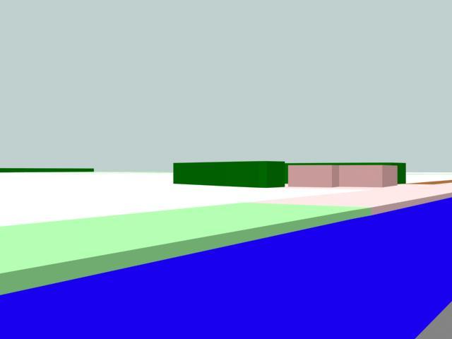
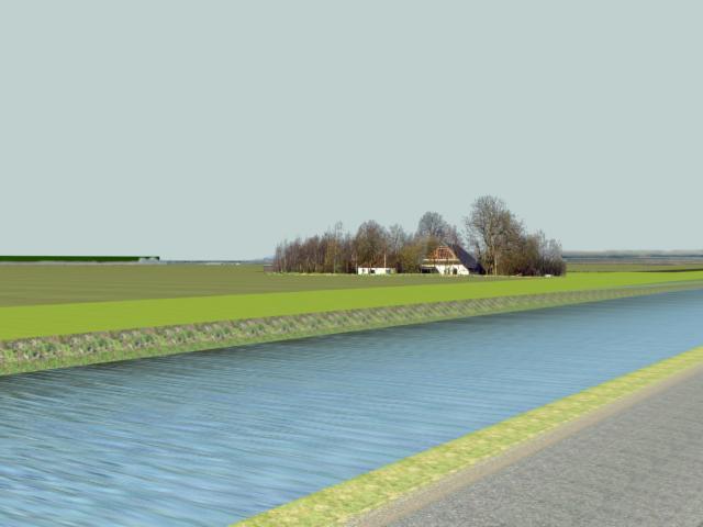
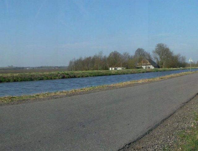
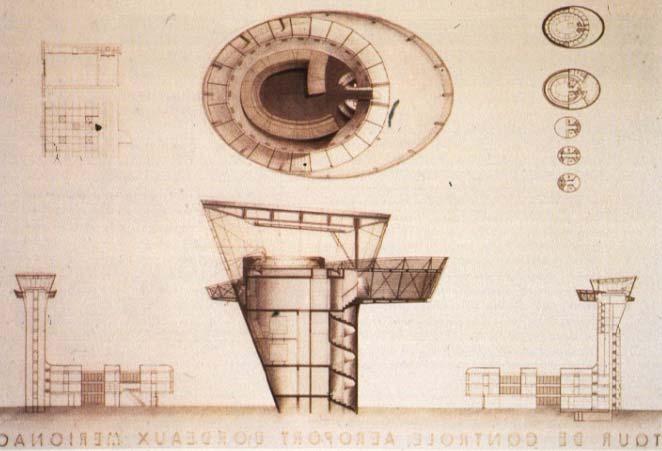
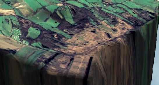
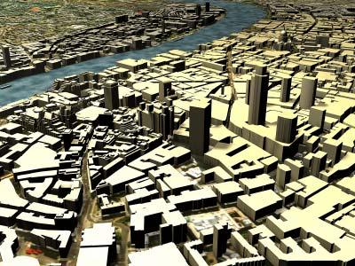
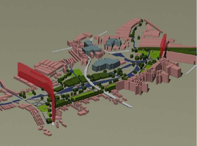
19 3D GEO-VISUALIZATION From carto-conceptual into photo-realistic 5 RL01

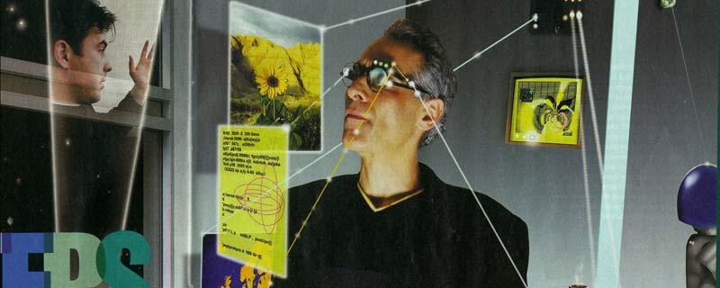
20 Communicative environment 6 RL01

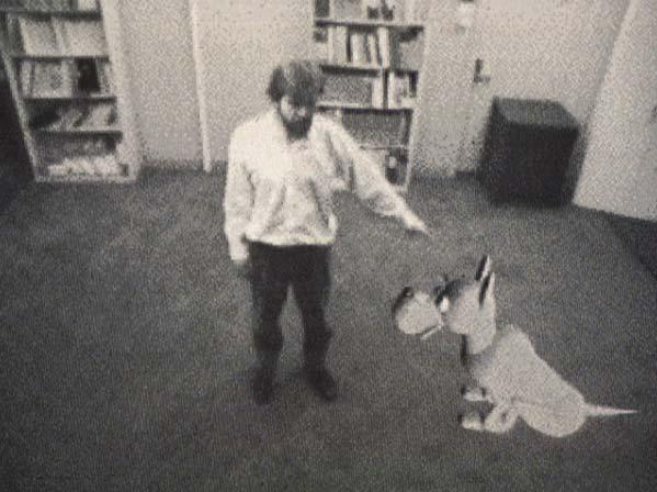
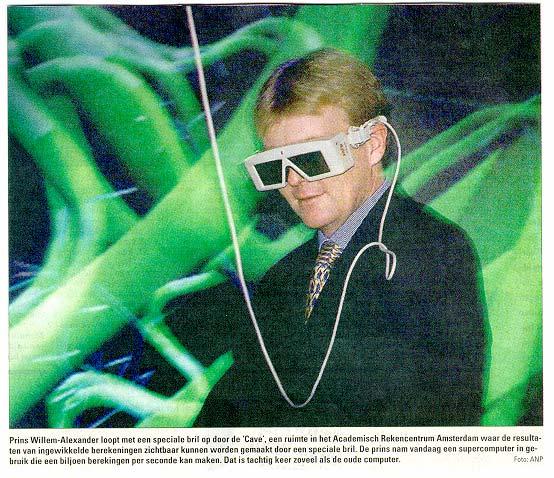
21 Geo VR use 7 RL01
, Nothelfer (2002)")
22 Reality-Virtuality continuum Milgram (1994), Nothelfer (2002) 8 RL01
23 Overview Realism/Perceptual Carto-Symbolic/Conceptual Static Animation Viewer dynamics Object dynamics Stills Digital video Virtual reality VR simulations / games cross-overs!! 9 RL01
24 Geo-data and geo-data visualisation reader : Lo, Yueng : Kraak, Ormeling assignments: 2, 3 and 4 10 RL01
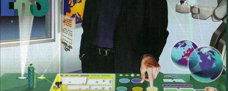
25 Interest in Geo-information Automatic data capture Processing of data by algorithms (of others) Man-computer interaction Digital communication Realisation by robots Separation between data storage and data visualization Freedom of visualization via content, lay out and perspective 11 RL01


26 WDGM-model Figure 2.1: WGDM model (from R. v/d Schans) 12 RL01


27 2 digital models World Visual Presentation by a viewer Digital World Model DWM Digital Visualization Model DVM 13 RL01

28 Content of DWM and DVM Digital World Model (DWM) Digital Visualization Model (DVM) /rgb2cmyk{3{1 exch sub 3 1 roll}repeat 3{dup 5-1 roll sub neg exch}repeat}bd/rgb2g{2 index.299 mul 2 index.587 mul add 1 index.114 mul add 4 1 roll pop pop pop}bd/waldocolor_5 where{pop}{/setrgb/setrgbcolor ld/getrgb /currentrgbcolor ld/setgry/setgray ld/getgry/currentgray ld/setrgb2 systemdict /setrgbcolor get def/getrgb2 systemdict/currentrgbcolor get def/sethsb systemdict/sethsbcolor get def/gethsb systemdict/currenthsbcolor get def /rgb2hsb{setrgb2 GetHsb}bd/hsb2rgb{3-1 roll dup floor sub 3 1 roll SetHsb GetRgb2}bd/setcmykcolor where{pop/setcmyk_5/setcmykcolor ld}{/setcmyk_5{ cmyk2rgb SetRgb}bd}ifelse/currentcmykcolor where{pop/getcmyk/currentcmykcolor ld}{/getcmyk{getrgb rgb2cmyk}bd}ifelse/setoverprint where{pop}{/setoverprint{ /$op xd}bd}ifelse/currentoverprint where{pop}{/currentoverprint 14 RL01
29 Data model development Description of geographic phenomena by location, size, shape and meaning within 2D or 3D geo-reference systems via geographic data models. - static - Description of the changes of geographic phenomena by geographic spatial-temporal models. - dynamic - Ergo: 2D 2D + Δt 3D 3D + Δt 15 RL01
30 Concept GeoVisualisation GeoData 2D 2D + ΔT 3D 3D + ΔT 2D 2D + Δt 2.5D 2D + Δt 3D 3D + Δt 16 RL01

31 Examples 17 RL01
32 Batty s classification Geographic - data driven = vis. 2D data model Geographic - mathematical = vis. 2D simulation model Geometric icons = vis. approximation of 3D. reality Communicative environment = indirect (multi)actor/ avatar interaction Virtual world = direct (multi)actor interaction 18 RL01

33 Geographic data - 2D 19 RL01
34 2D simulation 20 RL01
35 Geographic 2.5D 21 RL01

36 About 2D and 3D 22 RL01
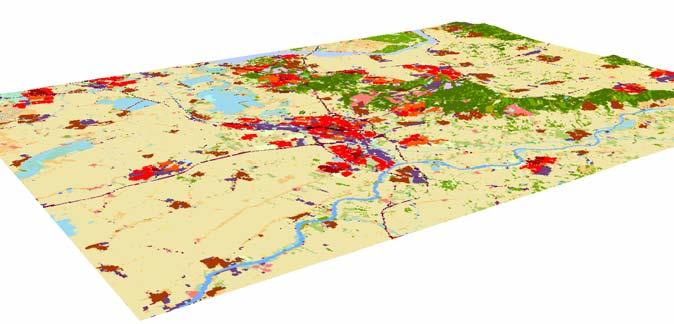
37 Geovisualization items cases RIVM message land use changes LEVEL OF DETAIL information intensity COMPARE LIM. immersion interaction intelligence COGNITIVE MAPS FEEDBACK NAVIGATION, MANIPULATION LIM. LIM. NO Salix 23 RL01
Geo-Visualization. GRS1011 Ron van Lammeren
 Geo-Visualization GRS1011 Ron van Lammeren Theory Semiologie Graphique http://www.flickr.com/photos/kbean/491051226/ 2/30 How to present my geo data? Visualization definitions Map making Cartographic process
Geo-Visualization. GRS09/10 Ron van Lammeren
 Geo-Visualization GRS09/10 Ron van Lammeren 2/30 Theory Semiologie Graphique http://www.flickr.com/photos/kbean/491051226/ 3/30 How to present my geo data? Visualization definitions Map making Cartographic
Cartographic visualisation of Time
 Cartographic visualisation of Time prof Menno-Jan Kraak Barend Köbben INTERNATIONAL INSTITUTE FOR GEO-INFORMATION SCIENCE AND EARTH OBSERVATION Contents Changing Cartography
CONCEPTUAL DEVELOPMENT OF AN ASSISTANT FOR CHANGE DETECTION AND ANALYSIS BASED ON REMOTELY SENSED SCENES
 CONCEPTUAL DEVELOPMENT OF AN ASSISTANT FOR CHANGE DETECTION AND ANALYSIS BASED ON REMOTELY SENSED SCENES J. Schiewe University of Osnabrück, Institute for Geoinformatics and Remote Sensing, Seminarstr.
THE USE OF GIS, REMOTE SENSING AND VIRTUAL REALITY IN FLOOD HAZARD MODELING, ASSESSMENT AND VISUALIZATION
 THE USE OF GIS, REMOTE SENSING AND VIRTUAL REALITY IN FLOOD HAZARD MODELING, ASSESSMENT AND VISUALIZATION Shunfu Hu Department of Geography Southern Illinois University Edwardsville Edwardsville, IL 62026
Three-Dimensional Visualization of Activity-Travel Patterns
 C. Rinner 231 Three-Dimensional Visualization of Activity-Travel Patterns Claus Rinner Department of Geography University of Toronto, Canada rinner@geog.utoronto.ca ABSTRACT Geographers have long been
Current trends in visualisation of geospatial data with special reference to cartography (Invited Paper)
") Current trends in visualisation of geospatial data with special reference to cartography (Invited Paper) Menno-Jan Kraak ITC, Department of GeoInformation Processing PO Box 6, 7500 AA Enschede, the Netherlands
Current trends in visualisation of geospatial data with special reference to cartography (Invited Paper) Menno-Jan Kraak ITC, Department of GeoInformation Processing PO Box 6, 7500 AA Enschede, the Netherlands
Cell-based Model For GIS Generalization
 Cell-based Model For GIS Generalization Bo Li, Graeme G. Wilkinson & Souheil Khaddaj School of Computing & Information Systems Kingston University Penrhyn Road, Kingston upon Thames Surrey, KT1 2EE UK
VGIscience Summer School Interpretation, Visualisation and Social Computing of Volunteered Geographic Information (VGI)
") VGIscience Summer School Interpretation, Visualisation and Social Computing of Volunteered Geographic Information (VGI) TU Dresden, 11.-15. September 2017 Welcome PhD students working on research topics
VGIscience Summer School Interpretation, Visualisation and Social Computing of Volunteered Geographic Information (VGI) TU Dresden, 11.-15. September 2017 Welcome PhD students working on research topics
From User Requirements Analysis to Conceptual Design of a Mobile Augmented Reality Tool to be used in an Urban Geography Fieldwork Setting
 From User Requirements Analysis to Conceptual Design of a Mobile Augmented Reality Tool to be used in an Urban Geography Fieldwork Setting Xiaoling Wang, Corné P.J.M. van Elzakker, Menno-Jan Kraak 2016
GIS-BASED VISUALIZATION FOR ESTIMATING LEVEL OF SERVICE Gozde BAKIOGLU 1 and Asli DOGRU 2
 Presented at the FIG Congress 2018, May 6-11, 2018 in Istanbul, Turkey GIS-BASED VISUALIZATION FOR ESTIMATING LEVEL OF SERVICE Gozde BAKIOGLU 1 and Asli DOGRU 2 1 Department of Transportation Engineering,
EXPLORATION OR COMMUNICATION: DEFINING EFFECTIVE VISUALISATIONS FOR SPATIAL DATA
 EXPLORATION OR COMMUNICATION: DEFINING EFFECTIVE VISUALISATIONS FOR SPATIAL DATA Xiaogang Chen 1 Ian Bishop 2 Mingzheng Shi Centre for GIS and Modelling University of Melbourne VIC 3010, Australia 1 email:
2013 AND 2025 THE FUTURE OF GIS
 THE FUTURE OF GIS 2013 AND 2025 What is the state of geospatial computing today? What are the issues today? Unresolved problems What will geospatial computing be like in 2025? What issues will be of concern
Geo-identification and pedestrian navigation with geo-mobile applications: how do users proceed?
 TU Vienna presentation 17 th July 2008 Geo-identification and pedestrian navigation with geo-mobile applications: how do users proceed? Ioannis Delikostidis Corné van Elzakker INTERNATIONAL INSTITUTE FOR
VISUAL ANALYTICS APPROACH FOR CONSIDERING UNCERTAINTY INFORMATION IN CHANGE ANALYSIS PROCESSES
 VISUAL ANALYTICS APPROACH FOR CONSIDERING UNCERTAINTY INFORMATION IN CHANGE ANALYSIS PROCESSES J. Schiewe HafenCity University Hamburg, Lab for Geoinformatics and Geovisualization, Hebebrandstr. 1, 22297
Visualization Schemes for Spatial Processes
 Visualization Schemes for Spatial Processes Barbara HOFER and Andrew U. FRANK Summary The visualization of spatial data has a long tradition in the fields of cartography and geographic information science.
An Introduction to Geographic Information System
 An Introduction to Geographic Information System PROF. Dr. Yuji MURAYAMA Khun Kyaw Aung Hein 1 July 21,2010 GIS: A Formal Definition A system for capturing, storing, checking, Integrating, manipulating,
Geometric Algorithms in GIS
 Geometric Algorithms in GIS GIS Visualization Software Dr. M. Gavrilova GIS Software for Visualization ArcView GEO/SQL Digital Atmosphere AutoDesk Visual_Data GeoMedia GeoExpress CAVE? Visualization in
Data Origin. Ron van Lammeren CGI-GIRS 0910
 Data Origin Ron van Lammeren CGI-GIRS 0910 How to obtain geodata? Geo data initiative Executive Order 12906, "Coordinating Geographic Data Acquisition and Access: The National Spatial Data Infrastructure,"
Animating Maps: Visual Analytics meets Geoweb 2.0
 Animating Maps: Visual Analytics meets Geoweb 2.0 Piyush Yadav 1, Shailesh Deshpande 1, Raja Sengupta 2 1 Tata Research Development and Design Centre, Pune (India) Email: {piyush.yadav1, shailesh.deshpande}@tcs.com
CPSC 695. Future of GIS. Marina L. Gavrilova
 CPSC 695 Future of GIS Marina L. Gavrilova The future of GIS Overview What is GIS now How GIS was viewed before Current trends and developments Future directions of research What is GIS? Internet's definition
Geospatial Data Visualization
 Geospatial Data Visualization CS 7450 - Information Visualization October 19, 2016 John Stasko Guest speaker: Alex Godwin Learning Objectives Process of encoding Geospatial Visualization Common Geospatial
Alan M. MacEachren and Menno-Jan Kraak 1
 Research Challenges in Geovisualization Alan M. MacEachren and Menno-Jan Kraak 1 This special issue of Cartography and Geographic Information Science presents the results of an international collaboration
The Concept of Geographic Relevance
 The Concept of Geographic Relevance Tumasch Reichenbacher, Stefano De Sabbata, Paul Crease University of Zurich Winterthurerstr. 190 8057 Zurich, Switzerland Keywords Geographic relevance, context INTRODUCTION
Course Syllabus. Geospatial Data & Spatial Digital Technologies: Assessing Land Use/Land Cover Change in the Ecuadorian Amazon.
 Course Syllabus Geospatial Data & Spatial Digital Technologies: Assessing Land Use/Land Cover Change in the Ecuadorian Amazon Co- Instructors Dr. Carlos F. Mena, Universidad San Francisco de Quito, Ecuador
Logical data integration into digital landscape model 1
 Logical data integration into digital landscape model 1 1 Lecture contents: 1. Overview of geodata applicable in the modelling in the landscape. 2. Introduction into the models and modelling. 3. Classification
Web Visualization of Geo-Spatial Data using SVG and VRML/X3D
 Web Visualization of Geo-Spatial Data using SVG and VRML/X3D Jianghui Ying Falls Church, VA 22043, USA jying@vt.edu Denis Gračanin Blacksburg, VA 24061, USA gracanin@vt.edu Chang-Tien Lu Falls Church,
Spatial Intelligence. Angela Schwering
 Spatial Intelligence Angela Schwering What I do What I do intelligent representation and processing of spatial information From the Cognitive Perspective How do humans perceive spatial information? How
ADAPTABLE DASHBOARD FOR VISUALIZATION OF ORIGIN-DESTINATION DATA PATTERNS
 ADAPTABLE DASHBOARD FOR VISUALIZATION OF ORIGIN-DESTINATION DATA PATTERNS Ieva Dobrāja, PhD Candidate Prof. Dr. Menno-Jan Kraak Dr. Yuri Engelhardt NCG Symposium 2017 ADAPTABLE DASHBOARD FOR VISUALIZATION
ADAPTABLE DASHBOARD FOR VISUALIZATION OF ORIGIN-DESTINATION DATA PATTERNS
 ADAPTABLE DASHBOARD FOR VISUALIZATION OF ORIGIN-DESTINATION DATA PATTERNS Ieva Dobrāja, PhD Candidate Prof. Dr. Menno-Jan Kraak Dr. Yuri Engelhardt NCG Symposium 2017 ADAPTABLE DASHBOARD FOR VISUALIZATION
Modular Web Framework for the BRANDENBURGVIEWER
 Modular Web Framework for the BRANDENBURGVIEWER Geoinformation System (GIS) 2 GIS = geo + information + system + + Survey of data Organization of data Processing and Analysis Presentation geodata infrastructure
ArcGIS is Advancing. Both Contributing and Integrating many new Innovations. IoT. Smart Mapping. Smart Devices Advanced Analytics
 ArcGIS is Advancing IoT Smart Devices Advanced Analytics Smart Mapping Real-Time Faster Computing Web Services Crowdsourcing Sensor Networks Both Contributing and Integrating many new Innovations ArcGIS
An Evaluation of Web-based Geovisualizations for Different Levels of Abstraction and Realism What do users predict?
 An Evaluation of Web-based Geovisualizations for Different Levels of Abstraction and Realism What do users predict? Alíz Boér*, Arzu Çöltekin *, Keith C. Clarke** * University of Zurich, Department of
Data Origin. How to obtain geodata? Ron van Lammeren CGI-GIRS 0910
 Data Origin How to obtain geodata? Ron van Lammeren CGI-GIRS 0910 Spatial Data interest Improvement of policy making. ± 90% of all information used by government has spatial characteristics SPATIAL INFORMATION
APC Part I Workshop. Mapping and Cartography. 14 November 2014
 APC Part I Workshop Mapping and Cartography 14 November 2014 Cartography Cartography is the discipline dealing with the conception, production, dissemination and study of maps in all forms (ICA) A holistic
A General Framework for Conflation
 A General Framework for Conflation Benjamin Adams, Linna Li, Martin Raubal, Michael F. Goodchild University of California, Santa Barbara, CA, USA Email: badams@cs.ucsb.edu, linna@geog.ucsb.edu, raubal@geog.ucsb.edu,
Lecture 1: Geospatial Data Models
 Lecture 1: GEOG413/613 Dr. Anthony Jjumba Introduction Course Outline Journal Article Review Projects (and short presentations) Final Exam (April 3) Participation in class discussions Geog413/Geog613 A
INSTITUTE OF AERONAUTICAL ENGINEERING (Autonomous) Dundigal, Hyderabad
 Dundigal, Hyderabad") INSTITUTE OF AERONAUTICAL ENGINEERING (Autonomous) Dundigal, Hyderabad -00 0 CIVIL ENGINEERING TUTORIAL QUESTION BANK Course Name : Remote Sensing and GIS Course Code : A00 Class : IV B. Tech I Semester
INSTITUTE OF AERONAUTICAL ENGINEERING (Autonomous) Dundigal, Hyderabad -00 0 CIVIL ENGINEERING TUTORIAL QUESTION BANK Course Name : Remote Sensing and GIS Course Code : A00 Class : IV B. Tech I Semester
Basics of GIS. by Basudeb Bhatta. Computer Aided Design Centre Department of Computer Science and Engineering Jadavpur University
 Basics of GIS by Basudeb Bhatta Computer Aided Design Centre Department of Computer Science and Engineering Jadavpur University e-governance Training Programme Conducted by National Institute of Electronics
Intelligent GIS: Automatic generation of qualitative spatial information
 Intelligent GIS: Automatic generation of qualitative spatial information Jimmy A. Lee 1 and Jane Brennan 1 1 University of Technology, Sydney, FIT, P.O. Box 123, Broadway NSW 2007, Australia janeb@it.uts.edu.au
VISUALIZATION OF SPATIO-TEMPORAL PATTERNS IN PUBLIC TRANSPORT DATA
 VISUALIZATION OF SPATIO-TEMPORAL PATTERNS IN PUBLIC TRANSPORT DATA Yedendra babu Shrinivasan, Menno-Jan Kraak International Institute for Geo-Information Science and Earth Observation, The Netherlands
Lesson 4b Remote Sensing and geospatial analysis to integrate observations over larger scales
 Lesson 4b Remote Sensing and geospatial analysis to integrate observations over larger scales We have discussed static sensors, human-based (participatory) sensing, and mobile sensing Remote sensing: Satellite
Topic 2: New Directions in Distributed Geovisualization. Alan M. MacEachren
 Topic 2: New Directions in Distributed Geovisualization Alan M. MacEachren GeoVISTA Center Department of Geography, Penn State & International Cartographic Association Commission on Visualization & Virtual
6th ICA Mountain Cartography Workshop Lenk/Switzerland. Cartographic Design Issues Utilizing Google Earth for Spatial Communication
 6th ICA Mountain Cartography Workshop Lenk/Switzerland Cartographic Design Issues Utilizing Google Earth for Spatial Communication Department of Geography and Regional Research Karel Kriz University Vienna,
Geographic Information Systems (GIS) in Environmental Studies ENVS Winter 2003 Session III
 in Environmental Studies ENVS Winter 2003 Session III") Geographic Information Systems (GIS) in Environmental Studies ENVS 6189 3.0 Winter 2003 Session III John Sorrell York University sorrell@yorku.ca Session Purpose: To discuss the various concepts of space,
Geographic Information Systems (GIS) in Environmental Studies ENVS 6189 3.0 Winter 2003 Session III John Sorrell York University sorrell@yorku.ca Session Purpose: To discuss the various concepts of space,
Appropriate Selection of Cartographic Symbols in a GIS Environment
 Appropriate Selection of Cartographic Symbols in a GIS Environment Steve Ramroop Department of Information Science, University of Otago, Dunedin, New Zealand. Tel: +64 3 479 5608 Fax: +64 3 479 8311, sramroop@infoscience.otago.ac.nz
The Relevance of Cartography. Dubai 2015, Georg Gartner
 The Relevance of Cartography Dubai 2015, Georg Gartner Where are we? Data! Data? We are not short of data Technologies! Technologies? We are not short of technologies Data-driven and technology-driven
Alexander Klippel and Chris Weaver. GeoVISTA Center, Department of Geography The Pennsylvania State University, PA, USA
 Analyzing Behavioral Similarity Measures in Linguistic and Non-linguistic Conceptualization of Spatial Information and the Question of Individual Differences Alexander Klippel and Chris Weaver GeoVISTA
TOWARDS THE DEVELOPMENT OF A TAXONOMY FOR VISUALISATION OF STREAMED GEOSPATIAL DATA
 TOWARDS THE DEVELOPMENT OF A TAXONOMY FOR VISUALISATION OF STREAMED GEOSPATIAL DATA B. H. Sibolla a,c *, T. Van Zyl b, S. Coetzee c a Meraka Institute, Council for Scientific and Industrial Research, Pretoria,
WHO IS WHO ON THE MAP?
 WHO IS WHO ON THE MAP? Eng. Stanislav Vasilev, PhD Assoc. Professor in Department of Photogrammetry and Cartography 1, Christo Smirnenski blvd. 1046 Sofia, Bulgaria e-mail: vasilevs_fgs@uacg.bg Abstract
CARTOGRAPHY in a Web World
 CARTOGRAPHY in a Web World SENSE Research Cluster XIII meeting: Concepts and tools for spatial data visualization BAREND KÖBBEN kobben@itc.nl b.j.kobben@utwente.nl Agenda Short introduction to ITC and
Themes for Geomatics Conference. Geodesy Themes
 Themes for Geomatics Conference Geodesy Themes Geodynamics o Modeling the Deformation of the Earth s Crust o Recent Advances in Geometric Approaches to Deformation Analysis o Monitoring Systems (Sensors
Statistical perspectives on spatial social science
 Statistical perspectives on spatial social science Discussion Sarah Nusser (nusser@iastate.edu) Center for Survey Statistics and Methodology Department of Statistics Iowa State University Morris Hansen
Specialist Meeting on Spatial Concepts in GIS and Design Santa Barbara, California. Geo-Spatial Design
 Specialist Meeting on Spatial Concepts in GIS and Design Santa Barbara, California Geo-Spatial Design Creativity is the synapse between two normally disassociated matrices of thought. Arthur Koestler William
WELCOME. To GEOG 350 / 550 Introduction to Geographic Information Science
 WELCOME To GEOG 350 / 550 Introduction to Geographic Information Science 1 What will I learn? An overview of Geographic Information Science What is GIScience How does it differ front GISystems How GIS
CARTOGRAPHY in a Web World
 CARTOGRAPHY in a Web World Nationale GI Minor BAREND KÖBBEN b.j.kobben@utwente.nl Agenda Short introduction to ITC and me Cartography: communicating spatial data Changing GIS & Cartography technology:
Automated Generation of Geometrically- Precise and Semantically-Informed Virtual Geographic Environments Populated with Spatially-Reasoning Agents
 Automated Generation of Geometrically- Precise and Semantically-Informed Virtual Geographic Environments Populated with Spatially-Reasoning Agents Mehdi Mekni DISSERTATION.COM Boca Raton Automated Generation
Introduction: Cognitive Issues in Geographic Information Visualization
 Introduction: Cognitive Issues in Geographic Information Visualization Sara Irina Fabrikant Department of Geography / University of Zurich / Zurich / Switzerland Amy Lobben Department of Geography / University
THE USE OF MAPS IN THE EXPLORATION OF GEOGRAPHIC DATA
 THE USE OF MAPS IN THE EXPLORATION OF GEOGRAPHIC DATA van Elzakker, C.P.J.M. International Institute for Geo-Information Science and Earth Observation (ITC), Department of Geo-Information Processing, P.O.
Cognitive Engineering for Geographic Information Science
 Cognitive Engineering for Geographic Information Science Martin Raubal Department of Geography, UCSB raubal@geog.ucsb.edu 21 Jan 2009 ThinkSpatial, UCSB 1 GIScience Motivation systematic study of all aspects
GIS-based Smart Campus System using 3D Modeling
 GIS-based Smart Campus System using 3D Modeling Smita Sengupta GISE Advance Research Lab. IIT Bombay, Powai Mumbai 400 076, India smitas@cse.iitb.ac.in Concept of Smart Campus System Overview of IITB Campus
USING THE OPEN WEB PLATFORM FOR THEMATIC MAPPING IN A WEBSERVICE ENVIRONMENT. BAREND KÖBBEN
 USING THE OPEN WEB PLATFORM FOR THEMATIC MAPPING IN A WEBSERVICE ENVIRONMENT BAREND KÖBBEN kobben@itc.nl b.j.kobben@utwente.nl a story about different worlds... National GeoData Infrastructure National
Basics of GIS reviewed
 Basics of GIS reviewed Martin Breunig Karlsruhe Institute of Technology martin.breunig@kit.edu GEODETIC INSTITUTE, DEPARTMENT OF CIVIL ENGINEERING, GEO AND ENVIRONMENTAL SCIENCES, CHAIR IN GEOINFORMATICS
Compact guides GISCO. Geographic information system of the Commission
 Compact guides GISCO Geographic information system of the Commission What is GISCO? GISCO, the Geographic Information System of the COmmission, is a permanent service of Eurostat that fulfils the requirements
MAP SYMBOL BREWER A NEW APPROACH FOR A CARTOGRAPHIC MAP SYMBOL GENERATOR
 MAP SYMBOL BREWER A NEW APPROACH FOR A CARTOGRAPHIC MAP SYMBOL GENERATOR Olaf Schnabel Institute of Cartography, Swiss Federal Institute of Technology (ETH) CH-8093 Zurich, Switzerland schnabel@karto.baug.ethz.ch
Spatializing time in a history text corpus
 Zurich Open Repository and Archive University of Zurich Main Library Strickhofstrasse 39 CH-8057 Zurich www.zora.uzh.ch Year: 2014 Spatializing time in a history text corpus Bruggmann, André; Fabrikant,
The need for realistic visualizations in participatory spatial planning. Tessa Hoogerwerf, Ron van Lammeren
 The need for realistic visualizations in participatory spatial planning Tessa Hoogerwerf, Ron van Lammeren The need for realistic visualizations in participatory spatial planning three dimensional visual
The French SIGMA-Cassini Research Group The Agenda for
 Page 1 of 9 The French SIGMA-Cassini Research Group The Agenda for 2005-2008 M. Mainguenaud C. Weber michel.mainguenaud@insa-rouen.fr christiane.weber@lorraine.u-strasbg.fr http://www.sigma-cassini.org
A Land Use Transport Model for Greater London:
 Spatio-Temporal Analysis of Network Data and Road Developments Launch Event Workshop UCL Monday 18 May 2009 A Land Use Transport Model for Greater London: With Applications to an Integrated Assessment
What is special about geospatial? or A discipline in constant transition
 What is special about geospatial? or A discipline in constant transition Marinos Kavouras NTUA Ensuring the Rapid Response to Change, Ensuring the Surveyor of Tomorrow FIG 2015 Several paradigm shifts
Chapter 1. GIS Fundamentals
 1. GIS Overview Chapter 1. GIS Fundamentals GIS refers to three integrated parts. Geographic: Of the real world; the spatial realities, the geography. Information: Data and information; their meaning and
Cutting Edge Engineering for Modern Geospatial Systems Rear Admiral Dr. S Kulshrestha, retd
 Cutting Edge Engineering for Modern Geospatial Systems Rear Admiral Dr. S Kulshrestha, retd 11 Jun 2015 GeoIntelligence Asia 2015 The technology would become so pervasive that it becomes a part of you
Canadian Board of Examiners for Professional Surveyors Core Syllabus Item C 5: GEOSPATIAL INFORMATION SYSTEMS
 Study Guide: Canadian Board of Examiners for Professional Surveyors Core Syllabus Item C 5: GEOSPATIAL INFORMATION SYSTEMS This guide presents some study questions with specific referral to the essential
Welcome to NetMap Portal Tutorial
 Welcome to NetMap Portal Tutorial Potential Applications What Can you do with the Portal? At least 25 things! 1) Locate the best potential fish habitats. 2) Identify biological hotspots. 3) Map floodplain
Lecture 9: Reference Maps & Aerial Photography
 Lecture 9: Reference Maps & Aerial Photography I. Overview of Reference and Topographic Maps There are two basic types of maps? Reference Maps - General purpose maps & Thematic Maps - maps made for a specific
Geovisualization of Attribute Uncertainty
 Geovisualization of Attribute Uncertainty Hyeongmo Koo 1, Yongwan Chun 2, Daniel A. Griffith 3 University of Texas at Dallas, 800 W. Campbell Road, Richardson, Texas 75080, 1 Email: hxk134230@utdallas.edu
GeoTime Visualization of RFID Providing Global Visibility of the DoD Supply Chain
 GeoTime Visualization of RFID Providing Global Visibility of the DoD Supply Chain David Shuping (FC Business Systems) and William Wright (Oculus Info, Inc.) Abstract The use of Radio Frequency Identification
Green Space Services for Local Monitoring
 Green Space Services for Local Monitoring Aratos Group V3.0 2016/08 Value added services for the society using space and satellite technologies Aratos Group 2 One of the first European downstream value
- Towards new concepts for handling geoinformation
 - Towards new concepts for handling geoinformation Centre for 3D Geoinformation Aalborg University Denmark Outline 1. Introduction 2. Digital Northern Jutland in DK 3. Cente for 3D geoinformation 4. Drivers
An interactive tool for teaching map projections
 An interactive tool for teaching map projections Map projections are one of the fundamental concepts of geographic information science and cartography. An understanding of the different variants and properties
Assessing pervasive user-generated content to describe tourist dynamics
 Assessing pervasive user-generated content to describe tourist dynamics Fabien Girardin, Josep Blat Universitat Pompeu Fabra, Barcelona, Spain {Fabien.Girardin, Josep.Blat}@upf.edu Abstract. In recent
Antoine Masse, Sidonie Christophe
 Antoine Masse, Sidonie Christophe IGN, COGIT Laboratory France Motivation: coastal area geovisualization Coastal area Between highest astronomical tide (shoreline) and lowest astronomical tide (drying
Geographic Analysis of Linguistically Encoded Movement Patterns A Contextualized Perspective
 Geographic Analysis of Linguistically Encoded Movement Patterns A Contextualized Perspective Alexander Klippel 1, Alan MacEachren 1, Prasenjit Mitra 2, Ian Turton 1, Xiao Zhang 2, Anuj Jaiswal 2, Kean
Smart Data Collection and Real-time Digital Cartography
 Smart Data Collection and Real-time Digital Cartography Yuji Murayama and Ko Ko Lwin Division of Spatial Information Science Faculty of Life and Environmental Sciences University of Tsukuba IGU 2013 1
FUNDAMENTALS OF GEOINFORMATICS PART-II (CLASS: FYBSc SEM- II)
") FUNDAMENTALS OF GEOINFORMATICS PART-II (CLASS: FYBSc SEM- II) UNIT:-I: INTRODUCTION TO GIS 1.1.Definition, Potential of GIS, Concept of Space and Time 1.2.Components of GIS, Evolution/Origin and Objectives
FUNDAMENTALS OF GEOINFORMATICS PART-II (CLASS: FYBSc SEM- II) UNIT:-I: INTRODUCTION TO GIS 1.1.Definition, Potential of GIS, Concept of Space and Time 1.2.Components of GIS, Evolution/Origin and Objectives
A user-centered approach for designing and developing spatiotemporal crime analysis tools
 A user-centered approach for designing and developing spatiotemporal crime analysis tools R. E. Roth 1, K. S. Ross 1, B. G. Finch 1, W. Luo 1, A. M. MacEachren 1 1 GeoVISTA Center, Department of Geography
Maps and sustainability
 Maps and sustainability The International Map Year [ mapyear.org ] Menno-Jan Kraak Maps Cartography and maps A map is a visual representation of an environment maps tell stories maps invite maps show patterns
The Importance of Spatial Literacy
 The Importance of Spatial Literacy Dr. Michael Phoenix GIS Education Consultant Taiwan, 2009 What is Spatial Literacy? Spatial Literacy is the ability to be able to include the spatial dimension in our
Free Open Source Software for Geoinformatics (FOSS4G) A Practical Example System for Automated Geoscientific Analyses (SAGA)
 A Practical Example System for Automated Geoscientific Analyses (SAGA)") Free Open Source Software for Geoinformatics (FOSS4G) A Practical Example System for Automated Geoscientific Analyses (SAGA) Zlatko Horvat, MSc DGU Područni ured za katastar Čakovec My Motivation Give
Free Open Source Software for Geoinformatics (FOSS4G) A Practical Example System for Automated Geoscientific Analyses (SAGA) Zlatko Horvat, MSc DGU Područni ured za katastar Čakovec My Motivation Give
Planning in a Geospatially Enabled Society. Michael F. Goodchild University of California Santa Barbara
 Planning in a Geospatially Enabled Society Michael F. Goodchild University of California Santa Barbara What is a geospatially enabled society? Knowing the locations of all points of interest and their
Digital EIA - The Increasing Use of GIS
 Digital EIA - The Increasing Use of GIS The Benefits of Using GIS Tools in the EIA Process Gary Benson GIS Consultant, AECOM Environment Topics to be considered: 1. What is GIS? 2. What can GIS do/what
Evaluating the usability of visualization methods in an exploratory geovisualization environment
 International Journal of Geographical Information Science Vol. 20, No. 4, April 2006, 425 448 Research Article Evaluating the usability of visualization methods in an exploratory geovisualization environment
Geog183: Cartographic Design and Geovisualization Spring Quarter 2018 Lecture 3: Thematic cartography, geovisualization and visual analytics
 Geog183: Cartographic Design and Geovisualization Spring Quarter 2018 Lecture 3: Thematic cartography, geovisualization and visual analytics General Purpose or Reference Cartography Maps showing generic
The Evolution of NWI Mapping and How It Has Changed Since Inception
 The Evolution of NWI Mapping and How It Has Changed Since Inception Some Basic NWI Facts: Established in 1974 Goal to create database on characteristics and extent of U.S. wetlands Maps & Statistics In
Multi-cultural Aspects of Spatial Knowledge
 Multi-cultural Aspects of Spatial Knowledge Andrew U. Frank Geoinformation TU Vienna frank@geoinfo.tuwien.ac.at www.geoinfo.tuwien.ac.at Andrew Frank 1 Overview 1. What is culture? 2. Cultural influences
IMPLEMENTAION OF GIS TECHNOLOGY IN THE NILE AND ITS WADIS ABSTRACT
 IMPLEMENTAION OF GIS TECHNOLOGY IN THE NILE AND ITS WADIS Eng. NADIA M. ABD EI- SALAM 1 Dr. ABDEL AZIZ TAREK M. 2 ABSTRACT Traditional methods have been used for several years for map production of the
USGIF Essential Body of Knowledge Competency Areas
 GEOINT Job/Practice Analysis USGIF, in consultation with psychometric consultants and the GEOINT community, executed a job/practice analysis to identify common competencies within the GEOINT profession.
Bachelor of Geospatial Science The University of the South Pacific
 Bachelor of Geospatial Science The University of the South Pacific Geospatial Science Unit School of Geography, Earth Science and Environment Aleen Elisha Prasad Inesha Manzini Semisi Ketenilagi Geospatial
UAV s in Geoinformatics - Trends and Perspectives
 UAV s in Geoinformatics - Trends and Perspectives Torsten Prinz & Christian Knoth Institute for Geoinformatics (IFGI), University of Muenster (WWU) GeoNetzwerk Münsterland (29.11.2013) I. Introduction
VISUALIZING THE SMART CITY 3D SPATIAL INFRASTRUCTURE GEOSMART ASIA- 30 SEP, 2015
 www.aamgroup.com VISUALIZING THE SMART CITY 3D SPATIAL INFRASTRUCTURE GEOSMART ASIA- 30 SEP, 2015 Agenda AAM What is a Smart City? Data Acquisition 3D Modelling Benefits Questions AAM AAM is a Geospatial