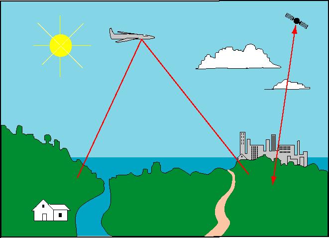
GEOSPATIAL WORLD FORUM. Geospatial for Energy RIA COVENTION CENTRE AMSTERDAM THE NETHERLANDS APRIL Adri de la Rey Republic of South Africa
|
|
|
- Christine Lawrence
- 5 years ago
- Views:
Transcription
1 GEOSPATIAL WORLD FORUM Geospatial for Energy RIA COVENTION CENTRE AMSTERDAM THE NETHERLANDS APRIL 2012 Adri de la Rey Republic of South Africa
2 About this presentation AM/FM Automated Mapping Facilities Mapping Geospatial Data gathering GIS Eskom Challenges Way forward Current situation 2012/05/03 2
3 GIS Eskom AM/FM Geospatial Data gathering GIS Eskom Challenges Way forward Current situation 2012/05/03 3
 & provides +/-45% end-users in SA +/- 45 % in rest of")
4 Electricity value chain All physical Infrastructure has a geographical position and is in relation to Man made and Natural features Eskom generates the following % of electricity used: +/- 95% in South Africa (SA) & provides +/-45% end-users in SA +/- 45 % in rest of Africa
5 Revenue Eskom s customers 1996 R 400 million 1,6 m electrification customers 2 % of revenue R million 7000 LPU 300 Key Customers 83 % of revenue R 900 million customers 5% of revenue Electrification customers Total revenue +/- R million june1995 5

6 Electricity delivery system 1996 Line Business Delivering Legendary Customer Service Value Chains CCC CC WMC TSU Building Blocks Information Management Data update Applications Information Technology Networks Application Development November
7 Electricity delivery system Applications built on spatial data GDC System CORE OR FUNDAMENTAL GEOSPATIAL DATA PROPRIETARIE GEOSPATIAL DATA (New routes & sites) TIPS System (Planning) Performance System (Electrical Performance ) FMS System (Fault management system) Maximo System ( Maintenance system) Spatial Platform SmallWorld Cornerstone November
8 Geospatial Data Gathering AM/FM Geospatial Data gathering GIS Eskom Challenges Way forward Current situation 2012/05/03 8
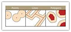
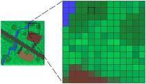
9 Characteristics Geospatial data Off the Shelf Classification Supply Chain Engineered Roads/Cadastral/Rivers Derived/Value Added/Plan Design Create Maintain Made to Order LiDAR/LSAP Vector Geospatial Data Formats Raster 2012/05/03 9

10 Cadastral (3 rd Parties) Land Parcels with referenced property index ( AfriGis and SG) Marapong Lephalale Farm name: Naauw Ontkomen Farm no: 509 Major region: LQ Town: Lephalale Munic: Ellisras Province: Limpopo Tribal Authoroty Area: No /05/03 10

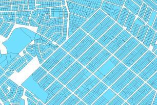
11 Topography (Government) Manmade and Natural Features Trigonometrical Beacons Control High urban densities Flood banks Contours Roads Rivers Power lines Inland water 2012/05/ /05/03 11

12 km surveyed GPS +/-5m Processed, maintained
13 Cadastre Diagrams Transmission lines km Distribution lines km
14 ESIGIS Vision & Mission 2004 Vision To be the preferred supplier of geospatial information solutions within the Eskom, local and African electricity supply industry (ESI) Mission To develop unique geospatial solutions that maximizes our customers infrastructure development needs 2012/05/03 14
15 Capacity development Technical Educated Spatial User (Specialist or Super User) High Skilled GIS Professional (GIS Career), Support other GIS Users Attend to Modelling and Spatial Analysis Decision Maker / Planner Desktop Users / Subject Matter Expert Use GIS as Decision Making Tool General User Use GIS as a Tool Via Web Viewer Maps Google Bing Map South African Qualification Board National Qualification Framework Standards Generation Body Geoscience - Gazetting Standards South African Council For Professional and Technical Surveyors Accreditation - Tertiary education, Prior learning, Life-long learning Registration - Professional, Technologist, Technician Grand father clause 2012/05/03 15
16 Current Situation AM/FM Geospatial Data gathering GIS Eskom Challenges Way forward Current situation 2012/05/03 16


17 Electrification (LSAP) Planning & Design showing proposed transformer areas & line routes Final as-built to be maintained Electrification Load zones Fill-inn Growth Maintenance


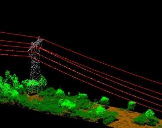
18 LiDAR (Power lines Design/Inspection Cost value, re-cycling, design, route selection, Environmental Impact & Management, Maintenance Fugro Fugro

19 Weather Dependant

20 SPOT 5 System Developing Country South Africa Collaboration CSIR Partners Sustainable Government / Partners Contribution Share data free SPOT French Satellite Pour l'observation de la Terre constellation Characteristics 10m multispectral 5m 2.5m panchromatic 500 tiles of 60kmX 60km Other applicable technology within next 5 years

21 SPOT 5 Coverage -500 scenes Wall to wall On-going annually


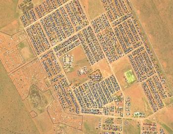
22 Change Detection - Spot5 Raster Settlement growth in Mamelodi /05/03 22
23 Spot Building Count(SBC) Vector Unique Structure / Building Count Full coverage of South Africa Initial Classes Complex Hostel Dwelling Mining Quarry Resort School Dense Informal Some of the attributes Erven Farm Farm Portion Agricultural Holding Parks Tribal Authorities New dwellings are captured annually and all original source information are retained in attribute fields to maintain consistency Quality Assurance methodology - An independent GIS specialist to do statistically sound sampling of work performed


24 Spot Building Count (SBC) Vector Comparison over 3 years growth Trends Demographics Quality How Resent Completeness
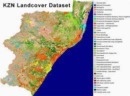
25 Land Cover & Land Use Land Cover (Only one Land Cover) Classification of all natural and man-made features that cover the earth s immediate surface Land Use (Multiple Land Use) Classification of human activity that is associated with a specific land-unit, in terms of utilization, impact or management practice, derived from Land Cover Last done 2001 for South Africa New South African Initiative supported by Eskom Selected Eskom Areas of interest Pilot Collaboration agreement in process - provinces Unique usage Deforestation Impact on South Arica


26 Land Cover Rural Urban

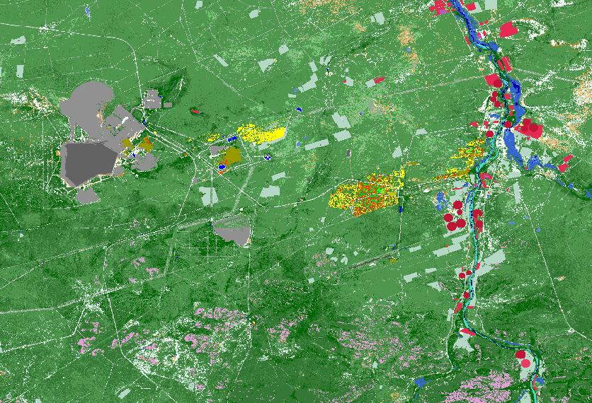
27 Land Use Rural Urban 2012/05/03 27
28 GIS Eskom AM/FM Geospatial Data gathering GIS Eskom Challenges Way forward Current situation 2012/05/03 28
 within catchments with available water balances Accessibility to transport (road and rail) Load Centers Accessibility")

29 Selection example continue Inclusion map met the distance criteria Fuel (coal) Sorbent (dolomite/limestone mines/ quarries) Water sources (rivers) within catchments with available water balances Accessibility to transport (road and rail) Load Centers Accessibility to housing skilled people Exclusion map was based on the combination of the following criteria Urban Fringe buffer Critically endangered and endangered biodiversity areas Very high/high potential lands- agriculture Major water bodies Potential areas for tourism investment
30

31 Selection spatial data decision making 03/05/
 SEA for long")
32 Strategic/Environmental Impact Assessments (SEA) SEA for long term planning Criterion three selection Birds Slope Soil type No go areas Best suited pathway Issues that might arise e.g. Preparation for EIA Monitor routes for invasion Map all EIA s within Eskom Past, Current, Future Collect EIA s spatial spatial location ESI-GIS service: Provide & Source available & new spatial datasets - Spatial Data Analysis Identify Constraints/opportunities - possible routes 2012/05/03 32

33 Soccer 2010 Local security GIS Loftus Stadium Background Legend Roads Stadiums2 planned mainfeed hv_line 11kv_ring_cables 2012/05/03 33


34 Soccer 2010 Integration - Metro Tshwane & Eskom HV Network 2012/05/03 34
 capacity potential PV generation capacity by municipal district PV yield of")

35 Renewable Energy : Solar Subject experts provide criteria for GIS analysis to determine area with the highest Photovoltaic (PV) capacity potential PV generation capacity by municipal district PV yield of a Silicon PV panel. The resolution of this layer is 1 x 1 km and is based on 12 years of solar and temperature data. The modelling was done based on 15 minute time steps. Typical fixed tilt PV installation 35
36 Renewable Energy : Wind The legend in the figure relates to the IEC wind classes as derived for a hub height at 80 m. In general a wind class 4 (dark green W/m 2 ) and up is economically exploitable. However recent developments in wind turbine technology and manufacturing cost are rendering wind class 3 (light green) also economically exploitable but in this study it is not included
37 Challenges - Way Forward AM/FM Geospatial Data gathering GIS Eskom Challenges Way Forward Current situation 2012/05/03 37

38 Skills Required for GIS Technologies Geodesy Earth Science Remote Sensing GIS Analytical 2012/05/03 38 Cartography


39 Skills required for GIS Metadata Data Manage ment Software Vendor specific Open Source Single users versus Enterprise user Hardware Vendor specific Singe users versus enterprise users Volume of data storage dissemination Vector/Raster Google 2012/05/03 39


40 Geospatial data collection Technology Changes threat/opportunity/choice Opportunity 2012/05/03 40


41 SPATIAL DATA INFRASTRUCTORE (SDI) Standardisation Sharing Sustainability Other Spatial Data Custodians? 2012/05/03 41
The use of Geographic Information Systems (GIS) in Electrification
 in Electrification") The use of Geographic Information Systems (GIS) in Electrification S lindi Mhlongo, GIS Advisor, Eskom, South Africa About this Presentation Introduction About Eskom Who is GIS What is GIS GIS in Electrification
The use of Geographic Information Systems (GIS) in Electrification S lindi Mhlongo, GIS Advisor, Eskom, South Africa About this Presentation Introduction About Eskom Who is GIS What is GIS GIS in Electrification
CAPE FARM MAPPER - an integrated spatial portal
 CAPE FARM MAPPER - an integrated spatial portal Skukuza Dr Mike Wallace June 2017 Overview of GIS applications in WCDoA Spatial information and technology has become indispensable across a wide range of
Sustainable and Harmonised Development for Smart Cities The Role of Geospatial Reference Data. Peter Creuzer
 Sustainable and Harmonised Development for Smart Cities The Role of Geospatial Reference Data Peter Creuzer 1. Introduction - Smart Cities and Geodata 2. Geodata in Germany 3. Examples 4. Data and Service
SA Geospatial Analysis Platform (GAP) Methodology*, collaborators & data sources
 Methodology*, collaborators & data sources") SA Geospatial Analysis Platform (GAP) Methodology*, collaborators & data sources Mesoframe CSIR, dti, the Presidency & GTZ Demarcation of South Africa into a grid of 50 Km 2 mesozones, nested within important
SA Geospatial Analysis Platform (GAP) Methodology*, collaborators & data sources Mesoframe CSIR, dti, the Presidency & GTZ Demarcation of South Africa into a grid of 50 Km 2 mesozones, nested within important
Achieving the Vision Geo-statistical integration addressing South Africa s Developmental Agenda. geospatial + statistics. The Data Revolution
 Achieving the Vision Geo-statistical integration addressing South Africa s Developmental Agenda geospatial + statistics The Data Revolution humble beginnings, present & future - South Africa UN World Data
GEOSPATIAL ONLINE WEB-TOOLS CapeFarmMapper & CAMIS
 GEOSPATIAL ONLINE WEB-TOOLS CapeFarmMapper & CAMIS F.C. Basson 14 March 2017 Overview Spatial information and technology has become more important and relevant Applications Mapping of Agricultural footprint
The creation of the dedicated
 Enabling decision making with the SPOT 5 Building Count by Adri de la Rey, Eskom ESI-GIS An overview of the development and perceived benefits of the Eskom SPOT 5 Building Count (SBC) datasets and possible
Preparing the GEOGRAPHY for the 2011 Population Census of South Africa
 Preparing the GEOGRAPHY for the 2011 Population Census of South Africa Sharthi Laldaparsad Statistics South Africa; E-mail: sharthil@statssa.gov.za Abstract: Statistics South Africa (Stats SA) s Geography
Norwegian spatial data infrastructure supporting disaster risk management Norwegian Mapping Authority
 Norwegian spatial data infrastructure supporting disaster risk management Norwegian Mapping Authority Arvid Lillethun, Norwegian Mapping Authority Land and Poverty 2018 Conference, World Bank 19.-23. March
Introduction. Elevation Data Strategy. Status and Next Steps
 1 2 Introduction Elevation Data Strategy Status and Next Steps 3 Canada is the 2nd largest country in the world - 9.9 million sq km Surrounded by 3 oceans with 202 000 km of coastline Population over 35
Exploit your geodata to enable smart cities and countries
 Exploit your geodata to enable smart cities and countries Carsten Rönsdorf, Head of Advisory Services Middle East Practice Manager Future Cities, standards and 3D 24 November 2014 Importance of Standards
Topic 4: Changing cities
 Topic 4: Changing cities Overview of urban patterns and processes 4.1 Urbanisation is a global process a. Contrasting trends in urbanisation over the last 50 years in different parts of the world (developed,
A career in Geoinformatics
 A career in Geoinformatics presented by Serena Coetzee Centre for Geoinformation Science www.up.ac.za/cgis Department of Geography, Geoinformatics and Meteorology Mamelodi campus, 6 September 2011 University
SDI Development in the Russian Federation
 , the Russian Federation Key words: SDI development, the Russian Federation SUMMARY A reform in the field of spatial data is gathering headway in Russia. Creation of a single agency, which united state
ESTABLISHMENT OF KARNATAKA GEOPORTAL AND ITS ROLE IN PLANNING
 ESTABLISHMENT OF KARNATAKA GEOPORTAL AND ITS ROLE IN PLANNING By H. Hemanth Kumar Karnataka State Council for Science & Technology (KSCST), Indian Institute of Science, Bangalore, India Abstract Natural
GEOMATICS. Shaping our world. A company of
 GEOMATICS Shaping our world A company of OUR EXPERTISE Geomatics Geomatics plays a mayor role in hydropower, land and water resources, urban development, transport & mobility, renewable energy, and infrastructure
Techniques for Science Teachers: Using GIS in Science Classrooms.
 Techniques for Science Teachers: Using GIS in Science Classrooms. After ESRI, 2008 GIS A Geographic Information System A collection of computer hardware, software, and geographic data used together for
7 GEOMATICS BUSINESS SOLUTIONS - ANNUAL REPORT 2006
 7 GEOMATICS BUSINESS SOLUTIONS - ANNUAL REPORT 2006 The Planning and Economic Development Committee recommends the adoption of the recommendation contained in the following report November 30, 2006, from
a national geological survey perspective François ROBIDA BRGM (French Geological Survey)
") a national geological survey perspective François ROBIDA BRGM (French Geological Survey) Pre-Conference Seminar on Socio-Economic Value of Geospatial for National and Regional Development 21 August 2017,
a national geological survey perspective François ROBIDA BRGM (French Geological Survey) Pre-Conference Seminar on Socio-Economic Value of Geospatial for National and Regional Development 21 August 2017,
Using OGC standards to improve the common
 Using OGC standards to improve the common operational picture Abstract A "Common Operational Picture", or a, is a single identical display of relevant operational information shared by many users. The
ADDRESSING THE DATA AND INFORMATION NEEDS FOR GOOD GOVERNANCE, SHARING EXPERIENCES FROM COTE D IVOIRE. 20 April 2016 to 22 April 2016 ADDIS ABABA
 20 April 2016 to 22 April 2016 ADDIS ABABA ADDRESSING THE DATA AND INFORMATION NEEDS FOR GOOD GOVERNANCE, SHARING EXPERIENCES FROM COTE D IVOIRE Dr. Edouard FONH-GBEI Director General of CNTIG, General
ArcGIS for INSPIRE. Marten Hogeweg
 ArcGIS for INSPIRE Marten Hogeweg Please Take Our Survey on the App Download the Esri Events app and find your event Select the session you attended Scroll down to find the feedback section Complete answers
IMPLEMENTING GOVERNMENT-WIDE ENTERPRISE GIS; THE FEDERATED MODEL
 IMPLEMENTING GOVERNMENT-WIDE ENTERPRISE GIS; THE FEDERATED MODEL James E. Mitchell, Ph. D. IT GIS Manager Louisiana Department of Transportation and Development presented at the ESRI International Users
Geospatial SDI Portal for effective Governance of Pune METROPOLIS region
 Geospatial SDI Portal for effective Governance of Pune METROPOLIS region Mr. Praveen Gautam Senior Manager 19 th January 2018 PMRDA Overview Provide a Spatial Framework for the entire region with various
Country Report On Sdi Activities In Singapore ( )
") UNITED NATIONS E/CONF.102/IP.4 ECONOMIC AND SOCIAL COUNCIL Nineteenth United Nations Regional Cartographic Conference for Asia and the Pacific Bangkok, 29 October 1 November 2012 Item 6(b) of the provisional
UNITED NATIONS E/CONF.102/IP.4 ECONOMIC AND SOCIAL COUNCIL Nineteenth United Nations Regional Cartographic Conference for Asia and the Pacific Bangkok, 29 October 1 November 2012 Item 6(b) of the provisional
Esri and GIS Education
 Esri and GIS Education Organizations Esri Users 1,200 National Government Agencies 11,500 States & Regional Agencies 30,800 Cities & Local Governments 32,000 Businesses 8,500 Utilities 12,600 NGOs 11,000
Oman NSDI Business Values and Future Directions. Hassan Alawi Alghazali Acting Director General National Spatial Data Infrastructure
 Oman NSDI Business Values and Future Directions Hassan Alawi Alghazali Acting Director General National Spatial Data Infrastructure Presentation Outline Geospatial Maturity Current Challenges NCSI s Role
Sharthi Laldaparsad Statistics South Africa, Policy Research & Analysis. Sub-regional workshop on integration of administrative data,
 Sub-regional workshop on integration of administrative data, big data and geospatial information for the compilation of SDG indicators and International Workshop on Global Fundamental Geospatial Data Themes
Project based approach developing National Spatial Data Infrastructure in Lithuania
 Project based approach developing National Spatial Data Infrastructure in Lithuania National Land Service under the Ministry of Agriculture of The Republic of Lithuania Cadastres & Geodesy Department Director
Indicator: Proportion of the rural population who live within 2 km of an all-season road
 Goal: 9 Build resilient infrastructure, promote inclusive and sustainable industrialization and foster innovation Target: 9.1 Develop quality, reliable, sustainable and resilient infrastructure, including
Regional Centre for Mapping of Resources for Development (RCMRD), Nairobi, Kenya
, Nairobi, Kenya") Regional Centre for Mapping of Resources for Development (RCMRD), Nairobi, Kenya Introduction to GIS (2 weeks: 10 days) Intakes: 8 th January, 6 th February, 5th March, 3 rd. April 9 th, May 7 th, June
Regional Centre for Mapping of Resources for Development (RCMRD), Nairobi, Kenya Introduction to GIS (2 weeks: 10 days) Intakes: 8 th January, 6 th February, 5th March, 3 rd. April 9 th, May 7 th, June
Creating synergies between Statistical and Geospatial information for better policy outputs: The case of Mexico
 Creating synergies between Statistical and Geospatial information for better policy outputs: The case of Mexico Geospatial & Statistics Integration for Informed Decision Making Geospatial World Forum 2017
Corporate. Information. Railway Infrastructure Administrator. Year indracompany.com
 geospatial and mobility Corporate Geographic Information System of ADIF Railway Infrastructure Administrator. Year 2009-2010 Corporate Geographic Information System of ADIF ADIF. Spanish Administrator
Imagery and the Location-enabled Platform in State and Local Government
 Imagery and the Location-enabled Platform in State and Local Government Fred Limp, Director, CAST Jim Farley, Vice President, Leica Geosystems Oracle Spatial Users Group Denver, March 10, 2005 TM TM Discussion
Ministry of ICT of I.R.IRAN
 The ECO 8/6 mill km 2 10 Slamic countries ~330 mill people Oil, Gas, Industries,Tourism 2 Issue transformation in last decade Problem solving needs more integrated approach More interaction &complexity
Land Administration and Cadastre
 Geomatics play a major role in hydropower, land and water resources and other infrastructure projects. Lahmeyer International s (LI) worldwide projects require a wide range of approaches to the integration
Afghanistan Resource Data and Geospatial Toolkit (GsT)
") Afghanistan Resource Data and Geospatial Toolkit (GsT) WISER Clean Energy Access Workshop Shannon Cowlin 22 March 2010 NREL is a national laboratory of the U.S. Department of Energy, Office of Energy Efficiency
Afghanistan Resource Data and Geospatial Toolkit (GsT) WISER Clean Energy Access Workshop Shannon Cowlin 22 March 2010 NREL is a national laboratory of the U.S. Department of Energy, Office of Energy Efficiency
Ministry of Health and Long-Term Care Geographic Information System (GIS) Strategy An Overview of the Strategy Implementation Plan November 2009
 Strategy An Overview of the Strategy Implementation Plan November 2009") Ministry of Health and Long-Term Care Geographic Information System (GIS) Strategy An Overview of the Strategy Implementation Plan November 2009 John Hill, Health Analytics Branch Health System Information
Ministry of Health and Long-Term Care Geographic Information System (GIS) Strategy An Overview of the Strategy Implementation Plan November 2009 John Hill, Health Analytics Branch Health System Information
Land Use in the context of sustainable, smart and inclusive growth
 Land Use in the context of sustainable, smart and inclusive growth François Salgé Ministry of sustainable development France facilitator EUROGI vice president AFIGéO board member 1 Introduction e-content+
Bridging the Gap between Engineering and GIS
 Bridging the Gap between Engineering and GIS Presented by: Karen Stewart, B.Tech, GISP Manager of Geomatics Township of Langley February 13, 2006 Agenda Introduction History Goals Implementation Benefits
Egypt Public DSS. the right of access to information. Mohamed Ramadan, Ph.D. [R&D Advisor to the president of CAPMAS]
![Egypt Public DSS. the right of access to information. Mohamed Ramadan, Ph.D. [R&D Advisor to the president of CAPMAS]](/thumbs/89/98483713.jpg "Egypt Public DSS. the right of access to information. Mohamed Ramadan, Ph.D. [R&D Advisor to the president of CAPMAS]") Egypt Public DSS ì the right of access to information Central Agency for Public Mobilization and Statistics Arab Republic of Egypt Mohamed Ramadan, Ph.D. [R&D Advisor to the president of CAPMAS] Egypt
Egypt Public DSS ì the right of access to information Central Agency for Public Mobilization and Statistics Arab Republic of Egypt Mohamed Ramadan, Ph.D. [R&D Advisor to the president of CAPMAS] Egypt
Introduction to GIS. Geol 4048 Geological Applications of Remote Sensing
 Introduction to GIS Geol 4048 Geological Applications of Remote Sensing GIS History: Before Computers GIS History Using maps for a long time Dr. Roger F. Tomlinson Father of GIS He was an English geographer
LandScan Global Population Database
 LandScan Global Population Database The World s Finest Population Distribution Data Uncommon information. Extraordinary places. LandScan Global Population Database East View Cartographic is now offering
Statewide Topographic Mapping Program
 Statewide Topographic Mapping Program February 28, 2018 www.dotd.la.gov Outline Purpose of the Statewide Topographic Mapping Program History Breakdown of R.S. 48:36 - Topographic Mapping Statewide Topographic
Dr.Sinisa Vukicevic Dr. Robert Summers
 Dr.Sinisa Vukicevic Dr. Robert Summers "Planning" means the scientific, aesthetic, and orderly disposition of land, resources, facilities and services with a view to securing the physical, economic and
2011 Oracle Spatial Excellence Awards Presentation
 2011 Oracle Spatial Excellence Awards Presentation May 19, 2011 Ronald Reagan Building and International Trade Center Washington, DC USA Thanks to our sponsors Media Sponsor Media Participants Media Sponsor
Regional Centre for Mapping of Resources for Development (RCMRD), Nairobi, Kenya
, Nairobi, Kenya") Regional Centre for Mapping of Resources for Development (RCMRD), Nairobi, Kenya Introduction GIS ( 2 weeks: 10 days) Intakes: 7 th Jan, 4 th Feb,4 th March, 1 st April 6 th May, 3 rd June, 1 st July,
Regional Centre for Mapping of Resources for Development (RCMRD), Nairobi, Kenya Introduction GIS ( 2 weeks: 10 days) Intakes: 7 th Jan, 4 th Feb,4 th March, 1 st April 6 th May, 3 rd June, 1 st July,
INDONESIA S S UPDATE: GEOSPATIAL INFORMATION FOR SUSTAINABLE DEVELOPMENT RELATED TO INA SDI Dr. Asep Karsidi, M.Sc
 INDONESIA S S UPDATE: GEOSPATIAL INFORMATION FOR SUSTAINABLE DEVELOPMENT RELATED TO INA SDI Dr. Asep Karsidi, M.Sc GEOSPATIAL INFORMATION AGENCY 08 August, 2012 OUTLINE 1. Transformation Bakosurtanal into
CENSUS MAPPING WITH GIS IN NAMIBIA. BY Mrs. Ottilie Mwazi Central Bureau of Statistics Tel: October 2007
 CENSUS MAPPING WITH GIS IN NAMIBIA BY Mrs. Ottilie Mwazi Central Bureau of Statistics E-mail: omwazi@npc.gov.na Tel: + 264 61 283 4060 October 2007 Content of Presentation HISTORICAL BACKGROUND OF CENSUS
Land Accounts - The Canadian Experience
 Land Accounts - The Canadian Experience Development of a Geospatial database to measure the effect of human activity on the environment Who is doing Land Accounts Statistics Canada (national) Component
Land-Line Technical information leaflet
 Land-Line Technical information leaflet The product Land-Line is comprehensive and accurate large-scale digital mapping available for Great Britain. It comprises nearly 229 000 separate map tiles of data
Regional Centre for Mapping of Resources for Development (RCMRD), Nairobi, Kenya. Introduction GIS ( 2 weeks: 10 days)
, Nairobi, Kenya. Introduction GIS ( 2 weeks: 10 days)") Regional Centre for Mapping of Resources for Development (RCMRD), Nairobi, Kenya Introduction GIS ( 2 weeks: 10 days) Intakes: 8 th Jan, 6 th Feb,5 th March, 3 rd April 9 th, May 7 th, June 4 th, July
Regional Centre for Mapping of Resources for Development (RCMRD), Nairobi, Kenya Introduction GIS ( 2 weeks: 10 days) Intakes: 8 th Jan, 6 th Feb,5 th March, 3 rd April 9 th, May 7 th, June 4 th, July
ArcGIS for INSPIRE. Marten Hogeweg Satish Sankaran
 ArcGIS for INSPIRE Marten Hogeweg Satish Sankaran Outline What is ArcGIS ArcGIS for INSPIRE Web GIS Case Studies Roadmap Q&A What is INSPIRE? INSPIRE is the legal framework for a European Spatial Data
GEOGRAPHY. Parts/Units Topics Marks. Part A Fundamentals of Human Geography 35. Map Work 5. Part B India: People and Economy 35
 GEOGRAPHY Course Structure Parts/Units Topics Marks Part A Fundamentals of Human Geography 35 Unit 1 Unit 2 Unit 3 Unit 4 Unit 5 Human Geography People Human Activities Transport, Communication & Trade
GIS FOR MAZOWSZE REGION - GENERAL OUTLINE
 GIS FOR MAZOWSZE REGION - GENERAL OUTLINE S. Bialousz 1), K Mączewski 2), E. Janczar 2), K. Osinska-Skotak 1) 1) Warsaw University of Technology, Warsaw, Poland 2) Office of the Surveyor of the Mazowieckie
Statistical-geospatial integration - The example of Sweden. Marie Haldorson Director, Statistics Sweden
 Statistical-geospatial integration - The example of Sweden Marie Haldorson Director, Statistics Sweden Spatial data and geospatial applications at Statistics Sweden Long tradition GI integrated in production
The National Spatial Data Infrastructure of Zambia Shlomi SIVAN, Israel. Key words: National Land Audit, GIS, LIS, Common Spatial Data
 The National Spatial Data Infrastructure of Zambia Shlomi SIVAN, Israel Key words: National Land Audit, GIS, LIS, Common Spatial Data SUMMARY One of Zambia's important challenges is to recognize the title
Methodological issues in the development of accessibility measures to services: challenges and possible solutions in the Canadian context
 Methodological issues in the development of accessibility measures to services: challenges and possible solutions in the Canadian context Alessandro Alasia 1, Frédéric Bédard 2, and Julie Bélanger 1 (1)
An online data and consulting resource of THE UNIVERSITY OF TOLEDO THE JACK FORD URBAN AFFAIRS CENTER
 An online data and consulting resource of THE JACK FORD URBAN AFFAIRS CENTER THE CENTER FOR GEOGRAPHIC INFORMATION SCIENCE AND APPLIED GEOGRAPHICS DEPARTMENT OF GEOGRAPHY AND PLANNING THE UNIVERSITY OF
The Social Life of Location. David Sonnen September 2008
 The Social Life of Location David Sonnen September 2008 Three Transformations Traditional Cartography -- 2300 B.C. - ~ 1980 Maps represent location and attributes Portable, persistent communication/ reference
Continental Divide National Scenic Trail GIS Program
 CDNST Vision Statement: Provide the most accurate geospatial locational information of the Continental Divide Trail and nearby resources to the public as well as help provide internal management information
GIS Geographical Information Systems. GIS Management
 GIS Geographical Information Systems GIS Management Difficulties on establishing a GIS Funding GIS Determining Project Standards Data Gathering Map Development Recruiting GIS Professionals Educating Staff
Applications of GIS in Electrical Power System
 Applications of GIS in Electrical Power System Abdulrahman M. AL-Sakkaf 201102310 CRP 514 May 2013 Dr. Baqer M. AL-Ramadan Abstract GIS has been widely used in various areas and disciplines. This paper
Summary Description Municipality of Anchorage. Anchorage Coastal Resource Atlas Project
 Summary Description Municipality of Anchorage Anchorage Coastal Resource Atlas Project By: Thede Tobish, MOA Planner; and Charlie Barnwell, MOA GIS Manager Introduction Local governments often struggle
Regional Centre for Mapping of Resources for Development (RCMRD), Nairobi, Kenya. Introduction GIS (2 weeks: 10 days)
, Nairobi, Kenya. Introduction GIS (2 weeks: 10 days)") Regional Centre for Mapping of Resources for Development (RCMRD), Nairobi, Kenya Introduction GIS (: 10 days) Intake Dates: 9 th Jan, 6 th Feb, 6 th Mar, 3 rd April, 8 th May, 5 th June, 3 rd July, 2017
Regional Centre for Mapping of Resources for Development (RCMRD), Nairobi, Kenya Introduction GIS (: 10 days) Intake Dates: 9 th Jan, 6 th Feb, 6 th Mar, 3 rd April, 8 th May, 5 th June, 3 rd July, 2017
CHAPTER 22 GEOGRAPHIC INFORMATION SYSTEMS
 CHAPTER 22 GEOGRAPHIC INFORMATION SYSTEMS PURPOSE: This chapter establishes the administration and use of to improve the quality and accessibility of Department s spatial information and support graphical
8/28/2011. Contents. Lecture 1: Introduction to GIS. Dr. Bo Wu Learning Outcomes. Map A Geographic Language.
 Contents Lecture 1: Introduction to GIS Dr. Bo Wu lsbowu@polyu.edu.hk Department of Land Surveying & Geo-Informatics The Hong Kong Polytechnic University 1. Learning outcomes 2. GIS definition 3. GIS examples
BIM and INSPIRE, for a better integration of built infrastructures in their environment : the MINnD project
 BIM and INSPIRE, for a better integration of built infrastructures in their environment : the MINnD project François ROBIDA Christophe CASTAING Strasbourg, > 1 8 septembre 2017 ABOUT BIM Building Information
Establishing the National Spatial Data Infrastructure (NSDI) for Norway a joint effort by many stakeholders SPATIAL DATA FOR BENEFIT OF THE SOCIETY
 for Norway a joint effort by many stakeholders SPATIAL DATA FOR BENEFIT OF THE SOCIETY") Establishing the National Spatial Data Infrastructure (NSDI) for Norway a joint effort by many stakeholders SPATIAL DATA FOR THE BENEFIT OF SOCIETY OUTLINE Political background Norway digital - The Norwegian
Establishing the National Spatial Data Infrastructure (NSDI) for Norway a joint effort by many stakeholders SPATIAL DATA FOR THE BENEFIT OF SOCIETY OUTLINE Political background Norway digital - The Norwegian
STEREO ANALYST FOR ERDAS IMAGINE Stereo Feature Collection for the GIS Professional
 STEREO ANALYST FOR ERDAS IMAGINE Stereo Feature Collection for the GIS Professional STEREO ANALYST FOR ERDAS IMAGINE Has Your GIS Gone Flat? Hexagon Geospatial takes three-dimensional geographic imaging
GIS Building Communities beyond National Borders (Building Successful Spatial Data Infrastructures) Nick Land, ESRI Europe
 Nick Land, ESRI Europe") GIS Building Communities beyond National Borders (Building Successful Spatial Data Infrastructures) Nick Land, ESRI Europe UK worst flooding in the last 60 years 350,000 households without drinking water
GIS Building Communities beyond National Borders (Building Successful Spatial Data Infrastructures) Nick Land, ESRI Europe UK worst flooding in the last 60 years 350,000 households without drinking water
GIS (GEOGRAPHICAL INFORMATION SYSTEMS) AS A FACILITATION TOOL FOR SUSTAINABLE DEVELOPMENT IN AFRICA
 AS A FACILITATION TOOL FOR SUSTAINABLE DEVELOPMENT IN AFRICA") GIS (GEOGRAPHICAL INFORMATION SYSTEMS) AS A FACILITATION TOOL FOR SUSTAINABLE DEVELOPMENT IN AFRICA a presentation by Elizabeth Hicken GDEST Conference on Geospatial Sciences for Sustainable Development
GIS (GEOGRAPHICAL INFORMATION SYSTEMS) AS A FACILITATION TOOL FOR SUSTAINABLE DEVELOPMENT IN AFRICA a presentation by Elizabeth Hicken GDEST Conference on Geospatial Sciences for Sustainable Development
CURRICULUM VITAE Mthobeli Vaaltyn
 CURRICULUM VITAE Mthobeli Vaaltyn 2880 Dwarhane Street Browns Farm Philippi 7785 Cell: 071 3720 456 E-Mail: mvaaltyn4@gmail.com PERSONAL DETAILS Surname First Name(s) : Vaaltyn : Mthobeli Date of Birth
ESRI Survey Summit August Clint Brown Director of ESRI Software Products
 ESRI Survey Summit August 2006 Clint Brown Director of ESRI Software Products Cadastral Fabric How does Cadastral fit with Survey? Surveyors process raw field observations Survey measurements define high-order
Digital Map of Mexico Platform and MxSIG. March 2017
 Digital Map of Mexico Platform and MxSIG March 2017 1 I. Digital Map of Mexico Platform Concept Evolution II. Digital Map of Mexico online Concept Capabilities Information available Other state units information
1The Many Uses of GIS
 1The Many Uses of GIS BUILDING EUROPEAN SPATIAL DATA INFRASTRUCTURES In April 2006, Esri president Jack Dangermond gave a presentation on the INSPIRE Directive at the European Union (EU) Interparliamentary
Geospatial Strategic Plan Abbreviated Version
 Geospatial Strategic Plan Abbreviated Version Prepared on behalf of the City of Penticton by 1410 Columbia Ave., Castlegar BC info@harterra.com www.harterra.com 1 EXECUTIVE SUMMARY The City of Penticton
How does ArcGIS Server integrate into an Enterprise Environment? Willy Lynch Mining Industry Specialist ESRI, Denver, Colorado USA
 How does ArcGIS Server integrate into an Enterprise Environment? Willy Lynch Mining Industry Specialist ESRI, Denver, Colorado USA wlynch@esri.com ArcGIS Server Technology Transfer 1 Agenda Who is ESRI?
Copernicus Data Driven Services for Regional & Local Government in Greece
 Workshop on Copernicus uptake by public authorities Gabriel Mavrellis CEO, Geospatial Enabling Technologies Copernicus Data Driven Services for Regional & Local Government in Greece The Company Copernicus
Geospatial Data, Services, and Products. National Surveying, mapping and geospatial conference
 Geospatial Data, Services, and Products Federal Programs -- USDA NRCS National Surveying, mapping and geospatial conference March 15, 2016 NRCS Applications using Geosaptial Products & Services Field
GIS in Developing Countries
 Prof.Sundeep Sahay GIS in Developing Countries GIS being used by developing countries to achieve socio-economic progress The promise of GIS to support development processes remains largely unfulfilled
I Background. Under the Cotton Tree: Situs Addressing System in Africa. Table of contents
 Cairo, April 2005 Under the Cotton Tree: Situs Addressing System in Africa Table of contents 1. Background 2. Current situation of addressing system in Africa 3. Benefits of a functional addressing system
Impact Policies Enabling Value Enhancement of Geospatial Information in Canadian Economy and Society
 1 Impact Policies Enabling Value Enhancement of Geospatial Information in Canadian Economy and Society May 26, 2015 Prashant Shukle, Director General Canada Centre for Mapping and Earth Observation Increased
R. Cons. Eng. Simon Mwangi REGISTERED CONSULTING ENGINEER
 R. Cons. Eng. Simon Mwangi REGISTERED CONSULTING ENGINEER eng.simon.mwangi@gmail.com Vision 2030 Statement is a national long-term development blue-print to create a globally competitive and prosperous
GIS = Geographic Information Systems;
 What is GIS GIS = Geographic Information Systems; What Information are we talking about? Information about anything that has a place (e.g. locations of features, address of people) on Earth s surface,
Systems (GIS) - with a focus on.
 - with a focus on.") Introduction to Geographic Information Systems (GIS) - with a focus on localizing the MDGs Carmelle J. Terborgh, Ph.D. ESRI www.esri.com Flying Blind Jul 24th 2003 The Economist We Live in Two Worlds Natural
Introduction to Geographic Information Systems (GIS) - with a focus on localizing the MDGs Carmelle J. Terborgh, Ph.D. ESRI www.esri.com Flying Blind Jul 24th 2003 The Economist We Live in Two Worlds Natural
EuroSDR (European Spatial Data Research)
") EuroSDR (European Spatial Data Research) ROLLING RESEARCH PLAN 2015-2018 EuroSDR Secretariat Public Governance Institute KU Leuven Parkstraat 45 bus 3609 3000 Leuven Belgium Tel.: +32 16 32 31 80 Fax:
EuroSDR (European Spatial Data Research) ROLLING RESEARCH PLAN 2015-2018 EuroSDR Secretariat Public Governance Institute KU Leuven Parkstraat 45 bus 3609 3000 Leuven Belgium Tel.: +32 16 32 31 80 Fax:
2007 / 2008 GeoNOVA Secretariat Annual Report
 2007 / 2008 GeoNOVA Secretariat Annual Report Prepared for: Assistant Deputy Minister and Deputy Minister of Service Nova Scotia and Municipal Relations BACKGROUND This report reflects GeoNOVA s ongoing
Chapter 10 Human Settlement Geography Book 1 Class 12
 CHAPTER 10 HUMAN SETTLEMENTS 1. RURAL, SUB URBAN AND URBAN SETTLEMENTS: This classification is common worldwide but the criteria differ from country to country. 5. Criteria for classification differs from
THE ROLE OF REGIONAL SPATIAL PLANNING IN SUPPORTING LONG-TERM ECONOMIC GROWTH IN NORTHERN IRELAND
 THE ROLE OF REGIONAL SPATIAL PLANNING IN SUPPORTING LONG-TERM ECONOMIC GROWTH IN NORTHERN IRELAND Jenny Pyper Director 6 th Annual ICLRD Conference 20 January 2011 PURPOSE OF REGIONAL PLANNING Framework
Eskom is the principal electricity supplier in South Africa
 Using GIS in electrification and network planning GIS by Jenny Barnard, Network Planning GIS Specialist, Eskom Distribution The South African government has set a target of universal access to basic electricity
THE CADASTRAL INFORMATION SYSTEM IN THE REPUBLIC OP SOUTH AFRICA
 I $:? Distr.: LIMITED ECA/NRD/CART.9/ORG.27 November 1996 Original: ENGLISH Ninth United Nations Regional Cartographic Conference for Africa Addis Ababa, Ethiopia 11-15 November 1996 THE CADASTRAL INFORMATION
Discovery and Access of Geospatial Resources using the Geoportal Extension. Marten Hogeweg Geoportal Extension Product Manager
 Discovery and Access of Geospatial Resources using the Geoportal Extension Marten Hogeweg Geoportal Extension Product Manager DISCOVERY AND ACCESS USING THE GEOPORTAL EXTENSION Geospatial Data Is Very
TTV VÉÇáâÄà Çz TTV VÉÇáâÄà Çz. TTV (LAGIS) VÉÇáâÄà Çz. TTV VÉÇáâÄà Çz. TTV VÉÇáâÄà Çz. TTV VÉÇáâÄà Çz. TTV VÉÇáâÄà Çz. TTV VÉÇáâÄà Çz.
 VÉÇáâÄà Çz. TTV VÉÇáâÄà Çz. TTV VÉÇáâÄà Çz. TTV VÉÇáâÄà Çz. TTV VÉÇáâÄà Çz. TTV VÉÇáâÄà Çz.") (LAGIS) by ANTHONY A. ADEOYE, Nigeria AAC Consulting, Lagos Lagos State Geoinformation Infrastructure Policy As a Tool for Mega City Development: Opportunities and Challenges aacogis@yahoo.com 1.0 INTRODUCTION
(LAGIS) by ANTHONY A. ADEOYE, Nigeria AAC Consulting, Lagos Lagos State Geoinformation Infrastructure Policy As a Tool for Mega City Development: Opportunities and Challenges aacogis@yahoo.com 1.0 INTRODUCTION
ReCAP Status Review of the Updated Rural Access Index (RAI) Stephen Vincent, Principal Investigator
 Stephen Vincent, Principal Investigator") ReCAP Status Review of the Updated Rural Access Index (RAI) Stephen Vincent, Principal Investigator Establishment of RAI in 2005/2006 2006 Definition of the RAI Note by Peter Roberts Dated September 2005
ReCAP Status Review of the Updated Rural Access Index (RAI) Stephen Vincent, Principal Investigator Establishment of RAI in 2005/2006 2006 Definition of the RAI Note by Peter Roberts Dated September 2005
THE ROLE OF GEOSPATIAL AT THE WORLD BANK
 THE ROLE OF GEOSPATIAL AT THE WORLD BANK INSPIRE Conference Barcelona, Spain September 26, 2016 Kathrine Kelm Senior Land Administration Specialist Global Land and Geospatial Unit The World Bank Group
GIS Capability Maturity Assessment: How is Your Organization Doing?
 GIS Capability Maturity Assessment: How is Your Organization Doing? Presented by: Bill Johnstone Principal Consultant Spatial Vision Group November 8, 2018 1. Motivation for Capability Maturity Models
Geographical Information System (GIS) Prof. A. K. Gosain
 Prof. A. K. Gosain") Geographical Information System (GIS) Prof. A. K. Gosain gosain@civil.iitd.ernet.in Definition of GIS GIS - Geographic Information System or a particular information system applied to geographical data
Geographical Information System (GIS) Prof. A. K. Gosain gosain@civil.iitd.ernet.in Definition of GIS GIS - Geographic Information System or a particular information system applied to geographical data
June 19 Huntsville, Alabama 1
 June 19 Huntsville, Alabama 1 Real-Time Geospatial Data: The Fusion of PI and ArcGIS Enabling Smarter Facilities Management OSIsoft and Esri Mapping and Location Analytics Platform Supporting Your Use
Exploring GIS Potential for Northwestern Ontario Land Information Ontario
 Exploring GIS Potential for Northwestern Ontario Land Information Ontario May 13, 2015 The LIO Vision LIO Vision: That all geographic information about Ontario is fully integrated and accessible LIO Goal: