This material is contributed by David Giblin. It is a great introduction about the UW herbarium research, but contents of this presentation will be
|
|
|
- Avice Scott
- 5 years ago
- Views:
Transcription
1 This material is contributed by David Giblin. It is a great introduction about the UW herbarium research, but contents of this presentation will be on the lecture exam.

2 Floristics Research at the University of Washington Herbarium David Giblin University of Washington Herbarium
3 Ongoing field projects Lecture Overview Ongoing herbarium-based informatics projects

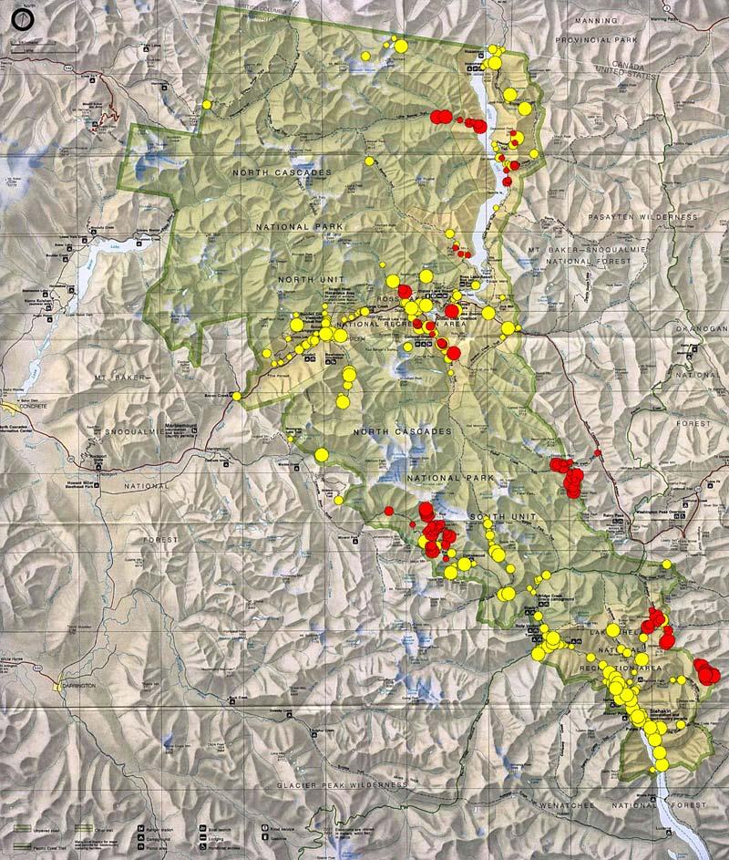
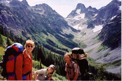
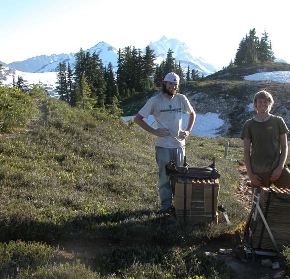
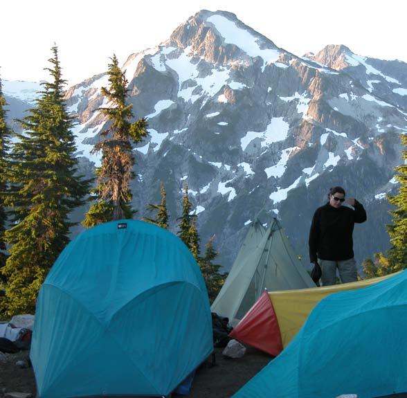
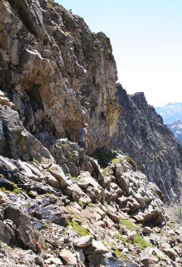
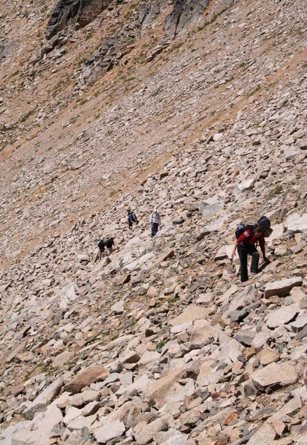
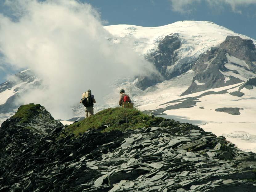
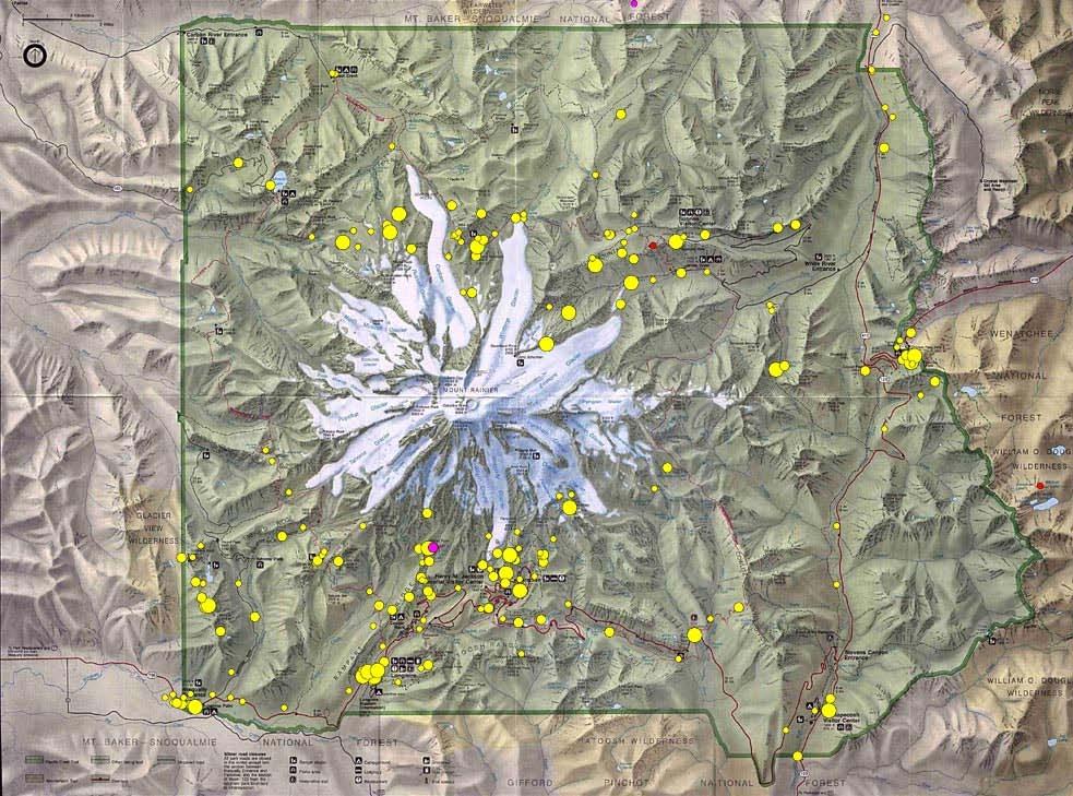
4 National Parks Botanical Surveys
5 Project Goals NOCA ( ) MORA ( ) EBLA (2004) Importance of botanical surveys Future
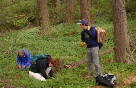
6 Increase documentation of vascular plants in NOCA, MORA, EBLA
7 Increase documentation of vascular plants in NOCA, MORA, EBLA Collect from species-rich or uncollected areas
8 Project Goals NOCA ( ) MORA ( ) EBLA (2004) Importance of botanical surveys Future
9
10
11
12
13
14
15 NOCA Results Summary ~1,900 specimens added to NOCA herbarium 137 previously undocumented species for Park New localities for 7 state-listed species 60+ volunteers contributed 2,000+ hours
16 Talk Outline Project Goals NOCA ( ) MORA ( ) EBLA (2004) Importance of botanical surveys Future
17
18
19

20
21
22 MORA Results Summary 1,000+ specimens added to MORA herbarium 66 previously undocumented species for Park 20 volunteers contributed 300+ hours


23 Combined Results for NOCA/MORA Unvisited areas yield new records Expect new species to as area covered
24 Talk Outline Project Goals NOCA ( ) MORA ( ) EBLA (2004) Importance of botanical surveys Future
25
26
27
28 EBLA Results Summary 305 collections made 126 previously undocumented species for Reserve Documentation for 93% of Reserve flora 23 volunteers contributed 230 hours
29 Talk Outline UW Herbarium Project Goals NOCA ( ) MORA ( ) EBLA (2004) Importance of botanical surveys Future
30 Contributions of Surveys to NPS Operations Scientific documentation
31 Contributions of Surveys to NPS Operations Scientific documentation Expand knowledge base
32 Contributions of Surveys to NPS Operations Scientific documentation Expand knowledge base Conservation
33 Contributions of Surveys to NPS Operations Scientific documentation Expand knowledge base Conservation Invasive species management
34 Contributions of Surveys to NPS Operations Scientific documentation Expand knowledge base Conservation Invasive species management Baseline data
35 Contributions of Surveys to NPS Operations Scientific documentation Expand knowledge base Conservation Invasive species management Baseline data Citizen science
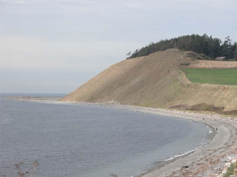
36 Talk Outline UW Herbarium Project Goals NOCA ( ) MORA ( ) EBLA (2004) Importance of botanical surveys Future
37 Future : 1 trip to NOCA each year Beyond 2009?
38
39


40 FLORISTICS AND BIOGEOGRAPHY OF VASCULAR PLANTS IN THE SAN JUANS
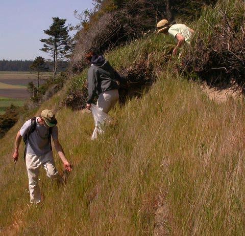
41 Project Background Floristic Results Biogeography Results Conservation Implications
42
43 473 islands San Juan Archipelago Last glaciated ~ 12,000 years ago ~ 850 vascular plant species Lowland western WA forest and grassland habitat
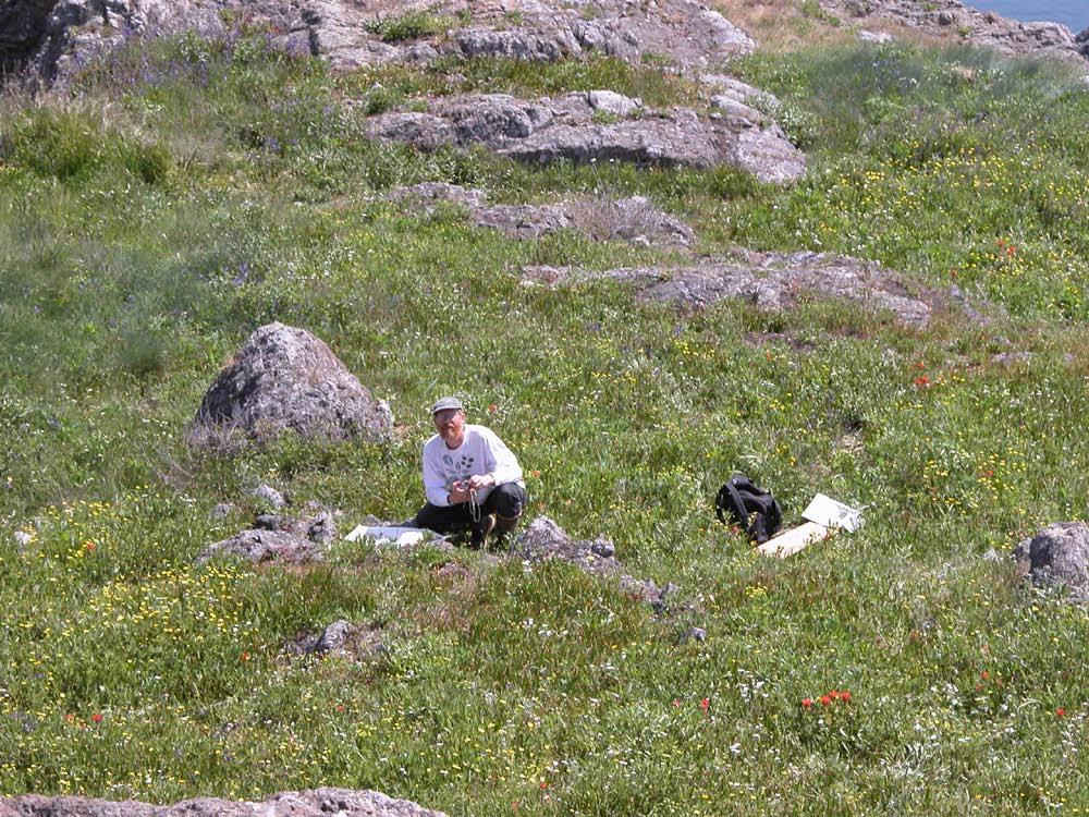
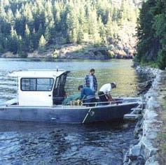
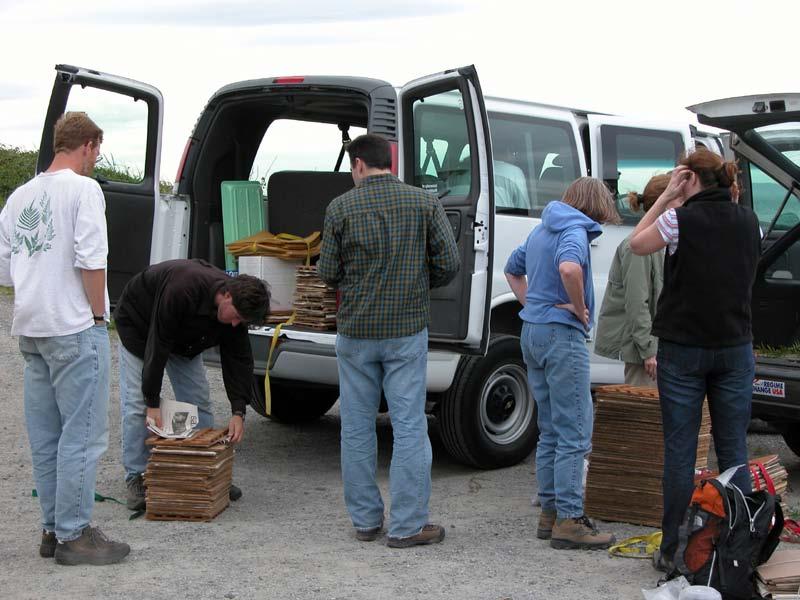
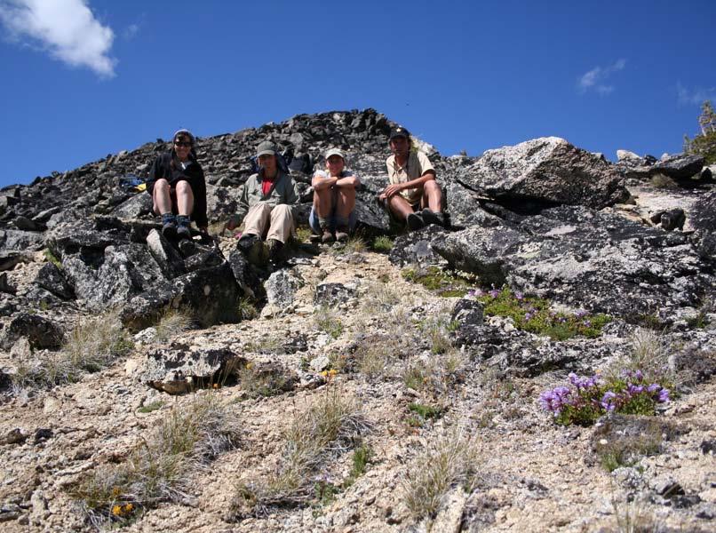
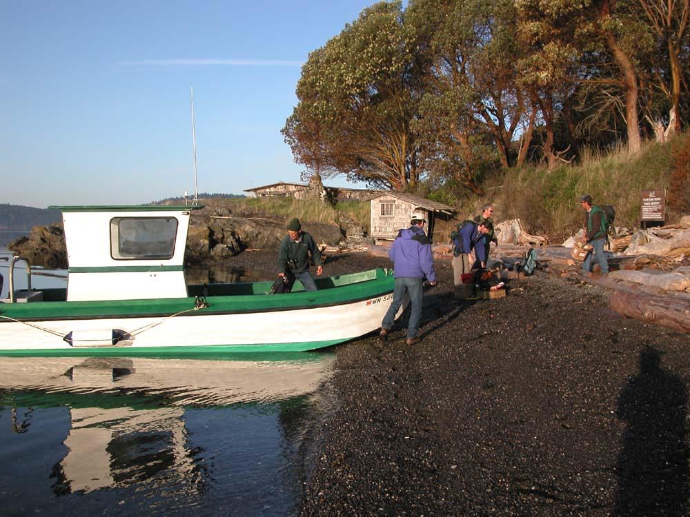
44


45
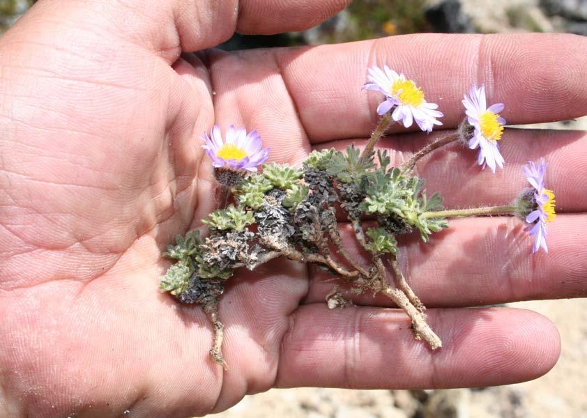
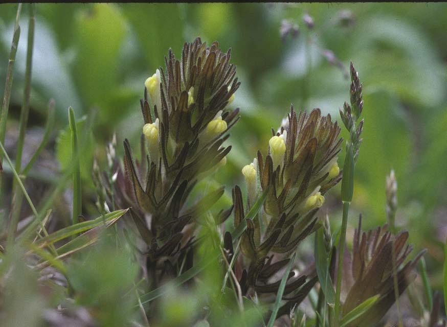
46 Project Goals Comprehensive botanical survey of small (< 30 ha) islands in San Juan Archipelago Quantify species distribution patterns Test general island biogeography hypotheses

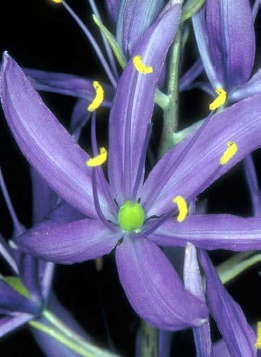
47
48 Methods Collect 1-2 specimens of all flowering/fruiting species on each island; deposit at UW Herbarium List all species on each island that are not collected Database all collections - make available online through UW Herbarium Web site
49
50
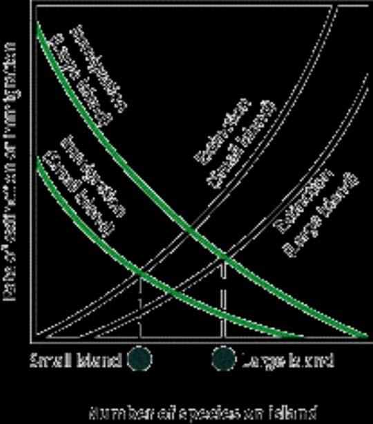
51 Surveys Completed 76 Islands visited in 30 days 40+ participants 4,000+ specimens
52 Project Background Floristic Results Biogeography Results Conservation Implications
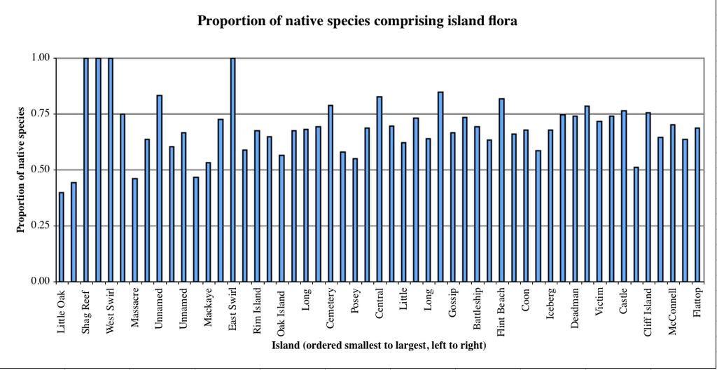
53 Floristics Summary 350 taxa collected 20+ new localities for state-listed taxa 1 previously undescribed species in genus Castilleja
54 Castilleja victoriae
55 Project Background Floristic Results Biogeography Results Conservation Implications
56 Species Richness by Origin Total Taxa 350 # Native 234 # Introduced 116 % Native 67 %Introduced 33
57
58 Species Richness as a Function of Island Size Number of Species y = 12.46Ln(x) R 2 = y = 5.17Ln(x) R 2 = Island Area (hectares) 0 Native Introduced Log. (Native) Log. (Introduced)
59 Species Richness as a Function of Island Distance Number of species y = Ln(x) R 2 = Native Introduced Log. (Native) Log. (Introduced) 20 0 y = Ln(x) R 2 = Distance from Nearest Large Island (m)
60 Frequency Distribution of Native and Introduced Species Across 54 Islands in the San Juans Number of Species Native Introduced Number of Island Occurrences
61 Widely Distributed Species Natives Festuca rubra (50) Grindelia hirsutula (46) Rosa nutkana (39) Plantago maritima (36) Cerastium arvense (36) Camassia leichtlinii (36) Introduced Geranium molle (38) Bromus hordeaceus (36) Bromus diandrus (35) Aira praecox (35) Vulpia bromoides (34) Hypochaeris radicata (31)
62 Biogeography Summary Richness of native and introduced taxa affected by island size but not distance from mainland Richness of introduced taxa more comparable to native taxa on small islands Land use history strong determinant of floristic composition
63 Project Background Presentation Outline Floristic Results Biogeography Results Conservation Implications
64 Priority Concerns Small islands are important habitat for several rare taxa Introduced taxa have spread quickly over the last 200 years Development on larger islands could dampen rescue effect of native species on small islands
65
66 Ongoing field projects Lecture Overview Ongoing herbarium-based informatics projects
67 Informatics Infrastructure PHP, Javascript, and MySQL allow for databasedriven, dynamic Web pages XML and information retrieval protocols allow for distributed database networks
68
69 Web-based Floristics Work Statewide WA Flora Checklist Regional Pacific Northwest Herbaria portal Global Global Biodiversity Information Facility
70 Mapping Noxious Weeds/Invasive Plant Species Google Maps-based application Will incorporate legacy observation data from external sources Will allow users to upload data from field Provides land managers/owners comprehensive, contextual view of weed threats
71 Acknowledgements National Science Foundation U.S. Fish and Wildlife National Park Service WA Native Plant Society U.S. Bureau of Land Management UW Herbarium Endowment The Nature Conservancy San Juan County Land Bank WA State Parks and Recreation Padilla Bay Research Reserve Washington Department of Natural Resources Society for Ecological Restoration U.S. Forest Service
72


73 Herbarium Collections and Invasive Species Biology: Understanding the Past, Present, and Future David Giblin, Ph.D. Ben Legler Richard G. Olmstead, Ph.D. University of Washington Herbarium - Burke Museum
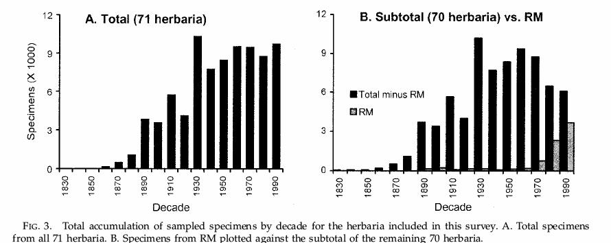
74 Talk Outline Herbaria and Invasive Plant Research Inadequate Invasive Plant Collections Recent Invasives Data from WTU Digital Resources at WTU Conclusions and Future Needs
75 Specimen-based Research Marion Ownbey - Tragopogon
76 Specimen-based Research Marion Ownbey - Tragopogon Richard Mack - Bromus tectorum
77 Specimen-based Research Marion Ownbey - Tragopogon Richard Mack - Bromus tectorum Sarah Reichard - Invasive Ornamentals

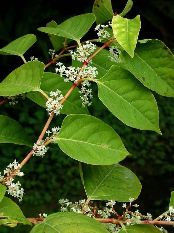
78 Specimen-based Research Marion Ownbey - Tragopogon Richard Mack - Bromus tectorum Sarah Reichard - Invasive Ornamentals Peter Zika - Native/Exotic congeneric hybridization
79 Talk Outline Herbaria and Invasive Plant Research Inadequate Invasive Plant Collections Recent Invasives Data from WTU Digital Resources at WTU Conclusions and Future Needs
80
81 # of Specimens (x 1000)
82 Collections Growth by Year at WTU Number of specimens Year
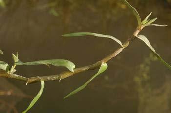
83 Collections Growth by Year at WTU Number of specimens Year Specimens of Introduced Species added to WTU Number of specimens Year

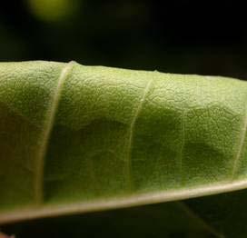
84 Spartina alterniflora - smooth cordgrass
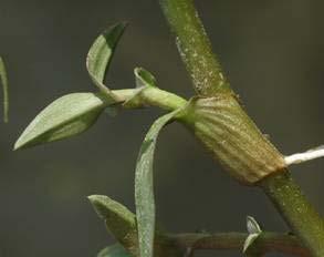
85 Polygonum cuspidatum - Japanese knotweed


86 Buddleja davidii - butterfly bush
87 Talk Outline Herbaria and Invasive Plant Research Inadequate Invasive Plant Collections Recent Invasives Data from WTU Digital Resources at WTU Conclusions and Future Needs
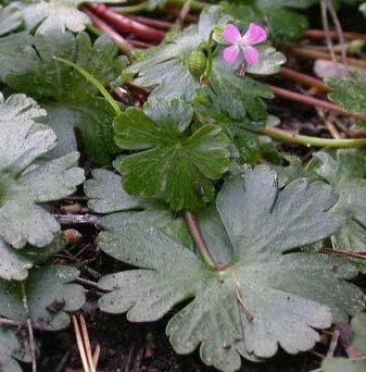
88 Recent Findings Impatiens x pacifica (I. ecalcarata x I. capensis) in Western Washington Murdannia kiesak along Columbia River Geranium lucidum in Clark and Skagit counties

89 Murdannia keisak - wartremoving herb

 -")
90 Impatiens x pacifica (I. ecalcarata x I. capensis) - jewelweed


91 Geranium lucidum - shining geranium
92 Talk Outline Herbaria and Invasive Plant Research Inadequate Invasive Plant Collections Recent Invasives Data from WTU Digital Resources at WTU Conclusions and Future Needs
93
94
95 Talk Outline Herbaria and Invasive Plant Research Inadequate Invasive Plant Collections Recent Invasives Data from WTU Digital Resources at WTU Conclusions and Future Needs
96 Conclusions and Future Needs Herbarium records invaluable Increase effort to collect invasives Deposit duplicates at regionally significant herbaria Increase funding for databasing invasives specimen Exploit emerging technologies for data sharing
97 Photo Acknowledgements Ben Legler Fred Weinmann Arne Andenberg
98
99 Lecture Overview National Park Service project Invasive species collections San Juan Islands project
100 Priority Concerns Small islands are important habitat for several statelisted taxa Introduced taxa have spread quickly over the last 200 years Limit human impacts on small islands Development on larger islands could dampen rescue effect of native species on small islands
101 2007 Trips to Date Taneum Creek Canyon Padilla Bay Columbia River Coastal Washington
Management of Spartina anglica in the Fraser River estuary, British Columbia
 Management of Spartina anglica in the Fraser River estuary, British Columbia Gary Williams GL Williams & Associates Ltd. White Rock & Surrey Naturalists Society May 12 th, 2005 White Rock, BC Presentation
Recent changes to Washington's flora: new taxa, arrivals, taxonomy, and nomenclature
 Recent changes to Washington's flora: new taxa, arrivals, taxonomy, and nomenclature Corrigiola littoralis ssp. littoralis David E. Giblin, Ph.D. Collections Manager, University of Washington Herbarium,
The Sixth Extinction? Community effects on ecosystem processes CMM Chap The context: altered biodiversity. 2a. Loss of Global Biodiveristy:
 Community effects on ecosystem processes CMM Chap. 12 A.1. State factors and interactive controls: Species effects on interactive controls determine ecosystem consequences I. Introduction A. The context
Community Mapping Network. Selected Coastal Atlases and Information Systems in British Columbia, Canada
 Community Mapping Network Selected Coastal Atlases and Information Systems in British Columbia, Canada Outline Community Mapping Network cmnbc.ca Pacific Coastal Resources Atlas for BC cmnbc.ca The Living
A revised Flora of the Pacific Northwest: Taxonomic implications Washington s flora
 A revised Flora of the Pacific Northwest: Taxonomic implications Washington s flora (or, why accept all those annoying name changes?) Lewisia tweedyi (Portulacaceae) Lewisiopsis tweedyi (Montiaceae) Disporum
Geography 3251: Mountain Geography Assignment II: Island Biogeography Theory Assigned: May 22, 2012 Due: May 29, 9 AM
 Names: Geography 3251: Mountain Geography Assignment II: Island Biogeography Theory Assigned: May 22, 2012 Due: May 29, 2012 @ 9 AM NOTE: This lab is a modified version of the Island Biogeography lab that
Natural Resource Condition Assessments. Everglades National Park and Big Cypress National Preserve 2015
 Natural Resource Condition Assessments Everglades National Park and Big Cypress National Preserve 2015 Greater Everglades Ecosystem Restoration Conference- 4/23/2015 The Information Pyramid. Data and information
Serving Up Large Overlapping Polygon Data for Web Queries. Leta Rogers GEOG 596A Winter 2012
 Serving Up Large Overlapping Polygon Data for Web Queries. Leta Rogers GEOG 596A Winter 2012 Challenge -concepts, data intensive spatial queries Background objectives, data preparation Methods overview
INTEGRATION OF BIODIVERSITY DATABASES IN TAIWAN AND LINKAGE TO GLOBAL DATABASES
 INTEGRATION OF BIODIVERSITY DATABASES IN TAIWAN AND LINKAGE TO GLOBAL DATABASES Kwang-Tsao Shao 1*, Ching-I Peng 1, Eric Yen 2, Kun-Chi Lai 1, Ming-Chih Wang 1, Jack Lin 1, Han Lee 1, Yang Alan 3, and
Using Big Interagency Databases to Identify Climate Refugia for Idaho s Species of Concern
 Using Big Interagency Databases to Identify Climate Refugia for Idaho s Species of Concern What is a Climate Refugia? habitat that supports a locally reproducing population [or key life history stage]
Ecoregional Assessment of Biodiversity Conservation Executive Summary September 2006 Hawaiian High Islands
 Ecoregional Assessment of Biodiversity Conservation Executive Summary September 2006 Hawaiian High Islands This executive summary presents an 9-page overview of the Hawaiian High Islands Ecoregional Assessment
Motivation for project:
 Motivation for project: Shale Gas exploration and development requested of government by Oil Companies. Shale Gas Development Strategic Environment Assessment (SGD SEA) commissioned by DEA Biodiversity
The Atlas Aspect of the Atlas of Living Australia
 The Atlas Aspect of the Atlas of Living Australia Lee Belbin lee@blatantfabrications.com Melbourne Museum, July 28, 2010 The Atlas is funded by the Australian Government under the National Collaborative
New Invasives and Other Weeds to Worry About. Clallam County Noxious Weed Control Program
 New Invasives and Other Weeds to Worry About Clallam County Noxious Weed Control Program What s wrong with Noxious Weeds? Numerous Impacts Reduce crop value or production Pose hazard to humans and animals
Kootenai River Habitat Restoration Program Update
 Kootenai River Habitat Restoration Program Update Kootenai Tribe of Idaho Kootenai Valley Resource Initiative November 19, 2012 Bonners Ferry, Idaho Changes to Kootenai Basin Beaver trapping Floodplain
A Comparison of the Social Valuation of Ecosystem Services in Urban and Rural Contexts
 A Comparison of the Social Valuation of Ecosystem Services in Urban and Rural Contexts Jarrod L. Loerzel College of Charleston Zachary D. Cole University of Florida Presentation Map 1. What is SolVES?
Water Atlas Overview. Myakka River Management Coordinating Council June 22, 2012 Englewood, Florida
 Water Atlas Overview Myakka River Management Coordinating Council June 22, 2012 Englewood, Florida What is the Water Atlas? A data warehouse A set of interactive maps A collection of tools for viewing/analyzing
CalWeedMapper. Mapping the Spread of Invasive Plant Species. Karsten Vennemann. Seattle
 CalWeedMapper Mapping the Spread of Invasive Plant Species Karsten Vennemann Seattle Talk Overview The CalWeedMapper Project this presentation is about the expert online editing tool (part of larger project)
Key to West Coast Spartina Species Based on Vegetative Characters
 Glossary Accuminate - tapering to a sharp tip and having concave sides just before the tip. Caespitose - growing in tufts. Glabrous - having a smooth, shiny surface. Internode - the region of a stem between
ICAN Great Lakes Workshop
 Washington Coastal latlas ICAN Great Lakes Workshop September 13 15, 15 2010 Current Washington Coastal Atlas http://www.ecy.wa.gov/programs/sea/sma/atlas_home.html 1 st version of WA Coastal Atlas was
The Weed Battle. Sage Fitch, Salt Lake County Weed Specialist
 The Weed Battle Noxious and Invasive Weed Management by The Salt Lake County Weed Program and The Bonneville CWMA Sage Fitch, Salt Lake County Weed Specialist Our program & our partners Who are we and
Creating an e-flora for South Africa
 SANBI POLICY DOCUMENT DIVISION: Biosystematics Research and Biodiversity Collections EFFECTIVE DATE: 1 April 2014 Compiler: Marianne le Roux & Janine Victor POLICY NUMBER: LAST AMENDED: Creating an e-flora
Harvesting and harnessing data for biogeographical research
 How do we know what grows where? Harvesting and harnessing data for biogeographical research A. Geography Tree B. Species Tree inventories and surveys natural areas, preserves, state forests, private properties
Community Ecology Bioe 147/247
 Community Ecology Bioe 147/247 Species Richness 2: Area Effects: Islands and Mainland Themes: o Species Area effects o Mechanisms: area, distance, equilibrium theory o Habitat islands o Is it area? Or.?
Bombing for Biodiversity in the United States: Response to Zentelis & Lindenmayer 2015
 CORRESPONDENCE Bombing for Biodiversity in the United States: Response to Zentelis & Lindenmayer 2015 Jocelyn L. Aycrigg 1, R. Travis Belote 2, Matthew S. Dietz 3, Gregory H. Aplet 4, & Richard A. Fischer
世界在线植物志 (World Flora Online) 项目介绍
 项目介绍") Global Strategy for Plant Conservation 世界在线植物志 (World Flora Online) 项目介绍 覃海宁 中国科学院植物研究所 Email: hainingqin@ibcas.ac.cn Website: www.cvh.org.cn #gppc Global Strategy for Plant Conservation A programme of
Global Strategy for Plant Conservation 世界在线植物志 (World Flora Online) 项目介绍 覃海宁 中国科学院植物研究所 Email: hainingqin@ibcas.ac.cn Website: www.cvh.org.cn #gppc Global Strategy for Plant Conservation A programme of
Proceedings of Association of Pacific Rim Universities (APRU) Research Symposium on University Museums: Forming a University Museum Collection
 Research Symposium on University Museums: Forming a University Museum Collection") Proceedings of Association of Pacific Rim Universities (APRU) Research Symposium on University Museums: Forming a University Museum Collection Network as the Core of Frontier Research O-10 The Beaty Biodiversity
Proceedings of Association of Pacific Rim Universities (APRU) Research Symposium on University Museums: Forming a University Museum Collection Network as the Core of Frontier Research O-10 The Beaty Biodiversity
Pablo Bay in Sonoma, Solano, and Napa Counties. It is owned and managed by the U.S. Fish and Wildlife
 Appendix L San Pablo Bay Marsh Introduction San Pablo Bay National Wildlife Refuge marsh (hereafter San Pablo) is located on the north shore of San Pablo Bay in Sonoma, Solano, and Napa Counties. It is
Jean-Marc Dufour-dror
 Israel Nature and Parks Authority Science & Conservation Division The Jerusalem Institute for Israel Studies The Center for Environmental Policy Invasive plant species in Israel s natural areas: Distribution,
Poison vine (Derris elliptica)
") Poison vine (Derris elliptica) An Alien Plant Report Prepared by: Forest Starr, Kim Martz and Lloyd Loope United States Geological Survey Biological Resources Division In cooperation with: American Water
Poison vine (Derris elliptica) An Alien Plant Report Prepared by: Forest Starr, Kim Martz and Lloyd Loope United States Geological Survey Biological Resources Division In cooperation with: American Water
DOWNLOAD OR READ : VASCULAR PLANTS OF WESTERN WASHINGTON PDF EBOOK EPUB MOBI
 DOWNLOAD OR READ : VASCULAR PLANTS OF WESTERN WASHINGTON PDF EBOOK EPUB MOBI Page 1 Page 2 vascular plants of western washington vascular plants of western pdf vascular plants of western washington The
CHAPTER 7 PRODUCT USE AND AVAILABILITY
 CHAPTER 7 PRODUCT USE AND AVAILABILITY Julie Prior-Magee Photo from SWReGAP Training Site Image Library Recommended Citation Prior-Magee, J.S. 2007. Product use and availability. Chapter 7 in J.S. Prior-Magee,
Climate Change and Invasive Plants in the Pacific Northwest
 Climate Change and Invasive Plants in the Pacific Northwest David W Peterson Becky K Kerns Ecosystem Dynamics and Environmental Change Team Threat Characterization and Management Program Pacific Northwest
Naturally. Westport... Wet and Wild...
 Westport... Wet and Wild... Naturally A revitalization concept for the City of Westport and Port of Grays Harbor presented by FOGH (Friends of Grays Harbor), Wildlife Forever of Grays Harbor and other
An Introduction to Day Two. Linking Conservation and Transportation Planning Lakewood, Colorado August 15-16, 16, 2006
 An Introduction to Day Two Linking Conservation and Transportation Planning Lakewood, Colorado August 15-16, 16, 2006 1 Agenda Day One Transportation Planning Heritage Program State Wildlife Action Plan
CHAPTER 12: TERRESTRIAL LAYERS
 CHAPTER 12: TERRESTRIAL LAYERS Coordinator: Shannon McElvaney Hawai`i Natural Heritage Program mcelvane@hawaii.edu Theme Description: Land use corresponds to the socio-economic description (or functional
A national islands database and assessment of conservation value
 A national islands database and assessment of conservation value Julie Quinn and Karl Bossard Spotted-Tailed Quoll (D.Watts) Feral pig (B. Salau) Glossodia orchid (S.Bourne) Tracking and Tasman Island
Descriptions and Performance
 LSU AgCenter Coastal Plants Program Smooth Cordgrass Varieties: Descriptions and Performance Smooth cordgrass (Spartina alterniflora Loisel.) is a perennial grass native to intertidal saline marshes along
Using Remote Sensing to Map the Evolution of Marsh Vegetation in the South Bay of San Francisco
 Using Remote Sensing to Map the Evolution of Marsh Vegetation in the South Bay of San Francisco Brian Fulfrost Design, Community and Environment (DC&E) 6 th Annual Bay-Delta Science Conference PROJECT
Armoring on Puget Sound: Progress towards a better baseline
 Western Washington University Western CEDAR Salish Sea Ecosystem Conference 2016 Salish Sea Ecosystem Conference (Vancouver, BC) Armoring on Puget Sound: Progress towards a better baseline Hugh Shipman
1. PURPOSE 2. PERIOD OF PERFORMANCE
 Statement of Work Herbarium Voucher Collection Land Management Section, Environmental Security Department Marine Corps Installations West Marine Corps Base Camp Pendleton, California 1. PURPOSE The purpose
Research Background: Researcher Sam Bond taking Sediment Elevation Table (SET) measurements in the marsh. A view of salt marsh hay growing in a marsh
 measurements in the marsh. A view of salt marsh hay growing in a marsh") Name Keeping up with the sea level Featured scientist: Anne Giblin from the Marine Biological Laboratory and the Plum Island Ecosystems Long-Term Ecological Research site Research Background: Salt marshes
Name Keeping up with the sea level Featured scientist: Anne Giblin from the Marine Biological Laboratory and the Plum Island Ecosystems Long-Term Ecological Research site Research Background: Salt marshes
Supplemental Lab Topic BIODIVERSITY Biology 211 Fall 2004
 Supplemental Lab Topic BIODIVERSITY Biology 211 Fall 2004 OBJECTIVES After this lab you should be able to 1) describe different patterns and types of biodiversity, 2) discuss reasons for conserving biodiversity,
the map Redrawing Donald Hobern takes a look at the challenges of managing biodiversity data [ Feature ]
![the map Redrawing Donald Hobern takes a look at the challenges of managing biodiversity data [ Feature ]](/thumbs/82/86628837.jpg "the map Redrawing Donald Hobern takes a look at the challenges of managing biodiversity data [ Feature ]") Redrawing the map Donald Hobern takes a look at the challenges of managing biodiversity data 46 Volume 12 > Number 9 > 2008 www.asiabiotech.com Cicadetta sp., Canberra, Australia, December 2007 Photograph
Redrawing the map Donald Hobern takes a look at the challenges of managing biodiversity data 46 Volume 12 > Number 9 > 2008 www.asiabiotech.com Cicadetta sp., Canberra, Australia, December 2007 Photograph
NOAA s OCM: Services, tools and collaboration opportunities & Puerto Rico s NE Marine Corridor as a case study
 NOAA s OCM: Services, tools and collaboration opportunities & Puerto Rico s NE Marine Corridor as a case study Dr. Antares Ramos Álvarez NOAA s Office of Coastal Management September 15 th, 2016 Conservation
An Introduction to NatureServe Linking Conservation and Transportation Planning Phoenix, Arizona November 8 & 9, 2006
 An Introduction to NatureServe Linking Conservation and Transportation Planning Phoenix, Arizona November 8 & 9, 2006 1 NatureServe in Brief An independent, non-profit conservation organization Provides
Plant Systematics. What is Systematics? or Why Study Systematics? Botany 400. What is Systematics or Why Study Systematics?
 Plant Systematics Botany 400 http://botany.wisc.edu/courses/botany_400/ What is Systematics? or Why Kenneth J. Sytsma Melody Sain Kelsey Huisman Botany Department University of Wisconsin Pick up course
Peter Gault Kennedy CURRICULUM VITAE. 321 Koshland Hall phone: University of California, Berkeley fax: Berkeley, CA 94720
 Peter Gault Kennedy CURRICULUM VITAE Department of Plant and Microbial Biology pkennedy@berkeley.edu 321 Koshland Hall phone: 510-643-5483 University of California, fax: 510-642-4995, CA 94720 Professional
Restoring Rivers in Cumbria Online Story Map of a case study on the River Lyvennet
 Restoring Rivers in Cumbria Online Story Map of a case study on the River Lyvennet Summary This Story Map presents a river restoration case study for the River Eden Catchment, Cumbria. Students can learn
Visitation: Recreation and Tourism Model
 Visitation: Recreation and Tourism Model Shuang Feng Florida State University, Center for Economic Analysis and Forecasting May 02, 2017 Visitation: Recreation and Tourism Model Supporting Ecosystem Services
Assessing Effectiveness of Management Actions on Recovery of CSS Plant Communities Over-Time
 Assessing Effectiveness of Management Actions on Recovery of CSS Plant Communities Over-Time Recovery of Native CSS Always Begins with Weed Control And often feels like an impossible war, but small battles
Plant Biology Of The Basin And Range (Ecological Studies) READ ONLINE
 READ ONLINE") Plant Biology Of The Basin And Range (Ecological Studies) READ ONLINE If searched for the ebook Plant Biology of the Basin and Range (Ecological Studies) in pdf form, in that case you come on to faithful
Plant Biology Of The Basin And Range (Ecological Studies) READ ONLINE If searched for the ebook Plant Biology of the Basin and Range (Ecological Studies) in pdf form, in that case you come on to faithful
Field Survey for Laramie Columbine. (Aquilegia laramiensis) In the Rawlins Field Office
 In the Rawlins Field Office") Field Survey for Laramie Columbine (Aquilegia laramiensis) In the Rawlins Field Office prepared for the Wyoming Natural Diversity Database, University of Wyoming, and the Bureau of Land Management, Rawlins
Field Survey for Laramie Columbine (Aquilegia laramiensis) In the Rawlins Field Office prepared for the Wyoming Natural Diversity Database, University of Wyoming, and the Bureau of Land Management, Rawlins
EBA Engineering Consultants Ltd. Creating and Delivering Better Solutions
 EBA Engineering Consultants Ltd. Creating and Delivering Better Solutions ENHANCING THE CAPABILITY OF ECOSYSTEM MAPPING TO SUPPORT ADAPTIVE FOREST MANAGEMENT Prepared by: EBA ENGINEERING CONSULTANTS LTD.
Introducing the. a partnership of
 Introducing the a partnership of Background Need for online atlas identified by managers and researchers to make coastal data available Shoreline data Ocean and coastal resources Sea-level rise potential
Garlic Mustard Distribution
 Garlic Mustard Distribution Brian Adair Solye Brown Alliaria Petiolata (garlic mustard) Biennial Brought to North America as a culinary and medicinal herb (useful treating skin ulcers, throat infections,
United States Department of the Interior NATIONAL PARK SERVICE Northeast Region
 United States Department of the Interior NATIONAL PARK SERVICE Northeast Region June 17, 2017 REQUEST FOR STATEMENTS OF INTEREST and QUALIFICATIONS Project Title: ASSESSMENT OF NATURAL RESOURCE CONDITION
Native species (Forbes and Graminoids) Less than 5% woody plant species. Inclusions of vernal pools. High plant diversity
 Less than 5% woody plant species. Inclusions of vernal pools. High plant diversity") WILLAMETTE VALLEY WET-PRAIRIE RESTORATION MODEL WHAT IS A WILLAMETTE VALLEY WET-PRAIRIE Hot Spot s Native species (Forbes and Graminoids) Rare plant species Less than 5% woody plant species Often dominated
WILLAMETTE VALLEY WET-PRAIRIE RESTORATION MODEL WHAT IS A WILLAMETTE VALLEY WET-PRAIRIE Hot Spot s Native species (Forbes and Graminoids) Rare plant species Less than 5% woody plant species Often dominated
Problemi e strategie di conservazione della Biodiversità: Parchi, Natura 2000 e Rete Ecologica Nazionale
 Problemi e strategie di conservazione della Biodiversità: Parchi, Natura 2000 e Rete Ecologica Nazionale Problems and strategies for Biodiversity conservation: Parks, Natura2000 and National Ecological
Creating Basemaps to Manage Buildings and Facilities
 Esri International User Conference San Diego, California Technical Workshops July 26, 2012 Creating Basemaps to Manage Buildings and Facilities Mark Stewart and Tamara Yoder Topics for this Session Overview
Wichita State University s Herbarium: Filling a Critical Gap
 Wichita State University s Herbarium: Filling a Critical Gap Presented by Mary Liz Jameson and Susan Matveyeva With collaboration from F. Leland Russell, Sai Deng, and Stephen Scott Great Plains Plant
Virginia Shoreline Mapping Tools
 Virginia Shoreline Mapping Tools December 15, 2017 Karen Duhring Center for Coastal Resources Management Virginia Institute of Marine Science College of William & Mary Virginia Shoreline Mapping Tools
KING GEORGE COUNTY DEPARTMENT OF COMMUNITY DEVELOPMENT
 GIS REPORT 2016 KING GEORGE COUNTY DEPARTMENT OF COMMUNITY DEVELOPMENT Background The GIS (Geographic Information System) coordinator was hired in 2001 to develop a GIS for King George County. Prior to
climate famous data sharing toolbox in
 This is the story of what was done, and some lessons learnt as we bumped along on a very rough road. In the process of our work in mapping vegetation, modelling to investigate the possible impacts of climate
Connecting Content Information Connections Research SAA Research Forum August
 Connecting Content Information Connections Research SAA Research Forum August 23 2011 Richard T. Fischer, MLS Information Connections Research Intern Connecting Content: Project Background The California
Understanding and fighting the invasion of Spartina densiflora Humboldt Bay (California, USA) & the Gulf of Cádiz (Andalusia, Spain)
 & the Gulf of Cádiz (Andalusia, Spain)") Understanding and fighting the invasion of Spartina densiflora Humboldt Bay (California, USA) & the Gulf of Cádiz (Andalusia, Spain) Jesús M. Castillo The main threat to the conservation of salt marshes
Understanding and fighting the invasion of Spartina densiflora Humboldt Bay (California, USA) & the Gulf of Cádiz (Andalusia, Spain) Jesús M. Castillo The main threat to the conservation of salt marshes
Geomorphology Of The Chilliwack River Watershed Landform Mapping At North Cascades National Park Service Complex, Washington By National Park Service
 Geomorphology Of The Chilliwack River Watershed Landform Mapping At North Cascades National Park Service Complex, Washington By National Park Service READ ONLINE Snowshed contributions to the Nooksack
Weeds, Exotics or Invasives?
 Invasive Species Geography 444 Adopted from Dr. Deborah Kennard Weeds, Exotics or Invasives? What is a weed? Invasive species? 1 Weeds, Exotics or Invasives? Exotic or non-native: Non-native invasive pest
Southwest LRT Habitat Analysis. May 2016 Southwest LRT Project Technical Report
 Southwest LRT Habitat Analysis Southwest LRT Project Technical Report This page intentionally blank. Executive Summary This technical report describes the habitat analysis that was performed to support
GARLIC MUSTARD (Alliaria petiolata) EMERGING PEST PLANT IN NC
 EMERGING PEST PLANT IN NC") GARLIC MUSTARD (Alliaria petiolata) EMERGING PEST PLANT IN NC AGENDA Background on Garlic Mustard Ecological threats Control strategies Early Detection, Rapid Response: Fighting an invasion along Ellerbe
GARLIC MUSTARD (Alliaria petiolata) EMERGING PEST PLANT IN NC AGENDA Background on Garlic Mustard Ecological threats Control strategies Early Detection, Rapid Response: Fighting an invasion along Ellerbe
The Invasion of False Brome in Western Oregon
 The Invasion of False Brome in Western Oregon GIS II Presentation Winter 2006 Will Fellers Kurt Hellerman Kathy Strope Statia Cupit False Brome (Brachypodium sylvaticum) Perennial bunchgrass native to
Background. North Cascades Ecosystem Grizzly Bear Restoration Plan/ Environmental Impact Statement. Steve Rochetta
 Grizzly Bear Restoration Plan/ Environmental Impact Statement Steve Rochetta Background Situated in the core of the North Cascades ecosystem (NCE), the North Cascades National Park Complex is surrounded
Study 11.9 Invasive Plant Study
 Initial Study Report Update Meeting Study 11.9 Invasive Plant Study March 29, 2016 Prepared by ABR, Inc. Environmental Research & Services 10/21/2014 1 Study 11.9 Status ISR documents (ISR Part D Overview):
The Species-Area Relationship (SAR) in Conservation Biology
 in Conservation Biology") No. (S) S This document is available at www.earthskysea.org, ecology resources. ln(species) The SpeciesArea Relationship (SAR) in Conservation Biology Adam B. Smith Missouri Botanical Garden adamatearthskyseadotorg
No. (S) S This document is available at www.earthskysea.org, ecology resources. ln(species) The SpeciesArea Relationship (SAR) in Conservation Biology Adam B. Smith Missouri Botanical Garden adamatearthskyseadotorg
Tools for Climate Change Adaptation Planning
 Adaptation base for Planning Tool (ADAPT) CRiSTAL (Community-based Risk Screening Tool Adaptation and Livelihoods) NOAA CSC Coastal Inundation Toolkit NOAA CSC Roadmap Ecosystem-Based Managment Tools Network
Ants in the Heart of Borneo a unique possibility to join taxonomy, ecology and conservation
 Ants in the Heart of Borneo a unique possibility to join taxonomy, ecology and conservation Carsten Brühl, University Landau, Germany 1 Borneo Interior mountain ranges of Central Borneo represent the only
Biodiversity data use by Regional NRM groups
 Biodiversity data use by Regional NRM groups The Ins; The Outs; and the Ins-and-Outs Richard McLellan CEO, NACC NRM on ALA: Data by NRM Regions ALA has great resources (Australian BioBlitz Guidelines,
Hydrologic Analysis for Ecosystem Restoration
 Hydrologic Analysis for Ecosystem Restoration Davis, California Objectives: To provide participants with: 1) an understanding of the issues in restoration studies; 2) an overview of Corps policies and
Digital Key to the Flora of Mongolia
 Najmi U., Rilke S. & Schnittler M. Digital Key to the Flora of Mongolia a follow-up of the project Virtual Guide to the Flora of Mongolia: Plant Database as practical approach Reliable determination of
Second Year Annual Report - Botany
 Darwin Initiative Project 17-022 Conservation of the Lowland Savannas of Belize Second Year Annual Report - Botany April 2010 March 2011 Zoë Goodwin Summary of Year 2 Activities...3 Project website launched
Habitat destruction by IAS Flora. Siril Wijesundara Research Professor National Institute of Fundamental Studies Kandy, Sri Lanka
 Habitat destruction by IAS Flora Siril Wijesundara Research Professor National Institute of Fundamental Studies Kandy, Sri Lanka Invasive species can cause significant changes to ecosystems, upset the
FOURTEEN YEARS OF SPATIAL DATA FROM PLANTS OF CONCERN: WHAT ARE WE LEARNING?
 FOURTEEN YEARS OF SPATIAL DATA FROM PLANTS OF CONCERN: WHAT ARE WE LEARNING? Rachel Goad, Manager, Plants of Concern Shannon Still, Postdoctoral Researcher, Chicago Botanic Garden Jeremie Fant, Conservation
Doing Things Differently: Tracking Invasive Exotic Plants in the Florida Park Service
 Florida Park Service Doing Things Differently: Tracking Invasive Exotic Plants in the Florida Park Service 21 May 2013 The Big Picture 171 State Parks and Trails across 5 Districts ~785,000 Acres Almost
THE USE OF GEOSPATIAL DATA TO SUPPORT VULNERABILITY MAPPING OF THE OREGON COAST. Kelvin Raiford MS Candidate Geography Department of Geosciences
 THE USE OF GEOSPATIAL DATA TO SUPPORT VULNERABILITY MAPPING OF THE OREGON COAST Kelvin Raiford MS Candidate Geography Department of Geosciences INTRODUCTION This study is an outcome of the project Geospatial
Flowering Rush Biocontrol: Future Funding and Research Needs
 Flowering Rush Biocontrol: Future Funding and Research Needs CABI Jennifer Andreas*, Hariet L. Hinz, Patrick Häfliger, Jenifer Parsons, Greg Haubrich, Peter Rice, Susan Turner * jandreas@wsu.edu, (253)
California Phenology Project (CPP) Briefing: Goals for National Park participation
 Briefing: Goals for National Park participation") Briefing: Goals for National Park participation Collaborators: National Park Service UC Santa Barbara National Phenology Network PRESENTATION OUTLINE Background Project Scope & Collaborators Project Goals
Briefing: Goals for National Park participation Collaborators: National Park Service UC Santa Barbara National Phenology Network PRESENTATION OUTLINE Background Project Scope & Collaborators Project Goals
The Refugia Concept: Using Watershed Analysis to Prioritize Salmonid Habitat for Conservation and Restoration
 The Refugia Concept: Using Watershed Analysis to Prioritize Salmonid Habitat for Conservation and Restoration Christopher May Battelle & UW Cumulative Impacts of Urbanization Landscape Alterations Loss
Northwestern Hawaiian Islands Coral Reef Research Partnership: Ocean Mapping, Ecosystem Threats, and Information Management
 Northwestern Hawaiian Islands Coral Reef Research Partnership: Ocean Mapping, Ecosystem Threats, and Information Management Malia Chow Papahanaumokuakea Marine National Monument National Oceanic and Atmospheric
Using remote sensing and Detection of Early Season Invasives (DESI) to analyze the temporal dynamics of invasive cheatgrass (Bromus tectorum).
 to analyze the temporal dynamics of invasive cheatgrass (Bromus tectorum).") 2015 NASA Space Grant Consortium Research Fellowship 1 Using remote sensing and Detection of Early Season Invasives (DESI) to analyze the temporal dynamics of invasive cheatgrass (Bromus tectorum). Bishop,
2015 NASA Space Grant Consortium Research Fellowship 1 Using remote sensing and Detection of Early Season Invasives (DESI) to analyze the temporal dynamics of invasive cheatgrass (Bromus tectorum). Bishop,
Biodiversity data, current gaps and work package efforts
 Biodiversity data, current gaps and work package efforts Florian T. Wetzel 1, Veljo Runnel 2, Anton Güntsch 3, Urmas Köljalg 2 1 Museum für Naturkunde Berlin - Leibniz Institute for Evolution and Biodiversity
Recreation Use and Spatial Distribution of Use by Washington Households on the Outer Coast of Washington
 Journal of Park and Recreation Administration Vol. 36 pp. 56 68 2018 https://doi.org/10.18666/jpra-2018-v36-i1-7915 Special Issue Recreation Use and Spatial Distribution of Use by Washington Households
Most people used to live like this
 Urbanization Most people used to live like this Increasingly people live like this. For the first time in history, there are now more urban residents than rural residents. Land Cover & Land Use Land cover
Puakea, Hawaiÿi. Puakea, Hawaiÿi WATERSHED FEATURES
 Puakea, Hawaiÿi DAR Watershed Code: 85046 Puakea, Hawaiÿi WATERSHED FEATURES Puakea watershed occurs on the island of Hawaiÿi. The Hawaiian meaning of the name is white blossom. The area of the watershed
Issues in bryophyte conservation and research
 Issues in bryophyte conservation and research Paula Warren Head Office Wellington Craig Miller West Coast Conservancy Hokitika Published by Head Office, PO Box 10-420 Wellington, New Zealand This report
A new resource for online mapping of mosquito, tick and sand fly species distribution data Desmond Foley, Richard Wilkerson and Leopoldo Rueda
 A new resource for online mapping of mosquito, tick and sand fly species distribution data Desmond Foley, Richard Wilkerson and Leopoldo Rueda Division of Entomology, Walter Reed Army Institute of Research,
Modeling habitat suitability for the European green crab using the ShoreZone mapping system
 Modeling habitat suitability for the European green crab using the ShoreZone mapping system Jodi N. Harney, Ph.D. and John R. Harper, Ph.D. Coastal and Ocean Resources Inc. Mary Morris, R.P. Bio. Archipelago
2014 report on the distribution of Boneseed within the Port Hills Containment Zone
 2014 report on the distribution of Boneseed within the Port Hills Containment Zone Report No. R15/151 ISBN 978-0-947507-11-4 (print) 978-0-947507-12-1 (web) Mark Parker July 2015 Report No. R15/151 ISBN
Tao Tang and Jiazhen Zhang Department of Geography and Planning, and the Great Lakes Research Center State University of New York Buffalo State
 Tao Tang and Jiazhen Zhang Department of Geography and Planning, and the Great Lakes Research Center State University of New York Buffalo State College 1300 Elmwood Ave., Buffalo, NY 14222-1095 Email:
Invasion history: Eichhornia crassipes, Water Hyacinth
 Water Hyacinth, Eichhornia crassipes Overview. Short description of Eichhornia crassipes, Water Hyacinth Water hyacinth is a striking floating aquatic plant native to tropical regions of South America.
Using GIS to Focus Field Inventories of Rare and Endemic Plants at Badlands National Park, South Dakota
 Using GIS to Focus Field Inventories of Rare and Endemic Plants at Badlands National Park, South Dakota Sandee Dingman, Badlands National Park, P.O. Box 6, Interior, South Dakota 57750; sandee_dingman@nps.gov